The ice caps which cover our planet's poles are key to understanding global weather patterns and changing climate. But we still don't have a complete understanding of how they work, and what goes on beneath the frozen surface.
A group led by researchers at the UK's University of Durham used radar to glimpse beneath the coast of East Antarctica. In a new study, they announced their findings: Ancient riverbeds beneath Antarctica control the behavior of the ice sheet above them.
Reconstructing ancient landscapes
It is crucial to understand how much, and how quickly, the East Antarctic Ice Sheet is going to melt as temperatures continue to rise. It's the largest of Antarctica's three ice sheets, and it contains enough water to raise the sea level by over 50 meters.
The behavior of an ice sheet depends on more than just surface conditions. The landmass hidden beneath the ice impacts how quickly it melts and where it collapses. To get an idea of what that hidden landscape looks like, researchers analyzed a series of radar scans covering 3,500km of East Antarctica.
The scans found what was once a coastal plain formed by fluvial erosion. Between 80 million years ago, when Antarctica divorced Australia, and 34 million years ago when it became covered in ice, rivers flowed across East Antarctica and into the sea. Those rivers carved out a smooth, flat floodplain all along the coast. Breaking up the plain are deep narrow troughs in the rock. These plains covered about 40% of the area they scanned.
This find confirms previous, fragmentary evidence for a very flat, even plain beneath the icy expanse.

Hopeful findings
This is good news for those of us who enjoy not being underwater. Computer programs modeling future climate behavior now have more data to work on. Before, as the study's lead author, Dr. Guy Paxton, said in a Durham press release, "The landscape hidden beneath the East Antarctic Ice Sheet is one of the most mysterious not just on Earth, but on any terrestrial planet in the solar system."
Understanding the terrain beneath the ice makes it much easier to understand how and where the ice will move. “This in turn will help make it easier to predict how the East Antarctic Ice Sheet could affect sea levels.”
More than that, however, the ancient fluvial plains may be slowing down the melt. The study suggests that the flat plains may be acting as barriers to ice flow. Fast-moving glaciers pass through the deep channels, but the bulk of the ice, atop the plains, is moving much more slowly.
Ultimately (as they always do), researchers stressed the need for more investigation. Further studies would involve drilling all the way through the ice and taking samples of the rock below. So look forward to that.
"The North Shore invented mountain biking," claims Todd "Digger" Fiander, a trail builder and videographer. If the sport was indeed born in , Betty Birrell was there from the start.
North Shore Betty, a short film from Patagonia, introduces us to the eponymous Betty. Now entering her seventies, Betty reflects on what is means to be an older woman in the rough world of mountain biking.
One big playground
She didn't start in mountain biking. Betty first made a splash (pun intended) pioneering women's wave sailing in the early 1980s. By her mid-forties, she was a single mother and full-time flight attendant, but she also started mountain biking. She started riding Fiander's "roller coasters for bicycles" after getting her first mountain bike in 1993.

Rather than competing, Betty found that mountain biking and being a single mother worked together. It became an activity she could do with her son, and they still bike together now that he's an adult.
Betty also isn't afraid to get injured. She's broken an arm, a wrist, a hand, and "lots" of ribs, dislocated shoulders, and torn her rotator cuff, but it didn't, and still doesn't, bother her.
According to Betty, when her ex told her she treated life like it was "one big fucking playground," she took it as a compliment.

The short film interviews Lea Holt, a nurse with a family who worried, as she approached fifty, that she would have to give up mountain biking. But Betty's career changed her mind. "I have twenty more years..." Holt explained, "to get better."
"Betty is a legend on the North Shore," says fellow British Columbia mountain biker Amanda Moffat. When they ride together, she says, people will call out to Betty as they pass, like she was a celebrity.
Now 73, Betty plans to keep riding into her nineties. "Older people...need to know that you can keep going," she says. On the screen, Betty's bike leaps over rocky trails and races around bends and through the forests.
In May of 1622, the English East India Company ship Tryall became the first English ship to sight the coast of Australia. Shortly after, it became the first ship to sink off the coast of Australia.
The story of the Australia's oldest shipwreck covers 400 years, from a suspicious sinking to a pair of castaway journeys, a court case, a geographical mystery, and a modern scandal involving the misuse of explosives at an archaeological site.
The maiden launch of the Tryall
The Tryall (also spelled Triall, Tryal and Trial) set sail from Plymouth on Sept. 4, 1621. She was a British East Indiaman, a mercantile vessel built to travel between England and the Global Southeast, then called the East Indies.
Owned by the British East India Company, her generous hold was filled with textiles, silver, and supplies bound for Batavia -- present-day Jakarta, Indonesia. This was to be her maiden voyage, and an inspection by EIC officials at the docks found her in good condition.
Her Captain was John Brookes. The other key man aboard was Thomas Bright, the EIC's representative, or "factor" for the voyage. One hundred and forty-three seamen rounded out the crew, and after a brief pay dispute, they sailed for the Cape of Good Hope.
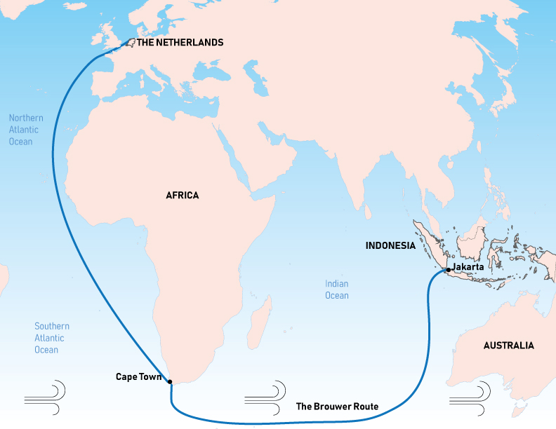
This stage of the journey went fine. They arrived at the tip of Africa, took on fresh supplies, and set off for Batavia on March 19. By a new, dangerous route.

Another way to India
At the turn of the 17th century, the standard route from Cape Town to Batavia came from 15th-century Portuguese explorers, who used the seasonal monsoon winds to cross the Indian Ocean. It took about 12 months.
The Dutch decided that if they were going to steal the spice trade from Portugal, they had to do better than that. So Hendrik Brouwer took an alternative way in 1611. It became known as the Brouwer route.
The new route cut travel time in half by ducking down into the Roaring Forties and using their strong westerly winds to cross the Indian Ocean. The key was the timing of that northeast turn. Too early, and you'd end up in the middle of the Indian Ocean. Too late, and you'd crash into Australia.
They didn't know that yet, though. A few Dutch explorers had sighted some islands off the Australian mainland, but no one suspected a whole continent might be in the way.
The problem with that all-important turn is that, at the time, there was no good way to determine longitude at sea. Ships would have to make the turn using dead reckoning, which is a fancy nautical term for "guessing." In 1620, the British EIC decided to copy the Dutch and sent Captain Humphrey Fitzherbert to test the route.
He had a great time and gave it a thumbs-up, so they gave Captain Brookes a copy of Fitzherbert's journal and told him to do the same thing.
The wreck of the Tryall
Brookes was nervous about the new route. In Cape Town, he met Captain Bickell, another EIC Captain. He asked Bickell if he could borrow one of his experienced mates to help navigate, and Bickell gave him permission. But Bickell's ship, the Charles, was on its way home, and none of her mates were willing to delay their return to help.
Brookes had to sail on, with only the 1620 journal and imperfect charts as a guide. The Tryall descended to 39 degrees latitude, and the Roaring Forties drove them east.
On May 1, they spotted land. They had just become the first Englishmen to see Australia. Brookes and Bright both describe a great island, because from their perspective, a pair of points made the coast look like an island. Brookes turned north for the run up to Java, but was kept in place by contrary winds. Finally, on May 24, he was able to head north.
The next day, late in the evening, in calm seas, the Tryall struck rocks. Brookes ran up on deck, giving orders to tack west, hoping to dislodge her. A strong, brisk wind began to blow as water flooded into the ship, the sharp rocks tearing her timbers apart. It was too late, Brookes realized, to save her. He "made all ye meanes I could to save my life and as manie of my compa[ny] as I could."
He launched the ship's two boats. Ten, including Brookes, climbed into the skiff, while 36, including Thomas Bright, piled into the pinnace. Less than six hours after striking rocks, the fore-part of the Tryall broke up. Ninety-seven died.

Brookes' story
Brookes' skiff launched first. With him were nine sailors and a cabin boy, who would definitely be eaten first if it came to cannibalism. They had several cases of spirits and kegs of water, but only four pounds of bread. They landed briefly on a low island, now known to be Barrow Island, then set off again.
On July 5, they arrived in Batavia, and Brookes sent his report to his EIC superiors. Fitzherbert must have overlooked the land they sighted on May 1, he explained. "He went 10 leagues to ye Southwardes of this iland," Brookes asserted, before making the northeast by east turn. Brookes said that after sighting this land, he also made a northeast by east turn.
That Fitzherbert had missed the rocks was pure chance; his ships had sailed right past destruction without realizing it. The wreck of the Tryall could have happened to anyone. The EIC agreed. So they gave him another ship, the Little Rose, to explore the area around Sumatra. When he got back, they put him in charge of the Moone.
The wreck of the Moone
Brookes was taking the Moone back to England with a few other EIC vessels. But the Moone was wrecked off the coast of Dover, and with her went £55,000 worth of cargo, about $14,000,000 today. John Brookes and the ship's master, Churchman, began accusing each other of misconduct, and the EIC threw them into prison.
In court, Brookes made multiple lengthy speeches protesting his innocence. He also stressed, once again, that the Tryall wreck was not his fault. Regarding the Moone, Brookes blamed the ship's poor condition, calling it worm-infested and half rotten.
Witnesses, however, testified that he had discussed deliberately sinking the ship back in Cape Town. He was accused of deliberately sinking the ship in an elaborate heist of the valuable cargo. In fact, when the wreck site was examined, most of the cargo was missing. Multiple eyewitnesses also claimed Brookes had used the confusion of the sinking to break open and pilfer a chest of jewels.
The court case dragged on for years before finally being settled out of court. While he was never convicted, Brookes had lost all of his money and reputation. But with all the back and forth about stolen diamonds and the Moone, his claims about the Tryall went unchallenged. There was one man, however, willing to challenge John Brookes: Thomas Bright.

Bright's story
In a series of letters, Thomas Bright gave his side of the story. The fact that they'd hit the rocks at all, he claimed, was due to Brookes not keeping a proper lookout. Once the ship was struck, he described Brookes rushing to provision his own boat. He even personally betrayed Bright ("like a Judasse") by promising to take him, then launching the skiff while Bright wasn't looking. The skiff then made straight for Java without waiting to see what became of everyone else.
The pinnace, or longboat, launched an hour and a half after the skiff, with 36 men aboard. They had a couple of pounds of bread, some bottles of wine, and a single barrel of water. The sea was too rough to do anything but keep in sight of the crumpling ship, weathering the waves, until morning. In daylight, they made for a nearby island.
They spent a week on a low, uninhabited island, now known as North West Island. There, they repaired the pinnace and tried to stock up on provisions for the journey ahead. Bright kept himself busy drawing maps and charts of the surrounding area, becoming the first Englishman to map parts of Australia.
The pinnace successfully reached Java in late July. Bright was furious at Brookes and the lies he had been spreading. He wrote detailed letters and drew maps and charts laying out Brookes' deception -- but they went unheeded, and then were lost.
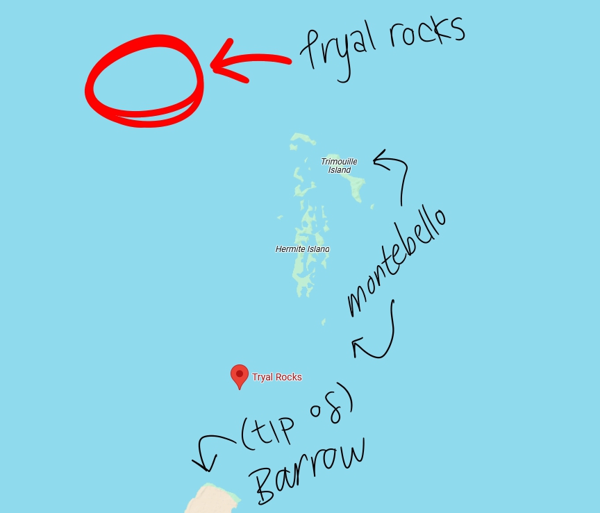
The search for the Trial Rocks
Both the British and Dutch East India Companies (referred to as EIC and VOC, respectively) were concerned that their trade route had secret, deadly rocks somewhere along it. Brookes advised the company to avoid going too far south, theoretically avoiding the Trial Rocks but also reducing speed.
In 1636, the VOC sent a pair of ships under Gerrit Tomaszoon Pool. His instructions included "trying in passing to touch at the Trials," to gather information about their exact location. But he didn't find them.
As the years went on, sailors and mapmakers alike were confused as to where the rocks were and whether they existed. By 1705, the Commodore of the Dutch Ships reportedly didn't believe they were real, at least not in the position Brookes had indicated.
By the late 18th century, even the story's origins were hazy. A 1780 directory of the East Indies claimed that the Trial Rocks were "discovered by a Dutch ship in 1719."
In 1803, English Captain Matthew Flinders took many soundings in the area on his way back from Timor. He spent weeks searching for the rocks despite the fact that illness was rampant aboard ship.
Finally, he concluded that "the Trial Rocks do not lie in the space comprehended between the latitudes 20° 15' and 21° South, and the longitudes 103° 25' and 106° 30' East." Thus concluded, they set sail, hoping to get better food for the sick, as "the diarrhoea on board was gaining ground."
His hard-won findings convinced the British Admiralty, which declared the Trial Rocks nonexistent.

The (re)finding of the Trial Rocks
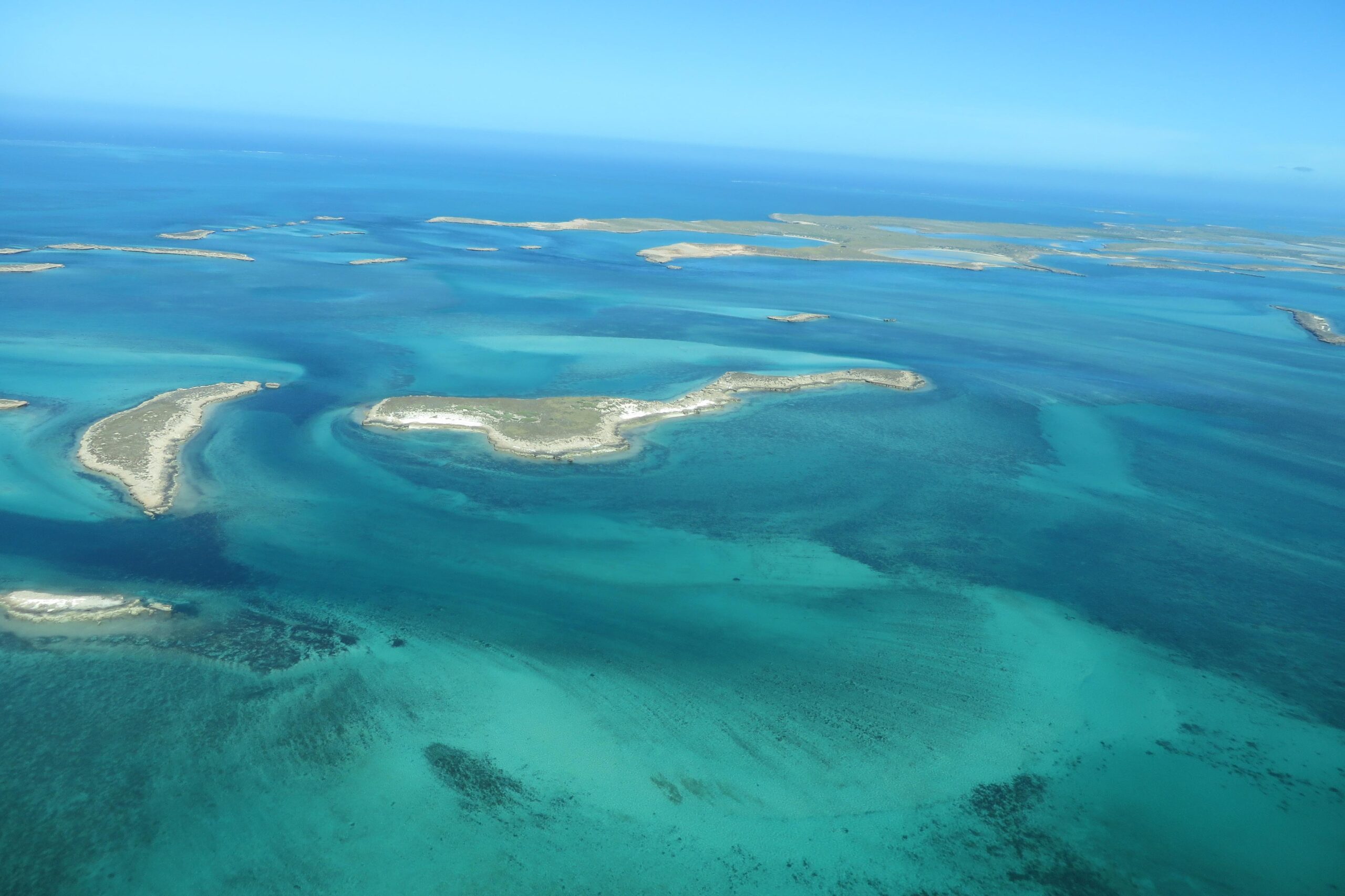
Today, we know that the Trial Rocks lie just off the Montebello Island group, off the coast of Western Australia. The definitive identification of the Trial Rocks came in fits and starts, being repeatedly made and then forgotten.
In 1818, the Greyhound had a run-in with the rocks, managing to avoid being sunk through luck and good spotting. As she was captained by one Thomas Richie, the rocks became known as Richie's Reef. Two years later, another brig passed through the area and had a look-see.
Aboard was Lt. Phillip Parker King, who recorded his belief that the Trial Rocks were, in fact, located around the area of Barrow Island and the Montebello Islands. The next Admiralty chart placed Richie's Reef to the northwest of Montebello, and a second, separate set of Trial Rocks between Montebello and Barrow. They were only wrong by 42 kilometers, which was at least an improvement.
Enter Australian historian Ida Lee. She uncovered the letters by Bright and Brookes and consulted Rupert Gould. Before he became really into the Loch Ness monster, Gould was a member of the Hydrographer's Department at the Admiralty, a respected expert on cartography and naval history.
He replied confidently: Richie's Reef was the Trial Rocks, and Captain Brookes had intentionally deceived everyone about where the rocks lay.

Captain Brookes' great deception
Have you ever really messed up at work? I mean really, really messed up? Imagine if you messed up so bad that nearly a hundred people had died and a huge ship full of valuable trade goods had been lost. Would you lie about it? Be honest.
The truth was that the rocks hadn't been anywhere along the Brouwer route. Brookes had gone too far east, overshooting his turn so badly that they'd sailed right into the coast of Australia. Realizing he went too far, Brookes then headed directly north, instead of northeast, running into the Trial Rocks.
When it came time to write his account, he claimed to have turned earlier and been headed northeast. He told the same lie about the skiff journey, claiming to have traveled northeast instead of east. If he had actually traveled northeast from the Trial Rocks, he would've missed Java entirely.
Brookes had lied about where the rocks were to disguise his mistake, claiming they were hundreds of kilometers west of their actual position. This was not an innocent deception. As the men who died on the Tryall could tell you, knowing where hidden rocks lay was a matter of life and death.
Bright had tried to get the real story out in his letter. But that had been lost to the depths of the archives until Ida Lee. In 1934, Lee published her article, and henceforth, the rocks were placed in the correct location. Except, apparently, on Google Maps, which inexplicably gives the pre-1934 location.
The Tryall gets blown up
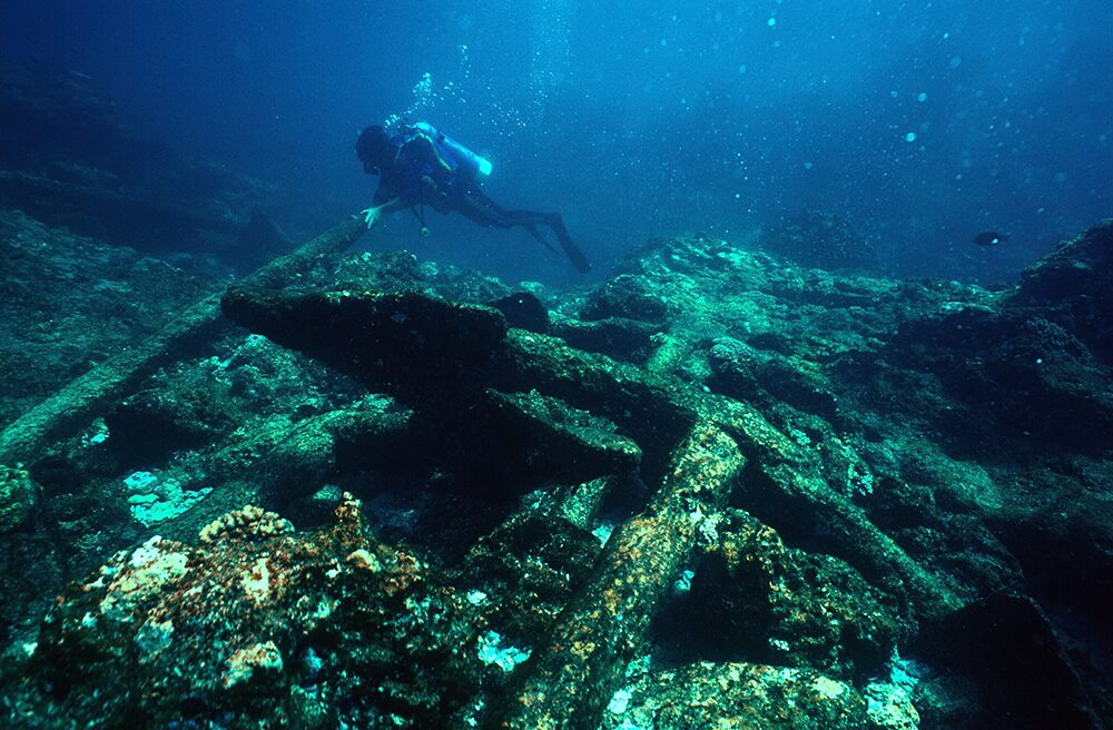
No one actually went looking for the wreck until the late 1960s. Two men from a group called the Underwater Explorers Club, John MacPherson and Eric Christiansen, got Gould's report from the Admiralty Hydrographic Office. A few years later, Christiansen led a small party of divers to the wreck site. For our purposes, the most important member of this group was Alan Robinson.
They dove at the Trial Rocks in May 1969. On the southwestern side of the rocks, they found an old anchor, then another, and then cannons — it was a wreck site. They reported the find to the Western Australia Museum and collected a finder's fee equivalent to about $18,500.
The WA Museum organized an expedition, but poor weather prevented them from doing much diving. In 1971, they came back with more funding, but when they dove down to the site, they found it had been vandalized -- with explosives. The reef itself was damaged, along with some of the cannons and anchors, and the various smaller artifacts one would expect around the site were nowhere to be found.
The suspected culprit was Alan Robinson. A notorious figure in Australian maritime archaeology, Robinson was a treasure-hunter who frequently came into conflict with the laws around salvage and cultural artifacts. He was acquitted of the charges regarding the Tryall site, but we'll probably never know the truth.
Robinson died in jail while awaiting trial for attempting to murder his ex-wife, so was unable to confess about using blasting gelatin on Australia's first shipwreck.

An active archaeological site
Several more expeditions visited the damaged wreck site. Like many of the most famous Australian shipwrecks, any write-up of work on the Tryall site must mention the contributions of Dr. Jeremy Green. Green wrote the book on maritime archaeology, and by the discovery of the Tryall, had already led the investigations of the Batavia and Vergulde Draeck.
It was Green who led the 1971 dives and who gave the first tentative identification of the wreck as that of the Tryall. Because of all the missing artifacts, it's difficult to say beyond a shadow of a doubt that the ship found on Trial Rocks is really the Tryall. In addition to the location, Green used the cannons and anchors to confirm that they were looking at the remains of an English merchant ship from the early 17th century.

Subsequent dives have provided further evidence that this is, in fact, the Tryall, such as the makeup of the ballast stones. The most recent expedition took place in 2021, where they confirmed that there were no other wrecks in the area. Since we know that the Tryall wrecked there, and there is only one wreck, it must be the Tryall. After centuries of doubt, we finally have certainty.
The Western Australia Museum recently completed the restoration of one of Tryall's cannons, which is now on display in the museum.
Camera traps in the jungles of Peru have captured footage of ocelots and opossums traveling together. We have at least four confirmed cases of the two animals walking in tandem, seeming to be perfectly aware and comfortable with the other's presence. The pairs were never more than two meters apart, moving at a leisurely pace. Their body language is relaxed, the opossum never attempting its famous "play dead" manoeuvre.
Experts believe that these aren't isolated incidents, but a pattern of behavior. A group of ecologists and researchers released a new study speculating on what that behavior could mean.

Sniff test
Before they developed formal theories, the researchers needed to collect more data. Ocelots might seek out opossums to hunt them, but would opossums actively seek out ocelots?
To find out, they set up camera traps with 'ocelot cues' -- items which gave off the scent of an ocelot, usually a strip of fabric -- and waited. Opossums showed up and even interacted with the ocelot cues, sniffing, biting, or rubbing themselves on the fabric. Opossums visited the ocelot-scented cameras far more often than control cameras.
To confirm that it was specifically ocelots that the little marsupials were interested in, they repeated the experiment. Using control and puma (cougar, catamount, mountain lion) scented traps, they observed that the opossums preferred the control, apparently disdaining the company of puma.
Both animals are solitary within their species, yet the ocelot and opossum don't just fall in together, but actively seek each other out. The question remains, why?

Much we don't know
Mutual partnerships between species are not rare and form when both sides have something to offer the other. Coyotes and badgers sometimes partner up to hunt burrowing prey. Their different adaptations and hunting strategies complement each other -- the coyote handles the chasing, and the badger handles the digging.
One theory is that the ocelot and opossum partnerships work much the same way. Opossums often feed on snakes and are even immune to viper venom, like the eponymous hero of Rudyard Kipling's short story Rikki-Tikki-Tavi. Perhaps the pairs team up to hunt serpents.
The researchers also speculate that moving as a pair may be a sort of camouflage. By moving with the notoriously odoriferous opossum, the ocelot could hide its scent, making it easier to stalk prey. Moving with the ocelot, the opossum would be safer from pumas and jaguars.
Ultimately, we don't know if one, both, or neither of these theories is correct. The study concludes with a call for more research, and a reflection on what this find reminds us: "how limited our understanding remains of the complex dynamics among tropical rainforest species."
Like the inverse of the mythical butterfly flapping its wings in China, an ice core extracted from Greenland can reveal the rise and fall of societies in European antiquity. A new study took ice cores from the Greenlandic ice sheet and used them to measure the output of lead pollution in Europe. The varying levels of lead pollution corresponded with technological and societal changes.

A global record
Ice sheets are laid down over time in layers of compacted snow. A bit like tree rings, the conditions during their formation are preserved in the layer.
By taking an ice core, scientists are effectively looking at a timeline of climate conditions over thousands of years. Air temperature, greenhouse gases, pollen levels, and chemical concentrations are printed in the layers.
This latest research is a collaborative effort between several universities and climate research organizations. The ice cores in question come from the North Greenland Ice Core Project, or NorthGRIP. NorthGRIP drilled from surface to bedrock in northern Greenland. While NorthGRIP finished drilling in 2004, the wealth of data it offers is still largely unexplored. Led by Joseph R. McConnell of the Desert Research Institute, researchers recently turned to lead levels.
When we imagine ancient coins, many of us imagine gold, but silver was far more common in most premodern coinage systems. Premodern silver smelting produced a lot of lead pollution, and archaeologists can measure ancient economic productivity through lead levels -- more lead, more coins, more activity.

What your lead poisoning says about you
Wind blows European lead emissions to Greenland, where they freeze in ice. Previous studies worked from limited samples; by using the NorthGRIP ice cores, researchers were finally able to construct a complete record of classical emissions.
The first jump in lead levels came around 1000 BCE, when the Phoenicians began expanding into the Mediterranean. Emissions continued through the founding of the Roman kingdom and then the Republic. Levels spiked again when both the Romans and Carthaginians colonized Spain and began mining silver intensively there.
Both Punic Wars saw short-term declines, as the campaigning in Spain pulled workers away from the mines and to the battlefields. They bounced back quickly as Rome took Spain and began minting Roman silver coins in Carthaginian mines.
Researchers can chart the whole of Roman history in this way. Wars and political crises lead to dips, and with new conquered territory, mining ramped back up. The peak was the Pax Romana, following the ascendance of Augustus née Octavian.

Putting Edward Gibbon out of a job, the ice cores also document the decline and fall of the empire. "The great Antonine Plague struck the Roman Empire in 165 AD and lasted at least 15 years. The high lead emissions of the Pax Romana ended exactly at that time and didn’t recover until the early Middle Ages, more than 500 years later," explained coauthor Andrew Wilson, of Oxford.
A group of young people from several Native American groups has completed a month-long journey down the Klamath River. The journey commemorates the removal of four dams, leaving much of the river to flow freely for the first time in a century.
Years in the making
Indigenous activists had been fighting for decades by the time the Klamath Basin Restoration Agreement was signed in 2010. The agreement promised to remove the four hydroelectric dams on the Klamath River. In November of 2022, federal approval finally came through for the dam removals.
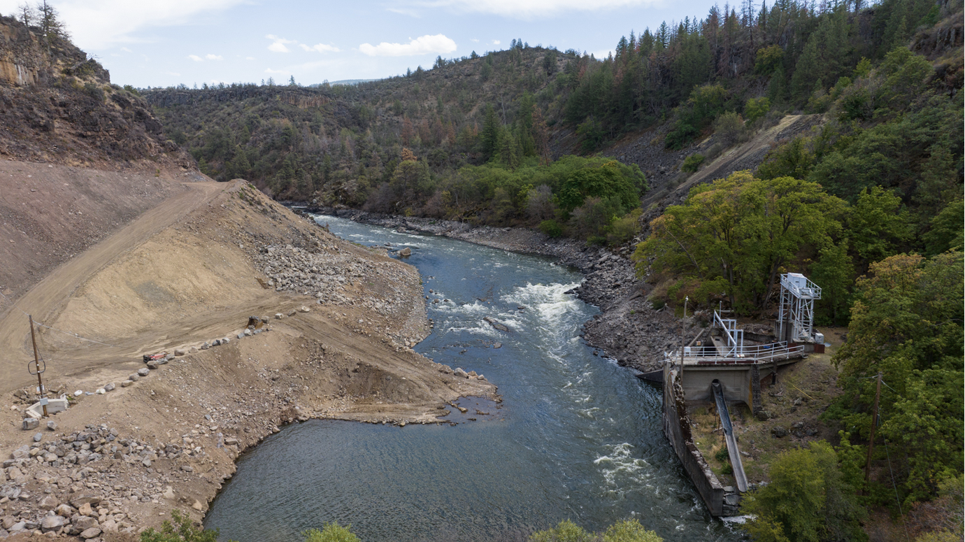
The first and smallest, Copco No. 2 Dam, was removed in 2023, 98 years after it was built. In 2024, the other three dams -- Iron Gate Dam, Copco No.1 Dam, and JC Boyle -- were removed as well.
Paddle Tribal Waters, a nonprofit program teaching kayak and river advocacy to Indigenous youth from all along the Klamath basin, launched in July 2022. After years of training, 43 young kayakers ranging from 13 to 20 set out on June 12 from the Southern Oregon headwaters. There are still two dams remaining, near the headwaters, which they had to portage around.
The journey took them through canyons with rapids as well as across the choppy Agency Lake and through the dam removal sites. Those who had clearance tackled class 3, 4, and 5 rapids, while others chose to take those sections by raft.
In the last few days, even more young people joined. Youth from indigenous communities in the United States, Chile, Bolivia, and New Zealand took to the water. By July 11, a veritable flotilla, 110 strong, approached the mouth of the river. There, friends, family, and community members waited to welcome them.

A historic return
Now that the river flows freely, the ecosystem is beginning to repair itself. Important species like salmon, steelhead, and lamprey can now access over 600km of historic spawning habitat. The drained reservoirs no longer cause massive algae blooms, so the water quality is increasing and the temperature is decreasing. The speed of the river's recovery is a heartening surprise, even to its staunchest advocates.
"We were hopeful that within a couple of years, we would see salmon return to Southern Oregon. It took the salmon two weeks," said Dave Coffman, in a conversation with CNN. Coffman is the director of northern California and southern Oregon for Resource Environmental Solutions, which is working to restore the Klamath.
Klamath fish populations are a vital resource for Indigenous people along the basin, primarily the Klamath, Shasta, Karuk, Hoopa Valley, and Yurok peoples. But though salmon can now return, they return to a very different habitat. Industrial farming has reshaped and polluted the Klamath, and the federal government has frozen much of the funding for restoration.
The trip wasn't just a celebration, but a commitment to continue the fight. "It’s not just a river trip and it’s not just a descent to us," said Hupa tribal member and Yurok descendant Danielle Frank, a participant who gave a speech at the celebration. "We promise that we will do whatever is necessary to protect our free-flowing river."
Officials at the United States Geological Survey have tracked over 300 earthquakes beneath Washington State's Mt Rainier from July 8-10.
A popular tourist destination, Mt Rainier is also an active volcano, closely watched by experts. On average, the area experiences nine small earthquakes a month. About once a year, activity will increase and become a "swarm." But these regular annual swarms are not nearly as strong as the current event.
The current swarm kicked off between 1 and 2 in the morning, local time, on July 8. The largest quake came twelve hours later, registering 2.3 on the Richter scale. The strength and frequency of the quakes have steadily decreased since. The Pacific Northwest Seismic Network continues to track the miniature earthquakes.

Much stronger than the 2009 swarm
The 2025 event has far outstripped the most recent big swarm, from 2009. Scientists detected 120 earthquakes in 2009, and the current swarm is approaching 350, at least 55 of which have been over 1.0 magnitude.
However, officials aren't concerned yet. The volcano alert level remains at "Green/Normal," with no danger to hikers. None of the earthquakes, individually, has been big enough to cause any damage, or even felt by visitors to the mountain.
Volcanic disruption is far from the only cause of seismic activity. Rockfalls and landslides can register as seismic events. Glacial movement is another potential contributor, especially since Mt Rainier is the most glaciated peak in the lower 48. Officials believe the recent activity is the result of water moving through preexisting fault lines, above the magma in Mt Rainier.
Just because this level of activity is higher than what we've previously observed doesn't mean it's abnormal. "We've only been monitoring it for 40, maybe 50 years now. So just because it's the most significant one we've seen on equipment doesn't mean this hasn't happened in the past," cautioned Alex Iezzi, a geophysicist with the Cascades Volcano Observatory.
The previous eruption of Rainier was over one thousand years ago; we have a limited understanding of what normal looks like. From that perspective, the swarm is good. It will give researchers an opportunity to learn more about how the volcano works and what we can expect it to do in the future.
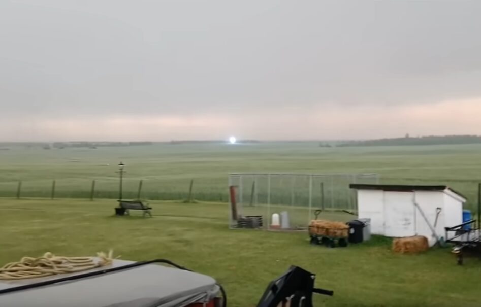
As a massive storm swept through central Alberta in early July, a couple stood on their porch watching bolts of lightning play across the cloudy skies. A particularly massive lightning strike hit nearby. A moment later, they saw a ball of light hovering near the impact site.
In an interview with Global News Canada, Ed Pardy described seeing "a ball of fire… about 20 feet above the ground, and it kind of stayed there in a big round ball."
Ed and his wife, Melinda, said the orb consisted of bluish light, maybe two meters across. Amazed, they began filming. The couple captured 23 seconds of the light hovering on the horizon, before it vanished with a popping sound.
After viewing the video, that the couple sent to several Canadian news networks, many people believe the phenomenon is "ball lightning."
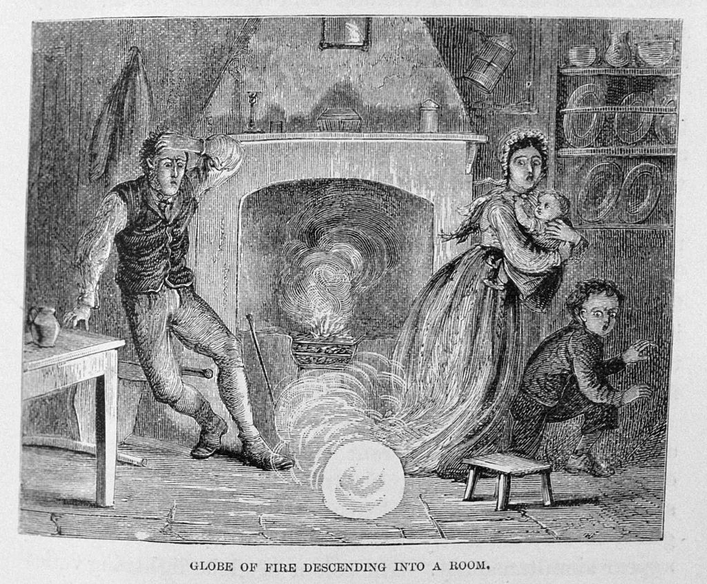
Elusive and mysterious
Ball lightning is a rare and little-understood atmospheric phenomenon. Accounts vary, but the generally agreed-upon description is of a ball of light, anywhere from a few centimeters to a few meters across. Ball lightning coincides with thunderstorms and hovers for a minute or so before disappearing.
Accounts of ball lightning are uncommon, but stories have been around for centuries. The earliest account commonly cited is from a massive storm that swept over England in 1638. Three hundred people were attending church when, according to eyewitness accounts, a ball of fire over two meters across burst through the church window, bashed around, tore open the roof, and killed four church-goers, filling the building with smoke and the smell of sulfur. Witnesses concluded it was the devil, an understandable conclusion at the time.
This isn't the only story of "globular lightning" entering a building. In 1852, the French Academy of Sciences took sworn statements that a ball of light, roughly the size of a human head, burst from the fireplace of a startled tailor, having traveled down the chimney.
In 1753, ball lightning killed a Russian scientist researching electricity, according to contemporary reports. Georg Richmann was holding one end of a string, the other end of which he had attached to a kite. Ball lightning appeared, traveled down the string, and killed Richmann instantly.
Despite scattered reports continuing over the years, scientific understanding lagged behind.
Many theories, limited evidence
So, what exactly is ball lightning? Science isn't quite sure yet. Many reports can likely be attributed to other things. A 2010 study from researchers at Austria's University of Innsbruck found that the magnetic fields generated by lightning storms could cause visual hallucinations. Specifically, they can cause "magnetophosphenes," which appear as flashing lights. This could account for cases of ball lightning.
But unless magnetophosphenes are contagious and spread over video, what the Pardy's saw was real.
Researchers have put forward dozens of theories to explain ball lightning. One of the more credible theories came from a group of Chinese researchers who happened to record ball lightning in 2014. In only a few seconds, the ball went from purple, to orange, to white, to red and then sputtered out. The changing colors indicated its makeup, and the scientists detected small amounts of silicon, iron, and calcium.
They proposed that ball lightning forms when a lightning bolt hits soil, vaporizing the elements within, and creating light and color effects. Experiments in 2007 using vaporized silicon support this theory. Scientists from the Federal University of Pernambuco were able to produce small glowing orbs by delivering electric shocks to silicon wafers.
Another theory is that ball lightning is detached Saint Elmo's fire (a faint light on the extremities of pointed objects during stormy weather, such as around the masts of ships). There's also the "Electrochemical Model," positing that ball lightning is air plasma held in a ball by layers of chemical ions.
Science has yet to settle which, if any, of these theories is correct. But the video filmed by the Pardy's is probably the best video of ball lightning captured so far, and lightning phenomena researchers will likely pore over the 23 seconds of footage for new information.
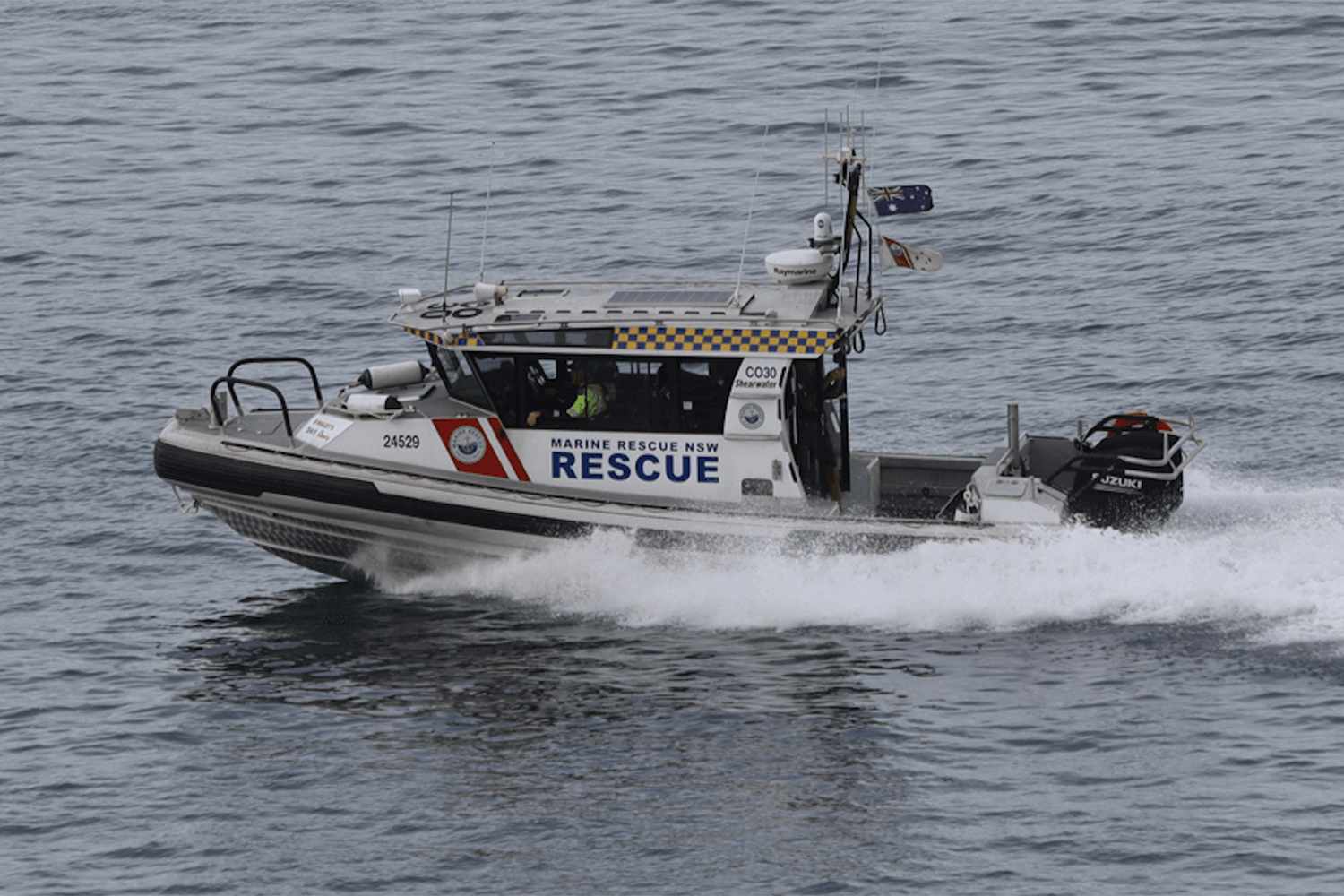
Nineteen-year-old Darcy Deefholts went out surfing on the afternoon of July 9 at Wooli Beach in New South Wales, Australia. When he failed to come home that night, his parents raised the alarm, calling the police to report the young man missing. Authorities immediately launched a large search-and-rescue effort.
Searchers found his discarded clothes, shoes, and bicycle on the beach. It was obvious that southward currents had swept the young man out to sea. The only source of hope was the absence of his long board. Marine Rescue New South Wales assembled a crew of volunteers and launched their rescue boat, Wooli 30. The community rallied, adding half a dozen private vessels to the search efforts.
Water conditions were favorable, and they were able to cover a significant stretch of coast. But at 1 am on July 10, the vessel had to return to shore, unsuccessful.
One in a million
On the morning of July 10, SAR operations recommenced. Wooli 30 and six other boats began searching, while many more volunteers canvassed the beaches. Around 9 am, a crew of volunteers, including the missing man's uncle, found him alive on North Solitary Island.
North Solitary Island is part of the Solitary Islands, named by Captain James Cook when he sailed past them in 1770. The small uninhabited island lies 14 kilometers off Wooli Beach.
Deefholts spent the night adrift, clinging to his longboard, before reaching the relative safety of the island. When searchers found the missing surfer, he was cold and suffering from exposure, but otherwise uninjured. Upon reaching shore, he was taken to Grafton Base Hospital for medical assessment and is reportedly recovering well from his ordeal.
His father, Terry Deefholts, spoke with the Australian Broadcasting Corporation, expressing his relief and amazement that his son had been found. He had been close to giving up, he told them. "It's a one in a million. Who survives this?"
ABC also spoke with Marine Rescue Wooli Unit Commander Matthew McLennan, who led the group that found Darcy Deefholts.
"It's rare that we ever get to participate in a search with an outcome such as this," McLennan said. The massive community response, and the happy resolution to a case everyone expected to end in tragedy, was "really heartwarming."
In Tornado Hunting: Chase it From the South, storm chasers Chris Chittick and Ricky Forbes document their lives in the notorious Tornado Alley of the central U.S.
Just south of Sioux Falls, North Dakota, Forbes, Chittick, and their crew are waiting and watching the skies for funnels of violent cloud.
"We are in the right spot!" they crow as a tornado warning comes in only a few kilometers away. The tornado siren echoes through an empty town as dark clouds roll overhead. The unfolding scene is apocalyptic. The air turns green, they lose signal -- but the tornado doesn't appear.
A professional storm chaser is like a sailor of old. The wind and weather are the ultimate deciders of success, no matter their skill or determination. Like the tars, they spend a lot of time away from their families.
After the disappointing storm, in a rain-soaked parking lot, Chris calls home and tells his children that he misses them. Then it's back on the road.

Home is Saskatchewan, Canada. Chris pushes one of his three young children on the swing, one eye on the darkening sky.
"I feel like weather always wins," admits his wife, Chelsea.
Meanwhile, Rickey and his fiancée, Tirzah Cooper, are driving to her first cancer treatment. She wonders how soon she'll lose her hair.

From the south
A storm is forming around Canby, Minnesota, and the Tornado Hunters drive to meet it. But the road conditions and local terrain complicate their attempt. Hills and tall trees prevent their view and access to the storm. The only chance of getting close is to go right in front of the storm's path, a dangerous gamble. It's safer to approach tornadoes from the south, as the storms move in a northerly direction. Driving into them head-on can, and has, been deadly.
"The more I've storm-chased, and the more that I've seen the destruction that tornadoes can do, the more terrified I become of them," admits Ricky.
They're watching construction crews haul away the wreckage of a ruined house, after the storm they failed to catch has passed.

Their caution brings them back to Saskatchewan, where Ricky and Tirzah go to another appointment. He shaves her head. Not long after, a nearby tornado watch offers what he thinks will be the best chance all year. She urges him to chase after it.
After a succession of near-misses, Ricky finally approaches a dramatic tornado. He stops the car and stands in the road, staring up at the twisting mass dominating the sky. In narration, he says that the feeling he had at that moment was the same feeling of awe he experienced the first time he saw a tornado.

Then, he goes home. " A few years ago," he says, "I never thought anything could be more important than storm chasing. I was wrong."
The film ends with him at home, as on-screen text tells us that both Ricky and Chris continue tornado hunting, and Tirzah is now cancer-free.
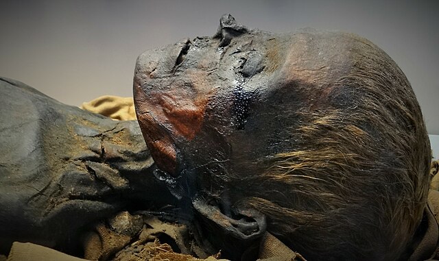
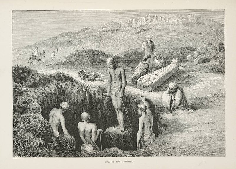
While Egyptian kings and queens are the most famous examples of mummification, the practice wasn’t just for pharaohs. It expanded over time until everyone from the poor up were being preserved for eternity.
So, where are all the mummies? Well, unfortunately, 700 years of rich Europeans ate them. For their health, of course.
From a 12th-century translation error, a massive trade kicked off, depopulating the tombs of Egypt to populate European apothecaries -– and starting an underground market in fake mummy powder.
Bitumen and mūmiyah
Why did Europeans think that eating mummies was a good idea? It's all to do with bitumen. Bitumen is a viscous petroleum product, which occurs naturally in a semi-solid form. Bitumen is particularly common around the Dead Sea, and is useful for waterproofing and as a glue. Archaeological evidence shows that both early humans and their Neanderthal cousins used bitumen tens of thousands of years ago. It even appears in the Bible as the mortar which was used in the tower of Babel.
By the classical era, bitumen was used in everything from shipbuilding to jewelry. People also started using it as medicine. Pliny the Elder, a Roman author and naturalist, lists 27 discrete medicinal applications for it. These include staunching blood flow, diagnosing epilepsy, treating leprosy, dysentery, and gout, and curing toothache.
After the fall of the Roman Empire, Muslim scholars took pains to preserve classical learning. By the Middle Ages, Arabic authors were considered the foremost medicinal experts throughout Europe and the Middle East. The tradition of using bitumen as medicine continued through the works of scholars like Avicenna, who prescribed it for concussions, paralysis, and more. He didn't call it "bitumen," though. He called it mūmiyah, from the Persian word mum, meaning wax.

A medieval game of telephone
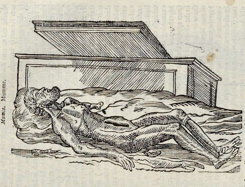
The Ancient Egyptians didn't use bitumen for their mummies. However, the dark resin they used resembled bitumen, leading many classical and medieval observers to believe that bitumen coated Egyptian mummies. So the same word came to refer both to naturally occurring bitumen and the dark waxy coating found on Egyptian mummies.
In the 12th century, an Italian translator of Arabic texts named Gerard of Cremona came across Rhazes of Baghdad's reference to mūmiyah. Gerard said the product was created when "the liquid of the dead, mixed with the aloes, is transformed and is similar to marine pitch.”
Another European, Simon Geneunsis, translated a work by Arab physician Serapion the Younger that referenced medicinal bitumen as "mumia." Geneunsis interprets the word along the same lines as Gerard of Cremona, calling it "the mumia of the sepulchers," which is formed when the aloes and spices used to prepare the dead mix with the liquids the corpse itself expels."
Meanwhile, crusaders were bringing back the bitumen medicine fad from the Islamic medical traditions of the Middle East. Unfortunately, the easily accessible supplies of bitumen in the area were limited. Shrewd Alexandrian merchants realized that there was all this mumia lying around, coating the bodies of the dead. They began raiding tombs, breaking the resinous bodies up, and exporting them to Europe.
The fact that the mumia came from corpses didn't bother people much, possibly due to the confusion between medical mumia and Egyptian mummies. Before long, mumia stopped being the substance on the mummy and became the mummy itself.
It's good for what ails you
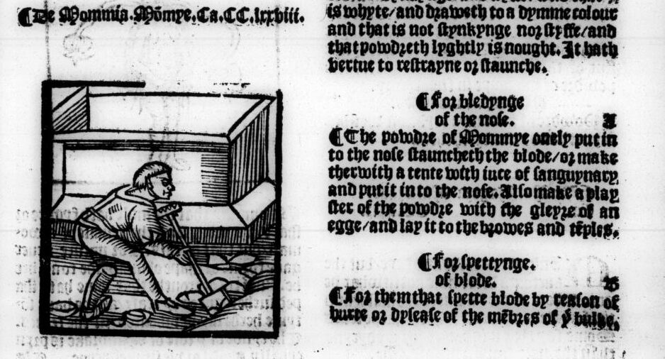
Mumia became a wildly popular remedy in Europe, sold in every well-stocked apothecary. One influential pharmacopeia, Theatrum Botanicum, contains a long list of conditions mumia is useful for, including headaches, colds, coughs, seizures, heart problems, poisoning, scorpion stings, snake bites, bladder ulcers, paralysis, and retention of urine. Treatments involved combining mumia with other ingredients, usually a liquid like wine or goat milk.
Genoese physician Giovanni da Vigo considered mumia an essential medicine for ship's physicians and village doctors. He claimed it promoted wound healing and staunched bleeding. Sir Francis Bacon, the eminent English philosopher, and the physicist Robert Boyle, both considered it useful for wounds, falls, and bruises.
The French king, Francis I, was a habitual mummy consumer; contemporaries reported that he always carried a mixture of rhubarb and mumia on his person, just in case. Nicasius Le Febre, chemist to England's King Charles II, recommended mummy from Libya specifically.
By the way, if you were wondering how it tasted, the English College of Physicians has the answer. Mummy was listed in their official pharmacopeia from 1618 to 1747, where it is described as being "somewhat acrid and bitterish."
Supply chain issues
Egyptian authorities were not actually keen on all the grave robbing and corpse exporting that was happening. In 1428, authorities in Cairo captured and tortured several people connected to a mummy scheme. They confessed to robbing tombs, boiling the mummified bodies in a pot, and selling the oil which rose to the surface.
It was illegal to export Egyptian mummies out of Egypt. But enforcement could be lax, especially if you had money to grease the wheels. Englishman John Sanderson visited Egypt in 1586, where he explored a sepulcher and broke off chunks of blackened mummified flesh. He applied the correct bribes and compliments, and sailed off with 600 pounds worth of "divers heads, hands, arms, and feete."
For every literal boatload of real pillaged mummies, there was at least an equal measure of mummies created specifically for export. Many mummy sellers in Egypt found it was easier to source fresh corpses and dry them than it was to dig up old ones. These fresh corpses mostly came from executed criminals, plague victims, and enslaved people.
The Italian traveler Ludovico di Varthema wrote about the local production of mumia during a visit to the Arabian Peninsula. According to him, there were two kinds; the first was made from the dried-up remains of people who had died recently while crossing the desert. The other, nobler and more pure kind, was "the dryed and embalmed bodies of kynges and princes."
In truth, even authentic mumia wasn't made from rulers, but from their subjects. European nobles liked to imagine their healthful powder came from ancient priestesses and kings, but the remains of the poor were far more plentiful and accessible.
Paracelsus and domestic mummy manufacture
Though a fair amount of the mummy product on the market was inauthentic, the real stuff was still being sold into the modern era. One recent study analyzed the contents of an 18th-century pharmaceutical jar labelled "mumia." They found that the contents really were the remains of an Egyptian mummy from the Ptolemaic period.
But without our modern analysis tools, the question of mumia authenticity was an ongoing problem for physicians. As the supply became more questionable, some medical authorities began to wonder whether mumia being "authentically Egyptian" was even important.
Some definitions of mumia dropped the ancient Egyptian element entirely, ascribing benefits to any old preserved human flesh. The influential physician Paracelsus, who spawned a legion of followers, believed the medicinal benefit of mumia came from a transfer of life energy. To make his mumia, he left a fresh body out exposed. The best bodies were of young, healthy men who died suddenly. Other recipes in this line were even more specific, preferring a 24-year-old redheaded man who was recently executed.
There was a persistent belief that there was a vital animating force remaining in corpses, and one could benefit from this force by consuming corpse products. In the time of Paracelsus, for instance, executioners would collect and sell the blood of those they executed. People believed that drinking it promoted general health and cured epilepsy. Bandages soaked in human fat were applied to wounds, and powdered human skull was prescribed for headaches.
The broader genre of corpse medicine is beyond the scope of this article, but suffice it to say that mumia wasn't always the only human-derived medicine available.
Some reasonable concerns
Now I'm not a doctor, but I feel confident in saying that "you should eat powdered human corpses for nosebleeds" is not best practice. By the 16th century, many doctors were starting to think along the same lines.
Ambroise Pare, surgeon to four French kings, published a 1582 treatise decrying the use of mummy. He argued that most mummy sold was actually manufactured in France from the recently dead, and also didn't work. In his professional experience, it had not only failed to stop bleeding but had unsurprisingly caused the patient to have an upset stomach and bad breath.
Pare's German contemporary, Leonhart Fuchs, made similar arguments. He also laid out the series of medieval translation errors which had led to the idea of mumia. Fuchs decried the "stupid...credulity of certain doctors of our age," who still prescribed mummy.
Additionally, some commentators were beginning to recognize the historical and cultural wealth that was being ground up for tinctures. English natural philosopher Thomas Browne opined that "The Ægyptian Mummies, which Cambyses or time hath spared, avarice now consumeth. Mummy is become merchandise, Mizraim cures wounds, and Pharaoh is sold for balsams."
There was also cannibalism. Michel de Montaigne, a 16th-century French writer and early critic of colonialism, pointed out the hypocrisy of demonizing cannibalistic practices in the New World while taking medicinal human flesh at home. But most people didn't think of it as cannibalism, any more than people today would consider a blood transfusion cannibalism. Mumia wasn't food, it was medicine.
Still, as time went on, people were increasingly wondering if it was medicine they should be taking. Mumia mania peaked in the 18th century, but took much longer to fade entirely.

Consuming Egypt
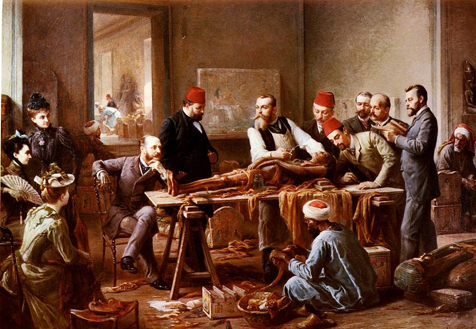
For wealthy Europeans, part of the appeal of mumia was the mystical, exotic associations. For centuries, Europeans treated the bodies of deceased Egyptians with a combination of fetishistic fascination and blatant disrespect. They were curios and collectors' items, souvenirs of exciting trips turned household decor.
Mummy unwrapping parties were popular in 19th-century Europe, where middle and upper-class men and women would watch a mummy's bandages be unwound, revealing its body as the finale of the morbid show.
The remains were consumable as a variety of commercial products. A popular paint color from the mid-18th to 19th centuries was "mummy brown." This pigment was made from ground-up mummified bodies. Art historians believe this rich, warm brown pigment appears in a number of well-known paintings, including Eugene Delacroix's famous Liberty Leading the People. The last tube of mummy brown was produced, unbelievably, in 1964.
There are also accounts, of varying reliability, that both human and animal mummies were used as fertilizer, paper (from their bandages), and fuel for locomotives. These claims are likely exaggerated, but they speak to the manner in which mummified Egyptian remains were treated at the time. As Imperial plunder, they were, literally, things to be consumed.
The end of the mummy-eating era?
By the end of the Victorian period, mumia had fallen out of popular use. But it was still available for sale, and occasionally prescribed, into the beginning of the 20th century. The last known appearance of the drug for sale is in a 1908 Merck catalogue. The German pharmaceutical advertised, "Genuine Egyptian mummy as long as the supply lasts, 17 marks 50 per kilogram."
Rich old Europeans didn't actually eat up all the mummies. Archaeologists are still finding them, for one. It's impossible to say how significantly the manufacture of mumia impacted the number of surviving mummified remains. It's safe to say, though, that nearly a millennium of looting Egypt led to the loss of untold historical and cultural knowledge.
The 1908 example is troublingly recent, but we might still be tempted to dismiss mumia as something from another, less enlightened age. Exporting ground-up mummy to eat as a health supplement is something so patently absurd that a modern reader might make the mistake of smugly holding themselves above all those involved in the practice.
It's true that we don't eat mummies anymore. But physical and cultural wealth is still extracted from exploited nations for the consumption of the global north.
Most human bones available for sale in the West, as curios or medical teaching tools, come from India, though the export of human skeletons was officially banned in the 1980s. World-class museums still display cultural artifacts and remains of colonized people for the predominantly white public to gawk at. Mummy remains merchandise.
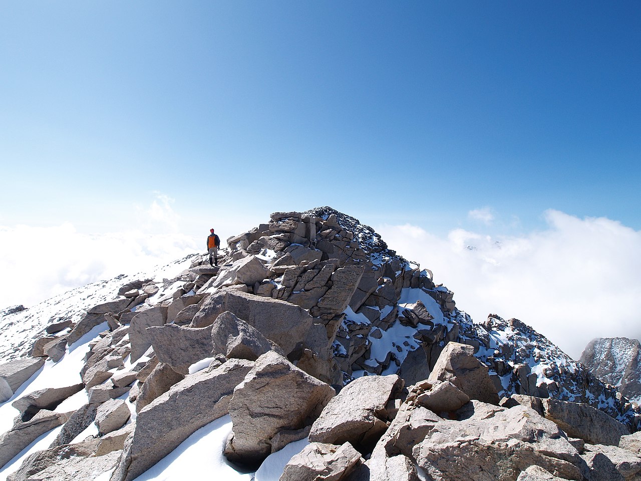
Around 3:30 pm on July 2, an SOS signal from a Garmin InReach device reached the California Governor’s Office of Emergency Services. It had been sent from just below the summit of 4,383m Mt. Williamson, the second-highest peak in the Sierra Nevada.
The sender, whose name authorities have not released, had fallen and sustained serious injuries. She also lost most of her equipment. Her situation soon became even more desperate when a thunderstorm rolled in. Lightning menaced her, and lashing rain beat over the area as a multi-agency rescue operation launched. But the weather, her severe injuries, and the difficult location kept her stranded for many hours.
The woman had been scrambling off-route near the West Chute on Mt. Williamson. While snow-free in July, the nearly 500m chute has sections of loose scree which make it difficult. Mt. Williamson is trickier to summit than the slightly taller Mt Whitney. There is no established trail above 3,000m, and there aren't many fellow climbers around.
The woman was just a few hundred meters from the summit when she fell, losing her backpack and badly breaking her leg. Over her Garmin, she described the grisly compound fracture -- a fracture where the bone protrudes through the skin -- and her lack of food, water, and extra clothing.
A series of helicopter attempts
California Highway Patrol sent an Airbus H125 helicopter to pick up rescue volunteers. By the time rescuers were on board, the storm had fully descended, bringing cloud cover that prevented the helicopter from reaching her.
More resources were called in, and the nearby China Lake Naval Air Weapons Station agreed to lend aid. They transported search-and-rescue workers to Shepherd's Pass, around 3,000m up, but couldn't get any closer. This was around midnight. Volunteers proceeded on foot, reaching the bottom of the west face by sunrise.
They were able to call up to the stranded climber, but the terrain prevented them from reaching her. By then, however, the weather had improved somewhat, and the helicopter returned and dropped two rescuers about 100m above her. They carefully made their way down, reaching her 23 hours after her fall.
They still had to get her out. Again, SAR personnel called in more resources. The Los Angeles County Sheriff’s Department's Air 5 helicopter buzzed over, but the elevation proved too much. Finally, the California National Guard offered their Blackhawk Spartan 164.
SAR workers on the ground carefully moved her into a more open position. Just after 7 pm on July 3, 28 hours after her fall, she was hoisted aboard Spartan 164 and eventually transferred to a hospital.
According to a statement from Inyo County Search and Rescue, the victim displayed "Enormous bravery and fortitude...and all involved were impressed by her ability to remain calm, collected, and alive."
Perhaps the most famous ship in exploration history, the Fram was designed specifically for the challenges of polar navigation. With her rounded hull, she withstood the crushing ice that shattered the likes of Shackleton's Endurance, rising up over the ice instead of being pinned by it. Her design, however, which made her so perfectly adapted to her line of work, also made her roll horribly in the open sea, inducing seasickness.
The SS Bessemer was basically the exact opposite of the Fram. While she was engineered against seasickness, she also seemed to be engineered against seaworthiness. Or perhaps some jealous oceanic deity, seeing humanity attempt to conquer the limitations he'd placed upon their encroachment in his domain, cursed the poor ship.
Cursed or no, the SS Bessemer certainly had an eventful career.
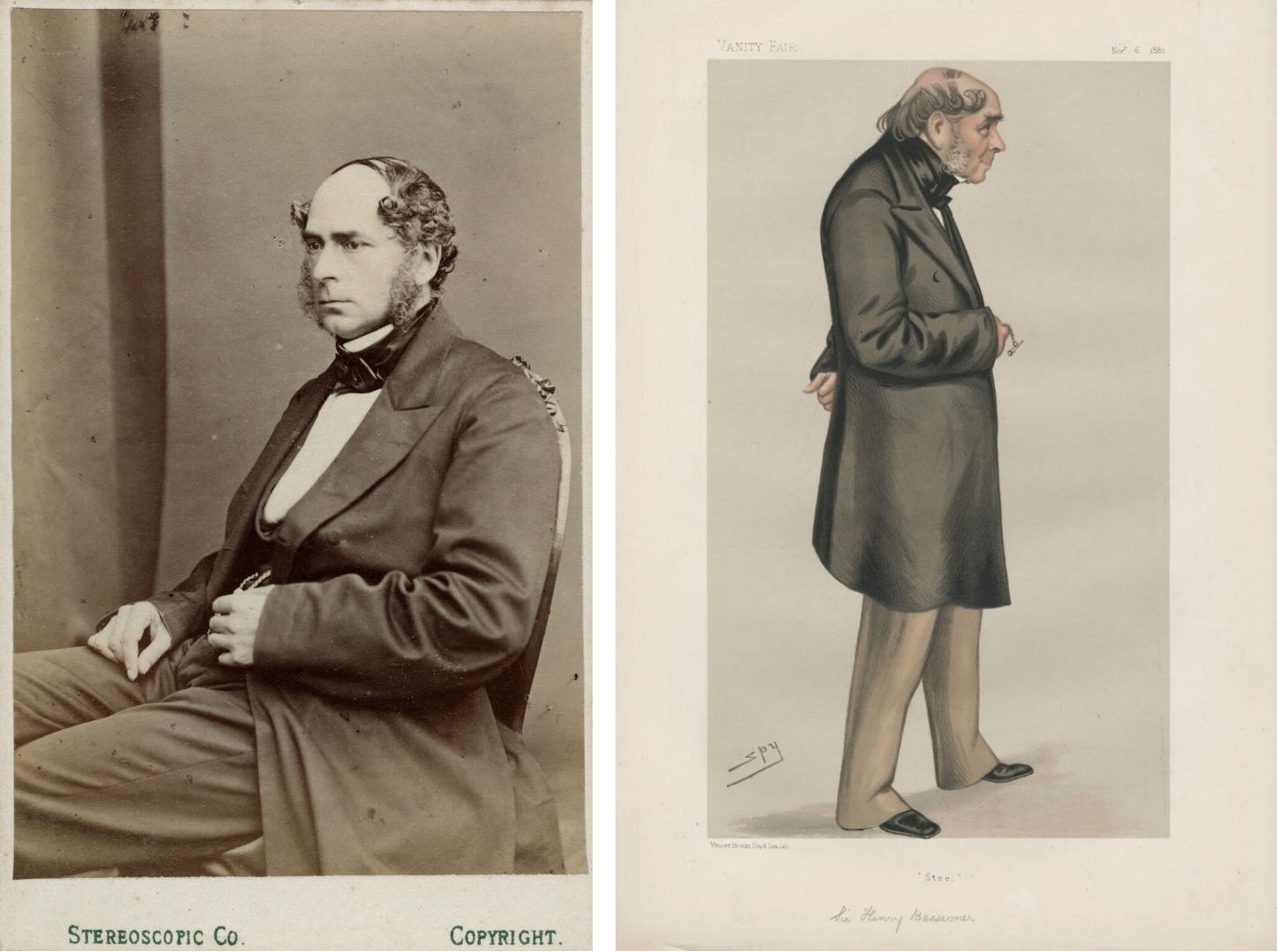
The eponymous Bessemer
Henry Bessemer was born in 1813 on his Huguenot inventor father's small Hertfordshire estate. After fleeing the French Revolution, his father settled in England and made his money from his inventions. Henry took after his father, fascinated by machinery and driven to improve upon the mechanisms he observed. He moved to London at 17 to seek his fortune and immediately began experimenting.
His first big success was a steam-powered machine to manufacture bronze powder. Originally, his only ambition with the experiment was to make gold paint for his sister, a watercolor artist. But the process and manufacturing machines he developed made enough to support him while he continued inventing.
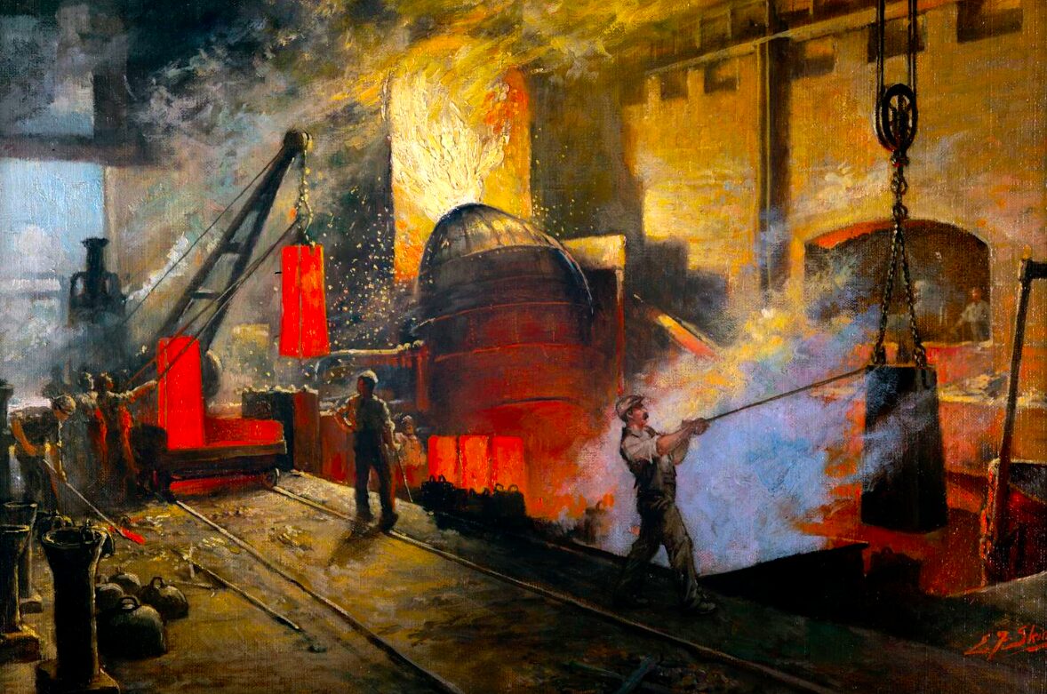
If you've heard the name Bessemer, you've heard it in connection with his most important invention: the Bessemer process. In terms of Industrial Revolution inventions, it ranks among the steam engine, the telegraph, and the spinning jenny.
What Bessemer invented was the first way to produce steel quickly and cheaply. Bessemer steel built the railroads, bridges and skyscrapers of the next century, and made Bessemer a wealthy man. But he wasn't done inventing.
The steel magnate and mal de mer
In 1868, Sir Henry (we will call him that moving forward, to avoid confusion between the inventor and his ship) took a channel steamer from Calais to Dover. While the English Channel crossing through the Strait of Dover, as this route is called, is and was very common, it wasn't easy. While it took less than a day on the steamship ferries, the shallow channel with its powerful, strange currents was notorious for causing seasickness.
"Few persons have suffered more severely than I have from sea sickness," Sir Henry wrote in his autobiography. The 1868 crossing, followed by a 12-hour train journey, left him temporarily bedridden and, it seems, somewhat traumatized. Determined to rid the world of this scourge, he set his inventive mind to work.
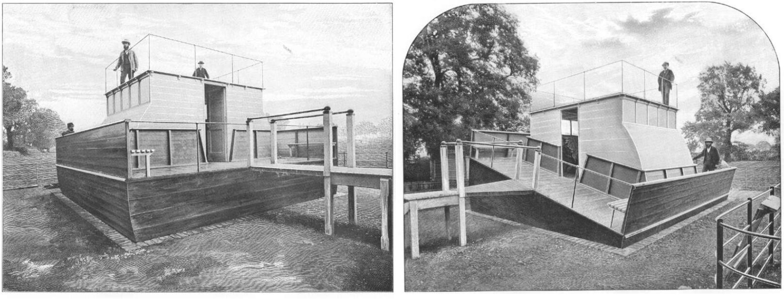
The principle was deceptively simple: A suspended cabin within the ship, which, mounted on gimbals, would remain stable while the outside of the ship was tossed about by the waves. He built a tiny model, "small enough to be placed on a table," and rocked it back and forth using clockwork. It was probably rather adorable.
In December 1869, Sir Henry patented his design and set about building it.
The backyard ship
Rushing into the project, Sir Henry paid a shipbuilder to construct a small steamer for the modern equivalent of over $430,000. No sooner had he done so than he realized he needed to alter his initial design, and the half-built ship wouldn't accommodate the changes. He sold it off for a third of what he'd paid and instead built another model.
Sir Henry was unwilling to actually go out to sea for testing, so he built the middle of a small ship in his backyard. His new design included a steersman. He would manually adjust the level of the cabin by turning a handle to match a spirit level. The motion of the handle would then control the hydraulics.
Sir Henry invited scores of wealthy and prominent friends and fellow inventors to experience the model. They all pronounced it a success, and papers on both sides of the Atlantic reported excitedly that soon seasickness would be a thing of the past.
Building the SS Bessemer
This steersman design satisfied Sir Henry, who formed a joint-stock company and raised $340,000, roughly $34 million today. Joining him in the company was Sir Edward James Reed, who'd been the Chief Constructor for the Royal Navy, and would go on to become a railroad magnate and a member of Parliament.
Designing the ship part of the SS Bessemer was probably somewhat of a low point for him. He'd just bitterly resigned from his Naval command. Parliament had undermined and insulted him by funding the HMS Captain, designed by his detested rival Captain Cowper Phipps Coles, without consulting him. He had something to prove when he decided to join the ambitious new venture.
Sir Henry and Sir Reed sent their plans to Earle's Shipbuilding Company in Hull. Sir Henry continued to bleed money into the project just to keep it afloat.
When the ship was nearly complete and was moored outside Earle's Shipbuilding Company in Hull, a late October gale struck the coast. Too long to be anchored in the regular way, she'd been chained horizontally by both stern and head. As a result, her long side met the full force of the wind, and she was torn from her moorings and driven onto the muddy bank.
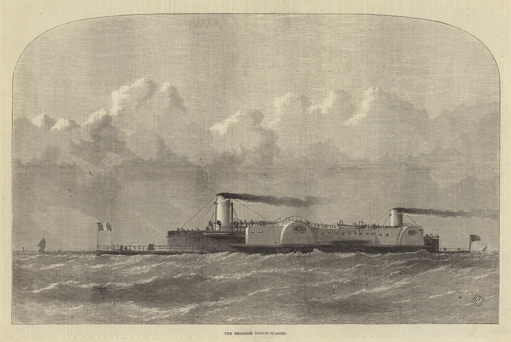
She escaped the embarrassing incident without major injury, and they were able to coax her back into the water and finish construction. Finally, after even more personal financial outlay, the ship was insured, and a commander, a Captain Pittock, was found. The maiden voyage of the SS Bessemer was scheduled for May 8, 1875.

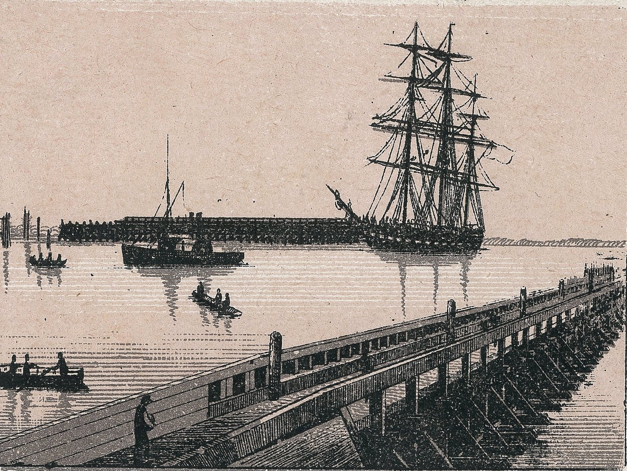
A trying trial run
The company wisely decided to perform a trial run before the public debut in May. A few weeks in advance of the date, Captain Pittock took the SS Bessemer out of Dover, planning to dock at Calais and then return.
Unlike many maritime mishaps, weather could not be blamed for what followed. As Sir Henry himself described, the SS Bessemer approached Calais "on a beautiful calm day, in broad daylight, at a carefully chosen time of the tide, and with all the skill of the best Channel navigator."
Whereupon she crashed into the pier. Her paddle wheels slammed into the pier, causing $3,800 in damages and destroying the paddle wheels. Captain Pittock had to go before the consul in Calais, where he swore that the ship simply "did not answer her helm."
She was fitted with replacement paddle wheels, and Pittock managed to carefully inch her back out of the port and limp home to England.
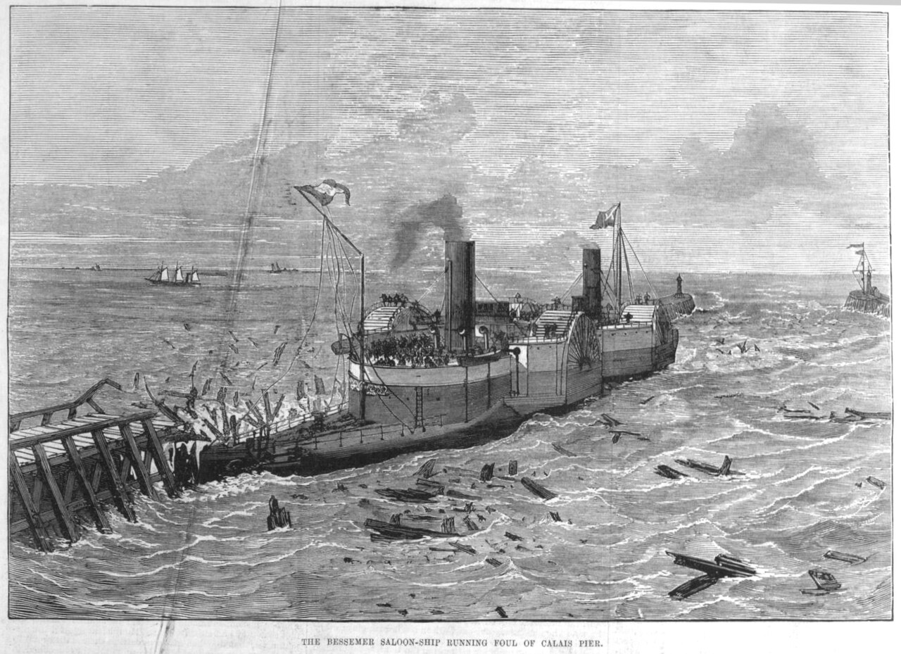
Sir Henry and the company decided it was too late to postpone the May 8 launch. Instead, while the SS Bessemer was being repaired, her creator had the saloon fixed in place, completely defeating the whole purpose of its existence.
Failure continues
Without a doubt, Sir Henry was an incredibly intelligent man with a gift for metallurgy in particular. But he was not a shipwright. The balance of weight in a ship is both important and delicate. The holds of contemporary sailing ships were carefully packed and re-packed to ensure the weight was perfectly distributed. Getting this wrong could negatively affect the sailing abilities of even a very seaworthy vessel.
The SS Bessemer, built around an unwieldy cabin and hydraulics, was already not the easiest sailor. With a great weight constantly shifting the center of gravity, she was practically unsteerable, with dangerously unpredictable movement.
Worst of all, she wasn't even seasickness-proof. Reporting on her maiden voyage, a Wisconsin newspaper wrote that while the design seemed to work in the bay, once she reached the open channel things went awry: "Pitched about by the raging sea, the cabin floundered wildly, and the passengers parted with their victuals as passengers have ever been wont to do."
On her first journey from Hull, where she was built, to Gravesend, she gobbled up coal at an amazing rate. One passenger reported that the saloon itself moved as designed, but either due to mechanical or human error, it didn't respond fast enough to actually negate the movement of the ship.
On the 8th of May, with the first passengers on board and just as ill as always, the SS Bessemer inched into the port of Calais. All breaths were held as Captain Pittock gave his orders-- and the ship failed to respond. The SS Bessemer crashed into the Calais pier for a second time, as Sir Henry put it, "knocking down the huge timbers like so many ninepins!"
The final demise of the SS Bessemer
Sir Henry had sunk a great deal of his personal fortune into developing, building, re-building, and rebuilding a second time. It was an unwillingness to throw good money after bad, not a lack of belief in the concept, that caused Sir Henry to finally pull the plug.
At least, that's what he himself said. That his saloon had proved an entire failure, "nothing could be more absolutely untrue," Sir Henry insisted. It's almost sweet how much he believed in the viability of the wretched little ship despite all evidence to the contrary. At any rate, he never admitted that the concept itself was flawed.
But the second Calais incident killed the SS Bessemer commercially. The bankrupt Bessemer Saloon Steamboat Company was sold off, and the SS Bessemer was sold for scrap. Sir Reed had the saloon itself removed from the ship and installed as a billiards room on his estate in Kent.
Henry Bessemer continued to invent, with varying degrees of success. In 1893, he attempted to build a sun-powered furnace that he promised would reach up to 33,000˚C. However, he gave up after a lens maker failed to produce the required lenses.
In 1889, Sir Reed's estate became Swanley Horticultural College, a women's agricultural school. The beautiful, ornate saloon of the SS Bessemer was used as a lecture hall.

On March 1, 1944, Swanley Horticultural College was bombed in a German air raid. The saloon was destroyed by a direct hit. Only a few pieces of paneling, rescued by local residents, survive.
Humanity has yet to invent a seasick-proof ship, but we do have over-the-counter dimenhydrinate now, which has always worked for me, anyway.
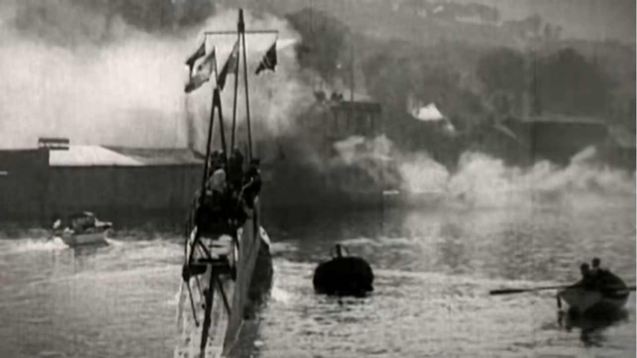
This week's documentary takes us to the frozen Arctic, where a modern expedition follows the route of early 20th-century explorer Hubert Wilkins. In 1931, Wilkins set out for the North Pole in a repurposed military submarine. The subtitle of Frozen North -- "The Disastrous Attempt To Reach The North Pole In A WW1 Submarine" -- hints at how well they fared.
A promising adventurer
Wilkins was raised in Australia. The son of a sheep farmer, he was a self-taught pilot, photographer, and explorer with an abiding interest in the weather. Wilkins first made a name for himself when he flew from Alaska to Spitsbergen, completing the first trans-Arctic airplane flight. He immediately launched himself into the next adventure: reaching the North Pole by submarine.
He chose an old WW1 submarine, which he rented from the U.S. Navy for $1 a year. Interested in his plans, newspaper magnate William Randolph Hearst promised Wilkins $250,000 -- worth over $5 million today -- if he could actually reach the North Pole.

Feted in Brooklyn and well-wished by the wealthiest men of the age, the newly christened Nautilus headed North. Wilkins' goals were scientific. He believed, correctly, that polar conditions impacted weather worldwide.
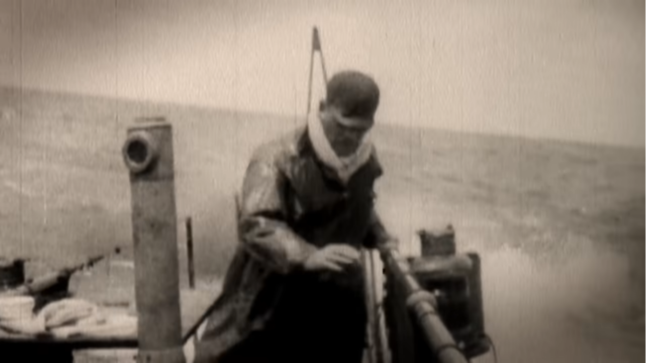
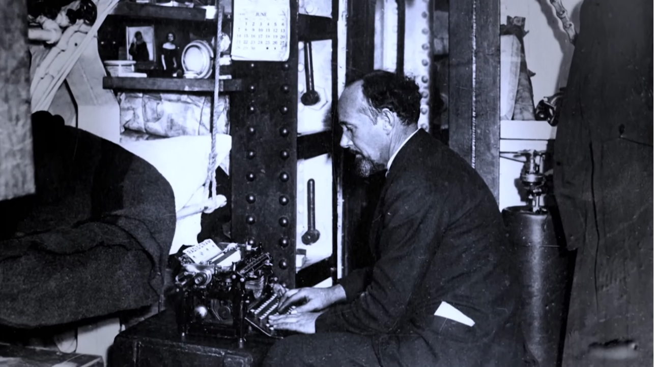
In addition to his meteorological instruments, the ship was fitted with an ice-borer which didn't work, a hydraulic flap to keep it below the ice, and an airlock from the converted torpedo bay. It had no heating or insulation.

The disastrous attempt
Her sea trials went badly, but the season was getting late. It was forge ahead or wait another year, and no polar explorer has ever chosen option two. They left New York with only two months of summer left, with 10,000km to go.
Almost immediately, a storm nearly wrecked them, and the Nautilus sent out an SOS signal. They were rescued and towed the rest of the way to England. Once there, they lost a month to repairs, only halfway to the North Pole. They kept going anyway, making it to Bergen, Norway. Norwegian experts doubted they would survive, and Randolph Hearst sent Wilkins a telegram telling him to call it off. Wilkins ignored this.
It was freezing in the hold, where Wilkins and the researchers conducted observations. They actually did important research, including showing that the Earth is flattened at the poles, instead of a perfect circle. Hopefully, this achievement consoled them through the miserably cold, wet, and cramped conditions.
After doing some science and freezing in the Arctic Ocean, the crew was ready to go home. But that wouldn't satisfy the press, so Wilkins ordered a dive. They were going under the ice.
Under the ice and missing the Pole
Upon inspection, however, Wilkins found the steering mechanism damaged. Historians in cutaway interviews suggest that this was deliberate sabotage by an engineer anxious to go home. Wilkins was unmoved and ordered a dive on the next calm day.
They made it under the ice, becoming the first people to do so. But the radio was damaged, leaving them unable to call for help. At home, newspapers reported them dead.
When they re-emerged, they jury-rigged a radio announcing they were alive. Hearst signaled back that he was glad they were alive and was also cutting off funding. Devastated, Wilkins stayed in the ice for three weeks, taking groundbreaking scientific measurements. It was clear they were not going to reach the Pole.
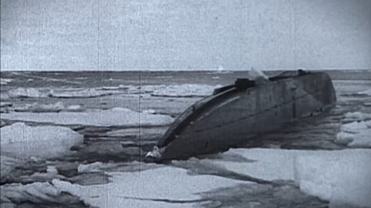
The Nautilus left the frozen north and limped back to Norway. By the time it arrived, another engine failure had left it unusable. On order of the U.S. Navy, it was scuttled off the coast of Norway.
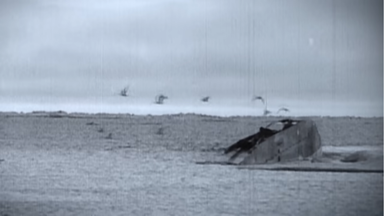
Diving to the Nautilus
Nearly a century after his failure to reach the Pole, Wilkins' attempt is appreciated as an exploratory and scientific success. But the mystery of the broken steering mechanism lingers.
In a modern two-man submersible, researchers descend to the sunken Nautilus. The modern craft contrasts sharply with the dangerous, dirty, and miserable conditions of the older one, showing how far (with some exceptions) the technology has come.
They found the Nautilus, well preserved in the cold water, but now home to a diverse array of marine life. Researchers focused on the steering gear, looking for signs of deliberate damage. But it's buried in the sediment, preventing them from inspecting it.

Sabotage or not, it was suicidal to dive without those diving rudders, explains oceanographer Raphael Plante. Coming back alive at all was a remarkable achievement.
But Wilkins always dreamed of returning, and proving that submarines were a viable way to explore the North Pole. In March of 1958, a year after Wilkins' death, U.S. Navy submarine USS Skate reached the North Pole. They scattered Wilkins' ashes there.
Later that year, his vessel's namesake, the USS Nautilus, became the first submarine to transit under the North Pole.
In 2023, the world consumed more than 7.3 billion kilograms of tea. Bar water, tea is the most popular beverage on earth. We've even figured out how to drink it in space, where both boiling water and drinking from a cup is a serious endeavor.
Today, many regions are known for the production and consumption of tea. But for the first few thousand years of its existence, it was synonymous with China.
Tea only reached Europe in the 17th century. When the famous English diarist Samuel Pepys first tried it in 1660, he called it "a cup of tee (a China drink) of which I never had drank before." He did not record whether he liked it or not. Many British people did take to the drink, though, and by 1800, the Brits were importing 24 million pounds from China every year.
British merchants chafed under the trade deficit; their people wanted tea, silk, porcelain, cotton, and indigo. The Chinese didn't seem to want anything but silver. To protect their monopoly, the Chinese government made it illegal to sell live tea plants or their seeds, and closely protected the secrets of tea manufacturing. There was only one way around this: The British were going to have to steal tea from China.
![]()
The most powerful company in history
The British East India Company was one of the most powerful and ruthlessly evil corporations ever to exist, and they had set their sights on taking tea from China.
Formed in 1600, Elizabeth I granted the British East India Company (EIC) a monopoly over all trade east of the Cape of Good Hope. The intention was to create a strong, organized merchant army to break Dutch control of the spice trade.
In 1683, Charles II gave the EIC the unilateral ability to "declare peace and war" with the "heathen nations" of Africa, Asia, and America. The EIC had the right to govern colonies, build plantations and military forts, raise armies, and execute martial law within their territories. The private armies of the EIC conquered much of Southeast Asia, ruling India, Pakistan, Burma, and Bangladesh. They turned these countries into wealth-extraction machines, reducing the inhabitants to desperate poverty.
The company controlled the trade of some of the world's most valuable products: tea, coffee, spices, cotton, silk, porcelain, saltpeter, wool, and slaves. But their monopoly was growing unpopular at home, as it drove up prices and prevented competition. In 1813, the British government opened up trade to India, and in 1833, to China.
But the EIC still had monopolies to trade in a few products, including tea.
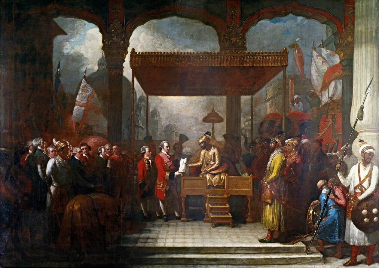
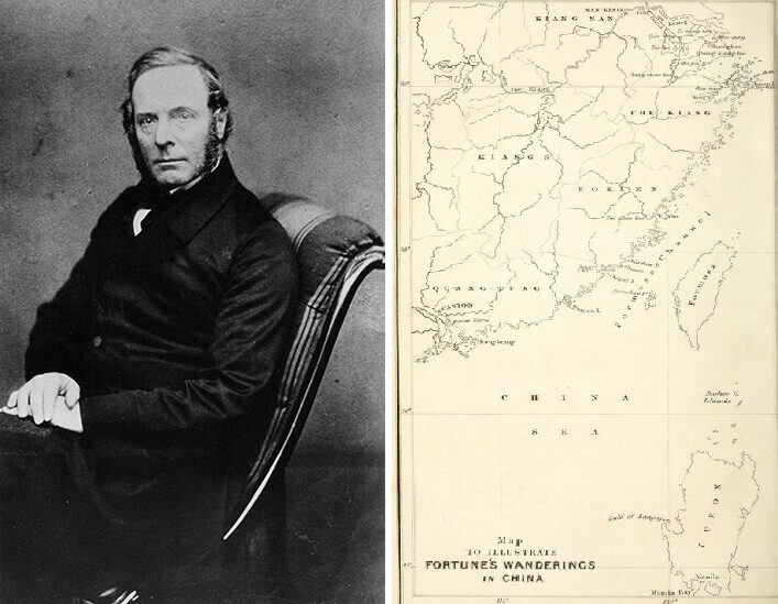
A bold proposition
In 1848, Robert Fortune, curator of the Chelsea Physic Garden, was approached by the renowned botanist Dr John Forbes Royle. Royle was an EIC surgeon and the superintendent of the EIC's botanical garden in Saharanpur, India.
Royle had come to offer him a job, on behalf of his employer. Go to China in disguise, make your way deep into territory never seen by Westerners, and smuggle out living tea plants. Fortune would also need to observe how tea was processed -- a closely guarded secret -- and make it out of the country with his specimens alive. The pay was £500, five times his current annual salary.
Fortune had already traveled and collected in China, and even observed some parts of the tea growing and collecting process. Before he had gone, many Europeans believed that green tea came from one plant, Thea viridis, and black tea from another, Thea Bohea. Fortune discovered the truth: the difference between green and black tea is in the preparation, not the plant.
Born in Duns, Scotland, in 1812, Fortune came from humble beginnings. He excelled as a gardener on a nearby estate, and in 1839 he moved to Edinburgh to work under William McNab, a celebrated botanist. It was McNab who recommended him to the Royal Horticultural Society in London. The society was sponsoring an expedition to China, allowing Fortune to travel there in 1843.
On that first trip to China, he was attacked by bandits and pirates, battered by typhoons, and nearly killed by fever. He risked death by entering areas banned to foreigners. He also sent back dozens of plants unknown in the West, and brought the art of bonsai to Europe.
In 1848, he agreed to return.
Arrival and disguise
On June 20, 1848, Fortune left Southampton on a passenger steamship. On August 14, it anchored in the Bay of Hong Kong. From there, he traveled up the Shanghai River to the city of the same name, then the northernmost open Chinese port.
It had changed since his last visit. In the harbor, Fortune saw "a forest of masts" from English and American ships, and on shore, a Western port town had replaced the Chinese houses and farms. A steady stream of former Shanghai residents poured from the new settlement into the country, bearing coffins. They were retreating with the remains of their ancestors, to rebury them near their new homes.
Fortune didn't stay long in Shanghai. His destination was the "great green-tea country of Hwuy-chow." He was referring to famous tea plantations in the Anhui region, deep in the Yellow Mountains. This was where the most celebrated tea was grown, but it was well over 300km from Shanghai, and forbidden to Europeans.
Fortune didn't trust a Chinese agent to get the samples for him. For one, it would take botanical knowledge to keep the samples alive, and two, he believed that "no dependence can be placed upon the veracity of the Chinese." Unlike the Chinese, Fortune was honest and forthright, which was why he decided to disguise himself to infiltrate their plantations and steal from them.
Fortune's hired translator and guide, Wang, rented a boat and found him Chinese clothes. Meanwhile, another servant, a day laborer unnamed by Fortune, shaved his employer's head into a queue hairstyle. Thus attired, they set off in a riverboat headed inland.
Discovering devastation
The boat took them upriver to the city of Hangzhou-Fu. On the way, Fortune passed through several large but "dilapidated" cities. Fortune, like many Western men, considered China a great civilization in ruin, whose ancient glory had fallen to stagnation. But there was another reason for the ruined, half-empty towns.
Stealing the secrets of tea was not the first attempt Britain and the EIC made to adjust the trade imbalance. First, they introduced the Chinese to a desirable product of their own: opium.
Opium wasn't unknown in China, but was used only medicinally. Britain planned to flood the country with the highly addictive drug, forcing Chinese merchants to trade their valuable goods for opium, instead of silver. The EIC could produce opium cheaply in India, and began smuggling it by the ton into China.
A succession of emperors tried to prevent the trade, making it highly illegal, but the drug still got through. In 1838, Chinese officials destroyed over 20,000 chests of opium and set up a naval blockade. British warships fired on them, smashing through and proceeding up the Pearl River. By 1841, they had conquered and occupied Canton, and the First Opium War was in full swing.
A year later, the British took the then-capital city of Nanjing, and the Chinese were forced to sign a treaty handing over the island of Hong Kong and opening new ports. Opium would continue to flow. The effect for many Chinese people was economic depredation, an addiction crisis, and cities ravaged by conquering English armies.
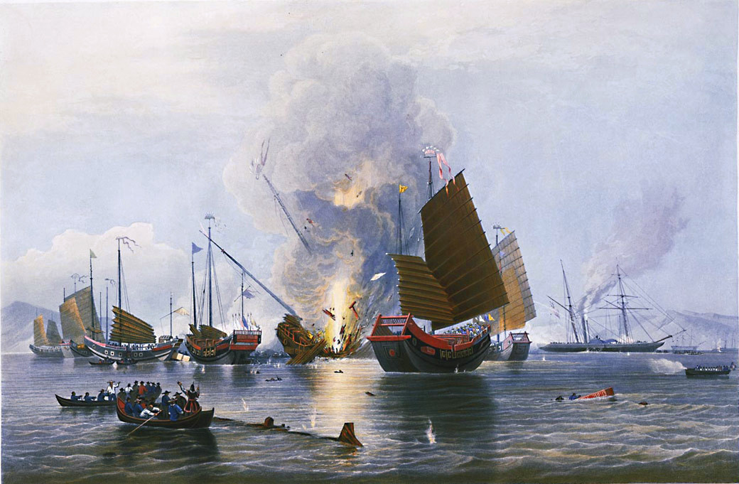
Through the gates of Hangzhou-Fu
Fortune had planned to skirt around the outside of Hangzhou-Fu, a large city which sat on the river, on his way from the coast to the tea district. But a miscommunication found him alone in the bustling city, separated from his servants. He believed that if he was detected, an angry mob would tear him to pieces or haul him to court.
Fortunately, his disguise seemed to hold, and Fortune, having decided to hope for the best, stayed in the hired chair his servants had arranged. It took him through the city to an inn where his baggage and his servants were waiting.
It seems difficult to believe that his disguise was effective. Maybe the people around him just didn't care if he was a foreigner, as long as he was paying handsomely and not causing a disturbance.
However, most of the people Fortune encountered would never have seen a white man before. They also probably hadn't traveled much outside their district. Fortune did speak Chinese -- not fluently, but conversationally -- and his errors could be chalked up to a dialect difference. The people he met probably assumed Fortune, going as Sing Wa, was an eccentric, ugly, rich man from a different part of China.
Fortune boarded another river boat, and they glided into the hills. Finally, the river became shallow, and the boat would go no further. As they decamped, Fortune saw Song Luo Mountain, believed to be the birthplace of tea, in the distance.

Green tea factories and black tea temples
Having reached his destination, Fortune set about recording the climate conditions, soil type, and growing patterns of the lush tea bushes. He recorded, in great detail, how and when the best tea was planted, transplanted, watered, and harvested.
Wang's father lived in the area, so Fortune, emboldened by success, traveled across the region with Wang's home as his base. Fortune was able to send many samples back to Shanghai.
But the growing was only half the mystery; how tea is prepared is just as important to its quality. It was Wang who finally got Fortune into a tea factory. He dressed Fortune as a mandarin (a government official) who had come from a distant province to learn about tea manufacture.
The factory supervisor bought the story. Fortune was free to observe the complexities of harvesting, sun-drying, stir-frying, wringing out, stir-frying again, sorting, and packing. Every step is essential to perfecting high-quality tea.
Next, Fortune set his sights on the Wuyi Mountains. Leaving Wang, Fortune hired another guide, Sing-Hoo, who was more familiar with the area. The Wuyi Mountains, then called the Bohea Hills, are the origin of many famous tea varieties today, such as oolong and lapsang souchong.
After a hard climb, they arrived at the top of the mountain at a large temple complex. Sing-Hoo went first, telling the monks that his master, an important man from a far-off region of China, would be staying for a day or two.
It worked. The old priests fed them, gave them a place to rest, and shared wine and tobacco with the visitors. Fortune left with several more living tea plants.

Prussian blue and tea green
Having risked life and limb to penetrate the inner sanctum of tea preparation, Fortune noticed something curious: the workmen's hands were blue. But only when they were preparing tea for foreign markets; the bulk of tea grown in China stayed in China, and had no associated blueness.
Fortune investigated and found the operation superintendent grinding down gypsum and Prussian blue, a deep blue synthetic pigment, in a mortar and pestle. Workers mixed the resulting light blue powder into the tea leaves. They were dying the tea because most Westerners, to Fortune's distaste, preferred their green tea to be really green.
Fortune believed tea was best the way the Chinese drank it, without milk or sugar, and certainly without dye. This was a good call on his part; gypsum can produce hydrogen sulfide gas when it breaks down. It also generally acts as an irritant in the body. Don't eat gypsum.
"It seems perfectly ridiculous that a civilized people should prefer these dyed teas to those of a natural green. No wonder that the Chinese consider the natives of the West to be a race of barbarians," Fortune wrote.
Fortune secreted away some samples and sent them on to England, where they were displayed to a horrified public.

A Wardian case
Bringing live tea plants out of China and into the Assam region of India presented significant challenges. To keep the little tea plants alive during their long journey, Fortune turned to an ingenious new device: the Wardian case.
Earlier, English doctor and amateur botanist Nathaniel Bagshaw Ward had considered the problem of transporting plants alive. His solution, presented in an 1842 book, was the precursor to the modern terrarium.
He wasn't the first to discover that plants could be kept alive in a hermetically sealed glass container, but he was the first to publicize it. "Wardian cases," based on his work, became a trendy item for Victorian drawing rooms. Robert Fortune used them to transport living tea plants from the Yellow Mountains to the foot of the Himalaya.
Tea takes root in India
India already had a type of tea, growing wild and cultivated for medicinal use. But the British didn't want that; they wanted the tea from China, but for far less than what the Chinese charged them. They started plantations in Assam, awaiting the tea seeds and plants from China.
As a result of Fortune's mission, nearly 20,000 tea bushes were planted in India. He also hired skilled Chinese tea growers to lead production. Fortune wrote of the new tea plantations with pride, believing they not only provided cheap tea to the English but gave employment opportunities to Indians.
"If part of these lands produced tea, [a rural Indian man] would have the means of making himself and his family more comfortable and more happy," Fortune wrote optimistically.
British dominion did not make rural Indians more comfortable and happy, but it did make India a tea-producing country.
Today, Assam is the world's single largest tea-growing region. India as a whole is the second largest tea producer after China, exporting over 250 million kilograms annually. I'm drinking tea as I finish writing this article. I checked the packaging; it was grown in Assam.
Jake Davis is a professional wildlife filmmaker who has recently begun posting what he captures to YouTube. The title of his latest is descriptive: I Left $100K in Cameras on a Wolf Kill. Here's What They Captured. It's a deceptively simple premise. The footage Davis captures is the story of an entire ecosystem and a rare and intimate glimpse into the lives of wolves.
One day, Davis tells us in the introduction to the footage, he spotted a wounded bull elk. Davis realized he had stumbled into the immediate aftermath of a wolf hunt, and was now face to face with the victim. Knowing this presented a rare opportunity, Davis waited and watched. The next day, carrion birds flying overhead led him to the body of the elk.
Setting up the cameras, we get a behind-the-scenes look into the process of professional wildlife filmmaking. Davis explains his setup, placing cameras at different distances and angles to get different shots. To make sure they're on when there's activity, he sets them to be activated when a nearby device registers heat signatures-- living creatures. Then he leaves.
The afterlife of a bull elk
The birds are the first to arrive at the wolf kill. Various corvids hop about the corpse, and even a large golden eagle alights. Foxes join the gathering periodically. But after five days, the carcass is still largely intact -- and no wolves have visited. But they have been spotted close by.
Davis faced a dilemma. The cameras needed to be serviced to ensure none of them had a dead battery or were buried in snow. But if Davis went out to refit them, he would scare away the wolves. Or he could trust luck, hope the batteries held out, and wait. Fate decided for him, closing the road with storms and accidents.
When he finally makes it out, the cameras are covered in snow. And wolves had visited.
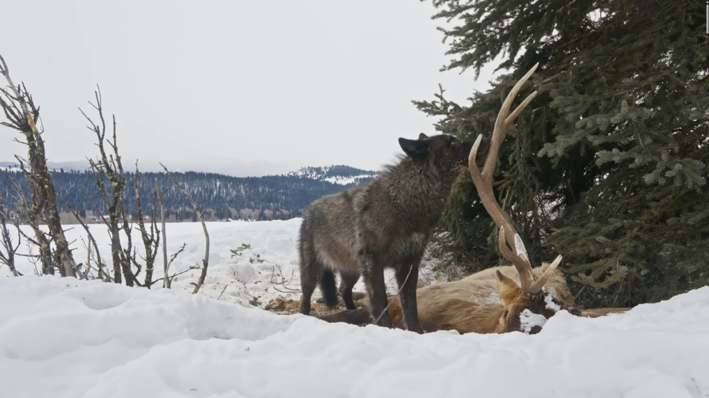
Visit of the wolves
Two young black wolves had arrived to feed, then left again. Quickly, Davis replaced the batteries and memory cards on his cameras and replaced them. Two weeks later, he returned again, to a strange scene.
The elk was nearly eaten up and had also been dragged several yards. And one of the cameras was missing. Footage showed the black pair had returned, as had an older grey wolf, and finally an entire pack. They fed on the elk all night, though one of them took a break -- to steal a camera and carry it off.
The wolves carried it away down the hill, biting at the case and the handle. When Davis is able to find it again, however, the memory card is intact, and we get a glimpse of the thief.
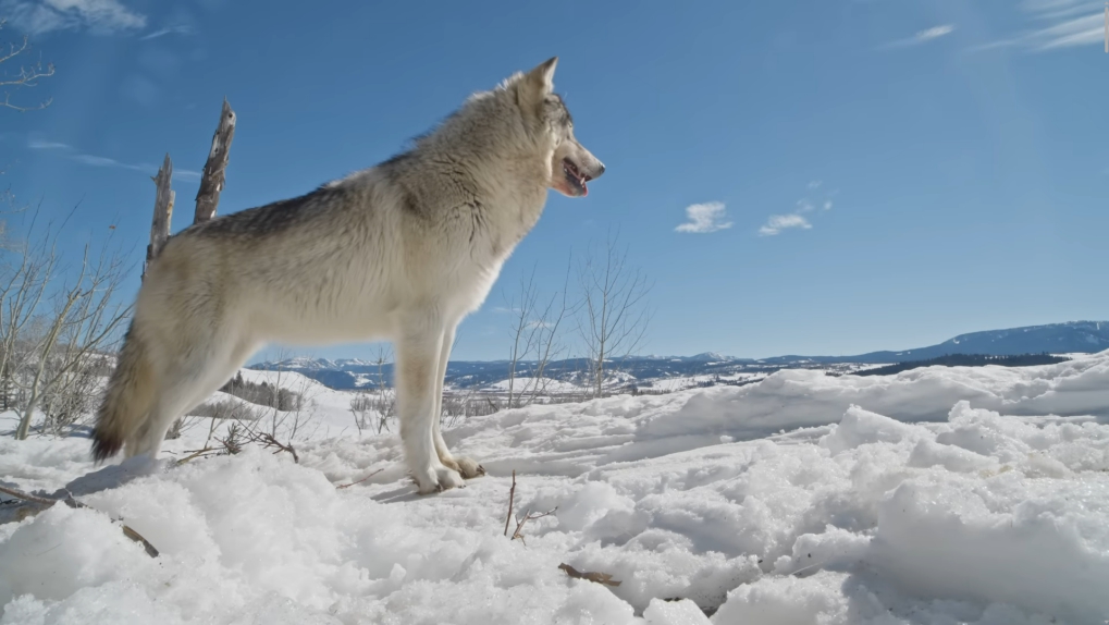
The next day at sunset, the wolves return for the final time. As we watch them gnaw at the bones, it is, as Davis says, "a window into a world that's never seen."
Juliana Marins, who fell from the trail on Indonesia's Mount Rinjani volcano, has been found dead after four days. She disappeared from a guided early morning hike around 6:30 on Saturday morning, slipping off the rim into the crater. She survived the fall and began calling for help. Rescuers tried but failed to reach her.
Weather hampered subsequent efforts, but on Tuesday, they launched a third attempt to reach Marins. The first rescuer reached her 600m below the trail and found her unresponsive. Three others reached her and confirmed that Marins had died. She had been trapped on the volcanic slope for four days, facing cold, stormy weather without any supplies, possibly injured from the fall.
Her family reported her death on Instagram. Their account, advocating for her swift rescue, has gained over a million concerned followers in four days. "Today, the rescue team managed to reach the place where Juliana Marins was. With great sadness, we inform you that she did not survive."
Dashed hopes
It had seemed that she might get through this alive. But on Sunday, a day after her initial slip, she had fallen further down the crumbling cliff, and authorities were unable to find her. Weather reduced visibility and made the terrain slippery and unstable, hampering efforts to both find and reach her.
On Monday morning, drone footage helped locate Marins again, several hundred meters further down. Rescue teams again attempted to descend to her position, but weather conditions prevented success. Reuters interviewed Muhammad Hariyadi, the head of local rescue efforts, who explained that the soft sandy terrain had prevented them from rescuing Marins using ropes.
Indonesian authorities reported that the rescuers had been able to deliver food and water to Marins, but the Brazilian embassy in Jakarta contested this claim. Marins' family also disbelieves the claim, writing on Instagram that Marins had been without food or water the entire time.

After discovering her lifeless body, rescuers had to retreat due to worsening weather. They plan to return today, June 25, to retrieve her remains. However, heavy rain and cloudy conditions are expected to continue, and may prevent their success.
The Indonesian Ministry of Forestry closed hiking routes on Rinjani yesterday. This precaution was taken both out of respect for Marins' family and to simplify rescue efforts.
Rescuers are still trying to reach a Brazilian tourist who fell into the crater of Indonesia's 3,726m Mt. Rinjani on Saturday.
Juliana Marins, 26, rose before dawn to hike around the rim of the country's second-largest volcano with a small guided group. But in the early-morning fog, she slipped over the edge of the trail and fell down a cliff into the crater.
Drone footage captured over the previous three days shows her alive and conscious, but rescuers have been unable to reach her.
In and out of sight
Marins disappeared from the group around 6:30 am local time. Later on Saturday, she was heard screaming for help, and park authorities attempted to arrange a rescue. Drone footage showed her sitting in the grey soil, awake and moving, about 300m below the trail.
However, when rescuers descended to that point, they were unable to find her. They called out but received no response and were forced to climb back up to the rim. On Sunday, more drone footage confirmed that she was no longer in her original location.
On Monday morning, authorities found Marins again, even further down the slope. It appears that at some point on Saturday, she slid further down the cliff from where she was perched. Rescuers attempted to reach her again, but stopped a little under halfway down. They were reportedly able to send food and water down to her before retreating.
Weather hampering rescue
Hikers who had been with Marins on Saturday morning told the BBC that the weather had made the hike difficult: "It was really early, before sunrise, in bad visibility conditions with just a simple lantern to light up the terrain, which was difficult and slippery."
The same dense fog and slippery ground underfoot forced rescuers to turn around on Monday.
Her family has set up an Instagram account to report on the situation and advocate for Marins' rescue. Marins' family is currently in contact with the company that led the hiking trip, through the Brazilian embassy in Jakarta.
They also expressed dismay that the park was still open and hikers were still undertaking the route from which she had fallen. Juliana is not the first visitor in recent years to fall into Rinjani. Just this May, a Malaysian man fell to his death while climbing the peak, and in 2022, a Portuguese tourist died in a similar fall.
In 1954, the Academy gave the award for Documentary Short Subject to the first film in Walt Disney's People & Places series. Titled The Alaskan Eskimo, the film stitched together events in the daily lives of indigenous Alaskan people.
While the language and viewpoints expressed are outdated, the footage represents a remarkable historical document of daily life in an Alaskan community over 70 years ago.

Summer business
The film crew visited in the warmest months and documented the preparations for the coming hunts and colder seasons. We see men building houses, and women stitching watertight coverings for new kayaks.
When the whalers return, the entire community comes together to haul in and flense the carcass of a beluga whale. We see children enjoying muktuk, slices of the skin and blubber of the whale. It's a very traditional food for groups all across the Arctic Circle, and an excellent source of vitamin C. "It has a taste like beech nuts, er, they say," our mid-Atlantic 1950s narrator adds with typical dryness.

Winter underground
The film crew stays on as the winter chill comes in, and the camera moves inside. The home we saw being built in summer, half buried in the earth, is now finished and in use. The people of the village are not idle in the long, cold hours, but busy themselves preparing useful items.
Men carve knives and harpoons, while women sew waterproof raincoats out of dried whale intestines and strands of grass. The people of the village also prepare seal skins for mukluk shoes. The children snatch the cut-off scraps to chew on, grinning widely at the camera.
A break in the weather occasions an outburst of activity. Dog teams set out to replenish stores and gather wood before the full fury of winter returns. We watch as the men harness dogs, load driftwood onto sleds, and conduct a reindeer hunt.
Hunters and fishermen, the narrator reminds us, are in constant danger. If a blizzard sets in while they are so far away from home, they are likely to die. The weather does turn, but the hunter we are following manages to make it back to the village just in time.

Spring is sprung
As winter draws to a close, the villagers prepare for the celebration of spring. Dressed in their best clothes, they come together in the meeting house. There, the filmmakers record a festival celebrating the end of winter. Men dance in masks representing the gods of the sky, the sea, and the land, in order to honor and thank them, accompanied by drumming and singing.

The ceremonial transitions into the farcical as the dancers switch their masks for caricature masks, intended to represent fellow villagers. The audience laughs, rocking to the quick tempo of the drums, as another winter ends.
Humanity's closest relatives, both extinct, are the Neanderthals and the Denisovans. The second group, who lived alongside both humans and Neanderthals, were only discovered in 2008. They lived across Asia and Siberia, and may have passed on increased altitude tolerance to Tibetan and Nepalese people, who carry around 2% Denisovan DNA.
The Denisovans were sophisticated tool users, crafting stone axes as well as decorative objects. They spent at least some of their lives in caves, where the remains and artifacts have been found. We learned all this about our lost cousins from recovered artifacts, loose teeth and slivers of bone. Until now, we hadn't found a single Denisovan skull.
Or, rather, we didn't think we'd found one. Turns out, one was found in the 1930s.
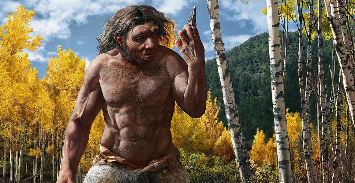
A century of mistaken identity
In 1933, construction of a bridge over northeast China's Songhua River churned up old sediment. In the sediment was a skull. Someone, presumably a worker, took the skull home and kept it safe. The family of farmers held onto it for three generations, passing it down.
Then in 2018, a farmer decided to donate the old family skull to Hebei GEO University. It was immediately subjected to a battery of examinations resulting in three different studies. One dated it to 146,000 years old; another pegged it at 138,000 years; a third, at 309,000 years old.
More intriguingly, they compared it to other known hominid skulls and found no match. The cranium was larger than any other hominid, suggesting a brain size in line with our own. But other features more closely resembled earlier human ancestors: heavy, jutting brows and large, prominent teeth with squarish eye sockets.
He must, they decided, be a new species. The "Dragon Man," as he was being called, after the Songhua River's associations with them, was Homo longi.
But a pair of new studies turned the Homo longi theory on its cranium.

Proteins and the family tree
Researchers from Chinese, German, and American universities worked together to extract genetic information from the Dragon Man skull, also called the Harbin cranium. They had noticed similar large teeth on both the Harbin cranium and the Xiahe mandible, a jawbone found on the edge of the Tibetan plateau.
In a previous study, researchers identified the Xiahe mandible as the remains of a Denisovan. It was the first hominid remains found using proteomic analysis, a technique that matches unique proteins. If the mandible was Denisovan, researchers wondered, then the matching Harbin cranium might be, too.

But the Dragon Man wouldn't give up his secrets easily. They tried to find preserved DNA in the bone and then in a tooth, but with remains this old, it's nearly impossible. Finally, they turned to dental calculus -- calcified plaque. Dental calculus is bad for your gum health but good for preserving DNA.
And there, after cleaning, converting, and sequencing, they found what they needed. Researchers isolated pieces of mitochondrial DNA, which they could match against previous Denisovan genetic profiles. It was a match. Specifically, a match for the older Denisovans, likely before they began interbreeding with both humans and Neanderthals.
Now that we have a confirmed Denisovan skull, the studies' authors hope more unidentified hominid fossils can be identified as Denisovan. A particularly well-preserved hominid cranium from the Shaanxi province of China may turn out to be the second Denisovan skull.
In a new study, a team of biologists found that participants' breathing patterns were so unique that they could identify them with almost perfect accuracy.
But not only that; the study also showed that these "respiratory fingerprints" could predict physical and mental traits like Body Mass Index (BMI) and mental illness.

Counting breaths
To measure breathing patterns, researchers strapped a special device onto 100 subjects for 24 hours, logging every inhale and exhale. AI analysis then turned the data into a distinct pattern, which then matched breathing to participants with 96.8% accuracy. The breathing data also indicated whether a subject was asleep or awake, and seemed to indicate Body Mass Index.
Researchers invited the subjects back three months later for another trial. They found that their breathing patterns hadn't changed much, indicating that the fingerprint was fairly stable.
Participants filled out surveys designed to measure depressed, anxious, and autistic traits. All three conditions have possible links to respiratory dysfunction.
Breathing exercises are widely used to reduce anxiety. But respiratory fingerprints could have a much broader application. "We envision application of respiratory fingerprints across various areas of medicine," the paper predicted.
The future of respiratory fingerprints
Even the most fundamental physiological processes, like breathing, aren't fully understood. We are still learning how changes to breathing and air conditions affect the body. The respiratory fingerprint may help fill in those gaps.
It's promising research, but the rocky history of fingerprints shows why good science is slow and cautious. The method of using fingerprints as identification was developed in 1892, and they became prime evidence for many convictions and executions. Now, in the era of DNA evidence, several people convicted based on their fingerprints have been exonerated.
It took millions of years of being a species before humans took the first picture of our own Earth's southernmost point. Now, after less than a century in space, we've photographed the Sun's south pole.
The European Space Agency's Solar Orbiter's images aren't just groundbreaking. Learning more about our star's polar regions will help scientists understand and predict the Sun's effects on Earth.
A new point of view
For all human history, we have had only one angle on the Sun. The view was straight on. This is because the planets and their spacecraft rotate around the Sun on a flat circle called the ecliptic plane. Picture a CD playing. Or don't, I'm not your boss. At any rate, that flat-on angle prevented us from seeing either pole.
Escaping the ecliptic plane takes some doing, by which I mean a lot of very expensive rocket fuel. The Solar Orbiter used Venus's gravity to help pull it out of the usual equatorial orbit around the Sun. Every time it passes Venus, the planet's massive gravitational force shoves it out of the ecliptic plane. As it keeps looping around Venus, it gets pushed further and further out of alignment with that plane.
In January 2027, it should come around the Sun again at a more tilted angle, giving us an even better view.

Weird magnetic fields at the sun's south pole
The Sun's polar regions are pretty busy and chaotic places, it turns out. The ESA's press release about their findings goes so far as to call the Sun’s magnetic field "a mess." The Sun's magnetic north and south poles switch places every 11 years, and it's a somewhat sloppy process.
During the transition period, called the "Solar Maximum," the magnetic field becomes a confused tangle, with no clear north or south pole. These magnetic upsets can cause a variety of startling and unpleasant effects on Earth, as seen in the history of solar superstorms. Look forward to power outages, satellite communication breakdowns, and particularly striking auroral displays until the sun settles down again and decides which end is which.
The images and readings from the Solar Orbiter give scientists a better idea of what's going on with the Sun's magnetic fields. This, in turn, will allow them to predict future solar activity more accurately. We aren't there yet, but this is a massive step toward building accurate computer models of solar magnetic behavior.

In Five Caves, Five Days, Australian climber Ben Cossey sets off on what he alliteratively dubs "The great Australian coastal cave climbing crawl from Campbelltown to Coolum."
Cossey's been climbing in Australia for more than two decades, but he admits that he hasn't explored much. He has his few favorite areas, and until a friend suggested it, hadn't thought much of climbing north of Sydney. But after looking at a map and finding five promising crags in a line along the coast, he set out to expand his horizons.

Junkyard cave
The first stop is at Junkyard Cave, outside of Campbelltown. Cossey meets up with local climbers who introduce him to a warmup line named Fifty Shades of Mt Druitt.
One of these locals, also named Ben, shows Cossey the main event. It's a line that he and his peers have been working on for a long time, but has attracted little attention from the broader Australian climbing community. Ben hopes they can get more people to try it and appreciate the "little paradise" around Junkyard Cave.
Cossey is game. He manages to send the line, quite literally kicking and screaming, emerging victorious atop a rather cinematic jut of cliff.
"A clean, beautiful rock," he admits, surprised. "Reminiscent of some of the best stuff I've climbed in Australia."
Lobster Cave
Tom is the friendly local assigned to Lobster Cave. In addition to showing Cossey the lines, including one Roast Lobster, they spend some time exploring the area. Close to the coast, the area around Lobster Cave has been inhabited for a very long time. Australian Aboriginal people have carved rock art nearby.
When it's time to start climbing, Cossey first goes for the Red Headed Dragon.
"Not a bad spot," Cossey says with satisfaction. "That's an ideal top out... another coastal cave-crawl classic."

Hoppy's Cave
Another day, another cave. This one is known for being rather sharp. Cossey isn't dissuaded, but he does stop and pick up some analgesic cream in anticipation. His guide today is Jason, who sets Cossey onto Blackleg Miner. The route is long and steep, running all the way from the back of the cave.
"It's pretty radical. It's really radical," Cossey says, impressed. The rock sticks out from the surrounding valley, the only feature like it in sight. It is also, as promised, sharp.
"Man, that is an undertaking!" Crossey exclaims when, hanging upside down bat-like from the ceiling, he reaches the end of the line.
Flinder's Cave
"It's about 400 degrees in the shade," Cossey says, as day four finds him at Flinder's Cave. That's 752 degrees Fahrenheit. Lucy is his guide today, who starts him on Wet Jigsaw Puzzle as a warmup.
Cossey compares her introduction to the cave to being shown around someone's home.
"I didn't know what to expect, but it's better than what I expected," Cossey says.
After "Wet Jigsaw Puzzle" and one other, Lucy sets him onto the grand finale: A Space Odyssey. It's a hard climb, with smoother rock than the other Flinder's lines. Cossey is screaming and panting in the final stretch.
"There's unfinished business there," Cossey reflects. "A lot of routes there to go back to."
Mt. Coolum
Cossey's final day finds him sore and swollen-fingered but undaunted. Krystle meets him at Mt. Coolum, a cave with unique horn-like rock formations.
The strange new style of rock throws Cossey for a loop, to his surprise. The locals, used to the strange surfaces, scurry up the rock where Cossey was struggling, but he keeps at it.
His goal is to finish a route at every crag, and for the first time, there's doubt if he can. As the hours go by, Cossey is running out of time.
Torn to shreds by five days of climbing, his fingers force an end to the fight. This time, Mt. Coolum defeats him. The locals, smiling, are sure he'll be back.
He technically failed the challenge, but resolved his original question: Is there enough good climbing along this coastal route north of Sydney to consider it a climbing destination?
"The answer is, absolutely."
On Dec. 3, 1827, an engraving changed the world of ornithology forever. Robert Havell Jr. of Edinburgh made the engraving, which was based on a painting by a man who had bet his career on its success.
The painting's artist was John James Audubon. Born in Haiti in 1785, the illegitimate son of a sugar plantation owner, he had dedicated his life to his work as a self-taught artist and ornithologist. After a stint in France, he moved to America at age eighteen, where he obsessively hunted and sketched the birds around him.
Around 1820, after over a decade in business, he decided to make his hobby his career. Intending to paint every American bird, he set out into the wild with a gun and his art supplies.
The result was 435 plates of detailed, lifelike avian illustrations. But the American public wasn't interested, so he took 250 of his best plates on a ship to England and began exhibiting there. The jewel of his collection was his large painting of Falco Washingtonii, which was chosen as the first engraving and published to drum up interest in his work.
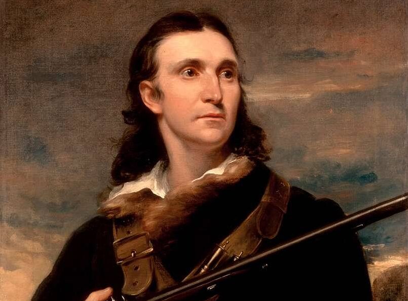
Falco Washingtonii, the Washington sea eagle
The regal bird, perched on a cliff face and overlooking the sea, was a new species, and not just any new species, but the largest eagle in North America. Patriotically, Audubon named it after George Washington. It has been called, interchangeably, the bird of Washington, Washington sea eagle, great sea eagle, and sea eagle.
According to Audubon, it was a bird with reddish-brown plumage, notably larger than any other American eagle. The specimen Audubon painted had a three-meter wingspan and stood a meter tall; its sharp hind talons were over six centimeters long.
The public, and Audubon's fellow naturalists, were astonished by the discovery. It was a career-making moment for Audubon, and it helped him secure funding to print his seminal work, Birds of America.
The problem? As Matthew Halley has pointed out in his thorough and excellent analysis of Audubon's supposed Washington sea eagle, there has never been a confirmed specimen. Today, it is not considered a species because of a lack of evidence. So why did Audubon seem so sure it existed?
There are, broadly speaking, three possibilities: He mistook a known animal for a new species; he was lying, and possibly even plagiarized the illustration; or he was right, and the giant North American eagle disappeared before its existence could be verified.
Birds just look like other birds sometimes
We all know the distinctive white head of the bald eagle, but only mature birds have that feature. For the first year of their lives, bald eagles have completely brown plumage. The next few years are an awkward, patchy, white-bellied stage. Finally, around year five, they attain the classic white head, brown body combination.
When juvenile bald eagles leave the nest, they have reached their full, impressive adult size. While not as big as the purported Washington sea eagle, the largest bald eagles can have a wingspan of 2.3 meters. It can be difficult to accurately judge the size of a moving object at a distance, and in his excitement over sighting a big bird he didn't recognize, Audubon could easily have remembered the animal as larger than it was.
The problem is, he also claimed to have measured an actual specimen. It was significantly larger than even the biggest bald eagles. It was supposedly a male -- usually up to 25% smaller than females -- suggesting a female of this new species would be even bigger.
Audubon knew that juvenile bald eagles were brown, and this larger specimen was distinctive. He also claimed to observe a breeding pair with chicks, which could not have been juveniles. Finally, bald eagles do not nest on cliff faces, but in trees.
Sea eagle timeline
There is more than motive to suggest Audubon's account wasn't honest. Looking closely at his timeline, the math doesn't quite add up.
According to Audubon, he first saw the eagle in February 1814. He described "rapturous feelings" at the sight of the large bird flying over his pontoon boat on the Upper Mississippi. His companion, a Canadian, calls the bird a "great eagle," which he claimed was a very rare eagle, larger than any other, that roosts on rocky cliffs.
Audubon saw the bird again "a few years afterwards," near the Green River in Kentucky. There, high on a rocky cliff, he saw a nest and watched a mated pair of sea eagles bring fish to their chicks.
Two years after seeing the nest, Audubon had another encounter. Again in Kentucky, this time near the Ohio River outside the town of Henderson, he saw a large brown eagle fly up from a hollow and perch on a low branch. Audubon crept forward stealthily. Once in range, he shot it with his double-barreled hunting rifle. It fell, dead, and Audubon was delighted.
This, according to Audubon, is the specimen on which he based his official description and painting. His last sighting of a living Washington sea eagle was in November 1821, when a pair of them flew over his boat at the mouth of the Ohio River.
The holes in his story
Critical readers of his account had a few questions. Why wait until 1828 to publish anything on this new species? He'd procured the specimen (which he was never able to produce) in 1821 at the latest. During the seven years he waited to publish, he was periodically broke and attempting to gain funding for his work. Surely, revealing this exceptional new species would have been helpful.
Another oddity: according to his diaries, it was only in late 1820 that he began to think that there were two eagle species, one brown and the other white-headed. But eight years later, he claimed to have known since 1814 that there was a larger brown eagle.
This 1820 diary entry, in which he wrote about seeing a group of brown and white-headed eagles, is probably the "last sighting" he claims took place in 1821. He wasn't at the mouth of the Ohio River in November 1821, but was there in November 1820. His timeline doesn't line up. Could it be that the entire account given in 1828 was invented?
Plagiarism accusations
There's no doubt that Audubon was an extraordinarily skilled artist. He used thin wires to arrange his freshly deceased specimens in lifelike poses, and had a very strong visual memory. But he drew from life, not from imagination. So, how could he draw a bird he hadn't seen?
Over a century and a half after the painting was unveiled, historian Linda Dugan Partridge noticed a similarity between it and an 1802 print in The Cyclopædia, a serialized British encyclopedia. It depicted a golden eagle, the other species of eagle native to North America.
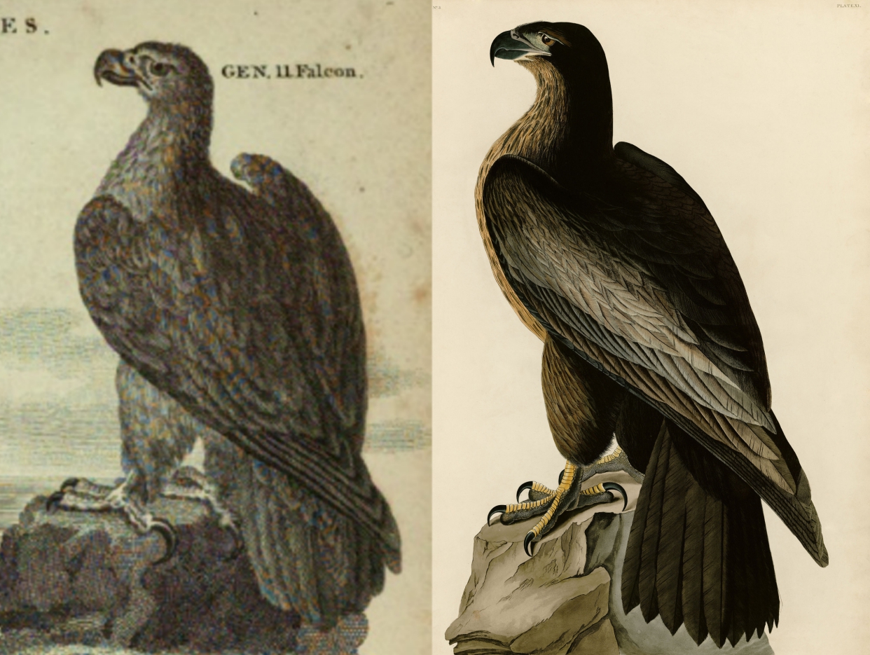
In Audubon's written description, he specified that his bird had twelve tail feathers. But in his painting, the bird has ten, matching the golden eagle print. Feather count aside, from subjective observation, there is something stiff and old-fashioned about Audubon's painting. His birds are usually livelier and more dynamic. The Washington sea eagle seems posed, statuesque, but not in a good way.
Then there's the matter of the foot. The feet are unlike those of any known eagle species. What they are like is a second illustration from The Cyclopaedia.
An international debate
In an obvious bid to inspire patriotic feelings, Audubon named the bird after America's first President. "If America has reason to be proud of her Washington, so has she to be proud of her great eagle," he wrote. Challenging the bird, therefore, would be challenging Washington, challenging America itself.
Nevertheless, some experienced ornithologists on both sides of the Atlantic began looking askance at his eagle.
In 1831, Audubon claimed there was a specimen of the bird in Philadelphia. Several local ornithologists visited the purported Washington sea eagle, which a friend of Audubon's had bought and donated to a museum. Among them was George Ord, who examined the specimen and declared it identical to juvenile bald eagles he had seen. Another ornithologist, Titian Peale, came to the same conclusion.
Unfortunately, the eagle specimen didn't survive, so we can't confirm their findings. But Ord was sure, and wrote pages and pages of scathing letters dismissing Audubon's claims.
But the public loved Audubon. They were, as Ord opined, "determined to make him a great man in defiance of truth and common sense."
As the decades went on, the scientific community grew more skeptical about Audubon's eagle, though public support for Audubon stuck. By the late 19th century, naturalists were sick of the whole debate. Ornithologist Elliot Coues said in 1876 that "this eagle business is about done to death...That famous ‘bird of Washington’ was a myth. Either Audubon was mistaken, or else...he lied about it."
A lost giant of the skies
Despite the compelling case against Audubon, there are still those who argue that he was right. There had, after all, been birds of prey of the size he described, and larger, on the North American continent in the past. Buteogallus woodwardi, or Woodward's eagle, lived in the United States and Cuba during the Pleistocene. Paleontologists estimate it grew over a meter tall with a wingspan of up to three meters.
Outside of the Americas, we find even larger extinct birds of prey. Haast's eagle flew in the skies of New Zealand until 1445, when competition with early Māori settlers drove it to extinction. These eagles grew up to a meter and a half in length and had comparatively short wings for their body size. Even so, their wingspan may have been as wide as three meters.
Giant eagles aren't wholly a thing of the past, either. The Steller's sea eagle can have a wingspan of over two meters. They live in the Pacific Far East, such as northern Japan and Russia's Kamchatka Peninsula. Like the purported Washington sea eagle, they nest on rocky outcroppings.
The skeptic is not always right (often, though)
There is also a precedent for Audubon being correct. Naturalists of his day claimed his depiction of a rattlesnake attacking a mockingbird nest was unscientific because rattlesnakes can't climb trees. We now know that they can.
Botanists mocked him for his painting of the common American swan, which featured a yellow water lily. Fifty years later, the yellow water lily was discovered in Florida.
Species thought extinct have reappeared in the past, and enthusiasts of speculative zoology are quick to point out that animals like the platypus and giant squid were once thought to be hoaxes. A lost giant eagle, now extinct, is a romantic prospect. But it is far from the most plausible one.
Time will uncover the truth?
Audubon has a complicated legacy, to put it mildly. That business I mentioned he was engaged in before he dedicated himself to birding? It was slave trading. On his journey down the Mississippi River, two enslaved black men accompanied him. When they arrived in New Orleans, Audubon sold them into the cotton farming industry. He used the profits to help fund Birds of America.
Later in his career, Audubon helped collect specimens for Dr. Samuel Morton's anthropological work. Morton was establishing scientific racism by developing a ranking of human races by cranial capacity.
Audubon's contribution included the skulls of five Mexican soldiers, scavenged from a battlefield, as well as looted indigenous remains. Once, for instance, he came upon the tree-burial of "a three-year-dead Indian chief, called the White Cow." Audubon cut down the chief's body and unwrapped the buffalo skins he had been lovingly interred in. He sawed off the head for Morton and left the rest of the body on the ground.
Suffice to say, possibly lying about an eagle species is far from the biggest problem with Audubon's legacy. But the Washington sea eagle issue raises questions about the scientific legitimacy of work that underpins two centuries of ornithology.
What does it mean for American birding that the father of it all likely built his career on a scientific fraud? When it comes to evaluating his legacy, what should weigh more heavily, fraud or racism?
Audubon's motto was Le temps decouvrira la vérité -- "time will uncover the truth." Let's hope that he was right about that.
Readers who want to learn more about this should consult Matthew Halley's thorough account here.
"I remember we were in the bunk about two or three o'clock in the morning, and somebody came into the barracks and said, 'You're going to South Pole at 0800' or something," said Conrad Shinn in a 1999 interview. "We chuckled because we thought that was what we called a whiskey decision."
That's how Lieutenant Commander Shinn recalled finding out he had been chosen to land at the South Pole. A WW2 veteran, Shinn joined the American Naval Antarctic exploration efforts "just to get out of doing the usual things every day." On October 31, 1956, he became the first man to land a plane at the South Pole.
A recent announcement reveals that he died on May 15 in Charlotte, North Carolina, at the age of 102.

Test flights
The decision to send Shinn to the South Pole, he claimed, was fairly last minute. But Shinn had plenty of experience for the job. At the start of WW2, he'd joined the Naval Aviation School. After graduating, he served in the Pacific, airlifting casualties. After the war, he decided to volunteer for duty in Antarctica.
There, he worked under the famous and somewhat controversial explorer Admiral Richard Byrd. His first flights at the bottom of the world were part of Operation Highjump, in 1946-47. His job was to fly back and forth over the frozen continent, while a camera strapped to the plane took pictures.
The mission fell short of its goal -- to take air photos of the continent for mapmaking -- but it gave Shinn lots of experience with Antarctic aviation. As Shinn reflected in 1999, "It was fun. No, I don't really understand why they did it and what the benefits were."
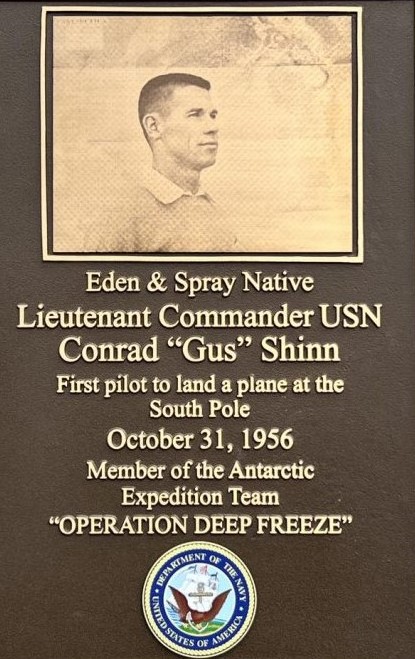
Shinn was part of an anti-submarine helicopter squadron in 1953, when a call went out for volunteers for a new Antarctic mission. He was the first pilot to sign on.
The new mission was part of Operation Deep Freeze, a 40-nation endeavor to explore both polar regions for science. The Antarctic aviation branch made a rocky start. In the first year, the planes didn't bring enough gas, and half of them, including Shinn's, had to turn around and go back to New Zealand. Aircraft carrier ships were deemed unworkable in the frozen waters. So, Shinn made his triumphant return to Antarctica only after 18 hours of difficult flying.
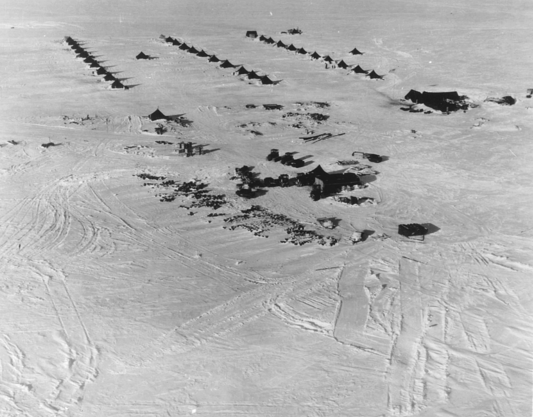
Que Sera Sera
By year three, though, they had not only made it to Antarctica but also set about a science program. The crowning achievement was to fly to and land at the South Pole.
Staffing the flight was complicated. As with Scott's more ill-fated South Pole run, no one knew who would be on the final team until the last minute. There were two factions: one was aligned with the absent Admiral Byrd, the other with Admiral Dufek. Shinn, a neutral party, believed he was chosen partly to prevent a Byrd-aligned man from going.
Shinn observed more staffing drama when it came time to decide the co-pilot. The plane was a twin-engined R4D-5 Skytrain called Que Sera Sera. It could bring seven, but only two in the cockpit. When Captain Hawkes was chosen over Captain Cordiner, Cordiner protested.
"If there'd been any firearms, they might've been used," Shinn recalled. "He was really livid."
The flight out went comparatively smoothly. On October 31, 1957, eight hours after taking off from the base at McMurdo Sound, Shinn landed Que Sera Sera at 90 degrees South.
While the brass took photographs, Shinn hopped back into the plane. Landing, he knew, had been the easy part. Now came the hard part -- taking off. The stakes for failure were high; they had very little survival experience and no other means of transport. It was around -50˚C. The Navy's backup plan was to airdrop survival equipment for them.
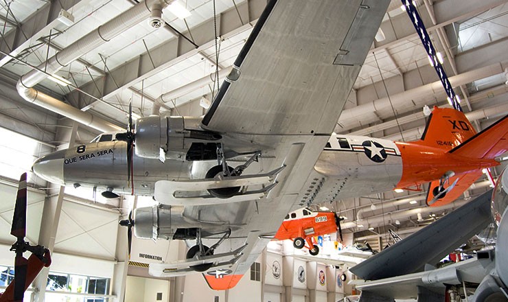
Take-off from the South Pole
The real achievement, Shinn later quipped, was being the first man to take off from the South Pole. The pole is about 3,000m above sea level. With the thin oxygen, the engines couldn't fire at full capacity. Worse, the heat of the plane's skis melted the ice beneath it, which refroze quickly in the freezing temperatures.
Even with the engines at full, Que Sera Sera couldn't budge. Shinn resorted to a jet-assisted take-off. This meant firing 16 rockets in order to generate enough thrust to get them aloft. It just barely worked.
The pilot wasn't home free. "We were engulfed in a cloud of ice," he said, which limited visibility. The extreme cold made the instruments inaccurate, and at any moment, the hydraulics in the flaps could freeze solid.
Luck and skill held true; Shinn returned them all safe (though not sound; the Admiral had come down with pneumonia) to base.
Shinn retired in 1963 to Pensacola, Florida. When asked in the 1999 interview if he wished he'd done anything differently, he responded with a firm no. "I did my best. I had good crews."
The Mirage follows Timothy Olson as he fights to claim the Pacific Crest Trail speed record. To do so, he has to run 4,270km in less than 52 days, 8 hours, and 25 minutes. This means about 14 marathons a week and about 17 Mt. Everests' worth of elevation gain.
He'll also be accompanied by his pregnant wife, Krista, their two young sons, and Krista's parents, Debbie and Bob Loomis. Trailing Tim in an RV, their family must take care of Tim as well as themselves, always racing against the clock.

Things get off to a rocky start. By day two, husband and wife both recall hitting a wall.
"It's going to bring out the worst of me," Tim admits.
His family provides logistical support, mapping and scouting the trail ahead. Olson is entirely reliant on them to feed and supply him with water. But stretches of the trail he has to backpack alone -- not one of his strengths. But that's sort of the point.
Heat, cold, bears, and snakes
You want ideal conditions, Olson explains, when you're attempting a record. Olson did not have ideal conditions. He hadn't planned for his wife to be heavily pregnant, and he certainly hadn't planned for a record-breaking heat wave.
In addition to the heat, Olson's path is strewn with venomous serpents that rattle and hiss, sometimes from the underbrush and sometimes from the path itself.

Abruptly, the battle with the desert ends, as he crosses the Mojave and enters the Sierra Nevada. Now, Olson faces a different battle. Snowy, rocky slopes cut down on his time.
As the attempt goes on, fate seems to be conspiring against them in a dozen petty ways, all caught on camera. The RV is stuck in a ditch and needs towing, Olson gets injured and lost, and equipment breaks. Because of the then-recent COVID pandemic, trail maintenance is more neglected than usual, leaving downed trees all over the trail.
Climate change affects the run in more ways than the heat. Wildfires rage around the trail, closing aid stations and filling the air with smoke.
Around the halfway mark, a shin injury begins to worsen, slowing his time and causing "excruciating pain" with every step.
"I miss the whole reason I'm out here...to heal," Tim admits. But he keeps pushing, and his team "throw the kitchen sink" at his injury, trying everything they can think of (other than rest) to keep his leg working. Slowly but surely, the pain starts lessening. His speed picks back up. It still hurts, though.
A family affair
His wife's father explains that running the PCT would, technically speaking, be far easier on Olson without having his family along. "But that wasn't the project."
Bringing his family along wasn't about logistical help. Knowing his wife and kids were waiting in the RV at the end of the day pulled him forward, "like a magnet," during his time on the trail.
Despite everything, Olson triumphs in the end. After 51 days, 16 hours, and 55 minutes, he reaches Canada and the end of the trail. The film ends with a selection of baby photos, and a phone recording Olson made during the run, addressed to his then-unborn daughter.
"Dad is out running...having a hard moment, but it's really beautiful to think of you."
In September of 1573, authorities in the Franche-Comté region of now-France declared open season...on werewolves. The edict raised the alarm about a werewolf on the loose. Villagers reported that children had gone missing, and they thought a werewolf was to blame.
The parliament agreed, and they agreed far enough to pause previous edicts that banned citizens from gathering in large groups and carrying weapons. Armed with their newly legal halberds, pikes, long guns, and cudgels, the people of Franche-Comté sallied forth.
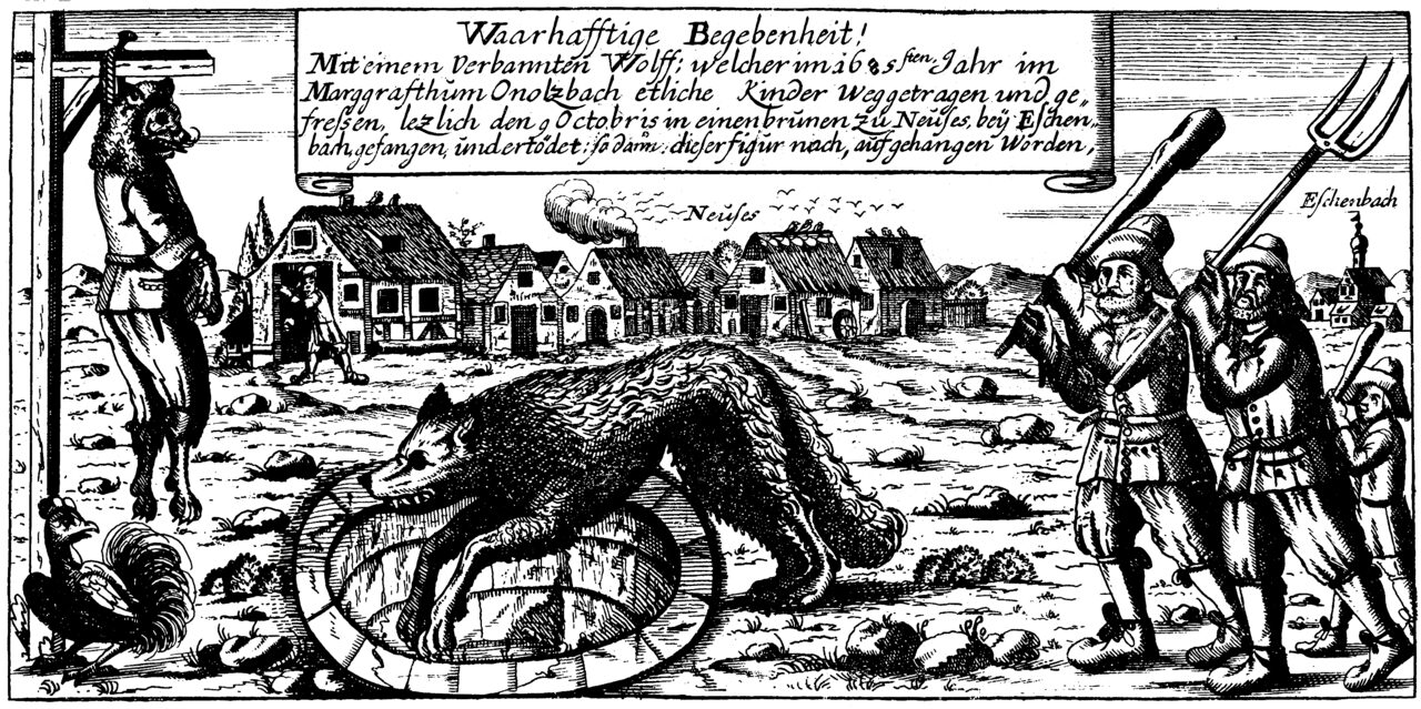
What is a werewolf?
You may think you know what a werewolf is. You've seen movies. A person who was bitten by a werewolf is cursed to turn into a wolf-man hybrid every full moon, when they run through the woods (or London) in a state of mindless animal violence. But that creature is a much more recent creation; the werewolf of the 16th and 17th centuries was an entirely different animal.
To the people of early modern Europe, the werewolf was a person, usually a man, to whom a demon had given the power to transform into a wolf. The wolf transformation was triggered by an item of clothing the werewolf put on, like a wolfskin belt or cloak, or by applying a special ointment.
Second only to transforming into a wolf, the defining trait of the early modern werewolf was cannibalism. The eating of a fellow person was one of the ultimate taboos of the period. It was invoked as a potent symbol of "otherness" and the violation of cultural norms. Jewish people, Mongolians, pre-Christian Celts, and Indigenous Americans were all depicted as cannibals, as were witches.
Witches and werewolves overlapped considerably, and it's difficult to draw a firm line between the two categories. Some demonologists of the period, like Henri Boguet, believed the werewolf was an especially dangerous kind of witch. As time went on, the werewolf and the witch blurred together. In fact, the more blurred the distinction, the more often female werewolf cases appear.
But at the height of the werewolf panic, they were a distinct class of religious criminal, and were nearly always male.
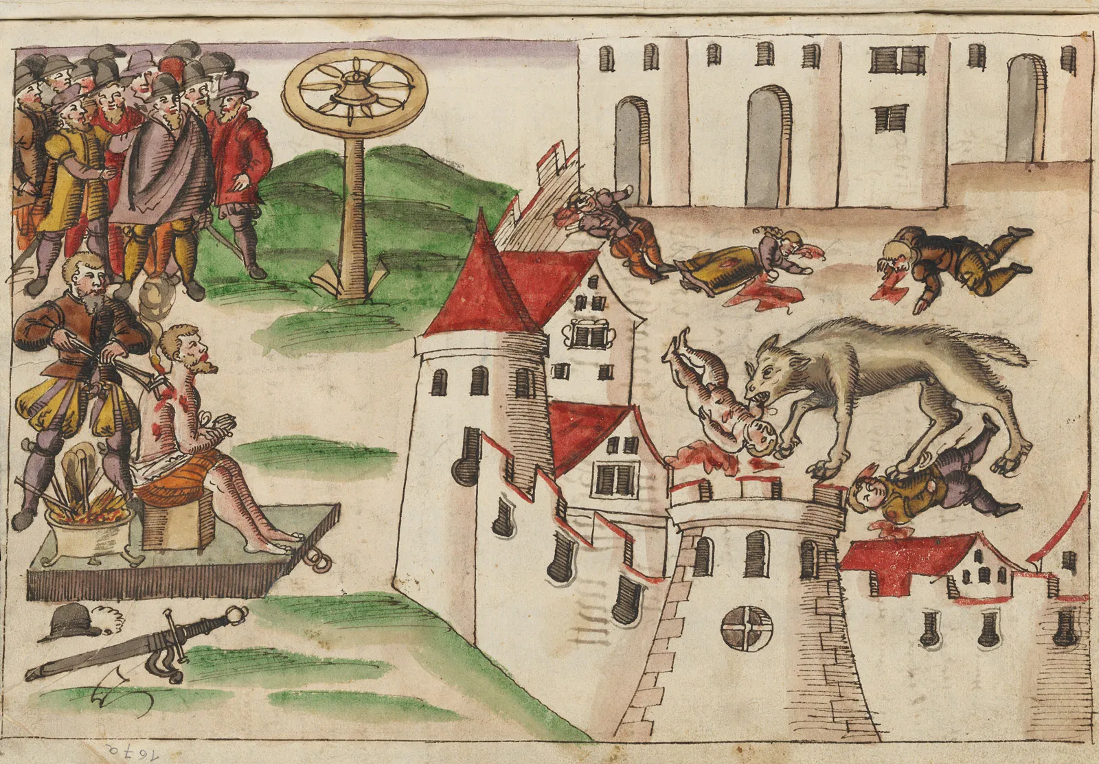
Why did people hunt werewolves?
Even today, there are occasional panics over wolf attacks, real or imagined. But in early modern France (and into Switzerland and Germany) wolf attacks were an actual threat. Many of the missing children and ravaged bodies that appear in werewolf records were probably victims of wolf attacks. In North America, genuine wolf attacks are almost unknown, but in Europe, the animals had ample opportunities to acquire a taste for human flesh by feeding on battlefield corpses. So attacks in Europe sometimes had substance to them. However, the local authorities weren't calling for wolf hunts. There were hunting werewolves.
In many ways, the people of 16th and 17th-century Europe imagined the werewolf as the ultimate violator of cultural, moral, and religious norms. But unlike their racist imaginings about pagan cannibal foreigners, the werewolf was an enemy within. It's no coincidence that werewolf and witch paranoia came at the same time as the Protestant Reformation.
Imagine the innocent WASP suburbanite of the 1950s threatened by hidden aliens in Invasion of the Body Snatchers (1956). Only, instead of secret communists, it's secret Protestants. Or, in a Protestant country, secret Catholics. This was also a period of changing economic and social systems, where poverty became a major social concern and began to be associated heavily with sin and crime.
At the same time, countries were getting bigger and governments were getting more involved in people's personal and religious lives. How does a government, secular or religious, demonstrate and enforce its new power? By persecuting and prosecuting the embodiment of everything that wasn't allowed.
The Inquisition inquires about werewolves
The 1573 hunt wasn't the first incidence of werewolf fervor in the French region. Fifty years earlier, the first werewolf case was prosecuted -- by the Spanish Inquisition.
While Franche-Comté, situated in a forested and mountainous region next to Switzerland, is part of France today, in the 16th century it was owned by the Spanish Habsburgs and was subject to the Inquisition.
So in the winter of 1521, papal representative Jean Boin traveled to the small town of Poligny. Poligny had a werewolf problem; two of them, in fact, named Pierre Burgot and Michel Verdun. Boin extracted a confession from the pair, detailing their strange crimes, as follows.
Several years ago, they had given their souls to the devil in exchange for various promised gifts. These included a bag of money which, Burgot complained, the devil had failed to deliver. He did give them an ointment which allowed them to turn into wolves, though. As wolves, they ran freely through the countryside, copulating with female wolves and eating several children.
One contemporary, 16th-century physician and skeptic Johann Weyer, pointed out a number of inconsistencies in the account. In one example, they claimed to have swallowed up a girl whole, except for her arm. Later, however, they claimed they had only eaten a little of her. Weyer believed that the experiences they described were imaginary, coming from hallucinogenic drugs in the ointment or some kind of mental illness.
The court didn't agree: Burgot and Verdun were convicted and burnt to death.

Who gets to hunt the werewolves?
After Burgot and Verdun, the hunt went cold for several decades. Then in 1551, another Inquisitor found himself making the trek to rural Jura. Inquisitor Symon Digny heard the confession of a man named Pierre Tournier, who claimed to have murdered fifteen people. The Inquisitor charged him with werewolfery and witchcraft, and charged his wife and sister as conspirators. All three were burned alive at the stake.
The Parliament of Dole was horrified. Not by the burning-at-the-stake thing, they did that themselves all the time, but by what they believed was an infringement upon their right to prosecute criminals. The Parliament complained that the Inquisitor had failed to properly inform or cooperate with authorities. It insisted that from then on, they would be doing the prosecuting, thank you very much.
So when rumors of a werewolf snatching up children began to circulate in the early 1570s, the Parliament of Dole jumped at the opportunity to enforce its new authority. That's how we got to the September 1573 edict, which launched a werewolf hunt.
The Hermit of Dole
Giles Garnier was "the Hermit of Dole," an immigrant from Lyons, living in near-isolation with his wife Apolline in the forest hermitage of Saint-Bonnot. The Garniers lived in extreme poverty and weren't integrated into the local community. Authorities arrested him in 1573; they had found the werewolf they were hunting.
Garnier reportedly confessed readily, repeatedly, and without the use of torture. Even if that's true, it's impossible to know how much coaching he received. Possible coaching aside, the story he ended up telling went like this:
Starving, Giles Garnier was roaming the woods in search of food when he met with a mysterious figure, described only as a "phantom."
This phantom offered him an ointment that allowed him to transform into a wolf when applied. As a wolf, the phantom promised, Garnier would be able to hunt for food, saving himself and his wife from starvation. Garnier accepted the ointment.
According to his arrest record, he used this power to kill and eat several children while in the shape of a wolf. He also took some of their flesh to feed to his wife. Scandalously, they even ate this meat on a Friday. One would think even the devoutly Catholic authorities would consider "eating meat on a fish day" to be burying the lead a bit in this case.
The record includes times and locations of the murders, some of which occurred over sixty kilometers from where Garnier, an older man in poor health, was living. Nevertheless, he was burned at the stake in 1573 on the authority of the Parliament of Dole.
Henri Boguet and the Loupgarou menace
Perhaps the most prolific werewolf hunter was a demonologist and legal scholar named Henri Boguet. Thanks to his expertise and zeal, in 1596 Boguet became the grand judge of the Saint-Claude region of Franche-Comté.
He got right to work rooting out the scourge of demonic influence he believed infested his new domain. Boguet was convinced that witchcraft and werewolfery were everywhere, heralding the imminent coming of the end times.
During his tenure, Boguet tried 38 people, condemning 28 to death by burning. Burning at the stake was usually just for show; the victims were strangled to death beforehand, saving them the long agony of burning. Werewolves were one of the few groups that were always burned alive.
Throughout 1597-98, Boguet uncovered (or created) a hidden society of werewolves. It started with Jacques Bocquet. Bocquet was a "cunning man," a sort of folk healer herbalist. A woman accused him of witchcraft, and he then accused her of the same. She never confessed, but Bocquet did. Not only was he a witch, he admitted, he was a werewolf -- and he wasn't the only one.
Bocquet named names who named names. All of them, the account went, ran together with the devil as wolves, attacking livestock and children. They were all desperately poor people, leveraging their diabolic power for revenge against their tormentors. As wolves, Bocquet and his followers attacked people who had previously beaten them or denied them food and alms.
Nearly all of Boguet's werewolves were condemned and burned alive. But not every werewolf case ended in execution.
The madman Werewolf of Angers
In the same year, a guard of the Provost of Angers found a man lying prone by an abandoned house. The man was “hideous, and very hairy, with an evil stare.” He fled, but not long after this odd encounter, the guard saw him again -- being dragged into town, tied to a cart. Inside the cart was the bloody body of a teenage boy.
The man was Jacques Roulet. The guard asked him if he was the man he'd seen in the forest. Roulet said yes, and also, by the way, he was a werewolf and had killed and eaten the boy in the cart.
He was immediately arrested and brought to Angers for trial, where Chief of police Pierre Airaut examined Roulet and the remains. The boy's body was partially eaten and had claw and tooth marks from a "beast." Roulet himself was an alarming figure, with bloody hands and teeth. He had long fingernails and a hard, distended belly, presumably from gorging on flesh.
Roulet wasn't shy about telling his story. He was about thirty years old and lived with his parents and three siblings in a village nearby. Roulet implicated his entire family; according to Roulet, his brother Jean and cousin Julien went out as wolves with him and had helped him kill the young boy. They transformed using an ointment that his parents had given them.
Roulet was condemned to death, but not executed. Instead, his case was appealed to the Parliament of Paris.
"There was more insanity in this poor, miserable idiot than there was malice or witchcraft," they decided. Roulet was sent to an asylum for two years, after which he disappeared from the historical record.
The strange case of Jean Grenier, child werewolf
In 1603, a series of wolf attacks on both livestock and children rocked the small settlement of La Roche-Chalais. Then a 13-year-old shepherd girl named Marguerite Poirier, the victim of one attack, came forward with an accusation: a werewolf was responsible, and she knew who it was.
She'd been out in the fields with two other teenage girls when a wild-looking boy approached them. He asked them if any of them would marry him, and when they rejected him, he grew upset. Attempting to impress or intimidate them, he claimed he could turn into a wolf. Then he escalated his claims; not only was he a werewolf, but he had killed and eaten a number of children. In fact, he was the wolf who'd attacked Marguerite a few weeks prior.
They arrested the boy, named Jean Grenier. Grenier was about thirteen, but looked and acted younger. He had been roaming the countryside, begging, having left home after a severe beating from his father, Pierre. Pierre featured prominently in Jean's testimony, which was extracted in confused fits and starts after a period of imprisonment.
Jean transformed into a small red wolf using a wolfskin he had received from a demonic figure named Pierre Labouaut. Labouaut, Jean said, lived in a black house in the woods where people were boiled in pots and roasted on spits. His father had introduced them.
Together, Jean and Pierre had run as wolves and killed and eaten livestock and a young woman. But two years before, Jean's stepmother had found out about the werewolves and left them. Since then, Jean opined, his father didn't hunt with him.

A family affair
Investigators had Grenier recreate his crimes, likely further feeding into the fantasies of a mentally vulnerable young boy. After his initial confession, Jean broke down sobbing. He described attacking Marguerite, as well as breaking into a house and devouring an infant, and repeatedly accused his father of being complicit.
But when the judges brought father and son face to face, Jean froze. Seeming confused and frightened, he failed to accuse his father. When he was interviewed privately, he repeated his accusation, and after a second confrontation, he managed to face his father and level the charge of werewolfery directly. His initial wavering, however, led to Pierre's release. Despite Jean's best attempts, his father wasn't prosecuted.
Jean was, but “the court, in the end, took note of the age and imbecility of this young boy, who is so stupid and mentally impaired, that children of seven or eight normally show more reasoning than he." Instead, he was sent to live out the rest of his life in a monastery.
It was in that monastery, several years later, that he met juror and demonologist Pierre DeLancre, writer of the above quote. DeLancre interviewed Jean, then twenty, though still small for his age. Jean said that he still craved human flesh, but had learned to reject the devil, who no longer came to visit him.
DeLancre concluded that it was a mistake to let Grenier live. He personally had sentenced dozens of witches to death, and though he admitted Grenier was young, poor, and mentally disturbed, it set a bad precedent.

The end of werewolf hunting
Perhaps DeLancre was right about setting a precedent, but as time went on, officials and theologians became skeptical of whether werewolves even existed. Among everyday people, the concept became increasingly watered down.
In the Netherlands, werewolfery was just another activity of witches. In 1696, local courts saw a case where one woman's geese ate the cabbage from a neighbor's garden. The neighbor attempted to chase them off, which the owner of the geese took offense to, thinking he was trying to steal them. She accused him of being a werewolf and he sued her for slander. He won the case and she paid one Reichsthaler in damages.
In Germany, "werewolf" became shorthand for a violent, angry person. In 1623, a man named Johan Wulner was accused of being a werewolf due to his habit of intimidating people with a halberd. Around the same time, his fellow townsman Goddert Kampmann attacked another man's genitals with a fork. The man called him a werewolf, and Kampmann sued him for slander.
The Parliament of Dole stopped prosecuting werewolves in 1633, putting out an edict clarifying that they were just hunting regular wolves now. And witches still, obviously. Local courts that hadn't gotten the news yet managed to catch a few more werewolves, like a beggar named Claude Chastellan, who was convicted in 1643.
The last werewolf trial was held in a remote village in 1663. Brothers Mathieu, Claude, and Ayme Mathieu were in court for a series of robberies, and a charge of werewolfery was tacked on as well. The brothers confessed under torture, but appealed to the Parliament of Dole.
The same body that had called for a werewolf hunt a century earlier overturned Mathieu's sentences and declared the whole case bunk.
In the same way you can't prove a negative, "extinction" is always an informed guess. If we haven't seen hide nor hair (sometimes literally) of something for long enough, we have to assume it's not out there anymore.
But sometimes we assume wrong. Such was the case with the De Winton’s golden mole, which no one saw between 1936 and 2023, or the giant, elusive "ghost fish" of Cambodia's Mekong River. But finding these never-extinct-in-the-first place species is rare.
However, one more miracle reappearance has just occurred. Amid a global biodiversity crisis, the Asian small-clawed otter has emerged from hiding in Nepal to give otter enthusiasts hope.

The otter of the hour
The Asian small-clawed otter (Aonyx cinereus) is the smallest otter species on the planet, weighing only 2.7 to 3.5 kilograms. Its short claws, which give it its name, make it particularly dexterous, helping it pry open the molluscs and crabs it feeds on. These otters are very social and friendly, mating for life and often traveling in large family groups.
They're adaptable too, and live in a variety of different environments, including mangrove forests, swamps, swift rivers, stagnant pools, and rice paddy fields. In fact, rice farmers consider them helpful to have around, since they eat crabs, which farmers consider pests.
Small-clawed otters still live across Southeast Asia and into India. The last time they were officially seen in Nepal was 1839, so it's no surprise that they were considered extinct there.
Over the past few years, visitors to Makalu Barun National Park in the eastern Himalaya have reported scattered, unverified sightings of the little otter. But it remained elusive until forestry officials stumbled upon it.

The once and future Asian small-clawed otter
A bulletin by the IUCN/SSC Otter Specialist Group announced the confirmed presence of the Asian small-clawed otter in Nepal. The discovery of a surviving Nepalese otter population came when a local from Dadeldhura village found an injured baby otter by the Rangun and Puntara Rivers. Not knowing the significance of the little creature, the local passed it on to local forestry officials.
The Forestry Officer, Rajeev Chaudhary, thought it might be a small-clawed otter. While he was nursing it back it health, he took photos and videos of the pup. Chaudhary then sent them to Nepalese otter experts at the IUCN Otter Specialist Group. They confirmed his suspicions and set about a habitat study in the area. Meanwhile, the pup in question recovered its strength and was released back into the wild.

Asian small-clawed otters are listed as Vulnerable to Extinction. This discovery doesn't change that. The fact that these tenacious little otters are clinging on to their ancestral territory in Nepal is only more reason they need immediate support.
For one thing, they aren't on Nepal's Aquatic Animal Protection Act list. The river ecosystems they inhabit are threatened by mining, over-fishing, agricultural run-off, and deforestation. Getting official protection, now that they officially exist, is crucial.
"A timely conservation effort for this exceptionally rare species, a keystone aquatic mesocarnivore, is now urgently needed in Nepal," the IUCN bulletin concludes.
Salimor Khola is a remote valley in Api Himal, nestled between a steep gorge and several unclimbed 6,000m peaks. The ridges and valleys of far western Nepal are far less popular for tourists and mountaineers, a tantalizing lacuna for the latter-day explorer.
This recent documentary, Salimor Khola: A Climbing Expedition to an Unexplored Valley in the Himalaya, follows a team of four as they attempt to explore the valley and summit some of its unclimbed peaks.
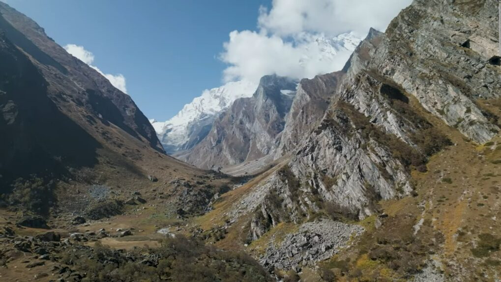
It takes over a week of travel -- first flying, then driving, finally trekking-- to reach the area. On the way, we meet the team-- Matt Glenn, Hamish Frost, Paul Ramsden, and Tim Miller -- all experienced mountaineers from the United Kingdom. The area is rural and remote; the people they do meet are surprised to encounter a Western climbing expedition.
The expedition is the brainchild of five-time Piolet d'Or winner Paul Ramsden, a sturdy Yorkshire man in his mid-50s. Ramsden had warned the younger alpinists that there might not be any climbing at all on their climbing expedition. They were going in to explore, not even knowing if they could reach accessible routes. But there was only one way to find out.
They manage to find a route into Salimor Khola, so with a week of food, the expedition splits into two teams: Paul and Tim, and Matt and Hamish. Taking the time to explore also allows them to acclimatize.
The summit that wasn't
After the reconnoitering and acclimatizing, Matt and Hamish set their sights on an unclimbed 6,000'er. After a hard day and 800 vertical meters gained, they bivouac on a ledge cut from snow.
They wake up to snow pressing on all sides, crushing and burying them. The footage goes black, but we hear them swear and pant as they struggle to free themselves and the tent. Eventually, with a half-broken tent and an exhausting night, they try to push on.
But they meet with impassable rock faces and are forced to turn back to base camp. After a day of rest, they head for a second peak -- but exhaustion and heavy snow follow them. The next day, they meet a false summit and a series of avalanche near-misses. But they push on.
Only a few hundred meters from the summit, they stop. The rest of the way is heavily corniced, and another avalanche has just missed them. It's time to turn around.
"There's just something really beautiful about doing this...and then not being able to do the thing that you wanted to do and just having to do it for the sake of it," Glenn observes.
Back at base camp, the pair reunites with Ramsden and Miller. They've made the first ascent 6,605m Surma-Sarovar, although Ramsden's finger is frostbitten.
The film stays with Glenn and Frost at the end of their expedition. They didn't get a summit, but they did do what Glenn calls a "proper expedition" -- an adventure.
"I would love to do more of that," Glenn says. "But maybe just not yet."
Crossing Dreams, subtitled "Solo bivouac paragliding adventure in Himalaya," documents the recent exploits of professional paragliding coach Francois Ragolski. His attempt to follow a long route through and over the Himalaya covered 60 days, four countries, 2,580km and 113 hours of paragliding.
Ragolski has been paragliding for 18 years and planning this expedition for six months. Like him, the movie is anxious to finally start, so it wastes no time launching into the first day of the journey.

It's a solo trip, but he avoids self-isolation, stopping to speak and share meals with the people he passes.
"I thought everybody here would speak Russian," Ragolski says ruefully, when his attempts to find a common language with two hunters in Tajikistan fail. "I was wrong, nobody here speaks Russian." But even with the language barrier, his friendly enthusiasm carries him through.
"Everyone was so welcoming...they load you with so much good food," Ragolski says. Every few days, he meets locals, usually shepherds, who share their food and shelter with him. Left to his own devices, he mostly eats packaged noodles and dried fruit, so a hot meal and friendly faces are a welcome change.
Re-routing
Ragolski spent months plotting his course on Google Maps using satellite images. But when he arrived in Dushanbe, Tajikistan to begin his route, officials stopped him. Government officials, military officers, and tour agency representatives told him the airspace he planned to fly through was simply too dangerous.
They gave him a new route. It was less likely to get him shot down, but it was also longer and more difficult from a technical perspective. The route change lands him in an area heavily populated by wolves and bears, where officials warned him not to stay the night. But the wind and weather conditions ground him, and he passes a stressful night hearing the sounds of animals outside of his tent.
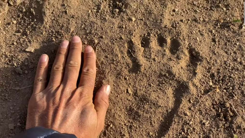
At your own speed
Tired and hoping to avoid confrontations with the local wildlife, Ragolski hitches a ride into Pakistan. Some exceptions for bear and militarized airspace-related dangers aside, he aims to fly as much as possible. Doing that means landing -- and sleeping -- in places he can take off from again in the morning. This makes for some uncomfortable digs, but it's better than walking. "I am lazy," Ragolski jokes.
After the stark beauty of the mountains, the intermissions in crowded urban areas are another kind of striking. Later, a two-week-long spot of rain grounds him in India. He avoids despair through ping pong and a bit of light tourism.
"But as soon as I flew again, I was just so happy," Ragolski says when he finally gets back in the air on day 41. This is a frequent exclamation; his sheer joy at being aloft and moving forward is palpable.
The point of going solo is that he can go at his own pace, taking his time to explore, to meet people, to avoid unnecessary dangers and complications. It's not a race or an exercise in self punishment -- it's an adventure.
In the final days of his journey, Ragolski glides past famous peaks like Annapurna and Everest, marveling aloud. "Wow! What an adventure...I'm so so happy I came."
A recent New York Times story covered how the Marubo people of Brazil were adjusting to life with the internet. They had received Starlink only months earlier, and according to the NYT piece, it had introduced serious problems into their society. Chief among those was "minors watching pornography."
Representatives of the Marubo people took issue with the story and the tabloid headlines it spawned on sites like TMZ and Yahoo. They claimed it was not just insulting and inaccurate but damaging in an actionable way, so they took legal action.
The Marubo community just filed defamation charges in an LA court, seeking $180 million in damages from the NYT, TMZ, and Yahoo.
The story that sparked it all
The Marubo people number about 2,000 in all. They live in villages along the Ituí River of the Javari basin. Their population has steadily grown over the past 50 years, coming back from the disease and violence of first contact in the 19th century.
In 2022, the Marubo tribe received 20 Starlink antennas thanks to the efforts of community leader Enoque Marubo and Brazilian activist Flora Dutra. Nine months later, Jack Nicas hiked through the jungle in order to visit the tribe and report on how the internet was affecting them. The tribe invited him to stay for a week, but Nicas left after about 48 hours.
He did not mention his early departure in the NYT piece. Published in June of 2024, the article claimed that the Marubo were now struggling with "teenagers glued to phones; group chats full of gossip; addictive social networks; online strangers; violent video games; scams; misinformation," and, of course, pornography.
Classy as ever, TMZ took the story and ran with it, publishing a piece titled Tribe's Starlink hookup results in porn addiction! Similar headlines echoed across the internet. Realizing the narrative had perhaps gotten away from him, Nicas published a follow up: "No, a remote Amazon tribe did not get addicted to porn."
For Morubo representatives, it was too little, too late.
A global media firestorm
According to the complaint, the news story and the dozens of salacious articles that followed damaged Enoque Marubo and Flora Dutra personally, as well as the tribe as a whole. It was they, after all, who introduced the internet. And they were the ones receiving the most online abuse. They claim to have received thousands of hateful online messages. These included "death threats, racist and misogynistic abuse, and reputational smears."
They allege that the articles launched "a global media storm" that subjected them to "humiliation, harassment, and irreparable harm to their reputations, safety, and standing both within their own people and on the world stage."
The New York Times agreed that other outlets had incorrectly reported on the story. But they had never averred that the Marubo people had become addicted to pornography, the outlet insisted.
Maybe so, the suit alleges, but their initial story had at the very least struck the match that became the firestorm.

A damaging narrative
The NYT story has uncomfortable echoes with past representations of Indigenous people. There are centuries of patriarchal depictions of Indigenous people as falling from Edenic innocence to debauched ruination as soon as they encounter the sins of Western civilization.
See, for instance, the "noble savage" of 18th-century philosopher Jean-Jacques Rousseau. He described Indigenous people in the Americas, the Caribbean, and Africa as living in an ideal state of nature. But when they encountered civilized men, they fell from this state of grace, and struggled to cope with the vices and complications of "civilized" life.
The English writer and explorer John Lawson wrote that in Carolina, "Most of the Savages are much addicted to Drunkenness, a Vice they never were acquainted with, till the Christians came amongst them." Recent reporting on the Marubo discusses their internet usage in similar terms.
"These statements were not only inflammatory but conveyed to the average reader that the Marubo people had descended into moral and social decline as a direct result of internet access," the complaint alleges. "They directly attack the character, morality, and social standing of an entire people, suggesting they lack the discipline or values to function in the modern world."
The UK Supreme Court has solidified the public's right to wild camp on private land in Dartmoor.
After a years-long battle, Dartmoor will remain the only place in England where the right to camp on private land is protected. But this decision is neither the beginning nor the end of the fight for the right to roam England's countryside.
A long history of conflict
In the UK, public use and access to land have a long history. The English public held ancient rights to common land -- space set aside for the entire community to use for grazing, hunting, peat harvesting, and wood gathering.
But starting in the 16th century and continuing into the modern era, a series of "enclosure acts" reduced the amount of public use land. Instead, those traditional common spaces became part of private land holdings.
Enclosure was deeply unpopular with the rural poor. Their resistance first turned into widespread violence in 1549, when 16,000 rebels converged on the city of Norwich. They took and held the city for nearly a month, repulsing a Royal Army attack before their ultimate defeat. The rebellion began when disgruntled landless farmers tore down the recently constructed fences on what had been public land.
Peaceful disobedience, small-scale riots, and full-out rebellions continued to break out in response to enclosure over the next few centuries. It was even a factor in the English Civil War, motivating many of the common soldiers who fought against the King under Oliver Cromwell. Cromwell later turned on his more radical allies and had their leaders killed.
Today, the people of England are still fighting for the right to land access that they lost in the 16th and 17th centuries. With so little public park land, common use of privately owned land is enshrined in British hiking culture. Campaign groups like Right to Roam and the Open Spaces Society work to expand public land access. They were both deeply involved in the recent court case.
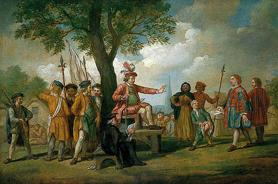
Darwall vs Dartmoor National Park Authority
Nowadays, land use fights generally go through the courts, not via forceful occupation of Norwich. This particular case started in 2022 when Alexander and Diana Darwall challenged the public's right to wild camp on the moor.
Alexander Darwall is a wealthy landowner and hedge fund manager who was previously in the news for charging gold panners £10 per day to access a 16,000-acre Scottish estate he'd purchased two years previously. His estate in Dartmoor is 4,000 acres, making him the sixth-largest landowner in the entire region.
Dartmoor is the only place in the UK which permits wild camping. In 1951, 954 square kilometers of Dartmoor became Dartmoor National Park. Since the 1985 Dartmoor Commons Act, "the public shall have a right of access to the commons on foot and on horseback for the purpose of open-air recreation."
The Darwalls, whose estate partly lies on this commons, didn't think this included camping. Alexander Darwall brought a claim against the Dartmoor National Park Authority, and Darwall won the case. His argument, by the way, was that only recreation "on foot and on horseback" was protected. Camping, therefore, was not included.
Victory for the commons
One must wonder whether Mr. Darwall, who studied history at Cambridge, saw some worrying similarities to past events when 3,000 people congregated on his estate. Following the decision against wild camping, public outcry erupted, resulting in a massive protest.

Encouraged by the public pressure and support, the Dartmoor National Park Authority appealed the case. They were supported by a witness statement from The Open Air Society. This time, judges unanimously voted to overturn the ruling, restoring the right to wild camp.
Celebrations were short-lived. The Darwalls appealed to the highest court in the land. But after a veritable roller coaster of emotions, the Supreme Court unanimously confirmed the decision by the appeals court. Wild camping remains a protected right on Dartmoor commons.
This ruling is particularly significant in that it may prevent or limit a precedent that would allow other landowners to legally challenge people camping on their property. Mountain land in the UK is owned by a mix of public bodies, private individuals, and charitable organizations.
"I think it's shown the huge public interest in this case that people responsibly wild camp on Dartmoor every year and want to be able to continue to do so," Right to Roam campaigner Guy Shrubsole told the BBC.
Moving forward, they will fight to pass laws protecting and expanding the public right to the land.
In 1983, Tami Oldham Ashcraft was adrift on a battered yacht, thousands of kilometers from land. It is difficult to imagine a more desperately lonely place to be than alone in a dismasted yacht in the middle of the Pacific Ocean. A furious storm had swept her fiancé overboard, leaving her stranded, mourning, and completely alone, without radio or navigation equipment.
Yet somehow, after 41 days, she reached land alive, with a remarkable story of survival, ingenuity, and mental endurance.
The storm
They'd been running from the hurricane for three days. Richard Sharpe, 35, and his fiancée, Tami Oldham Ashcraft, 23, were sailing the 13-meter yacht Hazana from Tahiti to San Diego. Both were experienced sailors. Tami was from San Diego and had grown up around boats. She had met Richard on the local docks. From there, they had sailed together to Tahiti.
In Tahiti, they met a couple who hired the newly engaged Oldham and Sharpe to sail their yacht to California. For the first two weeks, the journey was without major incident. Then, just north of the equator, troubling information came through their radio: A hurricane was heading west and growing stronger by the day.
They tried to outrun it, but it came on too fast. By the morning of October 9, the wind was picking up. All they could do was batten down the hatches, clear the deck, take down the sails, and strap themselves in. Then it hit.
Winds reached up to 190kph, well above the minimum hurricane force speed of 118kph. Fifteen-meter-high waves broke over them, and even higher rogue waves came from every direction. Richard was in the cockpit, secured to a safety line and trying to keep the yacht's stern facing into the waves, which would hopefully prevent it from capsizing.
Richard reassured Tami that they would be alright. Shouting through the storm, he told her to go below and strap herself down. No sooner had she done so than she heard Richard call again.
"Oh my God!" he cried. The yacht plummeted beneath her as they were caught in the dip below a massive rogue wave.
Then Tami lost consciousness.
Waking up alone
When the wave hit, Hazana had pitchpoled, capsizing end over end and knocking out Tami. Three hours later, she returned to consciousness, bruised and feverish, covered in her own blood. From the motion of the boat, she knew the storm had abated. She crawled out onto the deck.
In a Los Angeles Times interview, Tami described this as the worst moment of her ordeal: when she saw Richard had disappeared.
His tether was still firmly attached, but the force of the hurricane had pried apart the D-ring on his safety harness, and Richard had been washed away. The storm had also torn the Hazana to shreds: the deck had split, and both masts and the sails were gone. The radio, engine, and navigational systems were irreparable.
Wracked with shock and grief, with a major head injury and significant blood loss, Tami was in no state to consider the practicalities of survival. She screamed, sobbed, and, thinking the yacht was about to sink, curled up into a fetal position inside their little yellow lifeboat. But when she woke up the next morning and found that the yacht was still floating, she forced herself up.
"Richard died so I could live," Tami told the LA Times later. So she had to do everything possible to survive.
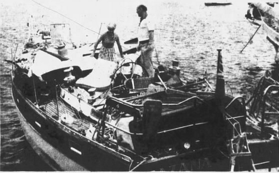
Jury-rigged and sailing by the stars
Water had flooded the cabin, destroying the electronics and dragging the Hazana slowly downward. Tami immediately began pumping out the water. She discovered that the hull, at least, was not leaking. The only remaining sail was a storm jib, a small triangular sail intended only to help steer during extreme weather conditions. She raised the sail on a makeshift mast, made out of half a broken pole.
Equipped with a sail, she could now steer the ship -- but to where? She was 2,400 kilometers away from the nearest land, the Hawaiian island of Hilo, and without modern navigation equipment.
What she did have was a sextant. The marine sextant is a celestial navigation tool in use since the 18th century. Mariners use it to fix their latitude by measuring the angles between the horizon and the sun, moon, and stars. It can also determine longitude, although that is much more difficult. At first, her plan was to travel by latitude alone, hoping to guess the right place to turn.
But after a week, she pumped the last of the water out of the bilge and found her watch still functioning. The veteran sailor was then able to calculate longitude by measuring the difference between local time and the time on her watch, which showed the time at the known longitude of Greenwich.
Once she found her position, she was able to get onto the North Equatorial Current and hitch a ride. This current took her down the 19th parallel at up to six knots, much faster than the two to three knots the damaged Hazana could make on it's own.
Even the work of navigation, sailing, and pumping water left her with time to think. Her grief was still overwhelming, and she was surviving on rationed canned goods. At the same time as she battled the elements, she had to battle her mind.
Third man factor
During traumatic hardship, some people will find themselves supported and comforted by an unseen voice or presence. Called the Third Man Factor, psychologists believe is is a subconscious defense mechanism that helps survivors keep going under terrible conditions.
Ernest Shackleton famously reported the phenomenon when he and his two companions, Tom Crean and Frank Worsley, were crossing South Georgia Island in a desperate bid to reach rescue. In his book, South, he wrote that "it seemed to me often that we were four, not three," and that Crean and Worsley had independently felt the same thing.
Shackleton's experience inspired a section of T.S. Eliot's The Wasteland, perhaps the most celebrated poem of the 20th century. This quotation, asking, "Who is the third who walks always beside you?", gives the phenomenon its name.
Tami's "third man" was Richard. "I really felt him right there with me the whole time, the air was thick with his presence," Tami told the Royal National Lifeboat Institution.
She spoke to Richard frequently during her 41 days, sitting by his tether, which she kept attached to keep him with her. The presence of Richard spoke back, encouraging her to keep going.
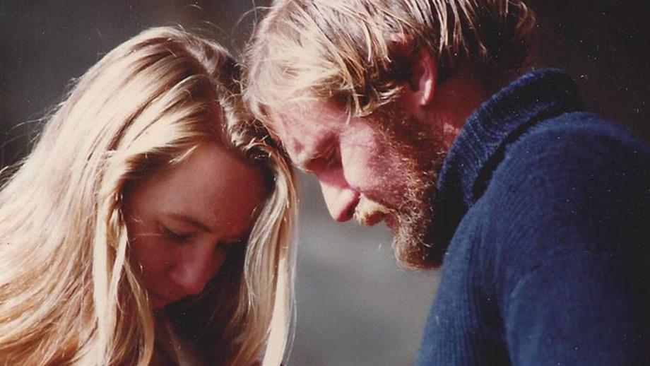
Gone to Hilo
Tami's route was a straight line down the 19th parallel of latitude, then an all-important turn. If her longitude calculations were off and she missed Hawaii, she'd be lost in the vastness of the Pacific. Missing this turn was a constant source of anxiety for her.
Every day, she wrote in the ship's log. It was a way to try and stay sane, but it was also a record of her experience, in case she didn't survive. "I didn’t want my family to never know what happened to me." she later explained.
After 39 days, she spotted what she thought was the island of Hilo, far off on the horizon. Peering desperately, Tami couldn't tell for sure whether it was the island or only clouds. Before she could see it clearly, the cloud cover thickened, hiding the island entirely.
Around the same time, a small military plane, flying low, passed over her without seeing her. Tami had set off flares, but neither the plane nor the two distant ships responded. Not for the first time, she contemplated suicide -- but the voice of Richard returned. She was so close, it told her, she had to go back out on deck and keep looking.
So she returned to the deck and saw that the clouds had cleared. The island of Hilo rose on the horizon. To celebrate, she cracked open the last bottle of beer on board. Two days later, just after midnight, Tami and the Hazana were three kilometers from the harbor.
But it was too risky to navigate the harbor at night in a decrepit little yacht. So close and yet so far, she sailed back and forth off the coast of the island.
After 41 days at sea
The Hokusei Maru was a Japanese scientific vessel conducting research on squids. In the red-golden light of dawn, their research was interrupted by a nearby emergency flare. It came from a battered yacht, crewed by a single young woman.
The researchers of the Hokusei Maru hooked the Hazana up to their own vessel and towed her safely to the harbor breakwater. There, Coast Guard officials were waiting to pick Tami up and finally take her to shore.
As soon as they learned she was safely ashore, her mother, Zonna Roberts, rushed from San Diego to Hilo. "Now that I have survived," Tami told the Hawaii Tribune-Herald, "I'm getting back to people again."
Tami Ashcraft was glad to have survived, but with the immediate emergency over, there was less to distract her from the pain of losing Richard.
"Even when I got back to shore, I was looking for him in crowds," she admitted. She suffered nightmares of being lost at sea and of losing Richard.
The head injury she sustained made it difficult to read. It took years for her to recover and begin writing down her story. It was published as Red Sky in Mourning in 2002, and later adapted into a movie.
Tami didn't let her experience keep her from the sea. She returned to sailing, always wearing a special pendant around her neck. The pendant is in the shape of a sextant, the tool that guided her out of a seemingly impossible situation.
Gaucho chronicles the days of elderly Patagonian gaucho Heraldo Rial. Gauchos are skilled horsemen and cattle ranchers who have lived independently in the Patagonian region for centuries. Known for their bravery and skill, the gaucho is a sort of folk hero in Argentina. But as modernity encroaches, that ancient way of life is under threat. Rial is one of the last true gauchos.
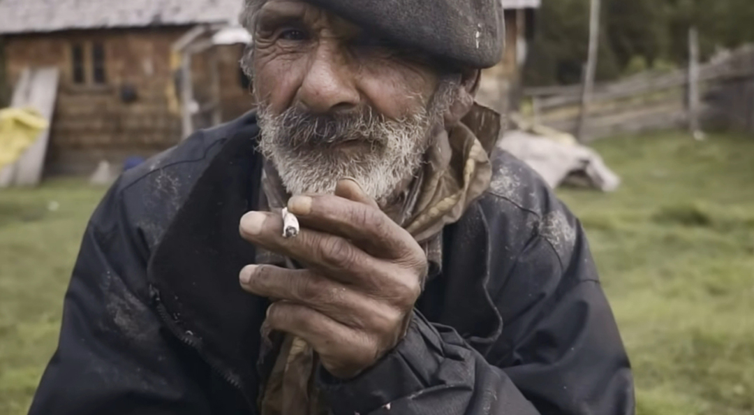
Now 80 years old, Rial can't do everything he used to. In the summer, three men make their way to the one thousand hectares of wilderness that he ranches. Papo, his nephew Diego, and his son Franco come to help Rial with his tasks. They're the only people who make the days-long journey through the mountains to see Rial.
He spends the winters alone in his little house, bringing his herd down from the mountain pastures to wait out the wind, rain, and snow. Papo compares him to a hibernating bear, tranquil and quiet. But he works every day, tending to his animals and maintaining the house and fences.
"I'm going to die here, at some point," Rial states calmly, as the camera lingers over his home. He seems to be at peace with the idea.
A dying breed
Most of the gauchos that Rial knew are gone now. Increased urbanization, as Papo explains, led gauchos to sell their lands and move to the cities, abandoning the mountain paths and old places.
Cattle ranching is an important part of the economy in Argentina. However, most of that money is made by a long series of middlemen. The men like Rial who work every day to raise the animals earn just enough to get by. In return, they face danger, isolation, and grueling work.
The film shows some of Rial and his helpers' daily tasks, which include finding and chasing down an escaped herd, branding and gelding young steers, and butchering animals.
Papo guides his son Franco, who is learning these skills for the first time. Rial might have passed these skills onto his own son, a friend of Papo, but he died five years ago. "But that's life," Rial says. "And his came to an end. He had to leave."
Rial's way of life is more than specific skills and herding practices.
"One should live without thinking," Rial explains. The way of country people, as he describes it, is one of acceptance. Of death, inevitability, circumstance. It's a way of thinking and living that is alien to modern, urban existence.
"He's the only gaucho left in Patagonia," Papo reflects. "There are no more."
In a previous life, Jose Naranja was an aeronautical engineer. Now he's a professional traveler and "notebooker." His work documents his travels, combining scrapbooking, illustration, cartography and journaling to create unique manuscripts.

It all started in 2005, when a young engineer from Madrid picked up a Moleskine sketchbook for the first time. A lover of travel, he used the notebook to document his thoughts and experiences and express himself creatively in a way he couldn't at his job. He began sharing the results online and grew a devoted following.
Eventually, he sold reproductions of his completed journals as art books, which allowed him to sustain a life of travel and adventure.
His travels mostly take him across Asia. He especially likes Thailand. "Thailand has many layers to be unveiled, and the more I discover, the more fascinating everything becomes," he wrote after a 2023 visit.

The travel notebooking genre
Multimedia travel journals as an art form predate Naranja. The late American photographer Peter Beard documented his travels in Kenya through a series of illustrated collage diaries. He combined photojournalism with multimedia collage art to create art books and exhibitions. His work, which documented the degradation of the natural world, even incorporated animal blood. The artistic travel journal, as a medium, can support a broad range of tones.
For anyone interested in travel notebooking, Naranja has shared a great deal about his process and materials. He travels light, focusing on portable supplies like pocket-sized folding watercolor sets and simple, reliable pens. He loves including local stamps in his journal pages; they're an easy way to add art to a notebook while showing where you've been.

Twenty years after that first Moleskine notebook, Naranja is still hard at work. He now hand-binds his own journals. While Thailand continues to exert a magnetic pull on him, he has also explored Colombia, the Netherlands, Georgia, Germany, Ireland, the Cook Islands, and even Everest Base Camp.
A group of five people was recently rescued after surviving 36 hours in the Bolivian jungle. When their plane crashed in the Amazon, they sought refuge on top of their submerged aircraft while alligators and anacondas circled the water around them.
Stranded in a swamp
Twenty-nine-year-old Andres Velarde was flying a single-engine plane over Bolivia on Thursday. He was taking four passengers -- three women and a young child -- from the town of Baures to the Bolivian city of Trinidad, a flight which should have taken less than an hour.
Suddenly, the engine failed, and the small plane began losing altitude. Velarde began searching for a place to make an emergency landing. Clear, open spaces are not easy to find in the Amazon, but Velarde brought the plane down in a swamp near the Itanomas River.
The rough landing flipped the plane upside down, shaking up the passengers. One of the women, Coria Guary, sustained a deep cut on her forehead, and all of them were bruised and rattled.
The five of them climbed out of the plane, which was sinking into the swamp. They had survived falling out of the sky, but now they had to survive the jungle.
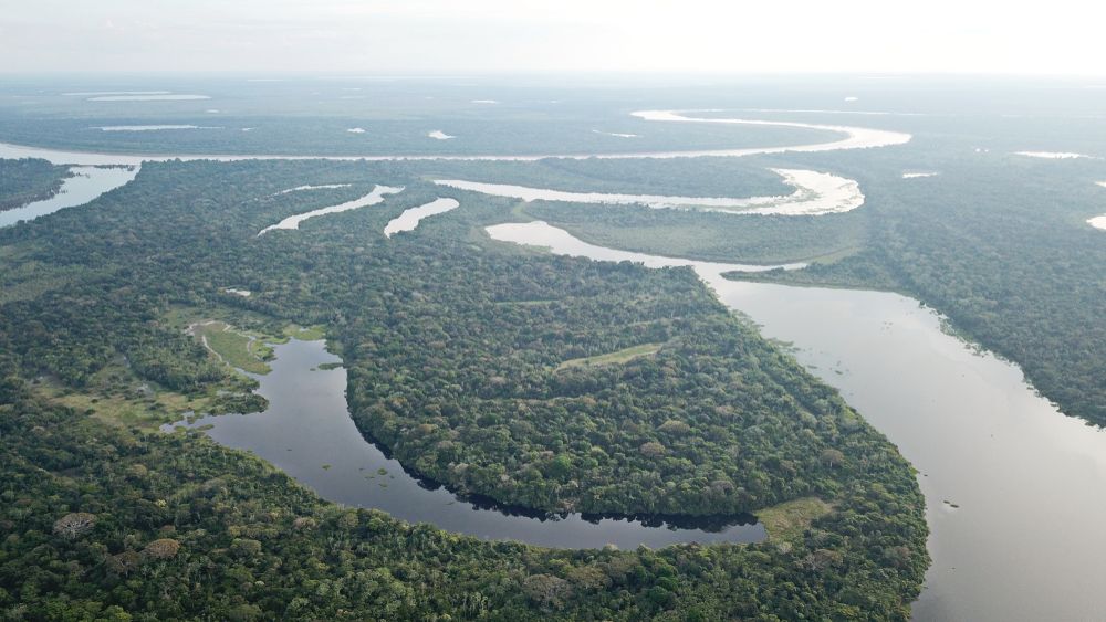
Alligators, anacondas, and mosquitos
Alligators and anacondas watched them from the water at all times, getting within three meters of the group. The alligators prevented anyone from trying to swim to shore, trapping them on top of the plane. The alligators were caimans, members of the alligator family native to South America. Caiman attacks are rare, but likely under-reported.
But neither the caimans nor the anacondas attacked. Velarde speculated that the gasoline, which was leaking into the water, had made them wary of the plane. Perhaps they were concerned that the people on the plane would also taste like gasoline.
The gasoline in the water also prevented the survivors from drinking. They had ground cassava flour, which one of the women had brought, but no water. Insects swarmed the five survivors, and soon they were covered in mosquito bites, which kept them from sleeping. As the hours dragged on, their situation seemed more and more desperate.
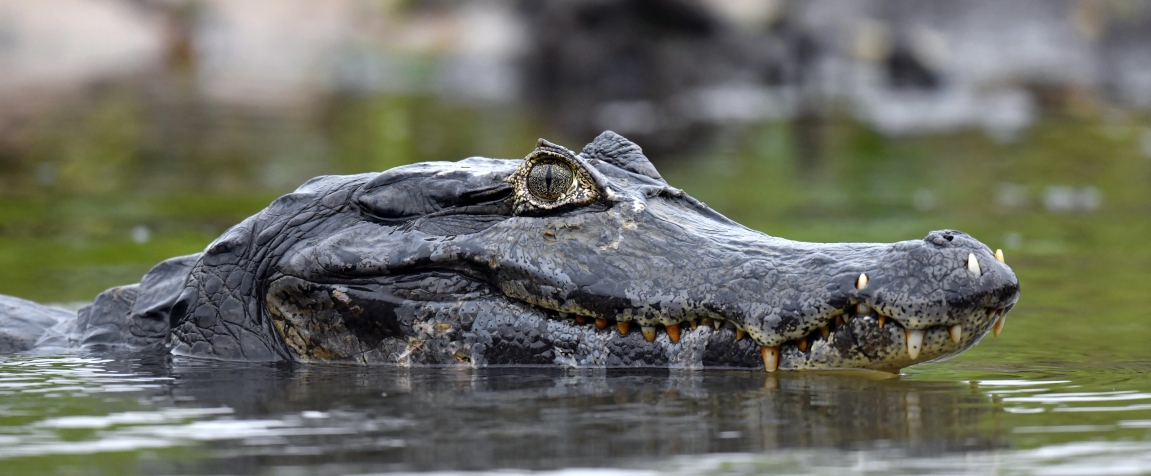
Rescue and relief
After 36 hours stranded on the sunken plane, they heard the sound of motorboats in the distance. Using cellphone flashlights and hoarse shouts, the group caught the attention of the local fishermen, who alerted the authorities. From there, an army helicopter airlifted them to Trinidad for medical attention.
They were dehydrated, battered, and covered in insect bites and cuts, some of which were infected. But all five, including the six-year-old boy, were conscious and in relatively good condition.
From his hospital bed, Velarde admitted, “We couldn’t have handled one more night."
Years ago, Nick Kleer, together with his now-wife, then-girlfriend Kristina Perlerius-Kleer, visited the Tiger Canyon nature reserve in South Africa. They never left. Wild Connection documents their cheetah conservation efforts, as Kleer and Perlerius connect with the famously fast cats living in the reserve.
Cheetahs are critically endangered. In the last century, their population has gone from 100,000 to less than 8,000. Their once-extensive habitat has shrunk due to increased urbanization and farming, leaving them with insufficient hunting ranges.
Anyone familiar with thoroughbred horses or purebred racing greyhounds will know that beautiful, fast animals are often also nervous, fragile, and inbred. The cheetah is no exception. The cheetah population is unusually inbred due to a population bottleneck that occurred around 12,000 years ago. While the paleolithic cheetahs managed to come back from the edge of extinction, it left them with very low genetic diversity.
Hands-on help required
As a result, cheetah breeding programs require very careful management. To save them, it isn't enough to just fence off a piece of land and put a bunch of cheetahs in it, Kleer explains. It requires hands-on intervention by people who can closely monitor their physical and, yes, emotional well-being.
While some conservation efforts emphasize a separation from nature for its own protection, Kleer thinks differently. With industrialization, he says, we have "disregarded...the natural world, to the point that people have forgotten that we are connected."
His cheetah conservation means fostering a close, personal connection with the animals. His particular love for the species began when he first visited Tiger Canyon and met a pair of cheetah brothers. He'd only hoped to get a good view of them, but the pair approached him, purring, and invited him to pet them with friendly headbutts.
Since then, Kleer has spent much of his time in the bush with cheetahs, forming close friendships with several of them.
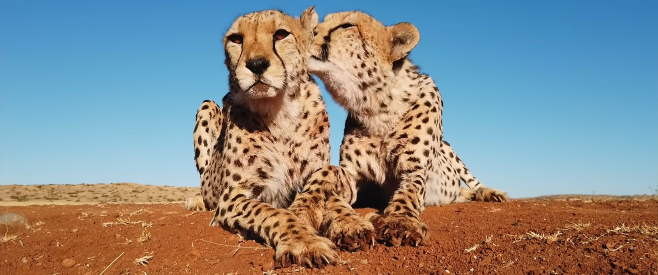
Tiger Canyon's cheetah reserve covers 970 hectares of bushland. Its inhabitants are Mara, her four cubs, her sister, and an adult male cheetah. Kleer recounts Mara's story, explaining how her anxious, shy personality transformed after she had her first cub.
"She's a very gentle soul...she truly enjoys our company," Perlerius says.
Mara will even bring out her cubs to spend time with the human visitors. The cubs' father is Mashai, who was raised in captivity and had to be taught how to hunt. Now, however, he is successfully living on his own in Tiger Canyon.
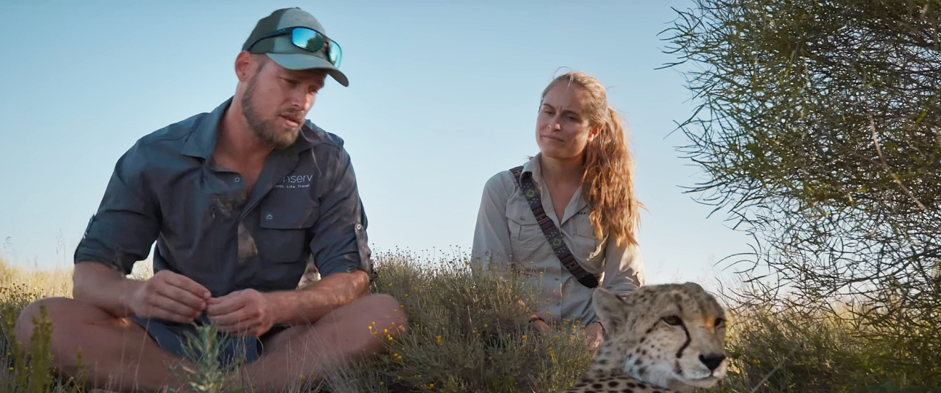
Saving the cheetah will help restore the entire ecosystem, Kleer explains, from the antelope on down to the plants. In the same way, the cheetah is connected to the ecosystem, people are connected to cheetahs.
Since the Tiger Canyon cheetah conservation program has started, they've released ten individuals into the wild, several of which have gone on to have cubs.
Animals that evolved in warm, tropical climes rarely decide to move to cold, snowy ones. Take any creature from the African grassland and drop it in Austria during an Ice Age, and the poor creature would surely not fare well.
Except Homo sapiens. We did just that, expanding into some of the coldest regions on Earth. New research into a 24,000-year-old site shows how technological innovations helped early humans keep warm during the Last Glacial Maximum.

The early humans of Kammern-Grubgraben
While we tend to associate early humans with caves, Austria's Kammern-Grubgraben site is open air, with a highland on one side and a sloping river valley on another. Between 20 to 24 thousand years ago, humans frequently lived there.
Nearby sites had an even older human history -- 33,000 years. They were hunter-gatherers, who moved with the seasons, returning to the same camps year after year. Sophisticated tool users, they produced a wide range of stone tools, as well as jewelry.
The Kammern-Grubgraben site also contains a wealth of organic remains. Those remains belong almost entirely to one species: Rangifer tarandus, the caribou, or reindeer.
The people of Kammern-Grubgraben hunted caribou almost exclusively during the winter. Researchers knew the hunts had taken place in winter because the skulls still had their antlers, and reindeer shed their antlers after winter. Tooth wear also indicated winter or late autumn deaths.
Why were they only hunting caribou during the winter and autumn? Researchers believe that it was for their hides.
Sewing for survival
As the Thule people in the Arctic discovered much later, caribou hide makes clothing warm enough for almost any conditions. Their thick pelts of hollow, air-trapping hairs conserve heat like nothing else. Once the people of Kammern-Grubgraben acquired these hides, they used sophisticated sewing tools and techniques to create cold-resistant clothing. Sewing traditional fur clothing requires incredible patience and skill, but it can also be incredibly effective. Recreations of Stone-Age clothing handled even in harsh Northern winters.
In the same chronological layer as the caribou bones, archaeologists found eyed bone needles. Eyed needle technology allowed them to sew tight, fitted seams, making clothing much warmer and sturdier than simple draped pelts.
Around 24,000 years ago, the Last Glacial Maximum caused temperatures to plummet. In nearby sites that dated from before this Ice Age, archaeologists found a much broader range of animal remains, and no eyed needles. Here, the most commonly hunted animal was the mammoth, suggesting that hunters prioritized calories over clothing.
When their environment changed, the Stone Age people adopted new lifestyles and techniques to suit their new, chillier environment. This superior winter clothing allowed them to survive an increasingly harsh and unstable climate.
Kitturiaq chronicles a 620km canoe expedition across the Labrador plateau down the George River in Canada's northern Quebec. Professional adventurer Frank Wolf undertook the journey with partner Todd McGowan.
Wolf is bold in adventure planning and is perfectly willing to be bold in filmmaking, too. The film's narration is delivered by a fictional mosquito who chooses to tag along as an unofficial third party member. In fact, the Inuktitut word for mosquito gives the project its title.
Meanwhile, the Kitturiaq, named Malina, shares the story of explorer Hesketh Hesketh Prichard. (Evidently, his parents felt that one "Hesketh" wasn't enough.) Through Malina's narration, the story of the Briton's failed 1910 attempt to complete the route unfolds simultaneously to the main action.
The journey begins in Nain, now the northernmost town on the Labrador coast and the administrative capital of the Inuit region of Nunatsiavut. There, Wolf interviews local community leaders about the land his upcoming journey will take him through.
A 600m climb, with canoe
The first stage takes them a little north to the giant Fraser Canyon, which they must scramble up to the Labrador plateau. Malina's blackfly relatives are thick in the air, just as locals warned they would be.
But it's the portage they have to make that is the real killer. With no waterway to follow, they have to unload their gear, then drag it and the canoe 600m up a crack in the cliffs called Poungassé to the top of the plateau. Sweat and blood cover them both by the time they reach camp, and McGowan suffers sunstroke. The long subarctic summer day can be blisteringly hot.
They're still doing better than Prichard, who took a steeper route and ended up abandoning one of his canoes. Atop the plateau, Prichard saw no waterways -- the plateau is mostly swamps and shallow ponds in this area -- and abandoned his last canoe, continuing on foot. Wolf and McGowan elect to drag theirs. After a brief descent into fly-induced madness, they're back on the water.
"People have been here, a long, long time before us," Wolf reflects, examining a piece of wood. No trees grow on the tundra, so an Inuit hunter must have brought the discarded log on his sled, or komatik, years before. This small moment is a quiet reflection on a core theme of the film.
The paddling and portaging continue. "They're beginning to act a little strange," Malina notes. A headnet makes a reappearance.
When they make it to Nunavik, they go fishing, while Nain politician Johannes Lampe reflects through a previous interview about how prohibitively expensive food is this far North. Caribou is much more cost-effective than groceries, and fishing is cheaper than buying fish. The land takes care of you, Lampe explains, when you take care of it.
The George River
When Prichard and his team reached the George River, they hoped to meet the local Innu people. But these elusive people had already passed on to different hunting grounds. Without any canoes to handle the George River, Prichard had to turn back.
But Wolf and McGowan's portage drudgery paid off, and they still have theirs. Once they reach the George River on day 17, the kilometers begin to fly by. Speaking of flies, they remain innumerable. Soon, the canoeists reach the end of the river at Ungava Bay.
Yellowstone National Park sits atop the world's most famous supervolcano. If it erupted, ash and molten rock would spew across much of the continental United States, devastating the country and disrupting global climate.
For over a century, researchers have worked to understand Yellowstone's volcano and its potential to blow its top. But that was difficult without knowing precisely where all that molten explosive was stored. Now, a recent study shows the location of Yellowstone's magma cap and hints at when it may erupt.
Mini-earthquakes
The Yellowstone caldera has a magma chamber about 40 by 80 kilometers across. The place where the stored melted rock meets solid, non-melted rock and forms a lid is called the magma cap. The cap's location, its depth beneath the surface, how sudden or gradual the transition is -- all help scientists predict eruptions.
But previous geophysical imaging have been vague. The estimated depth of the magma cap, for instance, has ranged from three to eight kilometers. Led by Rice University researchers Chenglong Duan and Brandon Schmandt, a team tried to get a closer look.
To do so, they borrowed a technique usually used for oil and gas exploration. They parked a massive 24,000kg truck on the northeastern caldera and turned on the seismic vibrator. Because Yellowstone receives thousands of daily visitors, the team had to conduct their research at night.
Lit by moonlight, the truck's vibrator sent seismic waves into the ground, causing what were essentially tiny earthquakes. This is called vibroseis.
It works a bit like a bat's echolocation -- they generate waves which bounce off of objects and then return, reshaped by the objects they bounced off. Only instead of sound waves, vibroseis uses seismic waves, and instead of tasty bugs or cave walls, the waves register natural gas stores. Or, in this instance, magma caps.

Will it blow?
After the truck gave the ground a good shake, the team ran the data through advanced imaging software.They modeled various materials which the waves could have passed through, looking for a scenario that would fit the complicated, jumbled data.
Eventually, they had a map of the dimensions, location, and composition of the caldera and its magma cap. The cap is 3.8 kilometers underground, with a sudden, sharp line dividing liquid from solid rock. Now that they've found the magma cap, scientists know a lot more about how Yellowstone's volcano works.
The cap itself, they discovered, is volatile-rich. Magma can be full of mix-ins, like good ice cream. These volatiles include silicate melt and gas bubbles formed when water or carbon dioxide exsolve from the magma and clump together. More volatiles make the magma buoyant and, well, volatile.
Luckily for the U.S., the volatile-rich cap suggests that Yellowstone is not about to blow. "Its bubble and melt contents are below the levels typically associated with imminent eruption," reassured Schmandt in a Rice University press release.
Instead, the bubbles vent up through the porous rock in a process Schmandt describes, a little eerily, as breathing. It is this vented gas which causes the area's iconic hydrothermal features. The spectacular geysers and chromatic pools which make Yellowstone so unique are the exhalations of a sleeping dragon, 3.8 kilometers underground.
We imagine the ancient world as one made of stone. Marble temples, megalithic structures, and rock-hewn tombs dominate the modern image of the pre-modern period. That image is, of course, an inaccurate one. Stone is all that remains of sites whose flesh was largely made of wood and other fast-decaying plant materials.
This problem of materials is especially relevant to ancient seafaring. Up until the mid-19th century, ships were practically all wood. Worse, the bottom of the oceans tends to be a uniquely bad place to preserve things. Even vessels that sank fairly recently, such as the Titanic and HMS Erebus, are already decaying.
Because of the simple realities of rot, there are very few physical remains of classical-era ships. There is one place, however, where they can be found: the Black Sea.

The Hospitable/Inhospitable Sea
The Black Sea's unique ecological environment allows it to preserve ancient shipwrecks. Its 436,400 square kilometers fill the space between Asia and Europe, but its secret lies beneath that surface.
Ancient Greeks first called the Black Sea Pontus Axeinus -- the Inhospitable Sea. However, as the centuries went on and they established colonies along the coast, they called it Pontus Euxinus, which had the exact opposite meaning from the original name. They couldn't have known this, but these two contrasting names reflected the hidden duality of the Black Sea.
The top layer of the sea is oxygen-rich and therefore able to support complex marine life. Below 100-200m, however, all oxygen is gone. The Black Sea is the world's largest meromictic body of water -- a marine environment with two stratified layers that never mix.
The two layers exist because water only enters the sea near the surface, from rivers like the Danube and Kuban, and out through the shallow Bosphorus Strait. No water mixing happens below 150m.
Honestly, I was simplifying too much when I said there were only two layers. There are actually secret intermediate layers that keep the upper and bottom from mixing, but for our purposes (shipwrecks) there are two: oxygen-rich upper, anoxic bottom.
That bottom layer is actually most of the sea. Only 13% of the Black Sea is oxygenated. The anoxic layer is a pretty bad place to be alive, but a good place to be a shipwreck.
A hot spot for shipwrecks
The same currents and tides that wreck ships on the surface can also damage them once they've already sunk. Wrecks near rocky coasts are particularly vulnerable and are soon smashed to bits and dispersed.
In addition to those ocean forces, the shipwreck has many natural predators. Organisms like shipworms, gribble (a type of marine isopod), and other wood borers quickly attack exposed beams. Materials buried under sediment will be eaten by bacteria, which feed off sugars like the cellulose and hemicellulose in wood.
So the quiet, deep waters of the Black Sea anoxic zone present an ideal, shipworm-free environment. In 1976, Willard Bascom, an engineer and marine archaeologist, wrote about the possibility of Black Sea anoxic waters preserving a wealth of ancient wrecks.
The Black Sea is also well-situated for wrecking ships in the first place. People have lived along its coasts for tens of thousands of years. Over the centuries, its location between Europe and Asia, connected to the Mediterranean and several major rivers, made the Black Sea a locus of ancient travel and trade.
Its waters were a theater for maritime history, hosting Hittites, Thracians, ancient Greeks, Persians, Scythians, Romans, Byzantines, Huns, ancient Slavic groups, Goths, Vikings, medieval Italian traders, Ottomans, and more.
Technological limitations, however, long prevented investigation of its depths.
Testing the waters
In 2000, Robert Ballard led an expedition to the northeastern Turkic coast of the Black Sea. Ballard pioneered new deep-sea exploration techniques that led him to discover the wreck of the Titanic. Searching off the coast between the Bosphorus and Sinop, the team was also looking for Bronze Age coastal settlements.
The Black Sea Deluge hypothesis proposes that until about the 7th millennium BCE, the Black Sea was a smaller freshwater lake, and people lived on its banks. When the Bosphorus opened, the Mediterranean flowed in, transforming the lake into an inland sea. Finding evidence for this theory was a major goal of Ballard's expedition.
Using a combination of sonar and remotely operated vehicle (ROV) technology, the 2000 expedition surveyed the sea floor. Argus, a small imaging vehicle equipped with lights to illuminate the ocean floor, was dropped over the side and dragged behind a boat. The other vehicle was remotely operated and attached to Argus. Called the Little Hercules, researchers deployed it to recover objects or samples.
Under 100m of water, researchers traced what they believed to be an ancient shoreline, finding freshwater snail shells and a possible Neolithic settlement, which they named Site 82. Ballard and his team theorized that the regular limestone blocks were the remains of a manmade settlement.
Twenty-five years later, we still aren't completely sure how the water level in the Black Sea has changed over time. But it probably isn't as simple or dramatic as the Flood Theory posits. For half a million years, the Black Sea has been repeatedly isolated and connected as water levels fluctuated. But these are gradual processes -- there just isn't a lot of physical evidence for a catastrophic, sudden deluge.

But what about the shipwrecks?
Whether Site 82 is a neolithic settlement or just some squarish limestone, it was only one of several key finds. Up to about 85m of depth, years of bottom-net fishing have effectively destroyed the archaeological record. So they began at that depth, scanning a 50km stretch of coast between 85 and 150m.
In a fairly short time, they began getting hits. First, Shipwreck A: two clusters of ceramic vessels and a few half-buried planks, dated to the Late Roman era. Shipwreck B: more ceramic jars and submerged hull planks. The outline of this vessel is larger, and it appears to have a bilge pipe to pump water out of the ship. Based on this, researchers dated it to the Byzantine era. Shipwreck C was similar to Shipwreck A.
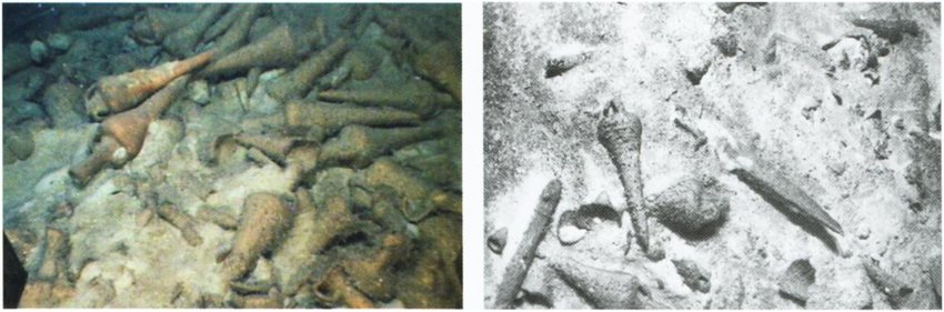
Shipwreck D
The promising findings offered new information on the location of an ancient trade route. But very little remained of the ships themselves; the water wasn't deep enough to preserve them. Off this coastal shelf, the sea bottom slopes abruptly downward to depths of 1,000m and more.
They turned to the trickier, deeper waters, with little initial success. With the expedition about to end, Ballard and his team made one final sweep -- and found something.
Shipwreck D sits upright in 320m of water. It's remarkably well preserved, with a deck structure, rudder, and mast rising 11m from the hull. There is even cordage wrapped around the top of the mast. Little Hercules collected a sample of the wood from the rudder area. The samples dated to 410-520 AD.
For such an old ship, it was shockingly well preserved, giving archaeologists insight into the construction of Byzantine ships. However, Shipwreck D, now called Sinop D, is most important as a sign of what else could be out there.

What else was out there?
Ballard and his team returned several times during the 2000s on further expeditions. They continued deploying Argus and Little Hercules to investigate sonar hits.
The technology continually improved, but was still a work in progress. Out of 500 hits, only 44 could be identified, and some of them turned out to be trash. The non-trash spanned a thousand years of history: An early medieval jar wreck, a 19th-century warship, three airplanes and even a WW2 Soviet destroyer, the Dzerzhynsky, named after the founder of the KGB.
Almost 10 years later, The Black Sea Maritime Archaeology Project used its ROVs in the Black Sea. A team from the University of Southampton set out on Stril Explorer, a state-of-the-art offshore survey vessel. They were there for the same ancient coastline debate Ballard investigated in 2000. It was almost by accident that acoustic and sonar data, combined with over 250,000 photographs, allowed them to find, map, and model 65 shipwreck sites.
Like the Ottoman ship above, most of them were trade vessels that sank in bad weather. They were far out to sea, along known routes. All were remarkably well preserved. One 13th or 14th-century Venetian vessel was the most complete of its type ever discovered. But the most impressive find was still yet to come.
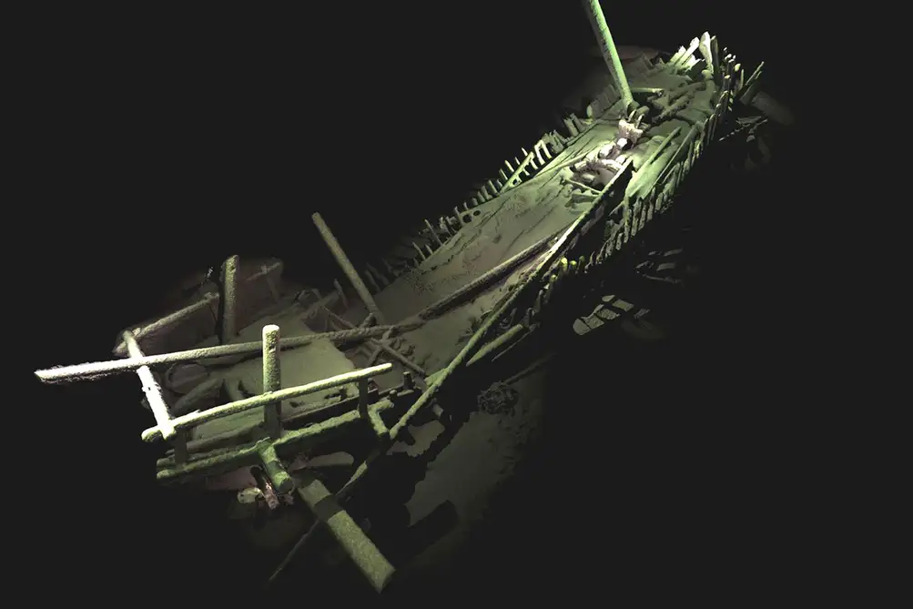
The world's oldest intact shipwreck
More than two kilometers under the surface of the Black Sea, off the coast of Bulgaria, lies a ship that is more than 2,400 years old. It was an Ancient Greek trading vessel, loaded up with goods meant for Greek colonies on the coast of the Black Sea.
The anoxic water has done its job; the 23m-long ship has an intact hull, with its precious cargo still hidden inside. The mast stands ready for winds that blew before the birth of Alexander the Great. There are intact benches for rowers who died before the invention of the number zero.
Because the cargo, which would usually be used to date the vessel, was inaccessible, the ROV took a small sample to carbon date. The result confirmed what the ship's design had suggested: It came from the 4th century BCE.
University of Southampton Archaeology Professor Jon Adams, who led the Black Sea MAP project, was stunned. An intact shipwreck of this age was unheard of. In fact, they could only recognize the ship's design from depictions on ancient pottery.
"This will change our understanding of shipbuilding and seafaring in the ancient world," Adams said in a press release.
This find is the world's oldest known intact shipwreck. Ships have sailed the Black Sea for over 2,400 years, though. Only a small fraction of its depths have been explored, and even older shipwrecks are still waiting to be found.
A pirate capture, a daring escape, a deserted island -- it all seems like material from an old swashbuckling movie, probably with Errol Flynn. But in 1722, a young fisherman named Philip Ashton found himself in just such a narrative.
He was thrown into captivity in a pirate ship, which brought him halfway around the world before he managed to escape -- getting away only to spend 16 months as a castaway on a small Caribbean island. His desperate fight for freedom and survival is not well known today, although it became the subject of a famous writer's adventure novel.
Captured by pirates
Born Aug. 12, 1702, Philip Ashton was only 19 years old in the summer of 1722. But as a Cape Cod man from Marblehead, Massachusetts, he had been at sea all his life. He was captaining the Milton, a small schooner. His crew included childhood friend Joseph Libbey.
On their way to the fishing grounds off Cape Sable, the Milton anchored in Port Roseway with a dozen other small fishing vessels. At first, none spared a second thought to the larger brigantine -- a two-masted sailing ship -- anchored alongside them.
When a boat with four men launched from the brigantine, it didn't worry Philip and his friends. They thought the vessel was a merchant, coming to trade news. It wasn't until the four men were aboard the Milton, drawing cutlasses and pistols, that their nature was revealed. Caught completely unawares, the Milton crew surrendered. The pirates took another dozen small fishing vessels the same way.
When Philip and the other captives were brought aboard the brigantine, they received a second shock: They hadn't been taken by just any pirate. Their lives were now in the hands of the infamous Ned Low.

Captain Ned Low
Edward Low was born in Westminster and went to sea as a child. As a young man, he settled in Boston and worked producing rigging for sailing ships. He married and had a child, but after the sudden death of his wife, a devastated Low fled to the sea.
He initially joined the British merchant marine, but in 1721 he led a mutiny. Taking over the ship and shooting the captain, he and the crew turned pirate. By Philip's capture, Low's ship had almost 50 men and six powerful cannons.
Low also acquired a reputation for brutality. Contemporary sources reported that he regularly mutilated and tortured his captives. At this time, pirate crews signed "articles," basically a contract of employment, outlining the shipboard roles and rules.
Some other captains, such as John Philips and Thomas Anstis, had clearly outlined punishments for crimes such as mistreatment of prisoners, rape, or striking a fellow sailor. Low's articles are unconcerned with these crimes, but do specify that the punishment for desertion was death.
One particularly brutal incident took place after the capture of the Portuguese ship, Nostra Signora de Victoria. Unable to find the expected treasure, Low tortured several prisoners. They admitted that during the preceding chase, the captain had thrown £15,000 worth of gold over the side. Incensed, Low cut off the captain's lips, boiled them, and forced him to eat them. Then he had every captive killed.
Though these accounts were published during Low's life, they were highly sensationalized. Modern scholars don't think Low was necessarily any more brutal than his contemporaries. Low also had his code of honor, as Philip was about to discover.
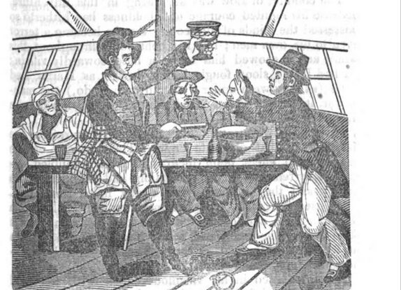
Pressed and oppressed
For much of maritime history, a significant number of every ship's crew were "pressed" men. These were merchant sailors, fishermen, and others who were captured from shore or abducted from other ships and forced to work as paid slaves. Pirates did this, but so did the British Royal Navy, and other European and American navies.
As they hauled him aboard, Philip was determined not to join the pirates. The pirates selected a half-dozen young men who looked healthy and strong. In addition to Philip Ashton, the select included his friends Nicholas Merritt and Joseph Libbey.
Pistol in hand, Low faced them on deck and asked a surprising question: Were any of them married? Surprised, and frightened by the gun he was brandishing, they said no, they were not. This, Philip later learned, was a firm rule Low held. Haunted by his own loss and the child he left in Boston, he wouldn't take away a married man.
Unfortunately, none of them were husbands. Low demanded that they sign his articles, and they refused. Then he threatened. Then he promised riches and drink. Philip and his friend Nicholas Merritt remained firm. Irritated, Low added them all to the books anyway, and the fleet set sail, carrying Philip away from family and freedom.
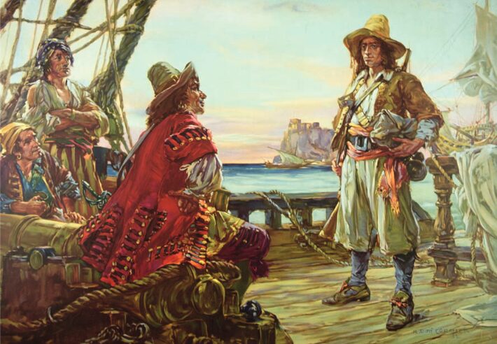
Life with the pirates
Philip did not have the temperament for piracy, and his unwillingness to cooperate only worsened things. The rough, noisy, and drunken men shocked his moral sensibilities, so he spent much of his time hiding in the hold.
Per Low's articles, they couldn't kill a man once they had given him quarter. But Philip didn't learn that for some time, and was constantly terrified that he'd be executed. When the pirates remembered he existed, or got bored, they'd rustle him out of his latest hidey-hole and demand he join them, beating him when he refused. His particular tormentor was the quartermaster, John Russell, a notorious pirate in his own right who chased Philip about the ship with a cutlass on multiple occasions.
Off the coast of Maryland, Low's crew captured the Portuguese ship Rose-Frigate. Taking a liking to the larger, better-armed vessel, Low renamed her the Rose Pink. He moved the bulk of his crew, including Philip, into the Pink, which sported a very respectable 14 guns.
They captured a sloop off the Cape Verde islands, and Philip's friend Nicholas Merritt was one of the eight men chosen to crew her. However, they were mostly pressed men, so the crew slipped away from the rest of Low's fleet.
While Merritt quietly escaped, Low went to the West Indies, where he promptly sunk the Rose Pink due to mishandling during routine repairs. Philip was cast into the water, and two boats of pirates passed by him without allowing him aboard. He was finally saved by his friend Joseph Libbey, who had integrated into the pirate crew but remained close to Philip. Another close escape.
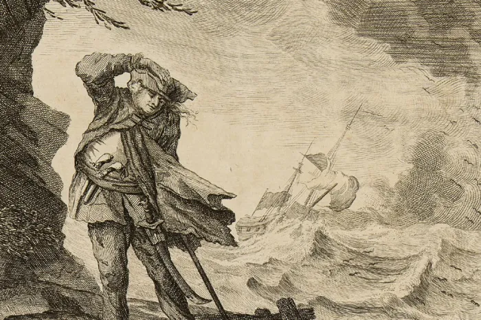
Out of the frying pan...
Loading everyone into the surviving sloop, Low, under false colors (deceptively flying an incorrect flag) sidled casually into the French-controlled harbor of Grand Grenada. He claimed to be an innocent merchant vessel in distress. The concerned French loaded up a ship and came up beside him, trying to determine if he was a smuggler. When Low gave the signal, 90 pirates burst out. They took over both ships, sailing them off.
Low captured more ships and took to calling himself Commodore. With every move, they dragged Philip along. The more Philip pleaded to go home and refused to join, the more Low swore that Philip would only go home when he did, and not before.
But more ships meant more maintenance, and soon Low had to anchor in the Gulf of Honduras, between Honduras and Belize. Low and his friends settled onto the island of Port Royal Key to drink and carouse. Low sent the rest of the crew to the nearby island of Roatán to clean and resupply the ships.
There, Philip saw his chance. The ship's cooper was preparing to go ashore and refill the water casks. He needed several men to help him, and Philip begged to be one of them. Thinking he wouldn't attempt to flee onto so deserted and remote an island, the cooper agreed.
Once on shore, Philip said he was going to go gather coconuts. Instead, he fled into the jungle. His practice of hiding in the hold came in handy. Philip burrowed into a dense thicket and lay still and silent. After some yelling, the cooper realized Philip wasn't coming back. Deciding that searching would be a waste of everyone's time, he left.
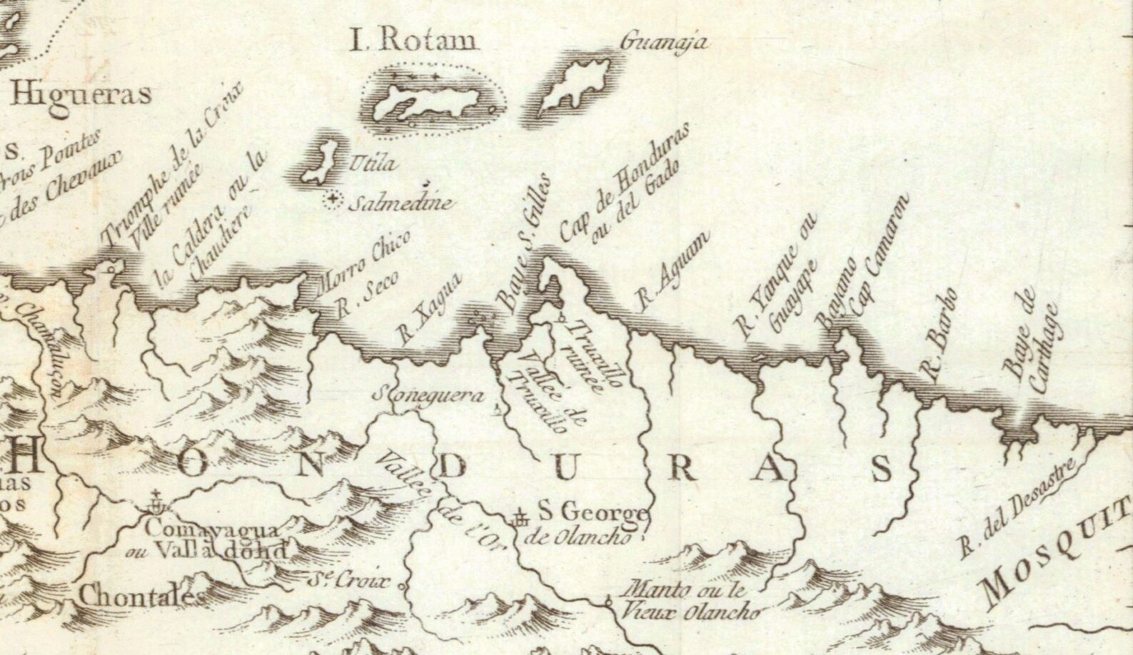
...Into the fire
Philip was free of the pirates. He was also alone with no food or supplies, on a remote and uninhabited island. He had already been away from home for nine months. Without even shoes, let alone hunting and fishing gear, he had limited options. But Philip determined to make the best of it and began exploring his new home.
Roatán island is a long, thin landmass, 64 kilometers long but only eight kilometers across at its widest. For hundreds of years, it was home to the Indigenous Pech people. In 1502, Christopher Columbus landed on the island, enslaving many of its inhabitants and forcing others into mining camps on the mainland. By the time Philip arrived, it was uninhabited. However, on the beach, he found broken pottery, which showed the Pech had once lived there.
The Spanish, too, had abandoned Roatán, leaving the battered remains of old fortifications. Along with Philip, the island was home to a diverse array of animal life—wild hogs, deer, seabirds, and tortoises. But without any tools to trap or butcher them, Philip could only eat the fruit that grew on the island.
He made a small hut out of palmetto leaves, but mosquitoes, venomous snakes, and stinging gnats continually harassed him. As the days passed, Philip grew weak and hopeless. He spent more and more time slumped on the beach, looking out at the water, wishing for a rescue that didn't come.
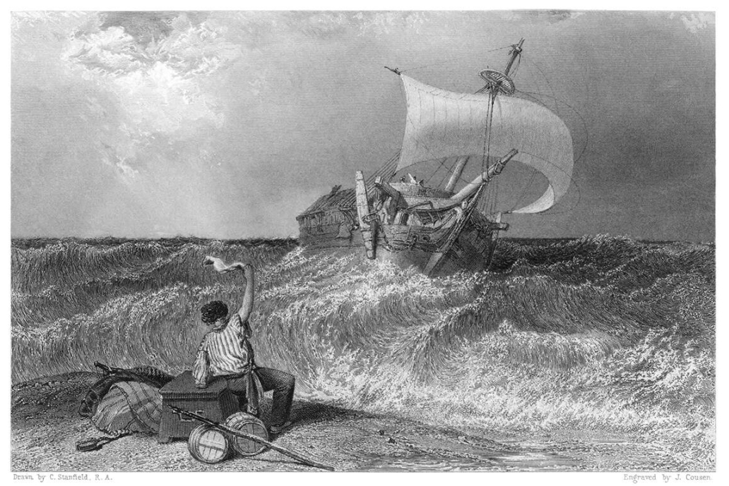
The fate of Joseph Libbey
A pirate's career rarely lasted more than a few years. In June of 1723, a British Navy warship caught up with Low. The HMS Greyhound, captained by Peter Solgard, had twenty guns and 120 men. On the other side, the pirates had two smaller ships, the 10-gun schooner Fancy, captained by Low, and the small sloop Ranger, under his protege, Charles Harris.
Captain Solgard used Low's own tactics against him, pretending to be a helpless whaler. Low, lured in by the thought of all that expensive whale oil, gave chase. When he came alongside, the Greyhound ran the Union Jack up the mast and opened fire.
Both Harris and Low decided to cut their losses and flee, but only Low, in a battered and demasted Fancy, managed to escape. Solgard took the Ranger and its crew into custody. Captain Solgard won fame and fortune from this victory, eventually rising to the rank of admiral.
Twenty-five captured men were sent to trial in Newport, Rhode Island. Among them was 21-year-old Joseph Libbey. Libbey may have been pressed into service, but he could still be prosecuted for his involvement.
Doctor Kencate, the Ranger's surgeon, testified against Libbey, claiming he'd been an "active man" on the crew. Libbey had, Kencate alleged, boarded and plundered ships and had fired his weapon during these raids. Another former crewmate had seen Libbey loot a pair of silk stockings from a vessel the pirates had taken.
Libbey protested that he was a pressed man, but to no avail. On July 19, he and 24 other men were hanged from the gallows on Gravelly Point. They were buried in a mass grave on the beach of Goat Island, in the unhallowed ground between the low and high-tide marks.
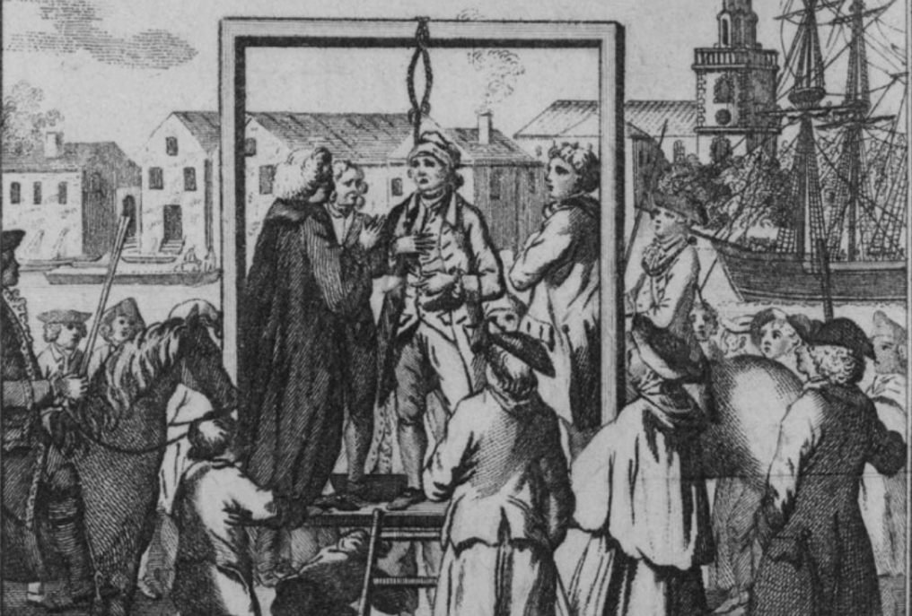
The English stranger
While Libbey was on trial, Philip Ashton was growing sick and weak in the jungle. He was always tired, and his whole body was sore and bruised. A number of nutritional deficiencies can come with a fruit and occasional scavenged egg diet. Lack of iron, calcium, and B vitamins likely made Philip weak, as did a lack of protein.
Still barefoot, his feet were covered in wounds, which made it painful and difficult to walk. After nine months on Roatán, Philip believed he was near death. Worse, the rainy season had begun, drenching and chilling him to the bone. Between storms, he baked in the tropical sun.
Then one day in November, Philip saw a canoe on the water. In it was a man, very startled to see a haggard Philip slumped on the beach. The stranger was a grave Englishman who had been living in Spanish Honduran settlements for two decades. But, having committed a crime he never specified, he had fled with his dog to Roatán Island, to wait for the heat to die down.
He was kind to Philip and took on the responsibility of hunting for them both. He said very little about himself, not even his name. Three days after arriving, he left again, saying he was going to hunt on another island. A storm blew in, and he never returned. Lost at sea or gone back to the Spaniards, Philip didn't know. But he was once again alone.
Still, things were looking up. The stranger had left behind the two tools Philip most needed: a flint to light fires, and a knife.

Castle Comfort
Better equipped, Philip's quality of life rapidly improved. He returned to exploring the island and found an old abandoned canoe. To his relief, it was not the canoe of the stranger, who was likely still alive somewhere. Now the lofty possessor of such wonders as a knife and old canoe, a cockier Philip began to call himself, as he later recounted, Admiral of the Neighboring Seas.
He got an unpleasant shock when the crew of a Spanish sloop had stopped by. Caught napping, Philip woke up to people shooting at him, which experts agree is one of the worst ways to wake up. He fled into the jungle, and they left.
In June of 1724, Roatán once again had visitors. A series of rowboats appeared on the horizon, bearing what Philip initially feared were pirates. Actually, they were 18 local baymen, English woodcutters, who had fled from Spaniards on the mainland. They also brought one Indigenous woman as a servant.
They settled in, giving Philip better clothes and building a house they called Castle Comfort. But Philip was wary -- the baymen were suspicious characters, half pirates themselves.
After four months of cohabitation, who should return to the island but, astoundingly, Captain Low's pirates. Philip and three men were away hunting on the nearby island of Bonacca when Captain Spriggs, Low's old lieutenant, landed in Roatán and attacked Castle Comfort. Philip and the three men with him fled in the canoe, and Philip once again hid in the dense jungle to avoid capture. The baymen who survived the attack took an old sloop the pirates had left behind and departed the islands.

Two years, ten months, and fifteen days
Philip and a man named John Symonds, as well as a black man enslaved by Symonds, elected to stay on the islands. Another few months passed. Finally, the season was approaching where Jamaican traders would stop by Bonacca to take on water, so the trio moved there to wait.
Only a week later, an entire fleet of English ships came over the horizon. It was a merchant convoy and its escort Diamond, a British Man-of-War. A brigantine approached the shore, and Philip, calling out that he was a friend, drew its attention. Onboard, his years of wretched luck continued to reverse. The commander of the brigantine was Captain Dove, an old Massachusetts acquaintance of Philip's.
Dove signed Philip onto his crew. It had been two years, 10 months, and 15 days since his capture, and he was finally heading home. On May 1, 1725, Philip Ashton returned to New England. The same night, he made it to his father's Marblehead house.
Philip returned to the sea, making a living as a fisherman, but managed to avoid further adventure. He married, was widowed, remarried, and had seven children. He was laid to rest in Old Burial Hill in his beloved Marblehead.

Philip Ashton's literary afterlife
Philip's story of perseverance and deliverance appealed to his pastor, a man named John Barnard. It was Barnard, through consultation with Philip, who wrote Ashton's Memorial, an account of Philip's adventures. Though intended as a demonstration of God's power to save, it became popular as an adventure story.
One of the readers was English writer Daniel Defoe. Today, he is most famous for Robinson Crusoe, but he authored many fictional and nonfictional accounts of piracy, shipwreck, and maritime adventure. His last novel, published in 1726, was The Four Years Voyages of Capt. George Roberts. It follows a man who is captured by Ned Low, then escapes and becomes a castaway. Many of the details are taken directly from Ashton's Memorial.
This adventure novel, based on Philip's story, is not one of Defoe's most famous works. But perhaps this suited Philip Ashton just fine. Despite his colorful escapades, he was at heart a humble fisherman who wanted no part in nautical adventures.
For over fifty years, a prehistoric rhinoceros mass grave has baffled paleontologists. Over one hundred rhino skeletons were found in the same spot, having all died together 12 million years ago. Now, a new study has revealed that this mass of animals, which died together, also lived together in one huge herd. How do we know? Their teeth.
Rhinos buried in ash
Located about 160 km from Sioux City, Iowa, the Ashfall Fossil Beds were created by the Yellowstone volcanic eruption 11.9 million years ago. When the volcano blew, a dense blanket of ash covered the entire region. Smaller animals died almost instantly, suffocating on the abrasive ash.
For larger, hardier creatures like the Teleoceras major, the barrel-bellied rhino, it was slower. Volcanic ash, on a microscopic level, is actually quite sharp, like tiny shards of glass. As it filled their lungs, animals slowly sickened and died. They came to the watering hole, seeking some relief in the cool water. There they died, and the wind swept more ash on top of them. What had killed them also preserved them perfectly.
In 1971, Michael and Jane Voorhies were walking down gullies in Northwestern Nebraska. Michael was a University of Nebraska State Museum paleontologist who hoped that erosion by nearby Verdigre Creek had revealed fossils.
It had. Emerging from the side of a gully was a flash of white bone, suspended in ash. Michael had found the skull of a baby rhinoceros. Excitingly, the skull was still connected to the neck, and the neck to the body.
Six years later, Dr. Voorhies came back with a crew from the University. The site is now part of a national park and is still an active dig site. The animals are suspended in layers showing their order of death: Small birds at the bottom, which succumbed first, then horses and camels, and rhinos last. There are over 20 species in total, and hundreds of skeletons, most of them rhinos.

Enamel revelations
However, paleontologists weren't sure at first why the rhinos had all come together in such huge numbers. Were these separate individuals and small herds, all fleeing to the same hole? Or could they really be part of a single massive herd? Researchers at the University of Cincinnati set out to answer the question.
They took samples from the tooth enamel of more than a dozen individuals. Then they analyzed the isotope ratios present in the enamel. Atoms of the same element can have different numbers of neutrons, resulting in different "species" of a given element. Isotope analysis measures the relative amounts of these different species of element. Because different isotopes occur in different environments, and therefore different foods, isotope analysis tells scientists what (and therefore where) an animal was eating.
Using this analysis method, they were able to examine where and why the individuals were moving. Had they traveled a long distance to avoid destruction? Did they migrate seasonally, or leave for new territory upon reaching adulthood?
As it turns out, the answers to those questions are no, no, and no. All the individuals they sampled had been eating the same local food for their whole lives. Comparing their isotopic signatures to another local animal, a sabre-toothed deer, revealed a more aquatic diet. If T. Major was semi-aquatic, like modern rhinos, this would have restricted its movement, explaining the lack of migration.
The hundred-strong rhino group at Ashfall hadn't come together by chance, all fleeing the same disaster. They were one large herd, who had lived together and died together.
A stroll through prehistoric Nebraska
Before the eruption, Mesozoic Nebraska was a vast savannah, crisscrossed with streams and watering holes. Grazing animals fed on the open grasslands. The long-necked Aepycamelus, a giant extinct camel, grazed on the treetops, while small three-toed horses like Pseudhipparion gratum and Neohipparion affine munched on the grass beneath them.
The smaller grazing animals and the young of their larger cousins had a number of canine enemies to watch out for. The deadliest of them was Epicyon, the massive "bone-crushing dog" that weighed up to 170 kilograms.
Moving placidly along riparian corridors were great masses of barrel-shaped T. Major. Growing up to four meters long, they were low to the ground, built more like the modern hippopotamus. In massive herds of dozens of these fleshy, tusked tanks, they enjoyed their muddy wallows, unconcerned by the bone-crushing dogs.
The volcanic eruption was not the end of T. Major. The rhino species persisted for another seven million years, until climate change froze its wet, temperate grasslands.
Llanberis in Northwest Wales is dense with routes that give the region arguably the best climbing in Britain. But ascending the lines of the green and grey Cymru hills is more than just technical. Adra, a new documentary, delves into the long history of Welsh climbing and its importance to local identity.
Friends Lewis Perrin-Williams and Zoe Wood grew up on the cliffs of Llanberis. Together, they take the viewer along on various iconic local climbs, like the Left Wall of Dinas Cromlech. When it was first ascended in 1956, climbers wore heavy boots and used railroad ties for protection. A fall meant a serious injury at best.
Lewis's father, mountaineer and author Jim Perrin, recounts the neglected history of native Welsh climbers. Recorded first ascents during earlier eras went to famous English climbers like Noel Odell, who used the hills of Wales as a proving ground before moving onto the Alps and Himalaya. But local Welsh copper miners were the true pioneers of many routes.
Devil-may-care attitudes
Older climbers like Jim Perrin draw a connection between the daring, "devil-may-care" attitudes of climbers in the 1980s and the rise of Margaret Thatcher. Thatcher's tenure is remembered with intense hatred in Wales. Her economic policies left millions unemployed, and the violent police response to the 1984-5 miners' strike shocked the nation.
Adra explores how climbing was counter-cultural in 1980s Wales.
"My climbing came from not being subject to social conditioning," explains John Redhead. Many of the young people in the area were out of work. They started climbing as a way to escape their daily anxieties.
Lewis explains that climbing isn't just a sport but a way of celebrating and communing with his homeland. Adra means "home" in Welsh, a language that was illegal to speak in court until 1942. Celebrating the Welsh language, heritage, and, yes, climbing history is an act of resistance to centuries of British rule.

Climbing, Adra explains, is ancient and indigenous in Wales. But it also nourishes an immediate, living community.
At 6 am on April 15, British endurance runner William Goodge set off from Cottesloe Beach in Perth. His goal: to run across the Australian continent in record time.
He wants to cover the 3,867km in just 35 days, a full four days faster than Chris Turnbull's previous 2023 record. To stay on track, Goodge needs to run about 110km every day. The record attempt is a year in the making.

For Goodge, running started as an outlet for his grief, after his mother passed away from cancer in 2017. The obsession quickly grew, and by 2019, he successfully ran the length of the UK. Two years later, he ran across America. His current run is fundraising for three cancer charities.

The road so far
William Goodge's progress can be tracked online, with live updates through his InReach device. At the moment of writing, he's covered 533km of the total 3,867km, and hasn't reported issues which might derail his attempt.
It's still early days, but in addition to his strong motivation, Goodge has a dedicated support team. Australian Dean Bartlett is Goodge's right hand man, whose brother Mark spent a year traveling the planned route and scouting locations. The extensive media coverage of Goodge's attempt, from his live-tracking to upcoming YouTube content, is thanks to Diego Garcia from L.A. Handling the physical side is Goodge's friend and coach, Jason Brooks. Graham Goodge, William's father, rounds out the team as driver.
My father always insisted on swimming in mountain tarns even in the depths of winter, which we all assumed meant there was something wrong with him. But health influencers have long touted the benefits of cold water plunges. The practice has been recommended for exercise recovery, increased energy levels, and even mental health disorders.
Curious about what cold plunges actually do to the human body, researchers at the University of Ottawa decided to take a closer look. The study reveals that after only a week of regular plunges, their subjects were seeing positive changes on a cellular level.
New evidence for an old practice
Humans seem to have an instinctual belief that getting really cold for a bit is good for us. Hippocrates recommended immersion in cold water for tetanus patients, and both the Roman physician Galen and Chinese surgeon Hua To favored an icy dip to treat fever.
In more modern times, the use of icy plunges expanded to all manner of ailments. English physician John Floyer published a treatise on temperature therapy in 1697. In it, he wrote that during summertime, "it is necessary to concente [sic] our Strength and Spirits by Cold bathing." By following his own regimen, he claimed to have made himself healthier and heartier.
During the 19th century, physicians used cold therapy to treat mental illness, numb limbs for amputation (this was before actual anesthesia), and lower fevers. The upper classes started cold bathing for all manner of aches and for that ephemeral and still sought-after "wellness."
Sea bathing became enormously popular as a general health and hygiene practice. One proponent was William Cullen, an 18th-century Scottish physician who prescribed cold showers (and cold enemas) for a range of ailments. The second thing did not catch on as much.
Throughout the 20th and 21st centuries, the popularity of cold water plunges has only increased. Sports medicine, especially, has embraced the practice for post-exercise and injury recovery. But just what exactly happens to a person when they undergo regular cold water treatment?
Cellular change
The Ottawa researchers, led by Glen Kenny and Kelli King, submerged their subjects in 14°C (57˚F) water for an hour a day, seven days in a row. By collecting blood samples before, during, and after this regimen, they could watch the effects of the plunges.
At first, it didn't look good. The stress on the body was significant, and it threw off the autophagic systems of the cells. Autophagy is the cell's cleanup and recycling system. When organelles are damaged or no longer needed, autophagic processes dispose of them. The material is then reused to make new cell parts. When this system isn't working well, damaged or unbalanced cells build up. This buildup of damaged cells is part of the aging process.
If cells are damaged, the body may trigger apoptosis, which destroys a cell entirely. Apoptosis is normal, and some cells simply need to go. However, it's much more efficient to repair them through autophagy rather than relying only on apoptosis. As the subjects' autophagy went down, apoptosis went up to compensate.
But after a few days, the patients' cells started to acclimate. Autophagy picked back up, though stress was still evident as well. By day four, the subjects were "over the hump," as it were. Their cells were undergoing autophagy more and apoptosis less.

Cold plunges for all?
The results are promising. By acclimating themselves to the cold, the subjects were better able to withstand the temperature extremes they were exposed to. More than that, Kelli King called cold water plunging a "tune-up for your body’s microscopic machinery." The positive impact on autophagy has implications for disease prevention and the slowing of aging.
But this was a small study. There were only 10 subjects, all healthy adult men. People of different ages and sexes handle cold differently. For people with preexisting conditions, this sort of treatment can be dangerous.
One influential cold-water health guru, a Dutch man named Wim Hof, has faced multiple accusations of negligence for his recommendations. A Sunday Times investigation in May of 2023 revealed 11 deaths connected with his teachings, which combine ice water plunges and breathing exercises.
The American Heart Association has come out against cold therapy. Sudden exposure to extreme cold can trigger heart attacks even in young, fit people. In fact, University of Portsmouth researcher Mike Tipton, an expert in the physical effects of cold water, found young and healthy people had up to a three percent chance of cardiac arrhythmia in an icy plunge.
The University of Ottawa subjects were carefully monitored and vetted. The amateur fitness enthusiasts trying cold plunges at home are not. So take this study as it is: fascinating preliminary research. Not a how-to guide for a frigid DIY fountain of youth.
The National Science Foundation (NSF) is an independent agency funds scientific and technological development across the United States and its territories. It also funds research and maintains facilities in Antarctica.
Well, it did do that, anyway. The Trump administration's cuts have slowed operations in Antarctica to a crawl. Scientists warn that climate research conducted there is vitally urgent. Despite this, the NSF is preparing for an operational retreat from Antarctica.

End of U.S. Antarctic dominance
For decades, the United States has been one of the most prominent forces on the southernmost continent. With three large Antarctic bases, a network of research vessels, and the South Pole Highway, which runs across the Ross Ice Shelf, the United States maintains a significant amount of Antarctic infrastructure.
However, that infrastructure has been in decline, especially in the wake of COVID-19. Last summer, the 30-year charter on the Antarctic Research Support Vessel Laurence M. Gould expired. Citing budgetary constraints, the NSF did not renew the charter, leaving only one functioning vessel.
The aging Antarctic stations also experienced cuts. Trump recently canceled the construction budget for the McMurdo Sound base. McMurdo Station has been in operation since 1956. From its position on Ross Island, it acts as a logistical and transport hub for the rest of Antarctica. However, its facilities are desperately in need of repairs and upgrades. Last year, one of the dorms was demolished, and now it will not be able to be rebuilt.
Not just the facilities but the research itself is imperiled. Last year, the NSF announced that it wouldn't fund new projects for the 2024-25 and 2025-26 field seasons. Only projects that secured earlier funding are proceeding, for now.
Meanwhile, other International powers remain interested in Antarctic research. Both China and Russia have announced new bases in the region, and China, France, and Chile will deploy new icebreakers there.
Antarctica can't wait
As the effects of anthropogenic climate change become more dramatic, Antarctica is the canary in the coal mine.
In an interview with New Zealand's Newsroom, Gary Wilson, president of the Scientific Committee on Antarctic Research, expressed his concerns.
The challenge, he said, is that "Antarctica can’t wait." Global temperature change and sea level rise are urgent problems, and Antarctica is central to stopping this. “Time is just not on our side."
This isn't just overzealous budget cuts; it's part of an intentional policy opposing climate research. It remains to be seen what, if any, research American scientists will be able to conduct in Antarctica in the coming years.
Exploration stories are rife with extreme deprivation, both physical and mental. "Sexually and socially, the polar explorer must make up his mind to be starved," wrote British polar explorer Apsley Cherry-Garrard, recalling the isolation he experienced in the Antarctic.
But few explorers endured what Ejnar Mikkelsen and Iver Iversen did. These two Danes, abandoned by their ship, spent two winters in a tiny hut in northern Greenland. They emerged unrecognizable.
In 1906, a Danish expedition led by Ludvig Mylius-Erichsen set out to explore the northeast coast of Greenland and survey over six degrees of latitude. Ejnar Mikkelsen was not a member of the expedition, but like many others interested in Arctic exploration, he was waiting for news of the ambitious expedition.
In 1908, Mikkelsen and the rest of the world learned that Mylius-Erichsen and two companions, Lieutenant Hoeg Hagen and an Inuit man called Jorgen Bronlund, had all perished. Bronlund, the final survivor, had reached an established depot before he died. On his body, he carried an account of the party's struggles. However, most of the expedition's journals and observations had been left behind and were missing.
Ejnar Mikkelsen was determined to retrieve them and preserve the work that the three men had died to undertake.
The Alabama sets sail
Mikkelsen had been at sea since he was 14 and already had several polar expeditions under his belt when he began planning to set off after Erichsen. Ambitious and indefatigable, as a teenager he had hiked over 500 kilometers to Gothenburg to meet with S.A. Andree. who was about to launch a balloon expedition to the North Pole. Mikkelsen begged to be taken on the ill-fated mission, but luckily for him, Andree said no. All perished.
Mikkelsen did manage to join an expedition a few years later, signing onto Amdrup's
expedition to East Greenland. Immediately after returning in 1901, he set out again on the Baldwin-Ziegler expedition to Russia's Frans Josef Land. Then, while Erichsen and his men were dying in Greenland, Mikkelsen led an Anglo-American polar expedition across the frozen Beaufort Sea.
His bona fides had become ironclad, and so when he applied to lead an expedition to look for the remains of the Erichsen party, he received widespread support. Funded half by the Danish government and half by private subscription, he bought a small sloop called the Alabama in 1909.
Not intended for the ice, the Alabama was rebuilt and retrofitted with a 15-horsepower motor, then loaded with 18 months of supplies. Besides Mikkelsen, the small crew consisted of only six others: Royal Navy Lieutenant Wilhelm Laub, Infantry Lieutenant C. H. Jorgensen, carpenter Carl Unger, mechanic Aangaard, and mates Hans Olsen and Georg Paulsen.
They set sail on June 20, 1909.
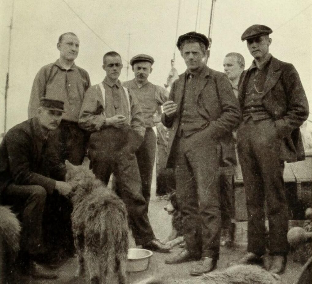
One hardship after another
Things began poorly. The weather was poor, and the dogs were sick. One by one, they were dying, and when Mikkelsen managed to find a veterinarian, his advice was that the animals were doomed. Reluctantly, the men put down the remaining ill dogs.
Luckily, Mikkelsen was friendly with the people of nearby Ammassalik Island, whom he had met on the Amdrup expedition. He bought 47 healthy dogs from them, but the stop delayed the expedition's arrival in Iceland.
Meanwhile, the mechanic Aagaard had "fallen sick," as Mikkelsen delicately put it. In reality, he was struggling with an alcohol addiction, which made him distinctly unsuited for the journey. They dropped him off at a small Icelandic village, then telegraphed the nearby naval vessel, Islands Folk. Did they have any volunteers who knew their way around an engine?
They sent over their eager assistant engineer, a young man named Iver Iversen. His appointment was so short notice that he had no chance to make arrangements or bid his loved ones goodbye.
Staffing issues resolved, the Alabama said farewell to the Islands Folk, and with it, the world they knew. They forged ahead alone into the cold northern waters.
Bad weather continued to oppress them. By late August, the Alabama was trapped in the ice off Shannon Island, about 300km from where Erichsen's party had wintered.
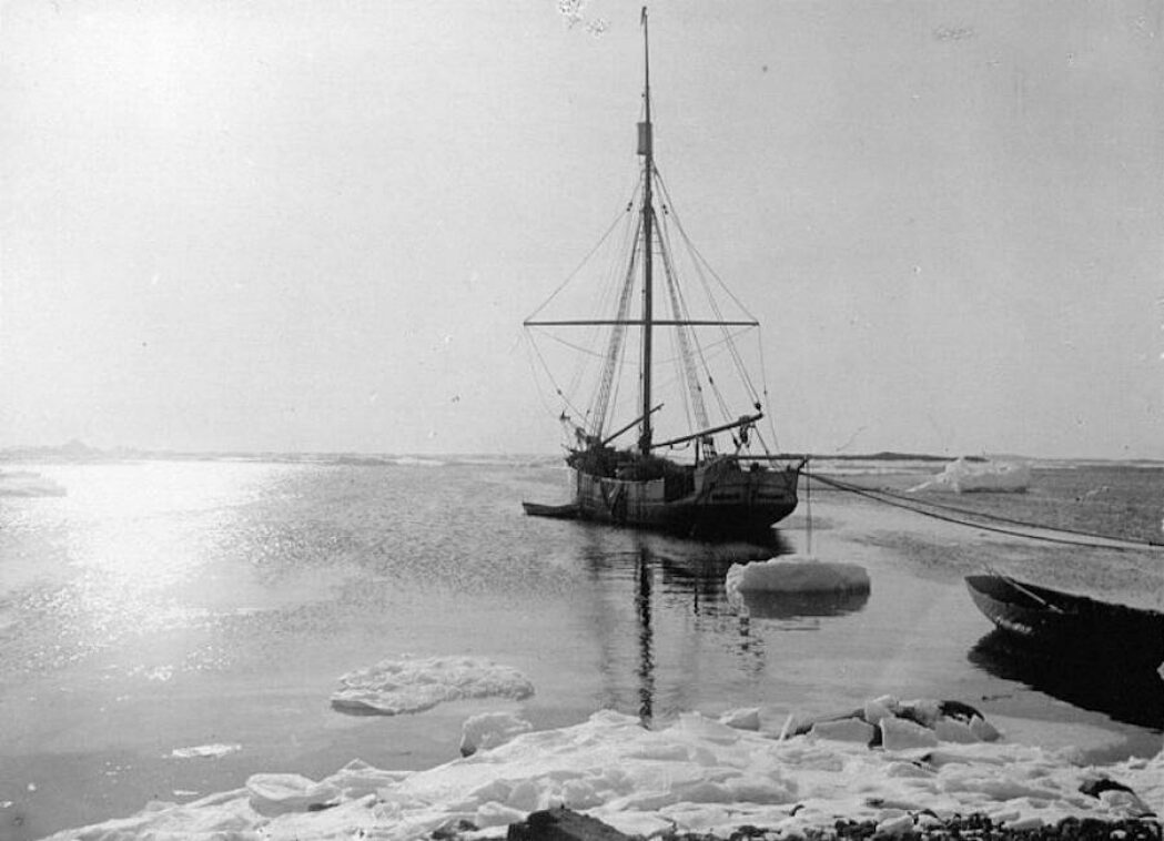
Miserable work
Before winter truly set in, Mikkelsen set off on an initial exploratory journey with Iversen and Jorgensen. Autumn sledding, he admitted, was miserable work, and they lost several dogs. However, they succeeded in reaching their goal, the depot on Lambert's Land where Jorgen Bronlund had died.
His body was still there, preserved by the Arctic cold, and they searched it for clues. All the records he had carried had already been collected, so they buried him solemnly and moved on. The small party split up to explore the area, searching for Erichsen's last camp without success.
With winter closing in and supplies low, they turned around. After a difficult journey -- they ran out of food and fuel and lost many dogs -- they rejoined the Alabama crew at its winter quarters on Shannon Island.
The crew passed the winter as well as could be expected, managing to keep warm and fed and not poisoned by anything. This is the height of luxury on a polar expedition. Jorgensen, however, had been very badly frostbitten, and by spring, he still wasn't fit to sled.
Though his second-in-command was out of commission, Mikkelsen pushed on, sending depot-laying parties in early spring and preparing sledding equipment. Once ready, Mikkelsen set off. Lieutenant Laub, Olsen, and Poulson would accompany him for the first leg, with only Iversen continuing on with him.
The pair had no idea that they were beginning a nearly three-year-long ordeal.
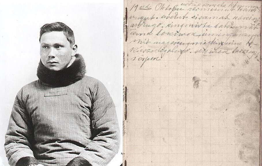
On the trail of Mylius-Erichsen
The journey was slow going. The weather was as bad as ever, and they carried so much weight in supplies and had so few healthy dogs left that they had to go in stages. For every kilometer of progress, they had to travel three kilometers. Though they hadn't made it as far as they'd hoped, Iversen and Mikkelsen said goodbye to their three companions on April 10. They continued on, while the other three returned to the ship.
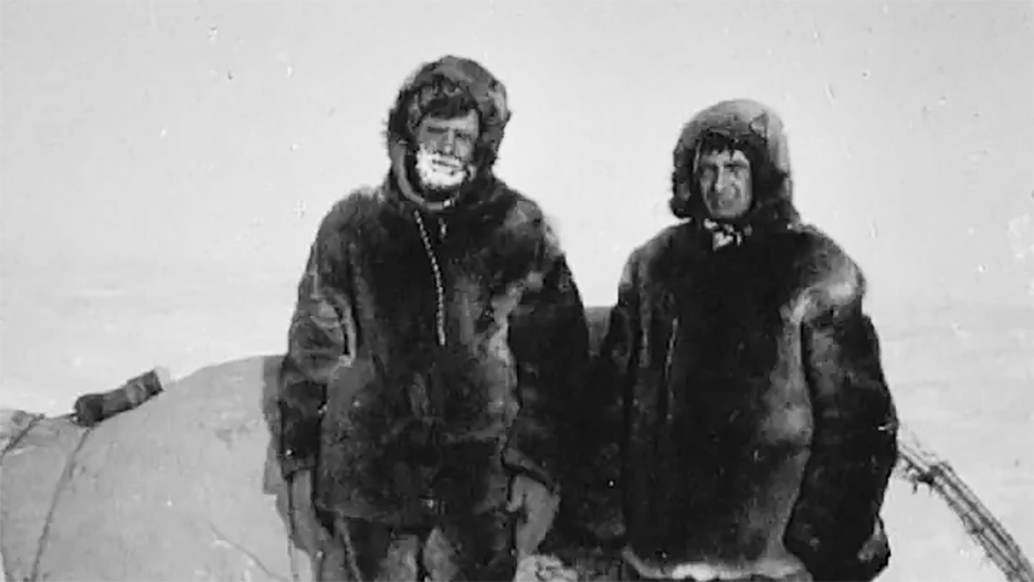
Knowing that they may not rejoin the Alabama before she was freed from the ice and made her escape, Mikkelsen wrote to his former captain, Amdrup. If they failed to return on the Alabama, he wrote, there was no cause for concern. He and Iversen would find a passing sealing ship to take them home. He also wrote that there was no reason to send a relief mission. Any attempt to find them would be like looking for a needle in a haystack.
Iversen and Mikkelsen continued to struggle northward. After crossing a stretch of inland ice riddled with deadly crevasses and impassible cliffs, the two reached Danmark Fiord, down several dogs. There, they began to trace the steps of Erichsen's lost party.
In late May, they found a cairn and the remains of a camp, with a note that Erichsen had left. It was heartbreakingly sanguine: They had starved and struggled but had recently found game and hoped to reach their ship in six weeks by following the coast.
"Poor fellows," Iversen exclaimed aloud. "So glad and hopeful here — and then — what they must have gone through before the end!"
A few days later, they reached a second cache and found another message. What was written there would serve as an answer to the mystery of Erichsen's death. The bodies of Erichsen and Hogan were never found.
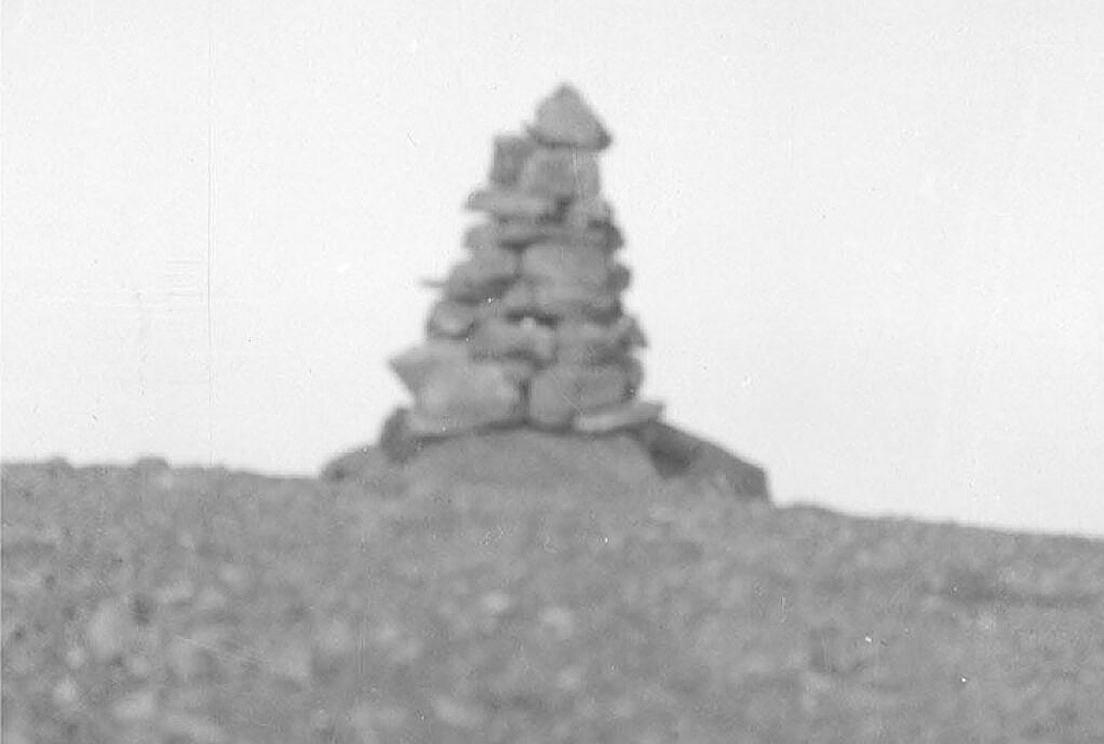
The nonexistent Peary Channel
The note harrowingly described the expedition's struggle, but what struck Mikkelsen most was a geographical revelation: "Peary's Channel does not exist."
Robert Peary was an American explorer best known for not discovering the North Pole. On an earlier 1892 expedition to Greenland, he had mapped a long swath of the coast. On this map, he placed a marine channel separating Peary Land from mainland Greenland. According to his account, he had observed the entire channel, and even a number of islands within it, from a vantage point on Navy Cliff. This supposed discovery of the north end of Greenland and land beyond it first made Peary famous.
Nowadays, many historians believe that Peary deliberately lied about his discovery. One of the men accompanying him, a respected explorer named Eivind Astrup, even insisted that Greenland extended far past Navy Cliff. There was no channel. But official support went to the politically savvy Peary. Sadly, Astrup took his own life in 1896, aged only 24, before he could be proven right.
Peary's observations formed the basis of the maps that both Erichsen and Mikkelsen had used, and both parties had made their plans based on the existence of an open waterway. The waterway, Mikkelsen explained, would have allowed them to reach civilization much more quickly than a journey along the east coast of Greenland. Erichsen's party had faced the same problem, and it had likely contributed to their deaths.
The expedition's goal, at least, had now been met. Mikkelsen and Iversen could contemplate the long way home, at least knowing that they had recovered the important discoveries Erichsen, Hogan, and Bronlund had made.
A desperate dash
The Alabama was over 1,200km away. The season was late. They had only seven exhausted dogs left and almost no food. As the dogs weakened further, Mikkelsen felt his strength ebbing, too.
By early June, he was unable to walk, suffering from aching muscles, swollen joints, and dark purple bruises all over his body. Iversen helped him onto the sled, leaving most of their remaining supplies so that their weak dogs could pull Mikkelsen. Though he was initially reluctant to admit it, scurvy had taken hold.
Iversen remained cheerful, and as they moved south they found game and old depots of food. The vitamin C in the fresh meat helped Mikkelsen, who was soon able to walk. But it was too late for most of the dogs, and they were soon down to three.
That number became two with the death of Girly, Mikkelsen's favorite dog. Though she had been sick for some time, he was unwilling to put her down like he had others, and she had been riding on the sled. But in the end, they butchered Girly and fed her to the last two dogs. Mikkelsen wrote that he wished he could've buried her properly, with a gravestone reading, "Here lies Girly — her little life of faithful and untiring service ended."
Abandoned
Iversen also grew weak and sick as they went on. Eventually, they were forced to leave everything-- even tents, sleeping bags, and diaries -- in a final effort to reach Alabama.
On September 19, they reached her. But what should have been a triumph was a bitter disappointment. She had been wrecked by the ice, and the other five men had gone home on a passing sealer.
The Alabama Cottage
Their shock was devastating, numbing. Neither swore or even spoke at all. "So confident we were," Mikkelsen wrote ruefully, "and now so utterly alone and helpless."
Mikkelsen and Iversen built a small hut out of the wreckage of the lost ship. With the Alabama's remaining supplies, they weren't in immediate danger of starving. The little canvas-covered hut would keep them from freezing.
Without coal, they had to slowly cut up and burn what was left of the ship. Even then, temperatures inside the hut were rarely much above freezing. While Mikkelsen cannibalized the ship for warmth, Iversen took it upon himself to serve as cook. He was not gifted in the arena, and the best that could be said of their diet was that it was enough to live on.
Aside from daily disputes with the neighbors-- a family of arctic foxes that stole their scraps -- the winter was uneventful.
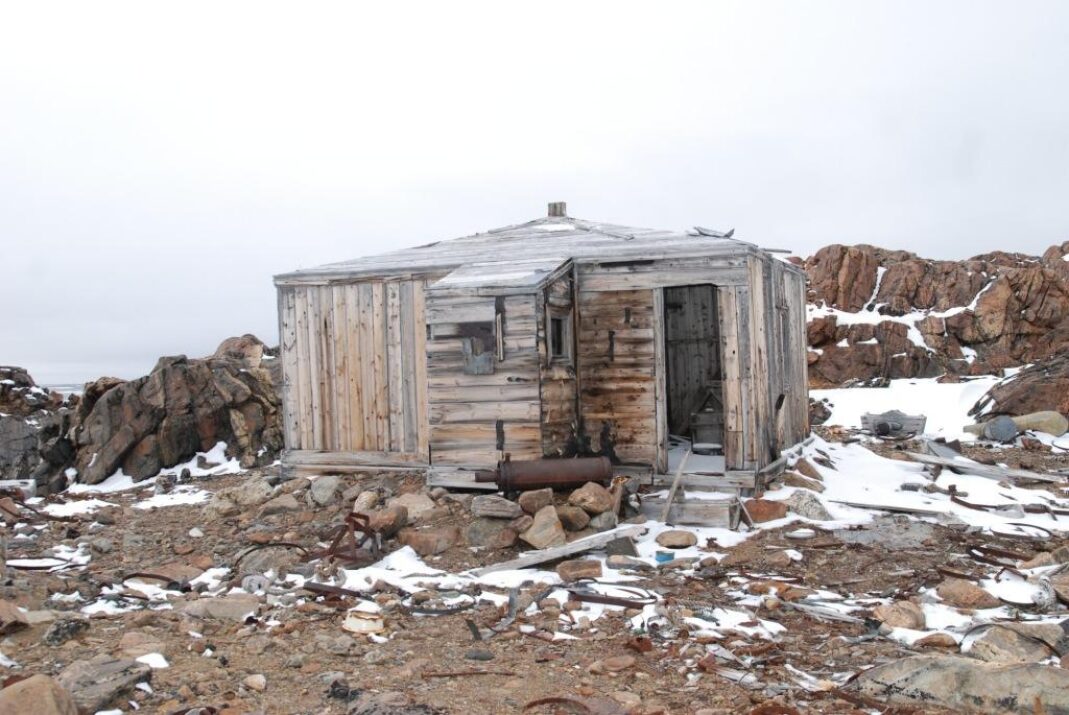
A third winter
As soon as winter broke, they set out on a sledding trip. It wasn't an attempt at self-rescue but a trip to retrieve their log books, left during their desperate push to regain the Alabama.
A polar bear had broken into their depot and eaten Mikkelsen's diary, but most of the log books, with their vital scientific discoveries, were unmolested.
They returned to the Alabama Cottage, confident that a ship would sail in to retrieve them in less than six weeks. The pair even adopted six baby hares, setting them up in a box in their hut. Caring for and playing with them was a welcome distraction from the waiting.
By mid-August, however, no ship had come. They had to face the dread prospect of spending another year in the Arctic. Worst of all, they were running out of fuel. They spent the autumn making a series of frantic trips back and forth from an American depot, where they discovered that a ship had stopped by, missing them by only 25km.
Once they settled in, boredom was again all-consuming. When Mikkelsen got a toothache, he was initially pleased because at least it was something new. They spent hours every day examining a book of postcards and coming up with backstories for the people pictured in them. They also adopted a "house-fox," and named him Prut.
The pair launched escape attempts by boat and by sled, but both proved impossible. Waiting for rescue while trying to keep themselves sane was all they could do.
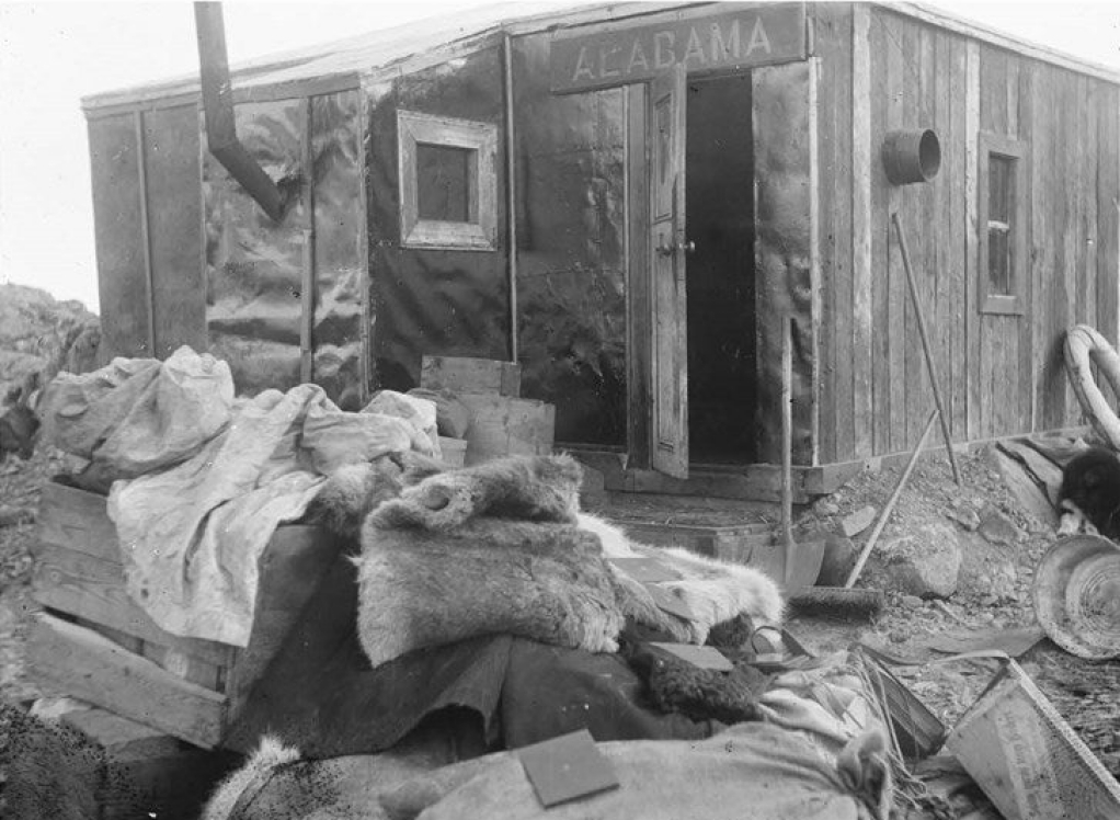
Unrecognizable
Early on the morning of July 19, 1912, Mikkelsen woke up to see Iversen, half-dressed, running across the room to throw open the cabin door. Mikkelsen looked on in confusion as Iversen yelled, "Good morning!"
Then he realized what it meant -- after 28 months of struggle and waiting, a ship had found them. The small Norwegian whaler soon put eight men to shore. The crew stared at the two explorers in shock. The steward, thinking they were dangerous lunatics, even darted back for the ship in fear.
Indeed, after more than two years in the wilderness, Mikkelsen and Iversen were a battered and wild-looking sight. But after the initial shock, the crew welcomed the pair aboard.
The captain, Paul Lillenaes, patiently answered all their questions about what they had missed during their three-year absence. Their king had died. Newspapers speculated on whether they were alive. When they set foot in Aalesund, Norway, a journalist was one of the first to greet them.
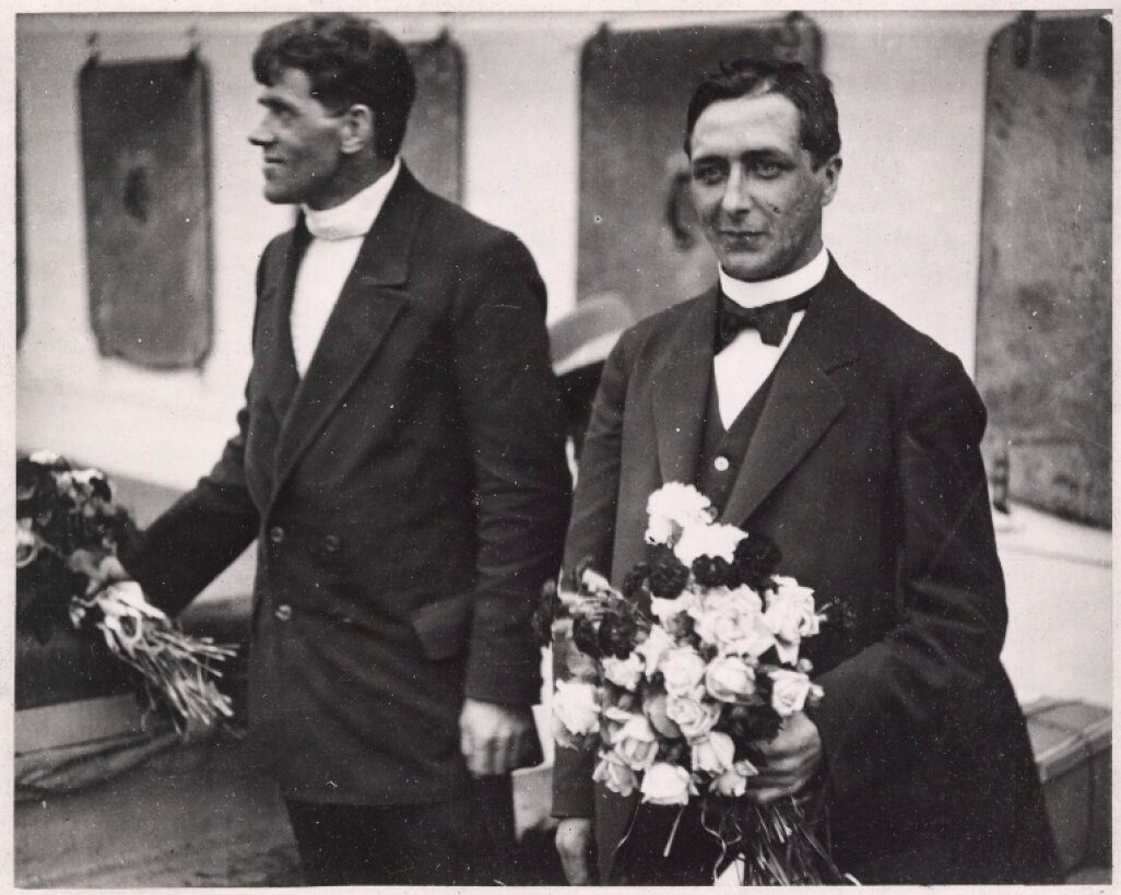
Mikkelsen had nothing but praise for Iversen, the last-minute addition who had stood by his side for nearly three years. The engineer had had enough of adventure, though, and settled down, never returning to the Arctic.
Ejnar Mikkelsen, on the other hand, spent the rest of his career traveling back and forth from Greenland. Even after his death, he maintains a strong presence there. Since 2007, a Danish vessel bearing his name has patrolled the waters around Greenland.
This short film examines what it means to be a snowboarder who isn't social media famous. Now I know what you may be thinking: Why even watch a film if the subject is cloutless? Well, he does fight fires, if that sweetens the deal for you. Snowboarder Joe Lax is not a household name and doesn't want to be. Dark Horse explores exactly what that looks like.

Documentary photographer Brad Slack discusses his subject's elusive, quiet nature. The film opens in Slack's studio, and we first see Lax through his lens. Then, we hear from fellow snowboarder Joel Loverin, who stumbled upon Lax's enigmatic Instagram account.
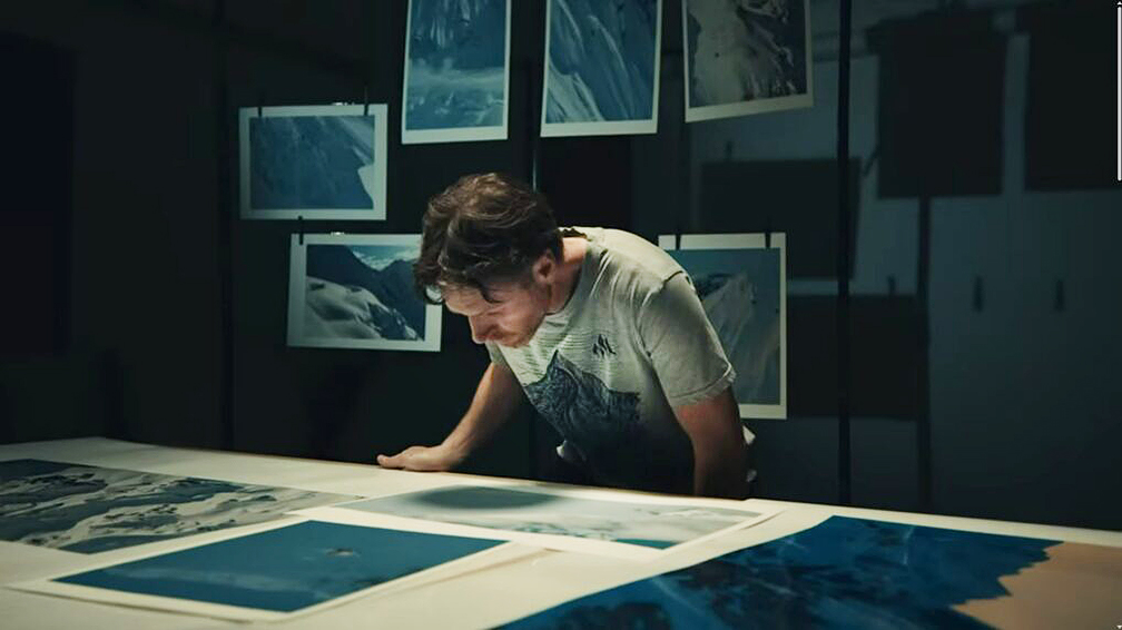
Whiskey Tahoe
Under the name Whiskey Tahoe, the account posted clip after clip snowboarding steep lines, all without any locations or personal information. Social media comments fill the screen with requests to know more -- where is he, who is he?
He's Joseph Donald Lax. Born to a Saskatchewan farming family, he left home as a teen. He went to Whistler, British Columbia, then a hub for snowboarding culture. There, film companies lurked, creating compilation tapes of the most impressive athletic feats. This is the culture Lax came up in.
But he wasn't interested in going with the crowd. Lax gets up early, what he calls "psycho early," to ensure he is the only one on the mountain. Often, he finds and rides new lines in places no one else dares to try.

Part-timer
Being an underground legend is technically only a hobby, though. By day, he's a firefighter.
"I never saw snowboarding as a career pursuit," Lax explains. He started firefighting as a means to support his time in the mountains. Work hard in the summer, and take the winter off to snowboard. Over the years, though, he's worked his way up to an operations chief. He has seen fire season grow fiercer and fiercer, threatening the mountains at the center of his life.
Something else came along, too, to threaten the primacy of snowboarding -- a wife, Ulla Clark, and two daughters. Instead of choosing between family and the mountains, he brought his family to the mountains. The four of them live in a cabin, and he taught his daughters to snowboard and go on backwoods adventures.
Lax snowboards purely for the love of it and has built his life around it.
"it's 'till the wheels fall off," he promises. His friend Joel thinks they'll be riding the slopes together as old men.
Archaeologists from the University of Pennsylvania were investigating Abydos, one of Egypt's most ancient cities, when they found a 3,600-year-old royal tomb.
From its location near the Mount Anubis necropolis and the surviving inscriptions, Egyptologists know the tomb belonged to a little-known royal family, the Abydos pharaohs. The discovery sheds light on a lost dynasty whose very existence scholars have debated.
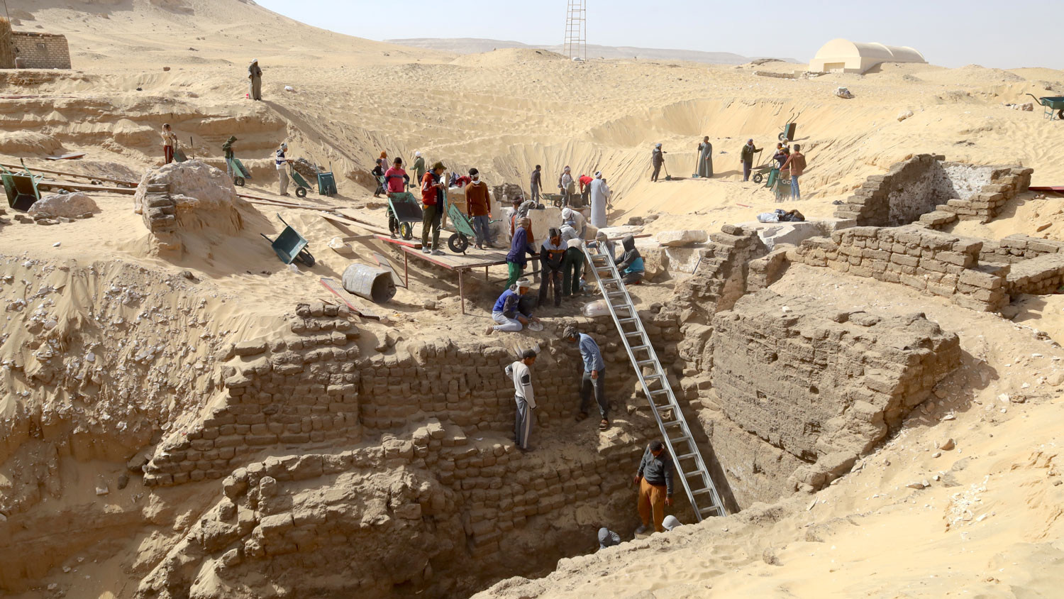
Who were the Abydos pharaohs?
It's difficult to imagine how long the Ancient Egyptian civilization persisted. In England, there have been seven different ruling dynasties since the Middle Ages. Egypt had roughly 33 dynasties.
This makes it a little easier to understand how an entire ruling family could slip through the cracks of history. The existence of the Abydos dynasty was first proposed in the 1990s and only confirmed by the discovery of a tomb in 2014. This second tomb provides more evidence.
Egyptologists believe the Abydos pharaohs ruled from 1700 to 1550 BCE. This Second Intermediate Period marked the chaotic transition between the Middle and New Kingdoms, a time of famine, warring dynasties, and rapid regime change.
The last Middle Kingdom dynasty was when the Hyksos people swept into Egypt. They conquered the Nile Delta area known as Lower Egypt, becoming the 15th Dynasty.
Upper Egypt, meanwhile, was split in two. The 16th dynasty ruled Thebes and its surrounding area. The area around Abydos was ruled by, you guessed it, the Abydos Dynasty. The area was fairly small, and the Abydos reign short. They left few monuments behind.
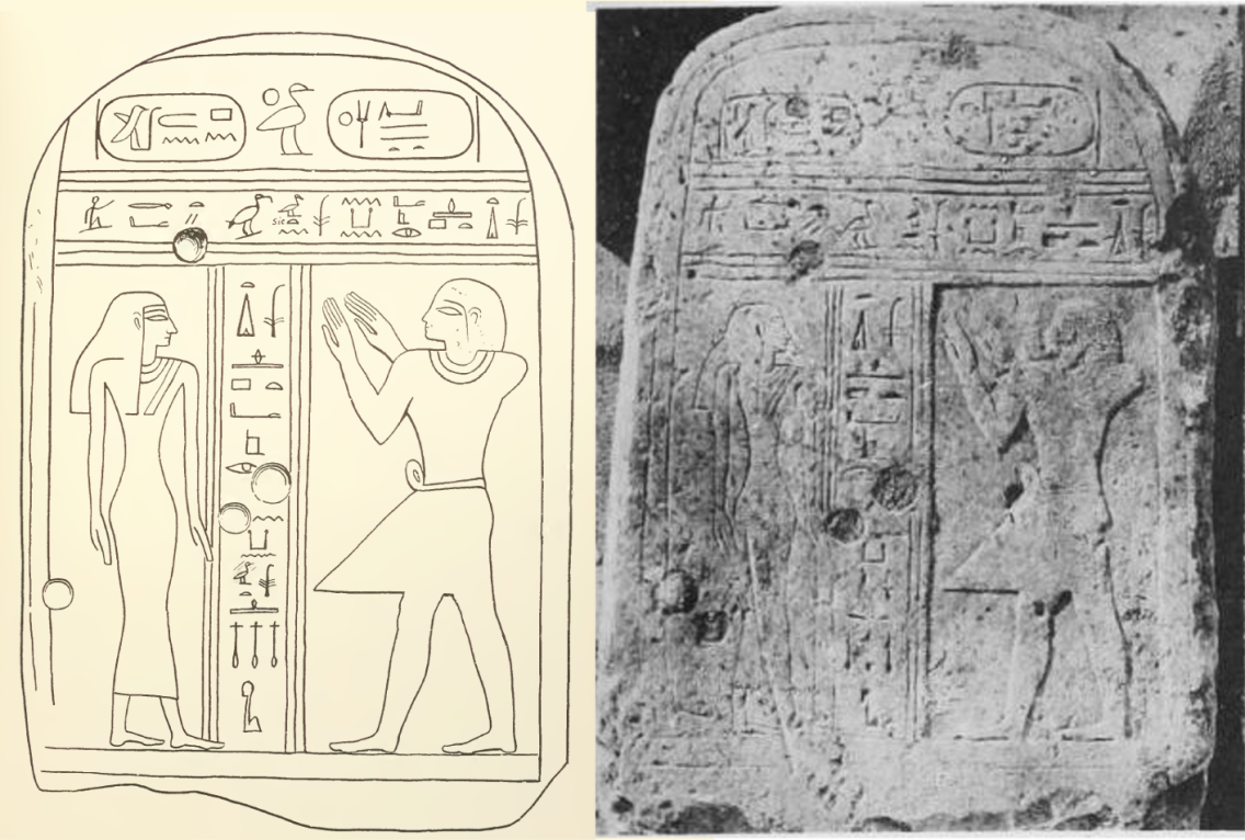
Turin King List
The Turin King List, compiled by the famous 19th Dynasty King Ramesses II, only chronicles four Abydos rulers. The list detailed every pharaoh before Ramesses II.
However, the list was discovered in fragments, with some sections lost, so a degree of guesswork is involved. Pharaoh Senebkay, whose tomb was discovered in 2014, is not one of the four Abydos rulers on the Turin King List.
The new grave belonged to someone who was likely an ancestor of Senebkay, as they were buried in a similar style. Beyond that, Egyptologists can only guess.
Looters stole the grave goods and the mummy and damaged the inscriptions. On either side of the tomb entrance, yellow bands once showed the pharaoh's name and images of the goddesses Isis and Nephthys. You can still make out the sister deities, but the name has vanished.
The Pennsylvania team, led by Josef Wegner, believes the tomb could belong to either Senaiib or Paentjeni. Both have monuments in the area, and researchers have not found either of their tombs.
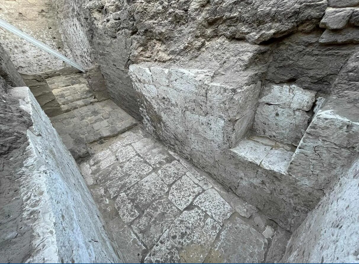
More to find
The Abydos tomb is the second royal grave Egyptologists have unearthed this year. The first belonged to Thutmose II, husband of the famous female pharaoh Hatshepsut.
Wegner and his team will continue excavations near Mount Anubis. More Abydos dynasty and Middle Period kings may be in the necropolis, Wegner believes.
For the Ancient Egyptians, Abydos was the burial place of the god Osiris, ruler of the afterlife. This made it a sacred city and the burial site for many of the earliest pharaohs. The kings buried here are much older than Thutmose II or the famous Tutankhamun, and their lives are much more mysterious. The Mount Anubis excavations may unearth their long-buried history.
Lush greenery is as unexpected in the Sahara as it is in Antarctica. Yet both were once home to more temperate ecosystems. Unlike the jungles of Antarctica, which froze away many millions of years ago, the Green Sahara was recent enough to host early humans.
Every 21,000 years, the Sahara experiences a wet, rainy period, turning it into a woodland. The last North African Humid Period occurred between 14,500 and 5,000 years ago. During that time, an enigmatic group of pastoral people called the region home.
But who exactly were they? Where did they come from? What happened to them when their home became a desert again? All this has long been a matter of debate.
A new study in Nature reveals the results of DNA testing, suggesting a clearer origin for the Green Sahara people.
Deciphering an ancient genome
The Takarkori rock shelter is tucked against the Tadrart Acacus Mountains of southwest Libya. Humans lived here from 10,200 to 4,200 years ago. Archaeologists have unearthed a number of artifacts, the most important finds are the 15 sets of human remains in the back of the cave.
A team from the Max Planck Institute for Evolutionary Anthropology in Germany decided the most likely remains for testing were a pair of adult female mummies carbon-dated from 6,800 to 6,300 years ago. Carefully, researchers extracted genetic material from their naturally mummified remains.
Conditions in the Sahara degrade DNA, making research into population change extremely difficult. The DNA was too damaged to construct a complete genome, but researchers were able to compare specific sections of code to almost 800 individuals from modern Africa, the Near East, and Southern Europe.
The unique people of the Green Sahara
Genetic analysis revealed that the Takarkori people were part of a unique, somewhat isolated group. Their overall ancestry was North African, and significant migration in or out of their population had not occurred.
This runs counter to previous theories, which suggested northward migration from sub-Saharan Africa. Around the height of the last humid period, the Green Sahara people moved from hunter-gathering to a more sedentary herder's life. Previously, researchers believed that sub-Saharan people moving through the area had introduced domestication.
The Takarkori people. also had far less Neanderthal DNA than other North African populations. They were fairly isolated genetically, but with a moderate population of around 1,000 people, they weren't in a population bottleneck.
The 13th century was eventful for the people of Medieval Russia. The Kievan Rus had fractured into warring kingdoms, each perpetually rocked by border disputes and revolts. The Mongol army invaded, burning and sacking cities like Kiev and Ryazan, and overturning the old order.
Famine struck in 1215, then again in the 1230s. The desperate people resorted to eating bark and leaves, then cats and dogs, and finally the corpses of the starved. Years of devastating famine led to a revolt against the ruling prince of Novgorod.
Noticing that their neighbors were distracted by their famine and the new "Mongol Yoke," the Swedes invaded, attempting to carve off chunks of Novgorod. A few years after that, Prussian Catholics invaded as part of the Northern Crusades.
But with all the upheaval, the people of Novgorod still went about their daily lives. They traded goods, collected debts, married and debated politics. Bored children still doodled in the margins of their schoolwork.
Onfim of Novgorod
Literacy rates were high in medieval Novgorod, and even children of relatively modest background learned and practiced their alphabet. They used birch bark, a readily available material used for cheap, disposable writing.
It is from these scraps of birch bark, uncovered by archaeologists, that we meet Onfim. Living in 13th-century Novgorod, Onfim was about seven years old when he made the art he's known for today. His drawings are interspersed with writing lessons and feature the charmingly crude imaginings of a young boy bored in class.
In one example, out of more than a dozen, Onfim begins writing the alphabet, getting about eleven letters in. Then he gives up and draws himself as a mounted knight defeating an enemy. He signs (or perhaps labels) the drawing with his name.
On another birchbark scrap, Onfim draws some sort of wild beast. Helpfully, he labels it, "I am a wild beast." The beast is passing on good wishes from Onfim to Danilo. Danilo may have been a friend or perhaps even a classmate.
Onfim seems to have liked drawing small figures, not dissimilar from the typical stick figures that children draw today. The writing is usually snippets of prayers or business notes, likely copied from a model.
One man's trash
Birchbark writing scraps weren't intended to be kept. They were written, read, and then discarded. There, in the mud, they were accidentally preserved while the streets of Novgorod rose above them. It wasn't until 1951 that the first birchbark manuscript was rediscovered.
Novgorod was founded sometime around the 9th century, and existed at the crossroads of several trade routes and cultural groups. This, in combination with the anaerobic soil which preserves materials, has led to extensive archeological work in the area.
Discarded birchbark notes are some of the most common discoveries. Over a thousand of them have been found so far. Birch forests ringed Novgorod, and their plentiful bark was harvested for writing. The people of Medieval Russia boiled the bark to soften it, then scraped and cut it to shape. Once they were done with the scraps, they could even use them in the privy.
Most of the birchbark manuscripts are online and can be browsed freely, though many have not been translated into English.
A glimpse of life in Medieval Russia
Most of the birchbark manuscripts are fairly boring -- financial transactions, debt records, legal documents. But others provide fascinating and often delightful insights into the people of medieval Novgorod.
One letter was from an older couple to a matchmaker, accepting the woman the matchmaker had proposed as a bride for their son. Another more direct marriage proposal reads: "From Mikita to Malaniya. Marry me -– I want you and you want me..."
Others are informal reference materials, such as a dictionary translating some Balto-Finnic words into Russian. One pair of documents turned out to fit together as one letter, which reported the murder of a man named Zhiznobud, who was killed for his inheritance.
Historians have used the letters to analyze trade networks, economic development, and linguistic change. They also show the high literacy rates in Old Novgorod, which included women as well as men. The informal language provides insights into Medieval Russian slang and obscenities.
But even with all of those insights and curiosities, Onfim's doodles are by far the most famous. He is a beloved local figure who even has a commemorative statue on the site where the first birchbark letters were found.

It can be easy to forget that historical figures, whose lives and societies were so different from ours, were people just like us. The charming, whimsical doodles of a young, bored boy are a reminder of what we have in common. I recommend printing one of his drawings out and putting it up on your fridge.
Early today, March 27, a tourist submarine with 45 people on board sank in the Red Sea. The vessel, owned by Sinbad Submarines, was cruising off the Egyptian coastal city of Hurghada, a popular tourist destination, when it went down.
Six passengers lost their lives and over a dozen more were injured. The surviving 39 passengers have all been rescued. Authorities still don't know what caused the disaster.
Submarine cruise in the Red Sea
According to the Russian Consulate, all the passengers aboard were Russian citizens. The 45 tourists included minors, but most of their identities are not yet known.
They had boarded the submarine, one of two recreational underwater craft operated by the company, for a brief tour of the coral reefs. The company has operated its submarine tours for several years. The submarine was fully licensed, and the captain had the required certificates, according to the Red Sea governor.

But something went wrong when they were about 20 meters down. Unconfirmed reports suggest that they may have hit a reef, causing the submarine to lose pressure.
At only 20 meters, the pressure loss wasn't as catastrophic as the 2023 implosion which destroyed the Oceangate Titan submersible near the Titanic. But the effect was still devastating.
Ambulances crowded the docks as rescue vehicles raced to the wreck site, about one kilometer off the coast. Twenty-nine survivors were pulled from the water in the immediate aftermath. In the following hours, a further 10 survivors were rescued and rushed to the hospital. Six are now confirmed deceased.
Two of those dead were married Russian doctors. Their now-orphaned daughters, also onboard, are reportedly hospitalized. Another two of the victims, according to Russian officials, were children.
Another Red Sea wreck
Thursday's tragedy is not a lone incident in the Red Sea. In recent years, a series of accidents involving tourist vessels have occurred there.
Last winter, Britain’s Marine Accident Investigation Branch (MAIB) issued a warning to its own citizens against maritime tourism in the Red Sea. They issued the warning after the 44-meter Sea Story yacht sank, claiming 11. A further three British vacationers lost their lives on the Red Sea in June 2024 when their dive boat caught fire.

On the same day that MAIB issued the warning, another Red Sea vessel capsized. The dive boat Triton went down just north of Hurghada, but rescuers successfully retrieved all six passengers.
Officially, the Sea Story sank due to bad weather. Survivors interviewed by the BBC later, however, remembered the weather being normal. Likewise, it was clear and mild when today's submarine went down.
It remains to be seen what caused today's incident, and what is behind the safety crisis striking Red Sea tourist vessels.
For over a hundred years, inventors have promised that flying cars are right around the corner. Aircraft and automobile engineers like Henry Ford, Glenn Curtis, and Norman Bel Geddes all tried to design one, but they failed to catch on (or work). The flying car glides through the skies of classic science fiction properties such as The Jetsons or The Fifth Element, but they remain trapped in the confines of fiction.
But California startup Alef Aeronautics Inc claims they've finally built one. Your retro-futurist dreams may not be so hopeless.

Vertical takeoff
Alef has dubbed it the Model A and promises that it will solve modern traffic congestion. Americans will try literally anything to avoid investing in public transport. Cynicism aside, it's a compelling pitch: you can drive the Model A down the street, then, as they describe it, "take off vertically when needed and fly above traffic."
The two-seater Model A doesn't need a runway to take off and can fly 177 kilometers between charges. Alef envisions faster and easier commutes for city dwellers. They're also billing it as an affordable vehicle, which I would say is debatable. Its expected launch price is $299,999, and pre-orders are open.
The 3,200 eager customers who've already placed those orders will have an additional hurdle before they can pull a James Bond and jump over traffic. An announcement by the Federal Aviation Administration (FAA) in 2024 established that everyone will require certification before taking the wheel (or throttle) of a flying car. Considering the dangers and pitfalls of early aviation history, they're right to be cautious about a new age of personal air travel.
While the FAA is working on specific regulations for flying cars, users will need to get a Private, Commercial, or Airline Transport pilot's license. Without one, they can only use their flying car as a very slow, expensive regular car. It can only reach speeds of about 40km per hour, so no highways.

Designed on a napkin
Undaunted by a century of false starts, the inventors behind Alef didn't imagine flying cars would be very difficult to build. Palo Alto-based inventors, engineers, and aspiring entrepreneurs Dr. Constantine Kisly, Pavel Markin, Oleg Petrov, and Jim Dukhovny devised the idea in 2015. They met in a cafe, drew a design on a napkin, and estimated the thing could be built in around six months.

The first full-scale prototype flew in 2019. So, the timeline was off, but investors present at the test flight didn't mind. What they saw was promising enough to win the team more funding. For the visual design, Alef hired Swedish designer Hirash Razaghi, who's worked with Bugatti and Jaguar.

Alef isn't the only tech startup working on the flying car. What models like the Jetson ONE, Aeromobil 4.0, or SkyDrive’s eVTOL SD-03 don't do, however, is look like cars. Aesthetically, they're more like drones with seating or very small, sleek helicopters. Alef CEO Jim Dukhovny insists it is "wrong [to start]...calling everything a flying car."
Alef plans to deliver the first Model A flying cars in 2026. It remains to be seen whether they will take off with consumers.
Shark researchers at Australia's University of Auckland were surprised recently to see an orange octopus perched atop a mako shark. They sent up their drone and captured a delightful if mystifying video.
'Sharktopus'
The research vessel was near the northern coast of New Zealand, studying shark feeding, when they spotted a large short-fin mako shark just underwater.
The patch of orange on top of its head confused them. Marine scientist Rochelle Constantine initially thought they were seeing a shark entangled in fishing gear. They sent up a drone to look closer, and that's when they realized the orange blob was a living animal.
The Maori octopus is one of the biggest octopuses in the southern hemisphere and can weigh 12 kilograms fully grown. Known for being rather ill-tempered and aggressive, they usually live on the seabed. Mako sharks, meanwhile, prefer shallower waters. The two species shouldn't even have met, yet alone interacted in this peculiar way.
The "sharktopus," as the amused researchers dubbed it, is a previously unrecorded phenomenon. Octopuses are famously intelligent, enough to work cooperatively with other species, and may act as strict leaders of mixed fish-octopus hunting parties. But researchers aren't sure whether the octopus intended to ride on a shark's head.

World's fastest shark
Like many octopus species, the formidable Maori octopus has a paralyzing neurotoxin that it uses to hunt. It can grow up to a meter long and may go after larger animals than itself, grasping with its strong, thick arms.

Not mako shark large, though. Also known as the blue pointer or bonito shark, the shortfin mako can be up to four meters long and 570 kilograms. They are also the world's fastest shark, hitting speeds of up to 50kph. The Maori octopus would have to make full use of its strong arms to hold on for dear life.
The Gulf where they recorded the sharktopus is considered an important shark conservation area. It is the home and breeding ground of many shark species, including the endangered shortfin mako. For Constantine, the encounter is a reminder of the mystery and wonder of the ocean.
Let's be honest, we've all fantasized about leaving it all behind and moving to a remote island. If you find yourself thinking that maybe those medieval hermits were onto something, this unusual new job posting may be for you and a loved one.
If you're one-half of "a couple who are resilient and self-reliant" (or just curious about life on a remote island in Scotland), read on.
Welcome to Auskerry, Scotland
Auskerry is a little over half a square kilometer of land in the North Sea, part of Scotland's Orkney archipelago. A Pictish tribe living on the Orkney islands were mentioned in Beowulf as fearsome "Orcs", from which J.R.R. Tolkien took the name of his fantasy villain race. The real Orcs (they prefer "Orcadians") do a lot of sheep grazing and have a strong tradition of handmade woolen goods.
That includes the remote island of Auskerry. For 50 years, Simon Brogan and Teresa Probert lived and raised sheep there. The sheep are the North Ronaldsay heritage breed, which eats mainly seaweed. They are a small breed, with rams weighing around 30kg and ewes 25kg. They have adapted to life on the harsh, rocky islands.
Despite their toughness, the North Ronaldsay sheep are endangered. The flock on Auskerry, which potential applicants would be tasked with caring for, is one of only two surviving populations.
Auskerry is also rife with evidence of Scotland's Neolithic heritage. There are standing stone monuments on the island dating to Orkney's oldest human inhabitants. Archaeologists have also found evidence of Bronze Age houses and Iron Age farming activity. For hundreds of years, Christian hermits lived on the island, leaving a small medieval church that still stands today.
The lighthouse perched on one corner of the island, overlooking the north entrance to the Stronsay Firth, was built in 1864 but automated a hundred years later. After this 1964 automation, the island was abandoned until its current inhabitants arrived.
Are you up for it?
Like their sheep, Auskerry dwellers have to be hardy and self-sufficient. During winter, strong tides prevent boats from leaving the island for up to six weeks at a time. When the weather does allow travel, the only option is a two-hour journey in a small boat. Heating comes from peat, which a resident has to hand cut and dry, or wood and coal, which they have to ship in. The toilet is outdoors and mail comes once a month.There is, however, solar and wind power and even a decent 4G WiFi signal.
Harsh winds constantly sweep the low, flat island, and storms are fierce. A reminder of this lies on the beach-- the shaft and engine of a massive cargo ship. They were part of the Norwegian Hastings County, 116 meters long, which broke apart off Auskerry in 1926.
"The weather in Auskerry can switch several times in the day," Teresa Probert warns. "When the storms set in, it can be physically and emotionally demanding."
Applicants need to have DIY skills as well as basic plumbing, mechanical, and electrical knowledge. They also need to pay their own way, buying food, fuel, and boat transport. Experience working with sheep and living off the grid are desirable but not required.
It's daunting, but according to Probert, the island life is also rewarding.
"The island will captivate you and enrage you, heal you and challenge you, but will never disappoint," she says. "I am reminded daily of my own mortality by the remains of human habitation going back to the neolithic or the shards of pottery I turn up in my garden, yet the closeness to the reality of birth and death makes you feel more alive."
Unfortunately, her husband Simon Brogan -- who bought the island years ago -- now suffers from Alzheimer's and had to leave his beloved island in 2023. Teresa Probert needs help over the summertime and is looking for a suitably handy couple.
To find out more about the opportunity, go to www.isleofauskerry.com/life-on-auskerry/
Last year, 40-year-old British runner Jasmin Paris became the first woman to finish the Barkley Marathon. The infamously difficult ultramarathon covers 160 rugged kilometers of trail running. This new documentary, The Finisher, uses never-before-seen footage and interviews to tell the story of her run.
A personal challenge
The film opens with a 2015 clip of Barkley race founder and organizer Gary Cantrell. "The race is too hard for women," he laughs. "They are simply not tough enough to do it."
He says he won't believe a woman could complete the course until one proves him wrong.
Mocking spite is in the spirit of the Barkley. It was originally conceived in 1977 when Martin Luther King assassin James Earl Ray escaped prison into the Tennessee backcountry but made less than 13km in 54 hours. Dismissively, local runner Gary Cantrell declared that he could've done 100 miles (160km) in that time.
Accordingly, the course -- which still takes place in Tennessee -- is deliberately punishing. "It was just so incredibly unforgiving," reflected Amelia Boone, an obstacle runner who attempted but did not complete the Barkley.
While the distance -- officially 160km but actually closer to 200 -- is nothing to sniff at, the true difficulty, as with other ultra-marathons, lies in the terrain. Runners spend a fair amount of their time climbing (more than if they summited Everest from sea level twice) and crawling through the mud. They also have to navigate and fend for themselves in the wilderness for several days. There are no rescue teams.
In an interview, Jasmin Paris explains that when she heard that women apparently couldn't finish the race, she took it as a personal challenge.

Decides to compete
In 2019, Jasmin Paris set a new record at another ultra-marathon called The Spine and became the first woman to win the overall race. According to Cantrell, this is when he began hoping that she would become the first woman to finish the Barkley.
In 2022, she ran the Barkley for the first time. Training for the event was her (admittedly extreme) way of getting fit again after her second pregnancy. She didn't finish but did become the first woman in nine years to complete the "fun run" of three 40km loops despite terrible weather and broken equipment.
In 2023, the weather was better, and so was her time. But she still didn't finish.
Undaunted, Jasmin committed to an even more intense training regiment. The film lingers on footage of her training at home in the UK, running across rolling fields with a faithful but increasingly beleaguered dog.
The fateful year
Going into 2024, she felt that this was the year she would finally finish the Barkley. She lays out her plan: push herself far beyond her limits on the first three laps to make sure she has enough time left to finish.
Fancy equipment isn't part of the ethos. She wore the same shoes and even the same shirt all three years and is proud of it. What she does have is support. Her husband stays at the gate that marks a completed loop, where he can cook and provide first aid.

There is also camaraderie between the runners, who can be seen cheering each other on, taking their brief breaks together, and sharing supplies.
After loop three, she was several hours ahead of her previous years' time but behind the pack. This was the lowest moment for her, she says -- feeling so terrible but knowing she had just enough time to finish and so would have to go back out. We watch her push through, strap back in, and leave camp alone.
Finisher
"At one point, I literally curled up on the forest floor," Paris reflects, remembering feeling so sick and exhausted that she couldn't go on. But she did, completing her fourth loop and returning to camp. Again, the worst part is knowing that she will go on.
Headlamps lit up the night's blackness as everyone at camp clapped and cheered Paris into the final loop. She was the first woman ever to start loop five. She had a little over 13 hours to complete it within the time limit.

Animated recreations of her final lap show the dark woods closing in around her and a giant hourglass running out. She was running on empty, eating almost nothing, and knowing that one minute can make the difference.
With eight minutes left, on the final stretch, Paris described a devastating realization that she might not make it. Back at the gate, everyone waited, wanting her to make it but imagining that it was no longer possible.
Jasmin Paris made it with 99 seconds to go on the clock, collapsing at the gate. The relief and catharsis of the moment can be felt through the screen.
"I didn't believe what other people told me was possible," she says, reflecting again on the now disproved idea that no woman could run the Barkley.
Early explorers weren't just worried about storms, starvation, mutiny, scurvy, wild animals, and all the other terrible fates that could and did befall them. They were also on guard against the monstrous humanoids that they thought lived just beyond the borders of the known world.
Before satellites and cameras, before accurate maps or reliable transportation, before modern understandings of biology and evolution, it was easy to think that anything could be out there.
Over thousands of years, a mythology of "monstrous peoples" evolved from the tales of historians and explorers. Today, few remember the whimsical imaginings that haunted the edges of maps. But as recently as the 18th century, they were considered very real dangers.
Monsters from the ancient world
Travelers' tales seem to grow more warped and fantastical the farther out they go from their starting point. Fifth-century BCE historian Herodotus wrote about traveling from his birthplace in modern-day Turkey to the boundaries of the Classical world. He records stories of giant ants in India, flying snakes in the Arabian peninsula, and half-lion, half-eagle griffins in North Africa.
He's somewhat skeptical about repeating these claims. Nevertheless, he writes, "the ends of the earth produce the things that we think most fair and rare."
The people also grew stranger with distance. On the border between Egypt and Ethiopia, he heard reports of "Troglodytes," cave-dwelling people whose language sounded like the squeaking of bats and who ate snakes and lizards. In India, he had heard, some tribes ate their friends and family if they became sick or weak.
The line between human and monster grew thinner as he got farther. Later writers built upon the corpus of monstrous peoples. In the imaginations of Europeans, the edges of their maps were filled with warped reflections of themselves, neither beasts nor proper people.
The fearsome Neuers were wolves in summer and humans in winter. The Phanesians had massive ears, which they used as blankets and pillows. The Ichthyophagi of India were totally covered in hairy bristles and lived in rivers and streams. But a few groups were mentioned particularly often, and they were some of the strangest.
Blemmyae
These were first described by Herodotus, who called them akephaloi, meaning "headless ones." He claimed they lived in Eastern Libya. Other Greek sources called them sternophthalmoi, or "chest-eyed." But they were later and better known as Blemmyae.
The Blemmyae, as their original names suggest, had no heads. Instead, their large faces were on their chests, shoulders, or stomachs. According to Roman writer Pliny the Elder, they lived in the ancient North African territory of Aethiopia, and were widely attested.
The curious chest-eyed people were popular in the Middle Ages as well. The 7th-century writer Isidore of Seville placed the Blemmyae in Libya. According to Isidore, there were two types of Blemmyae. Some, who were born as headless trunks, had their features on their chests. The others were born without a neck, and so their eyes were on their shoulders. What the practical difference is between those two things, he did not clarify.
The chronicler Bartholomaeus, writing in 1230, also includes Blemmyae, seemingly unsure what to make of them. Hedging his bets, he included them twice, once in the "animals" category and again in "peoples."
Cartographers frequently included Blemmyae on maps, as border illustrations or on distant lands. The Hereford Mappa Mundi, a massive early 14th-century map in the Hereford Cathedral, shows a shield and spear-wielding Blemmyae in Abyssinia (modern-day Ethiopia).

Different continents, same headless people
By the later 14th century, the Blemmyae were starting to appear outside of Africa. Mandeville's Travels, a mostly fantastical travelog by the probably fictional Sir John Mandeville, reports that the Blemmyae live on an island somewhere in Asia. His impression of them is distinctly negative, calling them "of foul stature and of cursed kind."
From there, the Blemmyae apparently emigrated to South America. In 1513, Ottoman admiral and explorer Piri Reis included them on his world map, near the coast of Brazil. According to his notes, they grew to about 5'3", with close-set eyes, and were fairly harmless.
Famed (and real -- here's looking at you, Mandeville) English explorer Sir Walter Raleigh was convinced by reports he'd heard on his travels that the headless men existed. They were called Ewaipanoma, and they had "their eyes in their shoulders and their mouths in the middle of their breasts." He didn't see them himself, but "every child" of Guyana knew about them, so he believed it.
Hundreds of years later, European writers proposed that maybe the sightings of Blemmyae were really sightings of apes, like chimpanzees or Bonobos, who can look like people with faces on their chests if you really squint and, I guess, haven't seen an ape before.
Ape or not, the Blemmyae made a mark on literary history, appearing in not one but two Shakespeare plays. The titular Othello claims to have seen "men whose heads/Do grow beneath their shoulders," while in The Tempest, Gonzalo says that when he was a boy, he believed in "such men whose heads stood in their breasts."
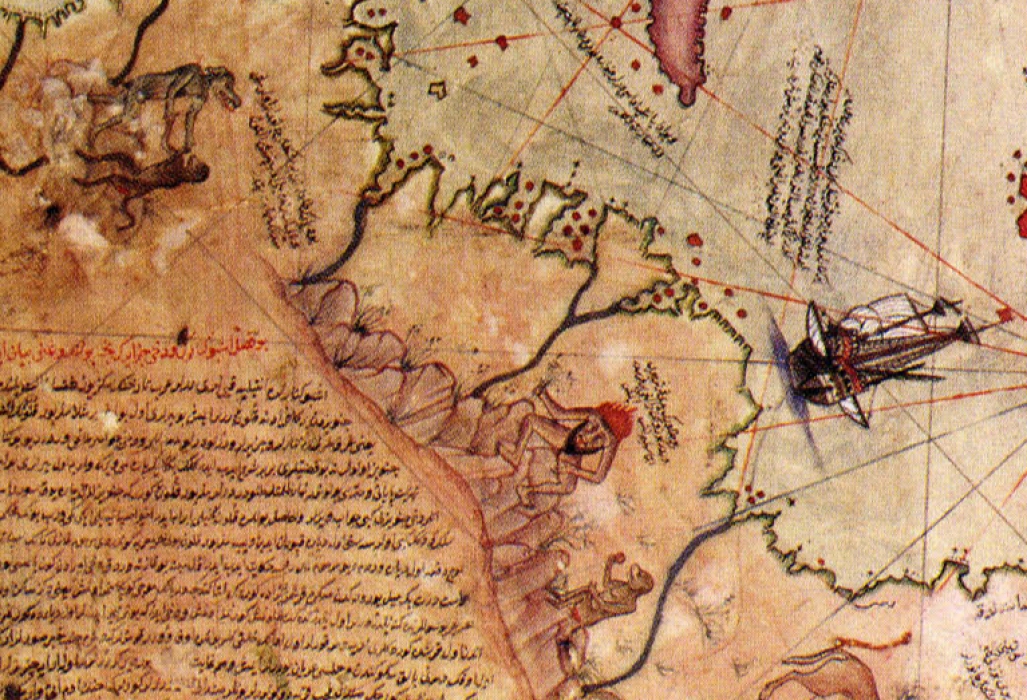
Cynocephali
While the Blemmyae had no heads at all, another purported race had the heads of dogs. The Cynocephali, or "dog-headed" people, first appeared in Ancient Greek writing. Fifth-century BCE physician Ctesias of Cnidus wrote that a tribe of dog-headed men lived in the mountains of India.
They wore animal skins and communicated with each other by barking, though they could understand the local language. The local Indians called them Calystrii and said they sent annual offerings of fruits, flowers, and amber to the King of India. In exchange, he sent them bows, swords, and other weapons.
The Calystrii were 120,000 strong and undefeatable in war but lived very simple lives. Instead of beds, they slept on leaves or grass, bathed rarely, and lived off raw meat. The lifestyle evidently agreed with them, because they could live up to 200 years.
According to Pliny the Elder, however, the Cynocephali were livestock kept by the Menismini people, a nomadic Aethopian tribe. The Menismini lived off the milk of Cynocephali, which they kept in vast herds of females, culling most of the males.
Man or beast?
Medieval depictions lean much closer to the earlier interpretation. The Liber Monstrum, a book of monsters found in the same manuscript as Beowulf, places the Cynocephali in India. They didn't speak, only bark, and lived off of raw flesh like animals do.
But other writers considered them more human-like than bestial. Odoric of Pordeno, a 13th-century Franciscan monk and world traveler, claimed to have encountered the Cynocephali on the island of Nicoveran. Now known to be one of the Nicobar Islands of the Indian Ocean, Odoric claimed it was home to a sophisticated dog-man society. The Nicoverans had organized religion -- they worshipped an ox, and wore ox-shaped gold and silver emblems on their foreheads -- and had a king who ruled well and justly, so that it was safe to travel his kingdom.
Marco Polo had quite a different impression of his dog-head-inhabited island. On the Angamanain Island (Adaman Islands) in the Bay of Biscay, he described a people with no king, who had heads like dogs. While the island was rich in spices, the people were beast-like and ate outsiders. Cannibalism is frequently mentioned in connection with dog-human hybrids.
Early modern explorers didn't seem to encounter any Cynocephali in the New World, but they were pretty sure they were there. Christopher Columbus claimed that natives had told him about a group of cannibals who had the faces of dogs. The Piri Reis map, following Columbus' claims, affixes a trio of dog men to the coast of South America.
Sciapods
One of the more absurd Monstrous Peoples was the Sciapods. Ctesias of Cnidus placed them in India alongside the Blemmyae and Cynocephali. Instead of a pair of legs, the Sciapods had one large leg and foot. This giant foot was quite useful, allowing them to hop along faster than any two-legged creature. It could also be a sunshade or umbrella, and they would sleep with their foot held up over themselves to keep out rain or sun.
This habit gave them their name Sciapod, meaning "shade-foot." They were also called Monopod, or "one-foot." These rather whimsical people were well known in the ancient world, even appearing in Aristophanes' celebrated comedy play, The Birds, which debuted in 414 BCE. Pliny the Elder includes them in his Natural History, an exhaustive 39-volume encyclopedia.
Sciapods continued to be popular in the Middle Ages. In the Liber Monstrum, they are again described as moving very quickly and using their feet for shade. The book goes on to explain that their knees harden into an inflexible joint, making one wonder how they are jumping at all.
They appeared frequently as decorative motifs, as marginalia in illuminated manuscripts, on the borders of maps, and even carved into the walls of cathedrals.
But they stretched the boundaries of belief, even in a time when those boundaries were extremely flexible. Fourteenth-century writer Giovanni de Marignolli, who traveled to India and China, argued that occasional one-footed men may exist but that they were not an entire race. Instead, he says, earlier writers were seeing chatra, an umbrella-like device carried as part of royal regalia in India.
The point of monsters
You probably noticed that around the 16th century, something curious happened: The monstrous peoples moved continents. When an area became familiar, as trade routes opened and maps were filled in, the monsters moved to a new borderland. When early modern explorers reached the New World, they used the familiar images and stories of monstrous foreigners to understand their interactions with Indigenous people.
Famous Christian theologian Augustine of Hippo wrestled with the question of whether monstrous peoples like the Cynocephali and Sciapods were human or animal. He decides that no matter their appearance, if they are rational, then they are human, possess souls, and are descended from Adam.
But early modern explorers weren't so convinced. The notes on the borders of the Piri Reis map claimed the inhabitants of the New World, depicted as Blemmyae and Cynocephali, were like animals, not like people.
Depicting foreign people as monsters allowed Classical and later Medieval people to reassure themselves of their own superiority. They imagined themselves in contrast to "monstrous, uncivilized races" in Africa, India, and China. Establishing this contrast was even more important for explorers in the New World. If the people there weren't people at all but monsters, then it was all right to kill, enslave, and exploit them.
Eventually, the idea that foreign people were physically, literally monsters faded from the popular imagination. The fear and prejudice behind that idea, however, still haunts us today.
Millions of years ago, the Antarctic continent was a lush jungle. Millions of years from now, it may be jungle again.
But for all of human history, Antarctica has been ice-covered and desolate. Explorers struggled to survive, and researchers struggled to retrieve the few accessible geological samples, hoping to glimpse what lay under the ice.
Now, a new model allows us to peel back the frozen white layers and see the land beneath.

Bedmap3
Called Bedmap3, the model is the most detailed and accurate map of the Antarctic continent ever completed. An International scientific team led by the British Antarctic Survey (BAS) used over 60 years of information gathered by plane, ship, satellite, and even dogsled. In total, they integrated 82 million data points, double the amount used in Bedmap2, the previous generation. To look beneath the 27 million cubic kilometers of ice, researchers used radar, sound waves, and gravity measurements.
This leap forward is thanks to recent surveys in under-explored regions of East Antarctica, including the South Polar area.
The map shows the location and size of the massive ice sheets based on 277 ice surveys over the past 60 years. The BAS team, led by glaciologist Hanish Pritchard, estimates a mean ice thickness of 1,948m. The area covered by ice is 13.63 million square kilometers, almost twice the size of Australia.

A vulnerable Antarctica
The real importance of Bedmap3 is that it will improve predictions of ice loss and sea level rise. Pritchard says the map will help researchers "investigate how the ice will flow across the continent as temperatures rise."
Already, the secrets of the continent's rocky underpinning have provided a worrying hint at Antarctica's future. Much of the ice rests on bedrock below sea level. This ice can melt quickly thanks to incursions of warm ocean water. Thanks to this latest research, if it melts, we know it would raise sea levels by 58m.
Bedmap3 is a fascinating glimpse into a hidden world. But it's also a grave reminder of how that buried land is quickly rising to the surface.
It's the worst nightmare for researchers at an isolated Antarctic station: What do you do when someone wigs out and you can neither escape nor evacuate the cause of the problem?
The South African government is “considering options” after an unnamed researcher sent a distress message last month from South Africa's Sanae IV research base in Antarctica. In the email, the individual pleaded for "immediate action," fearing for their own safety and that of the rest of the 10-person overwintering team.
The anonymous researcher accused a colleague, whose name is also not public, of physical and sexual assault as well as threats of murder against a third researcher. South African officials have now denied that the sexual assault took place but have confirmed the physical assault and threats.
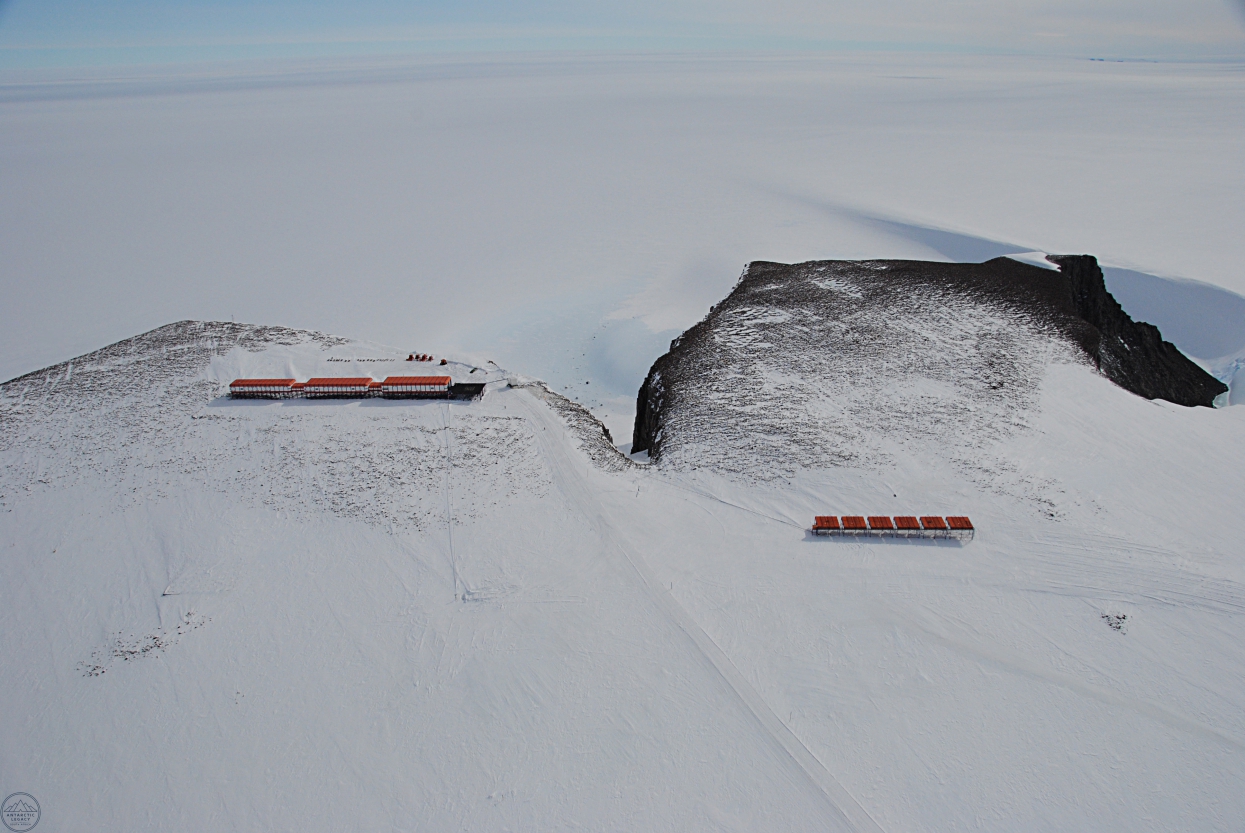
Physically isolated
Like every Antarctic station, the Sanae IV research base stands completely on its own in a sea of white. Completed in 1997, the base is 160km inland from the edge of the Fimbul Ice Shelf. This late in the season, no ship can pick them up. The closest neighbors are in Norway's Troll research station, 190km further inland.
March marks the end of summer in Antarctica. With each passing day, the sea ice grows, making ocean travel more difficult. Daylight is fast disappearing, and the darkness and cold make an emergency flight risky and difficult.
The 10-person team is not due to be picked up until December when summer returns and a ship makes the 10- to 15-day journey from Cape Town.
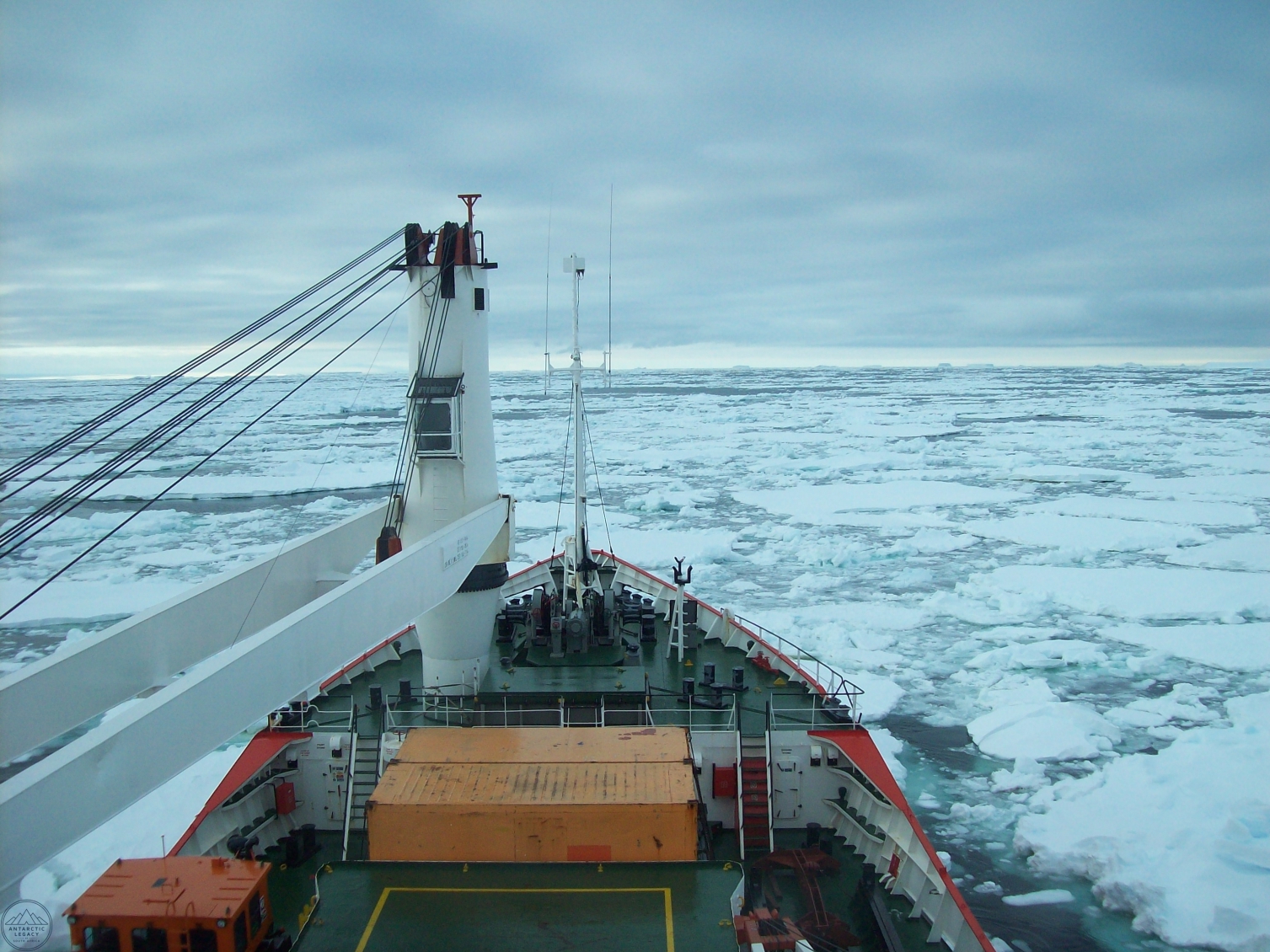
Under control
South African officials insist that the situation is under control. Work at the base falls under South Africa's Department of Forestry, Fisheries, and the Environment. According to its statement, it learned about the assault on February 27. Since then, a full investigation has been underway, with trained mediators in constant contact with the isolated researchers.
“The person who assaulted the team leader is remorseful and has been psychologically re-evaluated willingly," says Dion George, South Africa’s environment minister. He explained that a dispute over completing an assigned task led to the assault.
Aggressive and difficult behavior from the accused individual, the original email alleged, had been escalating for months" to a point that is deeply disturbing." The writer was now "constantly wondering if I might become the next victim."
Before being sent to live out an Antarctic winter, all potential members must undergo psychological evaluation. But officials admitted that it is not uncommon for individuals to have difficulty adjusting to conditions at remote research stations, even when their evaluations were not concerning.
Coping with isolation can be extremely difficult. In 2017, another South African Antarctic station on Marion Island was the scene of a violent outburst. One teammate allegedly attacked another's laptop after a dispute involving romantic jealousy. And in 1959, one man at a Soviet Antarctic station murdered his opponent with an axe after losing a game of chess. The government subsequently banned the beloved pastime at all its research stations.
During the late 19th and early 20th centuries, denizens of the Old West reported seeing a strange and mysterious beast: the camel. These sightings were not the fevered hallucinations of cowboys experiencing heatstroke, dehydration, whiskey, or tuberculosis. There really was a population of feral camels wandering the Sonoran Desert.
How did a bunch of camels end up loose in the desert? The U.S. Army, of course.

A quartermaster dreams of camels
The two visionaries met during the Mexican-American War. Henry Constantine Wayne was a Georgia native in his early thirties, a former West Point instructor decorated for his bravery in the battles of Contreras and Churubusco. The Pennsylvanian George Crosman was older, almost fifty, and saw little active combat. He was a logistics man with camel-related ambitions.
In 1836, Crosman had presented a proposal to the higher-ups in the War Department, advocating a U.S. Army Camel Core. They were unreceptive. A decade later, however, Henry Wayne was listening. Wayne wrote his own report for the War Department, and this time it ended up on the desk of a fellow West Point alumnus: Mississippi Senator Jefferson Davis. He was interested.
The U.S. Army Camel Corps
At the time, the issue of slavery dominated American cultural and political debate. Specifically, the expansion of slavery. As the U.S. carved more and more territory from Mexico and various Indigenous nations, they would have to decide whether brand-new states would hold slaves or not.
With every new territory came a race to move as many slave-holding settlers (and their slaves) into the area. If they could get a significant enough voting block together, then the territory could be a slave state once it attained statehood.
Davis, a Southern plantation owner and, jumping ahead here, future President of the Confederacy, was extremely pro-expanding slavery. The corresponding drive to Manifest Destiny convinced him there was an urgent need to forge paths through the desert. And he thought camels would help him do it.
After half a decade, Congress finally agreed to let him try out the camels. Congress gave Davis, now Secretary of War, $30,000 for camels. Major Henry C. Davis appointed Wayne as head of the project immediately.
The Cape Verde camel camp
Wayne sent the USS Supply, commanded by David Dixon Porter, to buy as many camels as he could fit in the ship. Porter's father was a diplomat who had taken his son along on trips to the Middle East, so was qualified for the position in that he had seen camels before. He fitted the ship with custom-made harness and ventilation systems and loaded up 33 camels and five Arab and Turkish drivers.
The modifications to the Supply did their job, and the ship duly landed in Texas was 34 camels aboard. One had died, but two calves had been born. The trip had gone so well and so cheaply -- they still had $22,000 left -- that Wayne sent Palmer right back to Egypt for a second load. Six months later, in early 1857, Palmer delivered another 41 camels to Texas.
Wayne took the camels, the hired drivers, and a (likely somewhat confused) herd of army soldiers and marched them over 190km to San Antonio. He then moved them another 90km to Camp Verde, where he established a more permanent camel facility.
Experiments with camels
It wasn't entirely off-base to think camels might do well in the American Southwest. Camels are sturdy, heat and drought-resistant, and incredibly tough. In fact, a now-extinct camel ancestor, the Camelops, lived all across the region during the Pleistocene era. The species had been discovered and named only three years before Wayne began experimenting at Cape Verde.

On the trail, the experiment seemed to pay off. The camels could go without water for over a week and were content living off scrub grass. The heat didn't bother them, and they faced the hardships of the trail with placid indifference.
There were some hiccups. Soldiers were used to constantly whipping their mules and horses, but camels don't put up with mistreatment. The men were unpleasantly surprised when their desert steeds responded with terrible violence and jets of cud. The smell of camels was also a frequent complaint. But their performance was undeniable.
In one test, comparing a team of six camels with a similar team of mules, the camel team was able to transport twice the amount of goods in half the time. Wayne was thrilled, writing that the results of the camel trials were "as favorable as the most sanguine could have hoped."
A new administration began in March of 1857, and both Davis and Wayne were out of their old jobs and off the camel division. But after investing so much money and time, the military wasn't ready to give up.
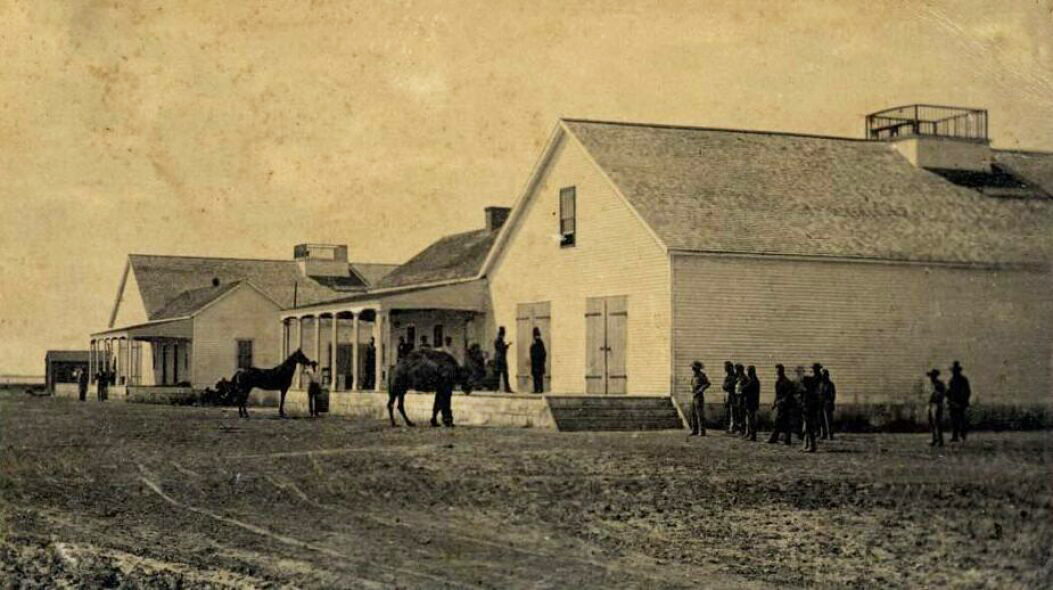
Beale's Wagon Road
As in any good Western film, the railroad was coming to town. Eventually. First, Congress needed someone to survey the route between Fort Defiance and the Colorado River. The man who won the contract was Edward Fitzgerald Beale, a wealthy frontiersman and former California Superintendent of Indian Affairs. His previous claim to fame was starting the Gold Rush by bringing the first Californian gold nuggets back East.
It was only once he had already signed the paperwork that the Secretary of War, Columbo-esque, said there was just...one more thing:
He was going to have to use camels. Despite Beale's repeated and strongly worded protests, he was given 25 camels. They set out in June of 1857, surely an ideal time of year to cross vast deserts.
At first, the camels lagged behind. The lead camel driver was patient, though, slowly conditioning the animals to haul heavy loads. He was a Syrian-Greek Muslim convert named Hadji Ali, which the American soldiers bastardized as "Hi Jolly."
Under Hadji Ali, the camels found their footing, and Beale was soon grateful to have them. They began outpacing the horses and mules, even carrying 300 kg. After months of hauling heavy supplies, not only had no camels died, but they were as healthy as when they had left. Beale was a camel convert, saying that "there never was anything so patient or enduring and so little troublesome as this noble animal."
After the success of this venture, Beale took camels on another expedition, this one over a year long. Again, they performed terrifically. His report to Congress strongly urged further investment in the camel. They weren't interested.
Texas wants camels
While Beale was forging his wagon trail, Henry Wayne was still enthusiastic about camels. He published a letter in an 1858 edition of the National Intelligencer, extolling the virtues of camels as pack and work animals. In addition to being strong and hardy, he claimed, they were docile enough that enslaved people could handle and manage them.
His article was reprinted and read across the South, and private Southern plantation owners rushed to import camels of their own.
There was another benefit that importing camels brought to slave owners. The U.S. had banned the importing of slaves in 1808, but that didn't stop demand. Slave ships, however, were easy to spot. The characteristic large water tanks, excess food supplies and the stench of death and excrement gave away the game to patrolling British warships. But camels were the perfect cover, requiring food and water tanks and producing strong odors, and being brought from West Africa to the Southern United States.
Mere months after Wayne's article was published, the Thomas Watson docked in Galveston and publicly unloaded 89 camels. Federal officials suspected it was secretly a slave ship but didn't feel there was enough evidence to investigate further. Meanwhile, the camels were released into the town, causing havoc. Three years later, authorities caught the owner of the Thomas Watson, John A. Machado, smuggling slaves into the U.S.
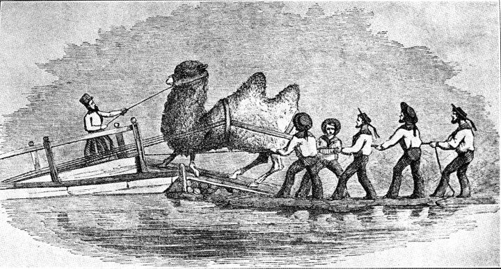
Brother against brother against camel
The mule lobby, worried that the sturdier, hardier camels would ruin them, pressured Congress to end the camel experiment. But the main reason Congress wasn't interested in Beale's camel report was that they were very busy at the moment. Half of the country was seceding. The outbreak of the Civil War ended the American camel experiment. Those camels already in the country were caught between the two sides.
Many privately owned camels were set loose in the desert as mining and farming operations ground to a halt.
Cape Verde was captured by Confederate forces in 1861. The Confederates put some of them to work transporting supplies but treated the animals poorly, and many died. One was even pushed off a cliff by its new owners. A standout, "Old Douglas," became the mascot of the 43rd Mississippi and was killed by a Union sharpshooter at Vicksburg.
The Fort Tejon herd remained in Union hands and fared better. They were kept in good condition, transferred from station to station, as officials tried to think of something to do with them. After three years, Secretary of War Edwin Stanton ordered them sold off. When the war ended, those who had survived their time with the Confederacy were also sold, for only $31 per animal.
Old friends and camel fans Henry Wayne and George Crosman ended up fighting on opposite sides. Confederate inspector-general Wayne's most relevant action was failing to stop Union forces from crossing the Oconee River in his home state of Georgia. Crosman, then in his late sixties, was recognized for his dedicated service as the Chief Quartermaster for Pennsylvania.
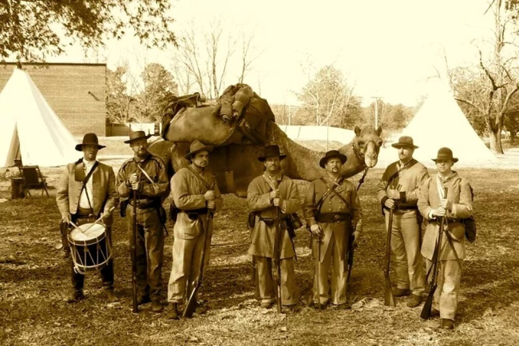
Circuses and creosote
After the war, the old camels were scattered across the frontier. Many ended up in circuses and zoos, while others were put to hard labor in mines. Edward Beale, still fond of the animals, bought some for his ranch. Bored Western townspeople started holding camel races with rounded-up animals.
Eventually, most of them were turned loose to fend for themselves. Camels are pretty good at that, and they can easily live into their fifties. They formed small herds, interbreeding and happily eating the creosote bush that few other animals would touch. Their ancestors, the Camelops, had once fed on the same plant.
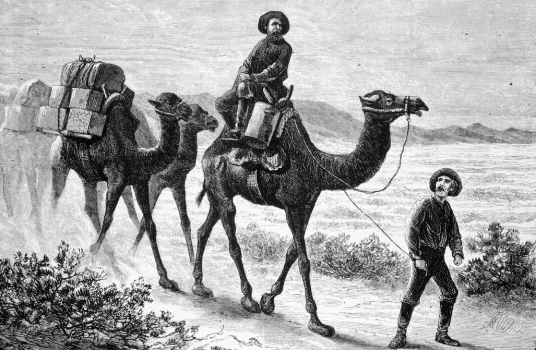
The legend of Hi Jolly
Hadji Ali kept two of the old army animals, Maya and Toulli, who helped pull his wagons. He had turned to prospecting, but he still did a fair bit of camel wrangling when required. With so many camels roaming around, it was sometimes required. In 1873, Ali led over seventy camels through the streets of Tucson, Arizona to a mining operation in Colorado.
He settled in Tucson for a time, marrying and having two daughters. But he still dreamed of digging up gold and left for the remote settlement of Quartzsite, Arizona. There, locals reported he would be called in to deal with feral camels from time to time. He mostly failed at prospecting but became a beloved local character, living off charity.
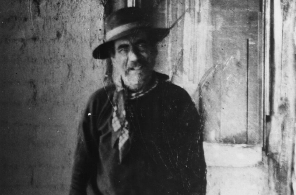
An early Arizona congressman, Mark Smith, tried to help Ali, appealing to the government for a pension. After all, Ali had served in the U.S. Army across various projects for almost thirty years. But he wasn't officially on the books, and they said no.
In late 1902, he died destitute. But the small town of Quartzsite didn't forget him. Over thirty years later, the Arizona State Highway Department erected a monument over his plain wooden grave marker. The stone pyramid, topped with a camel-shaped weathervane, is still there today.
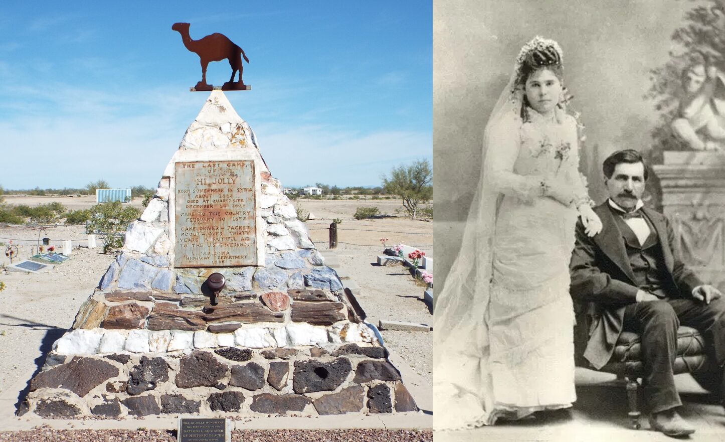
Strange sightings
During the late 19th and early 20th centuries, encounters with camels trickled in, mostly from prospectors and cowboy-types. Here are only a few of the many stories, most of which are vague and impossible to verify.
1875, an old army camel wandered into Bandera, Texas and was captured by a fellow Camel Corps veteran.
The future General Douglas MacArthur remembered seeing one as a small child in 1885, "one of the old army camels," wandering outside the garrison at Fort Seldon, New Mexico.
The International Boundary Commission, on an 1887 surveying project to establish the Mexico-U.S. border, saw a pair of camels. They were looking healthy, living about 60 kilometers from the border.
In 1907, a prospector reported seeing a pair of them in the wilds of Nevada.
The Red Ghost
The most famous and spectacular camel sighting was of the Red Ghost.
Sighting is probably too gentle a word. Encounter might be better. According to contemporary 1883 newspaper reports, the wild camel was out of control, knocking a woman over and trampling her to death.
Weeks later, a nearby group of miners had their camp destroyed by a large, red creature. After a third sighting, a well-respected local hunter named Cyrus (sometimes Si) Hamlin identified it as a camel. A camel which seemed to have something strapped to its back.
The same year, a group of hunters in the Verde Valley, less than 100 km away, saw it again. A large, red camel with something tied to it. They got closer and fired a few shots, which scared it away. But when it bolted, something fell off, coming to rest on the dry-baked earth.
It was a withered human head.
Years later, a cowboy saw it in an abandoned corral east of Phoenix. He, too, believed he saw a corpse tied to the camel.
The reign of the Red Ghost ended in 1893. A farmer named Mizoo Hastings caught the beast eating his turnips and promptly opened fire. When he examined the body, he found deep scars which looked to have been left by leather straps.
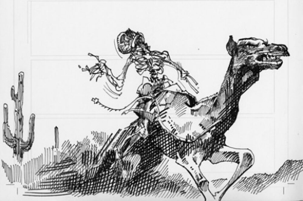
Who was the man tied to a camel?
Many theories and tales of the Red Ghost have been passed around since then. As a kid in Southern Arizona, I heard that the man was a prospector who got lost in the desert. He either owned or had caught a camel. Feeling himself grow weak from thirst, he strapped himself to the beast, hoping it would take him to water. Camels need to drink far less frequently than prospectors do, so the unfortunate fellow died before his camel grew thirsty.
Another theory is that it was an Army prank gone wrong. A soldier was jokingly tied to one of the captured camels by his laughing comrades. The camel bolted, though, running off into the desert.
More supernaturally-minded people might call the beast a vengeful ghost. The angry spirit of hundreds of camels brought far from their homes to toil and which then were abandoned.
Is there any truth to the Red Ghost? Sightings really were reported in newspapers. Camels really were out there in the desert. The Red Ghost occupies the place of all good folklore: It lives in the realm of plausibility.

Are they still out there?
As late as 1929, there were reports of a wild camel frightening a herd of horses in Banning, California. But the days of the wild American camel were ending.
In 1934, "Topsy" died in Los Angeles' Griffith Park Zoo. She had wandered alone from Arizona into Los Angeles, where she found a home until her death.
Sightings continued, of course, though they were less credible. Even today, over 150 years since the camels arrived, some believe there are wild populations alive out there. I have personally met people who swore to have seen a camel out in the desert.
My heart says yes. Experts say no. There wasn't a large enough breeding population to sustain wild American camels beyond two or three generations. There hasn't been a confirmed sighting in over a hundred years. The legacy of the feral American camel, however, remains.
The wagon road that camels helped build never became a railroad line. It did become Route 66, though.
Painting the Mountains documents the work of Matthew Tufts, a photographer and journalist, as he attempts to capture the mountaineering exploits of his companions.
In Patagonia, climbing is well-established. But the stark granite faces hold little snow, and skiing is more rare. The lines are dangerous -- and spectacular.
Matthew's goal was to follow high-level French skiers Aurel Lardy, Vivian Bruchez, and Jules Socie as they made new descents in the legendary Patagonian Andes.
Painters and Conquistadors
Matthew explains that Renaissance painters could spend six months just mixing the colors they used for a painting and another six months preparing the canvas. His photographic work in Argentine Patagonia was similar.
He first visited the town of El Chaltén years earlier, staying for three months to write an article. He self-funded the trip, determined to establish a connection with the place and the local people. Matthew was wary of coming in like a "modern-day conquistador," exploiting the land for his own gain.
Throughout the expedition, Matthew considers how he might give back to the community and the people who live at the foot of the famous mountains.
A new way to look at it
The skiers bring their own artistic vision to the slopes. The descents they attempt are extreme, dangerous. They see a path where others see only a cliff. Matthew describes one such line as "a thin ribbon painted across a wall of granite."
Through Matthew's camera, the skiers boldly carve their way through the mountains, across never-before-attempted slopes. Local legend Max Odell, who has been skiing El Chaltén for many years, says that the new perspective of the Frenchmen gives him his own new perspective. They see lines where he hadn't dared to imagine skiing, and it inspires him to get back out there.
Max Odell is known as the Godfather of Skiing in El Chaltén. Matthew is proud that they are inspiring him to return to his passion.
The second descent
The climax of their expedition is making the second-ever descent of the Whillans-Cochrane Ramp on Aguja Poincenot. The late extreme skier Andreas Fransson made the first descent in 2012. Descending the steep, exposed line is both dangerous and difficult.
After a hard climb, however, they turn and ski down the ramp, emerging unharmed at the bottom. Matthew, looking on, sees them as artists. They are, he says, "painting the mountain."
Recent discoveries have shown that brightly colored crests and eye-catching patterns adorned many dinosaurs. Meanwhile, our earliest mammalian ancestors survived these flamboyant predators by being as drab as possible.
The first prehistoric mammals were small, rodent-like creatures designed to hide from their bigger, more spectacular neighbors. A new study found that their coloration reflected this lifestyle.

How do you identify 100-million-year-old colors?
Melanin largely determines skin and fur colors. The more of this substance, the darker the skin, hair, or eyes of an individual. Melanin is stored in melanosomes -- specialized structures within pigment cells.
In addition to the amount of melanin, the shape of melanosomes determines the cell's color. Shorter, more oval-shaped melanosomes give a red tint, while longer ones of varying shapes produce black or shades of blue-green-yellow. This works in modern animals the same way it did for dinosaur-era ones.
By studying fossilized melanosomes, scientists can reconstruct the likely colors they produced. It's a technique developed using living animals, by comparing their actual color against the shape of the melanosomes. Researchers used melanosomes to predict feather pigment and found the technique was 82% accurate.
This is how we know that the Microraptor, a small dinosaur, had glossy, raven-black feathers or that Sinosauropteryx sported reddish-striped tails. However, no researcher has tried the technique on prehistoric mammals. Until now.
New database needed
Existing databases of melanosome color came from research on birds. To understand mammalian color, researchers at the University of Ghent needed a new database. They used samples from 116 species, including monkeys, echidnas, cats, and sun bears. For the cat hairs, they used a sample from lead researcher Matthew Shawkey's own pet, Masha.
Once they had a database of living mammals, they compared it with six extinct mammals. These ancient fossils all came from northeastern China but were millions of years apart and not closely related species.
The star of the show was a previously undescribed species of Euharamiyida. This was a family of early mammals that lived in trees and resembled the modern-day flying squirrel. This single fossil from the Hebei province of China was 158 million years old.
Thanks to melanosome analysis, researchers discovered that the animal had dark grey-brown fur all over. Because of this, they named it Arboroharamiya fuscus. In Latin, fuscus translates as "dusty," or "dark-colored."
A. Fuscus was small, weighing only 156 grams, about as much as a peach. It also likely had membranes between its arms and legs for gliding from branch to branch.
A. Fuscus' color matched the other five species tested. They all had the same dark, grey-brown fur. They also probably lacked stripes or other markings.

Nocturnal lifestyle
These findings back up what researchers have long believed about early mammals: they were mostly nocturnal. During the day, they hid from the giant toothy dinosaurs, which would eat them if they were given the chance. At night, they crept from their holes to find food.
Our ancient rodent-like ancestors were a practical bunch. Their dark, bland coloring helped them blend into the nighttime environment.
Shawkey believes that fur color didn't diversify much until about 66 million years ago. After the fall of the dinosaurs, early mammals took over the surface, becoming bigger and gaining brighter and more colorful coats.