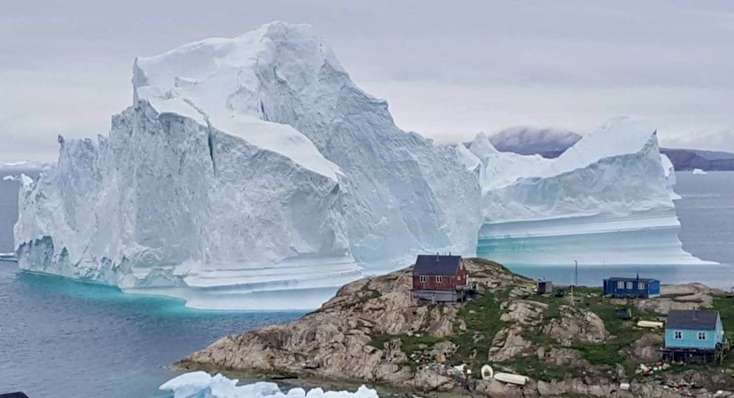
Earlier this month, a towering iceberg dangerously close to shore threatened Innaarsuit, a small fishing village in Northwest Greenland. The "skyscraper-sized" iceberg prompted authorities to evacuate some of Innaarsuit's residents to higher ground, according to SkyNews.
Located about 617km north of Nuuk, Greenland’s capital, and 46km north of Upernavik, Innaarsuit is a remote island community of just 169 people, accessible only by boat or helicopter. The village relies heavily on its harbor for fishing, but the iceberg’s proximity endangered homes, the Royal Greenland fish factory, and even the local grocery store. If it calved, or broke apart, the resulting tsunami could have easily swamped the houses on the rocky shore.
You can watch a recent video on it:
This wasn’t the first time Innaarsuit has faced such a crisis. In July 2018, a massive 11-million-ton iceberg, 200m wide and 100m tall, grounded near the village. Again, residents near the shore were evacuated, and the village’s power plant and fuel tanks were at risk. Fortunately, the iceberg drifted north after a few days, averting disaster.
Other incidents
Greenland has experienced several tsunami incidents in recent years. On June 17, 2017, a massive landslide in Karrat Fiord triggered a wave that struck Nuugaatsiaq (about 92km north-northwest of Innaarsuit), killing four people and injuring 11, washing several houses into the sea, and flinging boats 50m up the hillside. The landslide, likely caused by melting permafrost due to rising temperatures, highlighted the growing risks to coastal communities.
Another dramatic incident occurred in June 2018 near Ilulissat, known as Greenland’s Iceberg Capital, thanks to its UNESCO-listed Icefiord. A 6.4km-long iceberg calved and sent huge waves crashing toward the shore, again forcing residents to flee to higher ground.
A time-lapse video of the 2018 Innaarsuit iceberg:
Icebergs near Greenland’s shores often ground in shallow bays, where they can suddenly calve or flip. Warm weather accelerates melting, increasing calving risks, while ocean currents and winds can either push icebergs away or trap them closer to shore.
This month's iceberg in Innaarsuit raised similar concerns. However, in the end, it dislodged from the shallows and drifted away, sparing the shoreline structures.

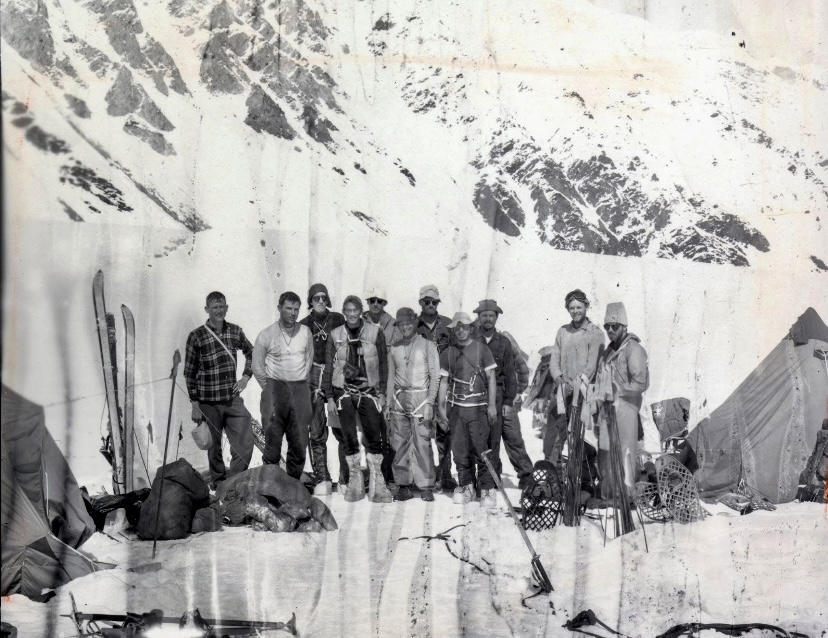
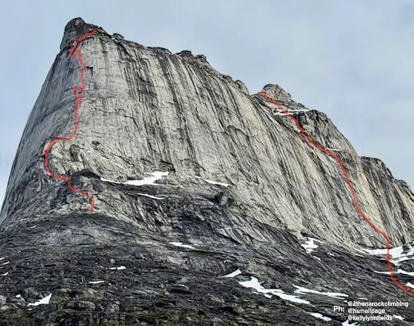
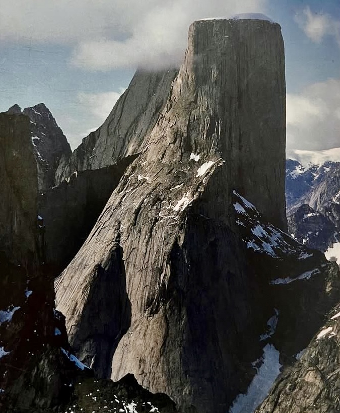
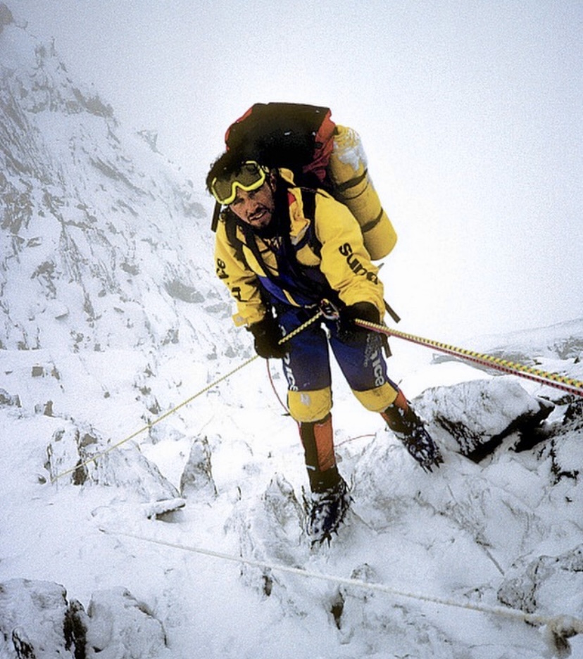
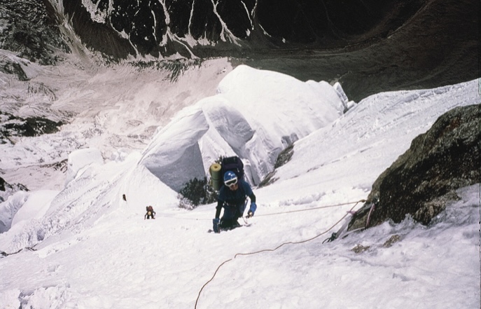
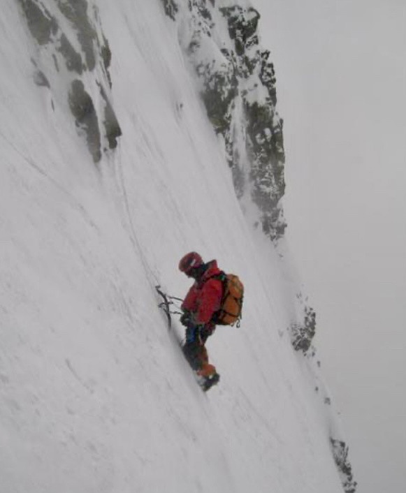
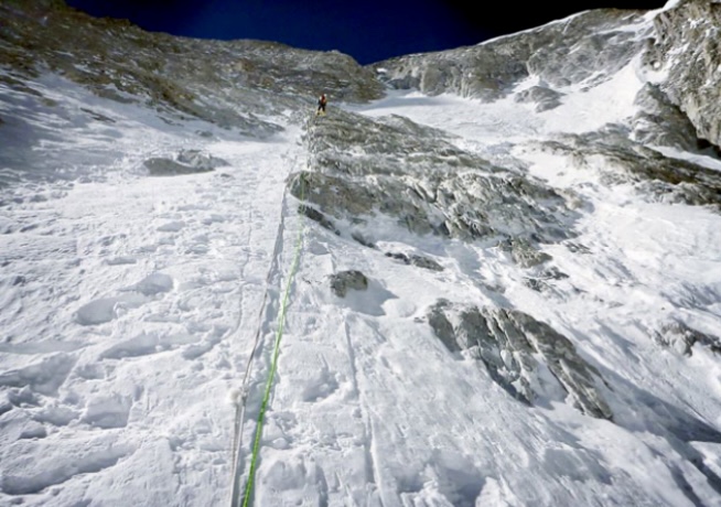
Shira M. Biner, Kelly Fields, and Heather B. Smallpage have done a new 550m big-wall route on Eglinton Tower’s buttress on Baffin Island, Canada. This marks the first route of its length and difficulty (5.11+ A0) by an all-female team on Baffin Island. The group included Natalie Afonina.

The daunting buttress rose approximately 893m above their Base Camp, with a challenging headwall that appeared nearly unclimbable from below. Over 12 long pitches and one cold bivouac, they summited of the first tower, only to discover a hidden 300m headwall leading to the true summit. Prioritizing safety and limited by food and energy, the team celebrated their milestone and made an 11-hour descent. The route included a tension traverse to avoid dangerous runout moves, but the climbers noted it could go free with one or two bolts.
Kelly Fields shared a personal reflection on her social media: “The summit was never my goal — surviving the ominous headwall was. I climbed with a respiratory infection and debilitating blisters, driven by a lifelong dream. Nothing and no one was going to stop me.”
She highlighted the team’s grit, climbing together for the first time and tackling an “insanely difficult and dangerous objective” in good style.
A long approach
The expedition included 250km of skiing on sea ice, paddling the Kogalu River, and trekking through Ayr Pass.
Eglinton Tower (933m) lies in remote Auyuittuq National Park's Weasel Valley, near other prominent Arctic peaks like Mount Thor and Mount Asgard. According to the American Alpine Journal, its first recorded ascent was in 1934, by British climbers John Hanham and Tom Longstaff. That ascent was part of early exploratory mountaineering in Baffin Island, focusing on peak bagging rather than technical big-wall routes. The climb marked the tower as one of the earliest summited peaks in the region. However, it’s not a frequently climbed peak, due to its remoteness.
Today, July 25, would be the 104th birthday of Lionel Terray. The celebrated French alpinist climbed routes from the Alps to the Himalaya to the Andes, and also wrote one of the all-time great mountaineering books, Conquistadors of the Useless.
Early years
Lionel Terray was born on July 25, 1921. Growing up in Grenoble near the French Alps, Terray discovered mountaineering and skiing as a child. A conversation with his mother, who dismissed climbing as a stupid sport involving scaling rocks with your hands and feet, sparked his curiosity.
By age 12, Terray was climbing peaks like the Aiguille du Belvedere and the Aiguille d’Argentiere with his cousin. By 13, the talented youngster was leading climbs. But Terray’s love for the mountains caused problems; he got kicked out of one boarding school and ran away from another to pursue ski racing. With little family support, he got by on his own. Skiing was Terray’s first love, and as a teen, he won prizes in competitions, which gave him some money.

In 1941, during World War II, Terray joined Jeunesse et Montagne, a military program that kept him in the mountains. There, he met lifelong friends and climbing partners Gaston Rebuffat and Louis Lachenal.
In 1942, Terray carried out the first ascent of the west side of Aiguille Purtscheller. He also climbed the difficult Col du Caiman. From 1943 to 1944, Terray served in a high-mountain military unit. In 1944, he joined the French resistance, using his mountain skills against the Nazis.
Terray knocked off other notable first ascents, such as the east-northeast spur of the Pain de Sucre and the north face of Aiguille des Pelerins with Maurice Herzog in 1944.
A rising star
After the war, Terray became a mountaineering instructor and settled in Chamonix as a freelance guide. With Lachenal, he did some of the Alps’ most difficult routes, including the Droites’ north spur in only eight hours in 1946, the Walker Spur of the Grandes Jorasses in 1946, the northeast face of Piz Badile, and the north face of the Eiger in 1947 (the second-ever ascent). Terray's speed and skill earned him a reputation as a climbing prodigy.

A rescue attempt on Mont Blanc
In late December 1956, Lionel Terray took part in a rescue attempt on Mont Blanc’s Grand Plateau. At about 4,000m, young climbers Jean Vincendon and Francois Henry were stranded after a failed attempt on the Gouter Route, a popular 1,800m climb to Mont Blanc’s summit.
On December 22, a blizzard caught Vincendon and Henry near the Vallot Hut at 4,362m. Freezing and frostbitten, they couldn’t descend. Terray, now a Chamonix guide, defied the Compagnie des Guides’ decision to postpone a rescue because of the extreme risks of strong winds and freezing temperatures.
Terray’s team battled brutal weather for two days but couldn’t reach the climbers. A military helicopter, attempting a parallel rescue, crashed near the Vallot Hut, stranding its crew. Terray’s group retreated, exhausted, as conditions worsened.
French Army instructors finally reached Vincendon and Henry in early January, but found them near death from exposure and frostbite. Evacuation was impossible, and both climbers died.
Terray’s rescue effort led to his expulsion from the guides’ organization, sparking controversy in Chamonix.

Eiger rescue
In the summer of 1957, Terray took part in a complicated rescue on the Eiger’s North Face in the Swiss Alps. Two Italian climbers, Claudio Corti and Stefano Longhi, were stranded after an avalanche hit their team during an attempt on the notorious Nordwand. The route, known for its steep ice, rockfall, and brutal weather, had already killed their partners, and Corti was injured.
Terray, then 35, joined a multinational rescue team at Kleine Scheidegg. The climbers were stuck near the Difficult Crack, at around 3,300m. Terray, with German climbers Wolfgang Stefan and Hans Ratay, ascended via ropes and pitons. They battled harsh winds and -20°C temperatures. After two days, they reached Corti, who was hypothermic but alive, clinging to a ledge. Longhi, lower down, was too weak to move. Terray secured Corti with ropes, and the team lowered him 600m to safety. Longhi, barely conscious, died during the descent when his rope jammed.
The effort, involving 50 people, was one of mountaineering’s greatest rescues.

Other historic climbs
Terray’s ambition took him beyond the Alps. In 1950, he joined Maurice Herzog’s expedition to 8,091m Annapurna I in the Himalaya, the first confirmed ascent of an 8,000m peak. Terray and Rebuffat's efforts, alongside one of the Sherpas, were crucial to helping the frostbitten Herzog and Lachenal descend safely. The climb brought global fame for the French team.
In 1952, Terray and Guido Magnone made the first ascent of Cerro Fitz Roy in Patagonia. That year, Terray also climbed 6,369m Huantsan in Peru with Cees Egeler and Tom De Booy.

In 1954, Terray summited 7,804m Chomo Lonzo with Jean Couzy, paving the way for their legendary 1955 first ascent of 8,485m Makalu. In 1962, Terray led the first ascent of 7,710m Jannu in Nepal, and in the summer of 1964, he led the first ascent of 3,731m Mount Huntington in Alaska.
In Peru, Terray made first ascents of peaks like 6,108m Chacraraju, considered the hardest peak in the Andes at the time, along with 5,350m Willka Wiqi, 5,428m Soray, and 5,830m Tawllirahu.
Conquistadors of the Useless
In 1961, Terray published Les Conquerants de l’inutile (Conquistadors of the Useless), a memoir that blends vivid accounts of his climbs with reflections on the purpose of mountaineering. The title captures his view that climbing, though seen as pointless by some, was a noble pursuit. The book, translated into several languages, remains a classic.

A tragic end
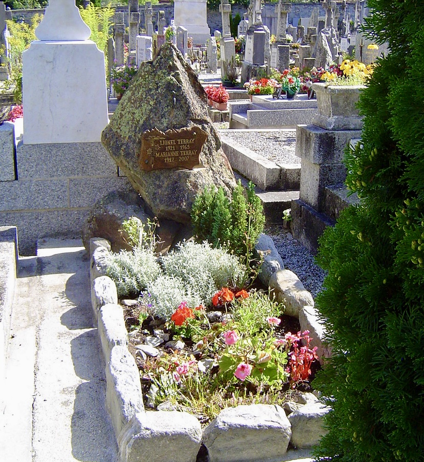
On September 19, 1965, Terray and his friend Marc Martinetti died in a climbing accident in the Vercors massif near Grenoble. Terray was just 44.
The pair was descending the Gerbier, a limestone cliff in the Vercors range, after completing a route. They were roped together when their rope -- likely weakened or damaged -- snapped. They fell more than 200m to the base of the cliff. Both climbers died on impact. Chamonix mourned deeply, and his funeral drew figures like Herzog, Rebuffat, and Leo LeBon.
"He was to many a great and dear friend, and all those who paid him tribute before he was laid to rest in the Chamonix Cemetery, among them hardened mountain climbers, wept like small children. To the French climbing world, especially the younger generation, his absence represents an irreplaceable loss, as he was the hero of their dreams, and could hold an audience breathless as no one ever has been able to," Lebon wrote in the American Alpine Journal.
Terray’s legacy lives on through his climbs, rescues, and writings. His son, Nicolas, is a mountain guide. Known for his red beanie and sunglasses, Terray appeared in films like Etoile du Midi, La Grande Descente, and Stars Above Mont Blanc.
You can watch Etoile du Midi below, with the option of automatic subtitles:
On July 19, two French climbers, a 25-year-old woman and a 56-year-old man, lost their lives on Mont Blanc in the Alps. The Peloton de Gendarmerie de Haute Montagne (PGHM) of Chamonix recovered their bodies from the base of 4,052m Aiguille de Bionnassay.
According to Aostasera, the climbers likely fell from the ridge of the Aiguille de Bionnassay, a technical route to Mont Blanc requiring significant experience. The search began Friday evening after family members, concerned by their failure to return, alerted authorities. The PGHM located the bodies on Saturday. Authorities have opened an investigation to determine the exact cause of the accident.
A deadly couple of years
This incident follows other recent fatalities in the Mont Blanc massif. On June 10, two climbers, a man and a woman in their 40s, were found dead below the Aiguille du Tricot on the Bionnassay Glacier, also likely from a fall.
On September 10 last year, two Italians and two South Koreans died of exhaustion after harsh weather stranded them near the summit of Mont Blanc. The next day, a 61-year-old Danish hiker fell 30m to his death near Saint-Gervais-les-Bains. On August 22, 2024, two Spanish climbers died in a rappelling accident on Mont Blanc du Tacul’s Gervasutti Couloir, and a 67-year-old climber fell into a crevasse on the Dome du Gouter.
Additionally, on July 13, 2025, a fatal accident occurred on the nearby 4,357m Dent Blanche in Switzerland’s Canton Valais, close to the Italian border. Two Austrian climbers, part of a group of five, fell on the mountain’s west face. A 46-year-old woman died, while her 46-year-old companion remains missing despite extensive search efforts complicated by adverse weather and rugged terrain, according to the Valais Cantonal Police.
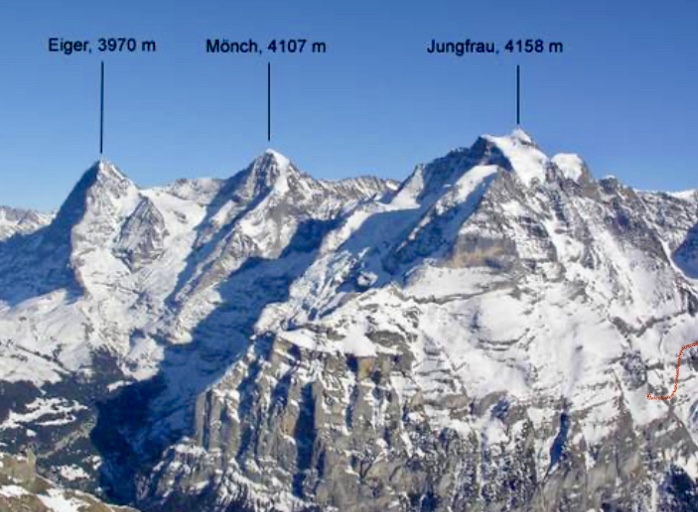
A mountaineering dispute continues to simmer after climber Stephan Siegrist questioned a new speed record set by Nicolas Hojac and Philipp Brugger. Brugger and Hojac had climbed the north faces of the Eiger, Mönch, and Jungfrau in Switzerland’s Bernese Oberland in April 2025.
The controversy then expanded, with some questioning Siegrist's 2004 record with Ueli Steck. The argument raises issues about transparency, ethics, and route choices. The dispute was explained earlier this month by Swiss climbing magazine Lacrux and German mountaineering magazine Bergsteigen.
The issue
In April 2025, Swiss climber Nicolas Hojac and Austrian Philipp Brugger set a speed record by climbing the north faces of Eiger, Mönch, and Jungfrau in 15 hours and 30 minutes. They surpassed the 2004 record set by Swiss climbers Ueli Steck and Stephan Siegrist by 9 hours and 30 minutes.

Hojac and Brugger praised Steck and Siegrist for their pioneering effort, but Siegrist argued their record wasn’t comparable. He alleged that Hojac and Brugger paused timing during breaks and chose a different route on the Jungfrau: the Lauper Route. According to Siegrist, the Lauper Route is not a "true" north face route, unlike the Ypsilon Couloir Route he took in 2004. He contacted their shared sponsor, who filmed the project, demanding an honest report and a correction to the press release.
Hojac and Brugger, stunned by the accusations, countered with transparency, providing GPS tracks, videos, and photos to prove they followed the classic routes Steck and Siegrist reported in 2004, including the Lauper Route on the Jungfrau. They had consulted Siegrist before their climb, relying on his documented route descriptions.

Controversy shifts
The controversy shifted dramatically when Hojac and Brugger discovered that Siegrist had retroactively changed details about his 2004 climb on his website this spring. Siegrist now claimed that he and Steck climbed Jungfrau’s Ypsilon Couloir (rated EX -- extremely difficult) instead of the Lauper Route. Previously, Siegrist had stated that they climbed the Lauper Route in his book, on his website, and in a pre-climb phone call with Hojac. The book, published years earlier, still lists the Lauper Route and cannot be altered, exposing Siegrist’s inconsistency.
Siegrist also recently admitted that he and Steck were aided by a 50m rope, lowered by two other climbers, to exit the Jungfrau. This detail remained hidden for 21 years.
This external assistance, deemed unethical in speed climbing, could disqualify their record because unaided ascents are standard for such feats. Hojac labeled this hidden information a "fraud."

Hojac argued Siegrist’s criticisms stemmed from jealousy. The sponsor urged a private resolution, but the public dispute revealed Siegrist’s alterations and reinforced Hojac and Brugger’s credibility.
The three North Face routes
The Bernese North Face Trilogy involves climbing the north faces of three iconic peaks: 3,967m Eiger, 4,107m Mönch, and 4,158m Jungfrau. Each presents unique challenges.

The Heckmair Route on Eiger’s North Face is a 1,800m climb on mixed terrain. It was first ascended from July 21-24, 1938, by Anderl Heckmair, Ludwig Vörg, Heinrich Harrer, and Fritz Kasparek. It is graded ED2 (extremely difficult two) in the alpine grading system, UIAA V-, and features ice climbing sections up to 70°. This route has challenging sections like the Hinterstoisser Traverse, Ice Hose, and Death Bivouac. Both duos, Siegrist-Steck and Hojac-Brugger, used this route.
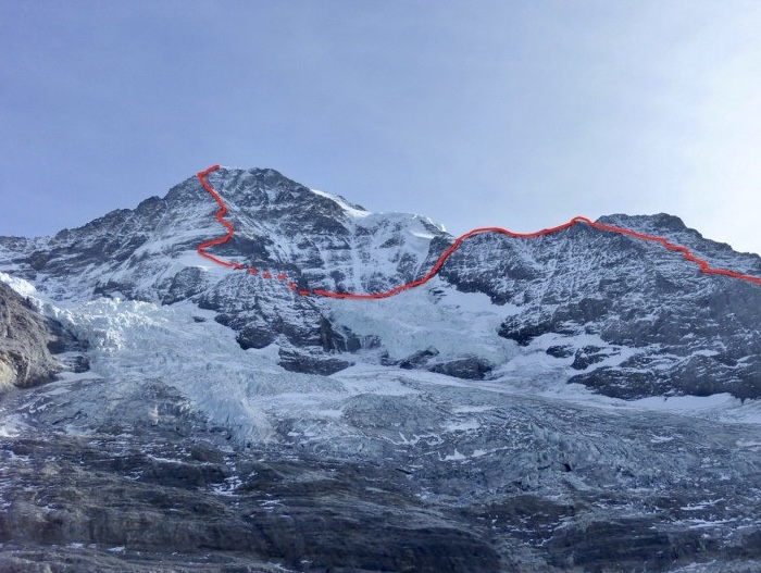
The Lauper Route on Mönch’s North Face involves steep snow and ice. Both teams followed this route, which was first ascended on July 23, 1921, by Hans Lauper and Max Liniger. This line, also known as the North Face Rib or Nordwandrippe, is a challenging mixed climb graded TD (very difficult) that follows a prominent rib dividing Mönch’s North Face.
The recent dispute centers on the Jungfrau. Hojac and Brugger climbed the Lauper Route, documented by Steck and Siegrist in 2004. The Lauper Route was first ascended in 1934 by Hans Lauper and Alfred Zurcher. Although less difficult than the Eiger’s Heckmair Route, it involves steep terrain and a challenging exit. It’s graded around D (difficult) or higher, depending on conditions.
This spring, Siegrist claimed that he and Steck had taken the Ypsilon Couloir and not the Lauper Route. The Ypsilon Couloir was first ascended in 2001 by Siegrist and Ralph Weber, and its exit is rated EX (extremely difficult).

The Eiger, Mönch, and Jungfrau remain alpine benchmarks, but this controversy underscores the need for clear speed-climbing rules to ensure fair records. The trilogy dispute mirrors broader mountaineering debates, such as unscrutinized 8,000m peak records involving time, Sherpa support, or supplemental oxygen.
You can watch a documentary about Hojac and Brugger's climb called The Fast Line here. Subtitles in different languages are available.

Kim Chang-ho was a South Korean mountaineer who summited the 14x8,000'ers without supplemental oxygen in record time. He pioneered numerous new routes and first ascents on 6,000m and 7,000m peaks. Today, we revisit his most notable climbs.
Early years
Most sources list Kim's birthday as September 15, 1969, but mountaineering historian Bob A. Schelfhout Aubertijn confirmed that Kim was born on July 13, with confusion arising from the Korean age system.
In 1988, Kim began studying International Trade at the University of Seoul. Inspired by Alexander the Great's exploits, Kim started climbing with the university’s Alpine Club.
His frequent expeditions delayed his academic progress, and he didn’t earn his Business Administration degree until 2013. Kim viewed his humanities studies as a way to enrich his climbing. He believed that understanding culture and history deepened his connection to the mountains.
By the 1990s, he was already tackling rock-climbing routes up to 5.12. Early expeditions to the Karakoram, including attempts on 6,286m Great Trango in 1993, and 7,925m Gasherbrum IV in 1996, revealed his bold -- sometimes reckless -- ambition. On Gasherbrum IV, he reached 7,450m but faced a sheer rock face without protection, instructing his partner to release the rope if he fell.
Exploration of northern Pakistan
Between 2000 and 2004, Kim embarked on solo trips in northern Pakistan’s Karakoram, Hindu Kush, and Pamir ranges, prioritizing discovery over summits. As detailed in the 2023 American Alpine Journal, he surveyed glacial valleys, documented hundreds of unclimbed peaks, and built relationships with local farmers and herders. These solitary treks were driven by a desire to understand the geography, culture, and history of the regions.
Kim’s journals reveal a meticulous approach, with photographs and descriptions of potential routes forming a database that remains a valuable resource for climbers. His interactions with locals shaped his climbing decisions, ensuring cultural sensitivity in his choice of peaks. This period of exploration laid the groundwork for his later ascents, blending adventure with respect for the human and natural contexts of the mountains.

Photo: Kim Chang-ho
Four first ascents of 6,000m peaks
Kim’s explorations in Pakistan led to a series of remarkable solo first ascents in 2003, when he was 33. The American Alpine Journal documents four solo climbs of 6,000m peaks in the Hindu Raj and Karakoram ranges.
He carried out the first ascent of 6,105mm Haiz Kor in the Thui Range of the Hindu Raj, by a challenging route via the southeast face and south ridge through a complex icefall.
Kim also made first ascents of 6,225m Dehli Sang-i-Sar in the Little Pamir, 6,189m Atar Kor in the Hindu Raj, and 6,200m Bakma Brakk in the Masherbrums.

Dehli Sang-i Sar from the southwest, showing the general line of Kim Chang-ho's solo ascent along the upper east ridge in 2003. Photo: Kim Chang-ho
Mastering 7,000’ers
In 2008, he led the first ascent of 7,762m Batura II, though the expedition’s use of fixed ropes drew criticism, prompting him to refine his lightweight approach.
In 2012, Kim and An Chi-young made the first ascent of 7,092m Himjung in Nepal, climbing via its southwest face. The expedition earned them the Piolet d’Or Asia Award.
In 2016, Kim and two partners opened a new 3,800m alpine route on the south face of 7,455m Gangapurna in Nepal. Described by the 2017 Piolet d’Or committee as "bold and lightweight," it earned an Honorable Mention, marking a historic recognition for Korean climbers.
During the Gangapurna expedition, Kim and his partners also attempted the south face of unclimbed Gangapurna West, where they reached the summit ridge.
One year after Gangapurna, the tireless Kim led an expedition to Himachal Pradesh in India, aimed at fostering a younger generation of Korean climbers and developing their skills and experience. The team made the second ascent of 6,446m Dharamsura, and climbed 6,451m Papsura via a direct route on the south face.

Choi Seok-mun and Park Joung-yong, climbing partners of Kim Chang-ho, approach the summit of Gangapurna. Photo: Korean Way Project
Summiting 8,000'ers
Kim summited all 14 of the world’s 8,000m peaks without supplemental oxygen, in record time.
Starting in 2006 with the Busan Alpine Federation’s Dynamic Hope Expedition (led by Hong Bo-Sung), Kim and a small team relied on minimal support, avoiding Sherpas and oxygen. Kim studied geography and history to learn more about his routes.
Kim completed the 14x8,000'ers in 7 years, 10 months, and 6 days, setting a record for the fastest completion without oxygen at the time. He surpassed Jerzy Kukuczka's record by one month.
Kim didn't set out with the explicit goal of climbing the 8,000'ers so quickly. His pursuit was primarily driven by his passion for mountaineering and a desire to climb these peaks in a pure, lightweight style.
Kim ascended three 8,000m peaks twice: Nanga Parbat, Gasherbrum I, and Gasherbrum II.
Among his 8,000m climbs, his south-north traverse of Nanga Parbat in 2005 and his sea-to-summit ascent of Everest in 2013 deserve special mention.

The south face of Gangapurna, showing (in red) the Canadian Route (1981), and (yellow) the Korean Way (2016). Photo: Korean Way Project
Nanga Parbat, 2005
In 2005, Kim climbed Nanga Parbat’s massive Rupal Face. The Korean Nanga Parbat Rupal Expedition lasted 109 days. They arrived at Base Camp on April 20 after a heavy snowstorm. Over the next 12 days, the team set up Camp 1 at 5,280m and Camp 2 at 6,090m, following a line close to the 1970 Messner Route.
The weather was brutal, with snow falling daily in May, destroying seven tents and burying Camp 2 under fresh snow. Despite these setbacks, by June 14, after 43 days of effort, the team established Camp 3 at 6,850m. Near the end of June, the team prepared for a summit attempt, and on June 26, Kim and three other climbers started their push. However, at 7,550m on the Merkl Icefield, a rock hit team member Kim Mi-gon in the leg, forcing the group to abort.
Undeterred, Kim and climbing partner Lee Hyun-jo made another attempt on July 13, starting from Camp 4 at 7,125m. They faced constant danger, dodging falling rocks and ice. After a 24-hour climb, they reached the summit of Nanga Parbat.

Kim Chang-ho. Photo: Abbas Ali
A difficult descent
Kim and Lee chose to go down the Diamir Face via the Kinshofer Route, unroped, to save time. In the middle of the descent, they triggered a wind slab avalanche. Lee was buried, and Kim was swept 50m downhill, scraping his face and losing his headlamp. Both managed to free themselves and continued down, exhausted and hallucinating, believing another climber was ahead of them. They reached another expedition’s tents at 7,100m but decided against stopping, fearing they might not wake up if they rested. After an incredible 68 hours from Camp 4, they arrived at the Diamir Base Camp, impressing others with their speed and resilience. Lee appeared remarkably fresh despite the ordeal.
This expedition was a turning point for Kim. The climb was a tactical, siege-style effort, relying on fixed ropes and a larger team, very different from the lightweight, alpine-style climbs he later became known for. During the descent, Lee’s emotional radio call to a teammate at Base Camp, expressing regret that they weren’t together, deeply affected Kim.
Kim reflected on his selfishness, realizing that reaching the summit meant little without returning safely with his team. This experience shaped his philosophy moving forward, which would emphasize teamwork, respect for the mountains, and survival over personal glory.

Views of Everest from neighboring Lhotse. Photo: Kadyr Saydilkan
Everest, 2013: Starting from sea level
Kim’s 2013 Everest ascent was the final step in his quest to climb the 8,000m peaks without supplemental oxygen, making him the first Korean to do so. But his Everest climb was not just about reaching the top; it was a unique adventure.
Kim’s journey to Everest’s summit began far from the mountain itself. He wanted to make the climb special by starting at sea level and traveling to Base Camp without using motorized transport.
On March 20, 2013, he began his expedition from Sagar Island near Kolkata, India. From there, he kayaked 156km on the River Ganges, cycled 893km through northern India to Tumlingtar in Nepal, and then trekked 162km to Everest Base Camp. This sea-to-summit approach was rare and challenging, inspired by earlier climbers like Tim Macartney-Snape and Goran Kropp, but Kim added a twist by kayaking part of the way.
Once at Everest Base Camp, Kim prepared to climb the mountain via the standard Southeast Ridge route from the Nepal side without oxygen. He moved steadily up the mountain, navigating the Khumbu Icefall, the Western Cwm, and the steep slopes leading to the South Col. On May 20, Kim reached the summit.
Sadly, Kim’s climbing partner, Seo Sung-ho, died during the descent. This loss cast a shadow over the triumph, but Kim’s accomplishment remained a mountaineering landmark.

Kim Chang-ho and his team near the Sara Umga La at 5,020m, west of Dharamsura and Pasura peaks, in 2017. Photo: Korean Way Project
Mountaineering philosophy
Kim’s mountaineering philosophy viewed climbing as a means of learning and coexistence, not conquest. He avoided treating peaks as mere challenges, instead choosing routes with historical or cultural significance. After losing his partner Seo Sung-ho on Everest in 2013, Kim founded the Korean Himalayan Fund to support young climbers in creative ascents. His database, preserved by his wife Kim Youn-kyoung, includes detailed notes on geography and local names.
Kim’s death
Kim’s life ended on October 11, 2018, when an avalanche, possibly triggered by a serac collapse, destroyed his team’s Base Camp beneath 7,193m Gurja Himal, located south of Dhaulagiri VI, in Nepal. The Korean Way Project expedition, aiming for a new route on the south face, included five South Korean climbers and four Nepali guides, all of whom perished.
Kim’s journal, ending on October 10, suggests the tragedy struck overnight. By the time of his death, he was recognized as South Korea’s most accomplished climber. Kim was 49 years old.
His legacy endures through his database, the Korean Himalayan Fund, climbers like Oh Young-hoon who carry forward his vision, Kim’s daughter (Danah, born in 2016), his wife, and through the international mountaineering community, who preserve his memory.

Kim Chang-ho. Photo: En.namu.wiki
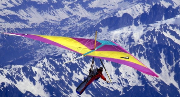
On July 11, 1985, Pierre Gevaux made the first paragliding descent from the summit of an 8,000m peak, soaring down from 8,034m Gasherbrum II. This groundbreaking feat opened a new chapter in mountaineering history.
Gevaux was part of a French expedition to Pakistan led by Claude Jaccoux. It included clients, three guides, and two high-altitude porters. They shared Base Camp with another French team led by well-known mountaineer and extreme adventurer Jean-Marc Boivin.
The expedition began in early July, with climbers establishing camps along the standard route. On July 11, Gevaux and the other team members topped out. The summit day featured clear weather, offering a rare window for his paragliding descent.
Paragliding technology was in its infancy, and Gevaux’s paraglider was likely a basic or parachute-like canopy. It required significant skill to control, especially in the thin air and unpredictable winds at such an extreme altitude.
According to Xavier Murillo, Gevaux's first two attempts to fly from the summit failed. Each time he had to climb back up, catch his breath, gather his thoughts, and tell himself that he would be able to do it. The third time was the charm.
The descent covered a vertical drop of several thousand meters to Camp 1 at 6,000m. He reached it in 5 minutes and 45 seconds. It had taken him five months of preparation, two months on the expedition, and four days of climbing.
Gevaux’s feat impressed other mountaineers who were on Gasherbrum II that day, including Jean-Marc Boivin.
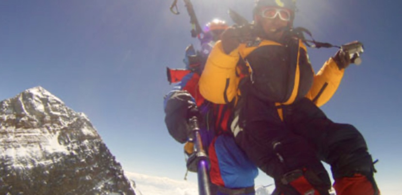
Boivin paraglides down Everest
Boivin was an adventurer known for his first ascents, ski descents, and pioneering hang gliding and paragliding. He was reportedly inspired by Gevaux’s paragliding descent from Gasherbrum II. On that expedition, Boivin broke a hang glider altitude record when he successfully launched from the summit. Previously, in 1979, Boivin had set a hang glider altitude record when he flew from nearly 8,000m after climbing K2.
Three years after Gevaux’s flight, on Sept. 26, 1988, Boivin achieved the first paragliding descent from just below the summit of Everest. The thin air at 8,848m made launching difficult, and gusty winds required precise timing to ensure a safe takeoff. Boivin’s success cemented his reputation as a pioneer of extreme sports, though he tragically died two years later while BASE jumping off Angel Falls in Venezuela.
You can read more about Everest’s paragliding and hang gliding history here.
Paragliding descents from other 8,000’ers
Gevaux’s 1985 flight and Boivin’s 1988 flight pointed the way for others.
In 1994, Australian Ken Hutt paraglided down from 7,200m on Cho Oyu.
In July 2019, Austrian climber Max Berger paraglided from the shoulder of 8,051m Broad Peak, landing in Base Camp 17 minutes later. Though not from the summit, this descent was a significant high-altitude feat.
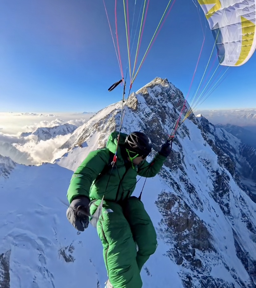
On July 19, 2022, French climber Benjamin Vedrines paraglided from Broad Peak’s summit ridge after a speed ascent without supplemental oxygen, landing at Base Camp in about an hour.
On July 28, 2024, French climbers Benjamin Vedrines, Jean-Yves Fredriksen, Zeb Roche, and Liv Sansoz paraglided from the summit of K2 despite a Pakistani paragliding ban. All four had summited without bottled oxygen.
Vedrines -- after claiming a climbing speed record of 10 hours, 59 minutes, and 59 seconds -- launched first, landing at Base Camp in 30 minutes. Fredriksen landed at 6,600m after struggling for 90 minutes to take off, and Roche and Sansoz achieved the first tandem paragliding descent from an 8,000m summit.
Most recently, on June 24 of this year, David Goettler paraglided from 7,700m after summiting Nanga Parbat via the Schell Route on the Rupal Face without bottled oxygen.
In the video below, you can watch Gevaux's pioneering paragliding descent from Gasherbrum II in 1985:
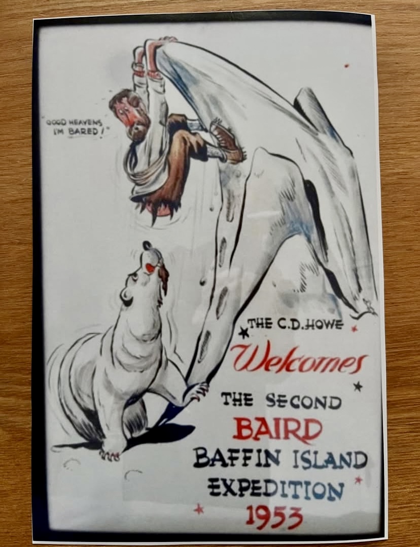
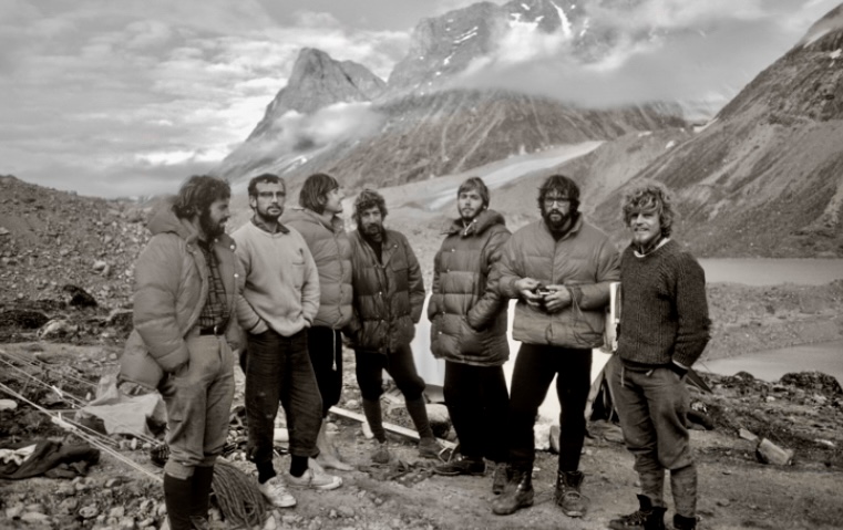
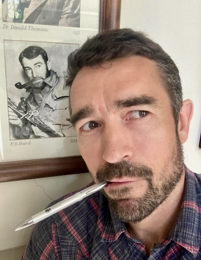
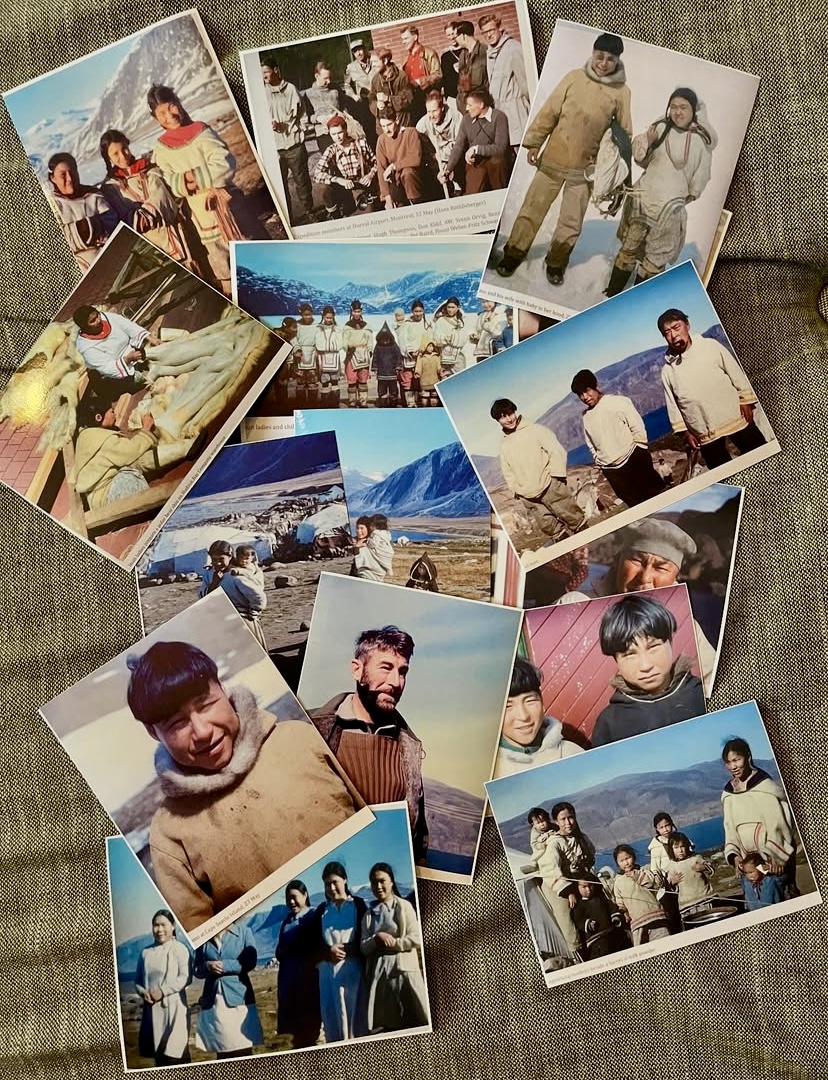
British adventurers Niall McCann and Finn McCann are on their way to climb Mount Asgard, the 2,015m twin-peaked granite tower in Auyuittuq National Park on Baffin Island. It's a family affair: They want to climb the peak that their grandfather, Patrick Douglas Baird, named but never summited.
The McCanns will arrive shortly in Pangnirtung, the gateway to that Canadian Arctic national park. Here, they will share 1953 photos with local residents to connect with those who may recall Patrick Douglas Baird. They will then haul 40kg loads to the base of the mountain and climb the tower over about three weeks.
In an Instagram post, Niall McCann recounted Patrick Douglas Baird’s 1953 expedition: “In the summer of 1953, my grandfather Pat Baird led a four-month expedition...for the Arctic Institute of North America. During this expedition, he first laid eyes on an extraordinary-looking mountain, which he named Asgard (subsequently changed to Mount Asgard), home of the gods.”
The jagged, fiord-indented east coast of Baffin Island features some of the highest cliffs in the world. The highest peak is Mount Odin (2,147m), followed by Mount Asgard (2,015m), Mount Qiajivik (1,963m), Angilaaq (1,951m), Kisimngiuqtuq (1,905m), Ukpik (1,809m), Bastille Peak (1,733m), Mount Thule (1,711m), Angna (1,710m), and Mount Thor (1,675m). There is also a whole other area further north with slightly lower but equally world-class cliffs in Sam Ford Fiord, where the walls rise directly from the ocean. In short, eastern Baffin offers amazing climbing.
The two towers
Mount Asgard lies inland on southeastern Baffin Island. Its granite north and south towers, separated by a saddle, soar 1,600m above the valley, making it a premier big-wall destination. Of the two towers, the north one is slightly taller than the south.
In 1934, Patrick Douglas Baird explored Greenland and northeastern Baffin Island. In 1938, he returned to Baffin, only to lose his companion when a storm blew him out to sea, to a watery grave.
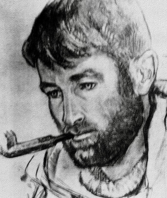
Although he never summited the peak, Patrick Baird was an important figure in the climbing history of Asgard. It began in 1953 during the Arctic Institute expedition, which he led. Four Swiss scientists -- Jurg Marmet, Hans Rothlisberger, Fritz Hans Schwarzenbach, and Hans Weber -- father of polar traveler Richard Weber -- made the first ascent. They reached the Asgard saddle from the east, then summited the north peak. Baird put up several first ascents during that four-month expedition, but he himself didn’t join the Asgard climb.

In 1963, Baird led another successful expedition to Mount Asgard. His 14-year-old daughter, Niall and Finn McCann’s mother, was a team member. Baird again did some notable first ascents in the area but did not climb Asgard.
A climbing party, led again by Baird, made the first ascent of the 2,000m South Tower in 1971. Doug Scott, Guy Lee, Rob Wood, and Phil Koch summited via the 1,000m south ridge. They then made an epic descent in a blizzard. In 1972, Scott returned to Baffin Island with Dennis Hennek, Paul Nunn, and Paul Braithwaite, this time without Baird, and established the Scott-Hennek Route on the East Pillar of Asgard.
More on Pat Baird
Patrick Douglas Baird was born in the UK in 1912 and became a key figure in latter-day Arctic exploration. He studied geography and geology at Cambridge University. Then in the 1930s, he joined the British Arctic Air Route Expedition to Greenland (1930–1931) and led the Cambridge East Greenland Expedition in 1934. He also directed a 1936–1937 expedition to Baffin Island, where he did mapping and studied glaciers.
During World War II, Baird served as an instructor at the Canadian Army’s winter warfare school, training soldiers for cold-weather combat. In 1947, he became Director of the Arctic Institute of North America, guiding research and serving on the institute’s Board of Governors.
Baird wrote many scholarly articles on Arctic geography and glaciology. He also authored The Polar World in 1964 and co-wrote Field Guide to Snow and Ice with W.H. Ward. Baird died in Ottawa in 1984, and his ashes were scattered on Baffin Island. You can read more about Pat Baird here.
The McCann brothers
Niall McCann, a biologist, National Geographic Explorer, and Fellow of the Royal Geographical Society, has extensive experience in big-wall climbing in the U.S. and Europe. He has also done ski-mountaineering in Greenland.
Finn McCann brings over 20 years of climbing experience across more than 30 overseas expeditions, including Himalayan ascents, technical Alpine mixed routes, and multi-day big walls. He also participated in the 2014 Greenland expedition with his brother.
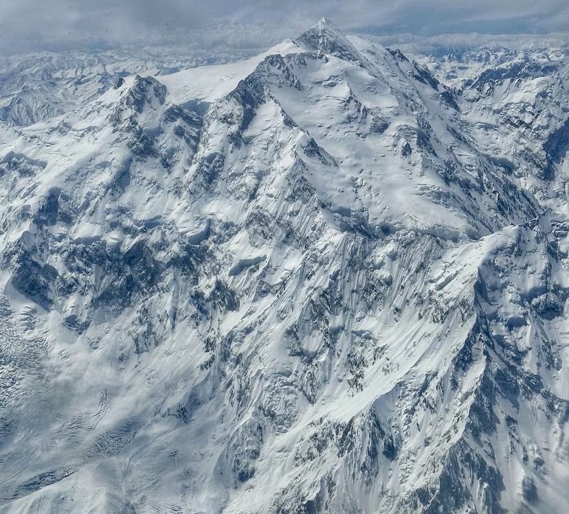
At 8,125m, Nanga Parbat in Pakistan’s Gilgit-Baltistan is the world's ninth-highest mountain, and it is dangerous. It earned its "Killer Mountain" nickname because of the high fatality rate during its early climbing history.
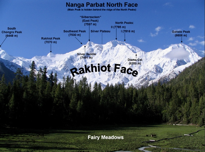
It has three main faces: the south-facing Rupal Face, the northeast-facing Rakhiot Face, and the northwest-facing Diamir Face. The Rakhiot Face is less frequently climbed than either the Diamir or Rupal Faces.
Only three teams have successfully ascended the Rakhiot Face, but more than 30 climbers have died.
The first fatalities
In 1895, Albert Mummery, Ragobir Thapa, and Goman Singh died while scouting the Rakhiot Face. They’re presumed to have died in an avalanche or fall, as their bodies were never found.
German expeditions
The Rakhiot Face became a focal point in the 1930s, particularly for German climbers, as Nanga Parbat was one of the few 8,000’ers accessible to non-British expeditions because of restrictions on Everest and the remoteness of K2.
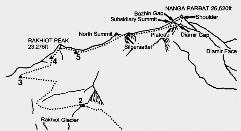
The face, characterized by the Rakhiot Glacier, Rakhiot Peak (7,070m), the Silver Saddle (7,400m), and a long ridge to the summit, presented a viable but hazardous route due to its length and exposure to avalanches and storms. The expeditions of this era targeted what would later be known as the Buhl Route, which contributed both to the mountain’s allure and its deadly reputation.
1932: Willy Merkl’s German-American expedition
The first significant attempt on the Rakhiot Face was in 1932, led by German climber Willy Merkl. The expedition, sometimes called German-American because of the inclusion of American climbers Rand Herron and Fritz Wiessner (Wiessner was German-born but became a U.S. citizen), aimed to establish a route via the Rakhiot Glacier and Rakhiot Peak.
Merkl’s party took a route to the left of the Northeast Ridge, which involved steep ice and rock. But they lacked Himalayan experience, and poor planning hampered their progress. They did not have enough porters, and bad weather added to their problems.
Peter Aschenbrenner and Herbert Kunigk reached 7,070m Rakhiot Peak but could not progress further. However, the expedition confirmed the feasibility of a route via Rakhiot Peak and the main ridge.

1934: Merkl’s second attempt
Merkl returned in 1934 with a better-prepared expedition, funded by the Nazi government. They targeted the same Rakhiot Face route as in 1932, with a minor variation.
Early in the expedition, climber Alfred Drexel died, likely from high-altitude pulmonary edema. Things only deteriorated from there.
Fierce storms caused chaos on the mountain. On July 6, Peter Aschenbrenner and Erwin Schneider reached 7,895m, one of the highest points ever attained at the time, but worsening weather forced them back.
On July 7, a ferocious storm trapped 14 team members at 7,480m near Camp 4, below Rakhiot Peak. This led to the deaths of Merkl, Willo Welzenbach, Uli Wieland, and six porters: Pintso Norbu, Nima Norbu, Dorje Sherpa, Tashi Sherpa, Dakshi Sherpa, and Gaylay Sherpa. The 1938 Nanga Parbat expedition found their bodies.
At the time, it was the deadliest mountaineering disaster in history. This tragedy, alongside later disasters, cemented Nanga Parbat’s Killer Mountain reputation.
1937: Karl Wien’s avalanche disaster
In 1937, another German expedition targeted the same route.
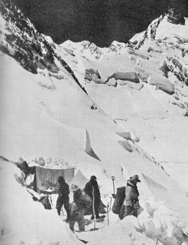
Led by Karl Wien, the team made slow progress because of heavy snowfall. On the night of June 14, a huge avalanche from the hanging glacier on Rakhiot Peak hit them in Camp 4. The avalanche rushed 1,200m across the flat terrace where their camp was set up, burying the tents under meters of ice and packed snow. The campsite was considered safe previously, but a sudden change in weather likely triggered the avalanche.
The avalanche killed seven German climbers (Wien, Hans Hartmann, Adolf Goettner, Martin Pfeffer, Gunther Hepp, Peter Mullritter, and Otto Fankhauser) and nine support staff members (Pasang P., Nim Tsering, Mambahadur, Kami, Gyaljen Monjo, Jigmay, Chong Karma, Ang Tsering II, and Da Thondup).
A search team led by Paul Bauer later found the tents buried under ice and snow, with one climber’s diary noting the camp’s unsafe position. Five bodies were found buried nearby. Described as having "no parallel in climbing annals" for its prolonged suffering, this disaster added to the Rakhiot Face’s deadly reputation.
1938: Paul Bauer’s cautious attempt
Paul Bauer led a German expedition in 1938, mindful of the 1934 and 1937 tragedies.
The team reached the Silver Saddle, halfway between Rakhiot Peak and the summit, but bad weather forced a retreat. Heinrich Harrer, a member of the expedition, noted the face’s challenging conditions. No fatalities occurred, but the expedition made no significant progress beyond previous attempts.
1939: Harrer’s reconnaissance
In 1939, Harrer joined a German expedition led by Peter Aufschnaiter, primarily to scout the Diamir Face. However, they also examined the Rakhiot Face, concluding that it was a viable but dangerous route. World War II and their internment in British India halted further attempts.
The 1930s saw five German expeditions to the Rakhiot Face, with at least 25 deaths and no successful ascents, underscoring its lethality.
1950: the British winter reconnaissance
The first documented winter attempt on Nanga Parbat occurred in December 1950, when a three-member British team of William Crace, John Thornley, and Robert Marsh scouted the Rakhiot Face.
Marsh descended with frostbiten toes, leaving Crace and Thornley in a tent at 5,500m. Both disappeared, likely swept away by an avalanche or caught in a storm.
"Thornley and Crace were both extremely determined," Marsh wrote for the Himalayan Club. "Thornley, for instance, marched 265km to Nanga Parbat over the Babusarr Pass, wearing a pair of gym shoes, in six days, and was in no way fatigued at the end. They were a fine pair of friends, and it took an expedition of this sort, where we lived close, in difficult conditions, to bring out fully the great qualities of endurance, patience, and kindness which were so characteristic of them. I am sure they wish for no better tribute than that. When they were last seen, they were still going up and still going strong."
1953: Nanga Parbat’s first ascent
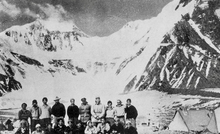
The first successful ascent of Nanga Parbat was in 1953 via the Rakhiot Face. The German-Austrian expedition was led by Karl Maria Herrligkoffer (who did not climb), whose half-brother Willy Merkl had died in 1934.
The team included Austrians Hermann Buhl, Peter Aschenbrenner, Walter Frauenberger, and Kuno Rainer, plus Germans Otto Kempter, Hermann Kollensperger, Albert Bitterling, Fritz Aumann, and Hans Ertl. It also included several (unnamed in the literature) local porters who carried supplies to Base Camp and up to Camp 4.
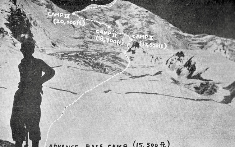
The expedition followed what became the Buhl Route: starting at the Rakhiot Glacier with Base Camp at 3,967m, ascending to Rakhiot Peak, traversing the Silver Saddle, and climbing the North Ridge to the summit.
On May 24, the expedition reached Base Camp. On June 10, Buhl, Kollensperger, and porters set up Camp 2 at 6,200m on the Rakhiot Glacier. Two weeks later, the climbers and porters established Camp 4 at 6,700m, below Rakhiot Peak.
On July 1, Buhl, Kempter, Frauenberger, and Ertl set up Camp 5 at about 6,950m with porter support. The porters then returned to the lower camps.
Hermann Buhl’s solo summit push
On July 2, Buhl and Kempter stayed at Camp 5 before Kempter turned back. After delays and disagreements, Aschenbrenner, the climbing leader of the expedition, ordered a retreat because of the approaching monsoon. Buhl, determined to summit, continued alone.
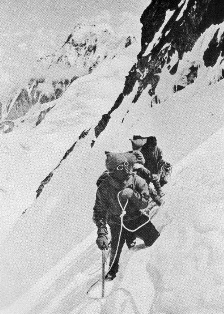
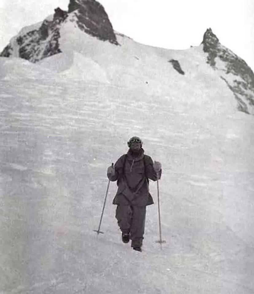
On July 3 at 2 am, Buhl started his summit push, carrying food, a flag, some pervitin and padutin pills, but no rope and no supplemental oxygen. His solo push was in alpine style.
Pervitin was a drug containing methamphetamine, a powerful stimulant. It was widely used by the German military during World War II to enhance alertness and relieve combat fatigue. Padutin improves blood circulation and prevents frostbite by dilating blood vessels. Yet despite the pills, Buhl did suffer frostbite.
By morning, Buhl reached the Silver Saddle at 7,450m. On July 3, by 2 pm, he hit the Bazhin Gap at 7,830m, dropped his backpack, and climbed the Shoulder (8,070m). After a tough rock section, he reached Nanga Parbat’s summit at 7 pm the same day, after a grueling 17-hour climb. He left his ice axe on the summit.
On the way down, he bivouacked overnight on a narrow ledge at 7,900m. He returned to high camp on July 4 and reached Camp 5 at 7 pm after 41 hours, exhausted and frostbitten.
Buhl's solo push was a monumental achievement and is detailed in his book Nanga Parbat Pilgrimage.
Only four years later, Buhl disappeared on 7,665m Chogolisa.
Later ascents
The second ascent of the Buhl Route came on July 11, 1971, when Slovaks Ivan Fiala and Michael Orolin made the second ascent of Nanga Parbat's Rakhiot Face. Other members of the same expedition achieved first ascents of the southeast peak (7,600m) and the foresummit (7,850m).
The climbers had also attempted the Buhl Route in 1969. That time, adverse weather and logistical challenges halted them before the summit. They reached 6,950m.
This 1971 expedition remains the only successful repetition of the Buhl Route.
The Japanese Route
In the summer of 1995, Japanese climbers Hiroshi Sakai, Yukio Yabe, and Takeshi Akiyama established a new route on the Rakhiot Face, ascending below the East Peak and traversing to the North Ridge near the North Peak.
"After a 1992 reconnaissance to the north and a subsequent study of aerial photos, I was convinced we could climb a new route via the ridge derived from the East Peak of Silver Crag," Sakai wrote in the American Alpine Journal.
The Japanese party consisted of 10 members, though only three members had adequate experience at high altitude. Of these three, two were soon injured and unable to climb.
The expedition began on June 5 with a three-day march from Tatoo to a temporary Base Camp at 3,900m, using 100 porters to carry three tons of supplies. The main Base Camp was at 4,500m on the Great Moraine, higher than typical due to the long summit route. Acclimatization took five days, and they had established Camp 1 at 5,300m on the Rakhiot Glacier by June 11. From here, they deviated from the 1953 route.
The route from Camp 1 to Camp 2 involved a steep wall of snow and granite reaching 5,700m. The climbers faced a grade IV+ rock crack and a hazardous snow gully prone to rockfall named the Confessional Pitch because of its danger. On June 26, a falling stone injured one climber's arm, and he had to withdraw.
"As we climbed higher, we felt more and more rockfall flying down toward us, as our route led toward the upper part of this snow gully," Sakai recalled.
Inching higher, another injury
After overcoming an overhang and a jagged snow ridge, they set Camp 2 at 5,900m on June 25. Above Camp 2, at 6,300m, a 300m ice tower posed a major obstacle. The team navigated a vertical slit in the ice, climbing four pitches at 70°. Beyond this, the route eased into knee-deep snow along a ridge, leading to Camp 3 at 6,700m, established on July 4.
On July 7, Tamura was injured by a falling stone at the Confessional Pitch, requiring a three-day rescue. With only six climbers left, the team abandoned plans to traverse Nanga Parbat and rested until July 12.
The route to Camp 4 traversed the Silver Saddle’s flanks, tackling Yabe’s Crack, a 50m grade V climb. By July 18, after navigating 800m of snow and rock, Camp 4 was set at 7,350m near the Silver Plateau.
The summit push
On July 22, Sakai, Yabe, and Akiyama left high camp toward the summit. However, soon after, they returned to Camp 4 because Akiyama felt pain in his chest, and Yabe’s fingers and toes had gone numb with cold. During that night, they took oxygen to regain their strength.
On July 23, Sakai, Yabe, and Akiyama summited at 5:13 pm via a new route, after a grueling climb through the Silver Plateau and a steep summit wall. They faced exhaustion and worsening weather but reached the top.
The descent was tough, with a bivouac at 7,700m in a snowstorm. The team returned to Camp 4 after 39 hours and reached Base Camp on July 28 amid bad weather. Despite injuries and setbacks, the expedition succeeded, marking a new route on Nanga Parbat’s North Face.
This marked the third successful ascent of the Rakhiot Face and introduced a more direct but equally challenging alternative to the Buhl Route. No further ascents of this route have been recorded.
2008: a new route attempt
In the summer of 2008, Italian climbers Simon Kehrer, Walter Nones, and Karl Unterkircher attempted a new route via the Rakhiot Ice Wall.
The team arrived at Base Camp in late May, spending weeks acclimatizing and observing the Rakhiot Face, noting its avalanche-prone seracs and crevasses. On July 14, they began their summit push at 10 pm, hoping to minimize avalanche risk by climbing at night when it was coldest.
They cached a tent at 4,500m and began climbing again after midnight on July 15, navigating 60° ice and a near-vertical M4/5 mixed wall to 5,700m. After tackling deep snow and a serac, they reached 6,300m by 4 pm, where Unterkircher fell into a crevasse and died. Kehrer and Nones attempted a rescue but found his body buried under snow. Unable to recover it in dangerous conditions, they retrieved his gear and continued up.
Opting against a risky descent, they climbed toward the Silver Plateau via a longer, easier route through avalanche-prone slopes and steep mixed terrain. A storm on July 17 slowed progress with waist-deep snow, forcing bivouacs at 6,650m, 6,800m, 7,000m, and 7,300m.
They reached 7,500m on July 21. On July 22–23, they skied down the Buhl route in poor visibility, surviving two avalanches. Eventually, a Pakistani Army helicopter airlifted them from 5,400m to Base Camp on July 24. Recovering Unterkircher’s body was deemed impossible.
The route, named Via Karl Unterkircher (3,000m, IV-V M4+ 70°-80°), was dedicated to their fallen friend.
Since its last ascent in 1995, the Rakhiot Face remains unclimbed to the summit. Of the 80 people who have died on Nanga Parbat, more than a third perished on the Rakhiot Face.
You can find the climbing history of the Diamir Face here, and the Rupal Face here.
Caro North, Soledad de las Nieves, and Tatin Sanchez likely made the first ski descent of 5,000m Pogranichnik Peak, which is on the border of Kazakhstan and Kyrgyzstan.
Pogranichnik Peak lies in the Tien Shan mountains of Central Asia, one of the world's great ranges. Pogranichnik means "border guard" in Russian and reflects its location on the Kazakhstan-Kyrgyzstan border. Strong winds, icy slopes, and challenging conditions for both climbing and skiing characterize this remote area.
The team also climbed Uzlovaya Peak, which is about 4,800m high and part of the same Borkoldoy Too subrange.
After summiting Uzlovaya Peak, the team followed a sharp ridge to the top of Pogranichnik.
Due to strong winds, most of the climb had no snow, so they used crampons on the bare ice. But De las Nieves had spotted a potential ski route down Pogranichnik’s north face. Sure enough, they found powder snow between large crevasses and skied down the whole way.
There’s limited information about Pogranichnik Peak’s first climb. In the early 2000s, mountaineers explored the Borkoldoy Too area and summited some unclimbed peaks around 5,000m. Pogranichnik may have been climbed then, but no specific record confirms this.
Caro North is a North Face athlete from Switzerland. Her frequent partner is Soledad de las Nieves of Chile, and Tatin Sanchez is from Argentina.
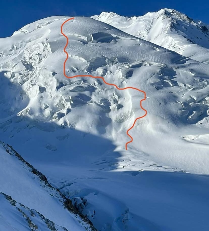
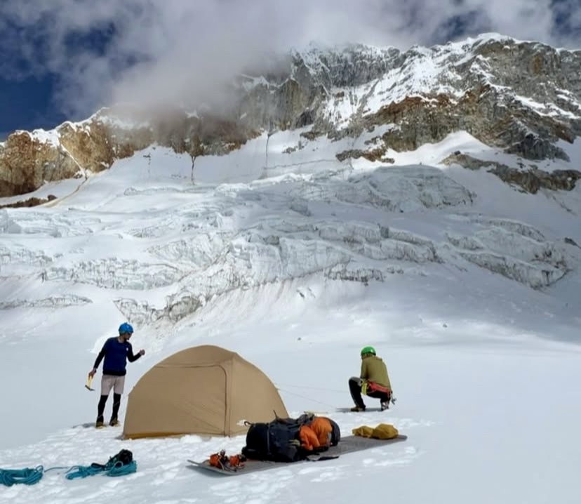
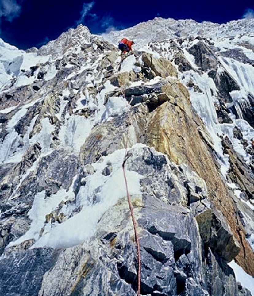
On June 15, two climbers established a difficult new route on the rarely climbed 6,070m Huandoy East in Peru.
Diomedes Mojica of Panama and Wilder Alva Chinchay of Peru climbed via the northeast face and graded their new route 480m, MD+, 75º-90º ice, M4-M5 mixed climbing, UIAA 5+.
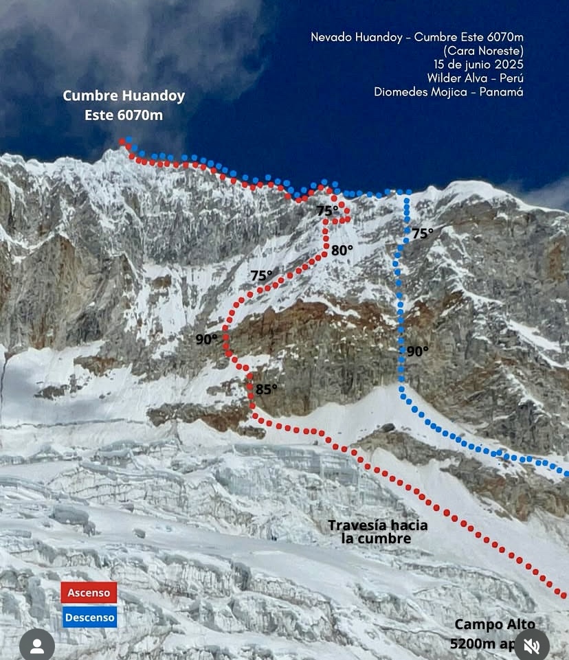
The duo climbed in alpine style over 18 hours (11 hours up, and seven hours down).
Huandoy East is highly technical, steep, and dangerous, and even experienced climbers almost never attempt it. This is the first ascent of Huandoy East by a Panamanian and marks Chinchay as the first person to summit all four Huandoy peaks (North, South, East, and West).
World's highest tropical range
Huandoy lies in Peru's Cordillera Blanca, the world's highest tropical mountain range. Its highest peak, Huandoy North, reaches 6,395m and is the second-highest in the range after 6,757m Huascaran. The Huandoy massif lies near the Llanganuco Valley and its lakes, with views of other big peaks like Huascaran and Chopicalqui.
Huandoy is a tough climb due to its steep ice, glaciers, and complex ridges. It's popular with experienced mountaineers who use their ice-climbing and high-altitude skills.
Huandoy, also called Tullparaju in Quechua, may come from local words meaning snowy fireplace.
Erwin Schneider and Erwin Hein from the German Alpine Club first ascended Huandoy North via its south side on Sept. 12, 1932.
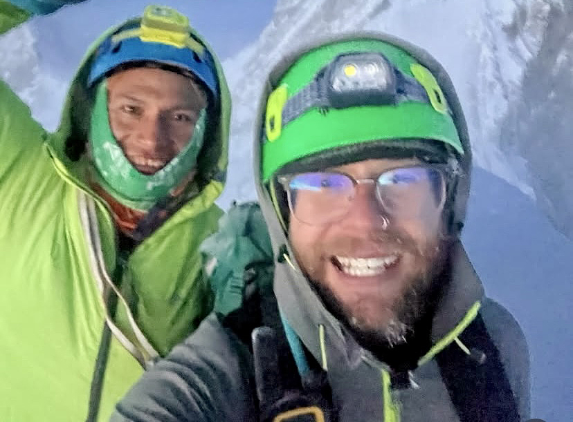
Diomedes Mojica, 31, is a student at Centro de Estudios de Alta Montana and an aspiring UIAGM mountain guide. On June 3, one week before Huandoy East, he summited Huascaran via a new route. His recent climb of Huandoy East establishes a new milestone for Panamanian mountaineering.
Wilder Alva Chinchay is also training as a UIAGM mountain guide. He is experienced on the Cordillera Blanca's high-altitude technical routes.
The ninth-largest mountain in the world, Pakistan's 8,125m Nanga Parbat has three main faces: the south-facing Rupal Face, the northeast-facing Rakhiot Face, and the northwest-facing Diamir Face.
On June 24, David Goettler, Tiphaine Duperier, and Boris Langenstein summited via the Schell Route after an 18-hour, alpine-style push from Camp 3 at 6,800m. From the summit, Duperier and Langenstein made the mountain's first complete ski descent, including the entire Rupal Face, according to Montagnes Magazine. Goettler paraglided from 7,700m to Base Camp.
This article will explore the climbing history of the Rupal Face.
The tallest mountain face
Many consider Nanga Parbat’s 4,600m Rupal Face the world's tallest mountain face because it forms a continuous, steep wall from the Rupal Valley at 3,500m to the summit at 8,125m. Its steep icefields, rocky buttresses, avalanche-prone slopes, and brutal weather make it a formidable challenge.
By contrast, 7,782m Namcha Barwa’s south face (5,282m to 5,782m high) and 7,294m Gyala Peri’s south face (4,794m to 5,294m high) both have greater total relief but include gentler, less consistent slopes, reducing their status as unbroken climbing faces.
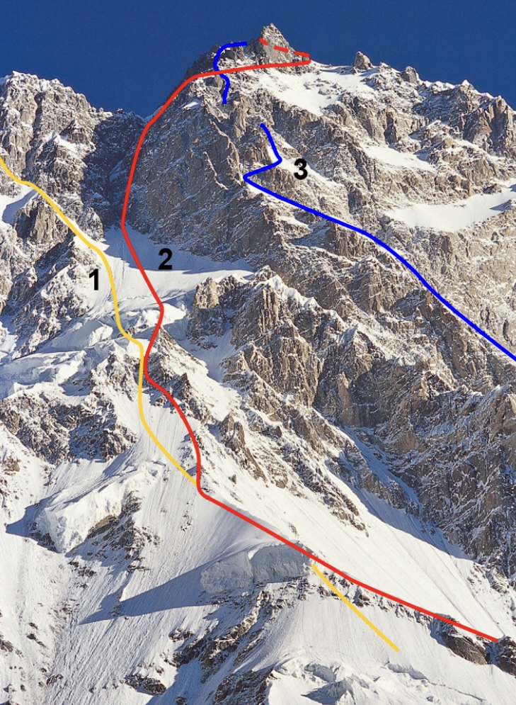
The Rupal Face has had just 12 successful ascents across four routes.

The Messner Route: The first ascent
In 1970, Reinhold Messner and his brother Gunther climbed Nanga Parbat via the Rupal Face. They climbed up the South-Southeast Spur (often referred to as the Messner Route). The expedition was led by Karl Maria Herrligkoffer, and the Messner brothers reached the summit on June 27.
Because of worsening weather, exhaustion, and Gunther’s altitude sickness, the Messner brothers were unable to descend the Rupal Face. Instead, they made the first traverse of Nanga Parbat by descending the Diamir Face, following a route along the Mummery Rib’s lower slopes and improvising a westward path toward the Mazeno Ridge’s lower slopes, crossing gullies and snowfields near the Diamir Glacier.
Tragically, Gunther Messner died during this descent, likely in an avalanche on the Diamir Face.
Messner's route repeated
In 2005, a South Korean team started from Base Camp on April 20 in heavy snow. They set up Camp 1 at 5,280m and Camp 2 at 6,090m along the 1970 Messner Route.
They were still on the mountain in early June when bad weather hit them hard and destroyed their tents. Despite this, they made Camp 3 at 6,850m before an injury stopped their first summit attempt.
On July 13, Kim Chang-ho and Lee Hyun-jo left Camp 4 at 7,125m. After 24 hours, dodging falling rock and ice, they summited late on July 14. The climbers went down the Diamir Face, survived an avalanche, and reached Base Camp after 68 hours. On the summit, they found a container left by Reinhold Messner and returned it to him as proof of their climb.
An alpine-style attempt on the Messner Route
A notable attempt of the 1970 Messner Route came in 1988. Canadians Kevin Doyle, Ward Robinson, and Barry Blanchard, plus American Marc Twight, prepared by climbing nearby peaks.
Doyle, Robinson, and Blanchard tackled a new route on 6,500m Shigeri’s north face, spending two unplanned nights at altitude. Twight soloed a new route on Laila’s south face and east ridge (6,000m). The three of them reached 7,000m on the easier Schell Route.
On July 9, the team started on the Rupal Face by the Messner Route. They left with light gear: five days’ food, eight days’ fuel, two ropes, and some climbing equipment.
The first 1,000m were easy, but after camping below Wieland Rocks, the terrain got steep and hard, needing two ice tools. At 6,400m, they avoided a rockfall-prone gully, climbing tough mixed ground. In two and a half days, they gained 3,170m, resting for half a day on July 12.
They climbed a steep ice barrier and struggled through deep snow. At 7,300m, they faced hard, brittle ice in the Merkl Gully. By July 13, they reached 7,700m, close to the summit.
A close call
Here, their luck ran out. A sudden storm hit, with lightning, 160kmph winds, and avalanches. Robinson, sick and hypothermic, could barely move. An avalanche nearly swept them off the mountain while rappeling, but their one ice screw held. After five hours, they reached the Merkl Icefield and found shelter for Robinson.
Twight and Blanchard descended to 7,000m, losing a tent and both ropes. At 6,700m, they found a discarded pack from the 1984 Japanese team with ropes and gear. Their find helped them escape the mountain over the next day and a half.
"The atmosphere quivered, and I could hear the tension of the storm's electrical charge -- white noise crackling in my ears," Blanchard wrote in his book The Calling. "The midday sky was as dark as dusk...The avalanche had ended 27 minutes after it had begun. Ward's face looked old. Deep lines dragged down the corners of his mouth; I had never seen those lines in his face before. His eyes had the improperly focused look of shock, with too much black in his pupils."
On July 25, they tried again, climbing to 7,300m in just over two days. Sick again, Robinson retreated from 7,000m. Soon after, clouds and a brewing storm stopped the rest of the team, and they descended in 13 hours.
Importance of the 1988 attempt
This expedition was significant for several reasons. First, it highlighted the extreme challenge of the Messner Route, reinforcing its reputation as one of mountaineering’s toughest objectives. No team had summited via this route since 1970, and the 1988 attempt underscored why: the combination of technical ice climbing, unpredictable weather, and constant rockfall and avalanche risks demands exceptional skill and luck.
The team’s alpine-style approach — carrying minimal gear to move quickly — tested the limits of the strategy, showing both its potential and its vulnerabilities when equipment was lost. Their survival, especially after the storm and Robinson’s altitude sickness, demonstrated remarkable resilience and decision-making under pressure. Finding the Japanese pack was a stroke of luck that likely saved their lives.
Though they didn’t reach the summit, their 7,700m high point and detailed account provided valuable insights into this formidable route.
The Schell Route
The Schell Route has eight successful ascents.
We previously detailed the first ascent of the Schell Route, climbed in 1976 by Austrians Hanns Schell, Robert Schauer, Siegfried Gimpel, and Hilmar Sturm. David Goettler, Tiphaine Duperier, and Boris Langenstein repeated this long, difficult route a few days ago.
With only eight successful climbs, the importance of this latest ascent is obvious. The other ascents are: 1981 by Ronald Naar; 1984 by Oscar Cadiach and Jordi Magrina; 1990 by Marija Frantar and Joze Rozman; 1990 by Reinmar Joswig and Peter Mezger; 1990 by Osamu Nakajima; 2013 by Zsolt Torok, Teofil Vlad Dima, Aurel Salasan, and Marius Gane.
The 2025 ascent via the Schell Route comes 12 years since its last ascent in 2013, and Duperier becomes just the second woman to achieve this remarkable feat. Goettler had attempted this route four times previously.
The Southeast Pillar: The Polish-Mexican Route
In 1982, Swiss climber Ueli Buhler nearly conquered the Southeast Pillar. He reached the 8,042m south summit but was unable to continue to the main peak.
In 1985, a Polish-Mexican expedition opened a new route on the Rupal Face by the Southeast Pillar.
This 1985 expedition, led by Pawel Mularz, tackled the dangerous pillar in brutal weather. During the climb, Andrzej Samolewicz survived a 600m fall with only minor injuries, but an avalanche killed Piotr Kalmus while he descended from Camp 2 to Camp 1. On July 13, Jerzy Kukuczka, Zygmunt Andrzej Heinrich, Carlos Carsolio, and Slavomir Lobodzinski reached the summit from Camp 5, marking Kukuczka’s ninth 8,000m peak.
A winter solo attempt ends in tragedy
In the winter of 2012-13, Joel Wischnewski, a little-known mountaineer from France, attempted a highly ambitious solo climb of the Southeast Pillar on Nanga Parbat’s Rupal Face.
He left France at the end of December 2012, reached base camp on January 9, 2013, and made his last journal entry on February 6 from Camp 2, indicating he was moving up the Southeast Pillar.
When he didn't return, his agent in Pakistan launched a search. Three experienced Pakistani mountaineers climbed up the lower part of his proposed route, but found no trace of the Frenchman.
Wischnewski's body was found on Oct. 10, 2013, at approximately 6,100m on the Rupal Face near the foot of an icefall. Local villagers spotted his boots after the summer snowmelt in early September and notified the French embassy.
A team led by Brigadier Akram Khan recovered the body, and it was buried at the Herrligkoffer climbers’ cemetery near Base Camp. Wischnewski likely died in an avalanche.
The Central Pillar: The Anderson-House Route
Vince Anderson and Steve House climbed the Rupal Face by a 4,100m new route (M5, 5.9, WI4) in the autumn of 2005.
The duo's route up the Central Pillar was alpine-style and faced tough challenges, like loose rock on a hard 5.9 section. On day three, they reached a hanging glacier, then followed an icy ramp to their last camp at 7,400m. There, they joined the Messner Route at 7,900m and summited on September 6. Anderson and House descended by the Messner Route.
The 2005 Central Pillar route, distinct from the 1970 Messner Route and the 1985 Southeast Pillar, was a significant achievement and earned them the 2006 Piolet d’Or. Their climb followed a 2004 attempt by House and Bruce Miller, which reached 7,500m but was halted by altitude sickness.
A central route attempt
In 2005, Slovenian Tomaz Humar attempted a challenging new central route up the Rupal Face. He had previously tried a similar route in 2003 but retreated because of poor weather and health issues.
On this second attempt, Humar reached about 6,300m before bad weather trapped him, forcing him to dig into the snowy slope and wait for clearer skies and fewer avalanches. However, after days of waiting, he required a risky helicopter rescue by Pakistani pilots.
Climbing journalists and peers criticized him, but Slovenians watched the drama unfold on TV and celebrated Humar's safe return as a national hero. Four years later, Humar died on Langtang Lirung.
Another new route attempt
In 2018, Czech climbers Marek Holecek and Tomas Petrecek attempted a new alpine-style route on the Rupal Face.
Initially, they planned to establish a new line to the right of the 2005 Anderson-House route on the Central Pillar. However, bad weather and heavy snowfall forced them to adjust their plans. When a weather window opened, they shifted to a line closer to the 1970 Messner Route, following it until the Merkl Rinne, a steep gully used by the Messner brothers. From there, they deviated, climbing a new variation through rocky buttresses to the left of the gully, seeking a natural line of weaknesses.
After six days on the face, they reached approximately 7,800m on September 2. There, they were forced to retreat in increasingly strong winds (up to 100kmph). They were about 300m below the summit when they turned back.
They descended the Rupal Face, which Holecek described as extremely challenging, comparing it to a "cabriolet [horse-drawn carriage] trip without a windscreen in an ice storm."
Winter attempts
Since 1988, nine winter attempts have targeted the Rupal Face, but all were defeated by the extreme conditions.
Maciej Berbeka of Poland led three attempts. In 1988-89, his team reached 6,500–6,800m on the Messner Route before switching faces in harsh weather. In 1990-91, a Polish-English team reached 6,600m on the Schell Route, and in 1991-92, they reached 7,000m. Both times, severe weather stopped them.
Krzysztof Wielicki’s 2006-07 Polish expedition reached 6,800m on the Schell Route but retreated in fierce winds. As we previously noted, Joel Wischnewski vanished during his winter solo attempt in 2013. Tomasz Mackiewicz’s winter attempts on the Schell Route included a 2012-13 solo climb to 7,400m, and a joint effort with David Goettler to 7,200m in 2013-14.
In the winter of 2014-15, Russians Nikolay Totmjanin, Sergei Kondrashkin, Valery Shamalo, and Victor Koval reached 7,150m on the Schell Route before deteriorating weather, including high winds, snow blizzards, and zero visibility, forced them back.
Cleo Weidlich (a Brazilian-born American climber) and her Sherpa team abandoned their 2015-16 Schell Route attempt in treacherous conditions.
In 2021-22, Herve Barmasse and David Goettler stopped at 5,670m on the Schell Route because of avalanche risk and bad weather.
The Schell Route remains unclimbed in winter
While Nanga Parbat was finally climbed in winter -- on Feb. 26, 2016, via the Kinshofer Route on the Diamir Face by Simone Moro (Italy), Alex Txikon (Spain), and Ali Sadpara (Pakistan) -- the ever-formidable Rupal Face remains unclimbed during the harshest season.
Experienced climbers Saki Terada and Chiaki Inada from Japan faced severe challenges while climbing 6,757m Nevado Huascaran earlier this week. Their climb of Peru's highest peak ended in tragedy.
The duo became stuck at 6,600m during their descent. Inada died, and rescue teams struggled to help Terada down.
Yesterday, rescuers finally evacuated Terada from the mountain, transporting her to Víctor Ramos Guardia Hospital in Huaraz. She is in a critical but stable condition, suffering from severe dehydration and frostbite on her hands and feet from prolonged exposure to extreme cold, according to Infobae.
Today, medics will transfer her to a hospital in Lima, Peru's capital city, where she can continue treatment.

Inada's body recovery underway
Efforts are underway to recover Inada's body. Inada, a 40-year-old doctor for Wilderness Medical Associates Japan (WMA), succumbed to hypothermia and cerebral edema.
According to some Peruvian sources, rescue services found the climbers at approximately 6,500m on the south face of Huascaran’s south peak, just below the summit. They were on the technical Escudo route, a 600m ice and snow wall known for its steep terrain and harsh weather.
Terada and Inada had arrived in Peru two weeks ago and had at least one acclimatization hike before starting the ascent on Huascaran. Presumably, the two women summited on June 23, and the problems started on June 24 when they encountered foggy weather and low visibility.

Timeline of events
Today, WMA Japan has published a report on what happened. Below we have translated it into English with minor edits to improve clarity. Note all times referred to are Peru Standard Time.
June 24
At around 1:30 am:
- Chiaki Inada became incapacitated due to suspected hypothermia. A distress signal was sent via Garmin’s SOS satellite device to a private rescue agency in Peru. The agency contacted WMA Japan to verify the situation.
At around 4:00 am:
- A response headquarters was established, and negotiations began with various parties.
- Requests for rescue to the local private rescue agency and to local police authorities.
- Request for support through the Japanese Embassy in Peru.
At around 7:30 am:
- Online meeting with Japanese and Peruvian stakeholders.
- Survival of Inada and Terada confirmed.
- Text communication with Japan was possible until around 10:00 am. The climbers were stranded and incapacitated at the site.
- Rescue arrangements confirmed.
- The climbers' problems occurred around 6,600m, just below the summit. No helicopters in Peru can fly at this altitude, so the rescue team had to fly to the Huascaran refuge hut, then proceed on foot to the site. The plan was to bring both climbers to the refuge hut by land, followed by a helicopter rescue.
- Cooperation from local police was secured through the Japanese Embassy in Peru.
At around 4:00 pm:
- A joint rescue operation by local police and private teams began. Nine team members, split into three groups, arrived at the Huascaran refuge hut.
- The team began climbing toward the stranded climbers on foot.
- Additional teams were dispatched through efforts by the Japanese Embassy and local stakeholders.
- The rescue team consisted of over 10 members, primarily local mountain guides, operating in several groups.
June 25
At around 7:30 am:
- Staff at a lodge at the mountain’s base reported phone contact with Inada and Terada
- Though their responses were not entirely clear, their voices were confirmed.
At around 12:00 pm:
The rescue team approached the SOS location but encountered difficulties due to large crevasses. They continued searching for a viable route.
At around 3:00 pm:
- The rescue team reached the two stranded climbers. Terada was conscious. Inada was unconscious and in critical condition.
- The team provided first aid and considered transport options through the night.
At around 6:00 pm:
- Deteriorating weather conditions made rescue operations extremely difficult, rendering simultaneous transport of both climbers impossible.
- Local rescue teams and authorities determined Inada’s death at the site.
- Further rescue activities became unsafe, so Inada’s body was temporarily left at the site with its location recorded via GPS.
- The rescue team focused on evacuating Terada.

June 26
At around 9:00 am:
- Terada was walking at approximately 5,100m (the pickup point is at about 4,500m).
- A helicopter and local medical personnel were on standby for transport.
- The plan was to transport Terada to a hospital at the base via helicopter upon reaching the pickup point.
At around 1:45 pm:
- Terada safely reached the helicopter pickup point at the refuge hut.
- Partway down, she became unable to walk independently and was carried by the rescue team, but remained fully conscious.
- Final landing arrangements and flight permissions were being coordinated, with the helicopter set to deploy once conditions were met.
At around 2:30 pm:
- Thanks to the rescue team’s swift coordination, Terada was safely admitted to a hospital.
- Preparations for the recovery of Inada’s body have begun.
At around 10:00 pm:
- A team of local mountain police and guides left to retrieve Inada’s body.
On June 23, two female Japanese mountaineers, Saki Terada, 36, and Chiaki Inada, 40, became stranded on 6,757m Nevado Huascaran, Peru’s highest peak. One of them is now confirmed dead.
The two veteran climbers arrived in Peru in early June and spent two weeks acclimatizing. They then started climbing Huascaran and likely summited earlier this week.
The weather has been challenging on Huascaran, with poor visibility above 6,000m. Terada and Inada became lost in the fog in the huge area just below the summit. They could not find their high camp and had to bivouac at around 6,500m, according to Latina Noticias.
There, health problems set in. One of the climbers went snowblind because of cerebral edema, and in nighttime temperatures as low as -30°C, hypothermia also affected them. Inada was in particularly poor condition.
Distress call
Terada and Inada sent a distress call via their InReach device on June 24, after spending two nights outside. Deep snow and poor visibility continued to complicate the situation. The climbers had cell service on the mountain and also asked for local rescue.
Peru’s National Police mobilized specialized rescue teams. A helicopter made three rescue sorties, but continuing poor weather didn't allow it to reach the two climbers. So from an altitude of 4,800m, rescuers started to move up on foot toward them, according to the TV station, Latina Noticias.
On June 25, both climbers were located, thanks to their InReach device. Unfortunately, by then, Inada had succumbed to hypothermia and was confirmed dead at the scene. Rescuers are currently bringing Terada down the mountain.
Terada and Inada are experienced mountaineers, and Inada also served as an expedition doctor.
Terada was a member of the Himalayan Camp, a Japanese mountaineering group known for organizing high-altitude expeditions. In 2023, she participated in the Sharpu VI expedition in Nepal.
Captain Manmohan Singh Kohli, a pioneering Indian mountaineer, passed away on June 23 at the age of 93.
Celebrated for leading India’s first successful Everest expedition in 1965, Captain M.S. Kohli's career also included an Antarctic expedition and many other Himalayan ventures. His work as a mountaineer, author, editor, Himalayan Club president, and Indian Mountaineering Foundation president shaped Indian mountaineering.
Born December 11, 1930, in Haripur (now Pakistan), Kohli joined the Indian Navy in 1950, rising to the rank of Commander. He trained in the UK and developed leadership skills. By 1956, he began Himalayan mountaineering.
Kohli took part in over 20 adventures in the Greater Ranges. In 1956, he climbed 7,672m Saser Kangri in the Karakoram. In 1959, with K.P. Sharma, he topped out on 6,861m Nanda Kot in the Kumaon Himalaya. It was just the second ascent of the mountain.
Between 1961 and 1964, Kohli led three successful expeditions -- the first ascent of Annapurna III, a climb of 7,816m Nanda Devi, and an expedition to 7,198m Nepal Peak.
In the 1960s, Kohli led and summited Kabru Dome and Rathong, strengthening India’s eastern Himalayan presence. In 1965, Kohli led a covert Indian-American mission to place a nuclear-powered device to monitor Chinese tests but did not summit due to harsh conditions.
Everest expedition leader
In 1965, Kohli led the first successful Indian expedition to Everest. Nine climbers on his team summited between May 20–29. It set a record for the most summiters on one expedition, which remained unbroken for 17 years.
His leadership on that expedition was extraordinary. Indira Gandhi, who later became the Prime Minister of India, said of Kohli at the time: "Commander Kohli’s expedition...was a masterpiece of planning, organization, teamwork, individual effort, and leadership.”
Later, Kohli climbed several European peaks with Tenzing Norgay. In 1982–1983, he led India’s first civilian Antarctic expedition, supporting scientific exploration.
He was also a committed alpinist beyond expeditions. As president and vice president of the Himalayan Club (1980–1983), Kohli edited the Himalayan Journal. As president of the Indian Mountaineering Foundation (1989–1993), he promoted adventure and youth engagement. In 1989, he co-founded the Himalayan Environment Trust with Sir Edmund Hillary. It was supported by Maurice Herzog, Reinhold Messner, Junko Tabei, and Chris Bonington.
Kohli was much loved and respected in international mountaineering circles. He promoted mountaineering and trekking through many presentations around the world.
Kohli authored Nine Atop Everest, Spies in the Himalayas (with Kenneth Conboy), The Great Himalayan Climb, and A Life Full of Adventures, among several other publications.

Kohli received the Padma Bhushan (1965), Arjuna Award (1965), Ati Vishisht Seva Medal (AVSM), and Tenzing Norgay Lifetime Achievement Award. He lectured at the Alpine Club (UK) and the American Alpine Club.
Captain Kohli’s passing marks the end of an era, but his expeditions, leadership, writings, and conservation efforts will continue to inspire.
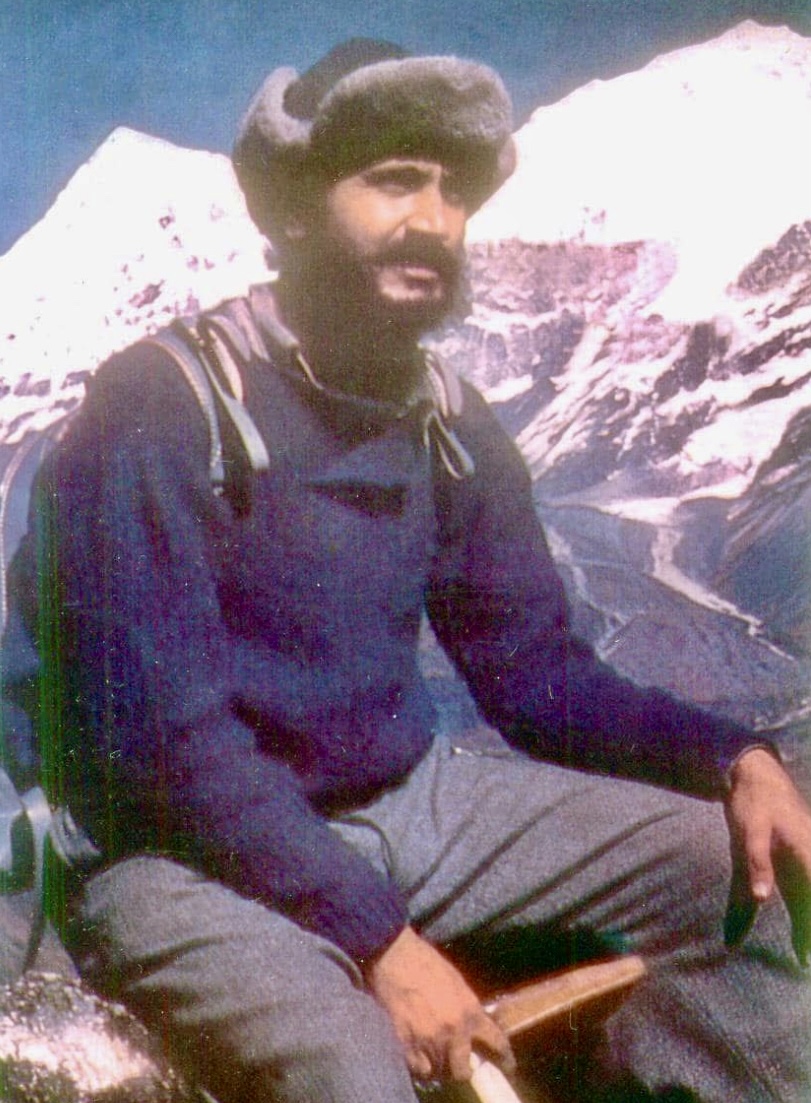
From June 2-7, Mueez Ud Din of Pakistan and Mathieu Maynadier of France opened a new route on the previously unclimbed east ridge of 7,029m Spantik in the Karakoram.
A massive wind slab obstructed the climbers during the final part of the ascent, and they did not quite reach Spantik's summit. Their GPS noted that they stopped at 6,999m.
The climbers named their new route Zindabad ("Long Live" in Urdu) and graded it 1,800m, M5, A1, 80°.
The expedition included Maynadier (leader), Ud Din, videographer Nathanael Sapey, documentary filmmaker Loury Lagardere, drone manager Ozair Khan, and two cooks. During the approach, 42 porters supported them.
The Spantik expedition almost didn't happen because of recent Pakistan-India tensions. Many other planned expeditions pulled out, so that by May 20, Maynadier's team may have been the only expedition in Skardu.
After a long drive, they reached Arandu, a small village in Baltistan's Shigar Valley, near the confluence of the Shigar and Basha Rivers. The village serves as a gateway to Spantik’s base camp.
Tense moments during the approach trek
After three intense days of trekking and 35km of crevassed glacier, the party arrived at base camp on May 26.
The approach journey included a few tense moments, including when a porter fell between two icy walls. He was not injured, but the fall "sparked a brief rebellion among the group," Maynadier wrote. "But after some negotiations, we were able to continue."
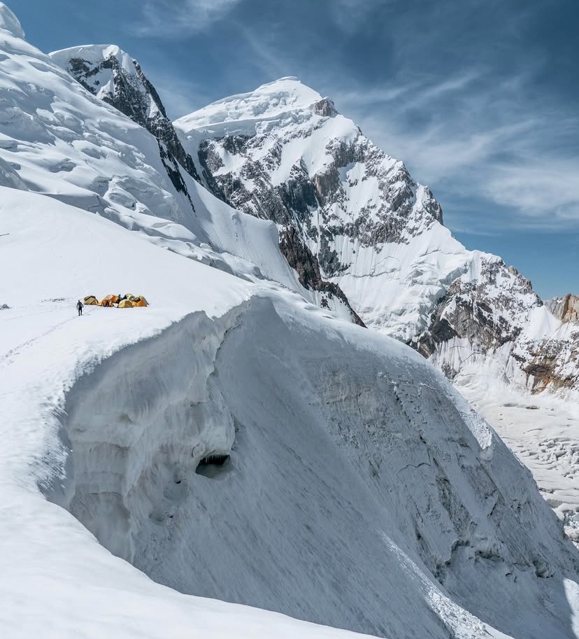
Their acclimatization took two days. Seizing the first break in the weather, they spent two nights at higher elevations –- 5,200m and 5,800m –- on Spantik’s normal southeast ridge route. They then returned to base camp for a night’s rest on June 9.
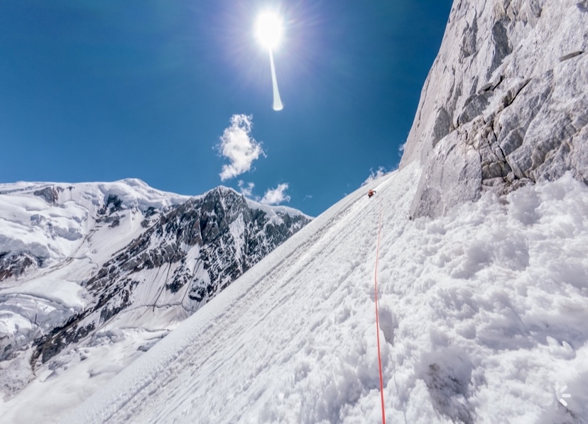
The favorable weather persisted, and though not fully acclimatized, Ud Din and Maynadier pushed for the summit via the east ridge.
The climb
"We spent 25 days on the mountain, 10 of them at base camp waiting for a window that barely opened," Ud Din wrote. "When it finally did, we went for it."
The pair left base camp, situated above a heavily crevassed glacier at 4,200m, and ascended 1,800m over four days.
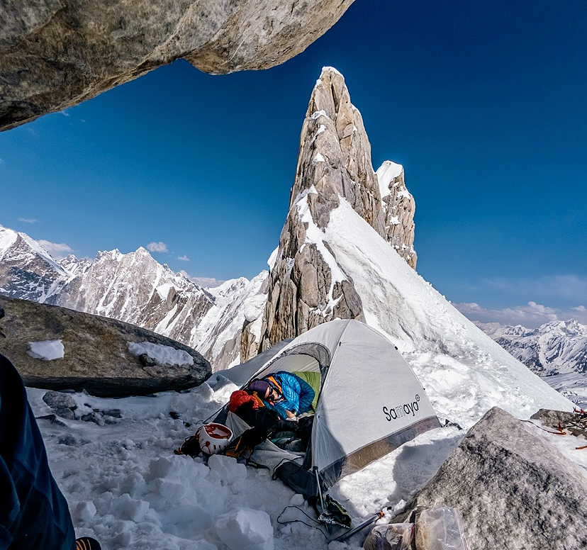
They crossed the bergschrund at 5,200m and eventually reached their highest point at 6,999m, just shy of the summit. There, a massive wind slab and dangerous amounts of snow blocked the final ridge.
"We made the tough call to turn back, but honestly, the route was the true summit," Ud Din explained in a post.
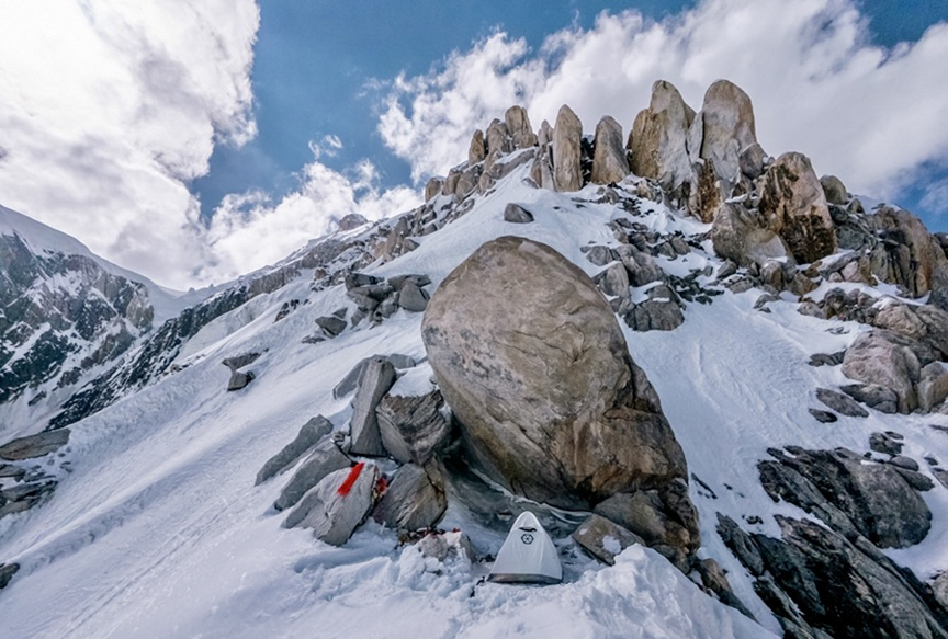
The ascent required three bivouacs. Connecting their new line to Spantik’s normal route, they completed the descent with one bivouac at 5,800m. After a day and a half, the duo returned to base camp, five days after setting off.
Complex terrain and the crux
The long east ridge presented a complex tapestry of terrain, with snow sections and a mixed crux. As they gained altitude, the ridge sharpened into a knife-edge of snow and rock.
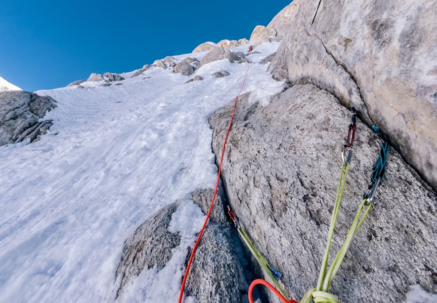
According to Maynadier, the crux arrived on the final day of the ascent: two mixed pitches rated M5, where ice-smeared granite demanded delicate footwork and precise axe placements. An A1 aid section required technical ingenuity to navigate overhanging rock.
"The higher you go, the steeper it gets," Maynadier recalled. The ridge’s exposure, coupled with its technical demands, made every move a calculated risk.
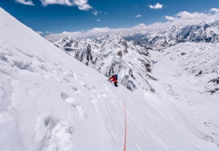
The first two days of the climb had clear skies, but conditions deteriorated on days three and four, as snow flurries dusted the ridge, obscuring holds and slowing progress.
The final bivouac at 6,700m was particularly tough, with 20cm of fresh snow blanketing their camp.
"It was a little stressful," Maynadier admitted, recalling the tension of the wind howling all night and waking to a snow-laden tent.
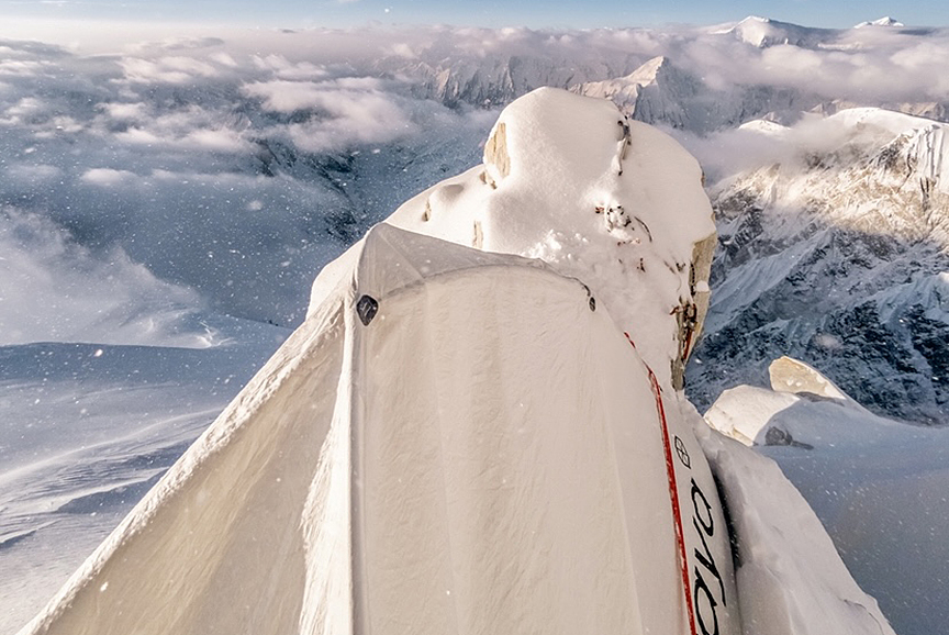
But their commitment paid off. "After weeks in the Karakoram, we returned with more than just frostbite and memories," Ud Din wrote on social media.
"We are happy. It’s a really cool line," Maynadier told us.
Spantik’s storied past
First ascended in 1955 by a German expedition led by Karl Kramer via the southeast ridge, Spantik has long captivated climbers.
The southeast ridge was first attempted in 1906 by American explorers Fanny and William Bullock Workman, who reached 6,700m, a remarkable feat for the era. Subsequent milestones include the south ridge, climbed by a Japanese team in 1978, and the striking northwest pillar, ascended by British climbers Mick Fowler and Victor Saunders in 1987.
However, the east ridge remained untouched, its steep, exposed line deterring attempts until Maynadier and Ud Din’s bold climb. The American Alpine Journal records no prior ascents of this route.
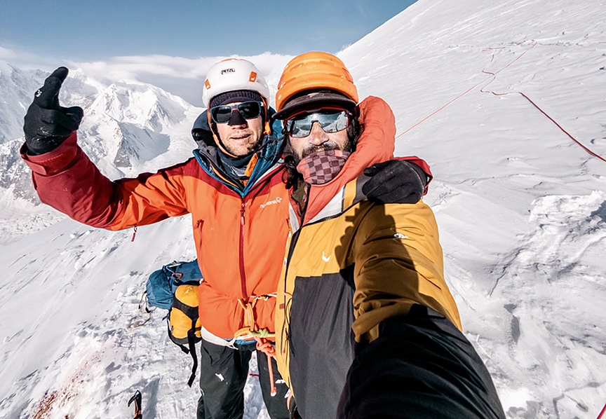
Unlike the guided, fixed-rope ascents common on Spantik’s more frequented routes, the duo’s approach aligns with the purist ethos of modern mountaineering. Their success not only adds a new chapter to Spantik’s legacy but highlights untapped potential.
Maynadier’s climbs
Maynadier, a 38-year-old French guide from Briançon, has a distinguished career of first ascents.
In 2010, Maynadier, Mathieu Detrie, Maxime Belleville, and Sebastien Ratel made the first ascent of 6,812m Lunag II in Nepal, via the southwest face. Their route, Close the Door (1,300m, ED), earned a 2011 Piolet d’Or nomination.
In 2012, Maynadier, Antoine Bletton, Pierre Labre, and Sebastien Ratel opened a new route on 7,108m Latok II in the Karakoram, reaching the southeast summit at 7,020m.
In 2013, Maynadier, Mathieu Detrie, Jerome Parra, and Pierre Labre carried out the first ascent of the south face of 7,134m Gaurishankar, by their new route Gare au Gauri (2,000m, ED+, M5/A1).
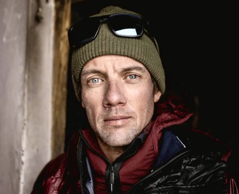
In the autumn of 2015, alongside Julian Dusserre, Maynadier opened the northeast face of 6,295m Dzasampatse in the Mahalangur Himal-Khumbu section of Nepal. Their 700m route was named A La Verticale de la Peine and graded TD+, WI5. They stopped 20m below the summit because of extremely unstable snow on the narrow ridge.
In 2017, Maynadier summited Gasherbrum II.
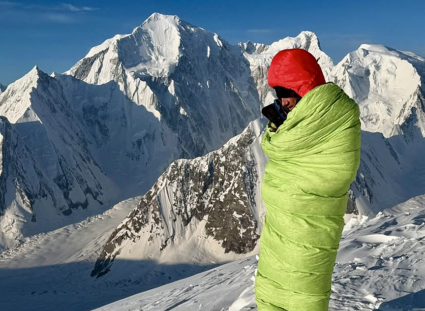
A close call in 2018
In the summer of 2018, Maynadier, Nicolas Favresse, Jean-Louis Wertz, and Carlitos Molina were probably the first foreign mountaineers to explore the Tagas Valley in Pakistan’s Karakoram. They focused their attention on the west side of a beautiful rock tower near the Second Tagas Glacier, according to Favresse’s report for the American Alpine Journal. The summit, approaching 6,000m, was named Pathan Peak. On August 4, all four climbers reached the summit.
During the climb, right after Maynadier and Favresse had just completed fixing a new anchor, the ledge above them, on which Molina was standing, collapsed. Maynadier was hit and suffered a concussion, a fractured right elbow, and two compressed vertebrae. He was incoherent, but the team lowered him to a portaledge and called for rescue.
However, the next morning, Maynadier was in better shape and descended to the base of the wall. From there, an army helicopter evacuated him to Skardu.
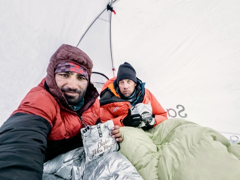
In 2021, Maynadier and Tom Livingstone attempted 6,850m Pumari Chhish East, retreating just 100m from the summit after heavy snowfall.
The next year, Maynadier made the first ski descent of 7,266m Diran in the Karakoram, after reaching the summit at 6 pm.
In 2023, Maynadier, Simon Gietl, and Roger Schaeli opened Goldfish (800m, M6+, A1) on 6,570m Meru South’s southeast face in India.

Ud Din, an emerging talent
Muizz Ud Din, an emerging talent from Pakistan, represents a new generation of local mountaineers. Ud Din’s local knowledge and determination were critical to the expedition’s success.
His partnership with Maynadier is a bridge between global and local climbing communities, and their climb might be the first major new route opened in Pakistan by a local climber.
"It’s a huge step, I hope, for the Pakistan climbing community," Maynadier said.
For Ud Din, Zindabad is more than a route. It’s a beacon for aspiring Pakistani climbers, proving that technical, high-altitude ascents are within their reach.
Rope fixers have begun securing the lower section of the normal route of 8,125m Nanga Parbat. Some independent climbers have begun their acclimatization. On the Rupal Face, David Goettler, Boris Langenstein, and Tiphaine Duperier are progressing. Here’s the latest news from Nanga Parbat.
Horia Colibasanu has spent this week acclimatizing. The Romanian aims to summit Nanga Parbat via the Kinshofer (standard) route on the Diamir Face without supplemental oxygen or high-altitude porters.
Three days ago, he reached Camp 1 at 5,000m and overnighted there. His mattress sprung a leak overnight, and by morning he felt like he was "in a boat." That night, about 12cm of snow fell, although temperatures remained mild at around 4–5°C.
He had intended to move higher, but conditions were too hazardous. The previous Sunday, a large avalanche had struck the couloir above the rock protecting Camp 1. So instead of risking that passage, Colibasanu descended to Base Camp to wait before attempting Camp 2.

Brutal climb, brutal sun
Yesterday, that opportunity came, and Colibasanu reached Camp 2 at 6,000m.
"It was brutal — 1,800m climbed with all my gear on my back," he wrote on social media.
He said the final 150m involved a tricky rock wall, and he found barely enough space for his tent. He managed to set it up on a two meter by one meter platform, securing it to fixed ropes to stabilize it. However, ice beneath part of the platform made leveling the tent challenging.
Sa’ad Mohamed of Pakistan also aims to summit Nanga Parbat via the Kinshofer route without supplemental oxygen or high-altitude porters. Today, he reached Camp 2 while acclimatizing, noting, "The sun is brutal up here."
Currently, there is no news from Denis Urubko and Maria Cardell, who are attempting a new route on the Diamir Face.

The Rupal Face
David Goettler, Boris Langenstein, and Tiphaine Duperier are climbing the demanding Schell Route on the hazardous Rupal Face.
The trio arrived a week ago and recently climbed to 6,000m to assess conditions. They are now at Latabo Base Camp, nestled beneath the Rupal Face, awaiting a suitable weather window. The team is climbing without external support or supplemental oxygen.

Goettler’s goal is to summit Nanga Parbat on this, his fifth attempt on the Rupal Face, then descend by paraglider, a feat never before accomplished. Langenstein and Duperier will ski from the summit.

The 1976 Schell route climb
On August 11, 1976, four Austrians — Hanns Schell (leader), Robert Schauer, Siegfried Gimpel, and Hilmar Sturm — summited Nanga Parbat via a new route, now known as the Schell Route, without supplemental oxygen. This was the fifth overall ascent of Nanga Parbat and the second ascent of the Rupal Face.

The Austrian team established Camp 1 at 5,100m in early July. After navigating rockfall and couloirs, they reached Camp 2 at 6,100m. They set up Camp 3 at 7,000m after heavy snowfall, during which they lost their cache of supplies and their tent was buried under two meters of snow.
From Camp 3, it took the Austrians four days to reach Nanga Parbat’s summit via this new route. After an eight-hour climb through deep snow, they established Camp 4 at 7,450m. On August 10, 1976, Schell’s team reached 8,042m by 7 pm but bivouacked at 8,020m due to darkness. On August 11, they finally summited, one month after leaving Base Camp.

In the early stages, the Austrians required fixed ropes and faced heavy snow and rockfall between Camps 1 and 2. A severe storm hit Camp 2 mid-climb, and monsoon-like rains and floods in Pakistan forced a six-day retreat to Base Camp.
Later, the weather cleared, but the snow had buried their equipment. A sudden gust nearly destroyed their Camp 3 tent. On the summit day, August 11, a storm at 8,000m forced a temporary retreat, but conditions improved by noon, with warm, clear weather at 7,700m.
Their descent, conducted between August 11 and September 5, 1976, was challenging. Schell suffered severe exhaustion and lung issues, which slowed their progress.
Current forecast on Nanga Parbat
Mountain Forecast indicates low winds at the beginning of next week. The weather for the summit and for 7,500m over the coming days is as follows:
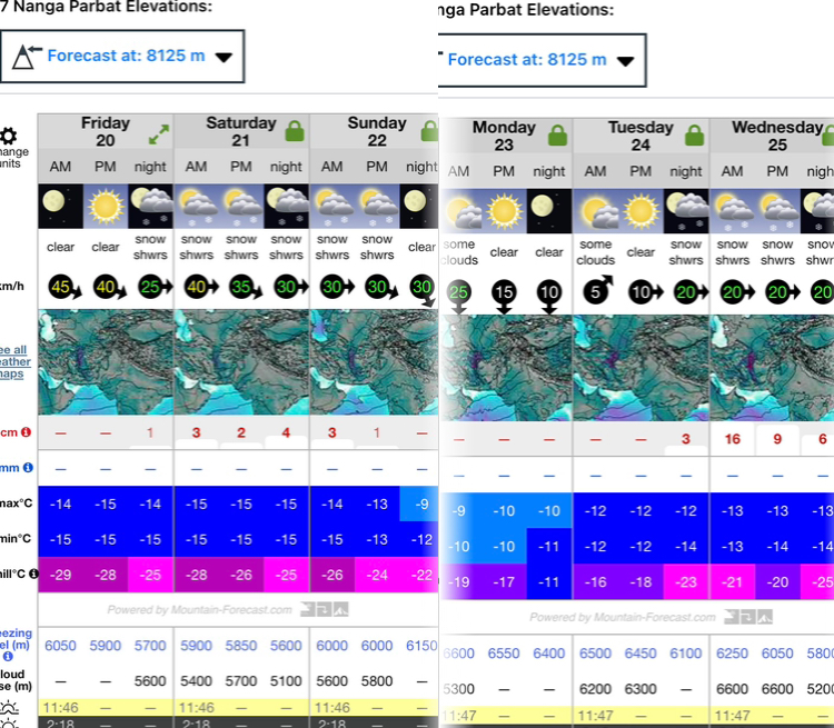
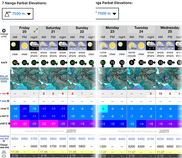
On June 18, Radoslav Groh and Zdenek Hak climbed the 3,000m Southwest Face of 6,270m Hunza Peak in Pakistan's Karakoram.
The Czech pair made the ascent in a 20-hour, alpine-style push, according to Aktivtono and an Instagram post from their sponsor, Hudysport. They trekked two or three days via the Batura Glacier to the base of the wall.
Hunza Peak lies in the Batura Muztagh above the Hunza Valley and near the Ultar Sar massif. Its southwest face, a steep wall of rock and ice, had been unclimbed until now.
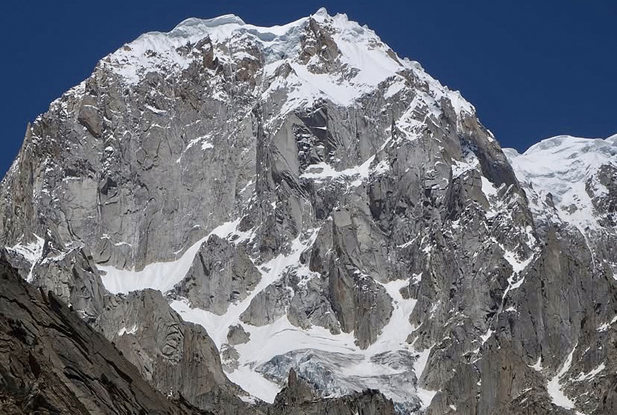
Hunza Peak's climbing history
In the summer of 1991, a British team, including Crag Jones and Mick Fowler, made the first ascent of Hunza Peak, via the southwest ridge, after an earlier unsuccessful attempt on Ultar Sar. That season, a Swedish team also ascended Hunza by an unspecified route. Both climbs were in alpine style.
Jones and Fowler proceeded from the Hasanabad Glacier to the col between Hunza Peak and Bublimoting, then mounted the southwest ridge from there over three days.
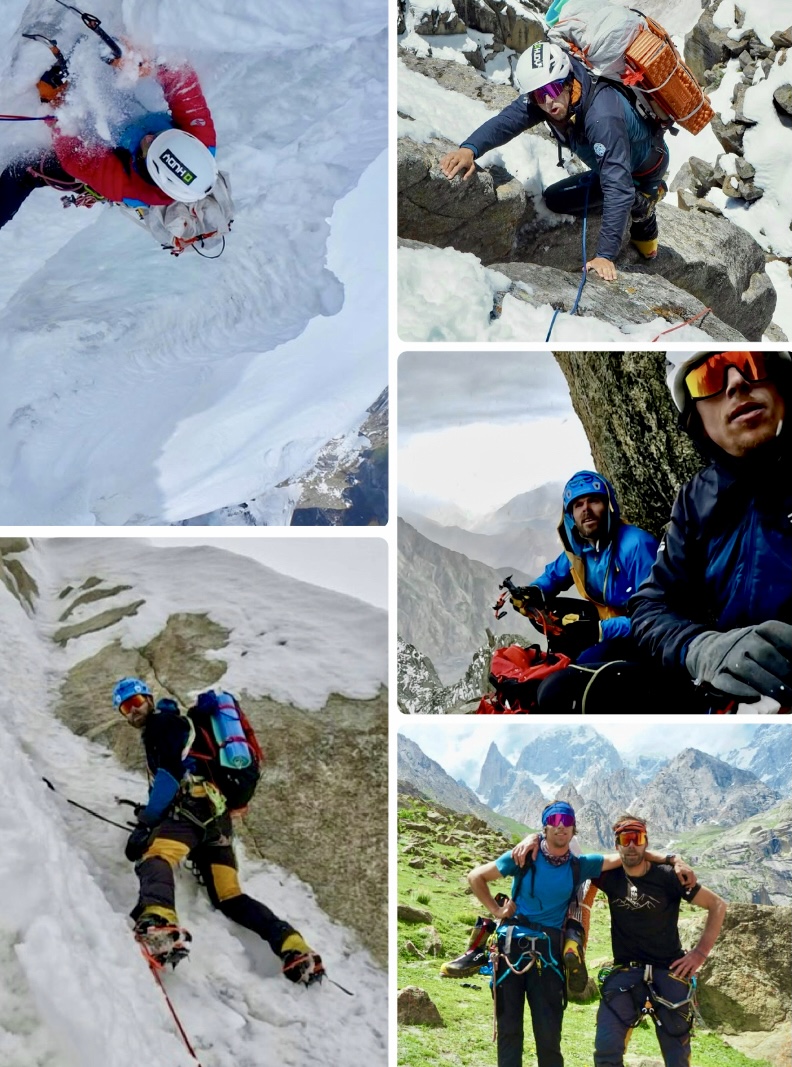
An Austrian party that included Harry Grun, Klaus Bonazza, and Jakob Karner attempted a 1,200m section of the southwest face in 2008, but failed due to bad weather.
Groh and Hak's first ascent of Mucchu Chhish last year was ExplorersWeb's top expedition of 2024. They named their new route on Hunza Peak Eid al-Adha ("Feast of Sacrifice").

On June 11, 14 highliners successfully connected and crossed a giant highline between the Dent du Geant and Mont Mallet in the Mont Blanc massif near Chamonix.
The team, which included Aurelia Lanoe, Antoine Mesnage, and Camille Le Guellaut of France, among others, used drones to assist with the highline installation at an altitude of 4,000m. It took them over two days to set the 19mm-wide, 788m long line across the gulf and a preliminary three days to prepare the setup.
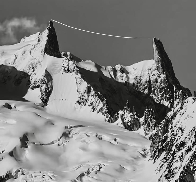
The French media, including Le Monde, reported the achievement, noting the technical difficulty and the absence of any problems. The adventure community celebrated the feat as a milestone. British climber and Everest guide Kenton Cool noted on social media that it represents "a bold vision suspended between sky and rock."
Each step during the 45-minute crossing demanded razor-sharp focus, with the void below amplifying every heartbeat.
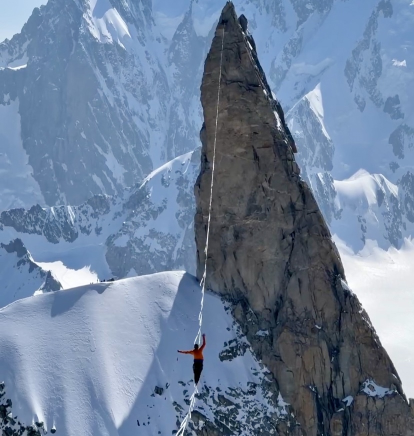
"Having walked between these two peaks still feels unreal," recalls Le Guellaut.
The 4,013m Dent du Geant is a prominent rocky spire above the Glacier du Geant, while 3,989m Mont Mallet is lesser known and stands almost a kilometer away.
Another use for drones
Connecting these two peaks by climbing would have been challenging. The terrain includes the crevassed Glacier du Geant and loose, unstable rock, with no established route between them. Descending the Dent du Geant's steep, technical normal route (5.9) leads to the glacier, followed by a tough, uncertain ascent up Mont Mallet's mixed snow and rock slopes. This traverse would have taken expert, well-equipped climbers several days -- hence their reliance on the increasingly useful drone technology.
The highliners spent eight months planning and a total of three weeks of grueling logistics, hauling 400kg of gear over 29 trips without helicopters, honoring the spirit of traditional mountaineering.
Sebastian Pelletti, Ethan Berman, and Maarten van Haeren have returned to civilization after their landmark ascent of the Southeast Pillar of 7,388m Ultar Sar in the Karakoram.
Still in Pakistan, Pelletti described their new Shooting the Moon route to ExplorersWeb, which they graded M5 WI4 3,100m. The climb took place from June 6 to 13 — six days up and two days down, including one weatherbound day.
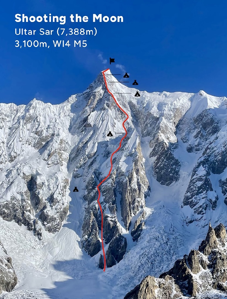
The 3,100m route featured steep snow and ice with a rock pillar between 6,700m to 7,200m. For the first three days, they tried to cover as much elevation as possible between safe bivouacs.
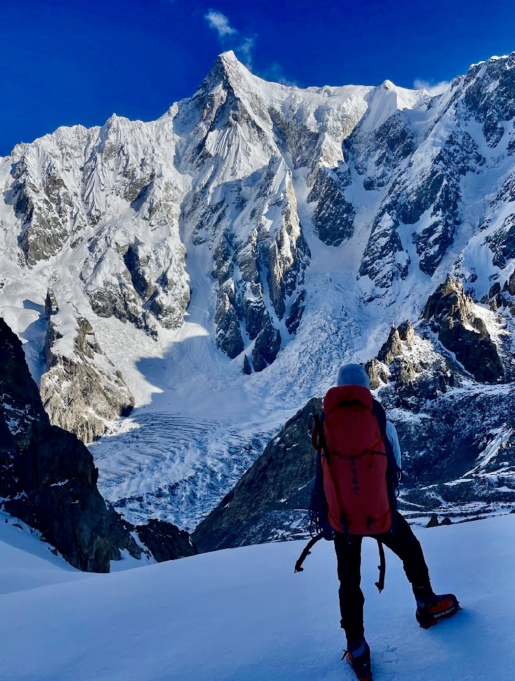
Based on what they learned from their 2024 attempt, they spent a lot of time climbing at night and during the early morning hours to optimize temperatures and conditions. Later in the day, high winds and cloud systems typically rolled through, eliminating visibility and forcing them to stop early.
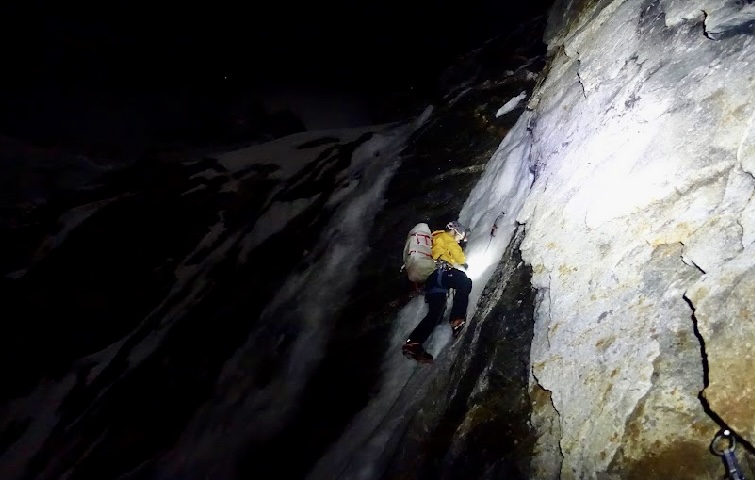
Spartan bivouacs
Excavating bivouacs on this pillar proved challenging, but they eventually carved out platforms big enough for the three of them to sleep together in a hammock.
On the third day, they climbed from 5,800m to 6,650m on mostly 70-degree ice. No bivouacs were possible until the base of the rock pillar, which they reached after a long day.
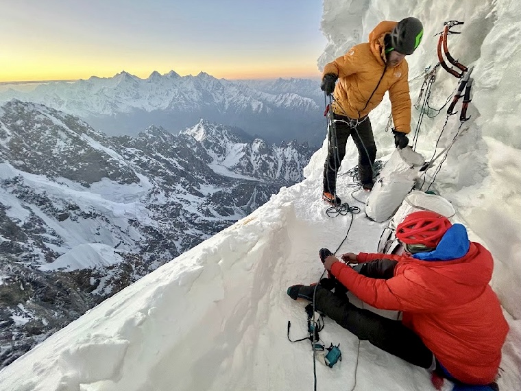
The rock pillar proved much higher than they had anticipated, and they had also expected the route to have some easier snow slopes. However, apart from the lower entrance fan and the final 200m to the summit, the entire route was steep ice and rock, keeping them on their tools and front points the entire time.
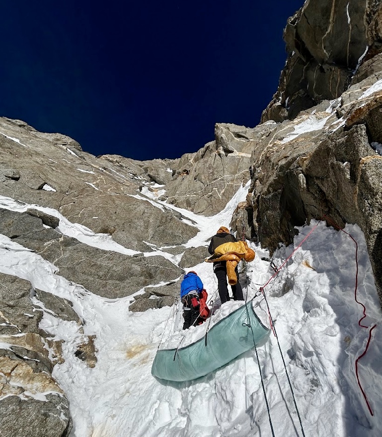
On day 4, they confronted the crux of the climb -- the upper part of the rock pillar. There, mixed climbing up to M5 continued from 6,800m to 7,200m before they gained the final snow slopes.

70+ rappels
After summiting, Pelletti, Berman, and van Haeren went down their ascent line. That afternoon, a storm pinned them down at their 6,650m bivouac. They endured 24 hours of blowing snow before a brief opening in the clouds allowed them to continue down.
By the time they reached 6,000m, the weather had significantly improved. They covered the descent in three stages: the first from the summit to 6,650m, the second (after the weather delay) from 6,650m to 4,300m, and finally, all the way down to base camp in a 31-hour push. They lost count after 70 rappels.
Their timing was exquisite: Back in base camp, a major storm swept through the range for several days.
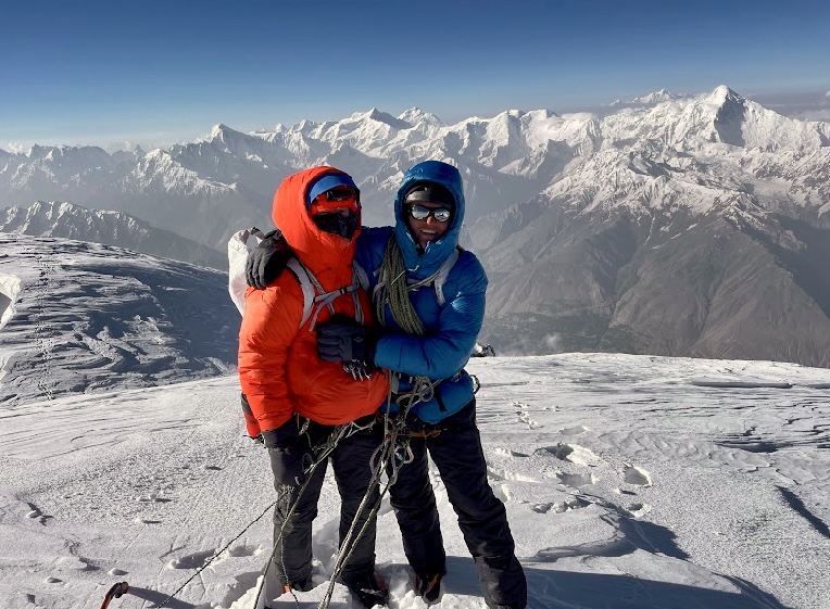
"This feels like the biggest climb any of us has individually done, and we are still processing the experience," Pelletti told ExplorersWeb. "We’ve all completed multi-day alpine climbs, but this was our first time applying this experience to an objective above 7,000m...We are just super-satisfied in the way we worked together on an objective that seemed too big to contemplate as a whole."
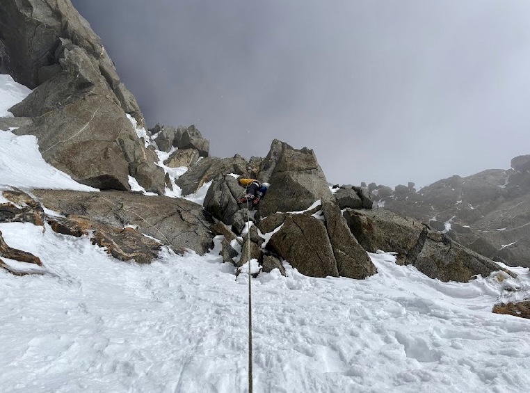
The climbers received financial support from the John Lauchlan Award, a Cutting Edge Grant, and the Mazamas Bob Wilson Grant, and logistical support from Pakistan Higher Ground Expeditions.
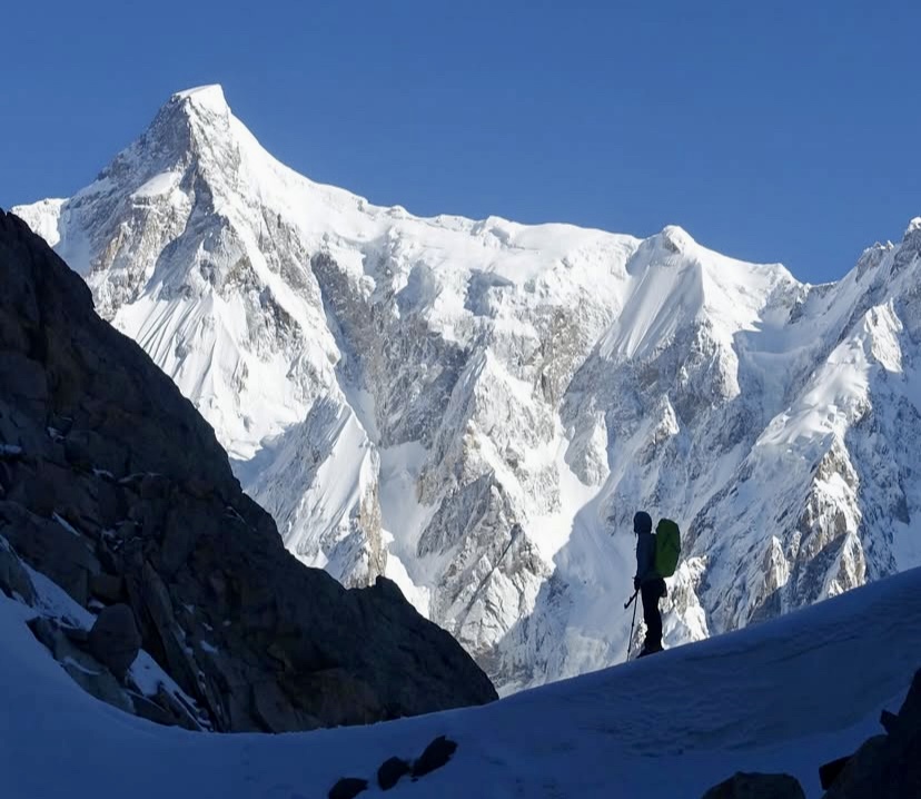
Mueez Ud Din of Pakistan and Mathieu Maynadier from France have climbed a new alpine-style route on the east ridge of 7,029m Spantik, located in the Spantik-Sosbun Mountains, a subrange of Pakistan's Karakoram.
The climbers set off from Base Camp at 4,200m in early June after a rough approach trek over a badly crevassed glacier.
A German expedition led by Karl Kramer first climbed Spantik in 1955 via the Southeast Ridge from the Chogolungma Glacier. This route, which has since become the normal route, had also been attempted in 1906 by Fanny and William Bullock Workman. The pioneering couple reached about 6,700m at the time.
A Japanese expedition led by Koumei Nakamura climbed Spantik's South Ridge in 1978, when Shigeru Nakamura and Shuetsu Yamamoto topped out on August 8. They reported significant avalanche danger along the route.
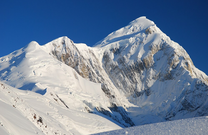
British climbers Mick Fowler and Victor Saunders succeeded on the famous Golden Pillar (Northwest Pillar) of Spantik in August 1987, descending via the Southwest Spur. A Korean team did a new route on the same face in 2009. Other expeditions have also used the Southwest Spur on the way down.
We couldn't find any registered ascent of the East Ridge in the American Alpine Journal, so the new alpine-style route potentially represents the first ascent of Spantik via the East Ridge.

One of Poland's great alpinists of the 1970s and 80s, Krystyna Palmowska, died yesterday in a climbing fall in Slovakia’s High Tatras, according to Polish sources.
The accident occurred on June 15, and her body was found today, June 16, by the Slovak Mountain Rescue Service after ground and helicopter searches.
Palmowska, 76, was one of the best female alpinists of her generation -- a generation when the Poles, both men and women, dominated high-altitude mountaineering. Her remarkable climbs included:
- 1977: Matterhorn North Face – 2nd all-female ascent
- 1978: Matterhorn North Face – 1st all-female winter climb
- 1979: Rakaposhi (7,788m) – New route
- 1982: Member of the K2 Women's Expedition
- 1983: Broad Peak (8,047m) – 1st woman summiter
- 1985: Nanga Parbat (8,126m) – 1st all-female ascent
- 1986: K2 Magic Line – Reached 8,200m with Anna Czerwinska
An Italian team is attempting an alpine-style climb of 7,932m Gasherbrum IV in Pakistan’s Karakoram.
Federico Secchi, Leonardo Gheza, and Gabriele Carrara aim to repeat the iconic Northeast Ridge route first climbed by Walter Bonatti and Carlo Mauri in 1958 during the first ascent of Gasherbrum IV.
Photographer Ettore Zorzini will accompany the climbers to 6,200m and take drone footage of the ascent from there. The expedition is backed by the Italian Alpine Club.
An Italian team led by Riccardo Cassin first climbed Gasherbrum IV via the Northeast Ridge and the North Summit in 1958. On Aug. 6, members Walter Bonatti and Carlo Mauri summited from Camp VI at 7,544m. The initial 107m on the Northeast Ridge, the easiest section they encountered, took three hours, with increasingly difficult climbing from there.
The summit ridge featured five rock towers, with the third deemed the highest. They navigated Class 4 and 5 climbing on unstable rock, then traversed from the North Summit to the main summit, where they topped out at 12:30 pm.
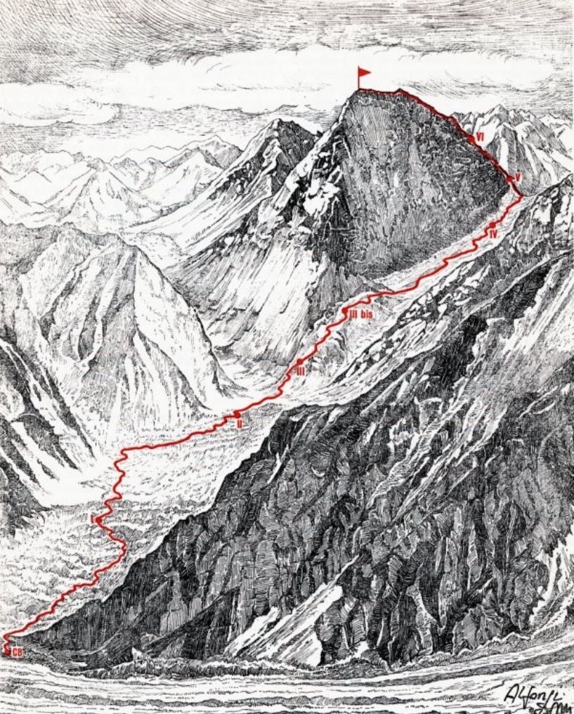
Traversing the pinnacled ridge to the main summit was considered the crux of the climb. After enduring a snowstorm at Camp VI, they descended the next day via a dangerous route to Camp V at 7,193m, where Toni Gobbi and Giuseppi de Francesch awaited. De Francesch narrowly escaped a fatal fall during the support effort. Other team members included Giuseppe Oberto and Dr. Fosco Maraini.
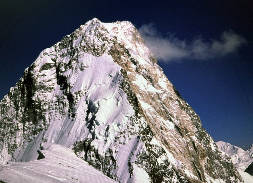
Never repeated
The 1958 route to the summit hasn’t been repeated since that first ascent, despite some attempts over the years.
One of those attempts ended in tragedy. In 2018, an Italian military team aimed to climb the Bonatti-Mauri route to mark its 60th anniversary. Climber Maurizio Giordano was killed by a falling serac, and the expedition failed to complete the Northeast Ridge route.
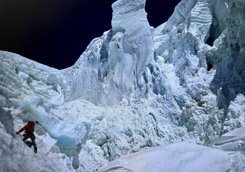
As we reported last week, another party also aims to climb Gasherbrum IV. French climbers Charles Dubouloz and Symon Welfringer will attempt the Southwest Ridge via the West Face (Shining Wall) and then continue along the ridge to the summit.
On June 11, Ethan Berman, Sebastian Pelletti, and Maarten van Haeren made the first ascent of the Southeast Pillar of 7,388m Ultar Sar in Pakistan’s Karakoram. Their outfitter, Abdul Ghafoor of Pakistan Higher Ground Expeditions, announced the news.
In 2024, the trio made a first unsuccessful attempt on this line. This year, supported again by a 2025 Cutting Edge Grant from the American Alpine Club and the John Lauchlan Memorial Award from the Alpine Club of Canada, they succeeded in climbing the 3,100m route alpine style. The route tackles steep snow, ice, and mixed terrain up to 6,500m, followed by mixed climbing, a rock barrier at 7,000m, and the final rock pillar to the summit.
Ultar Sar, also known as Bojohagur Duan Asir II, lies in the Batura Muztagh of the Karakoram. It rises 5,300m above the Hunza River, a striking yet perilous peak. Its Southeast Pillar, sometimes called the Hidden Pillar or the Walker Spur of the Karakoram, has long been considered one of the range’s last great unclimbed challenges.
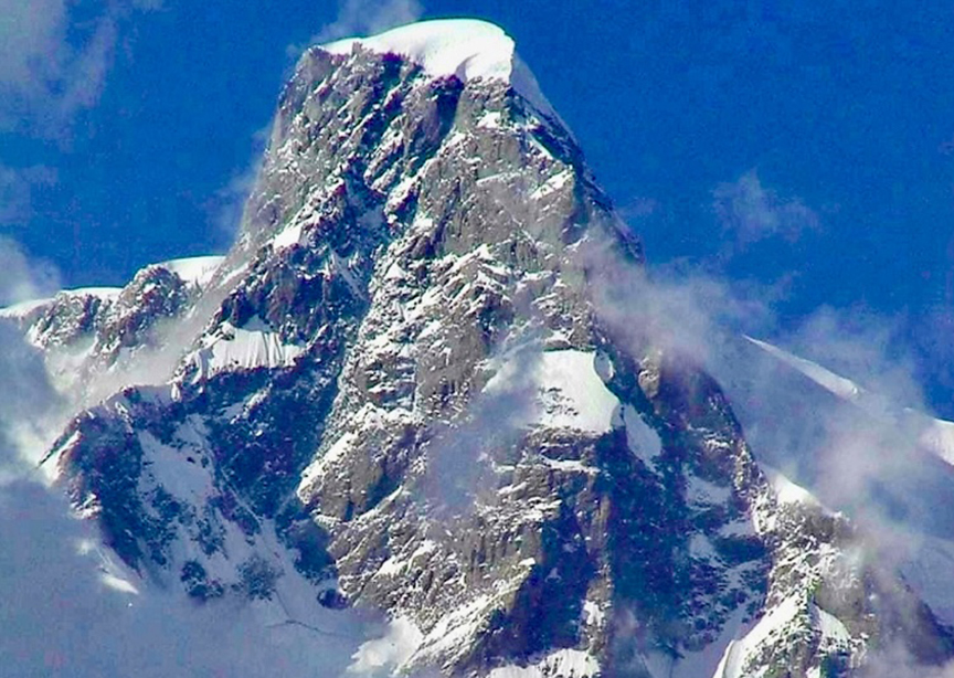
Past attempts
Ultar Sar had numerous failed attempts before its first ascents in July 1996 by two separate Japanese teams via the Southwest and South Ridges.
The Southeast Pillar, however, had resisted all efforts until now:
- In 1992, Toshio Narita’s team retreated from 5,400m due to technical difficulties.
- In 2000, Jerome Blanc Gras, Yannick Graziani, Erwin le Lann, and Here Qualizza were stopped by poor weather before starting the pillar.
- In 2005, Graziani and Christian Trommsdorff reached 5,800m, roughly halfway up the pillar.
- In 2011, Fumitaka Ichimura and Yusuke Sato made a strong alpine-style attempt. They started from a 4,300m Base Camp on September 6 and reached 6,500m after a week, but worsening snow conditions forced their retreat.
- In 2018, Tim Miller, Bruce Normand, and Christian Huber reached Camp 2 at 5,900m after cold, wet weather from June 14 to June 30. A brief weather window allowed them to continue climbing, but four days of snow trapped them, and a small avalanche buried their tent, killing Huber. Miller rescued Normand, and a Pakistani Army helicopter saved the survivors.
- In 2024, Berman, Pelletti, and Van Haeren reached 6,000m before unstable snow stopped them.
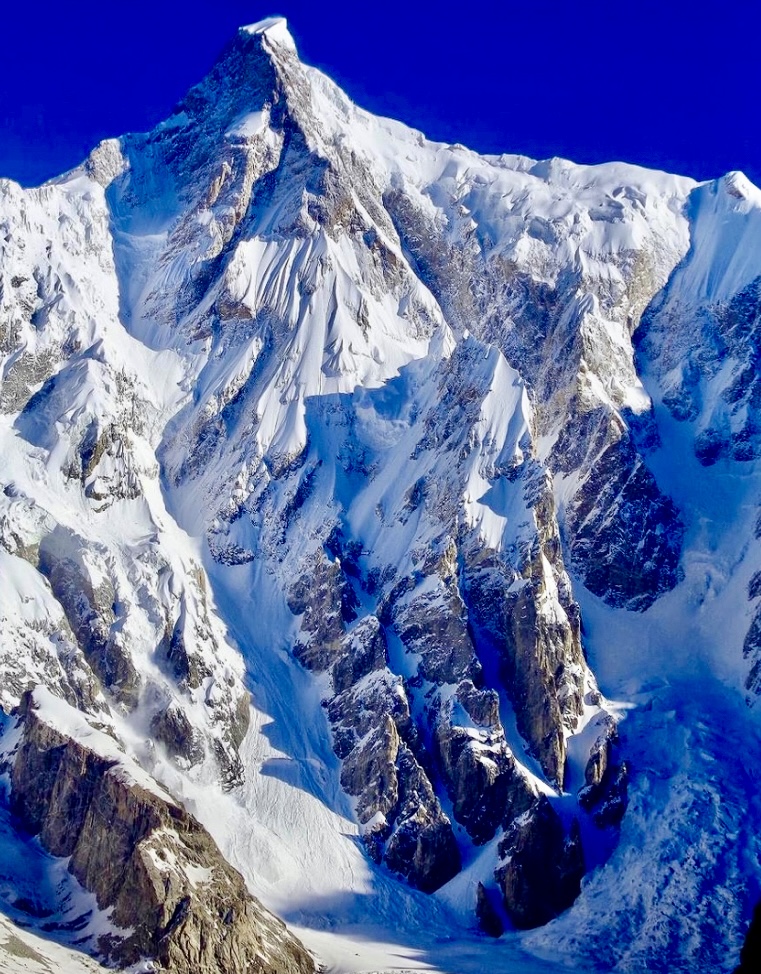
As Colin Haley noted in 2007, the Southeast Pillar of Ultar Sar, which is longer than Latok I’s North Ridge, demands sustained technical climbing, particularly in the mixed section from 6,500m to 6,900m and the rock barrier at 7,000m.
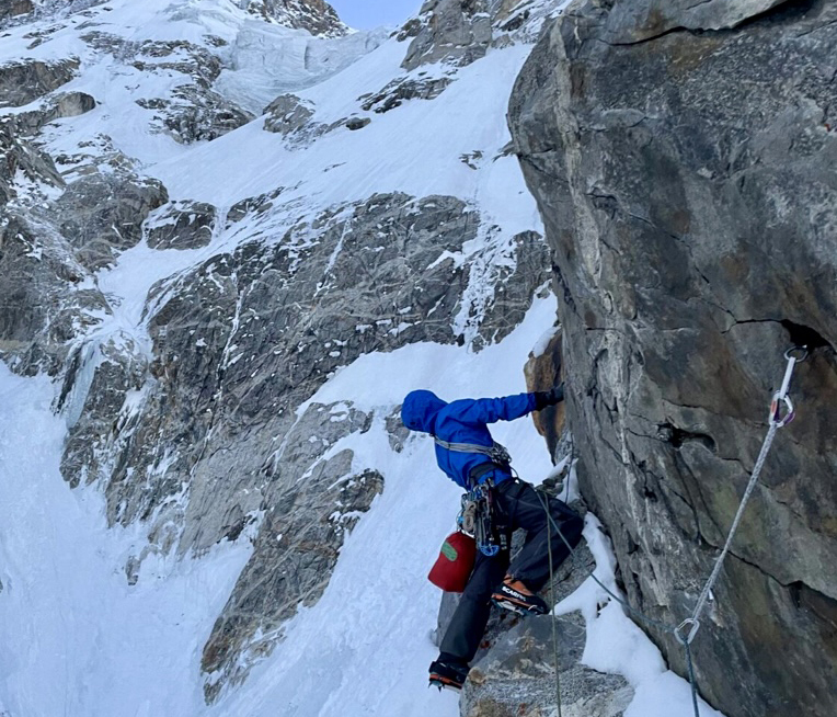
Berman, Pelletti, and Van Haeren reached the Hunza Valley a month ago, after a tumultuous week of travel, including many flight cancellations and unplanned nights in multiple cities en route, due to tensions between Pakistan and India.

Denis Urubko and Maria Cardell are in Pakistan to open a new alpine-style route on Nanga Parbat's Diamir Face. Here, we examine the climbing history of this formidable 4,000m wall.
Nanga Parbat (8,125m) is located in Pakistan’s Gilgit-Baltistan region and has three main faces: the south-facing Rupal Face, the northeast-facing Rakhiot Face, and the northwest-facing Diamir Face. The Diamir Face is bordered by the Diamir Glacier to the west and the Mazeno Ridge to the south, which separates it from the Rupal Face.
The Diamir Face features a complex mix of steep snowfields, icy slopes, rock bands, and couloirs. There are significant avalanche-prone areas and seracs, especially in the lower and mid-sections. It is Nanga Parbat’s most commonly climbed face because of its short approach, established routes, and relatively low (but still significant) avalanche risk compared with the 4,600m Rupal Face or the Rakhiot Face’s long, dangerous glaciers. However, the Diamir Face has other significant hazards, including rockfall and crevasses.
Before the first successful ascent of Nanga Parbat in 1953, dozens of mountaineers had died on the mountain from avalanches and harsh weather. No one topped out until Hermann Buhl’s successful solo summit push via the Rakhiot Face, a story that we’ll revisit on its anniversary on July 3.
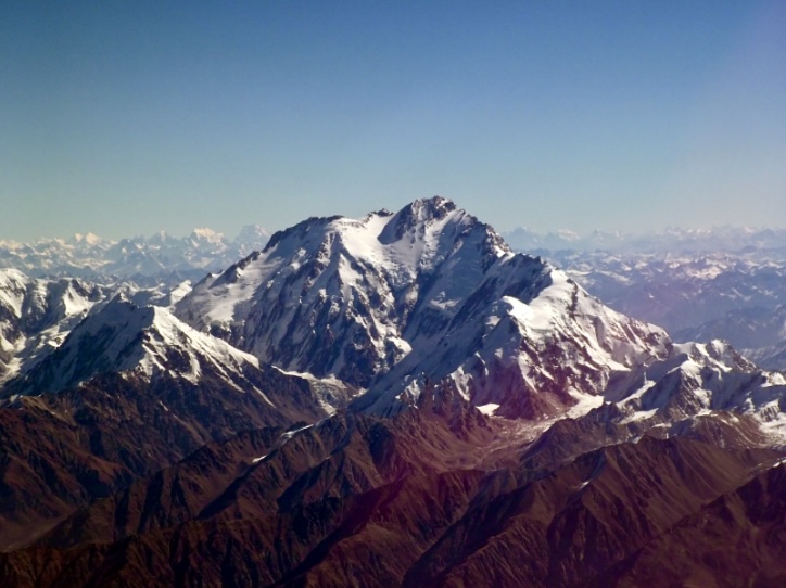
Reconnaissance
In 1932, Willy Merkl's German-American team explored Nanga Parbat. Though they focused on the Rakhiot Face, they also scouted the Diamir Face and noted its steep ice and rocky bands. In 1934, Merkl’s second expedition again prioritized the Rakhiot Face, but that expedition ended in tragedy when a storm killed Merkl, among others.
Paul Bauer’s German team mapped potential Diamir routes in 1938 while also focusing on the Rakhiot Face. In 1939, Heinrich Harrer and a German team scouted the Diamir Face, concluding it was a viable ascent route, but World War II and their internment in British India halted their plans.
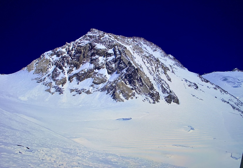
Mummery’s audacious plan
The Diamir Face’s climbing history began in the summer of 1895 with British mountaineer Albert Frederick Mummery and his small team. They aimed to summit Nanga Parbat by the central rib, known now as the Mummery Rib or Mummery Spur. Their expedition was the first recorded attempt to summit an 8,000m peak.
Inspired by earlier reconnaissances in the Karakoram and a desire to test the limits of high-altitude climbing, Mummery formed an audacious plan: He'd climb an 8,000m peak without a large, heavily supported team typical of later Himalayan siege-style expeditions. Mummery’s alpine-style approach was groundbreaking for its minimalism, relying on a small group and limited resources.
Mummery's team included J. Norman Collie, Geoffrey Hastings, and Gurkha porters Ragobir Thapa and Goman Singh.
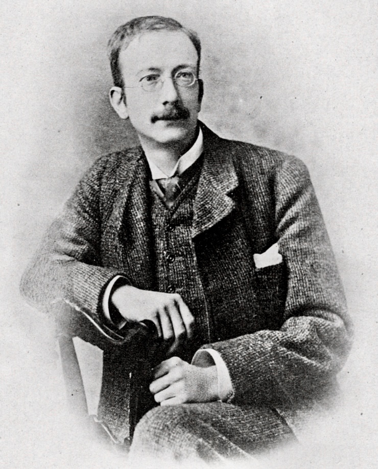
The Mummery Rib attempt
Mummery’s party approached from the Diamir Valley. His strategy was to scout and climb the central rib, a steep rocky feature on the Diamir Face that offered a direct route toward the summit.
Mummery's expedition reached 6,100m on the Mummery Rib, which was a remarkable achievement for the time, given their lack of supplemental oxygen, primitive equipment, and limited understanding of high-altitude physiology.
At 6,100m, Ragobir began to suffer from severe altitude sickness (likely high-altitude pulmonary edema), which forced the team to abandon their ascent. Mummery, Collie, and Hastings recognized the impossibility of continuing up the technically demanding and exposed Mummery Rib with a sick teammate in deteriorating conditions.
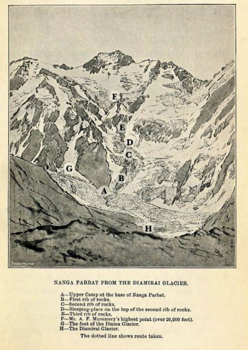
A tragic outcome
After abandoning the Mummery Rib, Mummery decided to explore an alternative route via the Rakhiot Face, hoping to find a more feasible line to the summit. On Aug. 24, 1895, Mummery, Ragobir, and Goman Singh set out on the Rakhiot Glacier. They were never seen again.
Collie, who remained at a lower camp, later concluded that an avalanche must have swept the trio away while they were crossing a snow-covered pass or glacier. Search parties found no trace of Mummery or the Gurkhas. Devastated by the tragedy, Collie returned to Britain and later wrote about the expedition, emphasizing Mummery’s bold vision and the inherent risks of high-altitude exploration.
After Mummery’s attempt, the exposed Mummery Rib saw little attention for decades. Early Nanga Parbat expeditions focused on the Rakhiot Face, and the Mummery Rib’s steepness and danger deterred climbers for years.
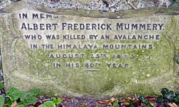
Descending the Diamir Face
In 1970, Reinhold Messner joined a German expedition to Nanga Parbat led by Karl Herrligkoffer. Messner and his brother Gunther climbed the Rupal Face, the steepest and highest rock-and-ice wall in the world, following a new route established by the expedition. They navigated steep icefields, rocky bands, and difficult terrain, reaching the summit on June 27. This marked Messner’s first 8,000m peak and was the first successful ascent of the Rupal Face.
After summiting, worsening weather and exhaustion made descending the Rupal Face too risky. With no fixed ropes or support, the Messner brothers chose to go down the Diamir Face, marking the first traverse of Nanga Parbat (Rupal Face up, Diamir Face down). They followed the Mummery Rib’s lower slopes before improvising a westward path toward the Mazeno Ridge’s lower slopes, crossing gullies and snowfields near the Diamir Glacier. Tragically, Gunther disappeared in this area during the descent, likely swept away by an avalanche. Reinhold barely survived, suffering severe frostbite and losing several toes.
Gunther’s remains, discovered in 2005, reinforced the accuracy of Messner’s earlier account, which had been controversial at the time.
Messner’s solo climb
In 1978, Messner returned to Nanga Parbat with a bold goal: to climb an 8,000m peak entirely alone, without support, fixed ropes, or supplemental oxygen.
Messner approached via the Diamir Valley and chose a new route on the Diamir Face, starting from Base Camp at 4,200m on July 20. He explicitly avoided the Mummery Rib because of high rockfall risk. Instead, he went further west toward the Mazeno Ridge’s lower slopes, steep icefields, and rocky sections. On August 9, equipped with minimal gear, he reached the summit, completing the first entirely solo ascent of an 8,000m peak.
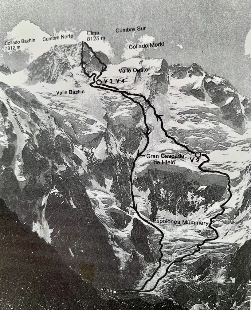
For his descent, Messner chose a different route because of avalanche risk. Descending through a steep gully (now called the Messner Couloir) parallel to the Mummery Rib’s left side, he avoided the rib's rocky spur by staying west and crossing adjacent snowfields and gullies, especially in the lower sections He bivouacked three times during the descent, relying on his experience from the 1970 traverse.
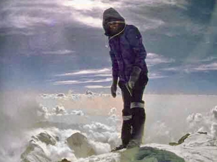
A secret solo climb
In the summer of 1999, Hungarian Zsolt Eross ascended Messner’s 1978 descent route. For several years, Eross's climb was not widely known.
It began in July 1999, when four Hungarian mountaineers organized a trek in Pakistan. The team included Zsolt Eross, Andras Foldes, Laszlo Mecs, and Peter Dely. They had no money to obtain permits for an 8,000m peak and did not have proper gear or equipment.
They headed to the Nanga Parbat region with little beyond a tarp for a shelter and a little food they had rationed from the trek. Despite these limitations, they managed to climb 6,608m Ganalo Peak, a subsidiary peak of Nanga Parbat. Then, 31-year-old Eross told his friends that he wanted to explore Messner’s route on Nanga Parbat. Somehow, he persuaded the group to move to the base of the mountain.
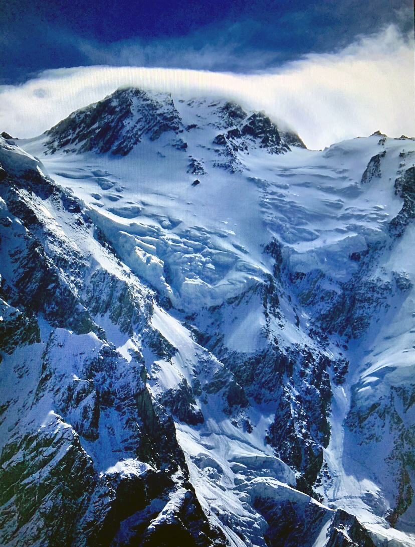
Climbing without permits, they had to hide from the authorities. This game of cat and mouse prevented them from properly acclimatizing. Nevertheless, Eross began to ascend Messner’s 1978 descent route alone, with practically no rope or gear.
During his ascent, Eross made three bivouacs. His first was on the plateau below Messner’s Couloir at 5,400m, the second was where the route crosses left through the sloping rock barrier, and his third was below the final headwall. On July 18, 1999, Eross topped out despite deep snow on the upper sections.
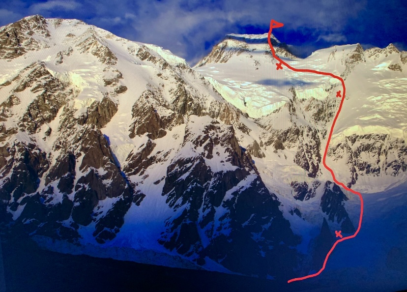
From the summit, Eross descended to his highest bivouac and continued down parallel to the Mummery Rib. During the descent, he became lost, fell into a crevasse from which he eventually escaped, and was later swept down 400m by an avalanche. Though he lost 10kg and frostbit his toes, Eross survived the climb.
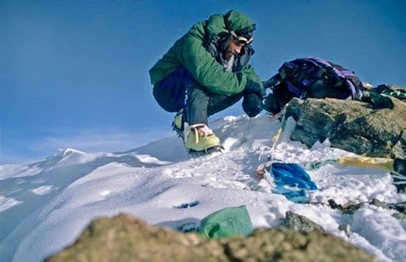
An incredible achievement, kept secret
Alongside Hermann Buhl (whose climb was partially solo, as Buhl climbed solo from 6,900m to the summit via the Rakhiot Face), Reinhold Messner (1978 Diamir Face), and Krzysztof Wielicki (1996 Kinshofer Route on the Diamir Face), Eross became the fourth person to summit Nanga Parbat solo.
For several years, Eross and his teammates kept the climb a secret, fearing they would be banned from entering Pakistan.
With no permit, Eross's climb was not officially recognized. However, it was undoubtedly a great solo mountaineering achievement, and his route remains significant for its historical connection to Messner's route.
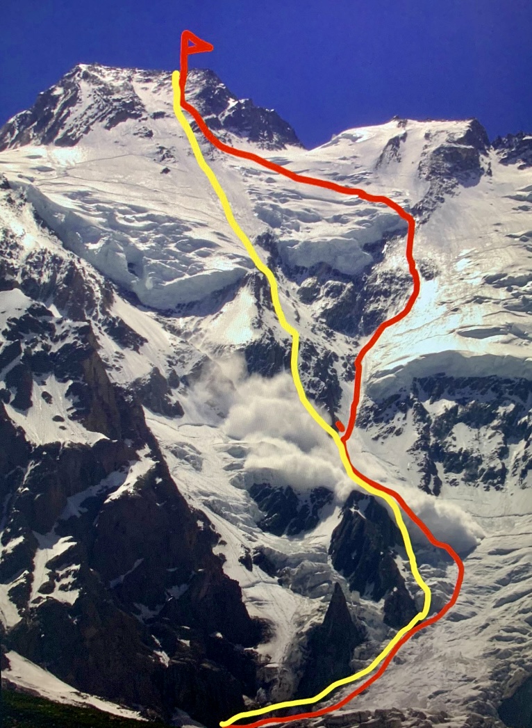
Daniele Nardi
Italian Daniele Nardi made multiple attempts on the Mummery Rib, driven by a passion to climb it in winter.
In 2012–13, Nardi and Elisabeth Revol reached 6,400m but retreated in harsh conditions. Nardi tried again in 2013–14 and other winters, aiming to solo the Rib. His fifth attempt in 2019, with British climber Tom Ballard, aimed for a new winter route. They reached about 6,300m by February 24 and dropped out of contact soon after. Their bodies were spotted through a telescope on March 9 by Alex Txikon, ending rescue efforts delayed by weather and regional tensions.
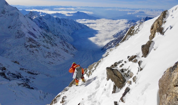
No expedition has definitively ascended the entire length of the Mummery Rib to the summit. Its upper sections above 7,000m are unclimbed because of extreme danger. It remains one of mountaineering’s unsolved challenges.
The first ascent of the Diamir Face
The Diamir Face was finally ascended in 1962, when Toni Kinshofer, Siegfried Low, and Anderl Mannhardt climbed a buttress on the left side, now known as the Kinshofer Route. This was the second overall ascent of Nanga Parbat, following Hermann Buhl’s 1953 Rakhiot Face climb.
The 1962 route avoided the avalanche-prone central Diamir Face by ascending a buttress on the left side, reaching the Kinshofer Icefield, and traversing the Bazhin Gap to the summit. Tragically, Low died during the descent, and Kinshofer and Mannhardt suffered severe frostbite.
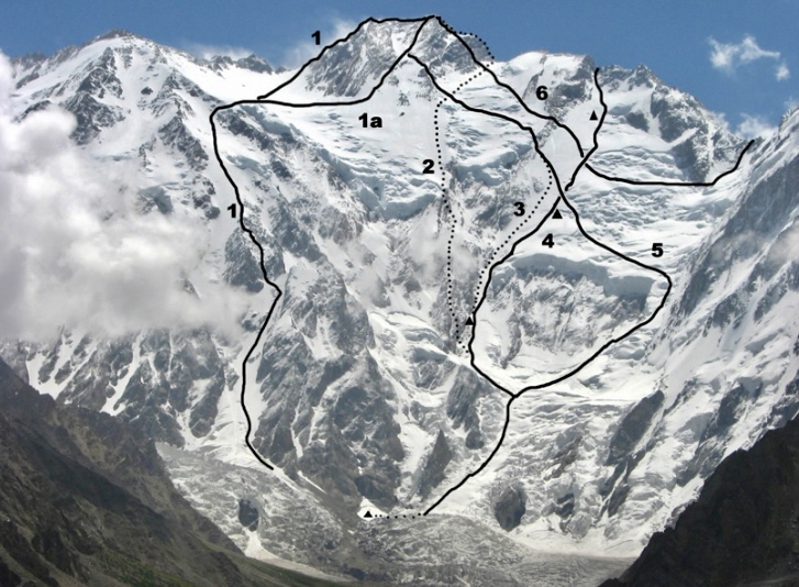
The modern normal route and further variations
The Kinshofer Route has become the standard route, with some variations that are minor adjustments to the established line. These variations are not entirely new routes, but adaptations to address specific conditions like rockfall or serac danger.
The current Kinshofer Route (called Kinshofer Line 1a) deviates slightly from the original 1962 route to avoid hazardous sections, particularly around the Kinshofer Icefield and Bazhin Gap.
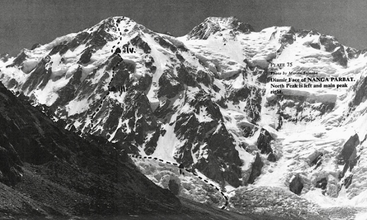
In the summer of 1978, a team of climbers from Czechoslovakia set their sights on the Diamir Face. The team included Andrej Belica, Joseph Just, Marian Zatko, and Juraj Zatko. They reached the North Summit at 7,800m by a variation of the Kinshofer Route. This ascent, though less celebrated than Reinhold Messner’s solo climb on the face’s right side that same year, was an impressive achievement.
In 2003, Jean-Christophe Lafaille and Simone Moro climbed a new 1,400m line (the "Tom and Martina" route) in alpine style on a broad buttress/spur, left of and parallel to the 1978 Slovak Route. Graded at 90° ice and M6, it later joined the Kinshofer Route. Lafaille continued to the summit via the Kinshofer with Ed Viesturs, whom he met at Camp 3.
In 2022, because of rockfall on the Kinshofer Route, a team led by Mingma G switched to a variation approximating Messner’s 1978 route and established a new Camp 1 at 5,100m. This wasn’t a new route, but a tactical shift to a safer line on the Diamir Face.
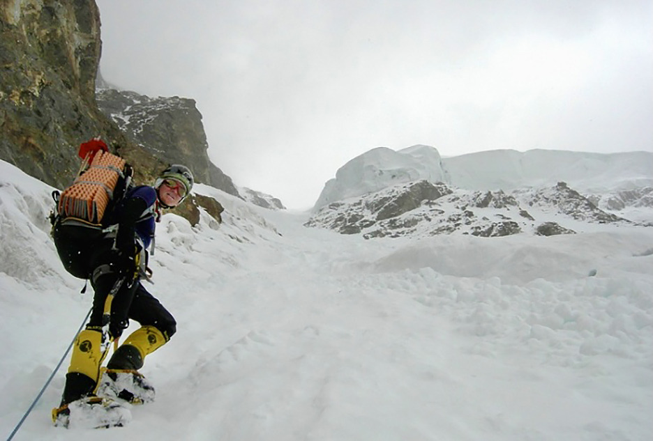
Slovenians to the upper Mazeno Ridge
In the summer of 2011, two Slovenian women, Mojca Svajger and Irena Mrak, attempted the Diamir Face. They originally aimed for the Kinshofer Route in a classic siege style, without supplementary oxygen or high-altitude porters. However, they switched to an alpine-style ascent beside the Mummery Rib and reached the upper Mazeno Ridge at 7,590m.
On July 24, the Slovenian party established a Base Camp at 4,250m, below the Diamir Face. By August 10, they had acclimatized by reaching 5,800m on the slopes of the Mazeno Ridge and Ganalo Peak. On August 23, the team began their ascent, targeting a direct line on the face to reach the Mazeno Ridge.
They climbed through challenging terrain, including the Messner Couloir, a steep gully with slopes of 45°–60° and a section of 70°. The route was exposed to serac fall, particularly between 4,700m and 5,800m, and included navigating black ice and falling rocks below the Messner Serac.
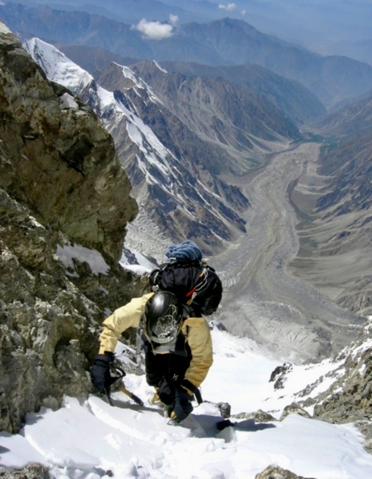
The two climbers reached the crest of the upper Mazeno Ridge at 7,590m on August 23 at 1:30 pm, ascending 3,100m.
"We missed the passage to the summit," Irena Mrak told ExplorersWeb. "[But] we completed a route to the ridge, spend nine days in the face, and had a severe accident on our return in the Messner/Mummery Couloir. Obviously, we survived."
The pair reached Base Camp on August 25 after a three-day descent.
While they did not reach the main summit, the Slovenians' new route was notable for completing a significant portion of the Diamir Face and connecting to the Mazeno Ridge.
Reinhold Messner, commenting on this ascent, said: “The summit isn’t that important. The adventure counts. Eight bivouacs on such a dangerous face is worth more than a few summits by all the prepared normal routes on 8,000m peaks.”
More notable climbs
The Mazeno Ridge was finally fully climbed to the summit in 2012 by Sandy Allan and Rick Allen. They started up the Schell Route to the summit and descended by the Kinshofer Route on the Diamir Face.
In 2022, Francois Cazzanelli and Pietro Picco climbed a 1,400m variant (M6, 90° ice, 85° snow) to 6,000m, joining the Kinshofer Route. Their variation, Aosta Valley Express, included a new start to the Kinshofer Route, not an independent new route.
This month, Urubko and Cardell hope to write a new chapter in the history of Nanga Parbat.
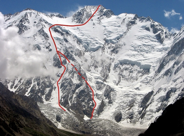
In the spring of 1982, a small British team set out to tackle one of the most formidable challenges in Himalayan climbing: the unclimbed East-Northeast Ridge of Everest from Tibet. During the attempt, Pete Boardman and Joe Tasker vanished in the Death Zone. We revisit their story.
By 1982, 117 climbers had summited Everest, but just six without supplemental oxygen. From its first ascent in 1953 until the end of 1981, 54 climbers died on Everest, and 41 of those didn’t use bottled oxygen.
Edmund Hillary and Tenzing Norgay first confirmed ascent of the mountain in 1953 went via the Southeast Ridge (now the standard route from Nepal) under John Hunt’s leadership.
From the north, a Chinese team claimed a summit in 1960 via the North Col and North Ridge, though evidence is limited and the ascent is not universally accepted. In 1975, a Chinese team, including Phantog, the first woman to summit from Tibet, reached the top.
Other significant routes included the Southwest Face, climbed in 1975 by a British team led by Chris Bonington (Pete Boardman, Doug Scott, Dougal Haston, and Pertemba Sherpa topped out), and the West Ridge, summited by Americans Tom Hornbein and Willi Unsoeld in 1963. A Yugoslavian team later completed a variation of the West Ridge route from Nepal in 1979.
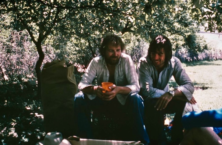
The 1982 team
Led by Chris Bonington, the 1982 Everest team included Pete Boardman, Joe Tasker, and Dick Renshaw, all experienced mountaineers. Charles Clarke, the expedition doctor, and Adrian Gordon supported the team. Clarke and Gordon didn’t plan to climb above Advanced Base Camp. The climbers aimed to ascend without oxygen, using minimal equipment and snow caves for camps.
Before the expedition, Bonington, Boardman, Tasker, and Renshaw had already built remarkable climbing legacies.
Bonington was already a mountaineering icon. He had organized the 1975 Everest Southwest Face expedition, on which his team achieved a historic summit. He also led the first ascent of 7,719m Kongur Tagh in China in 1981, where Boardman, Tasker, and Alan Rouse summited in alpine style.
Boardman began climbing in the Peak District as a teenager before exploring the Afghan Hindu Kush in 1972 and the Pennine Alps in 1968. His fame grew with his 1975 Everest summit alongside Pertemba Sherpa. In 1976, Boardman and Tasker made history with their ascent of 6,864m Changabang’s West Face in India. They famously trained for the climb in a refrigerated meat factory to simulate harsh conditions. Their feat redefined lightweight Himalayan mountaineering.
The intense Tasker started his career with bold climbs like the Eiger’s North Face (in winter 1975 with Dick Renshaw). His partnership with Boardman took him to Changabang and the first British ascent of Kangchenjunga in 1979 (without supplemental oxygen).
Renshaw had also climbed Dunagiri in 1975 with Tasker.

The team’s history of notable climbs prepared them for Everest's unclimbed East-Northeast Ridge.
A tough route
In mountaineering literature, their 1982 route is often referred to as the "full Northeast Ridge" route that includes three difficult pinnacles. This long, difficult line has its toughest challenges near the end, between 7,925m and 8,382m, where the ridge joins the North Ridge (the route taken by the pre-war expeditions and the successful Chinese expeditions of I960 and 1975).
Their route differed from the standard northern climbing route that joins the Northeast Ridge at the North Col (at 7,000m), avoiding the pinnacles and following a less technical line to the summit.
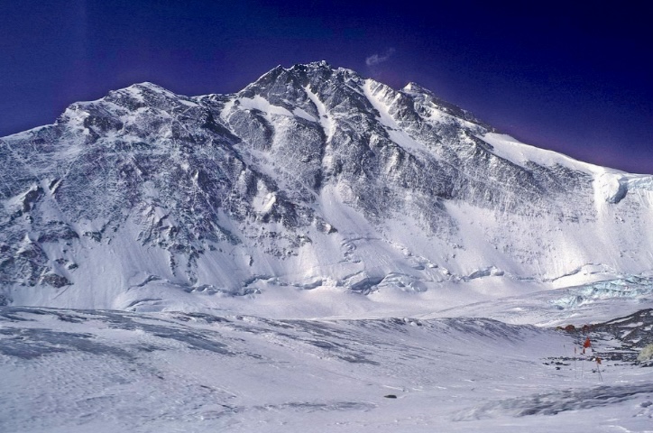
Arrival at Base Camp
Bonington’s team reached Base Camp at 5,180m on March 16, after a three-day drive from Lhasa. Ten trekkers joined them, exploring the Rongbuk Glacier and reaching 6,100m.
Bonington's team placed Base Camp near the glacier, just above the sites of the pre-war British camps. For a week, the team acclimatized and scouted the route. To manage the harsh winds and reduce gear weight, they chose siege tactics. However, they were digging snow caves instead of using tents for the lower camps, and tried to limit their use of fixed ropes. This kept four climbers together and made planning easier.

Establishing camps
On April 4, the party set up Advanced Base Camp at 6,400m after a three-day trek with 13 yaks hauling supplies up the East Rongbuk Glacier. Two more yak trips brought food and gear. The weather was brutally cold, with winds sweeping the glacier.
On April 10, they dug their first snow cave at 6,860m. Two days later, they began digging a second snow cave at 7,300m, but hitting rocks meant they had to work hard for 14 hours over several days to make it habitable. After this slog, they rested at Advanced Base Camp from April 14 to April 18.
Returning to the ridge on April 18, the team occupied their second snow cave on April 20. Over the next two days, they climbed two steep sections: a snow gully and a stretch of broken rock, where they placed their first fixed ropes. Exhausted, the party descended to Advanced Base Camp on April 23 and then to Base Camp for a few days’ rest, as full recovery at 6,400m was nearly impossible. Meanwhile, Clarke and Gordon oversaw yak herders ferrying gear from Base Camp.
On April 29, the climbers returned to Advanced Base Camp in a single day. While Clarke and Gordon attempted Point 6,919 on the Rongbuk Glacier’s eastern side, the climbers returned to the ridge.
On May 1, Boardman and Renshaw reached 7,800m, camping at the top of the snow shoulder. Bonington and Tasker carried food and gas to them before returning to the second snow cave. The next day, all four moved up, and Boardman and Renshaw dug a third snow cave just below the ridge crest.
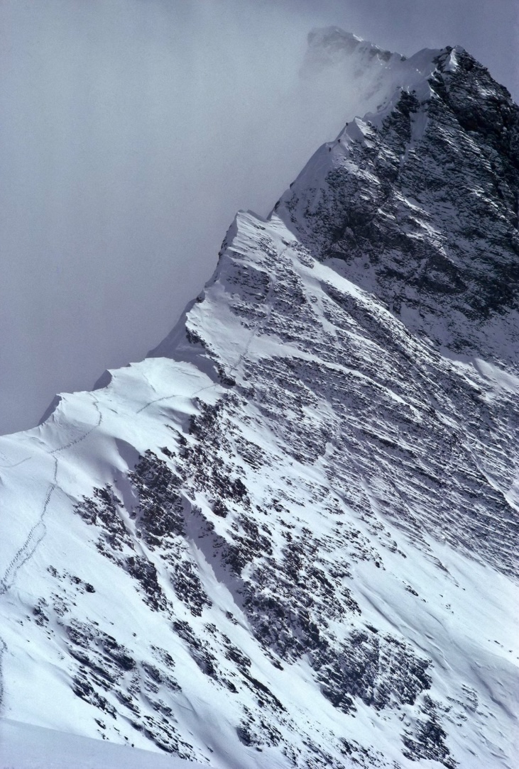
Facing the pinnacles
The real challenge began at 8,000m, where the ridge narrowed into a snow crest blocked by rocky pinnacles, stretching 800m and rising 400m to join the North Ridge route used by earlier expeditions. This section promised some of the hardest climbing ever attempted at such an altitude. On May 4, Boardman led a notable climb up the first pinnacle, navigating ice and loose rock with few anchor points. Bonington joined two ropes to give him a 76m run-out, and Boardman fixed another 91m to reach a notch overlooking the ridge’s eastern side.
On May 5, Renshaw took the lead, climbing a steep, unstable snow pitch to 8,200m. While working, he felt a strange tingling down one side of his body. Boardman and Tasker pushed on, reaching 8,230m, but Renshaw’s condition worried everyone. After four nights at nearly 8,000m, the team was drained.
They descended to Base Camp, where Clarke diagnosed Renshaw with a mild stroke and sent him to Chengdu for recovery. Bonington, feeling slower than Boardman and Tasker, decided to step back from the summit push. Instead, he and Gordon would try to reach the North Col at 7,000m to set up a food depot and mark a descent route.
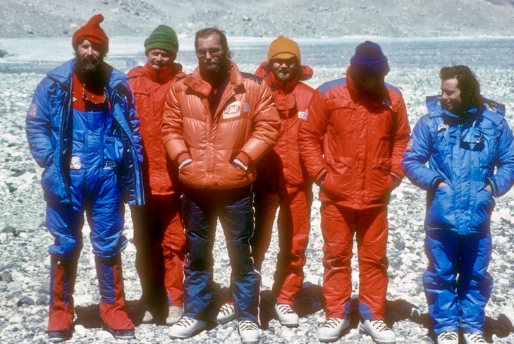
The final push
On May 13, Boardman, Tasker, Bonington, and Gordon returned to Advanced Base Camp. On May 15, Boardman and Tasker climbed to the second snow cave in just six hours. The next day, they reached the third snow cave, stocked with food, fuel, and 244m of rope.
Meanwhile, Bonington and Gordon attempted the North Col but stopped 90m short on May 16, blocked by a crevasse and a serac wall. That evening, they had their last radio contact with Boardman, who sounded optimistic, reporting that he and Tasker were doing well.
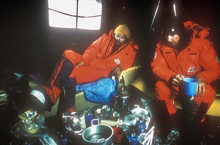
On May 17, Bonington and Gordon watched Boardman and Tasker through a telescope from Advanced Base Camp. The pair started early, reaching their previous high point by 9 am. By evening, they had fixed about 200m of rope, mostly on the northwest side, and moved to the eastern side of the second pinnacle, likely searching for a campsite. They missed radio calls at 3 pm and 6 pm, either distracted by climbing or because of a faulty radio. The team last saw Boardman and Tasker at the foot of the second pinnacle, at around 8,300m.
"How far they got beyond this point is not known, but that is where they were last seen," Doug Scott wrote in The Himalayan Journal.
Disappearance
On May 18, Bonington and Gordon resumed their North Col attempt, scanning the ridge with binoculars. They expected Boardman and Tasker to reappear, as the ridge’s layout forced climbers back into view. Reaching their previous high point, they camped by the crevasse. On May 19, they completed the route to the North Col but saw no sign of their teammates.
By May 20, Boardman and Tasker's absence was alarming. The short distance they needed to cover before reappearing suggested a fall, likely on the Kangshung side’s steep slopes.
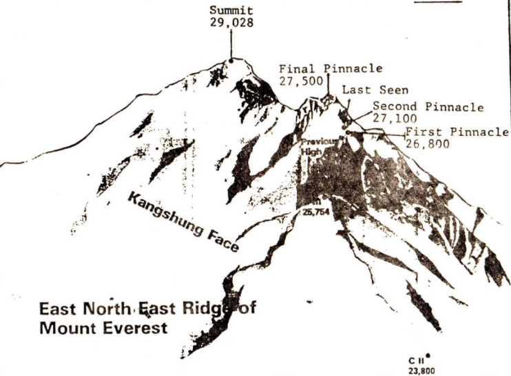
Clarke returned to Advanced Base Camp from Chengdu, and the team organized a search. Bonington and Clarke trekked 64km from Base Camp to the Kangshung Glacier’s head, arriving on May 27. Scanning the massive Kangshung face, they found no trace of Boardman or Tasker and concluded a fall there would have been fatal.
Gordon stayed at Advanced Base Camp until May 28, watching the ridge, but saw nothing. The team returned to Base Camp, hoping against hope that Boardman and Tasker might appear, but they did not.
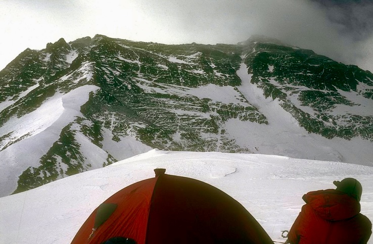
Aftermath
Clarke carved a memorial plaque and placed it on a cairn above Base Camp near the Mallory and Irvine memorial. They assumed Boardman and Tasker had fallen from around 8,300m.
Boardman’s body was found ten years later, in the spring of 1992, by Kazakh climbers on the Northeast Ridge at approximately 8,200m, near the second pinnacle. According to Elizabeth Hawley’s notes in The Himalayan Database: "On the Northeast Ridge, Kazakhs found a tent with two sleeping bags, a stove, an ice hammer, a book with Chris's name in it, and a diary with May 1982 entries. They took photos of a body near these items. On the breast of the down suit were logos with an outline of a mountain and three letters, one of which was an M. They brought down the book and the diary."
Boardman’s body was identified by the clothing and the equipment. The Kazakhs found him lying on his back in the snow, relatively intact, with no clear signs of a major fall. Maybe he collapsed and succumbed to hypothermia or exhaustion. The Kazakh climbers left the body where they found it.
Tasker’s body has not been found.

So close to success
The 1982 British Everest expedition was a bold attempt to climb one of Everest’s toughest routes.
"We had been so close to success, had worked harder, and had been more stretched both physically and mentally than ever before. We were united in what we were doing, and until the tragedy, it was the happiest expedition any of us had been on," Bonington wrote in his expedition report in The Himalayan Journal.
Boardman and Tasker’s legacy endures through their climbs and writings. Boardman’s The Shining Mountain and Tasker’s Savage Arena offer vivid accounts of their adventures and insights into why they climbed.
The Boardman Tasker Prize for Mountain Literature was established in 1983 in their memory.
The entire East-Northeast Ridge route was finally climbed to the summit in 1995 (and descended by the same route) by members of the Nihon University expedition from Japan led by Tadao Kanzaki, supported by 35 Sherpa porters. This expedition fixed ropes across nearly the entire route and used supplemental oxygen.
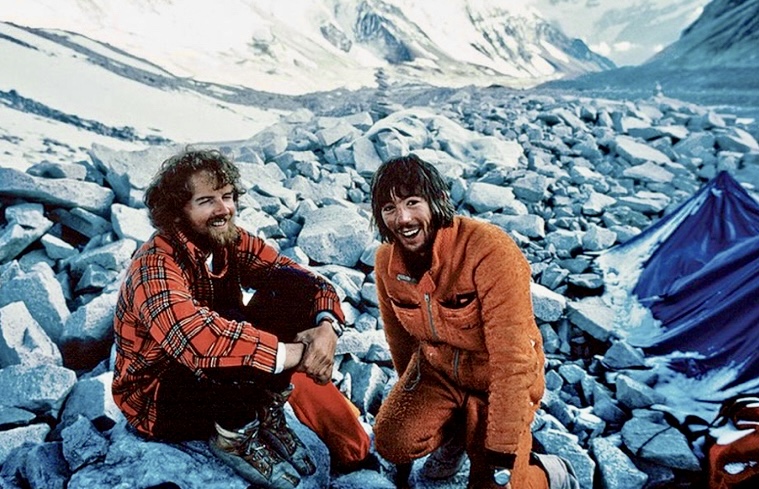
Seventy-five years ago, on June 3, 1950, French mountaineers Maurice Herzog and Louis Lachenal achieved what no climber had done before: summit an 8,000m peak. Herzog and Lachenal topped out on 8,091m Annapurna I, the 10th highest peak in the world, via the North Face and without supplemental oxygen.
In west-central Nepal, Annapurna I is the highest peak in the Annapurna massif. The name Annapurna originates from Sanskrit, combining "Anna" (meaning food or grain) and "Purna" (meaning full or abundant). It translates to "the giver of food," or "she who is full of food." In Hindu mythology, Annapurna is a goddess of nourishment and abundance, an incarnation of Parvati, Shiva’s consort, revered for sustaining life.
There are no registered attempts to climb Annapurna I before 1950. Its first ascent was not just a climb, but a race against time, weather, and human limits, marked by unparalleled courage and harrowing consequences.
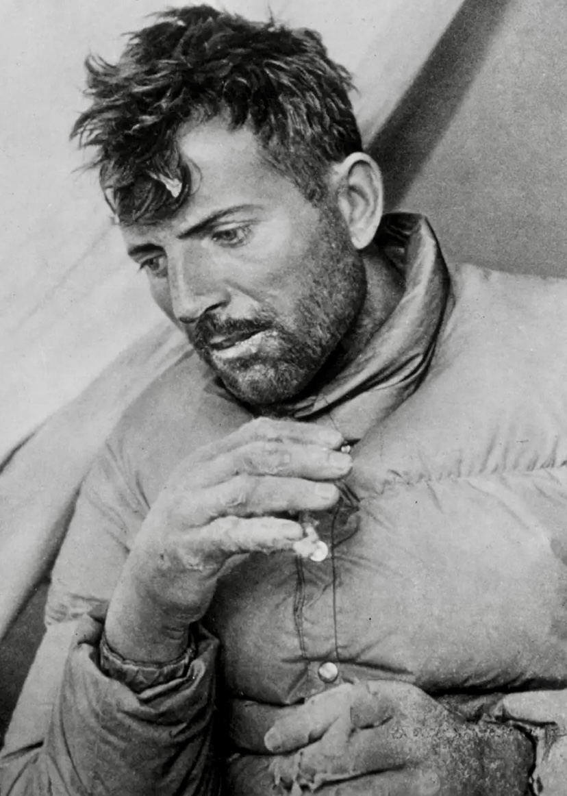
The team
The expedition, organized by the French Alpine Club and approved by the Nepalese government — the first such permission in over a century — included Maurice Herzog (leader), Louis Lachenal (a skilled Chamonix guide), Lionel Terray (a powerful, experienced alpinist), Gaston Rebuffat (another Chamonix guide known for his technical prowess), Jean Couzy and Marcel Schatz (both strong climbers), Francis de Noyelle (a diplomat facilitating logistics), Jacques Oudot (the expedition doctor), and Marcel Ichac (a filmmaker documenting the expedition).
The Sherpa team, which provided critical support during the expedition, included Ang Tharkay Sherpa (sirdar), Ajiba Sherpa, Ang Dawa Sherpa, Ang Tshering Sherpa, Dawa Thondup Sherpa, Ila Sherpa, Phu Tharkey Sherpa, and Sarki Sherpa.
Change of plans
The expedition began in mid-April 1950, with the team traveling from India to Nepal’s Kali Gandaki Valley.
Originally, Herzog’s team had climbing permits for both Dhaulagiri I and Annapurna I. The climbers first set their sights on Dhaulagiri I. From their base in Tukucha at 3,000m in the Kali Gandaki Valley, they explored the area around Miristi Khola river and the east of Dhaulagiri Glacier for potential routes. However, after making a reconnaissance of Dhaulagiri I’s Southeast Ridge and northern side, Dhaulagiri I seemed too difficult, especially with not much time before the monsoon season arrived. Instead, the team decided to shift to Annapurna I.
"As to Annapurna, we knew the northern slopes were accessible, but apart from that, although we had hopes, we could not be sure that the expedition could find a way up. We thought there were three possible routes, but only the glacier route proved practicable," Herzog wrote in the Alpine Journal.
Time was short. The expedition had to explore, scout, and climb the mountain in a single season, an unprecedented feat.
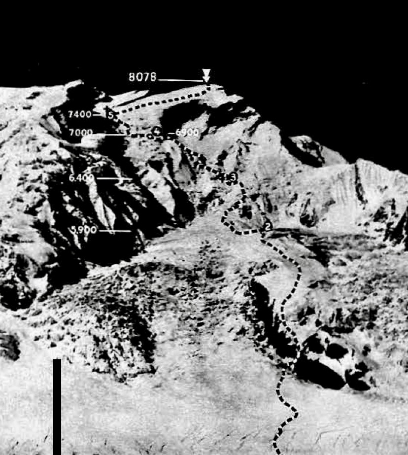
Route-finding
The distance between Dhaulagiri and Annapurna is approximately 35 to 40km, and the two peaks are separated by the Kali Gandaki Gorge, one of the deepest gorges in the world.
Herzog’s party arrived in the Annapurna region in early May. The approach offered them several challenges: dense forests and treacherous moraines. The team initially explored the North and East faces of Annapurna I, but the complex terrain and lack of viable routes forced them to reconsider. Herzog, with input from Terray and Rebuffat, decided to focus on the North Face, which offered a feasible but difficult way to the summit.
According to Herzog’s report, the other possibility, the East Glacier route, would have been technically more demanding. Their final decision was critical, as the monsoon’s approach left no room for further delays. The team adopted a siege-style approach, establishing a series of camps to support the ascent and abandoning their initial idea of carrying out a lighter, alpine-style climb. The route reconnaissance involved significant exploration, with key contributions from Terray and Rebuffat, who helped identify a viable line through the complex terrain of seracs, crevasses, and ice walls.
Camps
The route up Annapurna’s North Face began with the establishment of Base Camp at 4,500m on May 18. From there, the team set up five further camps.
Camp 1 was at 5,000m, at the base of the North Face. Camp 2 was at 5,500m, below a sickle-shaped glacier full of crevasses and steep ice slopes. This camp served as a key logistical point, stocked with supplies for the upper camps.
They set up Camp 3 at around 6,000m on a windy snowfield, offering a starting point toward the upper slopes. This was followed by Camp 4, at 6,800m, situated above the rock band on a narrow ledge. Their small, exposed Camp 5 at 7,400m would be the climbers’ last stop before the summit attempt.
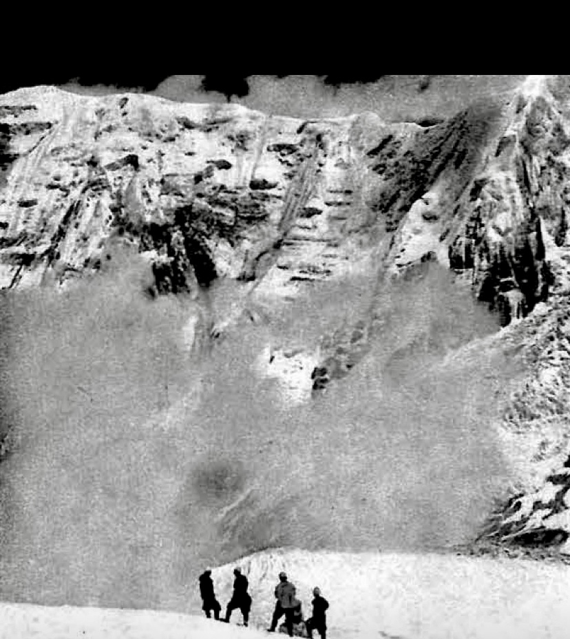
The ascent
The ascent was grueling. Snowstorms, avalanches, and bitter cold tested the team. The Sherpas, led by Ang Tharkay, hauled heavy loads to stock the camps, while Herzog, Lachenal, Terray, and Rebuffat scouted routes and fixed ropes. The terrain was treacherous, with steep ice, loose rock, and deep snow. Crevasses and avalanches were constant threats. Teamwork kept them going, though exhaustion and altitude strained their spirits.
On June 2, Herzog and Lachenal, supported by Terray and Rebuffat, reached Camp 5. Herzog invited Ang Tharkay Sherpa to be in the summit party, but Ang Tharkay declined, explaining that his feet were starting to freeze.
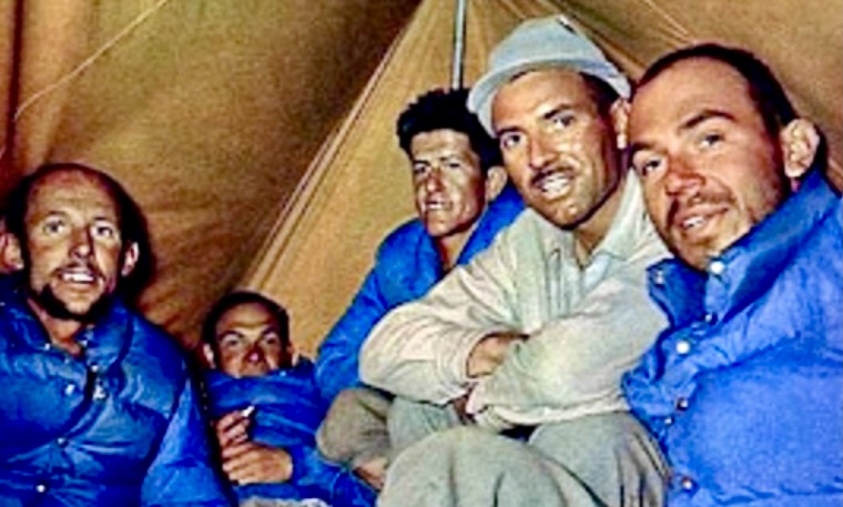
Summit push
On June 3, Herzog and Lachenal launched their summit bid from Camp 5. They started at dawn, climbing without oxygen, through deep snow and fierce winds. Each step of the last 700m was a battle, and the thin air consumed their strength. Lachenal, wary of frostbite, hesitated near the top, but Herzog, driven to reach the summit, urged them onward.
At around 2 pm, Herzog and Lachenal topped out in -40°C, becoming the first people to summit an 8,000m peak.
"I hardly knew if I were in heaven or on Earth, and my mind kept turning to all those men who had died on high mountains and to friends in France. Our moments up there were quite indescribable, with the realization before us that we were standing on the highest peak in the world to be conquered by man," Herzog wrote in the Alpine Journal.
Herzog took photographs at the summit, planting a French tricolor in worsening conditions. Lachenal, more pragmatic, urged a swift descent as the storm was about to arrive.
A difficult descent
The way down from the summit was where triumph almost turned to tragedy. As Herzog and Lachenal descended, a storm hit the mountain. Herzog lost his gloves, and both climbers suffered severe frostbite on their feet. At Camp 5, Terray and Rebuffat met them. Herzog’s hands and Lachenal’s feet were already severely frostbitten. Rebuffat and Terray warmed them overnight.
On June 4, in a whiteout, the snowblind Rebuffat and Terray tried to descend to Camp 4. Unable to find it, the four spent a harrowing night in a crevasse, sharing a single sleeping bag in freezing temperatures.
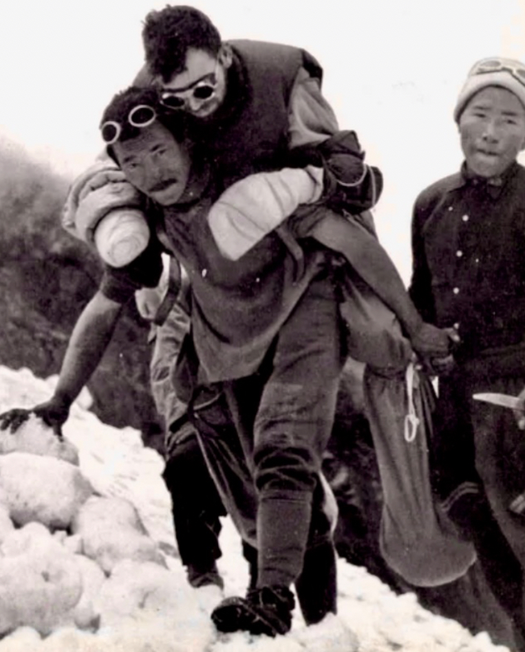
On June 5, during their descent to Camp 2, Rebuffat helped rescue Herzog and two Sherpas from an avalanche. By the afternoon, the team reached Camp 2. Finally, everyone reached Base Camp alive.
"We had beaten it, and I could lie back and think: the job has been finished, the struggle is over," Herzog wrote.

Amputations
Herzog and Lachenal, unable to walk because of their injuries, were carried by Sherpas across the moraines. Dr. Oudot began treating their frostbite in camp, making multiple amputations without anesthesia to combat gangrene. Oudot saved their lives but at great cost; Herzog lost all his toes and most of his fingers, and Lachenal lost his toes.
Aftermath
They left Base Camp on June 10, reaching Kathmandu a month later and returning to Paris on July 17.
Herzog, Lachenal, and Ang Tharkay were awarded the Legion of Honor, and Marcel Ichac’s film, Victoire sur l’Annapurna, premiered to acclaim. Herzog’s book, Annapurna: The First Conquest of an 8000-Meter Peak, became a mountaineering classic. The book ends with the classic line: "There are other Annapurnas in the lives of men," which inspired generations of climbers.
However, controversies later emerged. Rebuffat felt Herzog downplayed his contributions, particularly in route-finding, and was dismayed by the expedition’s hierarchical structure. Lachenal’s posthumously published journals (1996) revealed tensions, including his frustration with Herzog’s prolonged summit photography and the official narrative’s omissions.
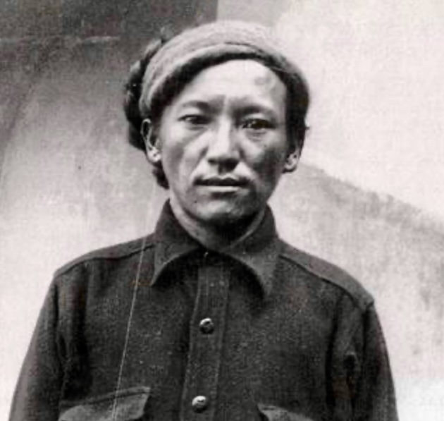
In his book True Summit, David Roberts revealed that the expedition was marred by internal discord. Herzog’s book portrayed a unified, heroic effort, but Lachenal’s diary and Rebuffat’s writings exposed tensions, including Herzog’s capricious leadership, and the marginalization of Lachenal, Terray, and Rebuffat’s contributions.
In his 1954 memoirs, Ang Tharkay Sherpa wrote that the French members of the expedition treated him with friendship and equality.
The 1950 Annapurna expedition remains a landmark in mountaineering history, a testament to human endurance, but also the price of ambition.
Last week, Benjamin Vedrines set a new speed record for skiing up and down Mont Blanc -- 4 hours 54 minutes 41 seconds. Today, mountain athlete William Boffelli of Bergamo, Italy skied the route 11 minutes faster.
Like Vedrines, the Italian started from the church in Chamonix, summited Mont Blanc, then skied back to the church. His time: 4 hours 43 minutes 24 seconds.
As of May 31, the current record round-trip times on Mont Blanc are:
On foot
For women: Hillary Gerard, June 17, 2023, 7 hours 25 minutes 28 seconds
For men: Kilian Jornet, July 11, 2013, 4 hours 57 minutes 40 seconds
On skis
For women: Elise Poncet, May 16, 2025, 6 hours 54 minutes 47 seconds
For men: William Boffelli, May 31, 2025, 4 hours 43 minutes 24 seconds
A few days ago, French alpinist Benjamin Vedrines set a new Fastest Known Time (FKT) for a round-trip on skis up Mont Blanc. He went from the church in Chamonix to the summit and back to the church.
The record times on Mont Blanc are:
On foot
For women: Hillary Gerard, June 17, 2023, 7 hours 25 minutes 28 seconds
For men: Kilian Jornet, July 11, 2013, 4 hours 57 minutes 40 seconds
On skis
For women: Elise Poncet, May 16, 2025, 6 hours 54 minutes 47 seconds
For men: Benjamin Vedrines, May 24, 2025, 4 hours 54 minutes 41 seconds
Skiing vs on foot
In a recent social media post, Vedrines shared details of his achievement, emphasizing the differences between skiing and running.
Vedrines, who prefers skiing, described the trade-offs of his approach.
"I really wanted to do this route on skis because it's more my field. There is something beautiful about skiing down from 4,810m, going all out. And it's all muscle -- no need for a paraglider," he wrote.
He pointed out that skiing requires heavier gear and managing transitions between skis and trail shoes for the final 1,200m run, but allows a faster descent on snow.
Running, by contrast, is lighter and more efficient on the ascent, but slower and more technical on the way down. Vedrines says that ideal conditions for either method are rare, keeping the gap between ski and foot records tight over the years. For example, the old ski record set in 2003 jointly by Pierre Gignoux and Stephane Brosse was just five minutes slower than Pierre-Andre Gobet's 1990 time on foot of 5 hours 10 minutes. And now Vedrines (skis) and Jornet (on foot) are within three minutes of each other.
Vedrines believes that a sub-four-hour and 30-minute round trip is possible in ideal conditions.
This afternoon, a massive avalanche of ice, mud, and rock buried the picturesque Swiss village of Blatten. It was triggered when a huge chunk of ice broke off from the Birch Glacier, which lies directly below Kleines Nesthorn, whose summit partly broke off last week, on May 19.
Seeing Blatten buried again and again, from every angle...
Properly staggering!
pic.twitter.com/fQYBZRQAZf
— Melaine Le Roy (@subfossilguy) May 28, 2025

The disaster struck around 3:30 pm local time and destroyed many homes. One person is missing, according to BBC. Yesterday, the glacier started to collapse.
Blatten residents and even the livestock were evacuated on May 19 because of the glacier's instability.
Local authorities described the situation as "very bad." Drone footage showed a deluge of debris sweeping through the valley, accompanied by a deafening roar and a massive cloud of dust. The collapse, triggered by weeks of rockfall from 3,341m Kleines Nesthorn, deposited approximately nine million tons of debris, overwhelming avalanche barriers and damming the Lonza River.
Over 130 buildings are reported buried, though the upstream part of the village was spared.
The canton of Valais has declared a "special situation" and mobilized the Swiss army's disaster relief unit to help clear debris and secure the riverbed. But many of Blatten's 300 residents may never return to their homes.
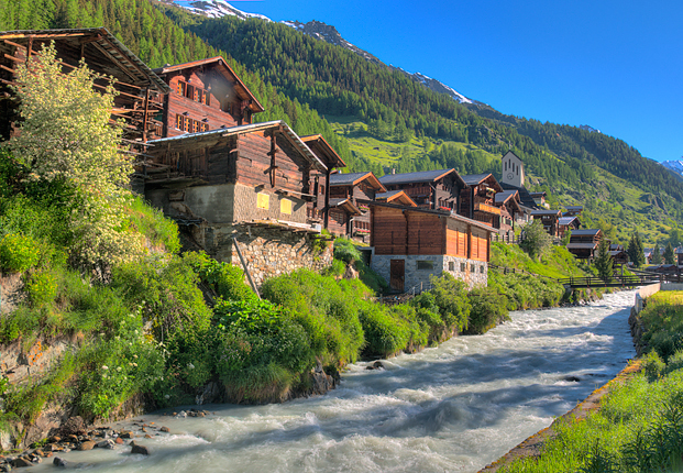
According to Euronews, experts warn that further collapses could worsen the situation.
Melting glaciers and thawing permafrost have destabilized the Alps. Glaciologists have long warned of such risks, noting that Swiss glaciers lost 10% of their volume between 2022 and 2023 alone.
On Sunday, May 25, the bodies of five skiers were discovered near Zermatt, Switzerland. All likely died in an avalanche.
The previous day, climbers on the 4,199m Rimpfischhorn in the nearby canton of Valais found several pairs of unattended skis near the summit, at about 4,000m.
The climbers alerted the rescue services that afternoon. Air Zermatt and the Valais police responded immediately and found the lifeless bodies of five skiers on the Adler Glacier. There was evidence of a recent avalanche nearby.

Three bodies were found in avalanche debris 500m below the skis, while the other two bodies lay 200m higher.
The Valais police are investigating, suspecting that recent heavy snowfall near Zermatt may have triggered the slide. The victims’ identification is ongoing.
Zermatt is a famous alpine resort town, known for its skiing, mountaineering, and views of the Matterhorn.

Yesterday, we reported on Benjamin Vedrines' record-breaking ascent of Mont Blanc -- less than five hours from Chamonix to the summit and back again. A week earlier, on May 16, France's Elise Poncet set a new women’s Fastest Known Time (FKT) for the round trip on skis. She completed the 35km route, which also involved 3,840m of elevation gain, in 6 hours, 54 minutes, and 47 seconds.
Poncet started at 5 am from the church in Chamonix -- the same starting point as Vedrines -- and followed the Grand Mulet route. Despite challenging conditions, including winds up to 70kph and temperatures around minus 15°C at the summit, she reached the top in 5 hours and 39 minutes. Poncet then completed the descent in 1 hour and 15 minutes.
Poncet was supported by a team that included her good friend Hillary Gerardi (who holds the women’s running speed record on Mont Blanc) and Austrian ski mountaineer Jakob Herrmann.
”Now, Mont Blanc is something [Gerardi and I] share -– with the foot record for her, and the ski record for me,” recalled Poncet on social media. "It’s ultimately the best thing that could have happened to us, and the best way to cement our friendship."
Previous record
The previous women’s FKT on skis was set by American Anna DeMonte, who completed the round trip on June 5, 2024, in 7 hours and 29 minutes. Poncet beat DeMonte by approximately 34 minutes. DeMonte achieved her success despite a 30m fall on the way up, which cost her time.
Twenty-nine-year-old Elise Poncet is known for her achievements in trail running, cross-country, and ski mountaineering. Eleven years ago, she won the French Junior Mountain Running Championship. She was a bronze medalist at the European Championships and won silver in mountain running in 2019. Poncet became the French champion in 2022. Poncet also started ski mountaineering in 2020.
Currently, the Mont Blanc round-trip FKT records are:
- On foot, for women: Hillary Gerard, June 17, 2023, 7 hours 25 minutes 28 seconds.
- On foot, for men: Kilian Jornet, July 11, 2013, 4 hours 57 minutes 40 seconds.
Elise Poncet now holds the women's FKT on skis: 6 hours 54min 47sec, while Benjamin Vedrines set the men's record on May 24, with a time of 4 hours 54 minutes 41 seconds. He beat Jack Kuenzle’s June 2024 time of 4 hours and 59 minutes. Both Poncet's and Vedrines' climbs are listed as "supported," according to Skimostats.
Today is the 70th anniversary of the first ascent of 8,586m Kangchenjunga, the world’s third-highest mountain.
Located on the border of Nepal and Sikkim, India, Kangchenjunga means the Five Treasures of the Great Snow, referencing its five prominent peaks and cultural significance in Sikkim, where it is considered sacred. Kangchenjunga drew early mountaineers because of its height and extreme technical challenges. Before its first ascent in 1955, 13 expeditions targeted the peak.
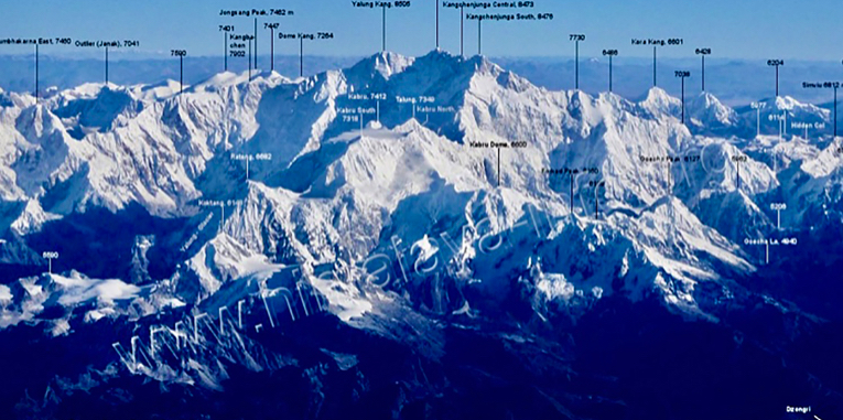
Early exploration and reconnaissance
The climbing history of Kangchenjunga begins with exploration rather than summit bids. In 1899, British mountaineer Douglas Freshfield became the first European to circumnavigate the mountain, mapping its glaciers and ridges. Freshfield described the Northwest Face as a formidable barrier, seemingly designed to repel climbers with its ice and snow defenses. His observations laid the groundwork for future attempts, suggesting potential routes via the Southwest Face and the Kangchenjunga Glacier.
The first summit attempt
The first serious attempt to climb Kangchenjunga came in 1905, led by controversial British mountaineer and occultist Aleister Crowley, who later styled himself "the wickedest man in the world." The expedition also included Jules Jacot-Guillarmod, Charles Reymond, and Alexis Pache of Switzerland, along with Alcesti C. Rigo de Righi (an Italian hotelier from Darjeeling), and four Sherpas.
The expedition approached from the Nepal side, targeting Kangchenjunga’s Southwest Face via the Yalung Glacier, a route suggested by Freshfield. Crowley, who had previously attempted K2 in 1902, led with a mixture of ambition and recklessness.
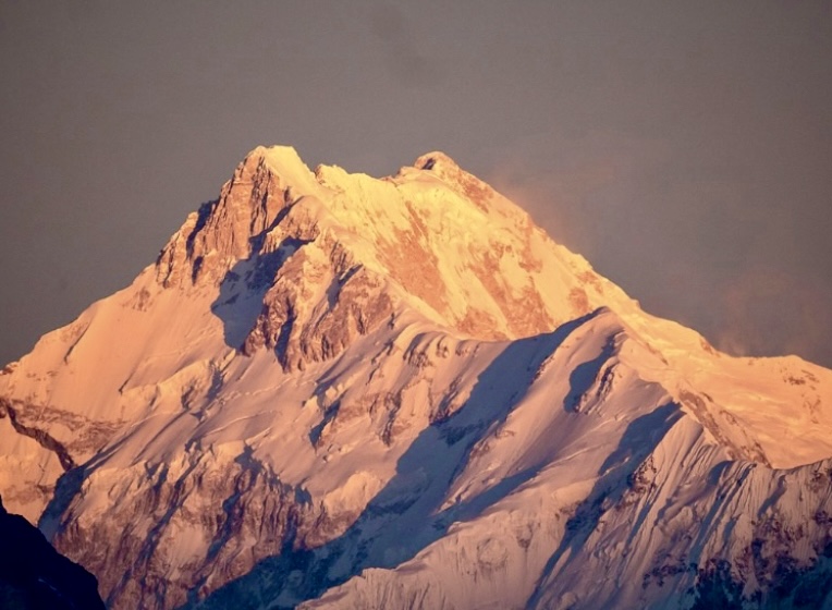
The team established Camp 7 at approximately 6,300m. However, the expedition unraveled because of Crowley's leadership and dangerous conditions. On September 1, an avalanche struck and swept the climbers away, killing Pache and three Sherpas (The Himalayan Database does not list the names of the Sherpas.) De Righi was partially buried, and the survivors called for help. Crowley reportedly remained in his tent, later claiming the "Demon of Kangchenjunga" had been appeased by the deaths. Earlier in the expedition, one porter died in a fall.
The avalanche ended the 1905 attempt, and Crowley’s reputation suffered.
Kellas’ reconnaissance
Between 1907 and 1921, Scottish chemist and mountaineer Alexander Mitchell Kellas made six visits to the Kangchenjunga region, climbing in alpine style with Sherpa and Lepcha porters. Kellas, a pioneer of high-altitude physiology, believed peaks like Kangchenjunga could be climbed without supplemental oxygen.
In the spring of 1910, Kellas made a solo reconnaissance trip on the northeast side of Kangchenjunga and explored near Kirat Chuli. Kellas studied the Zemu Gap, Simvu Saddle, and Kangchenjunga Glacier, making several first ascents of peaks over 6,000m, including 7,128m Pauhunri (1911) and 6,965m Langpo (1910).
Kellas’ work provided critical knowledge of the terrain and Sherpa capabilities, though he never attempted Kangchenjunga’s summit. Tragically, Kellas died in 1921 during an Everest reconnaissance expedition, but his contributions shaped Himalayan mountaineering.
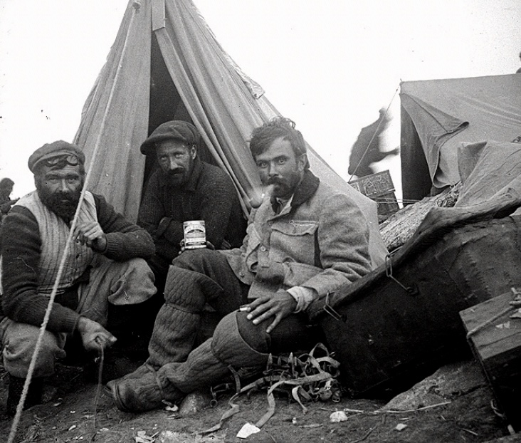
Interwar attempts
After Crowley’s failed attempt, Kangchenjunga saw no major expeditions until after World War I, when mountaineering interest in the Himalaya surged. In the autumn of 1920, British climber Harold Raeburn, accompanied by Ferdie Crawford, scouted the southwest side of Kangchenjunga and reached 6,400m.
Solo attempt and death
Edgar Francis Farmer was a young man from the Standard Oil Company of New York who dreamed of climbing Kangchenjunga. In May 1929, he set out on a solo attempt to reach the summit by the Southwest Face. The decision led to his death.
Thanks to detailed reporting in The Himalayan Journal and the American Alpine Journal, Farmer's climb was well covered. Farmer wasn’t an experienced Himalayan climber; his only mountaineering background was in the Rockies. Still, he was determined and had studied climbing books. He kept his ambitious plan secret, not sharing it with officials or experienced climbers in Darjeeling who might have warned him against it.
Farmer set out on May 6, with skilled Sherpa and Bhutia porters, claiming he would explore the Guicha La region. Farmer led his team across the Kang La into Nepal, and camped on the Yalung Glacier near Kangchenjunga’s Southwest Face. On May 26, with three porters, he tackled the icefall toward the Talung Saddle. Though personally well-equipped, his porters lacked proper gear.
With melting snow making the climb risky, the head porter, Lobsang, urged Farmer to turn back. However, the American, promising to stop by noon, continued alone into the mist despite the porters’ pleas.
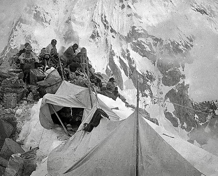
By 5 pm, the porters saw Farmer climbing higher, but the mist soon hid him. The porters signaled by torch, hoping he would return. The next morning, they spotted Farmer up a steep slope, moving oddly, possibly snowblind. He then vanished at approximately 6,000m.
Out of food, the porters waited until May 28 before descending. On May 30, they reached Tseram, traded a coat for food, and sent a porter to Darjeeling. The porter reported the tragedy on June 6.
Farmer had arrived in Darjeeling earlier that year and met G.H. Wood-Johnson, an experienced Himalayan climber. Wood-Johnson helped Farmer hire skilled porters, including Lobsang, a veteran of Everest expeditions. Lobsang’s detailed account to the Indian Police matched the porters’ story, describing how Farmer misled them about his real plans.
Farmer’s obsession with reaching the summit of Kangchenjunga clouded his judgment.
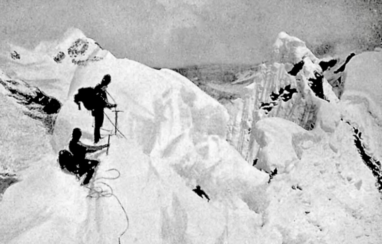
German attempt
In the summer of 1929, German climber Paul Bauer led a well-organized German-Austrian-British expedition targeting the Northeast Spur from the Sikkim side. Bauer’s team first made a reconnaissance of the East-Southeast Ridge, but then focused on the Northeast Spur-North Ridge route. The party reached 7,400m, where a five-day storm stopped them. The long and exposed Northeast Spur proved technically challenging and avalanche-prone, ultimately forcing a retreat.
In the spring of 1930, an international expedition led by Swiss mountaineer Gunter Oskar Dyhrenfurth attempted the Northwest Face via the Kangchenjunga Glacier from Nepal. The team, including German, British, Swiss, and Austrian climbers, aimed to follow Freshfield’s suggested route. They established Base Camp near Pangpema, but faced disaster when a massive ice avalanche killed Chettan Sherpa, one of their strongest high-altitude porters, and nearly wiped out the team. The expedition abandoned the climb at 6,400m, but completed a circuit of Kangchenjunga, ascending three lower peaks.
Years later, other climbers found Chettan Sherpa’s remains and G.O. Dyhrenfurth’s ice axe. According to a letter written by Dyhrenfurth’s son, Norman Dyhrenfurth, on November 27, 1987, and sent to The Himalayan Database, Chettan Sherpa was crushed by a huge ice avalanche on May 8, 1930. After more than an hour of artificial respiration, he was buried near Camp 2.
"My father’s old ice-axe was indeed placed on his grave. Perhaps a recent avalanche brought his remains to the surface and broke the ice axe as well. What a strong coincidence,” Norman Dyhrenfurth wrote.
Bauer returned in 1931 with a large German team of 10 climbers. They followed the same Northeast Spur. Despite persistent bad weather, they reached 7,940m, but a dangerous snow slope between the Spur and the North Ridge proved impassable. The expedition suffered losses when climber Hermann Schaller and Sherpa Pasang died in a fall, and Sirdar Lobsang and porter Babu Lall succumbed to illness. Bauer’s determination earned respect, but Kangchenjunga remained unclimbed.
Further reconnaissance
George Frey of Switzerland and Gilmour C. Lewis of the UK made a reconnaissance from the southeast to the southwest side of Kangchenjunga in the autumn of 1951. This was followed by John Kempe’s (UK) reconnaissance in the spring of 1953, also with C. Lewis, of Kangchenjunga’s Southwest Face.
Kempe returned in the spring of 1954 with seven other climbers (two of them Sherpas), again scouting the Southwest Face.
All attempts and reconnaissance of Kangchenjunga between 1905 and 1954 were carried out without supplemental oxygen.
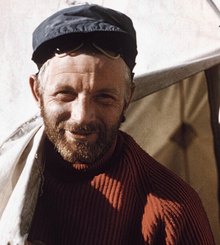
The 1955 British Kangchenjunga Expedition
By the 1950s, Kangchenjunga had gained a fearsome reputation, with 11 people dead and no summits. After the successful first ascents of Everest (1953) and K2 (1954), Kangchenjunga became the highest unclimbed peak, drawing intense interest.
In 1955, a British expedition led by Charles Evans, deputy leader of the 1953 Everest expedition, achieved the first confirmed ascent. The team’s success was a mountaineering landmark, often considered a greater achievement than Everest because of Kangchenjunga’s technical difficulty and remoteness.
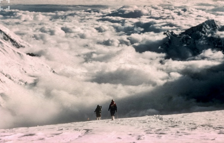
The expedition included experienced mountaineers and Sherpas, carefully selected for their skills and Himalayan experience: Charles Evans (leader, 36, a seasoned Himalayan climber, calm and strategic, who negotiated access with Sikkim’s authorities), Norman Hardie (deputy leader, 30, a New Zealand engineer and expert ice climber, responsible for oxygen equipment), George Band (26, a Cambridge graduate and Everest 1953 veteran, in charge of food logistics), Joe Brown (24, a British working-class rock climbing prodigy with no prior Himalayan experience but exceptional technical skills), John Clegg (29, expedition doctor and alpine climber), John Jackson (34, a Himalayan veteran who had been on the 1954 Kangchenjunga reconnaissance), Tom McKinnon (42, expedition photographer with extensive Himalayan experience), John Neil Mather (28, an ice and snow specialist from the Alps), and Tony Streather (29, an army captain with broad mountaineering experience, including the 1953 K2 attempt, responsible for porters).
The team also included Dawa Tenzing, Sirdar, 45, a highly respected Sherpa leader, known as the King of the Sherpas for his stamina and character. Additional Sherpas included Ang Temba, Ang Noru, Tashi, Urkien, Ila Tenzing, and Pemi Dorje, who played critical roles carrying supplies and establishing camps.
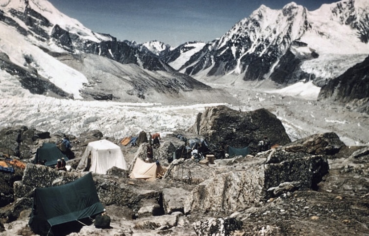
The route
The expedition, including over 300 porters and 26 climbing Sherpas, approached from Darjeeling, a 10-day trek along the Sikkim border and through Nepal to the Yalung Valley.
The team initially attempted a route reconnoitered by John Kempe in 1954 (Kempe’s Buttress) but found it impractical because of the very unstable lower icefall.
"We could find no safe route from the top of Kempe’s Buttress to the Plateau," Evans noted in the American Alpine Journal.
Instead, they chose the Southwest Face via the Yalung Glacier, the same route attempted by Crowley in 1905. This route ascended snow and ice slopes west of the Western Buttress, crossing what they called The Hump to the upper icefall and reaching the Great Shelf, a large ice terrace at 7,300m. From there, it followed the Gangway, a snow slope leading to the summit ridge, avoiding the dangerous "Sickle" formation.
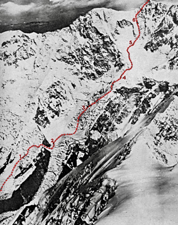
Kangchenjunga’s first ascent
The expedition began with Evans, Hardie, and two Sherpas reaching 7,150m, establishing Camp 4 and identifying the route to the Great Shelf. By May 13, the team reached the Great Shelf and established Camp 5 at 7,710m. This camp was under a vertical ice cliff, higher than any previous Kangchenjunga attempt.
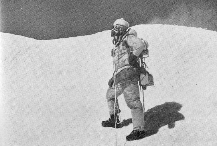
On May 15, Jackson and McKinnon led Sherpa teams to stock Camp 5, battling deep snow and an avalanche that scattered supplies. Jackson suffered snow blindness, but continued, guided by Sherpas.
The team regrouped at Base Camp, where Evans announced the summit plan: Joe Brown and George Band would lead the first summit attempt, supported by Evans, Mather, Dawa Tenzing, Ang Temba, Ang Noru, and Tashi.
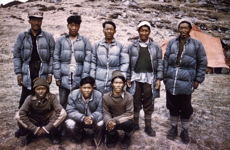
Hardie, Streather, Urkien, and Ila Tenzing formed a second summit team and planned to follow a day behind. On May 24, they established Camp 6 at 8,200m on a precarious snow ledge. It was the final camp before the summit.
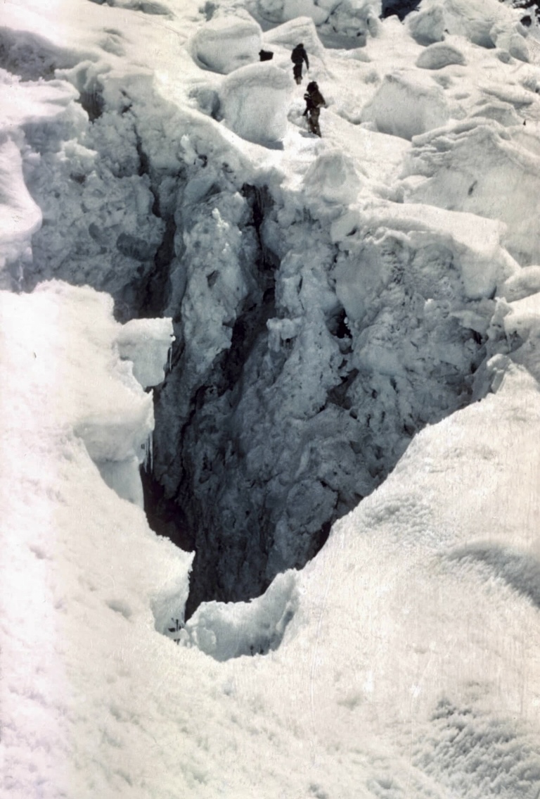
On May 25, Brown and Band set out from Camp 6 at 8,200m. They navigated the Gangway, facing soft snow and avalanche debris. Brown led a challenging six-meter rock climb up a crack with a slight overhang, rated very difficult at sea level but grueling at 8,500m.
On May 25 at 2:45 pm, Band and Brown topped out. Respecting Sikkim’s religious sensitivities and as Evans had promised the Sikkimese prime minister, they stopped just short of the true summit. Clouds obscured most of the view, but they glimpsed Makalu, Lhotse, and Everest 130km away. After an hour, they descended, discarding empty oxygen tanks and reaching Camp 6 as darkness fell. On May 26, at noon, Hardie and Streather also reached the summit.
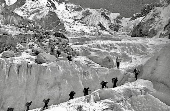
Supplemental oxygen was a key component in the expedition’s strategy, reflecting the growing acceptance of its necessity at extreme altitudes. The team used oxygen for climbing and sleeping above Camp 3 (6,700m). Sherpas used oxygen only for carries above Camp 5 (7,700m). George Band and Joe Brown carried 1,600 liters of oxygen each for their summit push, while Hardie and Streather carried 2,400 liters each. However, leaks reduced Hardie and Streather’s supply, forcing Streather to descend without oxygen. The oxygen systems posed challenges, including mask leaks that fogged goggles, contributing to Jackson’s snow blindness during a carry to Camp 5.
Sherpa contributions
Sherpas were integral to the expedition’s success, carrying heavy loads, establishing camps, and breaking trail in deep snow. Dawa Tenzing, the sirdar, was praised for his leadership and stamina. He had also previously outperformed others on Everest in 1953.
Sherpas like Ang Temba, Ang Noru, and Tashi supported the summit teams, carrying vital supplies to Camp 6. However, the expedition was marred by the death of Pemi Dorje, Dawa Tenzing’s brother-in-law, who died of a stroke at Base Camp on May 26, after an exhausting carry to Camp 5.
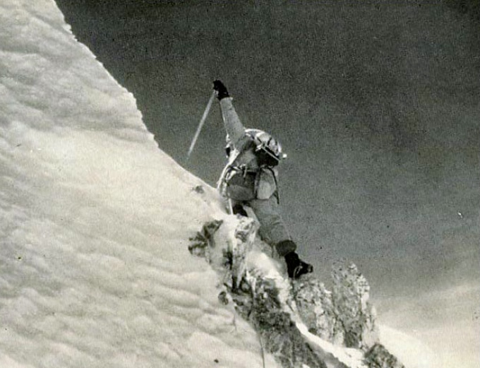
The 1955 British expedition achieved the first ascent of Kangchenjunga through meticulous planning, skilled climbing, and Sherpa support, navigating the Southwest Face with supplemental oxygen. The climb was a historic success, proving that even the Demon of Kangchenjunga could be tamed through perseverance and respect for the mountain’s cultural significance.
The second ascent of Kangchenjunga did not occur until the spring of 1977, when Prem Chand Dogra and Nima Dorje Sherpa, members of the Indian Army Expedition led by Narinder Kumar, carried out the ascent via the East Spur-North Ridge route.
Subsequent ascents included a 1979 climb by Doug Scott, Pete Boardman, and Joe Tasker, who made the first Kangchenjunga ascent without oxygen or high-altitude porters, via a new route.
Today, an avalanche hit several people on Switzerland's iconic Eiger. According to information provided on X by the Bern police, the avalanche occurred shortly after noon, sweeping away seven people.
A large rescue operation immediately ensued.
At around 8 pm local time, the Bern police posted an initial press release on social media that no one had died, and everyone has been airlifted from the mountain.
Unfortunately, the good news was premature. One man died at the scene while another later succumbed in the hospital.
At least eight people were on the 3,967m Eiger when the avalanche struck. One person had not been affected, police said.
Five others were flown to the hospital for treatment.
Earlier this week, Russian cosmonaut Sergey Ryazansky made a live video call from Everest Base Camp to the International Space Station (ISS). A few years ago, Ryazansky photographed Everest from space and wanted to see what it looked like from ground level. He shared his findings via Starlink with fellow cosmonauts Sergey Ryzhikov and Alexey Zubritsky on the ISS.
“Sergey Ryazansky showed his ISS friends what it’s like at Everest Base Camp,” said Mingma Gelu Sherpa, head of 7 Summit Club, the group organizing the trip.
Ryazansky, 50, is an experienced cosmonaut who has spent 305 days in space over two ISS missions. In 2013, he was in orbit for 166 days and did two spacewalks. In 2017, he spent 139 days on the ISS and did another spacewalk. He has a PhD in biology and studied how the human body works in space.
Now, Ryazansky is part of a 12-person Russian team climbing Everest, led by Alex Abramov. This might be Ryazansky's first major climb, but his cosmonaut training, which includes grueling physical tests, will likely help.
Using Starlink for the call caused some issues. Climbers praised Starlink’s fast internet as a game-changer, but Nepal’s Telecommunications Authority said Starlink isn’t allowed and ordered it stopped, according to The Himalayan Times.
Last year, SpaceX’s Tyler Carnevale tested Starlink on Everest but couldn’t connect live with Elon Musk.
While Ryazansky climbs, Ryzhikov and Zubritsky are on the ISS for an eight-month mission that started April 8. They will do 50 experiments before returning to Earth in December.
If Sergey Ryazansky summits Everest, he’ll be the closest person on Earth to his ISS colleagues orbiting 408km above.

After only a trickle of summits for several days because of stiff winds, a good weather window beginning tomorrow and extending for several days will usher in peak action on Everest.
UK guide Kenton Cool reached Camp 3 yesterday. He is now at 7,860m and heading for his 19th Everest summit over the next few days.
Other climbers are well-positioned in higher camps too, while some teams will begin shortly from Everest Base Camp (EBC).
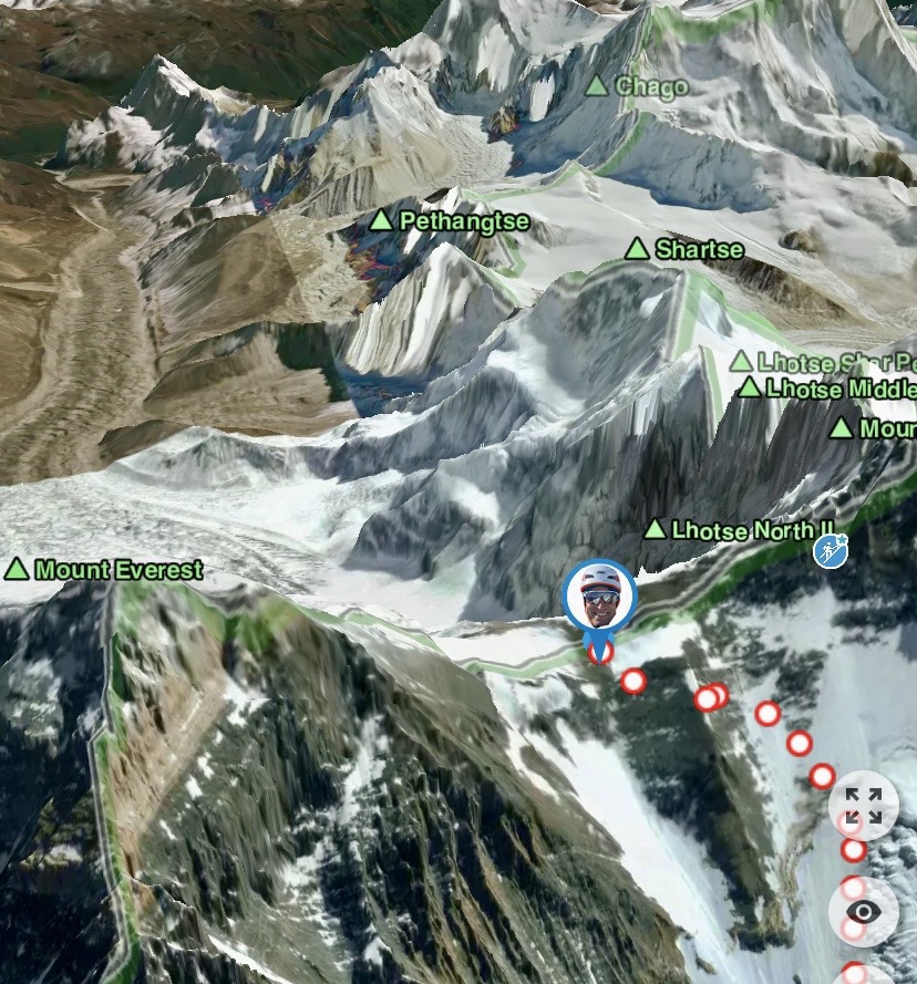
Tim Howell, who aims to make a wingsuit BASE jump from a ridge near the summit of Lhotse, left EBC last night with his team.
Meanwhile, a Russian climber had to be rescued by longline from 7,200m. She summited Everest two days ago and reached Camp 4 in the late afternoon. But she had symptoms of altitude sickness and was unable to descend to Camp 2 the following day, so she had to be airlifted from Camp 3.
Our Forgotten 7,000'ers series continues with the climbing history of 7,362m Kirat Chuli, a striking, rarely attempted peak in Sikkim, in the Indian Himalaya.
Also known as Tent Peak, Kirat Chuli has a prominence of 1,168m and is part of the northern section of the Kangchenjunga massif on the Nepal-India border.
The mountain lies between the Teesta River to the east and the Koshi River to the west and is surrounded by notable neighbors: Kangchenjunga and Gimmigela Chuli to the south, Siniolcho and Simvo to the southeast, Drohmo to the northwest, and Pathibara and Langpo Peak to the north.
Kirat Chuli's remote location, technical challenges, and harsh weather has limited mountaineering. From the Nepal side, the approach is complicated by heavily crevassed terrain.
The mountain holds cultural and religious importance for the Kirat, Limbu, and Rai communities. In the Limbu language, Kirat Chuli means "Kirat People." They believe the mountain is the abode of Yuma Sammang, an omnipotent goddess associated with knowledge, protection, and spiritual well-being.
Kirat Chuli’s other name, Tent Peak, was likely coined by early Western explorers because of its pyramid tent shape.
First reconnaissance
In 1910, Scottish chemist and mountaineer Alexander Mitchell Kellas scouted the Kangchenjunga region, including Kirat Chuli, as part of his broader exploration of the Sikkim Himalaya. Kellas’ goal was to study the geography, assess potential climbing routes, and gather data on the effects of altitude. He approached from Sikkim, likely via the Zemu Glacier.
Although Kellas didn’t attempt to climb Kirat Chuli, he did climb 6,965m Langpo. Interestingly, Langpo has had only two ascents, both by Kellas.
First attempts on Kirat Chuli
In the summer of 1936, a four-man German party led by Paul Bauer attempted to climb Kirat Chuli by two routes: by the south ridge from the east and by the south ridge via 7,177m Nepal Peak. The Germans eventually abandoned their attempt at the top of Nepal Peak because of poor conditions.
One year later, in the spring of 1937, a three-man Swiss-German party arrived, led by Ernst Grob and supported by five Sherpas above base camp. They chose the same route as the 1936 team, the south ridge from Nepal Peak.
The Himalayan Database does not provide much information about this attempt, and it is unknown how high they reached or why they retreated.
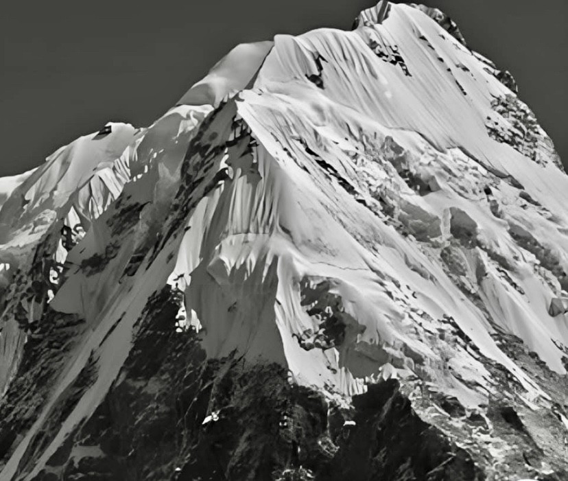
The only ascent
In the spring of 1939, Grob returned, this time with Germans Herbert Paidar and Ludwig Schmaderer and supported by Ajiba Sherpa, Genden Umdu Sherpa, Ila Sherpa, and Ila Tenzing Sherpa. The route was the same. After approaching the Zemu Glacier, they targeted the south ridge via Nepal Peak.
They established several camps along the glacier system, following the technical ridge of mixed snow and rock. On May 29, Grob, Paidar, and Schmaderer topped out.
The expedition also ascended Langpo South and attempted Gimmigela Chuli and Pyramid Peak.
To date, this is the only successful ascent of Kirat Chuli, though there have been eight further attempts on the mountain.
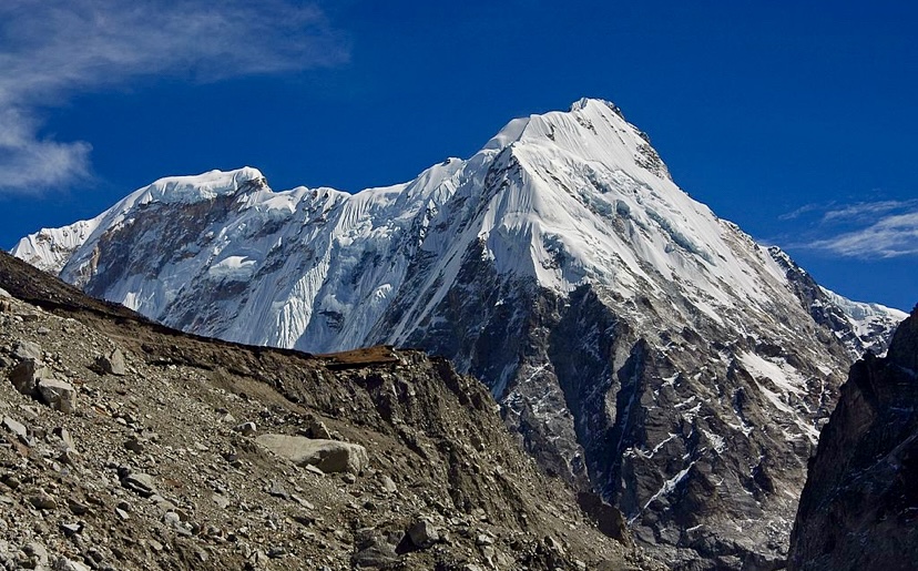
Further attempts
In the autumn of 1985, Mike Kefford led a large UK-Nepal expedition up the same route. They turned around at 6,735m on Nepal Peak because of strong winds and heavy snowfall.
The next attempt came a year later, in the autumn of 1986, when a French expedition led by Dominique Hembise attempted the same route. The outcome was the same: They abandoned at 6,650m because of snow, wind, and Hembise’s frostbite. The French expedition reported especially dangerous avalanche conditions at their Camp 1, located halfway between Cross Peak and Nepal Peak.
In the spring of 1995, an Austrian party led by Kurt Elbl attempted the southwest ridge from Sikkim via Nepal Peak. Their highest point was 7,150m, where bad weather ended their climb.
In the autumn of the same year, a German party led by Wolfram Schroeter reached 7,150m on Nepal Peak, where they ran out of time and turned around.
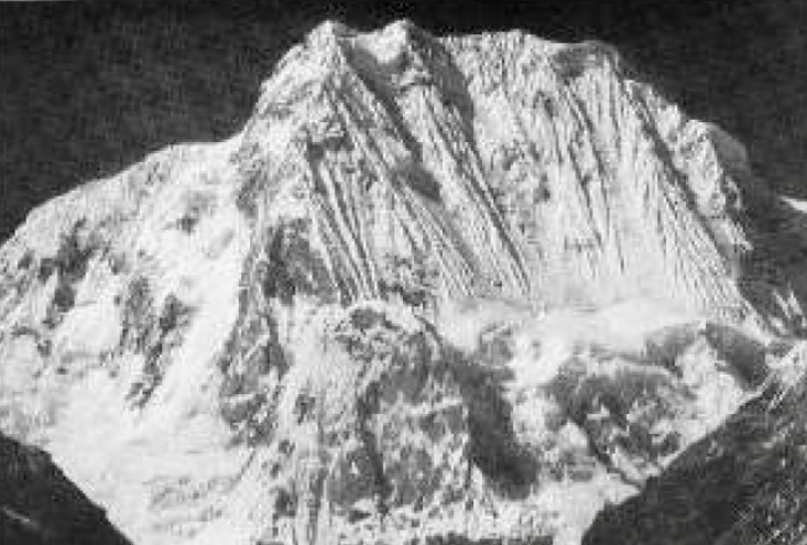
Other attempts by different routes
There were four other attempts via different routes.
In the autumn of 2000, Slovenian Andrej Stremfelj and his partners aimed to ascend Jongsang, Pyramid Peak, and Kirat Chuli via its south face. The Slovenians worked in small groups; Stremfelj and two partners were attempting Kirat Chuli when Andrej Markovic, climbing on Jongsang in another group, suffered a fatal fall. Stremfelj's team called off their expedition.
Two years later, another Slovenian expedition targeted the west face. Gregor Kresal’s party reached 6,700m but ran out of time before reaching the summit.
In autumn 2007, the Slovenian Kangbachen Expedition, led by Tone Skarja, also tried the west face. Deep snow and avalanches stopped them below 5,800m.
The most recent registered attempt in The Himalayan Database is from 2022. U.S. climbers Spencer Gray (leader), Rushad Nanavatty, and Matthew Zia targeted the north face but turned around at 6,000m in bad conditions.
Kirat Chuli remains an elusive prize. Its rugged terrain, icy slopes, and unpredictable conditions have yielded temptingly few triumphs.
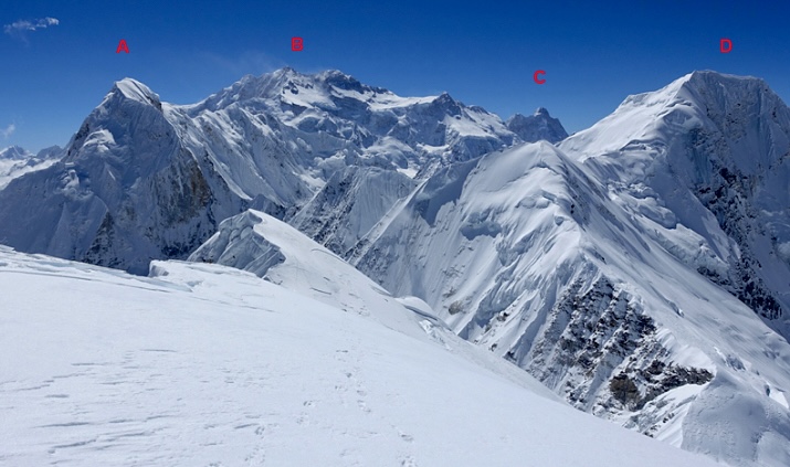
Subrata Ghosh, a 45-year-old from West Bengal, India, has died near the summit of Everest, according to The Himalayan Times. Bodhraj Bhandari of Snowy Horizon Treks reported that Ghosh passed away just below the Hillary Step during his descent.
Yesterday, Ghosh summited at around 2 pm with his guide, Champal Tamang. But Ghosh struggled with exhaustion and symptoms of altitude sickness on the way down. According to Tamang, Ghosh refused to continue descending.
Tamang eventually reached Camp 4 late last night and relayed news of the death. Efforts to retrieve the body and transport it to Base Camp are ongoing.
This marks the second fatality among foreign climbers on Everest this season, following the death of 45-year-old Philipp Santiago II from the same expedition. Santiago died at Camp 4 on May 14 while preparing for his summit attempt. There were also two Sherpas who died in hospital after coming down with Acute Mountain Sickness (AMS) in Base Camp.
Everest-Lhotse double header
Lakpa Sherpa of 8K Expeditions said climbers Sanu Sherpa, Valentyn Sypavin, Viacheslav Kryvosheia, Nina Aleksieieva, Iurii Kostiukevych, Marharyta Diachenko, Lakpa Ongjuk Sherpa, Ming Temba Sherpa, and Dawa Tenzi Sherpa summited Lhotse after Everest. Sypavin completed his fourth Everest-Lhotse double header.
Aleksieieva and Dawa Tenzi Sherpa climbed both peaks in 13 hours, summiting Everest on May 14 at 7:00 am, and Lhotse at 8:00 pm. The other climbers summited Lhotse on May 15. The whole group reached Everest’s summit on May 14.
On May 10, a French skier in his 50s died after falling over 300m in the Couloir des Cosmiques, a steep and dangerous ski route near Chamonix, France, in the Mont Blanc massif.
The victim is well-known skier and mountain guide Lucas Buzzeiro from Bariloche, Argentina.
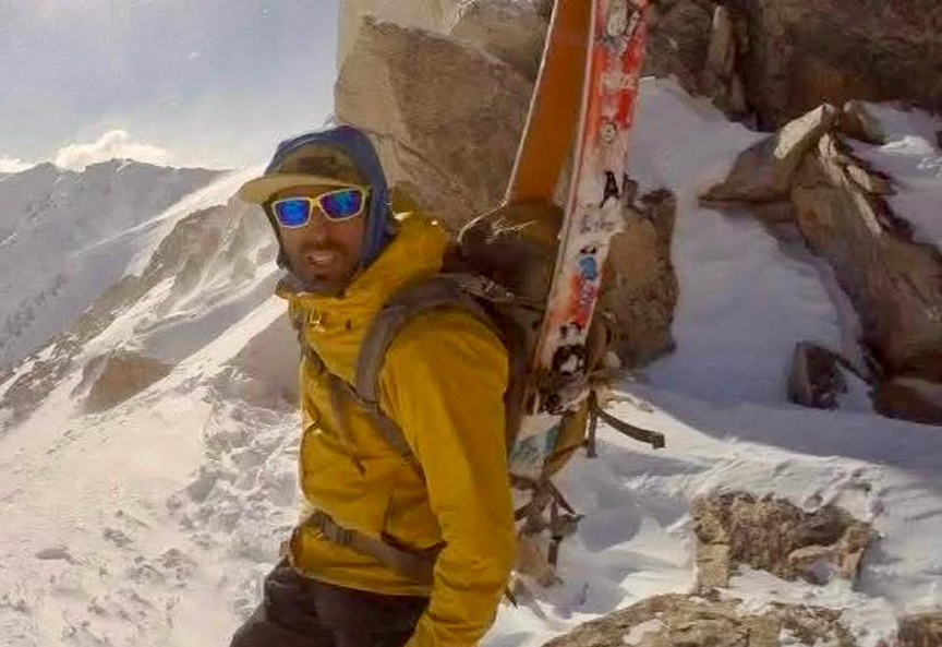
The area where he died is known for tough skiing, graded 5.1, E3, D+, S5, and is popular among very experienced skiers. However, a fall can be fatal.
At 9:20 am, the Chamonix PGHM rescue team (Peloton de Gendarmerie de Haute Montagne) received an alert, according to Le Dauphine. The rescuers helicoptered from their base in Les Bois, reaching the site minutes later. The slope was too steep to land, so rescuers were lowered to Buzzeiro. They tried to revive him, but he had died. They then airlifted out his body.
That day was busy for the PGHM, with six rescues. In the Capucin Couloir, another skier broke his leg and was evacuated. On the North Face of Mont Blanc du Tacul, a skier caused an avalanche that swept away others. The PGHM rescued the people and took them to the hospital.
Today, 104 years ago, legendary French alpinist Gaston Rebuffat was born.
One of the most celebrated mountaineers of the 20th century, Rebuffat was known for his bold new routes in the Alps, his role in the first confirmed ascent of an 8,000m peak (Annapurna I in 1950), and as the first person to climb all six great North Faces of the Alps. He wrote several influential mountaineering books and produced films that captured the essence of alpinism.
Early climbs
Rebuffat was born on May 7, 1921, in Marseille, France. He started climbing at 14 in the Calanques, a rugged coastal area near his hometown. In 1937, at 16, he joined the French Alpine Club, where he met Lionel Terray, a future climbing partner. Rebuffat visited Chamonix for the first time in 1937, and the Alps soon became his focus.
During World War II, Rebuffat took his climbing to a new level. In 1942, he graduated from Jeunesse et Montagne, a French youth training program, and received his mountain guide certification (despite being two years younger than the minimum age requirement of 23). In 1944, Rebuffat became an instructor for the French National Ski and Mountaineering School (ENSA) and the High Mountain Military School.
By 1945, he was focused on guiding clients in the Alps, fulfilling his desire to live in the mountains full time. He joined the prestigious Compagnie des Guides de Chamonix.
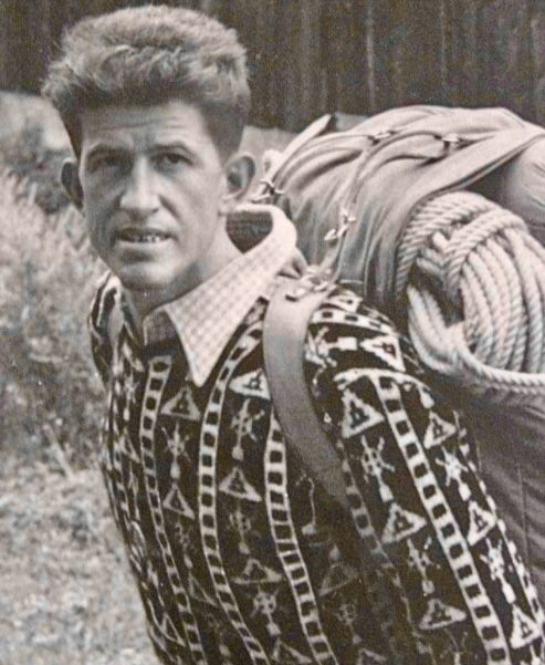
Climbs in the Alps
Rebuffat’s climbing career in the Alps was outstanding, with over 1,200 ascents classified as difficult or very difficult. In the 1940s, Rebuffat tackled some of the Alps’ most challenging peaks, alongside partners such as Terray and Louis Lachenal. By the end of the 1940s, Rebuffat was among France’s elite mountaineers.
In the 1940s and 50s, Rebuffat established approximately 40 significant first ascents via new routes. These included routes on the Aiguille du Midi, the Drus, and Aiguille du Roc. His new lines were known for their elegance and technical challenge, and reflect his philosophy of climbing in harmony with the mountain rather than conquering it.
The six North Faces of the Alps
Rebuffat finished his most celebrated achievement in 1952. The North Faces of the Matterhorn, Eiger, Grandes Jorasses, Piz Badile, Drus, and Cima Grande di Lavaredo are well known for their steepness, difficulty, and unpredictable weather.
Rebuffat began to plan his first North Face, the Grandes Jorasses, in 1938, when he was only 17 years old. The first ascent -- by Italians Riccardo Cassin, Gino Esposito, and Ugo Tizzoni -- inspired him.
On Rebuffat's first attempt, in 1943, bad weather forced him to retreat. Finally, in July 1945, he succeeded, climbing the Walker Spur with Edouard Frendo in three days with two bivouacs. This marked the second ascent of this route.
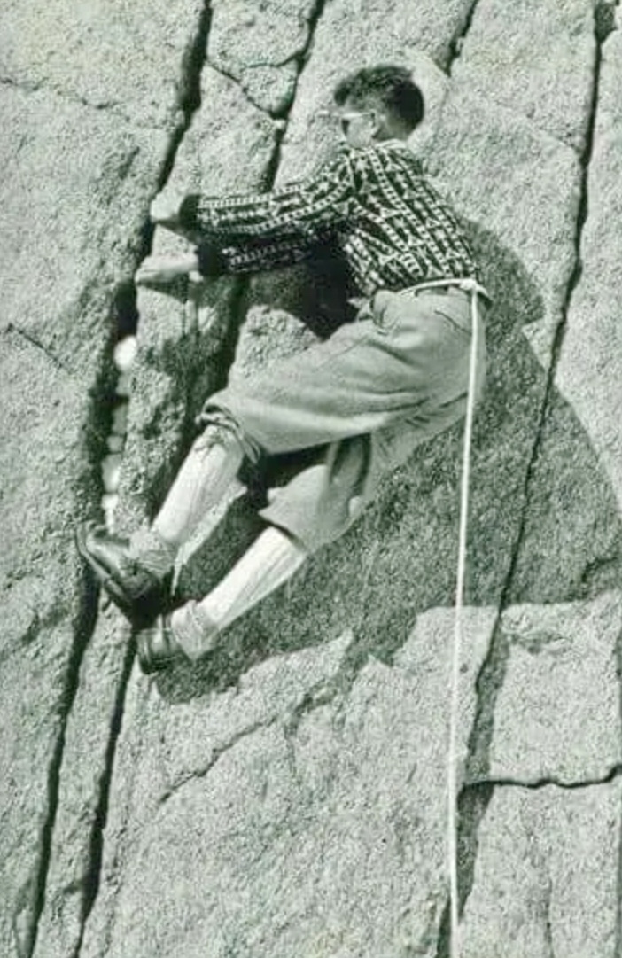
In August 1946, Rebuffat guided Belgian amateur mountaineer Rene Mallieux up the North Face of the Petit Dru. They climbed fast to reach the summit by nightfall, bivouacking on the descent and attending the Chamonix Guides’ Festival the next day. The one-day ascent showcased Rebuffat’s efficiency and guiding skills.
In the summer of 1948, Rebuffat guided a client up the northeast face of Piz Badile in the Bregaglia Alps. Despite a severe lightning storm, they reached the summit the following day. They followed the Cassin Route, first ascended in 1937.
Rebuffat’s fourth North Face came in 1949 when he climbed the Matterhorn twice, first with Raymond Simond, and later with other partners (though some sources mention only one ascent). He targeted the Schmid Route, first climbed in 1931.
The same year, Rebuffat ascended the North Face of Cima Grande di Lavaredo in the Dolomites, guided by Italian Gino Solda. This ascent followed the Comici-Dimai Route, first climbed in 1933.
In July 1952, Rebuffat completed his quest with the North Face of the Eiger via the Heckmair Route. He climbed with Paul Habran, Guido Magnone, Pierre Leroux, and Jean Brune.
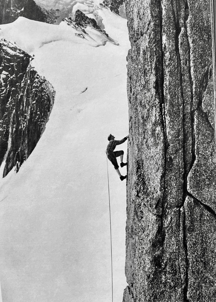
Annapurna I
In 1950, Rebuffat joined a French expedition to Annapurna I. Led by Maurice Herzog, the team included Rebuffat, Terray, and Lachenal, among others. The expedition started in March, but the ascent only began in May.
The French party established a base camp and four intermediate camps, the highest at 7,400m. On June 3, Herzog and Lachenal summited and became the first two people in the world to reach the top of an 8,000m peak. Rebuffat and Terray didn’t summit, but played a critical role during the descent.
While summiting was a historic triumph, the descent turned into an ordeal, marked by frostbite, snowblindness, avalanches, and navigational errors. Rebuffat helped to ensure the survival of frostbitten and disoriented teammates during the harrowing retreat.
Herzog and Lachenal reached the top around 2 pm and started to descend immediately. The weather was clear but very cold, with temperatures estimated at -40°. Herzog somehow lost his gloves while handling equipment, exposing his hands. Lachenal, impatient to descend quickly in the worsening conditions and with his own frostbite concerns, slipped and tumbled 100m down the slope. Miraculously, he stopped short of a fatal drop, but the accident left him shaken, with one crampon missing, and his ice axe gone. His feet, already numb from prolonged exposure, were deteriorating rapidly. Both men were in a very bad state as they struggled toward Camp 5 at 7,440m, where Rebuffat and Terray awaited.
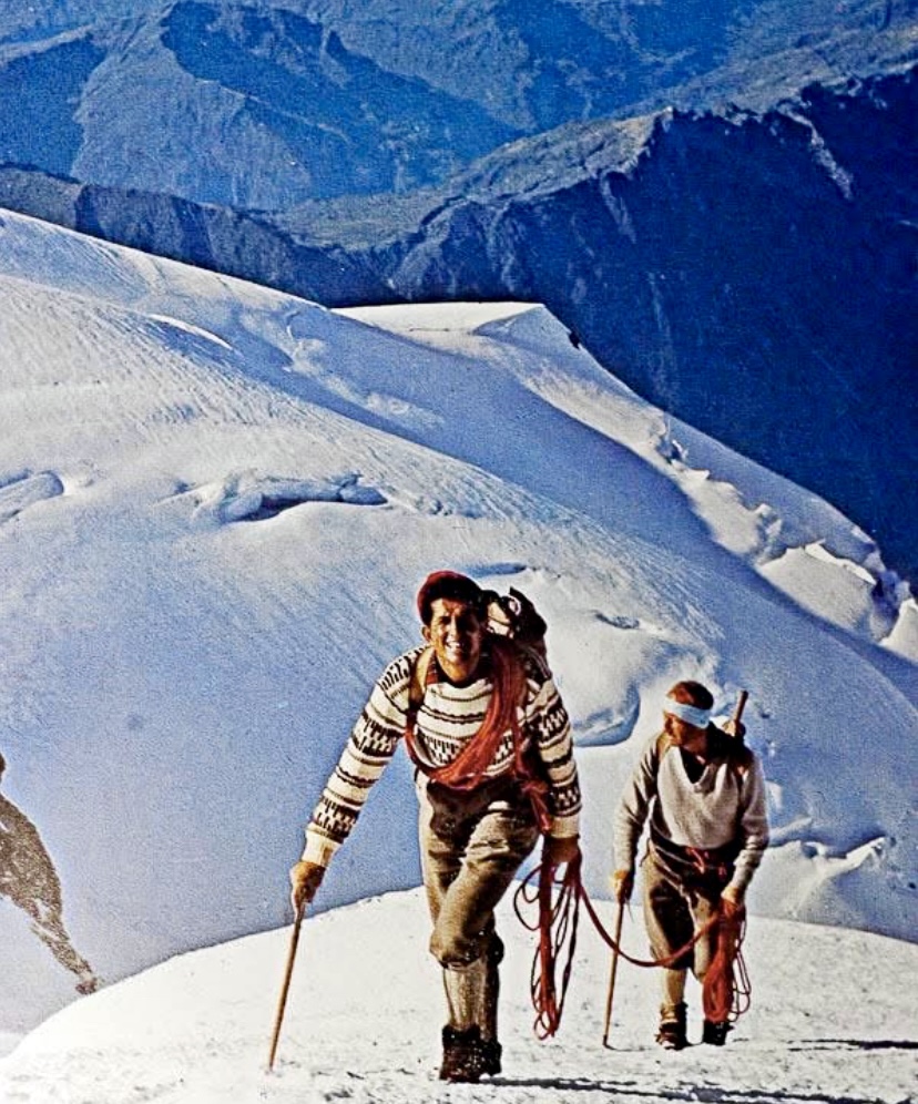
Meeting Rebuffat and Terray
Rebuffat and Terray had climbed to Camp 5 earlier that day, expecting to support Herzog and Lachenal or possibly attempt the summit themselves if conditions allowed.
When Herzog arrived at the high camp alone, Rebuffat and Terray were relieved, but then alarmed when they shook his hand. Herzog’s hands were frozen solid, white, and lifeless.
Rebuffat and Terray started to massage Herzog’s frostbitten hands and feet, hoping to restore the circulation, but their efforts had little result. Hearing some cries from below, Terray ventured out of the tent into the dusk and located Lachenal, who had missed the camp and was 200m down the slope. Terray guided Lachenal back to Camp 5. Lachenal’s feet were frozen, and he was disoriented from his fall and the altitude.
Rebuffat and Terray worked through the night to keep Herzog and Lachenal warm, using their body heat. Herzog’s hands and feet were turning black, and Lachenal’s toes were stiffening. Aware that the team needed to descend urgently for medical attention, Rebuffat helped organize the group for the next day’s descent.
Descending in cruel conditions
On June 4, in worsening weather, the four climbers set out to descend to Camp 4 at 7,150m. It was a whiteout, with heavy snow and almost zero visibility. Rebuffat and Terray had removed their glacier goggles the previous day while searching for the route, and both were snowblind.
The situation was critical. Two blind men were guiding two weak, injured climbers. Rebuffat relied on his instincts and memory of the route to help navigate, but the party struggled to locate Camp 4, missing it in the fog and snow. Exhausted, the four climbers had to bivouac in a crevasse for the night.
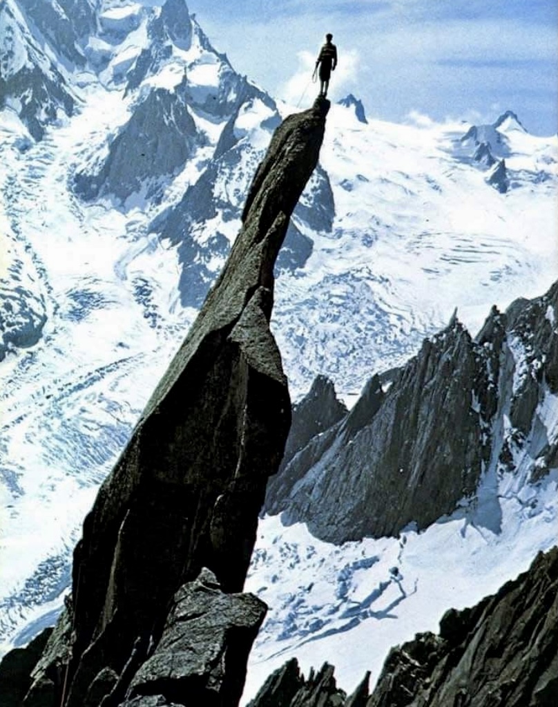
At dawn, on June 5, an avalanche poured into the crevasse, burying their boots and equipment. Rebuffat and Terray, still snowblind, dug frantically to recover their gear. Rebuffat was determined to keep the group moving.
Later that morning, teammate Marcel Schatz ascended from Camp 4 to search for them. Thankfully, he spotted the group and guided them to safety.
Rebuffat’s resilience
At Camp 4, Rebuffat was suffering early frostbite and snow blindness but coordinated the Sherpas' evacuation of his companions.
On June 5, during their descent to Camp 2, Rebuffat helped rescue Herzog and two Sherpas from an avalanche. By the afternoon, the team reached Camp 2. Finally, everyone reached base camp alive, though Herzog and Lachenal lost some digits.
Rebuffat died from cancer on May 31, 1985, in Bobigny, France at age 64. Rebuffat’s tombstone in Chamonix’s old cemetery bears a quote from his book Les Horizons Gagnes:
"The mountaineer is a man who leads his body to where, one day, his eyes have looked."
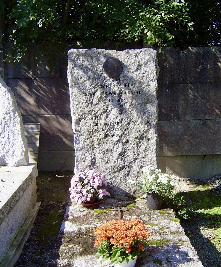
Legacy
Rebuffat wrote over 20 books on mountaineering, including Starlight and Storm: The Ascent of the Six Great North Faces of the Alps, Mont Blanc to Everest, On Ice and Snow and Rock, The Mont Blanc Massif: The 100 Finest Routes, Men and the Matterhorn, and Between Heaven and Earth. He also edited a mountaineering column for Le Monde.
Rebuffat also produced numerous films, including: Flammes des Pierres, Etoiles et Tempetes (which won the Grand Prize at the Trento Film Festival), Entre Terre et Ciel, and Les Horizons Gagnes.
Rebuffat’s commitment to share the beauty of the mountains continues to resonate with climbers and adventurers. His routes in the Mont Blanc massif are still climbed, and his books remain classics.
You can watch the film Etoiles et Tempetes (in French) below:
Anna Pfaff, Andres Marin, and Tad McCrea have completed a new route on the south face of Alaska's 3,429m Mount Providence.
Last year, Pfaff, Marin, and Thomas Bukowski opened this new route up the 983m south face but had to turn around about 100m below the summit. They graded it V, M5, AI4, 5.10.
At the end of last month, Pfaff and Marin returned with McCrea to complete the route to the summit, which they did.
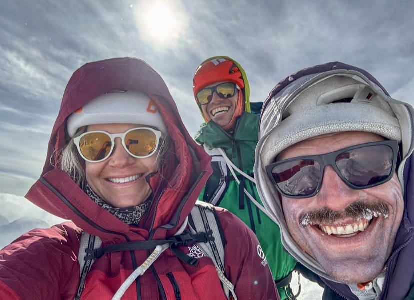
Mount Providence's steep and technical lines are rarely attempted. According to Marin, the peak has been summited only once or twice before.
According to the American Alpine Journal, Samuel Johnson and Jeremy Piggott established a new route in 2004 up the western half of the south face via a striking couloir and rock buttress. The mixed climb brought them to Providence's corniced summit ridge. They graded their 13-hour round-trip climb from base camp V, WWI4, M6.
In 2016, Andy Anderson and Kim Hall climbed a pyramidal rock buttress and up a couloir on Mount Providence. They didn't quite summit but established an aesthetic line that they graded 800m, IV, M5, WI4.
Andres Marin wrote on social media about the route:
https://www.instagram.com/p/DJMXgrluvuB/?igsh=MTdnNjRpZG5qdHVtdQ%3D%3D
Lenin Peak, a towering giant in the Pamirs, has attracted climbers for decades. We examine its first ascents (one from the south and one from the north) as well as two expeditions that ended in tragedy, including the deadliest-ever mountaineering disaster.
Lenin Peak
Lenin Peak (7,134m) is located on the border between Kyrgyzstan and Tajikistan in the Pamir Mountains. Its northern slopes are in Kyrgyzstan’s Alai Province, and its southern slopes are in Tajikistan’s Gorno-Badakhshan region. The summit lies on the border, making it a shared peak between the two countries.
It is the highest peak in the Trans-Alay Range, and the second highest in both Kyrgyzstan and Tajikistan, surpassed only by 7,495m Ismoil Somoni Peak in Tajikistan and 7,439m Jengish Chokusu in Kyrgyzstan.
Lenin Peak is one of five 7,000m peaks in the former USSR. Climbers must summit all five to achieve the prestigious Snow Leopard Award. Decades after the fall of the Soviet Union, climbers still pursue the Snow Leopard challenge.
A peak with many names
In 1871, the peak was named Mount Kaufman after Konstantin Kaufman, the first Governor-General of Russian Turkestan. In 1928, it was unsurprisingly renamed Lenin Peak.
The current official name differs between Kyrgyzstan and Tajikistan. In Kyrgyzstan, it is called Lenin Chokusu (Lenin Peak), while in Tajikistan, it is Qullai Abuali Ibni Sino (Ibn Sina Peak or Avicenna Peak). Tajikistan renamed the mountain in 2006 after the Persian scholar Abu Ali ibn Sina.
Local Kyrgyz names include Jel-Aidar (Wind’s God) and Achyk-Tash (Open Rock).
We’ll call the mountain Lenin Peak, as it bore this name for three of the four expeditions we cover in this article.
Renowned as one of the most accessible 7,000’ers, hundreds of climbers visit Lenin Peak annually. Most climb the classic north face route, approaching from Osh in Kyrgyzstan. However, the mountain’s reputation as the easiest 7,000m peak is misleading because of its high altitude, unpredictable weather, and avalanche risk.
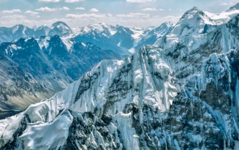
The first ascent
In September 1928, a Soviet-German expedition targeted Lenin Peak. The team included German climbers Eugen Allwein and Karl Wien, and Austrian Erwin Schneider, supported by Soviet climbers and porters. The expedition was a joint effort to map the Pamirs.
They approached from the south side, starting in the Saukdara River Valley, continuing up the south slope of the Trans-Alay Range, and then ascending via the Greater Saukdara Glacier. Their route wound from Krylenko Pass (a saddle that connects the Greater Saukdara Glacier to the upper slopes of Lenin Peak at 5,820m) to the northeast ridge toward the summit.
The three climbers faced brutal conditions with rudimentary gear: canvas jackets, wool layers, and leather boots with nail soles. High winds and subzero temperatures tested their endurance. On September 25 at 3:30 pm, Allwein, Wien, and Schneider reached the summit.
During the descent, the climbers suffered severe frostbite that required medical care in Osh. They left no summit proof on top, leading some to question their success. Despite some skepticism, authorities accepted their ascent, marking a historic first. The team also set a new mountaineering altitude record, surpassing that set by Alexander Kellas on 7,128m Pauhunri in 1911.
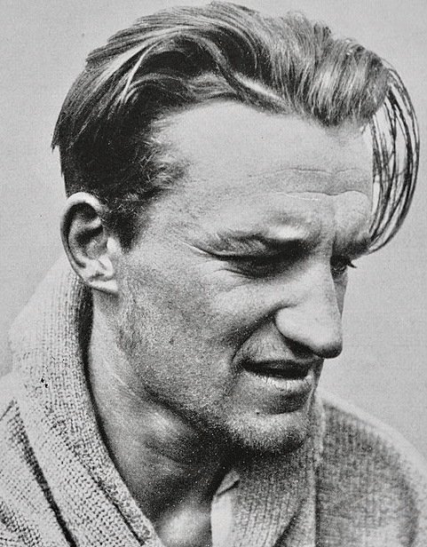
The first ascent from the north
In 1934, Soviet climbers tried from the northern side. The expedition, backed by the Red Army, included siblings Vitaly and Yevgeny Abalakov, Kasian Chernuha, and Ivan Lukin.
They started from Achik-Tash Canyon, ascending to Lenin Glacier’s western ice slope on the north face. They reached the crest of the northeast ridge at approximately 6,500m and continued along the ridge to the summit. En route, they established camps at 5,700m, 6,500m, and 7,000m.
On September 8 at 4:20 pm, Chernuha, Vitaly Abalakov, and Lukin summited after a four-day climb. Abalakov placed a bust of Vladimir Lenin on the summit.
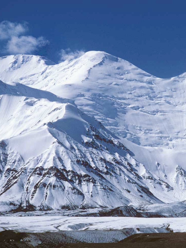
The 1974 tragedy
In 1974, Lenin Peak hosted an international mountaineering camp, attracting nearly 200 climbers.
A Soviet all-female team led by Elvira Shatayeva planned a traverse, ascending via the Lipkin Ridge on the north face, and descending the Razdelnaya Route on Lenin Peak's northern side.
The women topped out on August 7, despite warnings from base camp of an approaching storm. The storm, the worst in 25 years, caught them below the summit. The wind exceeded 100kph, shredded the party’s thin cotton tents, and exposed Shatayeva's team to temperatures below -20C°. They didn't want to abandon each other, and all eight stayed together until their last breath.
Shatayeva maintained radio contact with base camp, reporting dwindling supplies and frostbite. American climber John Roskelley and some nearby Japanese alpinists attempted a rescue but were repelled by the blizzard. Over two days, the women succumbed to hypothermia and exhaustion.
Shatayeva’s last radio message was: "I'm alone now, with just a few minutes left to live. See you in eternity."
All eight women perished, and climbers later found their bodies scattered along the summit ridge. The disaster, caused by inadequate gear and the ferocity of the storm, shocked the mountaineering community.
The deadliest mountaineering tragedy
In the summer of 1990, 45 climbers, primarily from the Leningrad Mountaineering Club, were at Camp 2 (5,300m) on what is now called the Razdelnaya Route on Peak Lenin's north face. The party included Soviet climbers Leonid Troshchinenko, Vladimir Voronin, and Alexei Koren (among others), six mountaineers from the former Czechoslovakia (including Miroslav Brozman), four Israelis, two Swiss climbers, and one Spaniard.
On July 13 at 9:30 pm, a 6.4-magnitude earthquake (with its epicenter in Afghanistan’s Hindu Kush) shook the Pamirs. It dislodged a serac from nearby Chapaev Peak, triggering a massive avalanche. Snow and ice hit Camp 2 on Lenin Peak, burying the climbers in seconds, and killing 43 people from five nations.
Koren and Brozman, who were positioned at the camp’s edge, survived with a broken arm and leg, respectively. They heard the trapped climbers’ cries as the debris froze into the glacial ice.
According to Charles Huss's report for the American Alpine Journal, a few other climbers were lucky to survive. Vladimir Balyberdin had decided at the last minute to move to Camp 3 with some friends, and six English climbers escaped because they had established their bivouac some distance from the main camp.
Rescue efforts
Soviet helicopters searched for the avalanche victims but initially could only recover one body. In 2004, because of glacial melt, human remains surfaced at 4,200m, with more emerging in 2008.
A plaque near the Achik-Tash base camp commemorates the victims of the 1990 disaster. It remains the deadliest single mountaineering accident in history.
In 1978, American mountaineer Johnny Waterman completed the first solo ascent and traverse of Mount Hunter’s twin summits in Alaska. His grueling 145-day odyssey redefined the limits of solo mountaineering, showcasing incredible endurance and skill. We examine the climb, its significance, and Waterman’s legacy.
Johnny Waterman
John Mallon Waterman, better known as Johnny Waterman, was born in 1952. He grew up climbing with his father, Guy Waterman (a mountaineer and conservationist who also wrote several books about the outdoors), and his older brother Bill.
When Johnny Waterman was still in his teens, he began backpacking and rock climbing in New York and New England. He led a 5.10 route (Retribution) in the Shawangunk Mountains in New York State at 15. At 16, he climbed McKinley’s West Buttress with the Appalachian Mountain Club.
According to Bradley Snyder for the American Alpine Journal, Waterman was years ahead of mainstream mountaineering: "John might have coasted through mountains on sheer natural ability, but he took the craft of climbing seriously, and trained himself to be a fast, safe, consistent climber on any terrain."
Notable climbs
After high school, Waterman made trips to England, Scotland, Canada, the Alps, and Turkey, and carried out several remarkable ascents. In Canada, he made the second ascent of Snowpatch Spire’s South Face.
Waterman made the first solo ascent of the committing VMC Direct route on 1,244m Cannon Mountain in New Hampshire, a mind-blowing feat.
He ascended The Nose of El Capitan, soloed the Grand Teton’s North Face, and carried out the first south-to-north traverse of the Howser Towers.
He made the first ascent of Mount McDonald’s North Face and the first ascent of the East Ridge of Mount Huntington. On Mount Robson, he made the third ascent of the North Face.
Mount Hunter
Mount Hunter (also called Begguya) is 13km south of Mount McKinley, in the Alaska Range within Denali National Park.
Begguya means child, or Denali’s child, in the local Dena’ina Athabascan language. It is famous for its technical difficulty, steep faces, and remoteness. Elite alpinists are drawn to its challenging routes, extreme weather, and beauty.
Mount Hunter has two summits: the North Summit at 4,442m and the South Summit at 4,255m. A high plateau connects the two summits, making the traverse an unusual challenge. Its climbing history features several bold ascents, technical innovation, and few summits, especially compared with McKinley.
Fred Beckey, Heinrich Harrer, and Henry Meybohm made the first ascent of Mount Hunter in 1954 via the west ridge from the Kahiltna Glacier. They topped out on the North Summit on July 3. Their multi-day route passed over crevassed glaciers, steep snow slopes, and a corniced ridge.
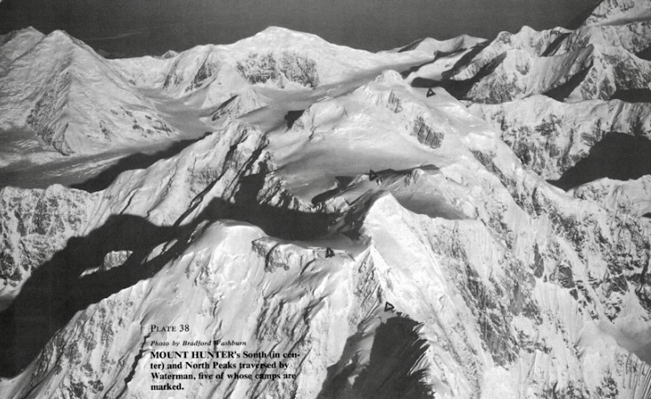
A bold attempt on Mount Hunter in 1973
In May 1973, Waterman and partners Dean Rau, Don Black, and Dave Carman attempted the first ascent of the south face-south ridge route of Mount Hunter. Waterman, then 21 years old, aimed for the 4,257m South Summit.
On May 29, Black, Waterman, and Carman were 61m below the South Summit when they mistakenly halted at a gendarme because of an approaching storm and confusion with the North Summit. (Rau had stopped lower down.)
Their route from the south col (3,200m) comprised three demanding sections: a complex lower rock ridge requiring 914m of rope and 40 anchors; a steep middle mixed face with ice-filled cracks; and an upper snow-ice ridge with unstable ice and minimal belays.
A storm trapped the climbers in a snow cave for days, with high winds and almost zero visibility. The climbers were running out of food, and Waterman had frostbite. The exhausted trio retreated from below the South Summit. Despite the failure, Waterman decided to return one day to solo Mount Hunter.
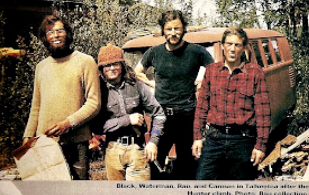
After 1973, Waterman moved to Fairbanks, Alaska. He preferred solo climbing because he struggled to find equally skilled partners, and possibly because of a tragic event in 1973. Johnny’s beloved brother, Bill, who had lost his leg in a railroad accident in 1969, disappeared in Alaska in 1973. Bill was only 22 years old.
After this, Waterman became more isolated and increasingly climbed solo.
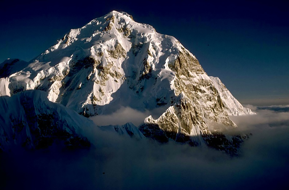
Mount Hunter solo traverse, 1978
Waterman returned to Mount Hunter alone in the spring of 1978.
"My vendetta with Mount Hunter started in the late 1960s, with Bradford Washburn’s pictures in the American Alpine Journal," Waterman wrote in his climbing report for the AAJ.
Driven by a decade-long obsession, Waterman began a solo south-to-north traverse. Starting on March 24 from the Tokositna Glacier’s cirque at 2,438m, he aimed to climb the 1,433m Central Buttress of the south face (referred to as the southeast spur in mountaineering literature), then traverse the summit plateau and descend the north spur.
He had 1,097m of rope and more than 350kg of gear, including food calculated to provide 5,000 calories a day.
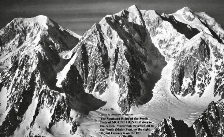
The climb
Waterman adopted an expedition-style approach, shuttling his 272kg base camp up each section, reusing rope to cover a route requiring 3,658m. The ascent involved 12 camps and 12 round trips per section.
The Central Buttress was mostly snow and ice, with rock steps and a 107m rock cliff. Section one included a 366m gully, and section two tackled a 152m technical crux, including a 24m pinnacle and a 90m gully. On April 11, day 18, he reached Camp 3.
Next came a 488m corniced arete, featuring a 30m headwall and ice pinnacle, which he finished on May 6. The next section wasn’t easy, either. He climbed steep terrain, joining the south ridge at 3,871m on May 26.
During the climb, Waterman suffered frostbite, lost a contact lens, and had a lice infestation. He dealt with fraying ropes, cornice collapses, and food shortages, dropping to two-thirds rations by June. A resupply on June 20 (day 88) provided 36 days of food.
By June 12, he reached the summit plateau after navigating a 213m ice arete. He topped out on the South Summit on July 2 after 101 days. After traversing the two summits, he reached the North Summit on July 26.
He descended by the north spur, arriving at his fly-out site 43 days later. His solo expedition took an astonishing 145 days. According to his report, Waterman used 40 ice pitons, pickets, and flukes, and 20 rock anchors.
His new route was the first solo ascent and the first solo traverse of the peak. He endured loneliness, rage, and frustration, but persevered, managing limited food supplies to complete his climb.
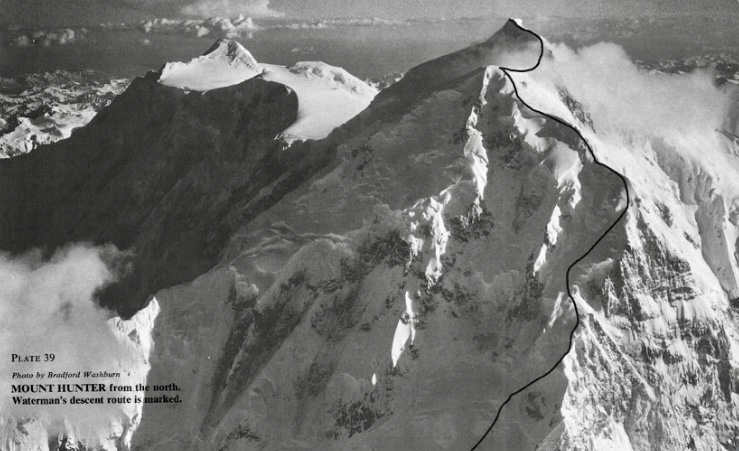
After the climb, Waterman’s mental health deteriorated. He displayed obsessive and delusional behavior. His past climbing feats convinced him he was invincible.
Disappearance
In the spring of 1981, Waterman targeted McKinley solo via the East Buttress. He planned to climb up the northwest fork of the Ruth Glacier, a route prone to crevasses and avalanches. Waterman began on April 1, carrying minimal supplies. He was last seen on April 19 at 3,350m.
Helicopters and ground rescue teams found only some tracks and an abandoned campsite. He might have suffered a fatal crevasse fall, died in an avalanche, or, with minimal gear, perished of exposure. Waterman was 29 years old when he disappeared.
Aftermath
Waterman’s father, Guy Waterman, committed suicide in February 2000, intentionally freezing to death on Mount Lafayette in New Hampshire. Laura Waterman, Guy Waterman’s wife (and Johnny Waterman’s stepmother), created The Waterman Fund after his death. The fund promotes wilderness preservation through education, trail maintenance, and research. The present an annual Guy Waterman Alpine Steward Award, honoring those dedicated to protecting the region’s mountain wilderness.
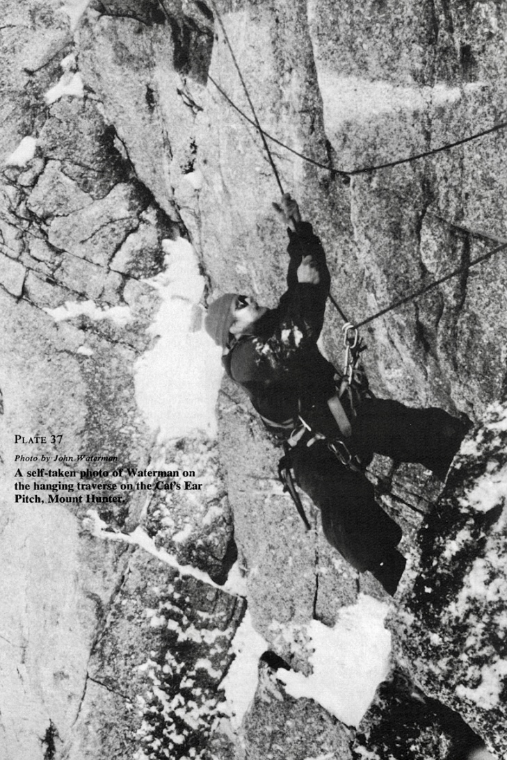
In this entry in our series on the climbing history of North American peaks, we examine Alaska's 4,996m Mount Blackburn and Dora Keen’s pioneering 1912 ascent.
Mount Blackburn is the highest peak in the Wrangell Mountains, within Wrangell-St. Elias National Park. It is also the fifth-highest peak in the United States.
It was named in 1885 after Senator Joseph Clay Stiles Blackburn, a supporter of the Alaska purchase. The local Athabascan people called it K’ats’i Tl’aadi.

Mount Blackburn has severe weather because of its proximity to the turbulent Gulf of Alaska. Storms, avalanches, dangerous crevasses, and serac falls are common. It experiences 2,310mm of annual rainfall and 1,930mm of snow. Permanent ice covers this ancient shield volcano.
The west face drops over 3,350m in less than 6.4km, while other faces descend 2,440-3,350m in under 12.8km, giving the mountain a notable prominence.
The mountain has two summits: the West Peak (4,996m), which is the true summit, and the East Peak (also called Kennedy Peak), which is about 60m lower. Authorities only discovered in the 1960s that the West Peak was higher. Previously, the East Peak was thought to be the highest point.
A vibrant era for women's mountaineering
Before detailing Dora Keen’s 1912 ascent, it’s important to put her climb in context. The era featured a vibrant women's mountaineering scene.
In 1912, American Fanny Bullock Workman reached 6,400m on the Siachen Glacier in the Himalaya, setting a new women’s altitude record while championing female suffrage. The same year, Gertrude Benham of the UK mapped remote regions in the Himalaya. Three years before, she had summited Kilimanjaro.
At 61, Annie Smith Peck of the U.S. followed her 1911 first ascent of Peru’s 6,377m Mount Coropuna with lectures and writing that inspired other women. Isabella Bird's Rocky Mountain ascents also gave women a role model.
Meanwhile, Lucy Walker had climbed the Matterhorn in 1871 and remained an important figure in the UK's Ladies Alpine Club, founded in 1907. In 1912, German-Polish Kathe Broske made the first traverses of the Vajolet Towers in the Dolomites.
Meanwhile, in 1911, American Dora Keen fixed her eyes on a difficult mountain in Alaska.
Dora Keen
Born on June 24, 1871, Dora Keen was the daughter of Emma Corinna Borden and renowned surgeon William Keen Jr., the first surgeon in the U.S. to remove a brain tumor successfully. Dora's mother died when she was a teenager.
Keen graduated in history from Bryn Mawr College in 1896. After graduation, she held civic positions in Philadelphia, including roles at the Society for the Prevention of Cruelty to Children, the American Society for Labor Legislation, and the Society for Organizing Charity. She advocated for compulsory education, free lunches, special education, and student healthcare, driving significant reforms.

Keen’s mountaineering career began in her late 30s. Between 1909 and 1910, she made several ascents in the European Alps, including the Matterhorn, Zinal Rothorn, Monte Rosa, Weisshorn, and Mont Blanc.
Next, Keen summited peaks in Ecuador, Norway, and Canada’s Selkirk Mountains. Writing for National Geographic in 1911, she explained that she pursued "wonderful views, vigorous exertion, relaxation, and inspiration."
All this alpine experience prepared her for a history-making challenge in Alaska.
Mount Blackburn, 1911
In 1911, inspired by a U.S. Geological Survey report, Keen decided to attempt Mount Blackburn. She led a small team that included four local gold miners (Charlie McGonagall, Pete Anderson, Billy Taylor, and Tom Lloyd) and a German adventurer.
Keen’s party approached the mountain from the southwest, following the Kennicott Glacier toward the base of the mountain.
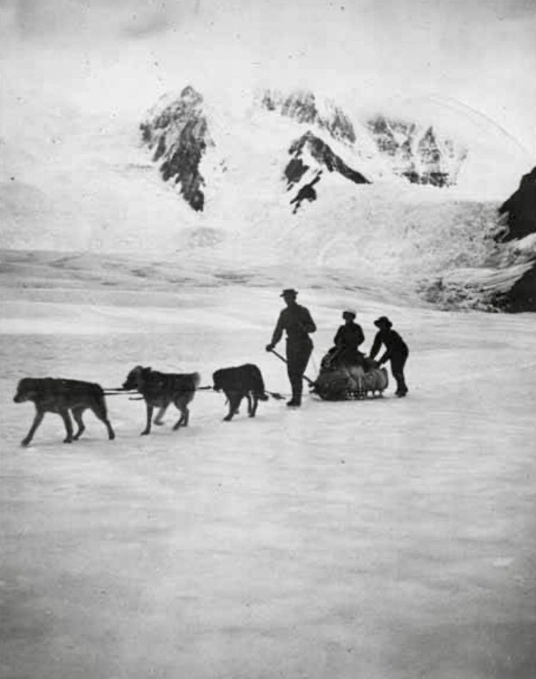
The team reached 2,740m but turned around because of bad weather and low food supplies. Avalanches, impassable glaciers, and crevassed terrain made the route slow and difficult.
Despite this unsuccessful attempt, Keen remained determined to climb the peak. She meticulously started to plan a second expedition for the following year.
Round two, 1912
Her spring 1912 expedition included seven unnamed miners from the nearby Kennicott Copper Mine, prospector Bill Lang, and German-American adventurer George W. Handy. Sled dogs hauled the supplies.
After another 40km trek up the Kennicott Glacier to the base of Mount Blackburn at 1,676m, the party started to ascend the crevassed east face. The team endured a 13-day snowstorm and spent 22 nights in snow caves at 3,780m. There, the miners abandoned the attempt.
Keen, Handy, and Lang continued up, navigating icefalls and avoiding avalanches. After a final section that they climbed at night, they topped out on the 4,964m East Peak on May 19. They believed that this was the true summit.
It was a groundbreaking climb — the first recorded ascent of Mount Blackburn. Keen, 41, had led an all-male team in extreme conditions. Her leadership challenged the social expectations of the era, and the expedition's use of sled dogs to haul supplies was notable.
Keen’s was also the first documented female ascent of an Alaskan peak, according to the American Alpine Journal.
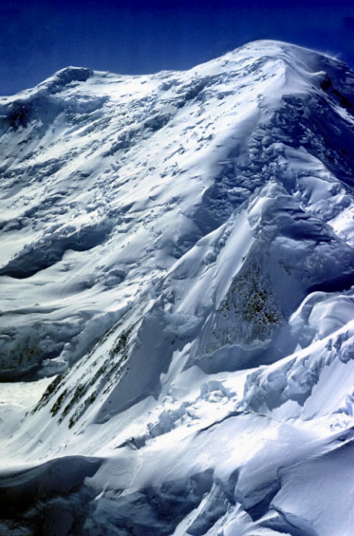
The second ascent that became the first
The second ascent, this time of the West Peak (the true summit), only came 46 years later, on May 30, 1958. Bruce Gilbert (U.S.), Hans Gmoser (from Canada with Austrian origin), Adolf Bitterlich (Austria), Dick Wahlstrom (U.S.), and Leon Blumer (U.S.) went via the northwest ridge.
At the time, the climbers reported it as the second ascent of Mount Blackburn. However, in the 1960s, the West Peak was confirmed as the true summit, making their 1958 climb the first ascent.
The northwest ridge route, approaching the mountain via the Nabesna Glacier, is now the most common route on the mountain. But Mount Blackburn is not often climbed. Only 50 parties have summited it.
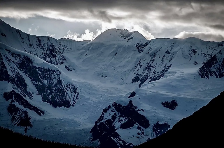
The second ascent of the East Peak
The East Peak had its second ascent in 1977. U.S. climbers Gerry Roach (leader), Barbara Roach, Dan McNerthney, Bill Krause, and Carrie Krause started on the southwest side and ascended via the southeast ridge. They then traversed over both summits (first the East Peak, then the West Peak) and descended the northwest ridge.
Climbers no longer use the 1912 Kennicott Glacier-East Face route because of its extreme hazards. Glacial retreat over the past decades has made this route more difficult than ever.
You can read more about climbing routes on Mount Blackburn here.
After Mount Blackburn
Keen and Handy married in the summer of 1916 and divorced 16 years later. After the divorce, Keen sold insurance products to fund her travels. In 1962, at 91, Keen embarked on a world tour that included a stop in Alaska. It was her first visit since 1916.
Keen died during her world tour, on Jan. 31, 1963, in Hong Kong.
Henry S. Hall Jr. wrote an excellent article, published in the American Alpine Journal in 1963, about Keen. It offers a glimpse of her character:
"My wife and I spent an hour with her last spring. She was alert, in full possession of her faculties, and looking forward to plans for the future which included travel, probably alone. She liked her independence. She was a remarkable little person, full of confidence and wanting no one to worry about her; she could manage quite well by herself."
Earlier this week, we examined the pioneering 1979 ascent of Everest’s West Ridge Direct route. In 1984, a team that included Bulgarian alpinist Hristo Prodanov completed the only repeat of this demanding route. Prodanov summited alone, without supplemental oxygen.
Prodanov’s climbing history
Born on Feb. 24, 1943, in Karlovo, Bulgaria, Prodanov was a metallurgical engineer whose true passion was mountaineering. Starting in 1958 in Bulgaria’s Pirin Mountains, he became one of his country’s greatest climbers.
Between 1967 and 1977, Prodanov made several important climbs in the Alps. In 1967, he ascended the North Face of the Grandes Jorasses via the Walker Spur and the Petit Dru by the Bonatti Pillar. In 1969, he did Mont Blanc’s Freney Pillar. He knocked off the North Face of the Matterhorn in 1974 and the Petit Dru by the Guides Route in 1977.
He also carried out several climbs in the Caucasus, including Ushba Pillar in 1970 and a traverse on Shkhelda in 1973.
In 1975, Prodanov began climbing 7,000'ers. That summer, he summited 7,134m Lenin Peak (now called Ibn Sina Peak) in the Pamirs, returning there in 1982 and 1983. In 1976, he climbed 7,492m Noshaq in the Hindu Kush. He successfully climbed 7,105m Korzhenevskaya Peak three times (in 1979, 1982, and 1983), and he also summited Communism Peak (now Ismail Samani) twice, in 1980 and 1983.
In April 1981, Prodanov became the first Bulgarian to summit an 8,000m peak when he did 8,516m Lhotse. Prodanov reached the summit alone and without supplemental oxygen.
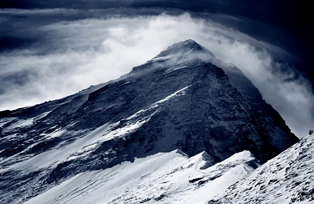
Everest, 1984
In the spring of 1984, a Bulgarian expedition led by Avram Iliev Avramov (with Prodanov as deputy leader) headed to Everest. The team established Base Camp on March 18. The group included 24 Bulgarians, Nepalese climbers Chowang Rinzi Sherpa, Ang Rita Sherpa, and Ang Zangbu Sherpa, plus other Sherpas to work as support staff above Base Camp. Avramov’s party chose the difficult West Ridge Direct route.
Five expeditions targeted Everest that spring: two on the Nepalese side and three from Tibet. On the Nepal side, Avramov's team shared the mountain with an Indian party led by Darshan Kumar Khullar. Khullar's team targeted the normal route (South Col-Southeast Ridge).
Good progress on the route
By March 21, the expedition had set up Camp 1 at Lho La (6,050m), with Ang Rita and Ang Zangbu assisting with gear transport. Six days later, the expedition established Camp 2 at 6,770m. There, they dug a snow cave large enough for 15 people.
On April 3, they set up Camp 3 at 7,170m. Again, they dug a snow cave, this time big enough for six climbers. On April 18, Prodanov and Chowang Rinzi established Camp 4 at 7,520m.
On April 19, Prodanov and Chowang Rinzi reached 8,120m and set up Camp 5. Meanwhile, Trifon Djambazov, Kostas Kanidis, and Dinio Tomov completed Camp 4 and stayed there overnight. Ang Rita and Ang Zangbu remained at the lower camps, managing supplies.
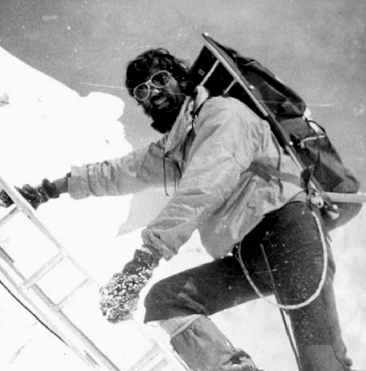
Summit push
On April 20, Prodanov and Chowang Rinzi left Camp 5 at 5:45 am in clear, cold weather, without supplemental oxygen. Mid-morning, Chowang Rinzi aborted his summit push because of the technical difficulty of the West Ridge and returned to Camp 4.
Prodanov continued the ascent alone. At 11:10 am, Prodanov radioed Base Camp from 8,550m, reporting steady progress on the West Ridge.
At 6:10 pm, he radioed Base Camp from the summit. He said that he found a pyramid of empty oxygen bottles left by Soviet climbers, alongside a Soviet flag. Prodanov tore off a fragment of the flag as a memento.
Prodanov spent 33 minutes on the summit and abandoned his 8mm camera there after removing the film. Then he started his descent via the West Ridge.
This was the first recorded ascent of Everest in April, and Prodanov also became the first Bulgarian to summit the highest peak in the world.
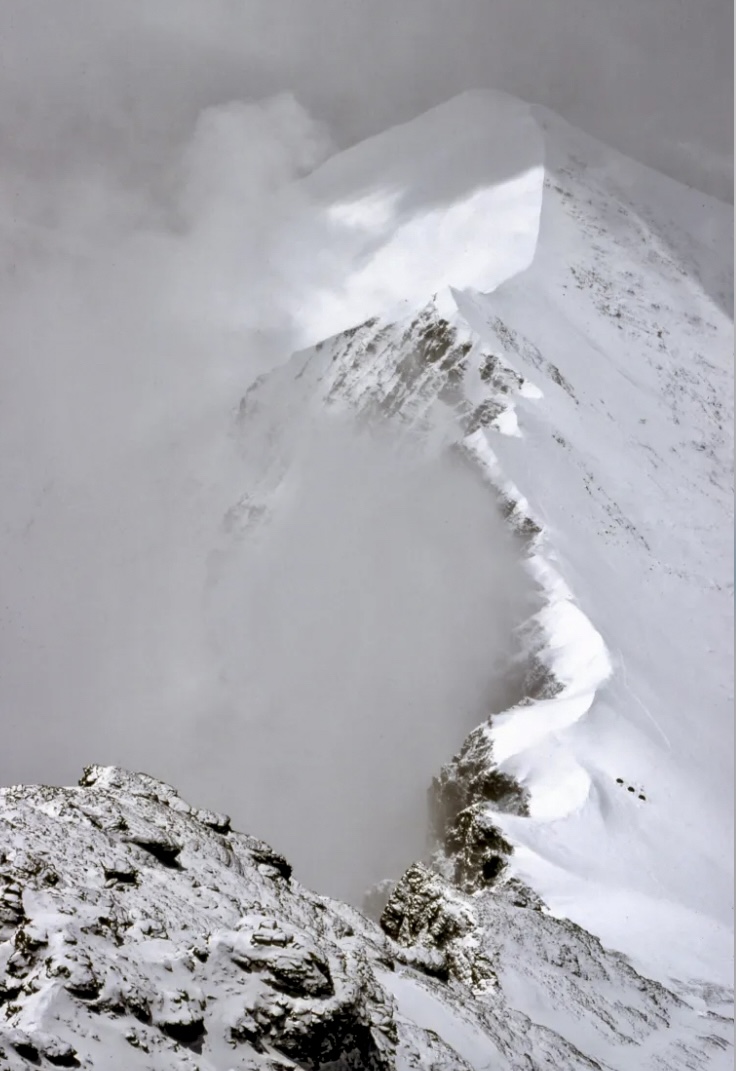
The descent
On April 20 at 9:10 pm, Prodanov radioed Base Camp again. He explained that he would bivouac because it was too dark.
The following day, Prodanov maintained voice contact with Base Camp until 5:30 pm. However, his voice was weak and almost unintelligible, suggesting extreme exhaustion. He relayed that he had lost his gloves and could not use his fingers. The oxygen-free climb was impacting his health.
At 7:45 pm, Prodanov turned on his walkie-talkie but was unable to speak. There was no further contact. Meanwhile, the weather worsened.
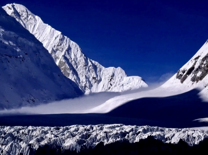
The rescue operation
A rescue operation started on April 21, when Prodanov was in trouble but still in contact. Lyudmil Yankov set out immediately and covered more than 1,000m in one push. He reached 8,500m extremely fast, arriving in the dark at 9:00 pm. He couldn't find any trace of Prodanov, who was possibly around 200m above him.
In bad weather, Yankov spent a sleepless night at 8,400m, in a dangerous spot with steep, loose rocks. During the night, he talked to Prodanov non-stop, trying to keep Prodanov awake: "Don’t fall asleep! You’re a great man, don’t sleep, you’re Bulgarian! People are running to you!"
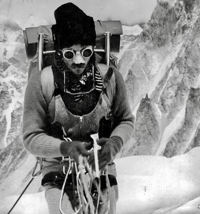
Yankov was finally ordered to descend in bad weather, with severe frostbite on four of his fingers.
According to a note in The Himalayan Database written by Prachanda Shrestha from the Tourism Ministry of Nepal, Prodanov seemed to know his time was up. While he was still able to speak, he said, "I see nobody to rescue me," aware that he was alone and that no one could assist him immediately.
Having risked his life to try and save Prodanov, Yankov finally descended to Base Camp.
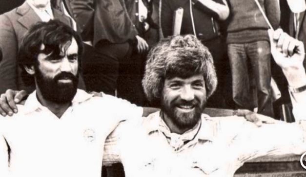
Although Prodanov survived more than 50 hours in the death zone, he finally succumbed and disappeared.
The next day, on April 22, bad weather kept the other climbers in their tents and prevented any further rescue efforts.
The second summit bid
On May 1, a group of climbers started a second summit bid from Base Camp.
By May 7, Camp 5 was stocked with food and oxygen, and on May 8, Metodi Savov and Ivan Valtchev began their summit push. Working up the West Ridge Direct, they reached the top at 5:15 pm, despite deep snow.
They descended via the Southeast Ridge, but ran out of energy near the 8,765m South Summit and spent the night without shelter or oxygen. Savov suffered frostbitten toes, and fog separated the two men.
On May 9, Nikolai Petkov and Kiril Doskov summited at 10:10 am and also went down the normal route. They found Savov exhausted 30m below the South Summit. They gave him oxygen from the Indian expedition team.
At 1:50 pm, Petkov, Doskov, and Savov reached the Indian Camp 5, where they found Valtchev. With Indian assistance at the South Col, the group descended together, reaching Base Camp in two and a half days. Savov was airlifted to Kathmandu on May 12, and the expedition left the region on May 13.
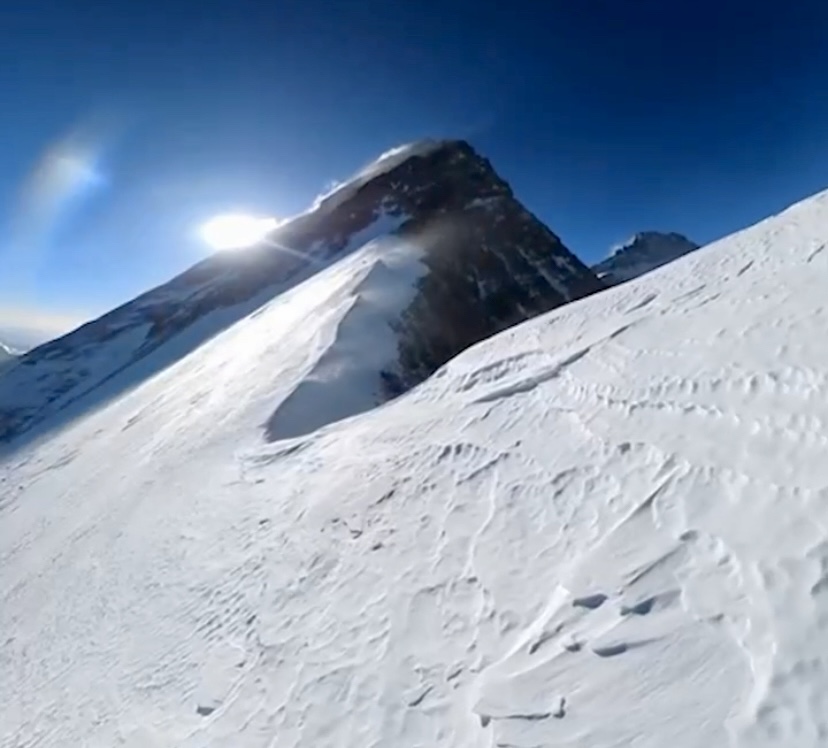
The Bulgarian and the Indian expeditions worked well together. The Indian team allowed the Bulgarians to use their tents and oxygen, and the Bulgarians later left their walkie-talkies for the Indians.
Svetoslav Kolev of the Bulgarian Mountaineering Federation told the American Alpine Journal that this Everest traverse would have been impossible without the Indian expedition's generous help, which included tents, oxygen, food, and medicine during the Bulgarian descent on the normal route.
Notable feat
Prodanov’s achievement was an important feat. He became the first and only person to summit the West Ridge Direct without supplemental oxygen. Unfortunately, he did not complete the climb as he perished during the descent, and his body was never found.
Prodanov received several awards. Bulgaria acknowledged him as the "Number 1 Bulgarian Mountaineer of the 20th Century" and awarded him the title of Hero of the People’s Republic of Bulgaria posthumously in 1984.
Savov and Valtchev survived an open bivouac at 8,600m-8,700m. The two pairs of Bulgarian climbers completed the first full West Ridge–Southeast Ridge traverse and the second overall traverse of the mountain.
Different versions of Everest’s West Ridge
As we pointed out in our Nejc Zaplotnik story, Tom Hornbein and Willi Unsoeld's ascent of the West Ridge in 1963 was different from the "Direct" route. They joined the West Ridge from the Western Cwm at around 7,500m. Then, they diverged to the Hornbein Couloir (8,000-8,500m) to the summit.
The 1979 Yugoslav ascent was the first complete ascent of the West Ridge. They climbed from Lho La (6,050m) to the summit, avoiding deviations (Western Cwm to the West Ridge), and descended via the North Face (Hornbein) and the West Ridge. The whole route was 6.5km.
The 1984 Bulgarian ascent of the West Ridge Direct was by a partially new route, as the Bulgarians climbed the entire West Ridge proper, and didn’t deviate to the Hornbein Couloir.
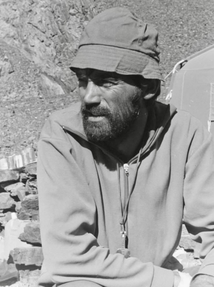
Tragedy repeats
Twenty years after Prodanov’s death, in the spring of 2004, his niece Mariana Prodanova Maslarova attempted Everest. She tried a similar oxygen-free ascent to honor her uncle on the 20th anniversary of his 1984 climb. Mariana attempted to ascend the peak from the north but disappeared at 8,700m. She likely died from exposure.
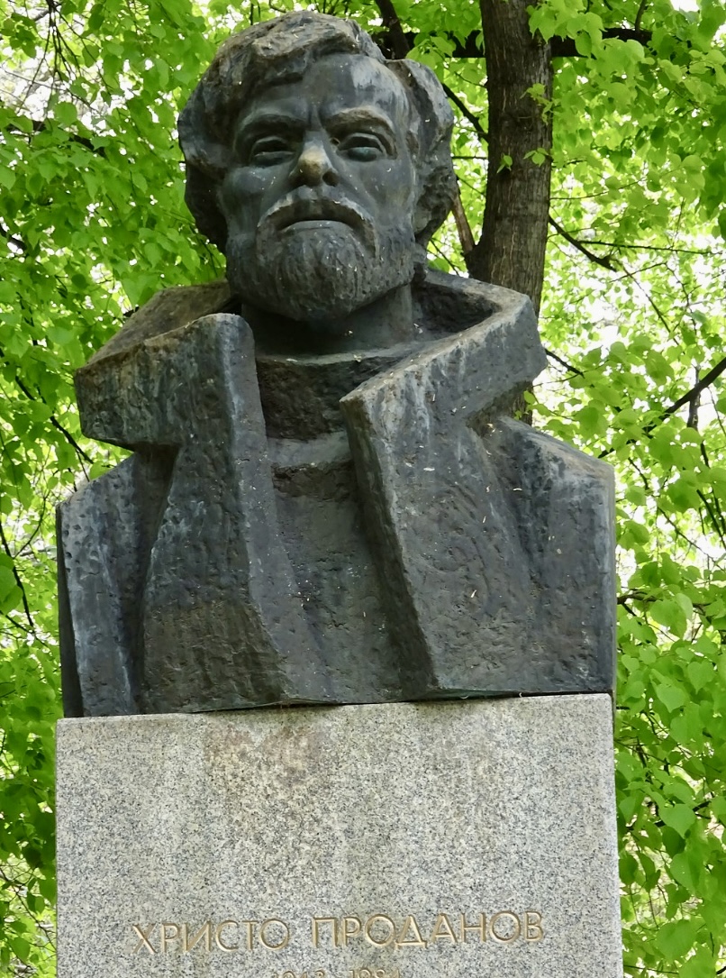
Today, Slovenian alpinist Nejc Zaplotnik would have turned 73. Widely regarded as one of the most influential climbers of his generation, he left an indelible mark on mountaineering through his bold ascents, philosophical writings, and tragic early death.
Zaplotnik’s resumé includes over 350 ascents across Europe, Africa, and North America. His career coincided with the golden age of Slovenian alpinism, characterized by ambitious expeditions to the Himalaya and other ranges, often with limited resources. We look at some of his notable climbs.
Jernej Zaplotnik, better known as Nejc Zaplotnik, was born in Kranj, Slovenia in 1952. He joined the town's Alpine Association in 1969 and soon made a name for himself in the Slovenian and Yugoslav climbing scenes.
Alongside climbing partner Tone Percic, Zaplotnik climbed a difficult route on 2,558m Grintovec, the highest peak in Slovenia's Kamnik-Savinja Alps.
In 1970, Zaplotnik joined the Mountain Rescue Service of the Slovenian Alpine Association. In 1971, he married Mojca Jamnik. Together, they had three children.

Early climbs
Also in Slovenia's Kamnik-Savinja Alps, Zaplotnik and Francek Ster made the first ascent of Tomazev Steber (Tomaz’s Pillar) on 2,540m Jezerska Kocna’s north face in 1971.
He also made several important climbs in Slovenia's Julian Alps. On Triglav, Jalovec, and Skuta peaks, he climbed several routes, focusing primarily on winter and solo ascents. For example, in 1978, Zaplotnik ascended the difficult 900m Skalaska Route on the north wall of 2,472m Spik Mountain.
He finished another important solo climb in 1980, on the north face of 2,864m Triglav. Here, he ascended the extremely challenging Cop Pillar route.
His ski descents were also notable, including those on the north face of Kocna and Skuta. He made other ski descents on Triglav, Jalovec, and Grintovec peaks.
In 1976, Zaplotnik ascended the difficult Schmid Route of the Matterhorn with Ivan Kotnik. He and partner Marko Stremfelj then climbed the even harder Carlesso-Sandri Route on Civetta in the Italian Dolomites.
In 1972, Zaplotnik went to Tanzania to climb the east wall of 5,149m Mawenzi Peak in the Kilimanjaro massif. Next, he moved on to Yosemite and did the Salathe Wall with Janez Gradisar.
Makalu
Zaplotnik participated in three expeditions that completed new routes on three 8,000’ers: Makalu’s South Face, Gasherbrum I’s Southwest Ridge, and Everest’s West Ridge.
In the autumn of 1975, only one expedition targeted Makalu. Under the leadership of Ales Kunaver, the Yugoslav Himalayan Expedition chose to take on the unclimbed South Face. The 21-man team included Zaplotnik, Janko Azman, Stane Belak-Strauf, Janez Dovzan, Viki Groselj, Ivan Kotnik, and Marjan Manfreda, among others.
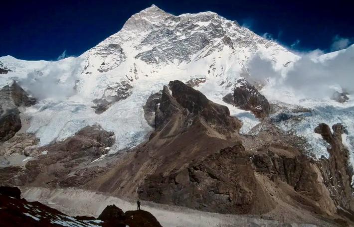
Other expeditions had tried Makalu’s South Face before. The Californian Makalu Expedition, led by William Siri, attempted the South Face–Southeast Ridge route in the spring of 1954, before the peak’s first ascent in 1955. However, the climbers aborted at 7,150m because of the approaching monsoon.
In the autumn of 1972, a Yugoslav expedition led by Ales Kunaver targeted the South Face without supplemental oxygen. In early November, climbers Miya Malezie and Janko Azman reached the top of the South Face at 8,100m. From there, they turned around, stymied by the route's difficulty.
In 1974, two parties attempted the face again. An Austrian expedition led by Wolfgang Nairz reached 7,500m in the spring before aborting in bad weather. That autumn, Fritz Stammberger led an expedition that made it to 7,800m, but bad weather again foiled them.
The first ascent of Makalu’s South Face
Kunaver’s party arrived at Makalu Base Camp on Sept. 5, 1975. They established Camp 1 at 5,850m on September 7 and Camp 2 at 6,300m on September 9. On September 14, they bivouacked at 6,600m. They established Camp 3 at 7,000m on September 16 and Camp 5 at 7,500m on September 23.
Their rapid progress was interrupted soon after. Heavy snowfall and avalanches destroyed Camp 4. It took till October 2 to rebuild it. Camp 5 was established at 8,050m two days later. They later camped in snow caves to avoid avalanches.
The team summited in small groups. On October 6, Stane Belak-Staruf and Marjan Manfreda summited via the South Face. On October 8, Zaplotnik and Janko Azman reached the top, followed by Ivan Kotnik and Viki Groselj on October 10 and Dovzan on October 11. Manfreda didn’t use bottled oxygen, while the other summiters did.

New route on Gasherbrum I
In the summer of 1977, Zaplotnik was part of a nine-man team that received a climbing permit for 8,080m Gasherbrum I in the Karakoram. Led by Janez Loncar, they would attempt the unclimbed Southwest Ridge.
The climbers navigated a complex icefall to set up Camp 1 at the base of a steep couloir. They progressed through challenging terrain -- a rocky chimney, ice slopes, and a vertical rock pitch -- to establish Camp 2 at 5,760m.
According to Zaplotnik’s report for the American Alpine Journal, from there, they climbed the White Dome’s avalanche-prone 50° slope. That day, an enormous slide narrowly missed them.
They set up Camp 3 at 6,340m, then descended to Base Camp to rest. Soon after, Loncar and Filip Bence fell ill, leaving only five fit climbers.
Andrej Stremfelj and Zaplotnik carried gear from Base Camp to Camp 2 in a day, and then moved it to Camp 3. Above Camp 3, Borut Bergant fixed some rope on the summit pyramid’s base. Then they climbed the steep, icy West Face on poor rock.
Andrej Stremfelj and Zaplotnik continued past the ropes alongside a 70° couloir that led to two snow shoulders. They placed Camp 4 on a precarious snow shelf somewhere between 7,000m-7,300m and endured a windy, sleepless night.
The Southwest Ridge
On the morning of July 8, Stremfelj and Zaplotnik departed Camp 4. After hours of climbing on icy rocks, they reached a gap below the summit at midday. They finally summited Gasherbrum I in fog and extreme cold. At the summit, they raised the Yugoslav, Pakistani, and Slovenian flags, took a few useless photos in the fog, then began the difficult descent to Camp 4 in a blizzard.
Stremfelj and Zaplotnik missed the fixed ropes and had to navigate a vertical chimney to reach Camp 2 and then Camp 1.
Meanwhile, Drago Bregar was at Camp 4, intending to push for the summit. But on July 10, the team lost contact with him. Some team members tried to reach the upper slopes to look for him, but on July 14, it started to snow again. They couldn’t find Bregar.
"I sat at Base Camp, looking at my second 8,000’er, Bregar’s grave," Zaplotnik wrote.
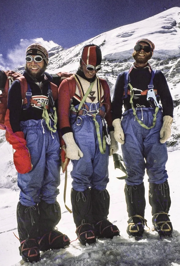
New route on Everest
In the spring of 1979, a strong Slovenian team led by Tone Skarja and including Zaplotnik tried a new route on Everest -- the complete West Ridge, also known as the West Ridge Direct.
The expedition arrived at Base Camp at the end of March with 700 porters. The climbers scouted the safer Lho La route, transported loads to the pass, and tested gear. For the next month, they established camps to 7,300m, fixing ropes on very steep terrain.
Storms delayed progress until May 9, when they established Camp 5 at 8,120m. On May 10, Viki Groselj and Marjan Manfreda attempted the summit but retreated at 8,300m because of route-finding issues, oxygen valve failures, and frostbite.
On May 12, Dusan Podbevsek and Roman Robas faced similar navigation challenges, barely surpassing 8,300m.
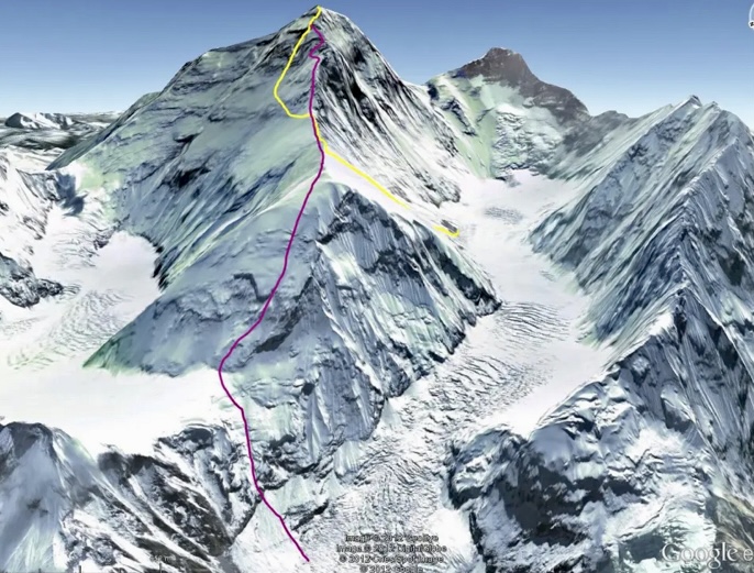
The West Ridge Direct
On May 13, brothers Andrej and Marko Stremfelj and Nejc Zaplotnik left Camp 5 in brutal -35° cold plus a wind. Marko turned back because of a faulty oxygen valve, but Andrej Stremfelj and Zaplotnik pressed on. After climbing a very demanding short section on the upper part of the peak, the two climbers rejoined the American Route and the Hornbein Couloir, summiting in the early afternoon.
On May 15, Stane Belak, Stipe Bozic (filming the ascent), and Ang Phu Sherpa left Camp 5 after a snowfall delay. As a trio, they moved slower, reaching Everest’s summit at 2:30 pm. During their descent, they were forced to bivouac in the open at over 8,200m on the Hornbein Couloir.
Borut Bergant, Ivan Kotnik, and Vanja Matijevec had been waiting at Camp 5. They found the trio below the couloir, seemingly fit to descend. Tragically, Ang Phu then slipped and fell 1,800m to his death. They discovered the body the next day.
Because of the accident and oxygen system failures, they made no further attempts.
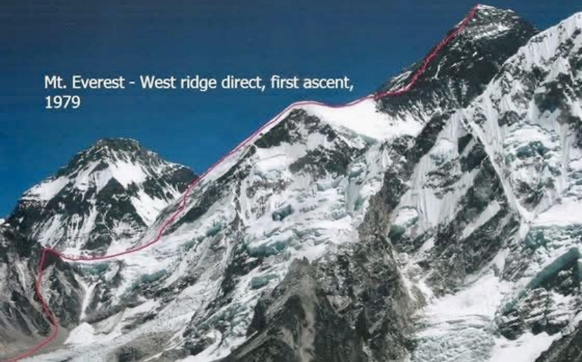
The difference between the 1963 and 1979 routes
The 1979 Everest West Ridge Direct and the 1963 American Route (by Willi Unsoeld and Tom Hornbein) both tackled Everest’s West Ridge, but their routes and approaches differed.
The 1979 team climbed the entire West Ridge from Lho La (6,050m) to the summit, a 6.5km route. This was the first confirmed full ascent of the West Ridge, avoiding deviations. The team of 24 climbers, with five summiting (A. Stremfelj, Zaplotnik, Ang Phu Sherpa, Belak, and Bozic), faced UIAA Grade V challenges near the summit. They used supplemental oxygen above Camp 5 (8,120m) and fixed ropes extensively.
Unsoeld and Hornbein climbed from the Western Cwm in 1963, joining the West Ridge at around 7,500m. They then diverged to the Hornbein Couloir (8,000-8,500m) to the summit. This partial West Ridge climb, covering less of the ridge’s full length, was the first traverse of Everest. The pair descended via the South Col, using minimal fixed ropes and limited oxygen.
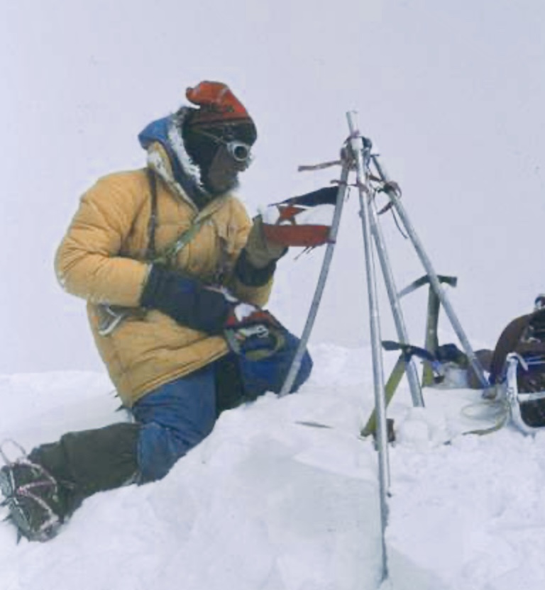
Lhotse South Face attempt
In the spring of 1981, Zaplotnik was a member of the Lhotse South Face Expedition led by Ales Kunaver. The team progressed well but abandoned their attempt on May 20 at 8,250m because of bad weather and exhaustion.
Zaplotnik’s death
In the spring of 1983, the Split Alpine Expedition set off for 8,163m Manaslu. Led by Vinko Maroevic, they targeted the dangerous South Face–South Ridge route. The team had 16 climbers, including Zaplotnik, and decided not to use supplemental oxygen.
The expedition started well, and they established four high camps, reaching 7,101m.
However, on April 24, an avalanche hit some of the climbers roughly 100m above Camp 1 on the Manaslu Glacier. It killed Zaplotnic and Ante Bucan. Srecko Grekov was badly injured.
Zaplotnik was 31 years old, which seems young considering how much he had already accomplished.
For more details on Zaplotnik’s life and career, we highly recommend Zaplotnik’s book Pot. It’s a cult text, a ”bible for a generation," as Slovenian climber Marko Prezelj once said.
We also recommend Bernadette Mcdonald's book Alpine Warriors and her excellent article Nejc Zaplotnik Mountain Poet, published in Alpinist.
The climbing permits issued recently by Nepal's Department of Tourism list two intriguing lower peaks: 6,180 Swelokhan and 6,372m Pokhar Khang.
France's Marine Margaux Minguet will lead a team to attempt the first ascent of Swelokhan in the Manaslu Himal on the Tibetan border. It just opened for mountaineering in 2003 and remains unclimbed.

Ethic Himalaya is the outfitter providing logistics, but we know no further details about this ongoing expedition. Until we learn more, here is the brief climbing history of this peak, which has been attempted just twice, in 2005 and 2007.
Swelokhan attempts
According to The Himalayan Database and the American Alpine Journal, a three-man party led by Sadmasu Kitagawa of Japan attempted Swelokhan in the spring of 2005. The party included Sadmasu Kitagawa and Hiroh Sogo from Japan, as well as Chhiring Dorchi Sherpa from Nepal.
They unsuccessfully tried two routes, the south face and the southwest face-northwest ridge.
On the south face, Kitagawa and Dorchi reached 5,200m, where a rock barrier blocked the glacier they were ascending.
On the second route, they reached 5,800m on the northwest ridge before turning around when they encountered a section of sharp, loose rock and fresh snow that was beyond their technical skill.
Two years later, in the autumn of 2007, Peter Ackroyd of the U.S. led a similarly small expedition to Swelokhan. He, Jim Frush, and Sam McClary attempted the southeast face and reached 5,120m on October 14 before aborting due to bad snow conditions. They noted that from here, they would have needed only one camp before the summit.
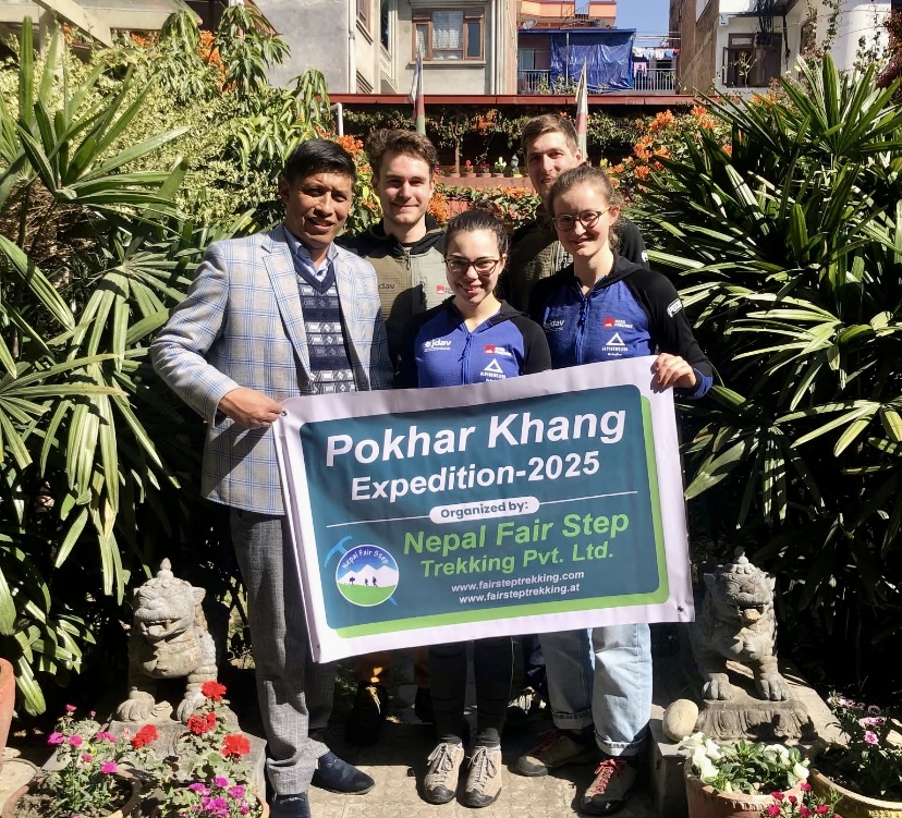
Pokhar Khang
A German party led by Konstantin Johannes August, including Moritz Quincke, Flora Voglic, and Fabienne Sophia Volle, will attempt 6,372m Pokhar Khang.
The peak lies in the Damodar Himalaya, between the upper Mustang and Annapurna. It was first opened for mountaineering in 2002. That autumn, a UK party led by Stephen Town achieved the first ascent. Richard Martin Scott, Dave Wynne-Jones from the UK, and Pasang Kaji Sherpa from Nepal summited via the south face-east ridge on November 17.
A Japanese team led by Koichi Kato attempted the mountain a little earlier that first season but only reached a foresummit at 6,346m on October 31.
Since then, two further successful expeditions have summited Pokhar Khang, in the autumns of 2009 and 2012. In all, 12 climbers have stood on the summit of this peak.
Both the Swelokhan and Pokhar Khang expeditions have already begun. We'll report further when we hear news.
Earlier this spring, a Nepalese party attempted unclimbed 6,186m Khayang but aborted their attempt due to bad weather and difficult conditions.
Nepal has 96 unclimbed 6,000'ers in all, including 56 peaks under 6,500m and 40 between 6,501m and 6,999m.
At 7,788m, Pakistan's Rakaposhi is a formidable peak that sees little climbing activity. Fewer than a dozen parties have topped out. Its steep slopes, technical difficulty, and unpredictable weather deter most climbers.
Rakaposhi is the 26th highest independent peak in the world and the 12th highest 7,000’er. It lies in the Lesser Karakoram mountains in Gilgit-Baltistan. The closest 8,000m peak is Nanga Parbat, roughly 110km south-southwest of Rakaposhi.
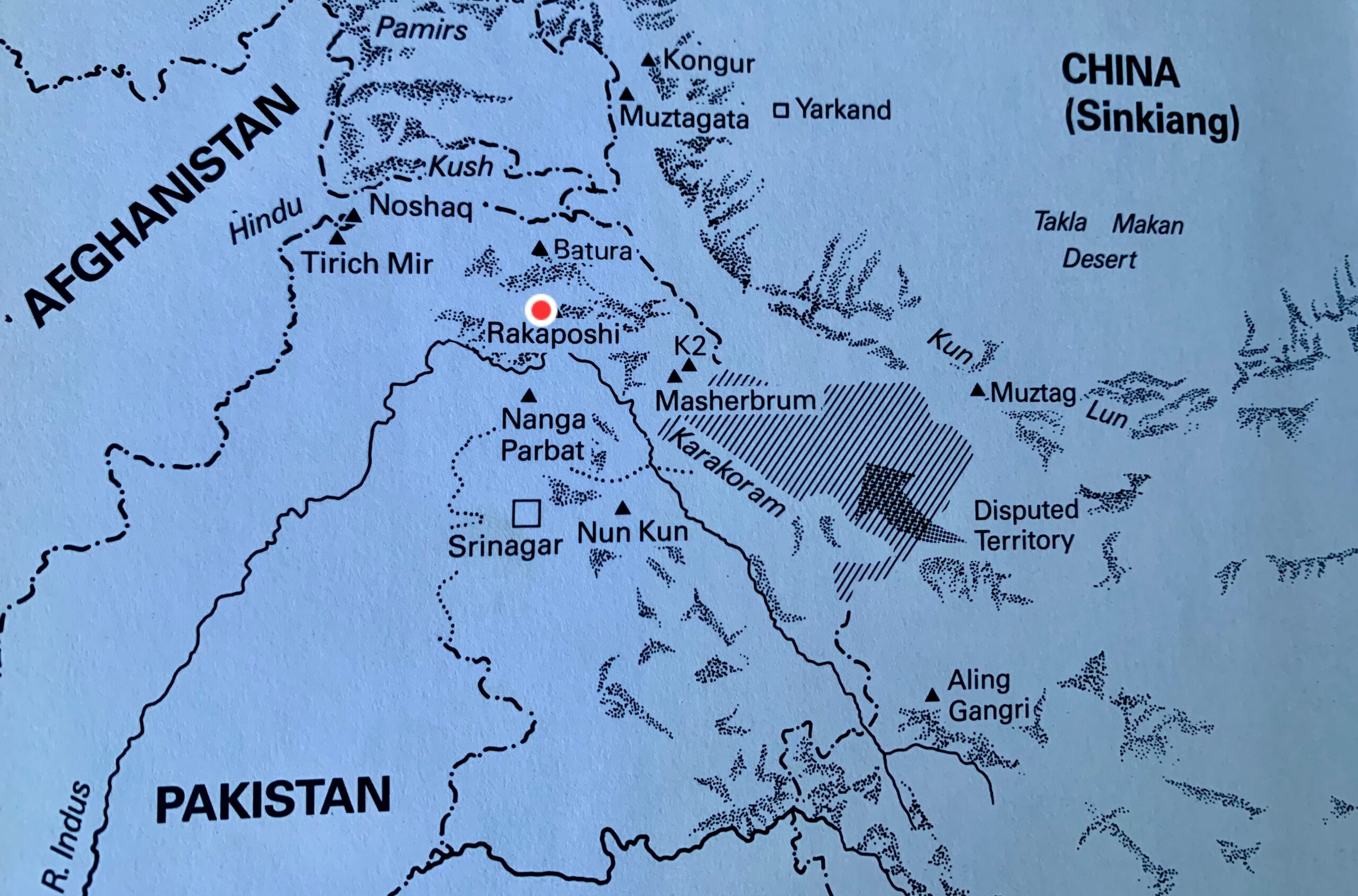
The mountain is also known by the name Dumani, which comes from the local Burushaski language. It translates to "Mother of Mist" or "Mother of Clouds" because the peak is often shrouded. The name Rakaposhi derives from a Burushaski term meaning "shining wall."
Rakaposhi rises 5,800m in just 11.5km of horizontal distance from the Hunza River.
The first foreign explorers arrived at the end of the 19th century. Martin Conway explored Rakaposhi's southern side in 1892. Conway concluded that although the upper part of Rakaposhi could be climbable, reaching the upper crest of the peak by any of the supporting ridges would be difficult and dangerous.
In 1938, British mountaineer and explorer Michal Vyvyan and his partner Reginald Campbell Secord approached the peak from the west. They ascended a small 5,800m forepeak at the end of the northwest ridge.
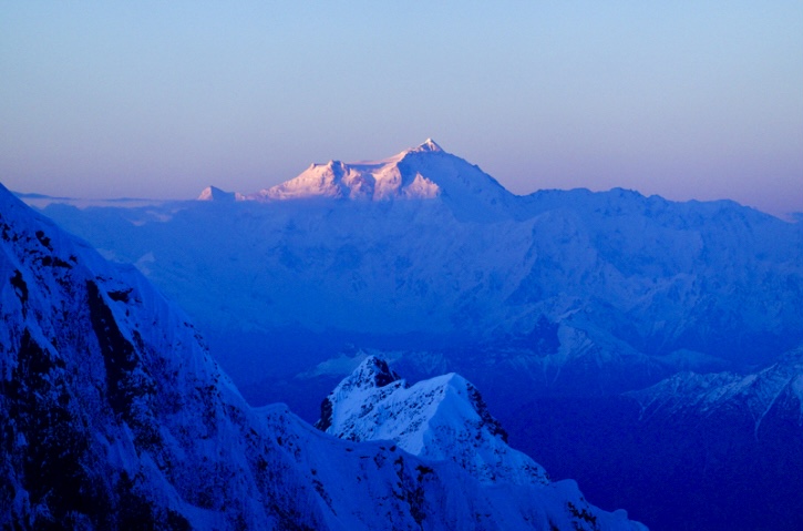
The first determined attempts
In 1947, Secord returned with Bill Tilman and two Swiss climbers to attempt the southwest spur. They abandoned their attempt at 5,800m, where a great gendarme blocked the route. From there, Tilman observed a 600m wall of snow and ice, which they called Monk’s Head.
The team then tried the northwest ridge. Later, they inspected the southeast face, the north face, and the east face but found them all impracticable.
In the summer of 1954, two expeditions arrived at Rakaposhi.
An Austrian-German party led by Mathias Rebitsch attempted the southwest spur. They reached 5,200m, but extreme snowstorms, high winds, and difficult ice conditions forced them to retreat. They agreed with Conway's conclusion from 60 years earlier: The mountain seemed unclimbable from that direction.
In the same season, an expedition from the Cambridge University Mountaineering Club led by Alfred Tissieres attempted the same route. They climbed the Monk’s Head but turned around in bad weather at 6,340m.
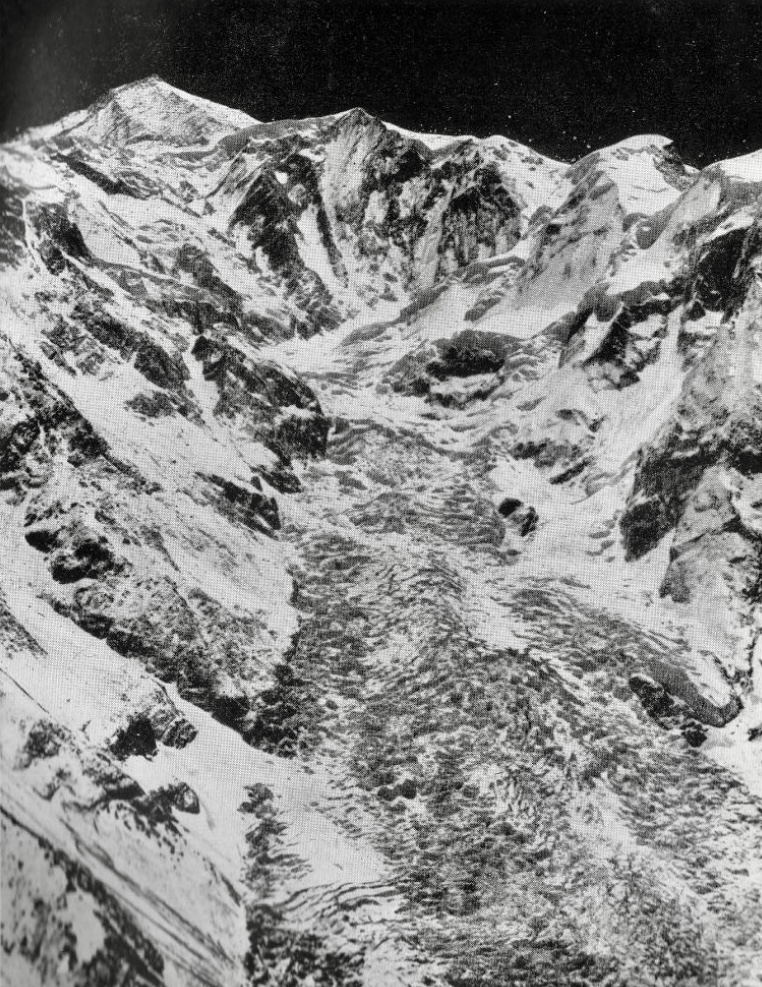
In 1956, Mike Banks led a four-man British-American expedition to Rakaposhi. They were the first expedition to go above 7,000m, reaching 7,170m on the southwest ridge. They made two further attempts later on that expedition but couldn’t progress higher.
"We were all much impressed by Rakaposhi," Richard K. Irvin recalled in his report for the American Alpine Journal. "It’s a very long climb, and it is a real climb, not just pushing along. This route certainly can be climbed to the summit, and there probably is no other way by today’s Himalayan standards."
The first ascent
In 1958, two years after his first attempt, Banks returned to the mountain, leading a British-Pakistani Forces Expedition that included Scottish mountaineer Tom Patey.
The climbers chose the southwest spur for their ascent. They established Base Camp on May 20 at 4,267m.
Over the next month, relentless snowfall, avalanches, and blizzards hampered their efforts to put up six camps to the summit. Despite the storms, the team set camps up to 5,791m. On June 20, seven climbers and some Hunza porters ascended the slope of Monk’s Head, and the porters carried loads beyond it.
On June 23, three climbers carried supplies from 6,400m to 7,010m, allowing Banks, Patey, R.F. Brooke, and R.N. Grant to camp at 7,010m. On June 24, Brooke and Grant supported the summit party of Banks and Patey. Banks and Patey then established a high camp at 7,315m.
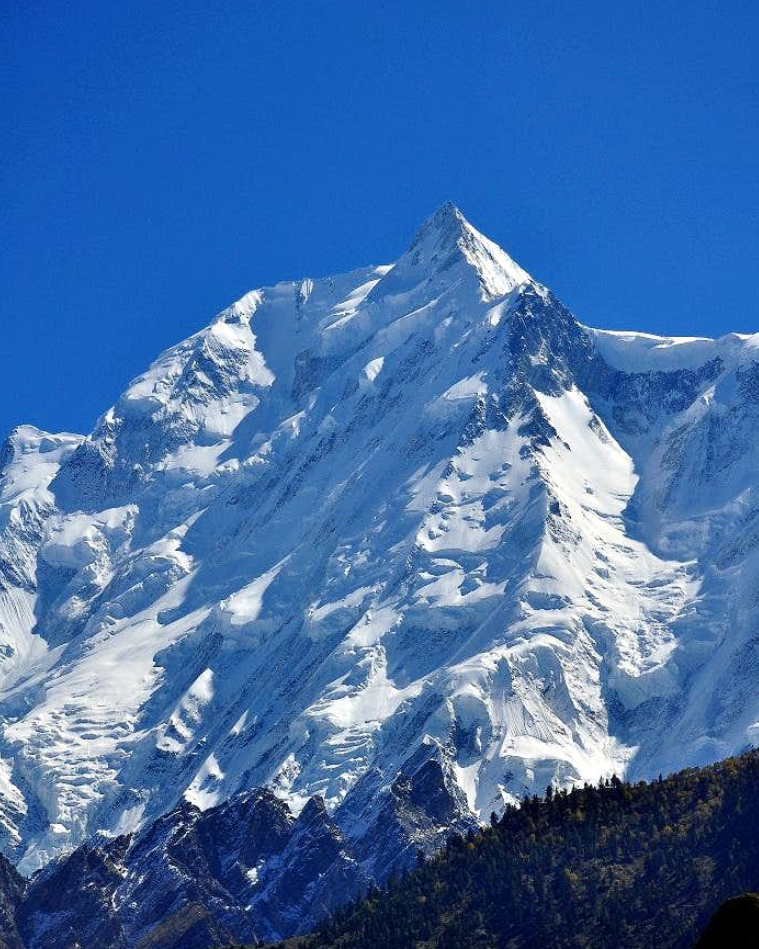
On June 25, Banks and Patey set out for the summit in a strong blizzard. Battling intense cold, they climbed for five hours and finally topped out.
Patey suffered minor frostbite on his hand and Banks on his feet. After summiting, the duo descended quickly to their high camp. Three days later, the entire team returned safely to base camp.
This first ascent of Rakaposhi was carried out without supplemental oxygen.
The first repetition of the southwest spur
The Belgian Club Alpin Beige Expedition repeated Rakaposhi’s southwest spur route in 1983. After great difficulty climbing the Monk’s Head slope, Bertrand Borrey, Daniel Bogaert, Arthur Delobbe, and high-altitude porter Sultan Ullah Baig topped out on August 2.
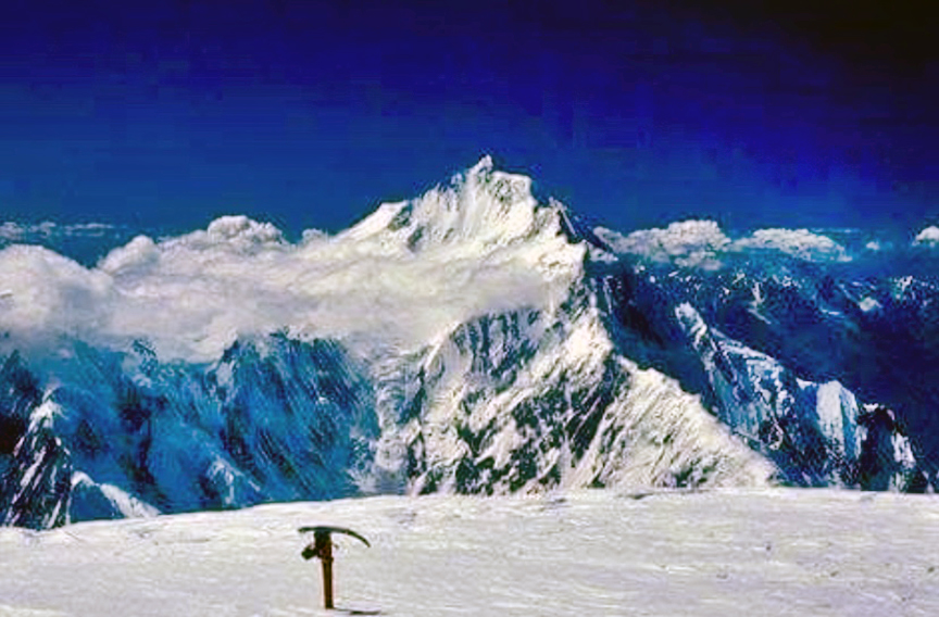
According to the expedition’s report in the American Alpine Journal, the climbers started an avalanche while descending. The avalanche swept away Michel Bodard, who fell 200m and suffered a broken leg and thumb, a punctured lung, a concussion, and multiple contusions. He was lowered to Camp 4 (at 6,400m), and two days later, a helicopter picked him up at 6,140m.
Their bad luck didn't end there. On August 5, high-altitude porter Sultan Ullah Baig insisted on descending alone to give his countrymen news of the summit success. He disappeared between Camp 2 and Camp 1. The team searched for five days but never found his body.
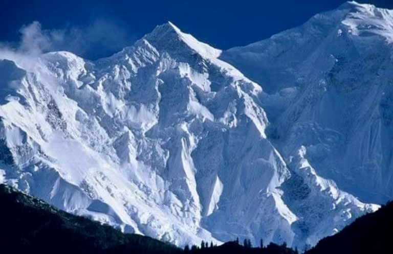
New route in 1979
On June 5, 1979, a Polish-Pakistani expedition led by Ryszard Kowalewski established a base camp at 3,810m in a side basin of the Biro Glacier.
On June 14, a gigantic ice avalanche from a collapsed wall devastated the tents at base camp, but the expedition continued. The party tackled the northwest ridge, previously scouted to 6,005m by an Irish expedition in 1964.
They set up Camp 1 on June 6, placing it at 4,907m at the base of the northwest ridge. They established Camp 2 at 6,203m on June 26.
The party then descended 61m to a snow terrace below the summit pyramid, where they set up Camp 3 at 6,500m. Crossing the terrace to a col at the end of the southwest ridge took between six and eight hours. Here, on June 30, they placed Camp 4 at 7,102m.
On July 1, Kowalewski, Pakistani climber Sher Khan, and Tadeusz Piotrowski climbed to the summit in 18 hours. The next day, after a miserable night with six in a tent, Andrzej Bielun, Jacek Gronczewski, and Jerzy Tillak also topped out, reaching the summit in only six hours.
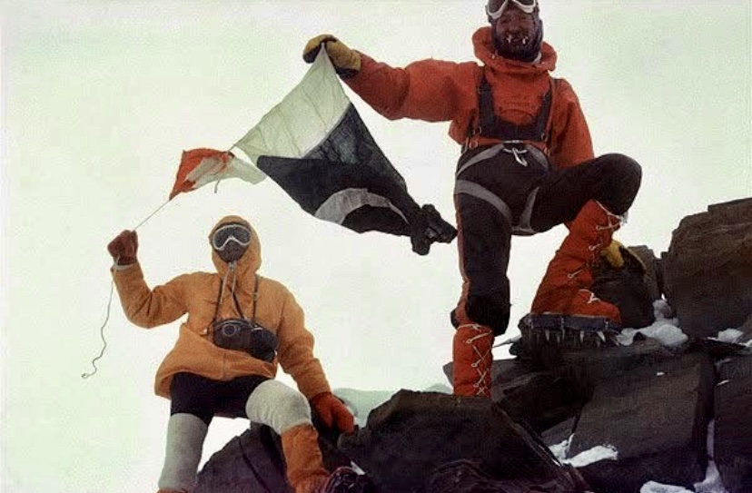
On July 5, with the higher camps empty, Anna Czerwinska and Krystyna Palmowska summited unroped through wind and snow. This marked the second-highest "ladies-only" climb after Gasherbrum II in 1975 by Halina Kruger and Anna Okopinska. The two women climbed unroped because it was too cold for one to wait for the other.
The Polish-Pakistani success was the second documented ascent of Rakaposhi.
A solo climb
In 1995, Anibal Pineda of Colombia made a notable solo climb via the northwest ridge. According to the American Alpine Journal, Volker Stallbohm was the expedition leader.
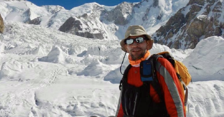
The extremely difficult north spur
In the summer of 1979, a Japanese expedition from Waseda University arrived. Led by Eiho Otani, they summited via the north spur, a steep route on the north face.
They established their high camp on an ice step at 7,300m. From there, Otani and Matsushi Yamashita started their summit push. The duo bivouacked at 7,600m and summited on August 2. On top, they found evidence of the Polish ascent. The expedition climbed siege-style, with 5,000m of fixed rope, over six weeks.
This extremely difficult route had been attempted in 1971 and 1973, both led by Karl Herrligkoffer.
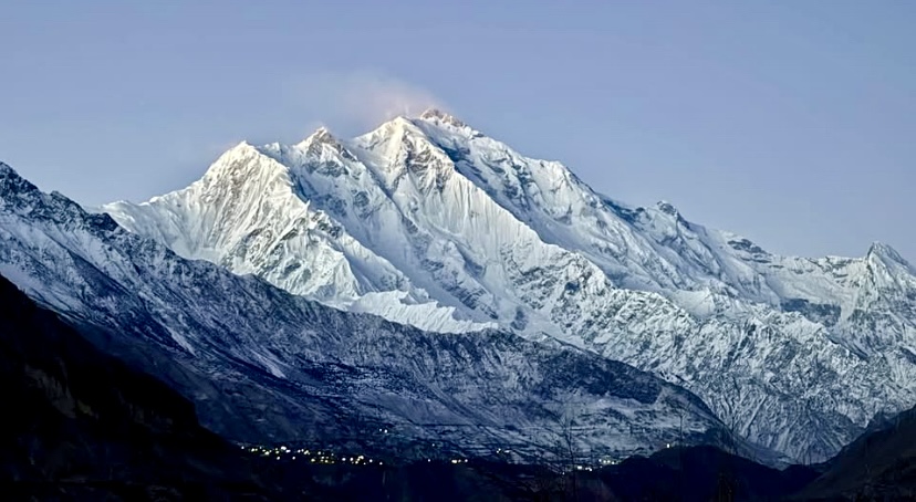
The same route saw its first alpine-style ascent in 1984. Canadians Barry Blanchard and Kevin Doyle and South African Dave Cheesmond survived lightning strikes that knocked them unconscious during their summit push. This was an outstanding ascent.
Other ascents
In the summer of 1986, a Dutch expedition climbed a variation of the northwest ridge. This route was a shorter line in the lower section and joined the 1979 Polish route at 6,000m.
In the summer of 1997, four members of an Iranian party summited via the southwest spur.
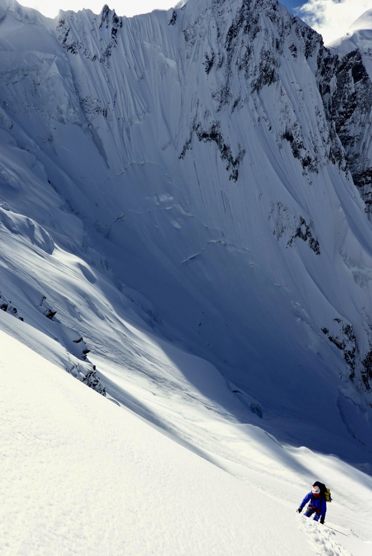
A Piolet d’Or climb
Another successful ascent took place in 2019. World-class Japanese climbers Kazuya Hiraide and Kenro Nakajima tackled the unclimbed south face before transitioning to the southeast ridge.
Starting from their base camp at 3,660m, Hiraide and Nakajima, climbing alpine style, reached 6,800m after three days. There, they waited out bad weather and summited on July 2 in a single day. They descended to Base Camp on July 3. In 2020, they were awarded the prestigious Piolet d’Or for their climb.
The last ascent of Rakaposhi was in September 2021. Czechs Jakub Vicek and Petr Macek, and Pakistani Wajidullah Nagri summited Rakaposhi via the southwest spur. The controversial expedition did not have permits and required a helicopter rescue.
In 1985, an Austrian expedition led by Eduard Koblmuller climbed Rakaposhi’s 7,010m east peak via the north buttress. On August 1, Koblmuller, Fred Pressl, and Gerald Fellner summited in alpine style. During the two-day descent, Fellner slipped at 4,700m in bad weather. He fell 100m down an ice slope and sustained fatal injuries. Despite medical attention, he died in the night.
Rakaposhi’s climbing history shows that even after decades, new routes remain for bold climbers.
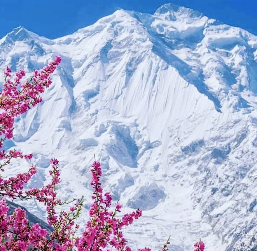
This Everest season, Swiss-Ecuadorian Karl Egloff and American Tyler Andrews are both attempting record-breaking speed ascents.
Kaji Sherpa set the current Everest record (without bottled oxygen) back in 1998. Yet the late Elizabeth Hawley of The Himalayan Database noted a dispute about his ascent. It appeared in the Season Chronicles For The Nepalese Himalaya.
Everest 1998
In the spring of 1998, 32 teams aimed to climb Everest. Eventually, 118 climbers summited, including six without supplemental oxygen. Four climbers died: Americans Sergey and Francys Arsentiev, Roger Buick from New Zealand, and Mark Howard Jennings from the UK. The Arsentievs and Buick were climbing without bottled oxygen.
That autumn, nine expeditions arrived at the foot of the mountain. Five of the parties made attempts from the north.
An Italian group led by Sergio Martini aimed to climb the North Col-Northeast Ridge from Tibet without supplemental oxygen. Their attempt ended on September 25 at 8,100m because of deep, frequent snow deposits and strong winds.
Another party, the Japanese Fos Chomolungma Expedition led by Masafumi Todaka, climbed via the Japanese Couloir on the North Face. Later in the same season, they also attempted the Great Couloir route on the North Face without bottled oxygen. They reached 8,500m on the latter route, where they ran out of energy and retreated.

A Spanish team led by Maria Jesus Lago attempted the standard northern route without bottled oxygen. Their highest point was at 8,100m. Bad snow conditions and strong winds halted their summit push.
A U.S. party led by Craig Calonica also chose the standard northern route from Tibet without supplemental oxygen. They abandoned at 7,000m because of the dangerous snow conditions.
Finally, a French expedition led by Jerome Ruby took the same route, again without bottled oxygen, and aborted at 8,100m for the same reason as the others.
That season, none of the expeditions from the north succeeded, and all climbed without bottled oxygen.

Teams from the south
Nepalese climber Kaji Sherpa led a five-member Speed Everest Expedition from the south via the normal route (South Col–Southeast Ridge). Kaji Sherpa climbed with Kami Sherpa, Kami Tshering Sherpa, Lhakpa Sherpa, and Tashi Tshering Sherpa. Kaji Sherpa was confident, aiming to ascend Everest in 18 hours.
A Spanish team led by Juan Corro also selected the normal route. This expedition included six Spaniards and three Sherpas.
The third expedition was a Japanese duo led by Ken Noguchi. It was also on the South Col-Southeast Ridge route. Four Sherpas supported the team.
The only team not on the normal route was another Japanese expedition, led by Norichika Matsumoto, to the Southwest Face. The team included eight Japanese and four Sherpas.
All the teams climbing from the Nepal side used bottled oxygen, with some complexities regarding Kaji Sherpa’s climb that we will detail later.

Summit bid
On October 14, Spaniards Corro and Carlos Pitarch and their two Sherpas, plus Noguchi from the Japanese party and his four Sherpas, were at Camp 4 on the South Col (7,900m).
On October 15, Corro and Mingma Sherpa decided to stay at Camp 4 because they were very tired and had some health issues. Eventually, they decided not to push for the summit and descended to a lower camp. Dorje, Pitarch, and the Japanese team started their summit push at 1:20 am on October 15.
At 8,300m, Dorje Sherpa decided to turn back. Pitarch made the "very risky decision" to continue. In strong winds and cloudy conditions, the Japanese group reached 8,350m at 4:00 am. There, they waited an hour for the weather to improve. Finally, Noguchi's team turned around from 8,350m.
Pitarch’s account
Years later, in 2015, Pitarch detailed his thought process in an interview for a Spanish media outlet: "I remember Oct. 15, 1998, every day of my life. I was climbing with my companion Juan Corro and two Sherpas, but in the end, I was left alone with a Japanese man. He saw a cloud and became psychotic about the tragedy of 1996 and turned around. There was 300m left to the summit, and I did a self-analysis. 'I feel good, and if I go down, I’ll never forgive myself.'”
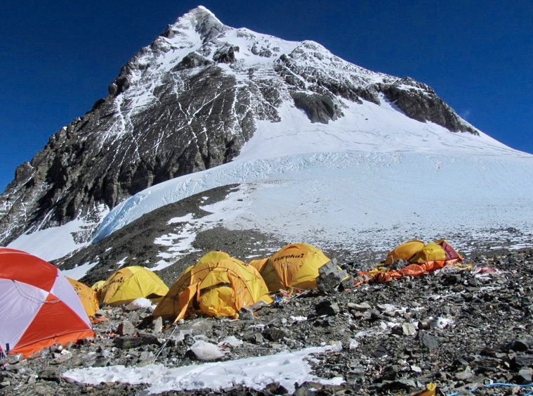
According to Corro, the Spanish team leader, they were very angry that Pitarch continued when the team decided to abort. Corro believed that "ambition and the high altitude affecting his decisions" made Pitarch continue.
During his ascent, Pitarch’s oxygen system froze and stopped working at the bottom of the Hillary Step.
According to Pitarch, he reached the top on October 15 at 10:30 am. He was alone in extremely strong winds. Pitarch started to develop frostbite on his toes and fingers and felt very tired. One minute after summiting, he started to descend, reaching Camp 4 at 2:30 pm. Pitarch stated that his footsteps quickly disappeared because it had started snowing. By October 16, Pitarch was snowblind. He was unable to see the ropes, but Sherpas helped him reach Camp 2.
On October 16, the Nepalese Ministry of Tourism acknowledged Pitarch’s summit, making this the first ascent of the autumn season.

Kaji Sherpa’s record claim
"This autumn was generally not a good time to be on the 8,000m giants in Nepal," Elizabeth Hawley wrote for The Himalayan Database. "Climbers were plagued by heavy snow and fierce winds, but a Nepalese Sherpa claimed the fastest ascent ever made on Everest."
The 35-year-old Kaji Sherpa said that he raced from Base Camp to the top of the world in a record-breaking 20 hours and 24 minutes without extra oxygen. He claimed to have cut two hours and five minutes from the previous no-O2 record, held by Marc Batard of France. Batard set that mark 10 years earlier via the same route (the normal route, starting at 5,300m).

Kaji Sherpa followed the same strategy that Batard had pioneered. He set off in the late afternoon and climbed all night, except for brief stops at established camps along the route. He made it to the summit early the following afternoon, October 17. However, according to Hawley, there were some differences between the two men’s tactics.
Different tactics
Batard climbed without teammates, although he did employ Sherpas to set up camps, and climbers from two other teams went ahead of him on his summit day and packed down a good track that Batard followed to the top.
On the other hand, Kaji had five team members, two of whom accompanied him on the last leg of his ascent from the South Col (7,900m). Batard and his Sherpas used no oxygen at any time, but two of Kaji Sherpa’s teammates, who climbed with him from the Col and broke trail for him, used bottled oxygen. Kaji also used oxygen during parts of his descent.
One of Kaji Sherpa’s men, Tashi Tshering Sherpa, summited a few minutes ahead of Kaji. The other team member turned back at 8,700m. During their descent from the South Summit (100m below the main summit), Tashi handed his oxygen set to Kaji, who used it until they were back at their camp on the South Col. The two men were in a hurry to reach their high camp as soon as possible.

Doubts
Norichika Matsumoto’s party (the Japanese team attempting the Southwest Face) reached their highest point at 8,040m on October 11. They turned around because of a lack of time and supplies.
After aborting, Matsumoto spoke to Hawley. "I don’t think they [Pitarch and Kaji Sherpa] reached the summit. No pictures, no evidence. Pitarch couldn’t see properly after his oxygen supply stopped, he made an error," he told her.
Matsumoto said that his sirdar watched the summit ridge through binoculars from Camp 2 for about an hour from 10:17 am. The sirdar saw no one despite good visibility. Matsumoto did not trust Kaji Sherpa’s account: "Kaji is a liar, he lied about not using Japanese radio and so many other things."
Later, Kaji Sherpa produced a picture of himself holding a Nepalese flag, which he said showed him on the summit. But the photo didn't show the old poles and prayer flags that summiters traditionally pose next to, and the snowfield he was standing in could have been anywhere.
Kaji said that the flags and poles were behind him in the photo. When it was pointed out that the picture was almost exactly the same as one of him on the summit in 1993, he explained that he always wears the same suit, belt, and cap. He insisted it was a new photo.

Noguchi’s account
Noguchi (the Japanese climber who took part in the first part of the summit push with Pitarch and the others) told The Himalayan Database that after he turned back, Pitarch went on alone. Pitarch continued despite being very tired. There were also no fixed ropes, and the wind was very strong. According to Noguchi, Pitarch arrived back at the South Col at 4 pm with a summit claim. Noguchi said it was impossible to see above 8,500m because of clouds.
Kaji Sherpa doubts Pitarch
In turn, Kaji Sherpa questioned Pitarch’s summit. He said that he was on his summit push on October 17, only two days after Pitarch, and he saw that Pitarch’s footprints stopped above the South Summit.
Spanish leader Corro trusted Pitarch’s honesty and believed he summited. They had known each other since childhood.
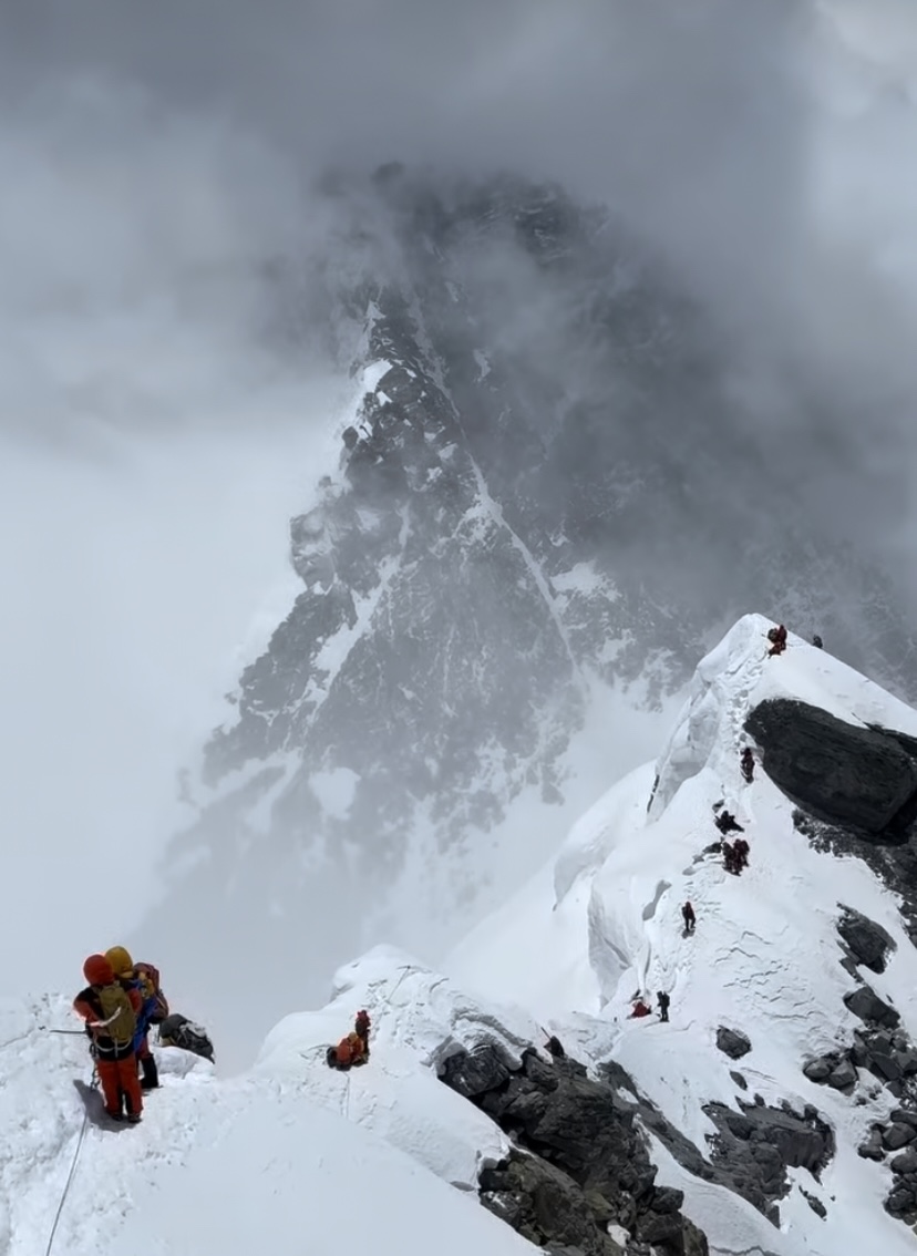
Climbs officially accepted
Kaji Sherpa’s speed ascent was officially accepted as an oxygen-assisted ascent, as he used bottled oxygen on the descent. Tashi Tshering Sherpa and Pitarch's summits were also accepted (with supplemental oxygen).

The body of a Chinese trekker who was caught in an avalanche on March 24 while descending from the Annapurna Base Camp was finally found on Saturday, according to tourisminfonepal. Unfortunately, the 28-year-old Yuan (complete name unknown) had perished in the slide.
After the avalanche, local searchers and Nepal Police looked for the missing man without success. On March 29, a special rescue team intensified efforts to locate the man.
Finally, on April 5, searchers discovered his body near the Modi River, located within the Annapurna Rural Municipality-11 near Chumrung.
Yuan was still carrying his backpack. His family had already arrived in Nepal to claim the body after the post mortems.
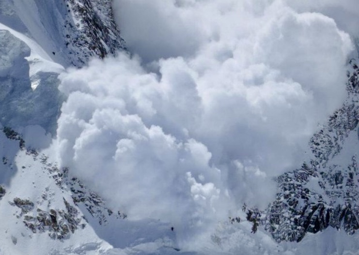
The first summits of the year on 8,091m Annapurna I in Nepal happened today.
Cesar Rosales, from Peru but with the Italian CAI Biella team, topped out this morning at 9:30 am local time, according to journalist Alessandro Filippini.

According to Mingma G from Imagine Nepal, team members Dipan Gurung, Phinjo Dorjee Sherpa, both from Nepal, and Zhao YiYi from China have also summited. An earlier attempt on March 26 was called off due to harsh weather above 7,500m. The team has been acclimatizing since March 10.

At 4,392m, Mount Rainier is the highest peak in the Cascade Range of the Pacific Northwest. Situated just 95km southeast of Seattle, it has long beckoned climbers and adventurers. Today, we’ll look into its rich climbing history, spotlighting the pioneers who first approached its icy heights.
An active volcano
An active stratovolcano, Mount Rainier's last significant eruption was around 1,000 years ago. (There was some unconfirmed minor activity in the 19th century.) Although it hasn’t erupted for a long time, Mount Rainier is close to populated areas and is considered one of the most dangerous volcanoes in the U.S.
Mount Rainier has three distinct summits. The highest is Columbia Crest (4,392m), situated on the crater's western rim. In 1870, the first successful climbers of Mount Rainier identified this as the main summit. The other summits are Point Success (approximately 4,315m) and Liberty Cap (approximately 4,301m).
Older sources occasionally treat Point Success and Liberty Cap as subsidiary peaks, but modern nomenclature and climbing records recognize all three because of their topographic significance.
Cultural significance
Mount Rainier has deep cultural roots for the Indigenous people of the Pacific Northwest, whose lands surround the mountain. For these communities, Mount Rainier was not just a physical landmark but a sacred entity tied to creation stories, spirituality, and survival. In various tribal languages, Mount Rainier is commonly known as Tahoma or Takhoma, often translated as "mother of waters" or "snow-covered mountain."
Archaeological evidence, like stone tools found at the peak, suggests the existence of seasonal camps dating back thousands of years. It is unlikely that climbing to the summit was a cultural practice because high elevations were often seen as the domain of spirits and deities.
First European sighting
In May 1792, English explorer Captain George Vancouver sighted the mountain during a scouting expedition. He named the peak Mount Rainier after Admiral Peter Rainier of the British Navy. The name has caused controversy, with many people believing the name should feature a local figure or have an Indigenous name. However, Mount Rainier has stuck.
In 1833, Scottish botanist William Fraser Tolmie explored the area, seeking medicinal plants. Tolmie was not a climber, but his documentation of the region provided some interesting early insights that encouraged later climbs.
Early attempts
The first documented attempt to climb Mount Rainier took place in August 1857. U.S. Army Lieutenant Augustine Kautz led a team that included Dr. Robert Orr Craig and several Nisqually guides. They started from a low elevation near the Nisqually River and followed what is now known as the Kautz Glacier route.
After eight difficult days of climbing, Kautz’s party reached about 4,267m. Here, they turned back because of exhaustion and health issues. "[We were] too weak to go further," Kautz wrote.
There was possibly an ascent in 1852, but the climb remains unverified. A brief account in the Olympia Columbian newspaper from September 1852 mentions a climb by one Benjamin Franklin Shaw and other climbers. But details were vague, without route specifics, any detailed description, or firsthand accounts. It’s possible that they reached a high ridge or a false summit, but without more evidence, the ascent can’t be credited as Mount Rainier's first.
The first ascent
On August 17, 1870, Americans Hazard Stevens and Philemon Beecher Van Trump completed the first documented ascent of Mount Rainier. Without much prior climbing experience, their achievement marked a significant moment in the mountaineering history of the Pacific Northwest.
Hazard Stevens was a clerk for the Oregon Steam Navigation Company and a Civil War veteran. Van Trump was a government official who worked as a private secretary to the governor of Washington Territory. Both had a keen interest in exploration and the natural world.
The two men had been planning their 1870 expedition for years but were delayed by forest fires in the region.
James Longmire, an experienced explorer of the area around Mount Rainier, provided critical logistical support for Stevens and Van Trump, including pack horses and guidance. Longmire would not ascend the peak, but his role was instrumental in getting the party to the base.
A Yakama Indian guide called Sluiskin accompanied Stevens and Van Trump to the base of the mountain. He took them to Sluiskin Falls, located at 1,830m, but warned against the climb, fearing supernatural dangers.
English mountaineer Edmund T. Coleman joined the party in Olympia and wanted to summit, but he had to turn back after losing his pack during a difficult crossing of the Tatoosh Range during the approach.
The long approach
The party departed from Olympia on Aug. 8, 1870, traveling southeast toward Mount Rainier. They were accompanied by Coleman and a group of well-wishers who escorted them to Longmire’s ranch on Yelm Prairie, 48km from Olympia.
At the ranch, Longmire provided pack horses. They then proceeded to Bear Prairie, hiring Sluiskin as their guide. Sluiskin was so convinced that the two climbers would perish that he promised to wait two days before reporting their deaths.
Between August 14 and 16, Stevens and Van Trump rested at their base camp and prepared for the ascent.
The ascent
On August 17, 1870, Stevens and Van Trump began their climb at dawn. They ascended via the challenging Gibraltar Ledges route, located on the southeast face. This route starts at a low elevation and follows a steep rocky ridge known as Gibraltar Rock, which connects to the upper snowfields and glaciers leading to the summit.
They navigated through loose rock, steep snow-covered slopes, and icy sections, arriving at the crater (at 4,317m) in the afternoon. From there, they made a final traverse to Columbia Crest at 4,392m.
After summiting, night fell, and the weather turned bad. They sheltered overnight in a steam-heated ice cave within the crater.
A difficult descent
The next day, Stevens and Van Trump began to descend early in the morning down the Gibraltar Ledges. On their way down, Van Trump slipped on ice and slid 12m, injuring his thigh but surviving the close call.
Finally, they reached base camp late in the afternoon on August 18, reuniting with their guide, Slusikin.
The duo's ascent marks the beginning of recorded mountaineering on Mount Rainier.
John Muir
Scottish-American writer and conservationist John Muir summited Mount Rainier in the summer of 1888. He also climbed via the Gibraltar Ledges route. He later wrote about his experience and helped secure the mountain’s protection as a national park in 1899. Muir was struck by Mount Rainier’s extensive glaciers and surrounding wildflower-rich meadows.
"Of all the fire-mountains which, like beacons, once blazed along the Pacific Coast, Mount Rainier is the noblest in form," Muir wrote.
Other notable ascents
The Gibraltar Ledges route saw its first winter ascent on Feb. 16, 1922. The party was led by Jean Landry and Jacques Landry, possibly alongside Ranger Oliver G. Cornwell and others.
In the autumn of 1935, Ome Daiber, Jim Borrow, and Arnold Campbell summited via the Liberty Ridge route on the north side. Liberty Ridge is Mount Rainier’s most iconic and dangerous route.
The Disappointment Cleaver route is on the southeast side of the peak. Dee Molenaar, Jim Wickwire, and four companions first ascended it on Aug. 23, 1950.
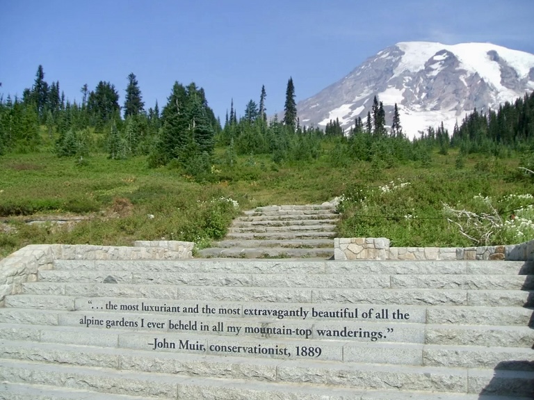
Since its first ascent, thousands of mountaineers have climbed Mount Rainier, which now has over 20 climbing routes.
To date, there have been 370,000-400,000 successful ascents. The success rate is around 50%. The success rate for guided climbs is higher.
Fatalities
Approximately 130 people have died Mount Rainier, including Willi Unsoeld of Everest fame in 1979. Almost every year, there is a fatality.
On Dec. 10, 1946, a U.S. Marine Corps transport plane carrying 32 Marines from San Diego to the Naval Air Station at Sand Point, Seattle, crashed into the South Tahoma Glacier on Mount Rainier’s southwest flank. In stormy weather, the plane hit the mountain at around 3,230m, killing everyone on board.
On June 21, 1981, a massive ice avalanche hit a guided team on the Ingraham Glacier route at 3,353m. A serac collapse triggered the avalanche, which buried 11 of the 29 climbers.
In May 2014, a six-person team was probably hit by an avalanche on the Liberty Ridge route. It killed all six climbers. The team was last spotted on May 28 at 3,962m.
Climbers forged several bold new lines in the Alps in February and March.
On February 16, Tom Lafaille and Noa Barrau skied a new line on the west face of Aiguille de Mesure. Lafaille recalls being uncertain about their targeted line as they did it on-sight. The photo below shows how precisely they threaded their way down the thinly covered face.

Then, from March 4-6, Tom Livingstone and Robert Smith opened a new 650m route on 3,422m Dent du Requin. According to Livingstone, the difficulty is somewhere in the range of M7, 6b.
The two climbers had two "somewhat comfortable" bivouacs as they inched up a corner of the north face.
"This pointy summit had caught my eye many times, and I wanted hard climbing with an unknown outcome," recalled Livingstone on his social media.
The duo's approach was more reminiscent of a big alpine face in the Greater Ranges than a local peak. Livingstone and Smith climbed all pitches on-sight.
On March 7, Giuseppe Vidoni and Francois Cazzanelli opened a new route on the East Face of 3,939m Breche de L'Aiguille Blanche. They graded their 800m route 6c, M7, AI5.
The duo failed on their first attempt due to poor conditions. On March 7, they finally succeeded.
Pyramide du Tacul
On March 18, Niccolo Bruni, Giovanni Ravizza, and Michele Tixi climbed a new route on Pyramide du Tacul in the Mont Blanc massif. The route, called Ussha, consists of eight pitches with difficulties up to M7+. The route runs parallel to Via Ottoz and shares the last pitch with it.
The following day, Jeff Mercier and Arnaud Bouvard made the first repetition of Ussha.
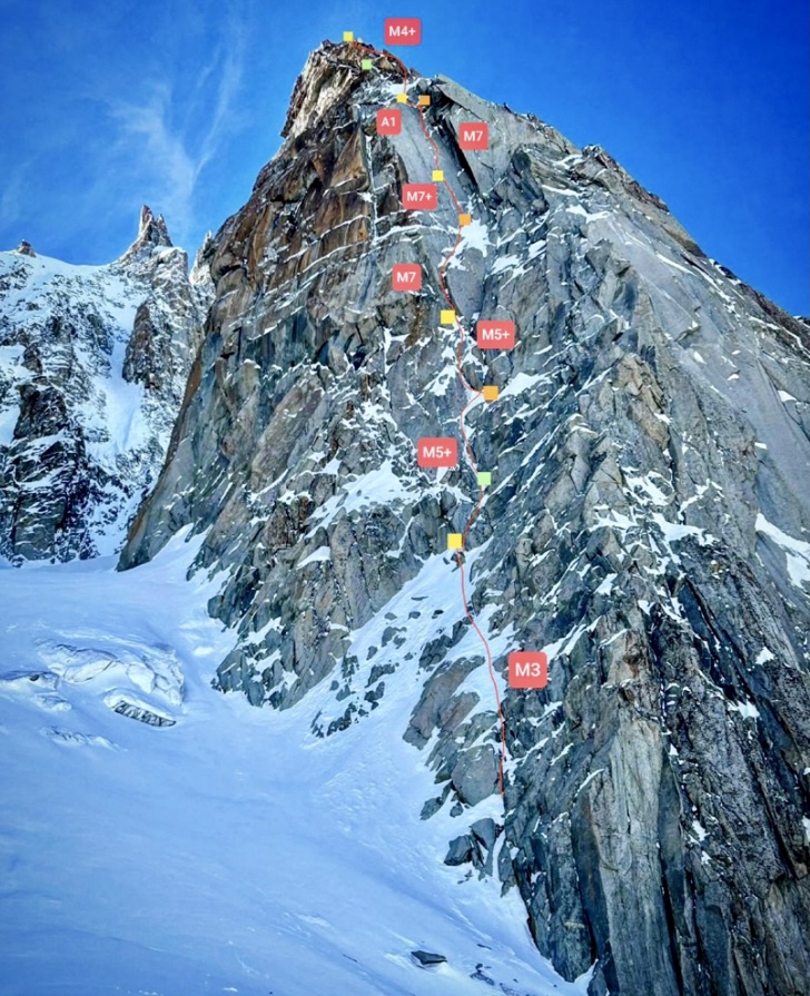
As we reported earlier this month, Herve Barmasse made the first solo winter traverse of all 17 points of the Grand Sasso d'Italia in the Apennines. And Roger Schaeli, Filippo Sala, and Silvan Schupbach made the first ascent of the north face of 3,237m Punta Pioda in the Swiss Alps.
In our recent article remembering French mountaineer Chantal Mauduit, we briefly touched on her 1992 rescue on K2. We noted how Scott Fischer and Ed Viesturs gave up their summit bid to bring her down safely. That short mention was just a glimpse of a complex rescue. Let's unpack the whole event.
International teams
Although this expedition tends to be called Russian–American, it included climbers from four countries.
The mixed party was led by Russian mountaineer Vladimir Balyberdin, consisting of two Russians, a Ukrainian, 12 Americans, and an Englishman. The other members were Gennady Kopeika, Alexey Nikiforov, Doug Colwell, Neal Beidleman, Thor Kieser, Scott Fischer, Ed Viesturs, Robert Green, Peter Green, Larry Hall, Charles Mace, Daniel Mazur, Gayle Olcott, Kelly Stover, and Jonathan Pratt. The team also included a doctor and a base camp manager.
The expedition was organized by the Russians and funded by the Americans. According to Ed Viesturs’s report, Dan Mazur was in charge of selecting the U.S. members. Scott Fischer and Ed Viesturs decided to participate when their original plans for K2’s north ridge fell through because of a lack of funding.
The Americans met in Rawalpindi on June 8, 1992. The Russians chose to travel overland and entered Pakistan one week later. The team trekked to K2 Base Camp in separate groups, with Fischer, Kieser, Viesturs, and two Americans arriving on June 21. Balyberdin, Kopeika, and Nikiforov arrived on June 30 with the rest of the expedition.
The Swiss party
In the summer of 1992, Chantal Mauduit was a member of a Swiss party led by Peter Schwitter. The team included Beat Ruppen, Norbert Huser, and Rupert Ruckstuhl. This team was already at K2 when Balyberdin’s expedition arrived.
Schwitter’s party attempted the Abruzzi Ridge but aborted somewhere between 7,000m and 7,400m at the beginning of July because of bad weather. When the Swiss left, Mauduit joined the Russian–American expedition. However, she did not have a permit to do so, which caused her serious problems with the Pakistani authorities after the climb.
On June 28, a Mexican-New Zealand-Swedish expedition also arrived. They also chose the Abruzzi route.
The different teams coordinated for the route-fixing work.
Unsettled weather
Kieser and Fischer established Camp 1 at 6,100m on June 25, and the teams progressed to Camp 2 at 6,700m at the beginning of July. On July 7, Kieser, Fischer, and Viesturs began fixing the route to Camp 3 through the Black Pyramid. They finished this section 10 days later, with Balyberdin and Kopeika fixing the last ropes at the top of the Black Pyramid.
The climbers faced unsettled weather. Short weather windows of three to four days were always followed by four or five days of snow and wind.
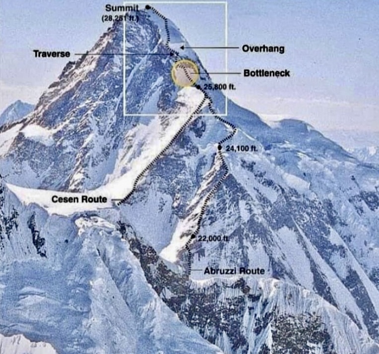
On July 12, Fischer suffered a minor accident and dislocated his shoulder. The Russian doctor advised him to end his expedition, but a week later, Fischer was climbing again.
Viesturs, Kieser, and Neal Beidleman continued fixing the route above the Black Pyramid. At 7,410m, they set up Camp 3 in a small crevasse, soon moving 30m higher to avoid spindrift avalanches.
On July 21, Balyberdin, Beidleman, Kieser, Mauduit, and Viesturs left Camp 3 toward Camp 4. On the way, the weather deteriorated, and all the climbers except Balyberdin turned around. Balyberdin bivouacked at 7,500m. From there, he progressed each day a little higher, reaching 8,000m in whiteouts and deep snow. He didn’t set up Camp 4 and returned to Base Camp on July 24. K2 continued to receive a lot of snow.
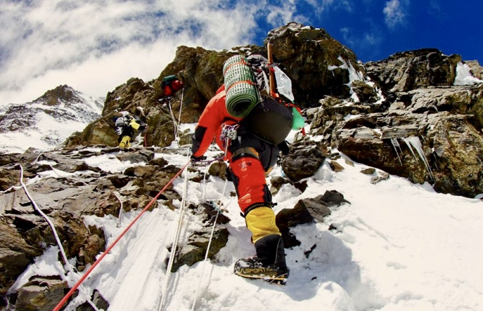
The first summit bid
On July 28, Balyberdin, Kieser, Beidleman, Kopeika, Mauduit, and Viesturs left Base Camp. By July 30, they arrived at Camp 3 in a windstorm. While Balyberdin and Kopeika continued, camping at 7,500m stormy weather, Mauduit and Kieser stayed at Camp 3, and Viesturs and Beidleman descended to Base Camp. On July 31, Balyberdin and Kopeika reached the base of the summit pyramid in chest-deep snow. Taking a risk, they camped at 8,000m, ready to push for the summit.
Meanwhile, Nikiforov reached Camp 3, where Kieser and Mauduit were camping.
On August 1 at 9:00 pm, Balyberdin and Kopeika finally topped out without bottled oxygen after an 18-hour nonstop climb. After summiting, Kopeika started the descent to Camp 4, but Balyberdin decided to bivouac below the summit. On August 3, Balyberdin and Kopeika made it down to Base Camp.
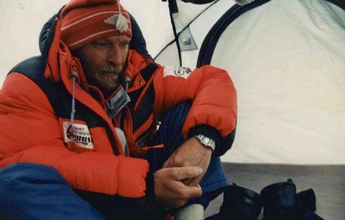
The second summit bid
On August 2, Kieser, Mauduit, Nikiforov, and Peter and Robert Green climbed to Camp 4. But the next day, the Green brothers descended to Base Camp. On August 3, Nikiforov, Kieser, and Mauduit started their summit push without bottled oxygen.
Kieser was the first to leave high camp, followed a few hours later by Nikiforov. According to writer Jennifer Jordan, Mauduit wanted to wait for the sun as her toes were cold.
After reaching 8,450m, Kieser was exhausted from the deep, icy snow. An inner voice told him to abort his summit push.
Nikiforov made careful progress. Mauduit, who started her push later, was climbing fast and passed the two men at the Bottleneck.
On August 3 at 5:00 pm, Mauduit summited K2. Nikiforov topped out two hours later. Kieser stayed at the top of the Bottleneck, where he secured a safety line by anchoring the rope Nikiforov had left behind.
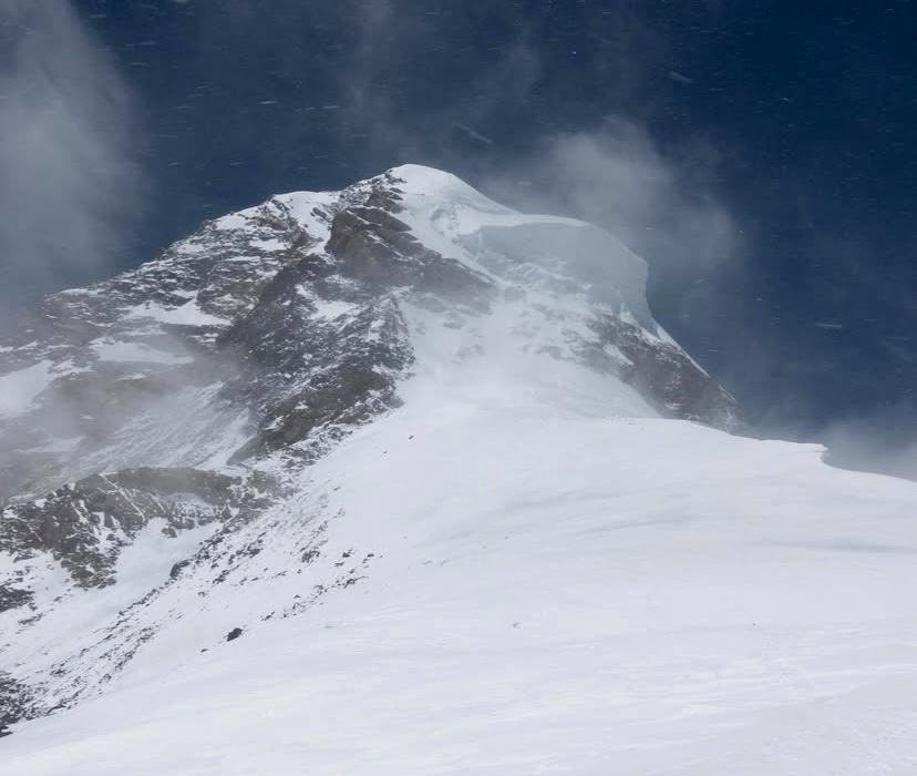
Problems start
Mauduit started the descent a couple of hours before Nikiforov but was afraid to make the traverse alone. Instead, she decided to bivouac in a snowcave at 8,400m, the same cave Balyberdin and Kopeika had used two days earlier.
When Nikiforov arrived a few hours later, he had to convince Mauduit to follow him down. Both climbers were exhausted, and Mauduit’s eyes, legs, and arms started to fail. With great difficulty, Nikiforov inched her toward Camp 4.
While Nikiforov was leading Mauduit, his crampon came loose, causing him to fall several meters. Kieser’s security rope saved his life.
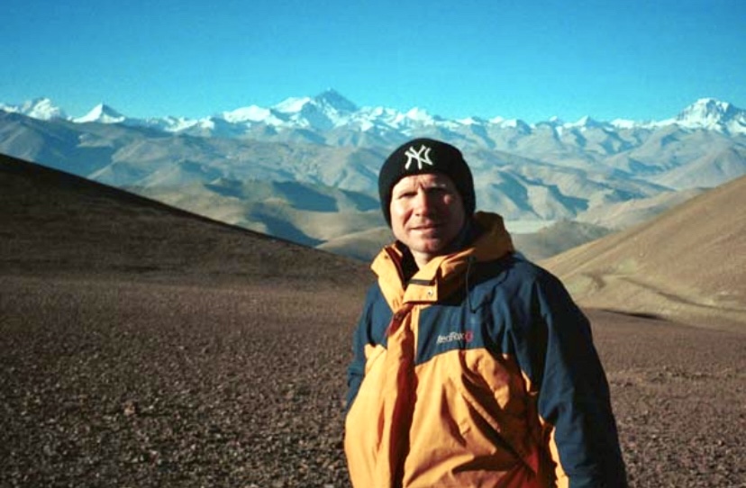
Nikiforov and Kieser started the descent from Camp 4 on August 4, supporting Mauduit between their shoulders. At Camp 4, the exhausted Nikiforov continued descending, and Kieser contacted Fischer and Viesturs on the radio. Fischer and Viesturs were in Camp 3 preparing for their summit push, but they said they would help.
Kieser moved Mauduit toward Camp 3 despite the bad weather. Mauduit was already snowblind, and Kieser knew there was no time to lose. They had to bivouac at the edge of the shoulder. Meanwhile, Fischer and Viesturs attempted to climb up.
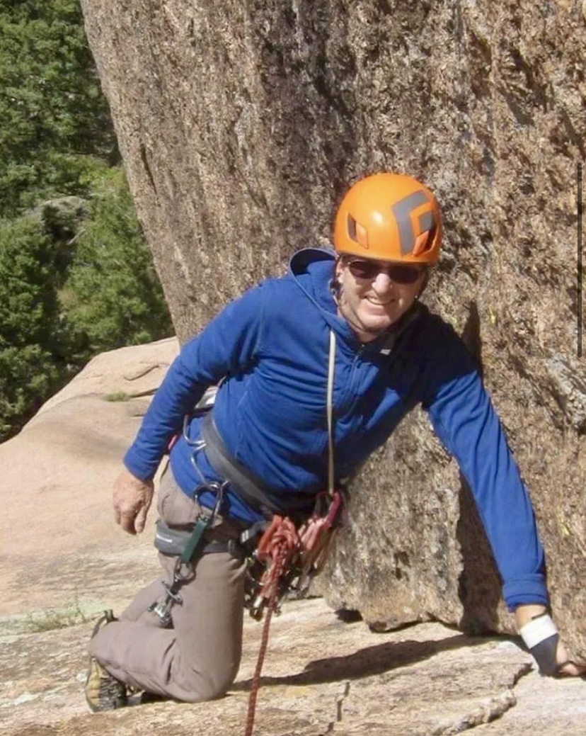
Avalanche hits Fischer
On the morning of August 5, Viesturs and Fischer were trying to reach Kieser and Mauduit when, just below the Shoulder, a spindrift avalanche swept Fischer 60m. Thankfully, Viesturs self-arrested and secured Fischer.
Kieser and Mauduit continued descending, and after many terrible hours, they found the top of the fixed ropes near Camp 3. Here, they finally met Viesturs and Fischer.
The group then assisted Mauduit to Camp 1, where Dan Mazur and Charley Mace took her the rest of the way to Base Camp.
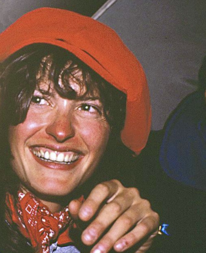
Aftermath
Mauduit never thanked her rescuers or publicly acknowledged the rescue.
The rescue was a team effort, all completed without bottled oxygen.
We recommend reading two books about the climb: No Shortcuts To The Top by Ed Viesturs and David Roberts, and Savage Summit by Jennifer Jordan.
The remarkable French alpinist Chantal Mauduit would have turned 61 today, but her passion for high-altitude mountaineering led to her premature death at age 34. Here, we explore her climbs and her fatal expedition to Dhaulagiri I.
Early life
Mauduit was born in Paris on March 24, 1964. At five, she moved with her family to Chambery in the Savoie region of the French Alps. This relocation introduced her to the mountains, where she began hiking in summer and skiing in winter.
At 15, her mother passed away from cancer. Seeking solace, Mauduit turned to climbing, starting with the Alps. By 17, she had already climbed the North Face of the Grandes Jorasses, the Drus, and the Matterhorn.
In the early 1990s, Mauduit ascended the Directissime Jori Bardill route on the Central Pillar of Freney in the Mont Blanc massif with Catalan climber Ernest Blade.
In July 1992, with Blade, Araceli Segarra, and Albert Castellet, she climbed the Bonatti Pillar on the Petit Dru. They finished the famous 800m route in eight hours. One year later, Mauduit completed the Walker Spur on the Grandes Jorasses in a single day from Chamonix.
In the mid-1990s, Mauduit did the Devies-Gervasutti route on the northwest face of Ailefroide Occidentale (3,954m) in the Ecrins massif. This 1,050m line is known for its remoteness and technical difficulty.
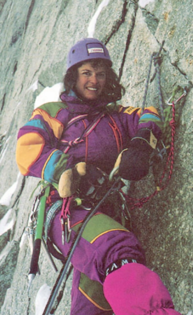
Next, Mauduit went to the Andes. She climbed 5,495m Nevado Urus and took part in an expedition to 6,768m Huascaran. She made the Sajama Traverse in Bolivia (6,542m) and ascended Mount William in Antarctica.
Himalaya and Karakoram
Her focus then shifted to the Himalaya, where she chose to climb without supplemental oxygen.
"Climbing without oxygen is my ethics. When you use [oxygen] during an ascent, you necessarily miss very strong, very intense moments, both visually and audibly. All the senses are then heightened," she told Le Monde newspaper.
On Aug. 3, 1992, aged 28, Mauduit summited K2 via the Abruzzi Route without supplemental oxygen. She became just the fourth woman to do so.
Her descent was harrowing. A storm caught her near Camp 4 at around 8,000m, and she became snowblind. Americans Ed Viesturs and Scott Fischer -- who had struggled to scrape together enough money for their expedition -- abandoned their summit bid to save her.
Controversy
Back at Base Camp, Mauduit didn’t thank Viesturs and Fischer but instead celebrated her summit success as if the rescue had never taken place.
"So now Chantal was celebrating with the Russians. We’d hear their cheers and revelry as we [Viesturs and Fischer] lay silent in our tents. Scott and I hadn’t been invited to the party," Viesturs wrote in his book No Shortcuts to the Top.
More big peaks
In 1993, Mauduit summited Shisha Pangma and Cho Oyu without supplemental oxygen, burnishing her 8,000m reputation.
On April 28, 1996, Mauduit topped out on 7,138m Pumori. After that, she climbed two 8,000m peaks in the same season. On May 10, she climbed Lhotse and reached the top alone, leading some to question her summit success because of a lack of proof. This climb took place during the infamous 1996 Everest disaster, and Mauduit witnessed the tragedy that killed several climbers, including Scott Fischer.
Ed Viesturs told Elizabeth Hawley of The Himalayan Database that he had seen Mauduit enter into a gully and return soon after, casting doubt on her summit. Mauduit's sponsors were likely pressing hard for her to succeed after her failure one year earlier on Everest. However, the summit was officially accepted, and she became the first woman to summit Lhotse.
Two weeks after Lhotse, Mauduit summited Manaslu, topping out alone again. According to Hawley, Mauduit was accompanied by Ang Tshering Sherpa, but Ang Tshering ran out of energy on their final push on May 24. He had been breaking trail for hours in deep snow. Mauduit's summit marked her fifth 8,000’er.
Her sixth 8,000m summit came in 1997 on Gasherbrum II, again without bottled oxygen.
In the autumn of 1996, Mauduit attempted Annapurna I but aborted above high camp in bad conditions.
Seven attempts on Everest
Between 1989 and 1995, Mauduit made seven attempts on Everest without bottled oxygen. She never summited the world's highest peak.
On her last attempt in 1995, she suffered serious altitude sickness. After almost collapsing during a summit push, she was carried down by fellow climbers and needed extra oxygen. This event, like the K2 rescue, drew criticism for her reliance on others.
Mauduit always pushed very hard, but on several occasions, she started strong but ran out of energy and needed help.
Despite these incidents, Mauduit’s successful 8,000m climbs without supplemental oxygen place her among the elite of her era.
Death on Dhaulagiri I
Mauduit had already attempted Dhaulagiri I in the autumn of 1997, but she aborted above high camp. In the spring of 1998, she returned to try again.
This was her last expedition. Mauduit and 45-year-old Ang Tshering Sherpa died, possibly between May 11 and 13. Climbers found their bodies in their tent at Camp 2 (6,500m). Ten Sherpas brought her body down, and it was flown to Kathmandu and then on to France.
During a summit push, other teams on the mountain had retreated to Base Camp because of avalanche danger and bad conditions. Yet Mauduit and Ang Tshering stayed in Camp 2.
An autopsy in France confirmed the cause of death as a broken neck, likely from a rockfall or small avalanche. The Italian climbers who found her body also believed this was the most likely cause of death.
Ed Viesturs was also on Dhaulagiri that season and suggested carbon monoxide poisoning from a stove could have killed her. He reasoned that there were no clear signs of an avalanche at Camp 2.
The Italian climbers had found Mauduit and Ang Tshering's tent covered in snow. They had to dig the tent out to look inside and found the pair in their sleeping bags. This accumulated snow might have broken Mauduit’s neck, the Italians suggested. Yet Ang Tshering's neck was not broken.
Mauduit’s family and friends chose to trust the results of the autopsy.
A poetic soul
Mauduit studied physiotherapy but abandoned it for a life in the mountains, living nomadically between expeditions. She carried books by Rimbaud and Baudelaire on climbs, wrote poetry on her tent, and spoke about her experiences with lyrical depth.
In 1997, she published J’habite au Paradise (I Live in Paradise), a book blending impressions of her climbs with reflections on the cultures she encountered.
"Chantal Mauduit was a very interesting woman,” Elizabeth Hawley once wrote. "When she arrived here, she named each of her expeditions after a flower she had drawn on her tents. She was flamboyant."
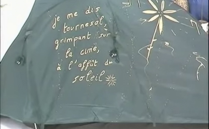
Mauduit’s approach to mountaineering was unconventional. She prioritized personal experience over logistical teamwork. But her infectious optimism and comfort in the mountains earned her admiration. Viesturs wrote that everybody loved Mauduit for her happy character.
After her passing, friends and family founded the Association Chantal Mauduit Namaste, which established a school in Kathmandu, honoring her generosity toward Nepalese communities.
Below is a short video showing something of her character.
On March 22, 1966, American climber John Harlin fell 1,000m to his death on the Eiger’s North Face. He was just 600m from completing his ambitious Direttissima route. Fifty-nine years later, we look back at his career, marked by innovation and a deep connection to the Alps.
From fine arts to pilot
John Elvis Harlin II was born in Kansas City on June 30, 1935. He graduated from Sequoia High School in California and later attended Stanford University, majoring in fine arts and dress design. In the early 1950s, Harlin began climbing.
Later, he joined the U.S. Air Force where he trained as a pilot, flying jet-fighter bombers.
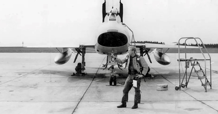
During his Air Force service, Harlin was stationed in Europe. In 1954, he made his first trip to the Alps. Just 19, it marked a turning point in his life. That year, he attempted the Eiger North Face by the Heckmair route but didn’t succeed. The climb began a lifelong obsession with the peak.
He married Marilyn Harlin, and they had two children: son John Harlin III and daughter Andrea Harlin. In the early 1960s, the family moved to Switzerland and Harlin immersed himself in the alpine climbing community.
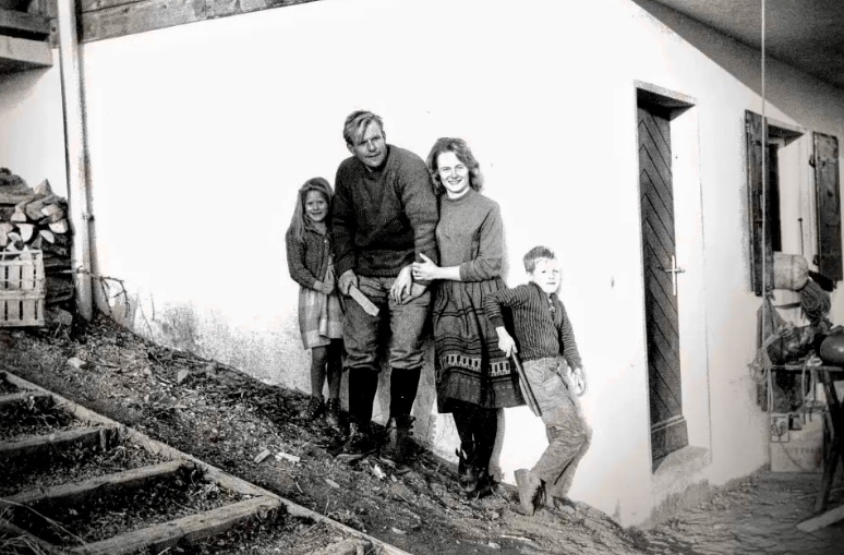
First American to climb the Eiger North Face
In the summer of 1962, Harlin became the first American to climb the North Face of the Eiger. He ascended via the 1938 Hechmair Route with German climbing partner Konrad Kirch. The climb took several days and required exceptional skill and endurance.
The same year, Harlin attempted the central Pillar of Freney in the Mont Blanc Massif, a steep granite route first climbed by Chris Bonington’s team in 1961.
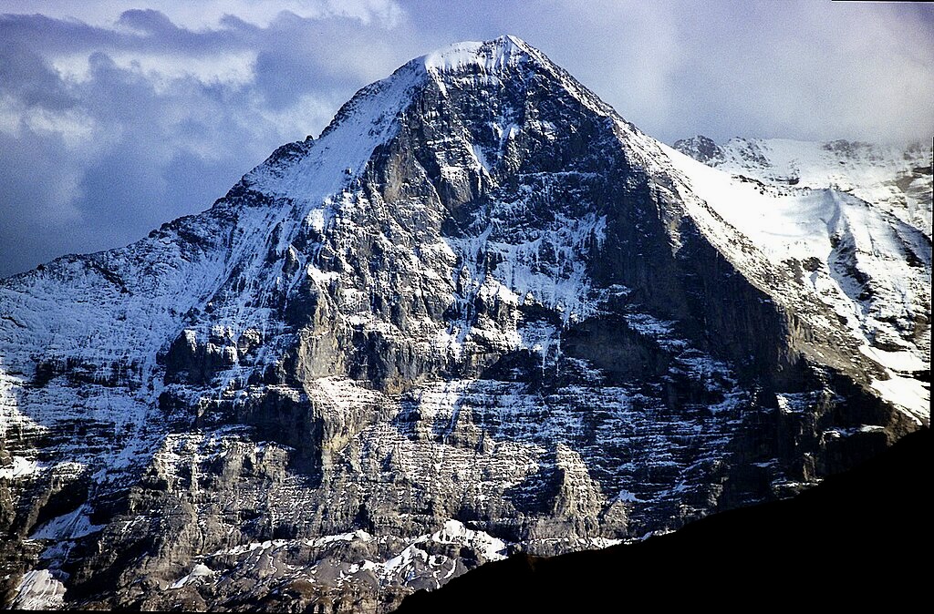
Other notable climbs in the Alps
In 1963, alongside American climbers Gary Hemming, Tom Frost, and Stewart Fulton, Harlin made the first ascent of the South Face of the Aiguille du Fou in the Mont Blanc massif. This climb was a technical masterpiece, involving steep rock and ice.
In 1964, Harlin, Chris Bonington, and Rusty Baillie climbed the northeast ridge of Cime de l’Est in the Dents du Midi in the Valais region of Switzerland.
In 1965, Harlin and Royal Robbins made the first ascent of the American Direct route on the West Face of the Aiguille du Dru, a steep and committed line that demanded advanced rock and ice skills.
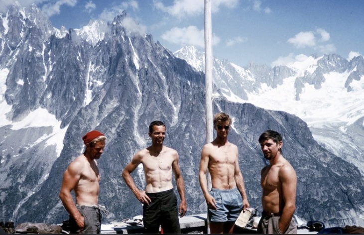
In June 1963, Harlin became the Director of Sports at the American School in Leysin, Switzerland. He also founded the International School of Modern Mountaineering.
Locally, Harlin earned the nickname Blond God. He was an excellent athlete, a member of the all-American Services football team, and, when younger, the junior wrestling champion of California.
Return to the Eiger
In the 1930s, many viewed the Eiger North Face as a crazy objective.
"The forcing of the Eigerwand [North Face] is principally a matter of luck, at least 90% of the latter is required," Dr. Hug, a Swiss member of the Alpine Club, said at the time. "Extreme forms of technical development, a fanatical disregard of death, staying power, and bodily toughness are, in this case, details of merely secondary importance."
Colonel Strutt, the retiring President of the Alpine Club, agreed. "The Eigerwand continues to be an obsession for the mentally deranged of almost every nation. He who first succeeds may rest assured that he has accomplished the most imbecile variant since mountaineering first began," Strutt said in his farewell address.
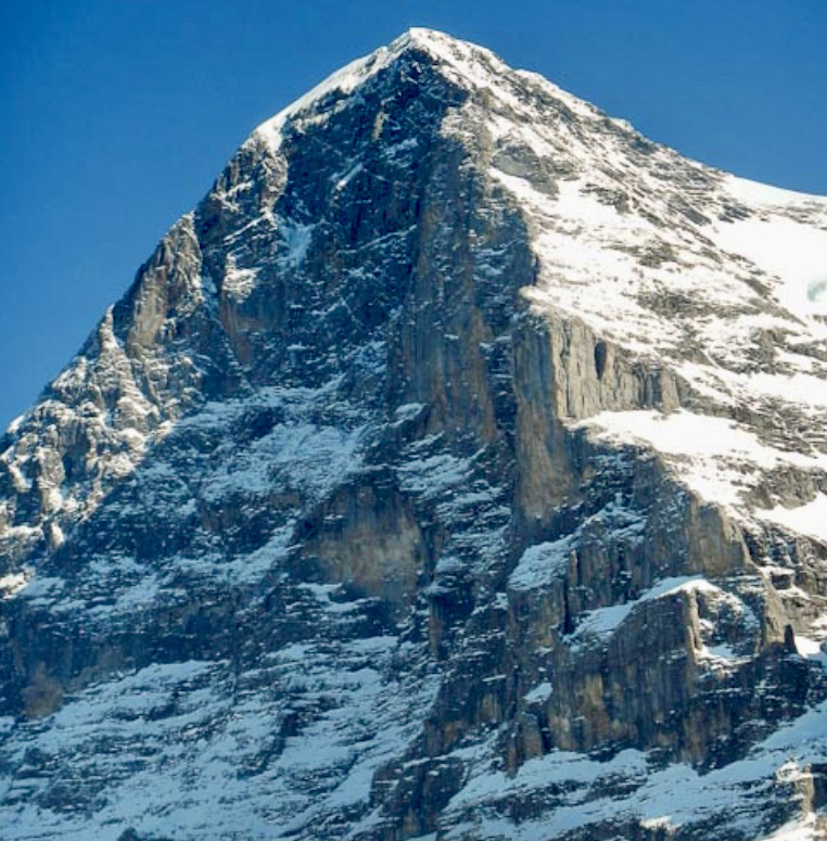
The North Face of the Eiger, rising 1,800m from its base to the summit at 3,967m, is notorious for its steepness, loose rock, and deadly weather. But it was finally ascended for the first time in 1938 by a four-man team that included Anderl Heckmair and Ludwig Vorg from Germany and Heinrich Harrer and Fritz Kasparek from Austria. The Heckmair route features ice fields, rock bands, and high exposure.
A German-Austrian party that included Toni Hiebeler, Walter Almberger, Anderl Mannhardt, and Toni Kinshofer made the first winter ascent of the Heckmair route in March 1961.
One year after his initial ascent of Eiger’s North Face in 1962, Harlin started to think about a direct line up the face.
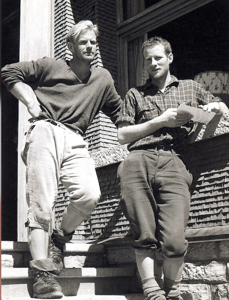
The team
Harlin made several reconnaissance climbs on the North Face. Finally, in February 1966, he organized a strong team. The group featured Colorado rock specialist Layton Kor (famed for his big-wall climbs in Yosemite), Scotsman Dougal Haston (known for Scottish winter ascents and prior Eiger climbs), experienced UK alpinist Chris Bonington, and Don Whillans in support. Don Whillans later withdrew from the expedition after a disagreement with the team.
In early February, Harlin’s party headed to Kleine Scheidegg, where journalist Peter Gillman would report on the ascent.
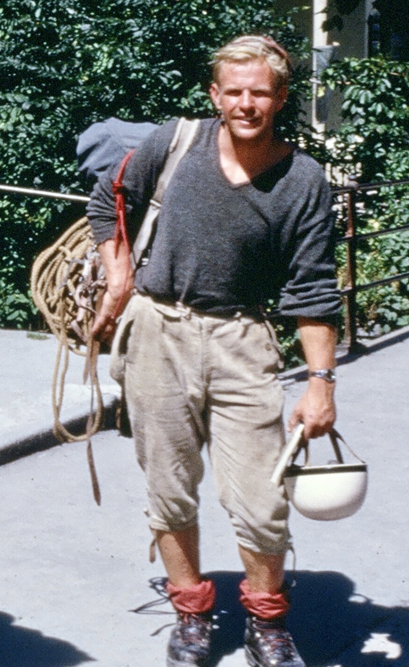
There had been rumors that a German team had their eyes on the same objective. At Kleine Scheidegg, it became clear that the teams would be rivals, with both keen to be the first to finish a direct line on the North Face.
The German team included leader Jorg Lehne, Gunter Strobel, Klaus Huba, Sigi Hupfauer, Karl Golikow, Rolf Rosenzopf, Gunther Schnaidt, and Peter Haag.
Harlin’s party aimed for an alpine-style dash, weather permitting, while the Germans planned a relentless ascent with fixed ropes, regardless of conditions.
Starting the climb
Both teams began on Feb. 2, 1966, establishing base camps near Kleine Scheidegg.
The Germans fixed ropes systematically and advanced higher each day. Harlin’s smaller team pushed when the weather allowed, often climbing parallel to the Germans.
Both teams faced brutal winter storms, sub-zero temperatures, and frequent snowfall. Additionally, there was the danger from the North Face itself, offering exposure to rockfall and avalanches.
By mid-March, both parties had fixed ropes up to around 3,400m. Around March 15, after weeks of rivalry, the teams began sharing ropes and bivouac sites, prompted by harsh conditions and mutual respect. Harlin and Lehne negotiated a loose alliance, though separate summit pushes remained the goal.
The fall
On March 22 at around 10:00 am, Harlin was ascending a fixed rope alone. He was on his way to join the others, approximately 610m below the summit, at 3,360m. But the 7mm rope snapped, likely because of wear, ice damage, or rockfall. Gillman, who was at Kleine Scheidegg watching the climbers with a telescope, saw Harlin fall 1,000m to his death.
The British-American team was devastated. Kor descended soon after, effectively leaving the climb. Haston and Bonington stayed, determined to finish.
The Germans, higher on the face when the accident occurred, learned of Harlin’s death by radio and offered support. The tragedy catalyzed a full merger of the two teams, and they would now go for the summit together.
The John Harlin Direct
On March 25 at 2:30 pm, Haston, Lehne, Strobel, Hupfauer, and Huba reached the summit after a final 200m push. A storm hit the mountain after they summited, forcing a grueling descent via the West Flank, completed over two days.
The climbers, some suffering serious frostbite, named the line The John Harlin Route.
"When John Harlin fell to his death from the Eiger on March 22, 1966, the world of mountaineering lost one of its brightest stars. In the not quite thirty-one years of his life, Harlin had forged a career that was unique in ambition and achievement," James Ramsey Ullman wrote in the American Alpine Journal.
For further details on Harlin and the 1966 climb, we recommend reading Eiger Direct by Peter Gillman and Dougal Haston.
Mount Waddington, an infrequently climbed peak in British Columbia’s rugged Coast Mountains, was initially known as the Mystery Mountain because of its remoteness. This is the story of early expeditions to this fortress of ice and stone.
Hard to reach
At 4,019m, Mount Waddington is the highest mountain entirely within the Canadian province of British Columbia. Taller peaks, such as Mount Fairweather and Mount Quincy Adams, lie on the British Columbia–Alaska border.
Approximately 300km northwest of Vancouver, Mount Waddington is surrounded by deep valleys and glaciers. Even approaching it is a great adventure over extreme terrain, ice fields, and difficult peaks. Early explorers often compared the area to the Himalaya, and many films set in the Himalaya were filmed in the Waddington Range.
Discovery
Don and Phyllis Munday were a renowned Canadian mountaineering couple with experience in the Pacific Northwest, Rockies, Selkirks, and the Coast Mountains. Between the 1920s and the 1940s, the Mundays climbed more than 150 peaks, with over 40 first ascents. In 1924, Phyllis became the first woman to summit 3,954m Mount Robson, the highest peak in the Canadian Rockies. She climbed with Annette Buck, and Don Munday also summited.
In 1925, Don and Phyllis Munday spotted a huge peak from Mount Arrowsmith on Vancouver Island. It is unclear if this was Mount Waddington, but their observation sparked exploration of the Waddington Range. The Mundays were the ones who dubbed that distant peak Mystery Mountain.
Authorities officially named Mount Waddington in 1928, following the recommendation of the Mundays. Alfred Waddington was an industrialist who advocated for a road and railway through the region.
The Mundays' attempts
For over a decade, the Mundays made several attempts to climb Mount Waddington, the most important of which was their 1928 expedition.
The couple began from the Franklin Glacier on the southwest side and ascended via the northwest ridge. On July 8, they reached the lower northwest summit at around 4,000m. There, they concluded that reaching the main summit would be too dangerous.
Tragedy in 1934
In the summer of 1934, a party from British Columbia, including Neal Carter, Alan Lambert, Alec Dalgleish, and Eric Brooks, likewise approached the mountain via the Franklin Glacier. They targeted a couloir on the south face leading toward the southeast ridge.
They reached 3,700m, but the expedition was called off after Dalgleish fell to his death on June 26. The accident happened only three days after they had established base camp.
Other attempts
In the same year, a Winnipeg-based team attempted to ascend via the Tiedemann Glacier and the northwestern flank. The party turned around 180m below the summit because of bad weather on June 28, 1934.
In 1935, climbers from California made three attempts from base camp at Dais Glacier, including two tries via the South Face. They failed to summit because of bad weather and technical difficulties. Their highest point was around 3,500m. During a third attempt, two climbers reached the northwest summit, first climbed by the Mundays in 1928.
According to climber Fred Beckey, there were 16 attempts on Mount Waddington before its first ascent. However, Beckey didn’t list all 16 attempts in his writings.
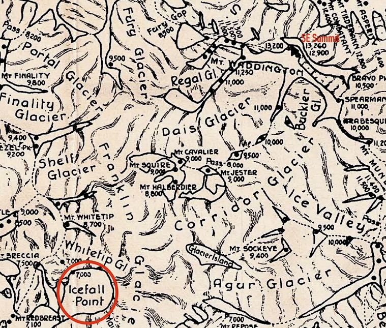
Fritz Wiessner and his small team
In the spring of 1935, alpinists Bill House, Elizabeth Woolsey, and Alan Wilcox started to plan an expedition to the Coast Range. A year later, German-American Fritz Wiessner joined the trio and led the small team to attempt the still-unclimbed Waddington in the summer of 1936.
Wiessner’s team learned that the British Columbia Mountaineering Club (BCMC) and the Sierra Club of California had joined forces. As a combined party, they were planning to climb Mount Waddington at around the same time.
According to Bill House’s report in the American Alpine Journal, after a meeting between the leaders of both groups, they agreed that the mountaineering clubs would attempt the climb first. Both teams targeted the South Face, with the BCMC-Sierra Club team setting up base camp at Icefall Point on the Dais Glacier.
The BCMC-Sierra Club team did not succeed. They couldn’t find a viable route up the face on difficult terrain.
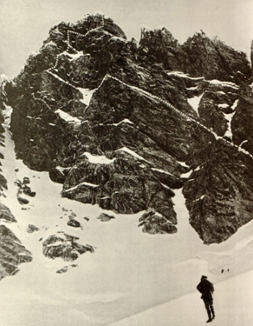
The South Face
The South Face, broken up by three couloirs, is known for poor route conditions and falling ice. An 800m granite wall of complex rock, snow patches, narrow couloirs, and mixed icy sections complicate the climb.
After a challenging approach via the Franklin Glacier, Wiessner’s team established their base camp on July 14, 1936. Like the BCMC-Sierra Club team, they chose Icefall Point (1,787m) on the upper Dais Glacier. Icefall Point is a spur of heather-covered rock. According to House, it’s the last place where a party can find firewood and running water.
Woolsey and Wilcox helped carry loads to camp but wouldn’t join the summit push.
On July 20, Wiessner and House started up via the left branch of a couloir between the main summit and the northwest peak. They eventually retreated because of poor rock conditions.
So instead, they then headed to the right of the South Face. By 2:45 am on July 21, Wiessner and House were on their way toward the summit from their high camp. They climbed the 305m upper section of ”forbidding-looking” rock in 13 hours.
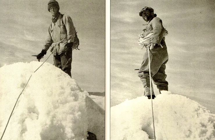
The summit
On July 21, Wiessner and House topped out.
”It is a hopeless task, as every mountaineer knows, to try to do justice to one’s feelings at the summit of a difficult peak. Probably relief is the most dominant one at the time,” House recalled.
On the top, they left a summit register in a waterproof match can. Wiessner and House descended by the same route and reached base camp on July 22 at 2:00 am. Their round trip took just over 23 hours.
It was a lightweight, alpine-style ascent using minimal, rudimentary gear (18 pitons). This contrasted with earlier expeditions, which tended to be large, complex affairs.
Wiessner and House demonstrated that the ”unclimbable” could be climbed. The 1936 first ascent marked the culmination of years of exploration and ticked off one of the last major unclimbed summits in North America.
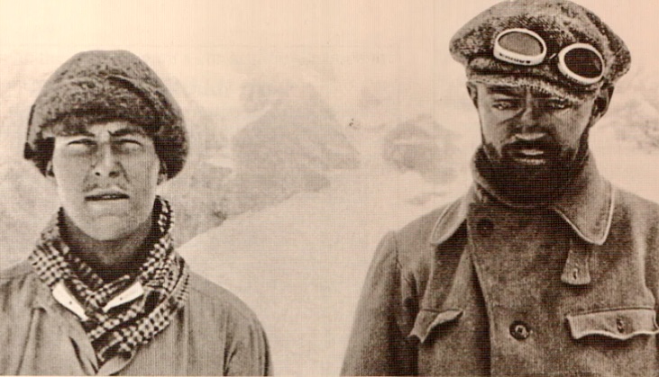
Two teens target Mount Waddington
In 1942, six years after the first ascent, 19-year-old Fred Beckey and his 16-year-old brother Helmy Beckey decided to climb Mount Waddington's South Face. With World War II underway, resources were few, and the Beckey brothers had no sponsors or porters, only their parents’ vague approval.
"Long behind seemed the months of preparation, conditioning climbs, and first ascents made in the Northern Cascades of Washington in June,” Fred Beckey wrote.
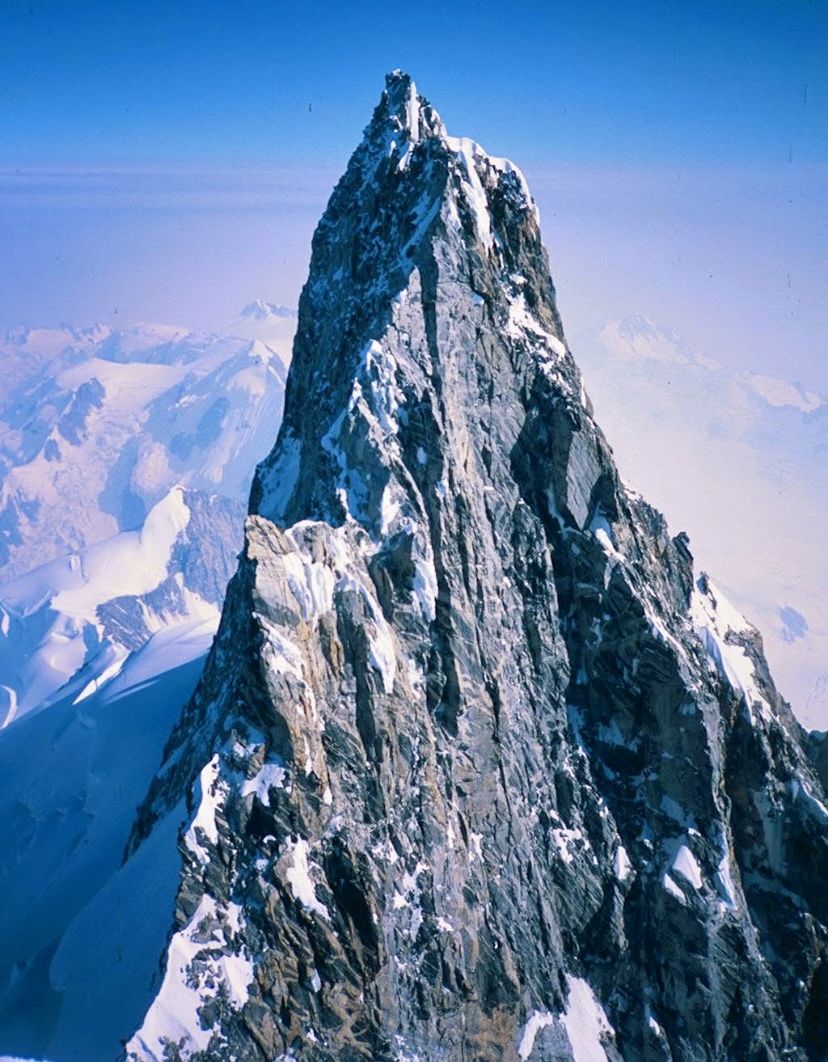
With climber Eric Larsson, the brothers started their multi-stage journey from Seattle. Traveling via bus to Vancouver, then steamship to Knight Inlet, and finally via a smaller boat to the Franklin River delta, they approached overland on foot.
After several days of travel from the coast, they reached the Franklin Glacier. Crossing required 32km of unsupported glacier travel. The approach added more than 2,000 vertical meters and weeks of effort to their adventure.
On the second day on the Franklin Glacier, Larsson fell ill and had to quit. The Beckey brothers continued and established base camp on the glacier below Waddington’s southwest face on July 20.
The ascent
The brothers decided to attempt the South Face route slightly to the right of the chimney climbed by Wiessner and House.
They traversed the glacier, navigating crevasses and icefalls to reach the base of the face. They carried minimal gear and moved in a lightweight style. Then they climbed to a higher camp to position themselves for a summit push. That process took a couple of days in complex terrain and worsening weather. When conditions allowed, they moved up quickly.
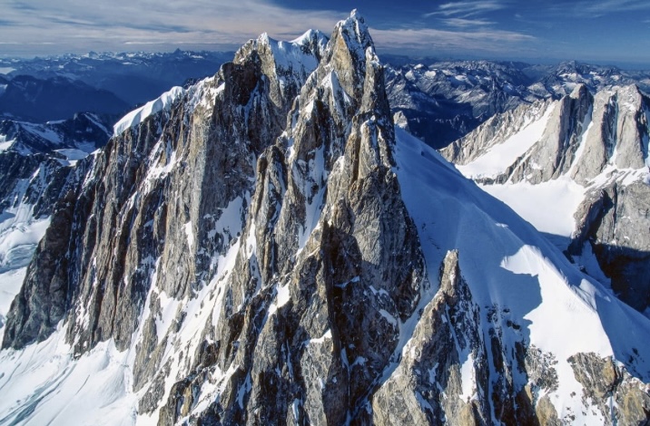
On the upper face, Fred Beckey changed to tennis shoes with felt pullovers to mount the rock slabs.
"The pullovers adhered well to the rock when wet and could be removed quickly for more friction on dry rock," Fred Beckey wrote in his report. (The term ”pullover’ refers to an improvised covering for the shoes.)
As they climbed, ice fragments broke off the summit ridge and thundered down the chimneys to their left.
On August 8 at 8:30 pm, Fred and Helmy Beckey topped out on the main summit. It was one day after Helmy’s 17th birthday. On the summit, they found Wiessner and House’s match-can register. It was the second ascent of the mountain.
During the descent, Helmy was hit on the knee by a rock as they descended into the gap between the northwest and the main peaks.
"This was Helmy’s birthday present, donated by Mount Waddington,” Fred said. ”Any hope of reaching camp that night was gone because of a heavily bleeding cut.”
The next day, they continued their descent and reached base camp.
Legacy
The Beckey brothers' feat was outstanding. Fred continued his climbing career and made hundreds of first ascents in North America. He also wrote a dozen books, hundreds of climbing reports, and several climbing guides. He dedicated his life to mountaineering and died at 94.
Colin Haley, who in 2012 made the first solo ascent of Mount Waddington, wrote about Fred Beckey for the American Alpine Journal:
"Fred was without a doubt the most accomplished climber ever to come out of North America and is among the all-time greats, right alongside figures such as Riccardo Cassin, Hermann Buhl, Lionel Terray, Walter Bonatti, and Reinhold Messner."
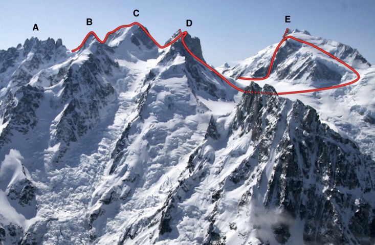
In 1996, Fred Beckey, John Middendorf, and Calvin Herbert made the first ascent of a peak in the Cathedral Mountains in Alaska. They named it Mount Beckey.
We recommend watching the documentary Dirtbag: The Legend of Fred Beckey, by Dave O’Leske.
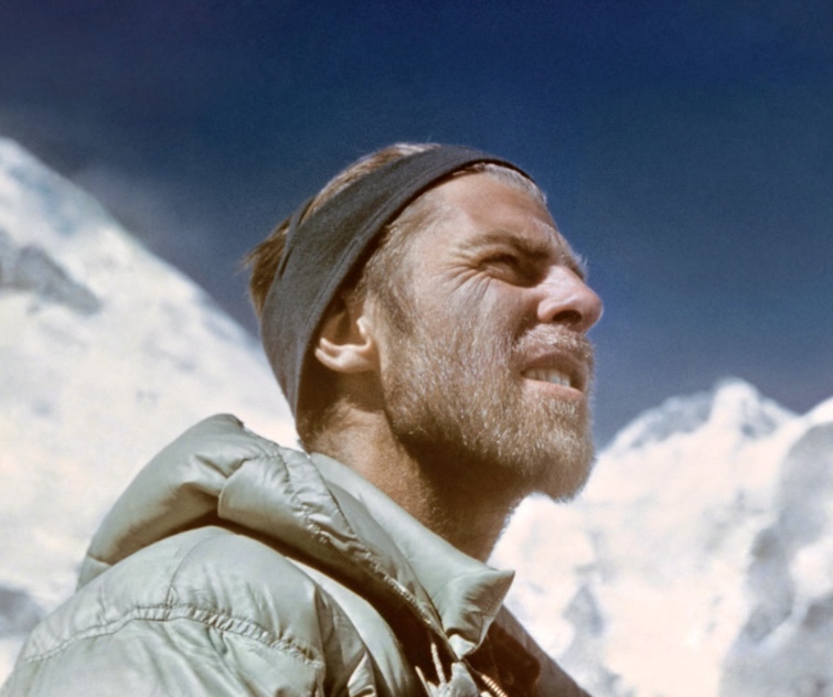
French alpinist Mathieu Maynadier and former Croatian alpine ski racer Ivica Kostelic did not expect to end their multi-sport adventure in a hospital bed. The pair had to be rescued after a storm swept their kayaks offshore in the Adriatic Sea.
The two athletes and filmmaker Bertrand Delapierre were attempting the first recorded ski traverse of the Albanian Alps, also known as the Accursed Mountains. The range lies in coastal southeastern Europe and spans the borders of Albania, Montenegro, and Kosovo.
The trio combined ski mountaineering, paragliding, cycling, and a final kayaking segment down the Bojana River to the Adriatic. The traverse was to showcase the region’s potential for extreme sports.
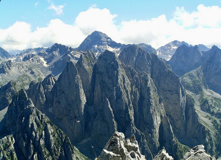
Swept out to sea
On March 10, after four days, they reached Lake Skadar. From there, they kayaked about 30km down the Bojana River to its outlet.
But as the river opened into the Adriatic, strong winds and waves of three to four meters swept Kostelic and Maynadier out to sea. Delapierre managed to reach the Albanian shore and alerted rescue services.
The Montenegro military responded. Five hours after the distress call, at around 10 pm, a naval vessel rescued Maynadier and Kostelic. A helicopter provided thermal imagery to locate the pair.
The extreme weather complicated the rescue, but finally, Kostelic and Maynadier were recovered and taken to a hospital in Montenegro. They were released the following day.
”We were tired and cold after four hours of fighting the waves, but...everything is now fine,” wrote Maynadier on social media.
He admits they made a mistake by entering the ocean in those conditions.
Piotr Krzyzowski of Poland will head to 8,485m Makalu in April, aiming to climb without supplemental oxygen or Sherpa support, according to wspinanie.
Krzyzowski has already climbed seven 8,000m peaks in this style, using only fixed ropes. Last year, he summited Lhotse and Everest in 47 hours and 22 minutes, in a single push without descending below Camp 4.
As we reported earlier, unsupported climbing is supposedly not allowed on Everest this year, but Makalu is not included in this restriction.
Annapurna I
As Sherpa rope-fixers prepare Annapurna I's normal route, 83-year-old Kazuyoshi Kondo from Japan is on his way to Nepal. Kondo will climb Annapurna in the company of three Sherpas. (His fellow octogenarian, Carlos Soria, 86, still hopes to return to Manaslu in the autumn if he can raise the funds.)
Kondo has participated in 15 Himalayan expeditions over the last 30+ years. He summited Cho Oyu (autumn 1992 with O2), Dhaulagiri I (autumn 1995 without O2), Everest (spring 1998 with O2), Manaslu (spring 2009 with O2), Lhotse (spring 2011 with O2), and Ama Dablam (autumn 2019 without O2). He attempted Annapurna I in 2023, according to The Himalayan Database.
The other Annapurnas
Sophie Lavaud of Switzerland, who has already completed the 14x8,000m series, has a new project. She wants to climb "the other Annapurnas," as Maurice Herzog might put it. She will start with 7,525m Annapurna IV as part of a trilogy of three peaks in the Annapurna massif.
Lavaud wants to honor the 75th anniversary of the first ascent of Annapurna I.
Between March 6 and 9, Roger Schaeli, Filippo Sala and Silvan Schupbach made the first ascent of the north face of 3,237m Punta Pioda in the Swiss Alps.
Also known as Pioda di Sciora, it doesn't have the same level of notoriety as the legendary north faces of the Eiger, the Matterhorn, or the Grandes Jorasses. Still, a glance at the photo below shows just how impressive and aesthetic this face is.
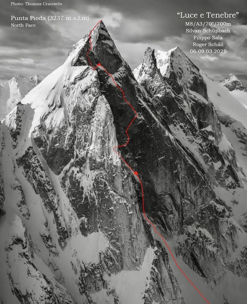
The peak lies in the canton of Graubunden in the Swiss Alps. It's part of the Sciora group, known for its rugged granite faces and alpine climbing routes.
According to Sala, Schupbach has a long-term project to climb forgotten north faces and the last wild walls of the Alps. During their four days on the Punta Pioda wall, Sala recalls they had to face loose rock, freezing temperatures, and high technical difficulties.
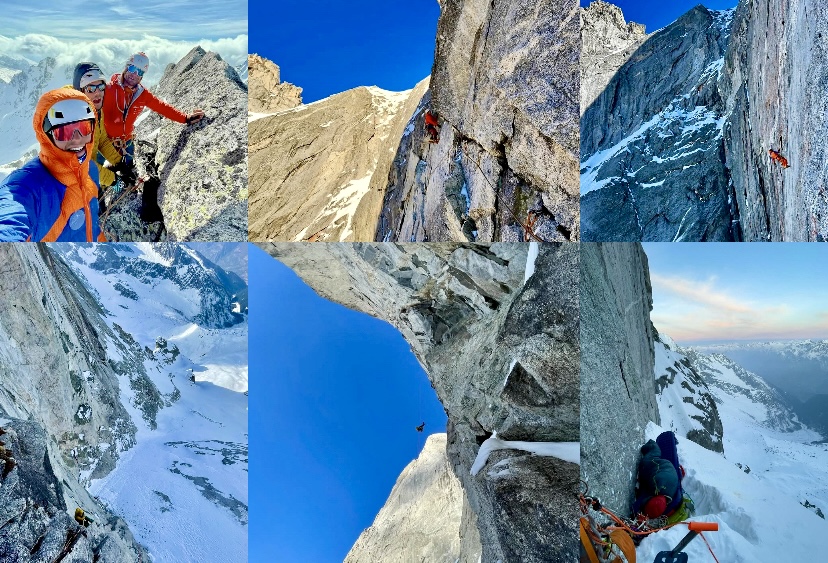
"Every pitch was a real battle," recalls Sala. "Long and complex pitches [combining] aid and free." The climbers graded their 700m route M8, A3, 70°.
The climbers returned to an alpine hut the first night and spent the other two nights bivouacking on the wall.
In late February, Sala established another new north face route, this time up 2,923m Pizzo San Giacomo in the Ticino region of Switzerland.
Punta Pioda was the first time that the three experienced climbers shared a climb together.
Kirill Belotserkovskiy and Ira Kozlovskaya recently spent a week climbing in Kazakhstan's northern Tien Shan.
First they climbed Igly Tuyuk-Su, a 4,000m peak south of Almaty, near the Kyrgyz border. According to Belotserkovskiy, the route had been climbed before as part of a traverse, but this is the first repeat. Belotserkovskiy graded it as 3A/B, 600m, AI2 III.
After a day off, the two climbers headed to the north face of 4,410m Ordzhonikidze, where they climbed a 700m route of 4B, WI4.
"About 400 meters of ice ranging from 30˚ to 90˚," recalls the guide. "[We] topped off with a constant stream of spindrift pouring over us.
According to Belotserkovskiy, the wind was so strong during the descent that they sometimes had to stop and wait for visibility to improve.
"It was the hardest climb I've guided someone on," wrote Belotserkovskiy. He has already established two new routes on Ordzhonikidze's north face.
David Kocsis and Marton Nagy of Hungary have opened a new line on the South Wall of 5,203m Shkhara, Georgia's highest mountain. Due to the difficult terrain, bad weather, and lack of time, they didn't continue along the upper ridge to the summit. Still, their climb marks only the second complete winter ascent of that wall.
Kocsis and Nagy started on February 28. At 3,800m, they encountered harsh conditions with intense snowfall. The more difficult technical sections began at 3,900m, and the Hungarians had to overcome 100m of waist-deep snow up a 65˚ slope.
At 4,058m, they camped in a small space they hollowed out for their tent in the deep snow. The temperature dropped to -26˚C that night. In the morning, an avalanche buried their tent, but they managed to dig themselves out. They moved the tent closer to the rocks to avoid more avalanches.
Kocsis and Nagy considered that the safest place was on top of the wall, so they hurried to finish it, despite the weather. After a difficult section, they completed the new line, according to Mozgasvilag.

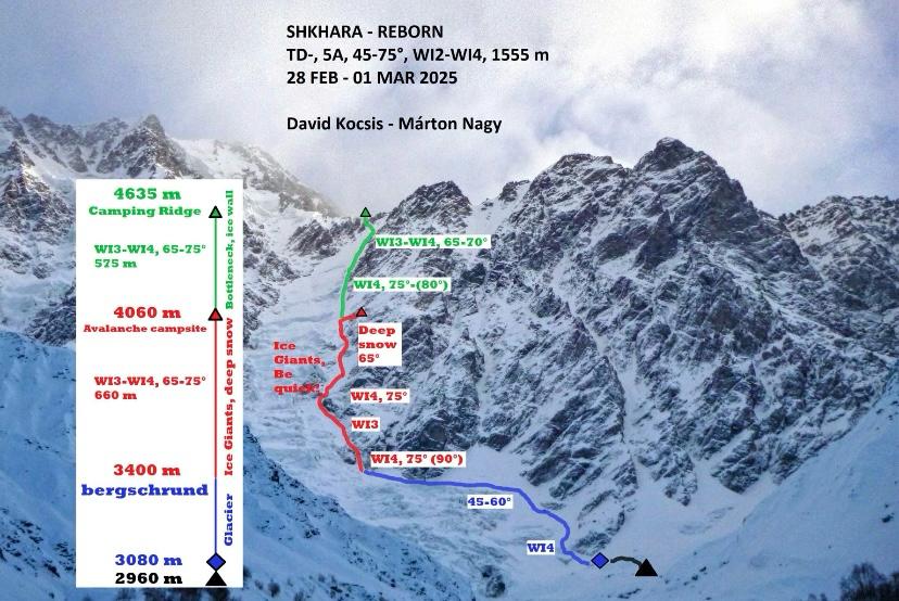
Seracs ready to fall
From there, the climbers saw that the glacier on the upper section was in bad condition, and they would have to climb just below falling seracs. Here, at around 4,600m, they turned around. After a difficult descent, they reached base camp.
Kocsis attempted Shkhara's South Face in the winter of 2024 as a member of the Hungarian National Climbing Team, which first attempted this face in 2020. In 2024, the late Archil Badriashvili advised the team about their planned line. Badriashvili and Georgi Tepnadze made the first ascent of the South Wall of Shkhara in February 2018. They also successfully summited the mountain.
Back in base camp, Badriashvili's friends arrived to celebrate the new line with them. It's a pity that Badriashvili could not be with them; he perished in a climbing accident in Georgia last year.
Below, the 2018 climb of Badriashvili and Tepnadze.
In 1967, Mount McKinley (Denali) witnessed two pivotal moments in mountaineering history.
In Part I of this series, we told the story of McKinley’s first winter ascent. Later that same year, during the summer season, the mountain saw one of the worst tragedies ever on a North American peak. This is the story of the 1967 summer season on McKinley.
(Writer’s note: Following the Associated Press style guide, I will use the name McKinley in these pieces.)
A record number of ascents
In 1967, 10 expeditions attempted Mount McKinley, making it the most successful year on record. Almost all of the expeditions' members topped out.
In summer, two teams aimed to summit via the remote Muldrow Glacier route, first ascended by the McKinley pioneers in 1913. The Muldrow Glacier route is considered more difficult than the West Buttress route for logistical and technical reasons.
The route begins on the north side of McKinley and requires a 63km trek from Wonder Lake to the base of the glacier. From the base near McGonagall Pass at 1,750m, climbers gain 4,440m to McKinley’s summit at 6,190m. The Muldrow Glacier features complex glacier travel in heavily crevassed terrain, usually requiring constant roped navigation.
The key section of the route, Karstens Ridge is a narrow, exposed ridge that joins the Harper Glacier, adding more crevasse hazards. The ridge is also particularly vulnerable to high winds. Unsurprisingly, the 1951 West Buttress route became the common route up McKinley rather than the tricky Muldrow Glacier-Karstens line.
Wilcox expedition
The Wilcox expedition, led by 24-year-old Joe Wilcox from Utah, was the first of the two teams attempting the Muldrow Glacier route. He looked for climbers to join him via climbing newsletters. His party eventually included nine members: Wilcox, Jerry Clark, Steve Taylor, Dennis Luchterhand, Mark McLaughlin, Anshel Schiff, Hank Janes, John Russell, and Walt Taylor.
It was a young group, with everyone between 22 and 31 years old. Most came from the Pacific Northwest. They all had basic mountaineering skills but hadn’t climbed higher than 4,550m.
Colorado expedition
Howard Snyder, 22, led the Colorado expedition, the second team on that route. With Snyder were Jerry Lewis, Steve Lewis (Jerry’s brother), and Paul Schlichter.
Like the Wilcox group, this was a young team. However, Snyder and his partners had more mountaineering experience and had climbed at higher altitudes.
Just before their departure on June 21, the team was reduced to three when Steve Lewis broke his arm in a car accident.
The National Park Service (NPS) was skeptical about the Wilcox expedition because of its limited high-altitude experience. They suggested Wilcox merge his group with Snyder’s party. Thankfully, this also suited Snyder because NPS rules stated there should be at least four members in an expedition group. The merger occurred on June 22, and Wilcox took command of the 12-person team.
July 16: the key day
The merged group started their trek in from Wonder Lake. In early July, the climbers made steady progress, establishing camps and ferrying supplies. Most of them experienced altitude sickness but tried to adapt. By July 13, the group had set up camp on the Harper Glacier.
On July 15, Wilcox, Snyder, Schlichter, and Lewis started a summit push from their high camp at 5,456m. They reached the summit at 6:30 pm in good weather, with a clear sky and light winds. After spending over an hour on top, they descended to high camp by 9:50 pm.
On July 16, all 12 members were at high camp when 113kph winds picked up, forcing everybody to remain at camp. This temporarily stalled plans for a second summit push by Clark, Luchterhand, McLaughlin, Janes, Russell, and the two Taylors.
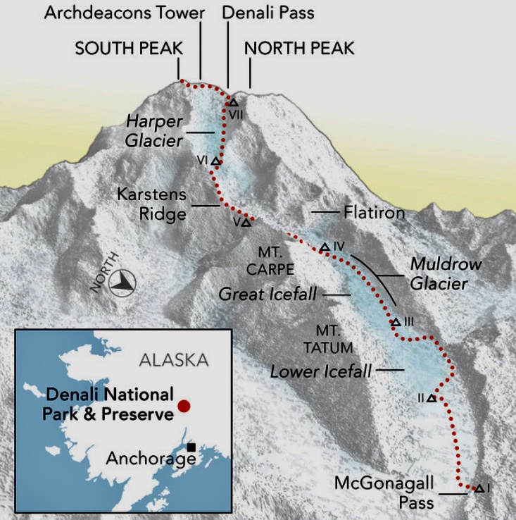
The second summit bid
Park rangers reportedly warned Wilcox of an approaching storm. They projected it would hit around July 16 or 17, but the group continued with their summit plan, perhaps underestimating the storm's severity.
On July 17, the second group, led by the 31-year-old Clark, went for the summit. The group that had summited two days earlier descended to a lower camp at 4,572m.
The wind had subsided as Clark and company set off. Steve Taylor remained at high camp because of altitude sickness. That night, strong winds started on the upper slopes. The summit group stopped to bivouac, hoping for better weather the next morning.
On July 18, at 11:30 am, Clark radioed to say that he, McLaughlin, Walt Taylor, Janes, and Luchterhand had topped out in a whiteout. John Russell's situation was unclear; he didn’t summit and might have turned back during the push.
Clark said that they would start to descend in 10 minutes. They never radioed again.
The biggest storm in 100 years
The storm kept getting worse. A high-pressure system from the south clashed with a moist low-pressure system from the north, creating the biggest storm ever recorded on the mountain. It would last seven days, to July 25.
Near the summit, the wind was 160–240kph, with still-air temperatures of -26ºC.
Those below the summit, on the upper section of McKinley, were trapped. The other members, who had already descended from their summit bid, spent the seven-day storm at a lower camp. They tried to stay warm by huddling together.
The seven climbers higher up had no chance of survival. Jerry Clark (31), Steve Taylor (22), Dennis Luchterhand (24), Mark McLaughlin (23), Hank Janes (25), John Russell (23), and Walt Taylor (24) all died. The five climbers at the lower camp made it down alive after the storm ended.
Several days after the storm, two bodies were found at Archdeacon’s Tower below the summit. The NPS located another body at high camp holding a tent pole. Their bodies could not be identified because of decomposition. The other four climbers were never located.
The three bodies were left on the mountain. In 1968, an expedition tried to find the victims but found no remains.
Conclusions
The original Wilcox team had no proper high-altitude experience. Experienced alpinists might have better gauged the risk or built snow caves.
Another problem could be that the team divided on the mountain after the first summit on July 15. This split the stronger climbers (who had already summited) from the less experienced climbers.
Later, Snyder criticized Wilcox for this split. Wilcox defended the split as a chance for everyone to summit, but Snyder argued that it weakened the team’s ability to respond as a unit. As a merged group, the team lacked cohesion.
The rangers’ warning about bad weather is also key. Wilcox claimed the notice he received was vague and didn't mention how fierce the storm would be.
The tragedy was the result of an extraordinary natural event and human decisions that amplified the risk. Seven relentless days caused exhaustion and hypothermia. National Weather Services later called the storm a once-in-century event. Possibly no team, regardless of skill, could have faced it effectively high on the mountain.
This was less about gross negligence and more about the limits of human judgment against nature’s extremes. McKinley's power was unforgiving.
Comparing the 1967 winter and summer expeditions
It is interesting to compare this summer expedition with McKinley's first winter ascent from February of the same year. Gregg Blomberg’s winter party had much more experience and enough collective knowledge to handle extreme conditions.
The winter team's decision to construct an ice cave below the summit was pivotal. The small cave was an important shelter that protected them from the worst of the wind. However, the July hurricane was much stronger than the February storm.
Mental strength is another important factor in a week-long hurricane at high altitude, in subzero temperatures, with frostbite setting in. Only strong mountaineers are capable of thinking clearly in these circumstances. Most people without experience on high mountains simply can’t react as assertively.
Luck
Luck also plays a major part. It was pure chance that the storm arrived during the July team's most exposed moment. Weather forecasting in 1967 could not predict its exact onset, and the rangers’ warning didn’t pinpoint the critical hours. The five who summited earlier, on July 15, were lucky to have made it to the top. By making it down in time to a lower camp, they missed the worst days.
However, it’s important to listen to the mountain and retreat when there are signs of changing weather. The key day was when all 12 members were at high camp, trapped by the weather, with the July 15 summiters unable to descend and the rest of the team unable to ascend.
Aftermath
The 1967 tragedy led Denali National Park to modify climbing protocols, including requiring parties to register in advance, document their mountaineering experience and readiness, carry two-way radios, and contact park officials when the climb is over.