The summit push on GII was aborted due to bad conditions, and the expectations for Broad Peak and K2 are equally discouraging.
However, a few stubborn climbers are willing to wait for a possible weather window at the end of July.
No one wants to surrender first
"The expeditions will officially end on August 2, but our teams on K2 and Broad Peak are [already nearly finished], as the situation seems not so good," Lakpa Sherpa of 8K told ExplorersWeb.
Nepal-based blog Everest Chronicle stated that Elite Exped has called off its expedition, and leader Mingma David Sherpa will have to wait another year to break his own record by summiting the mountain for the seventh time. As Lukas Supergan wrote on Saturday, no outfitter wants to be the first to call the expedition off.
"Several Sherpas have sustained climbing-related injuries, but their agencies are not discussing this publicly," the Polish climber added.
K2 climbers need at least acceptable conditions for the Sherpa guides to fix ropes and set higher camps, but the weather is not cooperating. Conditions have been bad all season. Already, one Pakistani climber has died.
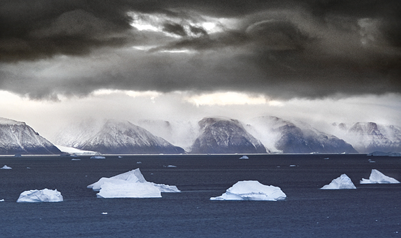
Heavy monsoon rains are hitting northern Pakistan, wreaking havoc at several places in Gilgit-Baltistan. As we posted last week, a hanging bridge at Shigar collapsed, cutting off the route back to Skardu. Even if climbers leave, they may have difficulty getting out.
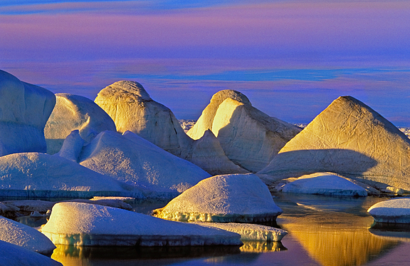
K2
"It's 3 degrees at Base Camp at 8:30 am," no-oxygen Everest summiter Lenka Polackova of Slovakia reported.
She adds that water continues to drip at 6,200m, and she has experienced rockfall even near 7,000, the highest she's reached.
However, most climbers believe that better weather is coming at the end of the month, after the current snowy spell. But will conditions on K2 be stable enough, and will the climbers -- stuck in Base Camp for so long -- be prepared?
Good weather and colder temperatures could stabilize K2. Then, perhaps, some very strong climbers could launch a last-minute summit push if they manage to pitch a couple of tents on Camp 3 and head up right behind the rope fixers. But it's a long way from Camp 3 at 7,000m to the 8,611m summit. Climbers planning to proceed without oxygen have a nearly impossible mission ahead, especially if they are not acclimatized enough.
Gasherbrum II
On Gasherbrum II, Imagine Nepal launched a summit push from Camp 2 on Saturday night, but eventually retreated because of deep snow. They safely returned to Base Camp today, and leader Mingma G bluntly stated: "Gasherbrum II will remain unclimbed in 2025."
Nirmal Purja of Elite Exped is also on Gasherbrum, but the company has not yet spoken of its plans.
Meanwhile, Selena Khawaja of Pakistan, just 16 years old, is aiming to climb Gasherbrums I and II with her father. The young Khawaja has been attempting 8,000'ers -- and raising concerns because of her young age -- since she showed up on Broad Peak in 2021 at age 13.
Last year, the Khawajas attempted Nanga Parbat. This year, before heading for the Gasherbrums, Selena and her father climbed Khosar Gang, a 6,004m peak near Skardu. They arrived at Base Camp on Friday after dealing with tough conditions due to heavy rains during the trek up the Baltoro.
Broad Peak
On Broad Peak, Madison Mountaineering's sole client and its Sherpa team are still in Base Camp waiting for a weather window. They will need better conditions and a more collaborative atmosphere amid growing tensions between climbers and outfitters on the mountain.
"Opening a route to the summit requires crossing deep snow above Camp 3," Lukas Supergan wrote on Saturday. "This could be achieved by a large, combined team from agencies and independent climbers working together, but such cooperation is not there. Leaders keep their plans secret; groups set out despite obviously bad forecasts and return exhausted and resigned. Each agency wants to be the one at the top, but by acting alone, it reduces its chances. Joint action has been replaced by a lack of communication."
Wrote Vibeke Andrea Sefland: "It is getting warmer and it is melting more day by day. On top of this, we have had several days with heavy snowfall up high, and rain below 6,000m, giving us hip-deep snow to break trail through."
The Norwegian climber and her group said they are going to wait a little longer, but the situation is complex. "I will do my best, but in these conditions, the only way to manage is [for] all of us to get together in a good team effort."
The ice caps which cover our planet's poles are key to understanding global weather patterns and changing climate. But we still don't have a complete understanding of how they work, and what goes on beneath the frozen surface.
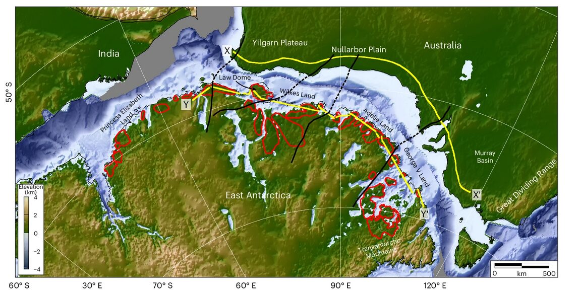
A group led by researchers at the UK's University of Durham used radar to glimpse beneath the coast of East Antarctica. In a new study, they announced their findings: Ancient riverbeds beneath Antarctica control the behavior of the ice sheet above them.
Reconstructing ancient landscapes
It is crucial to understand how much, and how quickly, the East Antarctic Ice Sheet is going to melt as temperatures continue to rise. It's the largest of Antarctica's three ice sheets, and it contains enough water to raise the sea level by over 50 meters.
The behavior of an ice sheet depends on more than just surface conditions. The landmass hidden beneath the ice impacts how quickly it melts and where it collapses. To get an idea of what that hidden landscape looks like, researchers analyzed a series of radar scans covering 3,500km of East Antarctica.
The scans found what was once a coastal plain formed by fluvial erosion. Between 80 million years ago, when Antarctica divorced Australia, and 34 million years ago when it became covered in ice, rivers flowed across East Antarctica and into the sea. Those rivers carved out a smooth, flat floodplain all along the coast. Breaking up the plain are deep narrow troughs in the rock. These plains covered about 40% of the area they scanned.
This find confirms previous, fragmentary evidence for a very flat, even plain beneath the icy expanse.
Hopeful findings
This is good news for those of us who enjoy not being underwater. Computer programs modeling future climate behavior now have more data to work on. Before, as the study's lead author, Dr. Guy Paxton, said in a Durham press release, "The landscape hidden beneath the East Antarctic Ice Sheet is one of the most mysterious not just on Earth, but on any terrestrial planet in the solar system."
Understanding the terrain beneath the ice makes it much easier to understand how and where the ice will move. “This in turn will help make it easier to predict how the East Antarctic Ice Sheet could affect sea levels.”
More than that, however, the ancient fluvial plains may be slowing down the melt. The study suggests that the flat plains may be acting as barriers to ice flow. Fast-moving glaciers pass through the deep channels, but the bulk of the ice, atop the plains, is moving much more slowly.
Ultimately (as they always do), researchers stressed the need for more investigation. Further studies would involve drilling all the way through the ice and taking samples of the rock below. So look forward to that.
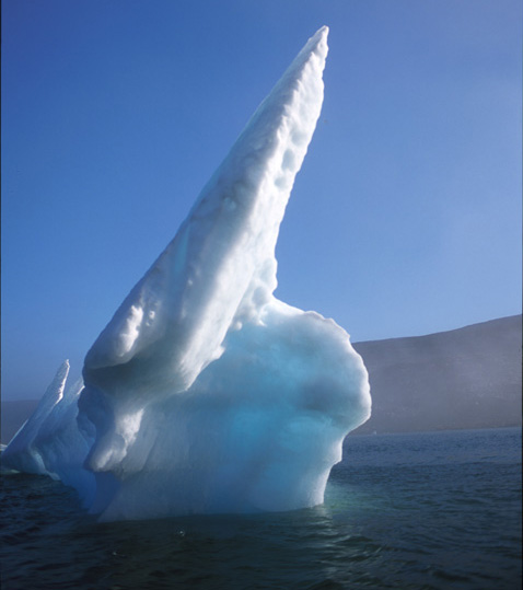
For Arctic residents and a few polar addicts, icebergs are familiar. I've skied, paddled, and boated past thousands of them. But most of us have just seen photos of these beautiful ice sculptures and may have only a vague idea where they come from. Here's a primer on one of nature's great art forms -- how they're made, how they differ from ice floes, and the many forms they come in.


Immobile icebergs


Arctic art


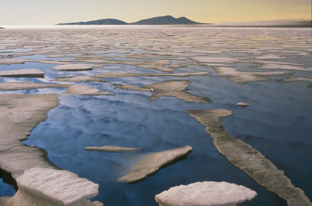
Icebergs vs ice floes


Multiyear ice: also not icebergs


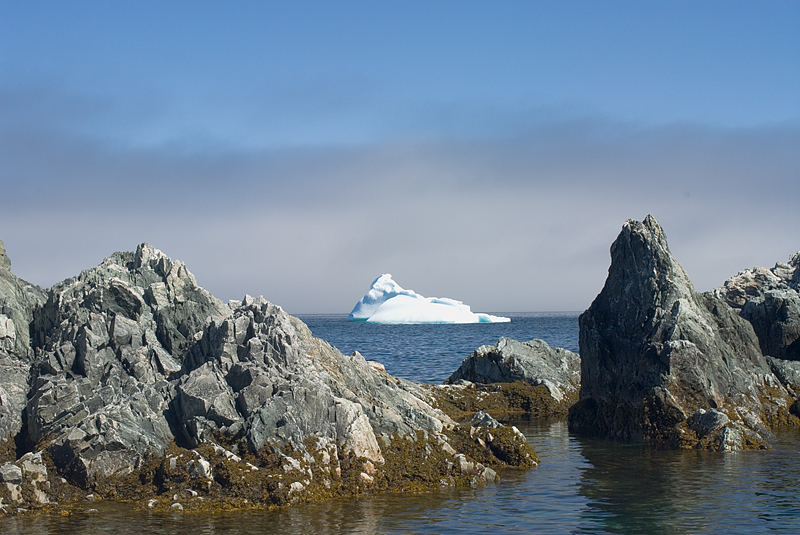
A dangerous beauty
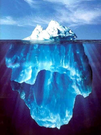
Icebergs can be as dangerous as they are beautiful. As a rule of thumb, boaters should not approach closer than twice the distance of an iceberg's height. See video below.
When we’re not outdoors, we get our adventure fix by exploring social media and the web. Here are some of the best adventure links we’ve discovered this week.
Desert of My Dreams: Vedangi Kulkarni recently set her eyes on a solo unsupported cycle around the globe, aiming to set a women's speed record. Because of the visa difficulties associated with an Indian passport, she followed a non-traditional route, and this brought unexpected logistical challenges. When it became clear the record was out of reach, she shifted her focus. In April 2025, after covering 29,030km over 270 days, Kulkarni completed her second global cycle while still only in her mid-twenties.
Mapping the myth: In search of Homer’s enchanted islands: Although Greek mythology is fictional, some classicists have explored connections between myth and reality. British-American classicist Emily Wilson suggests that "there is some correspondence between the world of Homer and the real world, although the relationship is partial and inexact." This piece traces the islands that may have inspired the travels of Homer’s epic hero, Odysseus.
Paddling with porpoise
It Began With a Paddle: At his lowest point, the stark beauty of Mexico’s Baja Peninsula offered Sean Jansen a lifeline, a glimpse into a different kind of life. One rooted in giving back to the environment he had once taken for granted. It was a chance to start over, dedicating his energy to protecting Mexico’s most endangered species. And it all began with a paddle.
Sixty Years Later: Finding -- and Climbing -- the Troll Wall: Sixty years after completing the first ascent of Troll Wall, Europe's highest and steepest cliff, British climber Tony Howard reflects on his experience and shares a short account of how the climb unfolded.
Revelry Collection: It seems there's a fresh digital counterculture in the outdoor world, with new print magazines and zines appearing at a steady rate. This offering from a young American high schooler only publishes original film images. It looks polished and has hooked in well-known outdoor photographers such as Alex Strohl and Taylor Burke.
Playing His Own Game: Despite climbing during South Africa’s apartheid era, Ed February achieved success both in the mountains and in academia. In this story from Alpinist, Brandon Blackburn explores how February defied racist barriers to follow his passions, always forging his own path.
"The North Shore invented mountain biking," claims Todd "Digger" Fiander, a trail builder and videographer. If the sport was indeed born in , Betty Birrell was there from the start.
North Shore Betty, a short film from Patagonia, introduces us to the eponymous Betty. Now entering her seventies, Betty reflects on what is means to be an older woman in the rough world of mountain biking.
One big playground
She didn't start in mountain biking. Betty first made a splash (pun intended) pioneering women's wave sailing in the early 1980s. By her mid-forties, she was a single mother and full-time flight attendant, but she also started mountain biking. She started riding Fiander's "roller coasters for bicycles" after getting her first mountain bike in 1993.

Rather than competing, Betty found that mountain biking and being a single mother worked together. It became an activity she could do with her son, and they still bike together now that he's an adult.
Betty also isn't afraid to get injured. She's broken an arm, a wrist, a hand, and "lots" of ribs, dislocated shoulders, and torn her rotator cuff, but it didn't, and still doesn't, bother her.
According to Betty, when her ex told her she treated life like it was "one big fucking playground," she took it as a compliment.

The short film interviews Lea Holt, a nurse with a family who worried, as she approached fifty, that she would have to give up mountain biking. But Betty's career changed her mind. "I have twenty more years..." Holt explained, "to get better."
"Betty is a legend on the North Shore," says fellow British Columbia mountain biker Amanda Moffat. When they ride together, she says, people will call out to Betty as they pass, like she was a celebrity.
Now 73, Betty plans to keep riding into her nineties. "Older people...need to know that you can keep going," she says. On the screen, Betty's bike leaps over rocky trails and races around bends and through the forests.
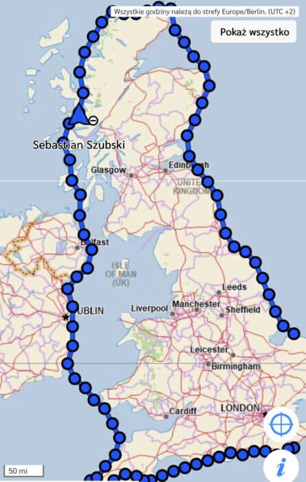
On July 18, Polish paddlesports athlete Sebastian Szubski completed a solo kayak circumnavigation of Great Britain. He covered the 3,000km route in 37 days, finishing three days faster than Dougal Glashier, the previous record holder from 2023.
Szubski began his journey in Western Scotland on June 12 and initially faced challenging waves, fatigue, and changeable weather conditions that are typical of the British coastline. His route led him around Scotland’s rugged coast, down the coasts of England and Wales, across the Bristol Channel, through the Irish Sea, past both Ireland and Northern Ireland, and ultimately back to Scotland.
For much of the route, Szubski was neck-and-neck with Glashier's time, paddling an average of 80km to sustain his target of 40 days.
Key moments
“Scotland welcomed me as if it were paradise on Earth. Beautiful, with seals, views, and no waves because I was hidden among the islands. I decided to start higher than I had planned. It turned out I'd chosen the most beautiful spot in all of Great Britain,” Szubski told Red Bull Poland.
However, on day two, this short-lived idyllic start was replaced by rudder issues, a leak, and rough seas that left him unable to control his boat properly. He narrowly avoided crashing into the cliffs at the famous sea stack of the Old Man of Stoer.
From the seventh day, Szubski’s journey settled into its routine of paddling, eating, and sleeping. He often spent up to 16 hours a day in his kayak. The timing of his efforts was frequently dictated by tidal currents, sometimes requiring pre-dawn starts in gnarly weather. These early rises became essential for staying on schedule.
By the eighteenth day, he reached the halfway point. Navigating past Dover under the cover of night helped him avoid the world's busiest shipping traffic, though technical issues left him without lights or radio communication.
A support team followed Szubski the entire way. On land, recovery was the top priority, although each landing also required recording footage for Guinness record documentation, changing into dry clothes, and eating high-calorie meals. He received massages from his support team and slept, at least at times, in a rooftop tent.
Olympic pedigree
When Szubski announced his intention to circumnavigate Britain by Kayak, some in the British paddling community were skeptical. He had reportedly never kayaked at sea, let alone the rugged British coast, which can be technically challenging and dangerous.
In preparation, in July 2024, Szubski and Sebastian Cuattrin paddled a 200km section of the River Thames in England in just under 22 hours. A few months later, that fall, the Pole visited and trained with Mike Lambert, a former British canoe sprinter who completed a 58-day kayak circumnavigation earlier in the year.

Although born in Poland, Szubski represented Brazil in the 2004 Summer Olympics in the sprint canoe event and the 500m doubles kayak. He also holds the record for the farthest distance by canoe or kayak on flat water in 24 hours -- an impressive 252km.
Fastest known time
Szubski has claimed his circumnavigation as the fastest kayak journey around Great Britain, and a number of news sources have suggested he has broken a Guinness World Record. How Guinness will ratify this record is unclear, as they do not currently appear to have published a comparable record on their website. Also, for some in the adventure community, they are not a credible record-keeping organization.
Dougal Glashier previously held the fastest known time, although his route was reportedly 3,120km -- slightly longer than the 3,000km initially reported by Szubski. Both Glashier and Szubski had support crews, but details remain unclear regarding how much they relied on them, whether they camped wild or stayed in accommodations, and how similar their routes were.
In 2012, Joe Leach, the previous record holder, completed the journey in 67 days, a benchmark Glashier surpassed by an impressive 27 days.
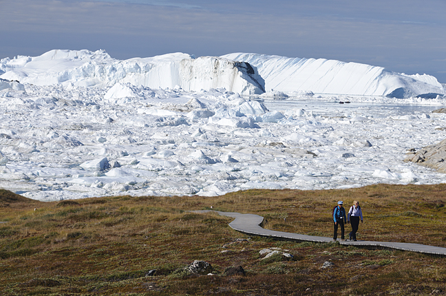
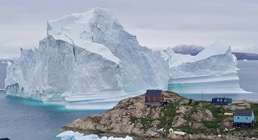
Earlier this month, a towering iceberg dangerously close to shore threatened Innaarsuit, a small fishing village in Northwest Greenland. The "skyscraper-sized" iceberg prompted authorities to evacuate some of Innaarsuit's residents to higher ground, according to SkyNews.
Located about 617km north of Nuuk, Greenland’s capital, and 46km north of Upernavik, Innaarsuit is a remote island community of just 169 people, accessible only by boat or helicopter. The village relies heavily on its harbor for fishing, but the iceberg’s proximity endangered homes, the Royal Greenland fish factory, and even the local grocery store. If it calved, or broke apart, the resulting tsunami could have easily swamped the houses on the rocky shore.
You can watch a recent video on it:
This wasn’t the first time Innaarsuit has faced such a crisis. In July 2018, a massive 11-million-ton iceberg, 200m wide and 100m tall, grounded near the village. Again, residents near the shore were evacuated, and the village’s power plant and fuel tanks were at risk. Fortunately, the iceberg drifted north after a few days, averting disaster.
Other incidents
Greenland has experienced several tsunami incidents in recent years. On June 17, 2017, a massive landslide in Karrat Fiord triggered a wave that struck Nuugaatsiaq (about 92km north-northwest of Innaarsuit), killing four people and injuring 11, washing several houses into the sea, and flinging boats 50m up the hillside. The landslide, likely caused by melting permafrost due to rising temperatures, highlighted the growing risks to coastal communities.
Another dramatic incident occurred in June 2018 near Ilulissat, known as Greenland’s Iceberg Capital, thanks to its UNESCO-listed Icefiord. A 6.4km-long iceberg calved and sent huge waves crashing toward the shore, again forcing residents to flee to higher ground.
A time-lapse video of the 2018 Innaarsuit iceberg:
Icebergs near Greenland’s shores often ground in shallow bays, where they can suddenly calve or flip. Warm weather accelerates melting, increasing calving risks, while ocean currents and winds can either push icebergs away or trap them closer to shore.
This month's iceberg in Innaarsuit raised similar concerns. However, in the end, it dislodged from the shallows and drifted away, sparing the shoreline structures.

Time is running out for climbers on the Karakoram 8,000'ers because of stubbornly bad conditions. Yet a few equally stubborn individuals are fighting to summit before the season ends.
GII push
Summit Karakoram, the local company outfitting 8K Expeditions and Imagine Nepal teams, reports that their climbers on Gasherbrum II have started for the top. "We are planning to reach the summit on July 27, contingent on favorable weather," they noted. Other teams could follow.
Broad Peak problems
In contrast to K2, where all teams seem to be coordinating their efforts, the situation on Broad Peaks looks chaotic. Climbers have gone up and down at their own pace, sometimes in bad weather or despite contradictory forecasts. Today, nearly everyone is in Base Camp, checking weather forecasts but fully expecting to leave shortly.
But not everyone. Charles Page of Canada went up yesterday to 7,600m -- about the altitude of the Broad Peak col -- before turning around, according to his tracker. In previous reports, Page wrote that his goal was K2.
Litter, and no progress
Yet the weather is not the only source of tension in Base Camp. Vibeke Andrea Sefland of Norway, back from a rotation to the top of the fixed ropes, describes Camp 3 at 7,000m as a "tent graveyard" with large amounts of trash. Climbers every season share similar comments about this spot.
On July 21, after a night in Camp 3, Sefland and other climbers descended back to Base Camp. That day, they crossed paths with another small group on their way to the summit despite bad weather forecasts.
"[On the way down,] we had to wait at least an hour in C1 to let climbers come up due to the risk of kicking rocks at them...We were wondering why they are [on a] summit push. The weather forecast is bad, and there are no fixed ropes and not enough manpower to break trail."
The Norwegian climber also noted how alarmingly fast the snow was melting. They had problems crossing a swollen glacier river and rappelled down "in waterfalls which should have been icefalls."
The management of the ropes is also a source of conflict in Base Camp.

As posted on social media, Karakorum Expeditions is in charge of fixing the ropes on the mountain. Climbers complained to ExplorersWeb about KE's leader Mirza Ali's lack of transparency about how and when the ropes will be fixed to the summit. These climbers say they have offered extra money and to help carry the loads. The uncertainty remains. The frustrated climbers have asked to remain anonymous until the expedition finishes and they are safely out of the country.
Karakorum Expeditions last reported on July 20 about the rope fixing:
Season's end
Whatever teams do, they must do it soon, as the season officially ends at the end of July. The problem in Pakistan is not the pending expiration of permits but the weather.
"Permits usually last for 60 days, so teams could remain for longer in Base Camp if they wished," sources from Pakistan Alpine Club told ExplorersWeb.
However, the weather typically becomes more unstable by the end of July, and the monsoon's influence makes climbing too hazardous in August. That is why high-altitude Karakoram expeditions take place in July.

However, changing weather patterns have not helped. As we reported yesterday, the monsoon has already caused serious flooding in northern Pakistan. It is likely that future expeditions will have to adapt to climate change by starting earlier.
With record-breaking summer heat becoming the norm each year, running endurance events beneath the beating sun becomes a tough — and dangerous — proposition. Just this spring, one runner died and others were hospitalized during a California half-marathon in May. Another died last year during a Disneyland half-marathon amid rising numbers of heat-related deaths in the U.S.
Even Paris had to make big changes to ensure athletes didn’t overheat during he 2024 Olympic games.
Amid all this hand-wringing over how to adapt to rising heat, a group co-founded by Bear Grylls has proposed a bold alternative: run underground.
On October 25, 60 runners will compete in a marathon using the underground tunnels of Swedish mining company Boliden. The race will occur 1,000 meters below the surface, with a goal of raising $1 million for charity.
In contrast to traditional marathons, participants will have to endure subterranean conditions, total silence, and “running in complete darkness with only their head torches for light,” organizers said.
“We’re incredibly proud to host this historic event at our Garpenberg mine,” Mikael Staffas, Boliden’s president and CEO, said in a news release. “As one of the safest and most technologically advanced mines in the world, it’s the perfect setting to show that mining can be both cutting-edge and purpose-driven. We look forward to welcoming the intrepid runners and shining a light on an industry that’s critical to a sustainable future.”
Not open to the public
Unfortunately, the race is not open to the public due to “space reasons,” organizers said. The selected participants mostly come from the mining and metals industry, and will represent 17 different countries. They all have “good running experience,” with many of them employees of Boliden who were offered the chance to participate.
The race will be a traditional marathon distance of 26.2 miles. Though Boliden also said that some of the race will be “partially illuminated,” we’re guessing that extra bright headlamps will be indispensable for this one.
Moreover, event organizers hope to earn two Guinness World Records with the race: one for the world’s deepest marathon and a second record for organizing the event.
This innovative event is organized by BecomingX, a digital platform co-founded by adventurers Bear Grylls and Paul Gurney. They partnered with the International Council for Mining and Metals and settled on the Boliden-owned Garpenberg Mine for the location. According to a news release, Boliden is “one of the world’s safest mining companies.”
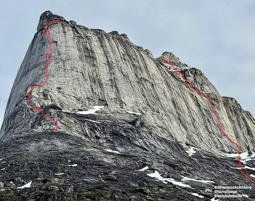
Shira M. Biner, Kelly Fields, and Heather B. Smallpage have done a new 550m big-wall route on Eglinton Tower’s buttress on Baffin Island, Canada. This marks the first route of its length and difficulty (5.11+ A0) by an all-female team on Baffin Island. The group included Natalie Afonina.

The daunting buttress rose approximately 893m above their Base Camp, with a challenging headwall that appeared nearly unclimbable from below. Over 12 long pitches and one cold bivouac, they summited of the first tower, only to discover a hidden 300m headwall leading to the true summit. Prioritizing safety and limited by food and energy, the team celebrated their milestone and made an 11-hour descent. The route included a tension traverse to avoid dangerous runout moves, but the climbers noted it could go free with one or two bolts.
Kelly Fields shared a personal reflection on her social media: “The summit was never my goal — surviving the ominous headwall was. I climbed with a respiratory infection and debilitating blisters, driven by a lifelong dream. Nothing and no one was going to stop me.”
She highlighted the team’s grit, climbing together for the first time and tackling an “insanely difficult and dangerous objective” in good style.
A long approach
The expedition included 250km of skiing on sea ice, paddling the Kogalu River, and trekking through Ayr Pass.
Eglinton Tower (933m) lies in remote Auyuittuq National Park's Weasel Valley, near other prominent Arctic peaks like Mount Thor and Mount Asgard. According to the American Alpine Journal, its first recorded ascent was in 1934, by British climbers John Hanham and Tom Longstaff. That ascent was part of early exploratory mountaineering in Baffin Island, focusing on peak bagging rather than technical big-wall routes. The climb marked the tower as one of the earliest summited peaks in the region. However, it’s not a frequently climbed peak, due to its remoteness.
Today, July 25, would be the 104th birthday of Lionel Terray. The celebrated French alpinist climbed routes from the Alps to the Himalaya to the Andes, and also wrote one of the all-time great mountaineering books, Conquistadors of the Useless.
Early years
Lionel Terray was born on July 25, 1921. Growing up in Grenoble near the French Alps, Terray discovered mountaineering and skiing as a child. A conversation with his mother, who dismissed climbing as a stupid sport involving scaling rocks with your hands and feet, sparked his curiosity.
By age 12, Terray was climbing peaks like the Aiguille du Belvedere and the Aiguille d’Argentiere with his cousin. By 13, the talented youngster was leading climbs. But Terray’s love for the mountains caused problems; he got kicked out of one boarding school and ran away from another to pursue ski racing. With little family support, he got by on his own. Skiing was Terray’s first love, and as a teen, he won prizes in competitions, which gave him some money.

In 1941, during World War II, Terray joined Jeunesse et Montagne, a military program that kept him in the mountains. There, he met lifelong friends and climbing partners Gaston Rebuffat and Louis Lachenal.
In 1942, Terray carried out the first ascent of the west side of Aiguille Purtscheller. He also climbed the difficult Col du Caiman. From 1943 to 1944, Terray served in a high-mountain military unit. In 1944, he joined the French resistance, using his mountain skills against the Nazis.
Terray knocked off other notable first ascents, such as the east-northeast spur of the Pain de Sucre and the north face of Aiguille des Pelerins with Maurice Herzog in 1944.
A rising star
After the war, Terray became a mountaineering instructor and settled in Chamonix as a freelance guide. With Lachenal, he did some of the Alps’ most difficult routes, including the Droites’ north spur in only eight hours in 1946, the Walker Spur of the Grandes Jorasses in 1946, the northeast face of Piz Badile, and the north face of the Eiger in 1947 (the second-ever ascent). Terray's speed and skill earned him a reputation as a climbing prodigy.

A rescue attempt on Mont Blanc
In late December 1956, Lionel Terray took part in a rescue attempt on Mont Blanc’s Grand Plateau. At about 4,000m, young climbers Jean Vincendon and Francois Henry were stranded after a failed attempt on the Gouter Route, a popular 1,800m climb to Mont Blanc’s summit.
On December 22, a blizzard caught Vincendon and Henry near the Vallot Hut at 4,362m. Freezing and frostbitten, they couldn’t descend. Terray, now a Chamonix guide, defied the Compagnie des Guides’ decision to postpone a rescue because of the extreme risks of strong winds and freezing temperatures.
Terray’s team battled brutal weather for two days but couldn’t reach the climbers. A military helicopter, attempting a parallel rescue, crashed near the Vallot Hut, stranding its crew. Terray’s group retreated, exhausted, as conditions worsened.
French Army instructors finally reached Vincendon and Henry in early January, but found them near death from exposure and frostbite. Evacuation was impossible, and both climbers died.
Terray’s rescue effort led to his expulsion from the guides’ organization, sparking controversy in Chamonix.

Eiger rescue
In the summer of 1957, Terray took part in a complicated rescue on the Eiger’s North Face in the Swiss Alps. Two Italian climbers, Claudio Corti and Stefano Longhi, were stranded after an avalanche hit their team during an attempt on the notorious Nordwand. The route, known for its steep ice, rockfall, and brutal weather, had already killed their partners, and Corti was injured.
Terray, then 35, joined a multinational rescue team at Kleine Scheidegg. The climbers were stuck near the Difficult Crack, at around 3,300m. Terray, with German climbers Wolfgang Stefan and Hans Ratay, ascended via ropes and pitons. They battled harsh winds and -20°C temperatures. After two days, they reached Corti, who was hypothermic but alive, clinging to a ledge. Longhi, lower down, was too weak to move. Terray secured Corti with ropes, and the team lowered him 600m to safety. Longhi, barely conscious, died during the descent when his rope jammed.
The effort, involving 50 people, was one of mountaineering’s greatest rescues.

Other historic climbs
Terray’s ambition took him beyond the Alps. In 1950, he joined Maurice Herzog’s expedition to 8,091m Annapurna I in the Himalaya, the first confirmed ascent of an 8,000m peak. Terray and Rebuffat's efforts, alongside one of the Sherpas, were crucial to helping the frostbitten Herzog and Lachenal descend safely. The climb brought global fame for the French team.
In 1952, Terray and Guido Magnone made the first ascent of Cerro Fitz Roy in Patagonia. That year, Terray also climbed 6,369m Huantsan in Peru with Cees Egeler and Tom De Booy.

In 1954, Terray summited 7,804m Chomo Lonzo with Jean Couzy, paving the way for their legendary 1955 first ascent of 8,485m Makalu. In 1962, Terray led the first ascent of 7,710m Jannu in Nepal, and in the summer of 1964, he led the first ascent of 3,731m Mount Huntington in Alaska.
In Peru, Terray made first ascents of peaks like 6,108m Chacraraju, considered the hardest peak in the Andes at the time, along with 5,350m Willka Wiqi, 5,428m Soray, and 5,830m Tawllirahu.
Conquistadors of the Useless
In 1961, Terray published Les Conquerants de l’inutile (Conquistadors of the Useless), a memoir that blends vivid accounts of his climbs with reflections on the purpose of mountaineering. The title captures his view that climbing, though seen as pointless by some, was a noble pursuit. The book, translated into several languages, remains a classic.

A tragic end
On September 19, 1965, Terray and his friend Marc Martinetti died in a climbing accident in the Vercors massif near Grenoble. Terray was just 44.
The pair was descending the Gerbier, a limestone cliff in the Vercors range, after completing a route. They were roped together when their rope -- likely weakened or damaged -- snapped. They fell more than 200m to the base of the cliff. Both climbers died on impact. Chamonix mourned deeply, and his funeral drew figures like Herzog, Rebuffat, and Leo LeBon.
"He was to many a great and dear friend, and all those who paid him tribute before he was laid to rest in the Chamonix Cemetery, among them hardened mountain climbers, wept like small children. To the French climbing world, especially the younger generation, his absence represents an irreplaceable loss, as he was the hero of their dreams, and could hold an audience breathless as no one ever has been able to," Lebon wrote in the American Alpine Journal.

Terray’s legacy lives on through his climbs, rescues, and writings. His son, Nicolas, is a mountain guide. Known for his red beanie and sunglasses, Terray appeared in films like Etoile du Midi, La Grande Descente, and Stars Above Mont Blanc.
You can watch Etoile du Midi below, with the option of automatic subtitles:
Bad weather has thwarted all attempts to reach the summit of Broad Peak and diminished hopes for K2 climbers, especially since the worst of the storm is yet to come.
Further down the valley, the consequences of the heavy rains are catastrophic. The Baltoro has been isolated since floods swept away a suspension bridge in Shigar.
K2 summits in peril
"A major storm is approaching K2, bringing heavy snow, strong winds, and freezing temperatures," Mingma David Sherpa of Elite Exped wrote today. He and his team remain in Base Camp, ready to ride out the storm and wait for the mountain to improve afterward before making a decision.
If the situation is dire for guided climbers, it is worse for those without oxygen. Santiago Quintero of Ecuador, who was climbing with Sajid Sadpara of Pakistan (also no-O2), has cancelled his attempt. Quintero and Sadpara had done two rotations. Both times, but especially on the latest trip up to Camp 2, they had several close calls with falling rocks.
"The peak cannot be climbed at present, [in these] highly dangerous conditions," Quitero noted. "It's a deadly gamble, and without a proper Camp 3 and a complete acclimatization, it makes no sense to try."
Quitero admitted the only option would be to buy four bottles of O2 and a porter to carry them up, but he does not have that extra $6- $7,000. "In addition, I don't want to risk an accident," he noted.
He managed to return to Skardu, although some trails are blocked or flooded at the moment.
Same on Gasherbrum II, Broad Peak
A small group of climbers summited Gasherbrum I last week, and Nirmal Purja followed with regular client and Qatari royal Asma Al Thani and a strong support team. However, no one has summited GII this season. The mountain has no fixed ropes, and some teams are reportedly giving up.
Charles Dubouloz of France has done two rotations in the Gasherbrums with climbing partner Symon Welfringer. Over the last few days, they have endured everything from scorching heat to near-constant snowfall. Yet he still hopes to launch an alpine-style push on one of the peaks in the region. They have not confirmed their specific plans, but a previous post by Welfringer suggests they could be willing to return to their original goal of the west face of Gasherbrum IV, if conditions improve.
On Broad Peak, bad weather thwarted the few climbers who launched a summit attempt. Madison Mountaineering reported that their small group (a client with two Sherpa guides) and three other similarly sized groups tried to break trail in fresh snow but turned around before reaching the Broad Peak col because of a storm and whiteout conditions.

Altitude thieves
To make things worse, climbers are reporting thefts in the higher camps again this season. Climbers and staff use others' tents -- that's normal and okay as long as they ask permission -- but the camp crashers also reportedly stole gear, fuel, and food.

"Losing even a small item can mean that a year of preparation, thousands of dollars, and a 1.5-month expedition will be wasted because the equipment needed on summit day has disappeared," Lukasz Supergan reported.
He also mentioned a specific case: "Two weeks ago, my friend's crampons disappeared from his tent. It transpired that a Nepalese guide had taken them and used them for 10 days. After a brief investigation, I found them in his agency's tent," Supergan said.
He added that some people who had recently gone up to the summit "despite the obviously bad forecast," used their tents in Camp 3.
Finally, he also reported problems with a different type of thief: Crows pecked holes in one of his tents and ate all the food.
Gilgit-Baltistan disaster area
Unless conditions improve quickly, we might end up seeing a season without summits on K2, Broad Peak, and Gasherbrum II. Conditions are only expected to worsen, and the teams are approaching the end of their planned stays. Both their climbing permits and the period that they have contracted with the agencies will expire soon.
That's frustrating for climbers, but the heavy rains have disrupted daily life for the local communities down the Baltoro.
This year, the monsoon has slipped into normally dry northern Pakistan. Floods and landslides have stranded thousands of locals and travelers in Gilgit-Baltistan. Even the Karakoram Highway is blocked at some points.
The situation is particularly serious in Diamir, near Nanga Parbat. At least six tourists have died in landslides near Babusar Pass, and many others had to be rescued and taken to Chilas, where authorities and local hoteliers are putting them up, Dawn reported.
"Moreover, river erosion caused the collapse of the Hotu suspension bridge in Shigar, cutting off the only access to K2 Base Camp," the paper noted. "A large number of foreign expedition members and trekkers were stranded, while eight villages were also disconnected."
On Tuesday, Al-Jazeera published a tally of 21 people killed by flash floods in northern Pakistan and at least 200 more rescued during this rainy spell.
In May of 1622, the English East India Company ship Tryall became the first English ship to sight the coast of Australia. Shortly after, it became the first ship to sink off the coast of Australia.
The story of the Australia's oldest shipwreck covers 400 years, from a suspicious sinking to a pair of castaway journeys, a court case, a geographical mystery, and a modern scandal involving the misuse of explosives at an archaeological site.
The maiden launch of the Tryall
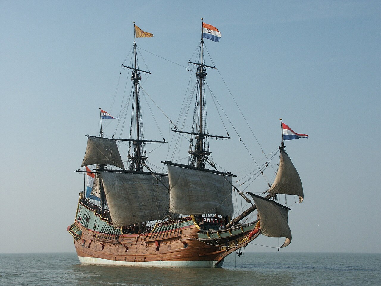
The Tryall (also spelled Triall, Tryal and Trial) set sail from Plymouth on Sept. 4, 1621. She was a British East Indiaman, a mercantile vessel built to travel between England and the Global Southeast, then called the East Indies.
Owned by the British East India Company, her generous hold was filled with textiles, silver, and supplies bound for Batavia -- present-day Jakarta, Indonesia. This was to be her maiden voyage, and an inspection by EIC officials at the docks found her in good condition.
Her Captain was John Brookes. The other key man aboard was Thomas Bright, the EIC's representative, or "factor" for the voyage. One hundred and forty-three seamen rounded out the crew, and after a brief pay dispute, they sailed for the Cape of Good Hope.
This stage of the journey went fine. They arrived at the tip of Africa, took on fresh supplies, and set off for Batavia on March 19. By a new, dangerous route.
Another way to India
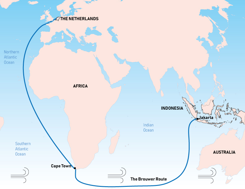
At the turn of the 17th century, the standard route from Cape Town to Batavia came from 15th-century Portuguese explorers, who used the seasonal monsoon winds to cross the Indian Ocean. It took about 12 months.
The Dutch decided that if they were going to steal the spice trade from Portugal, they had to do better than that. So Hendrik Brouwer took an alternative way in 1611. It became known as the Brouwer route.
The new route cut travel time in half by ducking down into the Roaring Forties and using their strong westerly winds to cross the Indian Ocean. The key was the timing of that northeast turn. Too early, and you'd end up in the middle of the Indian Ocean. Too late, and you'd crash into Australia.
They didn't know that yet, though. A few Dutch explorers had sighted some islands off the Australian mainland, but no one suspected a whole continent might be in the way.
The problem with that all-important turn is that, at the time, there was no good way to determine longitude at sea. Ships would have to make the turn using dead reckoning, which is a fancy nautical term for "guessing." In 1620, the British EIC decided to copy the Dutch and sent Captain Humphrey Fitzherbert to test the route.
He had a great time and gave it a thumbs-up, so they gave Captain Brookes a copy of Fitzherbert's journal and told him to do the same thing.
The wreck of the Tryall
Brookes was nervous about the new route. In Cape Town, he met Captain Bickell, another EIC Captain. He asked Bickell if he could borrow one of his experienced mates to help navigate, and Bickell gave him permission. But Bickell's ship, the Charles, was on its way home, and none of her mates were willing to delay their return to help.
Brookes had to sail on, with only the 1620 journal and imperfect charts as a guide. The Tryall descended to 39 degrees latitude, and the Roaring Forties drove them east.
On May 1, they spotted land. They had just become the first Englishmen to see Australia. Brookes and Bright both describe a great island, because from their perspective, a pair of points made the coast look like an island. Brookes turned north for the run up to Java, but was kept in place by contrary winds. Finally, on May 24, he was able to head north.
The next day, late in the evening, in calm seas, the Tryall struck rocks. Brookes ran up on deck, giving orders to tack west, hoping to dislodge her. A strong, brisk wind began to blow as water flooded into the ship, the sharp rocks tearing her timbers apart. It was too late, Brookes realized, to save her. He "made all ye meanes I could to save my life and as manie of my compa[ny] as I could."
He launched the ship's two boats. Ten, including Brookes, climbed into the skiff, while 36, including Thomas Bright, piled into the pinnace. Less than six hours after striking rocks, the fore-part of the Tryall broke up. Ninety-seven died.

Brookes' story
Brookes' skiff launched first. With him were nine sailors and a cabin boy, who would definitely be eaten first if it came to cannibalism. They had several cases of spirits and kegs of water, but only four pounds of bread. They landed briefly on a low island, now known to be Barrow Island, then set off again.
On July 5, they arrived in Batavia, and Brookes sent his report to his EIC superiors. Fitzherbert must have overlooked the land they sighted on May 1, he explained. "He went 10 leagues to ye Southwardes of this iland," Brookes asserted, before making the northeast by east turn. Brookes said that after sighting this land, he also made a northeast by east turn.
That Fitzherbert had missed the rocks was pure chance; his ships had sailed right past destruction without realizing it. The wreck of the Tryall could have happened to anyone. The EIC agreed. So they gave him another ship, the Little Rose, to explore the area around Sumatra. When he got back, they put him in charge of the Moone.
The wreck of the Moone
Brookes was taking the Moone back to England with a few other EIC vessels. But the Moone was wrecked off the coast of Dover, and with her went £55,000 worth of cargo, about $14,000,000 today. John Brookes and the ship's master, Churchman, began accusing each other of misconduct, and the EIC threw them into prison.
In court, Brookes made multiple lengthy speeches protesting his innocence. He also stressed, once again, that the Tryall wreck was not his fault. Regarding the Moone, Brookes blamed the ship's poor condition, calling it worm-infested and half rotten.
Witnesses, however, testified that he had discussed deliberately sinking the ship back in Cape Town. He was accused of deliberately sinking the ship in an elaborate heist of the valuable cargo. In fact, when the wreck site was examined, most of the cargo was missing. Multiple eyewitnesses also claimed Brookes had used the confusion of the sinking to break open and pilfer a chest of jewels.
The court case dragged on for years before finally being settled out of court. While he was never convicted, Brookes had lost all of his money and reputation. But with all the back and forth about stolen diamonds and the Moone, his claims about the Tryall went unchallenged. There was one man, however, willing to challenge John Brookes: Thomas Bright.

Bright's story
In a series of letters, Thomas Bright gave his side of the story. The fact that they'd hit the rocks at all, he claimed, was due to Brookes not keeping a proper lookout. Once the ship was struck, he described Brookes rushing to provision his own boat. He even personally betrayed Bright ("like a Judasse") by promising to take him, then launching the skiff while Bright wasn't looking. The skiff then made straight for Java without waiting to see what became of everyone else.
The pinnace, or longboat, launched an hour and a half after the skiff, with 36 men aboard. They had a couple of pounds of bread, some bottles of wine, and a single barrel of water. The sea was too rough to do anything but keep in sight of the crumpling ship, weathering the waves, until morning. In daylight, they made for a nearby island.
They spent a week on a low, uninhabited island, now known as North West Island. There, they repaired the pinnace and tried to stock up on provisions for the journey ahead. Bright kept himself busy drawing maps and charts of the surrounding area, becoming the first Englishman to map parts of Australia.
The pinnace successfully reached Java in late July. Bright was furious at Brookes and the lies he had been spreading. He wrote detailed letters and drew maps and charts laying out Brookes' deception -- but they went unheeded, and then were lost.
The search for the Trial Rocks
Both the British and Dutch East India Companies (referred to as EIC and VOC, respectively) were concerned that their trade route had secret, deadly rocks somewhere along it. Brookes advised the company to avoid going too far south, theoretically avoiding the Trial Rocks but also reducing speed.
In 1636, the VOC sent a pair of ships under Gerrit Tomaszoon Pool. His instructions included "trying in passing to touch at the Trials," to gather information about their exact location. But he didn't find them.
As the years went on, sailors and mapmakers alike were confused as to where the rocks were and whether they existed. By 1705, the Commodore of the Dutch Ships reportedly didn't believe they were real, at least not in the position Brookes had indicated.
By the late 18th century, even the story's origins were hazy. A 1780 directory of the East Indies claimed that the Trial Rocks were "discovered by a Dutch ship in 1719."
In 1803, English Captain Matthew Flinders took many soundings in the area on his way back from Timor. He spent weeks searching for the rocks despite the fact that illness was rampant aboard ship.
Finally, he concluded that "the Trial Rocks do not lie in the space comprehended between the latitudes 20° 15' and 21° South, and the longitudes 103° 25' and 106° 30' East." Thus concluded, they set sail, hoping to get better food for the sick, as "the diarrhoea on board was gaining ground."
His hard-won findings convinced the British Admiralty, which declared the Trial Rocks nonexistent.

The (re)finding of the Trial Rocks
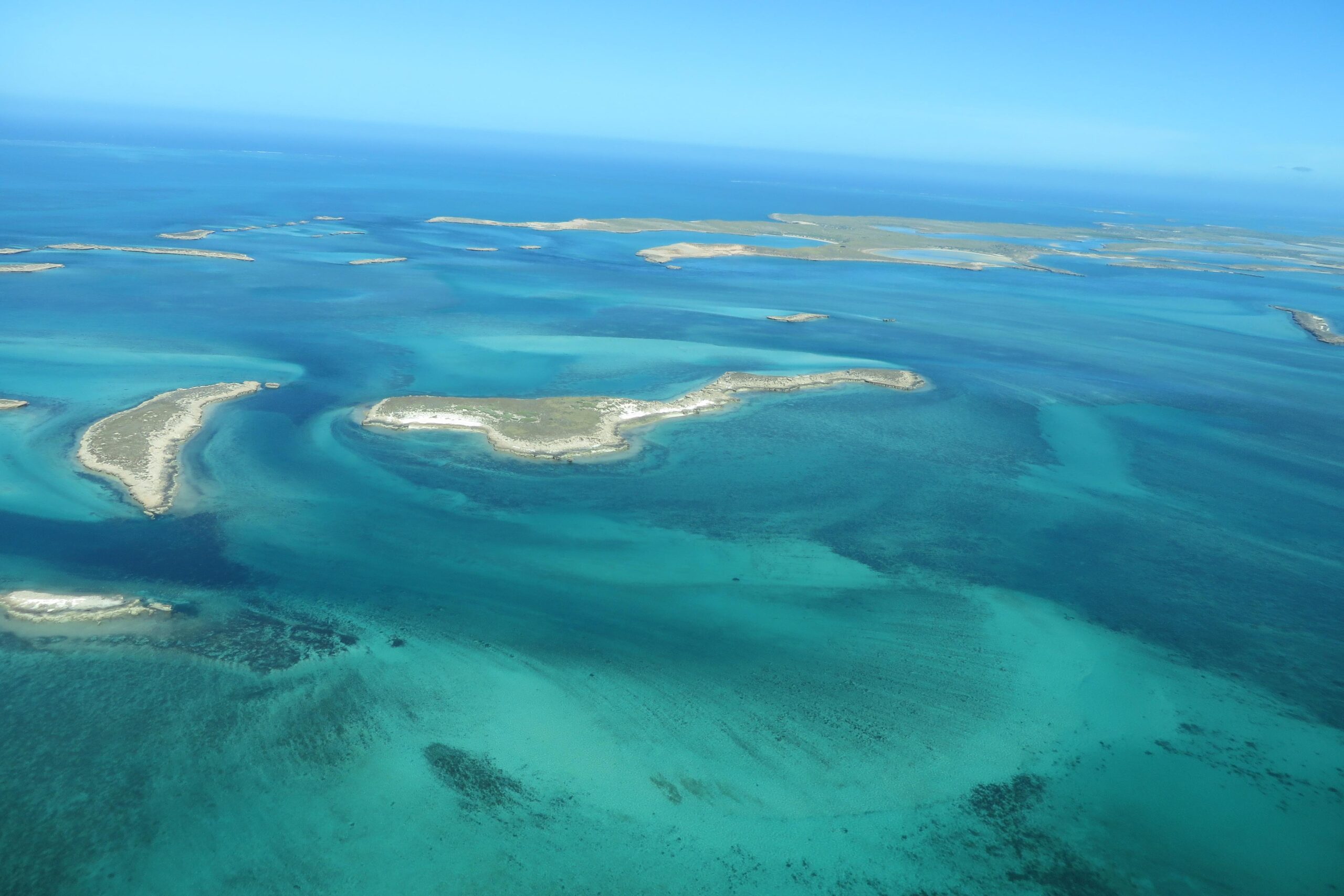
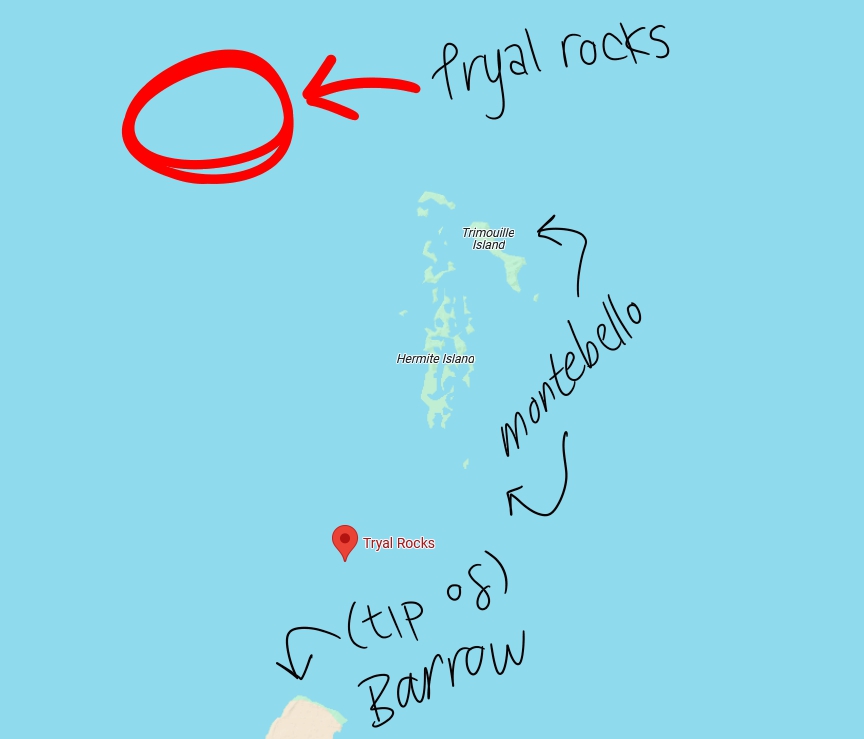
Today, we know that the Trial Rocks lie just off the Montebello Island group, off the coast of Western Australia. The definitive identification of the Trial Rocks came in fits and starts, being repeatedly made and then forgotten.
In 1818, the Greyhound had a run-in with the rocks, managing to avoid being sunk through luck and good spotting. As she was captained by one Thomas Richie, the rocks became known as Richie's Reef. Two years later, another brig passed through the area and had a look-see.
Aboard was Lt. Phillip Parker King, who recorded his belief that the Trial Rocks were, in fact, located around the area of Barrow Island and the Montebello Islands. The next Admiralty chart placed Richie's Reef to the northwest of Montebello, and a second, separate set of Trial Rocks between Montebello and Barrow. They were only wrong by 42 kilometers, which was at least an improvement.
Enter Australian historian Ida Lee. She uncovered the letters by Bright and Brookes and consulted Rupert Gould. Before he became really into the Loch Ness monster, Gould was a member of the Hydrographer's Department at the Admiralty, a respected expert on cartography and naval history.
He replied confidently: Richie's Reef was the Trial Rocks, and Captain Brookes had intentionally deceived everyone about where the rocks lay.

Captain Brookes' great deception
Have you ever really messed up at work? I mean really, really messed up? Imagine if you messed up so bad that nearly a hundred people had died and a huge ship full of valuable trade goods had been lost. Would you lie about it? Be honest.
The truth was that the rocks hadn't been anywhere along the Brouwer route. Brookes had gone too far east, overshooting his turn so badly that they'd sailed right into the coast of Australia. Realizing he went too far, Brookes then headed directly north, instead of northeast, running into the Trial Rocks.
When it came time to write his account, he claimed to have turned earlier and been headed northeast. He told the same lie about the skiff journey, claiming to have traveled northeast instead of east. If he had actually traveled northeast from the Trial Rocks, he would've missed Java entirely.
Brookes had lied about where the rocks were to disguise his mistake, claiming they were hundreds of kilometers west of their actual position. This was not an innocent deception. As the men who died on the Tryall could tell you, knowing where hidden rocks lay was a matter of life and death.
Bright had tried to get the real story out in his letter. But that had been lost to the depths of the archives until Ida Lee. In 1934, Lee published her article, and henceforth, the rocks were placed in the correct location. Except, apparently, on Google Maps, which inexplicably gives the pre-1934 location.
The Tryall gets blown up
No one actually went looking for the wreck until the late 1960s. Two men from a group called the Underwater Explorers Club, John MacPherson and Eric Christiansen, got Gould's report from the Admiralty Hydrographic Office. A few years later, Christiansen led a small party of divers to the wreck site. For our purposes, the most important member of this group was Alan Robinson.
They dove at the Trial Rocks in May 1969. On the southwestern side of the rocks, they found an old anchor, then another, and then cannons — it was a wreck site. They reported the find to the Western Australia Museum and collected a finder's fee equivalent to about $18,500.
The WA Museum organized an expedition, but poor weather prevented them from doing much diving. In 1971, they came back with more funding, but when they dove down to the site, they found it had been vandalized -- with explosives. The reef itself was damaged, along with some of the cannons and anchors, and the various smaller artifacts one would expect around the site were nowhere to be found.
The suspected culprit was Alan Robinson. A notorious figure in Australian maritime archaeology, Robinson was a treasure-hunter who frequently came into conflict with the laws around salvage and cultural artifacts. He was acquitted of the charges regarding the Tryall site, but we'll probably never know the truth.
Robinson died in jail while awaiting trial for attempting to murder his ex-wife, so was unable to confess about using blasting gelatin on Australia's first shipwreck.

An active archaeological site
Several more expeditions visited the damaged wreck site. Like many of the most famous Australian shipwrecks, any write-up of work on the Tryall site must mention the contributions of Dr. Jeremy Green. Green wrote the book on maritime archaeology, and by the discovery of the Tryall, had already led the investigations of the Batavia and Vergulde Draeck.
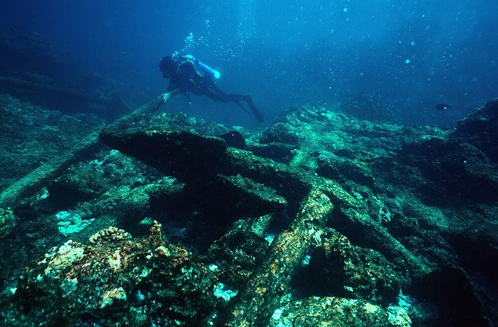
It was Green who led the 1971 dives and who gave the first tentative identification of the wreck as that of the Tryall. Because of all the missing artifacts, it's difficult to say beyond a shadow of a doubt that the ship found on Trial Rocks is really the Tryall. In addition to the location, Green used the cannons and anchors to confirm that they were looking at the remains of an English merchant ship from the early 17th century.

Subsequent dives have provided further evidence that this is, in fact, the Tryall, such as the makeup of the ballast stones. The most recent expedition took place in 2021, where they confirmed that there were no other wrecks in the area. Since we know that the Tryall wrecked there, and there is only one wreck, it must be the Tryall. After centuries of doubt, we finally have certainty.
The Western Australia Museum recently completed the restoration of one of Tryall's cannons, which is now on display in the museum.
Dani Arnold, Alexander Huber, and Simon Gietl have opened a difficult, 1,300m route on the east face of Jirishanca, in Peru's Huayhuash range, that may be one of the most significant climbs of 2025. The trio completed the 31-pitch climb in a single, alpine-style push between July 13-15.
Hummingbird's heartbeat
Gietl of Italy, Huber of Germany, and Arnold of Switzerland made two bivouacs on the wall and reached the east summit (6,028m, according to their GPS) at 9:15 am on July 15, the third day of the climb. They explained that climbers no longer attempt Jirishanca's main summit because of very poor snow conditions and high objective risk.
They named their route Kolibri, a translation of Jirishanca into German. Jirishanca means "hummingbird" in the Quechua language. According to author Jeremy Frimer, the name of the peak might refer to the spiky summit, likening it to the beak of a hummingbird. Climbers' heart rates might also mirror a hummingbird's when looking at the vertiginous southeast side of the mountain.
Great conditions
The Huayuash range is special. It is the only limestone range in the world with peaks surpassing 5,000m.
"The quality of the limestone is unique: solid, rough, and grippy," the team said. "We found a beautiful and logical line on the best rock. The conditions on the wall were ideal, and the teamwork was perfect."
Route report
We asked the climbers for details of a climb they described as "steep, technically demanding, and combining alpine seriousness with classic line selection."
Here is a complete report by Simon Gietl, and some notes added by Alex Huber.
The route begins on the lower part of the wall with slabby, sometimes overhanging passages that are often difficult to belay. This is dominated by technically demanding pitches with runouts in places that must be free-climbed up to grade 8 and occasional technical passages up to A2.
The middle section of the new route first follows the striking ice ramp of the Italian route, and then follows a direct line of cracks and intersections in the upper part of the wall, until it reaches the steep east ridge -- and the route of the first ascenders (Egger/Jungmair, 1957).
Serious endeavor
The climbers have estimated the route's difficulty at 8 (UIAA grade), A2. They assess the climb as a serious endeavor that demands high technical standards and alpine experience.
"The route is characterized by clear, elegant lines, excellent rock, and a varied wall structure. There is highly demanding wall climbing in the lower part, followed by classic crack climbing on the upper part of the wall up to the east ridge on snow and ice. Wedges, Friends, and micro-cams are essential."
The team was delighted with the climb. "For us, this line is one of our greatest first ascents, a gift from Mother Nature," Gietl told ExplorersWeb.
Between historical routes
In 1957, Jirishanca was the last 6,000'er to be summited in the Huayhuash range. Since then, it has attracted some of the best climbers in the world.
"Kolibri runs between the French and Italian routes," the team noted. "In the central section, we decided to follow the Italian route for three pitches (the Italian Ramp) before returning to the direct pillar between the French and the Italian route."
After the second bivouac, on their way to the summit on July 15, Arnold, Gietl, and Huber followed Tony Egger and Siegfried Jungmair's route, which was used during the peak's first ascent.
The 1957 team deemed the southeast face impossible and instead followed the peak's east spur, in heavy expedition style. Their route is now called the Austrian route. Egger died 18 months after climbing Jirishanca, on Patagonia's Cerro Torre.
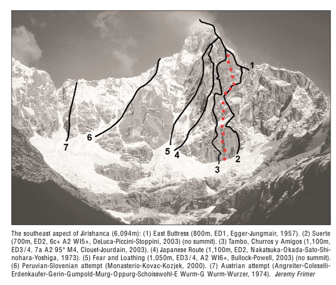
The French Route (actually called Tambo, Churros y Amigos) was the second line opened on Jirishanca from the east. Clouet and Jourdain climbed the peak in 2003 -- not in alpine style but without using bolts, which was quite a feat at the time on such a difficult face -- progressing up the main pillar on the southeast face.
Also in 2003, Italians Stefano DeLuca, Paolo Stoppini, and Alessandro Piccini climbed the Italian Route. They placed nearly 40 bolts on the wall and stopped where their route joined the Egger/Jungmair route, calling the incomplete route Suerte (luck). The complete route was finally free-climbed in 2022 by two Americans: Josh Wharton and Vince Anderson. They made the summit in three days without bolts. You can read their report here.
You can read Frimer's article in the American Alpine Journal about the climbing history of Jirishanca here.
A 63-year-old speleologist has been rescued from the Abisso Paperino cave system in northern Italy after suffering a head injury approximately 40m below the surface. The incident occurred on Sunday when falling rocks struck the man while he was in the cave with team members.
Specialist emergency responders, including a medical team, reached the injured caver the same day. He received treatment inside a specially installed heated tent within the cave. While the severity of the head injury remains unclear, the man was unable to exit the cave system without assistance.
Inside Italy’s Abisso Paperino cave system
The Abisso Paperino cave system in northern Italy reaches depths of up to 154m and is approximately 1,700m long. Accessible via a dirt road, the cave begins with a 28m vertical shaft that opens into a complex labyrinth of underground galleries, shafts, and winding sections. Notable features within the system include the Cavallo Orazio chamber, the central Pozzo Vertigine shaft, and a series of fossil galleries and water-filled siphons, making it an interesting site for speleologists and cavers.
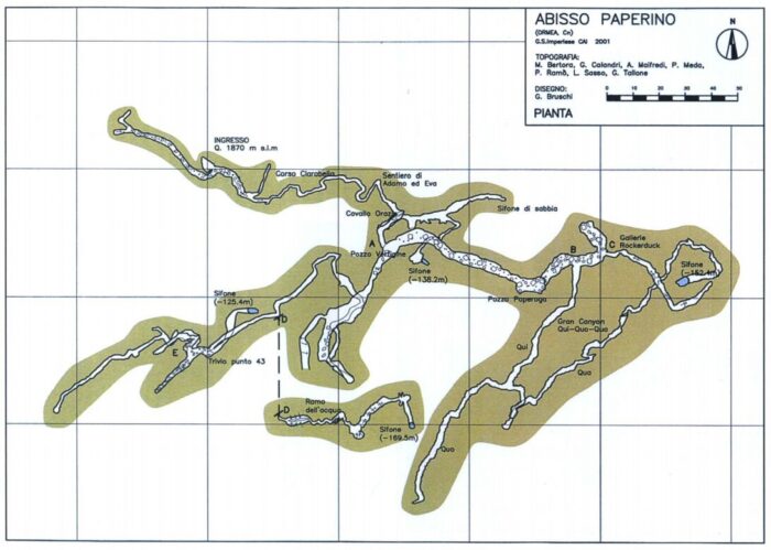
To extract the injured man from the Abisso Paperino cave system, rescue teams used controlled explosive charges to widen three critical passages. This allowed members of the Italian National Alpine and Speleological Rescue Corps to safely transport the man back to the surface through the narrow, challenging terrain.
The injured speleologist’s ascent to the surface on Monday involved climbing through two vertical shafts, each approximately 15m high. Rescuers also had to navigate a complex maze of tight, winding cave passages to complete the operation successfully.
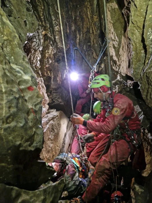
On May 28, Max Kilcoyne stood alone above 6,000m. Below him, clouds swirled over the Kahiltna Glacier. Above him, only the upper ridgeline of McKinley and the summit of Mount Foraker pierced the darkening skies. His hands were cold, his phone had just died, and he was alone. But he clicked into his skis and dropped in anyway.
Kilcoyne had just graduated from the University of Colorado Boulder, and now eight days later, he was nearly 5,000km north on the flanks of North America’s highest peak, solo skiing the Orient Express, a 1,000m couloir that slices straight off Mt. McKinley's upper slopes at angles that touch 50°.
"I don’t have many pictures from this day as I was by myself and my phone died, but I’ll have the memories of that ski forever," said the young American ski mountaineer.
What followed was a series of ski mountaineering linkups. Over 24 days on the mountain, Kilcoyne soloed and skied the Orient Express, climbed and skied down the Messner Couloir, and then climbed the legendary Cassin Ridge, skiing back down Rescue Gully.
In between, there were other forays high on the mountain. He skied nearly every day of the trip, 21 out of 24, and completed the Cassin just a week after finishing the Messner.
A grind to 14,000 Camp
Kilcoyne arrived in Talkeetna on May 18 with American mountain athletes Anna DeMonte and Jack Kuenzle. The goal was for Kilcoyne to support DeMonte and Kuenzle on a fastest known time (FKT) attempt on McKinley, and then, if all went well, climb the Cassin Ridge. After weather delays grounded the many climbers waiting to fly out to the Kahiltna Glacier, Kilcoyne’s team finally flew on May 21 when the clouds broke.

"The rangers really enjoyed the extra-large bottle of tequila we had given to them the day before," Kilcoyne joked when asked what may have earned them a seat on the flight out of town.
The next three days were spent dragging heavy sleds up the Kahiltna Glacier to 14,000 Camp, which sits at 4,300m on a plateau below the upper slopes of the mountain. "Any amount of incline with that much weight just feels like death," said Kilcoyne.
The three-strong team arrived at 14,000 Camp on May 23. That same week, DeMonte and Kuenzle made an early push toward Denali Pass at 5,500m to get some mileage in. Kilcoyne, feeling tired, stayed behind and dug out the cook tent.
Orient Express Couloir (May 28)
On a day when DeMonte and Kuenzle stayed in their tents, Kilcoyne headed up Orient Express Couloir solo. With no fixed lines, no partner, and no certainty about the conditions above, he pushed through deep snow and low visibility, booting into the white void above. By 5,400m, he was out of food. The wind picked up, and he walked backwards up the hill to protect his face.
Still, he kept climbing. At 6,140m -- just 45m shy of the summit -- he decided to stop. The wind chill temperature had dropped, and he knew he needed working fingers to take off his crampons and clip into his skis. He also planned to summit multiple times later in the season.
What followed was a descent in perfect conditions, skiing steep powder, without another soul on the route. "One of the most euphoric skis of my life," he said. "I got back to camp at 8 pm and couldn’t stop shivering all night but was stoked out of my mind."
Messner Couloir (June 6)
DeMonte and Kuenzle’s speed record attempt ended on May 29 when DeMonte was injured in a fall while skiing at 4,900m. A week later, Kilcoyne joined Wesley Perkins and Emmett Itoi to attempt the Messner Couloir, a direct line that drops 1,500m from just below McKinley’s summit. No one had skied it yet that season.

The trio climbed the couloir from 14,000 Camp to 5,900m, where Itoi decided to wait, leaving Kilcoyne and Perkins to summit in strong winds. On the way back, they rejoined Itoi and skied back down the Couloir. The snow was stable, and visibility was excellent. "All of 14,000 Camp was watching us as we opened it for the season," Kilcoyne said.

"We picked the most notable features from a photo, and then I got to make the first turns down. It felt committing, not really knowing where you are on such a big face, but it couldn’t have gone better."
Cassin Ridge and Rescue Gully (June 13)
Kilcoyne had long set his sights on the Cassin Ridge. "The Cassin meant the most to me by far. That has been a priority for me for the last two years, and it was amazing to see it come to fruition."
He and Perkins teamed up again and left 14,000 Camp on June 10, skied the Seattle Ramp to access the base of the route, and climbed light and fast. Night one was spent on a narrow ice ledge. Night two was spent tied to an ice screw on a ledge barely wide enough for one person. One of Kilcoyne’s food bags for the next day tumbled off into the void.
"The hardest thing about the linkup of the Cassin and Rescue Gully was probably just how remote you are and how hard it is to manage your gear in those temperatures. I brought three pairs of gloves, and by the end of day one, all of them were completely soaked and frozen solid. Your ski boots get wet and then freeze; pretty much everything gets wet at some point and then freezes solid. Climbing through some of the cruxes with skis on our backs was also quite difficult," Kilcoyne noted.

The route tested their mixed climbing skills, with M4/M5 terrain in places, simul-climbing with skis on their backs, and trail breaking in deep snow. On June 13 in the evening, they topped out on the Kahiltna Horn and skied around 1,800m back to 14,000 Camp via Rescue Gully.
"We topped out Kahiltna Horn at 8:33 pm, put on all our layers, put skis on, and ripped down as fast as possible. Neither of us had any interest in going the last 150 feet on the ridge to the true summit."
A skier had died on Rescue Gully in an avalanche a few days beforehand, and the pair were understandably apprehensive about skiing the gully when fatigued. Regardless, they managed the descent without any issues.
A successful first trip
The trip was not without hardship. DeMonte suffered a bad leg injury and had to be evacuated by helicopter. Kuenzle left to assist her. That left Kilcoyne alone, adapting to new partners and plans. But the mountains had more to offer, and he kept skiing.
"I can’t speak to how rare it is to do what I did this season on Denali as I am new to the Alaska scene," he says, before adding he saw "no one else ticking multiple ski lines on Denali this year."
For Kilcoyne, this first trip to McKinley brought together the many alpine tools he has built over time. From trail running and ski mountaineering as a kid in Boulder, to mixed climbing all winter to prepare for McKinley’s alpine terrain, it all came together in one highly productive season.
Anxiety gnaws at climbers on K2 and Broad Peak; conditions are still bad, rope-fixing work is seriously delayed, and the season is approaching its end.
This means that, for another year, there will be little or no chance to space out summit pushes. Instead, everyone on the mountain will probably go up at the same time. Fortunately, there are not that many climbers this year.
No-oxygen climbers may need to make some hard choices, particularly if the summit push timing finds them short of acclimatization.
Why the delay?
These days, the normal Abruzzi Spur route on K2 is climbed in commercial style, and Nepalese Sherpas complete the rope-fixing work, hired by international expeditions. The Sherpas are usually supported by Pakistani climbers. This year, bad conditions -- rain, snow, high winds, and rockfall -- have delayed the work.

Mingma David Sherpa, leader of the Elite Exped team, reported that he was stuck in Camp 1 for three days last week. He had stopped there because, contrary to the weather forecasts, there were storms and high winds on the mountain every afternoon. He reached as far as Camp 2 before retreating to Base Camp.
Last weekend, Mingma G and his Imagine Nepal team linked up with Madison Mountaineering's Sherpa staff and managed to get a little higher. "We fixed the rope to 7,200m, crossing the rocky section below Camp 3. Next will be the summit push on K2, depending on weather conditions."
Summit push or return home
The question is whether a summit push is a sensible option for those climbers who need more acclimatization.
"We could discuss why the damned ropes have not been fixed yet, but that is not going to solve the problem," wrote Serge Hardy of France, one of those who planned to climb without oxygen, but using the ropes and trails.
Hardy reported that he has done two trips to 7,000m (probably to the end of the ropes) across the Black Pyramid. "The fact remains that without at least one night at Camp 3 (7,300m) and a descent to recover, it's going to be pretty tough to even consider an ascent without oxygen," Hardy concluded.
Late July push
"Base Camp has split into two: those who leave and those who stay," Hardy said.
Madison Mountaineering reported a warm, sunny day in K2 Base Camp on Tuesday, but clouds are gathering again, and the forecasts show more bad weather coming. Lukasz Supergan (currently on neighboring Broad Peak) recently wrote that the next possible weather window is not expected until July 27-30.
As for Hardy, he's among those ready to stay. "If the prospect of a last-ditch push looms, while treading carefully on loose rocks and putting my brain into 'avalanche detector' mode, I'll give it a try," he said. "It's a question of principles...because that's what we're here for."
We are waiting for news about other K2 climbers planning no-oxygen ascents, such as Israfil Ashurli of Azerbaijan and Csaba Varga of Hungary.
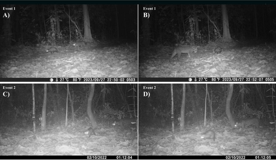
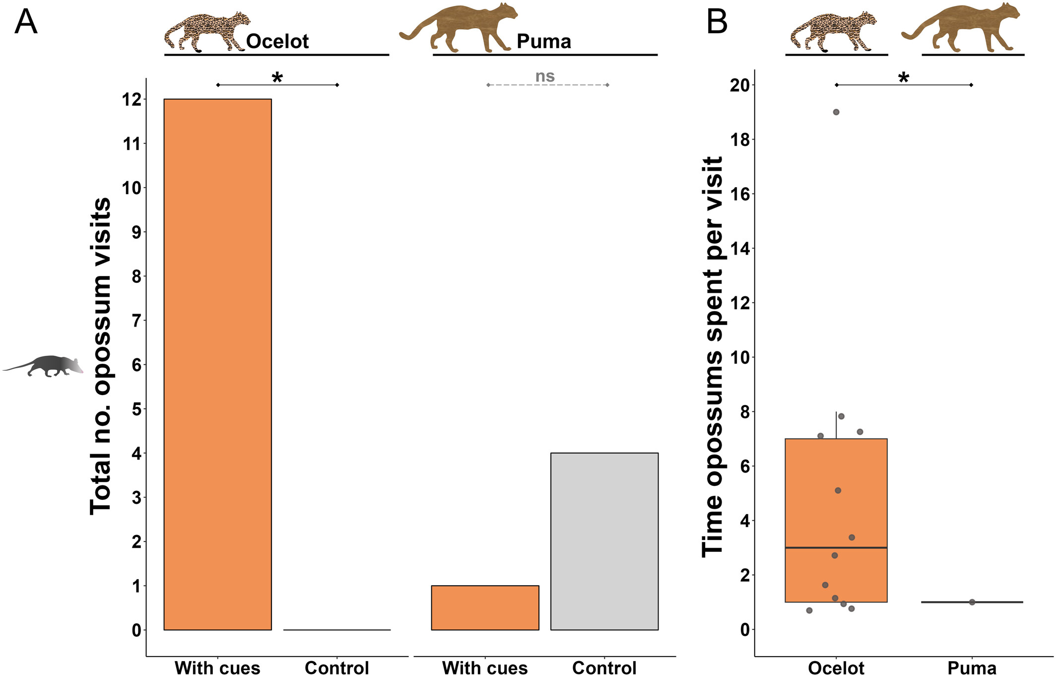
Camera traps in the jungles of Peru have captured footage of ocelots and opossums traveling together. We have at least four confirmed cases of the two animals walking in tandem, seeming to be perfectly aware and comfortable with the other's presence. The pairs were never more than two meters apart, moving at a leisurely pace. Their body language is relaxed, the opossum never attempting its famous "play dead" manoeuvre.
Experts believe that these aren't isolated incidents, but a pattern of behavior. A group of ecologists and researchers released a new study speculating on what that behavior could mean.
Sniff test
Before they developed formal theories, the researchers needed to collect more data. Ocelots might seek out opossums to hunt them, but would opossums actively seek out ocelots?
To find out, they set up camera traps with 'ocelot cues' -- items which gave off the scent of an ocelot, usually a strip of fabric -- and waited. Opossums showed up and even interacted with the ocelot cues, sniffing, biting, or rubbing themselves on the fabric. Opossums visited the ocelot-scented cameras far more often than control cameras.
To confirm that it was specifically ocelots that the little marsupials were interested in, they repeated the experiment. Using control and puma (cougar, catamount, mountain lion) scented traps, they observed that the opossums preferred the control, apparently disdaining the company of puma.
Both animals are solitary within their species, yet the ocelot and opossum don't just fall in together, but actively seek each other out. The question remains, why?
Much we don't know
Mutual partnerships between species are not rare and form when both sides have something to offer the other. Coyotes and badgers sometimes partner up to hunt burrowing prey. Their different adaptations and hunting strategies complement each other -- the coyote handles the chasing, and the badger handles the digging.
One theory is that the ocelot and opossum partnerships work much the same way. Opossums often feed on snakes and are even immune to viper venom, like the eponymous hero of Rudyard Kipling's short story Rikki-Tikki-Tavi. Perhaps the pairs team up to hunt serpents.
The researchers also speculate that moving as a pair may be a sort of camouflage. By moving with the notoriously odoriferous opossum, the ocelot could hide its scent, making it easier to stalk prey. Moving with the ocelot, the opossum would be safer from pumas and jaguars.
Ultimately, we don't know if one, both, or neither of these theories is correct. The study concludes with a call for more research, and a reflection on what this find reminds us: "how limited our understanding remains of the complex dynamics among tropical rainforest species."
Italians Dario Eynard, David Bacci, Giacomo Meliffi, and Enrico Bittelli are off to open a new route in Canada's Cirque of the Unclimbables. This cluster of remote, vertical granite walls is, in the words of Pat Goodman for the American Alpine Journal, actually very climbable. The walls offer excellent rock, incredible atmosphere, several levels of difficulty, and near-endless potential new lines for those who don't mind a long trip and isolation.

Cirque of the Unclimbables, Canada. Photo: Dario Eynard
An adventurous return
After the climb, the Italians will paddle down the Nahanni River for roughly 500km in packrafts. They are carrying the inflatable boats folded into their backpacks.
This ingenious means of transportation is an increasingly popular choice for exploratory climbing expeditions to remote areas. Packrafts are light, portable, sturdy, easy to navigate, and eco-friendly, as the boats are human-powered.
It is not clear exactly how the climbers will reach the MacKenzie Mountains, roughly 500km west of the city of Yellowknife in Canada's Northwest Territories. Usually, climbing teams charter an aircraft from Whitehorse to Glacier Lake and then hike for around seven hours.

The team during a packraft training session. Photo: Dario Eynard
A pure approach
A 1995 expedition to the area by Stefan Glowacz, Kurt Albert, Gerd Heidorn, and Leo Reitzner inspired the Italian team. The 1995 German expedition had opted for a "purer" approach to the massif, without the use of aircraft. They combined paddling in canoes with hiking sections. Here is a summary of that expedition published by the American Alpine Journal:
"[The team] parked their rental car at Flat Lakes, near the Tungsten Mine in Yukon Territory, then paddled canoes down the Little and South Nahanni rivers to the confluence of Brintnell Creek for approximately 80 miles [129km], before setting off on another 13 miles [21km] of rugged foot travel. Their exit strategy would be to follow the overland path back to the South Nahanni River, where they would paddle another 250 miles [402km] to reach the Liard River. While in the Cirque, they established Fitzcarraldo (V 5.12b) on the north pillar of Mt. Harrison Smith, thus becoming the first group of modern climbers to eschew air support to open a big-wall route in the Cirque of the Unclimbables. Yet their loads included many pounds of bolts -- they placed 50 on the 16-pitch route."
Like the inverse of the mythical butterfly flapping its wings in China, an ice core extracted from Greenland can reveal the rise and fall of societies in European antiquity. A new study took ice cores from the Greenlandic ice sheet and used them to measure the output of lead pollution in Europe. The varying levels of lead pollution corresponded with technological and societal changes.

A global record
Ice sheets are laid down over time in layers of compacted snow. A bit like tree rings, the conditions during their formation are preserved in the layer.
By taking an ice core, scientists are effectively looking at a timeline of climate conditions over thousands of years. Air temperature, greenhouse gases, pollen levels, and chemical concentrations are printed in the layers.
This latest research is a collaborative effort between several universities and climate research organizations. The ice cores in question come from the North Greenland Ice Core Project, or NorthGRIP. NorthGRIP drilled from surface to bedrock in northern Greenland. While NorthGRIP finished drilling in 2004, the wealth of data it offers is still largely unexplored. Led by Joseph R. McConnell of the Desert Research Institute, researchers recently turned to lead levels.
When we imagine ancient coins, many of us imagine gold, but silver was far more common in most premodern coinage systems. Premodern silver smelting produced a lot of lead pollution, and archaeologists can measure ancient economic productivity through lead levels -- more lead, more coins, more activity.
What your lead poisoning says about you
Wind blows European lead emissions to Greenland, where they freeze in ice. Previous studies worked from limited samples; by using the NorthGRIP ice cores, researchers were finally able to construct a complete record of classical emissions.
The first jump in lead levels came around 1000 BCE, when the Phoenicians began expanding into the Mediterranean. Emissions continued through the founding of the Roman kingdom and then the Republic. Levels spiked again when both the Romans and Carthaginians colonized Spain and began mining silver intensively there.
Both Punic Wars saw short-term declines, as the campaigning in Spain pulled workers away from the mines and to the battlefields. They bounced back quickly as Rome took Spain and began minting Roman silver coins in Carthaginian mines.
Researchers can chart the whole of Roman history in this way. Wars and political crises lead to dips, and with new conquered territory, mining ramped back up. The peak was the Pax Romana, following the ascendance of Augustus née Octavian.

Putting Edward Gibbon out of a job, the ice cores also document the decline and fall of the empire. "The great Antonine Plague struck the Roman Empire in 165 AD and lasted at least 15 years. The high lead emissions of the Pax Romana ended exactly at that time and didn’t recover until the early Middle Ages, more than 500 years later," explained coauthor Andrew Wilson, of Oxford.
We’ve all heard of El Dorado. The fabled lost city in South America, built of solid gold and ruled by a king so rich that he was covered head to toe in gold dust, has burrowed itself into the mind of many explorers since the 16th century. Ship captains, conquistadors, soldiers, and mapmakers dared the treacherous jungles in search of it, but to no avail. In the late 1500s, treasure hunters turned their attention to a mythical body of water, supposedly near El Dorado or even the lake upon which it was built, Lake Parime became their next fixation.
Deconstructing the myth
Before we get to Lake Parime, let us deconstruct the El Dorado myth. Where did the story come from? The name El Dorado did not originally refer to a city; the name comes from Spanish explorers and translates into "the golden one." The golden one was supposedly a man completely covered in gold, obscenely rich, or a powerful leader.
Rumours of gold had been circulating amongst explorers since at least 1529. The early expeditions of German conquistadors Ambrosius Dalfinger and Nikolaus Federmann recorded their encounters with tribes in the interiors of Venezuela who possessed plenty of gold and precious jewels. In 1534, Spanish conquistador Sebastián de Belalcázar mentioned an encounter with a mysterious man dressed in gold ornaments or armour. He called him "el indio dorado" or "golden Indian."
However, most historians trace the story of El Dorado to 1541, when a Spanish chronicler and soldier named Gonzalo Fernández de Oviedo y Valdés wrote about a king who conducted a sacred ritual in a lake near Quito, Ecuador. Oviedo said:
They tell me that what they have learned from the Indians is that a great lord or prince goes about continually covered in gold dust as fine as ground salt. He feels that it would be less beautiful to wear any other ornament...he washes away at night what he puts on each morning, so that it is discarded and lost, and he does this every day of the year.
Further information came from the writings of Juan de Castellanos, a conquistador who became a priest. In the 1570s, he wrote Elegías de varones ilustres de Indias, and identified the king as a cacique or zipa (leader) of the Muisca, a culture that resided in the Altiplano Cundiboyacense region of the Colombian Andes. Castellanos said that the lake in which this leader cleansed himself was Lake Guatavitá, 57km northeast of Bogotá.
The king cleansed himself in the sacred waters, and the villagefolk would toss in an array of gold pieces, jewels, and other treasures as an additional offering to their gods. Today, a depiction of the ceremony is captured in the Muisca Raft, an intricate golden object that the Muisca cast between 1295 and 1410 AD, which now resides in the Museum of Gold in Bogotá, Colombia.
As the Spanish continued to descend upon the continent, it was not long before they caught wind of this incredible story. Conquistadors searched the lake but only found a handful of gold pieces. In 1541, Gonzalo Pizarro (brother of famed conquistador Francisco Pizarro) set out with a large expeditionary force of 4,000 natives and over 300 conquistadors in search of El Dorado. However, he failed miserably, and they returned empty-handed.
Over time, El Dorado was used interchangeably to describe a city, a king, or the lake.
Sir Walter Raleigh and Lake Parime
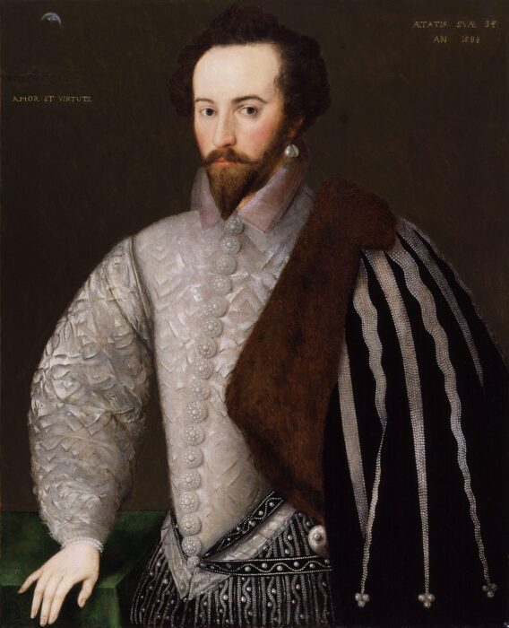
Sir Walter Raleigh searched for El Dorado up the Orinoco River in the 1590s. He had heard about El Dorado from the former governor of Trinidad, Antonio de Berrío, whom he captured when he landed on the island. Berrío had searched for El Dorado but failed.
According to Raleigh, during his exploration of Guiana, he heard about the city of Manoa and natives laden with gold:
I have been assured by such of the Spaniards as have seen Manoa, the imperial city of Guiana, which the Spaniards call El Dorado, that for the greatness, for the riches, and for the excellent seat, it far exceeded any of the world, at least of so much of the world as is known to the Spanish nation. It is founded upon a lake of salt water of 200 leagues long, like unto Mare Caspium.
I asked the manner how the Epuremei wrought those plates of gold, and how they could melt it out of the stone; he told me that the most of the gold which they made in plates and images was not seuered from the stone, but that on the lake of Manoa, and in a multitude of other rivers they gathered it in grains of perfect gold and in pieces as big as small stones.
One of Raleigh's colleagues, Lawrence Kemys, was the first to write about Lake Parime:
...afterwards they return for their canoes, and bear them likewise to the side of a lake, which the Iaos call Roponowini, the Charibes, Parime: which is of such bigness, that they know no difference between it and the main sea.
Kemys placed Lake Parime near the Essequibo River. As a result of these writings, some cartographers placed El Dorado and Lake Parime in Guyana. In the 17th century, English cartographer Robert Morden published Geography rectified; or, a description of the world, stating that:
The country about the Lake Parime, in the middle of Guyana, acknowledge, by report, a successor of Guainacapa of the House of Incas of Peru, and compose the true Kingdom of the Golden King.

Theories
Expeditions in subsequent years began to shed light on why explorers couldn’t pin down the lake’s location. An expedition led by Alexander von Humboldt found that no such lake exists, leading him to believe the "lake" was the result of the Rupununi Savannah flooding during the rainy season. The Rupununi floods every year from May to August. English naturalist Charles Waterton supported this explanation after natives told him that Lake Parime did not exist.
Fast forward to the 1970s, and explorer Roland Stevenson hoped to put the matter to rest. His travels took him to Roraima rather than Rupununi. He learned of a sacred road called "Nhamini-u" that featured numerous Inca petroglyphs and artefacts. His exploration of the road led him to the supposed water line of an ancient lake. He believed the lake disappeared and drained into the larger Rio Branco because of tectonic activity in the area. Scientists determined that it was possible that a lake formed there during the Paleozoic era.
It seems likely that early explorers, after witnessing local rituals, overestimated how much gold the native cultures possessed. Additionally, locals may have led the conquistadors on a wild goose chase, mixing fact and fiction.
The Madison Mountaineering team has announced a summit push as their team leaves Base Camp on Broad Peak. However, they have not provided even a tentative summit date, given the unclear weather forecasts and delayed rope-fixing work.
This year, Madison Mountaineering is focusing most of its efforts on K2, and has just one client, supported by a Sherpa team, on Broad Peak. Earlier today, the client and their Sherpas departed for Camp 2 and plan to reach Camp 3 tomorrow, weather permitting.
No-O2 climbers
Lukasz Supergan of Poland, climbing without supplementary oxygen, is on the opposite timeline: he reached Camp 3 last weekend and returned to Base Camp yesterday. According to the forecasts he is using, weather conditions will remain bad for the next few days. "There is a possible window from July 27 to July 30," he noted.

Lukasz Supergan on Broad Peak. Photo: Lukasz Supergan
Vibeke Sefland of Norway, also without oxygen, followed a similar itinerary on her second (and final) rotation before the summit push. On Sunday, she reached Camp 2 at 6,100m in "wet, slidy snow." Yesterday, she continued toward Camp 3 and then retreated to Base Camp.
Laura Mares of Romania also spent a night in Camp 2 last weekend, reached Camp 3 the following morning, and returned to Base Camp when bad weather settled on the mountain again.
Teams on Broad Peak and K2 are reporting poor weather, though it is not too cold. Rains are frequent this year at Base Camp.
No ropes on the ridge
It is also worth bearing in mind the state of the ropes. Karakorum Expeditions has a team on the mountain, carrying ropes to fix the final sections, and mending some anchors between Camp 1 and Camp 3 that have become loose over the last two weeks of bad weather.

A rope-fixer with Karakorum Expeditions on Broad Peak. Photo: Karakorum Expeditions
Karakorum Expeditions say they have repaired the route up to Camp 3. At approximately 7,000m, it is usually the uppermost camp set on Broad Peak. They have also stocked bottles of oxygen there.
However, there is still a long way to the summit. The route goes up from Camp 3 to a big col, and then follows a very long ridge across several ups and downs and secondary points, until it reaches the main summit. Commercial teams need most of these final sections to be fixed with ropes. Otherwise, they can get stuck, as happened in 2021 with tragic results.
Karakorum Expeditions also plan to start their summit push this week, after one or two days' rest in Base Camp. With them is Sabrina Filzmoser, supported by Zaman Karim. According to the team's latest update on Sunday, they were in Camp 3.
Last month, Canadian adventurers Dave Greene and Gaia Aish completed a 1,725km bike and canoe journey from the British Columbia border to the shores of the Arctic Ocean over 30 days.
The pair started on May 22 from the border of British Columbia and the vast Yukon Territory. To begin, they pedalled around 100km to a small settlement by the Yukon River, where they picked up their pre-stashed Canoes. "It was a good little break into the trip. A little gear shake down, if you will," Greene explained.
From here, Greene and Aish set out on a 746km canoe leg along the river, where they faced no major rapids or portages, but low water levels and snow melt made the journey challenging. As a result, they spent long hours in the boat, with paddling sessions stretching to 12 hours a day.
"We managed to cover significant distance by doing that; we were paddling 60, 70, sometimes 80km in a day," Greene reflected.
Yukon delights
Despite the long days, Greene enjoyed the Yukon River: "It was an incredible part of the trip, maybe the most memorable part for us."
This may have partly been because the two Canadians were treated to a host of wildlife sightings, including both moose and bears with babies, lynx, sheep, wolves, and even a wolverine.

Greene and Aish carried their bikes in the canoe down the Yukon. When they eventually reached the end of the canoe leg in the historic gold rush town of Dawson City, they left their rented canoes with a company that returned them to the south.
At Dawson, the duo got back on their bikes. On June 12, they headed out onto the Dempster Highway, Canada’s only road north to the Arctic Ocean. The cycle north took twelve days, and the 940km they covered was hard earned.
Greene and Aish pedalled through a summer heatwave, prompting night rides to avoid the intense heat. The gravel road and dry climate made finding drinkable water difficult, as well as turning the ride into a dusty affair.
"The Dempster is a gravel road. So, being as hot as it was, it was also extremely dusty. We had dirt kicked into our faces, in our ears at all times," Greene said.
The Midnight Pedal Paddle Party
A benefit of riding this far north is the extended daylight hours, hence Greene dreaming up the expedition moniker, the "Midnight Pedal Paddle Party."
"We were north of the Arctic Circle for the majority of this bicycle ride, which means that the sun was not setting. So we had 24 hours of daylight, which, after a certain amount of time, one just gets used to. You get tired enough that you can just lie down and sleep, but it also allowed us to ride our bikes whenever we wanted," Greene explained.

To ease some of the weight burden while cycling, Greene and Aish turned to the Dawson City Visitors Center, which allows cyclists to leave food boxes for pickup by drivers heading to Eagle Plains Hotel, a pit-stop 500km into their route. Additionally, they had a friend in the Northwest Territories, so they met with them to collect another box of food. At most, they had to carry seven days of food at a time.
To the ocean
The final 150km from Inuvik to Tuktoyaktuk were the most demanding of the expedition, thanks to the freshly gravelled road.
"It was four to six inches of fresh gravel and we had to push our bikes up all of the hills, because it was simply unrideable," Greene recalls.

Their spirits picked up when they reached the Arctic Ocean and the community of Tuktoyaktuk on June 23, marking the end of their trip.
"Getting to the Arctic Ocean was quite the thrill. The community of Tuktoyaktuk is an Inuit community in Canada, and we happened to arrive the same day they were having their indigenous day, a territorial holiday," Greene said.
Naturally, the weary -- and no doubt sweat-encrusted -- cyclists celebrated by jumping into the Arctic Ocean.
Planetary scientists have published a detailed follow-up on the debris from their historic 2022 asteroid impact experiment in outer space. What they found challenges their understanding of the asteroid's behavior since the impact. Two tight clusters of boulders have veered off from the main zone of debris at very high velocities.
Those boulders have escaped the asteroid system and are now orbiting the Sun. It's unclear where on the asteroid they came from, why they're moving so differently from the rest of the debris, or what they mean for the long-term course of the asteroid.
A historic asteroid deflection test

In 2022, NASA live-streamed one of the most daring missions in its history. The Double Asteroid Redirection Test, or DART, sought to change the orbit of an asteroid by slamming into it with a spacecraft. The challenge was enormous. The size of the target asteroid -- named Dimorphos -- in the night sky is akin to a single atom held at arm's length.
The team behind DART knew they might be live-streaming their spacecraft missing the asteroid. But in an era of misinformation, conspiracy theories, and apocalyptic panic, they wanted the public to have transparency every step of the way.
Their gamble paid off. The DART spacecraft knocked smack into Dimorphos. NASA proved that in the event that a killer asteroid is heading towards Earth, we can knock it out of the way.
Strange boulders

DART was proof to the public that planetary scientists can keep them safe, but first and foremost, it was a scientific experiment. Simulating asteroid impacts on a computer doesn't compare to the real thing, especially when there are so many things about asteroids we don't know. They can be as chemically and topologically variable as terrestrial geology, and their tiny size makes observing them challenging.
So, to protect Earth from a hazardous asteroid, planetary scientists have mined every aspect of the DART mission for pieces of the puzzle. The new boulder tracking study, published this month in the Planetary Science Journal, uses images taken by an ESA spacecraft called LICIACube that accompanied DART.
The researchers found that two main groups of boulders veered off from Dimorphos in the minutes after impact. Many of them aren't following the main cloud of debris, and have such high velocities that they can escape the asteroid system.
The team's top theory is that these boulders are the fractured remnants of larger rock formations right next to the impact site. Since they were already loose, the spacecraft easily dislodged them before reducing them to smithereens.
Boulders mean orbital calculations might be off
None of these boulders is anywhere near large enough to threaten life on Earth. If they happened to head towards us, they would vaporize upon atmospheric entry, treating us to a spectacular meteor shower. But they are massive enough that, without accounting for them, planetary scientists may have been miscalculating Dimorphos' new orbit.
The theory of rubble and impacts has to catch up to the observations. How can we predict what kinds of debris will form from striking an asteroid? How much momentum do boulders account for? How do we figure out how boulder-prone an asteroid is before we get there? We need to understand all of this so we don't miscalculate how to strike an asteroid.
DART means that we get to figure this out now, rather than when the Earth is on the line.
Denis Urubko of Russia and Maria Cardell of Spain have finally shared details of their new route on Nanga Parbat.
The couple took it easy after climbing from the Diamir side; in a very Urubko-style move, they remained an extra week in Base Camp, enjoying the solitude of the mountain. It was only yesterday, as they returned to Skardu, that they checked their emails and shared details of their line.

Difficult, exposed, lonely
They opened their route between July 6 and July 10. It combined varied terrain, with ice, mixed rock, snow, and a crevassed glacier, Urubko told Mountain.ru. He explained that the route is technically difficult and exposed to avalanches and rockfall in some sections.
In addition, the climbers went up in far from ideal weather conditions, with storms every afternoon and winds as high as 90kmph.
"We didn't use other people's ropes or tracks," Urubko told Mouintain.ru. "There were no breakdowns, injuries, or illnesses."
Indeed, they were the only people on that side of the mountain and, when the climb took place, they were the only people anywhere on the mountain. This season, summits on the normal route (the Kinshoffer) occurred on July 3 and July 4. David Goettler of Germany and French climbers Tiphaine Duperier and Boris Langenstein summited from the Rupal side on June 24.
You can read Urubko and Cardell's full report on Mountain.ru in Russian.
Crossing previous lines
Shortly after Urubko published a topo of the route, some members of the climbing community shared comments on social media pointing to the similarity of the line to previously opened routes. In particular, some pointed out that the route seems to coincide with a line opened in 2009 by Gerfried Goeschl of Austria and Louis Rousseau of Canada.

Urubko did note in his report that their route intersects the Austrian-Canadian route at around 6,600-6,800m. "But [our route] continues along the ridge, while the other team went along the glacier," he explained.
Asked by ExplorersWeb, Cardell confirmed the information from Pakistan: "Our route does not step on the Goeschl/Rousseau route at any section; both lines cross, but then the Austrian-Canadian route continues along the glacier and our line follows the ridge," Cardell said.
Cardell noted that she spoke to Rousseau before the expedition, and the Canadian climber shared information about his 2009 expedition alongside Goeschl (who later perished while attempting winter Gasherbrum I). Therefore, Urubko and Cardell were well aware of the location of the 2009 route.
"For a person not familiar with the terrain, it may look like it is the same line, but the distance between both routes is wide; everything else is speculation," Cardell said.
Many teams have climbed Nanga Parbat from its Diamir side. Crossing and/or following small sections with previous lines doesn't make Urubko and Cardell's feat any less impressive.
Female first
The achievement is especially significant for Maria "Pipi" Cardell. She is a ski patroller by profession and a member of Spain's elite female alpinism team. According to Urubko, Cardell is the first female climber to summit an 8,000'er via a new route opened in alpine style.
Urubko and Cardell took turns to lead during the climb, and in some sections they simul-climbed (progressed roped up at the same time, without belaying one another).
"It is an elegant and logical line, technical to a point that took me to my physical and mental limits," Cardell wrote. "I am not euphoric after the achievement. On the contrary, I feel calm...all the past efforts fit like pieces of a puzzle. Our dream is complete."
A solid pair
Cardell was enthusiastic in her praise for Urubko. "It is surreal to see how confidently he climbs in extremely complex terrain at high altitude," she said. "His intuition is based on wide experience, and his ability to obsessively focus becomes our guarantee of survival. [Added to his] supernatural strength at 8,000m, this makes him unique."

"Denis [Urubko] and I have been climbing together for ten years," Cardell wrote on Instagram. "We have been working and training all this time to get ready and, someday, achieve this dream."
Together, they have opened new routes, alpine style, on Chapayev (in the Tien Shan) and Ushba (in the Caucasus). They attempted a new route on Gasherbrum II in 2019, but Cardell had to drop out after injuring her back. Urubko soloed the route, naming it "Honeymoon" in tribute to Cardell. They also attempted a new route on Gasherbrum I, but eventually climbed via the normal route because of bad conditions.
Through the years, Urubko has been a methodical and very tough coach for iron-willed Cardell. "It has been training and more training...drytooling, climbing, running to exhaustion, learning new techniques and adopting new habits, don't drink, cry often, feeling utterly happy at every little step ahead, hesitating until finally managing to believe in myself and, never, never surrendering," Cardell said.
Forget-me-not
The pair has named the new route Незабудка (Nezabudka), meaning "the unforgettable girl." It is the Russian name of a flower known in English as the forget-me-not or scorpion grass. Under the Latin scientific name Myosotis and with some 60 variants, it is a small mountain plant that grows delicate flowers, generally blue, soon after the snow melts in alpine ecosystems. It is the official flower of Alaska. The relatively low altitude of Nanga Parbat's lower slopes allows grass and flowers to grow in Base Camp, especially during this relatively warm season.
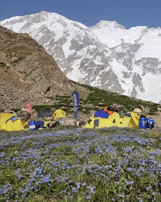
On July 19, two French climbers, a 25-year-old woman and a 56-year-old man, lost their lives on Mont Blanc in the Alps. The Peloton de Gendarmerie de Haute Montagne (PGHM) of Chamonix recovered their bodies from the base of 4,052m Aiguille de Bionnassay.
According to Aostasera, the climbers likely fell from the ridge of the Aiguille de Bionnassay, a technical route to Mont Blanc requiring significant experience. The search began Friday evening after family members, concerned by their failure to return, alerted authorities. The PGHM located the bodies on Saturday. Authorities have opened an investigation to determine the exact cause of the accident.
A deadly couple of years
This incident follows other recent fatalities in the Mont Blanc massif. On June 10, two climbers, a man and a woman in their 40s, were found dead below the Aiguille du Tricot on the Bionnassay Glacier, also likely from a fall.
On September 10 last year, two Italians and two South Koreans died of exhaustion after harsh weather stranded them near the summit of Mont Blanc. The next day, a 61-year-old Danish hiker fell 30m to his death near Saint-Gervais-les-Bains. On August 22, 2024, two Spanish climbers died in a rappelling accident on Mont Blanc du Tacul’s Gervasutti Couloir, and a 67-year-old climber fell into a crevasse on the Dome du Gouter.
Additionally, on July 13, 2025, a fatal accident occurred on the nearby 4,357m Dent Blanche in Switzerland’s Canton Valais, close to the Italian border. Two Austrian climbers, part of a group of five, fell on the mountain’s west face. A 46-year-old woman died, while her 46-year-old companion remains missing despite extensive search efforts complicated by adverse weather and rugged terrain, according to the Valais Cantonal Police.
Several teams summited Gasherbrum I on Sunday from 11 am local time. Some climbers reached the top without supplementary oxygen, as this peak has traditionally been climbed, while others used bottled gas.
According to reports, 8K Expeditions placed Pavlo Sydorenko of Ukraine and Magdalena Arcimowicz of Poland on top, supported by Migma Dorchi Sherpa and Pem Lakpa Sherpa. The Nepalese climbers did not use supplementary oxygen.
Seven Summit Treks reported that Marco Confortola of Italy summited without supplementary oxygen, but was supported by Pasang Ngima Sherpa and Lakpa Tashi.
Two climbers outfitted by Active Adventure Holidays summited without supplementary oxygen: Marie Saame of Estonia and Abid Baig from Hunza, Pakistan. Baig summited Nanga Parbat and Broad Peak last year.
Imagine Nepal also reported summits, including Sashko Kedev, who has become the first Macedonian climber to complete the 14x8,000'ers. Wang Zhong of China and Nepalese climbers Dawa Gyalje Sherpa and Ngima Nuru Sherpa also topped out.
Gasherbrum I (8,080m), also known as Hidden Peak, is the first Karakoram 8,000'er summited this year. The teams in place may attempt Gasherbrum II next.
K2's somber face
On K2 and Broad Peak, bad conditions have stopped any progress by the rope-fixing teams. Expedition leaders are starting to show some concern about the lack of remaining time and possible weather windows.
Last Friday, an avalanche hit a team of four climbers who were descending from Camp 2, killing one of them. Rescue teams could not save Iftekhair Hussain Sadpara, an experienced local climber who had previously summited K2 twice, Broad Peak, and Gasherbrum II. He leaves a wife, two daughters, and a son, Ali Saltoro of Alpine Adventure Guides Pakistan told ExplorersWeb.
Trango Towers
Conditions this year may be better at lower altitudes, such as on the rocky spires of the Karakoram. An Indonesian team will try their luck on Trango's Nameless Tower (6,239m). The six-member team, led by Iqbal Kamal Fasya, will climb the Eternal Flame route to celebrate the 80th anniversary of Indonesia's independence. They will reach Base Camp today.
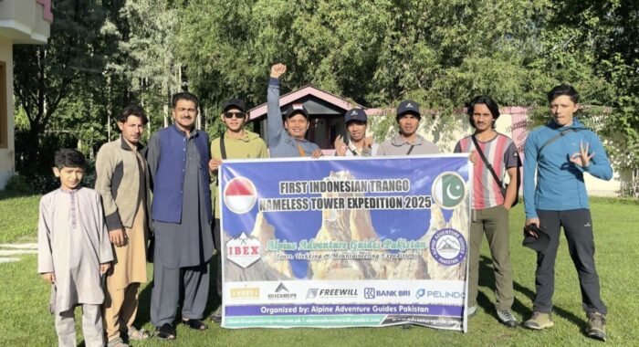
When we’re not outdoors, we get our adventure fix by exploring social media and the web. Here are some of the best adventure links we’ve discovered this week.
Soul Mountaineer -- In Conversation with Tamara Lunger: Italian alpinist Tamara Lunger started her journey in the mountains through ski mountaineering, eventually discovering her true calling in high-altitude climbing. She became the youngest woman to summit Lhotse and later reached the top of K2 without supplemental oxygen.
However, her path took a painful turn following the deaths of close climbing partners. Struggling with grief and searching for a new direction, she turned her focus to regeneration, realising she had never allowed herself the time or space to recover.
Does Hiking to Mount Everest Base Camp Make You Want to Reach the Summit?: Ben Ayers, Outside’s basecamp correspondent, explores whether trekking to Mount Everest Base Camp motivates you to attempt the summit. Drawing on his experience living in Nepal for over two decades, he reflects on how common it is for guided Base Camp hikers to feel inspired to climb -- and how guiding outfits leverage this connection by operating both trekking services and summit expeditions.
New Trails in the Middle East
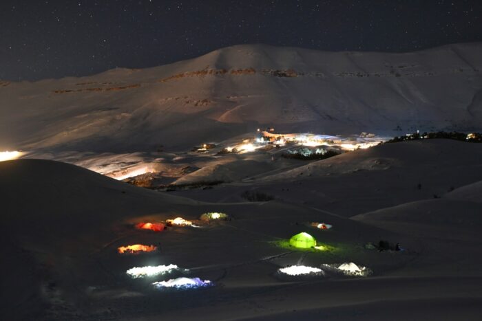
The Hiking Trails Reshaping Lebanese Tourism: Lebanon is developing a 400km network of hiking trails through the Anti-Lebanon and Mount Lebanon ranges to boost rural tourism and support local communities. Led by guide Gilbert Moukheiber, the Boukaat Loubnan Trails project connects around 50 villages, offering hikers cultural experiences, homestays, and local food. Despite challenges from regional instability, the trails aim to revive economies and promote sustainable tourism.
This Hiker Exploded a Can of Fuel Through the Ceiling, Don’t Make the Same Mistake:
Backpacker reports that using fuel transfer devices like FlipFuel to consolidate partially used isobutane canisters can save space. But mishandling, especially overheating or overfilling, can cause catastrophic explosions. Users share stories of canisters bursting after they have heated them in boiling water or on stoves, causing severe property damage and injury.
A Departing Legend
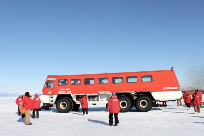
Photo: Eli Duke/CC BY-SA 2.0
The Bus, the Myth, the Legend: This podcast episode pays tribute to "Ivan," the iconic Terra Bus that has ferried researchers and workers between McMurdo Station’s airfield and base for over three decades in Antarctica. Hosts Dylan Thuras and Allegra Rosenberg explore its origins, as well as its distinctive physical presence: massive tires, a wood-paneled interior loaded with stickers, and bright orange-red paint. Drivers recount its quirks, such as the lengthy 30–60 minute engine warm-up, fogged windows, and leisurely 15–20mph pace.
As McMurdo modernised, Ivan symbolised a nostalgic link to Antarctica’s past, complete with songs and fond memories. Facing retirement because of parts shortages and cost, the bus was saved from the scrap heap by a grassroots campaign that relocated it to Christchurch for preservation.
Unpacking a Controversy
Inside the Salt Path controversy: This Guardian article examines the controversy surrounding Raynor Winn’s bestselling memoir The Salt Path, which chronicles a 1,000km walk along England’s coast. While recent investigative journalism questions elements of Winn’s story, this piece broadens its focus to explore how memoirs, especially those centered on transformative journeys like long-distance walking, often blur fact and narrative. It highlights the genre’s long history of embellishment and the lack of rigorous fact-checking, raising questions about truth, trust, and the responsibility of both writers and publishers.
A mountaineering dispute continues to simmer after climber Stephan Siegrist questioned a new speed record set by Nicolas Hojac and Philipp Brugger. Brugger and Hojac had climbed the north faces of the Eiger, Mönch, and Jungfrau in Switzerland’s Bernese Oberland in April 2025.
The controversy then expanded, with some questioning Siegrist's 2004 record with Ueli Steck. The argument raises issues about transparency, ethics, and route choices. The dispute was explained earlier this month by Swiss climbing magazine Lacrux and German mountaineering magazine Bergsteigen.
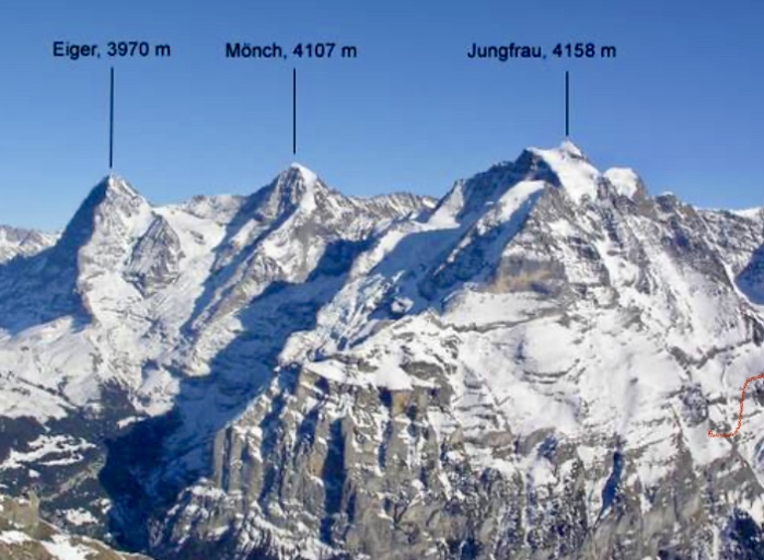
The issue
In April 2025, Swiss climber Nicolas Hojac and Austrian Philipp Brugger set a speed record by climbing the north faces of Eiger, Mönch, and Jungfrau in 15 hours and 30 minutes. They surpassed the 2004 record set by Swiss climbers Ueli Steck and Stephan Siegrist by 9 hours and 30 minutes.

Hojac and Brugger praised Steck and Siegrist for their pioneering effort, but Siegrist argued their record wasn’t comparable. He alleged that Hojac and Brugger paused timing during breaks and chose a different route on the Jungfrau: the Lauper Route. According to Siegrist, the Lauper Route is not a "true" north face route, unlike the Ypsilon Couloir Route he took in 2004. He contacted their shared sponsor, who filmed the project, demanding an honest report and a correction to the press release.
Hojac and Brugger, stunned by the accusations, countered with transparency, providing GPS tracks, videos, and photos to prove they followed the classic routes Steck and Siegrist reported in 2004, including the Lauper Route on the Jungfrau. They had consulted Siegrist before their climb, relying on his documented route descriptions.

Controversy shifts
The controversy shifted dramatically when Hojac and Brugger discovered that Siegrist had retroactively changed details about his 2004 climb on his website this spring. Siegrist now claimed that he and Steck climbed Jungfrau’s Ypsilon Couloir (rated EX -- extremely difficult) instead of the Lauper Route. Previously, Siegrist had stated that they climbed the Lauper Route in his book, on his website, and in a pre-climb phone call with Hojac. The book, published years earlier, still lists the Lauper Route and cannot be altered, exposing Siegrist’s inconsistency.
Siegrist also recently admitted that he and Steck were aided by a 50m rope, lowered by two other climbers, to exit the Jungfrau. This detail remained hidden for 21 years.
This external assistance, deemed unethical in speed climbing, could disqualify their record because unaided ascents are standard for such feats. Hojac labeled this hidden information a "fraud."

Hojac argued Siegrist’s criticisms stemmed from jealousy. The sponsor urged a private resolution, but the public dispute revealed Siegrist’s alterations and reinforced Hojac and Brugger’s credibility.
The three North Face routes
The Bernese North Face Trilogy involves climbing the north faces of three iconic peaks: 3,967m Eiger, 4,107m Mönch, and 4,158m Jungfrau. Each presents unique challenges.

The Heckmair Route on Eiger’s North Face is a 1,800m climb on mixed terrain. It was first ascended from July 21-24, 1938, by Anderl Heckmair, Ludwig Vörg, Heinrich Harrer, and Fritz Kasparek. It is graded ED2 (extremely difficult two) in the alpine grading system, UIAA V-, and features ice climbing sections up to 70°. This route has challenging sections like the Hinterstoisser Traverse, Ice Hose, and Death Bivouac. Both duos, Siegrist-Steck and Hojac-Brugger, used this route.
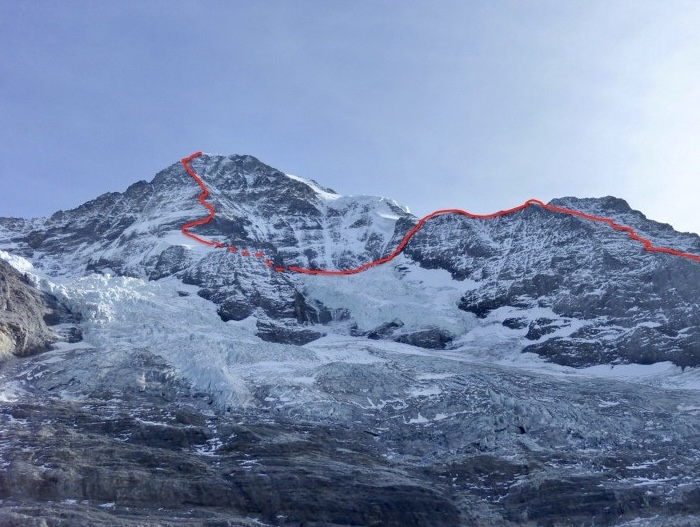
The Lauper Route on Mönch’s North Face involves steep snow and ice. Both teams followed this route, which was first ascended on July 23, 1921, by Hans Lauper and Max Liniger. This line, also known as the North Face Rib or Nordwandrippe, is a challenging mixed climb graded TD (very difficult) that follows a prominent rib dividing Mönch’s North Face.
The recent dispute centers on the Jungfrau. Hojac and Brugger climbed the Lauper Route, documented by Steck and Siegrist in 2004. The Lauper Route was first ascended in 1934 by Hans Lauper and Alfred Zurcher. Although less difficult than the Eiger’s Heckmair Route, it involves steep terrain and a challenging exit. It’s graded around D (difficult) or higher, depending on conditions.
This spring, Siegrist claimed that he and Steck had taken the Ypsilon Couloir and not the Lauper Route. The Ypsilon Couloir was first ascended in 2001 by Siegrist and Ralph Weber, and its exit is rated EX (extremely difficult).

The Eiger, Mönch, and Jungfrau remain alpine benchmarks, but this controversy underscores the need for clear speed-climbing rules to ensure fair records. The trilogy dispute mirrors broader mountaineering debates, such as unscrutinized 8,000m peak records involving time, Sherpa support, or supplemental oxygen.
You can watch a documentary about Hojac and Brugger's climb called The Fast Line here. Subtitles in different languages are available.

A new film, Everest Revisited: 1924–2024, invites viewers to look beyond the headlines to consider what Everest has come to mean, both in the past and the present. The film, which was publicly released earlier this week, won the Jury Special Mention Award at the 2024 Kraków Mountain Festival and was runner-up for the Audience Choice Award at the 2024 London Mountain Film Festival.
The 41-minute documentary, produced in association with the Alpine Club and the Mount Everest Foundation, weaves together archival footage with analysis and reflection from some of the UK's leading Everest enthusiasts.
Narrated compellingly by mountaineer Matt Sharman and anchored by the personal connection of Sandy Irvine’s great-niece, Julie Summers, Everest Revisited is less a dramatic retelling of Everest history and more a reflective journey through the mountain’s cultural and spiritual legacy.
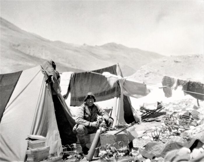
At the heart of the documentary are the expeditions of the 1920s, with particular focus on the ill-fated 1924 attempt by George Mallory and Sandy Irvine. With contributions from mountaineers and historians such as Rebecca Stephens, Leo Houlding, Stephen Venables, Chris Bonington, Krish Thapa, and Melanie Windridge, the film explores how these early attempts were shaped as much by imperial ambition and scientific curiosity as they were by the challenge of climbing itself.
A critical examination
Rather than idealise the past, the film examines it critically. It acknowledges the hierarchy embedded in British imperial attitudes, particularly toward the Sherpas and high-altitude porters who made these expeditions possible. The film highlights the essential, and often overlooked, contributions of figures like Karma Paul and Gyalzen Kazi, who bridged very different cultures. Porters like Paul and Kazi quite literally carried early Everest expeditions forward.
Everest Revisited also looks forward. Blending stories from climbers like former Gurkha Krish Thapa, who helped double-amputee Hari Budha Magar summit Everest in 2023, the film draws links between notions of historic heroism and modern questions of easy access and motivations. Despite the growing queues on Everest’s slopes and its increasingly commercial reputation, writer and climber Ed Douglas suggests that modern climbers may not be too dissimilar to those of the past.
"We tend to think that Everest is kind of somehow more complicated, more cynical, and less illustrious than it used to be. I think we need to look back at these expeditions with a more honest eye, because these are not simple, heroic people. These are people with the same motivations and the same, you know, concerns and the same complexities we have. They weren't always honourable. They weren't always perfect," Douglas reflected.
Emphasizing the unknown
Visually, the film integrates modern and archival footage of Himalayan landscapes with impactful interviews and primary artifacts, such as photos and equipment from early expeditions.
Rather than offering a final verdict on Mallory and Irvine’s fate, the film leaves room for mystery. It emphasizes the unknown. As climber Leo Houlding poignantly tells Irvine's great-niece Julie Summers, "I hope we never find your great uncle and I hope we don't find the camera. I hope that the mystery endures for another century."
Everest Revisited is a film about more than just mountaineering. It’s about memory and the shifting values we project onto the world's highest mountain. The documentary will intrigue climbers, historians, and anyone drawn in by the enduring allure of the world's highest mountain.
High-altitude worker Iftikhar Hussain of Pakistan lost his life on K2 yesterday in an avalanche that caught a four-member group while they descended from Camp 1 to Base Camp.
The slide took place at around 12:30, local time, on Friday. The avalanche hit Hussain, Dawa Finjo Sherpa and Dawa Geljen Sherpa from Nepal, and high-altitude porter Niaz Ali from Skardu, Dawn reported. They are all members of the Mountain Professionals team.
It is not clear whether the accident involved rockfall, a snow avalanche, or a combination of both.
No other teams affected
A ground rescue team was immediately dispatched from Base Camp to help the climbers. Sadly, there was nothing the rescue team could do to save Hussain's life. The other three team members were able to descend under their own power.
Ryan Waters, CEO of Mountain Professionals, confirmed the news to ExplorersWeb:
Hussain, one of the porters supporting our team, who was contracted through a local partner, tragically lost his life. We are deeply saddened by this loss, and our thoughts are with his family and the local climbing community in Pakistan.
Our international guide and clients were at Base Camp at the time of the incident and are all safe. Some of our support team members were higher on the route. Everyone from our team, including climbing Sherpas, has returned to Base Camp and is accounted for.
As this situation is still developing, we are continuing to gather accurate information from our team. We understand there is wide interest and will be able to share more once we have confirmed details and have connected with all the appropriate parties.
A helicopter will airlift Hussain's remains from Base Camp to his home in Sadpara village.
Climbers going up
Bad weather has kept K2 teams stalled for most of this week, but a slight improvement on Friday and optimistic forecasts encouraged many climbers to go up to Camp 2.
Staff members need to fix ropes and set Camp 3, and climbers without supplemental oxygen, such as Israfil Ashurli of Azerbajan (who, according to his tracker, is at camp 2), Santiago Quintero of Ecuador, Serge Hardy of France, and Csaba Varga of Hungary, need to acclimatize as high as possible if they want a summit chance.
Lakpa Sherpa of 8K Expeditions told ExplorersWeb that his team is moving toward Camp 3.
A group of young people from several Native American groups has completed a month-long journey down the Klamath River. The journey commemorates the removal of four dams, leaving much of the river to flow freely for the first time in a century.
Years in the making
Indigenous activists had been fighting for decades by the time the Klamath Basin Restoration Agreement was signed in 2010. The agreement promised to remove the four hydroelectric dams on the Klamath River. In November of 2022, federal approval finally came through for the dam removals.
The first and smallest, Copco No. 2 Dam, was removed in 2023, 98 years after it was built. In 2024, the other three dams -- Iron Gate Dam, Copco No.1 Dam, and JC Boyle -- were removed as well.
Paddle Tribal Waters, a nonprofit program teaching kayak and river advocacy to Indigenous youth from all along the Klamath basin, launched in July 2022. After years of training, 43 young kayakers ranging from 13 to 20 set out on June 12 from the Southern Oregon headwaters. There are still two dams remaining, near the headwaters, which they had to portage around.
The journey took them through canyons with rapids as well as across the choppy Agency Lake and through the dam removal sites. Those who had clearance tackled class 3, 4, and 5 rapids, while others chose to take those sections by raft.
In the last few days, even more young people joined. Youth from indigenous communities in the United States, Chile, Bolivia, and New Zealand took to the water. By July 11, a veritable flotilla, 110 strong, approached the mouth of the river. There, friends, family, and community members waited to welcome them.

A historic return
Now that the river flows freely, the ecosystem is beginning to repair itself. Important species like salmon, steelhead, and lamprey can now access over 600km of historic spawning habitat. The drained reservoirs no longer cause massive algae blooms, so the water quality is increasing and the temperature is decreasing. The speed of the river's recovery is a heartening surprise, even to its staunchest advocates.
"We were hopeful that within a couple of years, we would see salmon return to Southern Oregon. It took the salmon two weeks," said Dave Coffman, in a conversation with CNN. Coffman is the director of northern California and southern Oregon for Resource Environmental Solutions, which is working to restore the Klamath.
Klamath fish populations are a vital resource for Indigenous people along the basin, primarily the Klamath, Shasta, Karuk, Hoopa Valley, and Yurok peoples. But though salmon can now return, they return to a very different habitat. Industrial farming has reshaped and polluted the Klamath, and the federal government has frozen much of the funding for restoration.
The trip wasn't just a celebration, but a commitment to continue the fight. "It’s not just a river trip and it’s not just a descent to us," said Hupa tribal member and Yurok descendant Danielle Frank, a participant who gave a speech at the celebration. "We promise that we will do whatever is necessary to protect our free-flowing river."
Thomas Huber, Jon Griffin, and Tad McCrea are back in Pakistan for another summer climb in the impressive Latok massif. This time, they have set their sights on Latok III.
The team started the approach trek to the Choktoi Glacier yesterday, outfitter Shipton Treks & Tours said.
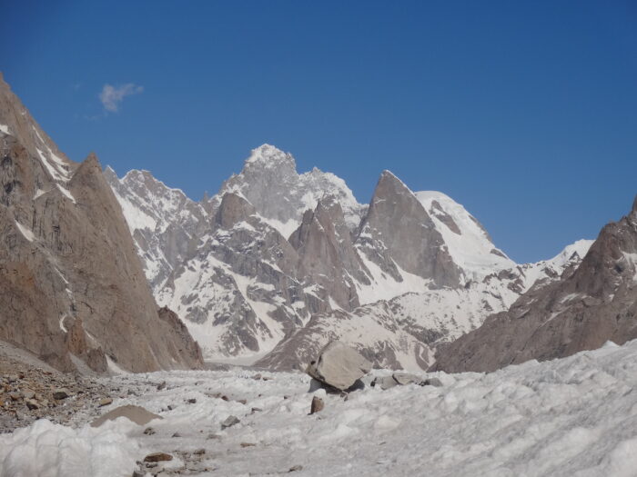
Favorite playground
For Thomas Huber of Germany, the Karakoram's Choktoi Glacier and the ragged spires surrounding it are special. Here, he has achieved some of his most spectacular ascents: Latok IV (6,459m) with his brother Alex in 1999, and Latok II (7,108m) in 1997 with Conrad Anker and Toni Gutsch. Huber also climbed the neighboring Ogre and Ogre III in 2001.
Choktoi is also home to a major unfinished project: linking the north face and north ridge to the summit of Latok I, a line that has never been completely climbed. Huber has attempted it several times, including last year with McCrea and Griffin.
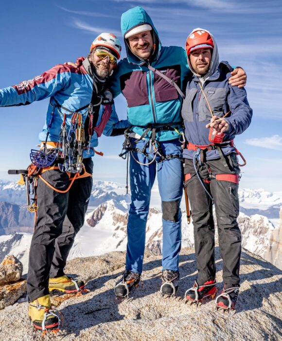
This time, Huber is back with the same partners, but a different goal: the unsummitted southeast pillar of Latok III (6,949m).
The team was awarded a cutting-edge grant to attempt the climb.
The international team of astrophysicists behind the world's three gravitational wave detectors just submitted a paper analyzing a uniquely strong gravitational wave from 2023. Caused by merging black holes, this gravitational wave is unusual for more than just its strength. The team's best models suggest that at least one, if not both, of the black holes shouldn't exist.
The black hole "mass gap"
Most large black holes are created when massive stars jettison their outer layers. The iron core, no longer supported against gravity, collapses in on itself and forms a black hole. But this kind of supernova only works for stars up to about 130 times the mass of the Sun.
Above that, astronomers theorize that a new type of supernova takes over. The light the star generates in its core doesn't manage to exit the star itself. Instead, many of the photons are so energetic that they create extra particles when they hit atoms at the right angle. That means that the pressure of light holding up the star vanishes. With its only defense against gravity gone, the star begins to collapse, triggering a massive thermonuclear explosion that vaporizes it entirely. Nothing remains, not even a black hole.

Astronomers have yet to confirm this kind of "pair instability supernova" actually exists, although simulations suggest it does. There are also several candidate pair instability supernovae observations, but further study is needed to confirm them. On balance, though, pair instability supernovae are a well-supported theory of stellar evolution. They imply that stars can't create black holes above 64 times the mass of the Sun and below about 130 times the mass of the Sun. After that, a new kind of supernova takes over and can produce black holes once more.
But the best models of the 2023 gravitational wave predict two black holes of 103 and 137 times the mass of the sun. The error bars on these measurements are sizable, but still place the lighter black hole firmly in the mass gap, while the heavier one is either in or above it.
These are also the heaviest reliable black hole measurements to come out of the LIGO collaboration.
Spinning black holes create gravitational waves
Gravitational waves occur when massive objects accelerate, rippling spacetime in their path. Black holes spinning together in the final moments before their collision create the most powerful gravitational waves.
Earth-bound systems of lasers, able to detect changes in distance of only 1/10,000th the size of a proton, go after this class. The Laser Interferometer Gravitational-Wave Observatory (LIGO) detected its first gravitational wave in 2015, finally confirming their existence.

The many possibilities for formation
The research team found one other clue to the history of this strange black hole system. Each of the black holes is spinning much faster than usual. Any explanation for how this system formed has to explain that as well.
It's possible that there are toggles on stellar evolution, such as exact nuclear reaction rates at high densities, that change the range of the mass gap. But that doesn't explain the high spin rates. The theory of two stars combining to create each black hole has the same issue.
One explanation that accounts for the spin rates is that one or both of the black holes are the remnants of previous black hole mergers, rather than a collapsing star. Although this requires exotic star cluster conditions, the universe is filled with those. (The research team favors this explanation.)
The colliding objects could also be primordial black holes, a predicted population of black holes formed during the dense stages of the early universe. Primordial black holes don't have any mass gaps, but they are also far more theoretical than pair instability supernovae.
In 2035, the European Space Agency plans to launch the Laser Interferometer Space Antenna, or LISA. LISA will probe a different regime of gravitational waves from the Earth-based detectors like LIGO. In doing so, it will add a host of strange new black holes to the canon.

The forecast promises better weather, but climbers cannot afford to fully trust predictions that have failed often over the last two weeks. Despite this, climbers are cautiously ascending with summit hopes on Gasherbrum I and Broad Peak.
Fortunately, the skies have cleared enough for rescue services to airlift Waldemar Kowalewski to the hospital after a few agonizing days waiting in Base Camp with a broken leg.
Gasherbrum I
"The Gasherbrum I team climbed to Camp 2 today, planning to go further up and hoping for a summit chance," Sakhawat Hussain of Summit Karakoram said. "The weather seems to be OK between July 19 and July 22, but conditions are proving unpredictable. We can only hope for the best."

Broad Peak
On Broad Peak, everyone is still in Base Camp, but a significant number of climbers will move up tomorrow, toward Camp 2. The plan is to go to Camp 3 if the avalanche risk is acceptable, and then wait there until the weather allows a summit push. As mentioned in previous updates, there are no ropes from Camp 3, so the guides will have to fix the route as they move along the long summit ridge.
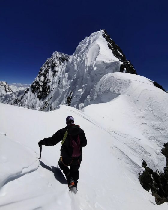
Kowalewski Airlifted
A helicopter has finally airlifted Waldemar Kowalewski to a hospital, one week after he broke his leg in an avalanche. Bad weather kept helicopters grounded until today. Rescue services admitted Kowalewski to the Kuwait Medical Complex (KMC) in Skardu.
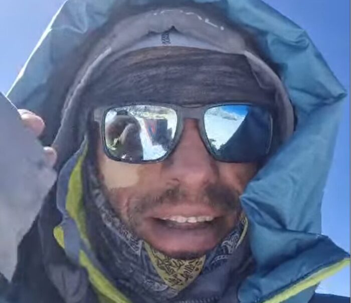
K2
On K2, there is no news of any progress beyond Camp 2. However, Mingma G of Imagine Nepal mentioned his team would try to open the way to Camp 3 this weekend.
Yakshin Gardan Sar
The Italian Alpine Club has published Stefano Ragazzo's expedition report on their Facebook page, where they provide further information about Chris Wright's accident, which put an end to the team's expedition. According to the report, Wright had a foot injury:
During an acclimatization climb at approximately 6,100m, Wright suffered a foot injury that prevented him from continuing. His climbing partners immediately took action to rescue him, rigging approximately 500m of abseils on abalakov ropes to lower him to Camp 1 at 5,500m. There, after approximately 24 hours, a Pakistani Army helicopter was able to evacuate Wright and transport him to Skardu Hospital, where he is currently in a stable condition.
You can read the report in Italian here.
Austrian extreme skydiver Felix Baumgartner, the first person to break the sound barrier during a freefall jump, has died in a paragliding accident.
Baumgartner, 56, was paragliding in Italy’s central Marche region yesterday when he lost control and crashed. He fell to the ground near a hotel in the town of Porto Sant’Elpidio. The town's mayor, Massimiliano Ciarpella, said that reports suggest Baumgartner may have suffered a cardiac arrest while flying.
The man who jumped from the edge of space
Baumgartner is best known for a 2012 jump in which he skydived from a balloon on the edge of space. The project, called Red Bull Stratos, resulted in several firsts. Leaping almost beyond gravity in a custom suit, Baumgartner plunged toward Roswell, New Mexico, faster than the speed of sound.
During a nine-minute descent, he set three world records, including Maximum Vertical Speed (1,357.6kmph, 843.6mph/Mach 1.25), Highest Exit Jump Altitude (38,969.4m, 127.852.4ft), and Vertical Distance of Freefall (36,402.6m, 119,431.1ft).
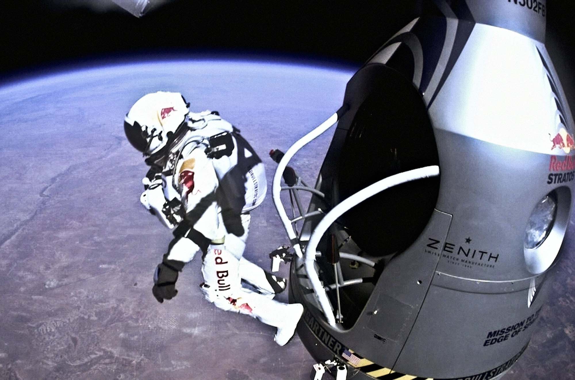
A former Austrian military parachutist, Baumgartner had a long career spanning thousands of jumps. In 1999, he parachuted from the Petronas Towers in Malaysia, and in 2003, he flew across the English Channel using a carbon fibre wing.
With the rope-fixing work stalled on K2 and Broad Peak, the next summit news might come from the Gasherbrums. Climbers have been in Camp 1, ready to go, all week. Finally, they have a summit plan.
Gasherbrum I weekend summits?
"Forecasts are not optimistic until at least July 19, but the wind is expected to drop to 20-25kmph (which is okay for a summit push) on July 18-19," Sakhawat Hussain, Managing Director of Summit Karakoram, told ExplorersWeb. "Therefore, we have scheduled the summit push on Gasherbrum I for between July 19 and July 20, if everything goes well. Then we will go for Gasherbrum II."
Hussain described weather conditions today as "manageable, but they might change at any moment."
At the beginning of this week, the expedition leaders hoped to attempt one of the Gasherbrums on July 17-18, but the weather halted that plan.
Summit Karakoram, a Pakistani agency, is outfitting a team from Nepal-based company 8K Expeditions, led by Saila Sherpa. However, apparently, all the commercial teams are moving at the same pace. Nirmal Purja is there, aiming to bag his 51st and 52nd 8,000'er summits.
Specific tactics
Both Gasherbrum I and II provide a slightly shorter climb than other 8,000'ers in Pakistan. The key is to take positions on the top of the tricky Gasherbrum glacier, which has become the most exposed section of the climb to both peaks. Warm conditions cause slushy snow with hard ice underneath and many open crevasses. This is why teams leave Base Camp and settle at Camp 1 to wait for the right time to launch summit pushes.
A lack of ropes on the upper sections can be solved with the same tactic used on Nanga Parbat some weeks ago: Sherpa guides will lay ropes as they go, with the commercial climbers following.
French and Italians
There are also some small groups aiming for the summit without Sherpa support. Among them are French climbers Charles Dubouloz and Symon Welfringer, who abandoned their plans to climb the highly difficult West Face of Gasherbrum IV because of a lack of ice on the wall. Mathieu Ruffray has also joined the team as a filmmaker.
"The dryness of these immense fortresses caught us off guard and pushed us to reconsider the location of our base camp for the coming month," Dubouloz reported yesterday.
The team headed for the common Base Camp for Gasherbrum I and Gasherbrum II, but has not made their next goal clear. They have, however, been able to acclimatize by climbing up to 6,414m and spending two nights at 5,700m and then 6,000m. They still need a second rotation before heading for a summit.
There is at least one other French team eyeing an alpine-style ascent, and an Italian expedition whose original goal was also Gasherbrum IV, which they hoped to climb from its north side.
Broad Peak
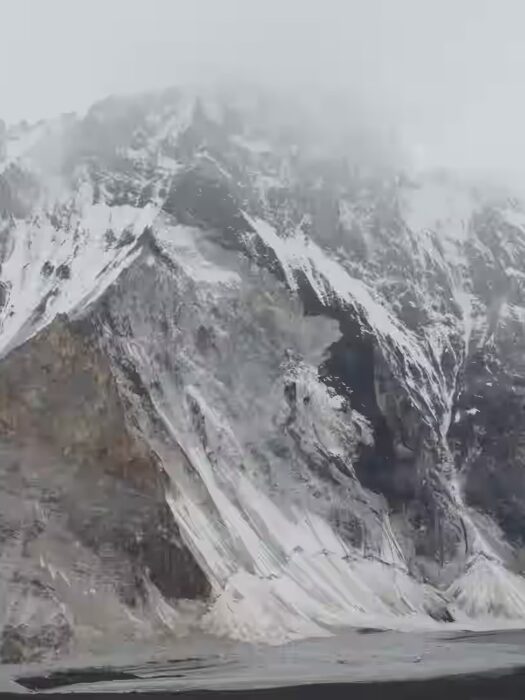
The situation is similar on Broad Peak. An optimistic forecast motivated some climbers to go up at the beginning of this week, but the prediction proved wrong. The weather is still bad, with snowfall on the upper part of the mountain and -- even worse -- rain in Base Camp and on the lower sections.
"Our mountain is melting before our eyes," Lukasz Supergan of Poland wrote.
American-British climber Chris Wright was injured in an accident on Yukshin Gardan Sar (7,530m) after an epic descent. He has been airlifted to a hospital in Skardu, where he is stable and recovering. His climbing partners, Michael Hutchins and Stefano Ragazzo, have called their expedition off.
According to Ragazzo, Wright had an accident at approximately 6,100m, though he has not confirmed the circumstances. Hutchins and Ragazoo were able to lower Wright to Camp 1, where he remained for 24 hours until a Pakistani Army helicopter evacuated him.
Attempt over
From Camp 1, Ragazzo and Hutchins continued down to Base Camp in very difficult conditions because of bad weather and snowfall. Once there, they called off their expedition.
"We're fine, but it was really challenging," Ragazzo said. "The conditions were no longer there to continue."
Bad weather has hampered other aerial evacuations in Pakistan, including the retrieval of Waldemar Kowalewski, injured on Broad Peak last Friday. Conditions in the Shimshal valley, where Yukshin Gardan Sar is located, were perhaps better than at Broad Peak's Base Camp at the head of the Baltoro valley.
We await further updates about the accident and Wright's state.
High difficulty
Awarded a Cutting-Edge Grant by the American Alpine Club, and supported by the Italian Alpine Club and UK Mount Everest Foundation, this was one of the most interesting expeditions this year.
The team had originally planned to climb Rimo III on the Indian side of the Karakoram, but did not receive a climbing permit. They changed goals at the last minute and instead went for an even harder goal: a new route on the previously unclimbed north face of Yukshin Gardan Sar, a monster 3,000m wall.
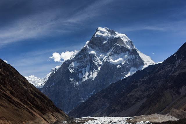
German artist Katharina Kneip is 900 days into an ambitious project to circumnavigate the top of the globe. Kneip started in January 2023 from Münster, Germany, and aims to hike, ski, and sail around the planet back to her starting point without motorized support.
Kneip has been on the road for over two years as part of a project she calls Round:Motion, which is based on the ethos of sustainability, cultural and artistic exchange, and a mindful pace. She aims to avoid competitive metrics often associated with long-distance adventure travel, like distance or records.
Traveling alone or occasionally accompanied by friends, the German artist turned adventurer travels by foot or skis on land, and by sailboat or kayak on water. Kneip relies on a network of sailors and helpful communities encountered along the way.
4,300km from Germany to Norway
Usually, Kneipp provides limited information on distances and the finer details of her journey, but we twisted her arm to reveal more.
The first phase of this multi-year odyssey began on Jan. 23, 2023, with a solo 4,300km hike and kayak leg from Münster to Kirkenes, near Norway’s northern tip. Most of this section was hiking, following well-known trails such as Norway’s Olavsleden and Sweden’s Kungsleden, but there were also short kayak segments between Denmark and Sweden. Kneipp arrived in Kirkenes in early September.
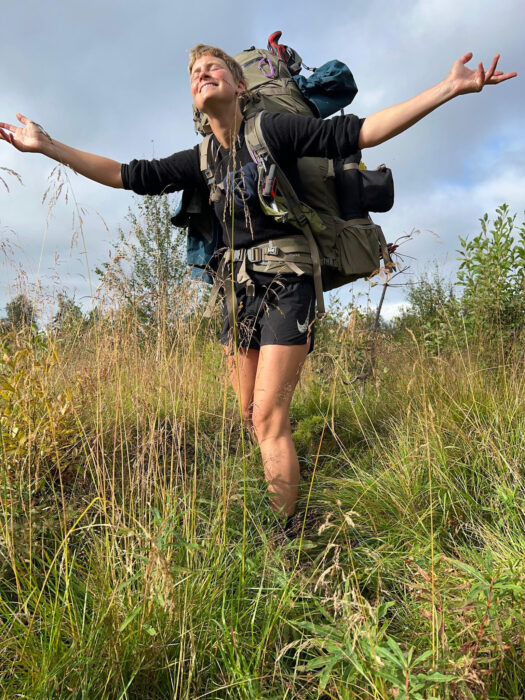
Along the way, Kneip weaved in artistic collaborations, such as with Norwegian dancer Signe Alexandra Domogalla. The pair explored themes of movement and nature through workshops and exhibitions in Oslo.
Logistically, Kneip keeps things simple: "I don’t send food packages or anything like that ahead, and I don’t hitchhike or take public transport to reach supermarkets. But of course, I’m not carrying food for several months. I plan my route so that I reach a shop from time to time. The most food I carried was for 20 days while hiking, and 25 days in the Pulka [sled] while crossing Iceland."
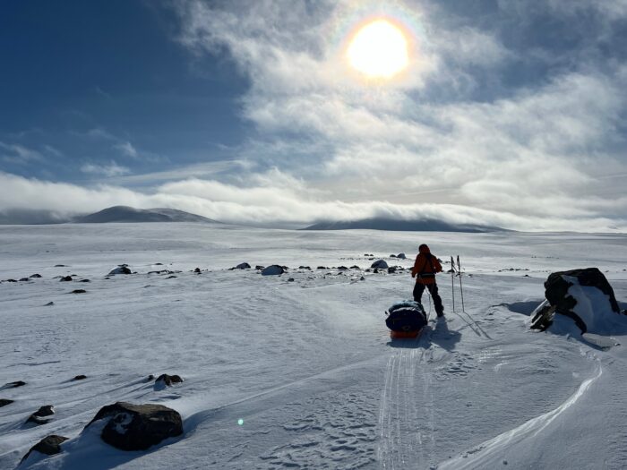
From Kirkenes, where she overwintered, Kneip resumed her journey in March 2024, with a long 900km leg south to Tromsø. She managed 750km on skis, with 150km on foot when snow conditions required detours. For some of this leg, Kneip was joined by two friends.
Crossing the Arctic
Kneip then secured passage by sailboat to Longyearbyen, Svalbard, working as both a guide and crew member during her stay. By late summer 2024, she had sailed to East Greenland, where she continued to Isafjordur, on the far west coast of Iceland. From there, she hiked a 500km route in September 2024, from Isafjordur to a farm near Akureyri, where she spent the next winter.
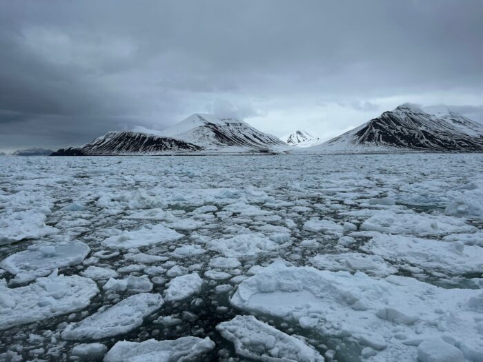
If that wasn't enough, in March of this year, Kneip and companion, Dirk Langer, completed a 350km winter ski crossing of Iceland from near Akureyri in the north to Eyrarbakki in the southwest. Kneip then completed a solo 450km trek from Akureyri to Reykjavik in May and June.
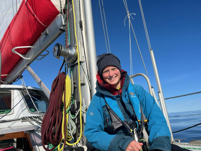
Kneip recently arrived in Labrador after sailing from Iceland to Greenland and then on to Canada. From here, she hopes to continue her journey, pending approval from Canadian authorities, by hiking around 7,000km and skiing another 3,000km before reaching Alaska. From there, she plans to sail across the Bering Strait into Russia. With much of the route still ahead and the unknowns of future travel in Russia, it will be several more years before she sees her finish line back in Germany.
Officials at the United States Geological Survey have tracked over 300 earthquakes beneath Washington State's Mt Rainier from July 8-10.
A popular tourist destination, Mt Rainier is also an active volcano, closely watched by experts. On average, the area experiences nine small earthquakes a month. About once a year, activity will increase and become a "swarm." But these regular annual swarms are not nearly as strong as the current event.
The current swarm kicked off between 1 and 2 in the morning, local time, on July 8. The largest quake came twelve hours later, registering 2.3 on the Richter scale. The strength and frequency of the quakes have steadily decreased since. The Pacific Northwest Seismic Network continues to track the miniature earthquakes.
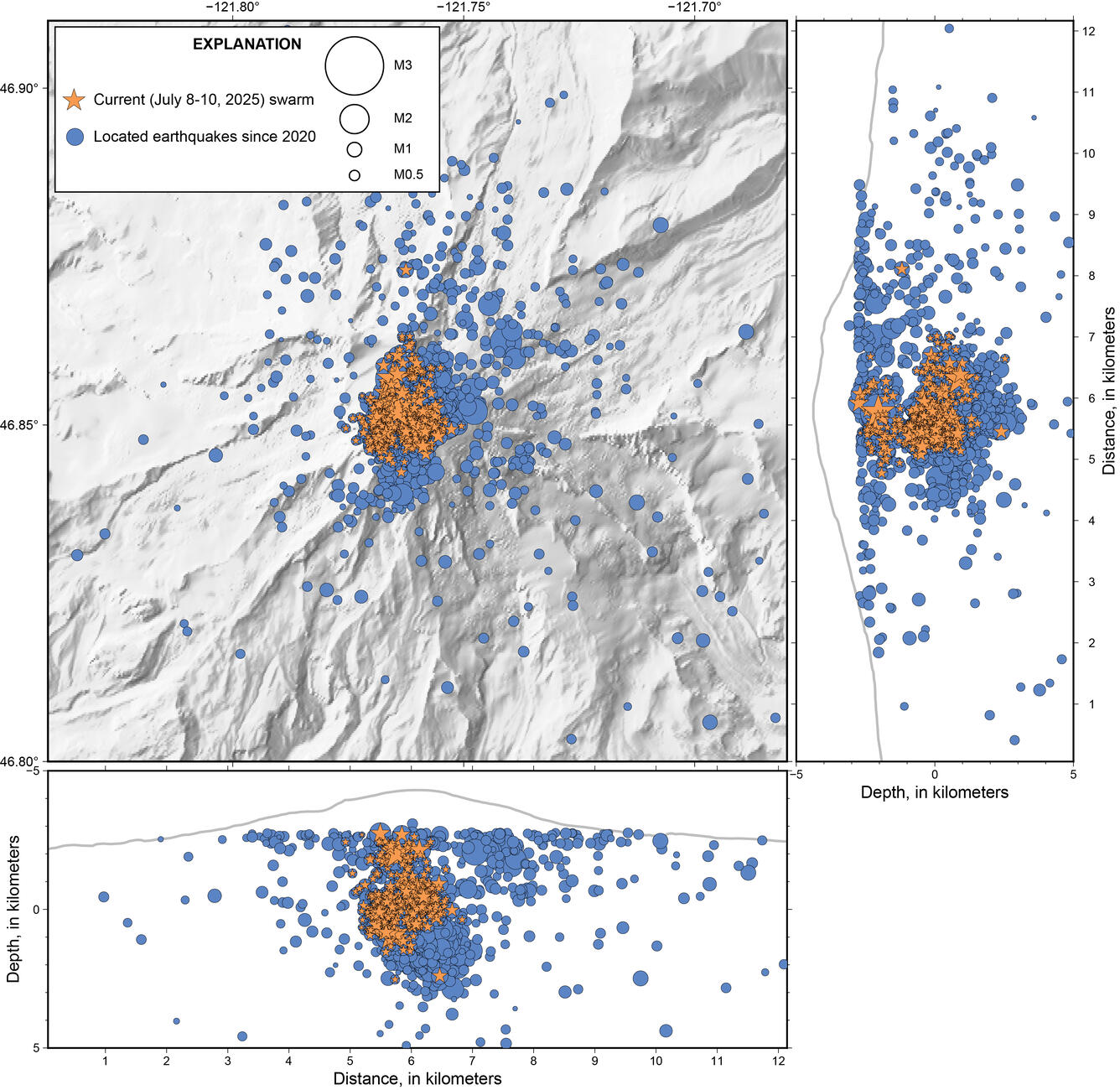
Much stronger than the 2009 swarm
The 2025 event has far outstripped the most recent big swarm, from 2009. Scientists detected 120 earthquakes in 2009, and the current swarm is approaching 350, at least 55 of which have been over 1.0 magnitude.
However, officials aren't concerned yet. The volcano alert level remains at "Green/Normal," with no danger to hikers. None of the earthquakes, individually, has been big enough to cause any damage, or even felt by visitors to the mountain.
Volcanic disruption is far from the only cause of seismic activity. Rockfalls and landslides can register as seismic events. Glacial movement is another potential contributor, especially since Mt Rainier is the most glaciated peak in the lower 48. Officials believe the recent activity is the result of water moving through preexisting fault lines, above the magma in Mt Rainier.
Just because this level of activity is higher than what we've previously observed doesn't mean it's abnormal. "We've only been monitoring it for 40, maybe 50 years now. So just because it's the most significant one we've seen on equipment doesn't mean this hasn't happened in the past," cautioned Alex Iezzi, a geophysicist with the Cascades Volcano Observatory.
The previous eruption of Rainier was over one thousand years ago; we have a limited understanding of what normal looks like. From that perspective, the swarm is good. It will give researchers an opportunity to learn more about how the volcano works and what we can expect it to do in the future.
Do you believe that the Pacific Islanders simply drifted until they found land? Over the last hundred years, most scholars believed that the Polynesians let the winds and weather push their boats wherever they may. But recently, the narrative has shifted, and many historians think that the Polynesians navigated the vast Pacific Ocean by reading the world around them. They observed the behaviour of birds, clouds, and ocean swells. But they also relied on an odd phenomenon that they couldn’t explain: a mysterious underwater light source that pointed them toward reefs, and inevitably, land.
A mysterious light
This light is called te lapa, which translates as "flashing light," or "darts." Though we have no photographic evidence, eyewitness testimony and historical sources say it has a consistent white colour, with some modern-day witnesses comparing it to the beam of a flashlight underwater.
Pacific islanders believe it originates from islands and travels through the ocean. According to writer Jeff Evans in his 2011 book Polynesian Navigation and the Discovery of New Zealand, te lapa can appear as far as 130km from shore and occurs 45cm to 1.8m under the ocean's surface. Depending on your distance from an island, te lapa's intensity varies.
The flashes are said to be visible just beneath the surface of the water or skimming the surface at night, appearing as faint but fast-moving beams of light that point in the direction of the nearest island. Unlike atmospheric phenomena, te lapa acts as a pilot signal whose appearance doesn’t depend on whether it’s raining, cloudy, or clear. It is not affected by surface waves.
What is it?
Explanations for the phenomenon are scant. Evans equates it with phosphorescence. However, in his book We, The Navigators (1972), writer and researcher David Lewis disagrees:
Te lapa has nothing in common with ordinary surface or subsurface phosphorescence. It comprises streaks, flashes, and momentarily glowing plaques of light, all well beneath the surface. Exactly like lightning, it flickers and darts and is in constant motion. It occurs a good deal deeper than common luminescence, at anything from a foot or two to more than a fathom.
Te lapa, dynamic, transient, and deep in the water, is in all these respects quite distinct from ordinary phosphorescence…common phosphorescence is most profuse within a mile or so of reefs and coasts, whereas te lapa does not begin until 8 or 9 miles offshore.
Lewis believed that he could trace te lapa's formation to "deep swell movement, perhaps to ground swell or backwash waves reflected from land or reefs."
Other scientists have chalked it up to bioluminescent marine organisms responding to subtle energy disturbances. Some organisms, such as plankton, emit a glowing light when disturbed. This can take on a green, blue, or white colour. Underwater currents or waves hitting underwater structures near islands might cause trails of light to appear. This could create the illusion of a directional flash moving through the water. However, critics of this theory argue that bioluminescence is generally scattered and does not form in straight lines.
Another theory involves electrical or tectonic forces. Some scientists speculate that underwater volcanic islands might generate natural electrical discharges because of tectonic or geothermal activity. Latent activity can cause materials like quartz to generate electricity or light under stress. In theory, these discharges could be visible as quick, flashing lines. However, this remains speculative, with no hard evidence.
Some researchers propose that te lapa could be light refracting or reflecting underwater. Possibly influenced by the interaction of moonlight, ocean swells, and sea floor topography, this theory suggests that the flashes are nothing more than an optical illusion, where light is channelled or bent through temperature layers in the water.
Richard Feinberg, a professor at Kent State University, searched for te lapa between 2007 and 2008. However, he did not witness it.
"[My] attempt to document te lapa ended in frustration. I even noted in my journal feeling as if I had been searching for the abominable snowman," Feinberg wrote.
What does a Polynesian navigator say?
Marianne George has been studying te lapa for several decades, and does not believe it is bioluminescence. She ruled out several natural phenomena, claiming:
I was already very familiar with a lot of lights one sees at sea: bioluminescence and luminescence that appear in the glowing wake of a vessel in both inland seas and offshore, St Elmo’s fire in the rigging, shooting stars, satellites, comets, the green flash, and strange lights and colors that occur at sunset.
George states that te lapa does not resemble any of these phenomena, and behaves very differently.
In the 1990s, she visited Taumako in the Solomon Islands and befriended a local legend, an experienced Polynesian navigator named Te Aliki Koloso Kahia Kaveia. The two of them frequently went out on the water and claimed to have experienced te lapa. George saw that the lights were sometimes skirting on the water’s surface and sometimes below. Kaveia insisted te lapa was above the surface.
George and Kaveia believe te lapa may be the result of ocean swells bouncing off the islands, the resulting waves meeting each other at certain points, and reflecting light caused by tectonic activity on the ocean floor.
"Te lapa may be the result of magnetic or electrical fields that are caused by the same tectonic energy emissions manifesting atmospheric light and color effects in the atmosphere as well as piezoelectric emissions prior to earthquakes," George says.
Conclusion
Polynesian navigators believe te lapa is a guardian force that looks out for seafarers, appearing when a person is most in need of its assistance. They say that experiencing te lapa is a sacred gift and has played a key role in the story of the voyagers who made the Pacific islands their home. Te lapa and other unconventional navigation tools might encourage sailors to develop a crucial skill: intuition.
Fixing ropes on K2 is a joint effort by all the teams on the mountain. It is also a fight against the elements; the weather has moved from too hot and dry to too wet and windy.
Migma David Sherpa, 36, hoping to summit K2 for the seventh time, described the situation for ExplorersWeb. The Nepalese climber is back at Base Camp after a trip to Camp 1 leading an Elite Exped team.
"Due to unfavorable weather conditions and continuous rockfall, the rope could not be fixed above Camp 2," he said. "Although the fixing team from Garrett Madison and other teams attempted to reach Camp 3, they were unable to open the route beyond Camp 2."
Nuptse expert Dawa Tenji Sherpa, working with Madison Mountaineering, was among those in Camp 2 last Monday. He confirmed that the wind was very strong and forced his team to retreat (as relayed by Jay Whiting, Tenji's partner on Nuptse this past Spring).
High winds in Camp 2
Before the weather worsened, Mingma David's team had made good progress on the rope-fixing work.
"Vinayak Malla, Nima Sherpa, and Phuri Kitar had fixed the route up to Camp 1," Mingma David said. "Above Camp 1, another team from Seven Summit Treks fixed one anchor just below Camp 2. Later, Nima and Phuri Kitar continued and fixed the route to Camp 2."
Unfortunately, progress is now stalled until the weather improves.
Waiting for the sun
"The weather is forecast to improve from July 18, and with a collaborative effort from all teams, we will progress fast," Mingma David said.
The situation is not yet a problem for the great majority of climbers in Base Camp, who use supplemental oxygen and personal guides. In the last two years, K2 summits occurred during a single weather window at the end of July, and summit rates were still very high.
The downside of having a single, massive push on K2 is the impossibility of avoiding traffic jams on the higher sections, especially during the dangerous traverse under the Big Serac and the Bottleneck at around 8,400m. When the time comes, expedition leaders need to be extremely cautious with conditions on that section.
Harder for no-O2 climbers
For climbers going with supplemental oxygen, it is another story. "The lack of ropes above Camp 2 may pose a challenge for climbers attempting to summit without supplemental oxygen, given the limited time remaining," Mingma David said.
Indeed, climbers without oxygen need to do more rotations and reach well above 7,000m before launching a final summit push. It all depends on conditions on the mountain after the first summit wave. In 2024, the weather remained good for long enough to permit several no-O2 climbers to top out in the three days after the first summit wave.
Some of them, such as Liv Sansoz and Seb Roche of France (who also performed a tandem paragliding flight from the summit), used a smart strategy; they acclimatized, not on K2, but on the more straightforward Broad Peak.
Ropes on Broad Peak
On Broad Peak, the ropes are ready up to Camp 3. Some climbers attempted to go up earlier this week but were pushed back by a blizzard. Like everyone else in Base Camp, they are getting ready to go up again as soon as the weather improves.
Those on oxygen could attempt the summit directly from Camp 3, but they need a team to fix the ropes. Sakhawat Hussain, Managing Director of Summit Karakoram, told ExplorersWeb that his team counts on experienced Pakistani and Nepalese climbers willing to fix the ropes are they go. He also expects strong climbers in other teams to collaborate with the efforts.
Climbers without oxygen may use the next rotation to complete their acclimatization, and then decide if they will go again to the summit of Broad Peak or move on to K2.
The current spell of bad weather is halting everyone on the Karakorum 8,000'ers. The helicopter meant to airlift Polish climber Waldemar Kowalewski, injured in an avalanche last Friday, remains grounded.
"The weather forecast is not clear for the next two to three days," charter airline company Askari Aviation told Kowalewski's outfitter, Lela Peak Expedition. "The injured climber should start going down from Base Camp on a horse or mule."
A tough decision
Kowalewski has a broken leg, which requires urgent treatment. Waiting for an airlift is bad, but a trip on the back of a mule down the very rough Baltoro, over glacial and rocky terrain, could be even worse.
A regular on 8,000'ers, Kowalewski was injured when he broke a slab of unstable snow as he descended to Base Camp after enduring two days in a snowstorm at Camp 3. Climbing partner Jarek Lukaszewski and Pakistani climber Hassan helped him to a tent at 6,500m.
An aerial pick-up was never an option, so outfitter Lela Peak Expedition hired a Sherpa team for a ground rescue mission. They climbed to the injured climber on Sunday and brought him down to Base Camp on a stretcher. Since then, he has waited for aerial evacuation, but bad weather has grounded the helicopters.
A team of genetics researchers has sequenced the genomes of Greenland sled dogs, or qimmeq (plural qimmit), both living and dead. Their results shed light on both the development of this breed and Greenland's murky human history.
Qimmit are the oldest dog breed, and the Greenland government takes their genetic conservation seriously: no other dogs are allowed above the Arctic Circle. But interbreeding is not the only threat to their survival.
Qimmit are tough, working dogs, and they regularly injure or even kill humans, particularly children. For a long time, their usefulness outweighed any danger; they were a vital part of Arctic travel, and their intense pack-bonding and high drive were a feature, not a bug. But snowmobiles have changed everything. In 2002, there were around 25,000 qimmit in Greenland. In 2020, there were only 13,000.
New research, published in the journal Science, began as a quest to preserve the genetic information of the qimmeq before it's too late.
Qimmeq DNA challenges timeline of Greenlandic settlement
Traditional scholarship places the Inuit settlement of Greenland at about 1200 CE. They would have joined the preexisting Dorset culture, which dropped out of the archaeological record several centuries later, as well as the Norse.
The Norse first ventured to Greenland in 985, when Erik the Red made contact with the "Skraelings" of the southeastern coast. They maintained a presence on the island until sometime in the 15th century. In the 18th century, Denmark embarked on a mission to recolonize Greenland, although first they had to find it again. Greenland has remained a Danish colony since.
By analyzing the remains of qimmit before Danish colonization, the team of geneticists challenged this narrative. Their models suggest that qimmit diverged from earlier species of sled dog 1,164 years ago -- over a hundred years before Erik the Red's arrival. In the centuries afterward, different regional variations diverged from one another within Greenland.
Either the qimmit were migrating on their own, or the Inuit arrived in Greenland much earlier than previously thought.
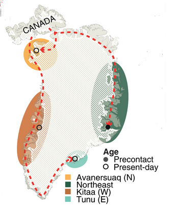
Where did the first Greenlandic Inuit come from?
Another interesting facet of the new research is the qimmeq's closest genetic relative. Rather than a modern husky or samoyed, qimmit shares the most DNA with the remnants of a dog from Alaska. Found near Teshekpuk Lake, this dog was alive about 3,700 years ago.
Finding the most similar genetics in Alaska rather than in Canada indicates that the ancestors of the Inuit moved rapidly from Alaska toward the eastern coast of Canada. The next closest relative of the qimmeq is a 4,000-year-old dog from Port-au-Choix in Newfoundland and Labrador.

The shadowy history of northeastern Greenland
The dogs' DNA also adds to the scant archaeological record of northeastern Greenland.
In 1823, an up-and-coming captain in the British Navy named Douglas Clavering received an assignment: to escort his friend, astronomer Edward Sabine, to the Arctic Circle. Sabine, a veteran of both the Ross and Parry Arctic expeditions, was engaged in a quest to measure the shape of the Earth using a pendulum. The period of a pendulum depends on gravity. Therefore, if the Earth bulges at the equator, the pendulum will have different periods at different latitudes.
But while engaged in his scientific ventures, Clavering twice encountered the same group of 12 Inuit. This was the last time any Inuit were confirmed to live in the northeast of Greenland before resettlement in the 19th century.
Oral history preserves stories of Inuit migration toward the southeastern coast of Greenland from the north over multiple centuries before Clavering's encounter. But the motives of this migration, along with when exactly the Inuit finally vacated the northeast, are unclear.
Clues from Qimmeq DNA
The new research places the first concrete estimate on the settlement of northeast Greenland: 1,146 years ago. This suggests that the Inuit settlers of Greenland moved from the northwest to the northeast within only a generation or two.
The pre-Danish northeastern qimmit is the most distinct regional population by far. Despite the rapid settlement of the northeast, once they were there, the northeastern Inuit didn't seem to intermingle with other communities in Greenland. Trade networks connected the whole west coast, but qimmit DNA suggests they did not venture east.
This supports one particular theory of the abandonment of the northeast: isolation. Archaeologists have suggested that among the many challenges faced by inhabitants of the northeast, the death knell may have been the nigh-insurmountable distance between their villages and any other communities. When the Little Ice Age struck in the early modern era, they would have had no allies. Migration may have been their only chance of survival.
A new tool for human history
In the absence of a historical record, the genetic analysis of companion animals can trace human migrations. Qimmit present a unique case because of their genetic preservation to the modern day.
Outside of Greenland, many dog breeds face serious genetic ailments because of inbreeding. Several breeds are now unable to give live birth. Meanwhile, the qimmeq has stayed healthy despite modern, artificial isolation and over a thousand years of natural isolation. This is a testament to the care with which its human companions have treated it for over a millennium.
German climber David Goettler had unfinished business with the Rupal side of Nanga Parbat: "I needed to prove I'm able to claim an 8,000’er in the style I like and off the normal route."
Back in Europe after climbing the Schell route and paragliding from the summit, Goettler is over the moon. He's not only ecstatic about the achievement, but also because he finally succeeded on a personal bet that has molded his high-altitude climbing career.
"After all these attempts and years I put into this project, it paid off and I am very happy," Goettler said. "I have fulfilled this dream, and flying down, it's kind of the cherry on the top, even if it was not right from the summit."
Prize for persistence
In some cases, when a climber achieves a project attempted and planned for years, they feel a kind of emptiness. Goettler, on the contrary, has found that it has motivated him for future climbs.
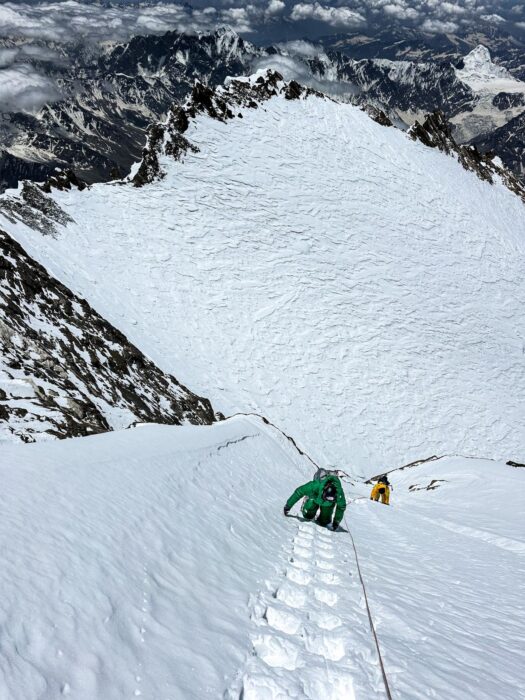
"The recent success has increased my motivation to chase similar projects because I have climbed Nanga Parbat in exactly the style I wanted. I have learned that it sometimes takes a lot of attempts, but in the end, with persistence and patience, it pays off."
This is an important issue for Goettler, who follows strict safety standards on his climbs. His goal is to complete a climb and descend safely, without "having to get epic," as he terms it.
"Through the years and the attempts, I turned around so many times because some small things didn't fit right or it was not perfect. Of course, I questioned myself. Perhaps I was not pushing hard enough? But in the end, I have proven that I can achieve my goals in what I consider the right way," Goettler explained.
Safe, not boring
Goettler concedes that his focus on safety "might look boring for audiences and the media, because I avoid drama. I am aware others push these limits far beyond [what I choose to do] and play with fire. But each climber has to decide this for themselves."
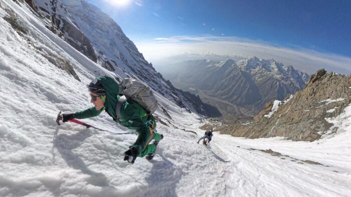
"Of course, bad luck is always possible, and you can always end up in a difficult situation without forcing it. However, if you push the limits again and again and again, you may need to start questioning your approach to mountaineering," Goettler told us.
On every attempt, Goetller studied his mistakes and tried to fix them for the next round. So, what changed on this attempt? What was the final finetuning that led to success instead of retreat? Was it just luck?
More than luck
"I believe it's not only luck, although we were indeed lucky with the weather window and with the conditions. The mountain was very dry this year, which made the going up to 6,000m quite complex, especially for Boris and Tiphaine [climbing partners Boris Langenstein and Tiphaine Duperier of France] who wanted to ski down from the top," Goettler said. "However, from 6,000m up, conditions were way better."
Goettler explained that, although the climbers had to break trail all the time, the snow was not as deep as in wetter years. As seen in videos from the mountain, the climbers wore small snowshoes, which made progress easier on the snowy patches.
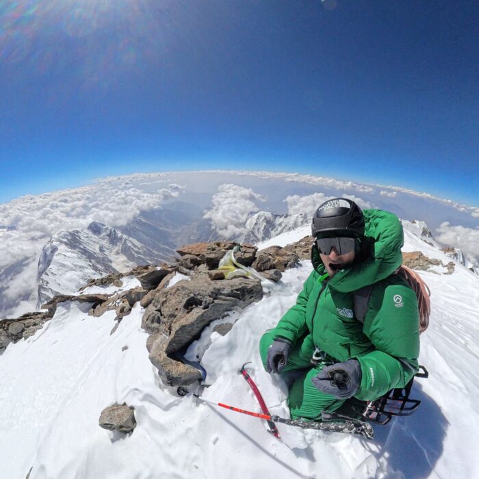
The team enjoyed an extraordinary weather window. "For three days we had little wind and no precipitation," Goettler recalls. "However, from my experience climbing in Pakistan since 2004, I had learned that temperatures are rising in recent years, so we knew we would need to make the attempt early in the season. We still almost got there too late!"
Fine-tuned tactics
Reflecting on the increasing temperatures, Goettler believes expeditions in the Karakoram may consider an earlier start, even if that means overlapping with the Spring season in Nepal.
Goettler also made a key tactical adjustment for this final attempt.
"The summit day from the last bivy at 7,400m is extremely long, and the last time I underestimated it. On the maps, the terrain looks so vertical that you think it cannot be too long, but it is! It’s a long way to the top, especially because of the traverse of the Diamir side," Goettler said.
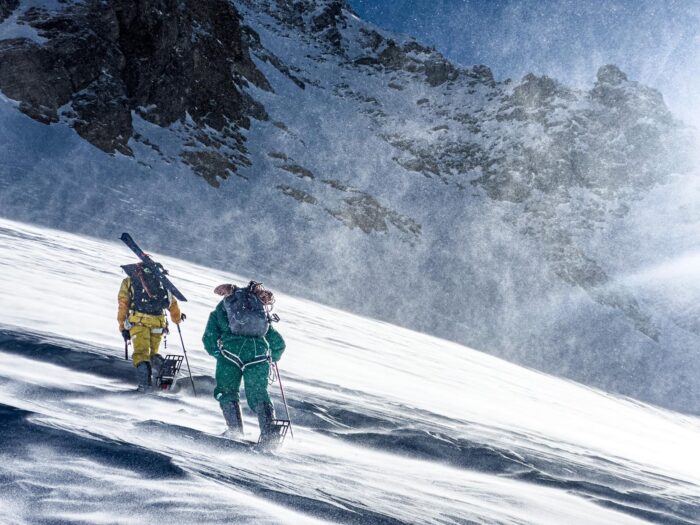
"Therefore, this time we took a tent, a stove, and a sleeping pad with us for the summit day. That way, we could always stop, pitch the tent, get shelter from the wind, and have a rest, no matter the altitude. Either on descent or during the ascent, if the weather turned for the worse, the safety items gave us confidence to tackle a longer summit day."
They reached the summit shortly after 3 pm local time, which is late on an 8,000'er. But they had perfect weather, so an evening descent was not concerning.
"However, it was just a little bit too much wind to feel comfortable taking off and paragliding directly from the summit," Goettler noted.
The descent
With too much wind to take off from the summit, Goettler started down with Langenstein and Duperier. The two French climbers put on their skis at the top and started down the summit ridge to the south summit of Nanga Parbat; Goettler followed on foot. The skiing was slow at that altitude, so he didn’t get left behind.
"At around 6:30 pm, we reached 7,700m. Here, the ridge opens up and the terrain falls away in a huge, steep snow field," Goettler said. "It was still a bit gusty, but I felt confident to take off."
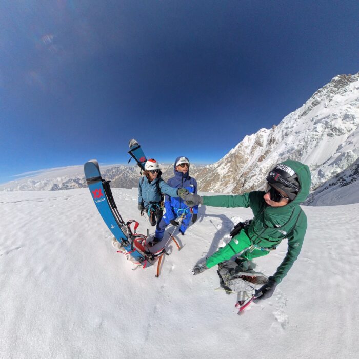
The following 30 minutes will always remain in Goettler’s memory as one of the most amazing, surreal moments of his life.
"I took off, first flying toward the flank of the mountain, along the traverse of the Diamir side and right over the Mazeno Col back to the Rupal face, where I dropped down and landed right beside our Base Camp. It was one of my best and craziest moments in the mountains so far."
Thirty minutes vs. three days
Goettler's arrival shocked the Base Camp cook, who didn’t expect anyone for dinner so soon after hearing the summit news. He ran out of the tent when he heard Goettler calling.
Going down took much longer for Langenstein and Duperier. "The traverse is no more than 50 vertical meters, but it’s all ups and downs, which can take an extremely long time when you’re on skis," Goettler said. "They used the tent, improvising a bivy for the night. The following day, they continued to the place of our last proper camp, at 7,400m, right at the access point to the Rupal side, and they spent another night there."
The descent down the Rupal Face was so rough that the French climbers still needed another stop. They halted on the ridge at 6,000m because the lower part of the mountain was so prone to rockfall that it could only be downclimbed when frozen, between midnight and 6 am.
Their long descent provided Goetller with a new experience: waiting in base camp for partners on the mountain. "It was quite intense," he said. "We could only communicate over the radio when they were on the Rupal Face. While they were on the other side, only SMS over InReach worked, and there was so little we could say. It was unnerving not knowing where they were and how they felt."
The art of flying
Indeed, flying down proved an amazing way to descend from a high-altitude summit. It is safer, faster, and spectacular. Benjamin Vedrines and other French climbers experienced it on K2 last year, where it also worked wonderfully.
"I'm sure we will see it more and more, but it will not become the norm," Goettler said. “Most days, flying from a summit or a high point is not possible. Even with modern, more accurate forecasts, you need to be really lucky with conditions, and then high-altitude paragliding requires extra skills. Often, I carry my wing up and I can't fly."
Goettler recalls that he took his wing to Nanga Parbat last year when he attempted the climb with Vedrines, but he was unable to fly from any higher than 5,500m because of high winds. Equally, he brought the wing up Baruntse in spring, but he had to return on foot in foggy weather.
"Gliding makes life so easy when it works. You fly with zero worries about rockfall, avalanches, exhaustion, or anything. In 30 minutes, you're back down to safety."
Team workflow
Goettler has attempted Nanga Parbat on five occasions with different climbing partners. He has climbed with Herve Barmasse, Mike Arnold, and Benjamin Vedrines. Last year, he met Langenstein and Duperier on Nanga Parbat. They shared the same goal, so they quickly made plans to join forces in 2025.
"It was one of the best teams I have ever been on, even though our characters are rather different. I worked really well, it's so good to have a group where you spend no energy managing the team dynamics," Goettler said.
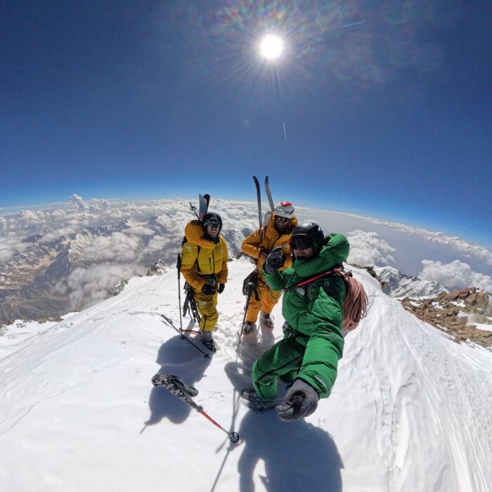
The climb
The climb was described by Goettler in a series of clips that he posted on social media. Here's a summary and the footage:
Day 1: Latabo Base Camp to Camp 1 (6,000m)
Goettler notes that the team had made a previous climb to this point to check conditions. They left a small gear deposit.
"For the ultra purists, our ascent wouldn't be 'alpine style,' but I’m still happy to call our climb alpine style because there wasn’t a single meter of fixed rope, no set camps, and no external help."
The team climbed with a 50m rope, some pitons and cams, one tent, and food and gas for five days.
Day 2: The ridge section and snow fields between 6,000m and 6,800m
"The route goes along a sharp ridge, then you have to cross big, wide open snowfields," Goettler described.
This is the section where the climbers enjoyed better conditions than the previous year, with not so much snow. Still, they used small snowshoes for some parts.
Day 3: To the third bivouac at 7,400m
For Goettler, this section is key to predicting whether the climb will be successful. Luckily, the forecasts were accurate, and the winds dropped.
Day 4, part 1: The traverse, 7,400m to 7,800m
Goettler turned around on this section on two previous occasions. They made much faster progress this time.
"The conditions on the summit ridge were exceptional, as was the weather, but the traverse itself has endless ups and downs, which makes for an exhausting return," he noted. "We swapped leads whenever someone needed a break, and with this teamwork, we maintained a slow but consistent pace to the Merkel Notch, just below the final unknown section of the route."
Day 4, part 2: From 7,800m to the summit
Once in unknown terrain, after the Merkel notch (a small col), they climbed a technical rocky section and crossed a snow field that took them to the south summit and then the main summit of Nanga Parbat.
"[The rock section] wasn’t super hard, but difficult enough to get the 50m rope and camalots out, which, at close to 8,000m, is spicy enough," Goettler recalled. "When we finally stood on the summit of Nanga Parbat, 14 hours after leaving our last camp, each of us knew that without the others we wouldn’t have made it. A feeling and a moment so powerful I won’t ever forget."
Meteora is a complex of imposing dark rocks, rising over the settlements of Kalampaka and the picturesque Kastraki village, on the plain of Thessaly, Greece. There are approximately 900 multi-pitch climbing routes in the Meteora towers. The texture of the rocks, the fairytale setting, and the fact that every route ends at the top of an outstanding tower make climbing in Meteora a peculiar experience.

Meteora's rocks and climbing style
Meteora's rock texture consists of a combination of pebbles, cobbles, and large rocks attached to a cement-like sandstone and cobblestone rock surface. Shallow holes are often encountered as a result of pebble detachment. When first climbing here, the texture can make the rock feel unstable, especially on downhill pebbles. But gradually, you will learn that the rock is stable.
The slope and the size of the pebbles determine the grade of the routes. Most of the routes are balanced, emphasize technique, and include delicate movements without the need for particularly athletic skills. High grades are considered exceptions. The main traits of the routes are their mixture of slab-based trad and sport climbing.

A look back in time
The first climbing records from the Meteora towers trace back to the 10th century, when the first ascetics in the region arrived and settled in the natural hollows of the rocks. The ascetics used scaffolding, nets, and wind ladders for these ascents.
Heinz Lothar Stutte and Dietrich Hasse's 1975 climbs mark the beginning of modern climbing in Meteora.
By 1985, climbers had established more than 200 routes, and the region had grown popular among climbers and adventurers. Amongst the early Greek climbers, Aris Mitronatsios stands out. Throughout the 1990s, the local climbing community made a significant contribution, establishing new routes and accomplishing challenging repeats. They followed the ethics of ground-up bolting, but installed more bolts than usual because of the difficulty of the routes. A typical example was two young climbers from Kastraki -- Christos Batalogiannis and Vangelis Batsios -- who made a decisive contribution to the opening of several now classic routes. Action Direct, Orchidea, and Crazy Dancing stand out among them.
By the end of the decade, the local climbing community had grown significantly, with Nikos Gazos and Nikos Theodorou playing an important role in the development of climbing in the region.
Today, Meteora is a global climbing destination. The Panhellenic Climbing Meeting, for instance, has been held in Meteora since 1988 under the umbrella of the Mountaineering and Climbing Federation, in association with the Kalambaka Municipality and the Kalambaka Climbing Club. This three-day event constitutes a major celebration of climbing each year.
How is it possible?
The giant towers of Meteora are mysterious. One can't help but wonder how people built monasteries on these summits centuries ago, when climbing them can be problematic even for today's sophisticated climbers. How, then, did the monks, shepherds, and hunters climb to these summits?
Based on findings from past ascents, researchers believe they started up the vertical sections by driving wooden or iron stakes into the rock. Then, they balanced a wooden ladder upon the stakes, climbed the ladder, wedged more stakes into the rock, and in the end pulled the ladder up to the new stakes, starting again.
The mystery of the cross
However, one of the biggest riddles in Meteora is the metal cross kept at Varlaam Monastery. In 1348, to celebrate his victory over Epirus and Thessaly, Serbian emperor Stephen Dušan ordered a large metal cross (1.80m x 80cm) to be perched atop Holy Ghost, the most imposing of Meteora's towers. Holy Ghost is a monolithic 300m tower. Climbing to its top involves continuous 5c climbing. Researchers have found no trace of historic attempts on the rock, so we can only assume that somebody climbed 300 vertical metres using just their hands and feet, with no aid whatsoever.
In 1987, a French film crew led by the famous rock climber Patrick Berhault made a film about Meteora climbing. One of the three rock climbers in the cast attempted to repeat a free-solo ascent of Holy Ghost on the route Pillar of Dreams, 250 meters long and 5c+ as an average grade. Eighty metres above ground, he suddenly changed his mind, and the film helicopter had to rescue him. In 1994, American climber Jane Balister took on the challenge and free-soloed it. Not even James Bond -- in 1981, For Your Eyes Only was largely shot in this area -- achieved this goal.
Then, climbing happened, thanks to the Germans
Dietrich Hasse was born in Bad Schandau, Saxony, and from a young age, he was involved in climbing. He quickly became one of Elba's best climbers. He opened many new routes and explored the Dolomites with excellent climbing partners, such as Lothar Brandler (known for the Hasse-Brandler route on the North face of Cima Grande di Lavaredo), Claude Barbier, and Heinz Steinkötter. In August 1975, Hasse and Sepp Eichinger visited Meteora for the first time. They were struck by the imposing towers and established the first four routes in the area.
In the spring of 1976, Hasse and his friend, professional climber and photographer Heinz Lothar Stutte, established even more climbing routes in the area. In 1977, they published the first climbing guide for the region, listing 83 routes.
Interest amongst the German climbing community was growing and seemed to reach a peak with the ascent of the eastern side of Alyssos tower. Hasse, Eichinger, Mägdefrau, and Lothar Stutte opened the Community Path route in a three-day effort, from March 27 to March 30, 1978.
Hasse died in 2022. Two years later, Greek climber Vangelis Galanis made a rope solo first ascent of a new multipitch route on Kapelo Peak and dedicated it to Hasse.
How to get there
From Athens, Meteora is 360km by car (in the direction of Lamia, Domokos, Karditsa, Trikala, and Kalambaka) on a route well serviced by intercity buses and train services. From Thessaloniki, the distance is 230km, by two main routes. The first leads to Kalambaka through Katerini, Larissa, and Trikala. The second goes via Veria, Kozani, Grevena, and Kalambaka. Both routes are possible by intercity bus and train.
You can also reach Meteora from Igoumenitsa, it is a 150km road through Loannina and Panagia. From Volos, it is 140km through Larissa and Trikala. Both routes are served by intercity buses.

Where to stay
The finest place to stay for climbers who want to explore the entire area is Kastraki, which lies between Meteora Towers. Small hotels, rental rooms, and two campsites are available there. Several lodgings are also offered in Kalambaka, a neighbouring town around 2km from Kastraki. I particularly recommend Ziogas Rooms, Thalia Rooms, Hotel Kastraki, and Camping Kastraki.
You can find a supermarket in the town of Kalambaka, and you can purchase basic supplies in a mini-market in Kastraki.

When to find perfect conditions
Climbing conditions are best between April and the middle of June, and from the middle of September to the end of November. The surroundings are lush in spring, but there is a greater chance of rain compared to hot and dry fall. Although summer can be quite warm, some routes are in the shade for a long time during the day. Though winter is more challenging, climbing is still an option on sunny days.
Gear, rules, and final recommendations
In addition to personal climbing gear such as a climbing harness, climbing shoes, a belay/rappel device, carabiners, straps, a lanyard, some nuts, and some friends, it is suggested you take 10-16 quickdraws. Two half-ropes of 60m will help with multipitch climbing, or a 70-80m single rope works for sport climbing.
In April 1976, the Archeological Service and the Orthodox Church granted written permission to climb in Meteora. Climbing is only forbidden on the six towers with inhabited monasteries. Rock climbing is thus permitted without restriction on the remaining 50 solid towers and 80 smaller ones. Campfires, camping, or bivouacking between the towers is strictly prohibited.
As a massive storm swept through central Alberta in early July, a couple stood on their porch watching bolts of lightning play across the cloudy skies. A particularly massive lightning strike hit nearby. A moment later, they saw a ball of light hovering near the impact site.
In an interview with Global News Canada, Ed Pardy described seeing "a ball of fire… about 20 feet above the ground, and it kind of stayed there in a big round ball."
Ed and his wife, Melinda, said the orb consisted of bluish light, maybe two meters across. Amazed, they began filming. The couple captured 23 seconds of the light hovering on the horizon, before it vanished with a popping sound.
After viewing the video, that the couple sent to several Canadian news networks, many people believe the phenomenon is "ball lightning."
Elusive and mysterious
Ball lightning is a rare and little-understood atmospheric phenomenon. Accounts vary, but the generally agreed-upon description is of a ball of light, anywhere from a few centimeters to a few meters across. Ball lightning coincides with thunderstorms and hovers for a minute or so before disappearing.
Accounts of ball lightning are uncommon, but stories have been around for centuries. The earliest account commonly cited is from a massive storm that swept over England in 1638. Three hundred people were attending church when, according to eyewitness accounts, a ball of fire over two meters across burst through the church window, bashed around, tore open the roof, and killed four church-goers, filling the building with smoke and the smell of sulfur. Witnesses concluded it was the devil, an understandable conclusion at the time.
This isn't the only story of "globular lightning" entering a building. In 1852, the French Academy of Sciences took sworn statements that a ball of light, roughly the size of a human head, burst from the fireplace of a startled tailor, having traveled down the chimney.
In 1753, ball lightning killed a Russian scientist researching electricity, according to contemporary reports. Georg Richmann was holding one end of a string, the other end of which he had attached to a kite. Ball lightning appeared, traveled down the string, and killed Richmann instantly.
Despite scattered reports continuing over the years, scientific understanding lagged behind.

Many theories, limited evidence
So, what exactly is ball lightning? Science isn't quite sure yet. Many reports can likely be attributed to other things. A 2010 study from researchers at Austria's University of Innsbruck found that the magnetic fields generated by lightning storms could cause visual hallucinations. Specifically, they can cause "magnetophosphenes," which appear as flashing lights. This could account for cases of ball lightning.
But unless magnetophosphenes are contagious and spread over video, what the Pardy's saw was real.
Researchers have put forward dozens of theories to explain ball lightning. One of the more credible theories came from a group of Chinese researchers who happened to record ball lightning in 2014. In only a few seconds, the ball went from purple, to orange, to white, to red and then sputtered out. The changing colors indicated its makeup, and the scientists detected small amounts of silicon, iron, and calcium.
They proposed that ball lightning forms when a lightning bolt hits soil, vaporizing the elements within, and creating light and color effects. Experiments in 2007 using vaporized silicon support this theory. Scientists from the Federal University of Pernambuco were able to produce small glowing orbs by delivering electric shocks to silicon wafers.
Another theory is that ball lightning is detached Saint Elmo's fire (a faint light on the extremities of pointed objects during stormy weather, such as around the masts of ships). There's also the "Electrochemical Model," positing that ball lightning is air plasma held in a ball by layers of chemical ions.
Science has yet to settle which, if any, of these theories is correct. But the video filmed by the Pardy's is probably the best video of ball lightning captured so far, and lightning phenomena researchers will likely pore over the 23 seconds of footage for new information.
An all-female team known as the "Hudson Bay Girls" is more than a month into a self-supported 1,900km canoeing expedition from Grand Portage on Lake Superior to York Factory on Hudson Bay.
Their route follows traditional waterways first traveled by the Anishinaabe people, and later used by French fur traders in the 18th and 19th centuries to connect remote trading posts across the Canadian wilderness.
The journey, expected to take 85 days, began at the end of May with a challenging 13km portage, known locally as "Grand Portage." From there, the team paddled 400km through the pristine Boundary Waters wilderness area, which is threatened by proposed mining projects.

Building on experience
The team has plenty of paddling and wilderness experience, having collectively paddled over 6,400km. The foursome of Olivia Bledsoe, Emma Brackett, Abby Cichocki, and Helena Karlstrom has varied backgrounds, including roles as wilderness canoe guides, wilderness medical technicians, and trail maintenance foremen in the Boundary Waters and Quetico Provincial Park.
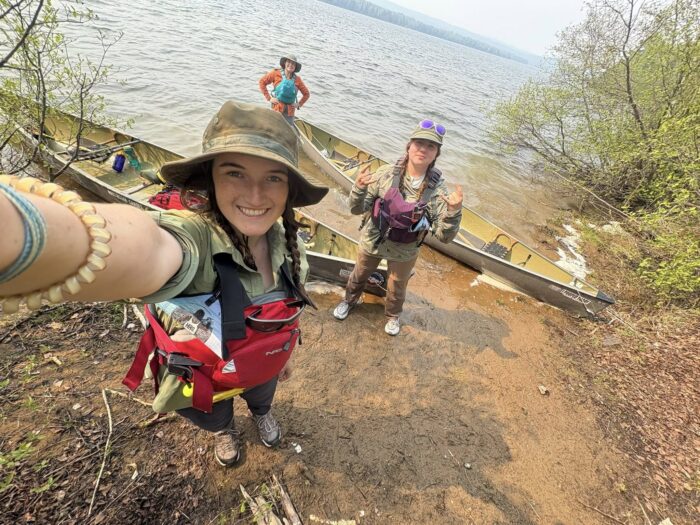
The Route Ahead
Recently, the expedition passed through Voyageurs National Park. They stopped to resupply at the city of International Falls, Minnesota, which straddles the U.S and Canada border. The next leg of their journey involves paddling north across Lake of the Woods, a vast body of water notable for its thousands of islands and indigenous heritage.
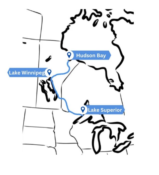
Following Lake of the Woods, the team will navigate the 240km Winnipeg River. From there, they'll paddle along the eastern shores of Lake Winnipeg for three to four weeks, likely contending with shallow waters and large swells.
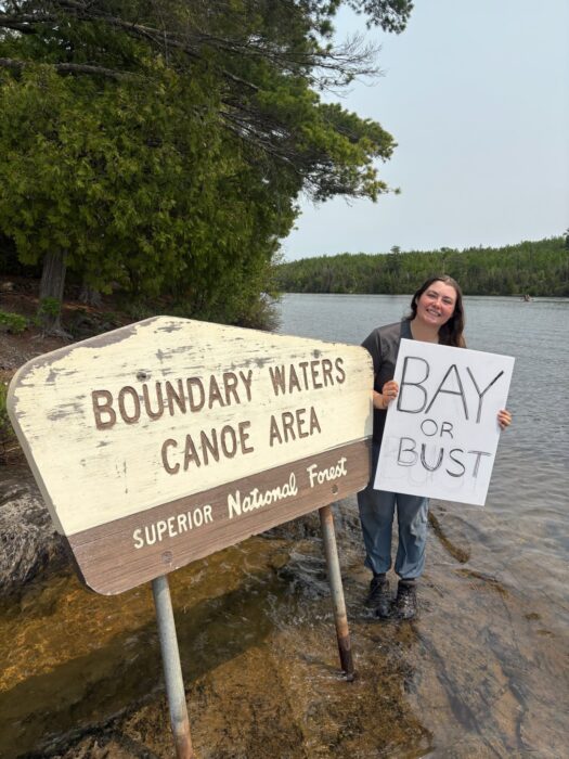
The expedition's final stretch is the 480km Hayes River, a Canadian Heritage River historically used by the Hudson Bay Company as a key trading route. The river transitions dramatically from boreal forest to sub-arctic tundra and is home to several Cree communities.
All being well, the Hudson Bay Girls' journey will culminate at York Factory -- a historically significant trading post pivotal to Canada's fur trade era -- in Hudson Bay.
Earlier this season, Zdenek Hak and Radoslav Groh made the first ascent of the southeast face of 6,300m Hunza Peak in the Karakoram. The Czechs' new route rises 2,300m from base to summit and reaches 90º of steepness. They proposed a grade of 5+UIAA, M6+, WI5 for their new line, which they called Eid al Adha.
The climbers posted some photos and a couple of sentences right after the expedition, but here is a complete report of how the pair reached what they called one of the most beautiful summits they’ve ever stepped on.
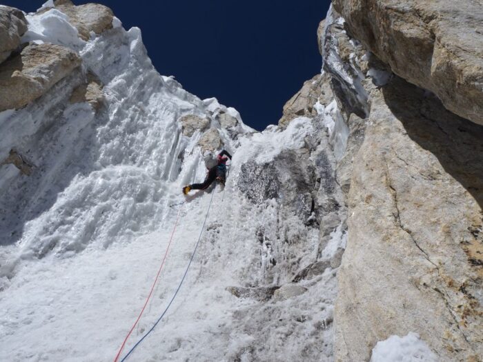
Promoted to main goal
This is not Hak and Groh's first rodeo; the pair are regulars on our best expeditions of the year list. They had first set their sights on Hunza Peak in 2024 as acclimatization for an even more ambitious project -- the first ascent of 7,453m Muchu Chhish, then the highest unclimbed peak in Pakistan. Their successful climb was ExplorersWeb's top expedition of 2024.
"Unfortunately, we had to cancel the attempt [on Hunza Peak] due to my illness and focus solely on the main target of that season, Muchu Chhish," Hak told us. "Nevertheless, we left at the bottom of the southeast face of Hunza Peak not only our equipment but also our dreams, desires, and commitment."
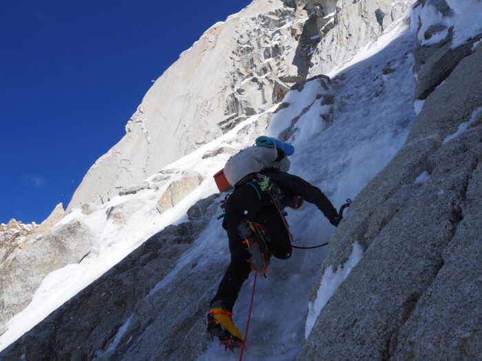
When Jaroslav Bansky, the third man on the Muchu Chhish team, dropped out of projects for 2025, "Radoslav Groh and I agreed not to attempt any extremely high mountain and to return to Hunza Peak instead," said Hak.
The duo arrived in Pakistan on May 20. They knew they wanted to try the unclimbed south face and had also seen a possible route to the summit.
"The only goal this time was to acclimatize well and wait for favorable conditions and weather," the climbers said.
The right conditions
The right conditions came on June 6. Hak and Groh set off toward the face, with 3,000 vertical meters ahead of them to the summit. Of this, 2,300m required technical climbing.
However, even the approaches to the climbing sections were not easy. Nearly one meter of fresh snow had recently fallen.
"It was quite tough to fight our way through," they admitted. "Also, in between the gullies, there were also rock sections of 5+."

The climbers pitched their tent for the first night on the glacier at 4,500m.
"The next day, we just managed another 600 vertical meters. Already at 10 am, avalanches were falling all around us," they explained. "It was so dangerous we had to set a second bivouac right then."
The third day, Hak and Groh climbed 800 vertical meters of steep snowy or mixed terrain to 5,900m.
"We worked hard to dig a small platform for our tent," they said.
On the following morning, they launched their summit push:
The summit day

On June 9, we left the tent and all the equipment at our last bivouac so we could go light. The first M6 pitch warmed us up, and we continued through a firn couloir with 20m of perpendicular ice. Once we got over it, we climbed tediously up to the top serac...There was no way further, so we rappeled leftward into the central couloir and then we climbed back up, until a shoulder right below the summit.
From there, we just had to overcome a 50m high ice/snow tower with a ‘mushroom’ on top just like a summit in Patagonia. It was beautiful and spectacular climbing with a lot of exposure! One of the most beautiful I have ever experienced. There was not enough place for both of us on the summit ridge so we had to take turns. We even dug a hole in the snow and looked through to the other side. Amazing experience! I have not been on such an extraordinary summit before.

They descended by rappelling down the same route they had climbed, resting for the night in Camp 3. They made it back to Base Camp on June 10.
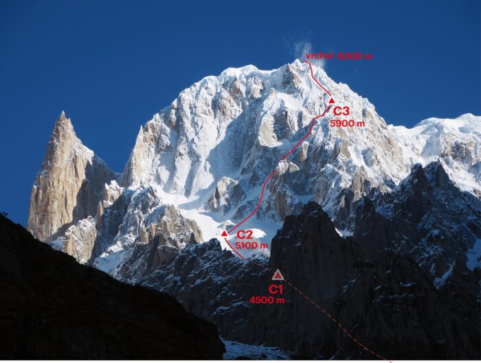
Hunza Peak lies at the head of the Hunza Valley, in the Batura Muztagh range. Several alpine-style teams visited the area earlier this season, with some success. The American expedition on neighboring Ultar Sar, for example, bagged the first ascent of the southeast pillar.
Pecking order
In several of the pictures shared by the team, Groh's helmet is seen severely damaged.
"Nothing serious," Hak explained. Apparently, it was not from a falling rock or a chunk of ice. For some reason, the local birds enjoyed pecking at the helmet when they found it in a gear cache.

Since our last ocean rowing roundup, the World’s Toughest Row has crowned its winner, one crew has started an Arctic row, and everyone else is still battling across the world’s oceans.
Pacific Ocean
World's Toughest Row: This year, four teams entered the World's Toughest Row, a 4,500km race across the mid-Pacific from Monterey, California, to Hanalei Bay, Hawaii. Teams set off on June 6, and two crews have crossed the finish line so far. After tricky conditions at the start of the race, and the expected issues with seasickness and fatigue, the four crews have settled into their rows.
After the first 10 days, the crews began to move quickly west, thanks to helpful waves and wind.
Four-person crew Swiss Raw aimed to set a new speed record. They succeeded. Jun Hurni, Samuel Widmer, Ingvar Groza, and Yassin Boussena completed the row in 25 days, 2 hours, and 21 minutes, shattering the previous record by four-and-a-half days. "We were told to push hard out of Monterey, and we just didn’t stop," Boussena said.
The next crew, Ocean5, came in seven days behind the winning team. Thomas Higham, Kevin Gaskell, Matt Gaskell, Stephen Greenan, and Patrick Deacon crossed the finish line after 32 days, 6 hours, and 51 minutes. They are the fastest five ever to complete the race, beating the previous record by almost 20 days.
The two remaining crews are drawing close to Hawaii and expect to land in the next few days.
Peru to Australia team making good progress
Seas the Day (UK): Jess Rowe and Miriam Payne are rowing from Peru to Australia. They first set off in April but had to abandon their attempt after 480km when their rudder broke.
In May, they restarted and have now covered 5,900km of the mammoth 14,000km journey. Originally, they were aiming for Sydney, but it is so busy during the months that they would likely finish that they have changed course for Brisbane.
A big milestone for the duo came on June 19, when they officially completed the first quarter of their journey. Now they are just weeks away from the halfway point, and are hoping to cross the imaginary line on July 25.
They have been incredibly upbeat since their first day, but even for the chirpiest of duos, months at sea can become monotonous. Nearing the halfway point has given them a huge boost. In the last few days, the weather had been on their stern, giving them some of their fastest days yet. Recently, they have clocked between 105km and 125km each day.
However, power remains an issue. Since the start of their row, their batteries have been playing up. Now, their electrical system has almost completely failed. The batteries drain every night, and they are unable to figure out what is causing the leak. They use all the power remaining solely for the autohelm. They have switched everything else off.
Self-imposed silence
MacLean Brothers (UK): Ewan, Jamie, and Lachlan McLean are also rowing from Peru to Australia. Three months after setting off, they had covered over half of the 14,000km.
They are hoping to set a new speed record, but unfavorable conditions are making that unlikely. In the last few weeks of June, they reported a "messy sea state with no regularity." Ocean swells combined with wind-driven waves. At one point, the squall was so strong they said it was like being "tossed around like a rubber duck in a wave pool." Constantly soaked, they ruefully remarked that they "yearn for the Edinburgh drizzle."
Conditions improved as they moved through to the end of June and the beginning of July. Deciding it felt a bit too easy, they decided to row in silence for three days. They did not speak to each other, turned off their Starlink, and went radio silent on all comms. Before starting, they made a plan for their silent days and came up with a few signals they could use for essential communication.
"Time moves differently when you’re completely silent," they wrote.
More speed record hopefuls
Tame the Kraken (US): Tim and Harrison Crockett are a father-and-son team taking on the Pacific. Their route is similar to the World’s Toughest Row, starting in California and rowing to Hawaii.
They are also hoping for a speed record, aiming to complete the row in 45 days. This is becoming less and less likely because of a difficult start, when they struggled with exhaustion and a broken autohelm.
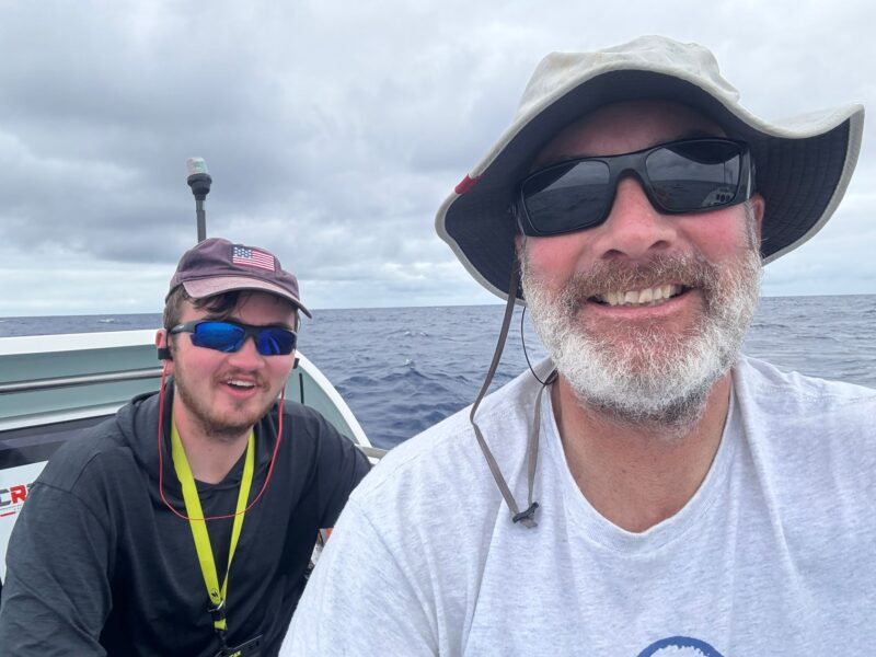
It is hurricane season over the Pacific. Bizarrely, this is helpful (as long as you don’t get caught in one) because it creates quite reliable trade winds that can push you along. However, the downside is that for the first three weeks of June, they were almost always in full foul-weather gear. Cloud cover was near constant, alongside heavy rain and choppy seas.
As it stands, they have been rowing for over 10 weeks and have 1,100km to go. To finish the row within 45 days, they need to cover 125km per day, approximately double their average pace.
Around the world with human power
Louis Margot (CH): Louis Margot is making his way around the world by rowing and cycling. He started by cycling from his home country of Switzerland to Portugal. Then he hopped into his boat and rowed to Columbia in 115 days. From there, he once again began pedaling, this time to Peru.
Now he is on his second rowing section, from Peru to Indonesia. After rowing to Hiva Oa in the Marquesas Islands, he stopped for a few months to rest, make repairs, and restock. He has been back on the water for just over a month and is chipping away at the 11,638km to Indonesia. So far, he has rowed approximately 2,300km.
Indian Ocean
Ocean Revival (UK): Matthew Mason, Jake Mattock, Matthew Inglesby, and Mathew Hemmings are rowing 8,500km from Australia to Kenya. Originally, they were rowing to Dar es Salaam in Tanzania, but have decided to change course slightly and are now heading towards Kilifi, slightly north of the city of Mombasa. Mid-row, they discovered that the port in Dar es Salaam has no slipways, which would make getting the boat out of the water incredibly tricky.
Showing how close-knit the ocean rowing community can be, the team got in touch with the Seas the Day crew. Jess Rowe was quick to respond with some helpful information; her father lives in Kenya and knows the coastline well. A few phone calls later, and the boatyard in Kilifi is getting ready for their arrival.
After two months, they have covered 6,800km. In the last few weeks, conditions have been changeable. They had 24 hours on the para-anchor as a big weather system crossed their path. They almost capsized, and then panicked as a large ship passed too close for comfort. To try and conserve power, they have been switching their navigation on and off. While it was off, a ship suddenly appeared. At first, they thought it was a wave, but within 20 minutes, it was a few kilometers from them.
"Somewhere between survival and bliss, we’ve found a strange kind of peace out here," the crew wrote recently. "As a crew, we’ve laughed hard, rowed harder, and been broken and rebuilt more times than we can count."
The world's blue highway
Untamed (BG, NL, CN, UA): A second four-person crew is also trundling across the Indian Ocean from Australia to Kenya. Almost eight weeks into their row, Evgeny Sudyr, Liu Yong, Ralph Tuijn, and Stefan Ivanov have covered 7,100km of the 9,000km.
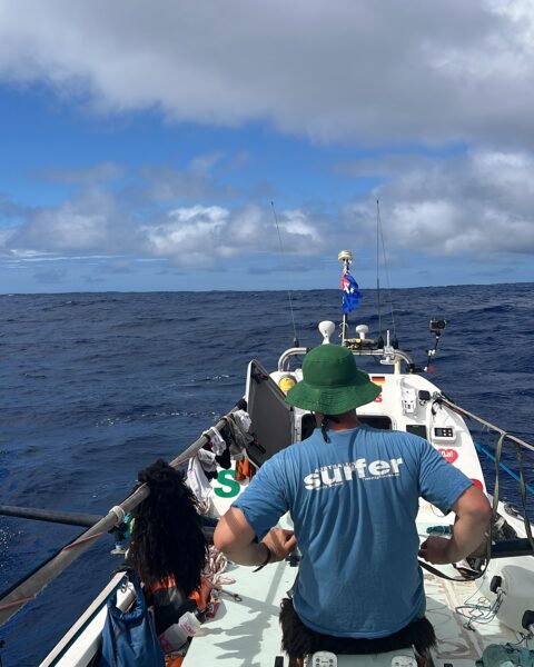
An ambitious crew with a wealth of ocean-rowing knowledge, they had hoped to make the crossing in 75 days. Despite their best efforts, they won't achieve this. Even for experienced rowers, the Indian Ocean is difficult. It is why so few ocean rowers tackle it.
The team has given few updates but noted the difficulties of rowing across the "world’s blue highway" after so many weeks of solitude: "We are right in the middle of the major shipping lanes connecting Southeast Asia, Africa, and Latin America. Seeing dozens of vessels appear on our tracker feels surreal after days alone with the waves, a reminder that this ocean is a global thoroughfare."
Around Britain
52 Degrees North (IE/UK): David Irving (IE), Rod Tredgett (UK), and Scott Brown (UK) are rowing 2,700km clockwise around Great Britain. Starting at Tower Bridge in London, they made their way down to the south coast and are now moving up the west coast through the Celtic Sea into the Irish Sea.
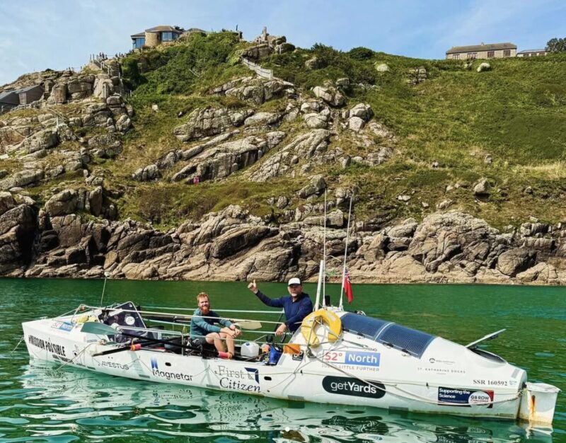
Slow progress has frustrated the trio. Conditions have forced them onto anchor at multiple points, sometimes for days at a time. "It is very hard to remain positive when momentum is so fragmented due to the adverse weather," they commented on social media.
Row with the Flow GB (UK): This six-man crew, originally called Counternavig8, had planned to row counterclockwise around mainland Britain in 2024. The weather at the time made it impossible, so they postponed the row for a year, only to face the same issues in 2025.
After waiting weeks for an appropriate weather window and running out of time to complete the row, they changed plans and rowed clockwise. They renamed themselves Row with the Flow.
Unlike most crews rowing around Britain, they did not start from Tower Bridge; they set off from Eyemouth on the east coast of Scotland. Having started three days ago, they are working their way down the east coast of Northumberland.
Arctic Ocean
The Arctic Challenge 2025 (US): This four-person American crew is rowing 1,000km across the Arctic Ocean from Tromsø, Norway, to Longyearbyen, Svalbard. The speed record for a four-person team on that section of the Arctic Ocean was set in 2023 by Ocean Revival, which made the crossing in 15 days, 5 hours, and 32 minutes. This crew hopes to beat that time. If they complete the row, they will be the first all-American team to row the polar ocean.
They started on July 4 and are getting used to the icy conditions. The last 24 hours have been wet and cloudy, and they are in battery conservation mode. They are making excellent progress, having already completed 70% of the journey.
Waldemar Kowalewski's ordeal on Broad Peak is almost but not quite over. The Polish climber, who broke his leg in an avalanche on Friday, was supposed to fly by helicopter to a hospital in Skardu today. But bad weather has grounded the flight until tomorrow.
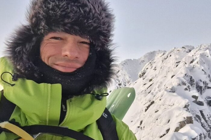
An avalanche hit Kowalewski, 45, as he was descending from Camp 3 in risky conditions. His partners helped him down to a tent at 6,500m, from which a Sherpa rescue team brought him down to Advanced Base Camp. Local climbers then helped him the rest of the way down.
Sherpa rescuers
The Sherpa rescuers were Dawa Sangay Sherpa, Pasang Tenje Sherpa, and Mingtemba Sherpa. All three work for Seven Summit Treks, assisting climbers and fixing ropes on K2. However, bad conditions on the mountain during the second half of last week forced the teams to halt the rope fixing. Everybody was waiting in Base Camp, and so were available. Israfil Ashurli of Azerbaijan coordinated the rescue.

The three set off from Broad Peak's Base Camp on Saturday night and reached Kowalewski Sunday morning. By evening, they had passed Camp 1 and continued down until they met a second local team dispatched from Base Camp to relieve them. Kowalewski arrived back in Base Camp that night, weak but conscious.
When we’re not outdoors, we get our adventure fix by exploring social media and the web. Here are some of the best adventure links we’ve discovered this week.
At 40, She Discovered She Was One of America’s Best Free Divers: At age 40, Sara Lynn Burnett took up freediving on a whim. In her first competition, she reached an impressive 65 m. After her dive, one of the judges suggested she apply for the national team.
A few months later, Burnett was at the Freediving World Championships. The only competitor without a coach, she placed 11th. What started as casual curiosity after her brother lent her his spearfishing fins has developed into an unexpected passion.
Tiny Dog Alerts Mountain Rescue to Accident Site: A hiking trip on Switzerland’s Fee Glacier turned into a dramatic rescue when a man fell roughly eight meters into a crevasse after a snow bridge gave way. The hero of the day? The man's tiny dog.
While its owner started frantically calling for rescue on his walkie-talkie, the little dog sat next to the hole until help arrived, acting as a marker so the team knew where to look. Air Zermatt hailed the dog a "four‑legged hero."

Do I like backpacking?
The Himalayan Trip That Made Me Question If I Even Liked Backpacking: Emily Pennington gives a first-person account of four days hiking Bhutan’s Druk Path Trek. Solo traveling was not new to Pennington, but for some reason, this guided hike felt lonely and isolated. As she saw Phajoding Monastery come into view, her eyes filled with tears. The trip had been on her bucket list for years: Why was she not enjoying herself? She realized that it might be because she would rather be sharing the experience with someone else.
National Park Tragedies in the UK: Over five days, two hikers died in separate falls in England’s national parks. The first hiker fell on Kinder Downfall, the Peak District’s tallest waterfall. Recovery efforts lasted 10 hours and included multiple mountain rescue teams and a coast guard helicopter. The second accident occurred days later on Sharp Edge, a narrow ridge on Blencathra in the Lake District that is considered one of the most dangerous hikes in the UK.
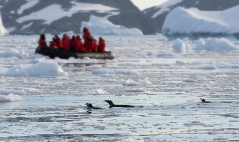
Protecting Antarctica
Why You Should Consider Taking Antarctica Off Your Bucket List: Antarctica holds great allure for a huge number of people, but tourism might wreck the pristine wilderness you’re hoping to visit. From under 8,000 visitors a year three decades ago, numbers have soared to nearly 125,000 in the 2023–24 season.
This influx of tourists puts a huge strain on the fragile ecosystems, with risks including compacting soil, bringing in invasive species, and disturbing breeding colonies. While the Antarctic Treaty and the International Association of Antarctica Tour Operators set guidelines, there are very few actual rules. Experts warn that without stricter regulations, Antarctica could be harmed beyond repair.
The Most Common Trail Running Accidents: Trail running carries more risk than most runners realize. Up to 80% of runners report injuries, but trail-running injuries tend to be particularly serious. A new study examines trail running risks and explores how both individuals and race planners can mitigate them. From cardiac arrest to lightning strikes, Alex Hutchinson summarizes the study and some of the injuries listed.

Biker approaches a bear with tragic results
Motorcyclist Takes Photo With Bear and Gets Mauled to Death: Italian motorcyclist Omar Farang Zin, aged 48, died after a brown bear mauled him in Romania on July 1. He was riding through the Carpathian Mountains when he spotted the bear and approached it. He posed for photos and selfies, some of which were later recovered from his phone. According to other motorcyclists, the bear attacked after he tried to take photos with her cubs.
The Art of Surfing Burn: Nicklas Balboa dissects surf line-up etiquette and the difference between a harmless "drop‑in" and a deliberate "burn." A drop‑in is seen as careless, unplanned, and sometimes forgivable. But a burn is a calculated move meant to insult or undermine another surfer.
Rescuers have brought Waldemar Kowalewski back to Broad Peak's Base Camp two days after the Polish climber broke his leg in an avalanche at 6,500m. The strong Sherpa team climbed from Base Camp to the stranded climber and back to Advanced Base Camp in less than 24 hours.
A second team of Pakistani climbers left Base Camp in the afternoon to take over from the exhausted Nepalese on the last leg, according to Anwar Syed of Lela Peak Expedition, the company managing the rescue.
Kowalewski is conscious but extremely tired and weak, the outfitter told ExplorersWeb.
From Base Camp, Kowalewski will be airlifted to a hospital in Skardu tomorrow, said a spokesperson for Askari Aviation.
Hopefully, tomorrow we will have more details about Kowalewski's condition and the names of the rescuers.

Kim Chang-ho was a South Korean mountaineer who summited the 14x8,000'ers without supplemental oxygen in record time. He pioneered numerous new routes and first ascents on 6,000m and 7,000m peaks. Today, we revisit his most notable climbs.
Early years
Most sources list Kim's birthday as September 15, 1969, but mountaineering historian Bob A. Schelfhout Aubertijn confirmed that Kim was born on July 13, with confusion arising from the Korean age system.
In 1988, Kim began studying International Trade at the University of Seoul. Inspired by Alexander the Great's exploits, Kim started climbing with the university’s Alpine Club.
His frequent expeditions delayed his academic progress, and he didn’t earn his Business Administration degree until 2013. Kim viewed his humanities studies as a way to enrich his climbing. He believed that understanding culture and history deepened his connection to the mountains.
By the 1990s, he was already tackling rock-climbing routes up to 5.12. Early expeditions to the Karakoram, including attempts on 6,286m Great Trango in 1993, and 7,925m Gasherbrum IV in 1996, revealed his bold -- sometimes reckless -- ambition. On Gasherbrum IV, he reached 7,450m but faced a sheer rock face without protection, instructing his partner to release the rope if he fell.
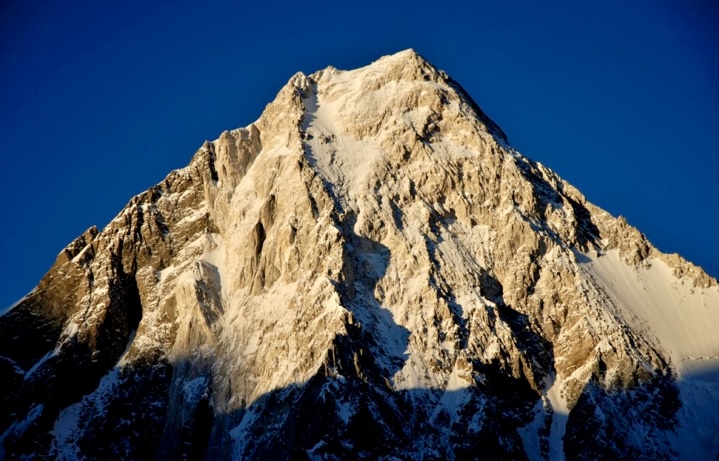
Exploration of northern Pakistan
Between 2000 and 2004, Kim embarked on solo trips in northern Pakistan’s Karakoram, Hindu Kush, and Pamir ranges, prioritizing discovery over summits. As detailed in the 2023 American Alpine Journal, he surveyed glacial valleys, documented hundreds of unclimbed peaks, and built relationships with local farmers and herders. These solitary treks were driven by a desire to understand the geography, culture, and history of the regions.
Kim’s journals reveal a meticulous approach, with photographs and descriptions of potential routes forming a database that remains a valuable resource for climbers. His interactions with locals shaped his climbing decisions, ensuring cultural sensitivity in his choice of peaks. This period of exploration laid the groundwork for his later ascents, blending adventure with respect for the human and natural contexts of the mountains.

Photo: Kim Chang-ho
Four first ascents of 6,000m peaks
Kim’s explorations in Pakistan led to a series of remarkable solo first ascents in 2003, when he was 33. The American Alpine Journal documents four solo climbs of 6,000m peaks in the Hindu Raj and Karakoram ranges.
He carried out the first ascent of 6,105mm Haiz Kor in the Thui Range of the Hindu Raj, by a challenging route via the southeast face and south ridge through a complex icefall.
Kim also made first ascents of 6,225m Dehli Sang-i-Sar in the Little Pamir, 6,189m Atar Kor in the Hindu Raj, and 6,200m Bakma Brakk in the Masherbrums.

Dehli Sang-i Sar from the southwest, showing the general line of Kim Chang-ho's solo ascent along the upper east ridge in 2003. Photo: Kim Chang-ho
Mastering 7,000’ers
In 2008, he led the first ascent of 7,762m Batura II, though the expedition’s use of fixed ropes drew criticism, prompting him to refine his lightweight approach.
In 2012, Kim and An Chi-young made the first ascent of 7,092m Himjung in Nepal, climbing via its southwest face. The expedition earned them the Piolet d’Or Asia Award.
In 2016, Kim and two partners opened a new 3,800m alpine route on the south face of 7,455m Gangapurna in Nepal. Described by the 2017 Piolet d’Or committee as "bold and lightweight," it earned an Honorable Mention, marking a historic recognition for Korean climbers.
During the Gangapurna expedition, Kim and his partners also attempted the south face of unclimbed Gangapurna West, where they reached the summit ridge.
One year after Gangapurna, the tireless Kim led an expedition to Himachal Pradesh in India, aimed at fostering a younger generation of Korean climbers and developing their skills and experience. The team made the second ascent of 6,446m Dharamsura, and climbed 6,451m Papsura via a direct route on the south face.

Choi Seok-mun and Park Joung-yong, climbing partners of Kim Chang-ho, approach the summit of Gangapurna. Photo: Korean Way Project
Summiting 8,000'ers
Kim summited all 14 of the world’s 8,000m peaks without supplemental oxygen, in record time.
Starting in 2006 with the Busan Alpine Federation’s Dynamic Hope Expedition (led by Hong Bo-Sung), Kim and a small team relied on minimal support, avoiding Sherpas and oxygen. Kim studied geography and history to learn more about his routes.
Kim completed the 14x8,000'ers in 7 years, 10 months, and 6 days, setting a record for the fastest completion without oxygen at the time. He surpassed Jerzy Kukuczka's record by one month.
Kim didn't set out with the explicit goal of climbing the 8,000'ers so quickly. His pursuit was primarily driven by his passion for mountaineering and a desire to climb these peaks in a pure, lightweight style.
Kim ascended three 8,000m peaks twice: Nanga Parbat, Gasherbrum I, and Gasherbrum II.
Among his 8,000m climbs, his south-north traverse of Nanga Parbat in 2005 and his sea-to-summit ascent of Everest in 2013 deserve special mention.

The south face of Gangapurna, showing (in red) the Canadian Route (1981), and (yellow) the Korean Way (2016). Photo: Korean Way Project
Nanga Parbat, 2005
In 2005, Kim climbed Nanga Parbat’s massive Rupal Face. The Korean Nanga Parbat Rupal Expedition lasted 109 days. They arrived at Base Camp on April 20 after a heavy snowstorm. Over the next 12 days, the team set up Camp 1 at 5,280m and Camp 2 at 6,090m, following a line close to the 1970 Messner Route.
The weather was brutal, with snow falling daily in May, destroying seven tents and burying Camp 2 under fresh snow. Despite these setbacks, by June 14, after 43 days of effort, the team established Camp 3 at 6,850m. Near the end of June, the team prepared for a summit attempt, and on June 26, Kim and three other climbers started their push. However, at 7,550m on the Merkl Icefield, a rock hit team member Kim Mi-gon in the leg, forcing the group to abort.
Undeterred, Kim and climbing partner Lee Hyun-jo made another attempt on July 13, starting from Camp 4 at 7,125m. They faced constant danger, dodging falling rocks and ice. After a 24-hour climb, they reached the summit of Nanga Parbat.

Kim Chang-ho. Photo: Abbas Ali
A difficult descent
Kim and Lee chose to go down the Diamir Face via the Kinshofer Route, unroped, to save time. In the middle of the descent, they triggered a wind slab avalanche. Lee was buried, and Kim was swept 50m downhill, scraping his face and losing his headlamp. Both managed to free themselves and continued down, exhausted and hallucinating, believing another climber was ahead of them. They reached another expedition’s tents at 7,100m but decided against stopping, fearing they might not wake up if they rested. After an incredible 68 hours from Camp 4, they arrived at the Diamir Base Camp, impressing others with their speed and resilience. Lee appeared remarkably fresh despite the ordeal.
This expedition was a turning point for Kim. The climb was a tactical, siege-style effort, relying on fixed ropes and a larger team, very different from the lightweight, alpine-style climbs he later became known for. During the descent, Lee’s emotional radio call to a teammate at Base Camp, expressing regret that they weren’t together, deeply affected Kim.
Kim reflected on his selfishness, realizing that reaching the summit meant little without returning safely with his team. This experience shaped his philosophy moving forward, which would emphasize teamwork, respect for the mountains, and survival over personal glory.

Views of Everest from neighboring Lhotse. Photo: Kadyr Saydilkan
Everest, 2013: Starting from sea level
Kim’s 2013 Everest ascent was the final step in his quest to climb the 8,000m peaks without supplemental oxygen, making him the first Korean to do so. But his Everest climb was not just about reaching the top; it was a unique adventure.
Kim’s journey to Everest’s summit began far from the mountain itself. He wanted to make the climb special by starting at sea level and traveling to Base Camp without using motorized transport.
On March 20, 2013, he began his expedition from Sagar Island near Kolkata, India. From there, he kayaked 156km on the River Ganges, cycled 893km through northern India to Tumlingtar in Nepal, and then trekked 162km to Everest Base Camp. This sea-to-summit approach was rare and challenging, inspired by earlier climbers like Tim Macartney-Snape and Goran Kropp, but Kim added a twist by kayaking part of the way.
Once at Everest Base Camp, Kim prepared to climb the mountain via the standard Southeast Ridge route from the Nepal side without oxygen. He moved steadily up the mountain, navigating the Khumbu Icefall, the Western Cwm, and the steep slopes leading to the South Col. On May 20, Kim reached the summit.
Sadly, Kim’s climbing partner, Seo Sung-ho, died during the descent. This loss cast a shadow over the triumph, but Kim’s accomplishment remained a mountaineering landmark.

Kim Chang-ho and his team near the Sara Umga La at 5,020m, west of Dharamsura and Pasura peaks, in 2017. Photo: Korean Way Project
Mountaineering philosophy
Kim’s mountaineering philosophy viewed climbing as a means of learning and coexistence, not conquest. He avoided treating peaks as mere challenges, instead choosing routes with historical or cultural significance. After losing his partner Seo Sung-ho on Everest in 2013, Kim founded the Korean Himalayan Fund to support young climbers in creative ascents. His database, preserved by his wife Kim Youn-kyoung, includes detailed notes on geography and local names.
Kim’s death
Kim’s life ended on October 11, 2018, when an avalanche, possibly triggered by a serac collapse, destroyed his team’s Base Camp beneath 7,193m Gurja Himal, located south of Dhaulagiri VI, in Nepal. The Korean Way Project expedition, aiming for a new route on the south face, included five South Korean climbers and four Nepali guides, all of whom perished.
Kim’s journal, ending on October 10, suggests the tragedy struck overnight. By the time of his death, he was recognized as South Korea’s most accomplished climber. Kim was 49 years old.
His legacy endures through his database, the Korean Himalayan Fund, climbers like Oh Young-hoon who carry forward his vision, Kim’s daughter (Danah, born in 2016), his wife, and through the international mountaineering community, who preserve his memory.

Kim Chang-ho. Photo: En.namu.wiki
Nineteen-year-old Darcy Deefholts went out surfing on the afternoon of July 9 at Wooli Beach in New South Wales, Australia. When he failed to come home that night, his parents raised the alarm, calling the police to report the young man missing. Authorities immediately launched a large search-and-rescue effort.
Searchers found his discarded clothes, shoes, and bicycle on the beach. It was obvious that southward currents had swept the young man out to sea. The only source of hope was the absence of his long board. Marine Rescue New South Wales assembled a crew of volunteers and launched their rescue boat, Wooli 30. The community rallied, adding half a dozen private vessels to the search efforts.
Water conditions were favorable, and they were able to cover a significant stretch of coast. But at 1 am on July 10, the vessel had to return to shore, unsuccessful.
One in a million
On the morning of July 10, SAR operations recommenced. Wooli 30 and six other boats began searching, while many more volunteers canvassed the beaches. Around 9 am, a crew of volunteers, including the missing man's uncle, found him alive on North Solitary Island.
North Solitary Island is part of the Solitary Islands, named by Captain James Cook when he sailed past them in 1770. The small uninhabited island lies 14 kilometers off Wooli Beach.
Deefholts spent the night adrift, clinging to his longboard, before reaching the relative safety of the island. When searchers found the missing surfer, he was cold and suffering from exposure, but otherwise uninjured. Upon reaching shore, he was taken to Grafton Base Hospital for medical assessment and is reportedly recovering well from his ordeal.
His father, Terry Deefholts, spoke with the Australian Broadcasting Corporation, expressing his relief and amazement that his son had been found. He had been close to giving up, he told them. "It's a one in a million. Who survives this?"
ABC also spoke with Marine Rescue Wooli Unit Commander Matthew McLennan, who led the group that found Darcy Deefholts.
"It's rare that we ever get to participate in a search with an outcome such as this," McLennan said. The massive community response, and the happy resolution to a case everyone expected to end in tragedy, was "really heartwarming."
A team of three Sherpas has reached Waldemar Kowalewski of Poland, stranded at 6,500m with a broken leg.
The Nepalese rescue team hopes to reach Camp 1 later today and Base Camp tomorrow, Anwar Syed from outfitter Lela Peak Expedition told ExplorersWeb. However, rescuers will have to deal with difficult conditions during their descent, including crossing avalanche-prone areas.
Kowalewski has waited in a tent -- supported by his climbing partner Jarek (Jaroslaw) Lukaszewski -- since an avalanche hit him on Thursday. Kowalewski had ascended to Camp 3 with at least two other climbers on an acclimatization round despite forecasts warning of incoming bad weather.
Polish climber Lukasz Supergan, reporting from Base Camp, says that the group spent three nights in Camp 3 in stormy conditions before finally starting to descend on Thursday. It was during this descent, as they entered a section of fresh, unstable snow, that the climbers broke a snow slab and triggered the avalanche.
The Nepalese climbers, whose names have not been shared, were previously working on neighboring K2. They had remained in Base Camp because of the bad weather hitting the Karakoram. Kowalewski's outfitter, Lela Peak Expedition, hired the Nepalese climbers after failing to find anyone in Broad Peak's Base Camp willing to perform a rescue on foot in the risky conditions.
Evacuation, insurance, and liability
The Pakistani Army told outfitter Lela Peak Expedition that an aerial pick-up via a long-line operation was not an option. The military pilots will evacuate Kowalewski, but only from Base Camp.
Kowalewski has an insurance policy with Global Rescue that will cover the helicopter costs, but not the ground rescue team. That means that the Polish climber and his home team will have to foot the bill for the Nepalese rescuers.
Outfitter Lela Peak has hired three Nepalese Sherpas to rescue Waldemar Kowalewski. The Polish climber is still stranded in a tent at 6,500m on Broad Peak after breaking his leg in an avalanche. The Sherpas left at around 11 pm Pakistan time.
Kowalewski's accident occurred when he and two other climbers tried to descend to Base Camp after a snow storm trapped them in Camp 3 for two days. They released a snow slab; the other two escaped but Kowalewski was injured.
The two climbers, identified only as Jarek and Hassan, helped him a little way down and pitched a tent for him at 6,500m. Jarek -- apparently a Polish friend of Kowalewski's -- is looking after him. They have sleeping bags and fuel for cooking.
For many hours, his situation did not improve. Snow continued to fall today, making the area even more avalanche prone. Lukasz Supergan and other climbers in Base Camp saw several slides today.
Helicopters are grounded due to the bad weather. Even if it improves, they have warned they will not fly any higher than 5,000m, roughly the altitude of Base Camp. Other Pakistani outfitters explained to ExplorersWeb that this is as high as their rescue helicopters typically go.

Took risks
Supergan noted that Kowalewski took significant risks by going up to Camp 3 when forecasts warned of bad weather ahead. Several other climbers on the mountain, Supergan included, did rotations to Camps 1 and 2, but returned to Base Camp earlier this week.
"Kowalewski was descending in terrain highly prone to avalanches, and that was the cause of the accident," he said.
Kowalewski's outfitter, Lela Peak Expeditions, had a hard time finding a local team to go up on foot, but eventually hired three Sherpas. They left Base Camp at night, when the cold makes both the snow and the bare rocky sections less unstable.
Last month, Icelanders Hoddi Tryggvason and Halldor Meyer completed a 4,200km circular snowkiting journey on Greenland’s ice sheet. The 50-day expedition began and finished near Tasiilaq on Greenland’s southeastern coast.
Beginning on May 10, the pair was initially accompanied by Danish adventurer Bjorn Lindhardt Wils as they traveled clockwise, passing the historic Cold War radar stations DYE 3 and DYE 2 on their way to Greenland’s west coast.
Early struggles and injury
In the early stages of the all-Scandinavian team’s journey, they contended with poor visibility and heavy snowfall. But the situation worsened when Wils injured himself while kiting, an all-too-common risk in the sport due to the high speeds and unpredictable winds. "Something went terribly wrong with his kite when he was launching it in really strong winds," said Tryggvason.

“He was catapulted several meters up in the air, came crashing down, and hurt himself quite badly,” Tryggvason continued. “He still tried to keep on kiting until it was just pointless.”
All three had previous snowkiting experience on Greenland, having kited 1,800km together from DYE 2 to Qaanaaq in 2022. Tryggvason has also kited from near the South Pole to Hercules Inlet, and Wils kited 2,400km from Narsaq to Qaanaaq in 2016.
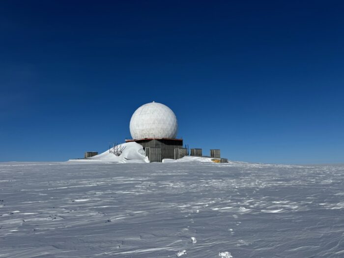
Previous kiting expeditions
Most kiting teams in Greenland travel a linear route from north to south, from Kangerlussuaq to Qaanaaq.“We wanted to do something a bit more challenging…something that not many people do,” said Tryggvason.

Few teams choose longer journeys. However, 2014 saw multiple teams undertake circular snowkiting expeditions around the interior of Greenland. The longest was the "Wings Over Greenland II" expedition by Michael Charavin and Cornelius Strohm. They covered 5,067km in 58 days, completing a loop around the ice cap from Narsaq in the far south.
At the same time, Dixie Dansercoer and Eric McNair-Landry completed a 4,045km loop from Tasiilaq in 56 days. A third team, "Trineo de Viento," used a large wooden wind-powered sled to travel 4,300km in 49 days, starting and ending in Kangerlussuaq.
Reaching the north coast
After Wils was evacuated by helicopter, Halldor and Tryggvason pressed on toward Greenland’s remote north coast, reaching 82˚N near Independence Fiord in Peary Land on June 9. Tryggvason, in particular, was keen to visit this region, which is steeped in exploration history, and rarely visited even by modern Arctic travelers.
Peary Land was named after the infamous American explorer Robert E. Peary, who mapped much of northern Greenland and controversially claimed to reach the North Pole in 1909. His maps included a major error, though: the Peary Channel, a nonexistent waterway thought to separate Peary Land from the mainland.

In 1907, the Denmark Expedition set out to chart Greenland’s northeast coast and investigate this supposed channel. Tragically, the Danish team became trapped in the remote interior, and three members perished.
The myth of the Peary Channel was finally put to rest in 1912, when Knud Rasmussen’s First Thule Expedition confirmed Peary Land was a peninsula, not an island, leading to the correction of all future maps.
The home stretch
The final leg of the journey, heading south along Greenland’s eastern edge, brought good weather and favorable winds. For over two weeks, the team pushed through long daily kiting sessions, gradually closing the loop on their 4,200km route.
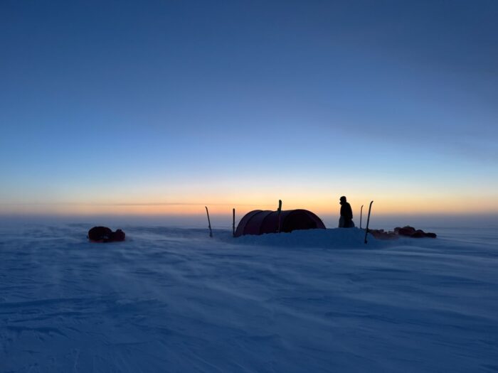
The two Icelanders completed the full circuit near Isortoq on the southeast coast, where a boat eventually picked them up. But the adventure didn’t end quietly. The final day demanded 16 hours of manhauling through the rapidly melting, slushy lower slopes of the Ice Sheet, a thorny reminder of the Arctic’s continually shifting conditions.
Naila Kiani is on her way to becoming the first Pakistani woman to complete the 14x8,000'ers, but her impact goes beyond summits. Kiani is driving change in her country's mountaineering scene, speaking up for those without a voice and making more than a few enemies along the way.
During her 14x8,000m quest, Kiani has been a reliable, outspoken witness in the usually secretive commercial climbing industry. She was the one who denounced how climber Ali Akbar Sakhi of Afghanistan was abandoned close to Camp 3 on K2, and faced threats when she accused Sakhi's outfitter of negligence.
Kiani also reported what happened on Shisha Pangma in 2023, when a race to become the first American woman to finish the 8,000m list ended with both women's deaths, alongside their Sherpas. After porter Ali Muhammad Hassan died at K2's Bottleneck, and a hundred climbers passed him on their way to the summit, Kiani coordinated a team of local climbers to return his body in the highest retrieval operation ever performed on K2. She has also led cleaning campaigns on the mountain.
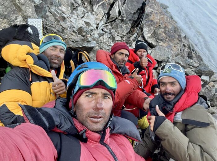
This year, Kiani has spoken out on behalf of a group of local porters whose outfitter had not paid them. She knew the porters were too vulnerable to protest by themselves and that the loss of income might mean misery and hunger for their families.
Changes in aerial rescues
In the last few weeks, Kiani also made two promising announcements: the establishment of a mobile medical dispensary in the Karakoram and a change in helicopter protocols for mountain rescues in Pakistan. Until now, army pilots have managed helicopter rescues, flying in two helicopter patrols that charged $26,000 per flight -- the most expensive fee in the world.
"Last year, I spoke out against the extremely high prices that sick and injured climbers were being charged for helicopter evacuations," Kiani said. "Many told me to stay quiet, and that no one would listen."
Instead, she wrote letters and contacted high-ranking army officials directly. Kiani provided lists of prices comparing aerial rescue services and their costs in several mountain ranges around the world.
"I clearly explained that climbers evacuated in Pakistan were paying way, way too much," Kiani told ExplorersWeb.
To the surprise of the skeptics, the military listened. The new president of the Alpine Club of Pakistan (and Army General), Irfan Arshad, supported Kiani in this quest. The protocols have now changed, and, if applied, the impact will be huge.
Rescues 60% cheaper
Now, the helicopters don't need to fly in pairs.
"Only one helicopter is being sent for rescues, bringing the cost down to under $9,900 on average, nearly one-third of what climbers were paying before," Naila explained.
The change will also double the rescue capacity of the Pakistani air force, as each helicopter may attend to a different rescue at the same time.
Kiani has also insisted on a stricter account of the rescue charges, as the previous cost (calculated per hour of flight time) was sometimes inaccurate.
Finally, Kiani hopes the new protocols will prioritize serious medical cases without insurance companies agreeing to foot the bill first. This would greatly benefit many local porters, who either lack insurance or have limited coverage.
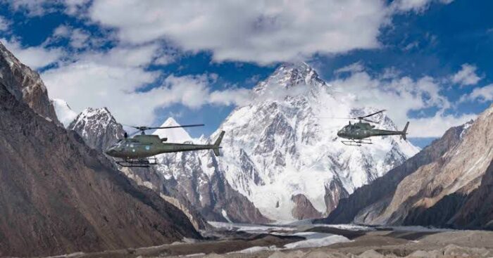
Kiani is hopeful costs will decrease immediately, but she also foresees further improvements. She told Explorersweb that the situation will improve when Pakistan allows private helicopter companies to operate rescues (as they can in Nepal), which Kiani is confident will happen in the future. In her opinion, private companies will lower costs and may be more flexible regarding altitude and weather conditions for rescues.
These improvements may seem logical, but in a country like Pakistan, where the army is incredibly powerful and rarely influenced by external forces, what Kiani has achieved is more extraordinary than any of her climbs.
Dispensaries in the Karakoram
Kiani has also lobbied for (and helped finance) the installation of two paramedical dispensaries along the Baltoro during the summer season. One is already operating at Concordia, one day from K2 Base Camp, and another is ready to start operating in Urdukas, as soon as the assigned nurse gets there.
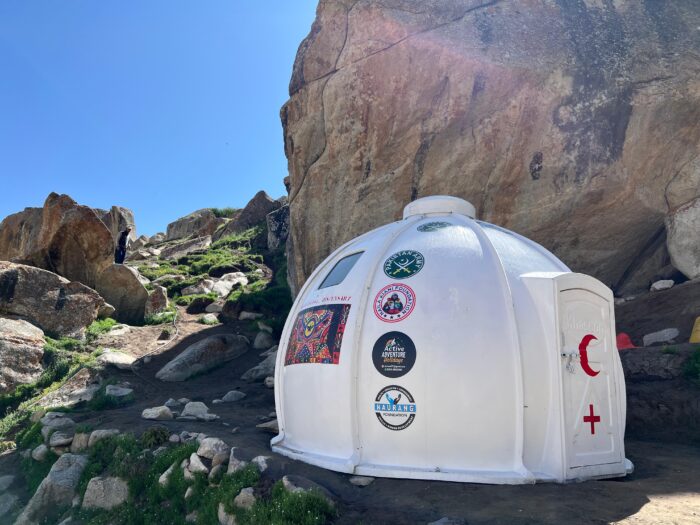
"They will treat everybody for free: trekkers, climbers, and locals working in the area," Kiani said. "Finally, there is a semi-permanent facility to provide sanitary care during the Baltoro trek: igloos prepared to endure harsh weather."
The lack of facilities was a serious problem, particularly for local porters who had nothing to treat their injuries and disinfect wounds. With no help, even small health issues rapidly developed into serious medical conditions.
"We don't have a doctor yet, but the nurse managing each dispensary can treat a wide range of issues," Kiani said.
Kiani will pay the nurse's salary while Pakistan's Alpine Club will cover the rest.
Not just words, actions
These changes come after years of very little progress to improve the welfare of climbers and, most of all, local communities working in the climbing industry.
"I am not the only one who speaks up," Kiani said. "Other climbers also make their voices heard, but it is one thing to speak about something we think is wrong, and another to take action to change it. I strongly believe that if you want things to change, you need to take action."
Kiani's campaign for change has made enemies, but it has also received important support, such as from the Alpine Club of Pakistan and Green Tourism, a private institution that works closely with the country's government. "Without their help, I couldn’t have achieved what I did this year," Kiani explained.
Yet speaking up takes a toll, especially in the close-knit Pakistani climbing community. When Kiani pointed a finger at the negligence of some local operators, she faced harsh criticism and accusations of jealousy or courting controversy.
But Kiani insists that these negative aspects impact the entire Pakistani tourism industry.
"I can't help thinking that Pakistan has such huge potential for mountain tourism, and that mountain tourism can make a life-changing impact on local communities."

In addition to her determination, Kiani has something else in her favor: She is well-educated, with experience making a case, with plenty of proof and documentation, to draw the attention of senior officials. She is a Dubai-based engineer who has worked as a banker, although she quit her full-time job to pursue climbing in 2023.
Breaking social boundaries through climbing
Kiani summited Kangchenjunga, her 12th 8,000'er, last spring. While she has not confirmed her plans for fall, she intends to climb Shisha Pangma and Dhaulagiri to complete the 14x8,000m challenge.
"I get some criticism because I use oxygen and Sherpa support, but climbing has given me a voice and I’m using that voice to try to make a difference," Kiani told ExplorersWeb.
Kiani has become an influential figure for young Pakistani women.
"Gender equality is a real issue. Women here sometimes don’t have confidence and self-belief, so I wanted to inspire Pakistani women," she explained. "If I can do things that are not associated with Pakistani women, and if I can speak up about things that others won’t even dare, then hopefully others can do the same."
Pakistan ranked last (148th out of 148 countries) in the World Economic Forum's Global Gender Gap Index in 2025, with a score of 56.7%. Dawn.com cited data from the Human Rights Commission of Pakistan (HRCP) showing that in 2024, "honor" killings continued to be a serious issue across Pakistan. That year, 346 people (nearly all women) were victims of these so-called honor crimes.
In Tornado Hunting: Chase it From the South, storm chasers Chris Chittick and Ricky Forbes document their lives in the notorious Tornado Alley of the central U.S.
Just south of Sioux Falls, North Dakota, Forbes, Chittick, and their crew are waiting and watching the skies for funnels of violent cloud.
"We are in the right spot!" they crow as a tornado warning comes in only a few kilometers away. The tornado siren echoes through an empty town as dark clouds roll overhead. The unfolding scene is apocalyptic. The air turns green, they lose signal -- but the tornado doesn't appear.
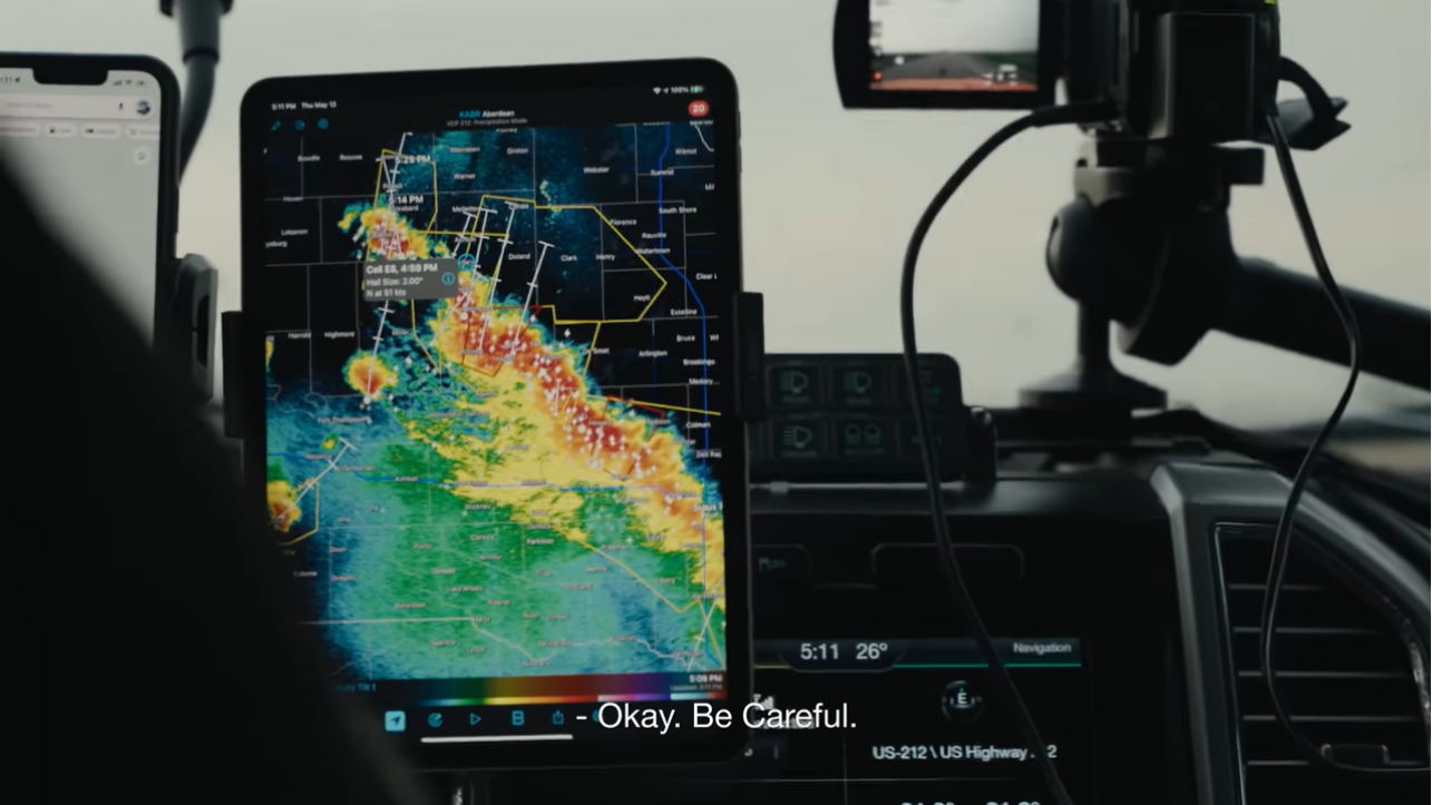
A professional storm chaser is like a sailor of old. The wind and weather are the ultimate deciders of success, no matter their skill or determination. Like the tars, they spend a lot of time away from their families.
After the disappointing storm, in a rain-soaked parking lot, Chris calls home and tells his children that he misses them. Then it's back on the road.

Home is Saskatchewan, Canada. Chris pushes one of his three young children on the swing, one eye on the darkening sky.
"I feel like weather always wins," admits his wife, Chelsea.
Meanwhile, Rickey and his fiancée, Tirzah Cooper, are driving to her first cancer treatment. She wonders how soon she'll lose her hair.

From the south
A storm is forming around Canby, Minnesota, and the Tornado Hunters drive to meet it. But the road conditions and local terrain complicate their attempt. Hills and tall trees prevent their view and access to the storm. The only chance of getting close is to go right in front of the storm's path, a dangerous gamble. It's safer to approach tornadoes from the south, as the storms move in a northerly direction. Driving into them head-on can, and has, been deadly.
"The more I've storm-chased, and the more that I've seen the destruction that tornadoes can do, the more terrified I become of them," admits Ricky.
They're watching construction crews haul away the wreckage of a ruined house, after the storm they failed to catch has passed.
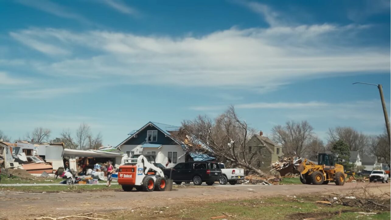
Their caution brings them back to Saskatchewan, where Ricky and Tirzah go to another appointment. He shaves her head. Not long after, a nearby tornado watch offers what he thinks will be the best chance all year. She urges him to chase after it.
After a succession of near-misses, Ricky finally approaches a dramatic tornado. He stops the car and stands in the road, staring up at the twisting mass dominating the sky. In narration, he says that the feeling he had at that moment was the same feeling of awe he experienced the first time he saw a tornado.

Then, he goes home. " A few years ago," he says, "I never thought anything could be more important than storm chasing. I was wrong."
The film ends with him at home, as on-screen text tells us that both Ricky and Chris continue tornado hunting, and Tirzah is now cancer-free.
Denis Urubko and Maria Cardell have opened a new route on the Diamir Face of Nanga Parbat. The couple reached the summit yesterday, outfitter Active Adventure Holiday told ExplorersWeb.
Imram Ali Khan of AAH confirmed that Urubko, 52, and his partner Maria Cardell, 50, climbed the new route in alpine style and safely returned to Base Camp. We are waiting for details.
The last person to open a new alpine-style route on an 8,000m peak was Urubko himself. The powerful Russian soloed Gasherbrum II via a new line from Camp 1 in 2019. He called that line Honeymoon as a tribute to Cardell. She had intended to climb the route as well, but a back injury forced her to wait in Base Camp.
Triumphant return
In 2022, Urubko's career suffered a severe blow. While attempting to climb Gasherbrum I in winter via another new route, he fell into a crevasse and was severely frostbitten. It has taken him two years to recover. This summer's expedition to Nanga Parbat marks his triumphant return to high altitude.
The husband-wife team climbed alpine style, acclimatizing on lesser peaks near Skardu. While the summits were all below 6,000m, they managed long day climbs with a significant altitude gain each day, sleeping low after each climb. Then they moved to Nanga Parbat and waited for the right moment.
The climbers started their summit attempt last Saturday and estimated that they would spend five days on the Diamir Face.
Denis Urubko has summited all 8,000m peaks without supplementary oxygen or Sherpa support. He also has two winter first ascents, on Makalu (with Simone Moro) and Gasherbrum II (with Moro and Cory Richards).
Urubko has opened new routes on Manaslu, Broad Peak, Gasherbrum II (solo), and on the highly difficult south side of Cho Oyu. He has also made a name for himself — and friends around the world — for the many rescues he has performed in the Himalaya.
One of them made him an international hero and earned him France’s Legion of Honor. In 2018, he and Adam Bielecki of Poland abandoned their own attempt on Winter K2 and hurried to Nanga Parbat to attempt the incredibly difficult rescue of Tomasz Mackiewicz and Elisabeth Revol. They couldn’t reach Mackiewicz but saved Revol’s life.
BY WILL BRENDZA
Texas is getting its very own long-distance cross-state thru trail thanks to one ambitious outdoorsman with a vision. The Cross Texas Trail (xTx) would extend 1,500 miles from Orange to El Paso, winding along some of the Lone Star State’s most scenic landscapes, passing towns and many historical sites, gaining roughly 56,000 feet in elevation along the way.
The nonprofit organization behind the xTx describes it on its website as “the future Pacific Crest Trail of Texas.”
Veteran trail hiker, bike-riding adventurer, and Texas native Charlie Gandy is leading the charge in establishing the xTx. The former Mesquite and East Dallas resident first had the idea when he was hiking the Tahoe Rim Trail (TRT) in June 2024.
He saw the power that cross-state trails had to connect people, uplift communities, and transform the individuals on them. He was a few days into his hike when it hit him.
“I could see a route across [Texas],” said Gandy. “I just wasn’t sure how I was going to get it done at that point.”
While people could technically hike the route now, Gandy hopes to have it officially established in the near future. At that point, it will be open season for thru-hikers, bikers, and horse riders who want to traverse the state of Texas by trail.
Currently, he’s asking for help from hikers, bikers, and equestrians who can help “ground proof” sections of the trail. Then, in spring 2026, Gandy intends to thru-hike the entire trail himself, and he’s inviting anyone to join him on the adventure.
xTx: The Pacific Crest Trail of Texas
Gandy graduated from the University of Texas and worked under the governor before starting several businesses of his own. He’s a serial entrepreneur, but he also has a history in the nonprofit world. He founded BikeTexas.org, the first statewide bike advocacy group in Texas. Now, he’s also founded xTexas.org.
In his spare time, he’s also an avid and fairly accomplished hiker. “I’ve hiked all of the fourteeners in Colorado and almost all of them in California and elsewhere,” he told me.
He revealed his plans for the xTx at the Texas Trails and Active Transportation Conference in September. He called the initiative kind of a wild ride, but said the response from both the hiking community and most of the locals he’s heard from has been positive.
“This is a big, hairy goal that I get to undertake,” Gandy said. “It kind of has a life of its own.”
The trail will be a mix of singletrack and about 40% gravel roads. It will showcase the diverse environments, scenic landscapes, and cultural variety that span the largest state in the contiguous U.S.
Gandy also hopes the xTx will draw visitors who will bring business to the communities it passes through. “It’s a new opportunity to have a different type of customer in town,” he said.
Crossing Texas: no easy endeavor
xTx Thru-Hike: the route
Miles 0-200
Miles 200-500
Miles 500-1,200
The Home Stretch
Getting xTx Thru-Hike across the finish line
xTx Thru-Hike: regional breakdowns & highlights
Eastern Piney Woods to Hill Country
Ecosystems
Towns
Central Hill Country to Big Bend
Ecosystems
Towns
Western Desert Section & Big Bend
Ecosystems
Towns
What to bring on the xTx Thru-Hike
Hazards on xTx Thru-Hike
Heat & hydration
Snakes & insects
People
This story first appeared on GearJunkie.
After weeks of drought, the first snowfall in the Karakoram has triggered an accident on Broad Peak. Earlier today, a slide hit Waldemar Kowalewski of Poland between Camps 2 and Camp 3, and he is waiting for rescue.
Fellow Pole Lukasz Supergan broke the news this morning from Base Camp. Supergan returned from Camp 2 on Monday, with the mountain in extremely dry conditions. Since then, snow has fallen for two days and covered the upper half of Broad Peak.
"We were sitting outside our tents at Base Camp when we spotted an avalanche descending [from] 6,600-6,800m, between Camp 2 and Camp 3. At first, we dismissed it as a curiosity until we saw the silhouette of a person in the avalanche," Supergan reported.
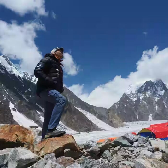
From Base Camp, climbers saw three people in the slide path, but two of them quickly moved away while the other one remained in the same place. Shortly afterward, they received word that Waldemar Kowalewski had a broken leg above Camp 2.
According to Supergan, the liaison officer in Base Camp has contacted the rescue services of the Pakistani army. However, it is unclear if the helicopters will be able to fly, since a storm front is approaching.
Climber safe for now
In a later update, Supergan wrote that Kowaleski has been helped down to a tent at 6,500m, about 330m above Camp 2.
"Two friends, Jarek and Hassan [surnames unknown], are with him," he wrote. "Jarek is looking after Kowalewski, while Hassan has descended to Camp 2 to get some gas."
A team of several people, including a doctor, is leaving Base Camp tonight. As Supergan explained, the lower slopes of Broad Peak are still dry and prone to rockfall, so rescuers will have to wait for the cooler night to go up.
Supergan also showed concern about avalanche risk for the rescuers above Camp 2. "The line where the snow slab broke can be clearly seen from Base Camp," Supergan wrote.
Apparently, the accident took place when the climbers were coming down from Camp 3, which is usually pitched at around 7,000m. The three climbers had spent three nights at that altitude. The avalanche triggered as soon as they entered a snowfield slightly below.
Waldemar Kowalewski is a regular on the 8,000m scene. Last winter, he summited Ama Dablam and then spent the spring cycling and trekking in Nepal. Before heading to Pakistan, he was on Denali. According to his Instagram, Kowalewski intended to climb Broad Peak this summer and then head to Cho Oyu in the fall.