Today, July 25, would be the 104th birthday of Lionel Terray. The celebrated French alpinist climbed routes from the Alps to the Himalaya to the Andes, and also wrote one of the all-time great mountaineering books, Conquistadors of the Useless.
Early years
Lionel Terray was born on July 25, 1921. Growing up in Grenoble near the French Alps, Terray discovered mountaineering and skiing as a child. A conversation with his mother, who dismissed climbing as a stupid sport involving scaling rocks with your hands and feet, sparked his curiosity.
By age 12, Terray was climbing peaks like the Aiguille du Belvedere and the Aiguille d’Argentiere with his cousin. By 13, the talented youngster was leading climbs. But Terray’s love for the mountains caused problems; he got kicked out of one boarding school and ran away from another to pursue ski racing. With little family support, he got by on his own. Skiing was Terray’s first love, and as a teen, he won prizes in competitions, which gave him some money.

In 1941, during World War II, Terray joined Jeunesse et Montagne, a military program that kept him in the mountains. There, he met lifelong friends and climbing partners Gaston Rebuffat and Louis Lachenal.
In 1942, Terray carried out the first ascent of the west side of Aiguille Purtscheller. He also climbed the difficult Col du Caiman. From 1943 to 1944, Terray served in a high-mountain military unit. In 1944, he joined the French resistance, using his mountain skills against the Nazis.
Terray knocked off other notable first ascents, such as the east-northeast spur of the Pain de Sucre and the north face of Aiguille des Pelerins with Maurice Herzog in 1944.
A rising star
After the war, Terray became a mountaineering instructor and settled in Chamonix as a freelance guide. With Lachenal, he did some of the Alps’ most difficult routes, including the Droites’ north spur in only eight hours in 1946, the Walker Spur of the Grandes Jorasses in 1946, the northeast face of Piz Badile, and the north face of the Eiger in 1947 (the second-ever ascent). Terray's speed and skill earned him a reputation as a climbing prodigy.

A rescue attempt on Mont Blanc
In late December 1956, Lionel Terray took part in a rescue attempt on Mont Blanc’s Grand Plateau. At about 4,000m, young climbers Jean Vincendon and Francois Henry were stranded after a failed attempt on the Gouter Route, a popular 1,800m climb to Mont Blanc’s summit.
On December 22, a blizzard caught Vincendon and Henry near the Vallot Hut at 4,362m. Freezing and frostbitten, they couldn’t descend. Terray, now a Chamonix guide, defied the Compagnie des Guides’ decision to postpone a rescue because of the extreme risks of strong winds and freezing temperatures.
Terray’s team battled brutal weather for two days but couldn’t reach the climbers. A military helicopter, attempting a parallel rescue, crashed near the Vallot Hut, stranding its crew. Terray’s group retreated, exhausted, as conditions worsened.
French Army instructors finally reached Vincendon and Henry in early January, but found them near death from exposure and frostbite. Evacuation was impossible, and both climbers died.
Terray’s rescue effort led to his expulsion from the guides’ organization, sparking controversy in Chamonix.

Eiger rescue
In the summer of 1957, Terray took part in a complicated rescue on the Eiger’s North Face in the Swiss Alps. Two Italian climbers, Claudio Corti and Stefano Longhi, were stranded after an avalanche hit their team during an attempt on the notorious Nordwand. The route, known for its steep ice, rockfall, and brutal weather, had already killed their partners, and Corti was injured.
Terray, then 35, joined a multinational rescue team at Kleine Scheidegg. The climbers were stuck near the Difficult Crack, at around 3,300m. Terray, with German climbers Wolfgang Stefan and Hans Ratay, ascended via ropes and pitons. They battled harsh winds and -20°C temperatures. After two days, they reached Corti, who was hypothermic but alive, clinging to a ledge. Longhi, lower down, was too weak to move. Terray secured Corti with ropes, and the team lowered him 600m to safety. Longhi, barely conscious, died during the descent when his rope jammed.
The effort, involving 50 people, was one of mountaineering’s greatest rescues.

Other historic climbs
Terray’s ambition took him beyond the Alps. In 1950, he joined Maurice Herzog’s expedition to 8,091m Annapurna I in the Himalaya, the first confirmed ascent of an 8,000m peak. Terray and Rebuffat's efforts, alongside one of the Sherpas, were crucial to helping the frostbitten Herzog and Lachenal descend safely. The climb brought global fame for the French team.
In 1952, Terray and Guido Magnone made the first ascent of Cerro Fitz Roy in Patagonia. That year, Terray also climbed 6,369m Huantsan in Peru with Cees Egeler and Tom De Booy.

In 1954, Terray summited 7,804m Chomo Lonzo with Jean Couzy, paving the way for their legendary 1955 first ascent of 8,485m Makalu. In 1962, Terray led the first ascent of 7,710m Jannu in Nepal, and in the summer of 1964, he led the first ascent of 3,731m Mount Huntington in Alaska.
In Peru, Terray made first ascents of peaks like 6,108m Chacraraju, considered the hardest peak in the Andes at the time, along with 5,350m Willka Wiqi, 5,428m Soray, and 5,830m Tawllirahu.
Conquistadors of the Useless
In 1961, Terray published Les Conquerants de l’inutile (Conquistadors of the Useless), a memoir that blends vivid accounts of his climbs with reflections on the purpose of mountaineering. The title captures his view that climbing, though seen as pointless by some, was a noble pursuit. The book, translated into several languages, remains a classic.

A tragic end
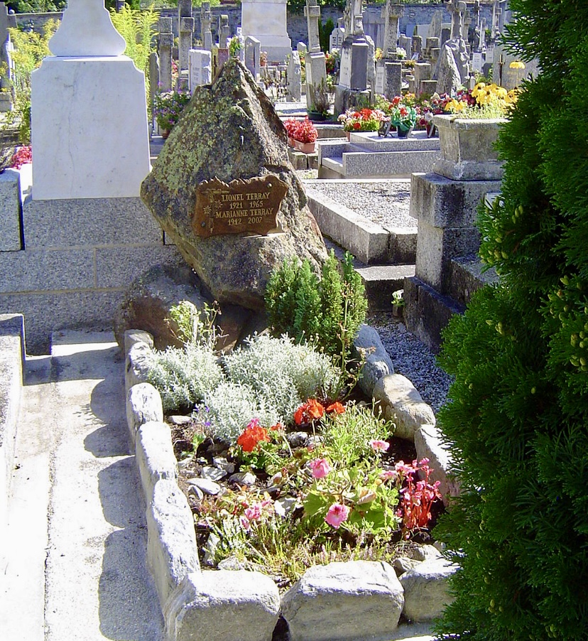
On September 19, 1965, Terray and his friend Marc Martinetti died in a climbing accident in the Vercors massif near Grenoble. Terray was just 44.
The pair was descending the Gerbier, a limestone cliff in the Vercors range, after completing a route. They were roped together when their rope -- likely weakened or damaged -- snapped. They fell more than 200m to the base of the cliff. Both climbers died on impact. Chamonix mourned deeply, and his funeral drew figures like Herzog, Rebuffat, and Leo LeBon.
"He was to many a great and dear friend, and all those who paid him tribute before he was laid to rest in the Chamonix Cemetery, among them hardened mountain climbers, wept like small children. To the French climbing world, especially the younger generation, his absence represents an irreplaceable loss, as he was the hero of their dreams, and could hold an audience breathless as no one ever has been able to," Lebon wrote in the American Alpine Journal.
Terray’s legacy lives on through his climbs, rescues, and writings. His son, Nicolas, is a mountain guide. Known for his red beanie and sunglasses, Terray appeared in films like Etoile du Midi, La Grande Descente, and Stars Above Mont Blanc.
You can watch Etoile du Midi below, with the option of automatic subtitles:
In May of 1622, the English East India Company ship Tryall became the first English ship to sight the coast of Australia. Shortly after, it became the first ship to sink off the coast of Australia.
The story of the Australia's oldest shipwreck covers 400 years, from a suspicious sinking to a pair of castaway journeys, a court case, a geographical mystery, and a modern scandal involving the misuse of explosives at an archaeological site.
The maiden launch of the Tryall
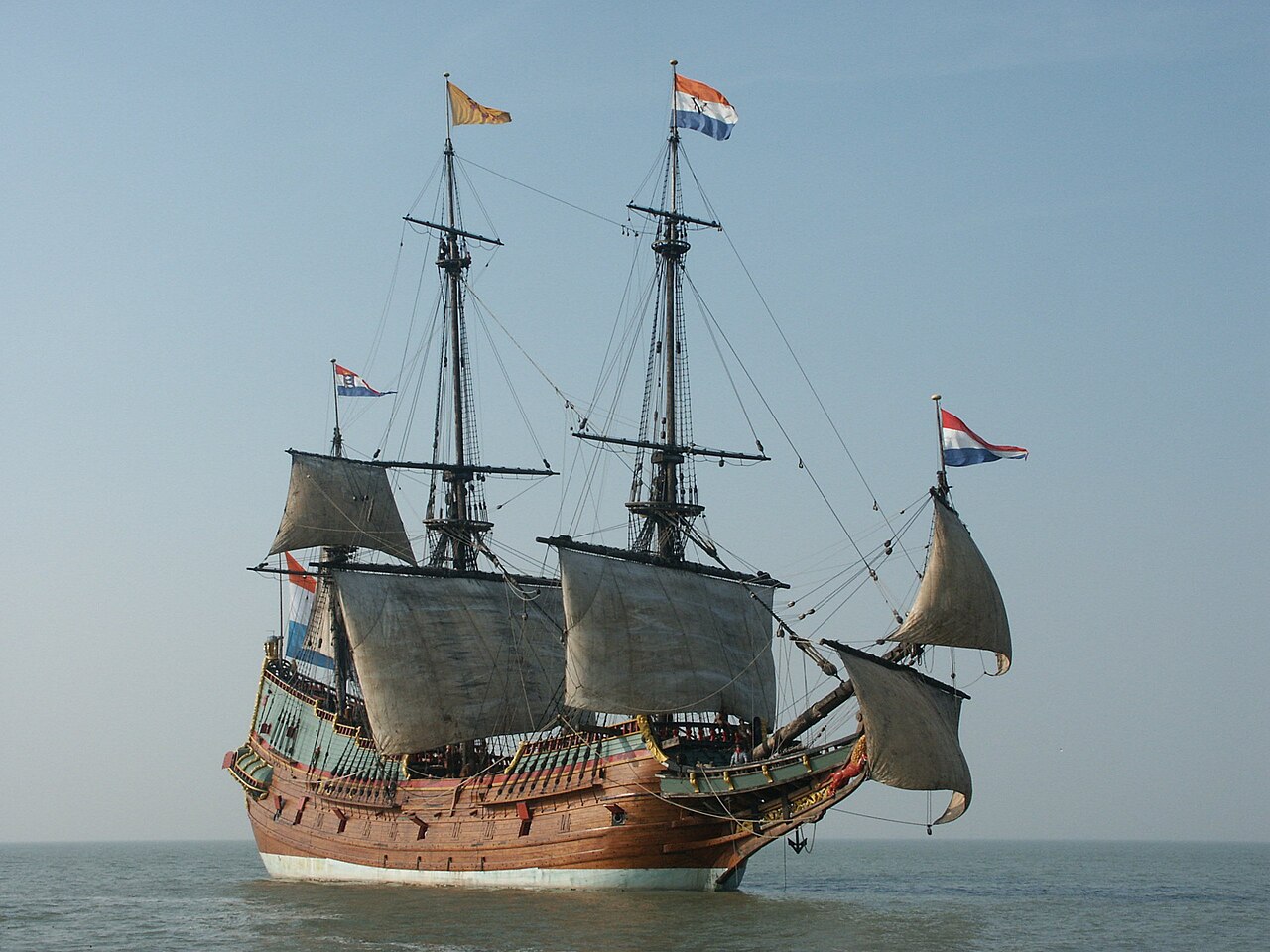
The Tryall (also spelled Triall, Tryal and Trial) set sail from Plymouth on Sept. 4, 1621. She was a British East Indiaman, a mercantile vessel built to travel between England and the Global Southeast, then called the East Indies.
Owned by the British East India Company, her generous hold was filled with textiles, silver, and supplies bound for Batavia -- present-day Jakarta, Indonesia. This was to be her maiden voyage, and an inspection by EIC officials at the docks found her in good condition.
Her Captain was John Brookes. The other key man aboard was Thomas Bright, the EIC's representative, or "factor" for the voyage. One hundred and forty-three seamen rounded out the crew, and after a brief pay dispute, they sailed for the Cape of Good Hope.
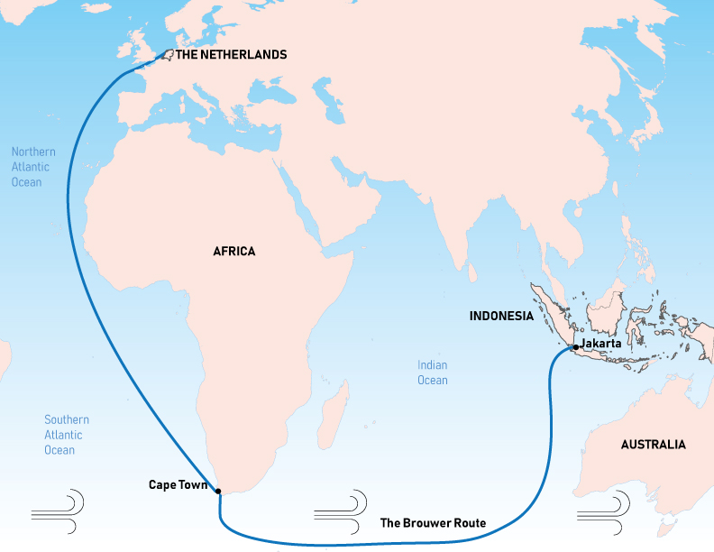
This stage of the journey went fine. They arrived at the tip of Africa, took on fresh supplies, and set off for Batavia on March 19. By a new, dangerous route.
Another way to India
At the turn of the 17th century, the standard route from Cape Town to Batavia came from 15th-century Portuguese explorers, who used the seasonal monsoon winds to cross the Indian Ocean. It took about 12 months.
The Dutch decided that if they were going to steal the spice trade from Portugal, they had to do better than that. So Hendrik Brouwer took an alternative way in 1611. It became known as the Brouwer route.
The new route cut travel time in half by ducking down into the Roaring Forties and using their strong westerly winds to cross the Indian Ocean. The key was the timing of that northeast turn. Too early, and you'd end up in the middle of the Indian Ocean. Too late, and you'd crash into Australia.
They didn't know that yet, though. A few Dutch explorers had sighted some islands off the Australian mainland, but no one suspected a whole continent might be in the way.
The problem with that all-important turn is that, at the time, there was no good way to determine longitude at sea. Ships would have to make the turn using dead reckoning, which is a fancy nautical term for "guessing." In 1620, the British EIC decided to copy the Dutch and sent Captain Humphrey Fitzherbert to test the route.
He had a great time and gave it a thumbs-up, so they gave Captain Brookes a copy of Fitzherbert's journal and told him to do the same thing.
The wreck of the Tryall
Brookes was nervous about the new route. In Cape Town, he met Captain Bickell, another EIC Captain. He asked Bickell if he could borrow one of his experienced mates to help navigate, and Bickell gave him permission. But Bickell's ship, the Charles, was on its way home, and none of her mates were willing to delay their return to help.
Brookes had to sail on, with only the 1620 journal and imperfect charts as a guide. The Tryall descended to 39 degrees latitude, and the Roaring Forties drove them east.
On May 1, they spotted land. They had just become the first Englishmen to see Australia. Brookes and Bright both describe a great island, because from their perspective, a pair of points made the coast look like an island. Brookes turned north for the run up to Java, but was kept in place by contrary winds. Finally, on May 24, he was able to head north.
The next day, late in the evening, in calm seas, the Tryall struck rocks. Brookes ran up on deck, giving orders to tack west, hoping to dislodge her. A strong, brisk wind began to blow as water flooded into the ship, the sharp rocks tearing her timbers apart. It was too late, Brookes realized, to save her. He "made all ye meanes I could to save my life and as manie of my compa[ny] as I could."
He launched the ship's two boats. Ten, including Brookes, climbed into the skiff, while 36, including Thomas Bright, piled into the pinnace. Less than six hours after striking rocks, the fore-part of the Tryall broke up. Ninety-seven died.

Brookes' story
Brookes' skiff launched first. With him were nine sailors and a cabin boy, who would definitely be eaten first if it came to cannibalism. They had several cases of spirits and kegs of water, but only four pounds of bread. They landed briefly on a low island, now known to be Barrow Island, then set off again.
On July 5, they arrived in Batavia, and Brookes sent his report to his EIC superiors. Fitzherbert must have overlooked the land they sighted on May 1, he explained. "He went 10 leagues to ye Southwardes of this iland," Brookes asserted, before making the northeast by east turn. Brookes said that after sighting this land, he also made a northeast by east turn.
That Fitzherbert had missed the rocks was pure chance; his ships had sailed right past destruction without realizing it. The wreck of the Tryall could have happened to anyone. The EIC agreed. So they gave him another ship, the Little Rose, to explore the area around Sumatra. When he got back, they put him in charge of the Moone.
The wreck of the Moone
Brookes was taking the Moone back to England with a few other EIC vessels. But the Moone was wrecked off the coast of Dover, and with her went £55,000 worth of cargo, about $14,000,000 today. John Brookes and the ship's master, Churchman, began accusing each other of misconduct, and the EIC threw them into prison.
In court, Brookes made multiple lengthy speeches protesting his innocence. He also stressed, once again, that the Tryall wreck was not his fault. Regarding the Moone, Brookes blamed the ship's poor condition, calling it worm-infested and half rotten.
Witnesses, however, testified that he had discussed deliberately sinking the ship back in Cape Town. He was accused of deliberately sinking the ship in an elaborate heist of the valuable cargo. In fact, when the wreck site was examined, most of the cargo was missing. Multiple eyewitnesses also claimed Brookes had used the confusion of the sinking to break open and pilfer a chest of jewels.
The court case dragged on for years before finally being settled out of court. While he was never convicted, Brookes had lost all of his money and reputation. But with all the back and forth about stolen diamonds and the Moone, his claims about the Tryall went unchallenged. There was one man, however, willing to challenge John Brookes: Thomas Bright.

Bright's story
In a series of letters, Thomas Bright gave his side of the story. The fact that they'd hit the rocks at all, he claimed, was due to Brookes not keeping a proper lookout. Once the ship was struck, he described Brookes rushing to provision his own boat. He even personally betrayed Bright ("like a Judasse") by promising to take him, then launching the skiff while Bright wasn't looking. The skiff then made straight for Java without waiting to see what became of everyone else.
The pinnace, or longboat, launched an hour and a half after the skiff, with 36 men aboard. They had a couple of pounds of bread, some bottles of wine, and a single barrel of water. The sea was too rough to do anything but keep in sight of the crumpling ship, weathering the waves, until morning. In daylight, they made for a nearby island.
They spent a week on a low, uninhabited island, now known as North West Island. There, they repaired the pinnace and tried to stock up on provisions for the journey ahead. Bright kept himself busy drawing maps and charts of the surrounding area, becoming the first Englishman to map parts of Australia.
The pinnace successfully reached Java in late July. Bright was furious at Brookes and the lies he had been spreading. He wrote detailed letters and drew maps and charts laying out Brookes' deception -- but they went unheeded, and then were lost.
The search for the Trial Rocks
Both the British and Dutch East India Companies (referred to as EIC and VOC, respectively) were concerned that their trade route had secret, deadly rocks somewhere along it. Brookes advised the company to avoid going too far south, theoretically avoiding the Trial Rocks but also reducing speed.
In 1636, the VOC sent a pair of ships under Gerrit Tomaszoon Pool. His instructions included "trying in passing to touch at the Trials," to gather information about their exact location. But he didn't find them.
As the years went on, sailors and mapmakers alike were confused as to where the rocks were and whether they existed. By 1705, the Commodore of the Dutch Ships reportedly didn't believe they were real, at least not in the position Brookes had indicated.
By the late 18th century, even the story's origins were hazy. A 1780 directory of the East Indies claimed that the Trial Rocks were "discovered by a Dutch ship in 1719."
In 1803, English Captain Matthew Flinders took many soundings in the area on his way back from Timor. He spent weeks searching for the rocks despite the fact that illness was rampant aboard ship.
Finally, he concluded that "the Trial Rocks do not lie in the space comprehended between the latitudes 20° 15' and 21° South, and the longitudes 103° 25' and 106° 30' East." Thus concluded, they set sail, hoping to get better food for the sick, as "the diarrhoea on board was gaining ground."
His hard-won findings convinced the British Admiralty, which declared the Trial Rocks nonexistent.

The (re)finding of the Trial Rocks
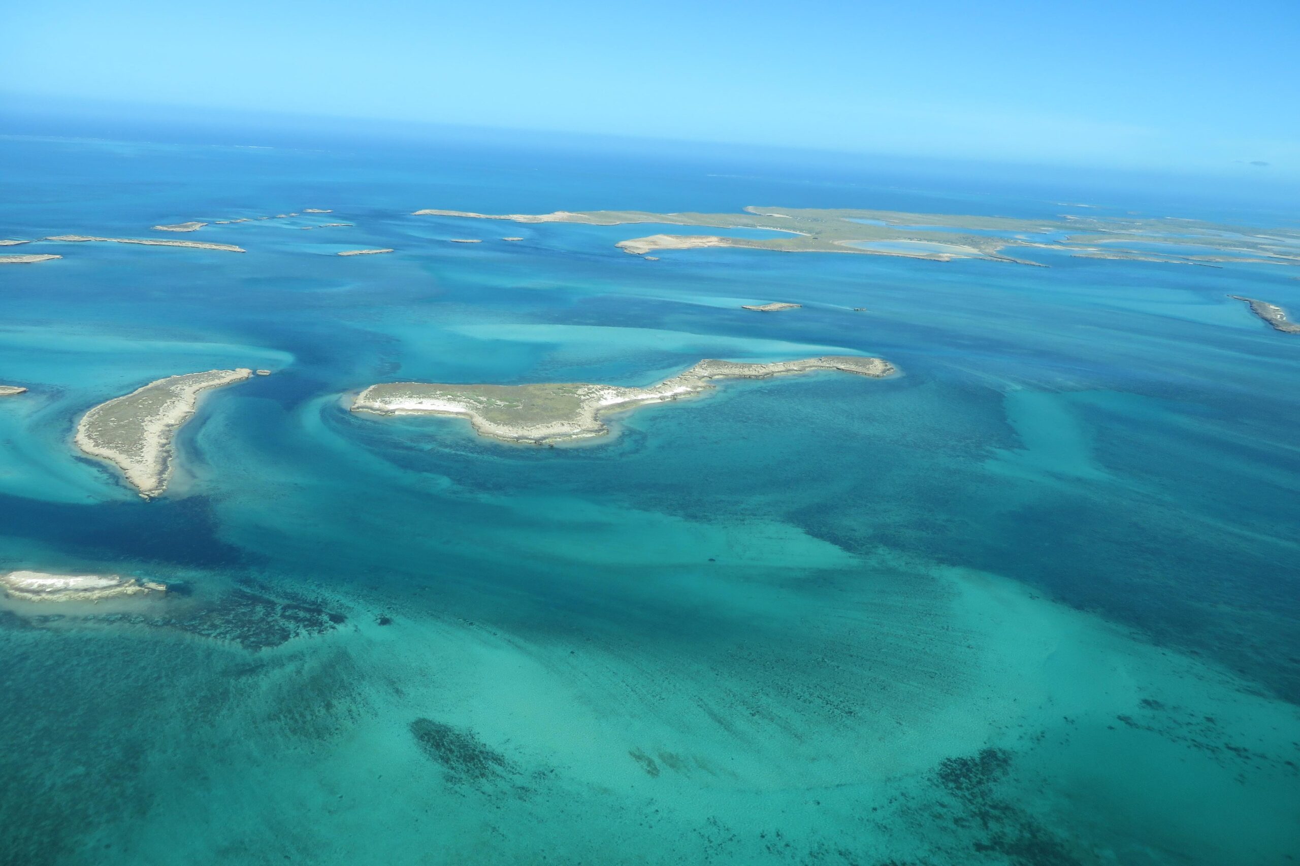
Today, we know that the Trial Rocks lie just off the Montebello Island group, off the coast of Western Australia. The definitive identification of the Trial Rocks came in fits and starts, being repeatedly made and then forgotten.
In 1818, the Greyhound had a run-in with the rocks, managing to avoid being sunk through luck and good spotting. As she was captained by one Thomas Richie, the rocks became known as Richie's Reef. Two years later, another brig passed through the area and had a look-see.
Aboard was Lt. Phillip Parker King, who recorded his belief that the Trial Rocks were, in fact, located around the area of Barrow Island and the Montebello Islands. The next Admiralty chart placed Richie's Reef to the northwest of Montebello, and a second, separate set of Trial Rocks between Montebello and Barrow. They were only wrong by 42 kilometers, which was at least an improvement.
Enter Australian historian Ida Lee. She uncovered the letters by Bright and Brookes and consulted Rupert Gould. Before he became really into the Loch Ness monster, Gould was a member of the Hydrographer's Department at the Admiralty, a respected expert on cartography and naval history.
He replied confidently: Richie's Reef was the Trial Rocks, and Captain Brookes had intentionally deceived everyone about where the rocks lay.

Captain Brookes' great deception
Have you ever really messed up at work? I mean really, really messed up? Imagine if you messed up so bad that nearly a hundred people had died and a huge ship full of valuable trade goods had been lost. Would you lie about it? Be honest.
The truth was that the rocks hadn't been anywhere along the Brouwer route. Brookes had gone too far east, overshooting his turn so badly that they'd sailed right into the coast of Australia. Realizing he went too far, Brookes then headed directly north, instead of northeast, running into the Trial Rocks.
When it came time to write his account, he claimed to have turned earlier and been headed northeast. He told the same lie about the skiff journey, claiming to have traveled northeast instead of east. If he had actually traveled northeast from the Trial Rocks, he would've missed Java entirely.
Brookes had lied about where the rocks were to disguise his mistake, claiming they were hundreds of kilometers west of their actual position. This was not an innocent deception. As the men who died on the Tryall could tell you, knowing where hidden rocks lay was a matter of life and death.
Bright had tried to get the real story out in his letter. But that had been lost to the depths of the archives until Ida Lee. In 1934, Lee published her article, and henceforth, the rocks were placed in the correct location. Except, apparently, on Google Maps, which inexplicably gives the pre-1934 location.
The Tryall gets blown up
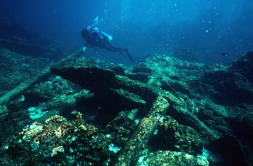
No one actually went looking for the wreck until the late 1960s. Two men from a group called the Underwater Explorers Club, John MacPherson and Eric Christiansen, got Gould's report from the Admiralty Hydrographic Office. A few years later, Christiansen led a small party of divers to the wreck site. For our purposes, the most important member of this group was Alan Robinson.
They dove at the Trial Rocks in May 1969. On the southwestern side of the rocks, they found an old anchor, then another, and then cannons — it was a wreck site. They reported the find to the Western Australia Museum and collected a finder's fee equivalent to about $18,500.
The WA Museum organized an expedition, but poor weather prevented them from doing much diving. In 1971, they came back with more funding, but when they dove down to the site, they found it had been vandalized -- with explosives. The reef itself was damaged, along with some of the cannons and anchors, and the various smaller artifacts one would expect around the site were nowhere to be found.
The suspected culprit was Alan Robinson. A notorious figure in Australian maritime archaeology, Robinson was a treasure-hunter who frequently came into conflict with the laws around salvage and cultural artifacts. He was acquitted of the charges regarding the Tryall site, but we'll probably never know the truth.
Robinson died in jail while awaiting trial for attempting to murder his ex-wife, so was unable to confess about using blasting gelatin on Australia's first shipwreck.

An active archaeological site
Several more expeditions visited the damaged wreck site. Like many of the most famous Australian shipwrecks, any write-up of work on the Tryall site must mention the contributions of Dr. Jeremy Green. Green wrote the book on maritime archaeology, and by the discovery of the Tryall, had already led the investigations of the Batavia and Vergulde Draeck.
It was Green who led the 1971 dives and who gave the first tentative identification of the wreck as that of the Tryall. Because of all the missing artifacts, it's difficult to say beyond a shadow of a doubt that the ship found on Trial Rocks is really the Tryall. In addition to the location, Green used the cannons and anchors to confirm that they were looking at the remains of an English merchant ship from the early 17th century.

Subsequent dives have provided further evidence that this is, in fact, the Tryall, such as the makeup of the ballast stones. The most recent expedition took place in 2021, where they confirmed that there were no other wrecks in the area. Since we know that the Tryall wrecked there, and there is only one wreck, it must be the Tryall. After centuries of doubt, we finally have certainty.
The Western Australia Museum recently completed the restoration of one of Tryall's cannons, which is now on display in the museum.
Like the inverse of the mythical butterfly flapping its wings in China, an ice core extracted from Greenland can reveal the rise and fall of societies in European antiquity. A new study took ice cores from the Greenlandic ice sheet and used them to measure the output of lead pollution in Europe. The varying levels of lead pollution corresponded with technological and societal changes.

A global record
Ice sheets are laid down over time in layers of compacted snow. A bit like tree rings, the conditions during their formation are preserved in the layer.
By taking an ice core, scientists are effectively looking at a timeline of climate conditions over thousands of years. Air temperature, greenhouse gases, pollen levels, and chemical concentrations are printed in the layers.
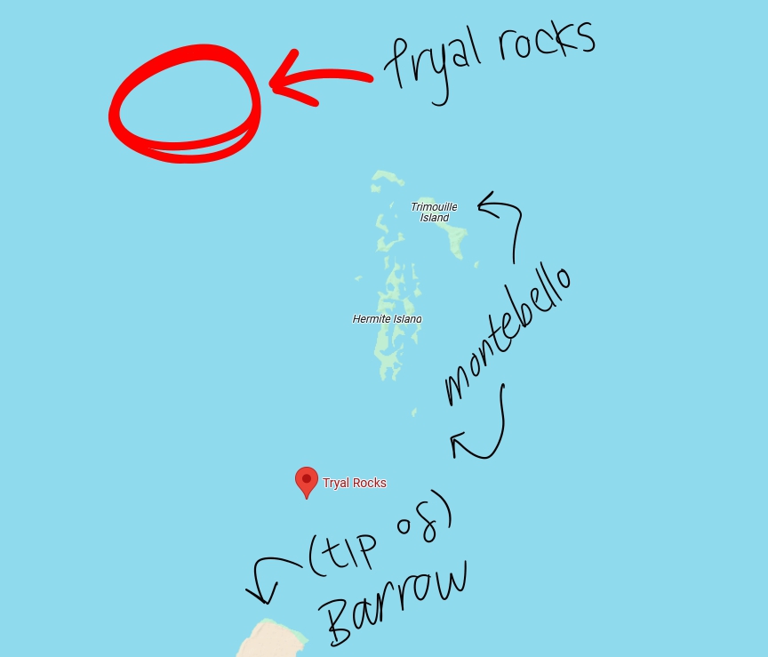
This latest research is a collaborative effort between several universities and climate research organizations. The ice cores in question come from the North Greenland Ice Core Project, or NorthGRIP. NorthGRIP drilled from surface to bedrock in northern Greenland. While NorthGRIP finished drilling in 2004, the wealth of data it offers is still largely unexplored. Led by Joseph R. McConnell of the Desert Research Institute, researchers recently turned to lead levels.
When we imagine ancient coins, many of us imagine gold, but silver was far more common in most premodern coinage systems. Premodern silver smelting produced a lot of lead pollution, and archaeologists can measure ancient economic productivity through lead levels -- more lead, more coins, more activity.
What your lead poisoning says about you
Wind blows European lead emissions to Greenland, where they freeze in ice. Previous studies worked from limited samples; by using the NorthGRIP ice cores, researchers were finally able to construct a complete record of classical emissions.
The first jump in lead levels came around 1000 BCE, when the Phoenicians began expanding into the Mediterranean. Emissions continued through the founding of the Roman kingdom and then the Republic. Levels spiked again when both the Romans and Carthaginians colonized Spain and began mining silver intensively there.
Both Punic Wars saw short-term declines, as the campaigning in Spain pulled workers away from the mines and to the battlefields. They bounced back quickly as Rome took Spain and began minting Roman silver coins in Carthaginian mines.
Researchers can chart the whole of Roman history in this way. Wars and political crises lead to dips, and with new conquered territory, mining ramped back up. The peak was the Pax Romana, following the ascendance of Augustus née Octavian.

Putting Edward Gibbon out of a job, the ice cores also document the decline and fall of the empire. "The great Antonine Plague struck the Roman Empire in 165 AD and lasted at least 15 years. The high lead emissions of the Pax Romana ended exactly at that time and didn’t recover until the early Middle Ages, more than 500 years later," explained coauthor Andrew Wilson, of Oxford.
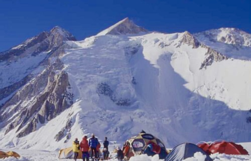
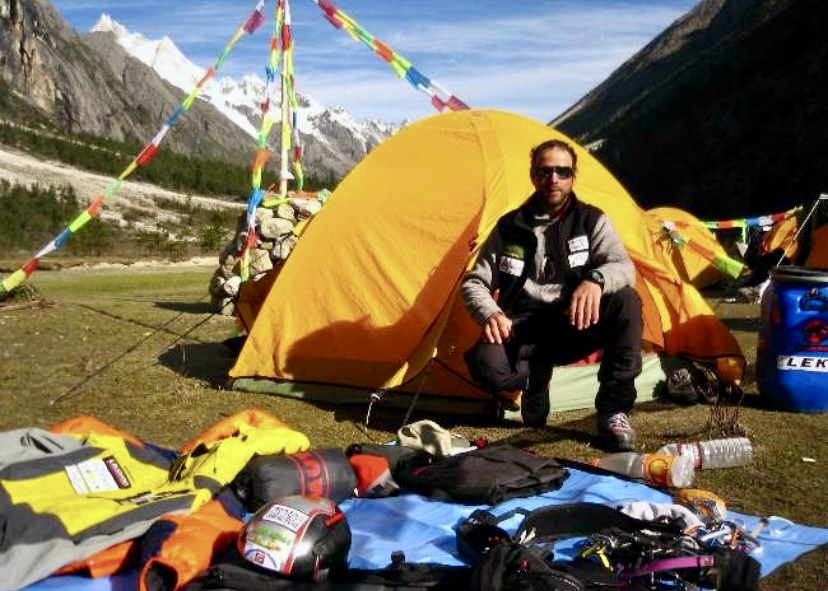
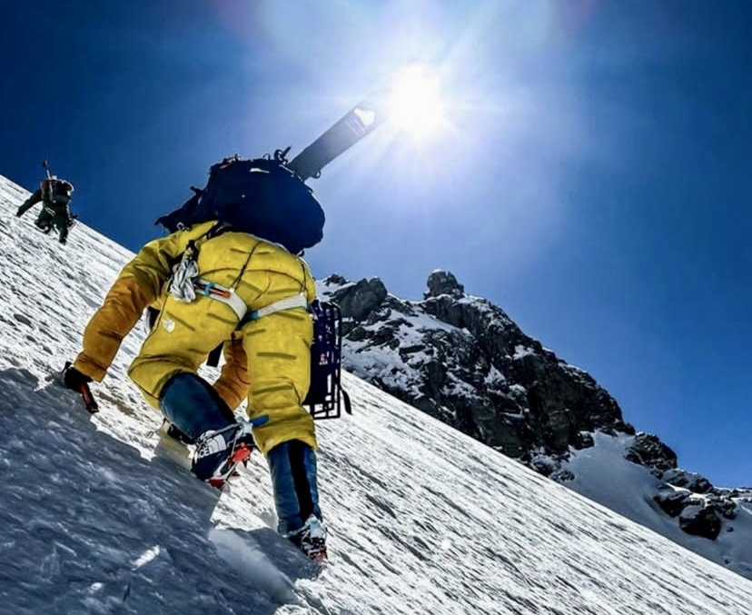
Kim Chang-ho was a South Korean mountaineer who summited the 14x8,000'ers without supplemental oxygen in record time. He pioneered numerous new routes and first ascents on 6,000m and 7,000m peaks. Today, we revisit his most notable climbs.
Early years
Most sources list Kim's birthday as September 15, 1969, but mountaineering historian Bob A. Schelfhout Aubertijn confirmed that Kim was born on July 13, with confusion arising from the Korean age system.
In 1988, Kim began studying International Trade at the University of Seoul. Inspired by Alexander the Great's exploits, Kim started climbing with the university’s Alpine Club.
His frequent expeditions delayed his academic progress, and he didn’t earn his Business Administration degree until 2013. Kim viewed his humanities studies as a way to enrich his climbing. He believed that understanding culture and history deepened his connection to the mountains.
By the 1990s, he was already tackling rock-climbing routes up to 5.12. Early expeditions to the Karakoram, including attempts on 6,286m Great Trango in 1993, and 7,925m Gasherbrum IV in 1996, revealed his bold -- sometimes reckless -- ambition. On Gasherbrum IV, he reached 7,450m but faced a sheer rock face without protection, instructing his partner to release the rope if he fell.
Exploration of northern Pakistan
Between 2000 and 2004, Kim embarked on solo trips in northern Pakistan’s Karakoram, Hindu Kush, and Pamir ranges, prioritizing discovery over summits. As detailed in the 2023 American Alpine Journal, he surveyed glacial valleys, documented hundreds of unclimbed peaks, and built relationships with local farmers and herders. These solitary treks were driven by a desire to understand the geography, culture, and history of the regions.
Kim’s journals reveal a meticulous approach, with photographs and descriptions of potential routes forming a database that remains a valuable resource for climbers. His interactions with locals shaped his climbing decisions, ensuring cultural sensitivity in his choice of peaks. This period of exploration laid the groundwork for his later ascents, blending adventure with respect for the human and natural contexts of the mountains.

Photo: Kim Chang-ho
Four first ascents of 6,000m peaks
Kim’s explorations in Pakistan led to a series of remarkable solo first ascents in 2003, when he was 33. The American Alpine Journal documents four solo climbs of 6,000m peaks in the Hindu Raj and Karakoram ranges.
He carried out the first ascent of 6,105mm Haiz Kor in the Thui Range of the Hindu Raj, by a challenging route via the southeast face and south ridge through a complex icefall.
Kim also made first ascents of 6,225m Dehli Sang-i-Sar in the Little Pamir, 6,189m Atar Kor in the Hindu Raj, and 6,200m Bakma Brakk in the Masherbrums.

Dehli Sang-i Sar from the southwest, showing the general line of Kim Chang-ho's solo ascent along the upper east ridge in 2003. Photo: Kim Chang-ho
Mastering 7,000’ers
In 2008, he led the first ascent of 7,762m Batura II, though the expedition’s use of fixed ropes drew criticism, prompting him to refine his lightweight approach.
In 2012, Kim and An Chi-young made the first ascent of 7,092m Himjung in Nepal, climbing via its southwest face. The expedition earned them the Piolet d’Or Asia Award.
In 2016, Kim and two partners opened a new 3,800m alpine route on the south face of 7,455m Gangapurna in Nepal. Described by the 2017 Piolet d’Or committee as "bold and lightweight," it earned an Honorable Mention, marking a historic recognition for Korean climbers.
During the Gangapurna expedition, Kim and his partners also attempted the south face of unclimbed Gangapurna West, where they reached the summit ridge.
One year after Gangapurna, the tireless Kim led an expedition to Himachal Pradesh in India, aimed at fostering a younger generation of Korean climbers and developing their skills and experience. The team made the second ascent of 6,446m Dharamsura, and climbed 6,451m Papsura via a direct route on the south face.

Choi Seok-mun and Park Joung-yong, climbing partners of Kim Chang-ho, approach the summit of Gangapurna. Photo: Korean Way Project
Summiting 8,000'ers
Kim summited all 14 of the world’s 8,000m peaks without supplemental oxygen, in record time.
Starting in 2006 with the Busan Alpine Federation’s Dynamic Hope Expedition (led by Hong Bo-Sung), Kim and a small team relied on minimal support, avoiding Sherpas and oxygen. Kim studied geography and history to learn more about his routes.
Kim completed the 14x8,000'ers in 7 years, 10 months, and 6 days, setting a record for the fastest completion without oxygen at the time. He surpassed Jerzy Kukuczka's record by one month.
Kim didn't set out with the explicit goal of climbing the 8,000'ers so quickly. His pursuit was primarily driven by his passion for mountaineering and a desire to climb these peaks in a pure, lightweight style.
Kim ascended three 8,000m peaks twice: Nanga Parbat, Gasherbrum I, and Gasherbrum II.
Among his 8,000m climbs, his south-north traverse of Nanga Parbat in 2005 and his sea-to-summit ascent of Everest in 2013 deserve special mention.

The south face of Gangapurna, showing (in red) the Canadian Route (1981), and (yellow) the Korean Way (2016). Photo: Korean Way Project
Nanga Parbat, 2005
In 2005, Kim climbed Nanga Parbat’s massive Rupal Face. The Korean Nanga Parbat Rupal Expedition lasted 109 days. They arrived at Base Camp on April 20 after a heavy snowstorm. Over the next 12 days, the team set up Camp 1 at 5,280m and Camp 2 at 6,090m, following a line close to the 1970 Messner Route.
The weather was brutal, with snow falling daily in May, destroying seven tents and burying Camp 2 under fresh snow. Despite these setbacks, by June 14, after 43 days of effort, the team established Camp 3 at 6,850m. Near the end of June, the team prepared for a summit attempt, and on June 26, Kim and three other climbers started their push. However, at 7,550m on the Merkl Icefield, a rock hit team member Kim Mi-gon in the leg, forcing the group to abort.
Undeterred, Kim and climbing partner Lee Hyun-jo made another attempt on July 13, starting from Camp 4 at 7,125m. They faced constant danger, dodging falling rocks and ice. After a 24-hour climb, they reached the summit of Nanga Parbat.

Kim Chang-ho. Photo: Abbas Ali
A difficult descent
Kim and Lee chose to go down the Diamir Face via the Kinshofer Route, unroped, to save time. In the middle of the descent, they triggered a wind slab avalanche. Lee was buried, and Kim was swept 50m downhill, scraping his face and losing his headlamp. Both managed to free themselves and continued down, exhausted and hallucinating, believing another climber was ahead of them. They reached another expedition’s tents at 7,100m but decided against stopping, fearing they might not wake up if they rested. After an incredible 68 hours from Camp 4, they arrived at the Diamir Base Camp, impressing others with their speed and resilience. Lee appeared remarkably fresh despite the ordeal.
This expedition was a turning point for Kim. The climb was a tactical, siege-style effort, relying on fixed ropes and a larger team, very different from the lightweight, alpine-style climbs he later became known for. During the descent, Lee’s emotional radio call to a teammate at Base Camp, expressing regret that they weren’t together, deeply affected Kim.
Kim reflected on his selfishness, realizing that reaching the summit meant little without returning safely with his team. This experience shaped his philosophy moving forward, which would emphasize teamwork, respect for the mountains, and survival over personal glory.

Views of Everest from neighboring Lhotse. Photo: Kadyr Saydilkan
Everest, 2013: Starting from sea level
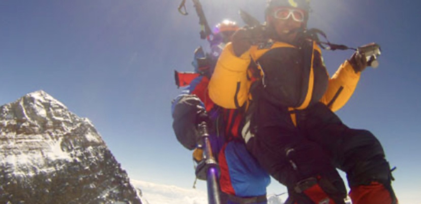
Kim’s 2013 Everest ascent was the final step in his quest to climb the 8,000m peaks without supplemental oxygen, making him the first Korean to do so. But his Everest climb was not just about reaching the top; it was a unique adventure.
Kim’s journey to Everest’s summit began far from the mountain itself. He wanted to make the climb special by starting at sea level and traveling to Base Camp without using motorized transport.
On March 20, 2013, he began his expedition from Sagar Island near Kolkata, India. From there, he kayaked 156km on the River Ganges, cycled 893km through northern India to Tumlingtar in Nepal, and then trekked 162km to Everest Base Camp. This sea-to-summit approach was rare and challenging, inspired by earlier climbers like Tim Macartney-Snape and Goran Kropp, but Kim added a twist by kayaking part of the way.
Once at Everest Base Camp, Kim prepared to climb the mountain via the standard Southeast Ridge route from the Nepal side without oxygen. He moved steadily up the mountain, navigating the Khumbu Icefall, the Western Cwm, and the steep slopes leading to the South Col. On May 20, Kim reached the summit.
Sadly, Kim’s climbing partner, Seo Sung-ho, died during the descent. This loss cast a shadow over the triumph, but Kim’s accomplishment remained a mountaineering landmark.

Kim Chang-ho and his team near the Sara Umga La at 5,020m, west of Dharamsura and Pasura peaks, in 2017. Photo: Korean Way Project
Mountaineering philosophy
Kim’s mountaineering philosophy viewed climbing as a means of learning and coexistence, not conquest. He avoided treating peaks as mere challenges, instead choosing routes with historical or cultural significance. After losing his partner Seo Sung-ho on Everest in 2013, Kim founded the Korean Himalayan Fund to support young climbers in creative ascents. His database, preserved by his wife Kim Youn-kyoung, includes detailed notes on geography and local names.
Kim’s death
Kim’s life ended on October 11, 2018, when an avalanche, possibly triggered by a serac collapse, destroyed his team’s Base Camp beneath 7,193m Gurja Himal, located south of Dhaulagiri VI, in Nepal. The Korean Way Project expedition, aiming for a new route on the south face, included five South Korean climbers and four Nepali guides, all of whom perished.
Kim’s journal, ending on October 10, suggests the tragedy struck overnight. By the time of his death, he was recognized as South Korea’s most accomplished climber. Kim was 49 years old.
His legacy endures through his database, the Korean Himalayan Fund, climbers like Oh Young-hoon who carry forward his vision, Kim’s daughter (Danah, born in 2016), his wife, and through the international mountaineering community, who preserve his memory.

Kim Chang-ho. Photo: En.namu.wiki
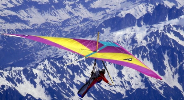
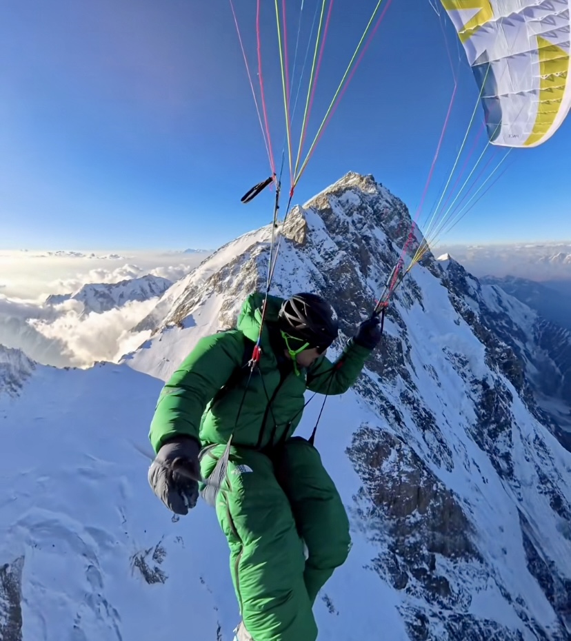
On July 11, 1985, Pierre Gevaux made the first paragliding descent from the summit of an 8,000m peak, soaring down from 8,034m Gasherbrum II. This groundbreaking feat opened a new chapter in mountaineering history.
Gevaux was part of a French expedition to Pakistan led by Claude Jaccoux. It included clients, three guides, and two high-altitude porters. They shared Base Camp with another French team led by well-known mountaineer and extreme adventurer Jean-Marc Boivin.
The expedition began in early July, with climbers establishing camps along the standard route. On July 11, Gevaux and the other team members topped out. The summit day featured clear weather, offering a rare window for his paragliding descent.
Paragliding technology was in its infancy, and Gevaux’s paraglider was likely a basic or parachute-like canopy. It required significant skill to control, especially in the thin air and unpredictable winds at such an extreme altitude.
According to Xavier Murillo, Gevaux's first two attempts to fly from the summit failed. Each time he had to climb back up, catch his breath, gather his thoughts, and tell himself that he would be able to do it. The third time was the charm.
The descent covered a vertical drop of several thousand meters to Camp 1 at 6,000m. He reached it in 5 minutes and 45 seconds. It had taken him five months of preparation, two months on the expedition, and four days of climbing.
Gevaux’s feat impressed other mountaineers who were on Gasherbrum II that day, including Jean-Marc Boivin.
Boivin paraglides down Everest
Boivin was an adventurer known for his first ascents, ski descents, and pioneering hang gliding and paragliding. He was reportedly inspired by Gevaux’s paragliding descent from Gasherbrum II. On that expedition, Boivin broke a hang glider altitude record when he successfully launched from the summit. Previously, in 1979, Boivin had set a hang glider altitude record when he flew from nearly 8,000m after climbing K2.
Three years after Gevaux’s flight, on Sept. 26, 1988, Boivin achieved the first paragliding descent from just below the summit of Everest. The thin air at 8,848m made launching difficult, and gusty winds required precise timing to ensure a safe takeoff. Boivin’s success cemented his reputation as a pioneer of extreme sports, though he tragically died two years later while BASE jumping off Angel Falls in Venezuela.
You can read more about Everest’s paragliding and hang gliding history here.
Paragliding descents from other 8,000’ers
Gevaux’s 1985 flight and Boivin’s 1988 flight pointed the way for others.
In 1994, Australian Ken Hutt paraglided down from 7,200m on Cho Oyu.
In July 2019, Austrian climber Max Berger paraglided from the shoulder of 8,051m Broad Peak, landing in Base Camp 17 minutes later. Though not from the summit, this descent was a significant high-altitude feat.
On July 19, 2022, French climber Benjamin Vedrines paraglided from Broad Peak’s summit ridge after a speed ascent without supplemental oxygen, landing at Base Camp in about an hour.
On July 28, 2024, French climbers Benjamin Vedrines, Jean-Yves Fredriksen, Zeb Roche, and Liv Sansoz paraglided from the summit of K2 despite a Pakistani paragliding ban. All four had summited without bottled oxygen.
Vedrines -- after claiming a climbing speed record of 10 hours, 59 minutes, and 59 seconds -- launched first, landing at Base Camp in 30 minutes. Fredriksen landed at 6,600m after struggling for 90 minutes to take off, and Roche and Sansoz achieved the first tandem paragliding descent from an 8,000m summit.
Most recently, on June 24 of this year, David Goettler paraglided from 7,700m after summiting Nanga Parbat via the Schell Route on the Rupal Face without bottled oxygen.
In the video below, you can watch Gevaux's pioneering paragliding descent from Gasherbrum II in 1985:
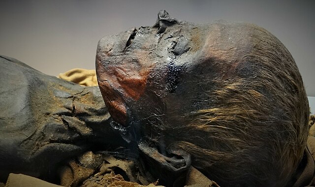
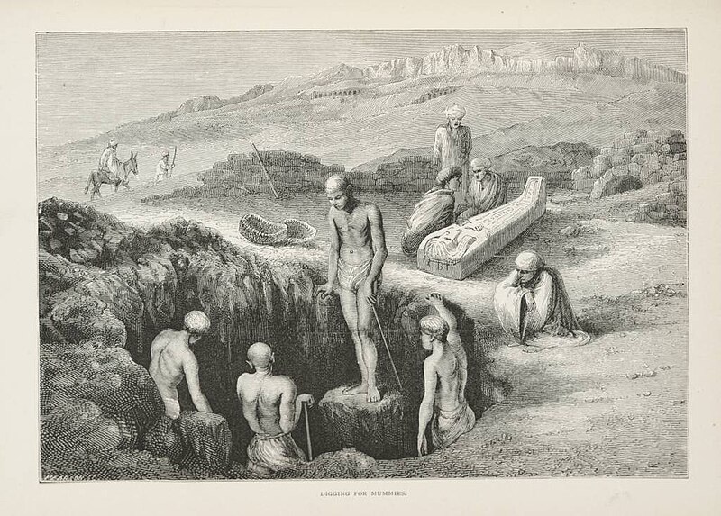
While Egyptian kings and queens are the most famous examples of mummification, the practice wasn’t just for pharaohs. It expanded over time until everyone from the poor up were being preserved for eternity.
So, where are all the mummies? Well, unfortunately, 700 years of rich Europeans ate them. For their health, of course.
From a 12th-century translation error, a massive trade kicked off, depopulating the tombs of Egypt to populate European apothecaries -– and starting an underground market in fake mummy powder.
Bitumen and mūmiyah
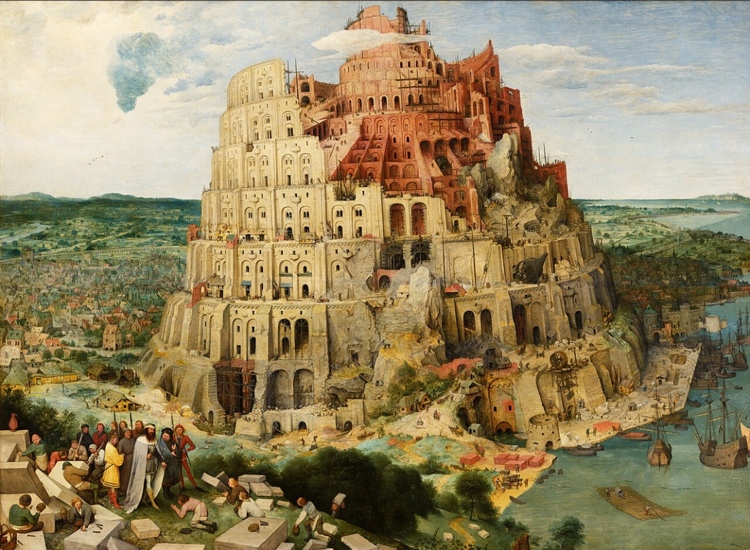
Why did Europeans think that eating mummies was a good idea? It's all to do with bitumen. Bitumen is a viscous petroleum product, which occurs naturally in a semi-solid form. Bitumen is particularly common around the Dead Sea, and is useful for waterproofing and as a glue. Archaeological evidence shows that both early humans and their Neanderthal cousins used bitumen tens of thousands of years ago. It even appears in the Bible as the mortar which was used in the tower of Babel.
By the classical era, bitumen was used in everything from shipbuilding to jewelry. People also started using it as medicine. Pliny the Elder, a Roman author and naturalist, lists 27 discrete medicinal applications for it. These include staunching blood flow, diagnosing epilepsy, treating leprosy, dysentery, and gout, and curing toothache.
After the fall of the Roman Empire, Muslim scholars took pains to preserve classical learning. By the Middle Ages, Arabic authors were considered the foremost medicinal experts throughout Europe and the Middle East. The tradition of using bitumen as medicine continued through the works of scholars like Avicenna, who prescribed it for concussions, paralysis, and more. He didn't call it "bitumen," though. He called it mūmiyah, from the Persian word mum, meaning wax.
A medieval game of telephone
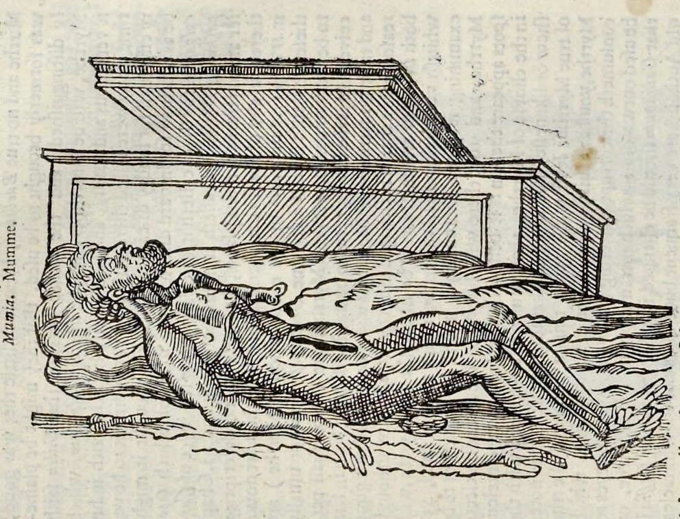
The Ancient Egyptians didn't use bitumen for their mummies. However, the dark resin they used resembled bitumen, leading many classical and medieval observers to believe that bitumen coated Egyptian mummies. So the same word came to refer both to naturally occurring bitumen and the dark waxy coating found on Egyptian mummies.
In the 12th century, an Italian translator of Arabic texts named Gerard of Cremona came across Rhazes of Baghdad's reference to mūmiyah. Gerard said the product was created when "the liquid of the dead, mixed with the aloes, is transformed and is similar to marine pitch.”
Another European, Simon Geneunsis, translated a work by Arab physician Serapion the Younger that referenced medicinal bitumen as "mumia." Geneunsis interprets the word along the same lines as Gerard of Cremona, calling it "the mumia of the sepulchers," which is formed when the aloes and spices used to prepare the dead mix with the liquids the corpse itself expels."
Meanwhile, crusaders were bringing back the bitumen medicine fad from the Islamic medical traditions of the Middle East. Unfortunately, the easily accessible supplies of bitumen in the area were limited. Shrewd Alexandrian merchants realized that there was all this mumia lying around, coating the bodies of the dead. They began raiding tombs, breaking the resinous bodies up, and exporting them to Europe.
The fact that the mumia came from corpses didn't bother people much, possibly due to the confusion between medical mumia and Egyptian mummies. Before long, mumia stopped being the substance on the mummy and became the mummy itself.
It's good for what ails you
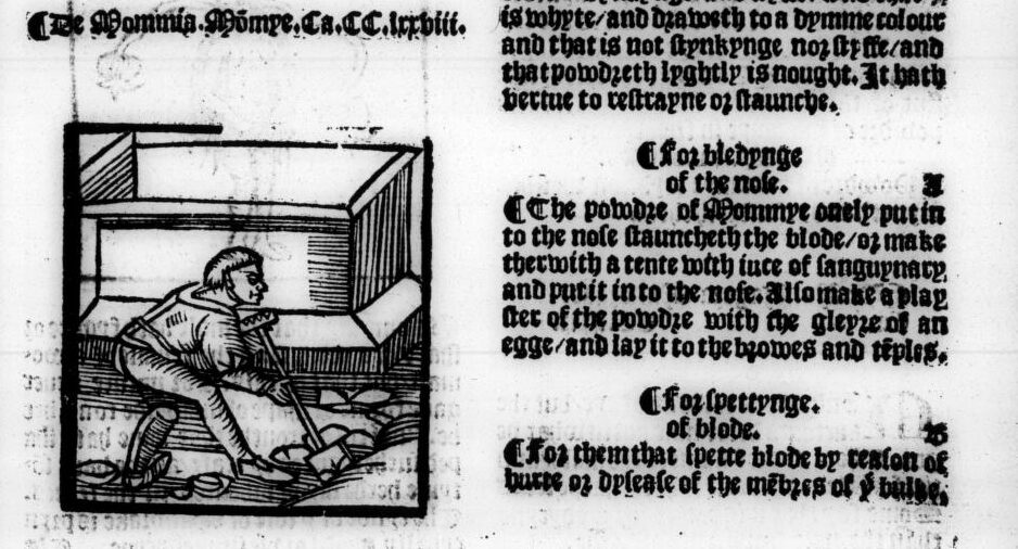
Mumia became a wildly popular remedy in Europe, sold in every well-stocked apothecary. One influential pharmacopeia, Theatrum Botanicum, contains a long list of conditions mumia is useful for, including headaches, colds, coughs, seizures, heart problems, poisoning, scorpion stings, snake bites, bladder ulcers, paralysis, and retention of urine. Treatments involved combining mumia with other ingredients, usually a liquid like wine or goat milk.
Genoese physician Giovanni da Vigo considered mumia an essential medicine for ship's physicians and village doctors. He claimed it promoted wound healing and staunched bleeding. Sir Francis Bacon, the eminent English philosopher, and the physicist Robert Boyle, both considered it useful for wounds, falls, and bruises.
The French king, Francis I, was a habitual mummy consumer; contemporaries reported that he always carried a mixture of rhubarb and mumia on his person, just in case. Nicasius Le Febre, chemist to England's King Charles II, recommended mummy from Libya specifically.
By the way, if you were wondering how it tasted, the English College of Physicians has the answer. Mummy was listed in their official pharmacopeia from 1618 to 1747, where it is described as being "somewhat acrid and bitterish."
Supply chain issues
Egyptian authorities were not actually keen on all the grave robbing and corpse exporting that was happening. In 1428, authorities in Cairo captured and tortured several people connected to a mummy scheme. They confessed to robbing tombs, boiling the mummified bodies in a pot, and selling the oil which rose to the surface.
It was illegal to export Egyptian mummies out of Egypt. But enforcement could be lax, especially if you had money to grease the wheels. Englishman John Sanderson visited Egypt in 1586, where he explored a sepulcher and broke off chunks of blackened mummified flesh. He applied the correct bribes and compliments, and sailed off with 600 pounds worth of "divers heads, hands, arms, and feete."
For every literal boatload of real pillaged mummies, there was at least an equal measure of mummies created specifically for export. Many mummy sellers in Egypt found it was easier to source fresh corpses and dry them than it was to dig up old ones. These fresh corpses mostly came from executed criminals, plague victims, and enslaved people.
The Italian traveler Ludovico di Varthema wrote about the local production of mumia during a visit to the Arabian Peninsula. According to him, there were two kinds; the first was made from the dried-up remains of people who had died recently while crossing the desert. The other, nobler and more pure kind, was "the dryed and embalmed bodies of kynges and princes."
In truth, even authentic mumia wasn't made from rulers, but from their subjects. European nobles liked to imagine their healthful powder came from ancient priestesses and kings, but the remains of the poor were far more plentiful and accessible.
Paracelsus and domestic mummy manufacture
Though a fair amount of the mummy product on the market was inauthentic, the real stuff was still being sold into the modern era. One recent study analyzed the contents of an 18th-century pharmaceutical jar labelled "mumia." They found that the contents really were the remains of an Egyptian mummy from the Ptolemaic period.
But without our modern analysis tools, the question of mumia authenticity was an ongoing problem for physicians. As the supply became more questionable, some medical authorities began to wonder whether mumia being "authentically Egyptian" was even important.
Some definitions of mumia dropped the ancient Egyptian element entirely, ascribing benefits to any old preserved human flesh. The influential physician Paracelsus, who spawned a legion of followers, believed the medicinal benefit of mumia came from a transfer of life energy. To make his mumia, he left a fresh body out exposed. The best bodies were of young, healthy men who died suddenly. Other recipes in this line were even more specific, preferring a 24-year-old redheaded man who was recently executed.
There was a persistent belief that there was a vital animating force remaining in corpses, and one could benefit from this force by consuming corpse products. In the time of Paracelsus, for instance, executioners would collect and sell the blood of those they executed. People believed that drinking it promoted general health and cured epilepsy. Bandages soaked in human fat were applied to wounds, and powdered human skull was prescribed for headaches.
The broader genre of corpse medicine is beyond the scope of this article, but suffice it to say that mumia wasn't always the only human-derived medicine available.
Some reasonable concerns
Now I'm not a doctor, but I feel confident in saying that "you should eat powdered human corpses for nosebleeds" is not best practice. By the 16th century, many doctors were starting to think along the same lines.
Ambroise Pare, surgeon to four French kings, published a 1582 treatise decrying the use of mummy. He argued that most mummy sold was actually manufactured in France from the recently dead, and also didn't work. In his professional experience, it had not only failed to stop bleeding but had unsurprisingly caused the patient to have an upset stomach and bad breath.
Pare's German contemporary, Leonhart Fuchs, made similar arguments. He also laid out the series of medieval translation errors which had led to the idea of mumia. Fuchs decried the "stupid...credulity of certain doctors of our age," who still prescribed mummy.
Additionally, some commentators were beginning to recognize the historical and cultural wealth that was being ground up for tinctures. English natural philosopher Thomas Browne opined that "The Ægyptian Mummies, which Cambyses or time hath spared, avarice now consumeth. Mummy is become merchandise, Mizraim cures wounds, and Pharaoh is sold for balsams."
There was also cannibalism. Michel de Montaigne, a 16th-century French writer and early critic of colonialism, pointed out the hypocrisy of demonizing cannibalistic practices in the New World while taking medicinal human flesh at home. But most people didn't think of it as cannibalism, any more than people today would consider a blood transfusion cannibalism. Mumia wasn't food, it was medicine.
Still, as time went on, people were increasingly wondering if it was medicine they should be taking. Mumia mania peaked in the 18th century, but took much longer to fade entirely.

Consuming Egypt
For wealthy Europeans, part of the appeal of mumia was the mystical, exotic associations. For centuries, Europeans treated the bodies of deceased Egyptians with a combination of fetishistic fascination and blatant disrespect. They were curios and collectors' items, souvenirs of exciting trips turned household decor.
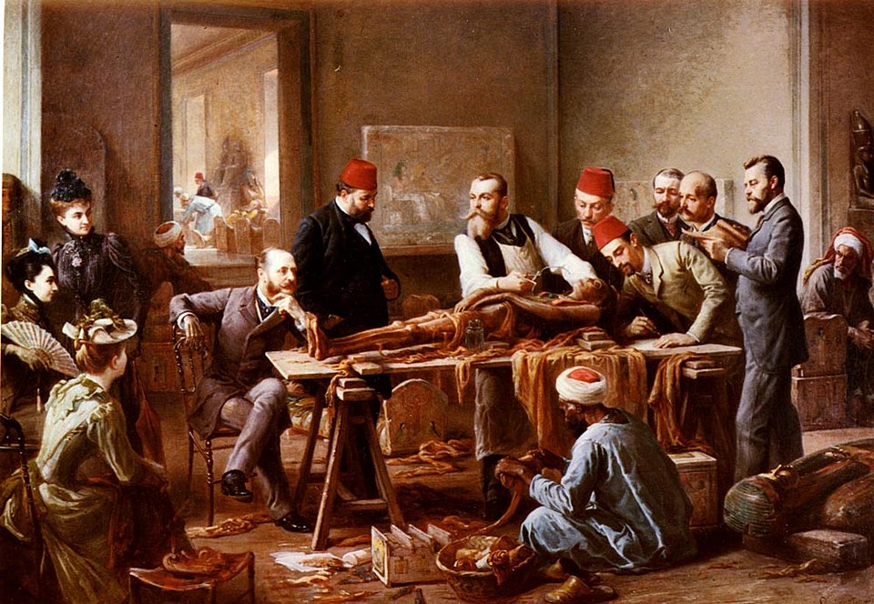
Mummy unwrapping parties were popular in 19th-century Europe, where middle and upper-class men and women would watch a mummy's bandages be unwound, revealing its body as the finale of the morbid show.
The remains were consumable as a variety of commercial products. A popular paint color from the mid-18th to 19th centuries was "mummy brown." This pigment was made from ground-up mummified bodies. Art historians believe this rich, warm brown pigment appears in a number of well-known paintings, including Eugene Delacroix's famous Liberty Leading the People. The last tube of mummy brown was produced, unbelievably, in 1964.
There are also accounts, of varying reliability, that both human and animal mummies were used as fertilizer, paper (from their bandages), and fuel for locomotives. These claims are likely exaggerated, but they speak to the manner in which mummified Egyptian remains were treated at the time. As Imperial plunder, they were, literally, things to be consumed.
The end of the mummy-eating era?
By the end of the Victorian period, mumia had fallen out of popular use. But it was still available for sale, and occasionally prescribed, into the beginning of the 20th century. The last known appearance of the drug for sale is in a 1908 Merck catalogue. The German pharmaceutical advertised, "Genuine Egyptian mummy as long as the supply lasts, 17 marks 50 per kilogram."
Rich old Europeans didn't actually eat up all the mummies. Archaeologists are still finding them, for one. It's impossible to say how significantly the manufacture of mumia impacted the number of surviving mummified remains. It's safe to say, though, that nearly a millennium of looting Egypt led to the loss of untold historical and cultural knowledge.
The 1908 example is troublingly recent, but we might still be tempted to dismiss mumia as something from another, less enlightened age. Exporting ground-up mummy to eat as a health supplement is something so patently absurd that a modern reader might make the mistake of smugly holding themselves above all those involved in the practice.
It's true that we don't eat mummies anymore. But physical and cultural wealth is still extracted from exploited nations for the consumption of the global north.
Most human bones available for sale in the West, as curios or medical teaching tools, come from India, though the export of human skeletons was officially banned in the 1980s. World-class museums still display cultural artifacts and remains of colonized people for the predominantly white public to gawk at. Mummy remains merchandise.
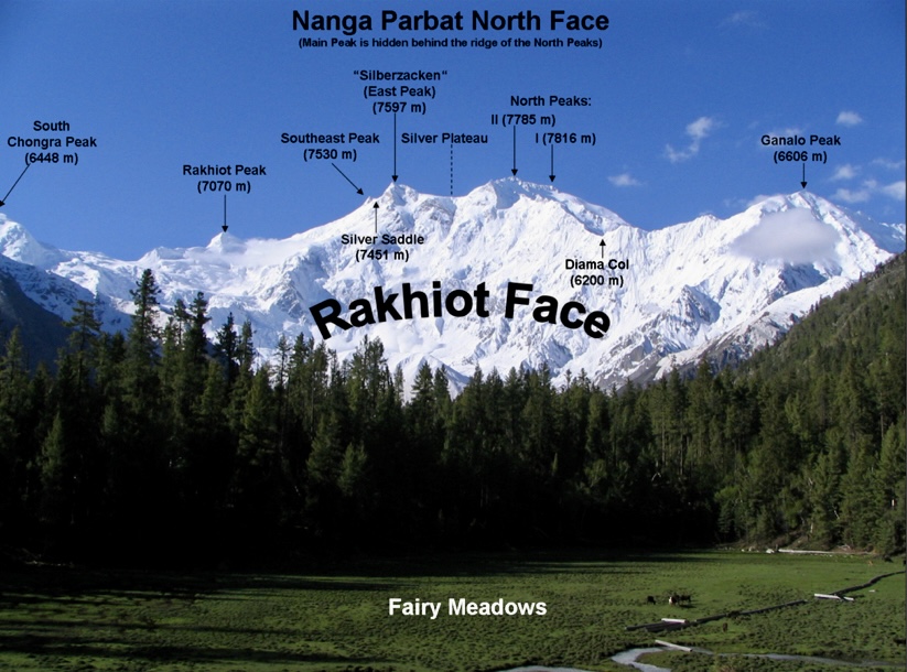
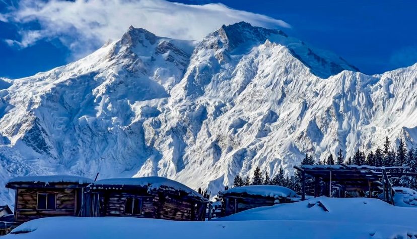
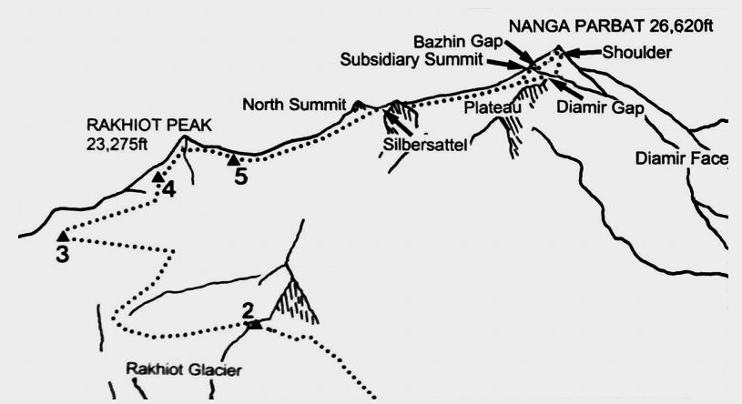
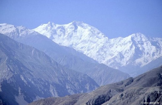
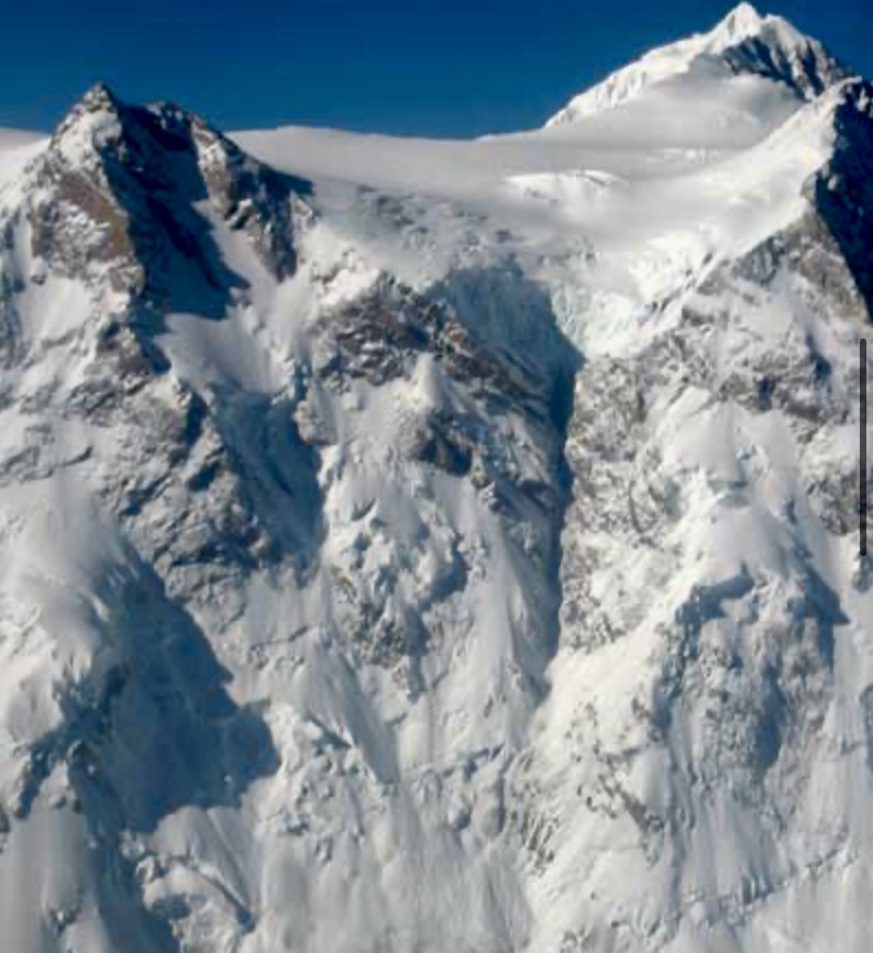
At 8,125m, Nanga Parbat in Pakistan’s Gilgit-Baltistan is the world's ninth-highest mountain, and it is dangerous. It earned its "Killer Mountain" nickname because of the high fatality rate during its early climbing history.
It has three main faces: the south-facing Rupal Face, the northeast-facing Rakhiot Face, and the northwest-facing Diamir Face. The Rakhiot Face is less frequently climbed than either the Diamir or Rupal Faces.
Only three teams have successfully ascended the Rakhiot Face, but more than 30 climbers have died.
The first fatalities
In 1895, Albert Mummery, Ragobir Thapa, and Goman Singh died while scouting the Rakhiot Face. They’re presumed to have died in an avalanche or fall, as their bodies were never found.
German expeditions
The Rakhiot Face became a focal point in the 1930s, particularly for German climbers, as Nanga Parbat was one of the few 8,000’ers accessible to non-British expeditions because of restrictions on Everest and the remoteness of K2.
The face, characterized by the Rakhiot Glacier, Rakhiot Peak (7,070m), the Silver Saddle (7,400m), and a long ridge to the summit, presented a viable but hazardous route due to its length and exposure to avalanches and storms. The expeditions of this era targeted what would later be known as the Buhl Route, which contributed both to the mountain’s allure and its deadly reputation.
1932: Willy Merkl’s German-American expedition
The first significant attempt on the Rakhiot Face was in 1932, led by German climber Willy Merkl. The expedition, sometimes called German-American because of the inclusion of American climbers Rand Herron and Fritz Wiessner (Wiessner was German-born but became a U.S. citizen), aimed to establish a route via the Rakhiot Glacier and Rakhiot Peak.
Merkl’s party took a route to the left of the Northeast Ridge, which involved steep ice and rock. But they lacked Himalayan experience, and poor planning hampered their progress. They did not have enough porters, and bad weather added to their problems.
Peter Aschenbrenner and Herbert Kunigk reached 7,070m Rakhiot Peak but could not progress further. However, the expedition confirmed the feasibility of a route via Rakhiot Peak and the main ridge.

1934: Merkl’s second attempt
Merkl returned in 1934 with a better-prepared expedition, funded by the Nazi government. They targeted the same Rakhiot Face route as in 1932, with a minor variation.
Early in the expedition, climber Alfred Drexel died, likely from high-altitude pulmonary edema. Things only deteriorated from there.
Fierce storms caused chaos on the mountain. On July 6, Peter Aschenbrenner and Erwin Schneider reached 7,895m, one of the highest points ever attained at the time, but worsening weather forced them back.
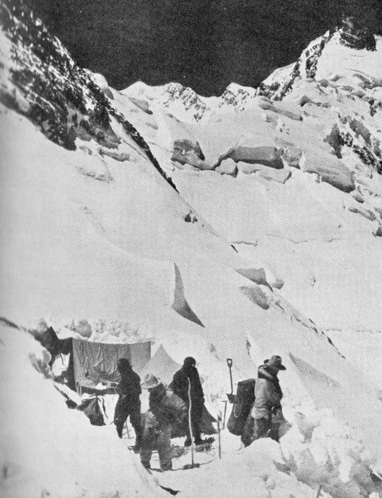
On July 7, a ferocious storm trapped 14 team members at 7,480m near Camp 4, below Rakhiot Peak. This led to the deaths of Merkl, Willo Welzenbach, Uli Wieland, and six porters: Pintso Norbu, Nima Norbu, Dorje Sherpa, Tashi Sherpa, Dakshi Sherpa, and Gaylay Sherpa. The 1938 Nanga Parbat expedition found their bodies.
At the time, it was the deadliest mountaineering disaster in history. This tragedy, alongside later disasters, cemented Nanga Parbat’s Killer Mountain reputation.
1937: Karl Wien’s avalanche disaster
In 1937, another German expedition targeted the same route.
Led by Karl Wien, the team made slow progress because of heavy snowfall. On the night of June 14, a huge avalanche from the hanging glacier on Rakhiot Peak hit them in Camp 4. The avalanche rushed 1,200m across the flat terrace where their camp was set up, burying the tents under meters of ice and packed snow. The campsite was considered safe previously, but a sudden change in weather likely triggered the avalanche.
The avalanche killed seven German climbers (Wien, Hans Hartmann, Adolf Goettner, Martin Pfeffer, Gunther Hepp, Peter Mullritter, and Otto Fankhauser) and nine support staff members (Pasang P., Nim Tsering, Mambahadur, Kami, Gyaljen Monjo, Jigmay, Chong Karma, Ang Tsering II, and Da Thondup).
A search team led by Paul Bauer later found the tents buried under ice and snow, with one climber’s diary noting the camp’s unsafe position. Five bodies were found buried nearby. Described as having "no parallel in climbing annals" for its prolonged suffering, this disaster added to the Rakhiot Face’s deadly reputation.
1938: Paul Bauer’s cautious attempt
Paul Bauer led a German expedition in 1938, mindful of the 1934 and 1937 tragedies.
The team reached the Silver Saddle, halfway between Rakhiot Peak and the summit, but bad weather forced a retreat. Heinrich Harrer, a member of the expedition, noted the face’s challenging conditions. No fatalities occurred, but the expedition made no significant progress beyond previous attempts.
1939: Harrer’s reconnaissance
In 1939, Harrer joined a German expedition led by Peter Aufschnaiter, primarily to scout the Diamir Face. However, they also examined the Rakhiot Face, concluding that it was a viable but dangerous route. World War II and their internment in British India halted further attempts.
The 1930s saw five German expeditions to the Rakhiot Face, with at least 25 deaths and no successful ascents, underscoring its lethality.
1950: the British winter reconnaissance
The first documented winter attempt on Nanga Parbat occurred in December 1950, when a three-member British team of William Crace, John Thornley, and Robert Marsh scouted the Rakhiot Face.
Marsh descended with frostbiten toes, leaving Crace and Thornley in a tent at 5,500m. Both disappeared, likely swept away by an avalanche or caught in a storm.
"Thornley and Crace were both extremely determined," Marsh wrote for the Himalayan Club. "Thornley, for instance, marched 265km to Nanga Parbat over the Babusarr Pass, wearing a pair of gym shoes, in six days, and was in no way fatigued at the end. They were a fine pair of friends, and it took an expedition of this sort, where we lived close, in difficult conditions, to bring out fully the great qualities of endurance, patience, and kindness which were so characteristic of them. I am sure they wish for no better tribute than that. When they were last seen, they were still going up and still going strong."
1953: Nanga Parbat’s first ascent
The first successful ascent of Nanga Parbat was in 1953 via the Rakhiot Face. The German-Austrian expedition was led by Karl Maria Herrligkoffer (who did not climb), whose half-brother Willy Merkl had died in 1934.
The team included Austrians Hermann Buhl, Peter Aschenbrenner, Walter Frauenberger, and Kuno Rainer, plus Germans Otto Kempter, Hermann Kollensperger, Albert Bitterling, Fritz Aumann, and Hans Ertl. It also included several (unnamed in the literature) local porters who carried supplies to Base Camp and up to Camp 4.
The expedition followed what became the Buhl Route: starting at the Rakhiot Glacier with Base Camp at 3,967m, ascending to Rakhiot Peak, traversing the Silver Saddle, and climbing the North Ridge to the summit.
On May 24, the expedition reached Base Camp. On June 10, Buhl, Kollensperger, and porters set up Camp 2 at 6,200m on the Rakhiot Glacier. Two weeks later, the climbers and porters established Camp 4 at 6,700m, below Rakhiot Peak.
On July 1, Buhl, Kempter, Frauenberger, and Ertl set up Camp 5 at about 6,950m with porter support. The porters then returned to the lower camps.
Hermann Buhl’s solo summit push
On July 2, Buhl and Kempter stayed at Camp 5 before Kempter turned back. After delays and disagreements, Aschenbrenner, the climbing leader of the expedition, ordered a retreat because of the approaching monsoon. Buhl, determined to summit, continued alone.
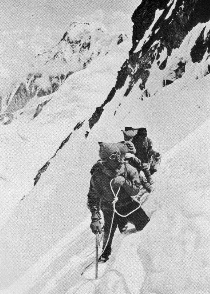
On July 3 at 2 am, Buhl started his summit push, carrying food, a flag, some pervitin and padutin pills, but no rope and no supplemental oxygen. His solo push was in alpine style.
Pervitin was a drug containing methamphetamine, a powerful stimulant. It was widely used by the German military during World War II to enhance alertness and relieve combat fatigue. Padutin improves blood circulation and prevents frostbite by dilating blood vessels. Yet despite the pills, Buhl did suffer frostbite.
By morning, Buhl reached the Silver Saddle at 7,450m. On July 3, by 2 pm, he hit the Bazhin Gap at 7,830m, dropped his backpack, and climbed the Shoulder (8,070m). After a tough rock section, he reached Nanga Parbat’s summit at 7 pm the same day, after a grueling 17-hour climb. He left his ice axe on the summit.
On the way down, he bivouacked overnight on a narrow ledge at 7,900m. He returned to high camp on July 4 and reached Camp 5 at 7 pm after 41 hours, exhausted and frostbitten.
Buhl's solo push was a monumental achievement and is detailed in his book Nanga Parbat Pilgrimage.
Only four years later, Buhl disappeared on 7,665m Chogolisa.
Later ascents
The second ascent of the Buhl Route came on July 11, 1971, when Slovaks Ivan Fiala and Michael Orolin made the second ascent of Nanga Parbat's Rakhiot Face. Other members of the same expedition achieved first ascents of the southeast peak (7,600m) and the foresummit (7,850m).
The climbers had also attempted the Buhl Route in 1969. That time, adverse weather and logistical challenges halted them before the summit. They reached 6,950m.
This 1971 expedition remains the only successful repetition of the Buhl Route.
The Japanese Route
In the summer of 1995, Japanese climbers Hiroshi Sakai, Yukio Yabe, and Takeshi Akiyama established a new route on the Rakhiot Face, ascending below the East Peak and traversing to the North Ridge near the North Peak.
"After a 1992 reconnaissance to the north and a subsequent study of aerial photos, I was convinced we could climb a new route via the ridge derived from the East Peak of Silver Crag," Sakai wrote in the American Alpine Journal.
The Japanese party consisted of 10 members, though only three members had adequate experience at high altitude. Of these three, two were soon injured and unable to climb.
The expedition began on June 5 with a three-day march from Tatoo to a temporary Base Camp at 3,900m, using 100 porters to carry three tons of supplies. The main Base Camp was at 4,500m on the Great Moraine, higher than typical due to the long summit route. Acclimatization took five days, and they had established Camp 1 at 5,300m on the Rakhiot Glacier by June 11. From here, they deviated from the 1953 route.
The route from Camp 1 to Camp 2 involved a steep wall of snow and granite reaching 5,700m. The climbers faced a grade IV+ rock crack and a hazardous snow gully prone to rockfall named the Confessional Pitch because of its danger. On June 26, a falling stone injured one climber's arm, and he had to withdraw.
"As we climbed higher, we felt more and more rockfall flying down toward us, as our route led toward the upper part of this snow gully," Sakai recalled.
Inching higher, another injury
After overcoming an overhang and a jagged snow ridge, they set Camp 2 at 5,900m on June 25. Above Camp 2, at 6,300m, a 300m ice tower posed a major obstacle. The team navigated a vertical slit in the ice, climbing four pitches at 70°. Beyond this, the route eased into knee-deep snow along a ridge, leading to Camp 3 at 6,700m, established on July 4.
On July 7, Tamura was injured by a falling stone at the Confessional Pitch, requiring a three-day rescue. With only six climbers left, the team abandoned plans to traverse Nanga Parbat and rested until July 12.
The route to Camp 4 traversed the Silver Saddle’s flanks, tackling Yabe’s Crack, a 50m grade V climb. By July 18, after navigating 800m of snow and rock, Camp 4 was set at 7,350m near the Silver Plateau.
The summit push
On July 22, Sakai, Yabe, and Akiyama left high camp toward the summit. However, soon after, they returned to Camp 4 because Akiyama felt pain in his chest, and Yabe’s fingers and toes had gone numb with cold. During that night, they took oxygen to regain their strength.
On July 23, Sakai, Yabe, and Akiyama summited at 5:13 pm via a new route, after a grueling climb through the Silver Plateau and a steep summit wall. They faced exhaustion and worsening weather but reached the top.
The descent was tough, with a bivouac at 7,700m in a snowstorm. The team returned to Camp 4 after 39 hours and reached Base Camp on July 28 amid bad weather. Despite injuries and setbacks, the expedition succeeded, marking a new route on Nanga Parbat’s North Face.
This marked the third successful ascent of the Rakhiot Face and introduced a more direct but equally challenging alternative to the Buhl Route. No further ascents of this route have been recorded.
2008: a new route attempt
In the summer of 2008, Italian climbers Simon Kehrer, Walter Nones, and Karl Unterkircher attempted a new route via the Rakhiot Ice Wall.
The team arrived at Base Camp in late May, spending weeks acclimatizing and observing the Rakhiot Face, noting its avalanche-prone seracs and crevasses. On July 14, they began their summit push at 10 pm, hoping to minimize avalanche risk by climbing at night when it was coldest.
They cached a tent at 4,500m and began climbing again after midnight on July 15, navigating 60° ice and a near-vertical M4/5 mixed wall to 5,700m. After tackling deep snow and a serac, they reached 6,300m by 4 pm, where Unterkircher fell into a crevasse and died. Kehrer and Nones attempted a rescue but found his body buried under snow. Unable to recover it in dangerous conditions, they retrieved his gear and continued up.
Opting against a risky descent, they climbed toward the Silver Plateau via a longer, easier route through avalanche-prone slopes and steep mixed terrain. A storm on July 17 slowed progress with waist-deep snow, forcing bivouacs at 6,650m, 6,800m, 7,000m, and 7,300m.
They reached 7,500m on July 21. On July 22–23, they skied down the Buhl route in poor visibility, surviving two avalanches. Eventually, a Pakistani Army helicopter airlifted them from 5,400m to Base Camp on July 24. Recovering Unterkircher’s body was deemed impossible.
The route, named Via Karl Unterkircher (3,000m, IV-V M4+ 70°-80°), was dedicated to their fallen friend.
Since its last ascent in 1995, the Rakhiot Face remains unclimbed to the summit. Of the 80 people who have died on Nanga Parbat, more than a third perished on the Rakhiot Face.
You can find the climbing history of the Diamir Face here, and the Rupal Face here.
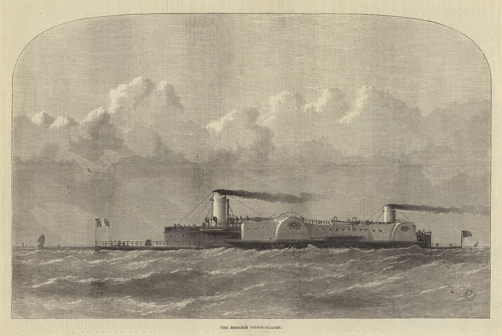
Perhaps the most famous ship in exploration history, the Fram was designed specifically for the challenges of polar navigation. With her rounded hull, she withstood the crushing ice that shattered the likes of Shackleton's Endurance, rising up over the ice instead of being pinned by it. Her design, however, which made her so perfectly adapted to her line of work, also made her roll horribly in the open sea, inducing seasickness.
The SS Bessemer was basically the exact opposite of the Fram. While she was engineered against seasickness, she also seemed to be engineered against seaworthiness. Or perhaps some jealous oceanic deity, seeing humanity attempt to conquer the limitations he'd placed upon their encroachment in his domain, cursed the poor ship.
Cursed or no, the SS Bessemer certainly had an eventful career.
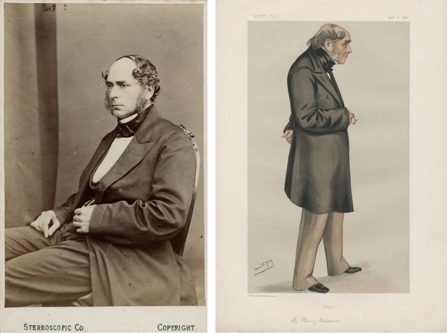
The eponymous Bessemer
Henry Bessemer was born in 1813 on his Huguenot inventor father's small Hertfordshire estate. After fleeing the French Revolution, his father settled in England and made his money from his inventions. Henry took after his father, fascinated by machinery and driven to improve upon the mechanisms he observed. He moved to London at 17 to seek his fortune and immediately began experimenting.
His first big success was a steam-powered machine to manufacture bronze powder. Originally, his only ambition with the experiment was to make gold paint for his sister, a watercolor artist. But the process and manufacturing machines he developed made enough to support him while he continued inventing.
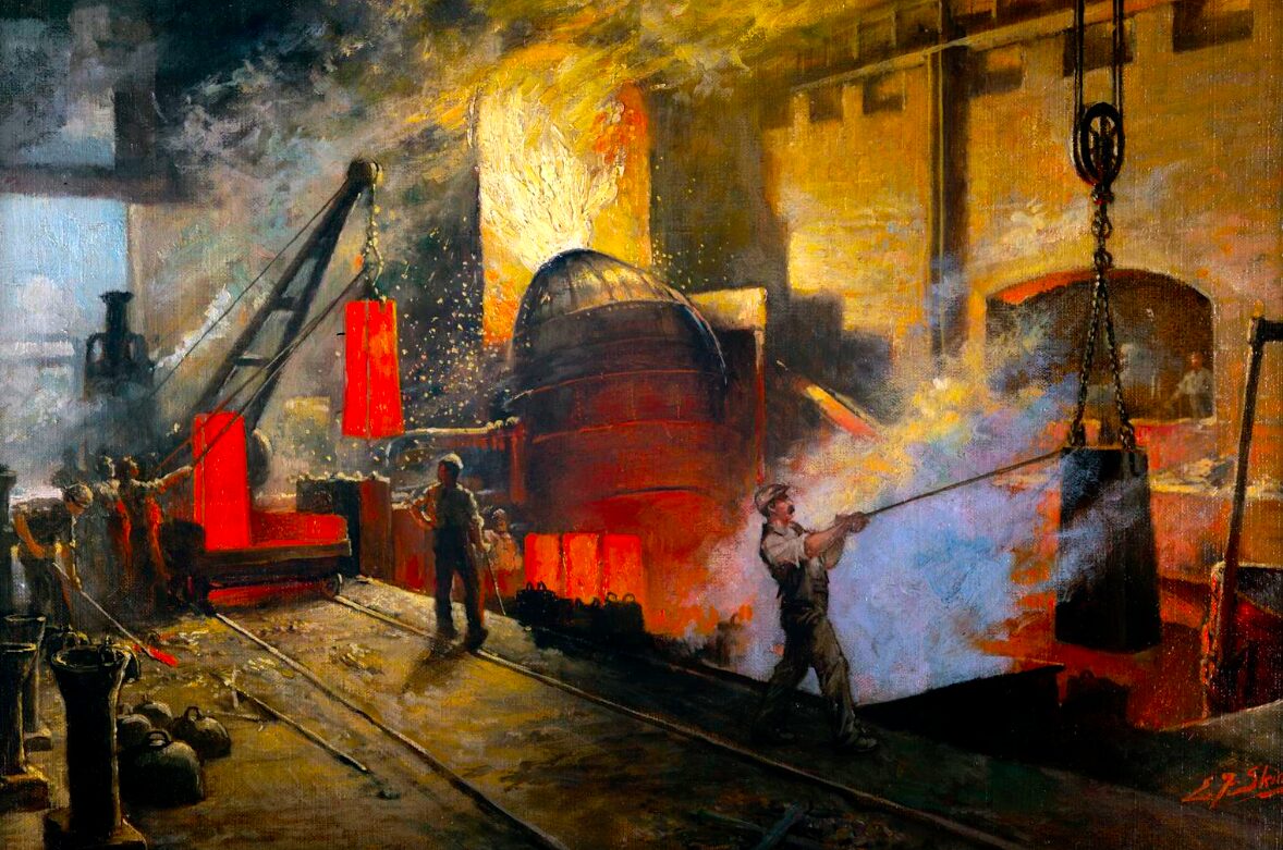
If you've heard the name Bessemer, you've heard it in connection with his most important invention: the Bessemer process. In terms of Industrial Revolution inventions, it ranks among the steam engine, the telegraph, and the spinning jenny.
What Bessemer invented was the first way to produce steel quickly and cheaply. Bessemer steel built the railroads, bridges and skyscrapers of the next century, and made Bessemer a wealthy man. But he wasn't done inventing.
The steel magnate and mal de mer
In 1868, Sir Henry (we will call him that moving forward, to avoid confusion between the inventor and his ship) took a channel steamer from Calais to Dover. While the English Channel crossing through the Strait of Dover, as this route is called, is and was very common, it wasn't easy. While it took less than a day on the steamship ferries, the shallow channel with its powerful, strange currents was notorious for causing seasickness.
"Few persons have suffered more severely than I have from sea sickness," Sir Henry wrote in his autobiography. The 1868 crossing, followed by a 12-hour train journey, left him temporarily bedridden and, it seems, somewhat traumatized. Determined to rid the world of this scourge, he set his inventive mind to work.
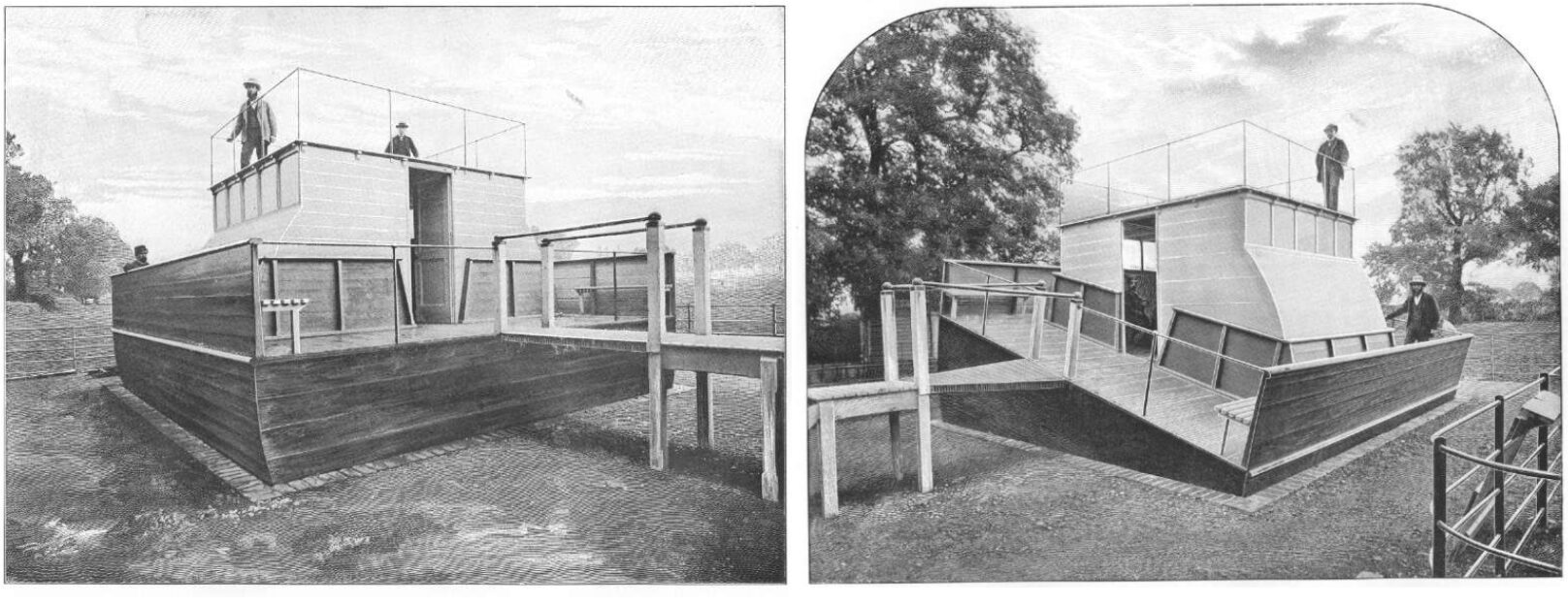
The principle was deceptively simple: A suspended cabin within the ship, which, mounted on gimbals, would remain stable while the outside of the ship was tossed about by the waves. He built a tiny model, "small enough to be placed on a table," and rocked it back and forth using clockwork. It was probably rather adorable.
In December 1869, Sir Henry patented his design and set about building it.
The backyard ship
Rushing into the project, Sir Henry paid a shipbuilder to construct a small steamer for the modern equivalent of over $430,000. No sooner had he done so than he realized he needed to alter his initial design, and the half-built ship wouldn't accommodate the changes. He sold it off for a third of what he'd paid and instead built another model.
Sir Henry was unwilling to actually go out to sea for testing, so he built the middle of a small ship in his backyard. His new design included a steersman. He would manually adjust the level of the cabin by turning a handle to match a spirit level. The motion of the handle would then control the hydraulics.
Sir Henry invited scores of wealthy and prominent friends and fellow inventors to experience the model. They all pronounced it a success, and papers on both sides of the Atlantic reported excitedly that soon seasickness would be a thing of the past.
Building the SS Bessemer
This steersman design satisfied Sir Henry, who formed a joint-stock company and raised $340,000, roughly $34 million today. Joining him in the company was Sir Edward James Reed, who'd been the Chief Constructor for the Royal Navy, and would go on to become a railroad magnate and a member of Parliament.
Designing the ship part of the SS Bessemer was probably somewhat of a low point for him. He'd just bitterly resigned from his Naval command. Parliament had undermined and insulted him by funding the HMS Captain, designed by his detested rival Captain Cowper Phipps Coles, without consulting him. He had something to prove when he decided to join the ambitious new venture.
Sir Henry and Sir Reed sent their plans to Earle's Shipbuilding Company in Hull. Sir Henry continued to bleed money into the project just to keep it afloat.
When the ship was nearly complete and was moored outside Earle's Shipbuilding Company in Hull, a late October gale struck the coast. Too long to be anchored in the regular way, she'd been chained horizontally by both stern and head. As a result, her long side met the full force of the wind, and she was torn from her moorings and driven onto the muddy bank.
She escaped the embarrassing incident without major injury, and they were able to coax her back into the water and finish construction. Finally, after even more personal financial outlay, the ship was insured, and a commander, a Captain Pittock, was found. The maiden voyage of the SS Bessemer was scheduled for May 8, 1875.

A trying trial run
The company wisely decided to perform a trial run before the public debut in May. A few weeks in advance of the date, Captain Pittock took the SS Bessemer out of Dover, planning to dock at Calais and then return.
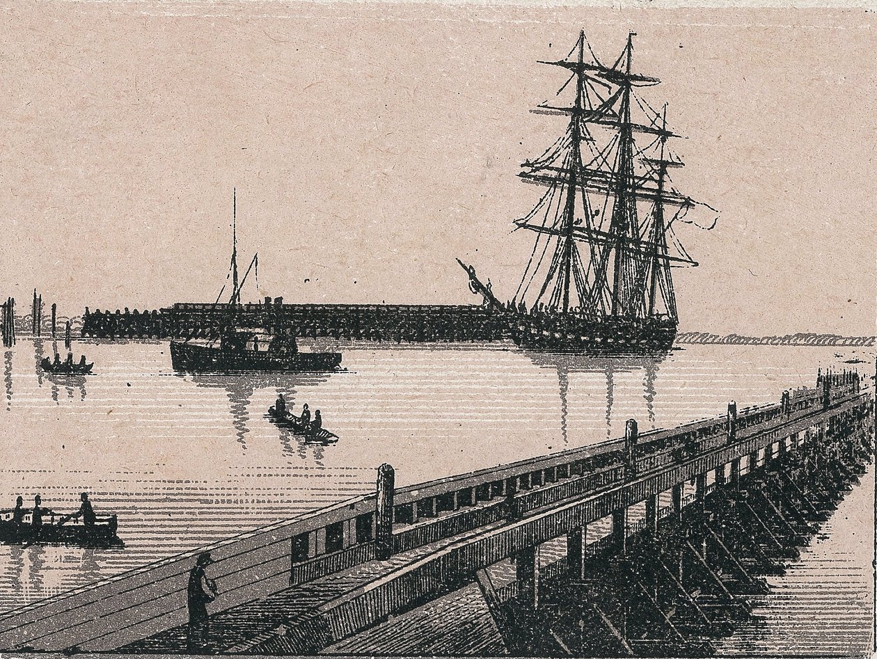
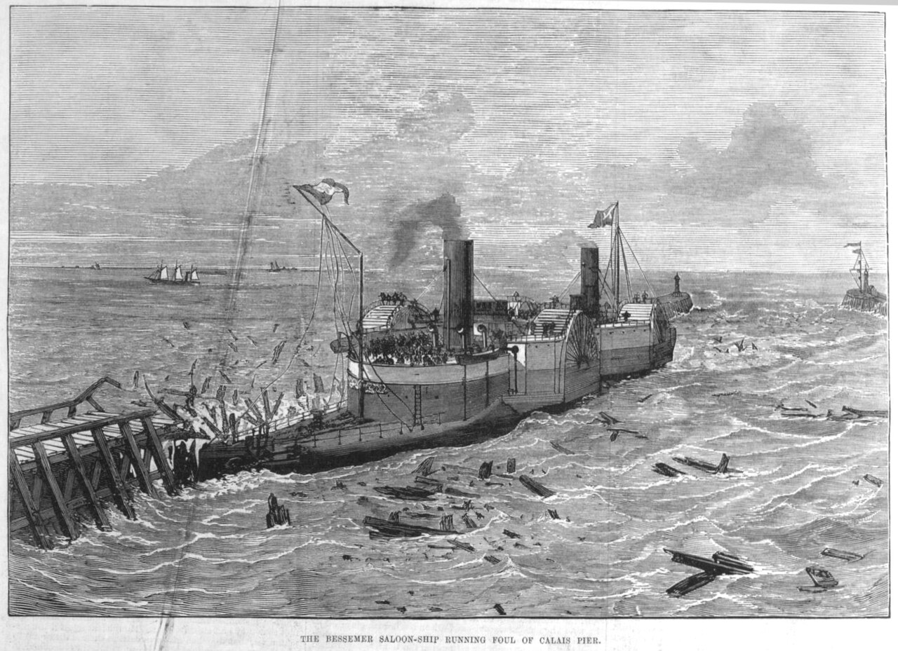
Unlike many maritime mishaps, weather could not be blamed for what followed. As Sir Henry himself described, the SS Bessemer approached Calais "on a beautiful calm day, in broad daylight, at a carefully chosen time of the tide, and with all the skill of the best Channel navigator."
Whereupon she crashed into the pier. Her paddle wheels slammed into the pier, causing $3,800 in damages and destroying the paddle wheels. Captain Pittock had to go before the consul in Calais, where he swore that the ship simply "did not answer her helm."
She was fitted with replacement paddle wheels, and Pittock managed to carefully inch her back out of the port and limp home to England.
Sir Henry and the company decided it was too late to postpone the May 8 launch. Instead, while the SS Bessemer was being repaired, her creator had the saloon fixed in place, completely defeating the whole purpose of its existence.
Failure continues
Without a doubt, Sir Henry was an incredibly intelligent man with a gift for metallurgy in particular. But he was not a shipwright. The balance of weight in a ship is both important and delicate. The holds of contemporary sailing ships were carefully packed and re-packed to ensure the weight was perfectly distributed. Getting this wrong could negatively affect the sailing abilities of even a very seaworthy vessel.
The SS Bessemer, built around an unwieldy cabin and hydraulics, was already not the easiest sailor. With a great weight constantly shifting the center of gravity, she was practically unsteerable, with dangerously unpredictable movement.
Worst of all, she wasn't even seasickness-proof. Reporting on her maiden voyage, a Wisconsin newspaper wrote that while the design seemed to work in the bay, once she reached the open channel things went awry: "Pitched about by the raging sea, the cabin floundered wildly, and the passengers parted with their victuals as passengers have ever been wont to do."
On her first journey from Hull, where she was built, to Gravesend, she gobbled up coal at an amazing rate. One passenger reported that the saloon itself moved as designed, but either due to mechanical or human error, it didn't respond fast enough to actually negate the movement of the ship.
On the 8th of May, with the first passengers on board and just as ill as always, the SS Bessemer inched into the port of Calais. All breaths were held as Captain Pittock gave his orders-- and the ship failed to respond. The SS Bessemer crashed into the Calais pier for a second time, as Sir Henry put it, "knocking down the huge timbers like so many ninepins!"
The final demise of the SS Bessemer
Sir Henry had sunk a great deal of his personal fortune into developing, building, re-building, and rebuilding a second time. It was an unwillingness to throw good money after bad, not a lack of belief in the concept, that caused Sir Henry to finally pull the plug.
At least, that's what he himself said. That his saloon had proved an entire failure, "nothing could be more absolutely untrue," Sir Henry insisted. It's almost sweet how much he believed in the viability of the wretched little ship despite all evidence to the contrary. At any rate, he never admitted that the concept itself was flawed.
But the second Calais incident killed the SS Bessemer commercially. The bankrupt Bessemer Saloon Steamboat Company was sold off, and the SS Bessemer was sold for scrap. Sir Reed had the saloon itself removed from the ship and installed as a billiards room on his estate in Kent.
Henry Bessemer continued to invent, with varying degrees of success. In 1893, he attempted to build a sun-powered furnace that he promised would reach up to 33,000˚C. However, he gave up after a lens maker failed to produce the required lenses.
In 1889, Sir Reed's estate became Swanley Horticultural College, a women's agricultural school. The beautiful, ornate saloon of the SS Bessemer was used as a lecture hall.

On March 1, 1944, Swanley Horticultural College was bombed in a German air raid. The saloon was destroyed by a direct hit. Only a few pieces of paneling, rescued by local residents, survive.
Humanity has yet to invent a seasick-proof ship, but we do have over-the-counter dimenhydrinate now, which has always worked for me, anyway.
The ninth-largest mountain in the world, Pakistan's 8,125m Nanga Parbat has three main faces: the south-facing Rupal Face, the northeast-facing Rakhiot Face, and the northwest-facing Diamir Face.
On June 24, David Goettler, Tiphaine Duperier, and Boris Langenstein summited via the Schell Route after an 18-hour, alpine-style push from Camp 3 at 6,800m. From the summit, Duperier and Langenstein made the mountain's first complete ski descent, including the entire Rupal Face, according to Montagnes Magazine. Goettler paraglided from 7,700m to Base Camp.
This article will explore the climbing history of the Rupal Face.
The tallest mountain face
Many consider Nanga Parbat’s 4,600m Rupal Face the world's tallest mountain face because it forms a continuous, steep wall from the Rupal Valley at 3,500m to the summit at 8,125m. Its steep icefields, rocky buttresses, avalanche-prone slopes, and brutal weather make it a formidable challenge.
By contrast, 7,782m Namcha Barwa’s south face (5,282m to 5,782m high) and 7,294m Gyala Peri’s south face (4,794m to 5,294m high) both have greater total relief but include gentler, less consistent slopes, reducing their status as unbroken climbing faces.
The Rupal Face has had just 12 successful ascents across four routes.

The Messner Route: The first ascent
In 1970, Reinhold Messner and his brother Gunther climbed Nanga Parbat via the Rupal Face. They climbed up the South-Southeast Spur (often referred to as the Messner Route). The expedition was led by Karl Maria Herrligkoffer, and the Messner brothers reached the summit on June 27.
Because of worsening weather, exhaustion, and Gunther’s altitude sickness, the Messner brothers were unable to descend the Rupal Face. Instead, they made the first traverse of Nanga Parbat by descending the Diamir Face, following a route along the Mummery Rib’s lower slopes and improvising a westward path toward the Mazeno Ridge’s lower slopes, crossing gullies and snowfields near the Diamir Glacier.
Tragically, Gunther Messner died during this descent, likely in an avalanche on the Diamir Face.
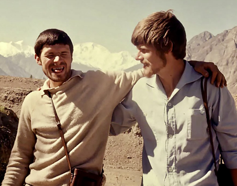
Messner's route repeated
In 2005, a South Korean team started from Base Camp on April 20 in heavy snow. They set up Camp 1 at 5,280m and Camp 2 at 6,090m along the 1970 Messner Route.
They were still on the mountain in early June when bad weather hit them hard and destroyed their tents. Despite this, they made Camp 3 at 6,850m before an injury stopped their first summit attempt.
On July 13, Kim Chang-ho and Lee Hyun-jo left Camp 4 at 7,125m. After 24 hours, dodging falling rock and ice, they summited late on July 14. The climbers went down the Diamir Face, survived an avalanche, and reached Base Camp after 68 hours. On the summit, they found a container left by Reinhold Messner and returned it to him as proof of their climb.
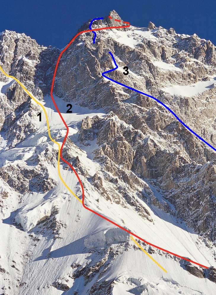
An alpine-style attempt on the Messner Route
A notable attempt of the 1970 Messner Route came in 1988. Canadians Kevin Doyle, Ward Robinson, and Barry Blanchard, plus American Marc Twight, prepared by climbing nearby peaks.
Doyle, Robinson, and Blanchard tackled a new route on 6,500m Shigeri’s north face, spending two unplanned nights at altitude. Twight soloed a new route on Laila’s south face and east ridge (6,000m). The three of them reached 7,000m on the easier Schell Route.
On July 9, the team started on the Rupal Face by the Messner Route. They left with light gear: five days’ food, eight days’ fuel, two ropes, and some climbing equipment.
The first 1,000m were easy, but after camping below Wieland Rocks, the terrain got steep and hard, needing two ice tools. At 6,400m, they avoided a rockfall-prone gully, climbing tough mixed ground. In two and a half days, they gained 3,170m, resting for half a day on July 12.
They climbed a steep ice barrier and struggled through deep snow. At 7,300m, they faced hard, brittle ice in the Merkl Gully. By July 13, they reached 7,700m, close to the summit.
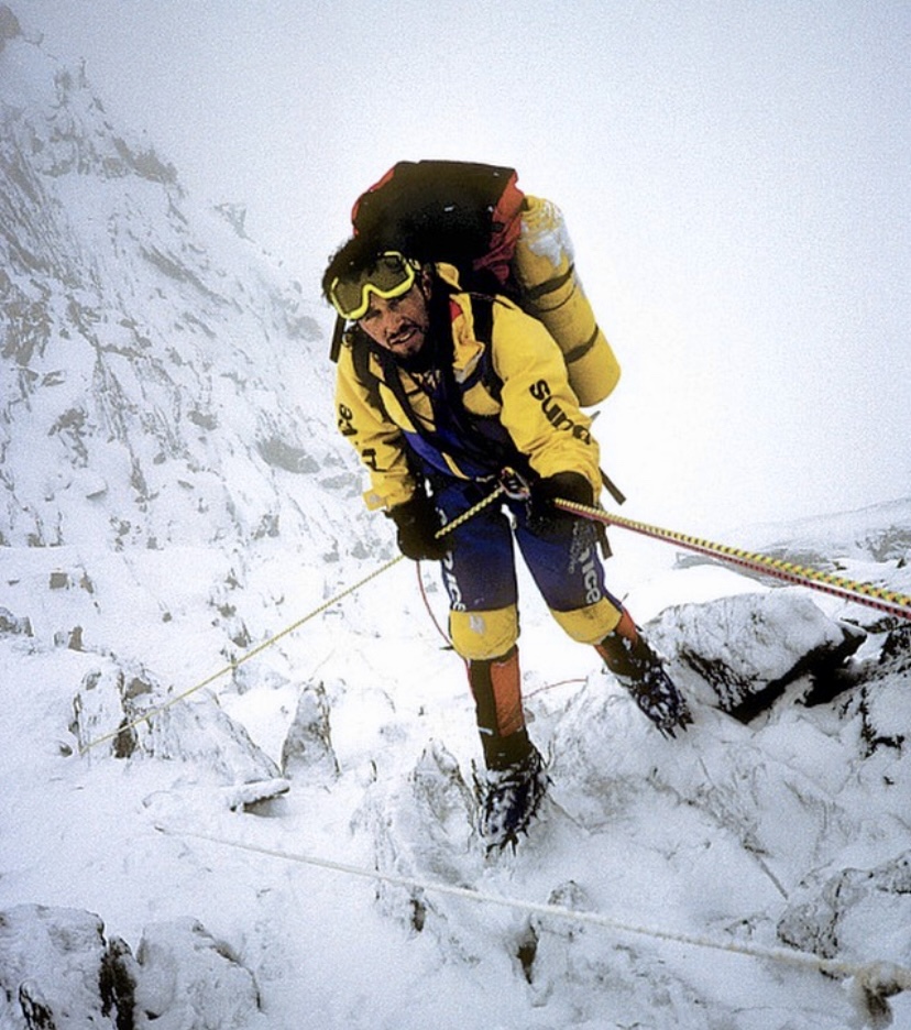
A close call
Here, their luck ran out. A sudden storm hit, with lightning, 160kmph winds, and avalanches. Robinson, sick and hypothermic, could barely move. An avalanche nearly swept them off the mountain while rappeling, but their one ice screw held. After five hours, they reached the Merkl Icefield and found shelter for Robinson.
Twight and Blanchard descended to 7,000m, losing a tent and both ropes. At 6,700m, they found a discarded pack from the 1984 Japanese team with ropes and gear. Their find helped them escape the mountain over the next day and a half.
"The atmosphere quivered, and I could hear the tension of the storm's electrical charge -- white noise crackling in my ears," Blanchard wrote in his book The Calling. "The midday sky was as dark as dusk...The avalanche had ended 27 minutes after it had begun. Ward's face looked old. Deep lines dragged down the corners of his mouth; I had never seen those lines in his face before. His eyes had the improperly focused look of shock, with too much black in his pupils."
On July 25, they tried again, climbing to 7,300m in just over two days. Sick again, Robinson retreated from 7,000m. Soon after, clouds and a brewing storm stopped the rest of the team, and they descended in 13 hours.
Importance of the 1988 attempt
This expedition was significant for several reasons. First, it highlighted the extreme challenge of the Messner Route, reinforcing its reputation as one of mountaineering’s toughest objectives. No team had summited via this route since 1970, and the 1988 attempt underscored why: the combination of technical ice climbing, unpredictable weather, and constant rockfall and avalanche risks demands exceptional skill and luck.
The team’s alpine-style approach — carrying minimal gear to move quickly — tested the limits of the strategy, showing both its potential and its vulnerabilities when equipment was lost. Their survival, especially after the storm and Robinson’s altitude sickness, demonstrated remarkable resilience and decision-making under pressure. Finding the Japanese pack was a stroke of luck that likely saved their lives.
Though they didn’t reach the summit, their 7,700m high point and detailed account provided valuable insights into this formidable route.
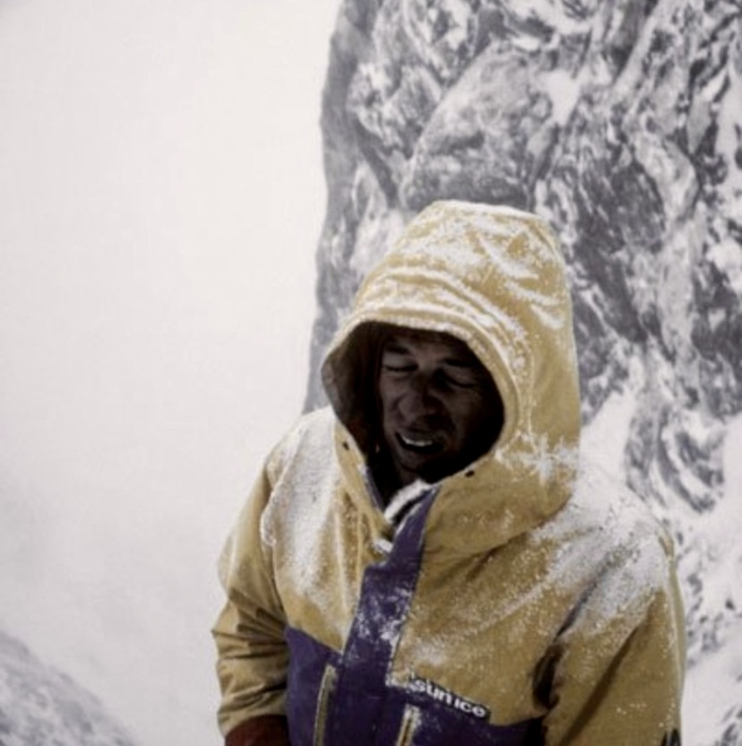
The Schell Route
The Schell Route has eight successful ascents.
We previously detailed the first ascent of the Schell Route, climbed in 1976 by Austrians Hanns Schell, Robert Schauer, Siegfried Gimpel, and Hilmar Sturm. David Goettler, Tiphaine Duperier, and Boris Langenstein repeated this long, difficult route a few days ago.
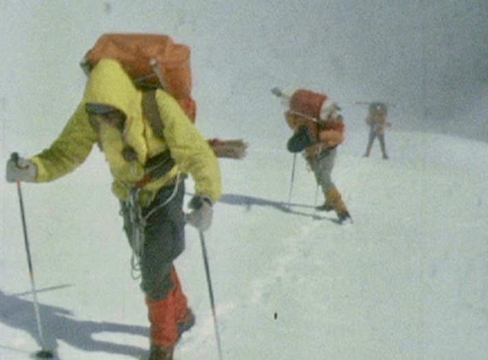
With only eight successful climbs, the importance of this latest ascent is obvious. The other ascents are: 1981 by Ronald Naar; 1984 by Oscar Cadiach and Jordi Magrina; 1990 by Marija Frantar and Joze Rozman; 1990 by Reinmar Joswig and Peter Mezger; 1990 by Osamu Nakajima; 2013 by Zsolt Torok, Teofil Vlad Dima, Aurel Salasan, and Marius Gane.
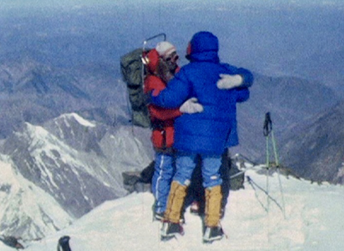
The 2025 ascent via the Schell Route comes 12 years since its last ascent in 2013, and Duperier becomes just the second woman to achieve this remarkable feat. Goettler had attempted this route four times previously.
The Southeast Pillar: The Polish-Mexican Route
In 1982, Swiss climber Ueli Buhler nearly conquered the Southeast Pillar. He reached the 8,042m south summit but was unable to continue to the main peak.
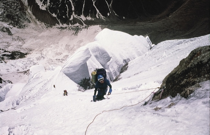
In 1985, a Polish-Mexican expedition opened a new route on the Rupal Face by the Southeast Pillar.
This 1985 expedition, led by Pawel Mularz, tackled the dangerous pillar in brutal weather. During the climb, Andrzej Samolewicz survived a 600m fall with only minor injuries, but an avalanche killed Piotr Kalmus while he descended from Camp 2 to Camp 1. On July 13, Jerzy Kukuczka, Zygmunt Andrzej Heinrich, Carlos Carsolio, and Slavomir Lobodzinski reached the summit from Camp 5, marking Kukuczka’s ninth 8,000m peak.
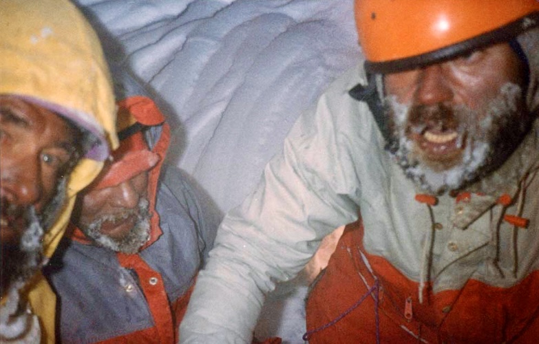
A winter solo attempt ends in tragedy
In the winter of 2012-13, Joel Wischnewski, a little-known mountaineer from France, attempted a highly ambitious solo climb of the Southeast Pillar on Nanga Parbat’s Rupal Face.
He left France at the end of December 2012, reached base camp on January 9, 2013, and made his last journal entry on February 6 from Camp 2, indicating he was moving up the Southeast Pillar.
When he didn't return, his agent in Pakistan launched a search. Three experienced Pakistani mountaineers climbed up the lower part of his proposed route, but found no trace of the Frenchman.
Wischnewski's body was found on Oct. 10, 2013, at approximately 6,100m on the Rupal Face near the foot of an icefall. Local villagers spotted his boots after the summer snowmelt in early September and notified the French embassy.
A team led by Brigadier Akram Khan recovered the body, and it was buried at the Herrligkoffer climbers’ cemetery near Base Camp. Wischnewski likely died in an avalanche.
The Central Pillar: The Anderson-House Route
Vince Anderson and Steve House climbed the Rupal Face by a 4,100m new route (M5, 5.9, WI4) in the autumn of 2005.
The duo's route up the Central Pillar was alpine-style and faced tough challenges, like loose rock on a hard 5.9 section. On day three, they reached a hanging glacier, then followed an icy ramp to their last camp at 7,400m. There, they joined the Messner Route at 7,900m and summited on September 6. Anderson and House descended by the Messner Route.
The 2005 Central Pillar route, distinct from the 1970 Messner Route and the 1985 Southeast Pillar, was a significant achievement and earned them the 2006 Piolet d’Or. Their climb followed a 2004 attempt by House and Bruce Miller, which reached 7,500m but was halted by altitude sickness.
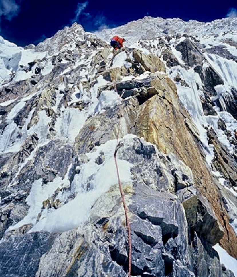
A central route attempt
In 2005, Slovenian Tomaz Humar attempted a challenging new central route up the Rupal Face. He had previously tried a similar route in 2003 but retreated because of poor weather and health issues.
On this second attempt, Humar reached about 6,300m before bad weather trapped him, forcing him to dig into the snowy slope and wait for clearer skies and fewer avalanches. However, after days of waiting, he required a risky helicopter rescue by Pakistani pilots.
Climbing journalists and peers criticized him, but Slovenians watched the drama unfold on TV and celebrated Humar's safe return as a national hero. Four years later, Humar died on Langtang Lirung.
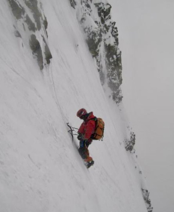
Another new route attempt
In 2018, Czech climbers Marek Holecek and Tomas Petrecek attempted a new alpine-style route on the Rupal Face.
Initially, they planned to establish a new line to the right of the 2005 Anderson-House route on the Central Pillar. However, bad weather and heavy snowfall forced them to adjust their plans. When a weather window opened, they shifted to a line closer to the 1970 Messner Route, following it until the Merkl Rinne, a steep gully used by the Messner brothers. From there, they deviated, climbing a new variation through rocky buttresses to the left of the gully, seeking a natural line of weaknesses.
After six days on the face, they reached approximately 7,800m on September 2. There, they were forced to retreat in increasingly strong winds (up to 100kmph). They were about 300m below the summit when they turned back.
They descended the Rupal Face, which Holecek described as extremely challenging, comparing it to a "cabriolet [horse-drawn carriage] trip without a windscreen in an ice storm."
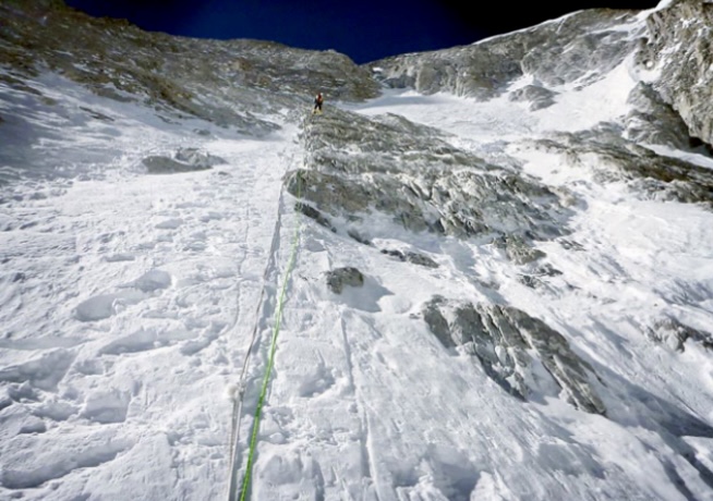
Winter attempts
Since 1988, nine winter attempts have targeted the Rupal Face, but all were defeated by the extreme conditions.
Maciej Berbeka of Poland led three attempts. In 1988-89, his team reached 6,500–6,800m on the Messner Route before switching faces in harsh weather. In 1990-91, a Polish-English team reached 6,600m on the Schell Route, and in 1991-92, they reached 7,000m. Both times, severe weather stopped them.
Krzysztof Wielicki’s 2006-07 Polish expedition reached 6,800m on the Schell Route but retreated in fierce winds. As we previously noted, Joel Wischnewski vanished during his winter solo attempt in 2013. Tomasz Mackiewicz’s winter attempts on the Schell Route included a 2012-13 solo climb to 7,400m, and a joint effort with David Goettler to 7,200m in 2013-14.
In the winter of 2014-15, Russians Nikolay Totmjanin, Sergei Kondrashkin, Valery Shamalo, and Victor Koval reached 7,150m on the Schell Route before deteriorating weather, including high winds, snow blizzards, and zero visibility, forced them back.
Cleo Weidlich (a Brazilian-born American climber) and her Sherpa team abandoned their 2015-16 Schell Route attempt in treacherous conditions.
In 2021-22, Herve Barmasse and David Goettler stopped at 5,670m on the Schell Route because of avalanche risk and bad weather.
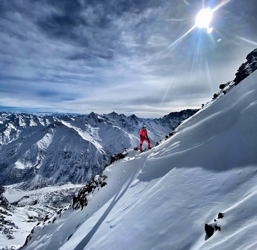
The Schell Route remains unclimbed in winter
While Nanga Parbat was finally climbed in winter -- on Feb. 26, 2016, via the Kinshofer Route on the Diamir Face by Simone Moro (Italy), Alex Txikon (Spain), and Ali Sadpara (Pakistan) -- the ever-formidable Rupal Face remains unclimbed during the harshest season.
In 2023, the world consumed more than 7.3 billion kilograms of tea. Bar water, tea is the most popular beverage on earth. We've even figured out how to drink it in space, where both boiling water and drinking from a cup is a serious endeavor.
Today, many regions are known for the production and consumption of tea. But for the first few thousand years of its existence, it was synonymous with China.
Tea only reached Europe in the 17th century. When the famous English diarist Samuel Pepys first tried it in 1660, he called it "a cup of tee (a China drink) of which I never had drank before." He did not record whether he liked it or not. Many British people did take to the drink, though, and by 1800, the Brits were importing 24 million pounds from China every year.
British merchants chafed under the trade deficit; their people wanted tea, silk, porcelain, cotton, and indigo. The Chinese didn't seem to want anything but silver. To protect their monopoly, the Chinese government made it illegal to sell live tea plants or their seeds, and closely protected the secrets of tea manufacturing. There was only one way around this: The British were going to have to steal tea from China.
![]()
The most powerful company in history
The British East India Company was one of the most powerful and ruthlessly evil corporations ever to exist, and they had set their sights on taking tea from China.
Formed in 1600, Elizabeth I granted the British East India Company (EIC) a monopoly over all trade east of the Cape of Good Hope. The intention was to create a strong, organized merchant army to break Dutch control of the spice trade.
In 1683, Charles II gave the EIC the unilateral ability to "declare peace and war" with the "heathen nations" of Africa, Asia, and America. The EIC had the right to govern colonies, build plantations and military forts, raise armies, and execute martial law within their territories. The private armies of the EIC conquered much of Southeast Asia, ruling India, Pakistan, Burma, and Bangladesh. They turned these countries into wealth-extraction machines, reducing the inhabitants to desperate poverty.
The company controlled the trade of some of the world's most valuable products: tea, coffee, spices, cotton, silk, porcelain, saltpeter, wool, and slaves. But their monopoly was growing unpopular at home, as it drove up prices and prevented competition. In 1813, the British government opened up trade to India, and in 1833, to China.
But the EIC still had monopolies to trade in a few products, including tea.
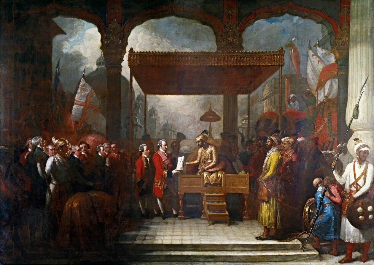
A bold proposition
In 1848, Robert Fortune, curator of the Chelsea Physic Garden, was approached by the renowned botanist Dr John Forbes Royle. Royle was an EIC surgeon and the superintendent of the EIC's botanical garden in Saharanpur, India.
Royle had come to offer him a job, on behalf of his employer. Go to China in disguise, make your way deep into territory never seen by Westerners, and smuggle out living tea plants. Fortune would also need to observe how tea was processed -- a closely guarded secret -- and make it out of the country with his specimens alive. The pay was £500, five times his current annual salary.
Fortune had already traveled and collected in China, and even observed some parts of the tea growing and collecting process. Before he had gone, many Europeans believed that green tea came from one plant, Thea viridis, and black tea from another, Thea Bohea. Fortune discovered the truth: the difference between green and black tea is in the preparation, not the plant.
Born in Duns, Scotland, in 1812, Fortune came from humble beginnings. He excelled as a gardener on a nearby estate, and in 1839 he moved to Edinburgh to work under William McNab, a celebrated botanist. It was McNab who recommended him to the Royal Horticultural Society in London. The society was sponsoring an expedition to China, allowing Fortune to travel there in 1843.
On that first trip to China, he was attacked by bandits and pirates, battered by typhoons, and nearly killed by fever. He risked death by entering areas banned to foreigners. He also sent back dozens of plants unknown in the West, and brought the art of bonsai to Europe.
In 1848, he agreed to return.
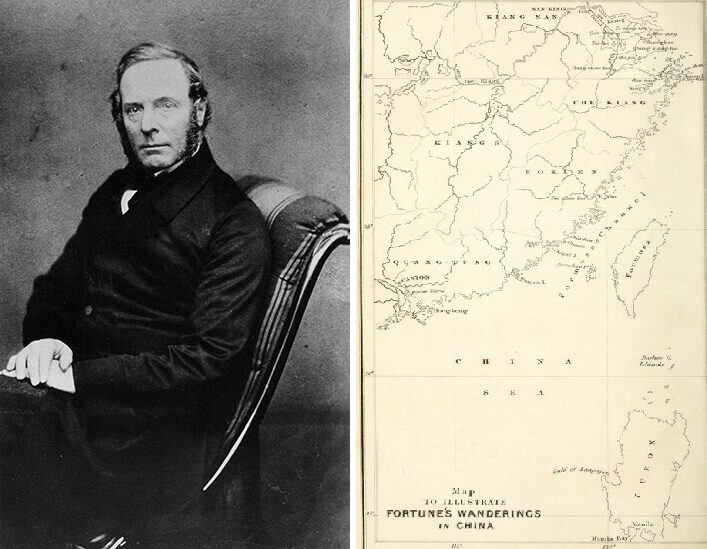
Arrival and disguise
On June 20, 1848, Fortune left Southampton on a passenger steamship. On August 14, it anchored in the Bay of Hong Kong. From there, he traveled up the Shanghai River to the city of the same name, then the northernmost open Chinese port.
It had changed since his last visit. In the harbor, Fortune saw "a forest of masts" from English and American ships, and on shore, a Western port town had replaced the Chinese houses and farms. A steady stream of former Shanghai residents poured from the new settlement into the country, bearing coffins. They were retreating with the remains of their ancestors, to rebury them near their new homes.
Fortune didn't stay long in Shanghai. His destination was the "great green-tea country of Hwuy-chow." He was referring to famous tea plantations in the Anhui region, deep in the Yellow Mountains. This was where the most celebrated tea was grown, but it was well over 300km from Shanghai, and forbidden to Europeans.
Fortune didn't trust a Chinese agent to get the samples for him. For one, it would take botanical knowledge to keep the samples alive, and two, he believed that "no dependence can be placed upon the veracity of the Chinese." Unlike the Chinese, Fortune was honest and forthright, which was why he decided to disguise himself to infiltrate their plantations and steal from them.
Fortune's hired translator and guide, Wang, rented a boat and found him Chinese clothes. Meanwhile, another servant, a day laborer unnamed by Fortune, shaved his employer's head into a queue hairstyle. Thus attired, they set off in a riverboat headed inland.
Discovering devastation
The boat took them upriver to the city of Hangzhou-Fu. On the way, Fortune passed through several large but "dilapidated" cities. Fortune, like many Western men, considered China a great civilization in ruin, whose ancient glory had fallen to stagnation. But there was another reason for the ruined, half-empty towns.
Stealing the secrets of tea was not the first attempt Britain and the EIC made to adjust the trade imbalance. First, they introduced the Chinese to a desirable product of their own: opium.
Opium wasn't unknown in China, but was used only medicinally. Britain planned to flood the country with the highly addictive drug, forcing Chinese merchants to trade their valuable goods for opium, instead of silver. The EIC could produce opium cheaply in India, and began smuggling it by the ton into China.
A succession of emperors tried to prevent the trade, making it highly illegal, but the drug still got through. In 1838, Chinese officials destroyed over 20,000 chests of opium and set up a naval blockade. British warships fired on them, smashing through and proceeding up the Pearl River. By 1841, they had conquered and occupied Canton, and the First Opium War was in full swing.
A year later, the British took the then-capital city of Nanjing, and the Chinese were forced to sign a treaty handing over the island of Hong Kong and opening new ports. Opium would continue to flow. The effect for many Chinese people was economic depredation, an addiction crisis, and cities ravaged by conquering English armies.
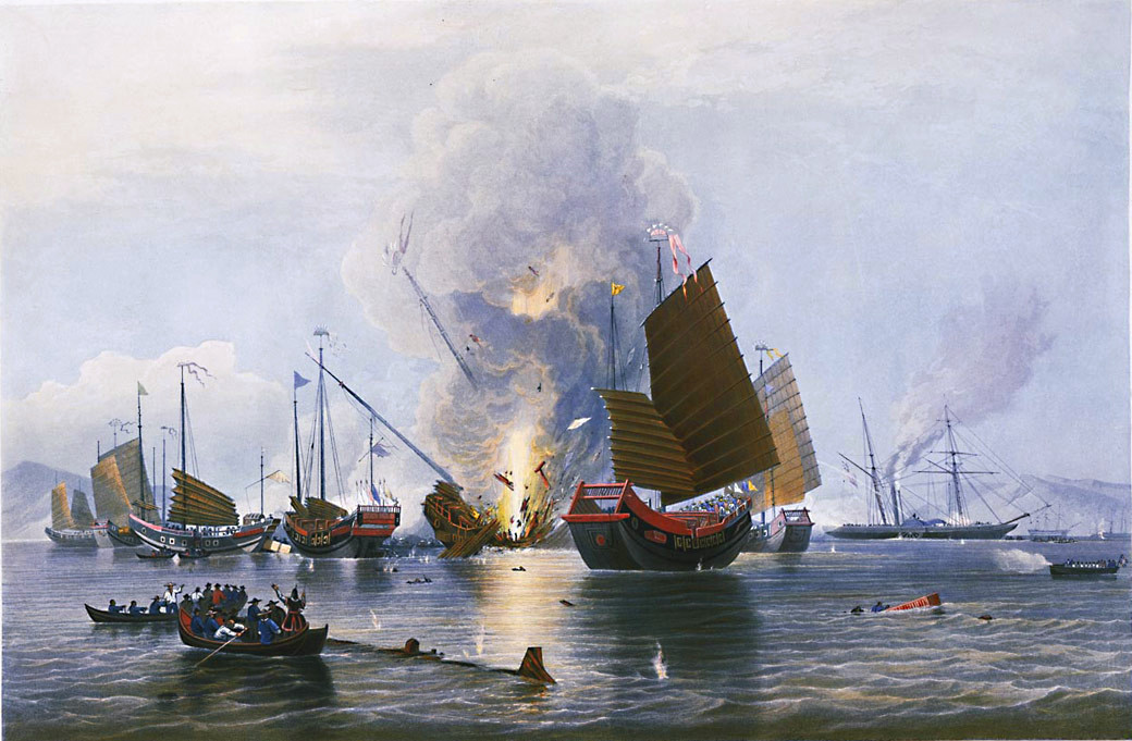
Through the gates of Hangzhou-Fu
Fortune had planned to skirt around the outside of Hangzhou-Fu, a large city which sat on the river, on his way from the coast to the tea district. But a miscommunication found him alone in the bustling city, separated from his servants. He believed that if he was detected, an angry mob would tear him to pieces or haul him to court.
Fortunately, his disguise seemed to hold, and Fortune, having decided to hope for the best, stayed in the hired chair his servants had arranged. It took him through the city to an inn where his baggage and his servants were waiting.
It seems difficult to believe that his disguise was effective. Maybe the people around him just didn't care if he was a foreigner, as long as he was paying handsomely and not causing a disturbance.
However, most of the people Fortune encountered would never have seen a white man before. They also probably hadn't traveled much outside their district. Fortune did speak Chinese -- not fluently, but conversationally -- and his errors could be chalked up to a dialect difference. The people he met probably assumed Fortune, going as Sing Wa, was an eccentric, ugly, rich man from a different part of China.
Fortune boarded another river boat, and they glided into the hills. Finally, the river became shallow, and the boat would go no further. As they decamped, Fortune saw Song Luo Mountain, believed to be the birthplace of tea, in the distance.
Green tea factories and black tea temples
Having reached his destination, Fortune set about recording the climate conditions, soil type, and growing patterns of the lush tea bushes. He recorded, in great detail, how and when the best tea was planted, transplanted, watered, and harvested.
Wang's father lived in the area, so Fortune, emboldened by success, traveled across the region with Wang's home as his base. Fortune was able to send many samples back to Shanghai.
But the growing was only half the mystery; how tea is prepared is just as important to its quality. It was Wang who finally got Fortune into a tea factory. He dressed Fortune as a mandarin (a government official) who had come from a distant province to learn about tea manufacture.
The factory supervisor bought the story. Fortune was free to observe the complexities of harvesting, sun-drying, stir-frying, wringing out, stir-frying again, sorting, and packing. Every step is essential to perfecting high-quality tea.
Next, Fortune set his sights on the Wuyi Mountains. Leaving Wang, Fortune hired another guide, Sing-Hoo, who was more familiar with the area. The Wuyi Mountains, then called the Bohea Hills, are the origin of many famous tea varieties today, such as oolong and lapsang souchong.
After a hard climb, they arrived at the top of the mountain at a large temple complex. Sing-Hoo went first, telling the monks that his master, an important man from a far-off region of China, would be staying for a day or two.
It worked. The old priests fed them, gave them a place to rest, and shared wine and tobacco with the visitors. Fortune left with several more living tea plants.

Prussian blue and tea green
Having risked life and limb to penetrate the inner sanctum of tea preparation, Fortune noticed something curious: the workmen's hands were blue. But only when they were preparing tea for foreign markets; the bulk of tea grown in China stayed in China, and had no associated blueness.
Fortune investigated and found the operation superintendent grinding down gypsum and Prussian blue, a deep blue synthetic pigment, in a mortar and pestle. Workers mixed the resulting light blue powder into the tea leaves. They were dying the tea because most Westerners, to Fortune's distaste, preferred their green tea to be really green.
Fortune believed tea was best the way the Chinese drank it, without milk or sugar, and certainly without dye. This was a good call on his part; gypsum can produce hydrogen sulfide gas when it breaks down. It also generally acts as an irritant in the body. Don't eat gypsum.
"It seems perfectly ridiculous that a civilized people should prefer these dyed teas to those of a natural green. No wonder that the Chinese consider the natives of the West to be a race of barbarians," Fortune wrote.
Fortune secreted away some samples and sent them on to England, where they were displayed to a horrified public.
A Wardian case
Bringing live tea plants out of China and into the Assam region of India presented significant challenges. To keep the little tea plants alive during their long journey, Fortune turned to an ingenious new device: the Wardian case.
Earlier, English doctor and amateur botanist Nathaniel Bagshaw Ward had considered the problem of transporting plants alive. His solution, presented in an 1842 book, was the precursor to the modern terrarium.
He wasn't the first to discover that plants could be kept alive in a hermetically sealed glass container, but he was the first to publicize it. "Wardian cases," based on his work, became a trendy item for Victorian drawing rooms. Robert Fortune used them to transport living tea plants from the Yellow Mountains to the foot of the Himalaya.
Tea takes root in India
India already had a type of tea, growing wild and cultivated for medicinal use. But the British didn't want that; they wanted the tea from China, but for far less than what the Chinese charged them. They started plantations in Assam, awaiting the tea seeds and plants from China.
As a result of Fortune's mission, nearly 20,000 tea bushes were planted in India. He also hired skilled Chinese tea growers to lead production. Fortune wrote of the new tea plantations with pride, believing they not only provided cheap tea to the English but gave employment opportunities to Indians.
"If part of these lands produced tea, [a rural Indian man] would have the means of making himself and his family more comfortable and more happy," Fortune wrote optimistically.
British dominion did not make rural Indians more comfortable and happy, but it did make India a tea-producing country.
Today, Assam is the world's single largest tea-growing region. India as a whole is the second largest tea producer after China, exporting over 250 million kilograms annually. I'm drinking tea as I finish writing this article. I checked the packaging; it was grown in Assam.
On Dec. 3, 1827, an engraving changed the world of ornithology forever. Robert Havell Jr. of Edinburgh made the engraving, which was based on a painting by a man who had bet his career on its success.
The painting's artist was John James Audubon. Born in Haiti in 1785, the illegitimate son of a sugar plantation owner, he had dedicated his life to his work as a self-taught artist and ornithologist. After a stint in France, he moved to America at age eighteen, where he obsessively hunted and sketched the birds around him.
Around 1820, after over a decade in business, he decided to make his hobby his career. Intending to paint every American bird, he set out into the wild with a gun and his art supplies.
The result was 435 plates of detailed, lifelike avian illustrations. But the American public wasn't interested, so he took 250 of his best plates on a ship to England and began exhibiting there. The jewel of his collection was his large painting of Falco Washingtonii, which was chosen as the first engraving and published to drum up interest in his work.
Falco Washingtonii, the Washington sea eagle
The regal bird, perched on a cliff face and overlooking the sea, was a new species, and not just any new species, but the largest eagle in North America. Patriotically, Audubon named it after George Washington. It has been called, interchangeably, the bird of Washington, Washington sea eagle, great sea eagle, and sea eagle.
According to Audubon, it was a bird with reddish-brown plumage, notably larger than any other American eagle. The specimen Audubon painted had a three-meter wingspan and stood a meter tall; its sharp hind talons were over six centimeters long.
The public, and Audubon's fellow naturalists, were astonished by the discovery. It was a career-making moment for Audubon, and it helped him secure funding to print his seminal work, Birds of America.
The problem? As Matthew Halley has pointed out in his thorough and excellent analysis of Audubon's supposed Washington sea eagle, there has never been a confirmed specimen. Today, it is not considered a species because of a lack of evidence. So why did Audubon seem so sure it existed?
There are, broadly speaking, three possibilities: He mistook a known animal for a new species; he was lying, and possibly even plagiarized the illustration; or he was right, and the giant North American eagle disappeared before its existence could be verified.
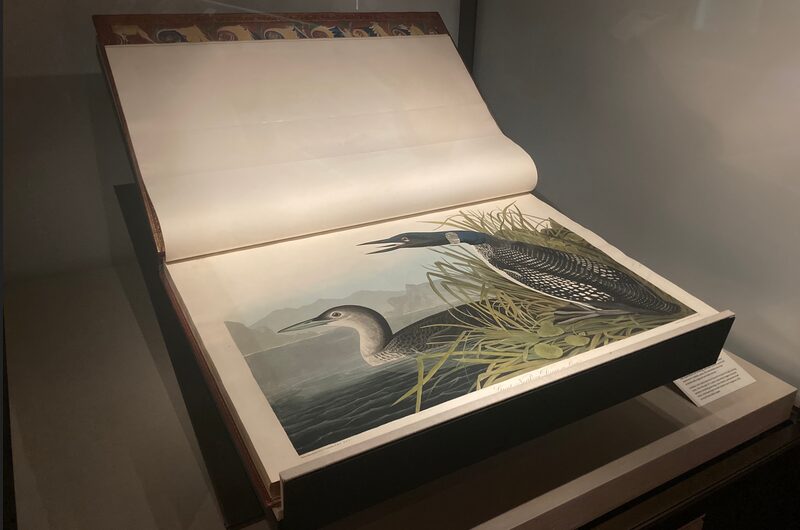
Birds just look like other birds sometimes
We all know the distinctive white head of the bald eagle, but only mature birds have that feature. For the first year of their lives, bald eagles have completely brown plumage. The next few years are an awkward, patchy, white-bellied stage. Finally, around year five, they attain the classic white head, brown body combination.
When juvenile bald eagles leave the nest, they have reached their full, impressive adult size. While not as big as the purported Washington sea eagle, the largest bald eagles can have a wingspan of 2.3 meters. It can be difficult to accurately judge the size of a moving object at a distance, and in his excitement over sighting a big bird he didn't recognize, Audubon could easily have remembered the animal as larger than it was.
The problem is, he also claimed to have measured an actual specimen. It was significantly larger than even the biggest bald eagles. It was supposedly a male -- usually up to 25% smaller than females -- suggesting a female of this new species would be even bigger.
Audubon knew that juvenile bald eagles were brown, and this larger specimen was distinctive. He also claimed to observe a breeding pair with chicks, which could not have been juveniles. Finally, bald eagles do not nest on cliff faces, but in trees.
Sea eagle timeline
There is more than motive to suggest Audubon's account wasn't honest. Looking closely at his timeline, the math doesn't quite add up.
According to Audubon, he first saw the eagle in February 1814. He described "rapturous feelings" at the sight of the large bird flying over his pontoon boat on the Upper Mississippi. His companion, a Canadian, calls the bird a "great eagle," which he claimed was a very rare eagle, larger than any other, that roosts on rocky cliffs.
Audubon saw the bird again "a few years afterwards," near the Green River in Kentucky. There, high on a rocky cliff, he saw a nest and watched a mated pair of sea eagles bring fish to their chicks.
Two years after seeing the nest, Audubon had another encounter. Again in Kentucky, this time near the Ohio River outside the town of Henderson, he saw a large brown eagle fly up from a hollow and perch on a low branch. Audubon crept forward stealthily. Once in range, he shot it with his double-barreled hunting rifle. It fell, dead, and Audubon was delighted.
This, according to Audubon, is the specimen on which he based his official description and painting. His last sighting of a living Washington sea eagle was in November 1821, when a pair of them flew over his boat at the mouth of the Ohio River.
The holes in his story
Critical readers of his account had a few questions. Why wait until 1828 to publish anything on this new species? He'd procured the specimen (which he was never able to produce) in 1821 at the latest. During the seven years he waited to publish, he was periodically broke and attempting to gain funding for his work. Surely, revealing this exceptional new species would have been helpful.
Another oddity: according to his diaries, it was only in late 1820 that he began to think that there were two eagle species, one brown and the other white-headed. But eight years later, he claimed to have known since 1814 that there was a larger brown eagle.
This 1820 diary entry, in which he wrote about seeing a group of brown and white-headed eagles, is probably the "last sighting" he claims took place in 1821. He wasn't at the mouth of the Ohio River in November 1821, but was there in November 1820. His timeline doesn't line up. Could it be that the entire account given in 1828 was invented?
Plagiarism accusations
There's no doubt that Audubon was an extraordinarily skilled artist. He used thin wires to arrange his freshly deceased specimens in lifelike poses, and had a very strong visual memory. But he drew from life, not from imagination. So, how could he draw a bird he hadn't seen?
Over a century and a half after the painting was unveiled, historian Linda Dugan Partridge noticed a similarity between it and an 1802 print in The Cyclopædia, a serialized British encyclopedia. It depicted a golden eagle, the other species of eagle native to North America.
In Audubon's written description, he specified that his bird had twelve tail feathers. But in his painting, the bird has ten, matching the golden eagle print. Feather count aside, from subjective observation, there is something stiff and old-fashioned about Audubon's painting. His birds are usually livelier and more dynamic. The Washington sea eagle seems posed, statuesque, but not in a good way.
Then there's the matter of the foot. The feet are unlike those of any known eagle species. What they are like is a second illustration from The Cyclopaedia.
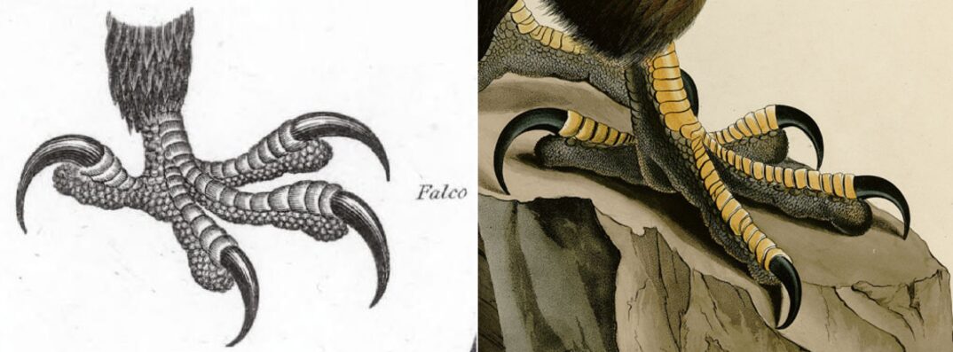
An international debate
In an obvious bid to inspire patriotic feelings, Audubon named the bird after America's first President. "If America has reason to be proud of her Washington, so has she to be proud of her great eagle," he wrote. Challenging the bird, therefore, would be challenging Washington, challenging America itself.
Nevertheless, some experienced ornithologists on both sides of the Atlantic began looking askance at his eagle.
In 1831, Audubon claimed there was a specimen of the bird in Philadelphia. Several local ornithologists visited the purported Washington sea eagle, which a friend of Audubon's had bought and donated to a museum. Among them was George Ord, who examined the specimen and declared it identical to juvenile bald eagles he had seen. Another ornithologist, Titian Peale, came to the same conclusion.
Unfortunately, the eagle specimen didn't survive, so we can't confirm their findings. But Ord was sure, and wrote pages and pages of scathing letters dismissing Audubon's claims.
But the public loved Audubon. They were, as Ord opined, "determined to make him a great man in defiance of truth and common sense."
As the decades went on, the scientific community grew more skeptical about Audubon's eagle, though public support for Audubon stuck. By the late 19th century, naturalists were sick of the whole debate. Ornithologist Elliot Coues said in 1876 that "this eagle business is about done to death...That famous ‘bird of Washington’ was a myth. Either Audubon was mistaken, or else...he lied about it."
A lost giant of the skies
Despite the compelling case against Audubon, there are still those who argue that he was right. There had, after all, been birds of prey of the size he described, and larger, on the North American continent in the past. Buteogallus woodwardi, or Woodward's eagle, lived in the United States and Cuba during the Pleistocene. Paleontologists estimate it grew over a meter tall with a wingspan of up to three meters.
Outside of the Americas, we find even larger extinct birds of prey. Haast's eagle flew in the skies of New Zealand until 1445, when competition with early Māori settlers drove it to extinction. These eagles grew up to a meter and a half in length and had comparatively short wings for their body size. Even so, their wingspan may have been as wide as three meters.
Giant eagles aren't wholly a thing of the past, either. The Steller's sea eagle can have a wingspan of over two meters. They live in the Pacific Far East, such as northern Japan and Russia's Kamchatka Peninsula. Like the purported Washington sea eagle, they nest on rocky outcroppings.
The skeptic is not always right (often, though)
There is also a precedent for Audubon being correct. Naturalists of his day claimed his depiction of a rattlesnake attacking a mockingbird nest was unscientific because rattlesnakes can't climb trees. We now know that they can.
Botanists mocked him for his painting of the common American swan, which featured a yellow water lily. Fifty years later, the yellow water lily was discovered in Florida.
Species thought extinct have reappeared in the past, and enthusiasts of speculative zoology are quick to point out that animals like the platypus and giant squid were once thought to be hoaxes. A lost giant eagle, now extinct, is a romantic prospect. But it is far from the most plausible one.
Time will uncover the truth?
Audubon has a complicated legacy, to put it mildly. That business I mentioned he was engaged in before he dedicated himself to birding? It was slave trading. On his journey down the Mississippi River, two enslaved black men accompanied him. When they arrived in New Orleans, Audubon sold them into the cotton farming industry. He used the profits to help fund Birds of America.
Later in his career, Audubon helped collect specimens for Dr. Samuel Morton's anthropological work. Morton was establishing scientific racism by developing a ranking of human races by cranial capacity.
Audubon's contribution included the skulls of five Mexican soldiers, scavenged from a battlefield, as well as looted indigenous remains. Once, for instance, he came upon the tree-burial of "a three-year-dead Indian chief, called the White Cow." Audubon cut down the chief's body and unwrapped the buffalo skins he had been lovingly interred in. He sawed off the head for Morton and left the rest of the body on the ground.
Suffice to say, possibly lying about an eagle species is far from the biggest problem with Audubon's legacy. But the Washington sea eagle issue raises questions about the scientific legitimacy of work that underpins two centuries of ornithology.
What does it mean for American birding that the father of it all likely built his career on a scientific fraud? When it comes to evaluating his legacy, what should weigh more heavily, fraud or racism?
Audubon's motto was Le temps decouvrira la vérité -- "time will uncover the truth." Let's hope that he was right about that.
Readers who want to learn more about this should consult Matthew Halley's thorough account here.
Long before Spanish colonization, the indigenous people of Peru kept track of important dates and numbers, and perhaps even stories, using a mysterious coding system of strings and knots called a quipu.
When the Spanish invaded, they decided these bundles of strings and knots were idolatrous and pagan, in opposition to the Catholic Church. They burned them, hoping to quell any thought of resistance.
How does it work?
Quipu means knot in Quechua, the dominant indigenous language in the region.
You might mistake a quipu for a brightly colored necklace or headdress, but it is a communication device. Unlike their Mayan and Aztec counterparts, the Incas had no written language. They used quipu instead.

Quipus consist of a series of colored, knotted cords made from cotton, wool, or other animal fibers. The knots and their placement on the cords represented numerical values. In some cases, it carried other information, such as dates or records of events. The use of the quipu dates back to 2500 BCE, long before the Inca Empire emerged. We still don't know how it originated.
Deciphering quipus is tough. Its purpose and meaning can change depending on the length of the cord, the number of knots, the color, the way the cords are twisted and woven, the material, and the arrangement. While some historians think they were used almost exclusively to communicate numbers, others believe they were capable of storytelling and poetry.
Certainly, the main purpose of the quipu was to track and manage the data of populations, goods, resources, and taxes. It was the administrative tool of the empire. Each knot on the cord had a specific value depending on its position, with different knot types (such as single knots, long knots, or figure-eight knots) representing different values. The Incas used the decimal system and knots to record 1s, 10s, 100s, 1000s, and so on.
The colors of the cords could indicate categories like resources, people, or geographical locations. For example, red represented warriors or war, white represented silver, and yellow symbolized gold.
Record keepers
The quipus were managed by quipucamayocs, which means "quipu authority." These administrators were the record keepers, accountants, bookkeepers, mathematicians, census takers, and historians of the empire. The smooth running of the empire rested almost entirely on their shoulders.
The Incas had a complex road network called the Qhapaq Ñan. All these roads led to the capital of Cusco. Endurance runners called chasquis transported quipus along these roads, resting or passing them to other runners in supply stations called tambos posted every few kilometers. Messengers could quickly carry news of an Incan victory, the death of an emperor, or details of an enemy attack from province to province.
Quipu as a weapon
After smallpox had killed the ruler Huayna Capac, his sons, Atahualpa and Huascar, battled for the throne. Atahualpa triumphed and killed his brother. To further legitimize his ascension, Atahualpa had all records destroyed. This meant burning quipus that recorded anything to do with his brother.
Atahualpa even killed the quipucamayocs. "[It was] a total renewal, what the Incas called a pachakuti or a turning over of time and space," historian Mark Cartwright wrote.
Later, a Spanish governor of Peru, Vaca de Castro, tried to find quipucamayocs to teach him about the land. Eventually, he came across two who had survived the purge. "They found them wandering in the mountains, terrorized by the tyrants of the past," according to historian John A. Yeakel.
Spanish response
Though the Spanish destroyed many quipus, some chose to study them. Inca Garcilaso de la Vega was the son of a conquistador and an Incan prince, and acted as an intermediary between the two peoples. He learned about the quipu as part of his upbringing and wrote extensively about them:
When my father's Indians came to town on Midsummer's Day to pay their tribute, they brought me the quipus; and the curacas [local leaders] asked my mother to take note of their stories, for they mistrusted the Spaniards, and feared that they would not understand them. I was able to reassure them by re-reading what I had noted down under their dictation.
Likewise, a rogue Jesuit priest named Blas Valera advocated for learning from the quipus. Also half Spanish and half Inca, Valera proclaimed that the Incas were the real rulers of Peru. He died under house arrest in 1597.
Threads of a story
In 2015, anthropologist Sabine Hyland got a call from the remote Andean village of San Juan de Collata. This little village held some of the last remaining quipus.
Villagers granted Hyland access to two quipus from the 18th century. They told her that for years, guarding the quipus was a coming-of-age ritual for local adolescent boys. After seeing one of Hyland's documentaries, the village elders had reached out, hoping she would visit.
"Over the next couple days, we would learn that these multicolored quipus, each of which is just over two feet long, were narrative epistles created by local chiefs during a time of war in the 18th century," Hyland wrote.
The elders recounted the story of a failed rebellion against the Spanish. A leader, betrayed by his associates, was imprisoned and eventually executed. He had used the quipu to tell his countrymen that he was the ruling Inca Emperor.

Not far from the village of San Juan de Collata, Hyland was invited by a local schoolteacher to examine a hybrid quipu. The hybrid was set on a wooden board containing a ledger of names and multicolored quipu threads.
"The board bears the names of villagers, while the quipu cord associated with each name indicates the contribution of labor and/or goods that the individual was expected to provide in a community ceremony," Hyland wrote.
Much to Hyland's astonishment, quipus were used in the village until the 1940s for communal, administrative, and record-keeping purposes.
In September of 1573, authorities in the Franche-Comté region of now-France declared open season...on werewolves. The edict raised the alarm about a werewolf on the loose. Villagers reported that children had gone missing, and they thought a werewolf was to blame.
The parliament agreed, and they agreed far enough to pause previous edicts that banned citizens from gathering in large groups and carrying weapons. Armed with their newly legal halberds, pikes, long guns, and cudgels, the people of Franche-Comté sallied forth.
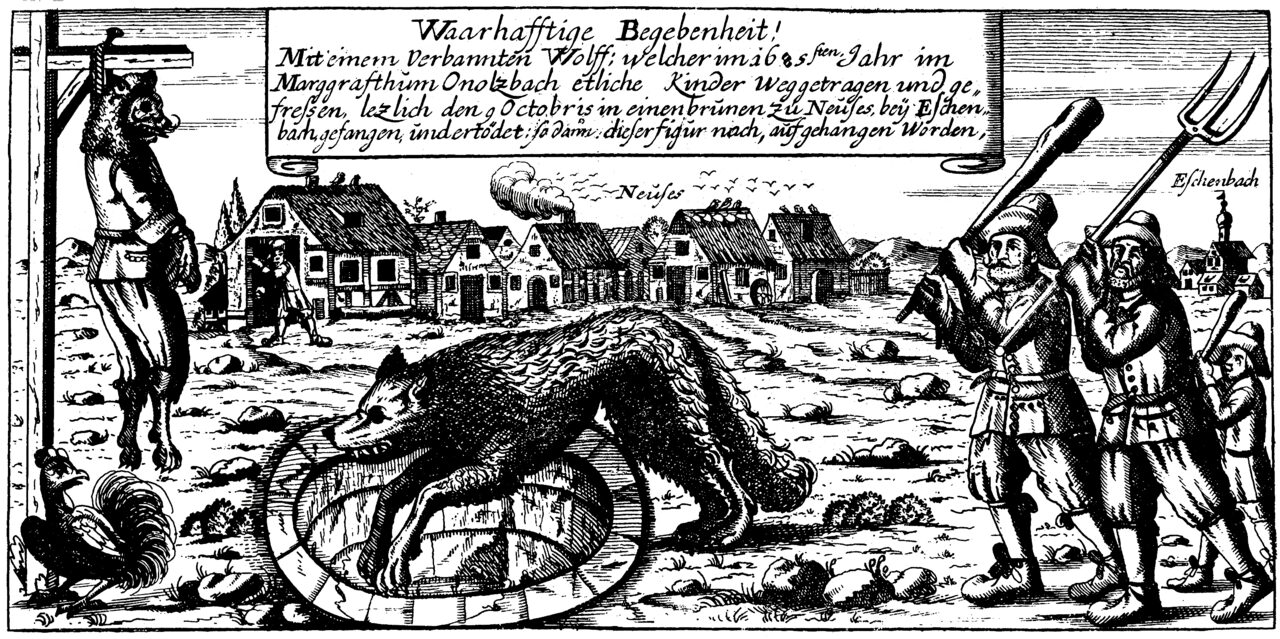
What is a werewolf?
You may think you know what a werewolf is. You've seen movies. A person who was bitten by a werewolf is cursed to turn into a wolf-man hybrid every full moon, when they run through the woods (or London) in a state of mindless animal violence. But that creature is a much more recent creation; the werewolf of the 16th and 17th centuries was an entirely different animal.
To the people of early modern Europe, the werewolf was a person, usually a man, to whom a demon had given the power to transform into a wolf. The wolf transformation was triggered by an item of clothing the werewolf put on, like a wolfskin belt or cloak, or by applying a special ointment.
Second only to transforming into a wolf, the defining trait of the early modern werewolf was cannibalism. The eating of a fellow person was one of the ultimate taboos of the period. It was invoked as a potent symbol of "otherness" and the violation of cultural norms. Jewish people, Mongolians, pre-Christian Celts, and Indigenous Americans were all depicted as cannibals, as were witches.
Witches and werewolves overlapped considerably, and it's difficult to draw a firm line between the two categories. Some demonologists of the period, like Henri Boguet, believed the werewolf was an especially dangerous kind of witch. As time went on, the werewolf and the witch blurred together. In fact, the more blurred the distinction, the more often female werewolf cases appear.
But at the height of the werewolf panic, they were a distinct class of religious criminal, and were nearly always male.
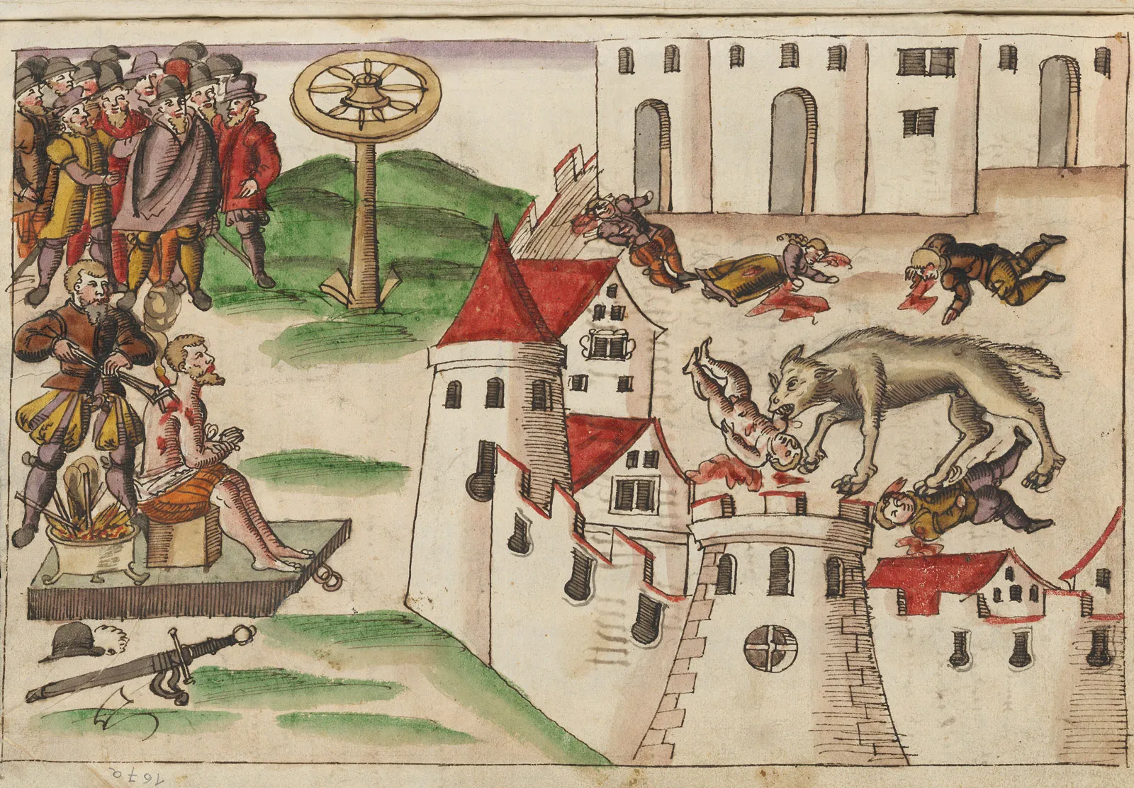
Why did people hunt werewolves?
Even today, there are occasional panics over wolf attacks, real or imagined. But in early modern France (and into Switzerland and Germany) wolf attacks were an actual threat. Many of the missing children and ravaged bodies that appear in werewolf records were probably victims of wolf attacks. In North America, genuine wolf attacks are almost unknown, but in Europe, the animals had ample opportunities to acquire a taste for human flesh by feeding on battlefield corpses. So attacks in Europe sometimes had substance to them. However, the local authorities weren't calling for wolf hunts. There were hunting werewolves.
In many ways, the people of 16th and 17th-century Europe imagined the werewolf as the ultimate violator of cultural, moral, and religious norms. But unlike their racist imaginings about pagan cannibal foreigners, the werewolf was an enemy within. It's no coincidence that werewolf and witch paranoia came at the same time as the Protestant Reformation.
Imagine the innocent WASP suburbanite of the 1950s threatened by hidden aliens in Invasion of the Body Snatchers (1956). Only, instead of secret communists, it's secret Protestants. Or, in a Protestant country, secret Catholics. This was also a period of changing economic and social systems, where poverty became a major social concern and began to be associated heavily with sin and crime.
At the same time, countries were getting bigger and governments were getting more involved in people's personal and religious lives. How does a government, secular or religious, demonstrate and enforce its new power? By persecuting and prosecuting the embodiment of everything that wasn't allowed.
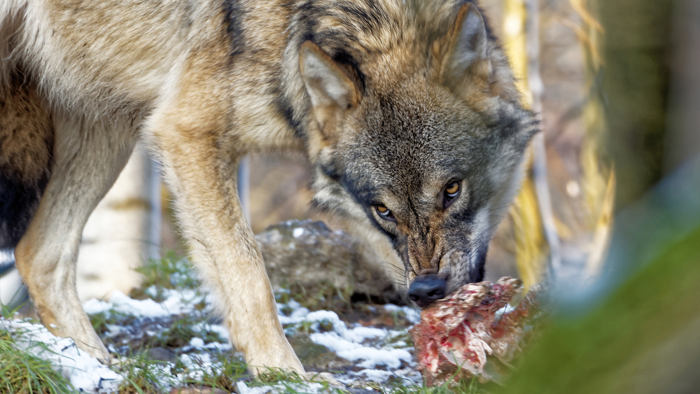
The Inquisition inquires about werewolves
The 1573 hunt wasn't the first incidence of werewolf fervor in the French region. Fifty years earlier, the first werewolf case was prosecuted -- by the Spanish Inquisition.
While Franche-Comté, situated in a forested and mountainous region next to Switzerland, is part of France today, in the 16th century it was owned by the Spanish Habsburgs and was subject to the Inquisition.
So in the winter of 1521, papal representative Jean Boin traveled to the small town of Poligny. Poligny had a werewolf problem; two of them, in fact, named Pierre Burgot and Michel Verdun. Boin extracted a confession from the pair, detailing their strange crimes, as follows.
Several years ago, they had given their souls to the devil in exchange for various promised gifts. These included a bag of money which, Burgot complained, the devil had failed to deliver. He did give them an ointment which allowed them to turn into wolves, though. As wolves, they ran freely through the countryside, copulating with female wolves and eating several children.
One contemporary, 16th-century physician and skeptic Johann Weyer, pointed out a number of inconsistencies in the account. In one example, they claimed to have swallowed up a girl whole, except for her arm. Later, however, they claimed they had only eaten a little of her. Weyer believed that the experiences they described were imaginary, coming from hallucinogenic drugs in the ointment or some kind of mental illness.
The court didn't agree: Burgot and Verdun were convicted and burnt to death.

Who gets to hunt the werewolves?
After Burgot and Verdun, the hunt went cold for several decades. Then in 1551, another Inquisitor found himself making the trek to rural Jura. Inquisitor Symon Digny heard the confession of a man named Pierre Tournier, who claimed to have murdered fifteen people. The Inquisitor charged him with werewolfery and witchcraft, and charged his wife and sister as conspirators. All three were burned alive at the stake.
The Parliament of Dole was horrified. Not by the burning-at-the-stake thing, they did that themselves all the time, but by what they believed was an infringement upon their right to prosecute criminals. The Parliament complained that the Inquisitor had failed to properly inform or cooperate with authorities. It insisted that from then on, they would be doing the prosecuting, thank you very much.
So when rumors of a werewolf snatching up children began to circulate in the early 1570s, the Parliament of Dole jumped at the opportunity to enforce its new authority. That's how we got to the September 1573 edict, which launched a werewolf hunt.
The Hermit of Dole
Giles Garnier was "the Hermit of Dole," an immigrant from Lyons, living in near-isolation with his wife Apolline in the forest hermitage of Saint-Bonnot. The Garniers lived in extreme poverty and weren't integrated into the local community. Authorities arrested him in 1573; they had found the werewolf they were hunting.
Garnier reportedly confessed readily, repeatedly, and without the use of torture. Even if that's true, it's impossible to know how much coaching he received. Possible coaching aside, the story he ended up telling went like this:
Starving, Giles Garnier was roaming the woods in search of food when he met with a mysterious figure, described only as a "phantom."
This phantom offered him an ointment that allowed him to transform into a wolf when applied. As a wolf, the phantom promised, Garnier would be able to hunt for food, saving himself and his wife from starvation. Garnier accepted the ointment.
According to his arrest record, he used this power to kill and eat several children while in the shape of a wolf. He also took some of their flesh to feed to his wife. Scandalously, they even ate this meat on a Friday. One would think even the devoutly Catholic authorities would consider "eating meat on a fish day" to be burying the lead a bit in this case.
The record includes times and locations of the murders, some of which occurred over sixty kilometers from where Garnier, an older man in poor health, was living. Nevertheless, he was burned at the stake in 1573 on the authority of the Parliament of Dole.
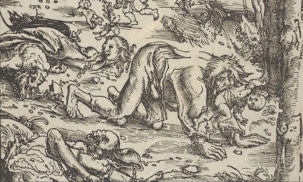
Henri Boguet and the Loupgarou menace
Perhaps the most prolific werewolf hunter was a demonologist and legal scholar named Henri Boguet. Thanks to his expertise and zeal, in 1596 Boguet became the grand judge of the Saint-Claude region of Franche-Comté.
He got right to work rooting out the scourge of demonic influence he believed infested his new domain. Boguet was convinced that witchcraft and werewolfery were everywhere, heralding the imminent coming of the end times.
During his tenure, Boguet tried 38 people, condemning 28 to death by burning. Burning at the stake was usually just for show; the victims were strangled to death beforehand, saving them the long agony of burning. Werewolves were one of the few groups that were always burned alive.
Throughout 1597-98, Boguet uncovered (or created) a hidden society of werewolves. It started with Jacques Bocquet. Bocquet was a "cunning man," a sort of folk healer herbalist. A woman accused him of witchcraft, and he then accused her of the same. She never confessed, but Bocquet did. Not only was he a witch, he admitted, he was a werewolf -- and he wasn't the only one.
Bocquet named names who named names. All of them, the account went, ran together with the devil as wolves, attacking livestock and children. They were all desperately poor people, leveraging their diabolic power for revenge against their tormentors. As wolves, Bocquet and his followers attacked people who had previously beaten them or denied them food and alms.
Nearly all of Boguet's werewolves were condemned and burned alive. But not every werewolf case ended in execution.
The madman Werewolf of Angers
In the same year, a guard of the Provost of Angers found a man lying prone by an abandoned house. The man was “hideous, and very hairy, with an evil stare.” He fled, but not long after this odd encounter, the guard saw him again -- being dragged into town, tied to a cart. Inside the cart was the bloody body of a teenage boy.
The man was Jacques Roulet. The guard asked him if he was the man he'd seen in the forest. Roulet said yes, and also, by the way, he was a werewolf and had killed and eaten the boy in the cart.
He was immediately arrested and brought to Angers for trial, where Chief of police Pierre Airaut examined Roulet and the remains. The boy's body was partially eaten and had claw and tooth marks from a "beast." Roulet himself was an alarming figure, with bloody hands and teeth. He had long fingernails and a hard, distended belly, presumably from gorging on flesh.
Roulet wasn't shy about telling his story. He was about thirty years old and lived with his parents and three siblings in a village nearby. Roulet implicated his entire family; according to Roulet, his brother Jean and cousin Julien went out as wolves with him and had helped him kill the young boy. They transformed using an ointment that his parents had given them.
Roulet was condemned to death, but not executed. Instead, his case was appealed to the Parliament of Paris.
"There was more insanity in this poor, miserable idiot than there was malice or witchcraft," they decided. Roulet was sent to an asylum for two years, after which he disappeared from the historical record.
The strange case of Jean Grenier, child werewolf
In 1603, a series of wolf attacks on both livestock and children rocked the small settlement of La Roche-Chalais. Then a 13-year-old shepherd girl named Marguerite Poirier, the victim of one attack, came forward with an accusation: a werewolf was responsible, and she knew who it was.
She'd been out in the fields with two other teenage girls when a wild-looking boy approached them. He asked them if any of them would marry him, and when they rejected him, he grew upset. Attempting to impress or intimidate them, he claimed he could turn into a wolf. Then he escalated his claims; not only was he a werewolf, but he had killed and eaten a number of children. In fact, he was the wolf who'd attacked Marguerite a few weeks prior.
They arrested the boy, named Jean Grenier. Grenier was about thirteen, but looked and acted younger. He had been roaming the countryside, begging, having left home after a severe beating from his father, Pierre. Pierre featured prominently in Jean's testimony, which was extracted in confused fits and starts after a period of imprisonment.
Jean transformed into a small red wolf using a wolfskin he had received from a demonic figure named Pierre Labouaut. Labouaut, Jean said, lived in a black house in the woods where people were boiled in pots and roasted on spits. His father had introduced them.
Together, Jean and Pierre had run as wolves and killed and eaten livestock and a young woman. But two years before, Jean's stepmother had found out about the werewolves and left them. Since then, Jean opined, his father didn't hunt with him.
A family affair
Investigators had Grenier recreate his crimes, likely further feeding into the fantasies of a mentally vulnerable young boy. After his initial confession, Jean broke down sobbing. He described attacking Marguerite, as well as breaking into a house and devouring an infant, and repeatedly accused his father of being complicit.
But when the judges brought father and son face to face, Jean froze. Seeming confused and frightened, he failed to accuse his father. When he was interviewed privately, he repeated his accusation, and after a second confrontation, he managed to face his father and level the charge of werewolfery directly. His initial wavering, however, led to Pierre's release. Despite Jean's best attempts, his father wasn't prosecuted.
Jean was, but “the court, in the end, took note of the age and imbecility of this young boy, who is so stupid and mentally impaired, that children of seven or eight normally show more reasoning than he." Instead, he was sent to live out the rest of his life in a monastery.
It was in that monastery, several years later, that he met juror and demonologist Pierre DeLancre, writer of the above quote. DeLancre interviewed Jean, then twenty, though still small for his age. Jean said that he still craved human flesh, but had learned to reject the devil, who no longer came to visit him.
DeLancre concluded that it was a mistake to let Grenier live. He personally had sentenced dozens of witches to death, and though he admitted Grenier was young, poor, and mentally disturbed, it set a bad precedent.

The end of werewolf hunting
Perhaps DeLancre was right about setting a precedent, but as time went on, officials and theologians became skeptical of whether werewolves even existed. Among everyday people, the concept became increasingly watered down.
In the Netherlands, werewolfery was just another activity of witches. In 1696, local courts saw a case where one woman's geese ate the cabbage from a neighbor's garden. The neighbor attempted to chase them off, which the owner of the geese took offense to, thinking he was trying to steal them. She accused him of being a werewolf and he sued her for slander. He won the case and she paid one Reichsthaler in damages.
In Germany, "werewolf" became shorthand for a violent, angry person. In 1623, a man named Johan Wulner was accused of being a werewolf due to his habit of intimidating people with a halberd. Around the same time, his fellow townsman Goddert Kampmann attacked another man's genitals with a fork. The man called him a werewolf, and Kampmann sued him for slander.
The Parliament of Dole stopped prosecuting werewolves in 1633, putting out an edict clarifying that they were just hunting regular wolves now. And witches still, obviously. Local courts that hadn't gotten the news yet managed to catch a few more werewolves, like a beggar named Claude Chastellan, who was convicted in 1643.
The last werewolf trial was held in a remote village in 1663. Brothers Mathieu, Claude, and Ayme Mathieu were in court for a series of robberies, and a charge of werewolfery was tacked on as well. The brothers confessed under torture, but appealed to the Parliament of Dole.
The same body that had called for a werewolf hunt a century earlier overturned Mathieu's sentences and declared the whole case bunk.
In the spring of 1982, a small British team set out to tackle one of the most formidable challenges in Himalayan climbing: the unclimbed East-Northeast Ridge of Everest from Tibet. During the attempt, Pete Boardman and Joe Tasker vanished in the Death Zone. We revisit their story.
By 1982, 117 climbers had summited Everest, but just six without supplemental oxygen. From its first ascent in 1953 until the end of 1981, 54 climbers died on Everest, and 41 of those didn’t use bottled oxygen.
Edmund Hillary and Tenzing Norgay first confirmed ascent of the mountain in 1953 went via the Southeast Ridge (now the standard route from Nepal) under John Hunt’s leadership.
From the north, a Chinese team claimed a summit in 1960 via the North Col and North Ridge, though evidence is limited and the ascent is not universally accepted. In 1975, a Chinese team, including Phantog, the first woman to summit from Tibet, reached the top.
Other significant routes included the Southwest Face, climbed in 1975 by a British team led by Chris Bonington (Pete Boardman, Doug Scott, Dougal Haston, and Pertemba Sherpa topped out), and the West Ridge, summited by Americans Tom Hornbein and Willi Unsoeld in 1963. A Yugoslavian team later completed a variation of the West Ridge route from Nepal in 1979.
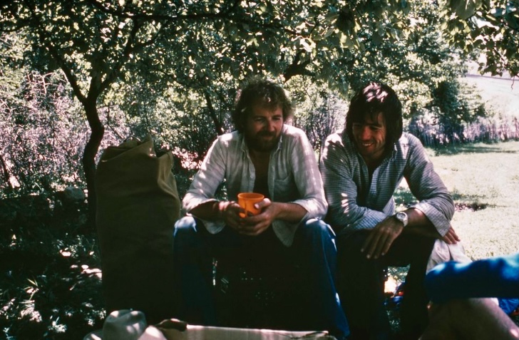
The 1982 team
Led by Chris Bonington, the 1982 Everest team included Pete Boardman, Joe Tasker, and Dick Renshaw, all experienced mountaineers. Charles Clarke, the expedition doctor, and Adrian Gordon supported the team. Clarke and Gordon didn’t plan to climb above Advanced Base Camp. The climbers aimed to ascend without oxygen, using minimal equipment and snow caves for camps.
Before the expedition, Bonington, Boardman, Tasker, and Renshaw had already built remarkable climbing legacies.
Bonington was already a mountaineering icon. He had organized the 1975 Everest Southwest Face expedition, on which his team achieved a historic summit. He also led the first ascent of 7,719m Kongur Tagh in China in 1981, where Boardman, Tasker, and Alan Rouse summited in alpine style.
Boardman began climbing in the Peak District as a teenager before exploring the Afghan Hindu Kush in 1972 and the Pennine Alps in 1968. His fame grew with his 1975 Everest summit alongside Pertemba Sherpa. In 1976, Boardman and Tasker made history with their ascent of 6,864m Changabang’s West Face in India. They famously trained for the climb in a refrigerated meat factory to simulate harsh conditions. Their feat redefined lightweight Himalayan mountaineering.
The intense Tasker started his career with bold climbs like the Eiger’s North Face (in winter 1975 with Dick Renshaw). His partnership with Boardman took him to Changabang and the first British ascent of Kangchenjunga in 1979 (without supplemental oxygen).
Renshaw had also climbed Dunagiri in 1975 with Tasker.

The team’s history of notable climbs prepared them for Everest's unclimbed East-Northeast Ridge.
A tough route
In mountaineering literature, their 1982 route is often referred to as the "full Northeast Ridge" route that includes three difficult pinnacles. This long, difficult line has its toughest challenges near the end, between 7,925m and 8,382m, where the ridge joins the North Ridge (the route taken by the pre-war expeditions and the successful Chinese expeditions of I960 and 1975).
Their route differed from the standard northern climbing route that joins the Northeast Ridge at the North Col (at 7,000m), avoiding the pinnacles and following a less technical line to the summit.
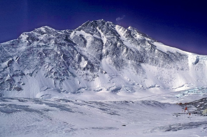
Arrival at Base Camp
Bonington’s team reached Base Camp at 5,180m on March 16, after a three-day drive from Lhasa. Ten trekkers joined them, exploring the Rongbuk Glacier and reaching 6,100m.
Bonington's team placed Base Camp near the glacier, just above the sites of the pre-war British camps. For a week, the team acclimatized and scouted the route. To manage the harsh winds and reduce gear weight, they chose siege tactics. However, they were digging snow caves instead of using tents for the lower camps, and tried to limit their use of fixed ropes. This kept four climbers together and made planning easier.

Establishing camps
On April 4, the party set up Advanced Base Camp at 6,400m after a three-day trek with 13 yaks hauling supplies up the East Rongbuk Glacier. Two more yak trips brought food and gear. The weather was brutally cold, with winds sweeping the glacier.
On April 10, they dug their first snow cave at 6,860m. Two days later, they began digging a second snow cave at 7,300m, but hitting rocks meant they had to work hard for 14 hours over several days to make it habitable. After this slog, they rested at Advanced Base Camp from April 14 to April 18.
Returning to the ridge on April 18, the team occupied their second snow cave on April 20. Over the next two days, they climbed two steep sections: a snow gully and a stretch of broken rock, where they placed their first fixed ropes. Exhausted, the party descended to Advanced Base Camp on April 23 and then to Base Camp for a few days’ rest, as full recovery at 6,400m was nearly impossible. Meanwhile, Clarke and Gordon oversaw yak herders ferrying gear from Base Camp.
On April 29, the climbers returned to Advanced Base Camp in a single day. While Clarke and Gordon attempted Point 6,919 on the Rongbuk Glacier’s eastern side, the climbers returned to the ridge.
On May 1, Boardman and Renshaw reached 7,800m, camping at the top of the snow shoulder. Bonington and Tasker carried food and gas to them before returning to the second snow cave. The next day, all four moved up, and Boardman and Renshaw dug a third snow cave just below the ridge crest.
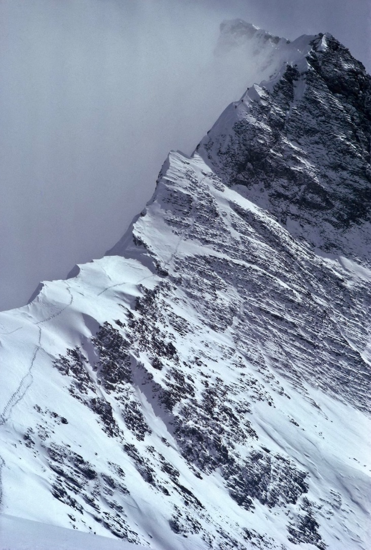
Facing the pinnacles
The real challenge began at 8,000m, where the ridge narrowed into a snow crest blocked by rocky pinnacles, stretching 800m and rising 400m to join the North Ridge route used by earlier expeditions. This section promised some of the hardest climbing ever attempted at such an altitude. On May 4, Boardman led a notable climb up the first pinnacle, navigating ice and loose rock with few anchor points. Bonington joined two ropes to give him a 76m run-out, and Boardman fixed another 91m to reach a notch overlooking the ridge’s eastern side.
On May 5, Renshaw took the lead, climbing a steep, unstable snow pitch to 8,200m. While working, he felt a strange tingling down one side of his body. Boardman and Tasker pushed on, reaching 8,230m, but Renshaw’s condition worried everyone. After four nights at nearly 8,000m, the team was drained.
They descended to Base Camp, where Clarke diagnosed Renshaw with a mild stroke and sent him to Chengdu for recovery. Bonington, feeling slower than Boardman and Tasker, decided to step back from the summit push. Instead, he and Gordon would try to reach the North Col at 7,000m to set up a food depot and mark a descent route.
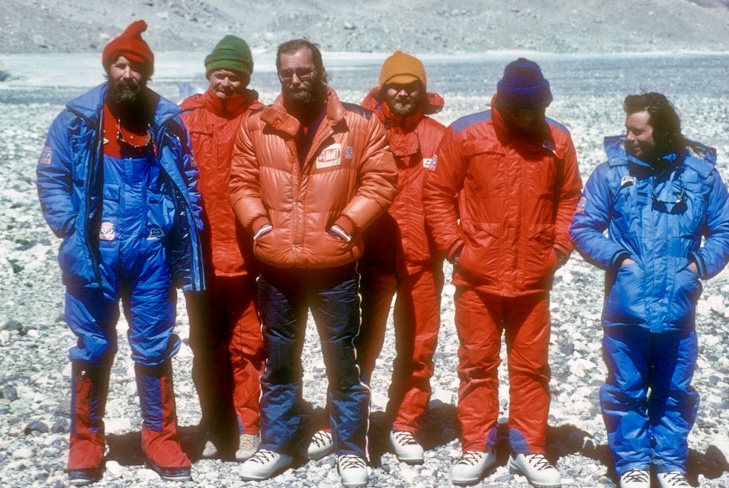
The final push
On May 13, Boardman, Tasker, Bonington, and Gordon returned to Advanced Base Camp. On May 15, Boardman and Tasker climbed to the second snow cave in just six hours. The next day, they reached the third snow cave, stocked with food, fuel, and 244m of rope.
Meanwhile, Bonington and Gordon attempted the North Col but stopped 90m short on May 16, blocked by a crevasse and a serac wall. That evening, they had their last radio contact with Boardman, who sounded optimistic, reporting that he and Tasker were doing well.
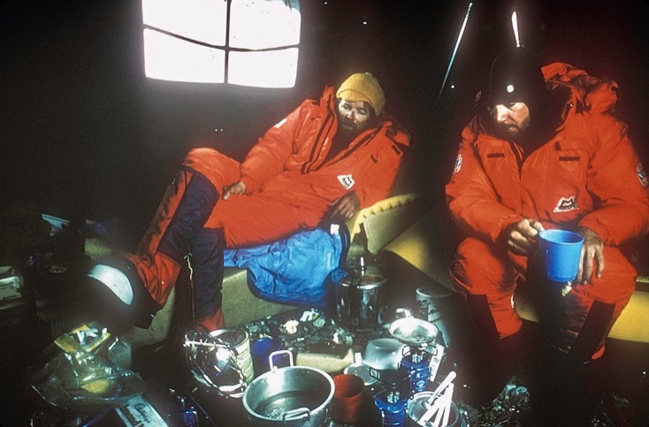
On May 17, Bonington and Gordon watched Boardman and Tasker through a telescope from Advanced Base Camp. The pair started early, reaching their previous high point by 9 am. By evening, they had fixed about 200m of rope, mostly on the northwest side, and moved to the eastern side of the second pinnacle, likely searching for a campsite. They missed radio calls at 3 pm and 6 pm, either distracted by climbing or because of a faulty radio. The team last saw Boardman and Tasker at the foot of the second pinnacle, at around 8,300m.
"How far they got beyond this point is not known, but that is where they were last seen," Doug Scott wrote in The Himalayan Journal.
Disappearance
On May 18, Bonington and Gordon resumed their North Col attempt, scanning the ridge with binoculars. They expected Boardman and Tasker to reappear, as the ridge’s layout forced climbers back into view. Reaching their previous high point, they camped by the crevasse. On May 19, they completed the route to the North Col but saw no sign of their teammates.
By May 20, Boardman and Tasker's absence was alarming. The short distance they needed to cover before reappearing suggested a fall, likely on the Kangshung side’s steep slopes.
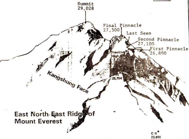
Clarke returned to Advanced Base Camp from Chengdu, and the team organized a search. Bonington and Clarke trekked 64km from Base Camp to the Kangshung Glacier’s head, arriving on May 27. Scanning the massive Kangshung face, they found no trace of Boardman or Tasker and concluded a fall there would have been fatal.
Gordon stayed at Advanced Base Camp until May 28, watching the ridge, but saw nothing. The team returned to Base Camp, hoping against hope that Boardman and Tasker might appear, but they did not.
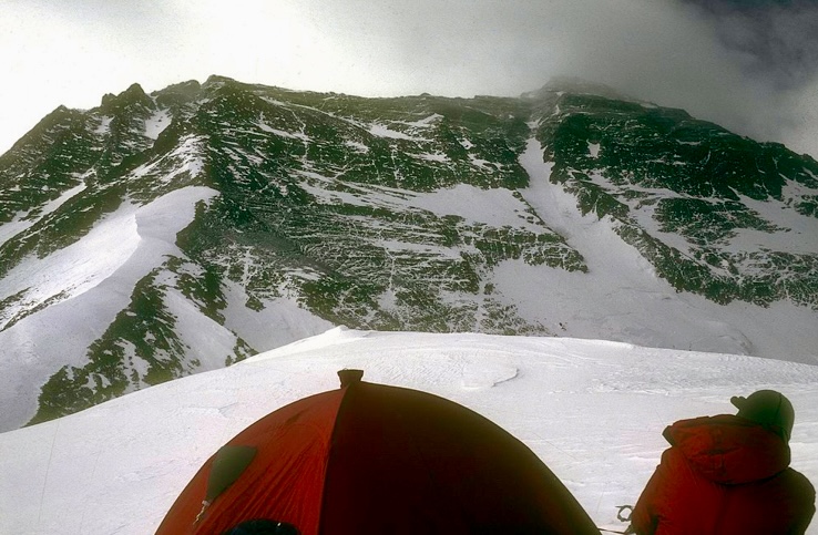
Aftermath
Clarke carved a memorial plaque and placed it on a cairn above Base Camp near the Mallory and Irvine memorial. They assumed Boardman and Tasker had fallen from around 8,300m.
Boardman’s body was found ten years later, in the spring of 1992, by Kazakh climbers on the Northeast Ridge at approximately 8,200m, near the second pinnacle. According to Elizabeth Hawley’s notes in The Himalayan Database: "On the Northeast Ridge, Kazakhs found a tent with two sleeping bags, a stove, an ice hammer, a book with Chris's name in it, and a diary with May 1982 entries. They took photos of a body near these items. On the breast of the down suit were logos with an outline of a mountain and three letters, one of which was an M. They brought down the book and the diary."
Boardman’s body was identified by the clothing and the equipment. The Kazakhs found him lying on his back in the snow, relatively intact, with no clear signs of a major fall. Maybe he collapsed and succumbed to hypothermia or exhaustion. The Kazakh climbers left the body where they found it.
Tasker’s body has not been found.

So close to success
The 1982 British Everest expedition was a bold attempt to climb one of Everest’s toughest routes.
"We had been so close to success, had worked harder, and had been more stretched both physically and mentally than ever before. We were united in what we were doing, and until the tragedy, it was the happiest expedition any of us had been on," Bonington wrote in his expedition report in The Himalayan Journal.
Boardman and Tasker’s legacy endures through their climbs and writings. Boardman’s The Shining Mountain and Tasker’s Savage Arena offer vivid accounts of their adventures and insights into why they climbed.
The Boardman Tasker Prize for Mountain Literature was established in 1983 in their memory.
The entire East-Northeast Ridge route was finally climbed to the summit in 1995 (and descended by the same route) by members of the Nihon University expedition from Japan led by Tadao Kanzaki, supported by 35 Sherpa porters. This expedition fixed ropes across nearly the entire route and used supplemental oxygen.
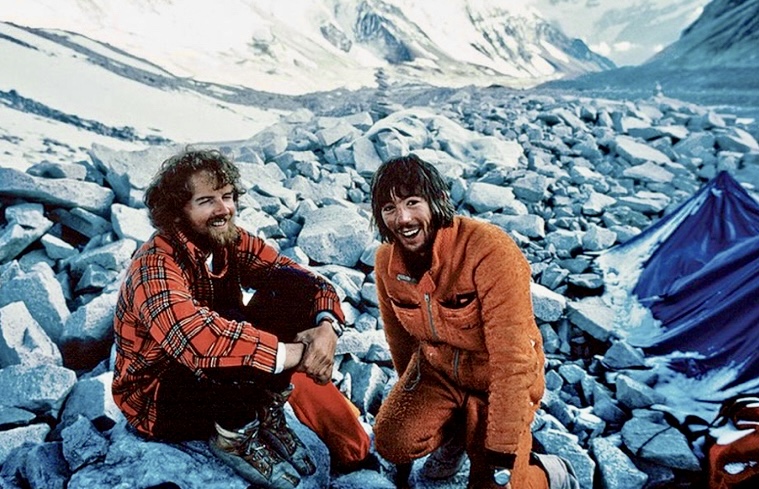
Seventy-five years ago, on June 3, 1950, French mountaineers Maurice Herzog and Louis Lachenal achieved what no climber had done before: summit an 8,000m peak. Herzog and Lachenal topped out on 8,091m Annapurna I, the 10th highest peak in the world, via the North Face and without supplemental oxygen.
In west-central Nepal, Annapurna I is the highest peak in the Annapurna massif. The name Annapurna originates from Sanskrit, combining "Anna" (meaning food or grain) and "Purna" (meaning full or abundant). It translates to "the giver of food," or "she who is full of food." In Hindu mythology, Annapurna is a goddess of nourishment and abundance, an incarnation of Parvati, Shiva’s consort, revered for sustaining life.
There are no registered attempts to climb Annapurna I before 1950. Its first ascent was not just a climb, but a race against time, weather, and human limits, marked by unparalleled courage and harrowing consequences.
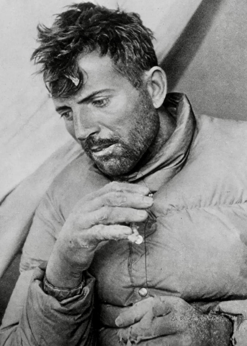
The team
The expedition, organized by the French Alpine Club and approved by the Nepalese government — the first such permission in over a century — included Maurice Herzog (leader), Louis Lachenal (a skilled Chamonix guide), Lionel Terray (a powerful, experienced alpinist), Gaston Rebuffat (another Chamonix guide known for his technical prowess), Jean Couzy and Marcel Schatz (both strong climbers), Francis de Noyelle (a diplomat facilitating logistics), Jacques Oudot (the expedition doctor), and Marcel Ichac (a filmmaker documenting the expedition).
The Sherpa team, which provided critical support during the expedition, included Ang Tharkay Sherpa (sirdar), Ajiba Sherpa, Ang Dawa Sherpa, Ang Tshering Sherpa, Dawa Thondup Sherpa, Ila Sherpa, Phu Tharkey Sherpa, and Sarki Sherpa.
Change of plans
The expedition began in mid-April 1950, with the team traveling from India to Nepal’s Kali Gandaki Valley.
Originally, Herzog’s team had climbing permits for both Dhaulagiri I and Annapurna I. The climbers first set their sights on Dhaulagiri I. From their base in Tukucha at 3,000m in the Kali Gandaki Valley, they explored the area around Miristi Khola river and the east of Dhaulagiri Glacier for potential routes. However, after making a reconnaissance of Dhaulagiri I’s Southeast Ridge and northern side, Dhaulagiri I seemed too difficult, especially with not much time before the monsoon season arrived. Instead, the team decided to shift to Annapurna I.
"As to Annapurna, we knew the northern slopes were accessible, but apart from that, although we had hopes, we could not be sure that the expedition could find a way up. We thought there were three possible routes, but only the glacier route proved practicable," Herzog wrote in the Alpine Journal.
Time was short. The expedition had to explore, scout, and climb the mountain in a single season, an unprecedented feat.
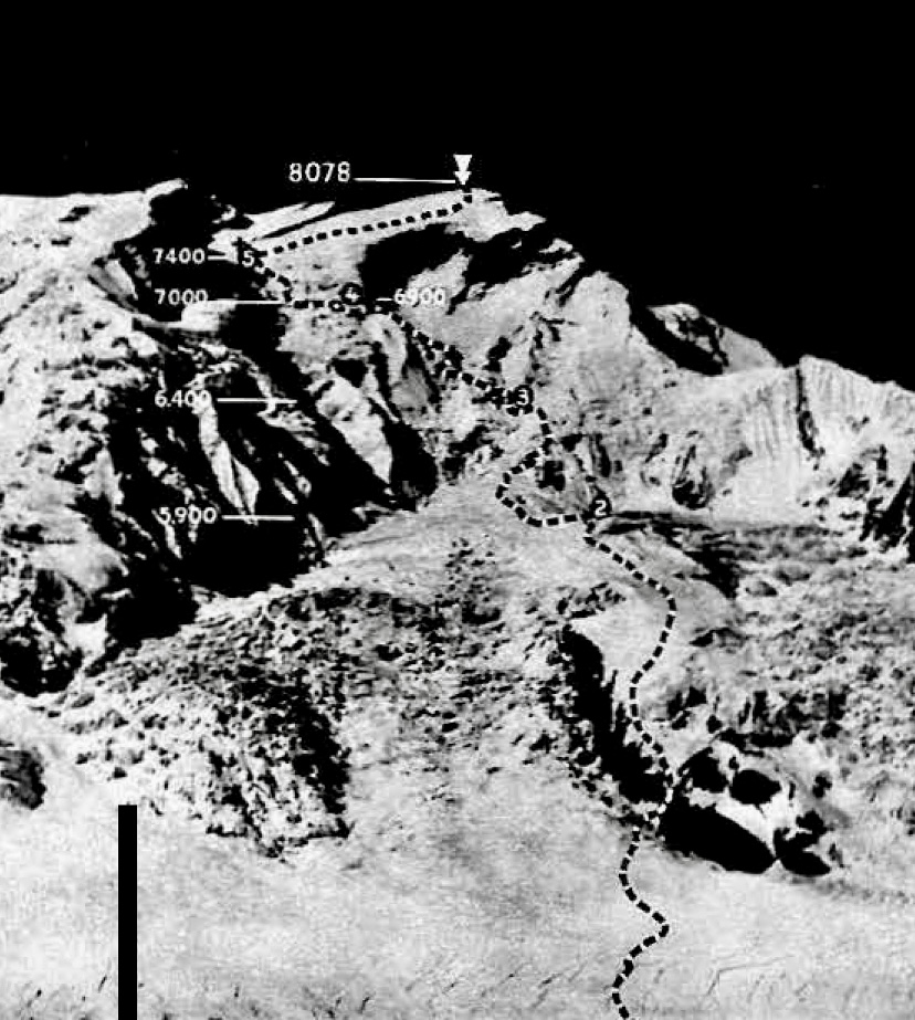
Route-finding
The distance between Dhaulagiri and Annapurna is approximately 35 to 40km, and the two peaks are separated by the Kali Gandaki Gorge, one of the deepest gorges in the world.
Herzog’s party arrived in the Annapurna region in early May. The approach offered them several challenges: dense forests and treacherous moraines. The team initially explored the North and East faces of Annapurna I, but the complex terrain and lack of viable routes forced them to reconsider. Herzog, with input from Terray and Rebuffat, decided to focus on the North Face, which offered a feasible but difficult way to the summit.
According to Herzog’s report, the other possibility, the East Glacier route, would have been technically more demanding. Their final decision was critical, as the monsoon’s approach left no room for further delays. The team adopted a siege-style approach, establishing a series of camps to support the ascent and abandoning their initial idea of carrying out a lighter, alpine-style climb. The route reconnaissance involved significant exploration, with key contributions from Terray and Rebuffat, who helped identify a viable line through the complex terrain of seracs, crevasses, and ice walls.
Camps
The route up Annapurna’s North Face began with the establishment of Base Camp at 4,500m on May 18. From there, the team set up five further camps.
Camp 1 was at 5,000m, at the base of the North Face. Camp 2 was at 5,500m, below a sickle-shaped glacier full of crevasses and steep ice slopes. This camp served as a key logistical point, stocked with supplies for the upper camps.
They set up Camp 3 at around 6,000m on a windy snowfield, offering a starting point toward the upper slopes. This was followed by Camp 4, at 6,800m, situated above the rock band on a narrow ledge. Their small, exposed Camp 5 at 7,400m would be the climbers’ last stop before the summit attempt.
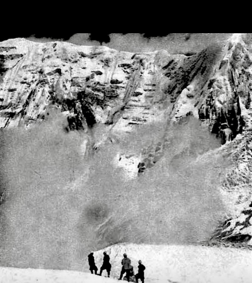
The ascent
The ascent was grueling. Snowstorms, avalanches, and bitter cold tested the team. The Sherpas, led by Ang Tharkay, hauled heavy loads to stock the camps, while Herzog, Lachenal, Terray, and Rebuffat scouted routes and fixed ropes. The terrain was treacherous, with steep ice, loose rock, and deep snow. Crevasses and avalanches were constant threats. Teamwork kept them going, though exhaustion and altitude strained their spirits.
On June 2, Herzog and Lachenal, supported by Terray and Rebuffat, reached Camp 5. Herzog invited Ang Tharkay Sherpa to be in the summit party, but Ang Tharkay declined, explaining that his feet were starting to freeze.
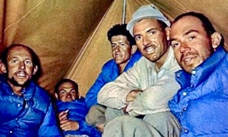
Summit push
On June 3, Herzog and Lachenal launched their summit bid from Camp 5. They started at dawn, climbing without oxygen, through deep snow and fierce winds. Each step of the last 700m was a battle, and the thin air consumed their strength. Lachenal, wary of frostbite, hesitated near the top, but Herzog, driven to reach the summit, urged them onward.
At around 2 pm, Herzog and Lachenal topped out in -40°C, becoming the first people to summit an 8,000m peak.
"I hardly knew if I were in heaven or on Earth, and my mind kept turning to all those men who had died on high mountains and to friends in France. Our moments up there were quite indescribable, with the realization before us that we were standing on the highest peak in the world to be conquered by man," Herzog wrote in the Alpine Journal.
Herzog took photographs at the summit, planting a French tricolor in worsening conditions. Lachenal, more pragmatic, urged a swift descent as the storm was about to arrive.
A difficult descent
The way down from the summit was where triumph almost turned to tragedy. As Herzog and Lachenal descended, a storm hit the mountain. Herzog lost his gloves, and both climbers suffered severe frostbite on their feet. At Camp 5, Terray and Rebuffat met them. Herzog’s hands and Lachenal’s feet were already severely frostbitten. Rebuffat and Terray warmed them overnight.
On June 4, in a whiteout, the snowblind Rebuffat and Terray tried to descend to Camp 4. Unable to find it, the four spent a harrowing night in a crevasse, sharing a single sleeping bag in freezing temperatures.
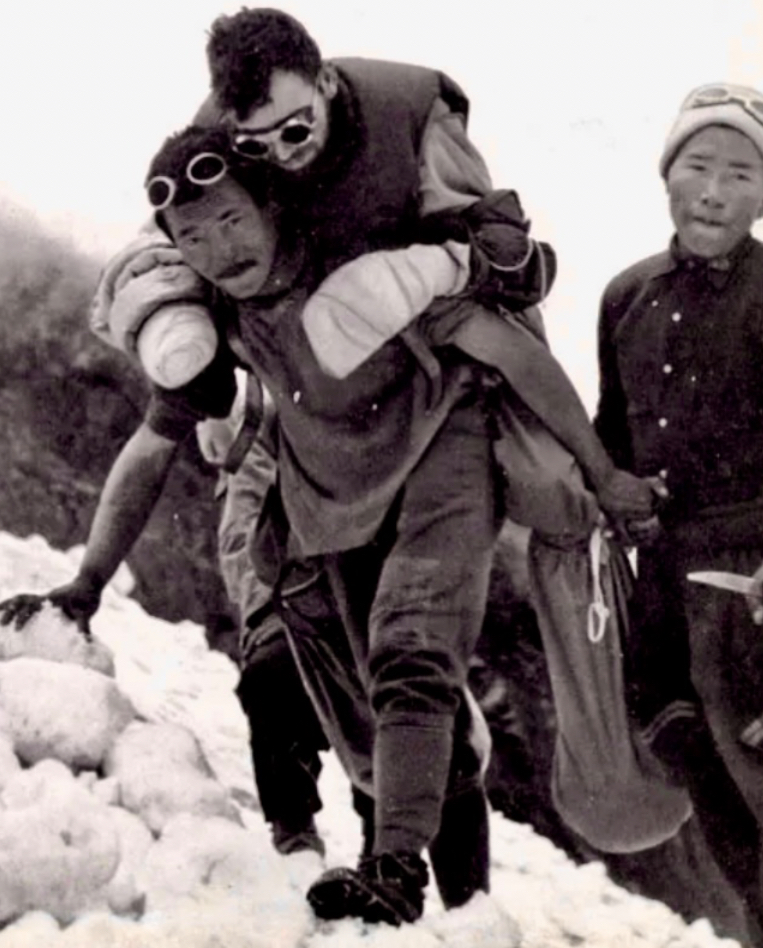
On June 5, during their descent to Camp 2, Rebuffat helped rescue Herzog and two Sherpas from an avalanche. By the afternoon, the team reached Camp 2. Finally, everyone reached Base Camp alive.
"We had beaten it, and I could lie back and think: the job has been finished, the struggle is over," Herzog wrote.

Amputations
Herzog and Lachenal, unable to walk because of their injuries, were carried by Sherpas across the moraines. Dr. Oudot began treating their frostbite in camp, making multiple amputations without anesthesia to combat gangrene. Oudot saved their lives but at great cost; Herzog lost all his toes and most of his fingers, and Lachenal lost his toes.
Aftermath
They left Base Camp on June 10, reaching Kathmandu a month later and returning to Paris on July 17.
Herzog, Lachenal, and Ang Tharkay were awarded the Legion of Honor, and Marcel Ichac’s film, Victoire sur l’Annapurna, premiered to acclaim. Herzog’s book, Annapurna: The First Conquest of an 8000-Meter Peak, became a mountaineering classic. The book ends with the classic line: "There are other Annapurnas in the lives of men," which inspired generations of climbers.
However, controversies later emerged. Rebuffat felt Herzog downplayed his contributions, particularly in route-finding, and was dismayed by the expedition’s hierarchical structure. Lachenal’s posthumously published journals (1996) revealed tensions, including his frustration with Herzog’s prolonged summit photography and the official narrative’s omissions.
In his book True Summit, David Roberts revealed that the expedition was marred by internal discord. Herzog’s book portrayed a unified, heroic effort, but Lachenal’s diary and Rebuffat’s writings exposed tensions, including Herzog’s capricious leadership, and the marginalization of Lachenal, Terray, and Rebuffat’s contributions.
In his 1954 memoirs, Ang Tharkay Sherpa wrote that the French members of the expedition treated him with friendship and equality.
The 1950 Annapurna expedition remains a landmark in mountaineering history, a testament to human endurance, but also the price of ambition.
After escaping the Nazis by minutes and then getting smuggled through spy-infested Stockholm, the bomb bay of a British fighter jet might have been a relief to physicist Niels Bohr. His approach to quantum mechanics held unsettling implications about the meaning of death, and now he had nearly escaped its shadow.
The Nazis had invaded his native Copenhagen in 1940. That was three years before the father of quantum mechanics found himself strapped to the felt-lined insides of a de Havilland Mosquito with only an ill-fitting helmet, a reading light, an oxygen mask, and a thin blanket for comfort. Bohr abhorred the Nazis, but had resisted every previous attempt by the British government to evacuate him. He had work to do in Copenhagen. He was busy shuffling Jewish scholars through his Institute of Theoretical Physics. During their visits, they were all offered very prestigious, very convenient fellowships to leave the Axis territories immediately.
Bohr did not worry as much about himself as he did about others. His mother might have been Jewish, but he didn't practice Judaism. Surely if he didn't consider himself Jewish, neither would the Nazis.
Then, in 1943, a tip-off from a Gestapo worker led to Bohr's narrow escape on a boat to Stockholm. And now the fighter jet, and a helmet that didn't fit right. The rip would last only two-and-a-half hours as they flew over the contested airways to England, where Bohr would finally be safe. Perhaps he felt as though the danger of his last week was finally over.
Blackout
Over the helmet's intercom, the pilot advised him to put on his oxygen mask, as the Mosquito was nearing 7,000m. But Bohr didn't hear the announcement through his badly fitting helmet. As the Mosquito climbed, Niels Bohr, whose discoveries in physics would lead to both quantum computing and the atom bomb, lost consciousness and drifted toward death.
Nearly a decade before, Niels Bohr's colleague Albert Einstein had co-authored a paper contending that the emerging theory of quantum mechanics was incomplete.
Einstein and Bohr had been tossing the matter back and forth for years. While Bohr was far from the only contributor to quantum theory, he was its earliest and most prominent advocate. Einstein agreed that quantum mechanics appeared to work, but he thought Bohr's interpretation of it made no sense at all.
The Copenhagen interpretation
It was called the Copenhagen interpretation, after Bohr's beloved city. If you have taken a physics class that covers quantum mechanics, this is almost certainly how you learned the subject. Bohr developed the Copenhagen interpretation in conjunction with Werner Heisenberg (who would go on to lead the Nazi effort to build an atom bomb) and Max Born (who would be among the first wave of Jewish academics to flee Germany in 1933).

Copenhagen posits that at the very small scale, such as individual atoms or electrons, the universe exists in a permanent juxtaposition of different possibilities. The exact position of a particle in a box, for instance, is not defined by default. It is not merely that we don't know where a particle is. Instead, the particle has no actual location, merely probabilities of being in different locations, until we try to observe where it actually is. Then all those probabilities coalesce into an actuality: The particle is here, not there, and moreover, it will stay there even when we stop observing. We can go make a cup of tea, do some dishes, and when we come back, it will be exactly where we left it. If we shake the box around, though, the position of the particle goes back to a fluffy cloud of probabilities.
For obvious reasons, this upset a lot of people. It agreed with experiments, and the math made sense, but nothing else did. It had some pretty bizarre implications regarding how events exist in space, too, which Einstein derided with the ever-quotable line, "spooky action at a distance."
Schrodinger's cat
When Einstein and two co-authors published their famous rebuttal of the Copenhagen interpretation in 1935, fellow Copenhagen critic Erwin Schrodinger wrote to him in support. To illustrate how ridiculous the Copenhagen interpretation was, Schrodinger described a hypothetical scenario in which the fate of a cat in a box depended on whether or not a particular quantum process (in this case, the nuclear decay of an atom) had occurred. If the atom decays, a mechanism in the box releases poison, killing the cat. If the atom doesn't decay, the cat is fine. Schrodinger wrote how in this quantum system, the cat is alive and dead at the same time, "mixed or spread out in equal parts."
Ridiculous though it was, the Copenhagen interpretation agreed. If there exists some quantum process in the brain that makes the difference between life and death during oxygen deprivation, then for two-and-a-half hours, the bomb bay of the de Havilland Mosquito contained both the living (but unconscious) and the dead bodies of Niels Bohr, father of quantum mechanics.

The many-worlds theory
For such an odd theory of the universe, the Copenhagen interpretation has surprising tenacity. It has vanquished every other approach to quantum mechanics in popularity if not in evidence. Why?
Part of it is that, as the first explanation, it has priority. Part of it has to do with the fact that its rivals are even more mathematically complicated (pilot wave theory), spiritually troubling (conscious measurement theory), or far out there (many-worlds).
In the pilot wave theory, the mathematics that predict probabilities in the Copenhagen interpretation instead describe a background field along which particles travel, much like an electric field. Particles have a real position, the cat is either alive or dead, but if we try to find out specifics, then we disturb the system. We will never know if the cat was alive just before we opened the box.
Conscious measurement theory runs far in the opposite direction. Possibility only collapses into reality when it interacts with a conscious observer. It is not enough to be seen on camera, someone has to be controlling the camera and attempting to process its information. The nature of death is about the only thing that isn't unsettling about this theory: A conscious observer collapses the probabilities, so the cat (or Niels Bohr) is either alive or dead, not both.
When everywhere becomes somewhere
But as bizarre as the Copenhagen interpretation of death might be, the many-worlds theory of quantum mechanics rivals it. It began with Hugh Everett III, a PhD student studying under John Wheeler, one of Niels Bohr's former students. Everett grew troubled by the Copenhagen interpretation, which seemed unnecessarily complicated. Why mess around with this business of something that was everywhere suddenly being somewhere when observed? After all, that implies the universe rearranges itself instantaneously. If nothing moves faster than the speed of light, how is that possible?
Easy, said Everett. It isn't. Nothing rearranges itself. Instead, the different probabilities predicted by quantum mechanics don't relate to whether the particle is actually at point A rather than B. Rather, they describe the chance that we are in a particular universe where the particle is at A instead of B. When we open the box, all we do is check which universe we are in.

This all sounds rather abstract. Nonetheless, Everett's PhD advisor, John Wheeler, recognized that in many ways, it's the simplest interpretation of the probability-based math required by quantum experiments. Wheeler encouraged Everett to publish it as his thesis, including a mathematical formulation for branching universes.
In 1959, Wheeler made the mistake of sending his protégé off to Copenhagen to meet the grandmasters of quantum mechanics. The meeting did not go well. Everett later described it as "hell" and "doomed from the start." One of the physicists he met, Leon Rosenfeld, detailed his impression of Everett in a letter: "He was indescribably stupid and could not understand the simplest things in quantum mechanics."
Everett promptly left academia for defense work.
Quantum immortality
Many-worlds lay dormant for a decade. Then, in 1970, a small circle of physicists rediscovered it and coaxed Everett into elucidating his ideas. Everett never returned fully to physics, but he stayed engaged with the small community of many-worlds enthusiasts.
One of the oddest features of many-worlds is the nature of death. In the Copenhagen interpretation, the probability of Schrodinger's cat being alive when we open the box is vanishingly small, the longer the experiment goes on. So small, in fact, that it approaches zero very quickly. In many-worlds, however, there is always a universe where one version of the cat survives.
This is very nice for the surviving cat in that just-right universe and not at all nice for the different versions of it that died. Hugh Everett had a solution to this, although even he did not dare publish it. Privately, he believed that his consciousness would always stay in the universe in which it continued to exist.
Everett died of a heart attack in 1982. He was 51 years old. His daughter committed suicide fourteen years later and wrote in her last letter that she was going to join her father in a parallel universe.

The fate of Niels Bohr
When the British army opened the bomb bay of the Mosquito, they found Niels Bohr unconscious but alive. Death by oxygen deprivation is not truly a quantum mechanical process, so our analogy notwithstanding, his survival says nothing about quantum mechanics.
Bohr went on to participate in the British arm of the Manhattan Project until his morals got in the way. He believed that the atom bomb would alter the world forever, and to develop it in secret was unforgivable. Hinting at the project in letters to Russian colleagues, he found an ally in Robert Oppenheimer. With Oppenheimer's help, Bohr met with Franklin D. Roosevelt, whom he tried to convince to make the project public. Roosevelt declined. By all accounts, though, he was more sympathetic to Bohr than Winston Churchill, who wrote, "It seems to me Bohr ought to be confined or at any rate made to see that he is very near the edge of mortal crimes."
Churchill kept Bohr under close watch in England. Not until the United States bombed Hiroshima and Nagasaki was Bohr finally permitted to return to his native Copenhagen, where he dedicated much of the rest of his career to nuclear non-proliferation. He passed away in 1962, three years after meeting with a hot-headed young physicist named Hugh Everett III, who believed neither would ever truly die.
Today is the 70th anniversary of the first ascent of 8,586m Kangchenjunga, the world’s third-highest mountain.
Located on the border of Nepal and Sikkim, India, Kangchenjunga means the Five Treasures of the Great Snow, referencing its five prominent peaks and cultural significance in Sikkim, where it is considered sacred. Kangchenjunga drew early mountaineers because of its height and extreme technical challenges. Before its first ascent in 1955, 13 expeditions targeted the peak.
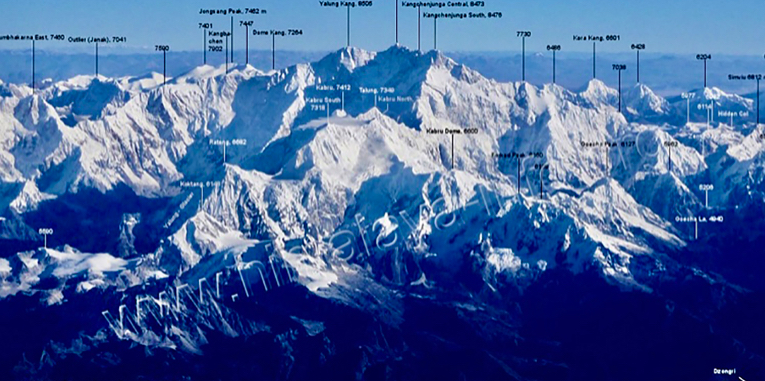
Early exploration and reconnaissance
The climbing history of Kangchenjunga begins with exploration rather than summit bids. In 1899, British mountaineer Douglas Freshfield became the first European to circumnavigate the mountain, mapping its glaciers and ridges. Freshfield described the Northwest Face as a formidable barrier, seemingly designed to repel climbers with its ice and snow defenses. His observations laid the groundwork for future attempts, suggesting potential routes via the Southwest Face and the Kangchenjunga Glacier.
The first summit attempt
The first serious attempt to climb Kangchenjunga came in 1905, led by controversial British mountaineer and occultist Aleister Crowley, who later styled himself "the wickedest man in the world." The expedition also included Jules Jacot-Guillarmod, Charles Reymond, and Alexis Pache of Switzerland, along with Alcesti C. Rigo de Righi (an Italian hotelier from Darjeeling), and four Sherpas.
The expedition approached from the Nepal side, targeting Kangchenjunga’s Southwest Face via the Yalung Glacier, a route suggested by Freshfield. Crowley, who had previously attempted K2 in 1902, led with a mixture of ambition and recklessness.
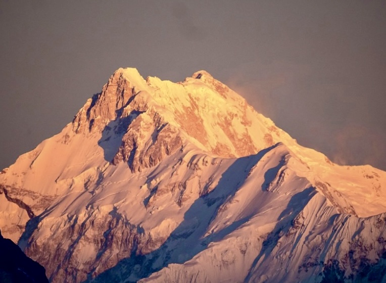
The team established Camp 7 at approximately 6,300m. However, the expedition unraveled because of Crowley's leadership and dangerous conditions. On September 1, an avalanche struck and swept the climbers away, killing Pache and three Sherpas (The Himalayan Database does not list the names of the Sherpas.) De Righi was partially buried, and the survivors called for help. Crowley reportedly remained in his tent, later claiming the "Demon of Kangchenjunga" had been appeased by the deaths. Earlier in the expedition, one porter died in a fall.
The avalanche ended the 1905 attempt, and Crowley’s reputation suffered.
Kellas’ reconnaissance
Between 1907 and 1921, Scottish chemist and mountaineer Alexander Mitchell Kellas made six visits to the Kangchenjunga region, climbing in alpine style with Sherpa and Lepcha porters. Kellas, a pioneer of high-altitude physiology, believed peaks like Kangchenjunga could be climbed without supplemental oxygen.
In the spring of 1910, Kellas made a solo reconnaissance trip on the northeast side of Kangchenjunga and explored near Kirat Chuli. Kellas studied the Zemu Gap, Simvu Saddle, and Kangchenjunga Glacier, making several first ascents of peaks over 6,000m, including 7,128m Pauhunri (1911) and 6,965m Langpo (1910).
Kellas’ work provided critical knowledge of the terrain and Sherpa capabilities, though he never attempted Kangchenjunga’s summit. Tragically, Kellas died in 1921 during an Everest reconnaissance expedition, but his contributions shaped Himalayan mountaineering.
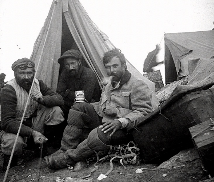
Interwar attempts
After Crowley’s failed attempt, Kangchenjunga saw no major expeditions until after World War I, when mountaineering interest in the Himalaya surged. In the autumn of 1920, British climber Harold Raeburn, accompanied by Ferdie Crawford, scouted the southwest side of Kangchenjunga and reached 6,400m.
Solo attempt and death
Edgar Francis Farmer was a young man from the Standard Oil Company of New York who dreamed of climbing Kangchenjunga. In May 1929, he set out on a solo attempt to reach the summit by the Southwest Face. The decision led to his death.
Thanks to detailed reporting in The Himalayan Journal and the American Alpine Journal, Farmer's climb was well covered. Farmer wasn’t an experienced Himalayan climber; his only mountaineering background was in the Rockies. Still, he was determined and had studied climbing books. He kept his ambitious plan secret, not sharing it with officials or experienced climbers in Darjeeling who might have warned him against it.
Farmer set out on May 6, with skilled Sherpa and Bhutia porters, claiming he would explore the Guicha La region. Farmer led his team across the Kang La into Nepal, and camped on the Yalung Glacier near Kangchenjunga’s Southwest Face. On May 26, with three porters, he tackled the icefall toward the Talung Saddle. Though personally well-equipped, his porters lacked proper gear.
With melting snow making the climb risky, the head porter, Lobsang, urged Farmer to turn back. However, the American, promising to stop by noon, continued alone into the mist despite the porters’ pleas.
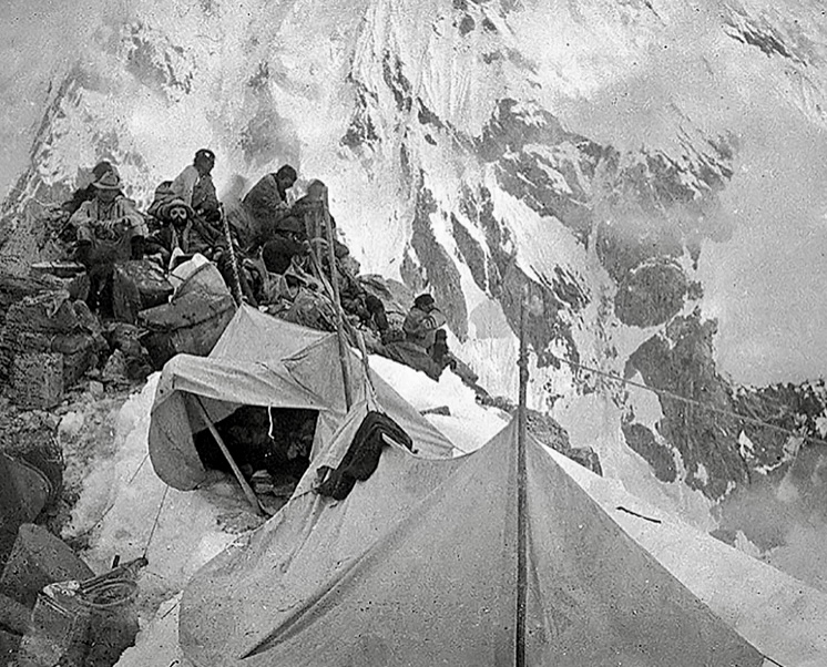
By 5 pm, the porters saw Farmer climbing higher, but the mist soon hid him. The porters signaled by torch, hoping he would return. The next morning, they spotted Farmer up a steep slope, moving oddly, possibly snowblind. He then vanished at approximately 6,000m.
Out of food, the porters waited until May 28 before descending. On May 30, they reached Tseram, traded a coat for food, and sent a porter to Darjeeling. The porter reported the tragedy on June 6.
Farmer had arrived in Darjeeling earlier that year and met G.H. Wood-Johnson, an experienced Himalayan climber. Wood-Johnson helped Farmer hire skilled porters, including Lobsang, a veteran of Everest expeditions. Lobsang’s detailed account to the Indian Police matched the porters’ story, describing how Farmer misled them about his real plans.
Farmer’s obsession with reaching the summit of Kangchenjunga clouded his judgment.
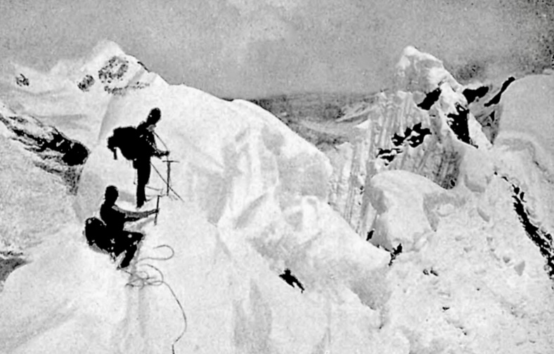
German attempt
In the summer of 1929, German climber Paul Bauer led a well-organized German-Austrian-British expedition targeting the Northeast Spur from the Sikkim side. Bauer’s team first made a reconnaissance of the East-Southeast Ridge, but then focused on the Northeast Spur-North Ridge route. The party reached 7,400m, where a five-day storm stopped them. The long and exposed Northeast Spur proved technically challenging and avalanche-prone, ultimately forcing a retreat.
In the spring of 1930, an international expedition led by Swiss mountaineer Gunter Oskar Dyhrenfurth attempted the Northwest Face via the Kangchenjunga Glacier from Nepal. The team, including German, British, Swiss, and Austrian climbers, aimed to follow Freshfield’s suggested route. They established Base Camp near Pangpema, but faced disaster when a massive ice avalanche killed Chettan Sherpa, one of their strongest high-altitude porters, and nearly wiped out the team. The expedition abandoned the climb at 6,400m, but completed a circuit of Kangchenjunga, ascending three lower peaks.
Years later, other climbers found Chettan Sherpa’s remains and G.O. Dyhrenfurth’s ice axe. According to a letter written by Dyhrenfurth’s son, Norman Dyhrenfurth, on November 27, 1987, and sent to The Himalayan Database, Chettan Sherpa was crushed by a huge ice avalanche on May 8, 1930. After more than an hour of artificial respiration, he was buried near Camp 2.
"My father’s old ice-axe was indeed placed on his grave. Perhaps a recent avalanche brought his remains to the surface and broke the ice axe as well. What a strong coincidence,” Norman Dyhrenfurth wrote.
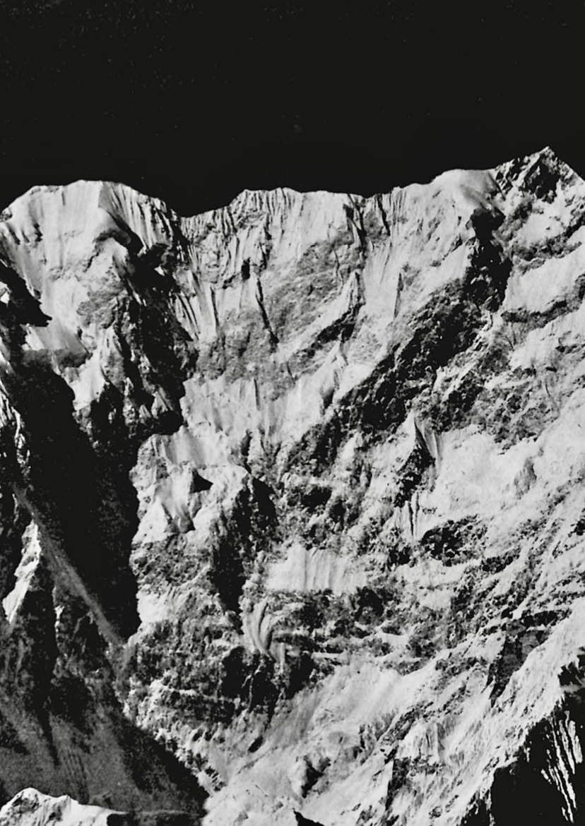
Bauer returned in 1931 with a large German team of 10 climbers. They followed the same Northeast Spur. Despite persistent bad weather, they reached 7,940m, but a dangerous snow slope between the Spur and the North Ridge proved impassable. The expedition suffered losses when climber Hermann Schaller and Sherpa Pasang died in a fall, and Sirdar Lobsang and porter Babu Lall succumbed to illness. Bauer’s determination earned respect, but Kangchenjunga remained unclimbed.
Further reconnaissance
George Frey of Switzerland and Gilmour C. Lewis of the UK made a reconnaissance from the southeast to the southwest side of Kangchenjunga in the autumn of 1951. This was followed by John Kempe’s (UK) reconnaissance in the spring of 1953, also with C. Lewis, of Kangchenjunga’s Southwest Face.
Kempe returned in the spring of 1954 with seven other climbers (two of them Sherpas), again scouting the Southwest Face.
All attempts and reconnaissance of Kangchenjunga between 1905 and 1954 were carried out without supplemental oxygen.
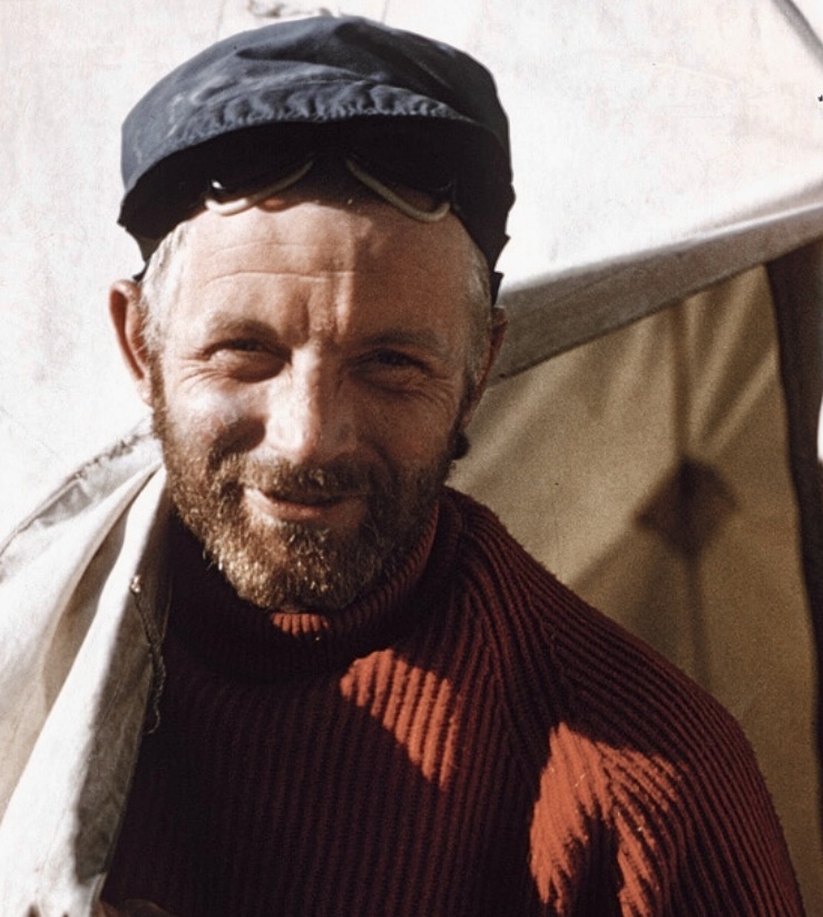
The 1955 British Kangchenjunga Expedition
By the 1950s, Kangchenjunga had gained a fearsome reputation, with 11 people dead and no summits. After the successful first ascents of Everest (1953) and K2 (1954), Kangchenjunga became the highest unclimbed peak, drawing intense interest.
In 1955, a British expedition led by Charles Evans, deputy leader of the 1953 Everest expedition, achieved the first confirmed ascent. The team’s success was a mountaineering landmark, often considered a greater achievement than Everest because of Kangchenjunga’s technical difficulty and remoteness.
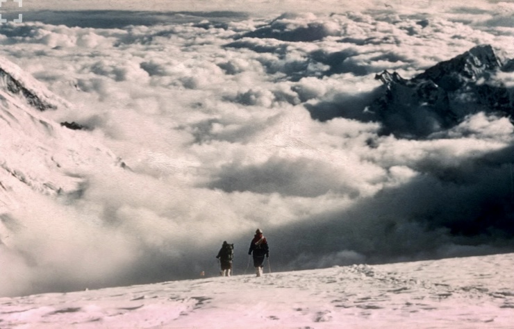
The expedition included experienced mountaineers and Sherpas, carefully selected for their skills and Himalayan experience: Charles Evans (leader, 36, a seasoned Himalayan climber, calm and strategic, who negotiated access with Sikkim’s authorities), Norman Hardie (deputy leader, 30, a New Zealand engineer and expert ice climber, responsible for oxygen equipment), George Band (26, a Cambridge graduate and Everest 1953 veteran, in charge of food logistics), Joe Brown (24, a British working-class rock climbing prodigy with no prior Himalayan experience but exceptional technical skills), John Clegg (29, expedition doctor and alpine climber), John Jackson (34, a Himalayan veteran who had been on the 1954 Kangchenjunga reconnaissance), Tom McKinnon (42, expedition photographer with extensive Himalayan experience), John Neil Mather (28, an ice and snow specialist from the Alps), and Tony Streather (29, an army captain with broad mountaineering experience, including the 1953 K2 attempt, responsible for porters).
The team also included Dawa Tenzing, Sirdar, 45, a highly respected Sherpa leader, known as the King of the Sherpas for his stamina and character. Additional Sherpas included Ang Temba, Ang Noru, Tashi, Urkien, Ila Tenzing, and Pemi Dorje, who played critical roles carrying supplies and establishing camps.
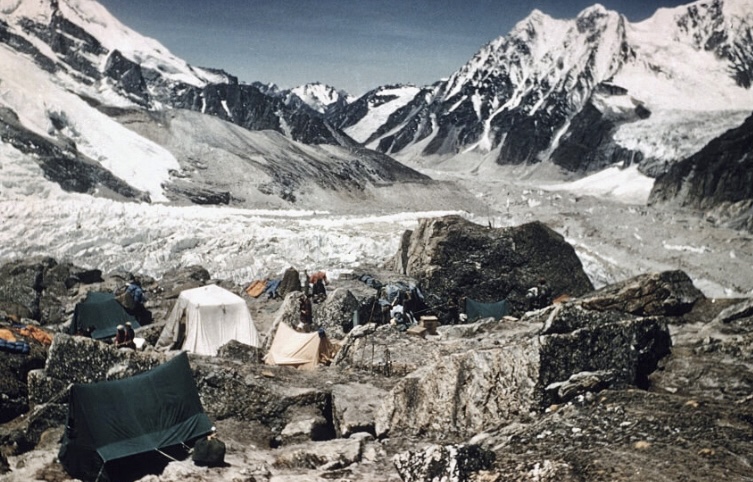
The route
The expedition, including over 300 porters and 26 climbing Sherpas, approached from Darjeeling, a 10-day trek along the Sikkim border and through Nepal to the Yalung Valley.
The team initially attempted a route reconnoitered by John Kempe in 1954 (Kempe’s Buttress) but found it impractical because of the very unstable lower icefall.
"We could find no safe route from the top of Kempe’s Buttress to the Plateau," Evans noted in the American Alpine Journal.
Instead, they chose the Southwest Face via the Yalung Glacier, the same route attempted by Crowley in 1905. This route ascended snow and ice slopes west of the Western Buttress, crossing what they called The Hump to the upper icefall and reaching the Great Shelf, a large ice terrace at 7,300m. From there, it followed the Gangway, a snow slope leading to the summit ridge, avoiding the dangerous "Sickle" formation.
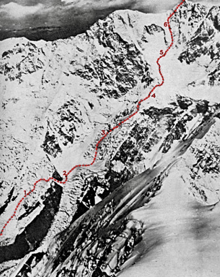
Kangchenjunga’s first ascent
The expedition began with Evans, Hardie, and two Sherpas reaching 7,150m, establishing Camp 4 and identifying the route to the Great Shelf. By May 13, the team reached the Great Shelf and established Camp 5 at 7,710m. This camp was under a vertical ice cliff, higher than any previous Kangchenjunga attempt.
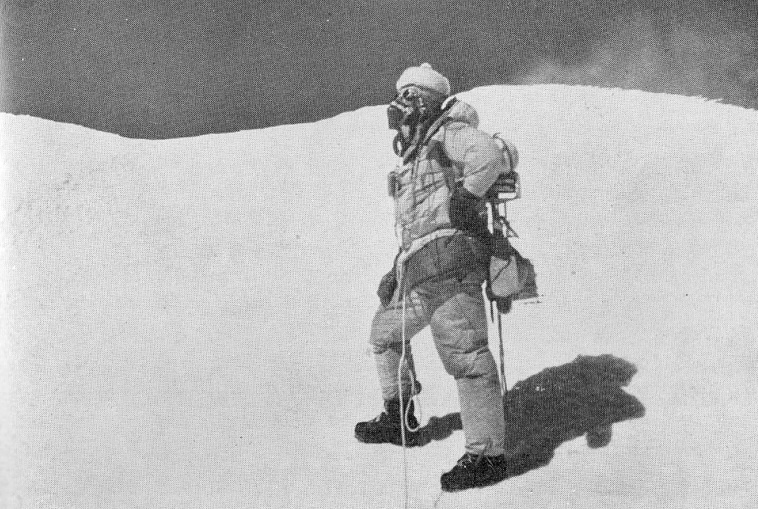
On May 15, Jackson and McKinnon led Sherpa teams to stock Camp 5, battling deep snow and an avalanche that scattered supplies. Jackson suffered snow blindness, but continued, guided by Sherpas.
The team regrouped at Base Camp, where Evans announced the summit plan: Joe Brown and George Band would lead the first summit attempt, supported by Evans, Mather, Dawa Tenzing, Ang Temba, Ang Noru, and Tashi.
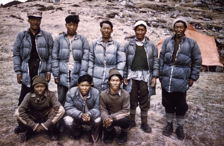
Hardie, Streather, Urkien, and Ila Tenzing formed a second summit team and planned to follow a day behind. On May 24, they established Camp 6 at 8,200m on a precarious snow ledge. It was the final camp before the summit.
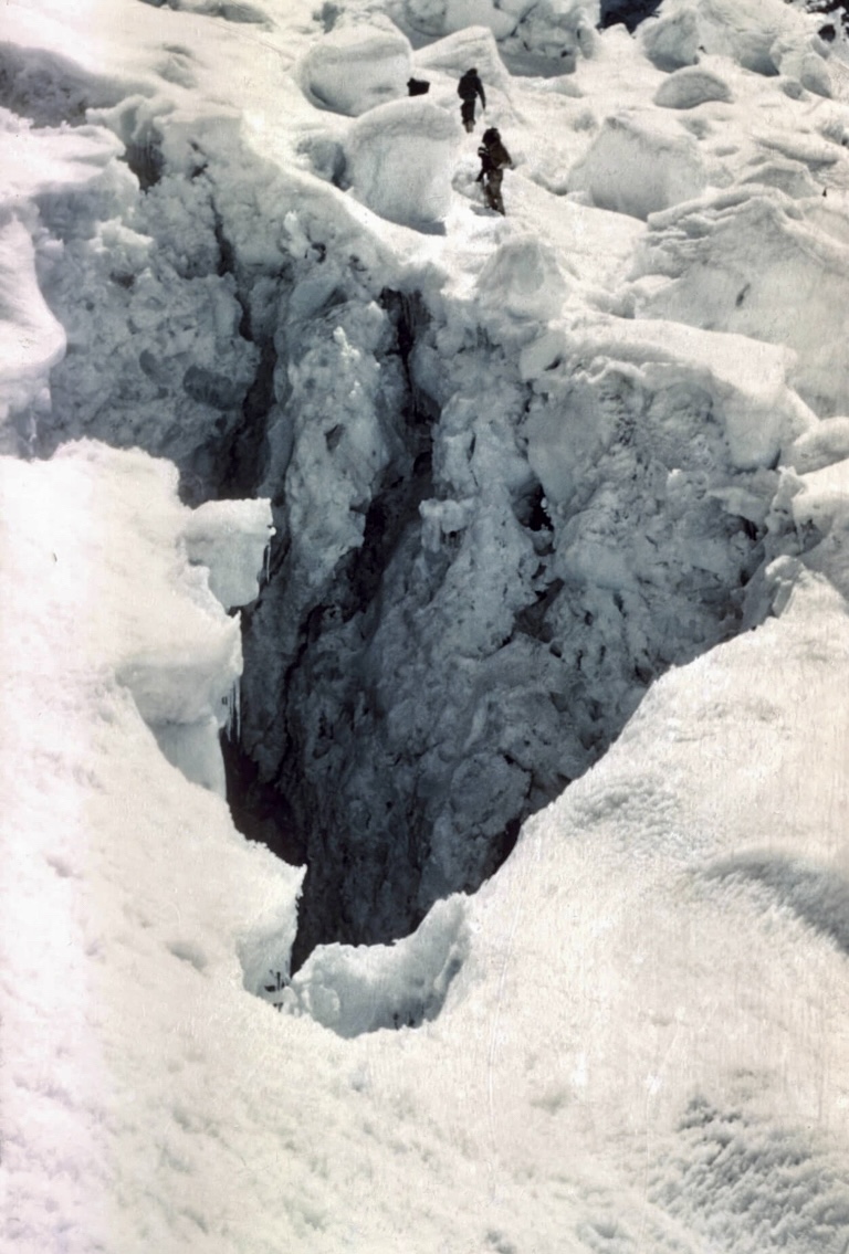
On May 25, Brown and Band set out from Camp 6 at 8,200m. They navigated the Gangway, facing soft snow and avalanche debris. Brown led a challenging six-meter rock climb up a crack with a slight overhang, rated very difficult at sea level but grueling at 8,500m.
On May 25 at 2:45 pm, Band and Brown topped out. Respecting Sikkim’s religious sensitivities and as Evans had promised the Sikkimese prime minister, they stopped just short of the true summit. Clouds obscured most of the view, but they glimpsed Makalu, Lhotse, and Everest 130km away. After an hour, they descended, discarding empty oxygen tanks and reaching Camp 6 as darkness fell. On May 26, at noon, Hardie and Streather also reached the summit.
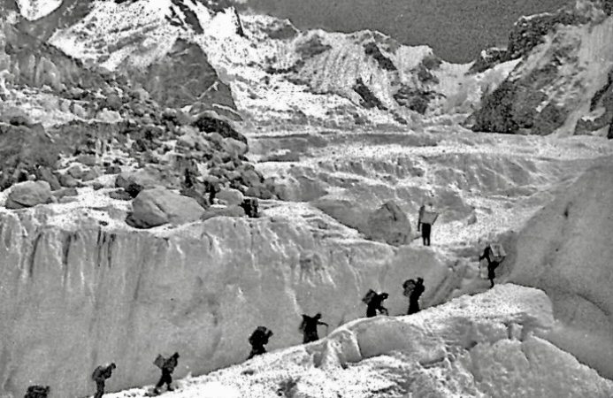
Supplemental oxygen was a key component in the expedition’s strategy, reflecting the growing acceptance of its necessity at extreme altitudes. The team used oxygen for climbing and sleeping above Camp 3 (6,700m). Sherpas used oxygen only for carries above Camp 5 (7,700m). George Band and Joe Brown carried 1,600 liters of oxygen each for their summit push, while Hardie and Streather carried 2,400 liters each. However, leaks reduced Hardie and Streather’s supply, forcing Streather to descend without oxygen. The oxygen systems posed challenges, including mask leaks that fogged goggles, contributing to Jackson’s snow blindness during a carry to Camp 5.
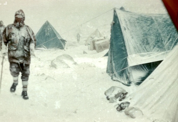
Sherpa contributions
Sherpas were integral to the expedition’s success, carrying heavy loads, establishing camps, and breaking trail in deep snow. Dawa Tenzing, the sirdar, was praised for his leadership and stamina. He had also previously outperformed others on Everest in 1953.
Sherpas like Ang Temba, Ang Noru, and Tashi supported the summit teams, carrying vital supplies to Camp 6. However, the expedition was marred by the death of Pemi Dorje, Dawa Tenzing’s brother-in-law, who died of a stroke at Base Camp on May 26, after an exhausting carry to Camp 5.
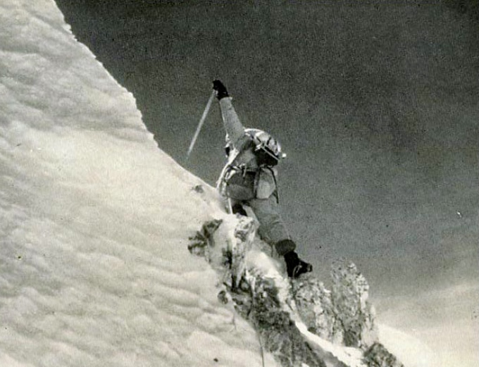
The 1955 British expedition achieved the first ascent of Kangchenjunga through meticulous planning, skilled climbing, and Sherpa support, navigating the Southwest Face with supplemental oxygen. The climb was a historic success, proving that even the Demon of Kangchenjunga could be tamed through perseverance and respect for the mountain’s cultural significance.
The second ascent of Kangchenjunga did not occur until the spring of 1977, when Prem Chand Dogra and Nima Dorje Sherpa, members of the Indian Army Expedition led by Narinder Kumar, carried out the ascent via the East Spur-North Ridge route.
Subsequent ascents included a 1979 climb by Doug Scott, Pete Boardman, and Joe Tasker, who made the first Kangchenjunga ascent without oxygen or high-altitude porters, via a new route.
Our Forgotten 7,000'ers series continues with the climbing history of 7,362m Kirat Chuli, a striking, rarely attempted peak in Sikkim, in the Indian Himalaya.
Also known as Tent Peak, Kirat Chuli has a prominence of 1,168m and is part of the northern section of the Kangchenjunga massif on the Nepal-India border.
The mountain lies between the Teesta River to the east and the Koshi River to the west and is surrounded by notable neighbors: Kangchenjunga and Gimmigela Chuli to the south, Siniolcho and Simvo to the southeast, Drohmo to the northwest, and Pathibara and Langpo Peak to the north.
Kirat Chuli's remote location, technical challenges, and harsh weather has limited mountaineering. From the Nepal side, the approach is complicated by heavily crevassed terrain.
The mountain holds cultural and religious importance for the Kirat, Limbu, and Rai communities. In the Limbu language, Kirat Chuli means "Kirat People." They believe the mountain is the abode of Yuma Sammang, an omnipotent goddess associated with knowledge, protection, and spiritual well-being.
Kirat Chuli’s other name, Tent Peak, was likely coined by early Western explorers because of its pyramid tent shape.
First reconnaissance
In 1910, Scottish chemist and mountaineer Alexander Mitchell Kellas scouted the Kangchenjunga region, including Kirat Chuli, as part of his broader exploration of the Sikkim Himalaya. Kellas’ goal was to study the geography, assess potential climbing routes, and gather data on the effects of altitude. He approached from Sikkim, likely via the Zemu Glacier.
Although Kellas didn’t attempt to climb Kirat Chuli, he did climb 6,965m Langpo. Interestingly, Langpo has had only two ascents, both by Kellas.
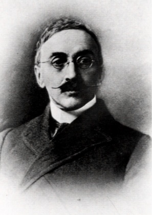
First attempts on Kirat Chuli
In the summer of 1936, a four-man German party led by Paul Bauer attempted to climb Kirat Chuli by two routes: by the south ridge from the east and by the south ridge via 7,177m Nepal Peak. The Germans eventually abandoned their attempt at the top of Nepal Peak because of poor conditions.
One year later, in the spring of 1937, a three-man Swiss-German party arrived, led by Ernst Grob and supported by five Sherpas above base camp. They chose the same route as the 1936 team, the south ridge from Nepal Peak.
The Himalayan Database does not provide much information about this attempt, and it is unknown how high they reached or why they retreated.
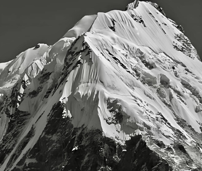
The only ascent
In the spring of 1939, Grob returned, this time with Germans Herbert Paidar and Ludwig Schmaderer and supported by Ajiba Sherpa, Genden Umdu Sherpa, Ila Sherpa, and Ila Tenzing Sherpa. The route was the same. After approaching the Zemu Glacier, they targeted the south ridge via Nepal Peak.
They established several camps along the glacier system, following the technical ridge of mixed snow and rock. On May 29, Grob, Paidar, and Schmaderer topped out.
The expedition also ascended Langpo South and attempted Gimmigela Chuli and Pyramid Peak.
To date, this is the only successful ascent of Kirat Chuli, though there have been eight further attempts on the mountain.
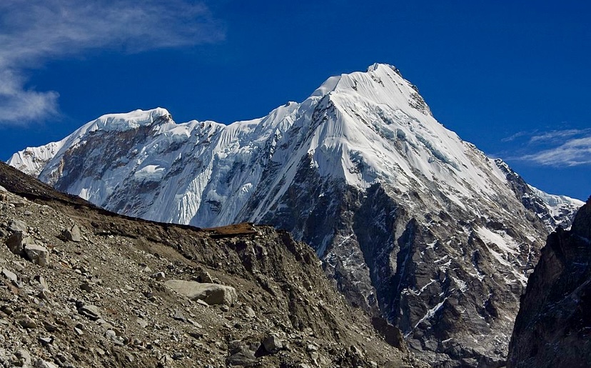
Further attempts
In the autumn of 1985, Mike Kefford led a large UK-Nepal expedition up the same route. They turned around at 6,735m on Nepal Peak because of strong winds and heavy snowfall.
The next attempt came a year later, in the autumn of 1986, when a French expedition led by Dominique Hembise attempted the same route. The outcome was the same: They abandoned at 6,650m because of snow, wind, and Hembise’s frostbite. The French expedition reported especially dangerous avalanche conditions at their Camp 1, located halfway between Cross Peak and Nepal Peak.
In the spring of 1995, an Austrian party led by Kurt Elbl attempted the southwest ridge from Sikkim via Nepal Peak. Their highest point was 7,150m, where bad weather ended their climb.
In the autumn of the same year, a German party led by Wolfram Schroeter reached 7,150m on Nepal Peak, where they ran out of time and turned around.
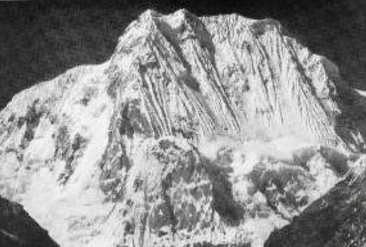
Other attempts by different routes
There were four other attempts via different routes.
In the autumn of 2000, Slovenian Andrej Stremfelj and his partners aimed to ascend Jongsang, Pyramid Peak, and Kirat Chuli via its south face. The Slovenians worked in small groups; Stremfelj and two partners were attempting Kirat Chuli when Andrej Markovic, climbing on Jongsang in another group, suffered a fatal fall. Stremfelj's team called off their expedition.
Two years later, another Slovenian expedition targeted the west face. Gregor Kresal’s party reached 6,700m but ran out of time before reaching the summit.
In autumn 2007, the Slovenian Kangbachen Expedition, led by Tone Skarja, also tried the west face. Deep snow and avalanches stopped them below 5,800m.
The most recent registered attempt in The Himalayan Database is from 2022. U.S. climbers Spencer Gray (leader), Rushad Nanavatty, and Matthew Zia targeted the north face but turned around at 6,000m in bad conditions.
Kirat Chuli remains an elusive prize. Its rugged terrain, icy slopes, and unpredictable conditions have yielded temptingly few triumphs.
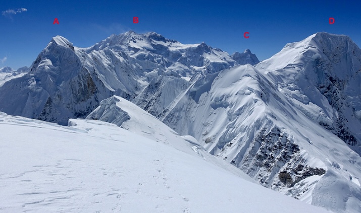
Today, 104 years ago, legendary French alpinist Gaston Rebuffat was born.
One of the most celebrated mountaineers of the 20th century, Rebuffat was known for his bold new routes in the Alps, his role in the first confirmed ascent of an 8,000m peak (Annapurna I in 1950), and as the first person to climb all six great North Faces of the Alps. He wrote several influential mountaineering books and produced films that captured the essence of alpinism.
Early climbs
Rebuffat was born on May 7, 1921, in Marseille, France. He started climbing at 14 in the Calanques, a rugged coastal area near his hometown. In 1937, at 16, he joined the French Alpine Club, where he met Lionel Terray, a future climbing partner. Rebuffat visited Chamonix for the first time in 1937, and the Alps soon became his focus.
During World War II, Rebuffat took his climbing to a new level. In 1942, he graduated from Jeunesse et Montagne, a French youth training program, and received his mountain guide certification (despite being two years younger than the minimum age requirement of 23). In 1944, Rebuffat became an instructor for the French National Ski and Mountaineering School (ENSA) and the High Mountain Military School.
By 1945, he was focused on guiding clients in the Alps, fulfilling his desire to live in the mountains full time. He joined the prestigious Compagnie des Guides de Chamonix.
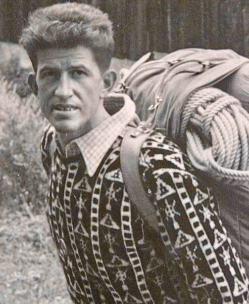
Climbs in the Alps
Rebuffat’s climbing career in the Alps was outstanding, with over 1,200 ascents classified as difficult or very difficult. In the 1940s, Rebuffat tackled some of the Alps’ most challenging peaks, alongside partners such as Terray and Louis Lachenal. By the end of the 1940s, Rebuffat was among France’s elite mountaineers.
In the 1940s and 50s, Rebuffat established approximately 40 significant first ascents via new routes. These included routes on the Aiguille du Midi, the Drus, and Aiguille du Roc. His new lines were known for their elegance and technical challenge, and reflect his philosophy of climbing in harmony with the mountain rather than conquering it.
The six North Faces of the Alps
Rebuffat finished his most celebrated achievement in 1952. The North Faces of the Matterhorn, Eiger, Grandes Jorasses, Piz Badile, Drus, and Cima Grande di Lavaredo are well known for their steepness, difficulty, and unpredictable weather.
Rebuffat began to plan his first North Face, the Grandes Jorasses, in 1938, when he was only 17 years old. The first ascent -- by Italians Riccardo Cassin, Gino Esposito, and Ugo Tizzoni -- inspired him.
On Rebuffat's first attempt, in 1943, bad weather forced him to retreat. Finally, in July 1945, he succeeded, climbing the Walker Spur with Edouard Frendo in three days with two bivouacs. This marked the second ascent of this route.
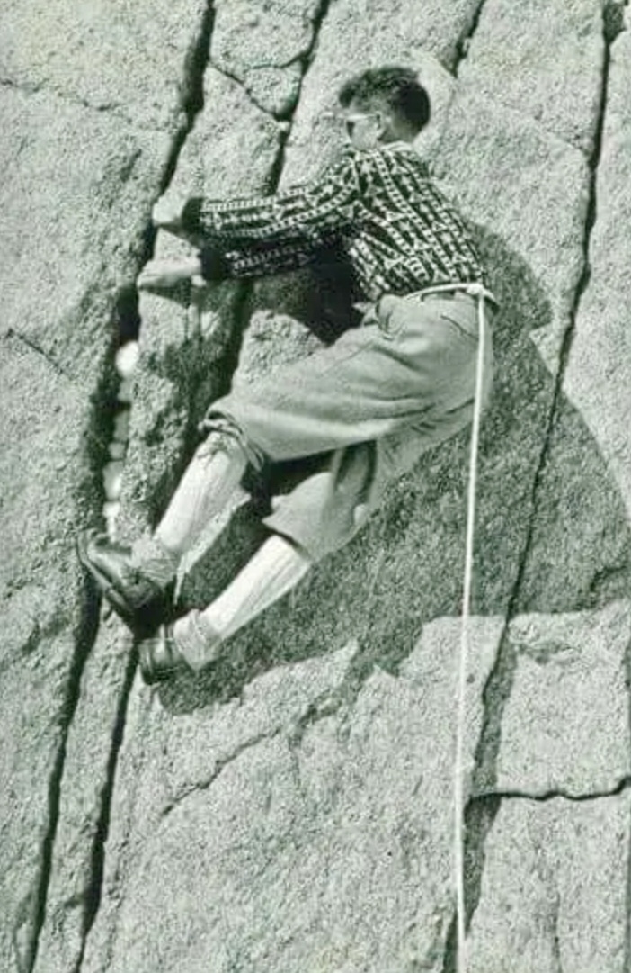
In August 1946, Rebuffat guided Belgian amateur mountaineer Rene Mallieux up the North Face of the Petit Dru. They climbed fast to reach the summit by nightfall, bivouacking on the descent and attending the Chamonix Guides’ Festival the next day. The one-day ascent showcased Rebuffat’s efficiency and guiding skills.
In the summer of 1948, Rebuffat guided a client up the northeast face of Piz Badile in the Bregaglia Alps. Despite a severe lightning storm, they reached the summit the following day. They followed the Cassin Route, first ascended in 1937.
Rebuffat’s fourth North Face came in 1949 when he climbed the Matterhorn twice, first with Raymond Simond, and later with other partners (though some sources mention only one ascent). He targeted the Schmid Route, first climbed in 1931.
The same year, Rebuffat ascended the North Face of Cima Grande di Lavaredo in the Dolomites, guided by Italian Gino Solda. This ascent followed the Comici-Dimai Route, first climbed in 1933.
In July 1952, Rebuffat completed his quest with the North Face of the Eiger via the Heckmair Route. He climbed with Paul Habran, Guido Magnone, Pierre Leroux, and Jean Brune.
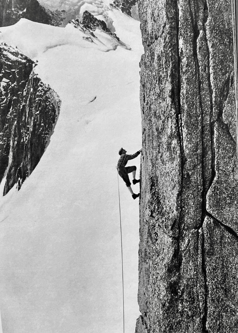
Annapurna I
In 1950, Rebuffat joined a French expedition to Annapurna I. Led by Maurice Herzog, the team included Rebuffat, Terray, and Lachenal, among others. The expedition started in March, but the ascent only began in May.
The French party established a base camp and four intermediate camps, the highest at 7,400m. On June 3, Herzog and Lachenal summited and became the first two people in the world to reach the top of an 8,000m peak. Rebuffat and Terray didn’t summit, but played a critical role during the descent.
While summiting was a historic triumph, the descent turned into an ordeal, marked by frostbite, snowblindness, avalanches, and navigational errors. Rebuffat helped to ensure the survival of frostbitten and disoriented teammates during the harrowing retreat.
Herzog and Lachenal reached the top around 2 pm and started to descend immediately. The weather was clear but very cold, with temperatures estimated at -40°. Herzog somehow lost his gloves while handling equipment, exposing his hands. Lachenal, impatient to descend quickly in the worsening conditions and with his own frostbite concerns, slipped and tumbled 100m down the slope. Miraculously, he stopped short of a fatal drop, but the accident left him shaken, with one crampon missing, and his ice axe gone. His feet, already numb from prolonged exposure, were deteriorating rapidly. Both men were in a very bad state as they struggled toward Camp 5 at 7,440m, where Rebuffat and Terray awaited.
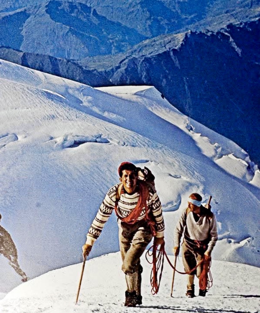
Meeting Rebuffat and Terray
Rebuffat and Terray had climbed to Camp 5 earlier that day, expecting to support Herzog and Lachenal or possibly attempt the summit themselves if conditions allowed.
When Herzog arrived at the high camp alone, Rebuffat and Terray were relieved, but then alarmed when they shook his hand. Herzog’s hands were frozen solid, white, and lifeless.
Rebuffat and Terray started to massage Herzog’s frostbitten hands and feet, hoping to restore the circulation, but their efforts had little result. Hearing some cries from below, Terray ventured out of the tent into the dusk and located Lachenal, who had missed the camp and was 200m down the slope. Terray guided Lachenal back to Camp 5. Lachenal’s feet were frozen, and he was disoriented from his fall and the altitude.
Rebuffat and Terray worked through the night to keep Herzog and Lachenal warm, using their body heat. Herzog’s hands and feet were turning black, and Lachenal’s toes were stiffening. Aware that the team needed to descend urgently for medical attention, Rebuffat helped organize the group for the next day’s descent.
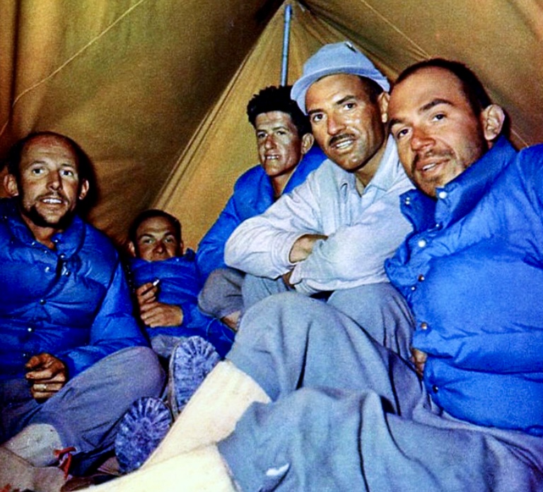
Descending in cruel conditions
On June 4, in worsening weather, the four climbers set out to descend to Camp 4 at 7,150m. It was a whiteout, with heavy snow and almost zero visibility. Rebuffat and Terray had removed their glacier goggles the previous day while searching for the route, and both were snowblind.
The situation was critical. Two blind men were guiding two weak, injured climbers. Rebuffat relied on his instincts and memory of the route to help navigate, but the party struggled to locate Camp 4, missing it in the fog and snow. Exhausted, the four climbers had to bivouac in a crevasse for the night.
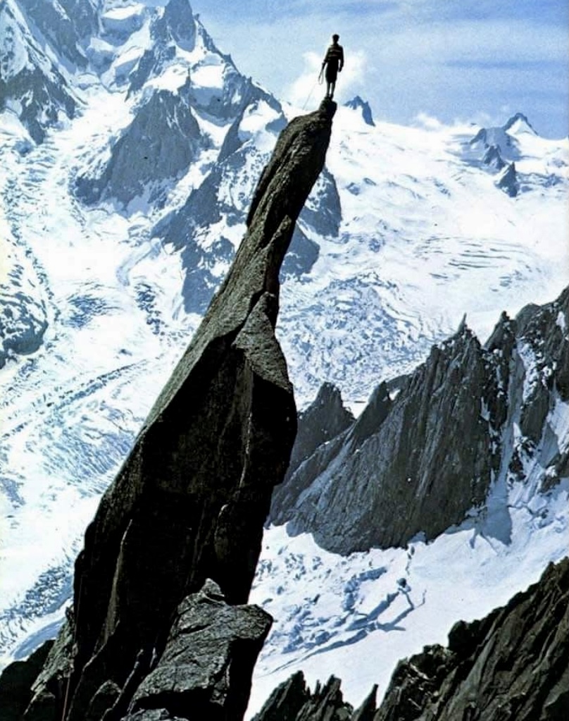
At dawn, on June 5, an avalanche poured into the crevasse, burying their boots and equipment. Rebuffat and Terray, still snowblind, dug frantically to recover their gear. Rebuffat was determined to keep the group moving.
Later that morning, teammate Marcel Schatz ascended from Camp 4 to search for them. Thankfully, he spotted the group and guided them to safety.
Rebuffat’s resilience
At Camp 4, Rebuffat was suffering early frostbite and snow blindness but coordinated the Sherpas' evacuation of his companions.
On June 5, during their descent to Camp 2, Rebuffat helped rescue Herzog and two Sherpas from an avalanche. By the afternoon, the team reached Camp 2. Finally, everyone reached base camp alive, though Herzog and Lachenal lost some digits.
Rebuffat died from cancer on May 31, 1985, in Bobigny, France at age 64. Rebuffat’s tombstone in Chamonix’s old cemetery bears a quote from his book Les Horizons Gagnes:
"The mountaineer is a man who leads his body to where, one day, his eyes have looked."
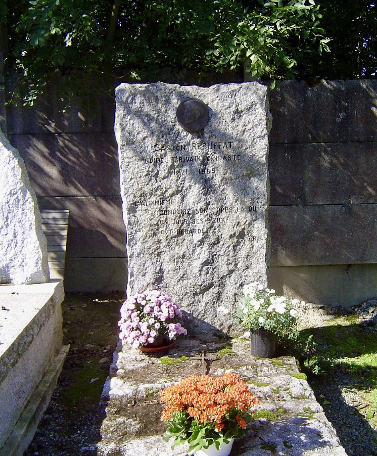
Legacy
Rebuffat wrote over 20 books on mountaineering, including Starlight and Storm: The Ascent of the Six Great North Faces of the Alps, Mont Blanc to Everest, On Ice and Snow and Rock, The Mont Blanc Massif: The 100 Finest Routes, Men and the Matterhorn, and Between Heaven and Earth. He also edited a mountaineering column for Le Monde.
Rebuffat also produced numerous films, including: Flammes des Pierres, Etoiles et Tempetes (which won the Grand Prize at the Trento Film Festival), Entre Terre et Ciel, and Les Horizons Gagnes.
Rebuffat’s commitment to share the beauty of the mountains continues to resonate with climbers and adventurers. His routes in the Mont Blanc massif are still climbed, and his books remain classics.
You can watch the film Etoiles et Tempetes (in French) below:
Lenin Peak, a towering giant in the Pamirs, has attracted climbers for decades. We examine its first ascents (one from the south and one from the north) as well as two expeditions that ended in tragedy, including the deadliest-ever mountaineering disaster.
Lenin Peak
Lenin Peak (7,134m) is located on the border between Kyrgyzstan and Tajikistan in the Pamir Mountains. Its northern slopes are in Kyrgyzstan’s Alai Province, and its southern slopes are in Tajikistan’s Gorno-Badakhshan region. The summit lies on the border, making it a shared peak between the two countries.
It is the highest peak in the Trans-Alay Range, and the second highest in both Kyrgyzstan and Tajikistan, surpassed only by 7,495m Ismoil Somoni Peak in Tajikistan and 7,439m Jengish Chokusu in Kyrgyzstan.
Lenin Peak is one of five 7,000m peaks in the former USSR. Climbers must summit all five to achieve the prestigious Snow Leopard Award. Decades after the fall of the Soviet Union, climbers still pursue the Snow Leopard challenge.
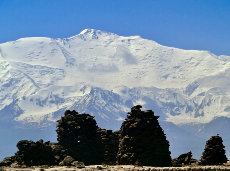
A peak with many names
In 1871, the peak was named Mount Kaufman after Konstantin Kaufman, the first Governor-General of Russian Turkestan. In 1928, it was unsurprisingly renamed Lenin Peak.
The current official name differs between Kyrgyzstan and Tajikistan. In Kyrgyzstan, it is called Lenin Chokusu (Lenin Peak), while in Tajikistan, it is Qullai Abuali Ibni Sino (Ibn Sina Peak or Avicenna Peak). Tajikistan renamed the mountain in 2006 after the Persian scholar Abu Ali ibn Sina.
Local Kyrgyz names include Jel-Aidar (Wind’s God) and Achyk-Tash (Open Rock).
We’ll call the mountain Lenin Peak, as it bore this name for three of the four expeditions we cover in this article.
Renowned as one of the most accessible 7,000’ers, hundreds of climbers visit Lenin Peak annually. Most climb the classic north face route, approaching from Osh in Kyrgyzstan. However, the mountain’s reputation as the easiest 7,000m peak is misleading because of its high altitude, unpredictable weather, and avalanche risk.
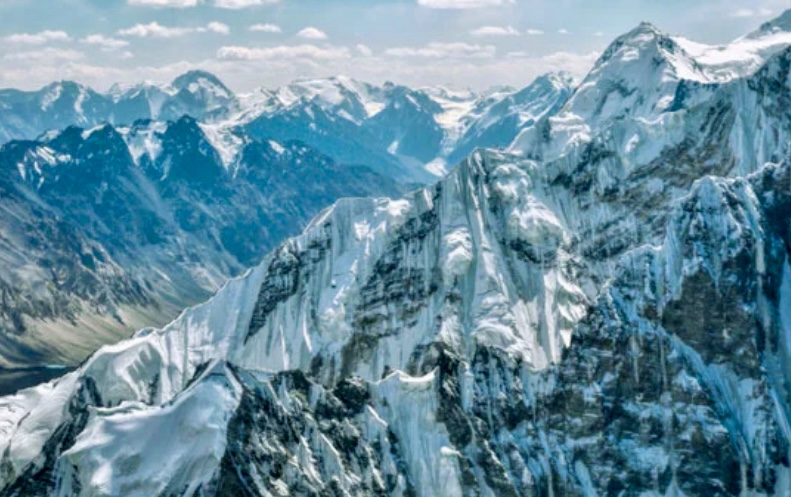
The first ascent
In September 1928, a Soviet-German expedition targeted Lenin Peak. The team included German climbers Eugen Allwein and Karl Wien, and Austrian Erwin Schneider, supported by Soviet climbers and porters. The expedition was a joint effort to map the Pamirs.
They approached from the south side, starting in the Saukdara River Valley, continuing up the south slope of the Trans-Alay Range, and then ascending via the Greater Saukdara Glacier. Their route wound from Krylenko Pass (a saddle that connects the Greater Saukdara Glacier to the upper slopes of Lenin Peak at 5,820m) to the northeast ridge toward the summit.
The three climbers faced brutal conditions with rudimentary gear: canvas jackets, wool layers, and leather boots with nail soles. High winds and subzero temperatures tested their endurance. On September 25 at 3:30 pm, Allwein, Wien, and Schneider reached the summit.
During the descent, the climbers suffered severe frostbite that required medical care in Osh. They left no summit proof on top, leading some to question their success. Despite some skepticism, authorities accepted their ascent, marking a historic first. The team also set a new mountaineering altitude record, surpassing that set by Alexander Kellas on 7,128m Pauhunri in 1911.
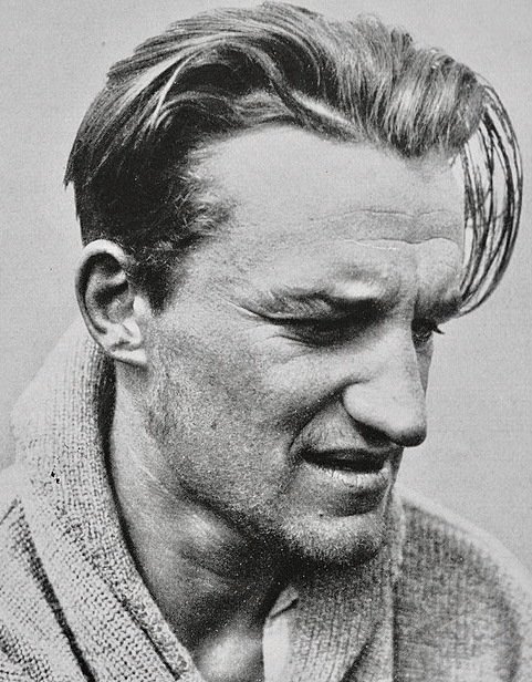
The first ascent from the north
In 1934, Soviet climbers tried from the northern side. The expedition, backed by the Red Army, included siblings Vitaly and Yevgeny Abalakov, Kasian Chernuha, and Ivan Lukin.
They started from Achik-Tash Canyon, ascending to Lenin Glacier’s western ice slope on the north face. They reached the crest of the northeast ridge at approximately 6,500m and continued along the ridge to the summit. En route, they established camps at 5,700m, 6,500m, and 7,000m.
On September 8 at 4:20 pm, Chernuha, Vitaly Abalakov, and Lukin summited after a four-day climb. Abalakov placed a bust of Vladimir Lenin on the summit.
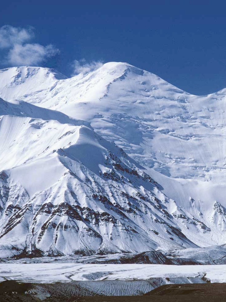
The 1974 tragedy
In 1974, Lenin Peak hosted an international mountaineering camp, attracting nearly 200 climbers.
A Soviet all-female team led by Elvira Shatayeva planned a traverse, ascending via the Lipkin Ridge on the north face, and descending the Razdelnaya Route on Lenin Peak's northern side.
The women topped out on August 7, despite warnings from base camp of an approaching storm. The storm, the worst in 25 years, caught them below the summit. The wind exceeded 100kph, shredded the party’s thin cotton tents, and exposed Shatayeva's team to temperatures below -20C°. They didn't want to abandon each other, and all eight stayed together until their last breath.
Shatayeva maintained radio contact with base camp, reporting dwindling supplies and frostbite. American climber John Roskelley and some nearby Japanese alpinists attempted a rescue but were repelled by the blizzard. Over two days, the women succumbed to hypothermia and exhaustion.
Shatayeva’s last radio message was: "I'm alone now, with just a few minutes left to live. See you in eternity."
All eight women perished, and climbers later found their bodies scattered along the summit ridge. The disaster, caused by inadequate gear and the ferocity of the storm, shocked the mountaineering community.
The deadliest mountaineering tragedy
In the summer of 1990, 45 climbers, primarily from the Leningrad Mountaineering Club, were at Camp 2 (5,300m) on what is now called the Razdelnaya Route on Peak Lenin's north face. The party included Soviet climbers Leonid Troshchinenko, Vladimir Voronin, and Alexei Koren (among others), six mountaineers from the former Czechoslovakia (including Miroslav Brozman), four Israelis, two Swiss climbers, and one Spaniard.
On July 13 at 9:30 pm, a 6.4-magnitude earthquake (with its epicenter in Afghanistan’s Hindu Kush) shook the Pamirs. It dislodged a serac from nearby Chapaev Peak, triggering a massive avalanche. Snow and ice hit Camp 2 on Lenin Peak, burying the climbers in seconds, and killing 43 people from five nations.
Koren and Brozman, who were positioned at the camp’s edge, survived with a broken arm and leg, respectively. They heard the trapped climbers’ cries as the debris froze into the glacial ice.
According to Charles Huss's report for the American Alpine Journal, a few other climbers were lucky to survive. Vladimir Balyberdin had decided at the last minute to move to Camp 3 with some friends, and six English climbers escaped because they had established their bivouac some distance from the main camp.
Rescue efforts
Soviet helicopters searched for the avalanche victims but initially could only recover one body. In 2004, because of glacial melt, human remains surfaced at 4,200m, with more emerging in 2008.
A plaque near the Achik-Tash base camp commemorates the victims of the 1990 disaster. It remains the deadliest single mountaineering accident in history.
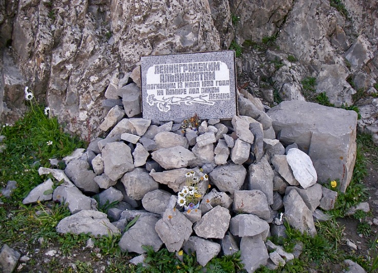
In 1978, American mountaineer Johnny Waterman completed the first solo ascent and traverse of Mount Hunter’s twin summits in Alaska. His grueling 145-day odyssey redefined the limits of solo mountaineering, showcasing incredible endurance and skill. We examine the climb, its significance, and Waterman’s legacy.
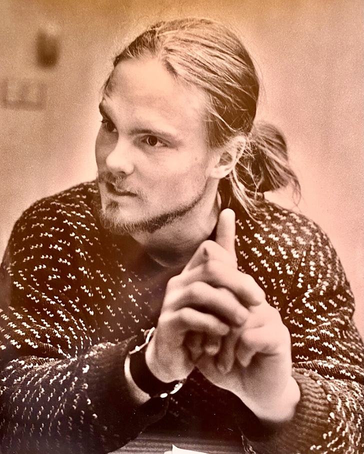
Johnny Waterman
John Mallon Waterman, better known as Johnny Waterman, was born in 1952. He grew up climbing with his father, Guy Waterman (a mountaineer and conservationist who also wrote several books about the outdoors), and his older brother Bill.
When Johnny Waterman was still in his teens, he began backpacking and rock climbing in New York and New England. He led a 5.10 route (Retribution) in the Shawangunk Mountains in New York State at 15. At 16, he climbed McKinley’s West Buttress with the Appalachian Mountain Club.
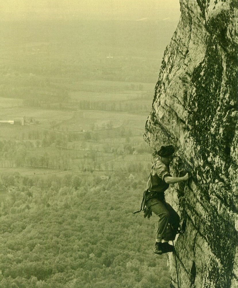
According to Bradley Snyder for the American Alpine Journal, Waterman was years ahead of mainstream mountaineering: "John might have coasted through mountains on sheer natural ability, but he took the craft of climbing seriously, and trained himself to be a fast, safe, consistent climber on any terrain."
Notable climbs
After high school, Waterman made trips to England, Scotland, Canada, the Alps, and Turkey, and carried out several remarkable ascents. In Canada, he made the second ascent of Snowpatch Spire’s South Face.
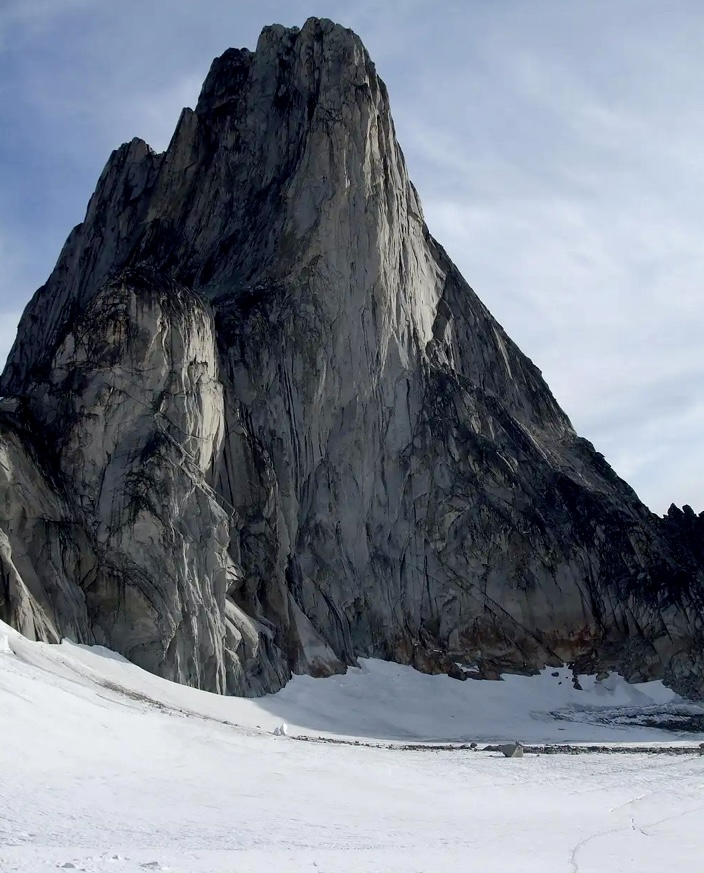
Waterman made the first solo ascent of the committing VMC Direct route on 1,244m Cannon Mountain in New Hampshire, a mind-blowing feat.
He ascended The Nose of El Capitan, soloed the Grand Teton’s North Face, and carried out the first south-to-north traverse of the Howser Towers.
He made the first ascent of Mount McDonald’s North Face and the first ascent of the East Ridge of Mount Huntington. On Mount Robson, he made the third ascent of the North Face.
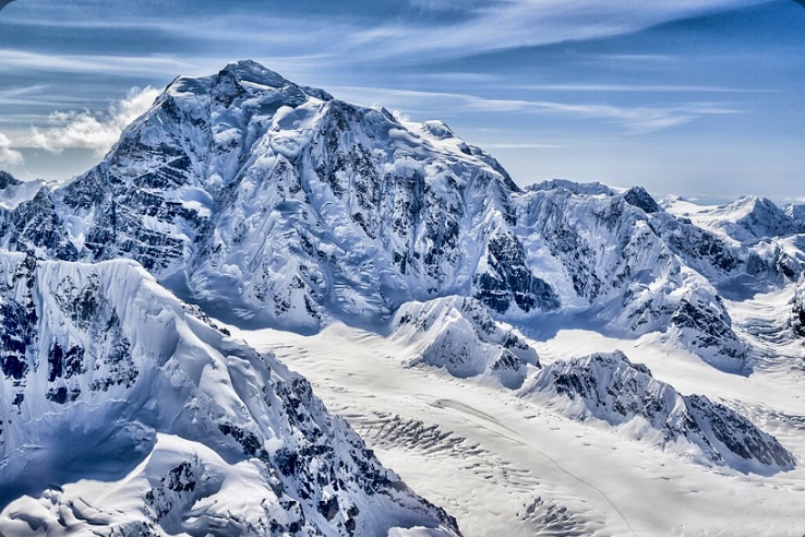
Mount Hunter
Mount Hunter (also called Begguya) is 13km south of Mount McKinley, in the Alaska Range within Denali National Park.
Begguya means child, or Denali’s child, in the local Dena’ina Athabascan language. It is famous for its technical difficulty, steep faces, and remoteness. Elite alpinists are drawn to its challenging routes, extreme weather, and beauty.
Mount Hunter has two summits: the North Summit at 4,442m and the South Summit at 4,255m. A high plateau connects the two summits, making the traverse an unusual challenge. Its climbing history features several bold ascents, technical innovation, and few summits, especially compared with McKinley.
Fred Beckey, Heinrich Harrer, and Henry Meybohm made the first ascent of Mount Hunter in 1954 via the west ridge from the Kahiltna Glacier. They topped out on the North Summit on July 3. Their multi-day route passed over crevassed glaciers, steep snow slopes, and a corniced ridge.
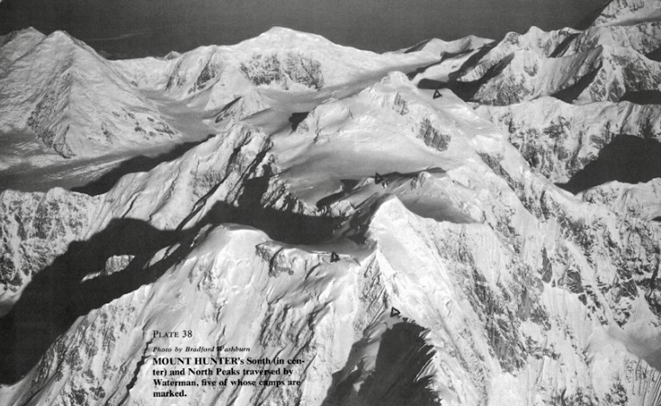
A bold attempt on Mount Hunter in 1973
In May 1973, Waterman and partners Dean Rau, Don Black, and Dave Carman attempted the first ascent of the south face-south ridge route of Mount Hunter. Waterman, then 21 years old, aimed for the 4,257m South Summit.
On May 29, Black, Waterman, and Carman were 61m below the South Summit when they mistakenly halted at a gendarme because of an approaching storm and confusion with the North Summit. (Rau had stopped lower down.)
Their route from the south col (3,200m) comprised three demanding sections: a complex lower rock ridge requiring 914m of rope and 40 anchors; a steep middle mixed face with ice-filled cracks; and an upper snow-ice ridge with unstable ice and minimal belays.
A storm trapped the climbers in a snow cave for days, with high winds and almost zero visibility. The climbers were running out of food, and Waterman had frostbite. The exhausted trio retreated from below the South Summit. Despite the failure, Waterman decided to return one day to solo Mount Hunter.
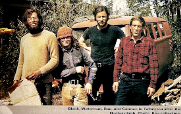
After 1973, Waterman moved to Fairbanks, Alaska. He preferred solo climbing because he struggled to find equally skilled partners, and possibly because of a tragic event in 1973. Johnny’s beloved brother, Bill, who had lost his leg in a railroad accident in 1969, disappeared in Alaska in 1973. Bill was only 22 years old.
After this, Waterman became more isolated and increasingly climbed solo.
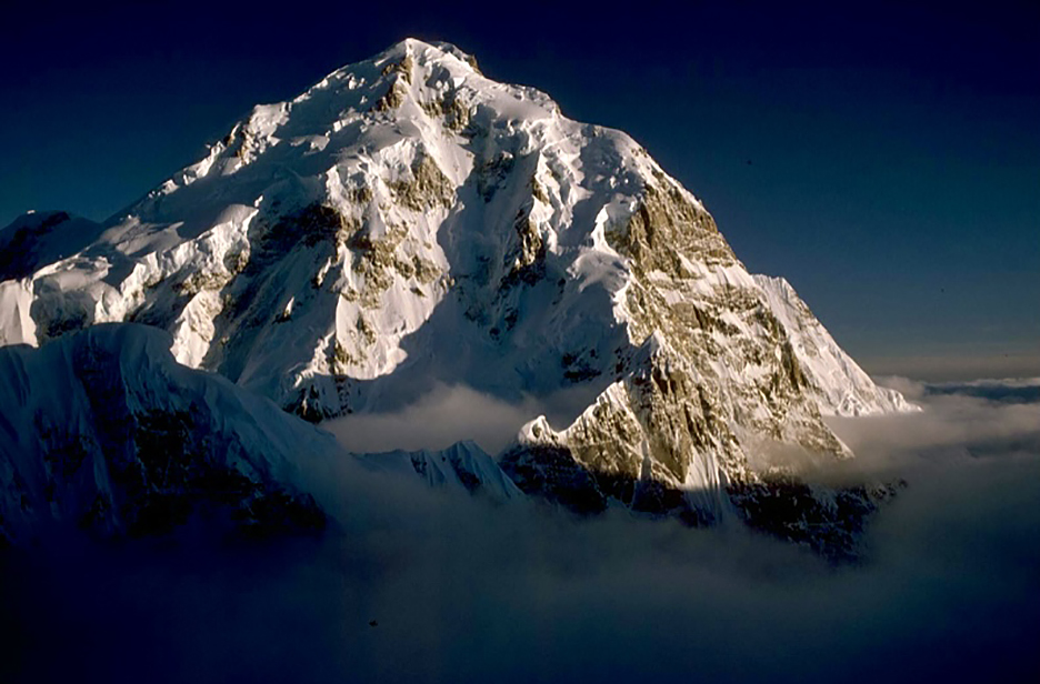
Mount Hunter solo traverse, 1978
Waterman returned to Mount Hunter alone in the spring of 1978.
"My vendetta with Mount Hunter started in the late 1960s, with Bradford Washburn’s pictures in the American Alpine Journal," Waterman wrote in his climbing report for the AAJ.
Driven by a decade-long obsession, Waterman began a solo south-to-north traverse. Starting on March 24 from the Tokositna Glacier’s cirque at 2,438m, he aimed to climb the 1,433m Central Buttress of the south face (referred to as the southeast spur in mountaineering literature), then traverse the summit plateau and descend the north spur.
He had 1,097m of rope and more than 350kg of gear, including food calculated to provide 5,000 calories a day.
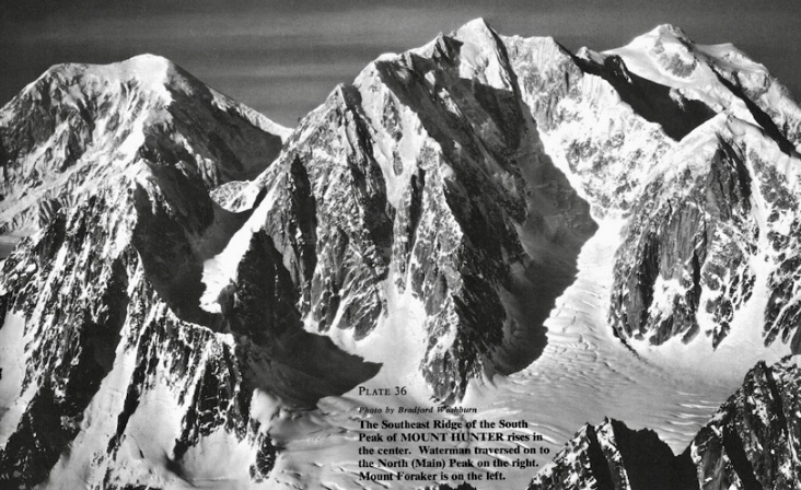
The climb
Waterman adopted an expedition-style approach, shuttling his 272kg base camp up each section, reusing rope to cover a route requiring 3,658m. The ascent involved 12 camps and 12 round trips per section.
The Central Buttress was mostly snow and ice, with rock steps and a 107m rock cliff. Section one included a 366m gully, and section two tackled a 152m technical crux, including a 24m pinnacle and a 90m gully. On April 11, day 18, he reached Camp 3.
Next came a 488m corniced arete, featuring a 30m headwall and ice pinnacle, which he finished on May 6. The next section wasn’t easy, either. He climbed steep terrain, joining the south ridge at 3,871m on May 26.
During the climb, Waterman suffered frostbite, lost a contact lens, and had a lice infestation. He dealt with fraying ropes, cornice collapses, and food shortages, dropping to two-thirds rations by June. A resupply on June 20 (day 88) provided 36 days of food.
By June 12, he reached the summit plateau after navigating a 213m ice arete. He topped out on the South Summit on July 2 after 101 days. After traversing the two summits, he reached the North Summit on July 26.
He descended by the north spur, arriving at his fly-out site 43 days later. His solo expedition took an astonishing 145 days. According to his report, Waterman used 40 ice pitons, pickets, and flukes, and 20 rock anchors.
His new route was the first solo ascent and the first solo traverse of the peak. He endured loneliness, rage, and frustration, but persevered, managing limited food supplies to complete his climb.
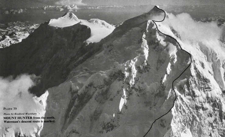
After the climb, Waterman’s mental health deteriorated. He displayed obsessive and delusional behavior. His past climbing feats convinced him he was invincible.
Disappearance
In the spring of 1981, Waterman targeted McKinley solo via the East Buttress. He planned to climb up the northwest fork of the Ruth Glacier, a route prone to crevasses and avalanches. Waterman began on April 1, carrying minimal supplies. He was last seen on April 19 at 3,350m.
Helicopters and ground rescue teams found only some tracks and an abandoned campsite. He might have suffered a fatal crevasse fall, died in an avalanche, or, with minimal gear, perished of exposure. Waterman was 29 years old when he disappeared.
Aftermath
Waterman’s father, Guy Waterman, committed suicide in February 2000, intentionally freezing to death on Mount Lafayette in New Hampshire. Laura Waterman, Guy Waterman’s wife (and Johnny Waterman’s stepmother), created The Waterman Fund after his death. The fund promotes wilderness preservation through education, trail maintenance, and research. The present an annual Guy Waterman Alpine Steward Award, honoring those dedicated to protecting the region’s mountain wilderness.
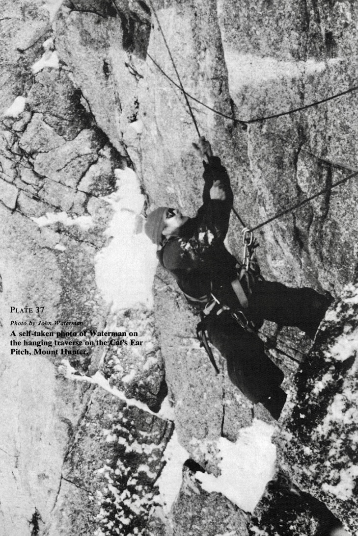
A pirate capture, a daring escape, a deserted island -- it all seems like material from an old swashbuckling movie, probably with Errol Flynn. But in 1722, a young fisherman named Philip Ashton found himself in just such a narrative.
He was thrown into captivity in a pirate ship, which brought him halfway around the world before he managed to escape -- getting away only to spend 16 months as a castaway on a small Caribbean island. His desperate fight for freedom and survival is not well known today, although it became the subject of a famous writer's adventure novel.
Captured by pirates
Born Aug. 12, 1702, Philip Ashton was only 19 years old in the summer of 1722. But as a Cape Cod man from Marblehead, Massachusetts, he had been at sea all his life. He was captaining the Milton, a small schooner. His crew included childhood friend Joseph Libbey.
On their way to the fishing grounds off Cape Sable, the Milton anchored in Port Roseway with a dozen other small fishing vessels. At first, none spared a second thought to the larger brigantine -- a two-masted sailing ship -- anchored alongside them.
When a boat with four men launched from the brigantine, it didn't worry Philip and his friends. They thought the vessel was a merchant, coming to trade news. It wasn't until the four men were aboard the Milton, drawing cutlasses and pistols, that their nature was revealed. Caught completely unawares, the Milton crew surrendered. The pirates took another dozen small fishing vessels the same way.
When Philip and the other captives were brought aboard the brigantine, they received a second shock: They hadn't been taken by just any pirate. Their lives were now in the hands of the infamous Ned Low.

Captain Ned Low
Edward Low was born in Westminster and went to sea as a child. As a young man, he settled in Boston and worked producing rigging for sailing ships. He married and had a child, but after the sudden death of his wife, a devastated Low fled to the sea.
He initially joined the British merchant marine, but in 1721 he led a mutiny. Taking over the ship and shooting the captain, he and the crew turned pirate. By Philip's capture, Low's ship had almost 50 men and six powerful cannons.
Low also acquired a reputation for brutality. Contemporary sources reported that he regularly mutilated and tortured his captives. At this time, pirate crews signed "articles," basically a contract of employment, outlining the shipboard roles and rules.
Some other captains, such as John Philips and Thomas Anstis, had clearly outlined punishments for crimes such as mistreatment of prisoners, rape, or striking a fellow sailor. Low's articles are unconcerned with these crimes, but do specify that the punishment for desertion was death.
One particularly brutal incident took place after the capture of the Portuguese ship, Nostra Signora de Victoria. Unable to find the expected treasure, Low tortured several prisoners. They admitted that during the preceding chase, the captain had thrown £15,000 worth of gold over the side. Incensed, Low cut off the captain's lips, boiled them, and forced him to eat them. Then he had every captive killed.
Though these accounts were published during Low's life, they were highly sensationalized. Modern scholars don't think Low was necessarily any more brutal than his contemporaries. Low also had his code of honor, as Philip was about to discover.
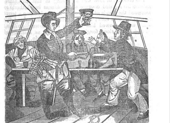
Pressed and oppressed
For much of maritime history, a significant number of every ship's crew were "pressed" men. These were merchant sailors, fishermen, and others who were captured from shore or abducted from other ships and forced to work as paid slaves. Pirates did this, but so did the British Royal Navy, and other European and American navies.
As they hauled him aboard, Philip was determined not to join the pirates. The pirates selected a half-dozen young men who looked healthy and strong. In addition to Philip Ashton, the select included his friends Nicholas Merritt and Joseph Libbey.
Pistol in hand, Low faced them on deck and asked a surprising question: Were any of them married? Surprised, and frightened by the gun he was brandishing, they said no, they were not. This, Philip later learned, was a firm rule Low held. Haunted by his own loss and the child he left in Boston, he wouldn't take away a married man.
Unfortunately, none of them were husbands. Low demanded that they sign his articles, and they refused. Then he threatened. Then he promised riches and drink. Philip and his friend Nicholas Merritt remained firm. Irritated, Low added them all to the books anyway, and the fleet set sail, carrying Philip away from family and freedom.
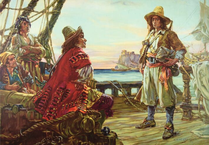
Life with the pirates
Philip did not have the temperament for piracy, and his unwillingness to cooperate only worsened things. The rough, noisy, and drunken men shocked his moral sensibilities, so he spent much of his time hiding in the hold.
Per Low's articles, they couldn't kill a man once they had given him quarter. But Philip didn't learn that for some time, and was constantly terrified that he'd be executed. When the pirates remembered he existed, or got bored, they'd rustle him out of his latest hidey-hole and demand he join them, beating him when he refused. His particular tormentor was the quartermaster, John Russell, a notorious pirate in his own right who chased Philip about the ship with a cutlass on multiple occasions.
Off the coast of Maryland, Low's crew captured the Portuguese ship Rose-Frigate. Taking a liking to the larger, better-armed vessel, Low renamed her the Rose Pink. He moved the bulk of his crew, including Philip, into the Pink, which sported a very respectable 14 guns.
They captured a sloop off the Cape Verde islands, and Philip's friend Nicholas Merritt was one of the eight men chosen to crew her. However, they were mostly pressed men, so the crew slipped away from the rest of Low's fleet.
While Merritt quietly escaped, Low went to the West Indies, where he promptly sunk the Rose Pink due to mishandling during routine repairs. Philip was cast into the water, and two boats of pirates passed by him without allowing him aboard. He was finally saved by his friend Joseph Libbey, who had integrated into the pirate crew but remained close to Philip. Another close escape.
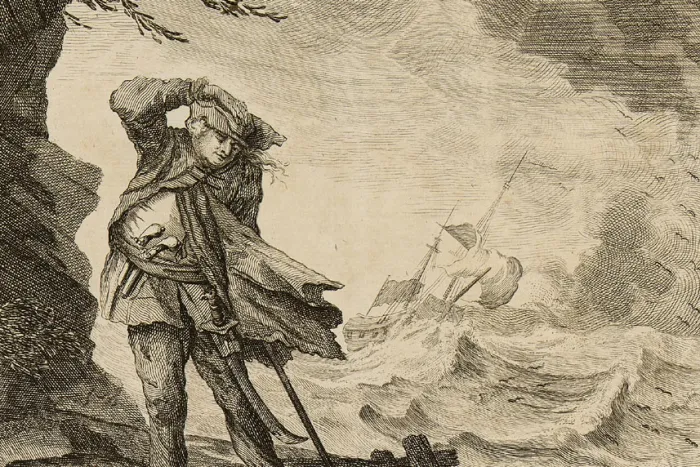
Out of the frying pan...
Loading everyone into the surviving sloop, Low, under false colors (deceptively flying an incorrect flag) sidled casually into the French-controlled harbor of Grand Grenada. He claimed to be an innocent merchant vessel in distress. The concerned French loaded up a ship and came up beside him, trying to determine if he was a smuggler. When Low gave the signal, 90 pirates burst out. They took over both ships, sailing them off.
Low captured more ships and took to calling himself Commodore. With every move, they dragged Philip along. The more Philip pleaded to go home and refused to join, the more Low swore that Philip would only go home when he did, and not before.
But more ships meant more maintenance, and soon Low had to anchor in the Gulf of Honduras, between Honduras and Belize. Low and his friends settled onto the island of Port Royal Key to drink and carouse. Low sent the rest of the crew to the nearby island of Roatán to clean and resupply the ships.
There, Philip saw his chance. The ship's cooper was preparing to go ashore and refill the water casks. He needed several men to help him, and Philip begged to be one of them. Thinking he wouldn't attempt to flee onto so deserted and remote an island, the cooper agreed.
Once on shore, Philip said he was going to go gather coconuts. Instead, he fled into the jungle. His practice of hiding in the hold came in handy. Philip burrowed into a dense thicket and lay still and silent. After some yelling, the cooper realized Philip wasn't coming back. Deciding that searching would be a waste of everyone's time, he left.
...Into the fire
Philip was free of the pirates. He was also alone with no food or supplies, on a remote and uninhabited island. He had already been away from home for nine months. Without even shoes, let alone hunting and fishing gear, he had limited options. But Philip determined to make the best of it and began exploring his new home.
Roatán island is a long, thin landmass, 64 kilometers long but only eight kilometers across at its widest. For hundreds of years, it was home to the Indigenous Pech people. In 1502, Christopher Columbus landed on the island, enslaving many of its inhabitants and forcing others into mining camps on the mainland. By the time Philip arrived, it was uninhabited. However, on the beach, he found broken pottery, which showed the Pech had once lived there.
The Spanish, too, had abandoned Roatán, leaving the battered remains of old fortifications. Along with Philip, the island was home to a diverse array of animal life—wild hogs, deer, seabirds, and tortoises. But without any tools to trap or butcher them, Philip could only eat the fruit that grew on the island.
He made a small hut out of palmetto leaves, but mosquitoes, venomous snakes, and stinging gnats continually harassed him. As the days passed, Philip grew weak and hopeless. He spent more and more time slumped on the beach, looking out at the water, wishing for a rescue that didn't come.
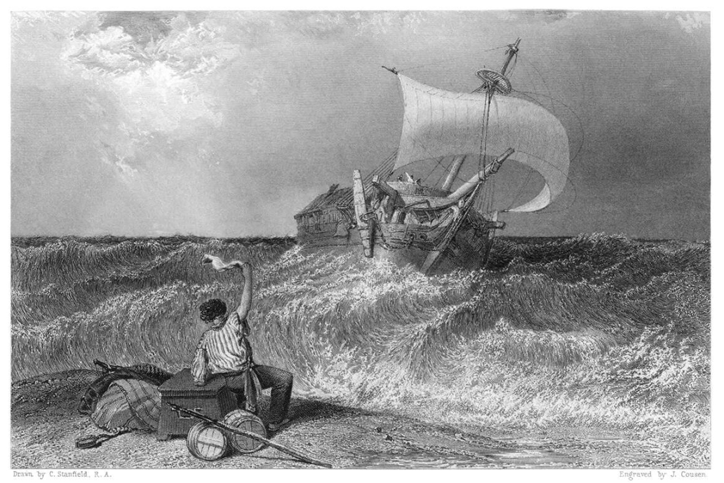
The fate of Joseph Libbey
A pirate's career rarely lasted more than a few years. In June of 1723, a British Navy warship caught up with Low. The HMS Greyhound, captained by Peter Solgard, had twenty guns and 120 men. On the other side, the pirates had two smaller ships, the 10-gun schooner Fancy, captained by Low, and the small sloop Ranger, under his protege, Charles Harris.
Captain Solgard used Low's own tactics against him, pretending to be a helpless whaler. Low, lured in by the thought of all that expensive whale oil, gave chase. When he came alongside, the Greyhound ran the Union Jack up the mast and opened fire.
Both Harris and Low decided to cut their losses and flee, but only Low, in a battered and demasted Fancy, managed to escape. Solgard took the Ranger and its crew into custody. Captain Solgard won fame and fortune from this victory, eventually rising to the rank of admiral.
Twenty-five captured men were sent to trial in Newport, Rhode Island. Among them was 21-year-old Joseph Libbey. Libbey may have been pressed into service, but he could still be prosecuted for his involvement.
Doctor Kencate, the Ranger's surgeon, testified against Libbey, claiming he'd been an "active man" on the crew. Libbey had, Kencate alleged, boarded and plundered ships and had fired his weapon during these raids. Another former crewmate had seen Libbey loot a pair of silk stockings from a vessel the pirates had taken.
Libbey protested that he was a pressed man, but to no avail. On July 19, he and 24 other men were hanged from the gallows on Gravelly Point. They were buried in a mass grave on the beach of Goat Island, in the unhallowed ground between the low and high-tide marks.
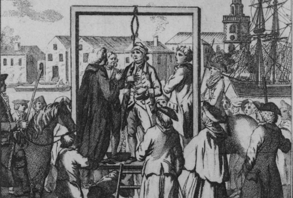
The English stranger
While Libbey was on trial, Philip Ashton was growing sick and weak in the jungle. He was always tired, and his whole body was sore and bruised. A number of nutritional deficiencies can come with a fruit and occasional scavenged egg diet. Lack of iron, calcium, and B vitamins likely made Philip weak, as did a lack of protein.
Still barefoot, his feet were covered in wounds, which made it painful and difficult to walk. After nine months on Roatán, Philip believed he was near death. Worse, the rainy season had begun, drenching and chilling him to the bone. Between storms, he baked in the tropical sun.
Then one day in November, Philip saw a canoe on the water. In it was a man, very startled to see a haggard Philip slumped on the beach. The stranger was a grave Englishman who had been living in Spanish Honduran settlements for two decades. But, having committed a crime he never specified, he had fled with his dog to Roatán Island, to wait for the heat to die down.
He was kind to Philip and took on the responsibility of hunting for them both. He said very little about himself, not even his name. Three days after arriving, he left again, saying he was going to hunt on another island. A storm blew in, and he never returned. Lost at sea or gone back to the Spaniards, Philip didn't know. But he was once again alone.
Still, things were looking up. The stranger had left behind the two tools Philip most needed: a flint to light fires, and a knife.
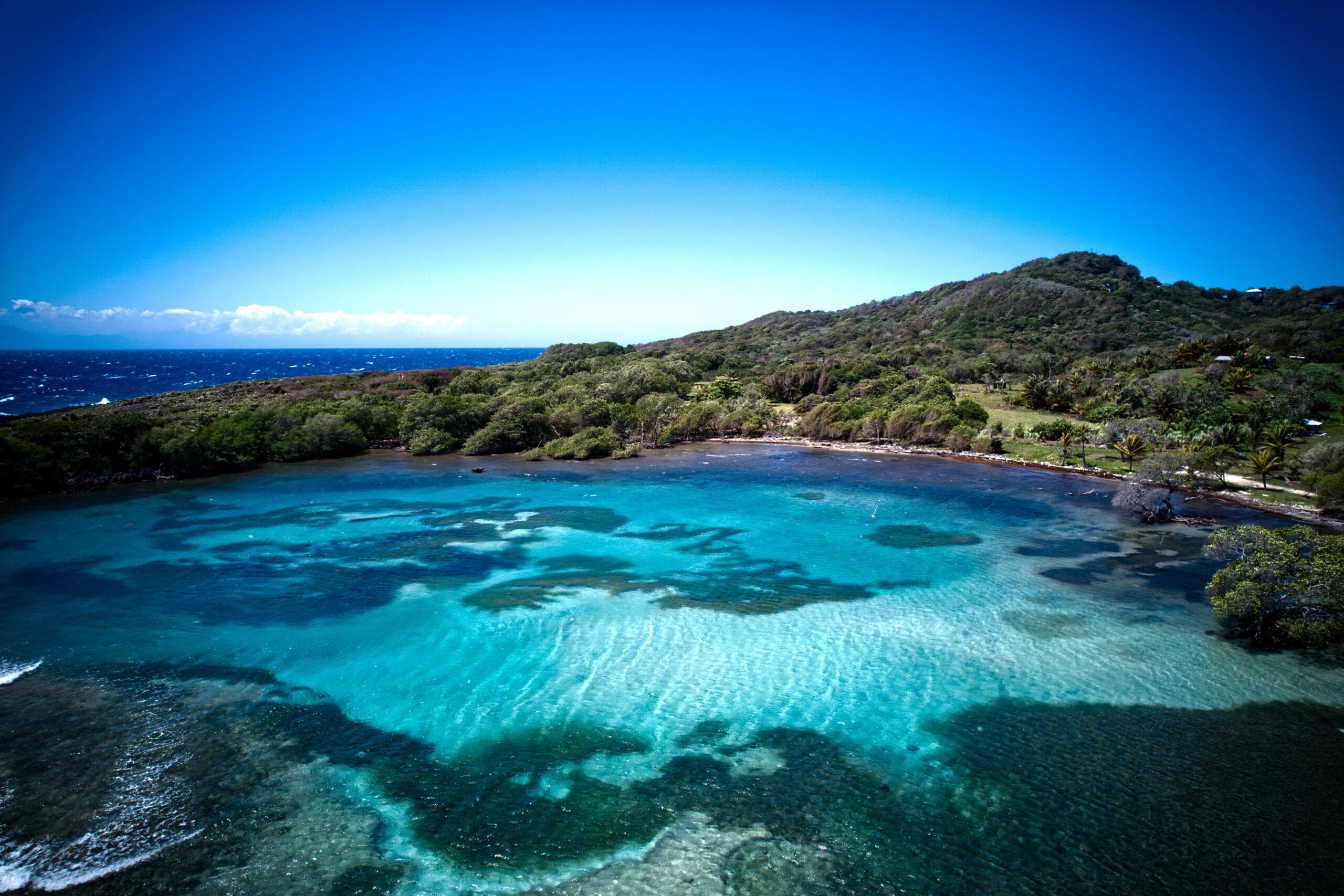
Castle Comfort
Better equipped, Philip's quality of life rapidly improved. He returned to exploring the island and found an old abandoned canoe. To his relief, it was not the canoe of the stranger, who was likely still alive somewhere. Now the lofty possessor of such wonders as a knife and old canoe, a cockier Philip began to call himself, as he later recounted, Admiral of the Neighboring Seas.
He got an unpleasant shock when the crew of a Spanish sloop had stopped by. Caught napping, Philip woke up to people shooting at him, which experts agree is one of the worst ways to wake up. He fled into the jungle, and they left.
In June of 1724, Roatán once again had visitors. A series of rowboats appeared on the horizon, bearing what Philip initially feared were pirates. Actually, they were 18 local baymen, English woodcutters, who had fled from Spaniards on the mainland. They also brought one Indigenous woman as a servant.
They settled in, giving Philip better clothes and building a house they called Castle Comfort. But Philip was wary -- the baymen were suspicious characters, half pirates themselves.
After four months of cohabitation, who should return to the island but, astoundingly, Captain Low's pirates. Philip and three men were away hunting on the nearby island of Bonacca when Captain Spriggs, Low's old lieutenant, landed in Roatán and attacked Castle Comfort. Philip and the three men with him fled in the canoe, and Philip once again hid in the dense jungle to avoid capture. The baymen who survived the attack took an old sloop the pirates had left behind and departed the islands.

Two years, ten months, and fifteen days
Philip and a man named John Symonds, as well as a black man enslaved by Symonds, elected to stay on the islands. Another few months passed. Finally, the season was approaching where Jamaican traders would stop by Bonacca to take on water, so the trio moved there to wait.
Only a week later, an entire fleet of English ships came over the horizon. It was a merchant convoy and its escort Diamond, a British Man-of-War. A brigantine approached the shore, and Philip, calling out that he was a friend, drew its attention. Onboard, his years of wretched luck continued to reverse. The commander of the brigantine was Captain Dove, an old Massachusetts acquaintance of Philip's.
Dove signed Philip onto his crew. It had been two years, 10 months, and 15 days since his capture, and he was finally heading home. On May 1, 1725, Philip Ashton returned to New England. The same night, he made it to his father's Marblehead house.
Philip returned to the sea, making a living as a fisherman, but managed to avoid further adventure. He married, was widowed, remarried, and had seven children. He was laid to rest in Old Burial Hill in his beloved Marblehead.
Philip Ashton's literary afterlife
Philip's story of perseverance and deliverance appealed to his pastor, a man named John Barnard. It was Barnard, through consultation with Philip, who wrote Ashton's Memorial, an account of Philip's adventures. Though intended as a demonstration of God's power to save, it became popular as an adventure story.
One of the readers was English writer Daniel Defoe. Today, he is most famous for Robinson Crusoe, but he authored many fictional and nonfictional accounts of piracy, shipwreck, and maritime adventure. His last novel, published in 1726, was The Four Years Voyages of Capt. George Roberts. It follows a man who is captured by Ned Low, then escapes and becomes a castaway. Many of the details are taken directly from Ashton's Memorial.
This adventure novel, based on Philip's story, is not one of Defoe's most famous works. But perhaps this suited Philip Ashton just fine. Despite his colorful escapades, he was at heart a humble fisherman who wanted no part in nautical adventures.
In this entry in our series on the climbing history of North American peaks, we examine Alaska's 4,996m Mount Blackburn and Dora Keen’s pioneering 1912 ascent.
Mount Blackburn is the highest peak in the Wrangell Mountains, within Wrangell-St. Elias National Park. It is also the fifth-highest peak in the United States.
It was named in 1885 after Senator Joseph Clay Stiles Blackburn, a supporter of the Alaska purchase. The local Athabascan people called it K’ats’i Tl’aadi.

Mount Blackburn has severe weather because of its proximity to the turbulent Gulf of Alaska. Storms, avalanches, dangerous crevasses, and serac falls are common. It experiences 2,310mm of annual rainfall and 1,930mm of snow. Permanent ice covers this ancient shield volcano.
The west face drops over 3,350m in less than 6.4km, while other faces descend 2,440-3,350m in under 12.8km, giving the mountain a notable prominence.
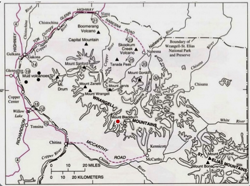
The mountain has two summits: the West Peak (4,996m), which is the true summit, and the East Peak (also called Kennedy Peak), which is about 60m lower. Authorities only discovered in the 1960s that the West Peak was higher. Previously, the East Peak was thought to be the highest point.
A vibrant era for women's mountaineering
Before detailing Dora Keen’s 1912 ascent, it’s important to put her climb in context. The era featured a vibrant women's mountaineering scene.
In 1912, American Fanny Bullock Workman reached 6,400m on the Siachen Glacier in the Himalaya, setting a new women’s altitude record while championing female suffrage. The same year, Gertrude Benham of the UK mapped remote regions in the Himalaya. Three years before, she had summited Kilimanjaro.
At 61, Annie Smith Peck of the U.S. followed her 1911 first ascent of Peru’s 6,377m Mount Coropuna with lectures and writing that inspired other women. Isabella Bird's Rocky Mountain ascents also gave women a role model.
Meanwhile, Lucy Walker had climbed the Matterhorn in 1871 and remained an important figure in the UK's Ladies Alpine Club, founded in 1907. In 1912, German-Polish Kathe Broske made the first traverses of the Vajolet Towers in the Dolomites.
Meanwhile, in 1911, American Dora Keen fixed her eyes on a difficult mountain in Alaska.
Dora Keen
Born on June 24, 1871, Dora Keen was the daughter of Emma Corinna Borden and renowned surgeon William Keen Jr., the first surgeon in the U.S. to remove a brain tumor successfully. Dora's mother died when she was a teenager.
Keen graduated in history from Bryn Mawr College in 1896. After graduation, she held civic positions in Philadelphia, including roles at the Society for the Prevention of Cruelty to Children, the American Society for Labor Legislation, and the Society for Organizing Charity. She advocated for compulsory education, free lunches, special education, and student healthcare, driving significant reforms.

Keen’s mountaineering career began in her late 30s. Between 1909 and 1910, she made several ascents in the European Alps, including the Matterhorn, Zinal Rothorn, Monte Rosa, Weisshorn, and Mont Blanc.
Next, Keen summited peaks in Ecuador, Norway, and Canada’s Selkirk Mountains. Writing for National Geographic in 1911, she explained that she pursued "wonderful views, vigorous exertion, relaxation, and inspiration."
All this alpine experience prepared her for a history-making challenge in Alaska.
Mount Blackburn, 1911
In 1911, inspired by a U.S. Geological Survey report, Keen decided to attempt Mount Blackburn. She led a small team that included four local gold miners (Charlie McGonagall, Pete Anderson, Billy Taylor, and Tom Lloyd) and a German adventurer.
Keen’s party approached the mountain from the southwest, following the Kennicott Glacier toward the base of the mountain.
The team reached 2,740m but turned around because of bad weather and low food supplies. Avalanches, impassable glaciers, and crevassed terrain made the route slow and difficult.
Despite this unsuccessful attempt, Keen remained determined to climb the peak. She meticulously started to plan a second expedition for the following year.
Round two, 1912
Her spring 1912 expedition included seven unnamed miners from the nearby Kennicott Copper Mine, prospector Bill Lang, and German-American adventurer George W. Handy. Sled dogs hauled the supplies.
After another 40km trek up the Kennicott Glacier to the base of Mount Blackburn at 1,676m, the party started to ascend the crevassed east face. The team endured a 13-day snowstorm and spent 22 nights in snow caves at 3,780m. There, the miners abandoned the attempt.
Keen, Handy, and Lang continued up, navigating icefalls and avoiding avalanches. After a final section that they climbed at night, they topped out on the 4,964m East Peak on May 19. They believed that this was the true summit.
It was a groundbreaking climb — the first recorded ascent of Mount Blackburn. Keen, 41, had led an all-male team in extreme conditions. Her leadership challenged the social expectations of the era, and the expedition's use of sled dogs to haul supplies was notable.
Keen’s was also the first documented female ascent of an Alaskan peak, according to the American Alpine Journal.
The second ascent that became the first
The second ascent, this time of the West Peak (the true summit), only came 46 years later, on May 30, 1958. Bruce Gilbert (U.S.), Hans Gmoser (from Canada with Austrian origin), Adolf Bitterlich (Austria), Dick Wahlstrom (U.S.), and Leon Blumer (U.S.) went via the northwest ridge.
At the time, the climbers reported it as the second ascent of Mount Blackburn. However, in the 1960s, the West Peak was confirmed as the true summit, making their 1958 climb the first ascent.
The northwest ridge route, approaching the mountain via the Nabesna Glacier, is now the most common route on the mountain. But Mount Blackburn is not often climbed. Only 50 parties have summited it.
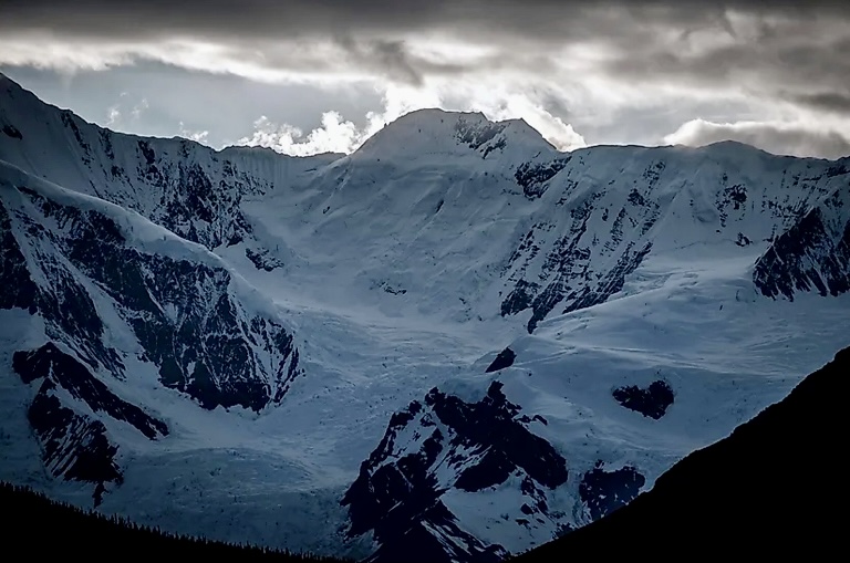
The second ascent of the East Peak
The East Peak had its second ascent in 1977. U.S. climbers Gerry Roach (leader), Barbara Roach, Dan McNerthney, Bill Krause, and Carrie Krause started on the southwest side and ascended via the southeast ridge. They then traversed over both summits (first the East Peak, then the West Peak) and descended the northwest ridge.
Climbers no longer use the 1912 Kennicott Glacier-East Face route because of its extreme hazards. Glacial retreat over the past decades has made this route more difficult than ever.
You can read more about climbing routes on Mount Blackburn here.
After Mount Blackburn
Keen and Handy married in the summer of 1916 and divorced 16 years later. After the divorce, Keen sold insurance products to fund her travels. In 1962, at 91, Keen embarked on a world tour that included a stop in Alaska. It was her first visit since 1916.
Keen died during her world tour, on Jan. 31, 1963, in Hong Kong.
Henry S. Hall Jr. wrote an excellent article, published in the American Alpine Journal in 1963, about Keen. It offers a glimpse of her character:
"My wife and I spent an hour with her last spring. She was alert, in full possession of her faculties, and looking forward to plans for the future which included travel, probably alone. She liked her independence. She was a remarkable little person, full of confidence and wanting no one to worry about her; she could manage quite well by herself."
Earlier this week, we examined the pioneering 1979 ascent of Everest’s West Ridge Direct route. In 1984, a team that included Bulgarian alpinist Hristo Prodanov completed the only repeat of this demanding route. Prodanov summited alone, without supplemental oxygen.
Prodanov’s climbing history
Born on Feb. 24, 1943, in Karlovo, Bulgaria, Prodanov was a metallurgical engineer whose true passion was mountaineering. Starting in 1958 in Bulgaria’s Pirin Mountains, he became one of his country’s greatest climbers.
Between 1967 and 1977, Prodanov made several important climbs in the Alps. In 1967, he ascended the North Face of the Grandes Jorasses via the Walker Spur and the Petit Dru by the Bonatti Pillar. In 1969, he did Mont Blanc’s Freney Pillar. He knocked off the North Face of the Matterhorn in 1974 and the Petit Dru by the Guides Route in 1977.
He also carried out several climbs in the Caucasus, including Ushba Pillar in 1970 and a traverse on Shkhelda in 1973.
In 1975, Prodanov began climbing 7,000'ers. That summer, he summited 7,134m Lenin Peak (now called Ibn Sina Peak) in the Pamirs, returning there in 1982 and 1983. In 1976, he climbed 7,492m Noshaq in the Hindu Kush. He successfully climbed 7,105m Korzhenevskaya Peak three times (in 1979, 1982, and 1983), and he also summited Communism Peak (now Ismail Samani) twice, in 1980 and 1983.
In April 1981, Prodanov became the first Bulgarian to summit an 8,000m peak when he did 8,516m Lhotse. Prodanov reached the summit alone and without supplemental oxygen.
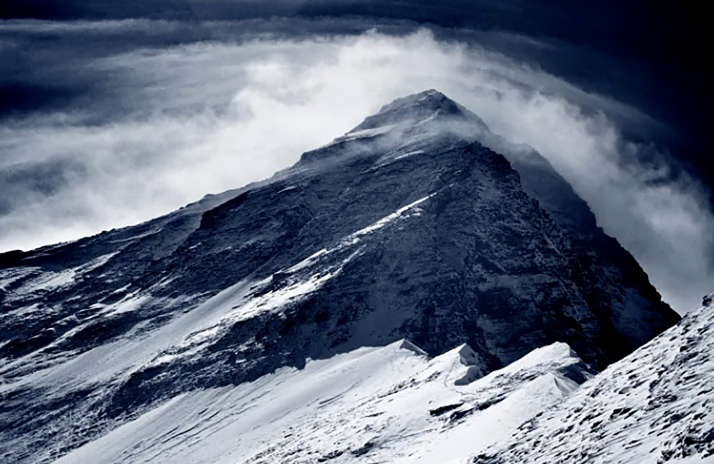
Everest, 1984
In the spring of 1984, a Bulgarian expedition led by Avram Iliev Avramov (with Prodanov as deputy leader) headed to Everest. The team established Base Camp on March 18. The group included 24 Bulgarians, Nepalese climbers Chowang Rinzi Sherpa, Ang Rita Sherpa, and Ang Zangbu Sherpa, plus other Sherpas to work as support staff above Base Camp. Avramov’s party chose the difficult West Ridge Direct route.
Five expeditions targeted Everest that spring: two on the Nepalese side and three from Tibet. On the Nepal side, Avramov's team shared the mountain with an Indian party led by Darshan Kumar Khullar. Khullar's team targeted the normal route (South Col-Southeast Ridge).
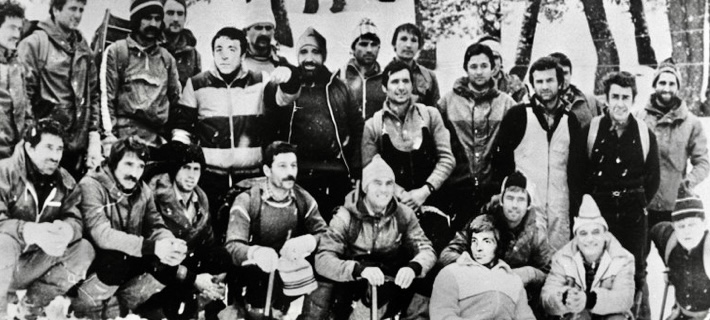
Good progress on the route
By March 21, the expedition had set up Camp 1 at Lho La (6,050m), with Ang Rita and Ang Zangbu assisting with gear transport. Six days later, the expedition established Camp 2 at 6,770m. There, they dug a snow cave large enough for 15 people.
On April 3, they set up Camp 3 at 7,170m. Again, they dug a snow cave, this time big enough for six climbers. On April 18, Prodanov and Chowang Rinzi established Camp 4 at 7,520m.
On April 19, Prodanov and Chowang Rinzi reached 8,120m and set up Camp 5. Meanwhile, Trifon Djambazov, Kostas Kanidis, and Dinio Tomov completed Camp 4 and stayed there overnight. Ang Rita and Ang Zangbu remained at the lower camps, managing supplies.
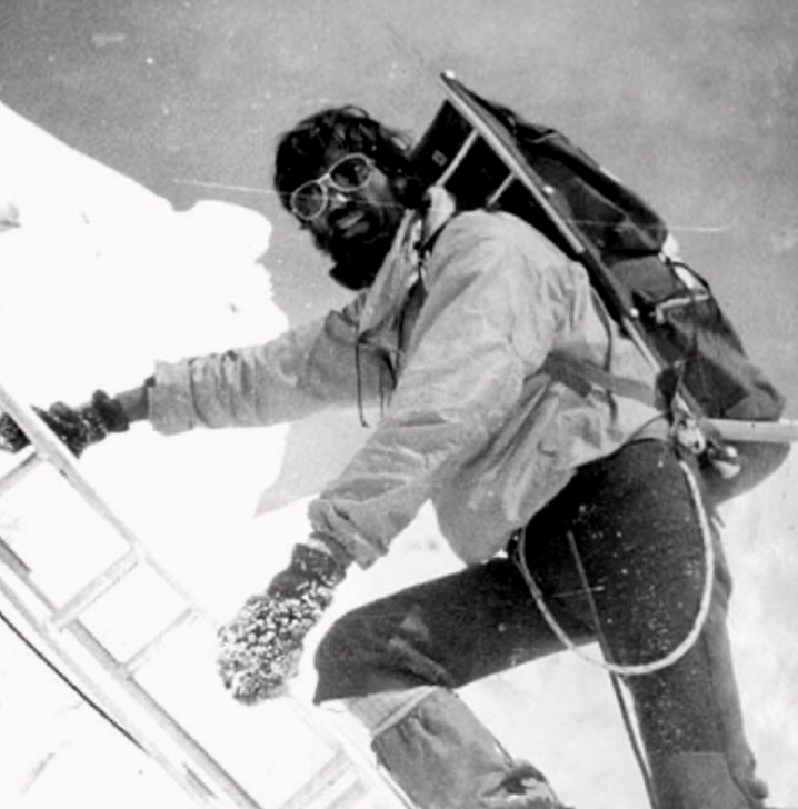
Summit push
On April 20, Prodanov and Chowang Rinzi left Camp 5 at 5:45 am in clear, cold weather, without supplemental oxygen. Mid-morning, Chowang Rinzi aborted his summit push because of the technical difficulty of the West Ridge and returned to Camp 4.
Prodanov continued the ascent alone. At 11:10 am, Prodanov radioed Base Camp from 8,550m, reporting steady progress on the West Ridge.
At 6:10 pm, he radioed Base Camp from the summit. He said that he found a pyramid of empty oxygen bottles left by Soviet climbers, alongside a Soviet flag. Prodanov tore off a fragment of the flag as a memento.
Prodanov spent 33 minutes on the summit and abandoned his 8mm camera there after removing the film. Then he started his descent via the West Ridge.
This was the first recorded ascent of Everest in April, and Prodanov also became the first Bulgarian to summit the highest peak in the world.
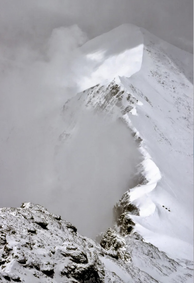
The descent
On April 20 at 9:10 pm, Prodanov radioed Base Camp again. He explained that he would bivouac because it was too dark.
The following day, Prodanov maintained voice contact with Base Camp until 5:30 pm. However, his voice was weak and almost unintelligible, suggesting extreme exhaustion. He relayed that he had lost his gloves and could not use his fingers. The oxygen-free climb was impacting his health.
At 7:45 pm, Prodanov turned on his walkie-talkie but was unable to speak. There was no further contact. Meanwhile, the weather worsened.
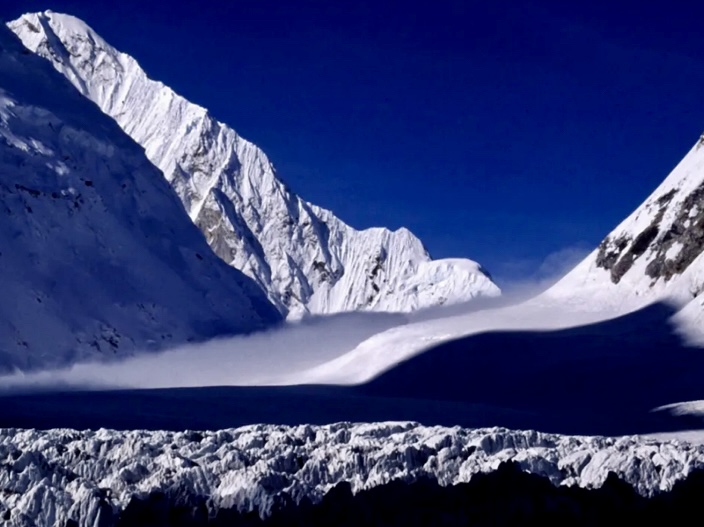
The rescue operation
A rescue operation started on April 21, when Prodanov was in trouble but still in contact. Lyudmil Yankov set out immediately and covered more than 1,000m in one push. He reached 8,500m extremely fast, arriving in the dark at 9:00 pm. He couldn't find any trace of Prodanov, who was possibly around 200m above him.
In bad weather, Yankov spent a sleepless night at 8,400m, in a dangerous spot with steep, loose rocks. During the night, he talked to Prodanov non-stop, trying to keep Prodanov awake: "Don’t fall asleep! You’re a great man, don’t sleep, you’re Bulgarian! People are running to you!"
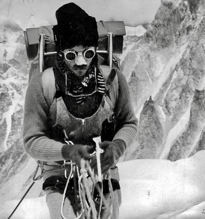
Yankov was finally ordered to descend in bad weather, with severe frostbite on four of his fingers.
According to a note in The Himalayan Database written by Prachanda Shrestha from the Tourism Ministry of Nepal, Prodanov seemed to know his time was up. While he was still able to speak, he said, "I see nobody to rescue me," aware that he was alone and that no one could assist him immediately.
Having risked his life to try and save Prodanov, Yankov finally descended to Base Camp.
Although Prodanov survived more than 50 hours in the death zone, he finally succumbed and disappeared.
The next day, on April 22, bad weather kept the other climbers in their tents and prevented any further rescue efforts.
The second summit bid
On May 1, a group of climbers started a second summit bid from Base Camp.
By May 7, Camp 5 was stocked with food and oxygen, and on May 8, Metodi Savov and Ivan Valtchev began their summit push. Working up the West Ridge Direct, they reached the top at 5:15 pm, despite deep snow.
They descended via the Southeast Ridge, but ran out of energy near the 8,765m South Summit and spent the night without shelter or oxygen. Savov suffered frostbitten toes, and fog separated the two men.
On May 9, Nikolai Petkov and Kiril Doskov summited at 10:10 am and also went down the normal route. They found Savov exhausted 30m below the South Summit. They gave him oxygen from the Indian expedition team.
At 1:50 pm, Petkov, Doskov, and Savov reached the Indian Camp 5, where they found Valtchev. With Indian assistance at the South Col, the group descended together, reaching Base Camp in two and a half days. Savov was airlifted to Kathmandu on May 12, and the expedition left the region on May 13.
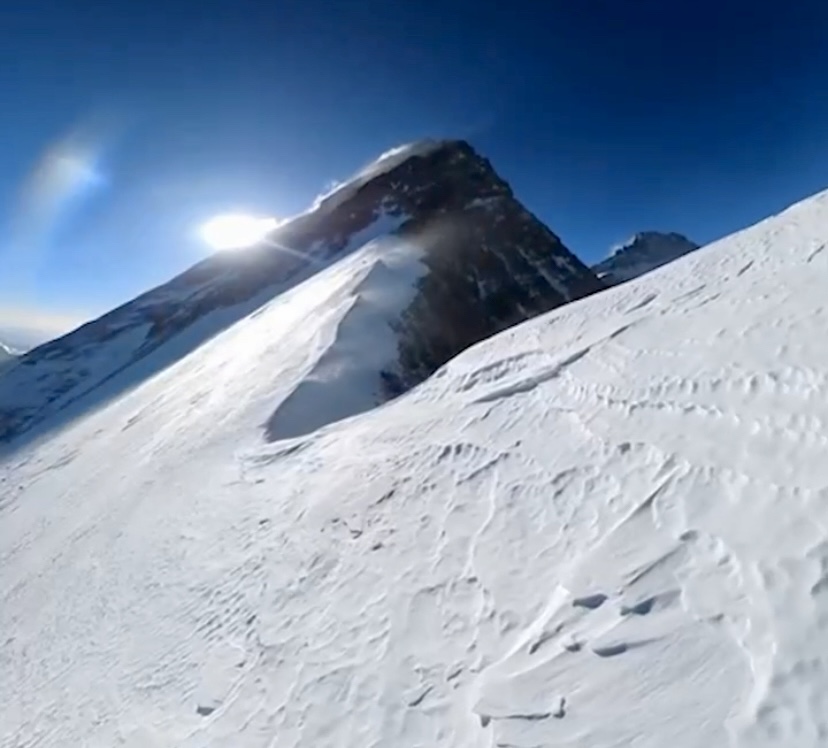
The Bulgarian and the Indian expeditions worked well together. The Indian team allowed the Bulgarians to use their tents and oxygen, and the Bulgarians later left their walkie-talkies for the Indians.
Svetoslav Kolev of the Bulgarian Mountaineering Federation told the American Alpine Journal that this Everest traverse would have been impossible without the Indian expedition's generous help, which included tents, oxygen, food, and medicine during the Bulgarian descent on the normal route.
Notable feat
Prodanov’s achievement was an important feat. He became the first and only person to summit the West Ridge Direct without supplemental oxygen. Unfortunately, he did not complete the climb as he perished during the descent, and his body was never found.
Prodanov received several awards. Bulgaria acknowledged him as the "Number 1 Bulgarian Mountaineer of the 20th Century" and awarded him the title of Hero of the People’s Republic of Bulgaria posthumously in 1984.
Savov and Valtchev survived an open bivouac at 8,600m-8,700m. The two pairs of Bulgarian climbers completed the first full West Ridge–Southeast Ridge traverse and the second overall traverse of the mountain.
Different versions of Everest’s West Ridge
As we pointed out in our Nejc Zaplotnik story, Tom Hornbein and Willi Unsoeld's ascent of the West Ridge in 1963 was different from the "Direct" route. They joined the West Ridge from the Western Cwm at around 7,500m. Then, they diverged to the Hornbein Couloir (8,000-8,500m) to the summit.
The 1979 Yugoslav ascent was the first complete ascent of the West Ridge. They climbed from Lho La (6,050m) to the summit, avoiding deviations (Western Cwm to the West Ridge), and descended via the North Face (Hornbein) and the West Ridge. The whole route was 6.5km.
The 1984 Bulgarian ascent of the West Ridge Direct was by a partially new route, as the Bulgarians climbed the entire West Ridge proper, and didn’t deviate to the Hornbein Couloir.
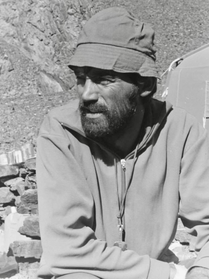
Tragedy repeats
Twenty years after Prodanov’s death, in the spring of 2004, his niece Mariana Prodanova Maslarova attempted Everest. She tried a similar oxygen-free ascent to honor her uncle on the 20th anniversary of his 1984 climb. Mariana attempted to ascend the peak from the north but disappeared at 8,700m. She likely died from exposure.
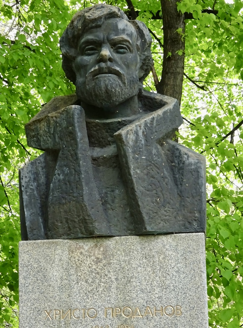
Today, Slovenian alpinist Nejc Zaplotnik would have turned 73. Widely regarded as one of the most influential climbers of his generation, he left an indelible mark on mountaineering through his bold ascents, philosophical writings, and tragic early death.
Zaplotnik’s resumé includes over 350 ascents across Europe, Africa, and North America. His career coincided with the golden age of Slovenian alpinism, characterized by ambitious expeditions to the Himalaya and other ranges, often with limited resources. We look at some of his notable climbs.
Jernej Zaplotnik, better known as Nejc Zaplotnik, was born in Kranj, Slovenia in 1952. He joined the town's Alpine Association in 1969 and soon made a name for himself in the Slovenian and Yugoslav climbing scenes.
Alongside climbing partner Tone Percic, Zaplotnik climbed a difficult route on 2,558m Grintovec, the highest peak in Slovenia's Kamnik-Savinja Alps.
In 1970, Zaplotnik joined the Mountain Rescue Service of the Slovenian Alpine Association. In 1971, he married Mojca Jamnik. Together, they had three children.

Early climbs
Also in Slovenia's Kamnik-Savinja Alps, Zaplotnik and Francek Ster made the first ascent of Tomazev Steber (Tomaz’s Pillar) on 2,540m Jezerska Kocna’s north face in 1971.
He also made several important climbs in Slovenia's Julian Alps. On Triglav, Jalovec, and Skuta peaks, he climbed several routes, focusing primarily on winter and solo ascents. For example, in 1978, Zaplotnik ascended the difficult 900m Skalaska Route on the north wall of 2,472m Spik Mountain.
He finished another important solo climb in 1980, on the north face of 2,864m Triglav. Here, he ascended the extremely challenging Cop Pillar route.
His ski descents were also notable, including those on the north face of Kocna and Skuta. He made other ski descents on Triglav, Jalovec, and Grintovec peaks.
In 1976, Zaplotnik ascended the difficult Schmid Route of the Matterhorn with Ivan Kotnik. He and partner Marko Stremfelj then climbed the even harder Carlesso-Sandri Route on Civetta in the Italian Dolomites.
In 1972, Zaplotnik went to Tanzania to climb the east wall of 5,149m Mawenzi Peak in the Kilimanjaro massif. Next, he moved on to Yosemite and did the Salathe Wall with Janez Gradisar.
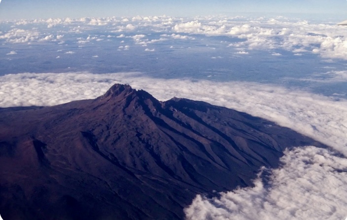
Makalu
Zaplotnik participated in three expeditions that completed new routes on three 8,000’ers: Makalu’s South Face, Gasherbrum I’s Southwest Ridge, and Everest’s West Ridge.
In the autumn of 1975, only one expedition targeted Makalu. Under the leadership of Ales Kunaver, the Yugoslav Himalayan Expedition chose to take on the unclimbed South Face. The 21-man team included Zaplotnik, Janko Azman, Stane Belak-Strauf, Janez Dovzan, Viki Groselj, Ivan Kotnik, and Marjan Manfreda, among others.
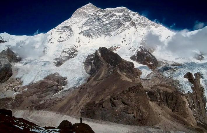
Other expeditions had tried Makalu’s South Face before. The Californian Makalu Expedition, led by William Siri, attempted the South Face–Southeast Ridge route in the spring of 1954, before the peak’s first ascent in 1955. However, the climbers aborted at 7,150m because of the approaching monsoon.
In the autumn of 1972, a Yugoslav expedition led by Ales Kunaver targeted the South Face without supplemental oxygen. In early November, climbers Miya Malezie and Janko Azman reached the top of the South Face at 8,100m. From there, they turned around, stymied by the route's difficulty.
In 1974, two parties attempted the face again. An Austrian expedition led by Wolfgang Nairz reached 7,500m in the spring before aborting in bad weather. That autumn, Fritz Stammberger led an expedition that made it to 7,800m, but bad weather again foiled them.
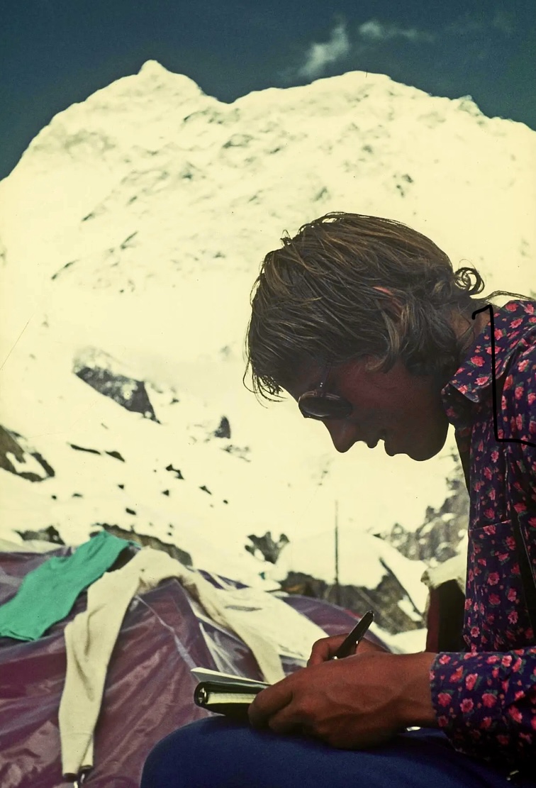
The first ascent of Makalu’s South Face
Kunaver’s party arrived at Makalu Base Camp on Sept. 5, 1975. They established Camp 1 at 5,850m on September 7 and Camp 2 at 6,300m on September 9. On September 14, they bivouacked at 6,600m. They established Camp 3 at 7,000m on September 16 and Camp 5 at 7,500m on September 23.
Their rapid progress was interrupted soon after. Heavy snowfall and avalanches destroyed Camp 4. It took till October 2 to rebuild it. Camp 5 was established at 8,050m two days later. They later camped in snow caves to avoid avalanches.
The team summited in small groups. On October 6, Stane Belak-Staruf and Marjan Manfreda summited via the South Face. On October 8, Zaplotnik and Janko Azman reached the top, followed by Ivan Kotnik and Viki Groselj on October 10 and Dovzan on October 11. Manfreda didn’t use bottled oxygen, while the other summiters did.

New route on Gasherbrum I
In the summer of 1977, Zaplotnik was part of a nine-man team that received a climbing permit for 8,080m Gasherbrum I in the Karakoram. Led by Janez Loncar, they would attempt the unclimbed Southwest Ridge.
The climbers navigated a complex icefall to set up Camp 1 at the base of a steep couloir. They progressed through challenging terrain -- a rocky chimney, ice slopes, and a vertical rock pitch -- to establish Camp 2 at 5,760m.
According to Zaplotnik’s report for the American Alpine Journal, from there, they climbed the White Dome’s avalanche-prone 50° slope. That day, an enormous slide narrowly missed them.
They set up Camp 3 at 6,340m, then descended to Base Camp to rest. Soon after, Loncar and Filip Bence fell ill, leaving only five fit climbers.
Andrej Stremfelj and Zaplotnik carried gear from Base Camp to Camp 2 in a day, and then moved it to Camp 3. Above Camp 3, Borut Bergant fixed some rope on the summit pyramid’s base. Then they climbed the steep, icy West Face on poor rock.
Andrej Stremfelj and Zaplotnik continued past the ropes alongside a 70° couloir that led to two snow shoulders. They placed Camp 4 on a precarious snow shelf somewhere between 7,000m-7,300m and endured a windy, sleepless night.
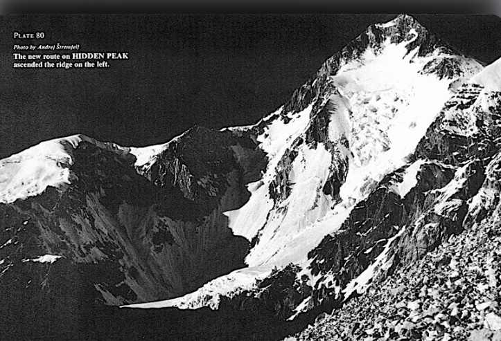
The Southwest Ridge
On the morning of July 8, Stremfelj and Zaplotnik departed Camp 4. After hours of climbing on icy rocks, they reached a gap below the summit at midday. They finally summited Gasherbrum I in fog and extreme cold. At the summit, they raised the Yugoslav, Pakistani, and Slovenian flags, took a few useless photos in the fog, then began the difficult descent to Camp 4 in a blizzard.
Stremfelj and Zaplotnik missed the fixed ropes and had to navigate a vertical chimney to reach Camp 2 and then Camp 1.
Meanwhile, Drago Bregar was at Camp 4, intending to push for the summit. But on July 10, the team lost contact with him. Some team members tried to reach the upper slopes to look for him, but on July 14, it started to snow again. They couldn’t find Bregar.
"I sat at Base Camp, looking at my second 8,000’er, Bregar’s grave," Zaplotnik wrote.
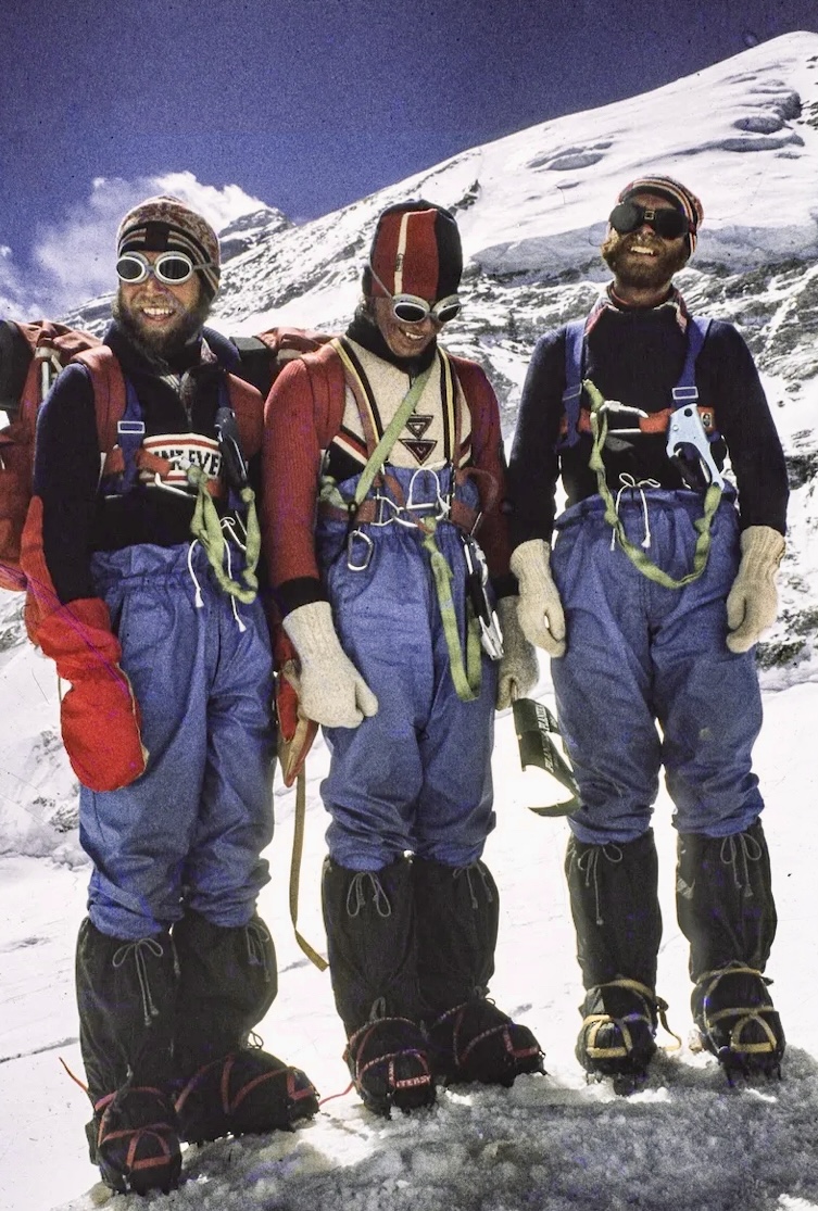
New route on Everest
In the spring of 1979, a strong Slovenian team led by Tone Skarja and including Zaplotnik tried a new route on Everest -- the complete West Ridge, also known as the West Ridge Direct.
The expedition arrived at Base Camp at the end of March with 700 porters. The climbers scouted the safer Lho La route, transported loads to the pass, and tested gear. For the next month, they established camps to 7,300m, fixing ropes on very steep terrain.
Storms delayed progress until May 9, when they established Camp 5 at 8,120m. On May 10, Viki Groselj and Marjan Manfreda attempted the summit but retreated at 8,300m because of route-finding issues, oxygen valve failures, and frostbite.
On May 12, Dusan Podbevsek and Roman Robas faced similar navigation challenges, barely surpassing 8,300m.
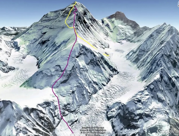
The West Ridge Direct
On May 13, brothers Andrej and Marko Stremfelj and Nejc Zaplotnik left Camp 5 in brutal -35° cold plus a wind. Marko turned back because of a faulty oxygen valve, but Andrej Stremfelj and Zaplotnik pressed on. After climbing a very demanding short section on the upper part of the peak, the two climbers rejoined the American Route and the Hornbein Couloir, summiting in the early afternoon.
On May 15, Stane Belak, Stipe Bozic (filming the ascent), and Ang Phu Sherpa left Camp 5 after a snowfall delay. As a trio, they moved slower, reaching Everest’s summit at 2:30 pm. During their descent, they were forced to bivouac in the open at over 8,200m on the Hornbein Couloir.
Borut Bergant, Ivan Kotnik, and Vanja Matijevec had been waiting at Camp 5. They found the trio below the couloir, seemingly fit to descend. Tragically, Ang Phu then slipped and fell 1,800m to his death. They discovered the body the next day.
Because of the accident and oxygen system failures, they made no further attempts.
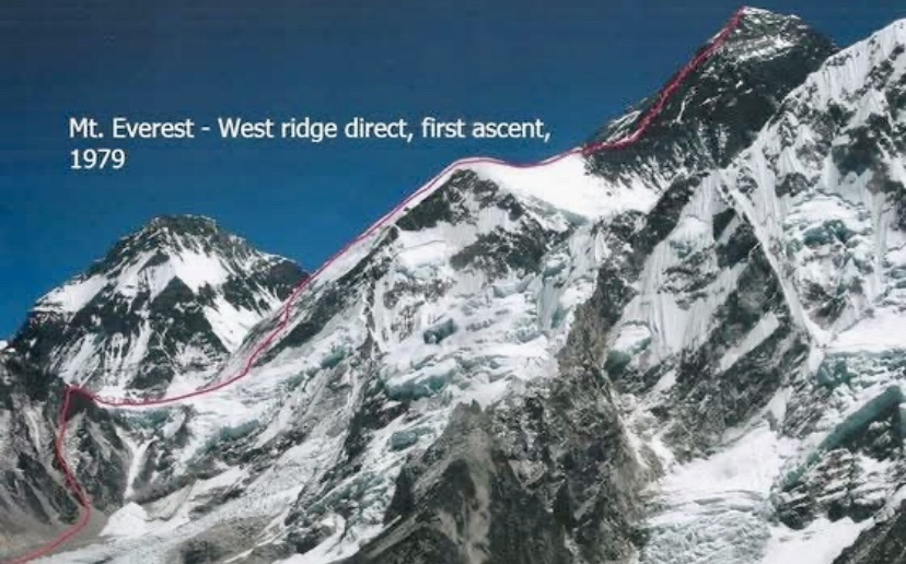
The difference between the 1963 and 1979 routes
The 1979 Everest West Ridge Direct and the 1963 American Route (by Willi Unsoeld and Tom Hornbein) both tackled Everest’s West Ridge, but their routes and approaches differed.
The 1979 team climbed the entire West Ridge from Lho La (6,050m) to the summit, a 6.5km route. This was the first confirmed full ascent of the West Ridge, avoiding deviations. The team of 24 climbers, with five summiting (A. Stremfelj, Zaplotnik, Ang Phu Sherpa, Belak, and Bozic), faced UIAA Grade V challenges near the summit. They used supplemental oxygen above Camp 5 (8,120m) and fixed ropes extensively.
Unsoeld and Hornbein climbed from the Western Cwm in 1963, joining the West Ridge at around 7,500m. They then diverged to the Hornbein Couloir (8,000-8,500m) to the summit. This partial West Ridge climb, covering less of the ridge’s full length, was the first traverse of Everest. The pair descended via the South Col, using minimal fixed ropes and limited oxygen.
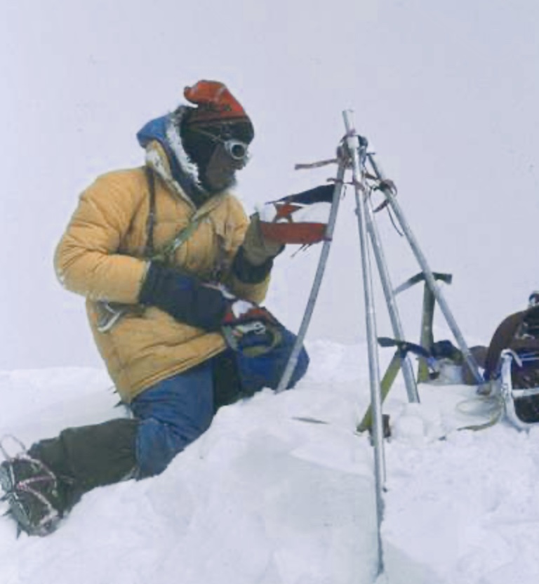
Lhotse South Face attempt
In the spring of 1981, Zaplotnik was a member of the Lhotse South Face Expedition led by Ales Kunaver. The team progressed well but abandoned their attempt on May 20 at 8,250m because of bad weather and exhaustion.
Zaplotnik’s death
In the spring of 1983, the Split Alpine Expedition set off for 8,163m Manaslu. Led by Vinko Maroevic, they targeted the dangerous South Face–South Ridge route. The team had 16 climbers, including Zaplotnik, and decided not to use supplemental oxygen.
The expedition started well, and they established four high camps, reaching 7,101m.
However, on April 24, an avalanche hit some of the climbers roughly 100m above Camp 1 on the Manaslu Glacier. It killed Zaplotnic and Ante Bucan. Srecko Grekov was badly injured.
Zaplotnik was 31 years old, which seems young considering how much he had already accomplished.
For more details on Zaplotnik’s life and career, we highly recommend Zaplotnik’s book Pot. It’s a cult text, a ”bible for a generation," as Slovenian climber Marko Prezelj once said.
We also recommend Bernadette Mcdonald's book Alpine Warriors and her excellent article Nejc Zaplotnik Mountain Poet, published in Alpinist.
Over a century after the Titanic sank, ground-breaking 3D scans have unveiled new insights into the ship's final moments. Using over 700,000 images, researchers have created a digital twin of the famous wreck.
Because it lies 3,800m down on the floor of the Atlantic, the only practical way to study the wreck is with underwater robots. Until now, this has meant researchers can only see a small section of the ship at a time. The new 3D replica shows the ship in full.
"It's like a crime scene," Titanic analyst Parks Stephenson told the BBC. "You need to see what the evidence is, in the context of where it is. And having a comprehensive view of the entirety of the wreck site is key to understanding what happened here."
The two sections of the ship lie 600m apart, and there are stark differences. While the bow of the ship rests upright on the seafloor with relatively little damage, the stern is a crumpled piece of metal. Researchers think most of the damage occurred as it crashed into the sea floor.
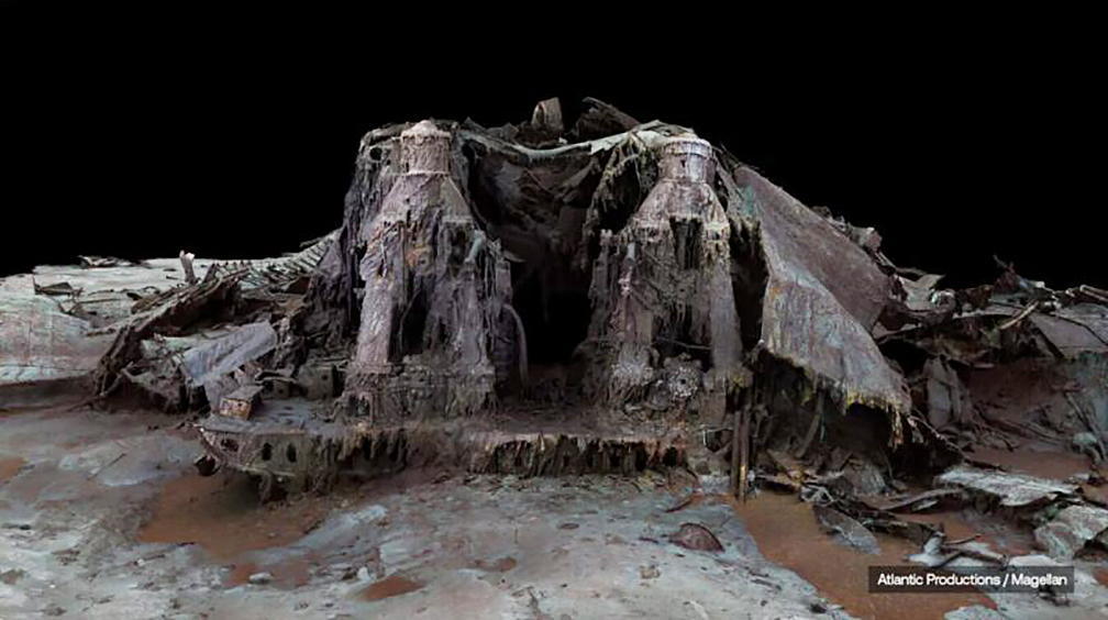
A glancing blow
Combining the 3D scans with computer modeling, the team created a simulation of the collision with the iceberg. Rather than a huge, powerful collision, researchers suggest that the ship only made “a glancing blow against the iceberg.” So instead of a huge gaping hole, the collision created a series of small, A4-sized punctures across one side of the hull.
Famously touted as unsinkable, the Titanic was designed to stay afloat even if four of its watertight compartments filled with water. The problem is that the small punctures stretched across six compartments.
“Those small holes are across a long length of the ship, so the flood water comes slowly but surely into all of those holes, and then eventually the compartments are flooded over the top, and the Titanic sinks,” explained naval architect Simon Benson.

Brave engineers
The scans also shed light on the bravery of the ship's crew. Images reveal that steam was still moving through the boilers and generating electricity as the ship sank. This supports eyewitness accounts that Joseph Bell and a team of engineers remained at their posts in the boiler rooms. Their actions likely saved hundreds of lives.
"They kept the lights and the power working to the end to give the crew time to launch the lifeboats safely with some light instead of in absolute darkness," said Stephenson.
Another revelation concerns First Officer William Murdoch. In James Cameron's 1997 film, he is shown shooting a passenger and then himself. New evidence from the scans indicates that this is completely untrue. A lifeboat davit at his evacuation station was found in the upright position, suggesting he was preparing to launch another lifeboat. This supports testimonies from Second Officer Charles Lightoller and other survivors that he was swept away while helping others.
The state-of-the-art 3D scan has been produced for the new National Geographic documentary Titanic: The Digital Resurrection.
Exploration stories are rife with extreme deprivation, both physical and mental. "Sexually and socially, the polar explorer must make up his mind to be starved," wrote British polar explorer Apsley Cherry-Garrard, recalling the isolation he experienced in the Antarctic.
But few explorers endured what Ejnar Mikkelsen and Iver Iversen did. These two Danes, abandoned by their ship, spent two winters in a tiny hut in northern Greenland. They emerged unrecognizable.
In 1906, a Danish expedition led by Ludvig Mylius-Erichsen set out to explore the northeast coast of Greenland and survey over six degrees of latitude. Ejnar Mikkelsen was not a member of the expedition, but like many others interested in Arctic exploration, he was waiting for news of the ambitious expedition.
In 1908, Mikkelsen and the rest of the world learned that Mylius-Erichsen and two companions, Lieutenant Hoeg Hagen and an Inuit man called Jorgen Bronlund, had all perished. Bronlund, the final survivor, had reached an established depot before he died. On his body, he carried an account of the party's struggles. However, most of the expedition's journals and observations had been left behind and were missing.
Ejnar Mikkelsen was determined to retrieve them and preserve the work that the three men had died to undertake.
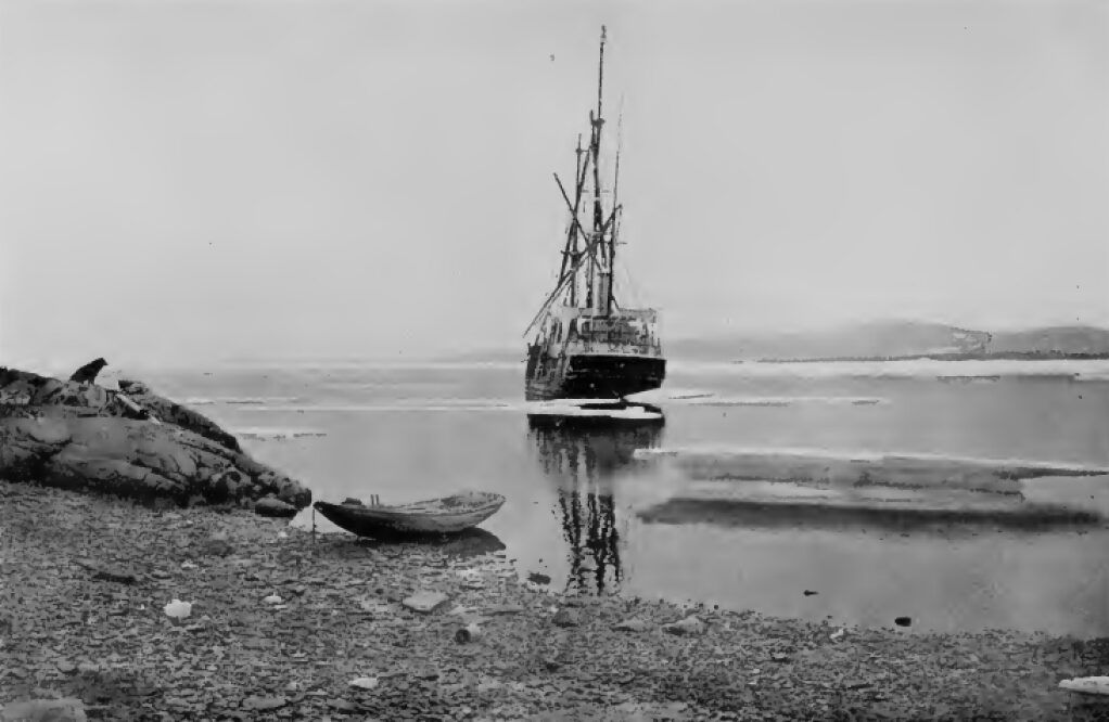
The Alabama sets sail
Mikkelsen had been at sea since he was 14 and already had several polar expeditions under his belt when he began planning to set off after Erichsen. Ambitious and indefatigable, as a teenager he had hiked over 500 kilometers to Gothenburg to meet with S.A. Andree. who was about to launch a balloon expedition to the North Pole. Mikkelsen begged to be taken on the ill-fated mission, but luckily for him, Andree said no. All perished.
Mikkelsen did manage to join an expedition a few years later, signing onto Amdrup's
expedition to East Greenland. Immediately after returning in 1901, he set out again on the Baldwin-Ziegler expedition to Russia's Frans Josef Land. Then, while Erichsen and his men were dying in Greenland, Mikkelsen led an Anglo-American polar expedition across the frozen Beaufort Sea.
His bona fides had become ironclad, and so when he applied to lead an expedition to look for the remains of the Erichsen party, he received widespread support. Funded half by the Danish government and half by private subscription, he bought a small sloop called the Alabama in 1909.
Not intended for the ice, the Alabama was rebuilt and retrofitted with a 15-horsepower motor, then loaded with 18 months of supplies. Besides Mikkelsen, the small crew consisted of only six others: Royal Navy Lieutenant Wilhelm Laub, Infantry Lieutenant C. H. Jorgensen, carpenter Carl Unger, mechanic Aangaard, and mates Hans Olsen and Georg Paulsen.
They set sail on June 20, 1909.
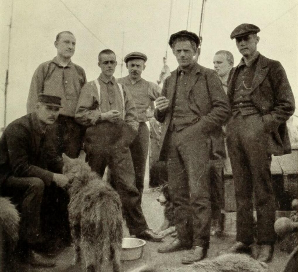
One hardship after another
Things began poorly. The weather was poor, and the dogs were sick. One by one, they were dying, and when Mikkelsen managed to find a veterinarian, his advice was that the animals were doomed. Reluctantly, the men put down the remaining ill dogs.
Luckily, Mikkelsen was friendly with the people of nearby Ammassalik Island, whom he had met on the Amdrup expedition. He bought 47 healthy dogs from them, but the stop delayed the expedition's arrival in Iceland.
Meanwhile, the mechanic Aagaard had "fallen sick," as Mikkelsen delicately put it. In reality, he was struggling with an alcohol addiction, which made him distinctly unsuited for the journey. They dropped him off at a small Icelandic village, then telegraphed the nearby naval vessel, Islands Folk. Did they have any volunteers who knew their way around an engine?
They sent over their eager assistant engineer, a young man named Iver Iversen. His appointment was so short notice that he had no chance to make arrangements or bid his loved ones goodbye.
Staffing issues resolved, the Alabama said farewell to the Islands Folk, and with it, the world they knew. They forged ahead alone into the cold northern waters.
Bad weather continued to oppress them. By late August, the Alabama was trapped in the ice off Shannon Island, about 300km from where Erichsen's party had wintered.
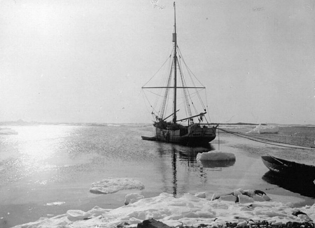
Miserable work
Before winter truly set in, Mikkelsen set off on an initial exploratory journey with Iversen and Jorgensen. Autumn sledding, he admitted, was miserable work, and they lost several dogs. However, they succeeded in reaching their goal, the depot on Lambert's Land where Jorgen Bronlund had died.
His body was still there, preserved by the Arctic cold, and they searched it for clues. All the records he had carried had already been collected, so they buried him solemnly and moved on. The small party split up to explore the area, searching for Erichsen's last camp without success.
With winter closing in and supplies low, they turned around. After a difficult journey -- they ran out of food and fuel and lost many dogs -- they rejoined the Alabama crew at its winter quarters on Shannon Island.
The crew passed the winter as well as could be expected, managing to keep warm and fed and not poisoned by anything. This is the height of luxury on a polar expedition. Jorgensen, however, had been very badly frostbitten, and by spring, he still wasn't fit to sled.
Though his second-in-command was out of commission, Mikkelsen pushed on, sending depot-laying parties in early spring and preparing sledding equipment. Once ready, Mikkelsen set off. Lieutenant Laub, Olsen, and Poulson would accompany him for the first leg, with only Iversen continuing on with him.
The pair had no idea that they were beginning a nearly three-year-long ordeal.
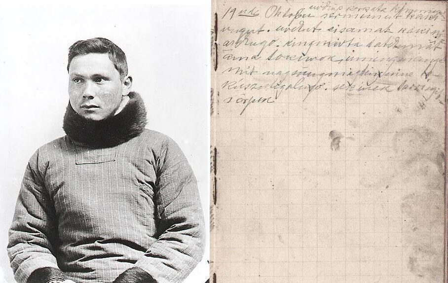
On the trail of Mylius-Erichsen
The journey was slow going. The weather was as bad as ever, and they carried so much weight in supplies and had so few healthy dogs left that they had to go in stages. For every kilometer of progress, they had to travel three kilometers. Though they hadn't made it as far as they'd hoped, Iversen and Mikkelsen said goodbye to their three companions on April 10. They continued on, while the other three returned to the ship.
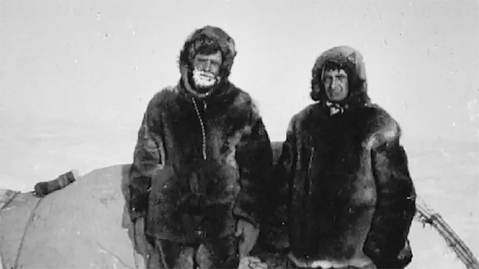
Knowing that they may not rejoin the Alabama before she was freed from the ice and made her escape, Mikkelsen wrote to his former captain, Amdrup. If they failed to return on the Alabama, he wrote, there was no cause for concern. He and Iversen would find a passing sealing ship to take them home. He also wrote that there was no reason to send a relief mission. Any attempt to find them would be like looking for a needle in a haystack.
Iversen and Mikkelsen continued to struggle northward. After crossing a stretch of inland ice riddled with deadly crevasses and impassible cliffs, the two reached Danmark Fiord, down several dogs. There, they began to trace the steps of Erichsen's lost party.
In late May, they found a cairn and the remains of a camp, with a note that Erichsen had left. It was heartbreakingly sanguine: They had starved and struggled but had recently found game and hoped to reach their ship in six weeks by following the coast.
"Poor fellows," Iversen exclaimed aloud. "So glad and hopeful here — and then — what they must have gone through before the end!"
A few days later, they reached a second cache and found another message. What was written there would serve as an answer to the mystery of Erichsen's death. The bodies of Erichsen and Hogan were never found.
The nonexistent Peary Channel
The note harrowingly described the expedition's struggle, but what struck Mikkelsen most was a geographical revelation: "Peary's Channel does not exist."
Robert Peary was an American explorer best known for not discovering the North Pole. On an earlier 1892 expedition to Greenland, he had mapped a long swath of the coast. On this map, he placed a marine channel separating Peary Land from mainland Greenland. According to his account, he had observed the entire channel, and even a number of islands within it, from a vantage point on Navy Cliff. This supposed discovery of the north end of Greenland and land beyond it first made Peary famous.
Nowadays, many historians believe that Peary deliberately lied about his discovery. One of the men accompanying him, a respected explorer named Eivind Astrup, even insisted that Greenland extended far past Navy Cliff. There was no channel. But official support went to the politically savvy Peary. Sadly, Astrup took his own life in 1896, aged only 24, before he could be proven right.
Peary's observations formed the basis of the maps that both Erichsen and Mikkelsen had used, and both parties had made their plans based on the existence of an open waterway. The waterway, Mikkelsen explained, would have allowed them to reach civilization much more quickly than a journey along the east coast of Greenland. Erichsen's party had faced the same problem, and it had likely contributed to their deaths.
The expedition's goal, at least, had now been met. Mikkelsen and Iversen could contemplate the long way home, at least knowing that they had recovered the important discoveries Erichsen, Hogan, and Bronlund had made.
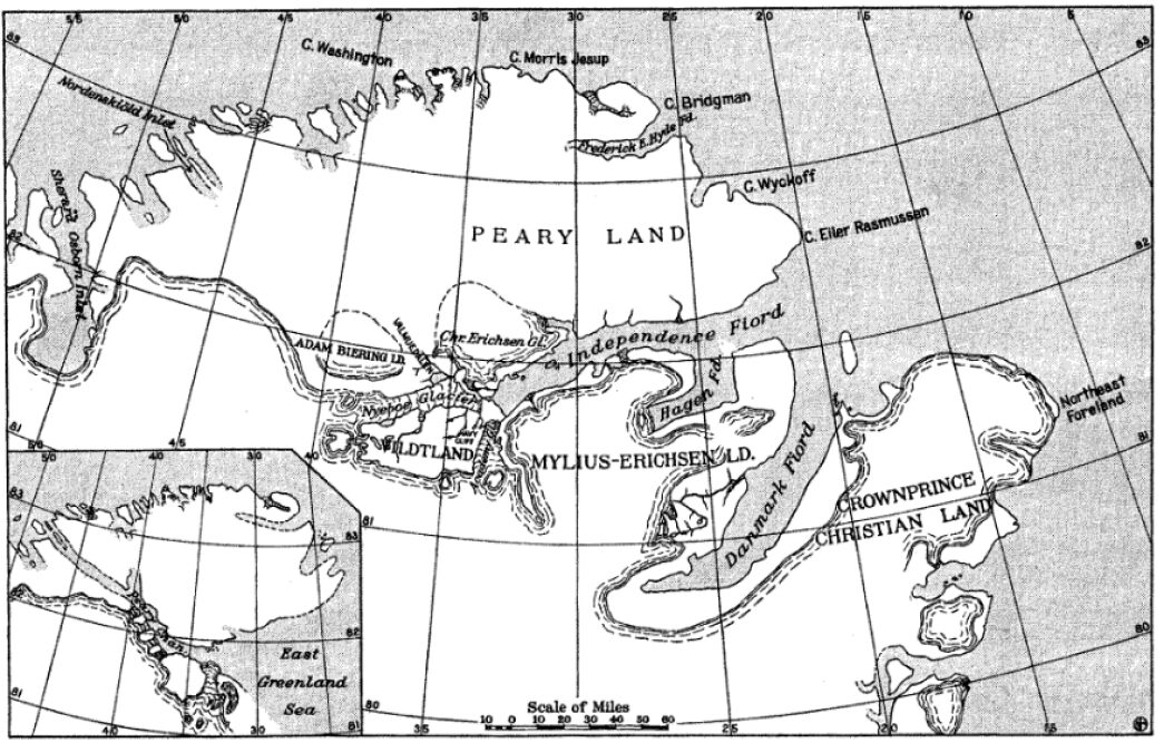
A desperate dash
The Alabama was over 1,200km away. The season was late. They had only seven exhausted dogs left and almost no food. As the dogs weakened further, Mikkelsen felt his strength ebbing, too.
By early June, he was unable to walk, suffering from aching muscles, swollen joints, and dark purple bruises all over his body. Iversen helped him onto the sled, leaving most of their remaining supplies so that their weak dogs could pull Mikkelsen. Though he was initially reluctant to admit it, scurvy had taken hold.
Iversen remained cheerful, and as they moved south they found game and old depots of food. The vitamin C in the fresh meat helped Mikkelsen, who was soon able to walk. But it was too late for most of the dogs, and they were soon down to three.
That number became two with the death of Girly, Mikkelsen's favorite dog. Though she had been sick for some time, he was unwilling to put her down like he had others, and she had been riding on the sled. But in the end, they butchered Girly and fed her to the last two dogs. Mikkelsen wrote that he wished he could've buried her properly, with a gravestone reading, "Here lies Girly — her little life of faithful and untiring service ended."
Abandoned
Iversen also grew weak and sick as they went on. Eventually, they were forced to leave everything-- even tents, sleeping bags, and diaries -- in a final effort to reach Alabama.
On September 19, they reached her. But what should have been a triumph was a bitter disappointment. She had been wrecked by the ice, and the other five men had gone home on a passing sealer.
The Alabama Cottage
Their shock was devastating, numbing. Neither swore or even spoke at all. "So confident we were," Mikkelsen wrote ruefully, "and now so utterly alone and helpless."
Mikkelsen and Iversen built a small hut out of the wreckage of the lost ship. With the Alabama's remaining supplies, they weren't in immediate danger of starving. The little canvas-covered hut would keep them from freezing.
Without coal, they had to slowly cut up and burn what was left of the ship. Even then, temperatures inside the hut were rarely much above freezing. While Mikkelsen cannibalized the ship for warmth, Iversen took it upon himself to serve as cook. He was not gifted in the arena, and the best that could be said of their diet was that it was enough to live on.
Aside from daily disputes with the neighbors-- a family of arctic foxes that stole their scraps -- the winter was uneventful.
A third winter
As soon as winter broke, they set out on a sledding trip. It wasn't an attempt at self-rescue but a trip to retrieve their log books, left during their desperate push to regain the Alabama.
A polar bear had broken into their depot and eaten Mikkelsen's diary, but most of the log books, with their vital scientific discoveries, were unmolested.
They returned to the Alabama Cottage, confident that a ship would sail in to retrieve them in less than six weeks. The pair even adopted six baby hares, setting them up in a box in their hut. Caring for and playing with them was a welcome distraction from the waiting.
By mid-August, however, no ship had come. They had to face the dread prospect of spending another year in the Arctic. Worst of all, they were running out of fuel. They spent the autumn making a series of frantic trips back and forth from an American depot, where they discovered that a ship had stopped by, missing them by only 25km.
Once they settled in, boredom was again all-consuming. When Mikkelsen got a toothache, he was initially pleased because at least it was something new. They spent hours every day examining a book of postcards and coming up with backstories for the people pictured in them. They also adopted a "house-fox," and named him Prut.
The pair launched escape attempts by boat and by sled, but both proved impossible. Waiting for rescue while trying to keep themselves sane was all they could do.
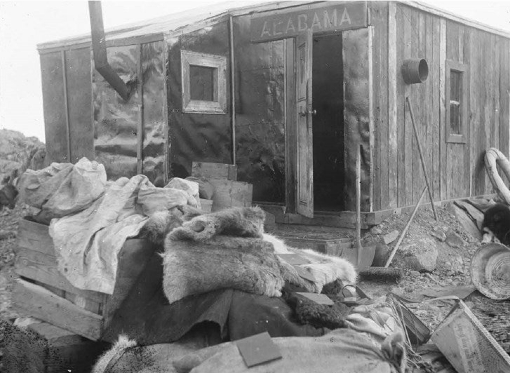
Unrecognizable
Early on the morning of July 19, 1912, Mikkelsen woke up to see Iversen, half-dressed, running across the room to throw open the cabin door. Mikkelsen looked on in confusion as Iversen yelled, "Good morning!"
Then he realized what it meant -- after 28 months of struggle and waiting, a ship had found them. The small Norwegian whaler soon put eight men to shore. The crew stared at the two explorers in shock. The steward, thinking they were dangerous lunatics, even darted back for the ship in fear.
Indeed, after more than two years in the wilderness, Mikkelsen and Iversen were a battered and wild-looking sight. But after the initial shock, the crew welcomed the pair aboard.
The captain, Paul Lillenaes, patiently answered all their questions about what they had missed during their three-year absence. Their king had died. Newspapers speculated on whether they were alive. When they set foot in Aalesund, Norway, a journalist was one of the first to greet them.
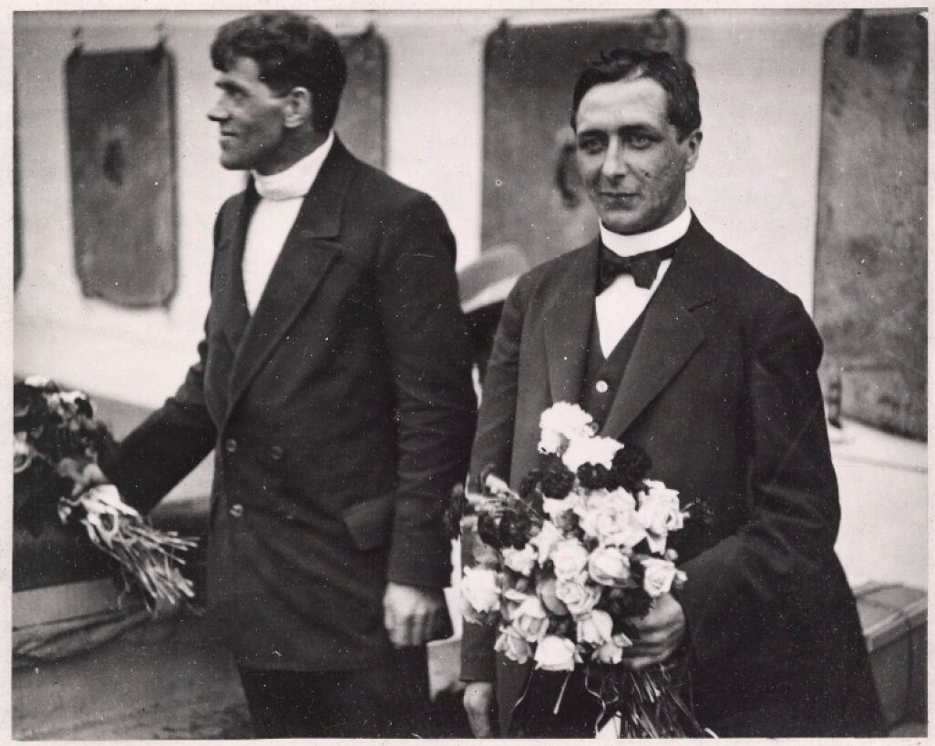
Mikkelsen had nothing but praise for Iversen, the last-minute addition who had stood by his side for nearly three years. The engineer had had enough of adventure, though, and settled down, never returning to the Arctic.
Ejnar Mikkelsen, on the other hand, spent the rest of his career traveling back and forth from Greenland. Even after his death, he maintains a strong presence there. Since 2007, a Danish vessel bearing his name has patrolled the waters around Greenland.
At 7,788m, Pakistan's Rakaposhi is a formidable peak that sees little climbing activity. Fewer than a dozen parties have topped out. Its steep slopes, technical difficulty, and unpredictable weather deter most climbers.
Rakaposhi is the 26th highest independent peak in the world and the 12th highest 7,000’er. It lies in the Lesser Karakoram mountains in Gilgit-Baltistan. The closest 8,000m peak is Nanga Parbat, roughly 110km south-southwest of Rakaposhi.
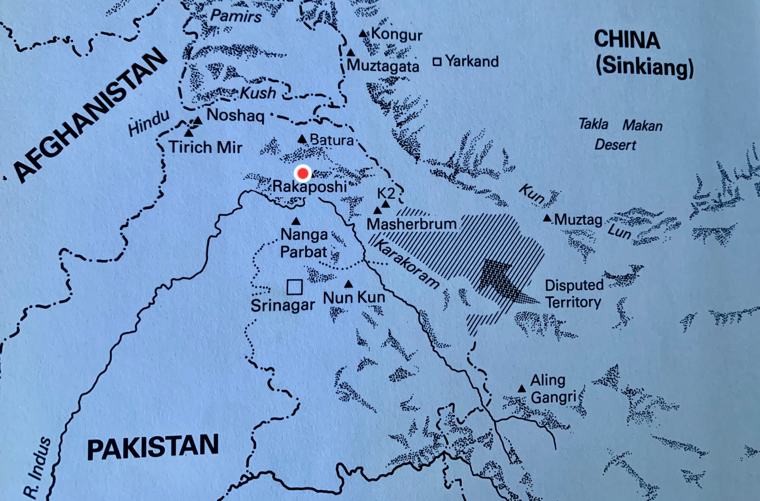
The mountain is also known by the name Dumani, which comes from the local Burushaski language. It translates to "Mother of Mist" or "Mother of Clouds" because the peak is often shrouded. The name Rakaposhi derives from a Burushaski term meaning "shining wall."
Rakaposhi rises 5,800m in just 11.5km of horizontal distance from the Hunza River.
The first foreign explorers arrived at the end of the 19th century. Martin Conway explored Rakaposhi's southern side in 1892. Conway concluded that although the upper part of Rakaposhi could be climbable, reaching the upper crest of the peak by any of the supporting ridges would be difficult and dangerous.
In 1938, British mountaineer and explorer Michal Vyvyan and his partner Reginald Campbell Secord approached the peak from the west. They ascended a small 5,800m forepeak at the end of the northwest ridge.
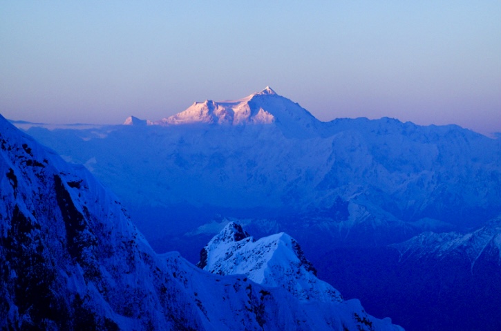
The first determined attempts
In 1947, Secord returned with Bill Tilman and two Swiss climbers to attempt the southwest spur. They abandoned their attempt at 5,800m, where a great gendarme blocked the route. From there, Tilman observed a 600m wall of snow and ice, which they called Monk’s Head.
The team then tried the northwest ridge. Later, they inspected the southeast face, the north face, and the east face but found them all impracticable.
In the summer of 1954, two expeditions arrived at Rakaposhi.
An Austrian-German party led by Mathias Rebitsch attempted the southwest spur. They reached 5,200m, but extreme snowstorms, high winds, and difficult ice conditions forced them to retreat. They agreed with Conway's conclusion from 60 years earlier: The mountain seemed unclimbable from that direction.
In the same season, an expedition from the Cambridge University Mountaineering Club led by Alfred Tissieres attempted the same route. They climbed the Monk’s Head but turned around in bad weather at 6,340m.
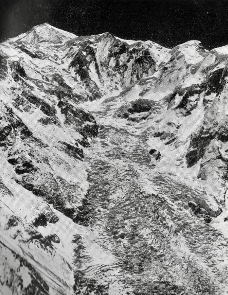
In 1956, Mike Banks led a four-man British-American expedition to Rakaposhi. They were the first expedition to go above 7,000m, reaching 7,170m on the southwest ridge. They made two further attempts later on that expedition but couldn’t progress higher.
"We were all much impressed by Rakaposhi," Richard K. Irvin recalled in his report for the American Alpine Journal. "It’s a very long climb, and it is a real climb, not just pushing along. This route certainly can be climbed to the summit, and there probably is no other way by today’s Himalayan standards."
The first ascent
In 1958, two years after his first attempt, Banks returned to the mountain, leading a British-Pakistani Forces Expedition that included Scottish mountaineer Tom Patey.
The climbers chose the southwest spur for their ascent. They established Base Camp on May 20 at 4,267m.
Over the next month, relentless snowfall, avalanches, and blizzards hampered their efforts to put up six camps to the summit. Despite the storms, the team set camps up to 5,791m. On June 20, seven climbers and some Hunza porters ascended the slope of Monk’s Head, and the porters carried loads beyond it.
On June 23, three climbers carried supplies from 6,400m to 7,010m, allowing Banks, Patey, R.F. Brooke, and R.N. Grant to camp at 7,010m. On June 24, Brooke and Grant supported the summit party of Banks and Patey. Banks and Patey then established a high camp at 7,315m.
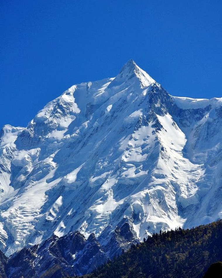
On June 25, Banks and Patey set out for the summit in a strong blizzard. Battling intense cold, they climbed for five hours and finally topped out.
Patey suffered minor frostbite on his hand and Banks on his feet. After summiting, the duo descended quickly to their high camp. Three days later, the entire team returned safely to base camp.
This first ascent of Rakaposhi was carried out without supplemental oxygen.
The first repetition of the southwest spur
The Belgian Club Alpin Beige Expedition repeated Rakaposhi’s southwest spur route in 1983. After great difficulty climbing the Monk’s Head slope, Bertrand Borrey, Daniel Bogaert, Arthur Delobbe, and high-altitude porter Sultan Ullah Baig topped out on August 2.
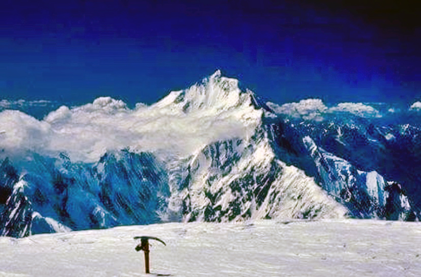
According to the expedition’s report in the American Alpine Journal, the climbers started an avalanche while descending. The avalanche swept away Michel Bodard, who fell 200m and suffered a broken leg and thumb, a punctured lung, a concussion, and multiple contusions. He was lowered to Camp 4 (at 6,400m), and two days later, a helicopter picked him up at 6,140m.
Their bad luck didn't end there. On August 5, high-altitude porter Sultan Ullah Baig insisted on descending alone to give his countrymen news of the summit success. He disappeared between Camp 2 and Camp 1. The team searched for five days but never found his body.
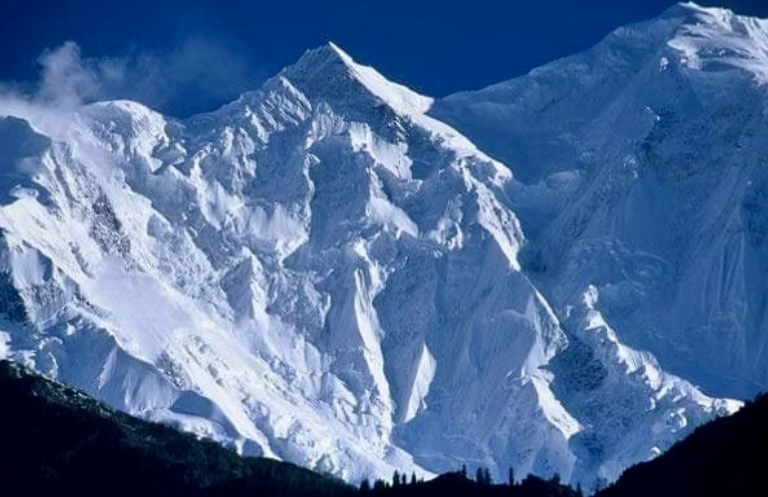
New route in 1979
On June 5, 1979, a Polish-Pakistani expedition led by Ryszard Kowalewski established a base camp at 3,810m in a side basin of the Biro Glacier.
On June 14, a gigantic ice avalanche from a collapsed wall devastated the tents at base camp, but the expedition continued. The party tackled the northwest ridge, previously scouted to 6,005m by an Irish expedition in 1964.
They set up Camp 1 on June 6, placing it at 4,907m at the base of the northwest ridge. They established Camp 2 at 6,203m on June 26.
The party then descended 61m to a snow terrace below the summit pyramid, where they set up Camp 3 at 6,500m. Crossing the terrace to a col at the end of the southwest ridge took between six and eight hours. Here, on June 30, they placed Camp 4 at 7,102m.
On July 1, Kowalewski, Pakistani climber Sher Khan, and Tadeusz Piotrowski climbed to the summit in 18 hours. The next day, after a miserable night with six in a tent, Andrzej Bielun, Jacek Gronczewski, and Jerzy Tillak also topped out, reaching the summit in only six hours.
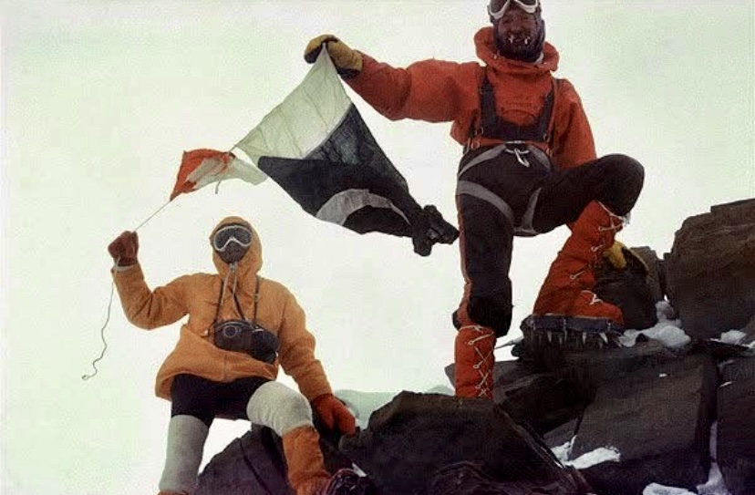
On July 5, with the higher camps empty, Anna Czerwinska and Krystyna Palmowska summited unroped through wind and snow. This marked the second-highest "ladies-only" climb after Gasherbrum II in 1975 by Halina Kruger and Anna Okopinska. The two women climbed unroped because it was too cold for one to wait for the other.
The Polish-Pakistani success was the second documented ascent of Rakaposhi.
A solo climb
In 1995, Anibal Pineda of Colombia made a notable solo climb via the northwest ridge. According to the American Alpine Journal, Volker Stallbohm was the expedition leader.
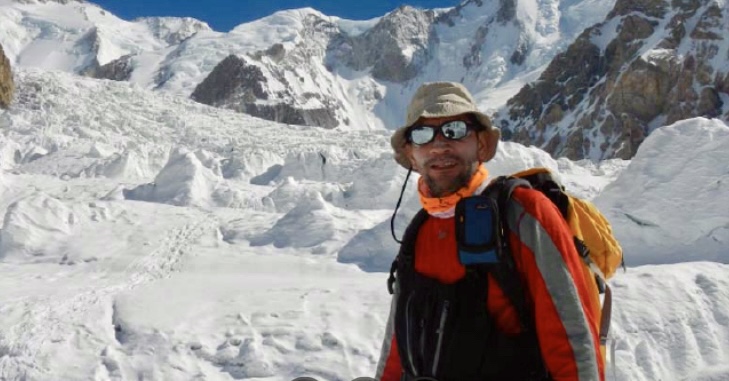
The extremely difficult north spur
In the summer of 1979, a Japanese expedition from Waseda University arrived. Led by Eiho Otani, they summited via the north spur, a steep route on the north face.
They established their high camp on an ice step at 7,300m. From there, Otani and Matsushi Yamashita started their summit push. The duo bivouacked at 7,600m and summited on August 2. On top, they found evidence of the Polish ascent. The expedition climbed siege-style, with 5,000m of fixed rope, over six weeks.
This extremely difficult route had been attempted in 1971 and 1973, both led by Karl Herrligkoffer.
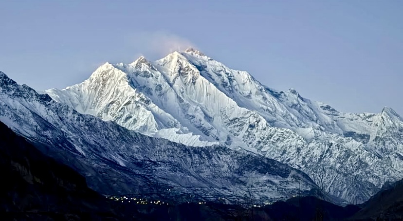
The same route saw its first alpine-style ascent in 1984. Canadians Barry Blanchard and Kevin Doyle and South African Dave Cheesmond survived lightning strikes that knocked them unconscious during their summit push. This was an outstanding ascent.
Other ascents
In the summer of 1986, a Dutch expedition climbed a variation of the northwest ridge. This route was a shorter line in the lower section and joined the 1979 Polish route at 6,000m.
In the summer of 1997, four members of an Iranian party summited via the southwest spur.
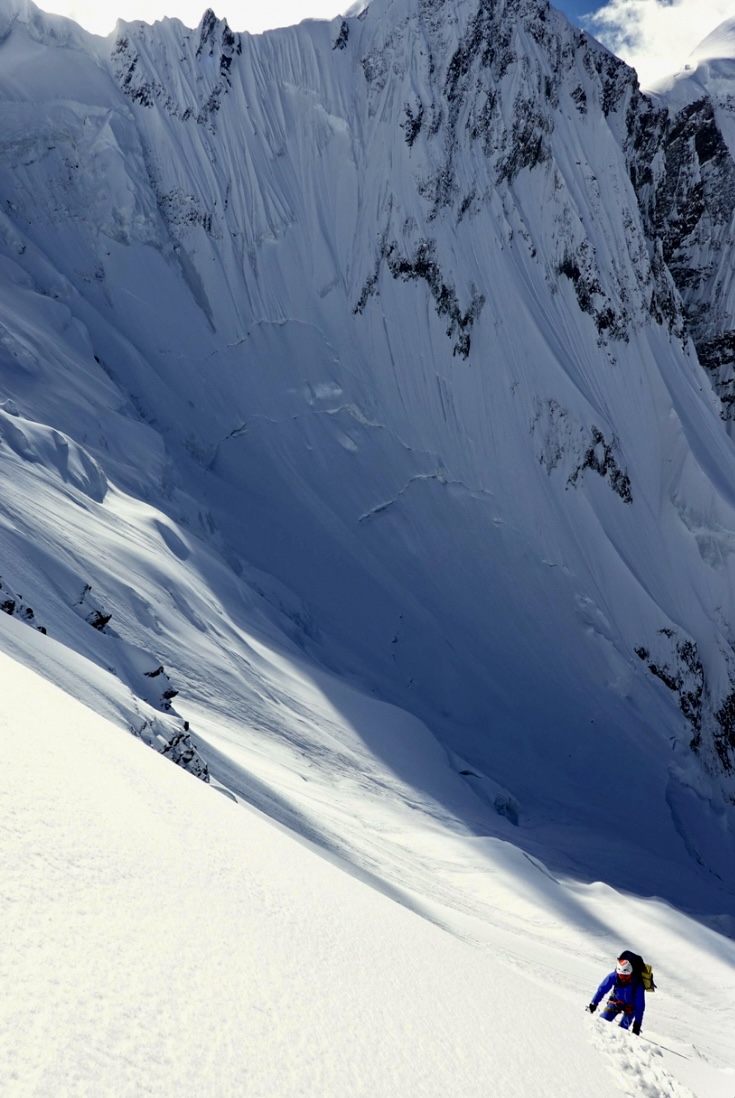
A Piolet d’Or climb
Another successful ascent took place in 2019. World-class Japanese climbers Kazuya Hiraide and Kenro Nakajima tackled the unclimbed south face before transitioning to the southeast ridge.
Starting from their base camp at 3,660m, Hiraide and Nakajima, climbing alpine style, reached 6,800m after three days. There, they waited out bad weather and summited on July 2 in a single day. They descended to Base Camp on July 3. In 2020, they were awarded the prestigious Piolet d’Or for their climb.
The last ascent of Rakaposhi was in September 2021. Czechs Jakub Vicek and Petr Macek, and Pakistani Wajidullah Nagri summited Rakaposhi via the southwest spur. The controversial expedition did not have permits and required a helicopter rescue.
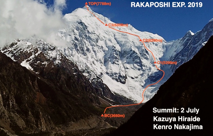
In 1985, an Austrian expedition led by Eduard Koblmuller climbed Rakaposhi’s 7,010m east peak via the north buttress. On August 1, Koblmuller, Fred Pressl, and Gerald Fellner summited in alpine style. During the two-day descent, Fellner slipped at 4,700m in bad weather. He fell 100m down an ice slope and sustained fatal injuries. Despite medical attention, he died in the night.
Rakaposhi’s climbing history shows that even after decades, new routes remain for bold climbers.
At 4,392m, Mount Rainier is the highest peak in the Cascade Range of the Pacific Northwest. Situated just 95km southeast of Seattle, it has long beckoned climbers and adventurers. Today, we’ll look into its rich climbing history, spotlighting the pioneers who first approached its icy heights.
An active volcano
An active stratovolcano, Mount Rainier's last significant eruption was around 1,000 years ago. (There was some unconfirmed minor activity in the 19th century.) Although it hasn’t erupted for a long time, Mount Rainier is close to populated areas and is considered one of the most dangerous volcanoes in the U.S.
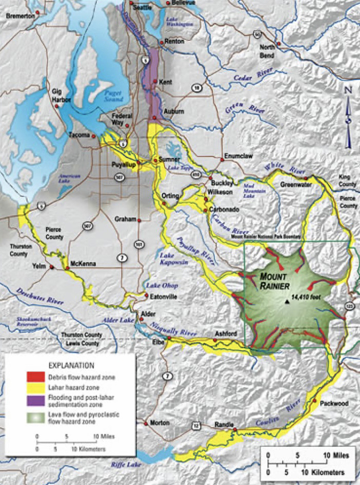
Mount Rainier has three distinct summits. The highest is Columbia Crest (4,392m), situated on the crater's western rim. In 1870, the first successful climbers of Mount Rainier identified this as the main summit. The other summits are Point Success (approximately 4,315m) and Liberty Cap (approximately 4,301m).
Older sources occasionally treat Point Success and Liberty Cap as subsidiary peaks, but modern nomenclature and climbing records recognize all three because of their topographic significance.
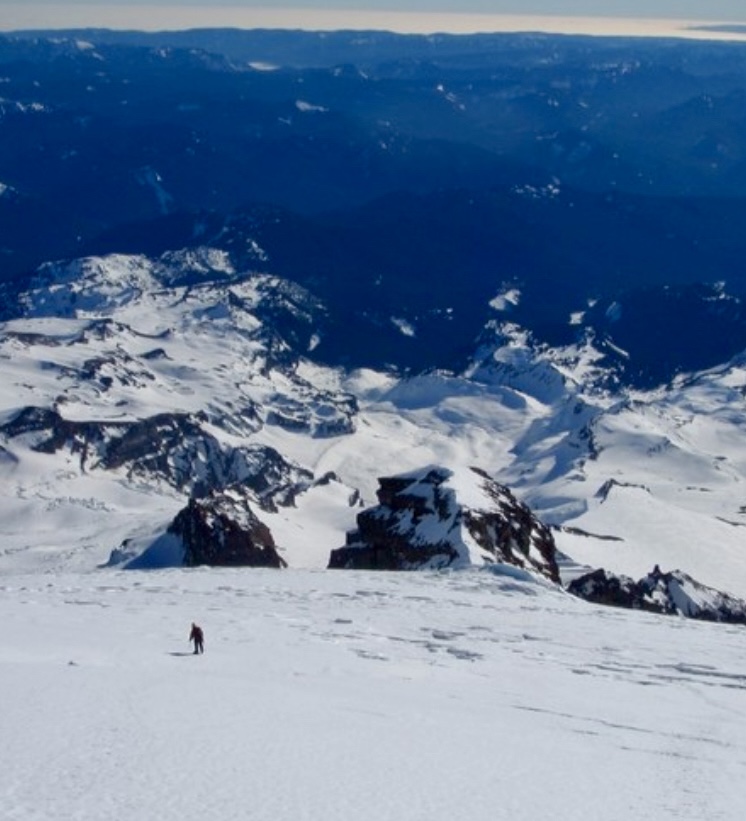
Cultural significance
Mount Rainier has deep cultural roots for the Indigenous people of the Pacific Northwest, whose lands surround the mountain. For these communities, Mount Rainier was not just a physical landmark but a sacred entity tied to creation stories, spirituality, and survival. In various tribal languages, Mount Rainier is commonly known as Tahoma or Takhoma, often translated as "mother of waters" or "snow-covered mountain."
Archaeological evidence, like stone tools found at the peak, suggests the existence of seasonal camps dating back thousands of years. It is unlikely that climbing to the summit was a cultural practice because high elevations were often seen as the domain of spirits and deities.
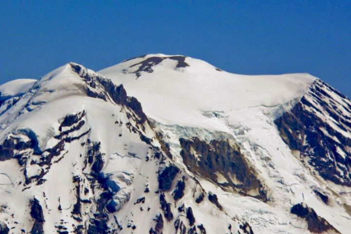
First European sighting
In May 1792, English explorer Captain George Vancouver sighted the mountain during a scouting expedition. He named the peak Mount Rainier after Admiral Peter Rainier of the British Navy. The name has caused controversy, with many people believing the name should feature a local figure or have an Indigenous name. However, Mount Rainier has stuck.
In 1833, Scottish botanist William Fraser Tolmie explored the area, seeking medicinal plants. Tolmie was not a climber, but his documentation of the region provided some interesting early insights that encouraged later climbs.
Early attempts
The first documented attempt to climb Mount Rainier took place in August 1857. U.S. Army Lieutenant Augustine Kautz led a team that included Dr. Robert Orr Craig and several Nisqually guides. They started from a low elevation near the Nisqually River and followed what is now known as the Kautz Glacier route.
After eight difficult days of climbing, Kautz’s party reached about 4,267m. Here, they turned back because of exhaustion and health issues. "[We were] too weak to go further," Kautz wrote.
There was possibly an ascent in 1852, but the climb remains unverified. A brief account in the Olympia Columbian newspaper from September 1852 mentions a climb by one Benjamin Franklin Shaw and other climbers. But details were vague, without route specifics, any detailed description, or firsthand accounts. It’s possible that they reached a high ridge or a false summit, but without more evidence, the ascent can’t be credited as Mount Rainier's first.
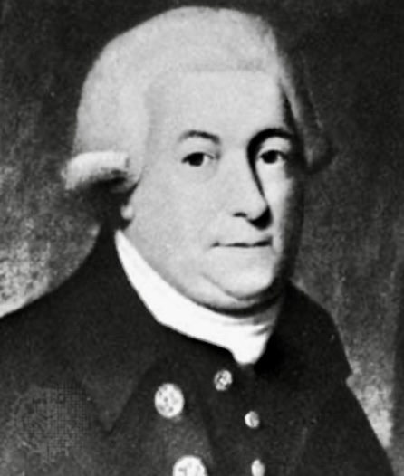
The first ascent
On August 17, 1870, Americans Hazard Stevens and Philemon Beecher Van Trump completed the first documented ascent of Mount Rainier. Without much prior climbing experience, their achievement marked a significant moment in the mountaineering history of the Pacific Northwest.
Hazard Stevens was a clerk for the Oregon Steam Navigation Company and a Civil War veteran. Van Trump was a government official who worked as a private secretary to the governor of Washington Territory. Both had a keen interest in exploration and the natural world.
The two men had been planning their 1870 expedition for years but were delayed by forest fires in the region.
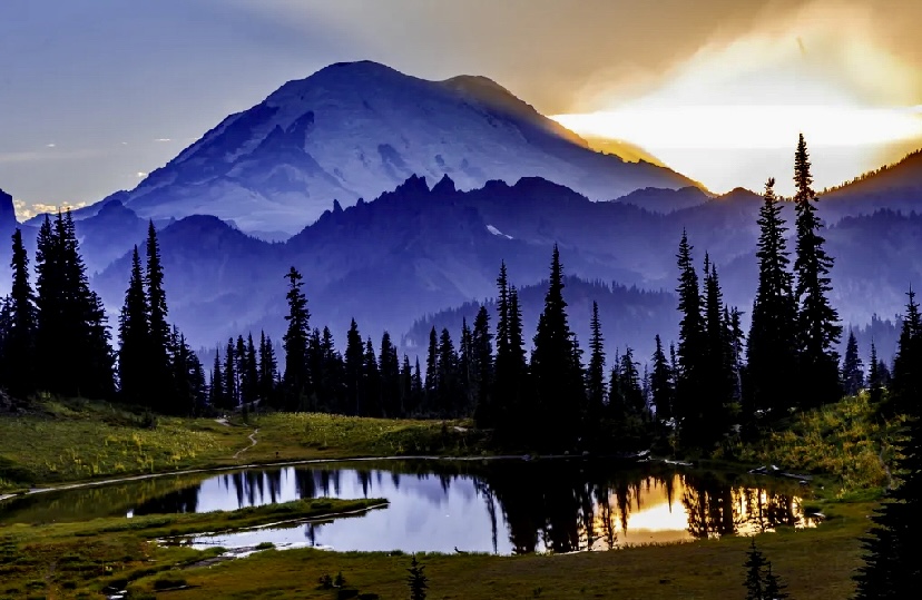
James Longmire, an experienced explorer of the area around Mount Rainier, provided critical logistical support for Stevens and Van Trump, including pack horses and guidance. Longmire would not ascend the peak, but his role was instrumental in getting the party to the base.
A Yakama Indian guide called Sluiskin accompanied Stevens and Van Trump to the base of the mountain. He took them to Sluiskin Falls, located at 1,830m, but warned against the climb, fearing supernatural dangers.
English mountaineer Edmund T. Coleman joined the party in Olympia and wanted to summit, but he had to turn back after losing his pack during a difficult crossing of the Tatoosh Range during the approach.
The long approach
The party departed from Olympia on Aug. 8, 1870, traveling southeast toward Mount Rainier. They were accompanied by Coleman and a group of well-wishers who escorted them to Longmire’s ranch on Yelm Prairie, 48km from Olympia.
At the ranch, Longmire provided pack horses. They then proceeded to Bear Prairie, hiring Sluiskin as their guide. Sluiskin was so convinced that the two climbers would perish that he promised to wait two days before reporting their deaths.
Between August 14 and 16, Stevens and Van Trump rested at their base camp and prepared for the ascent.
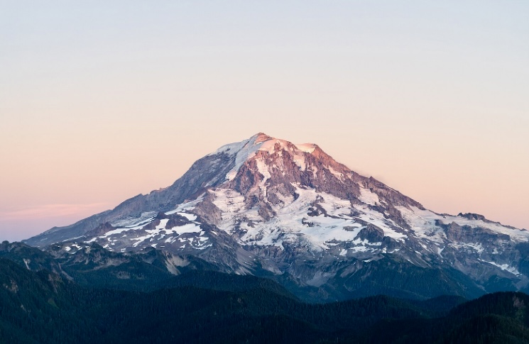
The ascent
On August 17, 1870, Stevens and Van Trump began their climb at dawn. They ascended via the challenging Gibraltar Ledges route, located on the southeast face. This route starts at a low elevation and follows a steep rocky ridge known as Gibraltar Rock, which connects to the upper snowfields and glaciers leading to the summit.
They navigated through loose rock, steep snow-covered slopes, and icy sections, arriving at the crater (at 4,317m) in the afternoon. From there, they made a final traverse to Columbia Crest at 4,392m.
After summiting, night fell, and the weather turned bad. They sheltered overnight in a steam-heated ice cave within the crater.
A difficult descent
The next day, Stevens and Van Trump began to descend early in the morning down the Gibraltar Ledges. On their way down, Van Trump slipped on ice and slid 12m, injuring his thigh but surviving the close call.
Finally, they reached base camp late in the afternoon on August 18, reuniting with their guide, Slusikin.
The duo's ascent marks the beginning of recorded mountaineering on Mount Rainier.
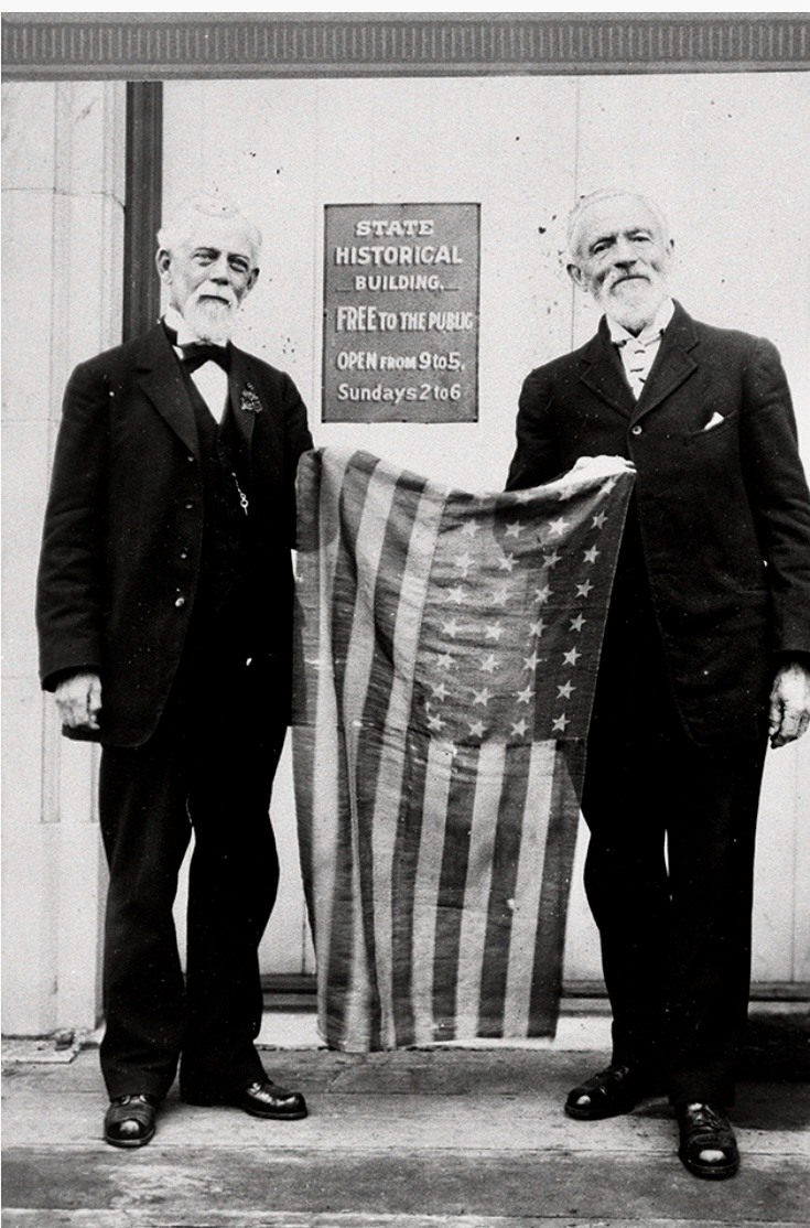
John Muir
Scottish-American writer and conservationist John Muir summited Mount Rainier in the summer of 1888. He also climbed via the Gibraltar Ledges route. He later wrote about his experience and helped secure the mountain’s protection as a national park in 1899. Muir was struck by Mount Rainier’s extensive glaciers and surrounding wildflower-rich meadows.
"Of all the fire-mountains which, like beacons, once blazed along the Pacific Coast, Mount Rainier is the noblest in form," Muir wrote.
Other notable ascents
The Gibraltar Ledges route saw its first winter ascent on Feb. 16, 1922. The party was led by Jean Landry and Jacques Landry, possibly alongside Ranger Oliver G. Cornwell and others.
In the autumn of 1935, Ome Daiber, Jim Borrow, and Arnold Campbell summited via the Liberty Ridge route on the north side. Liberty Ridge is Mount Rainier’s most iconic and dangerous route.
The Disappointment Cleaver route is on the southeast side of the peak. Dee Molenaar, Jim Wickwire, and four companions first ascended it on Aug. 23, 1950.
Since its first ascent, thousands of mountaineers have climbed Mount Rainier, which now has over 20 climbing routes.
To date, there have been 370,000-400,000 successful ascents. The success rate is around 50%. The success rate for guided climbs is higher.
Fatalities
Approximately 130 people have died Mount Rainier, including Willi Unsoeld of Everest fame in 1979. Almost every year, there is a fatality.
On Dec. 10, 1946, a U.S. Marine Corps transport plane carrying 32 Marines from San Diego to the Naval Air Station at Sand Point, Seattle, crashed into the South Tahoma Glacier on Mount Rainier’s southwest flank. In stormy weather, the plane hit the mountain at around 3,230m, killing everyone on board.
On June 21, 1981, a massive ice avalanche hit a guided team on the Ingraham Glacier route at 3,353m. A serac collapse triggered the avalanche, which buried 11 of the 29 climbers.
In May 2014, a six-person team was probably hit by an avalanche on the Liberty Ridge route. It killed all six climbers. The team was last spotted on May 28 at 3,962m.
The 13th century was eventful for the people of Medieval Russia. The Kievan Rus had fractured into warring kingdoms, each perpetually rocked by border disputes and revolts. The Mongol army invaded, burning and sacking cities like Kiev and Ryazan, and overturning the old order.
Famine struck in 1215, then again in the 1230s. The desperate people resorted to eating bark and leaves, then cats and dogs, and finally the corpses of the starved. Years of devastating famine led to a revolt against the ruling prince of Novgorod.
Noticing that their neighbors were distracted by their famine and the new "Mongol Yoke," the Swedes invaded, attempting to carve off chunks of Novgorod. A few years after that, Prussian Catholics invaded as part of the Northern Crusades.
But with all the upheaval, the people of Novgorod still went about their daily lives. They traded goods, collected debts, married and debated politics. Bored children still doodled in the margins of their schoolwork.
Onfim of Novgorod
Literacy rates were high in medieval Novgorod, and even children of relatively modest background learned and practiced their alphabet. They used birch bark, a readily available material used for cheap, disposable writing.
It is from these scraps of birch bark, uncovered by archaeologists, that we meet Onfim. Living in 13th-century Novgorod, Onfim was about seven years old when he made the art he's known for today. His drawings are interspersed with writing lessons and feature the charmingly crude imaginings of a young boy bored in class.
In one example, out of more than a dozen, Onfim begins writing the alphabet, getting about eleven letters in. Then he gives up and draws himself as a mounted knight defeating an enemy. He signs (or perhaps labels) the drawing with his name.
On another birchbark scrap, Onfim draws some sort of wild beast. Helpfully, he labels it, "I am a wild beast." The beast is passing on good wishes from Onfim to Danilo. Danilo may have been a friend or perhaps even a classmate.
Onfim seems to have liked drawing small figures, not dissimilar from the typical stick figures that children draw today. The writing is usually snippets of prayers or business notes, likely copied from a model.
One man's trash
Birchbark writing scraps weren't intended to be kept. They were written, read, and then discarded. There, in the mud, they were accidentally preserved while the streets of Novgorod rose above them. It wasn't until 1951 that the first birchbark manuscript was rediscovered.
Novgorod was founded sometime around the 9th century, and existed at the crossroads of several trade routes and cultural groups. This, in combination with the anaerobic soil which preserves materials, has led to extensive archeological work in the area.
Discarded birchbark notes are some of the most common discoveries. Over a thousand of them have been found so far. Birch forests ringed Novgorod, and their plentiful bark was harvested for writing. The people of Medieval Russia boiled the bark to soften it, then scraped and cut it to shape. Once they were done with the scraps, they could even use them in the privy.
Most of the birchbark manuscripts are online and can be browsed freely, though many have not been translated into English.
A glimpse of life in Medieval Russia
Most of the birchbark manuscripts are fairly boring -- financial transactions, debt records, legal documents. But others provide fascinating and often delightful insights into the people of medieval Novgorod.
One letter was from an older couple to a matchmaker, accepting the woman the matchmaker had proposed as a bride for their son. Another more direct marriage proposal reads: "From Mikita to Malaniya. Marry me -– I want you and you want me..."
Others are informal reference materials, such as a dictionary translating some Balto-Finnic words into Russian. One pair of documents turned out to fit together as one letter, which reported the murder of a man named Zhiznobud, who was killed for his inheritance.
Historians have used the letters to analyze trade networks, economic development, and linguistic change. They also show the high literacy rates in Old Novgorod, which included women as well as men. The informal language provides insights into Medieval Russian slang and obscenities.
But even with all of those insights and curiosities, Onfim's doodles are by far the most famous. He is a beloved local figure who even has a commemorative statue on the site where the first birchbark letters were found.
It can be easy to forget that historical figures, whose lives and societies were so different from ours, were people just like us. The charming, whimsical doodles of a young, bored boy are a reminder of what we have in common. I recommend printing one of his drawings out and putting it up on your fridge.
In our recent article remembering French mountaineer Chantal Mauduit, we briefly touched on her 1992 rescue on K2. We noted how Scott Fischer and Ed Viesturs gave up their summit bid to bring her down safely. That short mention was just a glimpse of a complex rescue. Let's unpack the whole event.
International teams
Although this expedition tends to be called Russian–American, it included climbers from four countries.
The mixed party was led by Russian mountaineer Vladimir Balyberdin, consisting of two Russians, a Ukrainian, 12 Americans, and an Englishman. The other members were Gennady Kopeika, Alexey Nikiforov, Doug Colwell, Neal Beidleman, Thor Kieser, Scott Fischer, Ed Viesturs, Robert Green, Peter Green, Larry Hall, Charles Mace, Daniel Mazur, Gayle Olcott, Kelly Stover, and Jonathan Pratt. The team also included a doctor and a base camp manager.
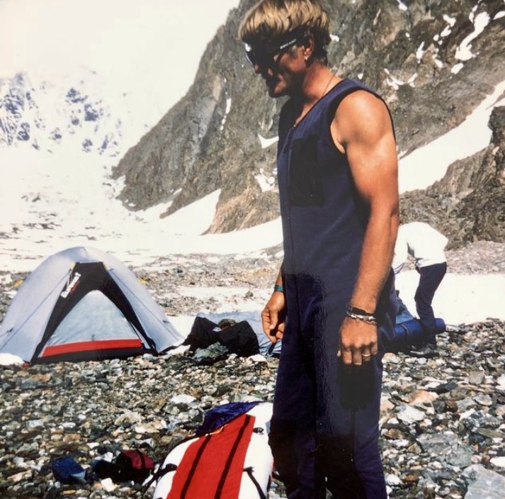
The expedition was organized by the Russians and funded by the Americans. According to Ed Viesturs’s report, Dan Mazur was in charge of selecting the U.S. members. Scott Fischer and Ed Viesturs decided to participate when their original plans for K2’s north ridge fell through because of a lack of funding.
The Americans met in Rawalpindi on June 8, 1992. The Russians chose to travel overland and entered Pakistan one week later. The team trekked to K2 Base Camp in separate groups, with Fischer, Kieser, Viesturs, and two Americans arriving on June 21. Balyberdin, Kopeika, and Nikiforov arrived on June 30 with the rest of the expedition.
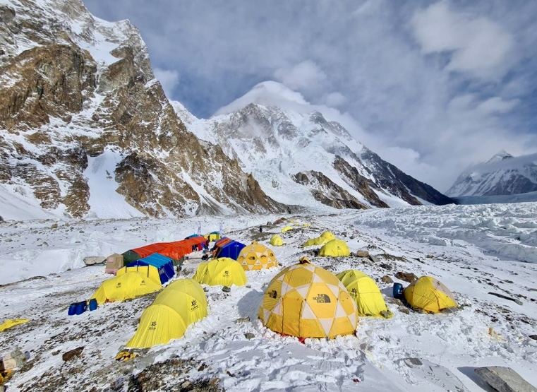
The Swiss party
In the summer of 1992, Chantal Mauduit was a member of a Swiss party led by Peter Schwitter. The team included Beat Ruppen, Norbert Huser, and Rupert Ruckstuhl. This team was already at K2 when Balyberdin’s expedition arrived.
Schwitter’s party attempted the Abruzzi Ridge but aborted somewhere between 7,000m and 7,400m at the beginning of July because of bad weather. When the Swiss left, Mauduit joined the Russian–American expedition. However, she did not have a permit to do so, which caused her serious problems with the Pakistani authorities after the climb.
On June 28, a Mexican-New Zealand-Swedish expedition also arrived. They also chose the Abruzzi route.
The different teams coordinated for the route-fixing work.
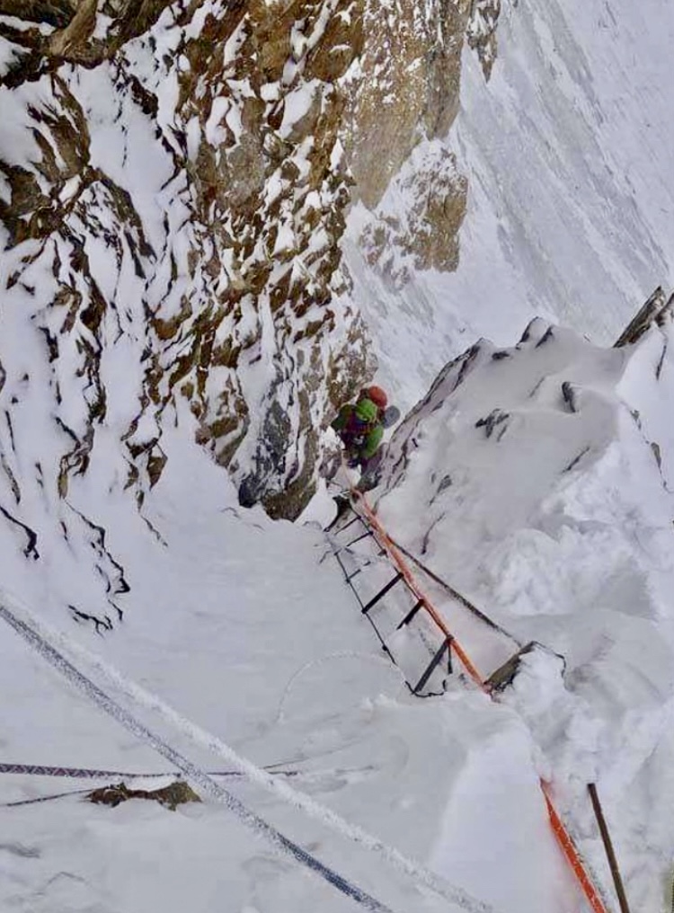
Unsettled weather
Kieser and Fischer established Camp 1 at 6,100m on June 25, and the teams progressed to Camp 2 at 6,700m at the beginning of July. On July 7, Kieser, Fischer, and Viesturs began fixing the route to Camp 3 through the Black Pyramid. They finished this section 10 days later, with Balyberdin and Kopeika fixing the last ropes at the top of the Black Pyramid.
The climbers faced unsettled weather. Short weather windows of three to four days were always followed by four or five days of snow and wind.
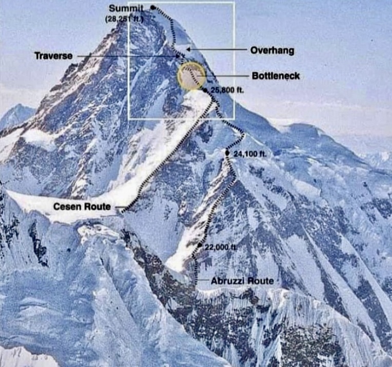
On July 12, Fischer suffered a minor accident and dislocated his shoulder. The Russian doctor advised him to end his expedition, but a week later, Fischer was climbing again.
Viesturs, Kieser, and Neal Beidleman continued fixing the route above the Black Pyramid. At 7,410m, they set up Camp 3 in a small crevasse, soon moving 30m higher to avoid spindrift avalanches.
On July 21, Balyberdin, Beidleman, Kieser, Mauduit, and Viesturs left Camp 3 toward Camp 4. On the way, the weather deteriorated, and all the climbers except Balyberdin turned around. Balyberdin bivouacked at 7,500m. From there, he progressed each day a little higher, reaching 8,000m in whiteouts and deep snow. He didn’t set up Camp 4 and returned to Base Camp on July 24. K2 continued to receive a lot of snow.
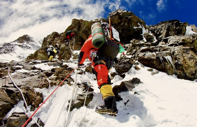
The first summit bid
On July 28, Balyberdin, Kieser, Beidleman, Kopeika, Mauduit, and Viesturs left Base Camp. By July 30, they arrived at Camp 3 in a windstorm. While Balyberdin and Kopeika continued, camping at 7,500m stormy weather, Mauduit and Kieser stayed at Camp 3, and Viesturs and Beidleman descended to Base Camp. On July 31, Balyberdin and Kopeika reached the base of the summit pyramid in chest-deep snow. Taking a risk, they camped at 8,000m, ready to push for the summit.
Meanwhile, Nikiforov reached Camp 3, where Kieser and Mauduit were camping.
On August 1 at 9:00 pm, Balyberdin and Kopeika finally topped out without bottled oxygen after an 18-hour nonstop climb. After summiting, Kopeika started the descent to Camp 4, but Balyberdin decided to bivouac below the summit. On August 3, Balyberdin and Kopeika made it down to Base Camp.
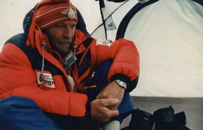
The second summit bid
On August 2, Kieser, Mauduit, Nikiforov, and Peter and Robert Green climbed to Camp 4. But the next day, the Green brothers descended to Base Camp. On August 3, Nikiforov, Kieser, and Mauduit started their summit push without bottled oxygen.
Kieser was the first to leave high camp, followed a few hours later by Nikiforov. According to writer Jennifer Jordan, Mauduit wanted to wait for the sun as her toes were cold.
After reaching 8,450m, Kieser was exhausted from the deep, icy snow. An inner voice told him to abort his summit push.
Nikiforov made careful progress. Mauduit, who started her push later, was climbing fast and passed the two men at the Bottleneck.
On August 3 at 5:00 pm, Mauduit summited K2. Nikiforov topped out two hours later. Kieser stayed at the top of the Bottleneck, where he secured a safety line by anchoring the rope Nikiforov had left behind.
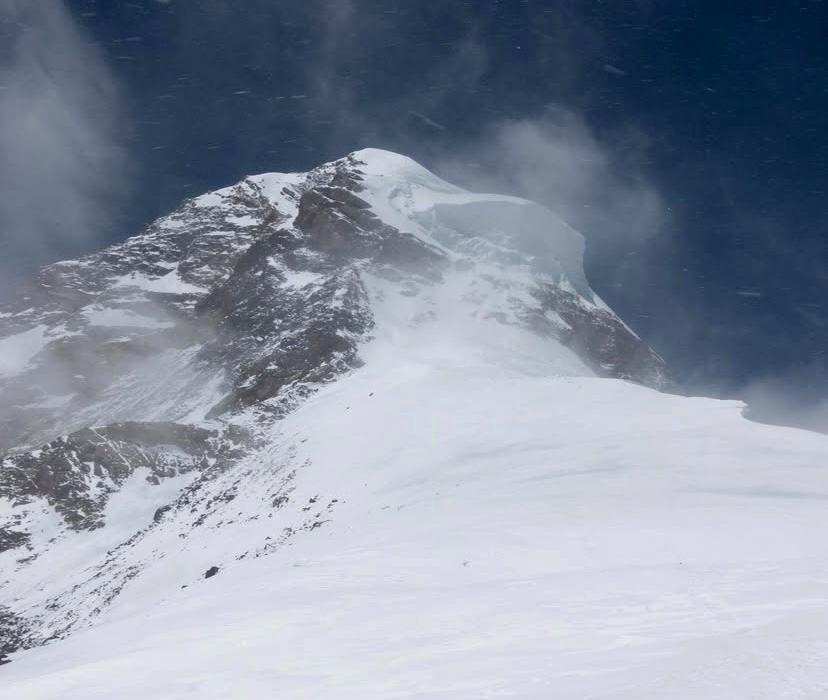
Problems start
Mauduit started the descent a couple of hours before Nikiforov but was afraid to make the traverse alone. Instead, she decided to bivouac in a snowcave at 8,400m, the same cave Balyberdin and Kopeika had used two days earlier.
When Nikiforov arrived a few hours later, he had to convince Mauduit to follow him down. Both climbers were exhausted, and Mauduit’s eyes, legs, and arms started to fail. With great difficulty, Nikiforov inched her toward Camp 4.
While Nikiforov was leading Mauduit, his crampon came loose, causing him to fall several meters. Kieser’s security rope saved his life.
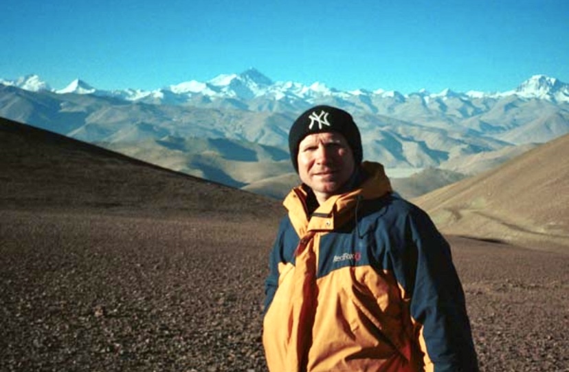
Nikiforov and Kieser started the descent from Camp 4 on August 4, supporting Mauduit between their shoulders. At Camp 4, the exhausted Nikiforov continued descending, and Kieser contacted Fischer and Viesturs on the radio. Fischer and Viesturs were in Camp 3 preparing for their summit push, but they said they would help.
Kieser moved Mauduit toward Camp 3 despite the bad weather. Mauduit was already snowblind, and Kieser knew there was no time to lose. They had to bivouac at the edge of the shoulder. Meanwhile, Fischer and Viesturs attempted to climb up.
Avalanche hits Fischer
On the morning of August 5, Viesturs and Fischer were trying to reach Kieser and Mauduit when, just below the Shoulder, a spindrift avalanche swept Fischer 60m. Thankfully, Viesturs self-arrested and secured Fischer.
Kieser and Mauduit continued descending, and after many terrible hours, they found the top of the fixed ropes near Camp 3. Here, they finally met Viesturs and Fischer.
The group then assisted Mauduit to Camp 1, where Dan Mazur and Charley Mace took her the rest of the way to Base Camp.
Aftermath
Mauduit never thanked her rescuers or publicly acknowledged the rescue.
The rescue was a team effort, all completed without bottled oxygen.
We recommend reading two books about the climb: No Shortcuts To The Top by Ed Viesturs and David Roberts, and Savage Summit by Jennifer Jordan.
The remarkable French alpinist Chantal Mauduit would have turned 61 today, but her passion for high-altitude mountaineering led to her premature death at age 34. Here, we explore her climbs and her fatal expedition to Dhaulagiri I.
Early life
Mauduit was born in Paris on March 24, 1964. At five, she moved with her family to Chambery in the Savoie region of the French Alps. This relocation introduced her to the mountains, where she began hiking in summer and skiing in winter.
At 15, her mother passed away from cancer. Seeking solace, Mauduit turned to climbing, starting with the Alps. By 17, she had already climbed the North Face of the Grandes Jorasses, the Drus, and the Matterhorn.
In the early 1990s, Mauduit ascended the Directissime Jori Bardill route on the Central Pillar of Freney in the Mont Blanc massif with Catalan climber Ernest Blade.
In July 1992, with Blade, Araceli Segarra, and Albert Castellet, she climbed the Bonatti Pillar on the Petit Dru. They finished the famous 800m route in eight hours. One year later, Mauduit completed the Walker Spur on the Grandes Jorasses in a single day from Chamonix.
In the mid-1990s, Mauduit did the Devies-Gervasutti route on the northwest face of Ailefroide Occidentale (3,954m) in the Ecrins massif. This 1,050m line is known for its remoteness and technical difficulty.
Next, Mauduit went to the Andes. She climbed 5,495m Nevado Urus and took part in an expedition to 6,768m Huascaran. She made the Sajama Traverse in Bolivia (6,542m) and ascended Mount William in Antarctica.
Himalaya and Karakoram
Her focus then shifted to the Himalaya, where she chose to climb without supplemental oxygen.
"Climbing without oxygen is my ethics. When you use [oxygen] during an ascent, you necessarily miss very strong, very intense moments, both visually and audibly. All the senses are then heightened," she told Le Monde newspaper.
On Aug. 3, 1992, aged 28, Mauduit summited K2 via the Abruzzi Route without supplemental oxygen. She became just the fourth woman to do so.
Her descent was harrowing. A storm caught her near Camp 4 at around 8,000m, and she became snowblind. Americans Ed Viesturs and Scott Fischer -- who had struggled to scrape together enough money for their expedition -- abandoned their summit bid to save her.
Controversy
Back at Base Camp, Mauduit didn’t thank Viesturs and Fischer but instead celebrated her summit success as if the rescue had never taken place.
"So now Chantal was celebrating with the Russians. We’d hear their cheers and revelry as we [Viesturs and Fischer] lay silent in our tents. Scott and I hadn’t been invited to the party," Viesturs wrote in his book No Shortcuts to the Top.
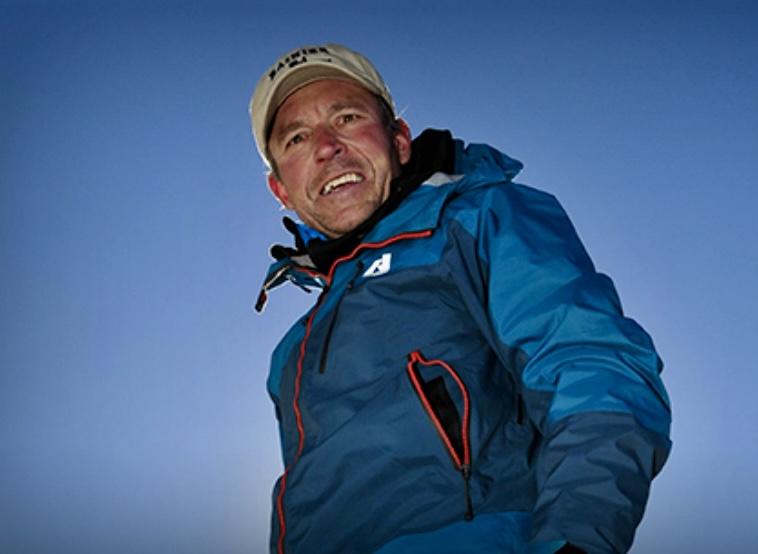
More big peaks
In 1993, Mauduit summited Shisha Pangma and Cho Oyu without supplemental oxygen, burnishing her 8,000m reputation.
On April 28, 1996, Mauduit topped out on 7,138m Pumori. After that, she climbed two 8,000m peaks in the same season. On May 10, she climbed Lhotse and reached the top alone, leading some to question her summit success because of a lack of proof. This climb took place during the infamous 1996 Everest disaster, and Mauduit witnessed the tragedy that killed several climbers, including Scott Fischer.
Ed Viesturs told Elizabeth Hawley of The Himalayan Database that he had seen Mauduit enter into a gully and return soon after, casting doubt on her summit. Mauduit's sponsors were likely pressing hard for her to succeed after her failure one year earlier on Everest. However, the summit was officially accepted, and she became the first woman to summit Lhotse.
Two weeks after Lhotse, Mauduit summited Manaslu, topping out alone again. According to Hawley, Mauduit was accompanied by Ang Tshering Sherpa, but Ang Tshering ran out of energy on their final push on May 24. He had been breaking trail for hours in deep snow. Mauduit's summit marked her fifth 8,000’er.
Her sixth 8,000m summit came in 1997 on Gasherbrum II, again without bottled oxygen.
In the autumn of 1996, Mauduit attempted Annapurna I but aborted above high camp in bad conditions.

Seven attempts on Everest
Between 1989 and 1995, Mauduit made seven attempts on Everest without bottled oxygen. She never summited the world's highest peak.
On her last attempt in 1995, she suffered serious altitude sickness. After almost collapsing during a summit push, she was carried down by fellow climbers and needed extra oxygen. This event, like the K2 rescue, drew criticism for her reliance on others.
Mauduit always pushed very hard, but on several occasions, she started strong but ran out of energy and needed help.
Despite these incidents, Mauduit’s successful 8,000m climbs without supplemental oxygen place her among the elite of her era.
Death on Dhaulagiri I
Mauduit had already attempted Dhaulagiri I in the autumn of 1997, but she aborted above high camp. In the spring of 1998, she returned to try again.
This was her last expedition. Mauduit and 45-year-old Ang Tshering Sherpa died, possibly between May 11 and 13. Climbers found their bodies in their tent at Camp 2 (6,500m). Ten Sherpas brought her body down, and it was flown to Kathmandu and then on to France.
During a summit push, other teams on the mountain had retreated to Base Camp because of avalanche danger and bad conditions. Yet Mauduit and Ang Tshering stayed in Camp 2.
An autopsy in France confirmed the cause of death as a broken neck, likely from a rockfall or small avalanche. The Italian climbers who found her body also believed this was the most likely cause of death.
Ed Viesturs was also on Dhaulagiri that season and suggested carbon monoxide poisoning from a stove could have killed her. He reasoned that there were no clear signs of an avalanche at Camp 2.
The Italian climbers had found Mauduit and Ang Tshering's tent covered in snow. They had to dig the tent out to look inside and found the pair in their sleeping bags. This accumulated snow might have broken Mauduit’s neck, the Italians suggested. Yet Ang Tshering's neck was not broken.
Mauduit’s family and friends chose to trust the results of the autopsy.
A poetic soul
Mauduit studied physiotherapy but abandoned it for a life in the mountains, living nomadically between expeditions. She carried books by Rimbaud and Baudelaire on climbs, wrote poetry on her tent, and spoke about her experiences with lyrical depth.
In 1997, she published J’habite au Paradise (I Live in Paradise), a book blending impressions of her climbs with reflections on the cultures she encountered.
"Chantal Mauduit was a very interesting woman,” Elizabeth Hawley once wrote. "When she arrived here, she named each of her expeditions after a flower she had drawn on her tents. She was flamboyant."
Mauduit’s approach to mountaineering was unconventional. She prioritized personal experience over logistical teamwork. But her infectious optimism and comfort in the mountains earned her admiration. Viesturs wrote that everybody loved Mauduit for her happy character.
After her passing, friends and family founded the Association Chantal Mauduit Namaste, which established a school in Kathmandu, honoring her generosity toward Nepalese communities.
Below is a short video showing something of her character.
On March 22, 1966, American climber John Harlin fell 1,000m to his death on the Eiger’s North Face. He was just 600m from completing his ambitious Direttissima route. Fifty-nine years later, we look back at his career, marked by innovation and a deep connection to the Alps.
From fine arts to pilot
John Elvis Harlin II was born in Kansas City on June 30, 1935. He graduated from Sequoia High School in California and later attended Stanford University, majoring in fine arts and dress design. In the early 1950s, Harlin began climbing.
Later, he joined the U.S. Air Force where he trained as a pilot, flying jet-fighter bombers.
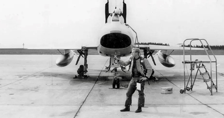
During his Air Force service, Harlin was stationed in Europe. In 1954, he made his first trip to the Alps. Just 19, it marked a turning point in his life. That year, he attempted the Eiger North Face by the Heckmair route but didn’t succeed. The climb began a lifelong obsession with the peak.
He married Marilyn Harlin, and they had two children: son John Harlin III and daughter Andrea Harlin. In the early 1960s, the family moved to Switzerland and Harlin immersed himself in the alpine climbing community.
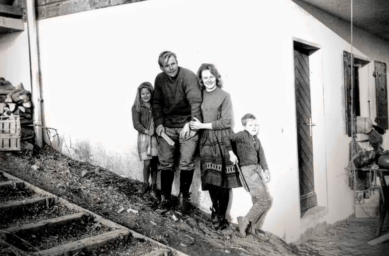
First American to climb the Eiger North Face
In the summer of 1962, Harlin became the first American to climb the North Face of the Eiger. He ascended via the 1938 Hechmair Route with German climbing partner Konrad Kirch. The climb took several days and required exceptional skill and endurance.
The same year, Harlin attempted the central Pillar of Freney in the Mont Blanc Massif, a steep granite route first climbed by Chris Bonington’s team in 1961.
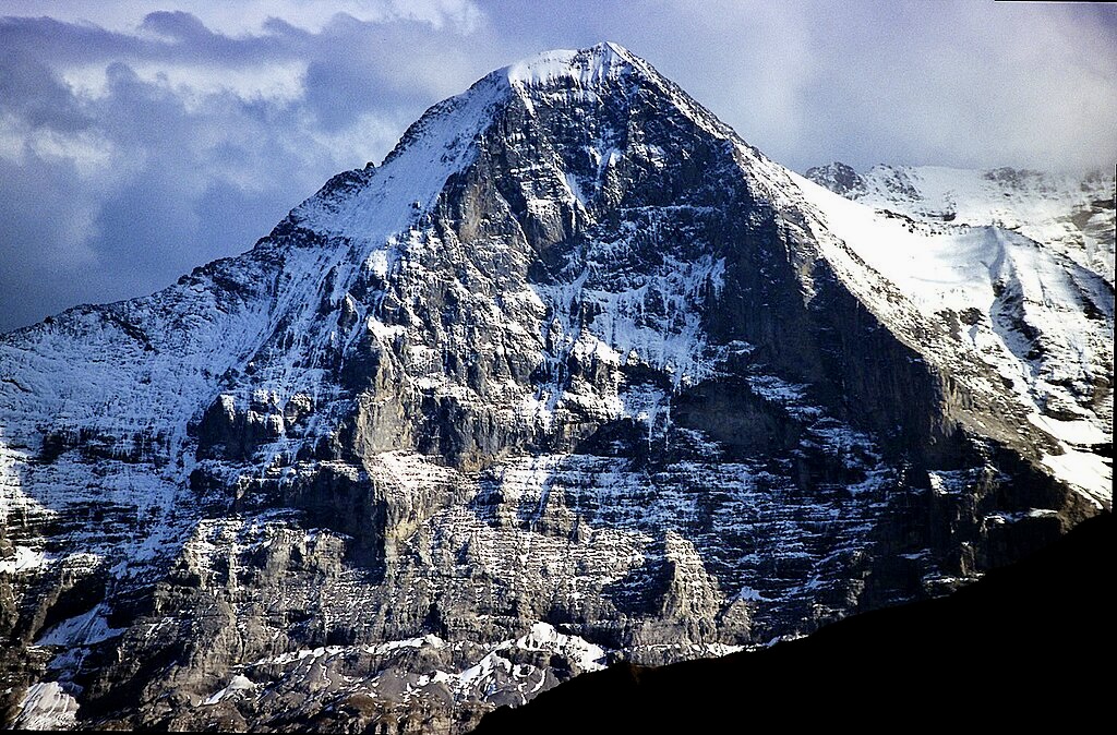
Other notable climbs in the Alps
In 1963, alongside American climbers Gary Hemming, Tom Frost, and Stewart Fulton, Harlin made the first ascent of the South Face of the Aiguille du Fou in the Mont Blanc massif. This climb was a technical masterpiece, involving steep rock and ice.
In 1964, Harlin, Chris Bonington, and Rusty Baillie climbed the northeast ridge of Cime de l’Est in the Dents du Midi in the Valais region of Switzerland.
In 1965, Harlin and Royal Robbins made the first ascent of the American Direct route on the West Face of the Aiguille du Dru, a steep and committed line that demanded advanced rock and ice skills.
In June 1963, Harlin became the Director of Sports at the American School in Leysin, Switzerland. He also founded the International School of Modern Mountaineering.
Locally, Harlin earned the nickname Blond God. He was an excellent athlete, a member of the all-American Services football team, and, when younger, the junior wrestling champion of California.
Return to the Eiger
In the 1930s, many viewed the Eiger North Face as a crazy objective.
"The forcing of the Eigerwand [North Face] is principally a matter of luck, at least 90% of the latter is required," Dr. Hug, a Swiss member of the Alpine Club, said at the time. "Extreme forms of technical development, a fanatical disregard of death, staying power, and bodily toughness are, in this case, details of merely secondary importance."
Colonel Strutt, the retiring President of the Alpine Club, agreed. "The Eigerwand continues to be an obsession for the mentally deranged of almost every nation. He who first succeeds may rest assured that he has accomplished the most imbecile variant since mountaineering first began," Strutt said in his farewell address.
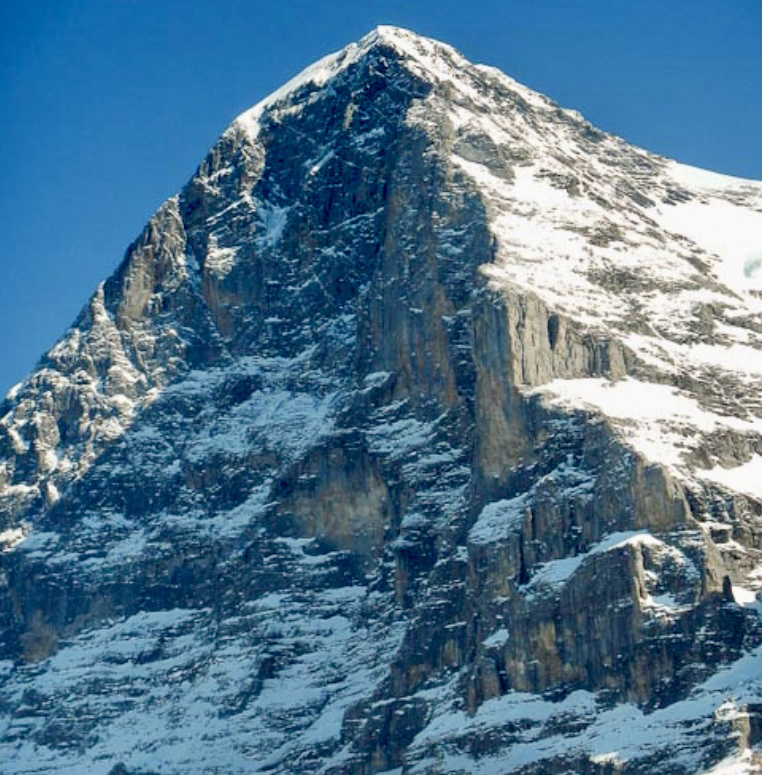
The North Face of the Eiger, rising 1,800m from its base to the summit at 3,967m, is notorious for its steepness, loose rock, and deadly weather. But it was finally ascended for the first time in 1938 by a four-man team that included Anderl Heckmair and Ludwig Vorg from Germany and Heinrich Harrer and Fritz Kasparek from Austria. The Heckmair route features ice fields, rock bands, and high exposure.
A German-Austrian party that included Toni Hiebeler, Walter Almberger, Anderl Mannhardt, and Toni Kinshofer made the first winter ascent of the Heckmair route in March 1961.
One year after his initial ascent of Eiger’s North Face in 1962, Harlin started to think about a direct line up the face.
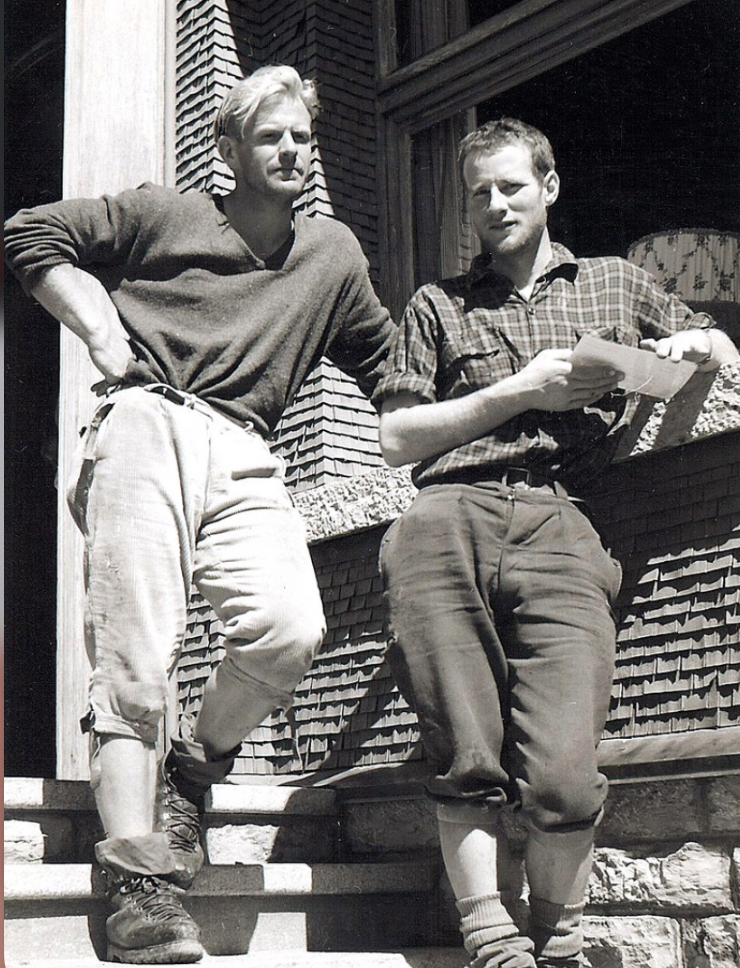
The team
Harlin made several reconnaissance climbs on the North Face. Finally, in February 1966, he organized a strong team. The group featured Colorado rock specialist Layton Kor (famed for his big-wall climbs in Yosemite), Scotsman Dougal Haston (known for Scottish winter ascents and prior Eiger climbs), experienced UK alpinist Chris Bonington, and Don Whillans in support. Don Whillans later withdrew from the expedition after a disagreement with the team.
In early February, Harlin’s party headed to Kleine Scheidegg, where journalist Peter Gillman would report on the ascent.
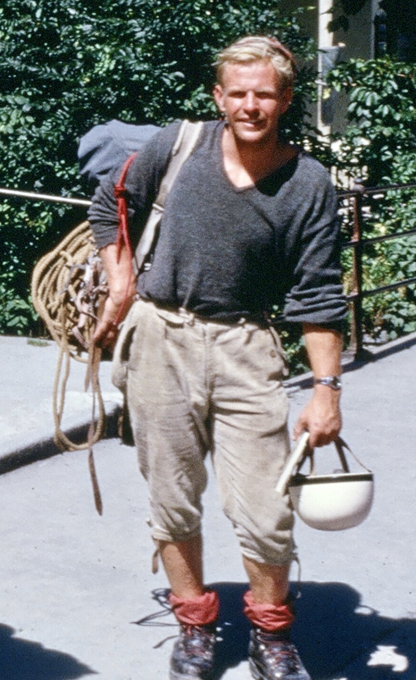
There had been rumors that a German team had their eyes on the same objective. At Kleine Scheidegg, it became clear that the teams would be rivals, with both keen to be the first to finish a direct line on the North Face.
The German team included leader Jorg Lehne, Gunter Strobel, Klaus Huba, Sigi Hupfauer, Karl Golikow, Rolf Rosenzopf, Gunther Schnaidt, and Peter Haag.
Harlin’s party aimed for an alpine-style dash, weather permitting, while the Germans planned a relentless ascent with fixed ropes, regardless of conditions.
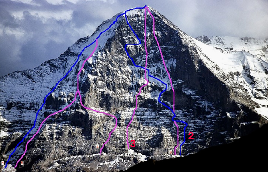
Starting the climb
Both teams began on Feb. 2, 1966, establishing base camps near Kleine Scheidegg.
The Germans fixed ropes systematically and advanced higher each day. Harlin’s smaller team pushed when the weather allowed, often climbing parallel to the Germans.
Both teams faced brutal winter storms, sub-zero temperatures, and frequent snowfall. Additionally, there was the danger from the North Face itself, offering exposure to rockfall and avalanches.
By mid-March, both parties had fixed ropes up to around 3,400m. Around March 15, after weeks of rivalry, the teams began sharing ropes and bivouac sites, prompted by harsh conditions and mutual respect. Harlin and Lehne negotiated a loose alliance, though separate summit pushes remained the goal.
The fall
On March 22 at around 10:00 am, Harlin was ascending a fixed rope alone. He was on his way to join the others, approximately 610m below the summit, at 3,360m. But the 7mm rope snapped, likely because of wear, ice damage, or rockfall. Gillman, who was at Kleine Scheidegg watching the climbers with a telescope, saw Harlin fall 1,000m to his death.
The British-American team was devastated. Kor descended soon after, effectively leaving the climb. Haston and Bonington stayed, determined to finish.
The Germans, higher on the face when the accident occurred, learned of Harlin’s death by radio and offered support. The tragedy catalyzed a full merger of the two teams, and they would now go for the summit together.
The John Harlin Direct
On March 25 at 2:30 pm, Haston, Lehne, Strobel, Hupfauer, and Huba reached the summit after a final 200m push. A storm hit the mountain after they summited, forcing a grueling descent via the West Flank, completed over two days.
The climbers, some suffering serious frostbite, named the line The John Harlin Route.
"When John Harlin fell to his death from the Eiger on March 22, 1966, the world of mountaineering lost one of its brightest stars. In the not quite thirty-one years of his life, Harlin had forged a career that was unique in ambition and achievement," James Ramsey Ullman wrote in the American Alpine Journal.
For further details on Harlin and the 1966 climb, we recommend reading Eiger Direct by Peter Gillman and Dougal Haston.
Early explorers weren't just worried about storms, starvation, mutiny, scurvy, wild animals, and all the other terrible fates that could and did befall them. They were also on guard against the monstrous humanoids that they thought lived just beyond the borders of the known world.
Before satellites and cameras, before accurate maps or reliable transportation, before modern understandings of biology and evolution, it was easy to think that anything could be out there.
Over thousands of years, a mythology of "monstrous peoples" evolved from the tales of historians and explorers. Today, few remember the whimsical imaginings that haunted the edges of maps. But as recently as the 18th century, they were considered very real dangers.
Monsters from the ancient world
Travelers' tales seem to grow more warped and fantastical the farther out they go from their starting point. Fifth-century BCE historian Herodotus wrote about traveling from his birthplace in modern-day Turkey to the boundaries of the Classical world. He records stories of giant ants in India, flying snakes in the Arabian peninsula, and half-lion, half-eagle griffins in North Africa.
He's somewhat skeptical about repeating these claims. Nevertheless, he writes, "the ends of the earth produce the things that we think most fair and rare."
The people also grew stranger with distance. On the border between Egypt and Ethiopia, he heard reports of "Troglodytes," cave-dwelling people whose language sounded like the squeaking of bats and who ate snakes and lizards. In India, he had heard, some tribes ate their friends and family if they became sick or weak.
The line between human and monster grew thinner as he got farther. Later writers built upon the corpus of monstrous peoples. In the imaginations of Europeans, the edges of their maps were filled with warped reflections of themselves, neither beasts nor proper people.
The fearsome Neuers were wolves in summer and humans in winter. The Phanesians had massive ears, which they used as blankets and pillows. The Ichthyophagi of India were totally covered in hairy bristles and lived in rivers and streams. But a few groups were mentioned particularly often, and they were some of the strangest.
Blemmyae
These were first described by Herodotus, who called them akephaloi, meaning "headless ones." He claimed they lived in Eastern Libya. Other Greek sources called them sternophthalmoi, or "chest-eyed." But they were later and better known as Blemmyae.
The Blemmyae, as their original names suggest, had no heads. Instead, their large faces were on their chests, shoulders, or stomachs. According to Roman writer Pliny the Elder, they lived in the ancient North African territory of Aethiopia, and were widely attested.
The curious chest-eyed people were popular in the Middle Ages as well. The 7th-century writer Isidore of Seville placed the Blemmyae in Libya. According to Isidore, there were two types of Blemmyae. Some, who were born as headless trunks, had their features on their chests. The others were born without a neck, and so their eyes were on their shoulders. What the practical difference is between those two things, he did not clarify.
The chronicler Bartholomaeus, writing in 1230, also includes Blemmyae, seemingly unsure what to make of them. Hedging his bets, he included them twice, once in the "animals" category and again in "peoples."
Cartographers frequently included Blemmyae on maps, as border illustrations or on distant lands. The Hereford Mappa Mundi, a massive early 14th-century map in the Hereford Cathedral, shows a shield and spear-wielding Blemmyae in Abyssinia (modern-day Ethiopia).
Different continents, same headless people
By the later 14th century, the Blemmyae were starting to appear outside of Africa. Mandeville's Travels, a mostly fantastical travelog by the probably fictional Sir John Mandeville, reports that the Blemmyae live on an island somewhere in Asia. His impression of them is distinctly negative, calling them "of foul stature and of cursed kind."
From there, the Blemmyae apparently emigrated to South America. In 1513, Ottoman admiral and explorer Piri Reis included them on his world map, near the coast of Brazil. According to his notes, they grew to about 5'3", with close-set eyes, and were fairly harmless.
Famed (and real -- here's looking at you, Mandeville) English explorer Sir Walter Raleigh was convinced by reports he'd heard on his travels that the headless men existed. They were called Ewaipanoma, and they had "their eyes in their shoulders and their mouths in the middle of their breasts." He didn't see them himself, but "every child" of Guyana knew about them, so he believed it.
Hundreds of years later, European writers proposed that maybe the sightings of Blemmyae were really sightings of apes, like chimpanzees or Bonobos, who can look like people with faces on their chests if you really squint and, I guess, haven't seen an ape before.
Ape or not, the Blemmyae made a mark on literary history, appearing in not one but two Shakespeare plays. The titular Othello claims to have seen "men whose heads/Do grow beneath their shoulders," while in The Tempest, Gonzalo says that when he was a boy, he believed in "such men whose heads stood in their breasts."
Cynocephali
While the Blemmyae had no heads at all, another purported race had the heads of dogs. The Cynocephali, or "dog-headed" people, first appeared in Ancient Greek writing. Fifth-century BCE physician Ctesias of Cnidus wrote that a tribe of dog-headed men lived in the mountains of India.
They wore animal skins and communicated with each other by barking, though they could understand the local language. The local Indians called them Calystrii and said they sent annual offerings of fruits, flowers, and amber to the King of India. In exchange, he sent them bows, swords, and other weapons.
The Calystrii were 120,000 strong and undefeatable in war but lived very simple lives. Instead of beds, they slept on leaves or grass, bathed rarely, and lived off raw meat. The lifestyle evidently agreed with them, because they could live up to 200 years.
According to Pliny the Elder, however, the Cynocephali were livestock kept by the Menismini people, a nomadic Aethopian tribe. The Menismini lived off the milk of Cynocephali, which they kept in vast herds of females, culling most of the males.
Man or beast?
Medieval depictions lean much closer to the earlier interpretation. The Liber Monstrum, a book of monsters found in the same manuscript as Beowulf, places the Cynocephali in India. They didn't speak, only bark, and lived off of raw flesh like animals do.
But other writers considered them more human-like than bestial. Odoric of Pordeno, a 13th-century Franciscan monk and world traveler, claimed to have encountered the Cynocephali on the island of Nicoveran. Now known to be one of the Nicobar Islands of the Indian Ocean, Odoric claimed it was home to a sophisticated dog-man society. The Nicoverans had organized religion -- they worshipped an ox, and wore ox-shaped gold and silver emblems on their foreheads -- and had a king who ruled well and justly, so that it was safe to travel his kingdom.
Marco Polo had quite a different impression of his dog-head-inhabited island. On the Angamanain Island (Adaman Islands) in the Bay of Biscay, he described a people with no king, who had heads like dogs. While the island was rich in spices, the people were beast-like and ate outsiders. Cannibalism is frequently mentioned in connection with dog-human hybrids.
Early modern explorers didn't seem to encounter any Cynocephali in the New World, but they were pretty sure they were there. Christopher Columbus claimed that natives had told him about a group of cannibals who had the faces of dogs. The Piri Reis map, following Columbus' claims, affixes a trio of dog men to the coast of South America.
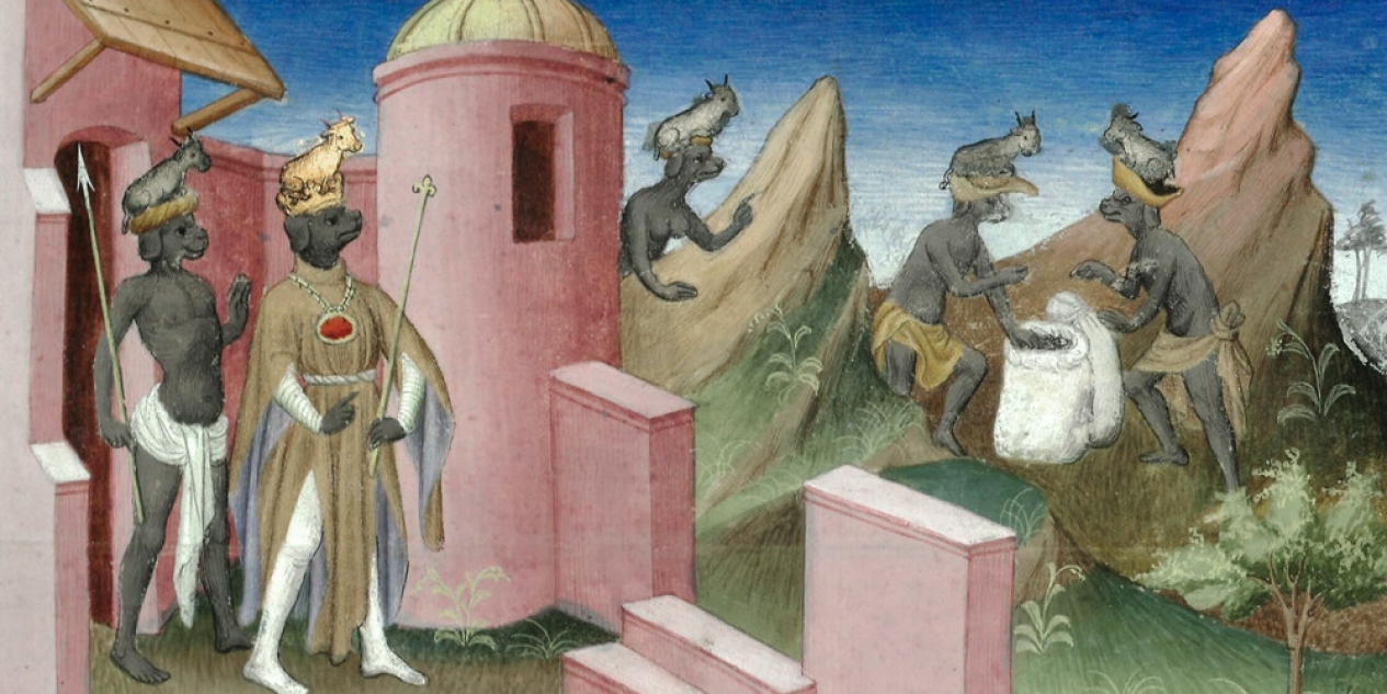
Sciapods
One of the more absurd Monstrous Peoples was the Sciapods. Ctesias of Cnidus placed them in India alongside the Blemmyae and Cynocephali. Instead of a pair of legs, the Sciapods had one large leg and foot. This giant foot was quite useful, allowing them to hop along faster than any two-legged creature. It could also be a sunshade or umbrella, and they would sleep with their foot held up over themselves to keep out rain or sun.
This habit gave them their name Sciapod, meaning "shade-foot." They were also called Monopod, or "one-foot." These rather whimsical people were well known in the ancient world, even appearing in Aristophanes' celebrated comedy play, The Birds, which debuted in 414 BCE. Pliny the Elder includes them in his Natural History, an exhaustive 39-volume encyclopedia.
Sciapods continued to be popular in the Middle Ages. In the Liber Monstrum, they are again described as moving very quickly and using their feet for shade. The book goes on to explain that their knees harden into an inflexible joint, making one wonder how they are jumping at all.
They appeared frequently as decorative motifs, as marginalia in illuminated manuscripts, on the borders of maps, and even carved into the walls of cathedrals.
But they stretched the boundaries of belief, even in a time when those boundaries were extremely flexible. Fourteenth-century writer Giovanni de Marignolli, who traveled to India and China, argued that occasional one-footed men may exist but that they were not an entire race. Instead, he says, earlier writers were seeing chatra, an umbrella-like device carried as part of royal regalia in India.
The point of monsters
You probably noticed that around the 16th century, something curious happened: The monstrous peoples moved continents. When an area became familiar, as trade routes opened and maps were filled in, the monsters moved to a new borderland. When early modern explorers reached the New World, they used the familiar images and stories of monstrous foreigners to understand their interactions with Indigenous people.
Famous Christian theologian Augustine of Hippo wrestled with the question of whether monstrous peoples like the Cynocephali and Sciapods were human or animal. He decides that no matter their appearance, if they are rational, then they are human, possess souls, and are descended from Adam.
But early modern explorers weren't so convinced. The notes on the borders of the Piri Reis map claimed the inhabitants of the New World, depicted as Blemmyae and Cynocephali, were like animals, not like people.
Depicting foreign people as monsters allowed Classical and later Medieval people to reassure themselves of their own superiority. They imagined themselves in contrast to "monstrous, uncivilized races" in Africa, India, and China. Establishing this contrast was even more important for explorers in the New World. If the people there weren't people at all but monsters, then it was all right to kill, enslave, and exploit them.
Eventually, the idea that foreign people were physically, literally monsters faded from the popular imagination. The fear and prejudice behind that idea, however, still haunts us today.
Mount Waddington, an infrequently climbed peak in British Columbia’s rugged Coast Mountains, was initially known as the Mystery Mountain because of its remoteness. This is the story of early expeditions to this fortress of ice and stone.
Hard to reach
At 4,019m, Mount Waddington is the highest mountain entirely within the Canadian province of British Columbia. Taller peaks, such as Mount Fairweather and Mount Quincy Adams, lie on the British Columbia–Alaska border.
Approximately 300km northwest of Vancouver, Mount Waddington is surrounded by deep valleys and glaciers. Even approaching it is a great adventure over extreme terrain, ice fields, and difficult peaks. Early explorers often compared the area to the Himalaya, and many films set in the Himalaya were filmed in the Waddington Range.
Discovery
Don and Phyllis Munday were a renowned Canadian mountaineering couple with experience in the Pacific Northwest, Rockies, Selkirks, and the Coast Mountains. Between the 1920s and the 1940s, the Mundays climbed more than 150 peaks, with over 40 first ascents. In 1924, Phyllis became the first woman to summit 3,954m Mount Robson, the highest peak in the Canadian Rockies. She climbed with Annette Buck, and Don Munday also summited.
In 1925, Don and Phyllis Munday spotted a huge peak from Mount Arrowsmith on Vancouver Island. It is unclear if this was Mount Waddington, but their observation sparked exploration of the Waddington Range. The Mundays were the ones who dubbed that distant peak Mystery Mountain.
Authorities officially named Mount Waddington in 1928, following the recommendation of the Mundays. Alfred Waddington was an industrialist who advocated for a road and railway through the region.
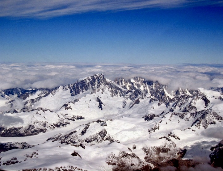
The Mundays' attempts
For over a decade, the Mundays made several attempts to climb Mount Waddington, the most important of which was their 1928 expedition.
The couple began from the Franklin Glacier on the southwest side and ascended via the northwest ridge. On July 8, they reached the lower northwest summit at around 4,000m. There, they concluded that reaching the main summit would be too dangerous.
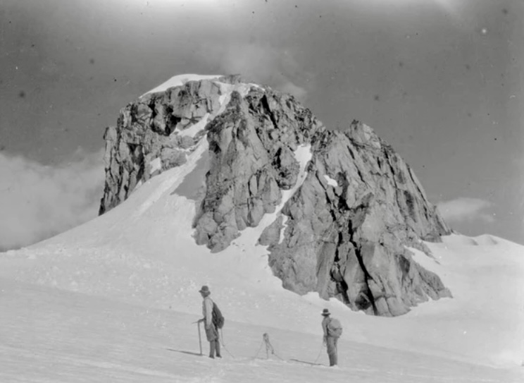
Tragedy in 1934
In the summer of 1934, a party from British Columbia, including Neal Carter, Alan Lambert, Alec Dalgleish, and Eric Brooks, likewise approached the mountain via the Franklin Glacier. They targeted a couloir on the south face leading toward the southeast ridge.
They reached 3,700m, but the expedition was called off after Dalgleish fell to his death on June 26. The accident happened only three days after they had established base camp.
Other attempts
In the same year, a Winnipeg-based team attempted to ascend via the Tiedemann Glacier and the northwestern flank. The party turned around 180m below the summit because of bad weather on June 28, 1934.
In 1935, climbers from California made three attempts from base camp at Dais Glacier, including two tries via the South Face. They failed to summit because of bad weather and technical difficulties. Their highest point was around 3,500m. During a third attempt, two climbers reached the northwest summit, first climbed by the Mundays in 1928.
According to climber Fred Beckey, there were 16 attempts on Mount Waddington before its first ascent. However, Beckey didn’t list all 16 attempts in his writings.
Fritz Wiessner and his small team
In the spring of 1935, alpinists Bill House, Elizabeth Woolsey, and Alan Wilcox started to plan an expedition to the Coast Range. A year later, German-American Fritz Wiessner joined the trio and led the small team to attempt the still-unclimbed Waddington in the summer of 1936.
Wiessner’s team learned that the British Columbia Mountaineering Club (BCMC) and the Sierra Club of California had joined forces. As a combined party, they were planning to climb Mount Waddington at around the same time.
According to Bill House’s report in the American Alpine Journal, after a meeting between the leaders of both groups, they agreed that the mountaineering clubs would attempt the climb first. Both teams targeted the South Face, with the BCMC-Sierra Club team setting up base camp at Icefall Point on the Dais Glacier.
The BCMC-Sierra Club team did not succeed. They couldn’t find a viable route up the face on difficult terrain.
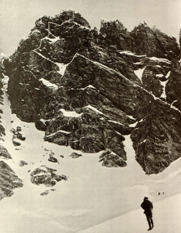
The South Face
The South Face, broken up by three couloirs, is known for poor route conditions and falling ice. An 800m granite wall of complex rock, snow patches, narrow couloirs, and mixed icy sections complicate the climb.
After a challenging approach via the Franklin Glacier, Wiessner’s team established their base camp on July 14, 1936. Like the BCMC-Sierra Club team, they chose Icefall Point (1,787m) on the upper Dais Glacier. Icefall Point is a spur of heather-covered rock. According to House, it’s the last place where a party can find firewood and running water.
Woolsey and Wilcox helped carry loads to camp but wouldn’t join the summit push.
On July 20, Wiessner and House started up via the left branch of a couloir between the main summit and the northwest peak. They eventually retreated because of poor rock conditions.
So instead, they then headed to the right of the South Face. By 2:45 am on July 21, Wiessner and House were on their way toward the summit from their high camp. They climbed the 305m upper section of ”forbidding-looking” rock in 13 hours.
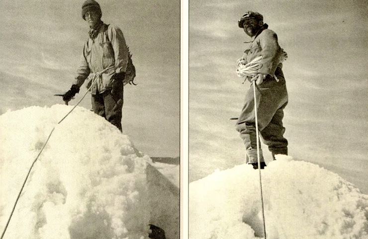
The summit
On July 21, Wiessner and House topped out.
”It is a hopeless task, as every mountaineer knows, to try to do justice to one’s feelings at the summit of a difficult peak. Probably relief is the most dominant one at the time,” House recalled.
On the top, they left a summit register in a waterproof match can. Wiessner and House descended by the same route and reached base camp on July 22 at 2:00 am. Their round trip took just over 23 hours.
It was a lightweight, alpine-style ascent using minimal, rudimentary gear (18 pitons). This contrasted with earlier expeditions, which tended to be large, complex affairs.
Wiessner and House demonstrated that the ”unclimbable” could be climbed. The 1936 first ascent marked the culmination of years of exploration and ticked off one of the last major unclimbed summits in North America.
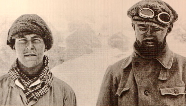
Two teens target Mount Waddington
In 1942, six years after the first ascent, 19-year-old Fred Beckey and his 16-year-old brother Helmy Beckey decided to climb Mount Waddington's South Face. With World War II underway, resources were few, and the Beckey brothers had no sponsors or porters, only their parents’ vague approval.
"Long behind seemed the months of preparation, conditioning climbs, and first ascents made in the Northern Cascades of Washington in June,” Fred Beckey wrote.
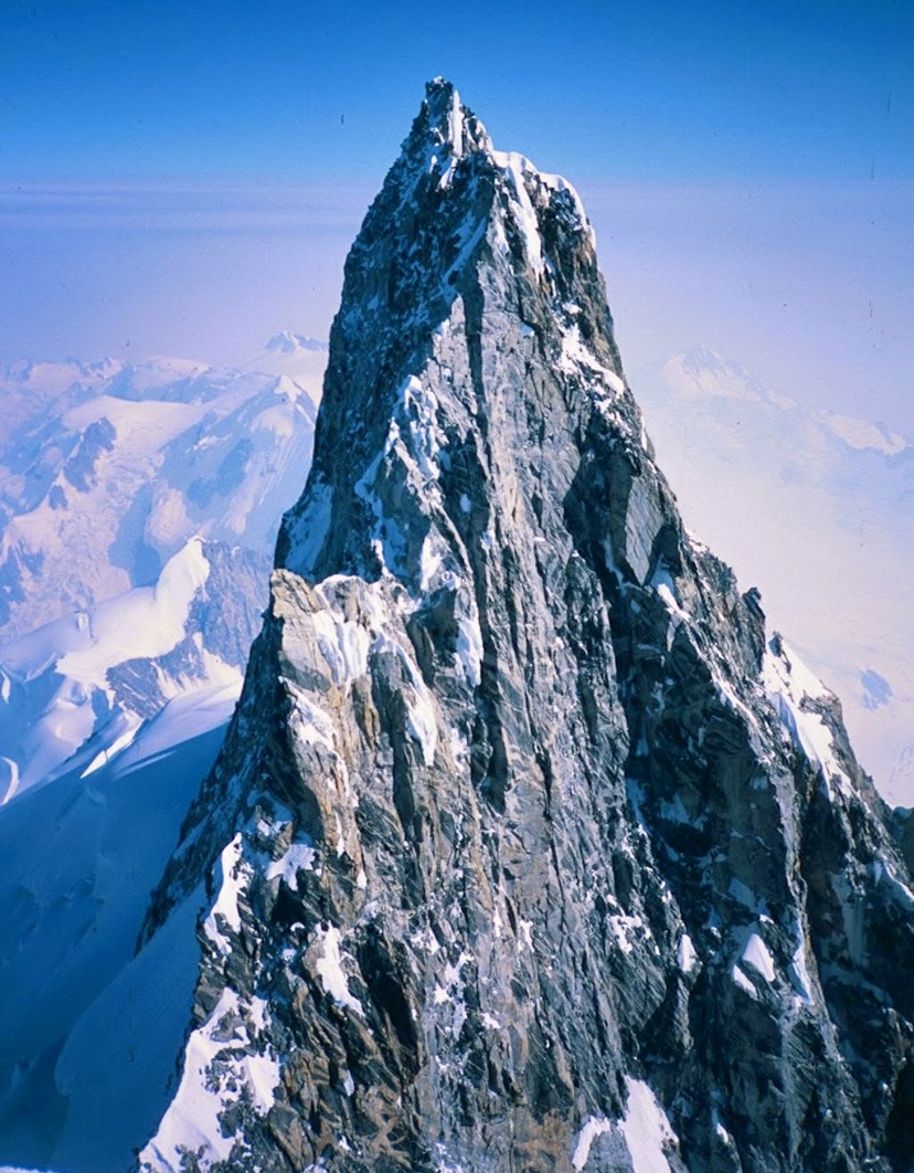
With climber Eric Larsson, the brothers started their multi-stage journey from Seattle. Traveling via bus to Vancouver, then steamship to Knight Inlet, and finally via a smaller boat to the Franklin River delta, they approached overland on foot.
After several days of travel from the coast, they reached the Franklin Glacier. Crossing required 32km of unsupported glacier travel. The approach added more than 2,000 vertical meters and weeks of effort to their adventure.
On the second day on the Franklin Glacier, Larsson fell ill and had to quit. The Beckey brothers continued and established base camp on the glacier below Waddington’s southwest face on July 20.
The ascent
The brothers decided to attempt the South Face route slightly to the right of the chimney climbed by Wiessner and House.
They traversed the glacier, navigating crevasses and icefalls to reach the base of the face. They carried minimal gear and moved in a lightweight style. Then they climbed to a higher camp to position themselves for a summit push. That process took a couple of days in complex terrain and worsening weather. When conditions allowed, they moved up quickly.
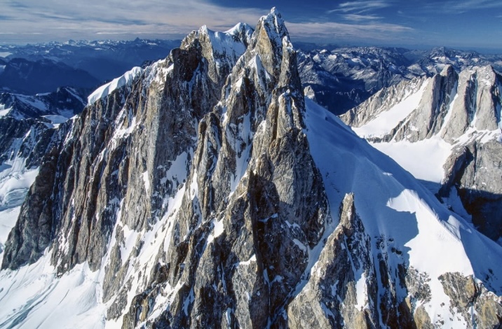
On the upper face, Fred Beckey changed to tennis shoes with felt pullovers to mount the rock slabs.
"The pullovers adhered well to the rock when wet and could be removed quickly for more friction on dry rock," Fred Beckey wrote in his report. (The term ”pullover’ refers to an improvised covering for the shoes.)
As they climbed, ice fragments broke off the summit ridge and thundered down the chimneys to their left.
On August 8 at 8:30 pm, Fred and Helmy Beckey topped out on the main summit. It was one day after Helmy’s 17th birthday. On the summit, they found Wiessner and House’s match-can register. It was the second ascent of the mountain.
During the descent, Helmy was hit on the knee by a rock as they descended into the gap between the northwest and the main peaks.
"This was Helmy’s birthday present, donated by Mount Waddington,” Fred said. ”Any hope of reaching camp that night was gone because of a heavily bleeding cut.”
The next day, they continued their descent and reached base camp.
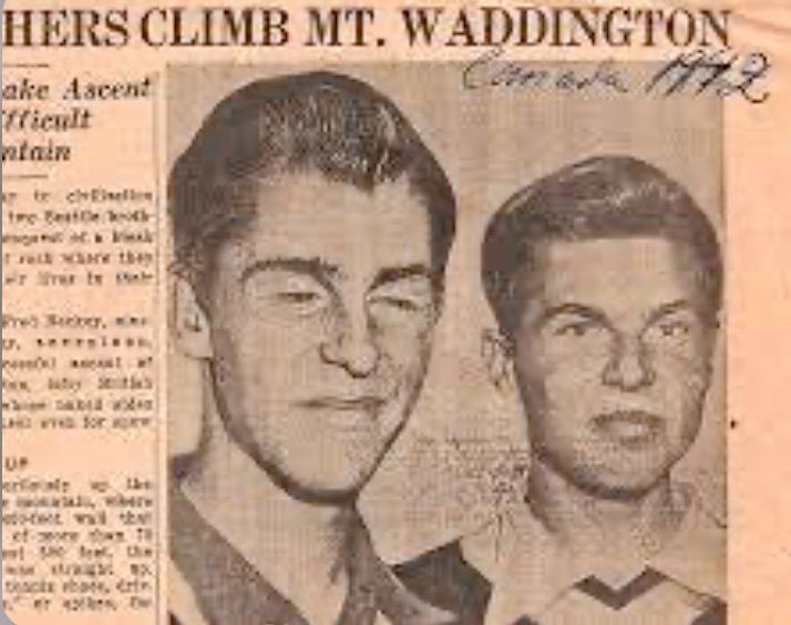
Legacy
The Beckey brothers' feat was outstanding. Fred continued his climbing career and made hundreds of first ascents in North America. He also wrote a dozen books, hundreds of climbing reports, and several climbing guides. He dedicated his life to mountaineering and died at 94.
Colin Haley, who in 2012 made the first solo ascent of Mount Waddington, wrote about Fred Beckey for the American Alpine Journal:
"Fred was without a doubt the most accomplished climber ever to come out of North America and is among the all-time greats, right alongside figures such as Riccardo Cassin, Hermann Buhl, Lionel Terray, Walter Bonatti, and Reinhold Messner."
In 1996, Fred Beckey, John Middendorf, and Calvin Herbert made the first ascent of a peak in the Cathedral Mountains in Alaska. They named it Mount Beckey.
We recommend watching the documentary Dirtbag: The Legend of Fred Beckey, by Dave O’Leske.
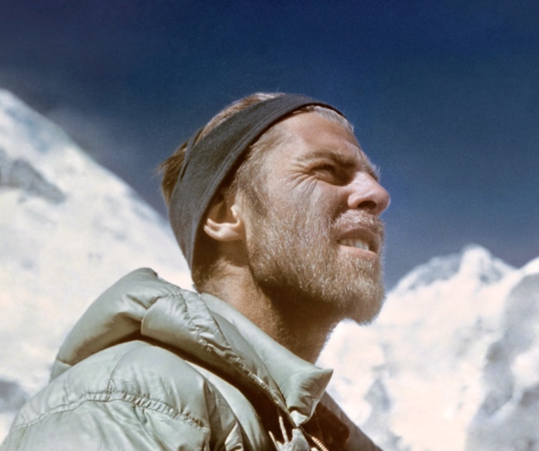
During the late 19th and early 20th centuries, denizens of the Old West reported seeing a strange and mysterious beast: the camel. These sightings were not the fevered hallucinations of cowboys experiencing heatstroke, dehydration, whiskey, or tuberculosis. There really was a population of feral camels wandering the Sonoran Desert.
How did a bunch of camels end up loose in the desert? The U.S. Army, of course.

A quartermaster dreams of camels
The two visionaries met during the Mexican-American War. Henry Constantine Wayne was a Georgia native in his early thirties, a former West Point instructor decorated for his bravery in the battles of Contreras and Churubusco. The Pennsylvanian George Crosman was older, almost fifty, and saw little active combat. He was a logistics man with camel-related ambitions.
In 1836, Crosman had presented a proposal to the higher-ups in the War Department, advocating a U.S. Army Camel Core. They were unreceptive. A decade later, however, Henry Wayne was listening. Wayne wrote his own report for the War Department, and this time it ended up on the desk of a fellow West Point alumnus: Mississippi Senator Jefferson Davis. He was interested.
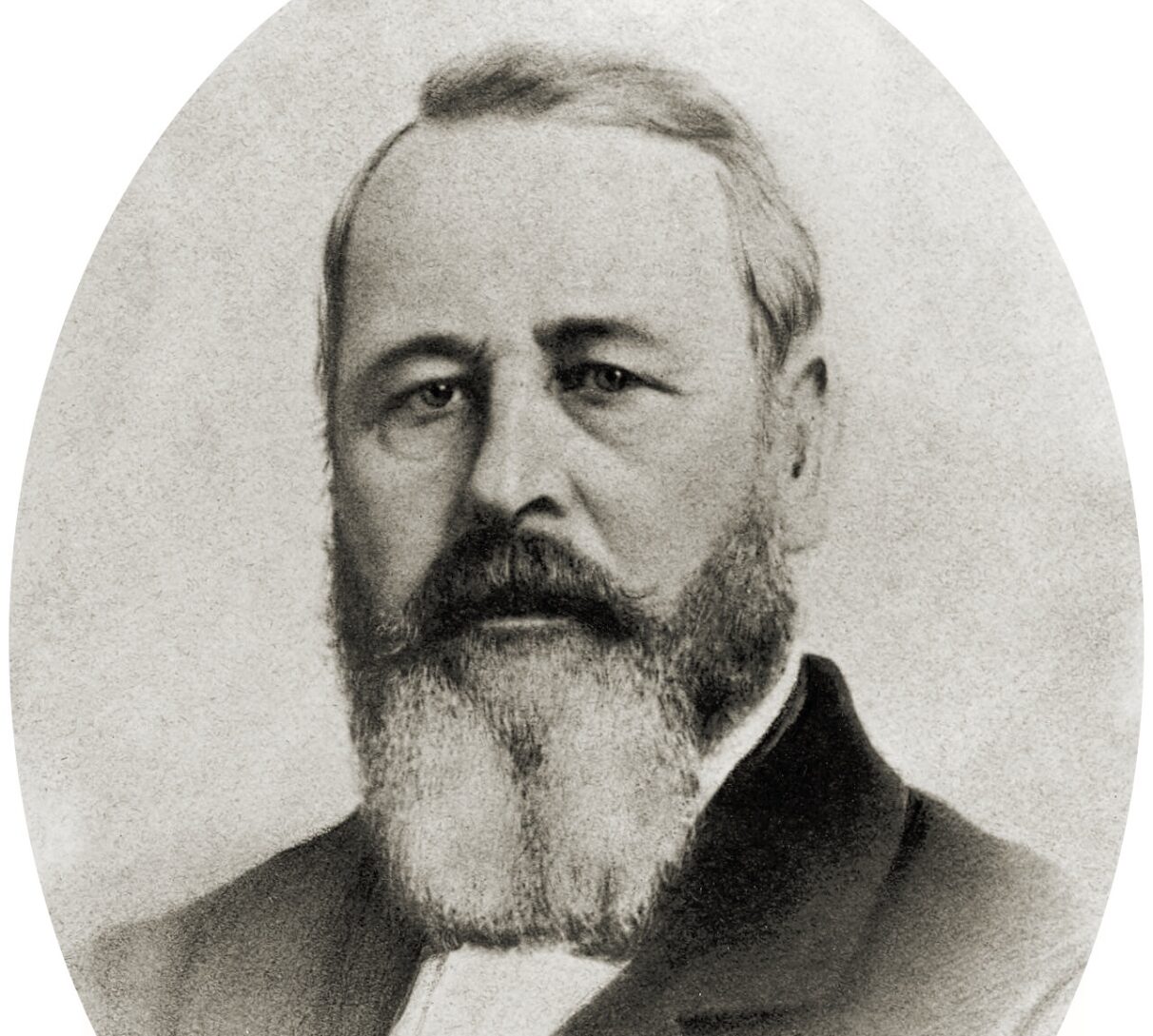
The U.S. Army Camel Corps
At the time, the issue of slavery dominated American cultural and political debate. Specifically, the expansion of slavery. As the U.S. carved more and more territory from Mexico and various Indigenous nations, they would have to decide whether brand-new states would hold slaves or not.
With every new territory came a race to move as many slave-holding settlers (and their slaves) into the area. If they could get a significant enough voting block together, then the territory could be a slave state once it attained statehood.
Davis, a Southern plantation owner and, jumping ahead here, future President of the Confederacy, was extremely pro-expanding slavery. The corresponding drive to Manifest Destiny convinced him there was an urgent need to forge paths through the desert. And he thought camels would help him do it.
After half a decade, Congress finally agreed to let him try out the camels. Congress gave Davis, now Secretary of War, $30,000 for camels. Major Henry C. Davis appointed Wayne as head of the project immediately.
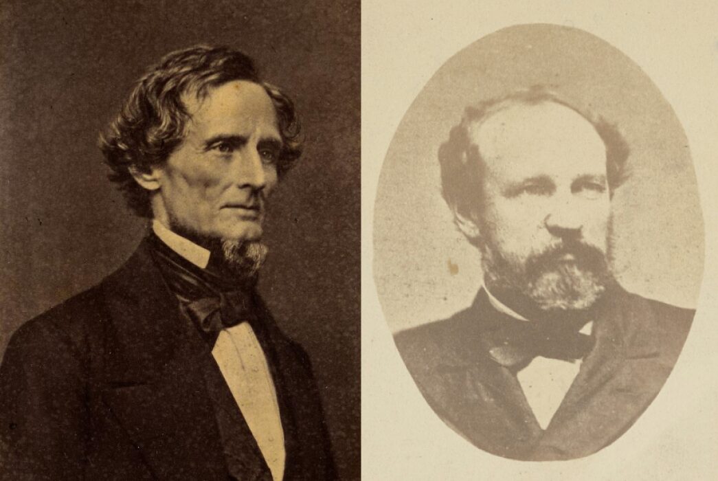
The Cape Verde camel camp
Wayne sent the USS Supply, commanded by David Dixon Porter, to buy as many camels as he could fit in the ship. Porter's father was a diplomat who had taken his son along on trips to the Middle East, so was qualified for the position in that he had seen camels before. He fitted the ship with custom-made harness and ventilation systems and loaded up 33 camels and five Arab and Turkish drivers.
The modifications to the Supply did their job, and the ship duly landed in Texas was 34 camels aboard. One had died, but two calves had been born. The trip had gone so well and so cheaply -- they still had $22,000 left -- that Wayne sent Palmer right back to Egypt for a second load. Six months later, in early 1857, Palmer delivered another 41 camels to Texas.
Wayne took the camels, the hired drivers, and a (likely somewhat confused) herd of army soldiers and marched them over 190km to San Antonio. He then moved them another 90km to Camp Verde, where he established a more permanent camel facility.
Experiments with camels
It wasn't entirely off-base to think camels might do well in the American Southwest. Camels are sturdy, heat and drought-resistant, and incredibly tough. In fact, a now-extinct camel ancestor, the Camelops, lived all across the region during the Pleistocene era. The species had been discovered and named only three years before Wayne began experimenting at Cape Verde.

On the trail, the experiment seemed to pay off. The camels could go without water for over a week and were content living off scrub grass. The heat didn't bother them, and they faced the hardships of the trail with placid indifference.
There were some hiccups. Soldiers were used to constantly whipping their mules and horses, but camels don't put up with mistreatment. The men were unpleasantly surprised when their desert steeds responded with terrible violence and jets of cud. The smell of camels was also a frequent complaint. But their performance was undeniable.
In one test, comparing a team of six camels with a similar team of mules, the camel team was able to transport twice the amount of goods in half the time. Wayne was thrilled, writing that the results of the camel trials were "as favorable as the most sanguine could have hoped."
A new administration began in March of 1857, and both Davis and Wayne were out of their old jobs and off the camel division. But after investing so much money and time, the military wasn't ready to give up.
Beale's Wagon Road
As in any good Western film, the railroad was coming to town. Eventually. First, Congress needed someone to survey the route between Fort Defiance and the Colorado River. The man who won the contract was Edward Fitzgerald Beale, a wealthy frontiersman and former California Superintendent of Indian Affairs. His previous claim to fame was starting the Gold Rush by bringing the first Californian gold nuggets back East.
It was only once he had already signed the paperwork that the Secretary of War, Columbo-esque, said there was just...one more thing:
He was going to have to use camels. Despite Beale's repeated and strongly worded protests, he was given 25 camels. They set out in June of 1857, surely an ideal time of year to cross vast deserts.
At first, the camels lagged behind. The lead camel driver was patient, though, slowly conditioning the animals to haul heavy loads. He was a Syrian-Greek Muslim convert named Hadji Ali, which the American soldiers bastardized as "Hi Jolly."
Under Hadji Ali, the camels found their footing, and Beale was soon grateful to have them. They began outpacing the horses and mules, even carrying 300 kg. After months of hauling heavy supplies, not only had no camels died, but they were as healthy as when they had left. Beale was a camel convert, saying that "there never was anything so patient or enduring and so little troublesome as this noble animal."
After the success of this venture, Beale took camels on another expedition, this one over a year long. Again, they performed terrifically. His report to Congress strongly urged further investment in the camel. They weren't interested.
Texas wants camels
While Beale was forging his wagon trail, Henry Wayne was still enthusiastic about camels. He published a letter in an 1858 edition of the National Intelligencer, extolling the virtues of camels as pack and work animals. In addition to being strong and hardy, he claimed, they were docile enough that enslaved people could handle and manage them.
His article was reprinted and read across the South, and private Southern plantation owners rushed to import camels of their own.
There was another benefit that importing camels brought to slave owners. The U.S. had banned the importing of slaves in 1808, but that didn't stop demand. Slave ships, however, were easy to spot. The characteristic large water tanks, excess food supplies and the stench of death and excrement gave away the game to patrolling British warships. But camels were the perfect cover, requiring food and water tanks and producing strong odors, and being brought from West Africa to the Southern United States.
Mere months after Wayne's article was published, the Thomas Watson docked in Galveston and publicly unloaded 89 camels. Federal officials suspected it was secretly a slave ship but didn't feel there was enough evidence to investigate further. Meanwhile, the camels were released into the town, causing havoc. Three years later, authorities caught the owner of the Thomas Watson, John A. Machado, smuggling slaves into the U.S.
Brother against brother against camel
The mule lobby, worried that the sturdier, hardier camels would ruin them, pressured Congress to end the camel experiment. But the main reason Congress wasn't interested in Beale's camel report was that they were very busy at the moment. Half of the country was seceding. The outbreak of the Civil War ended the American camel experiment. Those camels already in the country were caught between the two sides.
Many privately owned camels were set loose in the desert as mining and farming operations ground to a halt.
Cape Verde was captured by Confederate forces in 1861. The Confederates put some of them to work transporting supplies but treated the animals poorly, and many died. One was even pushed off a cliff by its new owners. A standout, "Old Douglas," became the mascot of the 43rd Mississippi and was killed by a Union sharpshooter at Vicksburg.
The Fort Tejon herd remained in Union hands and fared better. They were kept in good condition, transferred from station to station, as officials tried to think of something to do with them. After three years, Secretary of War Edwin Stanton ordered them sold off. When the war ended, those who had survived their time with the Confederacy were also sold, for only $31 per animal.
Old friends and camel fans Henry Wayne and George Crosman ended up fighting on opposite sides. Confederate inspector-general Wayne's most relevant action was failing to stop Union forces from crossing the Oconee River in his home state of Georgia. Crosman, then in his late sixties, was recognized for his dedicated service as the Chief Quartermaster for Pennsylvania.
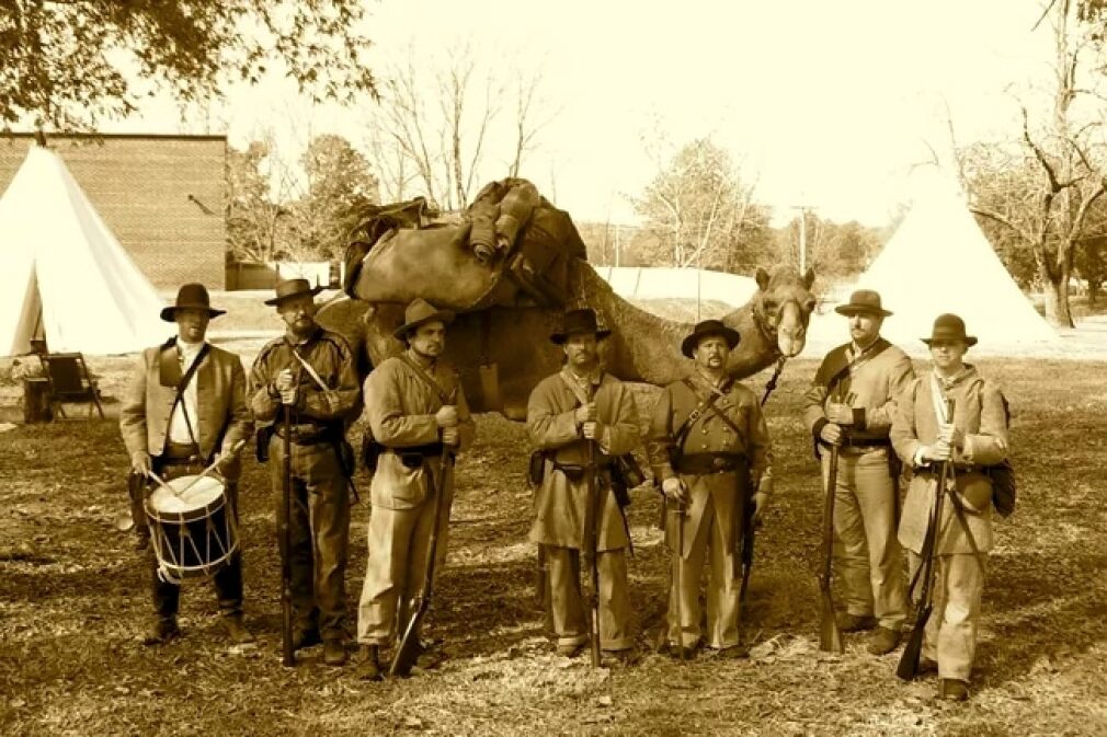
Circuses and creosote
After the war, the old camels were scattered across the frontier. Many ended up in circuses and zoos, while others were put to hard labor in mines. Edward Beale, still fond of the animals, bought some for his ranch. Bored Western townspeople started holding camel races with rounded-up animals.
Eventually, most of them were turned loose to fend for themselves. Camels are pretty good at that, and they can easily live into their fifties. They formed small herds, interbreeding and happily eating the creosote bush that few other animals would touch. Their ancestors, the Camelops, had once fed on the same plant.
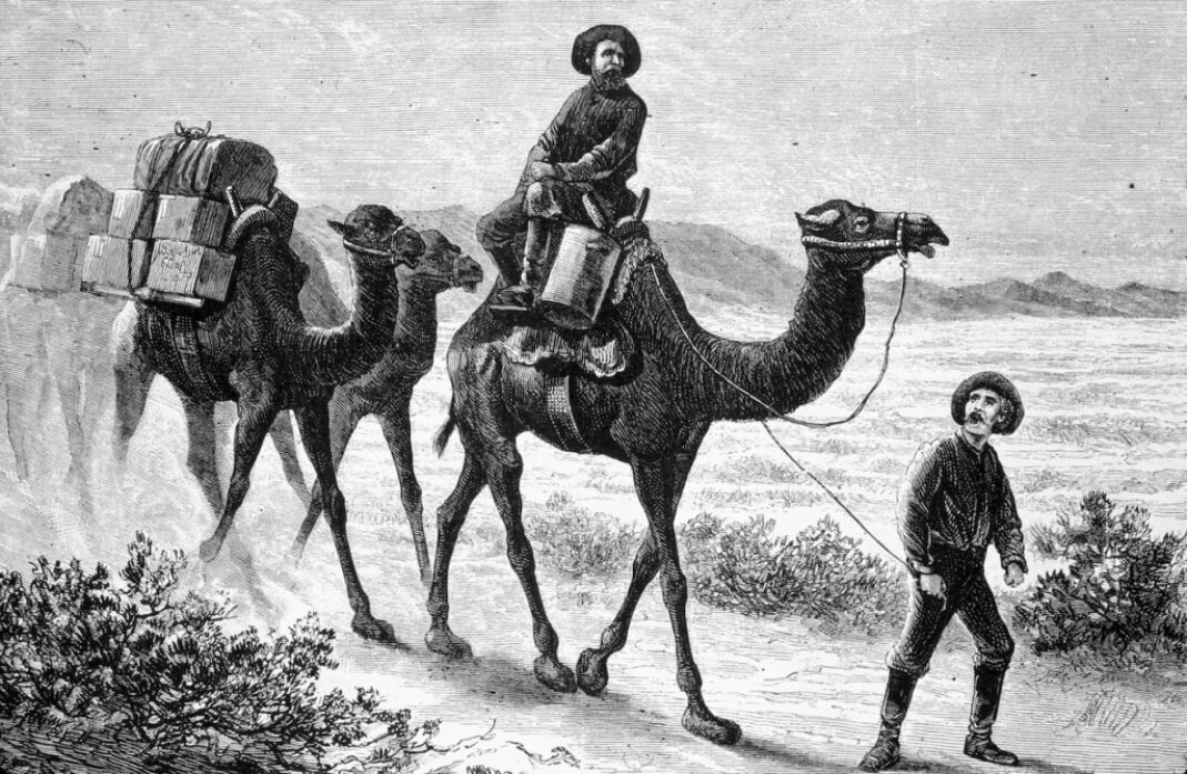
The legend of Hi Jolly
Hadji Ali kept two of the old army animals, Maya and Toulli, who helped pull his wagons. He had turned to prospecting, but he still did a fair bit of camel wrangling when required. With so many camels roaming around, it was sometimes required. In 1873, Ali led over seventy camels through the streets of Tucson, Arizona to a mining operation in Colorado.
He settled in Tucson for a time, marrying and having two daughters. But he still dreamed of digging up gold and left for the remote settlement of Quartzsite, Arizona. There, locals reported he would be called in to deal with feral camels from time to time. He mostly failed at prospecting but became a beloved local character, living off charity.
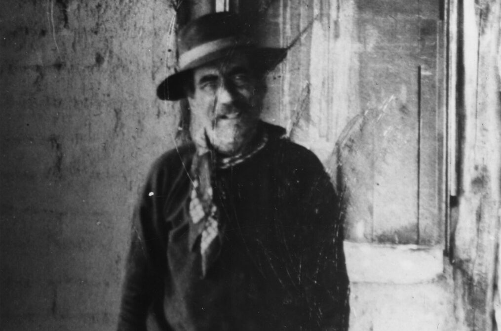
An early Arizona congressman, Mark Smith, tried to help Ali, appealing to the government for a pension. After all, Ali had served in the U.S. Army across various projects for almost thirty years. But he wasn't officially on the books, and they said no.
In late 1902, he died destitute. But the small town of Quartzsite didn't forget him. Over thirty years later, the Arizona State Highway Department erected a monument over his plain wooden grave marker. The stone pyramid, topped with a camel-shaped weathervane, is still there today.
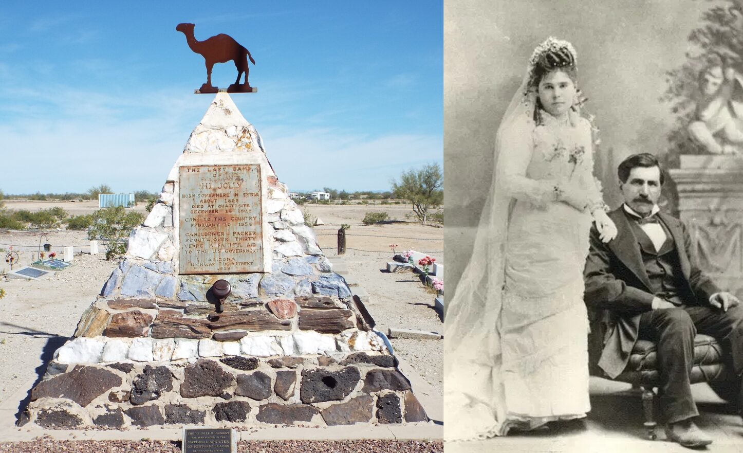
Strange sightings
During the late 19th and early 20th centuries, encounters with camels trickled in, mostly from prospectors and cowboy-types. Here are only a few of the many stories, most of which are vague and impossible to verify.
1875, an old army camel wandered into Bandera, Texas and was captured by a fellow Camel Corps veteran.
The future General Douglas MacArthur remembered seeing one as a small child in 1885, "one of the old army camels," wandering outside the garrison at Fort Seldon, New Mexico.
The International Boundary Commission, on an 1887 surveying project to establish the Mexico-U.S. border, saw a pair of camels. They were looking healthy, living about 60 kilometers from the border.
In 1907, a prospector reported seeing a pair of them in the wilds of Nevada.
The Red Ghost
The most famous and spectacular camel sighting was of the Red Ghost.
Sighting is probably too gentle a word. Encounter might be better. According to contemporary 1883 newspaper reports, the wild camel was out of control, knocking a woman over and trampling her to death.
Weeks later, a nearby group of miners had their camp destroyed by a large, red creature. After a third sighting, a well-respected local hunter named Cyrus (sometimes Si) Hamlin identified it as a camel. A camel which seemed to have something strapped to its back.
The same year, a group of hunters in the Verde Valley, less than 100 km away, saw it again. A large, red camel with something tied to it. They got closer and fired a few shots, which scared it away. But when it bolted, something fell off, coming to rest on the dry-baked earth.
It was a withered human head.
Years later, a cowboy saw it in an abandoned corral east of Phoenix. He, too, believed he saw a corpse tied to the camel.
The reign of the Red Ghost ended in 1893. A farmer named Mizoo Hastings caught the beast eating his turnips and promptly opened fire. When he examined the body, he found deep scars which looked to have been left by leather straps.
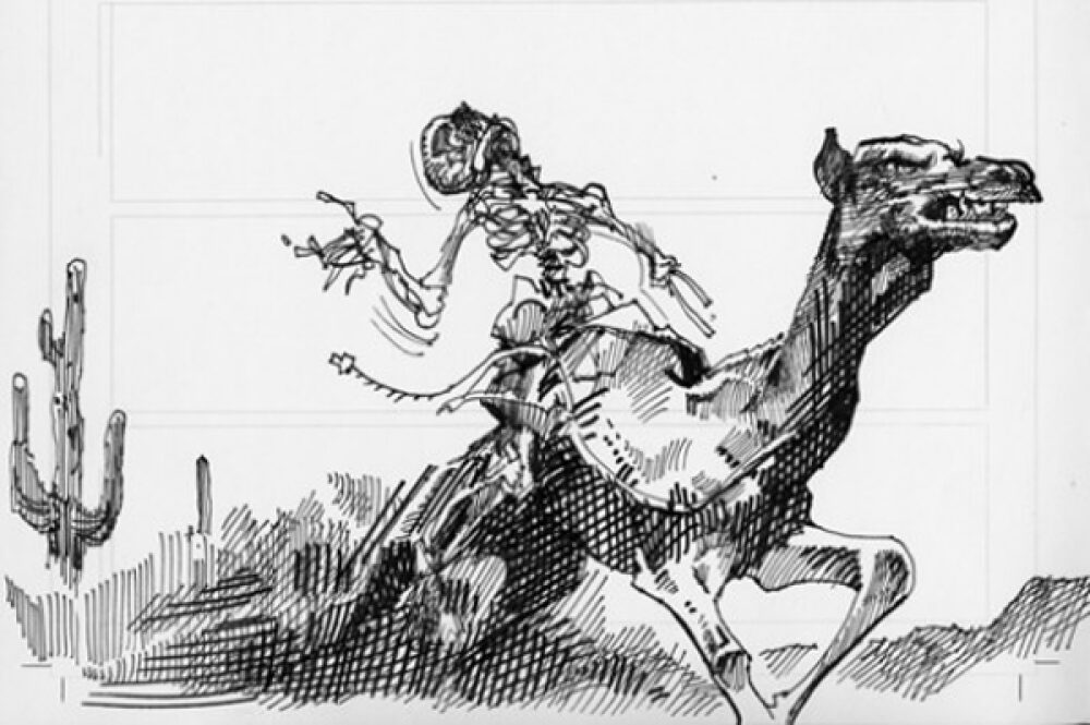
Who was the man tied to a camel?
Many theories and tales of the Red Ghost have been passed around since then. As a kid in Southern Arizona, I heard that the man was a prospector who got lost in the desert. He either owned or had caught a camel. Feeling himself grow weak from thirst, he strapped himself to the beast, hoping it would take him to water. Camels need to drink far less frequently than prospectors do, so the unfortunate fellow died before his camel grew thirsty.
Another theory is that it was an Army prank gone wrong. A soldier was jokingly tied to one of the captured camels by his laughing comrades. The camel bolted, though, running off into the desert.
More supernaturally-minded people might call the beast a vengeful ghost. The angry spirit of hundreds of camels brought far from their homes to toil and which then were abandoned.
Is there any truth to the Red Ghost? Sightings really were reported in newspapers. Camels really were out there in the desert. The Red Ghost occupies the place of all good folklore: It lives in the realm of plausibility.
Are they still out there?
As late as 1929, there were reports of a wild camel frightening a herd of horses in Banning, California. But the days of the wild American camel were ending.
In 1934, "Topsy" died in Los Angeles' Griffith Park Zoo. She had wandered alone from Arizona into Los Angeles, where she found a home until her death.
Sightings continued, of course, though they were less credible. Even today, over 150 years since the camels arrived, some believe there are wild populations alive out there. I have personally met people who swore to have seen a camel out in the desert.
My heart says yes. Experts say no. There wasn't a large enough breeding population to sustain wild American camels beyond two or three generations. There hasn't been a confirmed sighting in over a hundred years. The legacy of the feral American camel, however, remains.
The wagon road that camels helped build never became a railroad line. It did become Route 66, though.
It’s 1553, and Sir Hugh Willoughby is leading three ships into uncharted arctic waters to search for the Northeast Passage -- a direct route from Europe to China and India via northern Russia.
His expedition set out from Ratcliffe, a shipbuilding center on the outskirts of London. Three proud ships make their way down the Thames, past crowds of onlookers along the riverside, as the captain stands tall on the prow of his flagship. He is never seen alive again.
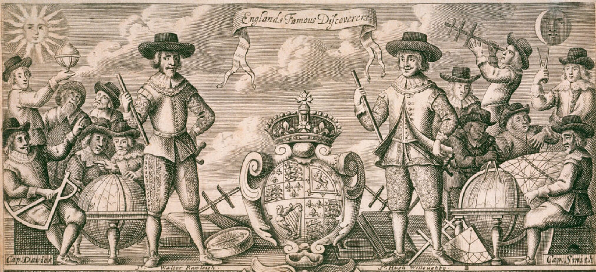
An unlikely captain
Willoughby might have looked the part while the ships set sail, but he was a surprising choice to lead an arctic expedition. He had no seafaring or navigation experience and had likely never left the British Isles before. But he had a talent for impressing the right people at the right time.
By the time he was a teenager, Hugh’s wealthy noble parents had both died. As a younger son, he received just a small share of his father’s estate. His older brother John received instructions to look after Hugh and find him a wife.
Hugh did not find a wife (though he did acquire a daughter at some point). However, he took a lesson from his late father, who earned a knighthood from his military service during the Wars of the Roses. The lesson was this: In the tumultuous social and political world of Tudor England, advancement could come readily to young noblemen willing to get their swords dirty.
Martial glory?
Hugh began his career fighting in the Scottish border wars. In 1544, he was knighted by his commander, Edward Seymour, the Earl of Hertford, and became Sir Hugh Willoughby.
His networking continued to pay off. In 1547, the king died, leaving his nine-year-old son Edward on the throne and appointing a council to rule until the boy came of age. Heading that council was Sir Hugh’s old friend Edward Seymour, now the Duke of Somerset and the most powerful man in England. Somerset made Hugh the captain of Lowther Castle so he could continue menacing the Scots.
By 1549, however, Somerset had become a controversial ally. Unpopular policy decisions and failed military campaigns led to his fall from power. Somerset himself spent a few years in and out of the Tower of London before losing his head.
Seeing all this going down, Sir Hugh decided it was time for a career change. Inspired by seafaring friends, including Venetian explorer Sebastian Cabot, he became a sea captain.
Company of Merchant Adventurers to New Lands
Cabot was in England, serving as central authority in all maritime and shipping matters, when Hugh befriended him. Sir Hugh, Sebastian Cabot, and a third man, Richard Chancellor, formed a company in 1551. Like Cabot, Chancellor was a career explorer and seaman. All three shared the goal of finding a Northeast Passage to “Cathay” (China) and the spice riches it would bring.
It was called the Company of Merchant Adventurers to New Lands. In 1553, King Edward VI formally incorporated them. They wasted no time setting up their first expedition, which Sir Hugh Willoughby was to command.
Yes, he had no seafaring experience, but he was a proven military leader. He was also tall -- his “goodly stature” was mentioned in contemporary accounts -- so he at least looked the part of the explorer.
While Willoughby was in overall command, Richard Chancellor was the “pilot general” of the fleet, in charge of the day-to-day navigation and sailing.
Cannibals and swearing
The expedition had resources and funding that later explorers could only dream of. The company had three ships built specifically for the voyage under Hugh’s command. His flagship was the Bona Esperanza, with a crew of 34. The largest vessel was the Edward Bonaventure, captained by Richard Chancellor with 49 men. Finally, there was the Bona Confidentia, carrying 28 men.
The company supplied the ships with 18 months of food, and armor and munitions as well, just in case. These 16th-century vessels were comparatively small; the largest ship was only about half the size of Sir John Franklin’s flagship, HMS Erebus.
Sebastian Cabot put together lengthy instructions to Hugh in a 33-item-long letter that covered everything from the dressing and feeding of the men to the goals of the voyage. It also contained moral guidelines. For example, item 12 said not to allow “blaspheming of God, detestable swearing… filthy tales or ungodly talk,” and also banned any form of gambling.
Cabot alerted Hugh to possible dangers he might encounter. Item 30 warned that some people might wear bear or wolf skins but that Hugh shouldn’t let that alarm him; they only wore them to scare people. Item 31 cautioned him to keep a close watch against naked cannibals who swam in rivers, lakes, and seas and would steal onto the boats to eat the crew.
Well-warned against the dangers of cannibals and swearing, Hugh was ready to set sail. On May 10, the three ships began their journey down the Thames.
Setting sail
The departure was not without hiccups. Two ill sailors had to be discharged before the voyage even began. Another was caught stealing. Sir Hugh had him ducked at the yardarm, an antique naval punishment wherein the offender would be tied to the end of the yard and dunked multiple times underwater, often while cannons were fired over his head. The thief was then discharged.
Staffing issues resolved, they continued their cheery river cruise, saluting a dying Edward VI as they passed Greenwich. The king had given Sir Hugh a long letter, translated into English, Latin, Greek, and various other languages, to give to any foreign monarchs he might meet on his travels.
Bad winds then delayed the voyage. For weeks, the weather forced them to anchor off East Anglia, waiting for a change. While there, they discovered the wine casks leaked and a significant amount of the provisions were bad. Willoughby decided that it was too late to go back and resupply, and they forged ahead as soon as the wind allowed.
Ships in the night
It wasn’t until mid-July that they finally reached the coast of Norway. They spent several weeks at harbor in various small Norwegian islands, then under Danish rule. The people were friendly and hospitable, and the crews spent their time hunting “diverse fowl.”
They were about to enter the harbor of Finmark when the weather turned bad again. In danger of being forced against the rocky cliffs by the strong winds, the ships quickly fled to sea. They headed vaguely northeast, hoping only to escape foundering. Soon the storm grew so strong that all the sails had to be taken in, and all the men could do was wait for the weather to pass.
That is how they spent the night of July 30. Conditions were terrible. One of the small boats on the deck of the Bona Esperanza was flung so hard against the side of the ship that it shattered into pieces.
In the morning, from onboard the Bona Esperanza, Willoughby looked for his other two ships. Off to the leeward, they spotted the little Bona Confidentia, which had come through alright. But the Edward Bonaventure -- Willoughby’s largest ship and the one which held his navigator and sailing master -- was nowhere to be seen.
For several days, the two ships continued wearing out the storm and scanning the horizon for their missing third party. But they never saw the Edward Bonaventure or their 49 comrades again.
Overwintering
Willoughby sailed his two remaining ships on, heading northeast. On August 14, they sighted land but could not go ashore because of shoals. The Confidence had sprung a leak, and her bilge was filling with water. They needed a place to anchor. They kept moving, trying to stick near enough to the coast of Lapland to spot potential harbors.
On September 18, they found a “haven” at the mouth of the Arzina River. The harbor was about five kilometers by ten, and deep enough for their ships. Willoughby even judged, “by crosses and other signs,” that there was evidence of human activity in the area. The harbor also supported lots of wildlife. There were seals and fish in the water, and on the nearby shore, they sighted bears, deer, foxes, and other animals they did not have names for.
They stayed there as the weather worsened. If, Hugh wondered, conditions were this bad in September, how much colder and stormier would true winter be? Additionally, he had no experienced navigators with him, and they did not know where they were. At the end of a week in the harbor, Sir Hugh made the decision that they would winter there.
They immediately set about preparing to overwinter. Hugh sent out three scouting parties to look for people, but despite the signs Hugh had observed earlier, they found no one. Sir Hugh and his men would be wintering alone.
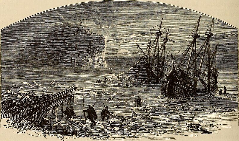
Fate of the Edward Bonaventure
Meanwhile, the terrible storm off North Cape had not sunk the lost Edward Bonaventure. In fact, Richard Chancellor had successfully sailed on to the port of Vardø, their planned meeting point. After a week of waiting, he decided to continue on alone. He entered arctic waters and headed east.
While not quite discovering the Northeast Passage, Chancellor became the first explorer to enter the White Sea. They sailed on, making contact with and heeding the advice of local people. The ship landed in what is now the Russian port of Archangel, at the mouth of the Dvina River.
The letters they had been given for foreign potentates came in handy. Tsar Ivan, of “the Terrible” fame, heard about the English ship that had arrived on his shores and sent for Chancellor. Leaving his men to winter on the ship, Chancellor undertook a sleigh journey of over a thousand kilometers. He arrived in Moscow, where Ivan treated him to grand celebrations and feasting.
There, he negotiated a trade agreement with Russia. They would provide a market for English wool, and he could, in turn, bring back fur goods. The next spring, Chancellor returned to the Edward Bonaventure and sailed back to England without incident.
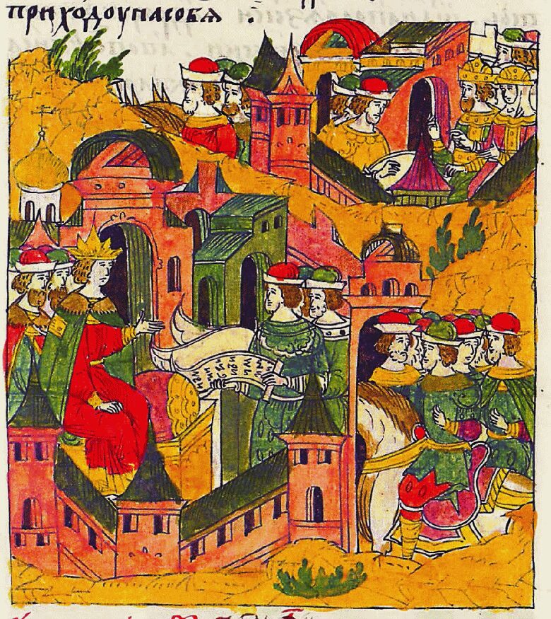
What the fishermen saw
While his erstwhile second in command was being feted in Moscow, things had become grim for Willoughby and his men. Willoughby had stopped recording in his journal, focused on keeping his crew together over the long, hard winter. They decided not to build structures on the shore, but to stay on their ships.
By January of 1555, things had gotten bad enough for Sir Hugh to write out his will. At that point, all or most of the men were alive. After that, the record stops.
Russian fishermen, whose signs Willoughby had noted when he arrived, returned to the area when the weather began to warm. They were surprised when they found two strange ships in the harbor. They were likely even more surprised when they went on board and found that everyone was dead.
Meanwhile, eager to take advantage of the new trading partner that Chancellor had acquired, English merchants quickly prepared to sail into the frozen North. The first, led by George Killingworth, reached Moscow in the summer of 1555.
There, they heard that fishermen had found frozen ships full of dead Englishmen. Knowing this must be the missing Sir Hugh Willoughby, they made the 1,000-kilometer journey from Moscow to Lapland.
The ships and the dead men inside were still there. Descriptions of the scenes inside the ships were nightmarish. The men froze where they died. There were no graves on shore, so they must have perished quickly.
Killingworth repurposed many of the goods and supplies on board and recovered the bodies. The two ships were refitted in a Russian dockyard.
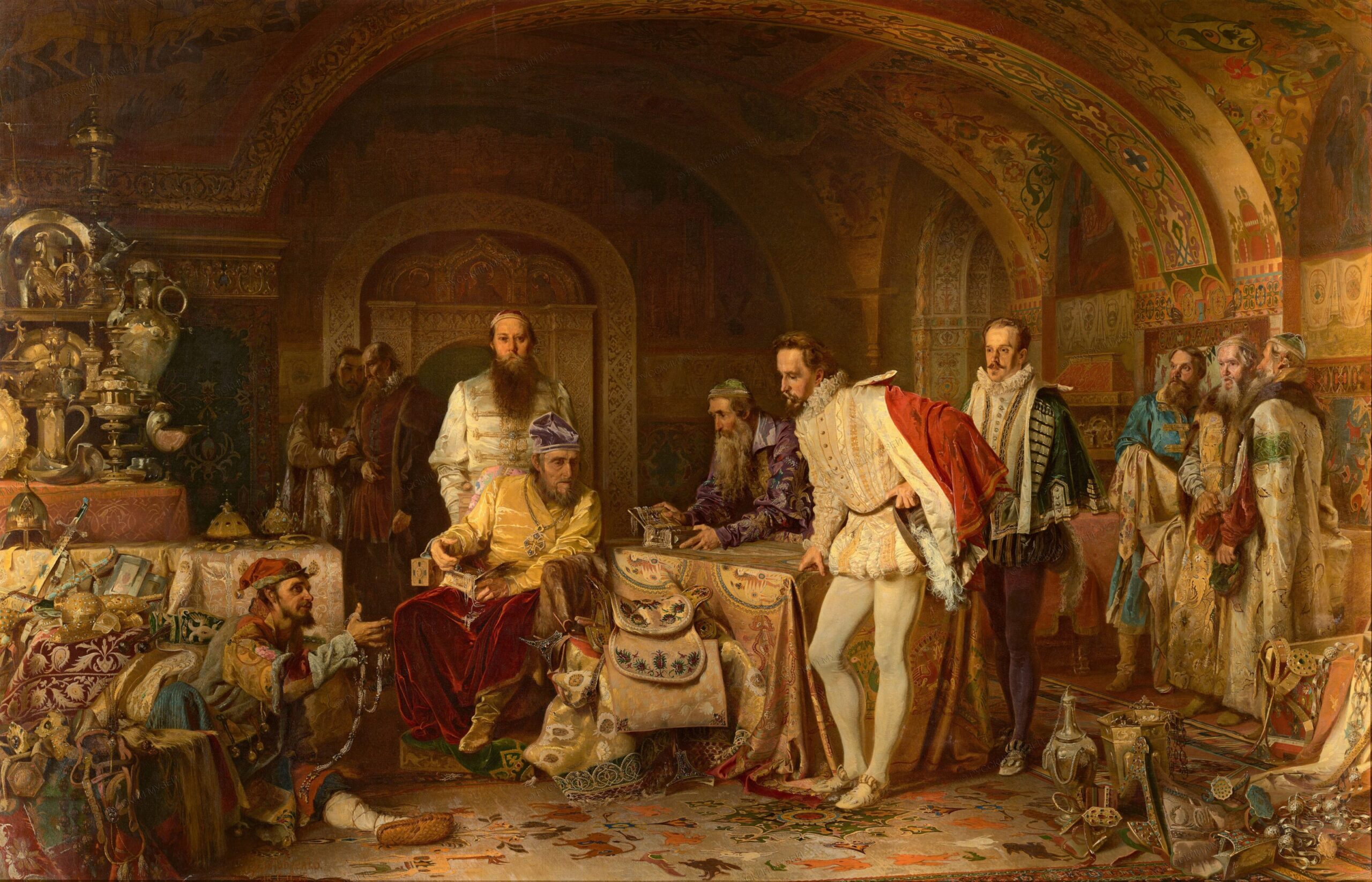
Scurvy, cold, or suffocation?
Early English arctic expeditions lacked knowledge and experience. Their clothes were inadequate, and the wooden ships kept out water but did not insulate against the cold. Heating them required massive amounts of fuel. In addition, the men likely suffered from scurvy. Though the plentiful game in the area could provide fresh meat, a source of vitamin C, much of the crew's diet would have come from their stores aboard ship.
These two causes -- scurvy and the cold -- have been the usual explanations for the deaths of Willoughby and his men. But there are problems with these theories.
While the early symptoms of scurvy likely afflicted some of the crew, they weren’t away long enough to die in large numbers. Besides, the fact that there were no graves on shore meant that they had all died quickly, together -- not from slow illness. The same applies to cold, which would have taken the weaker members first.
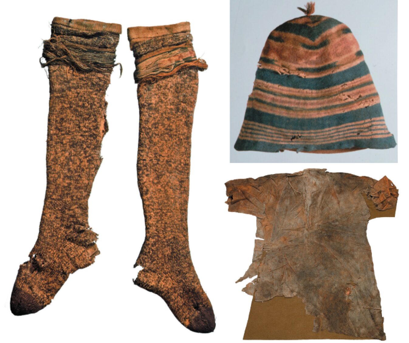
New theory
In 1986, scholar Eleanora C. Gordon proposed a new theory: carbon monoxide poisoning. Hoping to conserve heat and fuel, the 63 men gathered together below decks on one of the ships, tightly closing all the hatches against the freezing drafts. The coal they burned gave off carbon monoxide, which became highly concentrated in the small, unventilated space. The gas is invisible and odorless, silently replacing the oxygen in their blood.
If they felt dizzy, tired, and weak, it was easily attributable to the cold. By the time they lost consciousness, it was too late. They all died together, their safe haven becoming their tomb.
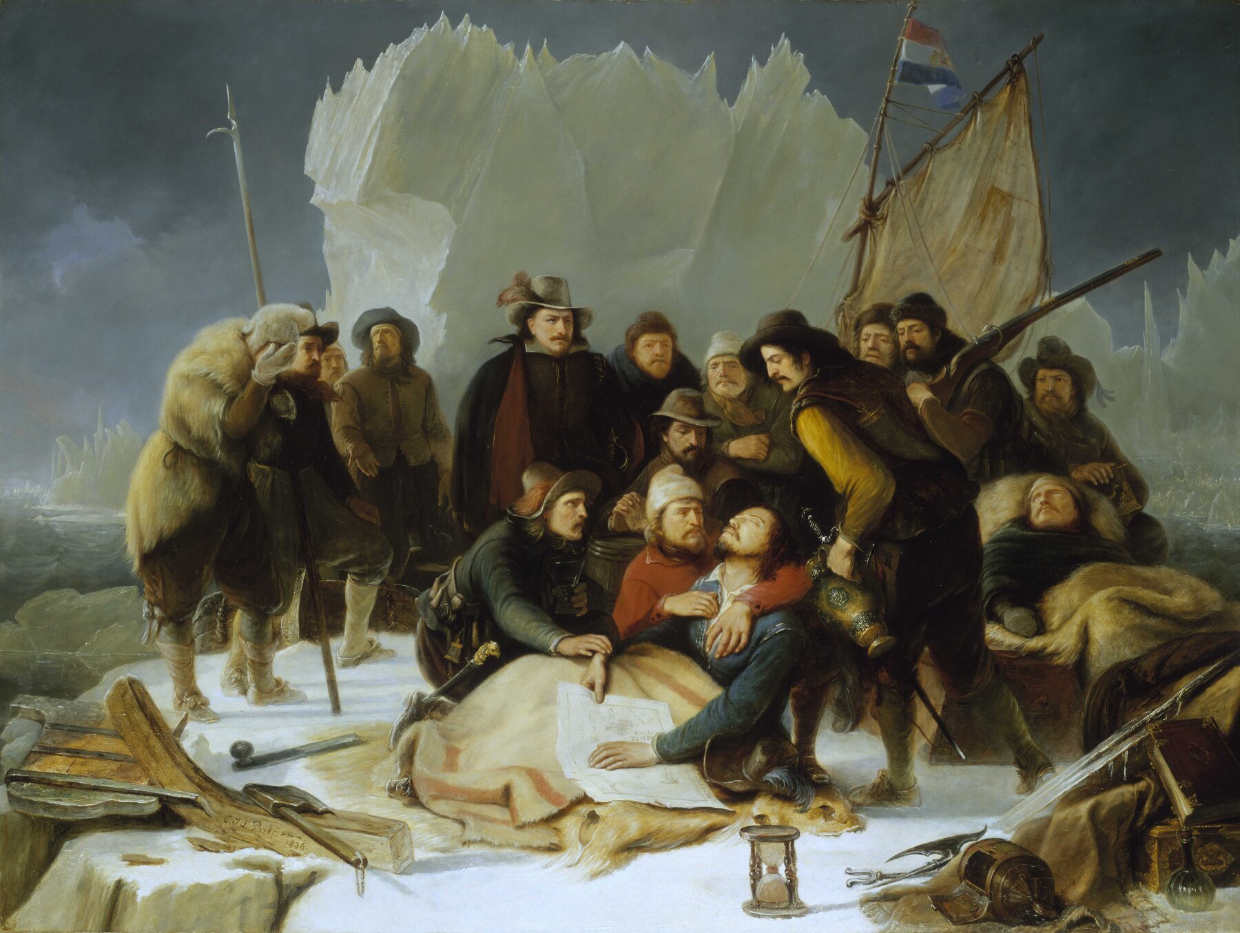
Lost, found, and lost again
Killingworth brought the story back to England, where Richard Chancellor finally learned the fate of the rest of his expedition. His upcoming return visit to Russia took on a new dimension. In addition to the new trade route, he would bring the rediscovered ships and an account of the disaster back home.
In July of 1556, after another visit to Moscow, Chancellor reunited the Bona Confidentia and Bona Esperanza with his own ship, the Edward Bonaventure. The voyage back was disastrous.
The Bona Confidentia was separated from the fleet and never seen again, and Bona Esperanza struck rocks off the coast of Norway and was lost with all hands. Then, on the 10th of November, the Edward Bonaventure sunk off Aberdour Bay, Aberdeenshire. Chancellor and much of the crew went with them.
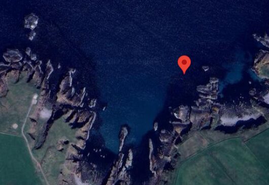
The lost ships had been found and then lost again, taking much of the physical evidence of their wintering with them. Ultimately, what happened to the 63 men who wintered in Lapland in 1555 remains a mystery.
In November of 1878, a three-masted schooner named the James Bentley set sail from Buffalo with a hold full of grain destined for Chicago. Built in 1897, it was a 54-meter-long wooden ship bearing a unique dragon figurehead. It had just come off of a round of repairs and updates on dry docks, and her skipper, Captain Hamilton, was a careful, experienced navigator.
But of course, a well-seasoned crew and a captain are no match for the "Witch of November" on the Great Lakes, as Gordon Lightfoot informs us. The James Bentley ran into bad weather. Then, while attempting to sail through a three-kilometer-wide gap between an island and the shore, the ship struck rocks.
The entire crew felt the impact, and instantly, the ship began to fill with water. All hands rushed to begin pumping it out, but they couldn't keep up with the deluge, especially in heavy seas. For three hours, they attempted to free the ship and struggle back to shelter, hoping to save the vessel and its cargo.
But it was no use. It was sinking underneath them, and Captain Hamilton was forced to abandon ship. Dutifully, he was the last one to leave the James Bentley. It sank in 52 meters of water off 40-Mile Point.
A Michigan grain relic
Luckily, the crew managed to escape onto a lifeboat. Nearby, the bark Erastus Corning saw the wreck and picked up the crew. They all survived without injuries except for the mate, William Dervy, who broke his arm. Helpfully, Captain Clarke of the Erastus Corning, who had no medical training, set his arm for him. To his credit, a physician who examined it later said the Captain did a good job.
The cargo was not so lucky. The waves of Lake Huron swallowed 36,288 bushels of rye. A contemporary newspaper report stated that “the vessel and cargo are certainly beyond all hope of recovery, the water where they are, being very deep. The cargo is, of course, ruined already.”
Recently, scientists at Michigan State University set out to prove otherwise. You see, those 36,288 bushels of rye weren’t just any grain; they were a variety that is now lost. Michigan used to grow a lot of rye -- more than any other U.S. state. But by the 1970s, no one was paying for it, and farmers switched to soybeans and corn. The Michigan rye varieties died out.
Now a movement to revive the Michigan rye industry, led by brewers and MSU, is attempting to bring back old cultivars. They had success recently with the "Rosen rye," a once-lost variety that was germinated from seed bank samples. Now it is being planted all over South Manitou Island, where it once grew.
Mammoth Distilling and MSU now plan to do the same with the so-called Bentley rye, the grain preserved inside the wreck of the James Bentley.
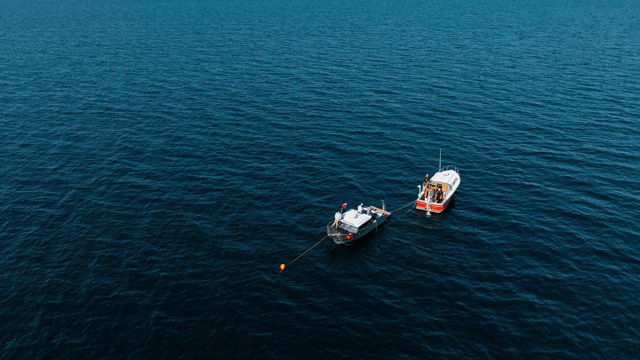
Rye-vival
The first order of business was retrieving the cargo. So in September 2024, a crew of six set out in two small boats, sailing nine kilometers out onto the lake. They were now over the James Bentley, which had held up well over the 146 years. Divers went down and retrieved some of the rye using a special tube.
Once they surfaced with their prize, the race was on. The near-freezing water had preserved the seeds, but the longer they spent in the warm air, the less likely they were to germinate. They were delivered on ice to MSU Associate Professor Eric Olson, who had successfully germinated the Rosen rye.
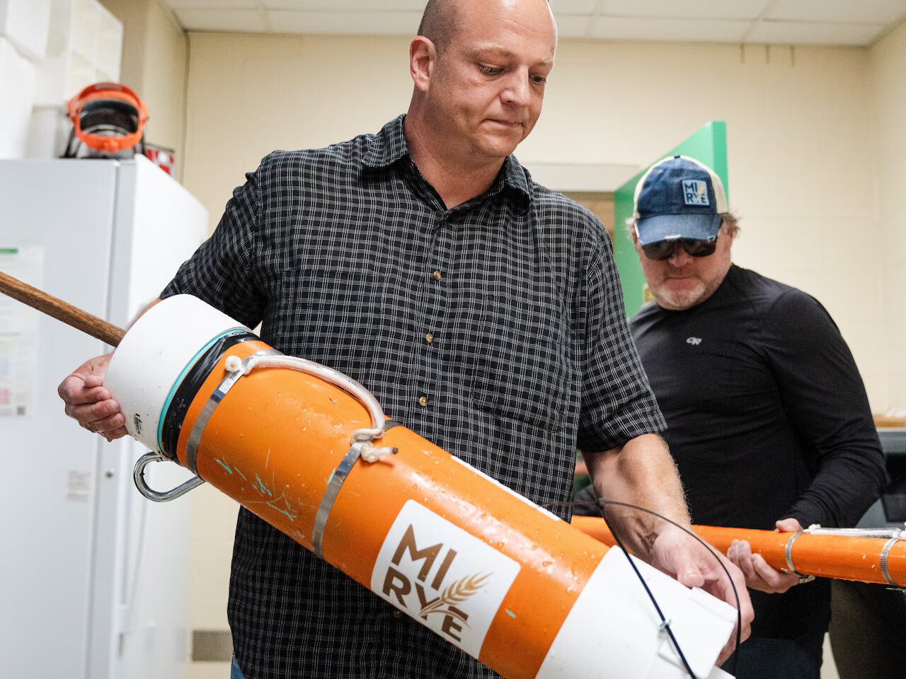
But the Bentley rye seeds were much older. Undaunted, Olsen and his team arranged the seeds in germination boxes and fed them plant hormones. They tried different temperatures and moisture levels to see what would make the seeds germinate.
Nothing, it turns out. They just sat there, not sprouting. Olsen believes that this means the mitochondria in the seeds, which would have turned the sugars into energy and made the rye sprout, had died off. The seeds wouldn’t grow on their own.
But they weren’t dead.

The future of Bentley rye
Eric Olsen is not giving up on the rye seeds. Their genetic information is still preserved inside them.
His new plan is to extract this DNA and use that to revive the Bentley rye. If he can sequence the DNA, he can take a modern rye variety -- or the Rosen rye, which would likely be more closely related to the even older Bentley -- and use it as a template to rebuild the Bentley rye. This is the same process scientists have proposed for resurrecting extinct species like the woolly mammoth. But he would be the first to do it with a plant species.
If he is successful, the new-old rye variety can be used to brew whiskey. Rye grown from historical cultivars may give the whiskey a unique flavor. Distillers hope that rebuilding Michigan’s rye industry will encourage agritourism, envisioning a "Michigan Rye Trail," similar to Kentucky’s famous Bourbon Trail.
“We want people to know where their grain came from — and that’s proudly grown in Michigan,” said Chad Munger, owner of Mammoth Distilling.
On January 29, 1873, Prince Luigi Amadeo Giuseppe Maria Ferdinando Francisco di Savoia-Aosta, better known as the Duke of Abruzzi, was born. The Italian Duke's interests were extensive. He was an arctic explorer, sailor, oceanographer, big-game hunter, topographer, geologist, botanist, zoologist, financier, and mountaineer.
Today, we examine the Duke's mountaineering activities.
Early start
The Duke of Abruzzi was a member of the Italian Royal House of Savoy. He was born in Madrid during the short period when his father, Amadeo I, Duke of Aosta, ruled Spain (1870-1873). Shortly after his birth, his father abdicated, and the family returned to Italy. His uncle became King Umberto I of Italy in 1878, and his cousin Vittorio Emanuelle III became king in 1900.
The family lived in Turin, Italy, only 106km from Mont Blanc. His mother, Princess Marie del Pozzo della Cisterna, died when the Duke was only three years old, and the young Duke received a strict, disciplined education.
At six, he became a cabin boy and then attended a naval college. Five years later, he received his first experience on a warship. By 20, he commanded his own ship, the Volturno, to Somalia.
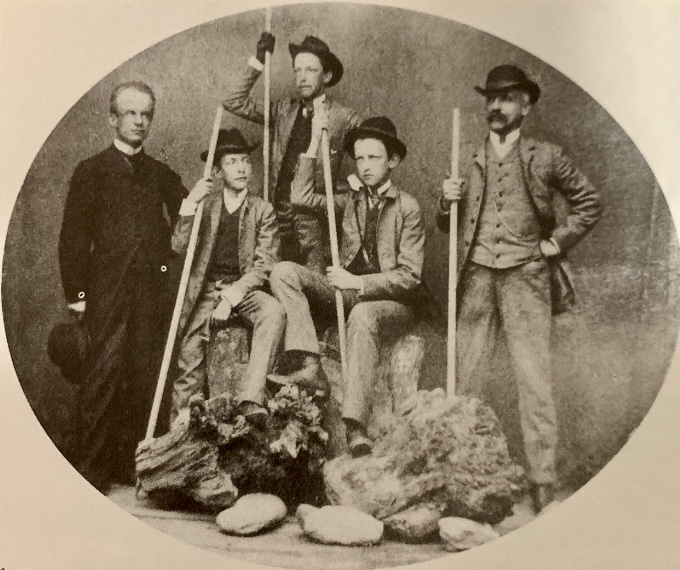
One year later, the Duke cruised around the world on a ship called the Christopher Columbus. The trip took two years. Much later, at 31, he captained another vessel on a three-year, round-the-world voyage.
Love for mountaineering
As a child, the Duke spent most of his summer holidays at his family's hunting lodge in the Alps. Hiking was a popular family activity, and his aunt Margherita was an avid mountaineer. During those summers, the Duke and his siblings spent a lot of time with Friar Francesco Denza, founder of the Moncalieri Meterologic Observatory. Denza taught them science, meteorology, and geology.
Accompanied by mountain guides and friends, including Emile Rey, one of the best climbers of that era, the Duke also began to climb in the Alps. In 1892, with Francesco Gonella, the past president of the Italian Alpine Club, he climbed Peak Levanna in Val dell’Orco. The following month, they summited several peaks in Gran Paradiso and the Mont Blanc massif.
Abruzzi also ascended 4,014m Dent du Geant, a challenging climb at the time.
Meeting Mummery
In 1879, Albert Frederick Mummery and guides Alexander Burgener, Augustin Gentinetta, and Johann Petrus made the first ascent of the difficult Zmutt Ridge on the Matterhorn. Mummery’s success sparked the Duke’s interest.
In the early 1890s, the Duke’s team ascended 4,357m Dent Blanche, and then 4,221m Zinalrothorn. By chance, they met Mummery, who had just opened a new route. Returning to the valley together, the Duke told Mummery he wanted to climb the Zmutt Ridge. They agreed to climb it together.
After this meeting, the Duke hurried to Monte Rosa to ascend Dufourspitze and Gnifetti. Afterward, the Duke received a telegram from Mummery asking him to head immediately to Zermatt because conditions were good for the Zmutt Ridge.
On Aug. 28, 1894, Mummery, the Duke, Norman Collie, and Joseph Pollinger summited the Matterhorn via the Zmutt Ridge.
The first ascent of Mount St. Elias
In 1897, when the Duke was only 24, he organized and led an expedition to unclimbed 5,489m Mount St. Elias on the border of Alaska and the Yukon.
Storms from the nearby Gulf of Alaska pound Mount St. Elias almost incessantly. Nevertheless, on July 31, the Duke and his partners (including the renowned Italian photographer and alpinist Vittorio Sella) made the first ascent. The second ascent came 48 years later!
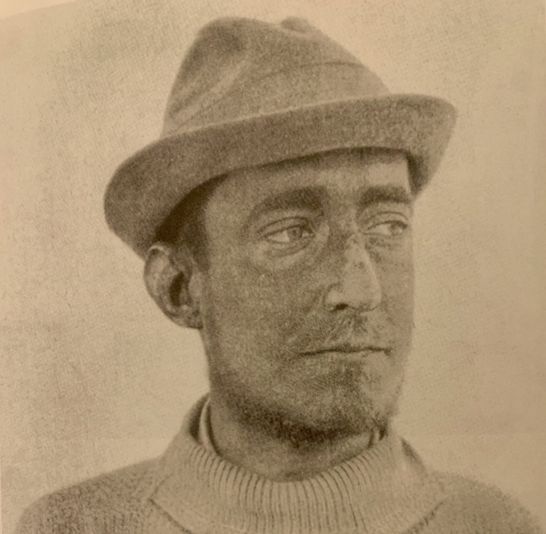
Ruwenzori
In 1904, the Duke was in Honolulu when the news arrived that Henry Morton Stanley had died. The newspaper reporting Stanley's death included a quote from a speech Stanley gave in 1901 at the Royal Geographic Society: "I hope that a man dedicated to his work, a passionate mountaineer, will take Ruwenzori into consideration and study it, explore it from top to bottom, crossing its enormous ridges and deep corridors."
The Duke's next goal was clear: to climb the Ruwenzori Mountains in eastern equatorial Africa. The highest peak in the glaciated Ruwenzori is 5,109m. Ruwenzori means King of the Clouds, and this range was believed to be the mysterious Mountains of the Moon mentioned by the ancient Greeks.
In 1906, the Duke organized an expedition that climbed 16 mountains in the range, including the highest peak. Ten Ruwenzori peaks surpass 4,800m. The highest are Mt. Margherita (5,109m) and Mt. Alexandra (5,105m), both named by the Duke. Afterward, the energetic Duke made a map of the Ruwenzori range.
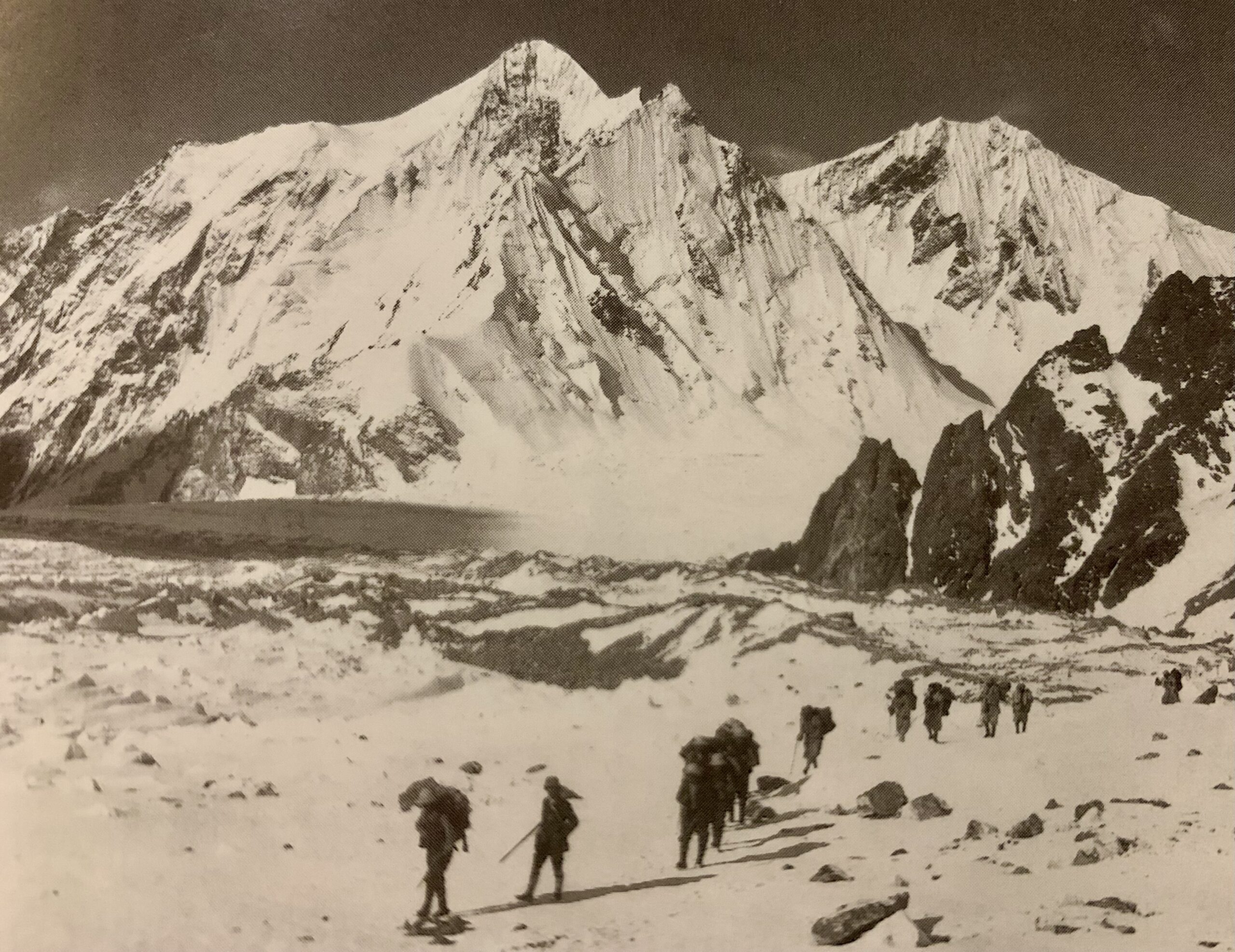
Attempt on K2
In 1909, the Duke organized an expedition to then-unclimbed K2. At 8,611m, it was the second-highest mountain in the world.
The first party to attempt K2 was a British-Austrian expedition led by Oskar Eckenstein in 1902. That group tried to ascend the northeast ridge but only made it to 6,000m.
The Duke’s team marked the second attempt.
After making an exhaustive plan and a long approach trek, they finally reached the mountain and tried twice. First, they attempted the Southeast Spur and made it to 6,200m. Today, this route is called the Abruzzi Spur and has become K2’s normal route.
They also attempted the Northwest Ridge, reaching 6,644m.
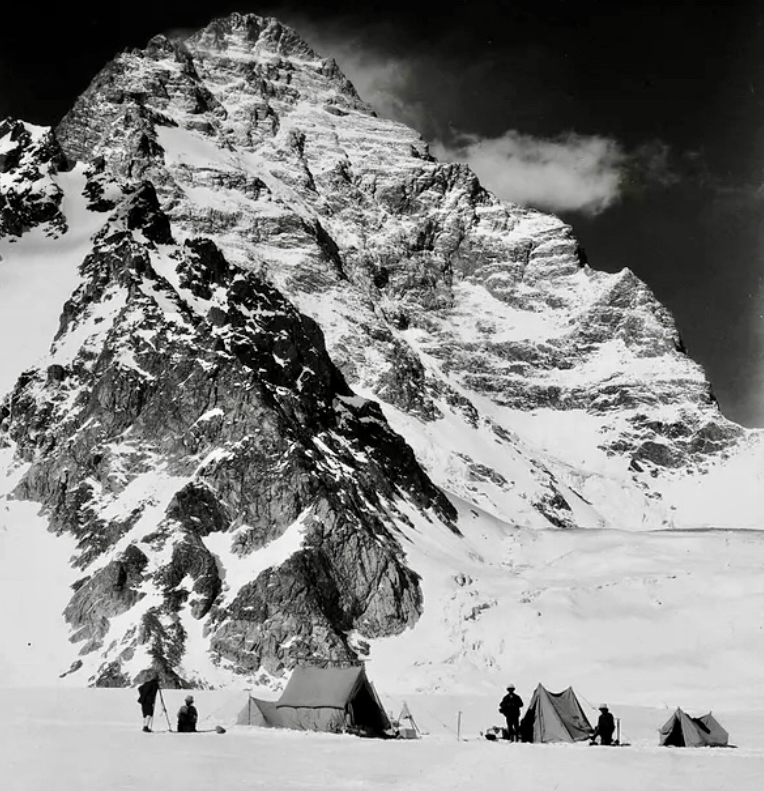
Chogolisa
After K2, the Duke headed to unclimbed 7,665m Chogolisa, one of the most beautiful mountains in the Karakoram. On Chogolisa, the Duke and two partners reached 7,498m, a record height at the time. Bad weather, poor visibility, and deep snow prevented them from summiting.
Vittorio Sella’s book, Mountain Photographs (1879-1909), has a beautiful collection of images from these expeditions.
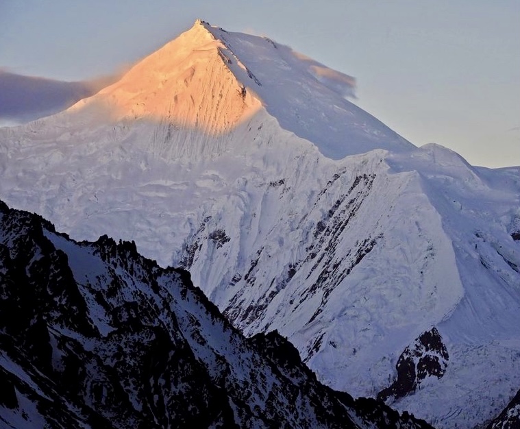
Somalia
The Duke did not have an easy life. His forbidden love with Katherine Elkins (he was not allowed to marry her because she came from a lower class) and many other complicated circumstances weren’t easy to manage.
After losing several climbing partners and some of his family over the years, he retired to Italian Somaliland. Nobody could convince the Duke to stay in Italy.
"I prefer that the fantasies of Somali women intertwine around my grave rather than the hypocrisy of civilized men," the Duke said.
The Duke died at age 60 on March 18, 1933, in Jowhar, Somalia.
For more on his expeditions and life, we recommend The Duke of the Abruzzi: An Explorer’s Life by Mirella Tenderini and Michael Shandrick.
The 100th anniversary
In 2009, a group of climbers attempted K2 to celebrate the 100th anniversary of the Duke's expedition. A fantastic film was made about their attempt.
The documentary K2: Siren of the Himalayas by Dave Olson can be viewed for free on YouTube. It stars Gerlinde Kaltenbrunner, Jake Meyer, Chris Szymiec, Ralf Dujmovits, and David Goettler, among others. The 1909 expedition is well presented, with original photos and fragments of the Duke's expedition report.
You can view the film below.
In the early hours of January 3, 1864, the anchor chain that tethered the 56-ton schooner Grafton to the sea bed off southern New Zealand snapped loose. Ninety minutes later, the gale that had been pounding the ship for almost two days drove the Grafton onto the rocks off Auckland Island.
At first, it appeared that the Grafton, a rugged ship outfitted for the Southern Hemisphere's treacherous waters, might survive. But with a disheartening crunch, the combination of water, waves, and rocks ripped her keel, and seawater poured in. The Grafton was finished.
But the five men aboard, including Captain Thomas Musgrave and voyage sponsor Francois Raynal, weren't finished. They gathered beneath a sail and waited for a stormy dawn to break. When it did, they loaded up the ship's dinghy with whatever supplies they could gather: a double-barreled rifle, ammunition, navigational instruments, cooking gear, ship's biscuits, flour, tea, coffee, pork, and tobacco.

But the shore lay across a swirling channel still beset by the gale. Thinking quickly, Norwegian Alexander Maclaren dove into the water, swam the waves, and rigged up a pulley system on a tree near the shore. The men got the canoe across in this way, then returned again to harvest planks, rope, and other building materials from the stricken Grafton. As the rain continued to hammer down, they built a rude hut and piled in to snatch what sleep they could.
The shelter would be their home for the next 18 months.
A failed venture, a strange crew
The Grafton Castaways, as history would come to call them, were a mixed bag.
Musgrave was an Englishman who, at 31, had been at sea for over half his life. When the Grafton foundered, he'd been living in Australia with his family for five years.
Raynal was a French adventurer who'd given up life on the ocean for 11 years in the Australian goldfields. There, he survived a mine collapse and a lingering infection — one that had left him bedridden for a month at the time of the wreck. The Grafton's voyage was his idea, an expedition to seek out tin on Campbell Island. Musgrave was the nephew of one of Raynal's business partners.
Maclaren was a lifelong sailor, experienced and reserved. The young man of the crew was George Harris, just 20. And rounding out the bunch was Henry Forges, ship's cook, sporting a leprosy-riddled face and a javelin injury from his time as the captive of Indigenous people on Samoa.
After failing to find the rumored tin on Campbell Island, Raynal attempted to turn a profit on the voyage by harvesting skins and oil. Auckland Island, devoid of human life but with a prodigious seal and sea lion population, seemed like a safe bet.
But before they could put ashore, the storm struck.
'The black, coarse, oleaginous flesh'
On the first morning of the ordeal, the men killed and ate a young sea lion. It was a disagreeable meal.
“The black, coarse, oleaginous flesh, which was as little agreeable to the smell as to the taste, did not appear to us a very satisfactory repast,” Raynal recorded. “But we felt we must accustom ourselves to it.”
He was right. Over the next 18 months, sea lions would be the staple food for the castaways. Understandably, they came to hate it. Yet they knew enough about sea lion behavior to understand that eventually, the animals would move on from the island. The castaways ate while they could.
The weather was uniformly dreary and cold, and boredom — and the ill-tempers that came with it — was more of a threat than starvation in the early days.
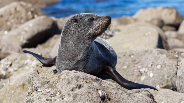
But Raynal and Musgrave had no intention of letting their crew succumb to melancholy. From the very beginning, they enacted several policies that have become a model for leadership and group management in survival situations.
For starters, the two leaders immediately shared supplies that had originally been slated for their use alone onboard the ship. They kept the men busy with continuous improvements to their hut, which was swiftly dubbed Epigwaitt. Soon enough, the dwelling had a cot for each man, homemade lamps, a fireplace, a chimney, a desk, and other amenities. They established a school and had regular lessons with Musgrave and Raynel, who were particularly insistent on teaching the illiterate Maclaren how to read.
The crew even managed to brew some beer using Stilbocarpa, a type of ground-hugging flowering plant, which lifted spirits considerably. Raynel also made a chessboard, dice, and cards.
'We stood so much in need of one another'
But perhaps most importantly, the castaways established clear tasks for each man and a system of governance, holding elections for leadership (which Musgrave, naturally, won). The little makeshift government came complete with rules scribbled in the margins of Musgrave's Bible, which he read aloud every Sunday.
“Assuredly, we had lived together since our shipwreck in peace and harmony — I may even say in true and honest brotherhood,” Raynal later wrote in an account of the wreck.
He admitted that occasional disagreements led to momentary anger and cross words, but they never let the bad feelings fester.
"If habits of bitterness and animosity were established amongst us, the consequences [would be] disastrous," he said. "We stood so much in need of one another!”
As May and winter in the Southern Hemisphere approached, animal life on the island became scarce. The Grafton castaways steeled themselves for lean days. They knew that rescue wasn't coming until spring, at the very earliest.
Another group of castaways
Meanwhile, elsewhere on the island, another bunch of castaways was also struggling to survive — and neither group was aware of the other.
On May 11, 1864, an autumn storm blew the Invercauld against the rocks on Auckland Island's northern tip, about 40km from the first group. Nineteen of the ship's 25-man crew made it ashore, including the leadership: Captain George Dalgarno, first mate Andrew Smith, and second mate James Mahoney.
But Dalgarno's leadership style in the face of disaster was markedly different from that of Musgrave and Raynel's. And the fate of his unhappy crew was tied to his missteps.
To start with, Dalgarno did not maintain a steady head during the wreck itself. He gave no order to abandon ship, and the men simply swam for shore as they saw fit. As a result, the crew that survived had far fewer supplies and tools than did those from the Grafton.
Dalgarno also proved ineffective in the first days of the wreck. He allowed his men to huddle in a poorly constructed and far-too-cramped shelter on the beach. He issued no orders to improve the shelter, instead commanding the lower-ranking men to serve the higher ranks as if they were all still aboard the ship. The crew burned precious calories fetching food and water for the Captain and mates.
Bored, starving, and chafing under a command structure ill-suited to the circumstances, the men talked of cannibalism before the month was out. And by the end of May, their numbers had been reduced to 10 by exposure and lack of nutrition. Eventually, one of the lower-ranking men, 23-year-old Robert Holding, convinced some of the others to go foraging with him. They found a row of berry bushes and followed it to the abandoned settlement of Hardwicke.
Only one of the ghost town's 18 buildings was habitable, but it was better than a lean-to on a beach. And the village turned up a few usable tools. But far from being their salvation, finding the village would have dire physiological consequences for the Invercauld crew.
Rather than being proactive and improving Hardwicke's structures for long-term use, the men — with the notable exception of Holding — believed the abandoned village was proof they'd soon be rescued. They continued to live on a meager diet of limpets, seals, and foraged plants while they waited out the long winter, mostly exposed to the elements. Always, they expected to see a ship on the horizon.
Physical conflict, starvation, and overwork in the service of the crew's leadership claimed more lives. Captain Dalgarno even abandoned his injured first mate Mahoney in a shack, leaving him to starve in isolation.
Eventually, the men were eating corpses.
A despondent Christmas
Meanwhile the crew of the Grafton had come to realize if they wanted to survive, they'd have to help themselves.
But it was a near thing. Spring arrived, and with it, more abundant hunting but no rescue ships. Despondency began to set in.
“My companions were lying on the ground, silent, their countenances dark with the dreariest melancholy,” Raynal wrote. “Evidently, they had been the victims of regrets as bitter and despair as great as mine."
Even Musgrave gave in to hopelessness.
“Well,” he said, “what matters it, since we are destined to die here? Better to bring our misery to an end at once. What is the use of living? Of what profit is life in such circumstances as ours?”
On Christmas Day, surveying the listless crew, Raynal felt the hopelessness encroaching within him finally give way to something more potent.
"I felt a complete revolution working within me. To depression succeeded a kind of exaltation; my heart, reinspired by a transport of pride, indignation, and almost wrath, beat violently," he remembered. “If men abandon us, let us save ourselves,” he said to the men. “Courage, then, and to work!”
Boats and forges
The Grafton castaways proposed to build a boat.
But to do so, they'd need nails and tools, and for that, they needed a forge.
They made one from scratch by January 16 and started churning out 50 nails a day. But they soon realized building a totally new boat would take at least a year and a half at the pace they were working. They changed tacks and began to modify the Grafton's canoe for an open-water voyage—knowing its small size would mean leaving two men behind while three went for help.
The group's division of labor continued smoothly as well, with some of the men in charge of foraging and upkeep on the hut and others taking shifts on the boat construction.
Decking appeared, and planks caulked with gum of lime and seal oil. Parts scavaged from the Grafton provided a mast, a pump, and a compass. By June 1865, and entering into the castaway's second winter, it was ready.
“Our work being completed, it presented to the gaze — at all events, to that of its authors — a very imposing appearance,” wrote Raynal. “It was a decked boat, 17 feet long, six feet wide, and three feet deep.”
They named her Rescue.
Last men standing
On the north end of the island, only three men remained. The resourceful and tireless Holding, Captain Dalgarno, and first mate Andrew Smith. Holding had finally taken command of his useless officers, and under his leadership, the trio was clinging — tenuously — to life.
On May 22, 1865, they finally got the lucky break that 16 men had died waiting for. The Portuguese brig Julian sailed into view, seeking a resupply. Despite the presence of plague on board, the Invercauld's crew scrambled aboard. There, Dalgarno and Smith were taken to officers' quarters, while Holding was relegated to the lower decks. The officers ordered Holding not to reveal he'd been the key to their survival.
After Julian made port in South America, they left him behind to make his own way home. He survived on charity until he secured a post on a ship bound for the Netherlands.
Rescue
On July 12, 1865, the five Grafton castaways launched Rescue. Raynal, Musgrave, and Maclaren — the crew's three most experienced sailors — were aboard. It was an emotional moment for all five men.
“We were on the point of separating from two of our companions — from George and Henry — who for 19 months had shared, day after day, our struggles and our sufferings, with whom we had lived as brothers,” Raynal remembered.
If all went well, the men of the Rescue hoped to reach New Zealand in 60 hours. But a storm battered them for four days. Eventually, they spotted the settled island of Rakiura, but the wind blew them back out to sea, and they didn't have the strength to fight against it with oars.
"We saw ourselves on the point of drifting out to sea and perishing in sight of port,” Raynal wrote of the dark moment.
But on July 24, 1865, 12 days after leaving the Auckland Islands in their jerry-rigged craft, Raynal, Musgrave, and Maclaren made port on Rakiura. Raynal collapsed into another relapse of his illness, but Musgrave found the strength to convince the cutter Flying Scud to mount a rescue.
It doesn't take much imagination to realize what Dalgarno would have done at this point. He'd have stayed on Rakiura.
But Musgrave, as he demonstrated time and time again during the ordeal, was made of better stuff. He accompanied Flying Scud back to Auckland Island, knowing that the treacherous winter seas had every chance of stranding him there again. There, he found his two remaining crew alive and well, despite a brief falling out that had sent them to opposite ends of the island in a fit of pique.
But in final evidence of the spirit that allowed the Grafton castaways to survive an experience that claimed so many other lives, the two made up as soon as they were rescued.
On January 2, 1909, the versatile mountaineer Riccardo Cassin was born in Friuli, Italy.
Cassin's father died in a mining accident in Canada in 1913. To help his family, Cassin left school at the age of 12 to work in a blacksmith shop.
In 1926, Cassin moved to Lecco and worked at a steel plant. He started boxing and also went to the surrounding mountains every spare moment. Eventually, he had to choose between boxing and climbing, and he chose climbing. He started honing his skills in the Grigna massif around Lecco. Eventually, he excelled in all disciplines, including rock, big-wall, and alpine climbing.
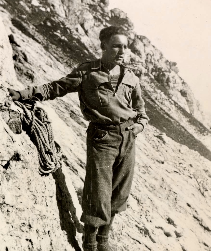
Cassin made several pioneering climbs in the 1930s. Among them:
- 1934: First ascent of Cima Picolissima of the Tre Cime di Lavaredo with two partners. The following year, he climbed the Torre Trieste via the southeast ridge and established a new route on the north face of the Cima Ovest di Lavaredo in the Dolomites with Vittorio Ratti.
- 1937: First ascent of the northeast face of Piz Badile along with partners Ratti and Gino Esposito. They also teamed up with two others, M. Molteni and G. Valsecchi, who died of exhaustion during the descent.
- 1938: Climbed the Walker Spur on the North Face of Grandes Jorasses with Esposito and Ugo Tizzoni. One year later, Cassin and Tizzoni ascended a new route on the north face of the Aiguille de Leschaux.
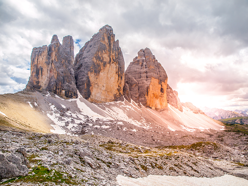
100 first ascents
These are only a few of his 2,500 ascents, of which 100 were first ascents.
The Second World War stopped his climbing. During the war, Cassin fought against the Nazis as a partisan.
The Ragni di Lecco (Spiders of Lecco) chapter of the Italian Alpine Club was founded in 1946. Their goal was to surpass Lecco's so-called "old climbers," including Cassin, who also became part of the group.
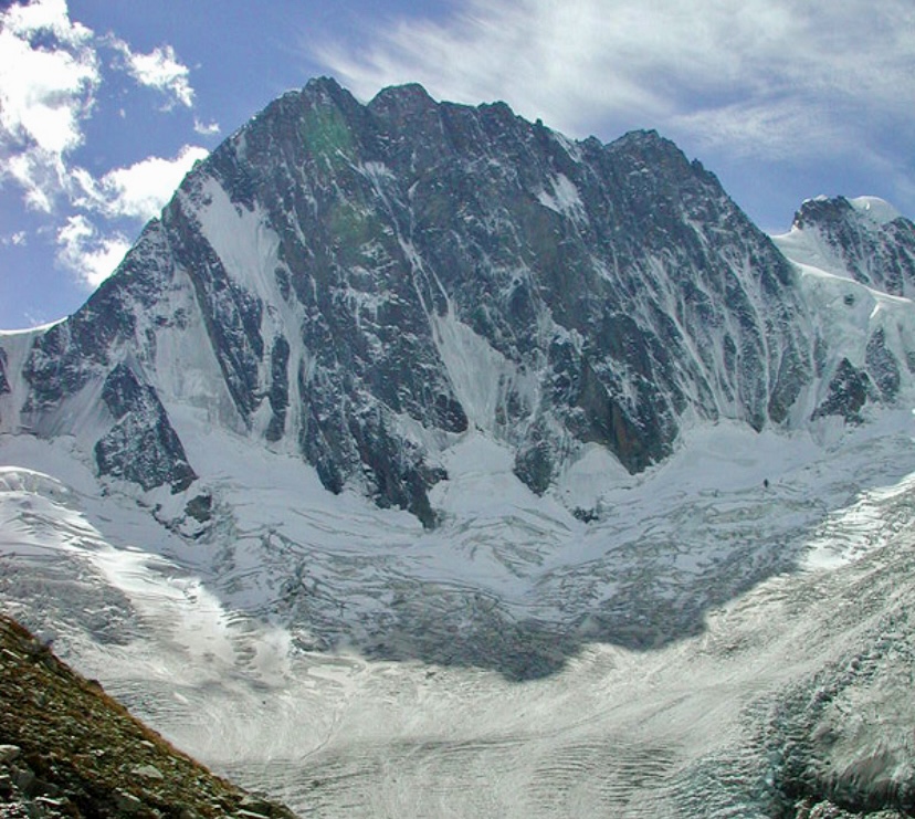
Thwarted from joining K2 expedition
In 1954, the leader of the Italian K2 expedition, Ardito Desio, left Cassin off the team -- according to Cassin, because of their rivalry. Instead, Cassin went on to lead several major expeditions himself, including a successful 1958 climb of 7,932m Gasherbrum IV. On that expedition, Walter Bonatti and Carlo Mauri made the first ascent of GIV via the northeast ridge.
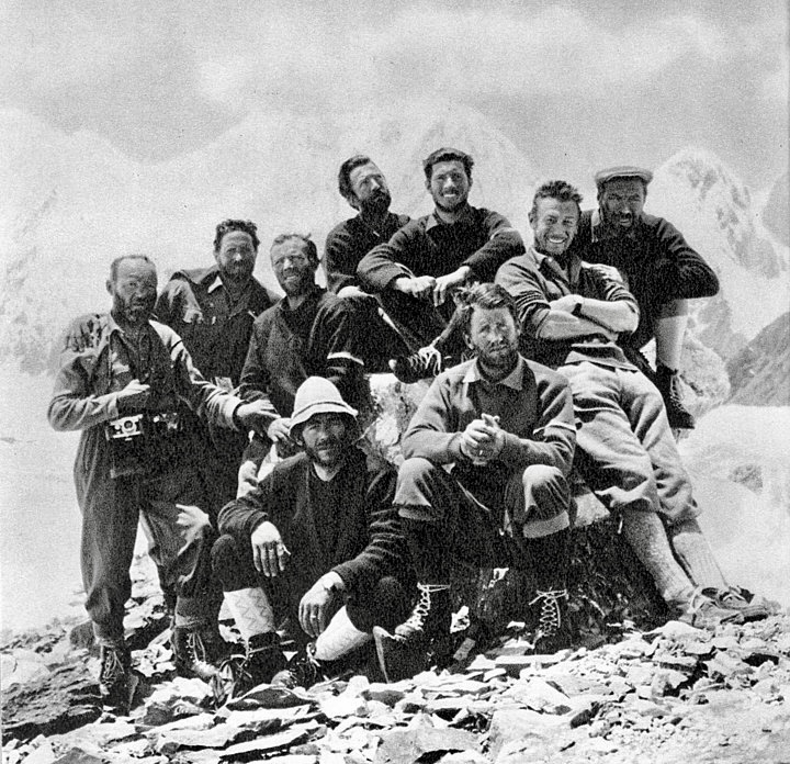
Then in 1961, Cassin led a strong party to the still-unclimbed south face of 6,190m Denali. On July 19, all five members topped out on a difficult route that became known as the Cassin Ridge.
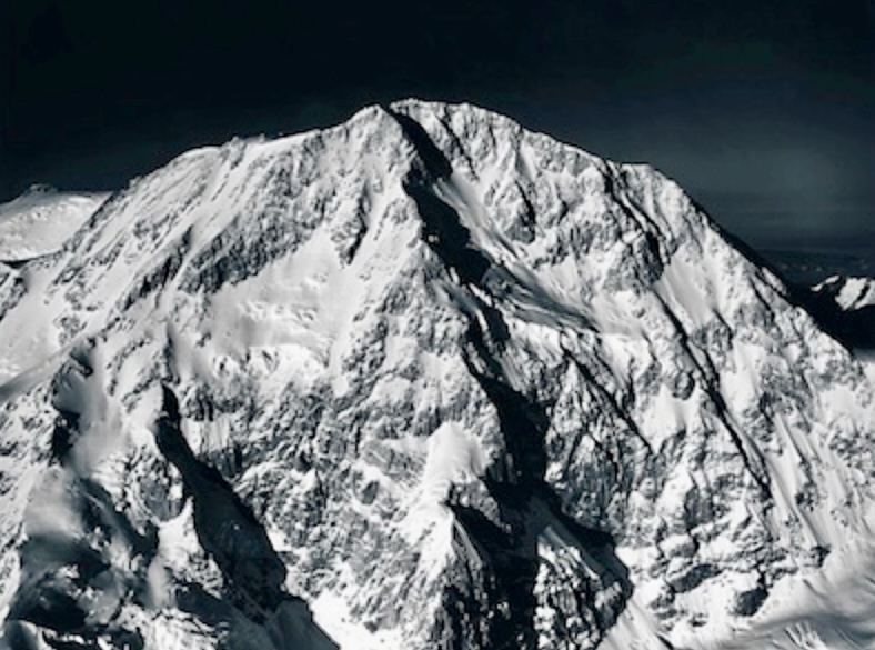
Cassin returned to the Himalaya in 1975 to lead an expedition to 8,516m Lhotse. They wanted to try a new route along the west part of the south face. Two years earlier, a Japanese party had tried that line unsuccessfully. Two members of Cassin's team reached roughly 7,500m, when bad weather forced them to turn around.
Piz Badile at 78
In 1987, on the 50th anniversary of his first ascent of the northeast face of Piz Badile, Cassin climbed it again at the age of 78. His filmmaker friend, Fulvio Mariani, would have liked to film it, but Cassin had not told him about the ascent, so Cassin volunteered to do it again.
When journalists reported that Cassin had repeated his own route twice, Cassin pointed out that the second repetition was not valid because a helicopter had picked him up at the summit.
Cassin continued climbing until he was 80. He died in Lecco on August 6, 2009, at the age of 100.
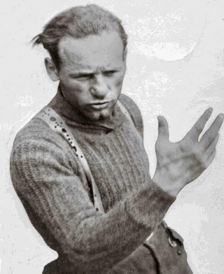
Every exploration buff knows that made-up geography often appeared on ancient maps. The most famous example is that of Atlantis, a myth that originated with Plato and persisted on maps well into the European Renaissance. But as explorers increasingly sought out the world just over the horizon, they brought back tales — often second or third-hand — of other wild lands.
Mapmakers often plopped these tales into existing blank spaces, sometimes as a bit of artistic flourish and sometimes because they legitimately believed the stories.
A website called Map Myths has turned these mythical lands and geographical features into a surprisingly thorough interactive experience. And it's a must-visit. Users can click on the names of these mythical spots for capsule explanations of how they originated, how they were dispelled, and sometimes who went looking for them. Users can also view the historical maps where the myth in question appears.
Here are a few of the most interesting examples.
Wishful thinking
Sometimes, a geographical feature ends up in a mapmaker's visual lexicon through the sheer power of wishful thinking.
When 16th-century explorer Giovanni da Verrazano peered over modern-day North Carolina's Outer Banks islands, he laid eyes on Pamlico Sound. The sound is the largest lagoon on the United States' eastern coast, so when Verrazano couldn't see the other side of it, he optimistically assumed it was the Pacific Ocean.
This notion was dispelled quickly as more and more colonists and explorers charted the New World, but the idea of a great "Sea of the West" hung on long after Verranzano's day.
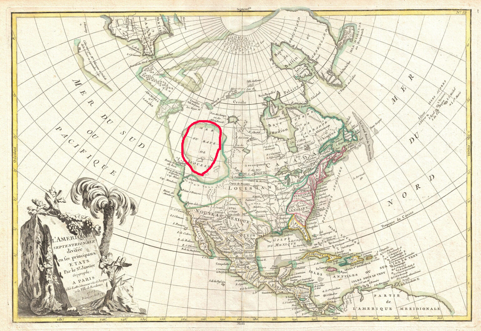
Partly, that's because a navigable, coast-to-coast water route through North America would pay huge economic dividends to whichever power discovered it. The idea was just too lucrative to let go. According to Map Myths, cartographers included the "Sea of the West" on more than 200 maps during the 18th century.
James Cook's exploration of the Pacific Northwestern coastline diminished the chances of the Sea being real. Lewis and Clark weren't expecting to find it during the Corps of Discovery's journey westward. But Thomas Jefferson — then President of the United States and the expedition's progenitor — would have been more than happy if they did.
Western Europe hopes against hope
The legend of Prestor John, a powerful and saintly Christian king living somewhere in the Far East, first arose in the mid-1100s AD. By the time European crusaders found themselves outmatched by Islamic military tactics in the Crusades, Prestor John was more than a fairy tale in the minds of many. He or his descendants were a much-hoped-for fighting force that could pressure Islamic armies from a second front.
As it turned out, such a fighting force did arrive to smash into the Islamic world, but it turned out to be the Mongols. Under Genghis Khan, the Mongols swept into Persia in the early 1200s, eventually sacking Baghdad. The unstoppable Mongols effectively ended the powerful Abbasid Caliphate, a turning point in human history if ever there was one.
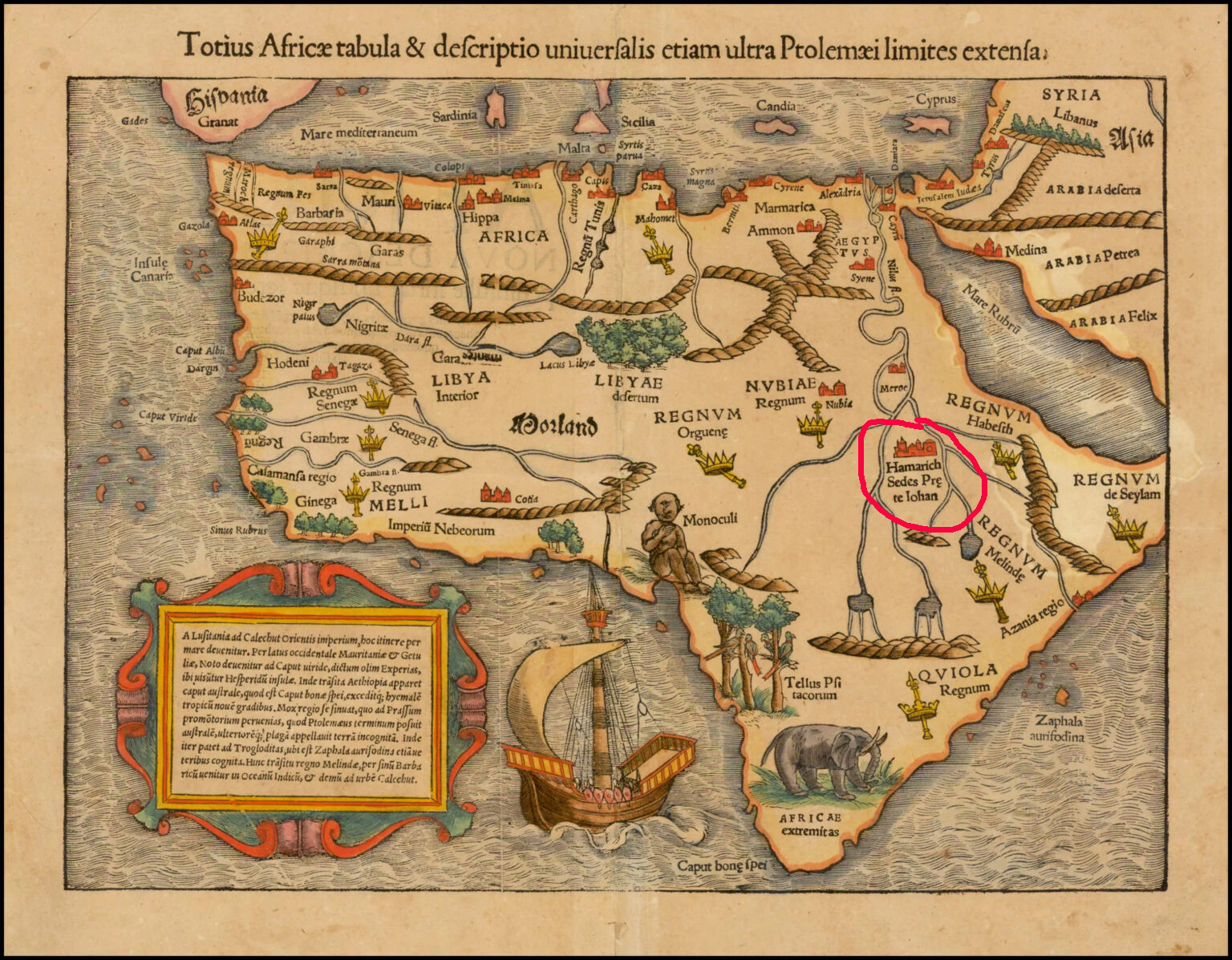
It eventually became apparent that Prestor John's legendary kingdom must lie elsewhere, so mapmakers began placing it around modern-day Ethiopia. Christianity in Ethiopia dates back to the fourth century AD, and the region was far enough removed from Western Europe to maintain a sense of mystery. It took another 200 years or so for Prestor John's imaginary kingdom to disappear from African maps.
But before it did, it inspired Europeans to explore Asia and Africa with religious zeal.
Demons and castaways
Almost every map created during the Age of Exploration was speckled with phantom islands.
It's hard to pinpoint the origins of many of these mythical islands — usually a blend of legends and sailors' tales filtered through time and many mouths. But in at least one case, we can look back at a true story to see the genesis of a phantom island.
In 1542, Jean-François de La Rocque de Roberval, a French nobleman and privateer, set out for New France (modern-day Quebec) to take up his post as the Lieutenant General of the colony. Accompanying him was Marguerite de La Rocque de Roberval, a young woman and relative of the freshly appointed colonial official. Marguerite took a lover on the voyage, and this behavior so scandalized the privateer that he marooned Marguerite, her servant, and her lover on an "island."
Eventually rescued
Marguerite later gave birth under these circumstances, but her baby, her lover, and the servant all died during the years they were marooned. Marguerite was eventually rescued by Basque fishermen.
Once she reached Europe again, Marguerite's tale became widely known. Mapmakers had already been including an "Isle of Demons" on maps of the Newfoundland coastline, noting it as a spot where all manner of hardships might befall unwary sailors. With the young women's tales of privations firmly lodged in the public imagination, the phantom island quickly became the setting for the marooning. In reality, it was most likely a region around Harrington Harbour, Quebec -- not an island at all.
Still, the Isle of Demons continued appearing on maps well into the mid-1700s.
You can easily — and happily — spend a whole afternoon exploring the mythical kingdoms, islands, and mountains inked onto the maps of yesteryear. Check out Map Myths here.
Fifteenth-century China was a maritime powerhouse that explored new lands and opened trade routes. It was also the best-connected political entity in the world, with a presence in Asia, Africa, and Arabia. A man named Zheng He led the charge.
A complex, multi-talented character, Zheng He rose from slave to top naval commander, diplomat, and world explorer.
Background
Born into a Chinese Muslim family in Yunnan, Zheng He's birth name was Ma He.
His father was descended from Persians and worked for the Mongol Empire. This became a problem, as Chinese animosity toward the Mongolians was growing. The two nations were at war by the time Ma He was a toddler.
The rise to power
By the time Ma He was 10, his parents had died, and he was a prisoner of the Ming Dynasty's army. As was common practice, Ma He was castrated and sent for military training.
Now a eunuch, he worked at court and became an impressive warrior. Eunuchs were valued members of Chinese society, given key positions in foreign relations, national security, the military, and in court. Chinese leaders did not view eunuchs as potential rivals and did not fear disloyalty.
As horrible as Ma He's early life sounds, he experienced social mobility and became increasingly important in the Emperor's court. He became a trusted confidant of Zhu Di, the Prince of Yan and future Yongle Emperor. He gained new titles and responsibilities, eventually running the Emperor's household. Ma He became Zheng He and also the commander of Nanjing.
"Zheng He’s eclectic religious attitude and broadened cultural horizons made him a good candidate for the armada’s commander," writes Yang Wei of the Association for Asian Studies.
Expeditions
China was already the dominant trading power in the region, but the Emperor wished to extend its influence. But China's goal was not to conquer and colonize. Writer Geoff Wade argues that their aim was globalization.
"Zheng He did not occupy a single piece of land, establish any fortress, or seize wealth from other countries," Wade wrote in his article, The Zheng He Voyages: A Reassessment.

Zheng He undertook seven epic voyages from 1405 to 1433. He sailed with monstrous vessels called "treasure ships." These boats were supposedly the size of football fields, with multiple decks and hundreds of sailors. Writers Marco Polo and Ibn Battuta both mention these treasure ships, but they likely exaggerated their size for dramatic effect.
The ships carried wealth and weaponry and could transport ambassadors and dignitaries back to China. Gold, silver, porcelain, and fine silks facilitated trade and foreign relations.
Force only when necessary
Sometimes, Zheng He needed to exercise force. On one expedition, the king of Sri Lanka thought he could steal from the fleet. Zheng He sent 2,000 troops to take the Sri Lankan capital and capture the royal family. The Chinese Emperor eventually pardoned the Sri Lankan king.
Each of Zheng He's voyages had different needs and goals. The first expedition involved 120 ships and over 27,000 men. They traveled west and met with rulers from India, Sri Lanka, Java, and Champa. His second voyage involved 249 ships as they expected conflict. War had broken out between parts of Java and Ming China.
Zheng He was a charismatic diplomat and a skilled navigator who set foot in what is now India, Vietnam, Indonesia, the Maldives, Somalia, Yemen, Zanzibar, Kenya, and Oman. He brought back exotic animals and foreign dignitaries.
On his last voyage, Zheng He died. We don't know how and where he died, only that his remains are at the bottom of the ocean. During this final expedition, we know that he sailed to Java and India before breaking off from the main fleet to journey to Mecca.
Conclusion
Some people believe that Zheng He's voyages were a form of "proto-colonialism." That may be so, but facilitating this early form of globalization proved highly beneficial to China. It also benefitted Zheng He, who overcame a traumatic childhood to become one of the most influential characters in Chinese history.
Interestingly, there are still echoes of these ancient voyages in places like Kenya. On Lamu Island and Pate Island, a handful of individuals claim descent from Zheng He's sailors. According to local stories, one of Zheng He's ships wrecked on Lamu Island.
A few hundred Chinese sailors assimilated into the local population, converting to Islam and having children with Kenyan women. DNA analysis and archaeological excavations, which revealed fragments of Chinese porcelain from Zheng He's treasure ships, confirm these stories.
During the violence and instability of 17th-century Europe, monarchies and religions struggled for dominance. Constant conflict drove thousands of refugees to distant lands. Jean Baptiste Tavernier emerged from this instability to pioneer trade in the Far East.
Background
Tavernier hailed from a Protestant family of engravers and geographers based in Paris. He grew up during a time of great upheaval in Europe. Catholicism and Protestantism struggled for dominance, and Tavernier’s family traveled back and forth between France and Belgium, depending on the situation for Protestants in each.
Despite the instability in his youth, Tavernier busied himself learning engraving and cartography. His father's travel tales enraptured him. Once he was old enough, he worked in royal courts and with the military.
Through his work, he visited England, Italy, Switzerland, Hungary, Germany, and the Netherlands. He also snagged an important position as controller of the household of the Duke of Orleans. But despite his stable occupation, Europe was not enough for him. He longed to explore the East.
Tavernier heard that a few men were going to travel to the Levant, and he decided to tag along. On his first trip, he traveled through Constantinople, Anatolia, Armenia, Persia, Iraq, Syria, and Malta.
The King of France requested that Tavernier write about his travels to inspire people to trade in the East and discover new routes. Tavernier went on five further voyages and wrote about them (with the help of a biographer) in The Six Voyages of Jean-Baptiste Tavernier.
In this travelogue, he illuminates court politics, royal family dramas, and common people's feelings toward their sovereigns. The first volume details the route from Isfahan, Iran to Agra, India.
Tavernier also wrote about customs laws and the transport of precious metals and jewels. For example, in Surat, he says: "As soon as the merchandise is landed at Surat, it has to be taken to the customs house, which adjoins the fort. The officers are very strict and search persons with great care. Private individuals pay as much as four and five percent duty on all their goods."
Gem dealing
Tavernier's greatest journey was in 1638. He went to India and spent five years making the right connections with emperors and court officials. At the time, the Kingdom of Golconda was the center of India's diamond trade. Here, he discovered his vocation as a gem merchant.
He arrived in Golconda in 1642. Golconda's diamonds came from the Kollur Mine and became world famous. They included the Daria-i-Noor (one of the Iranian Crown Jewels), the Nizam Diamond (which belonged to the Nizam of Hyderabad), the Dresden Green Diamond (which belonged to King Augustus III of Poland), and the Great Mogul Diamond (which belonged to the fifth Mughal Emperor Shah Jahan). However, one particular Golconda gem stood above all others.
In 1666, Tavernier came upon a raw, uncut diamond of 115 carats. It was unlike any gem he had ever seen. The diamond was described as violet-colored. After cutting and other aesthetic touches, it was called the French Blue, and then eventually the Hope Diamond.
The Hope Diamond underwent three phases. In its rawest form, it was called the Tavernier Diamond and was 115 carats when extracted from the mine. Then, it was cut to 69 carats and renamed the French Blue Diamond after it was sold to the King of France, Louis XIV. In 1792, someone stole it during the French Revolution. It was cut again, becoming the Hope Diamond. It was now approximately 45 carats.
After vanishing during the French Revolution, it re-emerged in London in 1812. After several private owners, the Smithsonian Museum bought the diamond. Though cut three times, it is still the largest diamond in the world and is worth approximately 350 million dollars.
As a gem merchant, Tavernier formed close relationships with his customers, particularly royalty. He made acquaintances in India, Persia, and Java. Over decades of travel, he earned a reputation as the top gem merchant in Asia.
A cursed diamond?
The Hope Diamond is said to be cursed. The details surrounding Tavernier's procurement of the diamond are not just fantastical and defamatory but what started the legend. After he obtained the diamond, rumors began circulating in jewel trade circles. One popular tale involved Tavernier murdering someone and stealing the diamond from the head of a sacred statue of Sita, a Hindu goddess who is the consort of the god Rama.
Those who believe in the curse claim that wild animals killed Tavernier. However, historical records don't support this. We know that he died in Moscow, most likely from natural causes.
But some owners of the Hope Diamond indeed suffered financial ruin, illness, or death. One early example is Louis XVI and Marie Antoinette, who were executed during the French Revolution. In 1910, a Greek jewel merchant named Simon Maocharides owned the diamond for a time. He died after driving his car off a cliff.
In the late 1950s, mailman James Todd carried the diamond to the Smithsonian Museum. Todd then suffered an onslaught of bad luck. First, he suffered a car accident that crushed his leg. Then, his wife died. Next, his dog. Finally, his house burned down. It is hard not to see a trend.
Some researchers believe that the diamond was cut several times to disguise its identity and prevent the French government from repossessing it after it was stolen during the French Revolution. So, other pieces of the diamond could be out there. If so, they could be in European crown jewel collections. The Russians claim to have a piece of the diamond among the Russian Crown Jewels. However, experts have not confirmed this.
Other possible "sister" diamonds (cut from the same stone) include the Brunswick Blue. The Brunswick Blue supposedly belonged to Charles II, Duke of Brunswick. According to Lang Antiques, the Brunswick Blue disappeared from public view after the Duke's estate was auctioned off in 1873.
Legacy
Tavernier was so influential that a diamond's worth is calculated using Tavernier’s Law. The worth is determined by the carat weight squared, multiplied by the basic price of the stone.
Tavernier has been the subject of films, including The Diamond Queen (1953) and a series of documentaries.
Author Richard Wise published The French Blue, which dealt with the events leading up to the diamond's final incarnation as the Hope Diamond. The beauty of the Hope Diamond also inspired the Heart of the Ocean necklace from the film Titanic. However, the Hope Diamond isn't a brilliant blue sapphire but rather a greyish blue.
Environmentalist and Pulitzer Prize-winning author Wallace Stegner once famously wrote, "National parks are the best idea we ever had. Absolutely American, absolutely democratic, they reflect us at our best rather than our worst."
But Stegner has another quote that's perhaps a little less well-known.
"The Devil had a good deal to do with the making of the West, if we may believe the [American] West’s place names," he pointed out.
A search for "devil" using the United States Geological Survey's GNIS Domestic Names Search Application revealed 239 mountains, rivers, creeks, washbasins, summits, forks, post piles, horns, islands, knobs, and lakes with devilish nomenclature. The search term "hell" turned up another 300-odd results. "Satan" got 11 hits, while swapping to the possessive "Satan's" got another seven.
Curious to see how far I could take it, I typed in "brimstone" and discovered 44 hits, most of which, surprisingly, were in Vermont.
If I'd have been more specific with my search terms, I'd have turned up many more examples.
Devils Tower and other examples
The Devils Tower National Monument in Wyoming is likely the most famous hellish natural wonder, at least to American readers. Note the lack of apostrophe — it's intentional, a geological naming convention that at least partially explains why geologists and English majors don't get along.
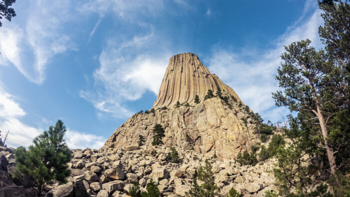
The imposing geological oddity is an igneous intrusion — a magma column that protruded through the surrounding sedimentary rock 40 million years ago and then cooled. As time rolled on, the soft sedimentary material eroded away, leaving behind the distinctive formation that appears on Wyoming's license plates.
Cinephiles will know Devils Tower from its keynote appearance in Steven Spielberg's Close Encounters of the Third Kind, but it gained fame early in United States history as the first designated National Monument.
Unsurprisingly, Yellowstone National Park, that home of perpetually bubbling geysers, sulfur, and boiling ponds, is also rife with references to the Christian idea of hell. Names like Hell's Gate Sprouter, Devil's Bathtub, and Little Lucifer abound. Many of them go back to the area's early exploration by the first batch of white mountain men in the early 1800s.
But as Vermont's surprisingly brimstone-rich place names indicate, the devil's fork-tongued influence on U.S. maps isn't limited to the arid West. Brimstone Creek is a waterway in Picket County, Tennessee. Satan's Toe is a cape on the Massachusetts coastline, and Big Devil Swamp is a bog in Kalkaska County, Michigan.
The sheer prevalence of these kinds of names sparks the question: Why so many?
Three theories
The most obvious answer is religion. The Puritans, a hardcore splinter group of Protestantism, took the idea of the devil extremely, extremely seriously (see the Salem Witch Trials, among other things). The Puritans were some of the first successful white settlers in North America. Their fledgling colonies were mostly collected in the Northeast, but even the more business-minded early colonists in the South had various strains of Christianity firmly centered in their minds. America has remained a religious country, with various ebbs and flows, throughout its entire history, right up until the present day.
As the 1600s and 1700s gave way to the 1800s, and the descendants of those original settlers made their way westward, the salty, rough-and-tumble sodbusters who put English names to ancient places remembered their childhood Bible studies.
The Spanish also took their religion seriously. As they explored the American West from the other direction, they didn't hesitate to name the sites they encountered with the devil's moniker. Arizona has at least four distinct canyons with Diablo in the name.
As with Yellowstone, sometimes that was because certain geological features seemed to be visual reminders of the Christian idea of Hell.
A devil of a time
Another theory is that some of the names came from a popular English expression.
"I had a devil of a time," meaning something gave somebody a fiendishly difficult experience, is a phrase still in use today. But it was more prevalent in the 1800s, and it's likely that the names of high mountain gaps, like Devils Pass in Nevada, sprang from early white explorers' lung-busting efforts in getting up and over the things.
A third explanation could be simple mistranslation. Author and humanist Terry Pratchett has recurring funny bits in his books where he posits that many of the place names adopted by explorers come from misunderstandings with indigenous people.
This seems to be the case with Devils Tower. According to the National Park Service, an 1875 expedition led by Colonel Richard Irving Dodge concluded with an interpreter mistranslating one of the Tower's more poetic Native place names as "Bad God Tower." Later, that got simplified to Devils Tower.
All of which takes me to a final important point in this discussion.
Most, if not everything, named after hell and the devil already had names before culturally Christian, ethnically white folks showed up to the party. And most, if not all, of these names are just better.
Better names
The Cheyenne had a name for Devils Tower that translated as Bear's Lodge, Bear's House, Home of the Bear, or some variation. The Lakota and Crow people also had bear-related place names for the Tower. My personal favorite is the Kiowa place name, which translates to Aloft on a Rock — one that I believe the many climbers who enjoy the National Monument could get behind.
Efforts to rename Devils Tower have been ongoing almost since it was named Devils Tower, the most recent in 2015. However, despite the work of various organizations, the Tower retains its fiendish name.
There's a tendency to view the renaming of American natural features as a recent liberal trend, an outgrowth of the increasing cultural sensitivity my home country is grudgingly undergoing. The many commenters who took to social media in the wake of the recent renaming of a mountain near my home certainly think so. Clingman's Dome, the high point of the Great Smoky Mountains, is now back to its ancestral Cherokee moniker: Kuwohi (ᎫᏬᎯ), or Mulberry Place.
And let me tell you, a lot of folks here in North Carolina and Tennessee aren't happy about it.
Woke or logical?
But I think we can safely dismiss critiques about reverting natural features to their Native names as a wokeness backlash. In fact, renaming these places isn't woke; it's logical. Yes, it's about honoring the culture and history of the people who occupied these places for thousands of years. And yes, it's about righting some wrongs.
But it's also just about calling these places what they've been called for the bulk of their history. Two hundred years or so is a drop in the bucket compared to the thousands of years the Cherokee roamed the misty peaks of Kuwohi or the endless decades that Kiowa youths, with more bravery than sense, scrambled up the sheer faces of Aloft on a Rock.
Even the early English surveyors in the Himalaya knew that. They tried to preserve local names whenever possible. Everest is a notable exception, and there's some debate over how exactly that happened. Andrew Waugh, the man who named it, claimed he couldn't find a consistent traditional name. And for what it's worth, Sir George Everest himself opposed the decision.
But setting aside all that, I submit that Native place names are just better — particularly concerning the hundreds of "hell," "devil," and "Satan" names that dot the map. The original names are more poetic, more in touch with the spirit of a place, and less representative of hardship and childhood nightmares spurred by religion.
Bear in mind I'm not trying to romanticize Indigenous people, particularly not in the "innocent savage-child of nature" way.
I'm simply saying that Native names indicate long and personal experiences with a place. Generations upon generations of birth and death. Marriages and murders, feasts and famines, centuries of human connection with nature. All of us who enjoy the outdoors want that kind of intimacy with the landscapes we enjoy.
So, to hell with it. I'll take Aloft on a Rock over Devils Tower any day.
The Nilgiri Himal in the Annapurna massif includes 7,061m Nilgiri North, 6,940m Nilgiri Central, and 6,839m Nilgiri South. Nilgiri North and Nilgiri South are considered main peaks, while Nilgiri Central is a subsidiary peak.
Alpinists rarely visit this range, with the first summits in the 1960s and most expeditions in the 1980s.
Nilgiri North
The highest Nilgiri peak, 7,061m Nilgiri North, had its first successful ascent in 1962.
Kees Egeler from the Netherlands organized this expedition, which included five geologists and a doctor, as well as three clients (who were siblings). Renowned French mountaineer Lionel Terray, and Wangdi Sherpa from Nepal, rounded out the team.
For the Dutch, it was their first Himalayan expedition.
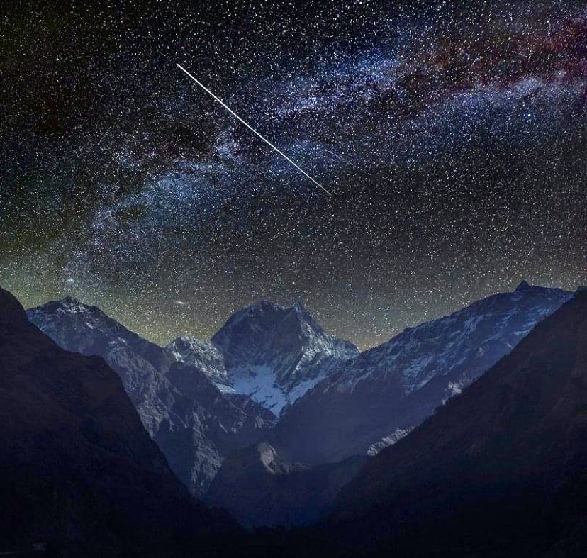
On October 19, Terray and Wangdi Sherpa led the way to the summit, with the three Dutch brothers, Holger, Paul, and Peter Van Lookeren Campagne, following behind. They ascended along a north face/west ridge route, placed three camps, and fixed ropes during the climb.
Sixteen expeditions have attempted Nilgiri North. The most recent attempt was this autumn by a Japanese party on the west ridge. Twenty-six climbers have summited, most recently in the autumn of 1990.
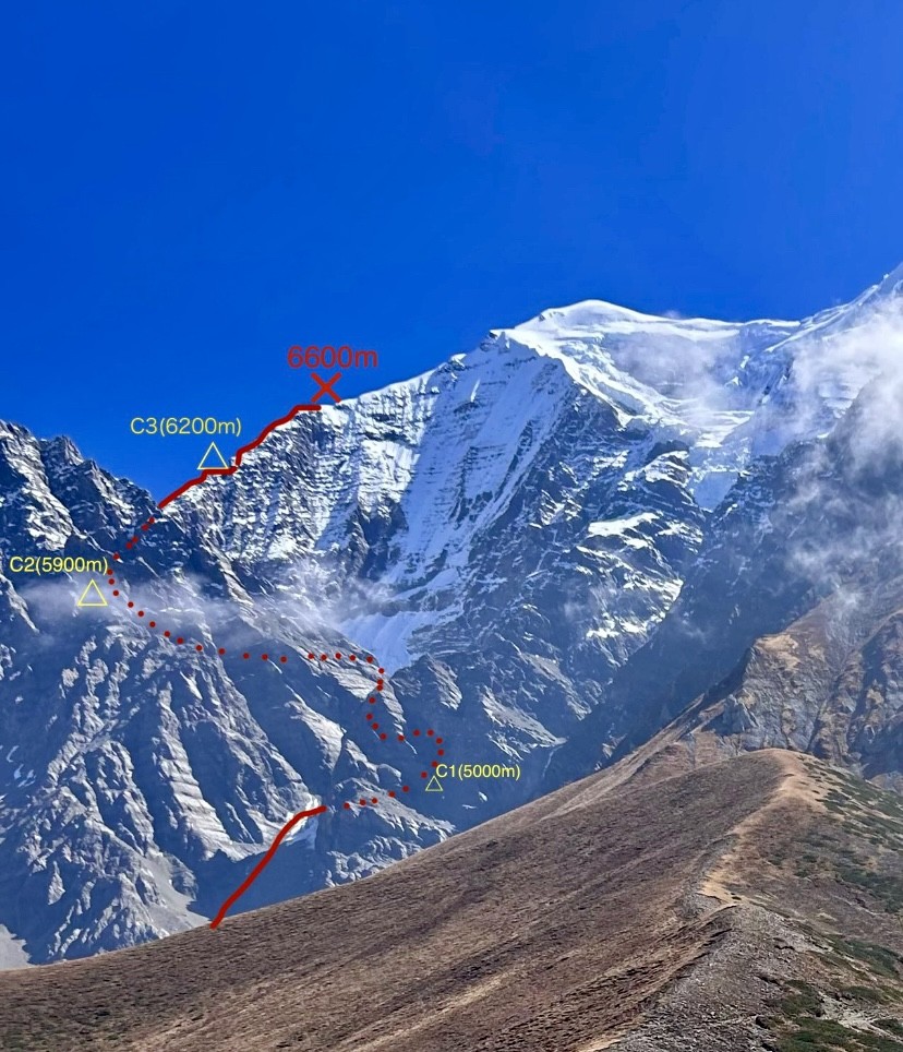
Those successful climbers belonged to five expeditions. After the first ascent in 1962, a Japanese team summited in the spring of 1981 via the east ridge. Then another Japanese expedition topped out in the spring of 1982 by the southeast face.
In the autumn of 1983, a joint Australian/New Zealand expedition also climbed via the southeast face. Finally, in the autumn of 1990, a South Korean expedition, including three Sherpas, summited via a small ridge on the same face.
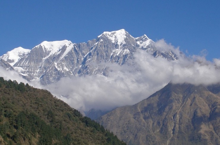
Nilgiri South
Nilgiri South (6,839m) saw its first ascent in the autumn of 1978. Led by Kazuo Mitsui, the Japanese team from Shinshu University consisted of Taichi Fujimatsu, Yoshiaki Kato, Nobuhito Morota, Seiji Tanaka, and Hideki Yoshida. They summited on October 10 via the east ridge from the north.
Seven more teams have attempted Nilgiri South. Japanese teams tried in the spring and autumn of 1981 and again in 1984 and 1985.
Slovenians Tadej Golob and Dusan Polenik attempted its south face in the autumn of 1996 but had to retreat from 5,400m because of deep snow and avalanches, according to The Himalayan Database.
Three years later, in the autumn of 1999, Golob returned with four Slovenian climbers to attempt the south face via the southwest ridge. They eventually withdrew at 6,600m because of bad weather and frostbite.
An alpine-style ascent of the south face
The last expedition to Nilgiri South was in the autumn of 2015.
The Austrian Nilgiri South Expedition was a small, three-member party led by the late Hansjorg Auer. With Alexander Blumel and Gerhard Fiegl, Auer ascended the south face to the west face/south ridge/northwest ridge of Nilgiri "Spire" (southeastern peak). From there, they took the east ridge of Nilgiri South and topped out on October 25 after three bivouacks.
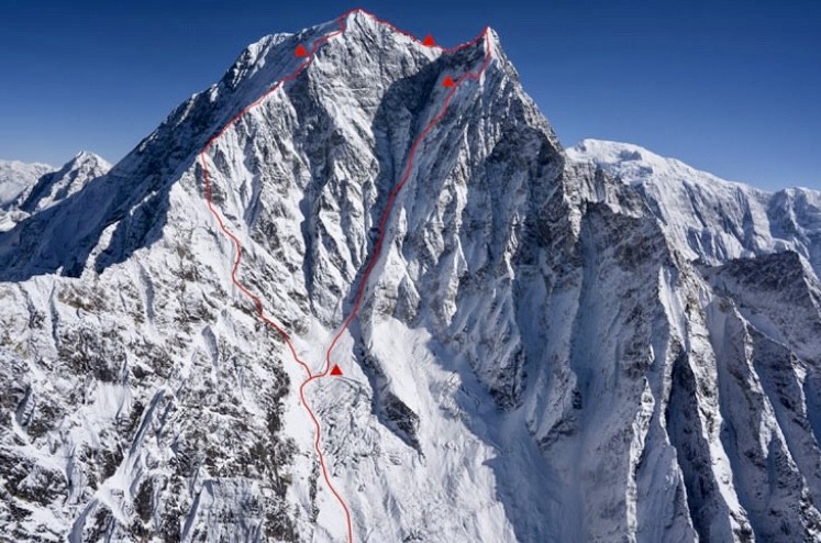
During the climb, the climbers overcame huge difficulties, including a ramp-like 60° average slope with some 90° sections. Other sections were up to M5 and 70°.
This was the first ascent of the south face of Nilgiri South, the first ascent of the southeastern peak, and the first traverse of both peaks.
Acute mountain sickness
But before they summited, there were some worrying signs. On October 24, the trio reached a nice flat bivouac spot at 6,740m, just below the main summit. But Fiegl had a bad night, showing signs of acute mountain sickness (AMS).
The next day, they started the last section to the summit. Fiegl climbed very slowly. After summiting at 11 am, they started the descent via the southwest ridge. At about 6,500m, Fiegl was exhausted, so Auer and Blumel decided to stop at 3 pm to bivouac and help him recover. Fiegl no longer seemed very aware of the situation.
On October 26, the forecast predicted 75kph winds.
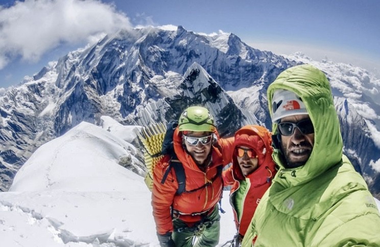
A fatal fall
After a cold night, the wind got stronger. At 8 am, they started to descend through a snow and ice ridge traverse. They climbed unroped to move as fast as possible. At 6,100m, while downclimbing, Fiegl fell down the southeast side of the peak. He dropped 800m down a couloir.
Auer and Blumel, in shock, rappeled down to an icefield and then continued downclimbing. All the way, they found traces of Fiegl’s fall. At 6 pm, the duo reached the glacier. But there was nothing they could do. Fiegl was dead.
Fiegl’s family wanted the body returned home. Although Auer and Bluemel told them that there was nothing to collect after such a destructive fall, a helicopter rescue was nevertheless organized. However, because of heavy snow even at 3,500m, the search proved impossible.
To date, nine climbers have summited Nilgiri South (six Japanese climbers in 1978 and three Austrians in 2015.)
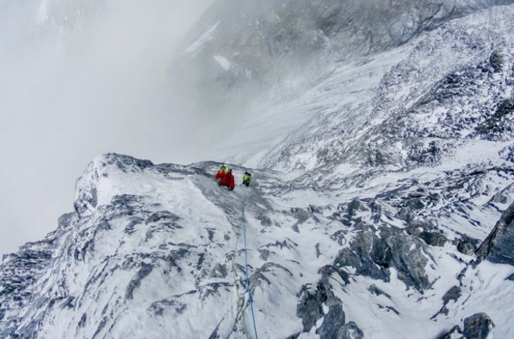
Nilgiri Central
Only three expeditions have tried Nilgiri Central (6,940m).
The first was a Japanese party from Matsuyama University, led by Masaki Aoki. The party chose the southeast ridge-south ridge route. Aoki, Toshiro Hamada, Kohichi Sakata, Yasuo Tsuda, and Junichi Yuyama topped out on April 30, 1979. This was the first ascent of this subsidiary peak.
In the autumn of the same year, another Japanese party attempted the west face. Led by Tsotomu Nishimura, they retreated from 6,000m because of falling ice.
The third expedition was a South Korean expedition led by Kim Ki-Heyg in the spring of 1982. Five members of the expedition (three South Koreans and two Nepalese sherpas) reached the summit on April 25 via the southeast face and southeast ridge.
Ten climbers have summited Nilgiri Central.
Swamps and wetlands get a bad rap, and not without reason. They can be difficult to navigate, play home to various venomous and tooth-filled creatures, and often serve as breeding grounds for one of humanity's most vicious enemies — the humble mosquito.
The first English settlers in Virginia found this out the hard way. When the Virginia Company, under the leadership of John Smith, founded the first permanent English settlement in the New World in 1607, they landed in a swampy spot not far from present-day Virginia Beach. Realizing that the area wouldn't suit the colony's needs fairly quickly, Smith and company relocated inland to a (somewhat) dryer spot they dubbed Jamestown.
But swamps are important. They filter water, provide buffers to flooding and erosion, and serve an important ecological niche.
They can also be stunningly beautiful, sometimes in surprising ways. The wetland where Smith and his soon-to-be-struggling colony first touched North American soil is now called First Landing. It's an unassuming little state park within the urban boundaries of Virginia Beach.
But a few times a year, something astonishing happens when the light is just right. The tannin-filled water lights up with a stunning display of rainbow striations.
"Magical" is probably the best word for it.
A chance viewing
Photographer Katherine Scott is lucky enough to have seen this natural wonder. In December 2018, Scott was hiking in First Landing with her camera. She spent the bulk of her day photographing the park's flora and fauna before turning around and heading for her car.
"As I turned off Bald Cypress [trail], I stopped short. The cypress swamp that just seconds before had been its usual dark, murky self was magically, suddenly transformed by sunlight," Scott wrote in a blog post on First Landing's website.
"There it was. Instead of old black water, a new rainbow of color. Across the still expanse of the swamp, reds, oranges, yellows, greens, blues, and purples were spread smoothly. The calm, colorful water was punctuated by cypress knees and long shadows, which somehow only enhanced the overall scene," she continued.
Thanks, cypress trees!
It takes a combination of factors to create a rainbow swamp.
Have you ever been walking across a concrete parking lot late in the afternoon, stepped over a puddle, and stopped to marvel at the rainbow sheen sparkling across the top of the water?
Those colors are created by a thin film of oil floating on the puddle's surface and refracting the sunlight.
The same phenomenon is at play at First Landing and in various wetlands across the American South.

The keystone flora in these wetlands is the cypress tree, a plant that is spectacularly well-adapted to soggy environments. Cypress trees can grow right up out of the water thanks to modified root structures called "knees" that they send up above the murky surface. Cypress trees also produce an oil that saturates their wood, bark, and needles.
Cypress trees are abundant in southern swamps. As evergreens, they produce needles year-round. As the needles age and fall into the water, the oils leach out and coat the swamp's surface.
But if that's all it took, every swamp in the American South would be a rainbow swamp. According to Jeff Ripple, who formerly led swamp walks in Florida, there's some microbiology at play as well.
"The rainbow sheens found as a thin film on top of pooled water in swamps and marshes are the result of natural oils released by decaying vegetation or the biological processes of anaerobic bacteria reducing iron in soil," the naturalist told the BBC.
Finally, it takes unusually quiet weather conditions to produce the effect.
"Movement by sheet flow, current, or wind disturbance would destroy the fragile rainbow film," Ripple said.
A rare occurrence
And so, unlike natural wonders that rely on geological processes, rainbow swamps are unpredictable and deliciously fleeting. Because of the angle of sunlight needed to create the rainbow effect, late fall and early winter are the best times to see them. But even then, it's a toss-up.
Retired engineer Michael Hussey owns a swampy patch outside of Tallahassee, Florida, and monitors the waters every year, hoping to catch a glimpse.
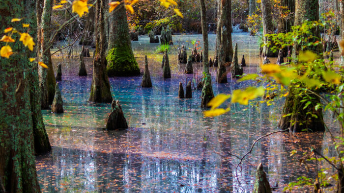
Still, he's only witnessed the phenomenon a few times in almost half a century.
"I have seen this occur about ten times in the 40 years I have lived here," he told the BBC. "It's beautiful to see."
So, what's the best way to see a rainbow swamp? You've got to spend a lot of time in the swampland of the American South at the right time of year, cross your fingers, and hope for the best.
Might we recommend a multi-month expedition along the 2,400km Florida Trail?
Say what you will about the British Empire in the early 1800s — and there's lots to say about colonialism and the theft of important artifacts from other cultures — that rain-soaked collection of islands in the North Atlantic certainly produced some world-class adventurers. Thanks to well-funded institutions like the Royal Geographical Society, the UK sent out wave after wave of explorers willing to put their bodies and minds on the line for the sake of scientific exploration.
And sometimes a little cash.
A monetary prize may or may not have played an important role in the sad finale of Alexander Gordon Laing's story. Laing was a Scottish explorer and geographer tasked with finding the source of Africa's Niger River. In pursuit of this goal, he suffered disease, maiming, and other hardships. He also became the first European to stumble into a city that had become virtually synonymous with "impossible-to-reach, mysterious places."
Timbuktu: history becomes mystery
Timbuktu is an ancient city in West Africa, south of the formidable Saharan desert. And by ancient, I mean ancient: there's archeological evidence for prehistoric settlements there. By the late Middle Ages, the city was a major trading hub and a jewel in the crown of Islamic culture.
But overland travel and geopolitical relationships being what they were five hundred years ago, Europeans didn't go there. As centuries progressed, the word Timbuktu began to symbolize a place so far out of reach that it might be mythical.
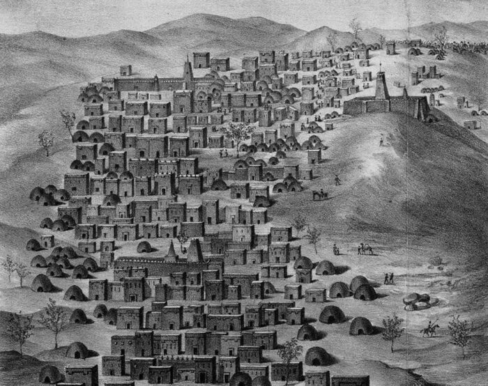
By the early 1800s, France was colonizing Mali, the country where Timbuktu sits. But even this didn't make Timbuktu accessible to Europeans — the desert was simply too much of a geographical boundary for Europeans without the know-how and connections to travel its punishing expanse.
The Societe de Geographie (France's version of the UK's Royal Geographical Society) offered a 9,000 franc prize to any European who could reach the city and come back alive. As we'll see, it's this cash prize that may have led to our hero's untimely demise at a far too young age.
A well-traveled young man
Like many young men of his time and station, Laing was well-educated and extensively traveled by his early adulthood. Laing was born in Edinburgh, Scotland, in 1794. His father was a private tutor specializing in the classics. Laing would complete his higher education at the University of Edinburgh, one of the finest institutions of the day.
With that hefty education under his belt, 17-year-old Laing shipped out to Barbados to clerk for his uncle.
But two years with a desk, pen, and blotter was enough to teach Laing he wanted something different for his life. A military enrollment followed at age 19, and soon enough young Laing found himself first in India, then Africa. There, he journeyed extensively among the local people (primarily the Mandika), saw combat, and began his first explorations of West Africa's rivers.
He was the first European to track the Rokel River (Sierra Leone's largest waterway) to its source. Laing also launched the first of his expeditions up the Niger, a journey that was ultimately stymied by troublesome relations with the locals.
Shortly after, Laing was promoted to Major. He returned home to the UK in 1824 to prepare an account of his adventures, Travels in the Timannee, Kooranko, and Soolima Countries in Western Africa, published in 1825. He returned to Africa later that year.
Laing also found time for courtship amongst all these journeys. He married Emma Warrington, the daughter of a British consul, in Tripoli on July 14, 1825.
But a long and happy marriage was not to be Laing's fate. Two days after his marriage, he set out into the desert on another adventure. It was destined to be his last.
South across the Sahara
Thanks to his demonstrated courage and extensive travels in the region, Henry, third Earl of Bathurst, secretary for the colonies, tapped Laing for another mission to the source of the Niger. And if Laing happened to reach Timbuktu along the way, all the better.
Things went well at first. In the company of a sheikh whose name is now lost to us, Laing first reached the oasis city of Ghadames (in modern-day Libya) and then the oasis city of In Salah (in modern-day Algeria).
But the toughest part of the desert yet remained. Ahead of Laing and the sheikh lay the flat, waterless, Tanezrouft, where summertime temperatures routinely reach 52°C. The Tanezrouft is so desolate and lifeless that, so far as archaeologists can tell, there has never been long-term human habitation. The Tanezrouft still presents travelers with difficulty today. Imagine traversing it in 1826.
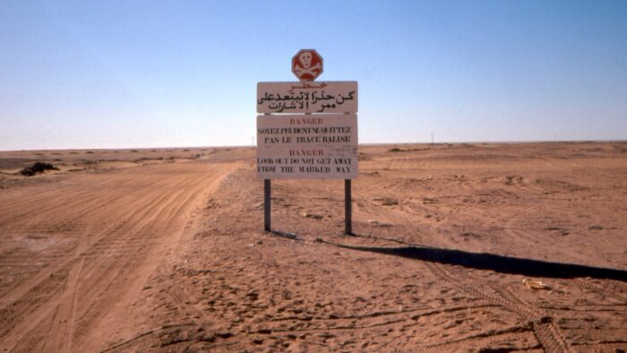
But it wasn't the heat that ultimately proved near-fatal for Laing in the Tanezrouft, but enemies both microbial and human.
Timbuktu, but no further
Like many European travelers in Africa, Laing was plagued with illness, particularly a devastating fever that severely weakened him.
That debilitated state certainly didn't help when the caravan Laing was traveling with came under attack by bandits. The group fought the raiders, but Laing was robbed of his money and supplies and wounded in 24 places — including the loss of his right arm.
Despite encountering a setback that would have sent lesser men back to the relatively benign shores of the West African coast, Laing managed to limp into the trading town of Sidi Al Muktar. After a brief recovery, the dauntless explorer pressed on. On Aug. 18, Laing crested a dune and finally saw the fabled city of Timbuktu spread out before him.
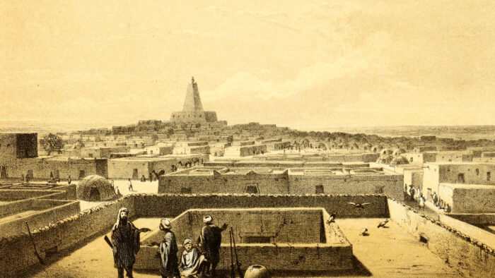
The accomplishment cannot be overstated. Laing was the first European to reach Timbuktu in recorded history and the first to complete a north-to-south crossing of the Sahara.
Death in the desert
What happened next is where things get mysterious. After his death, Laing's papers were never recovered, so all historians have to go on are the rather brief letters he sent home and some imperfect record-keeping from Timbuktu. It seems that Laing was an unwelcome guest in Timbuktu, and he swiftly made plans to leave and continue his search for the source of the Niger.
The one-armed explorer set out from the city on Sept. 24, 1826. Three days later, his Arab escorts murdered him and stole the few supplies he'd managed to cobble together. It was said at the time but never proven, that Laing's nameless sheikh escort was involved in the plot. The young explorer was just 31.
Why did this happen? Laing's influential father-in-law swiftly accused the French of masterminding the murder to allow a Frenchman to claim the 9,000-franc prize. He also claimed that the French had stolen Laing's journal.
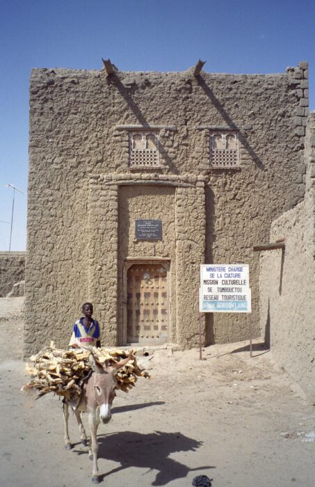
In fact, a Frenchman did end up succeeding where Laing failed. Two years after Laing's death, a French explorer named Rene Caillie reached Timbuktu and survived the return journey. The prize was his.
But there's no evidence that anything more nefarious than banal human violence and greed prompted Laing's murder. In cases like this, Occam's razor is a useful tool. Many were the European explorers of the day who found their infinitely less wealthy guides turning on them for profit. Laing's journal, far less valuable than whatever money and supplies Laing was carrying, was likely tossed into the sand and lost to time.
An explorer gets his due
Today Laing is a barely remembered footnote in the history of African exploration. Towering figures like Livingston, Burton, Speke, and Carter are all more well-known for their contributions to European scientific knowledge of Africa. To add to this, it's not as if Timbuktu was a "lost" city, it was an important trading hub, and certainly, the people who lived in and around it knew exactly where it was.
But we must remember the myriad difficulties faced by European adventurers as they explored the African interior. In many ways, setting off southward across the Sahara toward a city no European had ever seen was like getting into a rocket and blasting off into space without a flight plan, and just hoping to hit the moon.
The courage and physical resilience it took to do this — and to continue pressing on across the desert after severe wounds and disease struck him down — is astounding. Furthermore, nothing from Laing's existing letters and papers indicates he was in it for the money. It seems as if the young Scot was exploring for the sake of knowledge, adventure, and the desire to "fill in the blank spaces" that so gripped certain Europeans of the day.
But Laing was not forgotten by the French, the very government his father-in-law accused of masterminding his death. When the Societe de Geographie awarded Rene Caillie its Gold Medal in 1830, it gave Laing one as well.
In 1903, the French also placed a plaque on the house where Laing stayed in Timbuktu. In 1992, it became a National Heritage site.
Before Marco Polo and the great medieval travelers, a humble merchant went on an odyssey to find himself and his people. This unassuming man was not only one of the first medieval travelers but also a pioneer in cultural anthropology and ethnography. Both disciplines barely existed in that era.
Background
Benjamin of Tudela was a 12th-century Jewish merchant from northern Spain. This learned man spoke several languages and had an affinity for foreign cultures. He specialized in coral and gem trading and had a keen eye for investments and business opportunities. We don’t know much about his early life except that his great journey probably started around 1160. He may or may not have been a rabbi, as some Jewish sources claim.
After leaving Tudela, he explored his home country, then France, Italy, Greece, Turkey, Cyprus, the Holy Land, Damascus, and Iraq. In his later travel book, he lays out how long it takes to get from point A to point B. He also provides the reader with the first non-Arab mention of the Druze culture in literature.
Benjamin spent long periods in Christian strongholds like Rome and Constantinople. He was particularly impressed by Constantinople's wealth but felt uneasy by its treatment of its Jewish population.

Marcus N. Adler, a rabbi in the British Empire and one of Benjamin's translators, stated that he was one of the few medieval writers to mention Prester John, the legendary Christian monarch who might or might not have existed.
There is some doubt as to whether or not he traveled beyond Iraq. He reports on Persia, China and even Tibet, but some details of these far-flung lands are sketchy. Elsewhere, everything had been accurate. Persia notoriously oppressed the Jews so it was unsafe for him.
Benjamin also made one of the first mentions of China by name. It is possible that he filled in the gaps with information from other travelers. At the end of his journey, he returned to Spain by boat, passing through Egypt.
His travelogue
Thanks to his travelogue, The Itinerary of Benjamin of Tedula, he is considered one of the best and most accurate sources of medieval life and the relations between religious groups in Europe and the Middle East.
Benjamin seemed to feel more comfortable with Muslims than with Christians and emphasized the decent relations between Jews and Muslims at the time. He was very honest about conflicts in Judaism, pointing out the hostile relations between warring sects of the Rabbanities and the Karasites.
In his unofficial census of the Jewish population in Europe and the Middle East, he noted the numbers, occupations, learned men, synagogues, and practices. For example, he says, "Pisa is a very great city…[with] about twenty Jews." In the city of Lucca, he likewise counted about 40 Jews. In all, he documented around 300 cities.
Through the Itinerary, historians witness first-hand the great shifts occurring in Europe between Jews, Christians, and Muslims. Many transformative events characterized the 12th century: the Crusades, the early Renaissance, the emergence of nation-states, the rise of vernacular literature and translation, diversification in trade, and more.
Why?
Historians are unsure why he traveled, but some believe he had religious or commercial intentions. Throughout the text, he described his faith at play in different countries. The fact that he so thoroughly documented Jewish experiences, sites, and practices could indicate that his journey was a sort of religious quest.
Was he on a pilgrimage to the Holy Land? His tone and content indicate that he was a devout Jew. He tracked populations of his people and visited sites from the Old Testament. Once he commented, "The closer I get to Jerusalem, the more Jews are heretics.” However, if it was mainly about religion, he would likely have written more about the spiritual aspects of his trip.
Lost Tribes
Another possibility is that he was searching for the Lost Tribes of Israel. He and other travelers like him were trying to locate the Lost Tribes -- exiled after an ancient conflict -- as a means of maintaining their heritage. For centuries, the Jews had already scattered across the globe. Writer Alanna Cooper says in the AJS Review that while Benjamin mentions finding the tribes of Dan, Zevulun, Asher, and Naphtali, he does so in passing. His casual tone doesn’t indicate urgency or excitement. Most likely, then, he wasn’t searching for them.
Jewish theologian and Rabbi Michael Signer believes Benjamin’s travelogue was a “consolation for the Jewish people,” a way of uniting them. The Itinerary of Benjamin of Tudela was most likely a passion project for him to tap into his identity or present a map of the Jewish diaspora to potential migrants. In the wake of the Crusades, Jews had been persecuted and driven out of their original dwelling places.
Finally, he may have simply been scouting for trade routes between the Jewish communities. He often mentioned whether those he met were merchants, jewelers, glass workers, silk weavers, or dyers.
Legacy
An urban art project called Street Talk launched in Jerusalem in 2017, dedicated to Benjamin. It reimagined him as a 21st-century backpacker named Benny, exploring Europe and the Middle East.
He makes his way through Jerusalem, encountering historic figures from Jewish history, and receiving advice on where and how to travel. It was partly an educational project highlighting how the Jewish people have been scattered for so long, trying to make their way home.
A medieval geography project called Mapping the Jewish Communities of the Byzantine Empire by Nicholas de Lange at the University of Cambridge used GIS to map Jewish communities in the Byzantine Empire. Benjamin of Tudela was the main data source.
Tudela may not be as famous as Marco Polo or even Ibn Battuta, but his travels are considered on a par with theirs. And his work is crucial in Hebrew medieval literature.
It was a scene out of a horror movie. There was no sound, the air was deadly still, and the putrid smell of rotting eggs wouldn’t go away. Bodies of people and animals lay motionless in several villages near Lake Nyos. In August 1986, hundreds of people died suddenly in one of the rarest geological events of the modern era.
Background
Lake Nyos is a 1.9km long and 200m deep crater lake located in northwestern Cameroon. Between 9 pm and 10 pm on Aug. 21, 1986, villagers in the valley heard a strange rumbling noise. Those closest to the lake itself described a bubbling noise. Then, white smoke started to emerge from the lake and travel northwards. Then, people and animals suddenly dropped dead, killed by a silent assailant. The cloud is called a mazuku, a deadly blanket of carbon dioxide.
Around 1,800 people died, all living in the affected towns of Nyos, Cha, Fang, Mashi, and Subum. Most residents were farmers. About 3,500 livestock also perished. Insects stopped making sounds. It was as if time stood still. The lake water was usually a brilliant blue color, but after the eruption, it turned reddish-brown.
A rescue team did not arrive until 36 hours later. Assisted by the Cameroon military, everyone had to wear protective gear and oxygen tanks. Sadly, the dead could not receive individual funerals, so mass graves were dug.
The aftermath and effects varied. The survivors (four in Nyos and around 5,000 in the general area) were all in comas that ranged from six to 36 hours. They reported falling unconscious and waking up dazed. They escaped death because they lived on higher ground.
Some had respiratory issues, which cleared up soon after. Women suffered miscarriages; others had pneumonia. Some committed suicide after seeing the horror or losing family members. Pictures of the dead bodies also contained big lesions caused by low levels of oxygen.
Limnic eruption
The disaster at Lake Nyos is an example of a limnic eruption, also called a gas eruption. It happens when a lake, typically a volcanic crater lake, instantaneously releases a large amount of dissolved gases.
In this case, Lake Nyos primarily contained carbon dioxide with traces of sulfur dioxide. This gas release can occur when pressure builds up at the lake's bottom from geothermal activity.
When the pressure becomes too great, gas rapidly escapes to the surface and forms a dense, toxic cloud. The cloud can blanket the ground, displacing oxygen and asphyxiating people and animals. It does not seem to affect plant life.
Two other dangerous lakes
Lake Nyos is not the only incident. Just 100km away, Lake Monoun erupted on Aug. 15, 1984, killing 37 people. Lake Nyos erupted almost exactly two years later.
Lake Nyos and Lake Monoun are two of three lakes in Africa that experience these types of eruptions. In the Democratic Republic of the Congo, the third lake, Lake Kivu, expels not just carbon dioxide but also methane and hydrogen sulfide. Though it has not erupted catastrophically like the other two, scientists worry that it has the potential to release over 300 cubic kilometers of carbon dioxide and 60 cubic kilometers of methane, according to journalist Nicola Jones of Nature.
Though companies commercially extract methane from the lake, volcanic activity can trigger a limnic eruption at any time. In 2021, there was a scare when Mount Nyiragongo erupted and triggered small amounts of gas to emerge from the lake. A volcanic crater lake in Italy called Lake Albano also has the potential to have a limnic eruption.
In Russia, the Valley of Geysers is located in the super-active Kamchatka region. Locals refer to an adjacent low-lying area as the Valley of Death because heavier-than-air carbon dioxide can blanket the ground and kill wildlife. While the Valley of the Geysers is a tourist spot (it's the second-largest geyser field on Earth, after Yellowstone), the nearby Valley of Death is understandably off-limits.
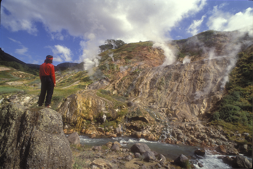
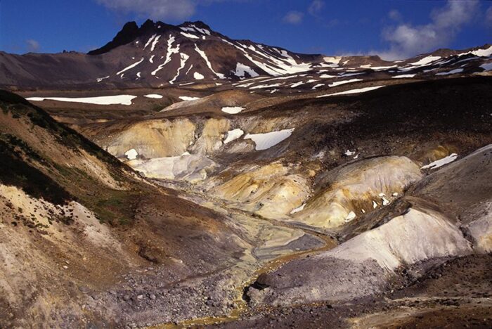
How it happened
“Anaesthetic concentrations of carbon dioxide [was] formed as the gas mixed with air during its flow into the valleys," explained the official study written by Peter J. Baxter et al.
Furthermore, on this calm night, the gas collected in hollows and would stay there until the winds or solar heat dispersed it. Although the initial cloud that erupted from the lake was an estimated 50-100m thick, it is unclear how thick the blanket that settled upon the villages was.
But why are these lakes concentrated in one region? Lake Nyos is not a very old lake, possibly just a few hundred years old. Lake Nyos and Lake Monoun are in the Oku Volcanic Field, part of a 1,600km-long chain of volcanoes that runs from Nigeria and Cameroon in the mainland to the southernmost island of Annobón.
Lake Kivu lies in the East Africa Rift Valley, which is notorious for its highly active and dangerous volcanic formations. The region's volcanism is due to the split between the African and South American plates over 100 million years ago.
A bubble of CO2
According to NASA, Lake Nyos sits on the edge of an inactive volcano and a pocket of magma. “Carbon dioxide from that magma slowly percolates through Earth’s crust with the groundwater and accumulates in the bottom of the lake," states NASA. "Eventually, the gas becomes too concentrated, and a bubble of CO2 bursts from the lake.”
What triggered the eruption? Most likely a landslide or a small earthquake. This would have released carbon dioxide, which accumulated to over 10%.
So why carbon dioxide? Why wasn’t it mixed with the usual volcanic gases -- sulfur dioxide, hydrogen fluoride, hydrogen sulfide, hydrogen chloride, and carbon monoxide? While water tests showed that the accumulated gas was almost completely carbon dioxide, the rotten egg or gunpowder smell after the eruption suggests that very small amounts of sulfur dioxide might have been present. However, when carbon dioxide is saturated in water, it also gives off this unpleasant smell.
Prevention
To prevent a recurrence, measures were implemented to manage the buildup in Lake Nyos. At first, scientists considered blowing up the lake with a bomb. Instead, they opted for a gradual degassing of the lake.
In 2001, French engineers installed degassing pipes to release the trapped gases in a controlled manner. A plastic tube reached 203m down and conducted the gas safely into the atmosphere. Authorities installed two more pipes in 2011. They did not want to take any chances with Lake Monoun, so they installed three pipes there as well.
They also relocated several communities and have tried to discourage those who wish to return to the lake decades later. Apparently, the lake is still toxic. However, residents claim that this is their ancestral land, and they prefer to bear the risk.
Despite what proponents of pseudo-archaeology would have you believe, the past is interesting enough without bringing aliens into it.
For instance, there are plenty of history-altering, world-shaking figures whose burial places are unknown. And we're not talking about quasi-mythological figures from the Bronze Age like Agamemnon or Odysseus. Proven historical figures like Alexander the Great, Genghis Khan, and Cleopatra are all resting in places unknown.
In some cases, these lost tombs result from cultural practices. Other times, the mystery springs from secrecy, betrayal, intrigue, or a combination of all three.
The quest to find the bodies of these figures is as fascinating as the history of how they came to be lost in the first place. What spectacular funerary goods lay in Cleopatra's tomb? What could we learn from Genghis Khan's DNA? And what insights might a hypothetical set of Alexander the Great's journals hold?
So plop on your pith helmet and settle in. Lost tombs await.
Alexander the Great
There's a reason they call him "The Great." Alexander of Macedon was one of the most audacious, skilled, and well-traveled humans the world has ever known. By the time Alexander was 20, his father, Phillip II, had accomplished what no one else had ever managed — uniting the eternally battling city-states of Greece under military rule.
Phillip II didn't stop there. Bolstered by deadly Greek hoplites (heavy infantry), the Macedonian army was moments away from invading the deadly Persian Empire when he was assassinated.
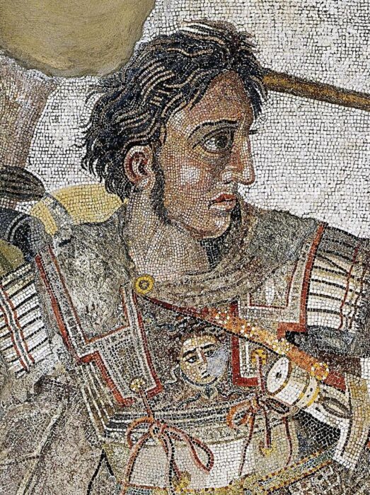
Alexander inherited his father's army and promptly took up where his father left off, eventually doing what no one in the classical world thought possible — toppling the Persian Empire. Alexander then continued toward the edge of the map, eventually turning around on the Indian subcontinent after his exhausted troops threatened to mutiny. Along the way, he spread Hellenistic (Greek-like) culture across the Near East and Central Asia, an act historians agree altered the course of human history.
Alexander returned to Babylon to rule his new empire. But it wasn't to be. Shortly before his death, someone asked him who should inherit the empire. His answer, famously, was "the strongest."
Doomed empire
It was a sentiment typical of the brusque young warrior, but it ultimately doomed his hard-won empire. His closest generals almost immediately fell into civil war, eventually dividing up the spoils among themselves. Ptolemy, perhaps the most gifted of them, ended up in Egypt, making his seat in the Alexander-founded city of Alexandria.
Meanwhile, a caravan containing Alexander's body was on its way back to Macedon. In a move seemingly custom-designed to irritate his former comrades, Ptolemy had it snatched and brought to Egypt.
The corpse, initially enclosed in a form-fitting coffin of hammered gold, eventually wound up on display in Alexandria. Over the centuries, luminaries from antiquity, like Julius Caesar, Augustus, and Cleopatra (more on her later), made pilgrimages to honor Alexander's legacy and ponder their own. By the time Caesar saw it, Alexander's body was resting in a spectacular coffin with a see-through crystal top.
It's unclear when or how the tomb was eventually lost. In the centuries between the rise and decline of the Roman Empire, various historical figures looted the tomb for gold or relics. So it's possible a well-meaning leader secreted away the body to stop the practice. In any case, when the early Christian John Chrysostom visited Alexandria in 400 AD, no one remembered where Alexander the Great lay buried.
Excitement and disappointment
Given how often we know Alexander's body changed hands, moved, or was looted over the centuries, it's unlikely that the tomb, wherever it is, contains the wonderous treasures that delight museumgoers. But it doesn't matter. Archaeologists have been searching for it since before archaeology was an official branch of academia.
And so the hunt was on. The Egyptian Supreme Council for Antiquities cataloged over 140 official attempts to find the body, and there have doubtless been many under-the-radar quests as well.
Initial 19th-century consensus placed the tomb somewhere within Alexandria. The problem is that Alexandria has been continuously occupied since its founding in 331 BC.. It has thus endured all the earthquakes, fires, civil unrest, sackings, and religious changes you'd expect.
Alexander's tomb might have been paved over or buried during an earthquake. It might be under a Christian church or a mosque, and the people who run each aren't generally too happy to see workers with shovels and pick-axes showing up on the doorstep.
Enter Heinrich Schliemann
Everyone's favorite bumbling-yet-brilliant early archaeologist, Heinrich Schliemann, had a pet theory and petitioned a mosque to excavate but was denied. Given the lasting damage Schliemann did to Troy — and his tendency to assume whatever he stumbled upon was what he was looking for — that's probably a good thing.
In more modern times, archaeologists have expanded their search beyond the borders of Alexander's most famous city. Some Greek archaeologists have proposed that Alexander's body, not his father Phillip II's, is buried in Macedon.
Others claim that relics found in the Siwa Oasis — an important location in Egyptian spirituality and Alexander's conquest of Egypt — hold his remains. As recently as 2021, Egyptian officials claimed to have found evidence of Alexander's tomb there, though the tomb itself never materialized.
One National Geographic television host claimed that the body was stolen by merchants and taken to Venice, where it is now venerated as the body of Saint Mark the Evangelist. This possibility seems the least likely, though given the remains' long history of being snatched and used for personal gain, who can say?
And so the hunt for the body of Alexander the Great continues.
Genghis Khan requests a humble burial
We'll return to Egypt, that land of oh-so-many lost tombs, in a moment. But first, a brief side trip across Asia to examine one of history's other great lost conquerors, Genghis Khan.
Dubbed Temujin after his birth on the Asian steppes between 1155 and 1167 AD, the fierce warrior consolidated his fractious people and set to work. Horse archers are some of history's most implacable battlefield opponents, and the Mongols, under Genghis Khan and his descendants, eventually created an empire that stretched from China to Eastern Europe. The utter devastation the Mongols wrecked on the powerful Islamic empire, in particular, allowed Christian Europeans to get a toehold in the Holy Lands — another historic inflection point that still has powerful ramifications in modern geopolitics.
When he died in August 1227, he was buried in a spot he'd chosen earlier, on or near a mountain called Burkhan Khaldun, close to his birthplace. However, Genghis Khan's successors immediately kept the funeral details secret, probably to prevent rival court factions from interfering with the body.
On top of that, Genghis Khan reportedly requested no grave marker at his burial place. Only a small honor guard knew the exact location of the body, and the mountain and surrounding regions were promptly declared taboo.
A sacred mountain
As with the corpse of Alexander the Great, time and political upheaval took their toll. The Mongol Empire eventually fractured and decayed, and those who knew the burial location died without passing on their secrets. Folklore developed over the centuries holds that a river was diverted over the burial place to further hide it, or that trees were planted over it.
Due to the political unrest in Asia over the last century or so, serious searches for Genghis Khan's tomb didn't really ramp up until the last twenty years or so. Most of the questing has been done remotely and non-invasively with satellites or drones.
For instance, in 2015, Dr. Albert Yu-Min Lin used publicly available satellite imagery and crowd-sourcing to identify 55 possible burial sites. He published his findings in the journal Public Library of Science One, but the sites have yet to be excavated.
Archaeologist Pierre-Henri Giscard and scientific image specialist Raphael Hautefort unearthed another promising lead at around the same time. The two men led a team that used drones to image the top of Burkhan Khaldun and uncovered a tumulus — a heap of earth and stone piled over a burial site. The scientists claim that the 250m-long mound is of human origin and modeled after contemporaneous imperial Chinese burial mounds.
Unfortunately, Giscard and Hautefort conducted their expedition without permits — they didn't even let local authorities know they were in the area. Genghis Khan is, quite understandably, a figure of some national pride for Mongolians, and Burkhan Khaldun is still considered sacred by local populations. To date, the tumulus is still unexplored — just like Genghis Khan would have wanted.
Things end badly for Cleopatra
Cleopatra is often relegated to a footnote in the story of Rome's troubled transition from a republican to an authoritarian government — or dismissed as a classical sex symbol who slept her way into power. But she deserves better from history.
By all accounts brilliant, she was a skilled linguist who was the first member of the Greek-speaking Ptolemaic dynasty to learn Egyptian. She was also a masterful politician. With a little help from Rome, she successfully fended off a coup attempt by her younger brother. In short, she was shaping up to be one of the most capable leaders Egypt had seen in years.
However, the Roman civil war eventually spelled the end for both Egyptian autonomy and Cleopatra herself. In the wake of Caesar's assassination, rival factions coalesced around Octavian (later Augustus) and Mark Antony for control of Rome. Choosing between humiliating client-state treatment at the hands of Octavian and possible joint rule with her lover Antony, Cleopatra made an understandable, if fateful, choice.
Her last-ditch naval effort at the Battle of Actium ended in defeat for Cleopatra and Antony. The two retreated with what was left of their army to mainland Egypt to await invasion by Octavian's forces. As the wolves closed in, the two elected to kill themselves rather than fall into the invader's hands.
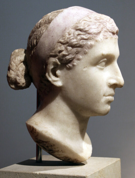
Buried together
Octavian, displaying the political tact that would soon mark him as among the most skilled of Rome's mixed bag of Emperors, allowed the two to be buried together without defiling their corpses. (It should be noted that the Roman historian Plutarch claims Antony was cremated, but sources are mixed.)
But Octavian was also nothing if not pragmatic. As an Egyptian leader from the powerful and wealthy Ptolemaic dynasty, Cleopatra's tomb was completed long before her death, and many people knew where it was at first. Octavian certainly did — he made sure to loot it of the vast treasures Cleopatra had stashed away there.
According to Roman sources, he used the gold, silks, and jewels to pay off debts, to further consolidate his power, and to bribe his troops into not sacking Alexandria. The circumstances do raise an intriguing historical question — what would the months following Octavian's final rise to power have been like without that crucial influx of wealth at just the right moment?
Egyptologists disagree
The lost tomb of Antony and Cleopatra shares much with Alexander's tomb — namely, proximity to the bustling city of Alexandria and nearly two thousand years of human history to sort through. All the difficulties of finding Alexander's tomb also apply to Cleopatra's, with the added difficulty that Cleopatra's life story didn't inspire the same kind of feverish dedication in 19th-century archaeologists that Alexander's did.
Still, modern research is promising. Egyptologist Kathleen Martinez has been hard at work on the search since 2005. She is focusing on the Taposiris Magna, a temple to Osiris lying west of Alexandria. Using traditional archaeological techniques as well as ground-penetrating radar, Martinez and her team have uncovered ten mummies from 27 tombs in the area, as well as promising coins and carvings bearing Cleopatra's image.
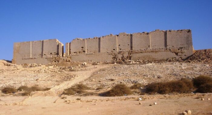
In November 2022, Martinez discovered a 1,300m tunnel under Taposiris Magna, which she believes might lead to the tomb. Excavations are ongoing.
Another prominent Egyptologist, Zahi Hawass, disagrees. At an archaeological conference, Hawass stated that Cleopatra was unlikely to be buried near a temple, as Egyptian temples were for worship, not burial.
The legacy of death
Regardless of this scholarly disagreement, of the three lost tombs mentioned here, that of Cleopatra seems the most likely to be discovered in our lifetime. All we non-archaeologists can do is watch the news.
In any case, if the millennia-long search for certain lost tombs tells us anything, it's that for those who swing the pendulum of human history, the end is often only the beginning.
Finding accurate navigation at sea has been one of mankind's toughest nuts to crack. Not so much the direction you're headed — expert ancient sailors from Phoenicians to Chinese to Polynesians learned fairly early to use the sun, stars, a compass, or all three to get a correct bearing. And determining latitude (how far north or south you are) is a relatively simple matter as well. The length of day or the height of the sun and certain stars above the horizon are handy guides in this department.
But determining how far east or west you are — longitude — is far trickier. Until the 1700s, navigators routinely over- or underestimated their longitude, leading to all kinds of maritime disasters.
In the early 1700s, the burgeoning British Empire took steps to solve the problem. As an island nation, Great Britain was always interested in expanding the frontiers of sea travel, and the thorny longitude issue was the most pressing matter on the agenda.
So, Parliament passed the Longitude Act. It offered a hefty cash prize to anyone who solved the longitude problem.
The race
In doing so, Parliament touched off one of the most fascinating scientific contests in history, on par with the race to the moon. But the race to determine accurate longitude was conducted not by competing governments but by a motley collection of private individuals possessing brilliant brains matched only by outsized personalities.
The following story — as laid down in Dava Sobel's excellent nonfiction account, Longitude — pits highly educated stargazers and mathematicians against self-taught tinkerers. It spans nearly a half century, ropes in some of the finest minds humanity ever produced, and contains double-crosses, selfishly motivated sabotage, and altruistic genius. Royalty and regular folks, captains and craftsmen, professors and priests all played their part.
Above all, however, the tale of the search for accurate maritime longitude is one of solitary, single-minded obsession.
Enter the clockmaker
John Harrison was born a woodworker but destined to be a clockmaker.
Apprenticed to his carpenter father at an early age, Harrison nevertheless nursed an obsession with timekeeping. He built three clocks in his early adulthood while still working as a carpenter, apparently simply because he could.
The carpentry skills inherited from his father were not wasted. His understanding of materials served him well when he tackled his first major clock-related commission in his early thirties.
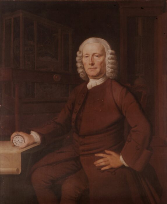
The mechanisms inside the turret clock at Brocklesby Park, North Lincolnshire — which Harrison was commissioned to build in the early 1720s — are entirely made of wood. As such, they don't require regular lubrication, a common failure point in the clocks of the time. The Brocklesby Park clock also contains another of Harrison's horological innovations: a grasshopper escapement.
The escapement is the part of a mechanical clock that keeps the pendulum swinging, and friction is every escapement's enemy. Harrison's innovation was part design and part material — his grasshopper escapement combines clever engineering with precisely carved wooden workings to virtually eliminate friction in the mechanism.
Other innovations followed, including the grid-iron pendulum. Harrison continued his restless innovation over the years. And as we marvel at his genius, it's important to remember he had no formal training or apprenticeship as a clockmaker. Like so many luminaries of the Enlightenment era, he simply turned his impressive mind toward a fascinating field, and away he went.
Disaster strikes
Meanwhile, a military disaster provided the impetus for the contest that defined the last fifty years of Harrison's obsessive life.
On Oct. 22, 1707, four Royal Navy warships ran aground off the Isles of Scilly. Up to 2,000 sailors drowned. The fleet was on the way back from a mission against the French when bad weather caused shipboard navigators to lose track of their position. As was all too common in the era, a shipwreck followed.
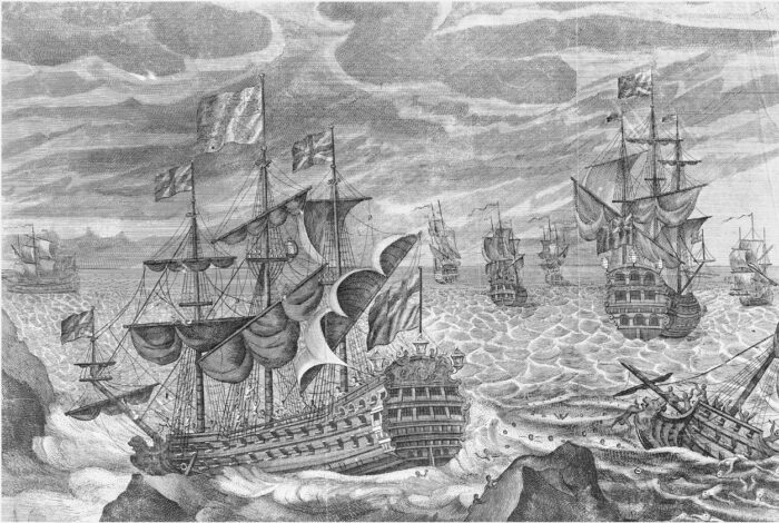
The staggering loss of life, considered by many to be one of the worst maritime accidents ever faced by the British, prompted Parliament into action. A few years later, the lawmaking body passed the Longitude Act of 1714. The legislation offered a hefty cash prize to anyone who could put forth a simple, reliable solution to the longitude problem.
Many great minds across the centuries had already worked on the conundrum. Sir Isaac Newton himself devoted considerable mental energies to it. Considering his interests and fields of study, it's perhaps inevitable that Newton eventually concluded the answer lay in the clockwork motion of the heavens.
By Harrison's time, the longitude problem had been boiled down to a deceptively simple concept: comparing accurate local time (determined by observing the high point of the sun on any given day) with the accurate time at a set location. Each hour of difference between the two times equals a 15-degree change in longitude.
But how to determine the time at the set location? That's the tricky part. The sun moves across the sky from east to west very quickly, so accurate timekeeping is vital.
Longitude methods
As Newton and others rightly concluded, you can measure longitude by calculating the moon's angle in relation to certain stars (the lunar distance method). You can also achieve the same effect by observing Jupiter's satellites as they transit the giant gas planet, a method championed by Galileo.
The problem with both methods is that they require time-consuming mathematical calculations on the part of a navigator. They also require thick stacks of astronomical tables created by decades of painstaking astronomical observations, most of which had yet to be conducted in 1714.
In addition to the hefty groundwork and mathematical skills, both the lunar and Jupiter methods require delicate observations with specialized equipment conducted on a rolling ship under clear skies. Any sailor reading this will know how daunting that can be.
Carrying a clock aboard ship — one set to the time of the fixed point — was by far the simplest solution.
Sort of.
Clock method drawbacks
The problem with the clock method is that the clocks of 1714, even the land-based ones, were notoriously unreliable. Put them in a salt-heavy, humid, temperature-fluctuating, constantly rolling environment, and things went even further downhill. Metal parts corroded, lubrication thickened or thinned, mechanisms expanded and contracted, and pendulums swung erratically.
Post 1714, the leading astronomers of the world settled on the lunar distance method, and set about the painstaking, decades-long work of compiling the tables necessary to make the required calculations while aboard ship.
At the same time, Harrison, now with several commissions and a bevy of innovations under his belt, felt he was accomplished enough to solve the existing deficiencies of maritime timekeepers. The race eventually pitted the humble self-taught clockmaker against none other than the Astronomer Royal — the leader of Britain's prestigious Royal Observatory.
Decades of obsession
By 1730, Harrison had designed a clock he thought could take the prize. He presented his plans to Edmond Halley, the Astronomer Royal at the time. Halley helped Harrison secure funding to create his first sea clock, a process that took five years.
Realizing that a pendulum wouldn't work at sea, Harrison's clock (dubbed H1) used two linked dumbbell balances. Harrison also included wooden workings and a version of his grasshopper escapement.
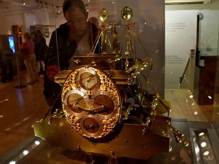
Harrison sailed to Lisbon and back with the H1 in 1736 to test the device. It worked well, but Harrison, as we'll soon see, was one of history's most exacting perfectionists. He saw room for improvement, as did the Longitude Board. Nevertheless, the H1 impressed the Board enough for it to grant Harrison funding for a second version.
The H2 took another five years to complete — three years of construction and two years of land-based testing. It was ready to go in 1741, by which time Britain was at war with Spain. The powers that be determined that the H2 was too valuable to fall into Spanish hands, so a sea-based test was postponed.

Another 17 years, another timepiece
By the time the war ended, Harrison's precise mind had abandoned the H2 and was already at work on the H3, this time incorporating new advances to compensate for the yawing action of ships.
Completing the H3 took Harrison an incredible 17 years.
Along the way, Harrison adapted his bi-metallic pendulum concept into the bi-metallic strip — fusing two pieces of metal together in strategic locations within the clock to compensate for the change of temperature commonly found on sailing vessels. He also invented the caged roller bearing, which further decreased friction within his device. Caged roller bearings are still in use today.
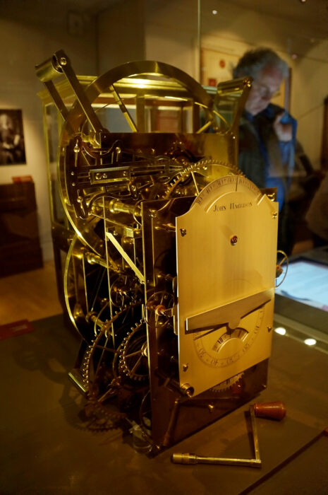
Perhaps even more importantly, the nearly two decades of work on the H3, along with advances made by other clockmakers during those years, convinced Harrison that his large and unwieldy devices could be shrunk to pocket watch size. The clock that became Harrison's masterstroke, the H4, was ready for sea testing in 1759, six years after Harrison began work on it.
All of Harrison's clocks are beautiful in their functionality, but the H4 outshines them all. Constructed of, among other things, brass and diamonds, it was as lovely as it was effective. In addition to being the most accurate of all Harrison's marine clocks, it also contained technology that kept it running as it was being wound — another of Harrison's endless innovations.
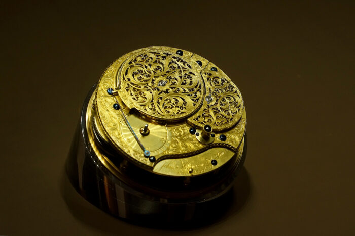
The rival
Now, all that was required was to send the H4 on a successful sea voyage, and then the prize money would finally be his.
But during the long years between 1714 and 1759, astronomers intent on proving the lunar distance method's viability were busy. Observations had been made, tables compiled, and tests conducted.
By then, the Royal Astronomer was Reverand Nevil Maskelyne. He was a huge proponent of the lunar method and had worked for years to prove its efficacy. As the Royal Astronomer, he sat on the Longitude Board, and he would use his considerable sway to make Harrison's life utterly miserable moving forward.

Complicated tests
The Board of Longitude demanded a series of increasingly detailed and complicated sea tests for the H4. Harrison's son accompanied the H4 on these tests, as Harrison himself was aging and his eyesight was beginning to fail. The H4 received acclaim from captains and navigators aboard every ship upon which it sailed. It was accurate within one nautical mile, while tests of the lunar distance method conducted by Maskelyne were only accurate to within 30 nautical miles.
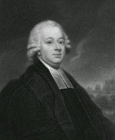
Still, Maskelyne convinced the Board that the H4's accuracy was a fluke and that the device was too expensive and complicated for mass production. At Maskelyne's urging, the Board insisted on confiscating the H1, H2, H3, and H4 for study, as well as all of Harrison's plans, notes, and diagrams of the various sea clocks. Maskelyne himself showed up at Harrison's house with a warrant for the devices, and it's perhaps no accident that the H1 was dropped and damaged during transport.
Harrison reluctantly agreed and settled in to wait on his prize money.
The King steps in
Months, then years, went by with no word from the Board. It appeared as if one well-placed astronomer would stop the burgeoning clock-based longitude method in its tracks.
But Harrison was nothing if not a manic tinkerer, and during the Board's endless testing and dithering, the aging clockmaker was hard at work on the H5. With a new pocket watch in hand, Harrison and his son were able to enlist help from an unlikely source — the King of England.

While American readers mostly know King George III from his actions before, during, and after the Revolutionary War, the King had a burning interest in science and often employed private tutors to expand his knowledge.
The Harrisons secured an audience with the King in 1772. By now, the elder Harrison was 79.
King George III was outraged at Harrison's treatment by Parliament and the Board, and he tested the watch himself over several months in 1772. The impressed monarch sent word to Parliament, threatening to appear in person to read them the riot act, then encouraged Harrison to appeal to the body one final time.
With royal pressure bearing down, Parliament finally relented and awarded Harrison a lump sum of £8,750, less than half of the £20,000 originally promised by the Longitude Act of 1714. But combined with disbursements Harrison secured over the course of his forty-year quest to build a functional sea clock, his total payments equaled roughly £23,065.
Endings and beginnings
Maskelyne continued as Astronomer Royal until his death in 1811 and championed the lunar method until his dying day. He published the British Nautical Almanac and Astronomical Ephemeris for the Meridian of the Royal Observatory at Greenwich, which contained a full set of tables for determining longitude by the lunar distance method. With the Almanac and increasingly sophisticated equipment, the lunar distance method finally became a viable option for mariners, though it still required considerable time and effort to make accurate determinations.
Unrepentant to the last, Maskelyne never expressed remorse for his role in squelching the viability of Harrison's clocks. In fact, after the day when the Reverend showed up at Harrison's door and demanded the devices, the two men never spoke again.
Harrison died in 1776, so he never lived to see his work gradually supplant the more labor-intensive lunar distance method. While the sums he received made him a wealthy man by that era's standards, he was frustrated, exhausted, and embittered by the entire process by the time he died.
But eventually, he was vindicated.
Other clockmakers standing on Harrison's shoulders found ways to simplify the mechanisms and cut production costs, reducing the burden for seafarers forced to buy their own navigational equipment. As the 19th century dawned, versions of Harrison's clocks and others based on his work gradually found their way into the hands of navigators the world over.
Harrison wins the long game
Captain Cook and other famous explorers eventually began using some form of sea clock to determine longitude, using lunar distance merely as a backup. In time, sea clocks, or chronometers as they came to be called, became every captain's method for determining longitude at sea. Mechanical marine chronometers remained in widespread use well through the 20th century.
Moreover, Harrison's contributions to the world of timekeeping are almost too staggering to be believed. Few other private citizens have made such leaping advancements in their field in such a relatively short time under such circumstances. It would be as if Robert Oppenheimer or Wernher von Braun conducted their research not as university or government employees but in the back room of a little shop, occasionally supplemented by drips of funding.
Today, the H1, H2, H3, and H4 are available for viewing at the Royal Museums Greenwich. A few of them are still running, a testament to one humble Yorkshire-born carpenter's lifelong dedication to a single scientific problem.
We'll never know what Harrison would think of his life's work being housed at the museum of the very institution that denied him his well-deserved fame and prize money.
But it's likely that if Harrison were standing in the display room, peering through the glass cases at his marvelous clocks, he'd waste no time in pulling out a notebook, borrowing a pen, and scuttling off to a quiet corner to begin work on yet another.
Two Sherpa women who made history on Everest are being honored in different ways.
The U.S. Geological Survey announced last week that a crater at the Moon's south pole will bear the name of Nepal's first female summiter, Pasang Lhamu Sherpa. The International Astronomical Union, in charge of astronomical nomenclature, previously approved the Lhamu Crater.
Triumph and tragedy
Pasang Lhamu Sherpa summited Everest in 1993 but didn't make it down alive. The wife of the powerful Lhakpa Sonam Sherpa, owner of Thamserku Trekking, she had attempted Everest three times before, striving to achieve this Nepalese first.
She finally summited on April 22, 1993 at 2:30 pm, together with five sherpas. One of them, Sonam Tshering, had shown signs of sickness on the way up. On the way down, exhausted and in worsening weather, she and Sonam Tsering became separated from the others. They stopped at the South Col, where they ran out of oxygen and finally perished. Read ExplorersWeb's profile of her here.
Pasang Lhamu became a national heroine and a source of inspiration for local female climbers. In addition to the Moon crater, she has a 7,315m peak and a road named after her in Nepal.
Lhakpa Sherpa and her lifelong climb
Lhakpa Sherpa, the only Nepalese woman to have summited Everest 10 times, stars in a Netflix documentary released worldwide at the end of July. She has indeed had a life worthy of a documentary, and not just because of her Everest summits. Although the film's title is Mountain Queen, Lhakpa has not enjoyed a life of royalty. Rather, she has distinguished herself by also overcoming ordinary hardships -- a marginal education, surviving an abusive partner, and raising her children as a single immigrant mother in the U.S.
The film suggests that life is finally becoming less hardscrabble for the 50-year-old Lhakpa. She has started a foundation to promote climbing among Nepalese women and hopes her two daughters become mountain guides. According to her latest Instagram posts, she might even still go for an 11th Everest summit.
So far as quality of life went in the Classical world, it was pretty great to be a Roman and not-so-great to be their enemy. But say what you will about the Roman tendency to push the boundaries of their empire ever outward — at least they left some truly spectacular soaking pools behind.
One of the most striking examples is the Pamukkale Water Terraces, located in the Menderes River Valley in Turkey. Pamukkale is a Turkish word roughly meaning "cotton castle." When you see the photos, you'll know exactly why the term applies so well.
Right place, right minerals
The Pamukkale Water Terraces cover an area of roughly 2,100 square meters. Seventeen hot springs bubble up at temperatures between 35° and 100°C, enhancing the shimmery, unforgettable natural formation.
The steaming waters are super-rich in calcium carbonate. When the hot, calcium-heavy liquid reaches the surface, it de-gasses carbon dioxide, eventually leaving behind a crust of calcium carbonate ledges. Geologists call such formations a travertine terrace.
Hot springs exist the world over, from Japan to Scandinavia. But few spots match the Pamukkale Water Terraces for geological beauty. It takes a rare combination of factors to create a travertine terrace — hot enough water, springs that bubble up from a slope, and the perfect combination of minerals in the water. Mammoth Hot Springs in Yellowstone National Park is another example.
Hot but not too hot
But the water at Mammoth Hot Springs is dangerously hot, and sulfurous to boot. It wouldn't make a pleasing place to take a dip. Travertine terraces that throw in a precious fourth factor — friendliness towards the perpetually aching human body — are even rarer.
Terme di Saturnia in Italy is one such spot. For centuries, the tiny town of 300 has drawn visitors from around the world to its scenic pools.
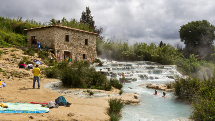
In that regard, Terme di Saturnia shares a lineage with the Pamukkale Water Terraces. As a Mediterranean country located at the crossroads of Europe and Asia, Turkey has been continually populated since the Late Paleolithic. It's likely that our Stone Age ancestors made liberal use of the Pamukkale Water Terraces to soak their tired muscles, as you would too if your life consisted primarily of either running from or chasing dangerous animals.
Nearly 3,000 years later, the combination of beautiful scenery and relaxing hot pools still attracts us. But as we'll see, such attraction comes at a cost to the landscape.
Early temple
The water terraces lie within the historical kingdom of Phrygia, which, according to Greek mythology, produced the legendary kings Midas and Gordias (of the famous knot). Modern archaeological digs indicate that the Phyrgians first built a temple there sometime in the 7th century BC, though likely people also lived there during the earlier Iron Age.
The original temple was a tribute to a Phrygian mother goddess named Cybele. Local spiritual traditions around Cybele purported that only her eunuch priests could survive inhalation of the gases emitted from the springs and surrounding caves.
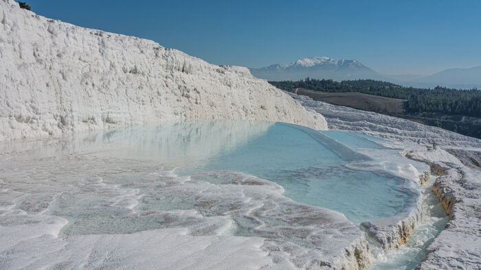
During the Hellenistic period — a time when Greek culture spread across the Near East, thanks to the efforts of Alexander the Great — the region was colonized by the Seleucid Empire, a nation of Western Asian Greeks founded by a former general after Alexander's untimely death.
The Selecuids built the city of Hierapolis sometime between 281 and 261 BC, using the site of the original temple as a starting place. (Hierapolis means "holy city.") After the city's founding, Cybele worship was absorbed into newcomers' religion, and the springs, terraces, and temple became associated with Hades and his consort Persephone. Greek doctors swiftly incorporated the waters into their healing practices, and people traveled from all over the ancient world to visit the site.
The Romans step in
But as always, when discussing hot springs and antiquity, we can't forget the Romans. The ever-expanding society took control of the region in 133 BC. A series of powerful earthquakes leveled Hierapolis during the reins of Emperors Tiberius and Nero. But the Romans never saw a pile of Hellenistic stones they failed to rebuild in their own image.
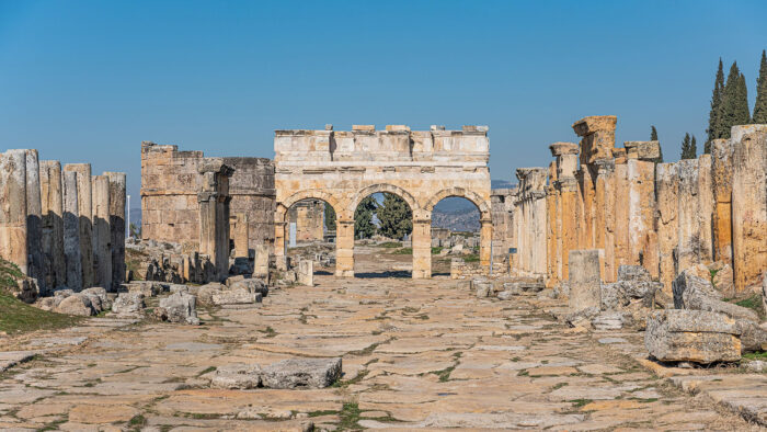
The Romans swiftly got to work building Roman-style baths, amphitheaters, gymnasiums, fountains, colonnaded streets, and other examples of their famous infrastructure. With the Pamukkale Water Terraces as a stunning focal point, Hierapolis became a thriving artistic and cultural center on the eastern fringes of the late Republic/early Empire.
Many luminaries of Roman society came to call Hierapolis home, including the famed Stoic slave-turned-philosopher Epectitus.
Rise and fall and rise again
The apostle Paul founded a church in Hierapolis during his ministry. As the influence of the early church spread over the centuries, Christian traditions gradually replaced the Hades-centered worship that had, in turn, replaced the mother goddess Cybele.
By 500 AD, Hierapolis and the Pamukkale Water Terraces were an important Christian site within the Byzantine Empire. But the coming turbulent centuries were not kind to the region. Persians sacked the city in the 7th century, and another earthquake destroyed what the Persians left behind. Inhabitants rebuilt again, only to see the city sacked by European crusaders in 1190.
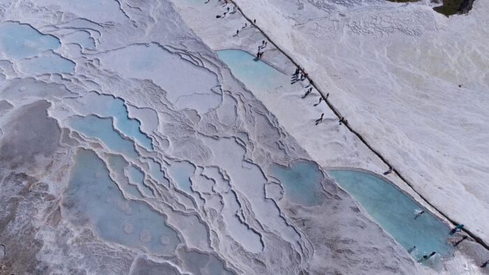
In 1354, a final earthquake completed the job. The last remnants of the ancient city toppled over, and time and elements covered the once-grand walls with sediment and stone.
Luckily, the same geologic activity that created the Pamukkale Water Terraces managed to spare the natural feature even as it toppled the structures mankind had built. As archaeologists in the late 1880s began excavating Hierapolis, contemporary travelers and tourists also rediscovered the Water Terraces. Perhaps inevitably, hotels sprang up, and foot traffic over the decades did the damage that centuries of earthquakes had been unable to do.
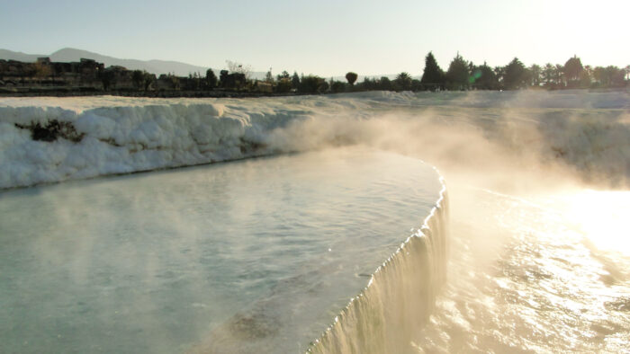
Luckily, Hierapolis-Pamukkale became a UNESCO World Heritage Site in 1988. Most of the hotels were torn down, and traffic in and around the Pamukkale Water Terraces was severely limited. While still a major tourist attraction today, the Terraces appear on track for preservation into the coming centuries and — hopefully — beyond.
The original Mercury space capsule had no window, a hatch with 70 bolts that had to be removed from outside, and zilch for the astronaut to do except endure g-forces, hope nothing went wrong, and throw an “abort” switch on command from mission control if it did.
It was so easy a monkey could do it.
The year was 1960. Two years earlier, seven test pilots known as the “Mercury Seven” had fought through almost two years of experimental training to become the first American in space.
It is understandable if their egos were hurt when NASA decided to send up a monkey first.
Correction: a chimpanzee.
In an event that’s varyingly heralded and maligned, the first hominid in space completed his record-setting flight on Jan. 31, 1961. Ham the Astrochimp blasted off on top of a Mercury-Redstone rocket — a rig that amounted to a chair strapped to an eight-story-tall ballistic missile — and punched a hole through the atmosphere.
Ham survived a 250-kilometer-high Mach 7 flight that spiraled out of its planned path and almost killed him. At three-and-a-half years old, he became an incidental hero while still technically an infant.
Three months later, astronaut Alan Shepard became the first U.S. astronaut in space. NASA largely assuaged his and his cohort’s complaints in the years to come. All seven Mercury astronauts made landmark flights as the American space program decisively eclipsed the rival Soviets’.
Ham, meanwhile, never flew again. In fact, according to virtually all accounts, he refused to.
Though the ape was “grinning” when recovery crews rescued him from a sinking Mercury capsule and brought him aboard the U.S.S. Donner, all may not have been well. When handlers later brought him near the “couch” he sat in for his 16.5 minutes in space, he recoiled from it.
In 1983, Ham died from liver failure at a North Carolina zoo at around 26 years old. The Astrochimp’s remains now lie in a commemorative grave at the International Space Hall of Fame in Alamogordo, New Mexico.
But what good is a Hall of Fame honor to a chimp?
It’s been 60 years since NASA closed the books on Project Mercury. Now, space historians, animal advocates, and even philosophers have all spun Ham’s story into a complex fabric that unites humans with our closest living ancestors — but also highlights a mutual isolation.
Number 65
Ham was born in approximately 1957 in what was then French Cameroon, West Africa. Captured by trappers, he soon ended up at a Florida tourist attraction called the Miami Rare Bird Farm. In 1959, the U.S. Air Force purchased the young chimp for $457 and transferred him to Holloman Air Force Base in New Mexico.
The facility spelled out Ham’s name in acronym — Holloman Aerospace Medical Center — but at first, he was just a number.
The U.S. military had been busy acquiring chimps to support testing for the space program. Urgency had run high since October 4, 1957, when the U.S.S.R. struck fear into the free world by launching a microwave-sized, largely inert object.
Sputnik 1 had achieved an elliptical low-Earth orbit, which it proved by transmitting basic, beeping radio signals around the planet.
It’s hard to overstate the primitivity of early space engineering. At the start of the Mercury program, engineers were still trying to figure out if humans could perform tasks in orbital flight as mundane as operating levers. It’s one of the factors that make those early achievements so astonishing.
Enter Number 65 and the rest of Project Mercury’s test chimpanzees.
When NASA personnel selected him and 39 other chimps for aptitude testing — which was virtually identical to the human astronauts’ training — the only living creature in space had been Laika, the Soviet dog.
Laika, a stray plucked from the Moscow streets, died in orbit on a 1957 mission that became infamous for animal rights abuse even at the time. In a cruel turn of early space travel, Sputnik engineers shot the female stray into space with one meal and the expectation that she would run out of oxygen and die in seven days. (The flight went awry and she likely died within hours.)
NASA officials claimed that the U.S., in contrast, chose chimpanzee pilots because they wanted the animals to survive their flights from liftoff to capsule recovery and work while they were on board.
They resembled astronauts, could potentially perform similar tasks in the capsule, and were docile, NASA said.
NASA manuals referenced in the 1998 book, This New Ocean: A History of Project Mercury, read:
Intelligent and normally docile, the chimpanzee is a primate of sufficient size and sapience to provide a reasonable facsimile of human behavior. Its average response time to a given physical stimulus is .7 of a second, compared with man's average .5 second. Having the same organ placement and internal suspension as man, plus a long medical research background, the chimpanzee chosen to ride the Redstone and perform a lever-pulling chore throughout the mission should not only test out the life-support systems but prove that levers could be pulled during launch, weightlessness, and reentry.
Flight school
Ham the Astrochimp’s training followed B.F. Skinner’s conditioning theory: rewards for the correct response, corporal punishment for the wrong one.
Project Mercury handlers strapped chimps into simple chairs, facing a panel fitted with colored lights and levers. According to the National Air and Space Museum, they earned banana pellets if they responded to the right light-and-sound cue by activating the right lever. If not, they received electrical shocks on the soles of their feet.
They endured rocket sled launches, sat in isolation training, and performed intelligence tests. They also underwent g-force testing in a massive centrifuge at Wright-Patterson Air Force Base, just like the astronauts. Incessant medical checkups and monitoring accompanied the regimen.
Edward C. Dittmer, Sr., a World War II veteran and non-commissioned laboratory officer, acted as Ham’s lead trainer at Holloman. Later, he repeatedly praised the chimp’s trainability and sometimes humanized him.
Dittmer said, according to the Space Hall of Fame:
“...I think…I know he liked me. I’d hold him, and he was just like a little kid. He’d put his arm around me and he’d play, you know. He was a well-tempered chimp.”
Tom Wolfe, author of the celebrated Mercury Project chronicle The Right Stuff, wrote that the relative peace was hard-won. Before “rebellion proved to be a dead end” for the chimps, he wrote:
The beasts tried everything they could think of to escape. They snapped, snarled, bit, thrashed at the straps, and made runs for it. Or they bided their time and used their heads. They would go along with a training task, seeming to cooperate, until the white smoker seemed to let his guard down — then they’d make a break for it. But the resistance and the wiles were of no avail. All they got for their struggles was more zaps.
Engineers at Holloman culled the entry class of 40 primates down to 18. Six finalists, including Ham, moved on to Cape Canaveral, Florida for final testing.
Starting on January 2, 1961, 29 separate tests stood between the chimps and the planned suborbital flight. Three weeks later, NASA wrote, the tests “had made each of the six chimps a bored but well-fed expert at the job of lever-pulling.”
When the electrical shocks and the banana pellets abated, Ham emerged at the top of the pile along with a female alternate.
“The competition was fierce, but one of the males was exceptionally frisky and in
good humor” in the days leading up to the space flight, NASA wrote.
Ham and his alternate went on a “low-residue” diet 19 hours before liftoff and awaited circumstances they couldn’t possibly anticipate.
Rocket rides
Until flight day, Jan. 31, 1961, the United States space program had produced discouraging results.
Throughout the '50s, Jupiter and Atlas rockets veered off course and exploded spectacularly, on and off the tortured Cape Canaveral launchpad.
The Redstone proved more reliable in early tests but was still a beast of a machine.
It was essentially a 10-meter aluminum can of liquid oxygen and ethyl alcohol on top of a gaudy combustion engine. First designed as a surface-to-surface ballistic missile with an 800km range, it generated 35,380kg of thrust and tore through the sky at 9,400 kph, or Mach 7.5.
The Mercury capsule acted as its nosecone, and the astronaut — or astrochimp — held on for the ride.
The first Mercury-Redstone launch attempt, MR-1, took place on Nov. 21, 1960 — just over two months before Ham’s flight. It was an unmanned test, and despite the rocket’s menacing power, anyone or anything strapped into the capsule that day would have experienced almost nothing but a meek trip from the top of the rocket back to the ground.
When NASA hit the ignition on MR-1, the rig fumed briefly, climbed a few centimeters off the launch pad, and settled back down. Then, comically, an electrical chain reaction caused the escape tower to blast off and deployed the still-attached capsule’s drogue (or safety) parachute.
The so-called “four-inch flight” drew public ridicule to Project Mercury, along with a little levity. But it also introduced glaring safety concerns. If Ham or any astronaut had been on board, they would have been trapped on top of a teetering, 25-meter-tall live bomb.
The failure also delayed planned tests of the recovery system. This was a critical piece of the Mercury program, in part because capsules would touch down in the ocean off the Florida coast. Recovering a capsule was an all-hands-on-deck situation: a plethora of aircraft and ships were involved. Failure meant the capsule could sink, dooming its occupant to drown.
By the time Ham and his alternate astrochimp made their final trip out to the launch pad for MR-2, only one Mercury-Redstone test (MR-1A) had succeeded.
Malfunctions and setbacks delayed Ham’s January 31 flight almost to the breaking point. And when the rocket finally did lift off, it put him through conditions more extreme than anyone expected.
‘Ham’ in a can
Accounts report Ham’s condition as calm on the morning of the launch. His handlers secured him in his couch, then trolleyed him toward the Redstone.
This New Ocean renders the moment stirringly, if oddly:
“There, an hour and a half before the scheduled launch time, the chimpanzee named ‘Ham,’ still active and spirited although encased in his biopack, boarded the elevator to meet his destiny.”
MR-2 was scheduled for liftoff before noon because mission control didn’t want to risk a night recovery. According to NASA, the hours-long countdown and final check process went as planned until about 7:45 am. That’s when a “tiny but important” inverter in the automatic control system started overheating.
Nevertheless, technicians loaded Ham into the capsule at 7:53 am and bolted down the heavy hatch for liftoff.
Hours of delays followed as mission control tried to fix the inverter. Chaos beset the launchpad, too, as an elevator got stuck, too many people took too long to clear the pad area, checks of the environmental control system ran 20 minutes too long, and flaps on the rocket’s booster tail jammed.
At 11:40, This New Ocean’s authors wrote, “it was decided that now or never was the time to go today.”
Five minutes before noon, controllers hit the red button, and Ham shot skyward.
Seconds into the flight, the Mercury-Redstone started to pitch upward. A launch angle just one degree steeper could significantly alter the flight plan. Speed, duration, recovery point, and g-forces all changed dramatically.
According to NASA, the high angle slammed Ham with a maximum g-force of 14.7 (making his body weigh 243 kg). He experienced 58,000kg of thrust for one unplanned second, and his 8,200 kph top speed was about 1,000 kph faster than planned.
Ham’s flight hit its apex at 253km — about 150km above the rough threshold between Earth and space. He was weightless for 6.6 minutes, according to NASA, during a flight that lasted two minutes longer than expected.
At the capsule’s highest point, NASA knew Ham was going to come down farther away — much farther away — than mission control hoped.
“At its zenith, Ham's spacecraft was already 77km farther downrange than programmed,” NASA calculated. He landed over 200km away from his target landing site.
Ham still wasn’t out of the woods. Cabin pressure had plummeted at one point during the flight. NASA later traced the problem to a spring-loaded valve that had unexpectedly popped open from vibrations.
This breech, and a rough landing due to an overcooked reentry, almost spelled the end for Ham.
When the capsule splashed down at 12:12 pm, it turned upside down and started sinking. The closest rescue was a destroyer stationed almost 100km away.
When the helicopters arrived on the scene, they found the spacecraft on its side, taking on water, and submerging. Wave action after impact had apparently punished the capsule and its occupant severely. The beryllium heatshield upon impact had skipped on the water and bounced against the capsule bottom, punching two holes in the titanium pressure bulkhead. After the craft capsized, the open cabin pressure relief valve let still more sea water enter the capsule.
Pilots finally recovered the spacecraft around 3 pm, filled with about 360kg of water.
It’s unknown how long it would have taken the capsule to sink, but Gus Grissom almost drowned under similar circumstances on MR-4 six months later. (NASA incorporated an explosive escape hatch into the Mercury design in the interim.)
Through his ordeal, Ham reportedly remained calm and performed admirably — pulling his levers when prompted to avoid the shocks on the soles of his feet. The punishment program was strenuous, with a clock that reset to schedule a new shock every 15 seconds. If Ham failed to prevent it, he would get a full blast.
(Enos, who became the first chimpanzee to orbit the Earth later that year, endured an especially grim situation. During his three-hour flight, the shock system shorted out and inverted. The five-year-old chimp responded to every prompt perfectly but still received 76 shocks.)
Grounded
Ham never flew again. Despite the “grin” he displayed as he accepted an apple after MR-2, he refused to go near his couch for a photo shoot on a later occasion. Though interpreted as a happy gesture at the time, the grin likely meant something else.
The world-famous Jane Goodall assessed it for the 2003 film One Small Step: The Story of the ‘Space Chimps.’
“Actually, that is the most extreme fear that I’ve ever seen on any chimpanzee,” she said. It’s now widely thought that when a chimpanzee shows its top teeth during a smile, as Ham did, it’s not a smile — it’s a “fear grimace.”
From the deck of the U.S.S. Donner in 1961, Ham’s story didn’t get brighter. NASA eventually transferred him to the Smithsonian Zoo in Washington, D.C., where he lived alone until 1980. (It’s also widely understood that chimpanzees need companionship to flourish.)
Finally, Ham arrived at the North Carolina Zoological Park in a habitat among several other chimps but died of liver failure three years later. NASA would macerate his corpse for research: separate the flesh from the bones, usually by soaking in room-temperature water. His skeleton showed no signs of stress from his space flight, according to the U.S. National Museum of Health and Medicine. His soft tissue was cremated and transported to his ceremonial grave at the Space Hall of Fame.

It’s impossible to quantify the stimulation Ham incurred during his Project Mercury experience — or during the rest of his life. Shock treatment on monkeys started PETA, and the U.S. Food and Drug Administration has repeatedly tried to ban it on humans. The human body can only endure the g-forces Ham survived for about a minute.
“Being unable to debrief his handlers, Ham alone knew at this time how grueling his flight had been,” said Robert F. Wallace, an information officer onboard the U.S.S. Donner when Ham landed.
There’s an aviator slang phrase for a pilot with no control over his ship. To a pilot, “SPAM in a can” means exactly what it sounds like: your aircraft is the can, and you’re the SPAM.
Ham’s name is an acronym, sure, but how hard is it to make the SPAM leap?
“[Ham] still would have been nursing at age 3 ½, dependent on his mother for survival,” Save the Chimps points out. “It is hard to imagine a human toddler performing as well as Ham in this challenging task. It speaks to his character, intelligence, and bravery.”
Ham’s involuntary contribution helped re-orient the space race in favor of the U.S., which NASA acknowledged. But if his Project Mercury cohort visited him after he left the program, no record of it exists.
“Ham's survival, despite a host of harrowing mischances over which he had no control, raised the confidence of the astronauts and the capsule engineers alike,” This New Ocean reads.
Wolfe puts a considerably sharper point on it in his last mention of Ham in The Right Stuff. The public attitude toward human space flight after Ham’s success, he wrote, boiled down to “‘My God, do you mean there are men brave enough to try what the ape has just gone through?'"
If people rock climbed before 1492, the evidence is conjectural.
Villagers inhabited the Sky Caves of Nepal, carved into stone hundreds of meters off the ground, as early as the seventh century BC. Asked how the ancients got up there, locals are known to quip, “The lamas fly.”
Similar sites exist in the western United States, where thousand-year-old groups like the Mogollon left faint traces of climbing to cliff dwellings and cultural depots such as Hueco Tanks.
But no documented record of a climb existed anywhere in the world until 1492. That year -- which coincidentally was also the year that Columbus set sail -- King Charles VIII decided to force one of his military engineers to climb Mont Aiguille — a 400m limestone mesa some called Mount Inaccessible. On its flat top, angels allegedly cavorted.
The engineer's name was Antoine de Ville. He and 10 other intrepid souls started up the northwest face armed with wooden ladders.
By all accounts, de Ville and his team did reach the 2,087m summit. After their unlikely flurry up hundreds of meters' worth of ladders, nobody else repeated it for centuries.
Most advanced ever
De Ville’s first ascent was the most advanced known rock climb relative to the rest of its era. Former American Alpine Journal editor J. Monroe Thorington’s 1965 report had this to say about the Mont Aiguille route: “The ascent was said to be ‘half a league by ladders, and a league by a route terrifying to see and even more so to descend.’ Only a few years after the event, Antoine de Ville was spoken of as an ‘alchimiste,’ a sorcerer!”
According to Thorington's research, ground witnesses sourced from French authorities corroborated that de Ville had actually summited Mont Aiguille.
De Ville simply called the ascent “le plus horrible” — “the worst.” Details on the campaign itself are scarce. But all 11 members, including multiple religious officials and a “ladder-man to the king,” seem to have topped out on Mont Aiguille.
Quick repeaters scurry up ladders
De Ville and his crew first spent a few days on the summit meadow building a mountain hut -- no details on how they carried the lumber up those ladders. They also erected a few crosses in the name of Charles VIII and wrote fantasy reports about unusual flora and fauna, and some mysterious human footprints.
The note about footprints turned out to be prescient, Thorington reported. Two more groups of local nobles and bureaucrats soon followed de Ville’s ladders to the top.
“Imagine their astonishment,” he wrote, when conspicuous people such as a viscount popped up onto the mesa.
Ladders, sorcery, or otherwise, it’s beyond argument that de Ville was ahead of his time. Later climbers retrofitted his route with fixed safety gear, including iron chains. American climber and historian W.A.B. Coolidge repeated it in 1881. His account, per Thorington:
"The way (center of NW face) lies through several deeply cut fissures, or rather, hollows of the most extraordinary nature. At one moment, we seemed to be in the very bowels of the mountain in a great cavern, whither scarcely any light penetrated. The rock is very smooth and bad to climb, so I was glad to avail myself of the iron chains.”
Today, climbing beta website The Crag calls de Ville’s route the Voie Normal and rates it at a gentle 4a (5.4).
Maybe controversially, the site credits the first ascent to Jean Liotard in 1834 — the man who allegedly arrived second, 342 years after de Ville.
Of course, most believe that de Ville genuinely summited the peak. A few have even tried to re-enact the legendary ladder ascent for a documentary project. It continues to be an intriguing objective for the historically minded.
Tomorrow’s objective: Mont Aiguille- The oldest documented rock climb in the world 1st done in 1400… pic.twitter.com/4bySgInEbp
— Mark Seaton (@guidemark) July 2, 2024
Last week, Spanish climbers Eneko and Iker Pou announced they had climbed a new route on the south face of Pisco, in Peru's Cordillera Blanca, with local climber Micher Quito. Only a few hours after we published news of their climb, French climber Herve Thivierge posted comments on the Pous' social media stating that he had opened the same line 46 years ago.
We contacted Thivierge as well as the Pou brothers to clarify the situation. But both the Pou brothers and Thivierge are sticking to opposite conclusions. Thivierge claims there is no new route, and the Pous insist they climbed a different line that shares only a couple of pitches with the 1978 route.
The debate has highlighted a fascinating topic. The recording of new routes has changed dramatically over the years, particularly with the arrival of the internet.
The Pou brothers announced their route a few hours after they climbed it, with photographs, videos, and a general topo. Herve Thivierge contacted the climbers on their Facebook page and got a quick response from the Basques.
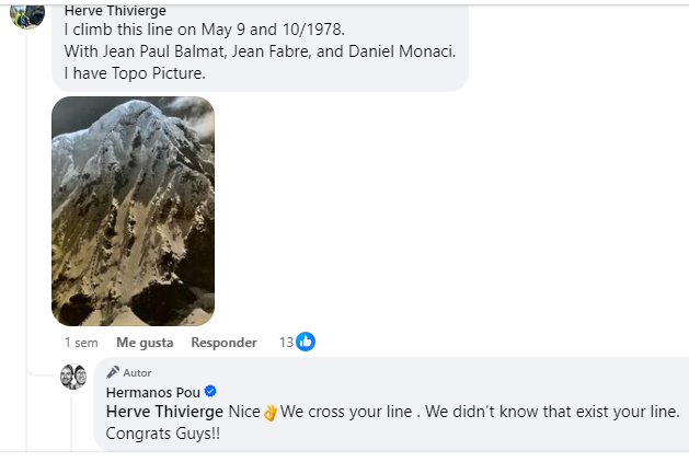
A good memory
"The Pous and Micher Quito climbed the route believing it was a first, but we climbed it 46 years ago, and I have a very good memory of this mountain and this route," Thivierge told ExplorersWeb. "Of course, the mountain conditions in 1978 and now are different, but the line is still there."
Thivierge provided a new topo of his route and added the sections done by the 2024 team as he understood it.
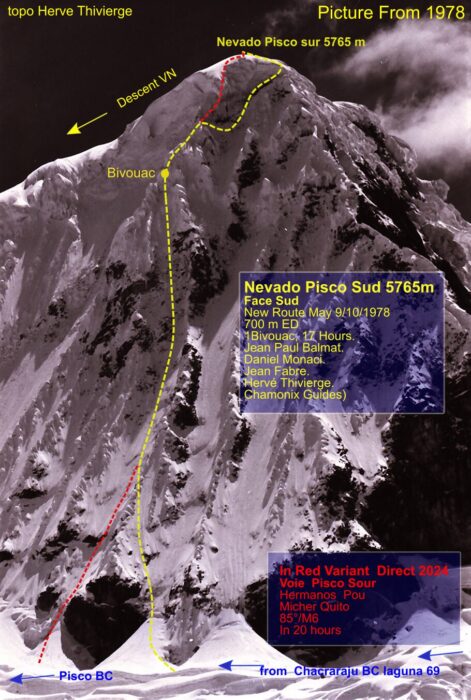
"The Pou brothers made a direct attack variant and a direct exit from our route," Thivierge said. "Otherwise, they more or less followed our line. It's hard to believe they only crossed our route once or twice."
Thivierge noted that the Pou's 2024 topo does not show any details of their route.
Topos not exact
The Pou brothers strongly disagree.
"No, it's not the same route, except for maybe a couple of pitches, and even that, I am not so sure of," Eneko Pou told ExplorersWeb. Pou explained that he drew their topo line on his cellphone with his finger, so it is only approximate. "We will do a new topo as soon as possible."
The Pous also note slight differences in Thivierge's two topos (see the pictures below). In the first topo, on the summit area, it looks like Thivierge's team moved to the opposite side of the mountain. In the second topo, their route goes along the summit ridge. In one topo, the line goes on top of a buttress above the bivouac point. On the other, the line is further to the right.
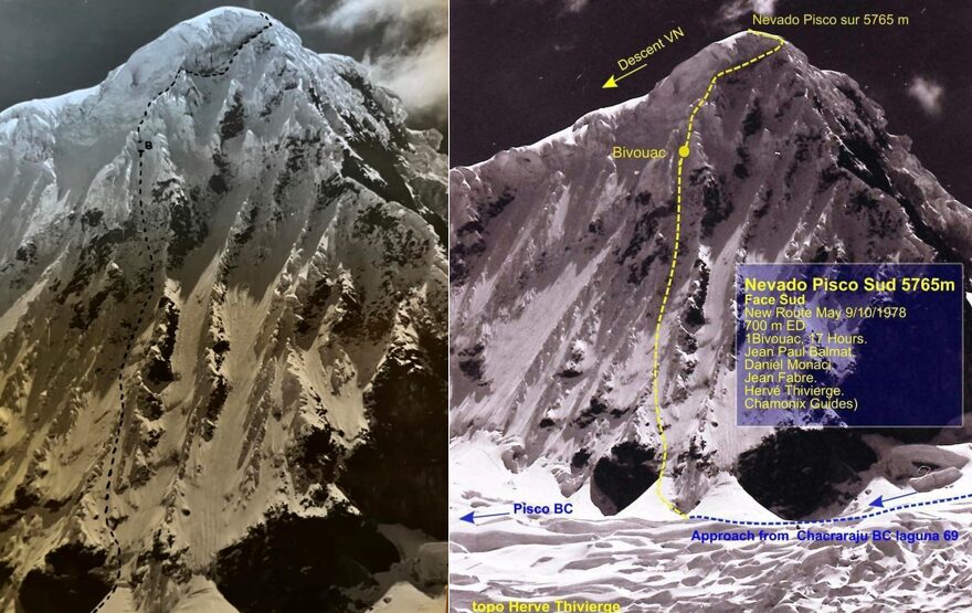
"We have been there, and we don't believe that ridge can be climbed, in 1978 or 2024, because of snow mushrooms, which are better avoided. Most of the time, they are impassable or, at best, they take too much time and effort to climb," Eneko Pou said. "On our topo, you'll see we avoided all the seracs as much as possible and exited directly to the summit. It was a difficult section that took a big effort."
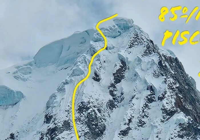
You can watch a video of how the team climbed that section here:
Few details from old climbs
The French team did little to publicize their 1978 climb. In the 1995 guidebook Climbs of the Cordillera Blanca of Peru, author David M. Sharman marks four routes on the south face of Pisco, but the French team's line is not included.
"I reported the ascent to the French Alpine Club (CAF) and to the American Alpine Journal (AAJ)," Thivierge told us. Indeed, the report is on the AAJ index (you can find it here), yet it is a very brief description.
"At the time, we did not outline itineraries in photos; we just gave a description. So it is very possible that it did not appear in the 1995 topo guides," Thivierge explained.
In addition, the highlights of the French team's 1978 Peru expedition were Taulliraju via the SSW ridge and an attempt on the south face of Chacraraju. Both climbs are on Thivierge's website, and he said he will add the Pisco route soon.
Climbers who regularly climb in the Cordillera Blanca told ExplorersWeb that it is strange that the Pous would claim a new route on such a popular face without researching previous ascents.
Research
"Of course, we checked for several days," Eneko Pou told ExplorersWeb while making the trek back from the mountains to Huaraz. "We found no previous routes on our planned line. We never saw the French route marked in a guide."
The Basque climbers say they checked on the internet, consulted with a local climbing historian, and asked several of the area's veteran guides.
"It is usually enough, but it is also true that very old lines, before the era of the internet, were often not documented," Pou said.
Meanwhile, the Pous tend to immediately announce their achievements on social media and send press releases to a pool of specialized media and journalists. They have posted several videos of the climb on Facebook and Instagram.
No newbies
The Pou brothers are professional climbers with decades of experience opening new routes, from sport crags to big walls and also on alpine faces. Thivierge and the team who climbed Pisco in 1978 -- Jean-Paul Balmat, Daniel Monaci, and Jean Fabre -- are mountain guides from Chamonix. Everyone involved is highly experienced.
So what may have happened? Eneko Pou offers an interesting point: the sheer size of the face might be to blame.
"Perhaps in a topo drawn on a pic of the mountain, the size is misleading. It is a very big face, and in the area where both routes go, there is space for more lines that might not touch each other," he said. "This is the Andes. If this face were in Chamonix, there would be three or four lines at the same place."
While this is true for rock and mixed faces, the criteria are not clear for big mountains. On big peaks, climbing lines are not so exact because climbers are looking for the safest routes in changing snow and ice conditions. Expeditions tend to describe their lines by the physical features they pass: couloirs, buttresses, ramps, walls, ridges, etc.
Nevertheless, the Pous insist their line is new. They have spoken with Thivierge and explained their point. "His line goes further to the left, we have climbed some sections that climbers in the 1970s wouldn't have considered an option."
Changing conditions
"The mountain has changed radically in the last 40 years. When we check old guidebooks, it's often hard to identify the routes on the actual mountain," Eneko Pou explained. "Where the French had a long snow ramp, we had difficult mixed sections in a much drier environment."
"In my experience, looking at all the photos, current conditions are much drier than 50 years ago," Thivierge agreed. "Currently, it is easier to protect yourself because the rocks appear, and you can place protection, but also sometimes more difficult. When we climbed the South Pisco face in 1978, we climbed virtually without protection. It was very, very steep with inconsistent snow."
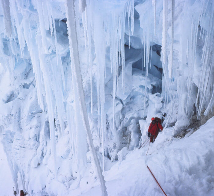
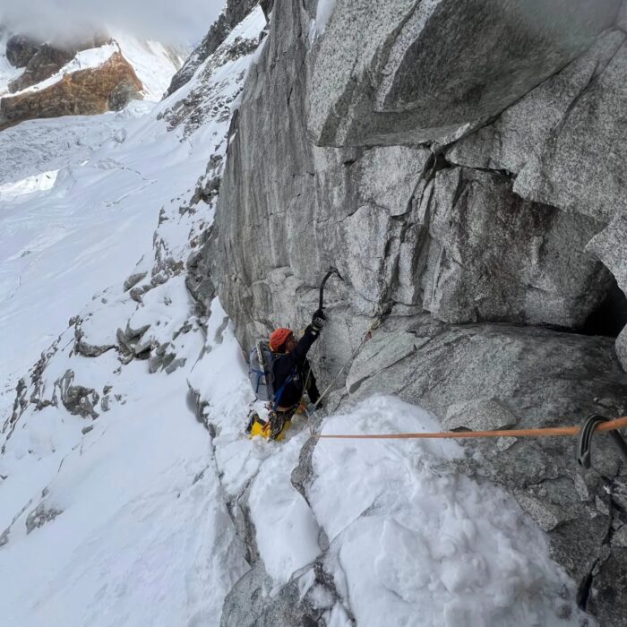
Conclusion
"So far, we have opened 19 new alpine routes in Peru and never had this problem before," Eneko Pou said. "Thivierge and the French climbers accomplished an awesome feat climbing that face in the '70s. It is something to be proud of, but we are positive our line is different. We also feel we have a right to be happy with the climb we have done."
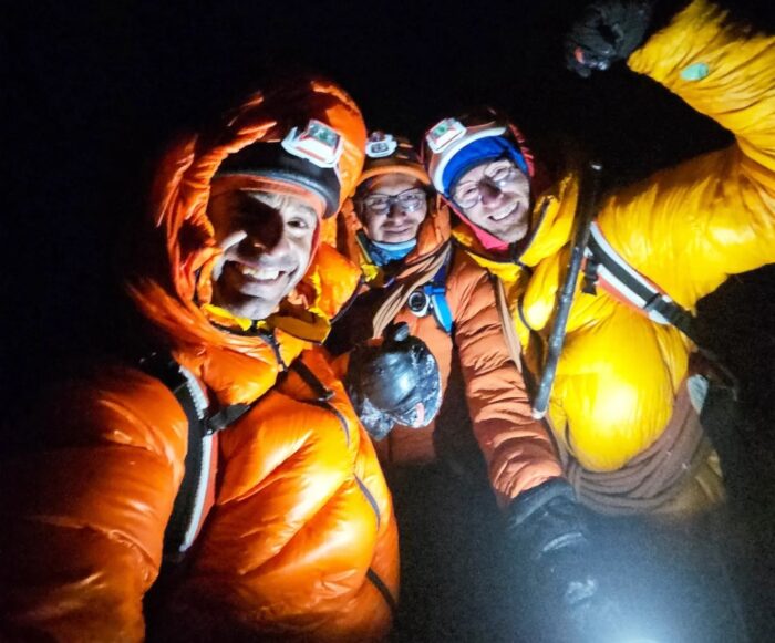
The Pous can't wait to be done with the issue, which they believe benefits no one. "We could have replied in our social media, but we preferred not to stir a nonexistent controversy," they said.
But Thivierge has not changed his mind. "Sorry to the Pou brothers, who thought they were making a big first," he said. "This is not the first time that old routes have been climbed again by people who thought they were doing a first ascent."
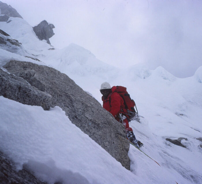
In 1745, gravity finally caught up to the inventor Johann Bessler. After a career creating mysterious wheels that defied its pull, he fell to his death from a windmill.
He was destitute, not long out of jail for heresy, and his wife had left him. His inventions had baffled the greatest minds of his generation, and now his death left the world with a question that appeared unsolvable. How had one man in the early decades of the 18th century made a wheel that never stopped spinning? Or had it all been a con?
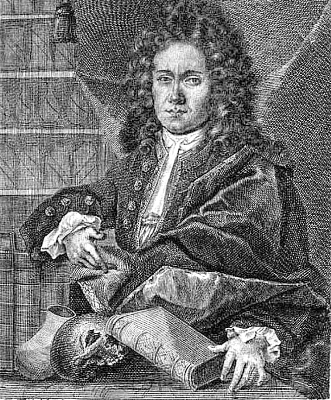
Bessler arrived on a stage perfectly set for scientific deception. A vicious feud between leading mathematicians Isaac Newton and Gottfried Leibniz in the early 18th century had split the physics world into factions. The feud originated in a debate over who had invented calculus. It turned out later that both had come up with it independently. But at the time, it spiraled into every aspect of the field, from what kept the planets orbiting the Sun to a messy controversy over momentum and energy.
Amid all the chaos, scientists were apt to leap onto whatever bandwagon might give their side an edge.
"Factionalism meant that scientists spent less time attempting to replicate the empirical results of free-fall experiments and more time interpreting existing results in a way that was favorable to their preferred accounts," says Robert Ziegler, a Ph.D. candidate in Philosophy at the University of Virginia, whose research focuses on Leibniz.
If anyone was an expert at exploiting what scientists wanted to see, it was Johann Bessler.
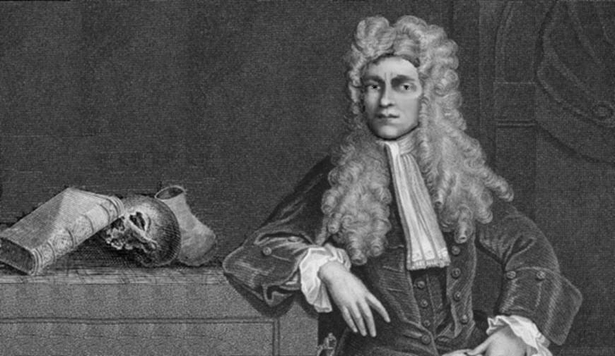
A questionable backstory
According to a late 18th-century biography of dubious reliability, Bessler's rags-to-riches-to-rags story began in Zittau, where this peasant's son showed such aptitude that he obtained a secondary education. By his own account, he excelled at everything mathematical. Yet after leaving school, he became an itinerant jack-of-all-trades, dabbling in everything from watchmaking to medicine.
His skills did not win him stability. Starving, he found sporadic work as a soldier and even lived for some time in a monastery simply to eat. He claimed to have rescued an alchemist from drowning in a well and learned the secrets of elixirs.
At some point in his wanderings, Bessler decided his name was not sufficiently cryptic, and so he chose the letters in the alphabet symmetrically opposite to those in his name -- A was N, B was O, etc. He thus came up with the pseudonym Orffyre, which he then Latinized to Orffyreus. He used this as his professional name for the rest of his life.
When Bessler stopped in the town of Annaberg, the mayor, Christian Schuhmann, begged him to save the life of his ailing daughter. The mayor promised Bessler his daughter's hand in marriage as a reward. One of the first certain facts of Bessler's life is that he married Barbara Elisabeth Schuhmann in or around 1712. It introduced him to a comfortable, middle-class life.
The wheels that turned forever
Bessler used his newfound status to construct the first of his "perpetual motion" machines. He displayed this small wheel, three feet in diameter, at the city of Gera, in eastern Germany. It lifted pound-weights several feet into the air, seemingly powered by something internal to the wheel. Water wheels need water to turn; windmills use wind; modern motors require electricity -- but this wheel didn't seem to need anything. Still, it must not have impressed anyone much because he left for Leipzig shortly after. At Leipzig, he presented his second wheel, about double the size of the first and capable of lifting 40 lbs while maintaining a brisk spin.
What should one expect at a demonstration of Johann Bessler's wheels? The usual exhibition involved Bessler giving the wheel a short push, whereupon it slowly gathered speed and then carried on at a maximum speed until asked to lift weights. When performing work, its speed decreased at first but then remained steady, as though it could continue turning forever.
Crashes and bangs rang out from somewhere within the concealed inner workings. Observers reported sounds as though of weights falling inside. On several occasions, they watched Bessler place metal cylinders behind the canvas covering. But anyone curious about the mechanisms of this machine would have to be content with the outside view. Bessler demanded £10,000 for knowledge of his machine, a nod to the prize offered by the British government for the discovery of longitude.
Praise and criticism
At that point, no one offered to pay £10,000 for such a suspicious invention. The Second Law of Thermodynamics states that you can't get something for nothing. A wheel cannot turn without external input; weights cannot be lifted without a transfer of energy.
Although this formalism had yet to be developed, many prominent thinkers, including Leonardo da Vinci, had provided mathematical proofs against the idea that gravity alone could power a wheel to turn, much less lift weights without stopping. That would imply the wheel possessed an intrinsic source of self-renewing energy. Bessler claimed he harnessed gravity to turn the wheel, but proofs against "gravity mills" had existed for centuries.
Despite the prevailing consensus on perpetual motion, Bessler received an illustrious visitor at Leipzig -- Gottfried Leibniz gave the wheel his stamp of approval. He even wrote to the court of Tsar Peter the Great about Bessler's miraculous invention.

If anything, the attention from Leibniz only concentrated the criticism against Bessler. He set up his next wheel in Merseburg and invited a panel of local literati to perform a comprehensive review. The Merseburg wheel was 12 feet in diameter and capable of lifting up to 70 lbs. The account of its performance is the most comprehensive description we possess of the functioning of Bessler's wheel, including the speed of rotation and timing of loud noises from within.
The glory days
Whatever may be said of Johann Bessler's legitimacy, he was not in the game for money. It was not until Merseburg that he monetized his wheel by asking for donations to charity. Even then, he did not require viewers to buy tickets, despite the city's tax on his demonstrations. Years later, when someone actually offered him the £10,000 for his design, he pretended to be sick until they gave up.
In 1716, Prince Karl of Hesse-Kassel offered him patronage, so Bessler moved his household and built yet another wheel. He began promoting his invention in pamphlets. Finally, he faced his critics head-on when he enclosed his wheel in a windowless room and claimed it would still be running at the same speed a month later.
On Nov. 12, 1717, Prince Karl officially sealed the door. On Jan. 4, 1718, he and his attendants broke the seals. The wheel sat in the middle of the room, untroubled, revolving just as it had over a month before.
The Newtonian perspective
The majority of Bessler's supporters in the early years were Leibnizians. This was about to change. The first to arrive was Johann Fischer, who found himself grudgingly impressed.
"I [...] stopped the wheel with much difficulty...An attempt to stop it suddenly would raise a man from the ground," Fischer wrote to fellow Newtonian philosopher and engineer John Desaguiliers. "Having stopped it in this manner, it remained stationary; and (here, Sir, is the greatest proof of it being a Perpetual Motion) I restarted it very gently...I observed that the rapidity of the wheel augmented little by little...and then it regained its former speed."
Like all the others who had viewed the wheel, Fischer was at a loss to explain its motion. Shortly afterward, respected Dutch mathematician Willem 's Gravesande made his own trip to Kassel. (The 's prefix is a historical Flemish naming convention.)
In a letter to Isaac Newton, 's Gravesande wrote that he had inspected the axles upon which the wheel rested and was "firmly persuaded that nothing from without the wheel in the least contributes to its motion."
The wheel fascinated 's Gravesande. He could not explain it, and disliked Bessler himself deeply, but he would become his most ardent supporter.
Upon examining the axles without Bessler present, 's Gravesande certified in a report that no external mechanism supplied power. Bessler didn’t wait to find out the contents of the report. As soon as he learned that 's Gravesande had observed the wheel without him, he smashed it to bits. Next to the pieces, he wrote on the wall that it was ‘s Gravesande’s “impertinent curiosity” that had driven him to this.
'Cursed, damned, and lost'
By all accounts, Bessler was an unpleasant man. He was easily annoyed, prone to fits of rage, and disinclined to cooperate with others. If he was unpleasant as an associate, he must have been even worse as the man of the house. Perhaps this goes some way to explain why first his wife and then his maid, Anne Rosine Mauersbergerin, tried to convince the world that his wheel was a fraud.
In an official testimony in 1727, Mauersbergerin claimed she and others had turned the wheel via a crank from an adjacent room. Bessler, she said, had threatened to shoot her if she came clean.
To support her account, she provided an oath that Bessler had forced her to sign. It makes no mention of exactly what Mauersbergerin was supposed to conceal, but by signing it she swore that she would be "cursed, damned and lost before God and men, before temporal and eternal judgment, for the present time and for all eternity" if she ever discussed Bessler's affairs or spoke ill of him.
What goes up...
Some of the greatest physicists of the time had inspected Bessler's axles and come away certain that nothing in them drove the rotation of the wheel. Perhaps Mauersbergerin, uncertain of the true nature of the fraud, threw an easily understandable accusation at an abusive employer. Or perhaps Bessler had successfully disguised a mechanism in plain view.
If the wheel had been turned from an adjacent room, how was the motion so steady? How were weights of up to 70 lbs lifted? How had no one noticed the crank setup for the entire duration of the closed-room experiment? Was it the wheel itself that the crank turned or some mechanism within it that stored energy? Or was the nature of the fraud something else entirely?
The historical record is scarce, but it appears that many important scientists believed Mauersbergerin's testimony. They shuffled Bessler out of view and ceased supporting his work, doing their best to ignore their own roles in his career.
The exception was 's Gravesande, who stood up for Bessler in face of changing public opinion. Bessler, disgraced and disregarded, turned from perpetual motion to another topical issue in 18th-century Germany: religion. In the early 1830s, he founded his own Church of Orffyreus. The authorities at Kassel promptly threw him in jail for heresy.
By the time he was released, his wife had left him. He retreated to his estate, where he pitched new contraptions to no avail and took mundane engineering jobs to pay the bills. In 1745, he began constructing a novel windmill that could turn no matter which way the wind blew. On Nov. 12, 1745, he fell to his death.
The believers
Exactly how Bessler so convincingly faked perpetual motion remains a mystery. The internet abounds with forums and personal websites devoted to uncritically perusing Bessler's work. Even the author of the most well-researched book on Bessler believes in the truth of what he peddled. Those willing to dismiss the Second Law of Thermodynamics can find many potential designs for Bessler's wheels, all based on his assertion that he had harnessed gravity.

The disbelievers
But for once, the skeptics have mystique on their side. If Bessler did not discover gravity-based perpetual motion, whatever he did was an unmatched feat of deceptive engineering. It's possible he used clockwork, and the sound of falling weights was a distraction from the true mechanism of rotation. The weights certainly played into his audiences' expectations of gravity.
Then there's the account of Anne Rosine Mauersbergerin and the crank. The crank might have wound a clockwork mechanism to store and release energy, or it might not have existed at all. But all we can say with confidence is that Bessler's wheels depended on sleight-of-hand techniques coupled with an approximation of perpetual motion that, to this day, no one has recreated.
One skeptic devoted to analyzing Bessler's work is Donald Simanek, a professor emeritus of Physics at Lock Haven University in Pennsylvania. Simanek has spent years carefully profiling and debunking physics misconceptions and hoaxes. Yet even he doesn't know how to explain Bessler's con.
"He must have had some way of re-energizing [the wheel] every time he changed the weights," Simanek says. "But I don't think we'll ever know."
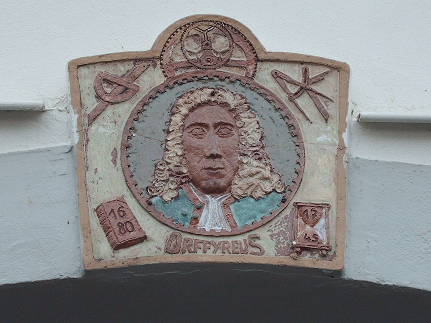
History and geography already make excellent bedfellows, but OldMapsOnline.org has taken the alliance one step further. The website is 50% map room of the Royal Geographical Society, 50% British Museum, and 100% awesome.
Here's why. OldMapsOnline.org combines a map of the world with a sliding timeline. With a few tweaks of the computer mouse, you can watch history unfold before your eyes.
Take Europe, Northern Africa, and Central Asia, for instance. With the site's default "Regions" tab active, you can start way back in 2,000 BC (or further) and scroll forward, watching as the Aegean, Sumerian, and Indus civilizations become Greecian, Assyrian, and Gandhāran, respectively. Keep scrolling and watch the Macedonians, Romans, and Babylonians arise — Egypt, of course, sticks around through the millennia (because that's how Egyptians roll).
And whatever you do, don't take your eyes off the Goths, Visigoths, Ostrogoths, and Germanic peoples. As you probably know, their moment is coming.
Fans of more modern history will be just as enthused. If you're curious about what, where, and when the Holy Roman Empire turned into the modern nation-state of Germany, this site is your huckleberry.
But wait, there's more
And that's just the "Regions" function. The site also has tabs for "Rulers," "People," and "Battles." Swapping back and forth between the tabs and rolling the slider back and forth is bound to be addictive to all but the most history-resistant dilettante. The tools are especially useful for students, journalists, and anyone else with more scholarly interests. It was hard not to get distracted even while writing this story!
That's because the interface is so clean and easy to interact with — and because of the inclusion of a Wikipedia interface. See a name you don't recognize? Click it and prepare to spend the next three hours going down a Wiki wormhole.
As a final touch, you can choose from a selection of old maps to overlay against the base interface, then use the "compare" tool to see how things have changed over time. And even better, the site has a Chrome extension that allows you to add suitable maps to the database.
As you'd expect from something that is both relatively new and somewhat crowd-sourced, OldMapsOnline isn't perfect. North America in the 1700s, for instance, doesn't currently show the traditional lands of the many native people who called the continent home at the time (only the Sioux and Iroquois). But we can foresee a near future where folks who run the site fix that.
Here's a recipe. Take one part larger-than-life figure, add two parts adventurous exploits, a dash of some of the most rugged country in the world, and salt liberally with the passage of time. That's how you get legend.
But what happens if you sprinkle fabrication into the mix?
The dish changes completely.
The history of the American West is overflowing with figures who had no shame about exaggerating — or in some cases, outright lying about — their achievements. When that happens, it becomes difficult to untangle the threads of history from the Gordian Knot of tall tales.
Perhaps no one in American exploration fit that bill better than Jim Bridger. An explorer, a trapper, a scout, and the first white man to lay eyes on large swathes of the American West, Bridger was iconic in his day. And he lived long enough to mythologize his own deeds.
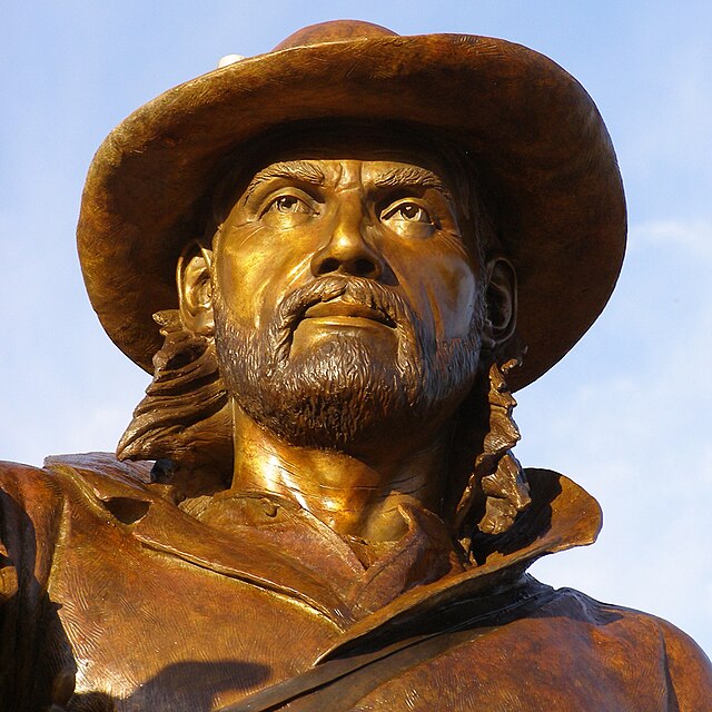
And though his name is now less recognizable than other early North American explorers like Lewis and Clark or Daniel Boone, his contributions to settling the West were invaluable to the many pioneers who tracked across the young country in search of opportunity.
The story that follows will feature the word "probably" quite heavily. "Possibly" and "according to Bridger" will pop up often as well. It's the price to pay when looking back through a telescope well-smudged by Bridger's tendency to play fast and loose with the facts. It's all part of the man's mystique, and when primary sources and trustworthy stories fail us, we must make do with legend.
Luckily, legends are fun.
A track ever westward
James Felix Bridger was born the son of an innkeeper in Richmond, Virginia, but didn't stay in the East for long. His family relocated to St. Louis when Bridger was eight. Tragedy struck at the age of 13 when young Bridger was orphaned, and he found himself alone, illiterate, in a hardscrabble world.
He spent the rest of his teenage years apprenticed to a blacksmith. Coming of age on the edge of the frontier must have nourished the wanderlust in his soul. At 18 — in other words, practically the minute his apprenticeship ended — Bridger came across an advertisement in a local newspaper. The brief words therein changed Bridger's life forever — and by extension, the lives of thousands of others.
"To Enterprising Young Men. The subscriber wishes to engage ONE HUNDRED MEN, to ascend the river Missouri to its source, there to be employed for one, two, or three years. Wm. H. Ashley."
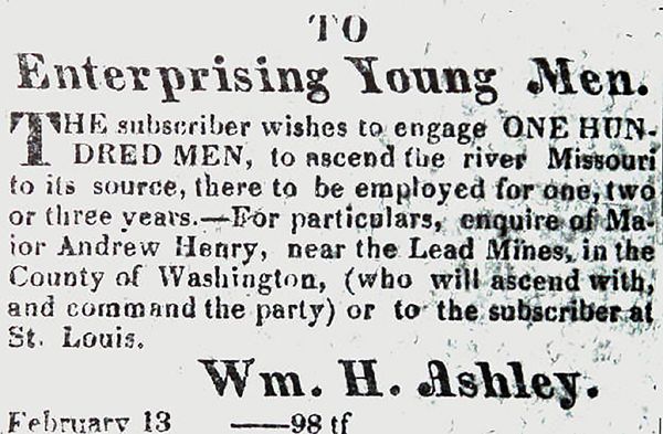
Eighteen-year-old Bridger was one of the enterprising young men who responded. Soon, he found himself trapping on the Missouri in the employ of Ashley's Rocky Mountain Fur Company. The year was 1822. In one short year, the dual threads of history and legend began twining for the first time.
The Hugh Glass Incident
In 1823, after enduring Native American attacks and poor pelt takes on the Missouri, a group of Rocky Mountain Fur Company trappers led by Andrew Henry struck out for a fort at the mouth of the Yellowstone River. Bridger was — here's the word — probably with the group.
A trapper and scout named Hugh Glass was also along. Glass was the party's designated hunter. While scouting for game along a brushy river bottom, he encountered a mother grizzly and her two cubs.
The bear turned on Glass with instant rage, mauling him severely. Hearing his screams, the rest of the party approached and killed the bear. The men didn't believe Glass would live through the night, but come morning, the tough scout was still drawing breath. Henry ordered his party to build a litter, and for two days, they attempted to carry Glass to safety.
However, the pace of travel was too slow, and Henry was concerned about further altercations with tribes in the area. Assuming that Glass would die eventually, he paid two men $80 to stay behind.
Bridger was probably one of these men.
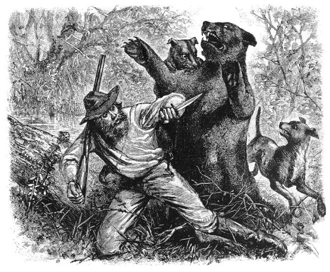
Abandoned the gravely injured man
Bridger and the other man, John Fitzgerald, stood a death watch for five days, but still Glass hung on. Cognizant of dropping further behind the rest of the party with each passing hour, and with the ever-present danger of Native American attack looming like a prairie thundercloud, Fitzgerald and Bridger abandoned the still-living Glass near a spring. They took the injured man's rifle, knife, tomahawk, and fire kit, and lit out for the mouth of the Yellowstone.
Glass survived, and the ordeal that followed became the subject of its own legend. It's an incredible epic but outside the scope of this story. Instead, it's worth pausing here a moment to consider the sources for this tale, then turn our attention to the character of Jim Bridger.
First, though tradition has now calcified Bridger as being the young man left behind with Glass and Fitzgerald, original accounts of the story didn't put names to the characters other than Glass. It's not until 1839 — 16 years later — that a writer named Edmund Flagg penned a telling of the story that included names. In this account, the youth in the story is identified as Bridges.
It was not until the 1890s that oral accounts collected by biographers and historians identified Jim Bridger (by then a household name) as the young man involved in the Hugh Glass incident.
Was Bridger even there?
So was Jim Bridger one of the men who abandoned Glass near that spring, taking his kit as they hurried to safety? We'll never know for sure. But we know Bridger was working for the Rocky Mountain Fur Company when Glass was injured. We also know that among the close-knit mountain man society of the time, the abandonment of Glass — and especially the confiscation of his gear — was as close to sacrilege as that rough-and-tumble society could imagine. It seems unlikely that Bridger would have taken credit for such an act if he wasn't really there, especially as his fame rose among later pioneers.
If Bridger was there, it's important to remember he was only 19, in serious lack of a father figure and subservient to the much more experienced Fitzgerald. Both oral tradition and Glass' own accounts absolve the young man of guilt over the matter, instead reserving all the blame for Fitzgerald. The story goes that Glass caught up with Bridger at Fort Henry on New Year's Eve, 1823, and — after hearing Bridger's version of events — spared the young man's life.
And that's a lucky thing for history, because Bridger had a lot left to accomplish.
Explorations further west
A year and some change later, young Bridger, now equipped with more life experience than most people gather in a decade, found himself in the high, arid, shockingly beautiful landscape that would one day become Utah.
Still with Ashley's Rocky Mountain Fur Company, Bridger was selected to settle a question about the course of the Bear River, a waterway that rises in northeastern Utah and flows northwest through Wyoming and Idaho before confusingly turning south again. Bridger's aim was to discover where it terminated, and what he found was a lake so large and salty that he believed it was part of the Pacific Ocean.
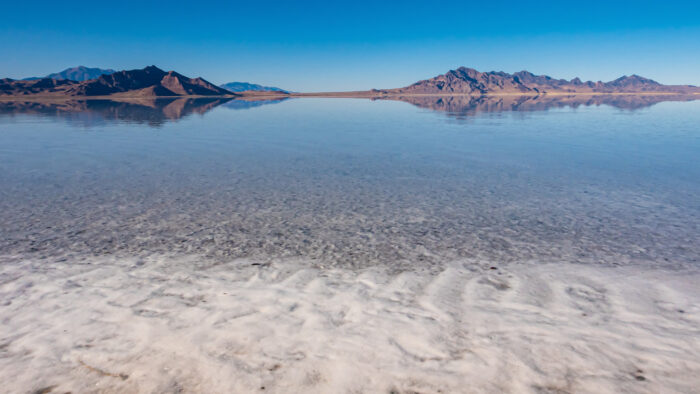
Thus, Bridger became the first white man to lay eyes on the Great Salt Lake.
Bridger eventually parted ways with the Rocky Mountain Fur Company and worked as an independent trapper. But by 1830, he and three partners raised enough capital to buy the company outright. While the venture was successful, Bridger's itchy feet prevented him from enjoying the life of a businessman. He sold his stake in the company in 1834 and married the daughter of a local Native American chief.
Yellowstone trails
Bridger and his wife trapped together for a few years before Bridger got a new idea — establish a trading post along the now thriving Oregon Trail. Fort Bridger was a success, and Bridger, now an experienced frontiersman with 20 years of adventuring on his resumé, acted as an advisor and guide to the many pioneers who traveled through.
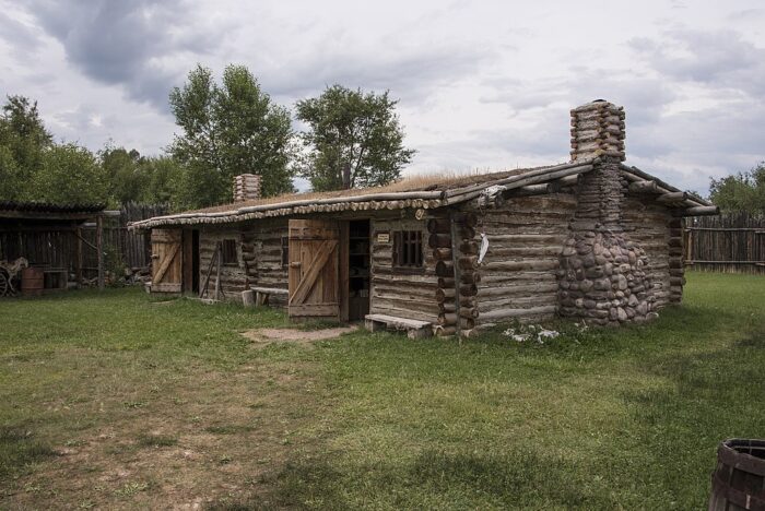
The post's location also gave Bridger the opportunity to explore one of the most famous spots in America.
Two hundred and fifty miles north of Fort Bridger lay the area that would one day become Yellowstone National Park. Bridger may have been the first white man to see it as well. It's at this point in the story that Bridger becomes known as a teller of tall tales.
Not content with legitimate descriptions of multi-hued hot springs, exploding geysers, and sparkling, fish-laden streams, Bridger also spun stories of a petrified forest that contained "petrified birds that sang petrified songs."
He spoke of a "mountain of pure glass." In Bridger's telling, he took aim at an elk he believed was in range, but his shot had no effect. Walking closer, Bridger realized the elk was far in the distance but being magnified as an optical illusion through the so-called glass mountain.
Despite the obvious falsehood of these tales, Bridger's exploration of Yellowstone — and the way he sold its beauty and mystery to the thousands of Americans who passed through Fort Bridger — are credited by many historians as one of the factors that led to its preservation as a national park by the 42nd U.S. Congress and President Ulysses S. Grant in 1872.
Passes, trails, and fatal mistakes
Bridger commanded his trading post until 1853. During that time, he blazed trails, offered advice, and otherwise assisted the travelers on their way to Oregon. But a mistake in 1846 forever connected him to the fate of one of the West's most famous disasters — the ordeal of the Donner Party.
The group was already running behind schedule and needed to cross the Sierra Nevada before the first snows fell. But first, they had to make it across Utah.
The pioneers had in mind an alternate route that dipped south below the Great Salt Lake rather than running above it, as the established Oregon Trail did. The route was first proposed by an ex-Confederate soldier named Lansford Hastings, who went to great trouble to publicize the route.

It's unknown if Bridger and his business partner had scouted the route and misjudged its difficulty and length or had just been paid by Hastings to recommend it. Regardless, it's one of the few black marks on Bridger's character — aside from the Hugh Glass incident.
The Donner Party
The route ended up being twice the length that Hastings had advertised and much more difficult for the Donner Party's wagons and pack animals than they were expecting. The resulting delay ended in the death of most of the party after it became snowed in at a small lake just shy of the Sierra crest some months later.
Perhaps seeking redemption, perhaps just a victim of his eternally restless spirit, Bridger sold his trading post in 1858 and became a scout in the so-called Indian Wars that characterized much of the mid-to-late 1800s in the American West. Bridger would spend the next decade and a half assisting various armies and expeditions in the conflicts that followed.
But before he did, he managed to shorten the Oregon Trail by 100 kilometers after discovering a pass over the Continental Divide in Wyoming. Travelers on the Oregon Trail swiftly adopted the pass. In later years, it became the route of choice for the Pony Express, the Overland Stage, the Union Pacific Railroad Overland Route, and, finally, Interstate 80.
It's still called Bridger Pass to this day.
Final years and legacy
Bridger's middle age and declining years were characterized by much personal loss. Though he remained illiterate all his days, he was a skilled linguist, and each of the three women he married in his adventurous life belonged to native tribes. His first wife died of illness in 1846, and his second wife died in labor in 1849. In 1850, he married for a third time.
Between all his marriages, he produced five children, but only one, his daughter Virginia, lived past early adulthood. It was Virginia who eventually cared for Bridger in the late 1860s and early 1870s, when the aches and ailments of life at the fringes of society finally began to take their toll.
His eyesight began failing during this time, and by 1875, he was completely blind.
The old scout finally passed away in 1881 on a farm in Kansas City, Missouri. One of life's great mysteries is what would draw such a widely traveled and passionate wanderer back almost exactly to where he began.
What does home mean to such a man — an orphan who lit out for the Missouri River the first chance he got and never looked back until the very end?
The stuff of myth
In any case, Bridger's life and achievements were already the stuff of myth by the time he passed, helped along by newspapers, periodicals, and the ever-ravenous American appetite for tales of the high prairie, soaring peaks, and expansive desert.
Today, he's remembered mostly thanks to his possible involvement in the Hugh Glass affair, which became a feature film starring Leonardo DiCaprio. But without his explorations, much of American history would likely be different. Would Yellowstone still be a national park? How many Oregon pioneers would have died without Bridger Pass? What would the history of the Church of Jesus Christ of Latter Day Saints, so instrumental in the shaping of Utah, have been without the Great Salt Lake?
Like separating the myth from the legend from the fact, it's hard, if not impossible, to say.
Black-flagged ships sailed up the Nile, bringing mysterious seafarers who wrought havoc wherever they went. They pillaged, plundered, and burned cities to the ground during the Late Bronze Age Collapse. Who were these so-called Sea Peoples, and were they responsible for social collapse in the Mediterranean?
The Bronze Age and its collapse
The Bronze Age lasted from 3300 BC to 1200 BC. This precarious period between the Stone Age and the Iron Age featured great civilizations in the Mediterranean and the Middle East, including the Assyrians, Hittites, Mycenaeans, Minoans, Canaanites, and Egyptians.
People had shifted from a nomadic existence and started to settle permanently. Groups expanded their territories, and hereditary monarchies replaced communal/clan living from the Stone Age. Class differentiation became commonplace, and societies began to use slaves.
When humans figured out how to create bronze by smelting tin and mixing it with copper, it changed society. It made agriculture easier, opened up new trade opportunities, altered warfare, and became a symbol of wealth and power. The era also saw the development of writing, such as cuneiform, Egyptian, a proto-Caananite script, and Chinese.
However, archaeological evidence shows that several civilizations from this era then suffered a mysterious and sudden decline. Most written records ceased with the destruction of these civilizations, particularly in the eastern Mediterranean. Cultures disappeared, or other powers assimilated them. Historical evidence points to various possible causes: earthquakes, disease, drought, mass migrations, war, and a mysterious force from the sea.
Who were they?
No one knows for sure, but there are a few theories. French Egyptologist Olivier Charles Emmanuel used the phrase "peuples de la mer" (peoples of the sea) after he read about maritime invaders in the Great Karnak Inscription near Luxor.
Based on ancient Egyptian temple inscriptions and steles, the Sea People consisted of nine groups: the Lukka, Sherden, Shekelesh, Peleset, Denyen, Teresh, Tjekker, Weshesh, and Eqwesh. Historians have been unable to verify the origins of these unfamiliar groups. They've settled for some educated guesses based on the linguistic similarities of place names.
For example, they speculate the Lukka came from the Lycia region, the Sherden from Sardinia, and the Shekelesh from Sicily. The Peleset could be the biblical Philistines. Some ancient Jewish texts and the Bible also mention "peoples of the sea."
Sources say the various groups wore very different clothing and armor from each other. As they weren't a single army, historians speculate that nations hired them as mercenaries or that the Sea Peoples had several objectives.
An inscription from the reign of Ramesses III paints the Sea Peoples as bloodthirsty, anarchical, and evil: "The foreign countries made a conspiracy in their islands. All at once the lands were removed and scattered in the fray. No land could stand before their arms."
Physical evidence
In 1928, locals stumbled upon an ancient tomb in northern Syria. French archaeologist Claude Schaeffer investigated and excavated Ugarit, a Bronze Age city of great wealth.
A tablet unearthed from the site revealed a letter between the King of Ugarit and the King of Cyprus. They both wrote with urgency about an impending invasion of the Sea Peoples. The King of Ugarit begged the King of Cyprus for help. The Sea Peoples plundered the countryside, leaving a trail of destruction. He was surrounded, and judging by the archaeological digs, it did not end well.
Further excavations revealed signs of this destruction, including ash, crumbled building material, arrowheads, and buried treasure in Ugarit.
Theories
After the Bronze Age Collapse, the ancient world descended into a dark age. With no surviving written records, further evidence of the Sea Peoples vanished too. We do not know where else they conquered, if they settled, or whether they assimilated into other cultures.
Historians believe the Sea Peoples could have been mixed ethnic groups who banded together after their own cities declined because of environmental or political problems. The decline of the Mycenaeans in Greece, the Minoans in Crete, and the Hittites and Philistines may have prompted people to explore the seas in search of a new home. In this scenario, the Sea Peoples were migrants. If so, perhaps they fought out of necessity rather than to conquer.
Established in 2014 to "unpack cultures from 2000 BC...and uncover the mysteries of the Collapse," a Swiss group called Luwian Studies concluded that the Luwians, from Anatolia and parts of the Hittite Empire, were the Sea Peoples.
Other academics have argued that the Sea Peoples may have originated from Central Europe or the Black Sea, but limited evidence supports this.
Villains or victims?
The Egyptian reliefs show not only warriors and battle scenes but also women and children, supporting the theory that the invaders were at least partly migrants.
As societies broke down, survivors from collapsed civilizations in the Aegean may have banded together to form a loose confederation. They then moved along the eastern Mediterranean, looking for somewhere to rebuild. Perhaps Egypt, one of the last strongholds of the age, looked like the most inviting spot.
Modern historians have regarded the Sea Peoples sympathetically, citing desperation as their primary driver. The Bronze Age Collapse was hard for everyone. Perhaps the Sea Peoples were a victim of the time rather than the cause of the collapse.
Legacy
New theories regularly pop up to explain the cause of the Bronze Age Collapse. Recent publications have pushed the Sea Peoples aside, focusing instead on environmental factors (earthquakes and volcanic eruptions), disease, famine, and political crises. However, the collapse was probably the result of all these factors.
Given Australia's gigantic scale and wild nature, archaeological research can be difficult and costly. Where to start digging on such a vast continent, where the archaeological sites can often be remote and difficult to reach?
Now a joint team of scientists from The University of Sydney, Southern Cross University, Flinders University, and Université Grenoble-Alpes has used new technology to simplify matters. The group recently published its research in the journal Nature Communications.
Australia's Atlantis
They studied, in particular, the terrain inhabited by the first hunter-gatherers as they traversed Sahul. This is the so-called Australian Atlantis — a supercontinent that existed up to 75,000 years ago and contained Australia, Papua New Guinea, and Tasmania.
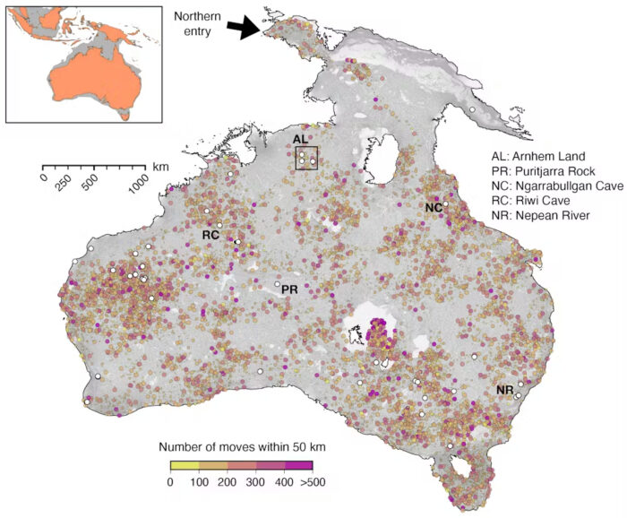
As sea levels rose at the end of the Pleistocene, the landscape took the form we now know. How the first humans reached Sahul is still a mystery, and the paths they took to spread across it are also lost to the sands of time.
A useful tool
Until now. In an article published in The Conversation, the scientists explain their approach. They first chose two likely entry points, "a northern route through West Papua (entry time: 73,000 years ago) and a southern one from the Timor Sea shelf (entry time: about 75,000 years ago)."
A computer model then combined geological evidence of how Sahul changed over time with how hunter-gatherer populations typically spread. The resulting maps show "radiating waves" of migration, with humans following receding coastlines, ancient waterways, and other likely routes since erased by the march of time.
The model also suggests that early humans spread between 0.36 and 1.15 kilometers per year.
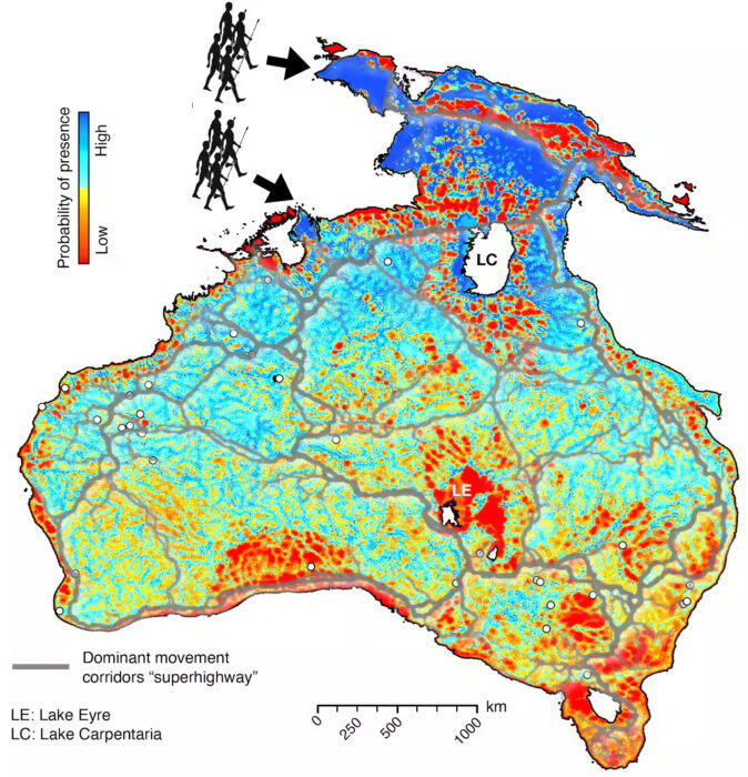
The upshot is a series of maps that will help archaeologists narrow their search for dig sights. The team also hopes their methodology can illuminate other migration mysteries, like the movement of early humans around — and out of — Africa.
"You've got to be joking."
That's what Doug Scott scrawled across a piece of paper given to him by the organizers of an event in 1975.
The paper? A liability waiver for the Derby Mercury Road Club's annual Dovedale Dash — essentially a 7.6km fun run. Scott himself? A legendary English mountaineer who was part of a team that had just made the first ascent of Everest's Southwest Face. Time between Everest ascent and fun run?
About two months.
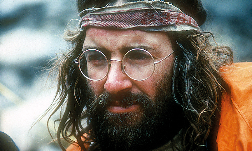
So we can understand Scott's cognitive dissonance. Imagine spending months pioneering a new route up the world's highest peak, only to return home and be asked to sign a liability waiver promising not to sue in the event of a rolled ankle or scraped knee.
In Scott's defense, the response came across as lighthearted to all involved, according to a post by the Mountain Heritage Trust.
View this post on Instagram
The post also features a newspaper clipping from the November 3 edition of the Derby Evening Telegraph — a clipping that doesn't hesitate to take a sly and good-natured potshot at the hometown hero.
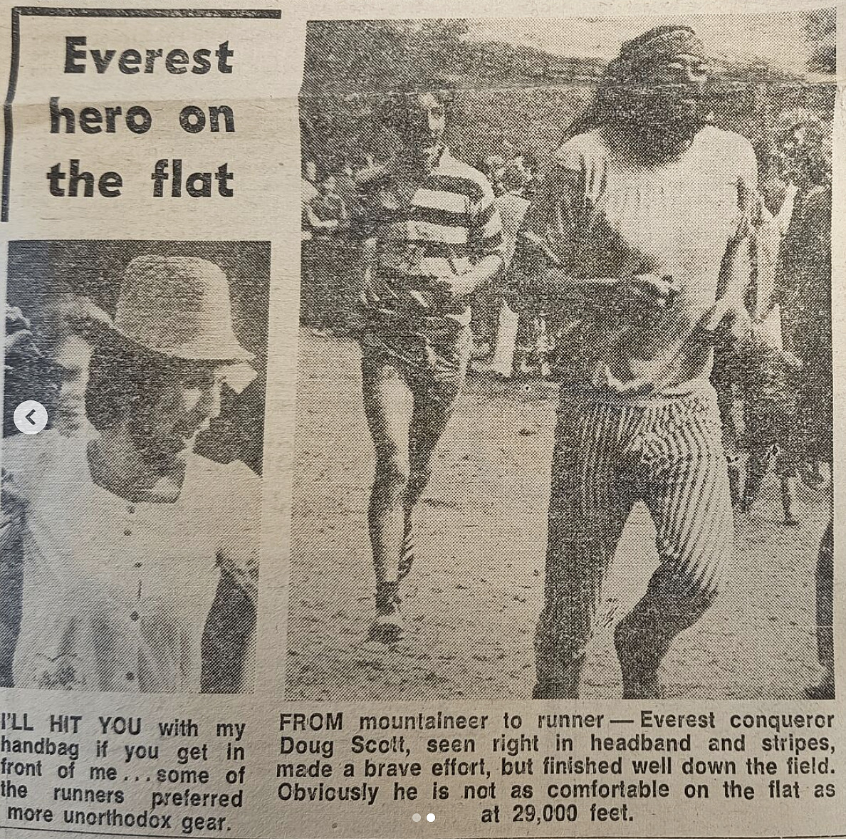
"Doug Scott...made a brave effort, but finished well down the field. Obviously, he is not as comfortable on the flat as at 29,000 feet," reads the caption underneath a decidedly hippie-looking Scott jogging along and presumably avoiding injury.
Doug Scott — an English Legend
Scott spent ten years as a teacher in his early days but quickly became one of the world's most noteworthy high-altitude mountaineers. In 1975, he became the first Englishman to summit Everest as part of an expedition led by Chris Bonington. The summit push ran into difficulties with oxygen equipment and deep snow but was ultimately successful at 6:00 pm on Sept. 24.
The summit led to an overnight bivouac with Scottish partner Dougal Haston. Neither climber had a functioning headlamp, nor did Scott have his down suit. Nevertheless, both made it down safely the next day.
In his later years, a shorter-haired Scott studied Buddhism, became a mentor to younger climbers, and founded the non-profit Community Action Nepal. He died on Dec. 7, 2020, of cancer.