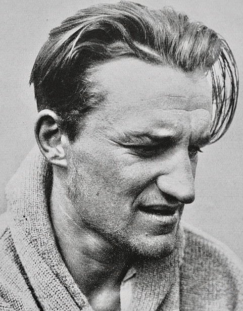
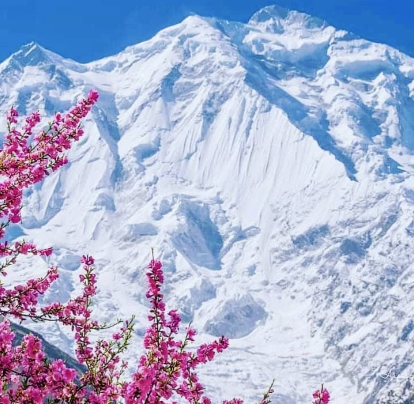
Today, July 25, would be the 104th birthday of Lionel Terray. The celebrated French alpinist climbed routes from the Alps to the Himalaya to the Andes, and also wrote one of the all-time great mountaineering books, Conquistadors of the Useless.
Early years
Lionel Terray was born on July 25, 1921. Growing up in Grenoble near the French Alps, Terray discovered mountaineering and skiing as a child. A conversation with his mother, who dismissed climbing as a stupid sport involving scaling rocks with your hands and feet, sparked his curiosity.
By age 12, Terray was climbing peaks like the Aiguille du Belvedere and the Aiguille d’Argentiere with his cousin. By 13, the talented youngster was leading climbs. But Terray’s love for the mountains caused problems; he got kicked out of one boarding school and ran away from another to pursue ski racing. With little family support, he got by on his own. Skiing was Terray’s first love, and as a teen, he won prizes in competitions, which gave him some money.

In 1941, during World War II, Terray joined Jeunesse et Montagne, a military program that kept him in the mountains. There, he met lifelong friends and climbing partners Gaston Rebuffat and Louis Lachenal.
In 1942, Terray carried out the first ascent of the west side of Aiguille Purtscheller. He also climbed the difficult Col du Caiman. From 1943 to 1944, Terray served in a high-mountain military unit. In 1944, he joined the French resistance, using his mountain skills against the Nazis.
Terray knocked off other notable first ascents, such as the east-northeast spur of the Pain de Sucre and the north face of Aiguille des Pelerins with Maurice Herzog in 1944.
A rising star
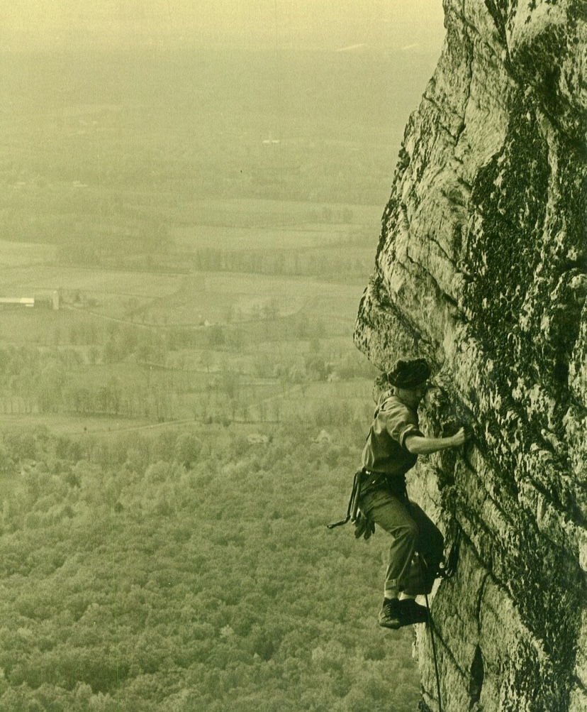
After the war, Terray became a mountaineering instructor and settled in Chamonix as a freelance guide. With Lachenal, he did some of the Alps’ most difficult routes, including the Droites’ north spur in only eight hours in 1946, the Walker Spur of the Grandes Jorasses in 1946, the northeast face of Piz Badile, and the north face of the Eiger in 1947 (the second-ever ascent). Terray's speed and skill earned him a reputation as a climbing prodigy.

A rescue attempt on Mont Blanc
In late December 1956, Lionel Terray took part in a rescue attempt on Mont Blanc’s Grand Plateau. At about 4,000m, young climbers Jean Vincendon and Francois Henry were stranded after a failed attempt on the Gouter Route, a popular 1,800m climb to Mont Blanc’s summit.
On December 22, a blizzard caught Vincendon and Henry near the Vallot Hut at 4,362m. Freezing and frostbitten, they couldn’t descend. Terray, now a Chamonix guide, defied the Compagnie des Guides’ decision to postpone a rescue because of the extreme risks of strong winds and freezing temperatures.
Terray’s team battled brutal weather for two days but couldn’t reach the climbers. A military helicopter, attempting a parallel rescue, crashed near the Vallot Hut, stranding its crew. Terray’s group retreated, exhausted, as conditions worsened.
French Army instructors finally reached Vincendon and Henry in early January, but found them near death from exposure and frostbite. Evacuation was impossible, and both climbers died.
Terray’s rescue effort led to his expulsion from the guides’ organization, sparking controversy in Chamonix.

Eiger rescue
In the summer of 1957, Terray took part in a complicated rescue on the Eiger’s North Face in the Swiss Alps. Two Italian climbers, Claudio Corti and Stefano Longhi, were stranded after an avalanche hit their team during an attempt on the notorious Nordwand. The route, known for its steep ice, rockfall, and brutal weather, had already killed their partners, and Corti was injured.
Terray, then 35, joined a multinational rescue team at Kleine Scheidegg. The climbers were stuck near the Difficult Crack, at around 3,300m. Terray, with German climbers Wolfgang Stefan and Hans Ratay, ascended via ropes and pitons. They battled harsh winds and -20°C temperatures. After two days, they reached Corti, who was hypothermic but alive, clinging to a ledge. Longhi, lower down, was too weak to move. Terray secured Corti with ropes, and the team lowered him 600m to safety. Longhi, barely conscious, died during the descent when his rope jammed.
The effort, involving 50 people, was one of mountaineering’s greatest rescues.

Other historic climbs
Terray’s ambition took him beyond the Alps. In 1950, he joined Maurice Herzog’s expedition to 8,091m Annapurna I in the Himalaya, the first confirmed ascent of an 8,000m peak. Terray and Rebuffat's efforts, alongside one of the Sherpas, were crucial to helping the frostbitten Herzog and Lachenal descend safely. The climb brought global fame for the French team.
In 1952, Terray and Guido Magnone made the first ascent of Cerro Fitz Roy in Patagonia. That year, Terray also climbed 6,369m Huantsan in Peru with Cees Egeler and Tom De Booy.

In 1954, Terray summited 7,804m Chomo Lonzo with Jean Couzy, paving the way for their legendary 1955 first ascent of 8,485m Makalu. In 1962, Terray led the first ascent of 7,710m Jannu in Nepal, and in the summer of 1964, he led the first ascent of 3,731m Mount Huntington in Alaska.
In Peru, Terray made first ascents of peaks like 6,108m Chacraraju, considered the hardest peak in the Andes at the time, along with 5,350m Willka Wiqi, 5,428m Soray, and 5,830m Tawllirahu.
Conquistadors of the Useless
In 1961, Terray published Les Conquerants de l’inutile (Conquistadors of the Useless), a memoir that blends vivid accounts of his climbs with reflections on the purpose of mountaineering. The title captures his view that climbing, though seen as pointless by some, was a noble pursuit. The book, translated into several languages, remains a classic.

A tragic end
On September 19, 1965, Terray and his friend Marc Martinetti died in a climbing accident in the Vercors massif near Grenoble. Terray was just 44.
The pair was descending the Gerbier, a limestone cliff in the Vercors range, after completing a route. They were roped together when their rope -- likely weakened or damaged -- snapped. They fell more than 200m to the base of the cliff. Both climbers died on impact. Chamonix mourned deeply, and his funeral drew figures like Herzog, Rebuffat, and Leo LeBon.
"He was to many a great and dear friend, and all those who paid him tribute before he was laid to rest in the Chamonix Cemetery, among them hardened mountain climbers, wept like small children. To the French climbing world, especially the younger generation, his absence represents an irreplaceable loss, as he was the hero of their dreams, and could hold an audience breathless as no one ever has been able to," Lebon wrote in the American Alpine Journal.
Terray’s legacy lives on through his climbs, rescues, and writings. His son, Nicolas, is a mountain guide. Known for his red beanie and sunglasses, Terray appeared in films like Etoile du Midi, La Grande Descente, and Stars Above Mont Blanc.
You can watch Etoile du Midi below, with the option of automatic subtitles:
Kim Chang-ho was a South Korean mountaineer who summited the 14x8,000'ers without supplemental oxygen in record time. He pioneered numerous new routes and first ascents on 6,000m and 7,000m peaks. Today, we revisit his most notable climbs.
Early years
Most sources list Kim's birthday as September 15, 1969, but mountaineering historian Bob A. Schelfhout Aubertijn confirmed that Kim was born on July 13, with confusion arising from the Korean age system.
In 1988, Kim began studying International Trade at the University of Seoul. Inspired by Alexander the Great's exploits, Kim started climbing with the university’s Alpine Club.
His frequent expeditions delayed his academic progress, and he didn’t earn his Business Administration degree until 2013. Kim viewed his humanities studies as a way to enrich his climbing. He believed that understanding culture and history deepened his connection to the mountains.
By the 1990s, he was already tackling rock-climbing routes up to 5.12. Early expeditions to the Karakoram, including attempts on 6,286m Great Trango in 1993, and 7,925m Gasherbrum IV in 1996, revealed his bold -- sometimes reckless -- ambition. On Gasherbrum IV, he reached 7,450m but faced a sheer rock face without protection, instructing his partner to release the rope if he fell.
Exploration of northern Pakistan
Between 2000 and 2004, Kim embarked on solo trips in northern Pakistan’s Karakoram, Hindu Kush, and Pamir ranges, prioritizing discovery over summits. As detailed in the 2023 American Alpine Journal, he surveyed glacial valleys, documented hundreds of unclimbed peaks, and built relationships with local farmers and herders. These solitary treks were driven by a desire to understand the geography, culture, and history of the regions.
Kim’s journals reveal a meticulous approach, with photographs and descriptions of potential routes forming a database that remains a valuable resource for climbers. His interactions with locals shaped his climbing decisions, ensuring cultural sensitivity in his choice of peaks. This period of exploration laid the groundwork for his later ascents, blending adventure with respect for the human and natural contexts of the mountains.

Photo: Kim Chang-ho
Four first ascents of 6,000m peaks
Kim’s explorations in Pakistan led to a series of remarkable solo first ascents in 2003, when he was 33. The American Alpine Journal documents four solo climbs of 6,000m peaks in the Hindu Raj and Karakoram ranges.
He carried out the first ascent of 6,105mm Haiz Kor in the Thui Range of the Hindu Raj, by a challenging route via the southeast face and south ridge through a complex icefall.
Kim also made first ascents of 6,225m Dehli Sang-i-Sar in the Little Pamir, 6,189m Atar Kor in the Hindu Raj, and 6,200m Bakma Brakk in the Masherbrums.

Dehli Sang-i Sar from the southwest, showing the general line of Kim Chang-ho's solo ascent along the upper east ridge in 2003. Photo: Kim Chang-ho
Mastering 7,000’ers
In 2008, he led the first ascent of 7,762m Batura II, though the expedition’s use of fixed ropes drew criticism, prompting him to refine his lightweight approach.
In 2012, Kim and An Chi-young made the first ascent of 7,092m Himjung in Nepal, climbing via its southwest face. The expedition earned them the Piolet d’Or Asia Award.
In 2016, Kim and two partners opened a new 3,800m alpine route on the south face of 7,455m Gangapurna in Nepal. Described by the 2017 Piolet d’Or committee as "bold and lightweight," it earned an Honorable Mention, marking a historic recognition for Korean climbers.
During the Gangapurna expedition, Kim and his partners also attempted the south face of unclimbed Gangapurna West, where they reached the summit ridge.
One year after Gangapurna, the tireless Kim led an expedition to Himachal Pradesh in India, aimed at fostering a younger generation of Korean climbers and developing their skills and experience. The team made the second ascent of 6,446m Dharamsura, and climbed 6,451m Papsura via a direct route on the south face.

Choi Seok-mun and Park Joung-yong, climbing partners of Kim Chang-ho, approach the summit of Gangapurna. Photo: Korean Way Project
Summiting 8,000'ers
Kim summited all 14 of the world’s 8,000m peaks without supplemental oxygen, in record time.
Starting in 2006 with the Busan Alpine Federation’s Dynamic Hope Expedition (led by Hong Bo-Sung), Kim and a small team relied on minimal support, avoiding Sherpas and oxygen. Kim studied geography and history to learn more about his routes.
Kim completed the 14x8,000'ers in 7 years, 10 months, and 6 days, setting a record for the fastest completion without oxygen at the time. He surpassed Jerzy Kukuczka's record by one month.
Kim didn't set out with the explicit goal of climbing the 8,000'ers so quickly. His pursuit was primarily driven by his passion for mountaineering and a desire to climb these peaks in a pure, lightweight style.
Kim ascended three 8,000m peaks twice: Nanga Parbat, Gasherbrum I, and Gasherbrum II.
Among his 8,000m climbs, his south-north traverse of Nanga Parbat in 2005 and his sea-to-summit ascent of Everest in 2013 deserve special mention.

The south face of Gangapurna, showing (in red) the Canadian Route (1981), and (yellow) the Korean Way (2016). Photo: Korean Way Project
Nanga Parbat, 2005
In 2005, Kim climbed Nanga Parbat’s massive Rupal Face. The Korean Nanga Parbat Rupal Expedition lasted 109 days. They arrived at Base Camp on April 20 after a heavy snowstorm. Over the next 12 days, the team set up Camp 1 at 5,280m and Camp 2 at 6,090m, following a line close to the 1970 Messner Route.
The weather was brutal, with snow falling daily in May, destroying seven tents and burying Camp 2 under fresh snow. Despite these setbacks, by June 14, after 43 days of effort, the team established Camp 3 at 6,850m. Near the end of June, the team prepared for a summit attempt, and on June 26, Kim and three other climbers started their push. However, at 7,550m on the Merkl Icefield, a rock hit team member Kim Mi-gon in the leg, forcing the group to abort.
Undeterred, Kim and climbing partner Lee Hyun-jo made another attempt on July 13, starting from Camp 4 at 7,125m. They faced constant danger, dodging falling rocks and ice. After a 24-hour climb, they reached the summit of Nanga Parbat.

Kim Chang-ho. Photo: Abbas Ali
A difficult descent
Kim and Lee chose to go down the Diamir Face via the Kinshofer Route, unroped, to save time. In the middle of the descent, they triggered a wind slab avalanche. Lee was buried, and Kim was swept 50m downhill, scraping his face and losing his headlamp. Both managed to free themselves and continued down, exhausted and hallucinating, believing another climber was ahead of them. They reached another expedition’s tents at 7,100m but decided against stopping, fearing they might not wake up if they rested. After an incredible 68 hours from Camp 4, they arrived at the Diamir Base Camp, impressing others with their speed and resilience. Lee appeared remarkably fresh despite the ordeal.
This expedition was a turning point for Kim. The climb was a tactical, siege-style effort, relying on fixed ropes and a larger team, very different from the lightweight, alpine-style climbs he later became known for. During the descent, Lee’s emotional radio call to a teammate at Base Camp, expressing regret that they weren’t together, deeply affected Kim.
Kim reflected on his selfishness, realizing that reaching the summit meant little without returning safely with his team. This experience shaped his philosophy moving forward, which would emphasize teamwork, respect for the mountains, and survival over personal glory.

Views of Everest from neighboring Lhotse. Photo: Kadyr Saydilkan
Everest, 2013: Starting from sea level
Kim’s 2013 Everest ascent was the final step in his quest to climb the 8,000m peaks without supplemental oxygen, making him the first Korean to do so. But his Everest climb was not just about reaching the top; it was a unique adventure.
Kim’s journey to Everest’s summit began far from the mountain itself. He wanted to make the climb special by starting at sea level and traveling to Base Camp without using motorized transport.
On March 20, 2013, he began his expedition from Sagar Island near Kolkata, India. From there, he kayaked 156km on the River Ganges, cycled 893km through northern India to Tumlingtar in Nepal, and then trekked 162km to Everest Base Camp. This sea-to-summit approach was rare and challenging, inspired by earlier climbers like Tim Macartney-Snape and Goran Kropp, but Kim added a twist by kayaking part of the way.
Once at Everest Base Camp, Kim prepared to climb the mountain via the standard Southeast Ridge route from the Nepal side without oxygen. He moved steadily up the mountain, navigating the Khumbu Icefall, the Western Cwm, and the steep slopes leading to the South Col. On May 20, Kim reached the summit.
Sadly, Kim’s climbing partner, Seo Sung-ho, died during the descent. This loss cast a shadow over the triumph, but Kim’s accomplishment remained a mountaineering landmark.

Kim Chang-ho and his team near the Sara Umga La at 5,020m, west of Dharamsura and Pasura peaks, in 2017. Photo: Korean Way Project
Mountaineering philosophy
Kim’s mountaineering philosophy viewed climbing as a means of learning and coexistence, not conquest. He avoided treating peaks as mere challenges, instead choosing routes with historical or cultural significance. After losing his partner Seo Sung-ho on Everest in 2013, Kim founded the Korean Himalayan Fund to support young climbers in creative ascents. His database, preserved by his wife Kim Youn-kyoung, includes detailed notes on geography and local names.
Kim’s death
Kim’s life ended on October 11, 2018, when an avalanche, possibly triggered by a serac collapse, destroyed his team’s Base Camp beneath 7,193m Gurja Himal, located south of Dhaulagiri VI, in Nepal. The Korean Way Project expedition, aiming for a new route on the south face, included five South Korean climbers and four Nepali guides, all of whom perished.
Kim’s journal, ending on October 10, suggests the tragedy struck overnight. By the time of his death, he was recognized as South Korea’s most accomplished climber. Kim was 49 years old.
His legacy endures through his database, the Korean Himalayan Fund, climbers like Oh Young-hoon who carry forward his vision, Kim’s daughter (Danah, born in 2016), his wife, and through the international mountaineering community, who preserve his memory.

Kim Chang-ho. Photo: En.namu.wiki
Naila Kiani is on her way to becoming the first Pakistani woman to complete the 14x8,000'ers, but her impact goes beyond summits. Kiani is driving change in her country's mountaineering scene, speaking up for those without a voice and making more than a few enemies along the way.
During her 14x8,000m quest, Kiani has been a reliable, outspoken witness in the usually secretive commercial climbing industry. She was the one who denounced how climber Ali Akbar Sakhi of Afghanistan was abandoned close to Camp 3 on K2, and faced threats when she accused Sakhi's outfitter of negligence.
Kiani also reported what happened on Shisha Pangma in 2023, when a race to become the first American woman to finish the 8,000m list ended with both women's deaths, alongside their Sherpas. After porter Ali Muhammad Hassan died at K2's Bottleneck, and a hundred climbers passed him on their way to the summit, Kiani coordinated a team of local climbers to return his body in the highest retrieval operation ever performed on K2. She has also led cleaning campaigns on the mountain.
This year, Kiani has spoken out on behalf of a group of local porters whose outfitter had not paid them. She knew the porters were too vulnerable to protest by themselves and that the loss of income might mean misery and hunger for their families.
Changes in aerial rescues
In the last few weeks, Kiani also made two promising announcements: the establishment of a mobile medical dispensary in the Karakoram and a change in helicopter protocols for mountain rescues in Pakistan. Until now, army pilots have managed helicopter rescues, flying in two helicopter patrols that charged $26,000 per flight -- the most expensive fee in the world.
"Last year, I spoke out against the extremely high prices that sick and injured climbers were being charged for helicopter evacuations," Kiani said. "Many told me to stay quiet, and that no one would listen."
Instead, she wrote letters and contacted high-ranking army officials directly. Kiani provided lists of prices comparing aerial rescue services and their costs in several mountain ranges around the world.
"I clearly explained that climbers evacuated in Pakistan were paying way, way too much," Kiani told ExplorersWeb.
To the surprise of the skeptics, the military listened. The new president of the Alpine Club of Pakistan (and Army General), Irfan Arshad, supported Kiani in this quest. The protocols have now changed, and, if applied, the impact will be huge.
Rescues 60% cheaper
Now, the helicopters don't need to fly in pairs.
"Only one helicopter is being sent for rescues, bringing the cost down to under $9,900 on average, nearly one-third of what climbers were paying before," Naila explained.
The change will also double the rescue capacity of the Pakistani air force, as each helicopter may attend to a different rescue at the same time.
Kiani has also insisted on a stricter account of the rescue charges, as the previous cost (calculated per hour of flight time) was sometimes inaccurate.
Finally, Kiani hopes the new protocols will prioritize serious medical cases without insurance companies agreeing to foot the bill first. This would greatly benefit many local porters, who either lack insurance or have limited coverage.
Kiani is hopeful costs will decrease immediately, but she also foresees further improvements. She told Explorersweb that the situation will improve when Pakistan allows private helicopter companies to operate rescues (as they can in Nepal), which Kiani is confident will happen in the future. In her opinion, private companies will lower costs and may be more flexible regarding altitude and weather conditions for rescues.
These improvements may seem logical, but in a country like Pakistan, where the army is incredibly powerful and rarely influenced by external forces, what Kiani has achieved is more extraordinary than any of her climbs.
Dispensaries in the Karakoram
Kiani has also lobbied for (and helped finance) the installation of two paramedical dispensaries along the Baltoro during the summer season. One is already operating at Concordia, one day from K2 Base Camp, and another is ready to start operating in Urdukas, as soon as the assigned nurse gets there.
"They will treat everybody for free: trekkers, climbers, and locals working in the area," Kiani said. "Finally, there is a semi-permanent facility to provide sanitary care during the Baltoro trek: igloos prepared to endure harsh weather."
The lack of facilities was a serious problem, particularly for local porters who had nothing to treat their injuries and disinfect wounds. With no help, even small health issues rapidly developed into serious medical conditions.
"We don't have a doctor yet, but the nurse managing each dispensary can treat a wide range of issues," Kiani said.
Kiani will pay the nurse's salary while Pakistan's Alpine Club will cover the rest.
Not just words, actions
These changes come after years of very little progress to improve the welfare of climbers and, most of all, local communities working in the climbing industry.
"I am not the only one who speaks up," Kiani said. "Other climbers also make their voices heard, but it is one thing to speak about something we think is wrong, and another to take action to change it. I strongly believe that if you want things to change, you need to take action."
Kiani's campaign for change has made enemies, but it has also received important support, such as from the Alpine Club of Pakistan and Green Tourism, a private institution that works closely with the country's government. "Without their help, I couldn’t have achieved what I did this year," Kiani explained.
Yet speaking up takes a toll, especially in the close-knit Pakistani climbing community. When Kiani pointed a finger at the negligence of some local operators, she faced harsh criticism and accusations of jealousy or courting controversy.
But Kiani insists that these negative aspects impact the entire Pakistani tourism industry.
"I can't help thinking that Pakistan has such huge potential for mountain tourism, and that mountain tourism can make a life-changing impact on local communities."

In addition to her determination, Kiani has something else in her favor: She is well-educated, with experience making a case, with plenty of proof and documentation, to draw the attention of senior officials. She is a Dubai-based engineer who has worked as a banker, although she quit her full-time job to pursue climbing in 2023.
Breaking social boundaries through climbing
Kiani summited Kangchenjunga, her 12th 8,000'er, last spring. While she has not confirmed her plans for fall, she intends to climb Shisha Pangma and Dhaulagiri to complete the 14x8,000m challenge.
"I get some criticism because I use oxygen and Sherpa support, but climbing has given me a voice and I’m using that voice to try to make a difference," Kiani told ExplorersWeb.
Kiani has become an influential figure for young Pakistani women.
"Gender equality is a real issue. Women here sometimes don’t have confidence and self-belief, so I wanted to inspire Pakistani women," she explained. "If I can do things that are not associated with Pakistani women, and if I can speak up about things that others won’t even dare, then hopefully others can do the same."
Pakistan ranked last (148th out of 148 countries) in the World Economic Forum's Global Gender Gap Index in 2025, with a score of 56.7%. Dawn.com cited data from the Human Rights Commission of Pakistan (HRCP) showing that in 2024, "honor" killings continued to be a serious issue across Pakistan. That year, 346 people (nearly all women) were victims of these so-called honor crimes.
Around 3:30 pm on July 2, an SOS signal from a Garmin InReach device reached the California Governor’s Office of Emergency Services. It had been sent from just below the summit of 4,383m Mt. Williamson, the second-highest peak in the Sierra Nevada.
The sender, whose name authorities have not released, had fallen and sustained serious injuries. She also lost most of her equipment. Her situation soon became even more desperate when a thunderstorm rolled in. Lightning menaced her, and lashing rain beat over the area as a multi-agency rescue operation launched. But the weather, her severe injuries, and the difficult location kept her stranded for many hours.
The woman had been scrambling off-route near the West Chute on Mt. Williamson. While snow-free in July, the nearly 500m chute has sections of loose scree which make it difficult. Mt. Williamson is trickier to summit than the slightly taller Mt Whitney. There is no established trail above 3,000m, and there aren't many fellow climbers around.
The woman was just a few hundred meters from the summit when she fell, losing her backpack and badly breaking her leg. Over her Garmin, she described the grisly compound fracture -- a fracture where the bone protrudes through the skin -- and her lack of food, water, and extra clothing.
A series of helicopter attempts
California Highway Patrol sent an Airbus H125 helicopter to pick up rescue volunteers. By the time rescuers were on board, the storm had fully descended, bringing cloud cover that prevented the helicopter from reaching her.
More resources were called in, and the nearby China Lake Naval Air Weapons Station agreed to lend aid. They transported search-and-rescue workers to Shepherd's Pass, around 3,000m up, but couldn't get any closer. This was around midnight. Volunteers proceeded on foot, reaching the bottom of the west face by sunrise.
They were able to call up to the stranded climber, but the terrain prevented them from reaching her. By then, however, the weather had improved somewhat, and the helicopter returned and dropped two rescuers about 100m above her. They carefully made their way down, reaching her 23 hours after her fall.
They still had to get her out. Again, SAR personnel called in more resources. The Los Angeles County Sheriff’s Department's Air 5 helicopter buzzed over, but the elevation proved too much. Finally, the California National Guard offered their Blackhawk Spartan 164.
SAR workers on the ground carefully moved her into a more open position. Just after 7 pm on July 3, 28 hours after her fall, she was hoisted aboard Spartan 164 and eventually transferred to a hospital.
According to a statement from Inyo County Search and Rescue, the victim displayed "Enormous bravery and fortitude...and all involved were impressed by her ability to remain calm, collected, and alive."
Experienced climbers Saki Terada and Chiaki Inada from Japan faced severe challenges while climbing 6,757m Nevado Huascaran earlier this week. Their climb of Peru's highest peak ended in tragedy.
The duo became stuck at 6,600m during their descent. Inada died, and rescue teams struggled to help Terada down.
Yesterday, rescuers finally evacuated Terada from the mountain, transporting her to Víctor Ramos Guardia Hospital in Huaraz. She is in a critical but stable condition, suffering from severe dehydration and frostbite on her hands and feet from prolonged exposure to extreme cold, according to Infobae.
Today, medics will transfer her to a hospital in Lima, Peru's capital city, where she can continue treatment.

Inada's body recovery underway
Efforts are underway to recover Inada's body. Inada, a 40-year-old doctor for Wilderness Medical Associates Japan (WMA), succumbed to hypothermia and cerebral edema.
According to some Peruvian sources, rescue services found the climbers at approximately 6,500m on the south face of Huascaran’s south peak, just below the summit. They were on the technical Escudo route, a 600m ice and snow wall known for its steep terrain and harsh weather.
Terada and Inada had arrived in Peru two weeks ago and had at least one acclimatization hike before starting the ascent on Huascaran. Presumably, the two women summited on June 23, and the problems started on June 24 when they encountered foggy weather and low visibility.

Timeline of events
Today, WMA Japan has published a report on what happened. Below we have translated it into English with minor edits to improve clarity. Note all times referred to are Peru Standard Time.
June 24
At around 1:30 am:
- Chiaki Inada became incapacitated due to suspected hypothermia. A distress signal was sent via Garmin’s SOS satellite device to a private rescue agency in Peru. The agency contacted WMA Japan to verify the situation.
At around 4:00 am:
- A response headquarters was established, and negotiations began with various parties.
- Requests for rescue to the local private rescue agency and to local police authorities.
- Request for support through the Japanese Embassy in Peru.
At around 7:30 am:
- Online meeting with Japanese and Peruvian stakeholders.
- Survival of Inada and Terada confirmed.
- Text communication with Japan was possible until around 10:00 am. The climbers were stranded and incapacitated at the site.
- Rescue arrangements confirmed.
- The climbers' problems occurred around 6,600m, just below the summit. No helicopters in Peru can fly at this altitude, so the rescue team had to fly to the Huascaran refuge hut, then proceed on foot to the site. The plan was to bring both climbers to the refuge hut by land, followed by a helicopter rescue.
- Cooperation from local police was secured through the Japanese Embassy in Peru.
At around 4:00 pm:
- A joint rescue operation by local police and private teams began. Nine team members, split into three groups, arrived at the Huascaran refuge hut.
- The team began climbing toward the stranded climbers on foot.
- Additional teams were dispatched through efforts by the Japanese Embassy and local stakeholders.
- The rescue team consisted of over 10 members, primarily local mountain guides, operating in several groups.
June 25
At around 7:30 am:
- Staff at a lodge at the mountain’s base reported phone contact with Inada and Terada
- Though their responses were not entirely clear, their voices were confirmed.
At around 12:00 pm:
The rescue team approached the SOS location but encountered difficulties due to large crevasses. They continued searching for a viable route.
At around 3:00 pm:
- The rescue team reached the two stranded climbers. Terada was conscious. Inada was unconscious and in critical condition.
- The team provided first aid and considered transport options through the night.
At around 6:00 pm:
- Deteriorating weather conditions made rescue operations extremely difficult, rendering simultaneous transport of both climbers impossible.
- Local rescue teams and authorities determined Inada’s death at the site.
- Further rescue activities became unsafe, so Inada’s body was temporarily left at the site with its location recorded via GPS.
- The rescue team focused on evacuating Terada.

June 26
At around 9:00 am:
- Terada was walking at approximately 5,100m (the pickup point is at about 4,500m).
- A helicopter and local medical personnel were on standby for transport.
- The plan was to transport Terada to a hospital at the base via helicopter upon reaching the pickup point.
At around 1:45 pm:
- Terada safely reached the helicopter pickup point at the refuge hut.
- Partway down, she became unable to walk independently and was carried by the rescue team, but remained fully conscious.
- Final landing arrangements and flight permissions were being coordinated, with the helicopter set to deploy once conditions were met.
At around 2:30 pm:
- Thanks to the rescue team’s swift coordination, Terada was safely admitted to a hospital.
- Preparations for the recovery of Inada’s body have begun.
At around 10:00 pm:
- A team of local mountain police and guides left to retrieve Inada’s body.
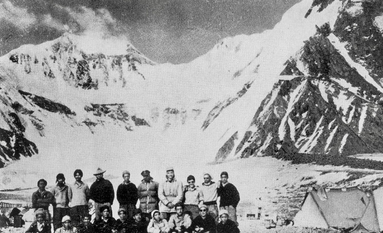
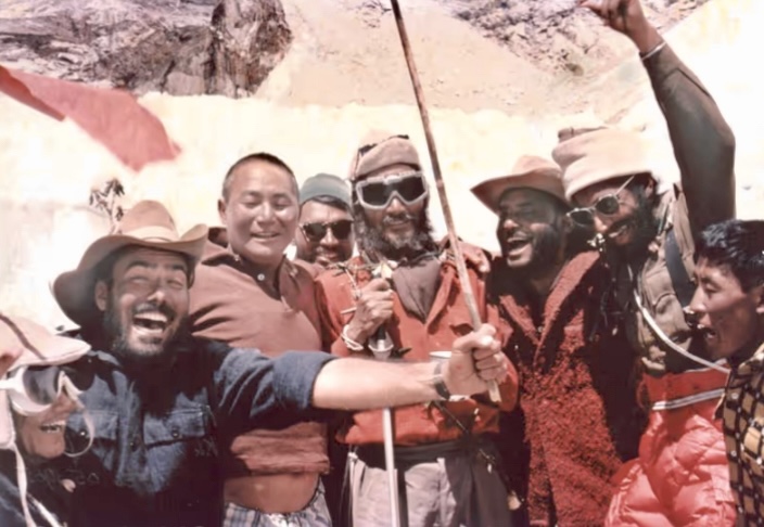
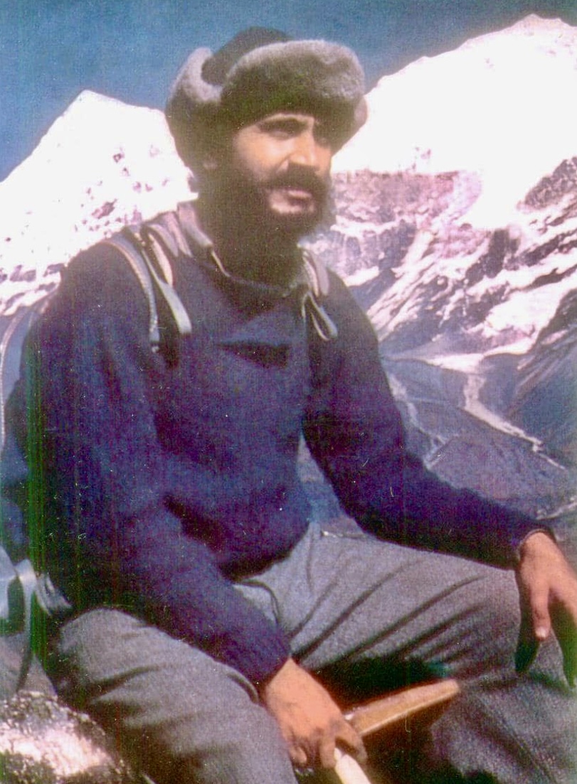
Captain Manmohan Singh Kohli, a pioneering Indian mountaineer, passed away on June 23 at the age of 93.
Celebrated for leading India’s first successful Everest expedition in 1965, Captain M.S. Kohli's career also included an Antarctic expedition and many other Himalayan ventures. His work as a mountaineer, author, editor, Himalayan Club president, and Indian Mountaineering Foundation president shaped Indian mountaineering.
Born December 11, 1930, in Haripur (now Pakistan), Kohli joined the Indian Navy in 1950, rising to the rank of Commander. He trained in the UK and developed leadership skills. By 1956, he began Himalayan mountaineering.
Kohli took part in over 20 adventures in the Greater Ranges. In 1956, he climbed 7,672m Saser Kangri in the Karakoram. In 1959, with K.P. Sharma, he topped out on 6,861m Nanda Kot in the Kumaon Himalaya. It was just the second ascent of the mountain.
Between 1961 and 1964, Kohli led three successful expeditions -- the first ascent of Annapurna III, a climb of 7,816m Nanda Devi, and an expedition to 7,198m Nepal Peak.
In the 1960s, Kohli led and summited Kabru Dome and Rathong, strengthening India’s eastern Himalayan presence. In 1965, Kohli led a covert Indian-American mission to place a nuclear-powered device to monitor Chinese tests but did not summit due to harsh conditions.
Everest expedition leader
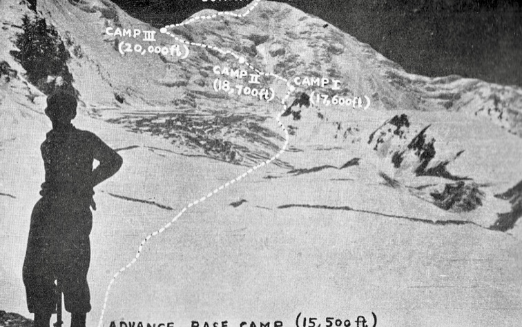
In 1965, Kohli led the first successful Indian expedition to Everest. Nine climbers on his team summited between May 20–29. It set a record for the most summiters on one expedition, which remained unbroken for 17 years.
His leadership on that expedition was extraordinary. Indira Gandhi, who later became the Prime Minister of India, said of Kohli at the time: "Commander Kohli’s expedition...was a masterpiece of planning, organization, teamwork, individual effort, and leadership.”
Later, Kohli climbed several European peaks with Tenzing Norgay. In 1982–1983, he led India’s first civilian Antarctic expedition, supporting scientific exploration.
He was also a committed alpinist beyond expeditions. As president and vice president of the Himalayan Club (1980–1983), Kohli edited the Himalayan Journal. As president of the Indian Mountaineering Foundation (1989–1993), he promoted adventure and youth engagement. In 1989, he co-founded the Himalayan Environment Trust with Sir Edmund Hillary. It was supported by Maurice Herzog, Reinhold Messner, Junko Tabei, and Chris Bonington.
Kohli was much loved and respected in international mountaineering circles. He promoted mountaineering and trekking through many presentations around the world.
Kohli authored Nine Atop Everest, Spies in the Himalayas (with Kenneth Conboy), The Great Himalayan Climb, and A Life Full of Adventures, among several other publications.

Kohli received the Padma Bhushan (1965), Arjuna Award (1965), Ati Vishisht Seva Medal (AVSM), and Tenzing Norgay Lifetime Achievement Award. He lectured at the Alpine Club (UK) and the American Alpine Club.
Captain Kohli’s passing marks the end of an era, but his expeditions, leadership, writings, and conservation efforts will continue to inspire.
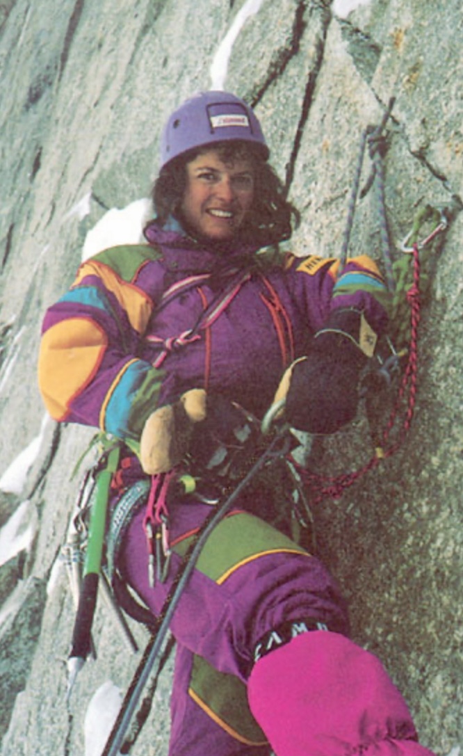
One of Poland's great alpinists of the 1970s and 80s, Krystyna Palmowska, died yesterday in a climbing fall in Slovakia’s High Tatras, according to Polish sources.
The accident occurred on June 15, and her body was found today, June 16, by the Slovak Mountain Rescue Service after ground and helicopter searches.
Palmowska, 76, was one of the best female alpinists of her generation -- a generation when the Poles, both men and women, dominated high-altitude mountaineering. Her remarkable climbs included:
- 1977: Matterhorn North Face – 2nd all-female ascent
- 1978: Matterhorn North Face – 1st all-female winter climb
- 1979: Rakaposhi (7,788m) – New route
- 1982: Member of the K2 Women's Expedition
- 1983: Broad Peak (8,047m) – 1st woman summiter
- 1985: Nanga Parbat (8,126m) – 1st all-female ascent
- 1986: K2 Magic Line – Reached 8,200m with Anna Czerwinska
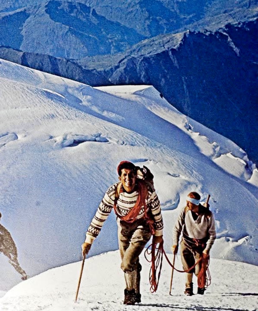
Today, 104 years ago, legendary French alpinist Gaston Rebuffat was born.
One of the most celebrated mountaineers of the 20th century, Rebuffat was known for his bold new routes in the Alps, his role in the first confirmed ascent of an 8,000m peak (Annapurna I in 1950), and as the first person to climb all six great North Faces of the Alps. He wrote several influential mountaineering books and produced films that captured the essence of alpinism.
Early climbs
Rebuffat was born on May 7, 1921, in Marseille, France. He started climbing at 14 in the Calanques, a rugged coastal area near his hometown. In 1937, at 16, he joined the French Alpine Club, where he met Lionel Terray, a future climbing partner. Rebuffat visited Chamonix for the first time in 1937, and the Alps soon became his focus.
During World War II, Rebuffat took his climbing to a new level. In 1942, he graduated from Jeunesse et Montagne, a French youth training program, and received his mountain guide certification (despite being two years younger than the minimum age requirement of 23). In 1944, Rebuffat became an instructor for the French National Ski and Mountaineering School (ENSA) and the High Mountain Military School.
By 1945, he was focused on guiding clients in the Alps, fulfilling his desire to live in the mountains full time. He joined the prestigious Compagnie des Guides de Chamonix.
Climbs in the Alps
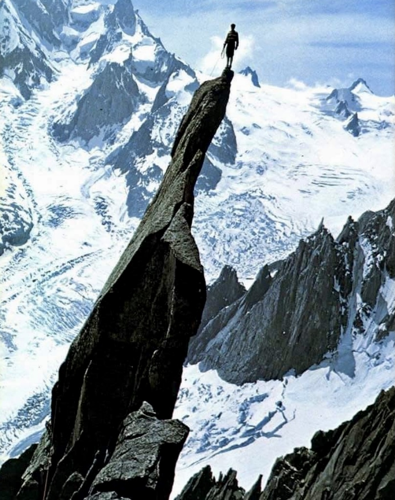
Rebuffat’s climbing career in the Alps was outstanding, with over 1,200 ascents classified as difficult or very difficult. In the 1940s, Rebuffat tackled some of the Alps’ most challenging peaks, alongside partners such as Terray and Louis Lachenal. By the end of the 1940s, Rebuffat was among France’s elite mountaineers.
In the 1940s and 50s, Rebuffat established approximately 40 significant first ascents via new routes. These included routes on the Aiguille du Midi, the Drus, and Aiguille du Roc. His new lines were known for their elegance and technical challenge, and reflect his philosophy of climbing in harmony with the mountain rather than conquering it.
The six North Faces of the Alps
Rebuffat finished his most celebrated achievement in 1952. The North Faces of the Matterhorn, Eiger, Grandes Jorasses, Piz Badile, Drus, and Cima Grande di Lavaredo are well known for their steepness, difficulty, and unpredictable weather.
Rebuffat began to plan his first North Face, the Grandes Jorasses, in 1938, when he was only 17 years old. The first ascent -- by Italians Riccardo Cassin, Gino Esposito, and Ugo Tizzoni -- inspired him.
On Rebuffat's first attempt, in 1943, bad weather forced him to retreat. Finally, in July 1945, he succeeded, climbing the Walker Spur with Edouard Frendo in three days with two bivouacs. This marked the second ascent of this route.
In August 1946, Rebuffat guided Belgian amateur mountaineer Rene Mallieux up the North Face of the Petit Dru. They climbed fast to reach the summit by nightfall, bivouacking on the descent and attending the Chamonix Guides’ Festival the next day. The one-day ascent showcased Rebuffat’s efficiency and guiding skills.
In the summer of 1948, Rebuffat guided a client up the northeast face of Piz Badile in the Bregaglia Alps. Despite a severe lightning storm, they reached the summit the following day. They followed the Cassin Route, first ascended in 1937.
Rebuffat’s fourth North Face came in 1949 when he climbed the Matterhorn twice, first with Raymond Simond, and later with other partners (though some sources mention only one ascent). He targeted the Schmid Route, first climbed in 1931.
The same year, Rebuffat ascended the North Face of Cima Grande di Lavaredo in the Dolomites, guided by Italian Gino Solda. This ascent followed the Comici-Dimai Route, first climbed in 1933.
In July 1952, Rebuffat completed his quest with the North Face of the Eiger via the Heckmair Route. He climbed with Paul Habran, Guido Magnone, Pierre Leroux, and Jean Brune.
Annapurna I
In 1950, Rebuffat joined a French expedition to Annapurna I. Led by Maurice Herzog, the team included Rebuffat, Terray, and Lachenal, among others. The expedition started in March, but the ascent only began in May.
The French party established a base camp and four intermediate camps, the highest at 7,400m. On June 3, Herzog and Lachenal summited and became the first two people in the world to reach the top of an 8,000m peak. Rebuffat and Terray didn’t summit, but played a critical role during the descent.
While summiting was a historic triumph, the descent turned into an ordeal, marked by frostbite, snowblindness, avalanches, and navigational errors. Rebuffat helped to ensure the survival of frostbitten and disoriented teammates during the harrowing retreat.
Herzog and Lachenal reached the top around 2 pm and started to descend immediately. The weather was clear but very cold, with temperatures estimated at -40°. Herzog somehow lost his gloves while handling equipment, exposing his hands. Lachenal, impatient to descend quickly in the worsening conditions and with his own frostbite concerns, slipped and tumbled 100m down the slope. Miraculously, he stopped short of a fatal drop, but the accident left him shaken, with one crampon missing, and his ice axe gone. His feet, already numb from prolonged exposure, were deteriorating rapidly. Both men were in a very bad state as they struggled toward Camp 5 at 7,440m, where Rebuffat and Terray awaited.
Meeting Rebuffat and Terray
Rebuffat and Terray had climbed to Camp 5 earlier that day, expecting to support Herzog and Lachenal or possibly attempt the summit themselves if conditions allowed.
When Herzog arrived at the high camp alone, Rebuffat and Terray were relieved, but then alarmed when they shook his hand. Herzog’s hands were frozen solid, white, and lifeless.
Rebuffat and Terray started to massage Herzog’s frostbitten hands and feet, hoping to restore the circulation, but their efforts had little result. Hearing some cries from below, Terray ventured out of the tent into the dusk and located Lachenal, who had missed the camp and was 200m down the slope. Terray guided Lachenal back to Camp 5. Lachenal’s feet were frozen, and he was disoriented from his fall and the altitude.
Rebuffat and Terray worked through the night to keep Herzog and Lachenal warm, using their body heat. Herzog’s hands and feet were turning black, and Lachenal’s toes were stiffening. Aware that the team needed to descend urgently for medical attention, Rebuffat helped organize the group for the next day’s descent.
Descending in cruel conditions
On June 4, in worsening weather, the four climbers set out to descend to Camp 4 at 7,150m. It was a whiteout, with heavy snow and almost zero visibility. Rebuffat and Terray had removed their glacier goggles the previous day while searching for the route, and both were snowblind.
The situation was critical. Two blind men were guiding two weak, injured climbers. Rebuffat relied on his instincts and memory of the route to help navigate, but the party struggled to locate Camp 4, missing it in the fog and snow. Exhausted, the four climbers had to bivouac in a crevasse for the night.
At dawn, on June 5, an avalanche poured into the crevasse, burying their boots and equipment. Rebuffat and Terray, still snowblind, dug frantically to recover their gear. Rebuffat was determined to keep the group moving.
Later that morning, teammate Marcel Schatz ascended from Camp 4 to search for them. Thankfully, he spotted the group and guided them to safety.
Rebuffat’s resilience
At Camp 4, Rebuffat was suffering early frostbite and snow blindness but coordinated the Sherpas' evacuation of his companions.
On June 5, during their descent to Camp 2, Rebuffat helped rescue Herzog and two Sherpas from an avalanche. By the afternoon, the team reached Camp 2. Finally, everyone reached base camp alive, though Herzog and Lachenal lost some digits.
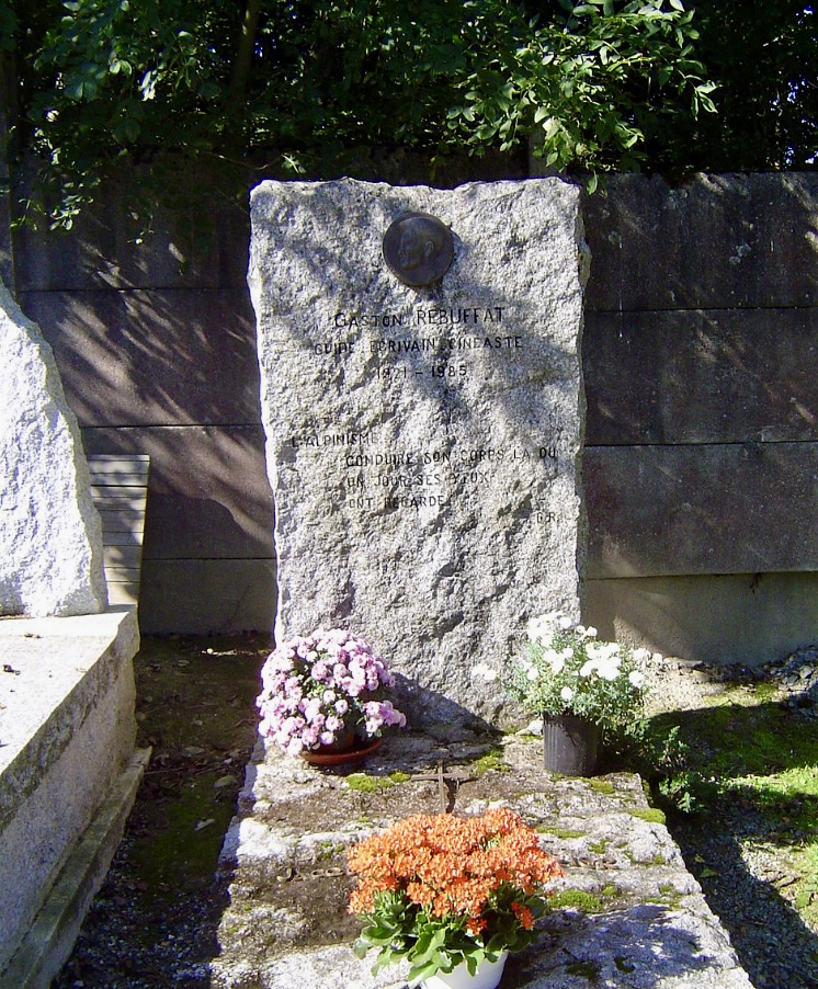
Rebuffat died from cancer on May 31, 1985, in Bobigny, France at age 64. Rebuffat’s tombstone in Chamonix’s old cemetery bears a quote from his book Les Horizons Gagnes:
"The mountaineer is a man who leads his body to where, one day, his eyes have looked."
Legacy
Rebuffat wrote over 20 books on mountaineering, including Starlight and Storm: The Ascent of the Six Great North Faces of the Alps, Mont Blanc to Everest, On Ice and Snow and Rock, The Mont Blanc Massif: The 100 Finest Routes, Men and the Matterhorn, and Between Heaven and Earth. He also edited a mountaineering column for Le Monde.
Rebuffat also produced numerous films, including: Flammes des Pierres, Etoiles et Tempetes (which won the Grand Prize at the Trento Film Festival), Entre Terre et Ciel, and Les Horizons Gagnes.
Rebuffat’s commitment to share the beauty of the mountains continues to resonate with climbers and adventurers. His routes in the Mont Blanc massif are still climbed, and his books remain classics.
You can watch the film Etoiles et Tempetes (in French) below:
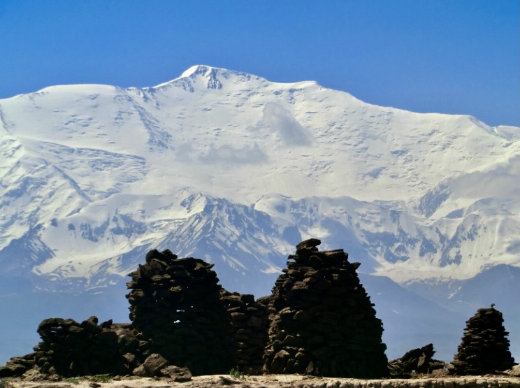
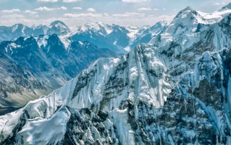
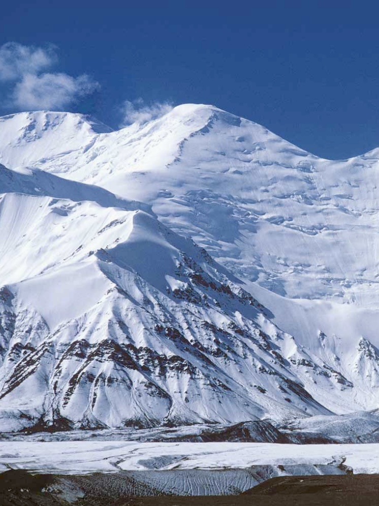
Lenin Peak, a towering giant in the Pamirs, has attracted climbers for decades. We examine its first ascents (one from the south and one from the north) as well as two expeditions that ended in tragedy, including the deadliest-ever mountaineering disaster.
Lenin Peak
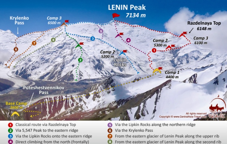
Lenin Peak (7,134m) is located on the border between Kyrgyzstan and Tajikistan in the Pamir Mountains. Its northern slopes are in Kyrgyzstan’s Alai Province, and its southern slopes are in Tajikistan’s Gorno-Badakhshan region. The summit lies on the border, making it a shared peak between the two countries.
It is the highest peak in the Trans-Alay Range, and the second highest in both Kyrgyzstan and Tajikistan, surpassed only by 7,495m Ismoil Somoni Peak in Tajikistan and 7,439m Jengish Chokusu in Kyrgyzstan.
Lenin Peak is one of five 7,000m peaks in the former USSR. Climbers must summit all five to achieve the prestigious Snow Leopard Award. Decades after the fall of the Soviet Union, climbers still pursue the Snow Leopard challenge.
A peak with many names
In 1871, the peak was named Mount Kaufman after Konstantin Kaufman, the first Governor-General of Russian Turkestan. In 1928, it was unsurprisingly renamed Lenin Peak.
The current official name differs between Kyrgyzstan and Tajikistan. In Kyrgyzstan, it is called Lenin Chokusu (Lenin Peak), while in Tajikistan, it is Qullai Abuali Ibni Sino (Ibn Sina Peak or Avicenna Peak). Tajikistan renamed the mountain in 2006 after the Persian scholar Abu Ali ibn Sina.
Local Kyrgyz names include Jel-Aidar (Wind’s God) and Achyk-Tash (Open Rock).
We’ll call the mountain Lenin Peak, as it bore this name for three of the four expeditions we cover in this article.
Renowned as one of the most accessible 7,000’ers, hundreds of climbers visit Lenin Peak annually. Most climb the classic north face route, approaching from Osh in Kyrgyzstan. However, the mountain’s reputation as the easiest 7,000m peak is misleading because of its high altitude, unpredictable weather, and avalanche risk.
The first ascent
In September 1928, a Soviet-German expedition targeted Lenin Peak. The team included German climbers Eugen Allwein and Karl Wien, and Austrian Erwin Schneider, supported by Soviet climbers and porters. The expedition was a joint effort to map the Pamirs.
They approached from the south side, starting in the Saukdara River Valley, continuing up the south slope of the Trans-Alay Range, and then ascending via the Greater Saukdara Glacier. Their route wound from Krylenko Pass (a saddle that connects the Greater Saukdara Glacier to the upper slopes of Lenin Peak at 5,820m) to the northeast ridge toward the summit.
The three climbers faced brutal conditions with rudimentary gear: canvas jackets, wool layers, and leather boots with nail soles. High winds and subzero temperatures tested their endurance. On September 25 at 3:30 pm, Allwein, Wien, and Schneider reached the summit.
During the descent, the climbers suffered severe frostbite that required medical care in Osh. They left no summit proof on top, leading some to question their success. Despite some skepticism, authorities accepted their ascent, marking a historic first. The team also set a new mountaineering altitude record, surpassing that set by Alexander Kellas on 7,128m Pauhunri in 1911.
The first ascent from the north
In 1934, Soviet climbers tried from the northern side. The expedition, backed by the Red Army, included siblings Vitaly and Yevgeny Abalakov, Kasian Chernuha, and Ivan Lukin.
They started from Achik-Tash Canyon, ascending to Lenin Glacier’s western ice slope on the north face. They reached the crest of the northeast ridge at approximately 6,500m and continued along the ridge to the summit. En route, they established camps at 5,700m, 6,500m, and 7,000m.
On September 8 at 4:20 pm, Chernuha, Vitaly Abalakov, and Lukin summited after a four-day climb. Abalakov placed a bust of Vladimir Lenin on the summit.
The 1974 tragedy
In 1974, Lenin Peak hosted an international mountaineering camp, attracting nearly 200 climbers.
A Soviet all-female team led by Elvira Shatayeva planned a traverse, ascending via the Lipkin Ridge on the north face, and descending the Razdelnaya Route on Lenin Peak's northern side.
The women topped out on August 7, despite warnings from base camp of an approaching storm. The storm, the worst in 25 years, caught them below the summit. The wind exceeded 100kph, shredded the party’s thin cotton tents, and exposed Shatayeva's team to temperatures below -20C°. They didn't want to abandon each other, and all eight stayed together until their last breath.
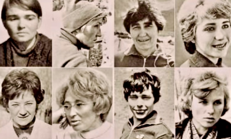
Shatayeva maintained radio contact with base camp, reporting dwindling supplies and frostbite. American climber John Roskelley and some nearby Japanese alpinists attempted a rescue but were repelled by the blizzard. Over two days, the women succumbed to hypothermia and exhaustion.
Shatayeva’s last radio message was: "I'm alone now, with just a few minutes left to live. See you in eternity."
All eight women perished, and climbers later found their bodies scattered along the summit ridge. The disaster, caused by inadequate gear and the ferocity of the storm, shocked the mountaineering community.
The deadliest mountaineering tragedy
In the summer of 1990, 45 climbers, primarily from the Leningrad Mountaineering Club, were at Camp 2 (5,300m) on what is now called the Razdelnaya Route on Peak Lenin's north face. The party included Soviet climbers Leonid Troshchinenko, Vladimir Voronin, and Alexei Koren (among others), six mountaineers from the former Czechoslovakia (including Miroslav Brozman), four Israelis, two Swiss climbers, and one Spaniard.
On July 13 at 9:30 pm, a 6.4-magnitude earthquake (with its epicenter in Afghanistan’s Hindu Kush) shook the Pamirs. It dislodged a serac from nearby Chapaev Peak, triggering a massive avalanche. Snow and ice hit Camp 2 on Lenin Peak, burying the climbers in seconds, and killing 43 people from five nations.
Koren and Brozman, who were positioned at the camp’s edge, survived with a broken arm and leg, respectively. They heard the trapped climbers’ cries as the debris froze into the glacial ice.
According to Charles Huss's report for the American Alpine Journal, a few other climbers were lucky to survive. Vladimir Balyberdin had decided at the last minute to move to Camp 3 with some friends, and six English climbers escaped because they had established their bivouac some distance from the main camp.
Rescue efforts
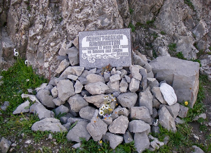
Soviet helicopters searched for the avalanche victims but initially could only recover one body. In 2004, because of glacial melt, human remains surfaced at 4,200m, with more emerging in 2008.
A plaque near the Achik-Tash base camp commemorates the victims of the 1990 disaster. It remains the deadliest single mountaineering accident in history.
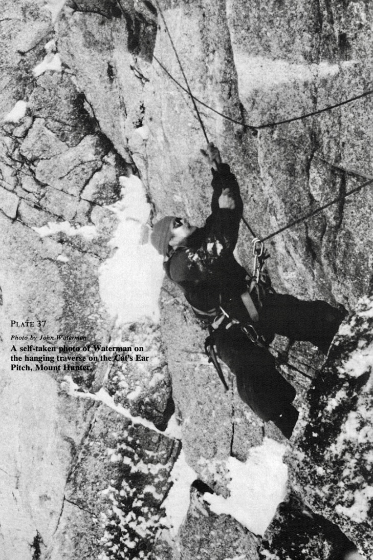
In 1978, American mountaineer Johnny Waterman completed the first solo ascent and traverse of Mount Hunter’s twin summits in Alaska. His grueling 145-day odyssey redefined the limits of solo mountaineering, showcasing incredible endurance and skill. We examine the climb, its significance, and Waterman’s legacy.
Johnny Waterman
John Mallon Waterman, better known as Johnny Waterman, was born in 1952. He grew up climbing with his father, Guy Waterman (a mountaineer and conservationist who also wrote several books about the outdoors), and his older brother Bill.
When Johnny Waterman was still in his teens, he began backpacking and rock climbing in New York and New England. He led a 5.10 route (Retribution) in the Shawangunk Mountains in New York State at 15. At 16, he climbed McKinley’s West Buttress with the Appalachian Mountain Club.
According to Bradley Snyder for the American Alpine Journal, Waterman was years ahead of mainstream mountaineering: "John might have coasted through mountains on sheer natural ability, but he took the craft of climbing seriously, and trained himself to be a fast, safe, consistent climber on any terrain."
Notable climbs
After high school, Waterman made trips to England, Scotland, Canada, the Alps, and Turkey, and carried out several remarkable ascents. In Canada, he made the second ascent of Snowpatch Spire’s South Face.
Waterman made the first solo ascent of the committing VMC Direct route on 1,244m Cannon Mountain in New Hampshire, a mind-blowing feat.
He ascended The Nose of El Capitan, soloed the Grand Teton’s North Face, and carried out the first south-to-north traverse of the Howser Towers.
He made the first ascent of Mount McDonald’s North Face and the first ascent of the East Ridge of Mount Huntington. On Mount Robson, he made the third ascent of the North Face.
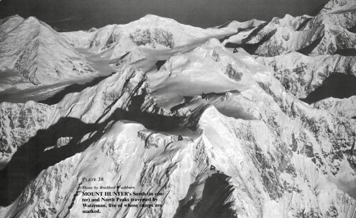
Mount Hunter
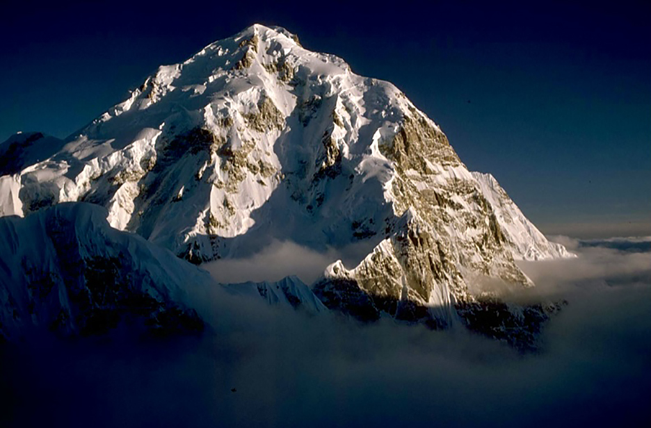
Mount Hunter (also called Begguya) is 13km south of Mount McKinley, in the Alaska Range within Denali National Park.
Begguya means child, or Denali’s child, in the local Dena’ina Athabascan language. It is famous for its technical difficulty, steep faces, and remoteness. Elite alpinists are drawn to its challenging routes, extreme weather, and beauty.
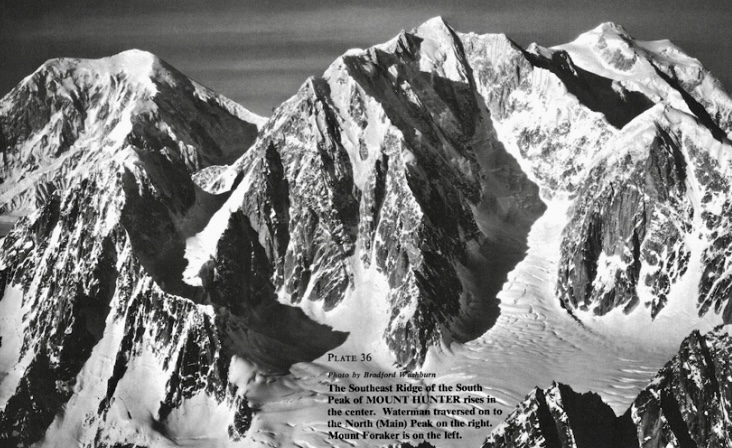
Mount Hunter has two summits: the North Summit at 4,442m and the South Summit at 4,255m. A high plateau connects the two summits, making the traverse an unusual challenge. Its climbing history features several bold ascents, technical innovation, and few summits, especially compared with McKinley.
Fred Beckey, Heinrich Harrer, and Henry Meybohm made the first ascent of Mount Hunter in 1954 via the west ridge from the Kahiltna Glacier. They topped out on the North Summit on July 3. Their multi-day route passed over crevassed glaciers, steep snow slopes, and a corniced ridge.
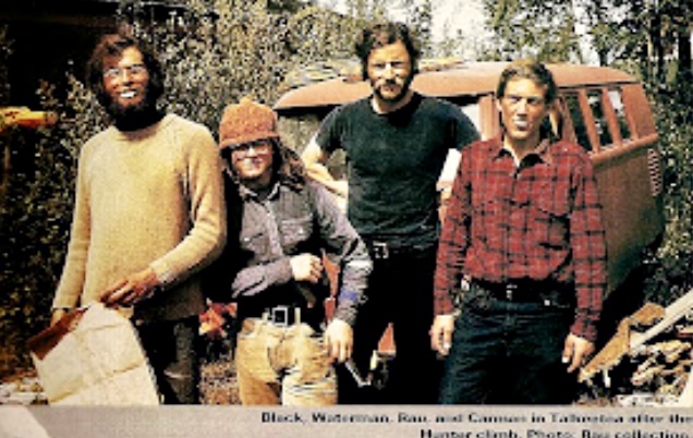
A bold attempt on Mount Hunter in 1973
In May 1973, Waterman and partners Dean Rau, Don Black, and Dave Carman attempted the first ascent of the south face-south ridge route of Mount Hunter. Waterman, then 21 years old, aimed for the 4,257m South Summit.
On May 29, Black, Waterman, and Carman were 61m below the South Summit when they mistakenly halted at a gendarme because of an approaching storm and confusion with the North Summit. (Rau had stopped lower down.)
Their route from the south col (3,200m) comprised three demanding sections: a complex lower rock ridge requiring 914m of rope and 40 anchors; a steep middle mixed face with ice-filled cracks; and an upper snow-ice ridge with unstable ice and minimal belays.
A storm trapped the climbers in a snow cave for days, with high winds and almost zero visibility. The climbers were running out of food, and Waterman had frostbite. The exhausted trio retreated from below the South Summit. Despite the failure, Waterman decided to return one day to solo Mount Hunter.
After 1973, Waterman moved to Fairbanks, Alaska. He preferred solo climbing because he struggled to find equally skilled partners, and possibly because of a tragic event in 1973. Johnny’s beloved brother, Bill, who had lost his leg in a railroad accident in 1969, disappeared in Alaska in 1973. Bill was only 22 years old.
After this, Waterman became more isolated and increasingly climbed solo.
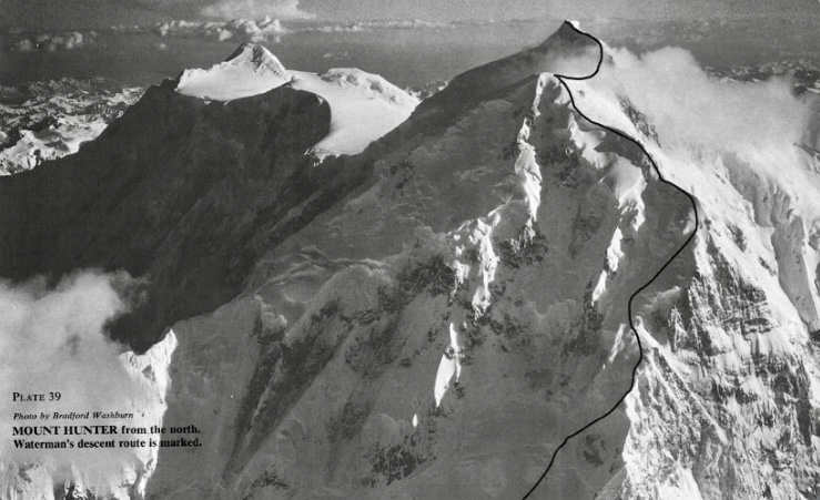
Mount Hunter solo traverse, 1978
Waterman returned to Mount Hunter alone in the spring of 1978.
"My vendetta with Mount Hunter started in the late 1960s, with Bradford Washburn’s pictures in the American Alpine Journal," Waterman wrote in his climbing report for the AAJ.
Driven by a decade-long obsession, Waterman began a solo south-to-north traverse. Starting on March 24 from the Tokositna Glacier’s cirque at 2,438m, he aimed to climb the 1,433m Central Buttress of the south face (referred to as the southeast spur in mountaineering literature), then traverse the summit plateau and descend the north spur.
He had 1,097m of rope and more than 350kg of gear, including food calculated to provide 5,000 calories a day.
The climb
Waterman adopted an expedition-style approach, shuttling his 272kg base camp up each section, reusing rope to cover a route requiring 3,658m. The ascent involved 12 camps and 12 round trips per section.
The Central Buttress was mostly snow and ice, with rock steps and a 107m rock cliff. Section one included a 366m gully, and section two tackled a 152m technical crux, including a 24m pinnacle and a 90m gully. On April 11, day 18, he reached Camp 3.
Next came a 488m corniced arete, featuring a 30m headwall and ice pinnacle, which he finished on May 6. The next section wasn’t easy, either. He climbed steep terrain, joining the south ridge at 3,871m on May 26.
During the climb, Waterman suffered frostbite, lost a contact lens, and had a lice infestation. He dealt with fraying ropes, cornice collapses, and food shortages, dropping to two-thirds rations by June. A resupply on June 20 (day 88) provided 36 days of food.
By June 12, he reached the summit plateau after navigating a 213m ice arete. He topped out on the South Summit on July 2 after 101 days. After traversing the two summits, he reached the North Summit on July 26.
He descended by the north spur, arriving at his fly-out site 43 days later. His solo expedition took an astonishing 145 days. According to his report, Waterman used 40 ice pitons, pickets, and flukes, and 20 rock anchors.
His new route was the first solo ascent and the first solo traverse of the peak. He endured loneliness, rage, and frustration, but persevered, managing limited food supplies to complete his climb.
After the climb, Waterman’s mental health deteriorated. He displayed obsessive and delusional behavior. His past climbing feats convinced him he was invincible.
Disappearance
In the spring of 1981, Waterman targeted McKinley solo via the East Buttress. He planned to climb up the northwest fork of the Ruth Glacier, a route prone to crevasses and avalanches. Waterman began on April 1, carrying minimal supplies. He was last seen on April 19 at 3,350m.
Helicopters and ground rescue teams found only some tracks and an abandoned campsite. He might have suffered a fatal crevasse fall, died in an avalanche, or, with minimal gear, perished of exposure. Waterman was 29 years old when he disappeared.
Aftermath
Waterman’s father, Guy Waterman, committed suicide in February 2000, intentionally freezing to death on Mount Lafayette in New Hampshire. Laura Waterman, Guy Waterman’s wife (and Johnny Waterman’s stepmother), created The Waterman Fund after his death. The fund promotes wilderness preservation through education, trail maintenance, and research. The present an annual Guy Waterman Alpine Steward Award, honoring those dedicated to protecting the region’s mountain wilderness.
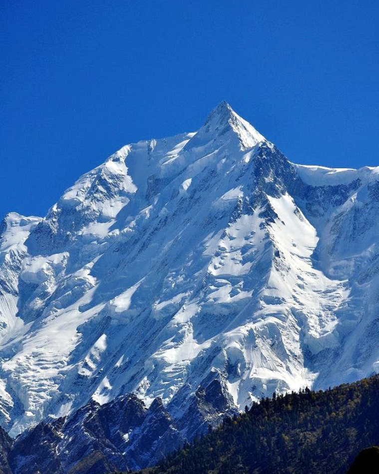
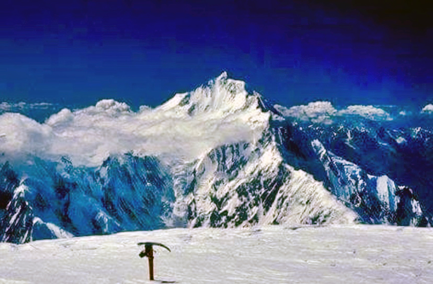
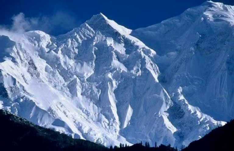
At 7,788m, Pakistan's Rakaposhi is a formidable peak that sees little climbing activity. Fewer than a dozen parties have topped out. Its steep slopes, technical difficulty, and unpredictable weather deter most climbers.
Rakaposhi is the 26th highest independent peak in the world and the 12th highest 7,000’er. It lies in the Lesser Karakoram mountains in Gilgit-Baltistan. The closest 8,000m peak is Nanga Parbat, roughly 110km south-southwest of Rakaposhi.
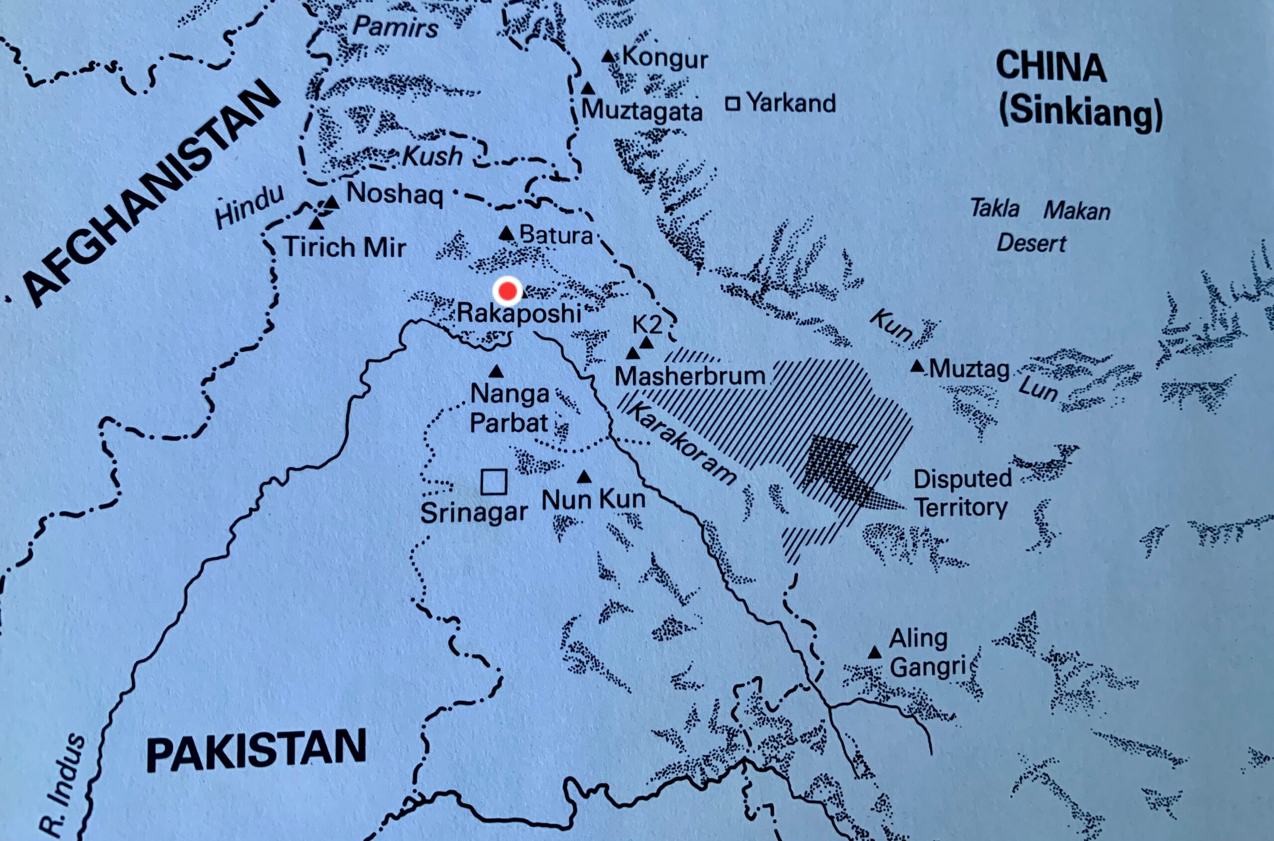
The mountain is also known by the name Dumani, which comes from the local Burushaski language. It translates to "Mother of Mist" or "Mother of Clouds" because the peak is often shrouded. The name Rakaposhi derives from a Burushaski term meaning "shining wall."
Rakaposhi rises 5,800m in just 11.5km of horizontal distance from the Hunza River.
The first foreign explorers arrived at the end of the 19th century. Martin Conway explored Rakaposhi's southern side in 1892. Conway concluded that although the upper part of Rakaposhi could be climbable, reaching the upper crest of the peak by any of the supporting ridges would be difficult and dangerous.
In 1938, British mountaineer and explorer Michal Vyvyan and his partner Reginald Campbell Secord approached the peak from the west. They ascended a small 5,800m forepeak at the end of the northwest ridge.
The first determined attempts
In 1947, Secord returned with Bill Tilman and two Swiss climbers to attempt the southwest spur. They abandoned their attempt at 5,800m, where a great gendarme blocked the route. From there, Tilman observed a 600m wall of snow and ice, which they called Monk’s Head.
The team then tried the northwest ridge. Later, they inspected the southeast face, the north face, and the east face but found them all impracticable.
In the summer of 1954, two expeditions arrived at Rakaposhi.
An Austrian-German party led by Mathias Rebitsch attempted the southwest spur. They reached 5,200m, but extreme snowstorms, high winds, and difficult ice conditions forced them to retreat. They agreed with Conway's conclusion from 60 years earlier: The mountain seemed unclimbable from that direction.
In the same season, an expedition from the Cambridge University Mountaineering Club led by Alfred Tissieres attempted the same route. They climbed the Monk’s Head but turned around in bad weather at 6,340m.
In 1956, Mike Banks led a four-man British-American expedition to Rakaposhi. They were the first expedition to go above 7,000m, reaching 7,170m on the southwest ridge. They made two further attempts later on that expedition but couldn’t progress higher.
"We were all much impressed by Rakaposhi," Richard K. Irvin recalled in his report for the American Alpine Journal. "It’s a very long climb, and it is a real climb, not just pushing along. This route certainly can be climbed to the summit, and there probably is no other way by today’s Himalayan standards."
The first ascent
In 1958, two years after his first attempt, Banks returned to the mountain, leading a British-Pakistani Forces Expedition that included Scottish mountaineer Tom Patey.
The climbers chose the southwest spur for their ascent. They established Base Camp on May 20 at 4,267m.
Over the next month, relentless snowfall, avalanches, and blizzards hampered their efforts to put up six camps to the summit. Despite the storms, the team set camps up to 5,791m. On June 20, seven climbers and some Hunza porters ascended the slope of Monk’s Head, and the porters carried loads beyond it.
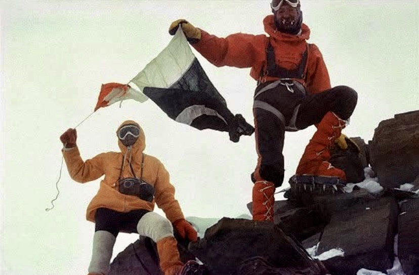
On June 23, three climbers carried supplies from 6,400m to 7,010m, allowing Banks, Patey, R.F. Brooke, and R.N. Grant to camp at 7,010m. On June 24, Brooke and Grant supported the summit party of Banks and Patey. Banks and Patey then established a high camp at 7,315m.
On June 25, Banks and Patey set out for the summit in a strong blizzard. Battling intense cold, they climbed for five hours and finally topped out.
Patey suffered minor frostbite on his hand and Banks on his feet. After summiting, the duo descended quickly to their high camp. Three days later, the entire team returned safely to base camp.
This first ascent of Rakaposhi was carried out without supplemental oxygen.
The first repetition of the southwest spur
The Belgian Club Alpin Beige Expedition repeated Rakaposhi’s southwest spur route in 1983. After great difficulty climbing the Monk’s Head slope, Bertrand Borrey, Daniel Bogaert, Arthur Delobbe, and high-altitude porter Sultan Ullah Baig topped out on August 2.
According to the expedition’s report in the American Alpine Journal, the climbers started an avalanche while descending. The avalanche swept away Michel Bodard, who fell 200m and suffered a broken leg and thumb, a punctured lung, a concussion, and multiple contusions. He was lowered to Camp 4 (at 6,400m), and two days later, a helicopter picked him up at 6,140m.
Their bad luck didn't end there. On August 5, high-altitude porter Sultan Ullah Baig insisted on descending alone to give his countrymen news of the summit success. He disappeared between Camp 2 and Camp 1. The team searched for five days but never found his body.
New route in 1979
On June 5, 1979, a Polish-Pakistani expedition led by Ryszard Kowalewski established a base camp at 3,810m in a side basin of the Biro Glacier.
On June 14, a gigantic ice avalanche from a collapsed wall devastated the tents at base camp, but the expedition continued. The party tackled the northwest ridge, previously scouted to 6,005m by an Irish expedition in 1964.
They set up Camp 1 on June 6, placing it at 4,907m at the base of the northwest ridge. They established Camp 2 at 6,203m on June 26.
The party then descended 61m to a snow terrace below the summit pyramid, where they set up Camp 3 at 6,500m. Crossing the terrace to a col at the end of the southwest ridge took between six and eight hours. Here, on June 30, they placed Camp 4 at 7,102m.
On July 1, Kowalewski, Pakistani climber Sher Khan, and Tadeusz Piotrowski climbed to the summit in 18 hours. The next day, after a miserable night with six in a tent, Andrzej Bielun, Jacek Gronczewski, and Jerzy Tillak also topped out, reaching the summit in only six hours.
On July 5, with the higher camps empty, Anna Czerwinska and Krystyna Palmowska summited unroped through wind and snow. This marked the second-highest "ladies-only" climb after Gasherbrum II in 1975 by Halina Kruger and Anna Okopinska. The two women climbed unroped because it was too cold for one to wait for the other.
The Polish-Pakistani success was the second documented ascent of Rakaposhi.
A solo climb
In 1995, Anibal Pineda of Colombia made a notable solo climb via the northwest ridge. According to the American Alpine Journal, Volker Stallbohm was the expedition leader.
The extremely difficult north spur
In the summer of 1979, a Japanese expedition from Waseda University arrived. Led by Eiho Otani, they summited via the north spur, a steep route on the north face.
They established their high camp on an ice step at 7,300m. From there, Otani and Matsushi Yamashita started their summit push. The duo bivouacked at 7,600m and summited on August 2. On top, they found evidence of the Polish ascent. The expedition climbed siege-style, with 5,000m of fixed rope, over six weeks.
This extremely difficult route had been attempted in 1971 and 1973, both led by Karl Herrligkoffer.
The same route saw its first alpine-style ascent in 1984. Canadians Barry Blanchard and Kevin Doyle and South African Dave Cheesmond survived lightning strikes that knocked them unconscious during their summit push. This was an outstanding ascent.
Other ascents
In the summer of 1986, a Dutch expedition climbed a variation of the northwest ridge. This route was a shorter line in the lower section and joined the 1979 Polish route at 6,000m.
In the summer of 1997, four members of an Iranian party summited via the southwest spur.
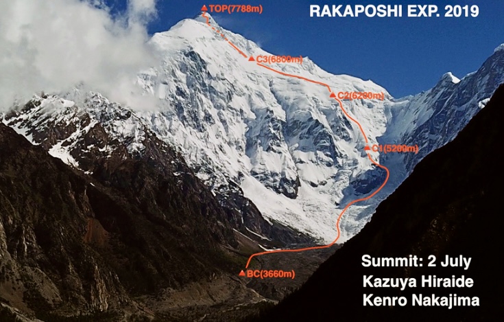
A Piolet d’Or climb
Another successful ascent took place in 2019. World-class Japanese climbers Kazuya Hiraide and Kenro Nakajima tackled the unclimbed south face before transitioning to the southeast ridge.
Starting from their base camp at 3,660m, Hiraide and Nakajima, climbing alpine style, reached 6,800m after three days. There, they waited out bad weather and summited on July 2 in a single day. They descended to Base Camp on July 3. In 2020, they were awarded the prestigious Piolet d’Or for their climb.
The last ascent of Rakaposhi was in September 2021. Czechs Jakub Vicek and Petr Macek, and Pakistani Wajidullah Nagri summited Rakaposhi via the southwest spur. The controversial expedition did not have permits and required a helicopter rescue.
In 1985, an Austrian expedition led by Eduard Koblmuller climbed Rakaposhi’s 7,010m east peak via the north buttress. On August 1, Koblmuller, Fred Pressl, and Gerald Fellner summited in alpine style. During the two-day descent, Fellner slipped at 4,700m in bad weather. He fell 100m down an ice slope and sustained fatal injuries. Despite medical attention, he died in the night.
Rakaposhi’s climbing history shows that even after decades, new routes remain for bold climbers.
The remarkable French alpinist Chantal Mauduit would have turned 61 today, but her passion for high-altitude mountaineering led to her premature death at age 34. Here, we explore her climbs and her fatal expedition to Dhaulagiri I.
Early life
Mauduit was born in Paris on March 24, 1964. At five, she moved with her family to Chambery in the Savoie region of the French Alps. This relocation introduced her to the mountains, where she began hiking in summer and skiing in winter.
At 15, her mother passed away from cancer. Seeking solace, Mauduit turned to climbing, starting with the Alps. By 17, she had already climbed the North Face of the Grandes Jorasses, the Drus, and the Matterhorn.
In the early 1990s, Mauduit ascended the Directissime Jori Bardill route on the Central Pillar of Freney in the Mont Blanc massif with Catalan climber Ernest Blade.
In July 1992, with Blade, Araceli Segarra, and Albert Castellet, she climbed the Bonatti Pillar on the Petit Dru. They finished the famous 800m route in eight hours. One year later, Mauduit completed the Walker Spur on the Grandes Jorasses in a single day from Chamonix.
In the mid-1990s, Mauduit did the Devies-Gervasutti route on the northwest face of Ailefroide Occidentale (3,954m) in the Ecrins massif. This 1,050m line is known for its remoteness and technical difficulty.
Next, Mauduit went to the Andes. She climbed 5,495m Nevado Urus and took part in an expedition to 6,768m Huascaran. She made the Sajama Traverse in Bolivia (6,542m) and ascended Mount William in Antarctica.
Himalaya and Karakoram
Her focus then shifted to the Himalaya, where she chose to climb without supplemental oxygen.
"Climbing without oxygen is my ethics. When you use [oxygen] during an ascent, you necessarily miss very strong, very intense moments, both visually and audibly. All the senses are then heightened," she told Le Monde newspaper.
On Aug. 3, 1992, aged 28, Mauduit summited K2 via the Abruzzi Route without supplemental oxygen. She became just the fourth woman to do so.
Her descent was harrowing. A storm caught her near Camp 4 at around 8,000m, and she became snowblind. Americans Ed Viesturs and Scott Fischer -- who had struggled to scrape together enough money for their expedition -- abandoned their summit bid to save her.
Controversy
Back at Base Camp, Mauduit didn’t thank Viesturs and Fischer but instead celebrated her summit success as if the rescue had never taken place.
"So now Chantal was celebrating with the Russians. We’d hear their cheers and revelry as we [Viesturs and Fischer] lay silent in our tents. Scott and I hadn’t been invited to the party," Viesturs wrote in his book No Shortcuts to the Top.
More big peaks
In 1993, Mauduit summited Shisha Pangma and Cho Oyu without supplemental oxygen, burnishing her 8,000m reputation.
On April 28, 1996, Mauduit topped out on 7,138m Pumori. After that, she climbed two 8,000m peaks in the same season. On May 10, she climbed Lhotse and reached the top alone, leading some to question her summit success because of a lack of proof. This climb took place during the infamous 1996 Everest disaster, and Mauduit witnessed the tragedy that killed several climbers, including Scott Fischer.
Ed Viesturs told Elizabeth Hawley of The Himalayan Database that he had seen Mauduit enter into a gully and return soon after, casting doubt on her summit. Mauduit's sponsors were likely pressing hard for her to succeed after her failure one year earlier on Everest. However, the summit was officially accepted, and she became the first woman to summit Lhotse.
Two weeks after Lhotse, Mauduit summited Manaslu, topping out alone again. According to Hawley, Mauduit was accompanied by Ang Tshering Sherpa, but Ang Tshering ran out of energy on their final push on May 24. He had been breaking trail for hours in deep snow. Mauduit's summit marked her fifth 8,000’er.
Her sixth 8,000m summit came in 1997 on Gasherbrum II, again without bottled oxygen.
In the autumn of 1996, Mauduit attempted Annapurna I but aborted above high camp in bad conditions.
Seven attempts on Everest
Between 1989 and 1995, Mauduit made seven attempts on Everest without bottled oxygen. She never summited the world's highest peak.
On her last attempt in 1995, she suffered serious altitude sickness. After almost collapsing during a summit push, she was carried down by fellow climbers and needed extra oxygen. This event, like the K2 rescue, drew criticism for her reliance on others.
Mauduit always pushed very hard, but on several occasions, she started strong but ran out of energy and needed help.
Despite these incidents, Mauduit’s successful 8,000m climbs without supplemental oxygen place her among the elite of her era.
Death on Dhaulagiri I
Mauduit had already attempted Dhaulagiri I in the autumn of 1997, but she aborted above high camp. In the spring of 1998, she returned to try again.
This was her last expedition. Mauduit and 45-year-old Ang Tshering Sherpa died, possibly between May 11 and 13. Climbers found their bodies in their tent at Camp 2 (6,500m). Ten Sherpas brought her body down, and it was flown to Kathmandu and then on to France.
During a summit push, other teams on the mountain had retreated to Base Camp because of avalanche danger and bad conditions. Yet Mauduit and Ang Tshering stayed in Camp 2.
An autopsy in France confirmed the cause of death as a broken neck, likely from a rockfall or small avalanche. The Italian climbers who found her body also believed this was the most likely cause of death.
Ed Viesturs was also on Dhaulagiri that season and suggested carbon monoxide poisoning from a stove could have killed her. He reasoned that there were no clear signs of an avalanche at Camp 2.
The Italian climbers had found Mauduit and Ang Tshering's tent covered in snow. They had to dig the tent out to look inside and found the pair in their sleeping bags. This accumulated snow might have broken Mauduit’s neck, the Italians suggested. Yet Ang Tshering's neck was not broken.
Mauduit’s family and friends chose to trust the results of the autopsy.
A poetic soul
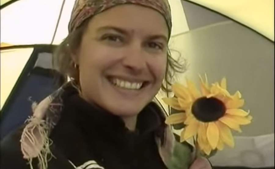
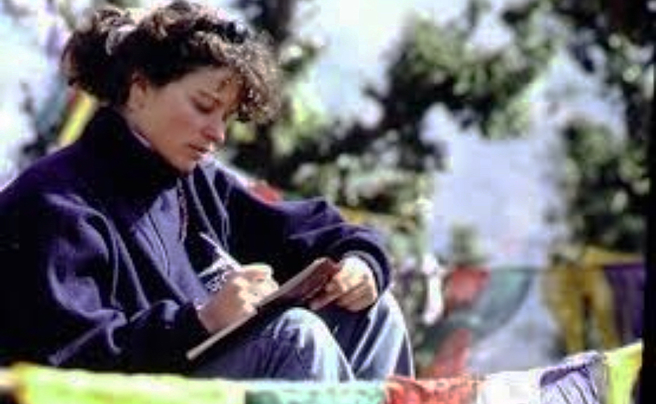
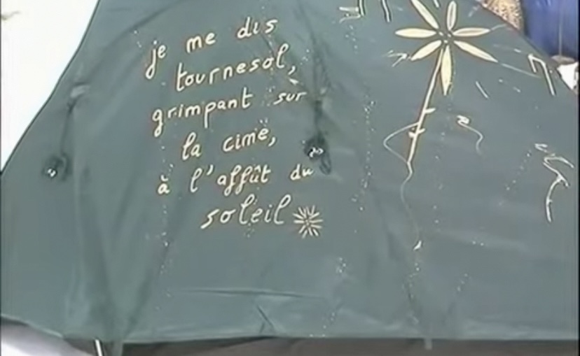
Mauduit studied physiotherapy but abandoned it for a life in the mountains, living nomadically between expeditions. She carried books by Rimbaud and Baudelaire on climbs, wrote poetry on her tent, and spoke about her experiences with lyrical depth.
In 1997, she published J’habite au Paradise (I Live in Paradise), a book blending impressions of her climbs with reflections on the cultures she encountered.
"Chantal Mauduit was a very interesting woman,” Elizabeth Hawley once wrote. "When she arrived here, she named each of her expeditions after a flower she had drawn on her tents. She was flamboyant."
Mauduit’s approach to mountaineering was unconventional. She prioritized personal experience over logistical teamwork. But her infectious optimism and comfort in the mountains earned her admiration. Viesturs wrote that everybody loved Mauduit for her happy character.
After her passing, friends and family founded the Association Chantal Mauduit Namaste, which established a school in Kathmandu, honoring her generosity toward Nepalese communities.
Below is a short video showing something of her character.
On March 22, 1966, American climber John Harlin fell 1,000m to his death on the Eiger’s North Face. He was just 600m from completing his ambitious Direttissima route. Fifty-nine years later, we look back at his career, marked by innovation and a deep connection to the Alps.
From fine arts to pilot
John Elvis Harlin II was born in Kansas City on June 30, 1935. He graduated from Sequoia High School in California and later attended Stanford University, majoring in fine arts and dress design. In the early 1950s, Harlin began climbing.
Later, he joined the U.S. Air Force where he trained as a pilot, flying jet-fighter bombers.
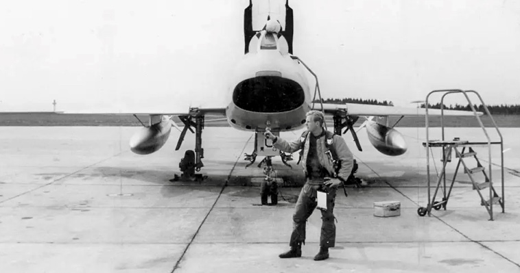
During his Air Force service, Harlin was stationed in Europe. In 1954, he made his first trip to the Alps. Just 19, it marked a turning point in his life. That year, he attempted the Eiger North Face by the Heckmair route but didn’t succeed. The climb began a lifelong obsession with the peak.
He married Marilyn Harlin, and they had two children: son John Harlin III and daughter Andrea Harlin. In the early 1960s, the family moved to Switzerland and Harlin immersed himself in the alpine climbing community.
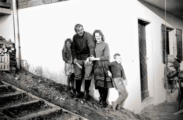
First American to climb the Eiger North Face
In the summer of 1962, Harlin became the first American to climb the North Face of the Eiger. He ascended via the 1938 Hechmair Route with German climbing partner Konrad Kirch. The climb took several days and required exceptional skill and endurance.
The same year, Harlin attempted the central Pillar of Freney in the Mont Blanc Massif, a steep granite route first climbed by Chris Bonington’s team in 1961.
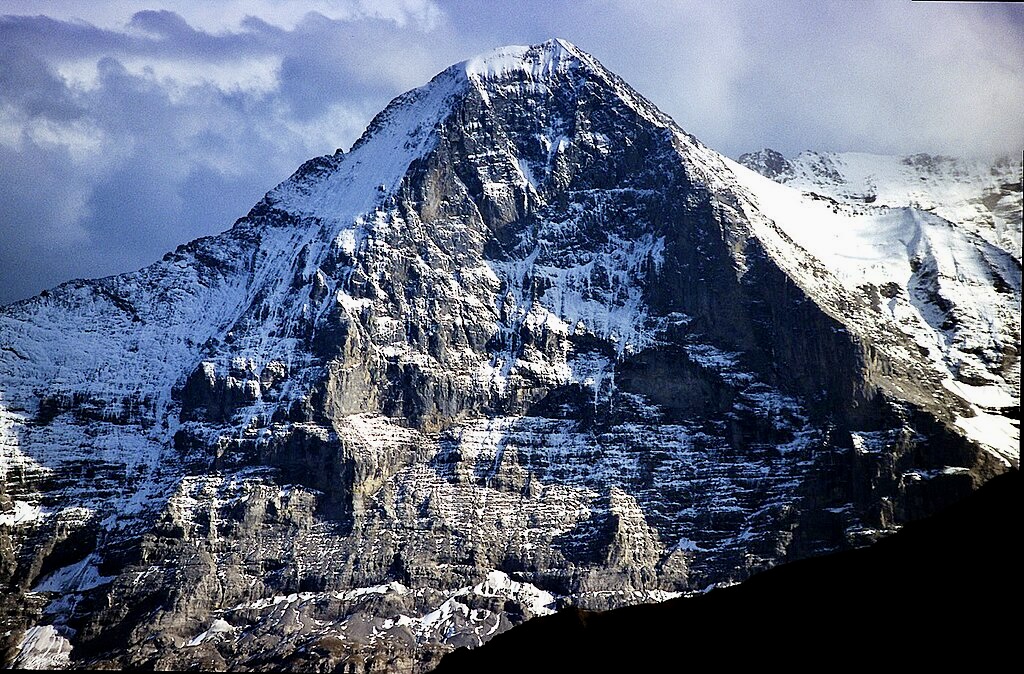
Other notable climbs in the Alps
In 1963, alongside American climbers Gary Hemming, Tom Frost, and Stewart Fulton, Harlin made the first ascent of the South Face of the Aiguille du Fou in the Mont Blanc massif. This climb was a technical masterpiece, involving steep rock and ice.
In 1964, Harlin, Chris Bonington, and Rusty Baillie climbed the northeast ridge of Cime de l’Est in the Dents du Midi in the Valais region of Switzerland.
In 1965, Harlin and Royal Robbins made the first ascent of the American Direct route on the West Face of the Aiguille du Dru, a steep and committed line that demanded advanced rock and ice skills.
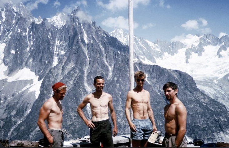
In June 1963, Harlin became the Director of Sports at the American School in Leysin, Switzerland. He also founded the International School of Modern Mountaineering.
Locally, Harlin earned the nickname Blond God. He was an excellent athlete, a member of the all-American Services football team, and, when younger, the junior wrestling champion of California.
Return to the Eiger
In the 1930s, many viewed the Eiger North Face as a crazy objective.
"The forcing of the Eigerwand [North Face] is principally a matter of luck, at least 90% of the latter is required," Dr. Hug, a Swiss member of the Alpine Club, said at the time. "Extreme forms of technical development, a fanatical disregard of death, staying power, and bodily toughness are, in this case, details of merely secondary importance."
Colonel Strutt, the retiring President of the Alpine Club, agreed. "The Eigerwand continues to be an obsession for the mentally deranged of almost every nation. He who first succeeds may rest assured that he has accomplished the most imbecile variant since mountaineering first began," Strutt said in his farewell address.
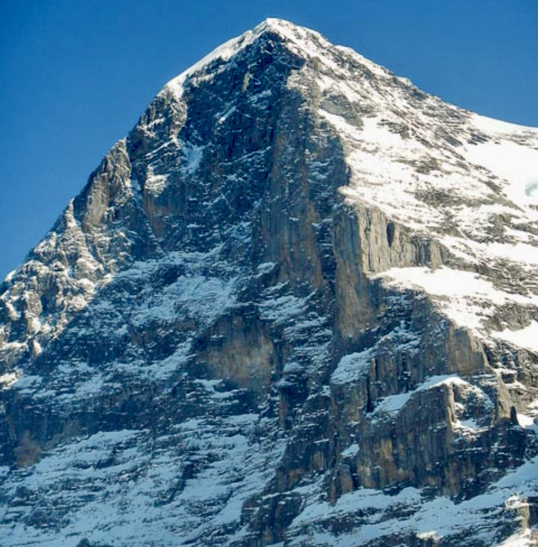
The North Face of the Eiger, rising 1,800m from its base to the summit at 3,967m, is notorious for its steepness, loose rock, and deadly weather. But it was finally ascended for the first time in 1938 by a four-man team that included Anderl Heckmair and Ludwig Vorg from Germany and Heinrich Harrer and Fritz Kasparek from Austria. The Heckmair route features ice fields, rock bands, and high exposure.
A German-Austrian party that included Toni Hiebeler, Walter Almberger, Anderl Mannhardt, and Toni Kinshofer made the first winter ascent of the Heckmair route in March 1961.
One year after his initial ascent of Eiger’s North Face in 1962, Harlin started to think about a direct line up the face.
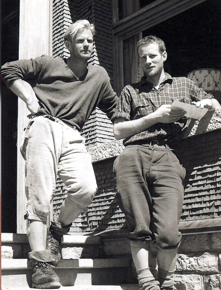
The team
Harlin made several reconnaissance climbs on the North Face. Finally, in February 1966, he organized a strong team. The group featured Colorado rock specialist Layton Kor (famed for his big-wall climbs in Yosemite), Scotsman Dougal Haston (known for Scottish winter ascents and prior Eiger climbs), experienced UK alpinist Chris Bonington, and Don Whillans in support. Don Whillans later withdrew from the expedition after a disagreement with the team.
In early February, Harlin’s party headed to Kleine Scheidegg, where journalist Peter Gillman would report on the ascent.
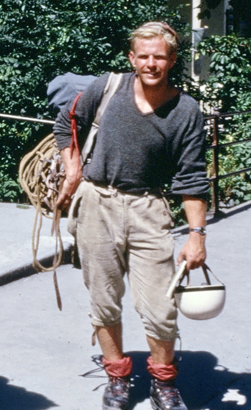
There had been rumors that a German team had their eyes on the same objective. At Kleine Scheidegg, it became clear that the teams would be rivals, with both keen to be the first to finish a direct line on the North Face.
The German team included leader Jorg Lehne, Gunter Strobel, Klaus Huba, Sigi Hupfauer, Karl Golikow, Rolf Rosenzopf, Gunther Schnaidt, and Peter Haag.
Harlin’s party aimed for an alpine-style dash, weather permitting, while the Germans planned a relentless ascent with fixed ropes, regardless of conditions.
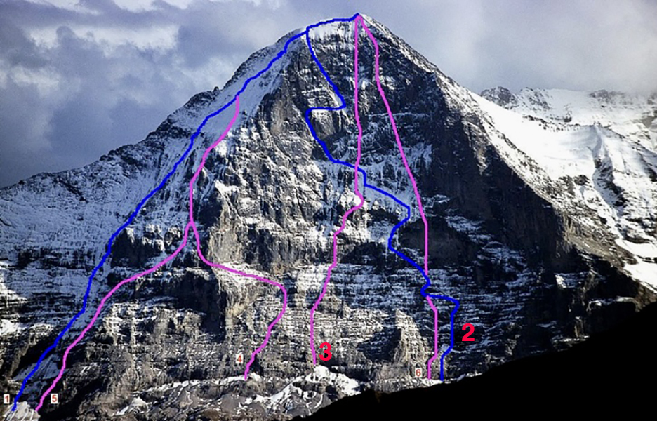
Starting the climb
Both teams began on Feb. 2, 1966, establishing base camps near Kleine Scheidegg.
The Germans fixed ropes systematically and advanced higher each day. Harlin’s smaller team pushed when the weather allowed, often climbing parallel to the Germans.
Both teams faced brutal winter storms, sub-zero temperatures, and frequent snowfall. Additionally, there was the danger from the North Face itself, offering exposure to rockfall and avalanches.
By mid-March, both parties had fixed ropes up to around 3,400m. Around March 15, after weeks of rivalry, the teams began sharing ropes and bivouac sites, prompted by harsh conditions and mutual respect. Harlin and Lehne negotiated a loose alliance, though separate summit pushes remained the goal.
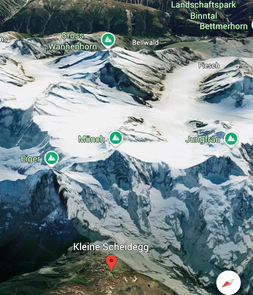
The fall
On March 22 at around 10:00 am, Harlin was ascending a fixed rope alone. He was on his way to join the others, approximately 610m below the summit, at 3,360m. But the 7mm rope snapped, likely because of wear, ice damage, or rockfall. Gillman, who was at Kleine Scheidegg watching the climbers with a telescope, saw Harlin fall 1,000m to his death.
The British-American team was devastated. Kor descended soon after, effectively leaving the climb. Haston and Bonington stayed, determined to finish.
The Germans, higher on the face when the accident occurred, learned of Harlin’s death by radio and offered support. The tragedy catalyzed a full merger of the two teams, and they would now go for the summit together.
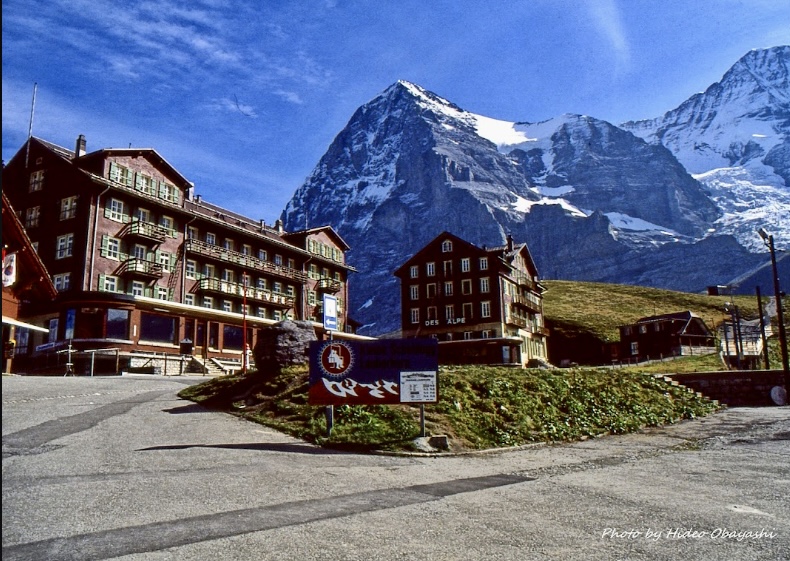
The John Harlin Direct
On March 25 at 2:30 pm, Haston, Lehne, Strobel, Hupfauer, and Huba reached the summit after a final 200m push. A storm hit the mountain after they summited, forcing a grueling descent via the West Flank, completed over two days.
The climbers, some suffering serious frostbite, named the line The John Harlin Route.
"When John Harlin fell to his death from the Eiger on March 22, 1966, the world of mountaineering lost one of its brightest stars. In the not quite thirty-one years of his life, Harlin had forged a career that was unique in ambition and achievement," James Ramsey Ullman wrote in the American Alpine Journal.
For further details on Harlin and the 1966 climb, we recommend reading Eiger Direct by Peter Gillman and Dougal Haston.
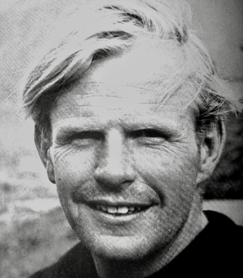
Mount Waddington, an infrequently climbed peak in British Columbia’s rugged Coast Mountains, was initially known as the Mystery Mountain because of its remoteness. This is the story of early expeditions to this fortress of ice and stone.
Hard to reach
At 4,019m, Mount Waddington is the highest mountain entirely within the Canadian province of British Columbia. Taller peaks, such as Mount Fairweather and Mount Quincy Adams, lie on the British Columbia–Alaska border.
Approximately 300km northwest of Vancouver, Mount Waddington is surrounded by deep valleys and glaciers. Even approaching it is a great adventure over extreme terrain, ice fields, and difficult peaks. Early explorers often compared the area to the Himalaya, and many films set in the Himalaya were filmed in the Waddington Range.
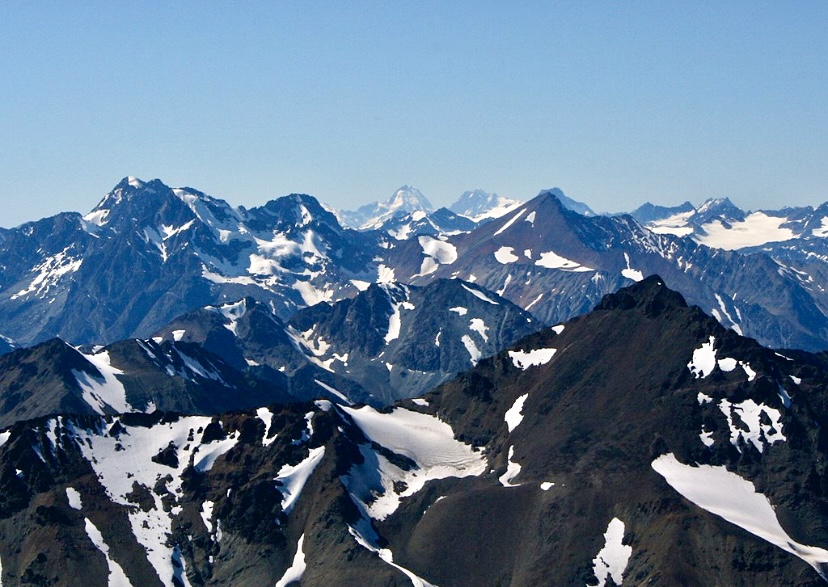
Discovery
Don and Phyllis Munday were a renowned Canadian mountaineering couple with experience in the Pacific Northwest, Rockies, Selkirks, and the Coast Mountains. Between the 1920s and the 1940s, the Mundays climbed more than 150 peaks, with over 40 first ascents. In 1924, Phyllis became the first woman to summit 3,954m Mount Robson, the highest peak in the Canadian Rockies. She climbed with Annette Buck, and Don Munday also summited.
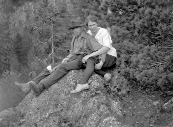
In 1925, Don and Phyllis Munday spotted a huge peak from Mount Arrowsmith on Vancouver Island. It is unclear if this was Mount Waddington, but their observation sparked exploration of the Waddington Range. The Mundays were the ones who dubbed that distant peak Mystery Mountain.
Authorities officially named Mount Waddington in 1928, following the recommendation of the Mundays. Alfred Waddington was an industrialist who advocated for a road and railway through the region.
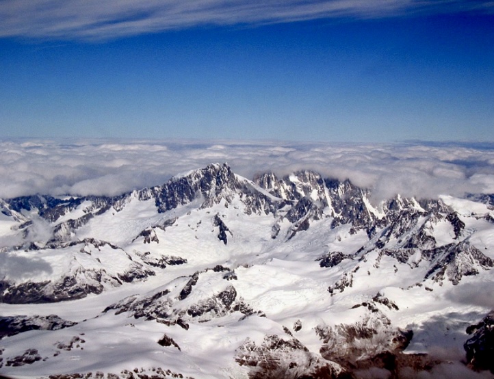
The Mundays' attempts
For over a decade, the Mundays made several attempts to climb Mount Waddington, the most important of which was their 1928 expedition.
The couple began from the Franklin Glacier on the southwest side and ascended via the northwest ridge. On July 8, they reached the lower northwest summit at around 4,000m. There, they concluded that reaching the main summit would be too dangerous.
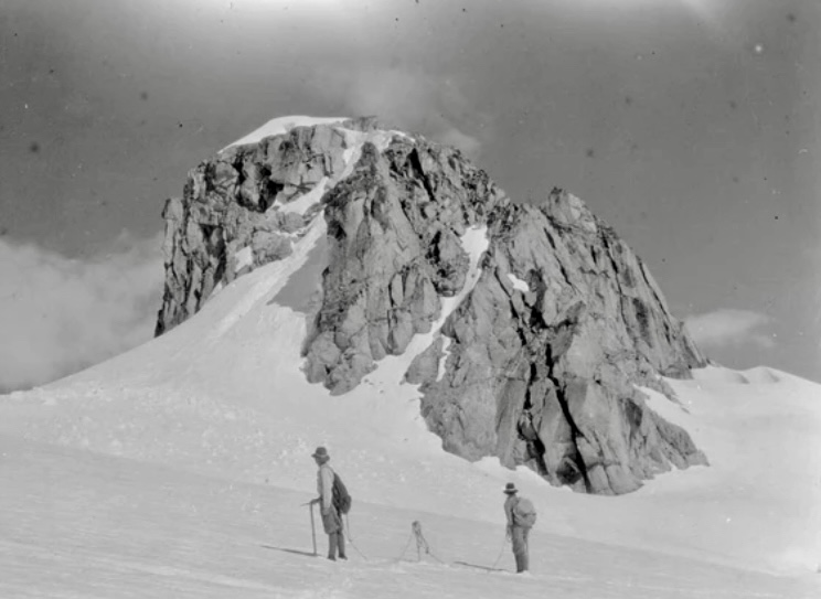
Tragedy in 1934
In the summer of 1934, a party from British Columbia, including Neal Carter, Alan Lambert, Alec Dalgleish, and Eric Brooks, likewise approached the mountain via the Franklin Glacier. They targeted a couloir on the south face leading toward the southeast ridge.
They reached 3,700m, but the expedition was called off after Dalgleish fell to his death on June 26. The accident happened only three days after they had established base camp.
Other attempts
In the same year, a Winnipeg-based team attempted to ascend via the Tiedemann Glacier and the northwestern flank. The party turned around 180m below the summit because of bad weather on June 28, 1934.
In 1935, climbers from California made three attempts from base camp at Dais Glacier, including two tries via the South Face. They failed to summit because of bad weather and technical difficulties. Their highest point was around 3,500m. During a third attempt, two climbers reached the northwest summit, first climbed by the Mundays in 1928.
According to climber Fred Beckey, there were 16 attempts on Mount Waddington before its first ascent. However, Beckey didn’t list all 16 attempts in his writings.
Fritz Wiessner and his small team
In the spring of 1935, alpinists Bill House, Elizabeth Woolsey, and Alan Wilcox started to plan an expedition to the Coast Range. A year later, German-American Fritz Wiessner joined the trio and led the small team to attempt the still-unclimbed Waddington in the summer of 1936.
Wiessner’s team learned that the British Columbia Mountaineering Club (BCMC) and the Sierra Club of California had joined forces. As a combined party, they were planning to climb Mount Waddington at around the same time.
According to Bill House’s report in the American Alpine Journal, after a meeting between the leaders of both groups, they agreed that the mountaineering clubs would attempt the climb first. Both teams targeted the South Face, with the BCMC-Sierra Club team setting up base camp at Icefall Point on the Dais Glacier.
The BCMC-Sierra Club team did not succeed. They couldn’t find a viable route up the face on difficult terrain.
The South Face
The South Face, broken up by three couloirs, is known for poor route conditions and falling ice. An 800m granite wall of complex rock, snow patches, narrow couloirs, and mixed icy sections complicate the climb.
After a challenging approach via the Franklin Glacier, Wiessner’s team established their base camp on July 14, 1936. Like the BCMC-Sierra Club team, they chose Icefall Point (1,787m) on the upper Dais Glacier. Icefall Point is a spur of heather-covered rock. According to House, it’s the last place where a party can find firewood and running water.
Woolsey and Wilcox helped carry loads to camp but wouldn’t join the summit push.
On July 20, Wiessner and House started up via the left branch of a couloir between the main summit and the northwest peak. They eventually retreated because of poor rock conditions.
So instead, they then headed to the right of the South Face. By 2:45 am on July 21, Wiessner and House were on their way toward the summit from their high camp. They climbed the 305m upper section of ”forbidding-looking” rock in 13 hours.
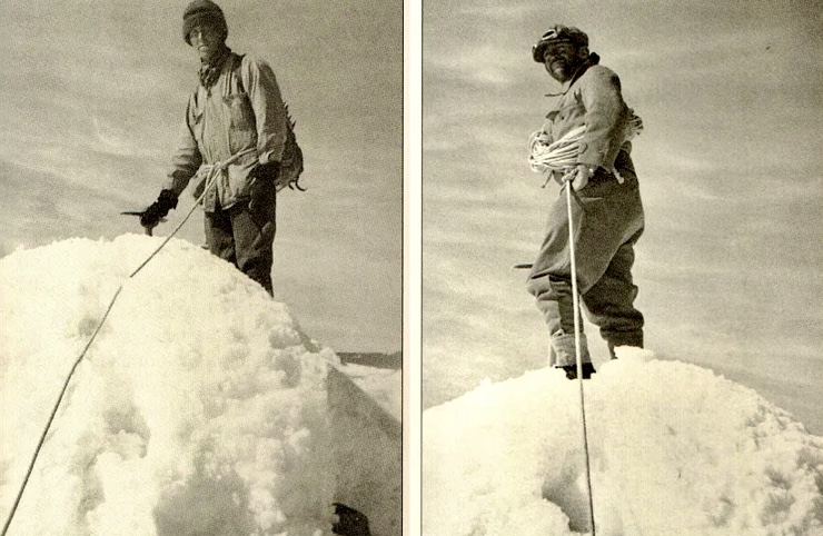
The summit
On July 21, Wiessner and House topped out.
”It is a hopeless task, as every mountaineer knows, to try to do justice to one’s feelings at the summit of a difficult peak. Probably relief is the most dominant one at the time,” House recalled.
On the top, they left a summit register in a waterproof match can. Wiessner and House descended by the same route and reached base camp on July 22 at 2:00 am. Their round trip took just over 23 hours.
It was a lightweight, alpine-style ascent using minimal, rudimentary gear (18 pitons). This contrasted with earlier expeditions, which tended to be large, complex affairs.
Wiessner and House demonstrated that the ”unclimbable” could be climbed. The 1936 first ascent marked the culmination of years of exploration and ticked off one of the last major unclimbed summits in North America.
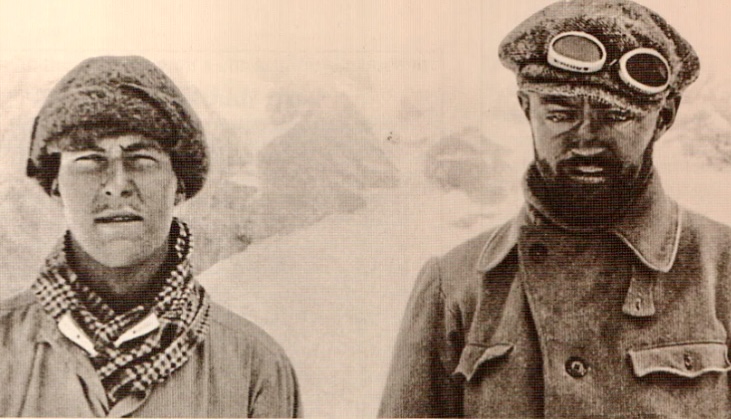
Two teens target Mount Waddington
In 1942, six years after the first ascent, 19-year-old Fred Beckey and his 16-year-old brother Helmy Beckey decided to climb Mount Waddington's South Face. With World War II underway, resources were few, and the Beckey brothers had no sponsors or porters, only their parents’ vague approval.
"Long behind seemed the months of preparation, conditioning climbs, and first ascents made in the Northern Cascades of Washington in June,” Fred Beckey wrote.
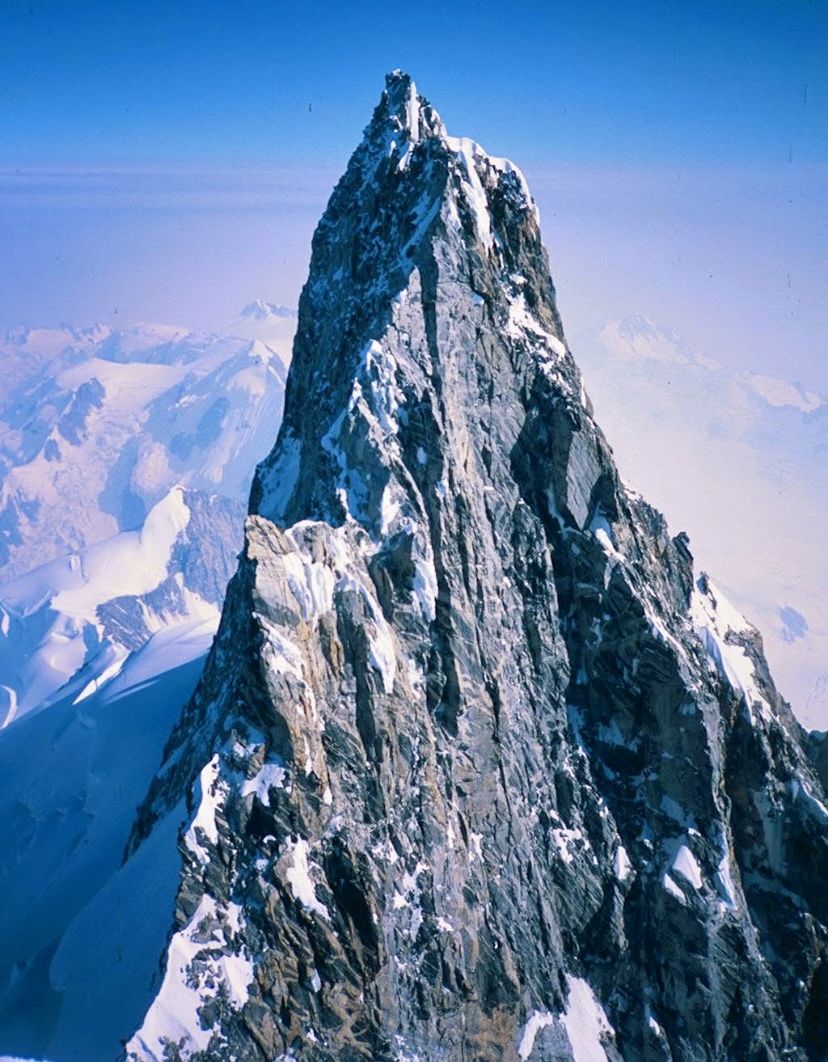
With climber Eric Larsson, the brothers started their multi-stage journey from Seattle. Traveling via bus to Vancouver, then steamship to Knight Inlet, and finally via a smaller boat to the Franklin River delta, they approached overland on foot.
After several days of travel from the coast, they reached the Franklin Glacier. Crossing required 32km of unsupported glacier travel. The approach added more than 2,000 vertical meters and weeks of effort to their adventure.
On the second day on the Franklin Glacier, Larsson fell ill and had to quit. The Beckey brothers continued and established base camp on the glacier below Waddington’s southwest face on July 20.
The ascent
The brothers decided to attempt the South Face route slightly to the right of the chimney climbed by Wiessner and House.
They traversed the glacier, navigating crevasses and icefalls to reach the base of the face. They carried minimal gear and moved in a lightweight style. Then they climbed to a higher camp to position themselves for a summit push. That process took a couple of days in complex terrain and worsening weather. When conditions allowed, they moved up quickly.
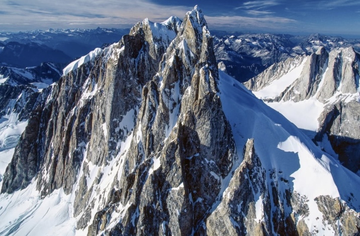
On the upper face, Fred Beckey changed to tennis shoes with felt pullovers to mount the rock slabs.
"The pullovers adhered well to the rock when wet and could be removed quickly for more friction on dry rock," Fred Beckey wrote in his report. (The term ”pullover’ refers to an improvised covering for the shoes.)
As they climbed, ice fragments broke off the summit ridge and thundered down the chimneys to their left.
On August 8 at 8:30 pm, Fred and Helmy Beckey topped out on the main summit. It was one day after Helmy’s 17th birthday. On the summit, they found Wiessner and House’s match-can register. It was the second ascent of the mountain.
During the descent, Helmy was hit on the knee by a rock as they descended into the gap between the northwest and the main peaks.
"This was Helmy’s birthday present, donated by Mount Waddington,” Fred said. ”Any hope of reaching camp that night was gone because of a heavily bleeding cut.”
The next day, they continued their descent and reached base camp.
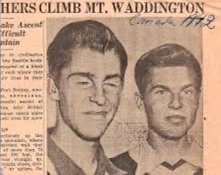
Legacy
The Beckey brothers' feat was outstanding. Fred continued his climbing career and made hundreds of first ascents in North America. He also wrote a dozen books, hundreds of climbing reports, and several climbing guides. He dedicated his life to mountaineering and died at 94.
Colin Haley, who in 2012 made the first solo ascent of Mount Waddington, wrote about Fred Beckey for the American Alpine Journal:
"Fred was without a doubt the most accomplished climber ever to come out of North America and is among the all-time greats, right alongside figures such as Riccardo Cassin, Hermann Buhl, Lionel Terray, Walter Bonatti, and Reinhold Messner."
In 1996, Fred Beckey, John Middendorf, and Calvin Herbert made the first ascent of a peak in the Cathedral Mountains in Alaska. They named it Mount Beckey.
We recommend watching the documentary Dirtbag: The Legend of Fred Beckey, by Dave O’Leske.
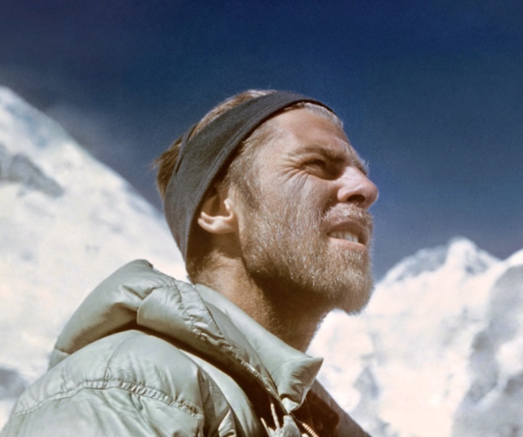
In 1967, Mount McKinley (Denali) witnessed two pivotal moments in mountaineering history.
In Part I of this series, we told the story of McKinley’s first winter ascent. Later that same year, during the summer season, the mountain saw one of the worst tragedies ever on a North American peak. This is the story of the 1967 summer season on McKinley.
(Writer’s note: Following the Associated Press style guide, I will use the name McKinley in these pieces.)
A record number of ascents
In 1967, 10 expeditions attempted Mount McKinley, making it the most successful year on record. Almost all of the expeditions' members topped out.
In summer, two teams aimed to summit via the remote Muldrow Glacier route, first ascended by the McKinley pioneers in 1913. The Muldrow Glacier route is considered more difficult than the West Buttress route for logistical and technical reasons.
The route begins on the north side of McKinley and requires a 63km trek from Wonder Lake to the base of the glacier. From the base near McGonagall Pass at 1,750m, climbers gain 4,440m to McKinley’s summit at 6,190m. The Muldrow Glacier features complex glacier travel in heavily crevassed terrain, usually requiring constant roped navigation.
The key section of the route, Karstens Ridge is a narrow, exposed ridge that joins the Harper Glacier, adding more crevasse hazards. The ridge is also particularly vulnerable to high winds. Unsurprisingly, the 1951 West Buttress route became the common route up McKinley rather than the tricky Muldrow Glacier-Karstens line.
Wilcox expedition
The Wilcox expedition, led by 24-year-old Joe Wilcox from Utah, was the first of the two teams attempting the Muldrow Glacier route. He looked for climbers to join him via climbing newsletters. His party eventually included nine members: Wilcox, Jerry Clark, Steve Taylor, Dennis Luchterhand, Mark McLaughlin, Anshel Schiff, Hank Janes, John Russell, and Walt Taylor.
It was a young group, with everyone between 22 and 31 years old. Most came from the Pacific Northwest. They all had basic mountaineering skills but hadn’t climbed higher than 4,550m.
Colorado expedition
Howard Snyder, 22, led the Colorado expedition, the second team on that route. With Snyder were Jerry Lewis, Steve Lewis (Jerry’s brother), and Paul Schlichter.
Like the Wilcox group, this was a young team. However, Snyder and his partners had more mountaineering experience and had climbed at higher altitudes.
Just before their departure on June 21, the team was reduced to three when Steve Lewis broke his arm in a car accident.
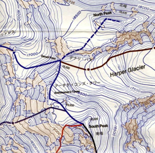
The National Park Service (NPS) was skeptical about the Wilcox expedition because of its limited high-altitude experience. They suggested Wilcox merge his group with Snyder’s party. Thankfully, this also suited Snyder because NPS rules stated there should be at least four members in an expedition group. The merger occurred on June 22, and Wilcox took command of the 12-person team.
July 16: the key day
The merged group started their trek in from Wonder Lake. In early July, the climbers made steady progress, establishing camps and ferrying supplies. Most of them experienced altitude sickness but tried to adapt. By July 13, the group had set up camp on the Harper Glacier.
On July 15, Wilcox, Snyder, Schlichter, and Lewis started a summit push from their high camp at 5,456m. They reached the summit at 6:30 pm in good weather, with a clear sky and light winds. After spending over an hour on top, they descended to high camp by 9:50 pm.
On July 16, all 12 members were at high camp when 113kph winds picked up, forcing everybody to remain at camp. This temporarily stalled plans for a second summit push by Clark, Luchterhand, McLaughlin, Janes, Russell, and the two Taylors.
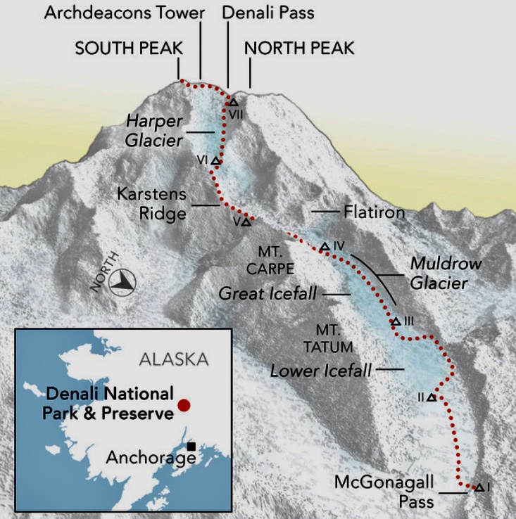
The second summit bid
Park rangers reportedly warned Wilcox of an approaching storm. They projected it would hit around July 16 or 17, but the group continued with their summit plan, perhaps underestimating the storm's severity.
On July 17, the second group, led by the 31-year-old Clark, went for the summit. The group that had summited two days earlier descended to a lower camp at 4,572m.
The wind had subsided as Clark and company set off. Steve Taylor remained at high camp because of altitude sickness. That night, strong winds started on the upper slopes. The summit group stopped to bivouac, hoping for better weather the next morning.
On July 18, at 11:30 am, Clark radioed to say that he, McLaughlin, Walt Taylor, Janes, and Luchterhand had topped out in a whiteout. John Russell's situation was unclear; he didn’t summit and might have turned back during the push.
Clark said that they would start to descend in 10 minutes. They never radioed again.
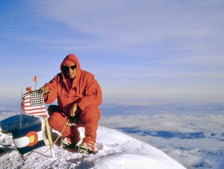
The biggest storm in 100 years
The storm kept getting worse. A high-pressure system from the south clashed with a moist low-pressure system from the north, creating the biggest storm ever recorded on the mountain. It would last seven days, to July 25.
Near the summit, the wind was 160–240kph, with still-air temperatures of -26ºC.
Those below the summit, on the upper section of McKinley, were trapped. The other members, who had already descended from their summit bid, spent the seven-day storm at a lower camp. They tried to stay warm by huddling together.
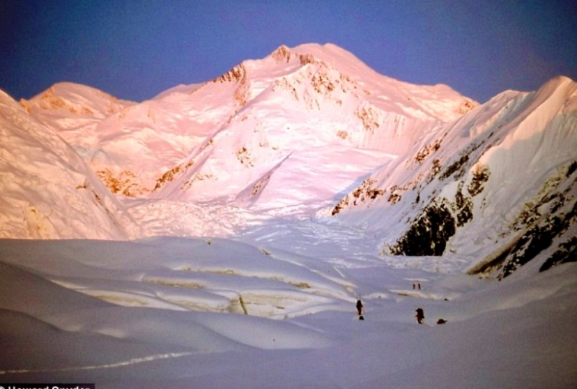
The seven climbers higher up had no chance of survival. Jerry Clark (31), Steve Taylor (22), Dennis Luchterhand (24), Mark McLaughlin (23), Hank Janes (25), John Russell (23), and Walt Taylor (24) all died. The five climbers at the lower camp made it down alive after the storm ended.
Several days after the storm, two bodies were found at Archdeacon’s Tower below the summit. The NPS located another body at high camp holding a tent pole. Their bodies could not be identified because of decomposition. The other four climbers were never located.
The three bodies were left on the mountain. In 1968, an expedition tried to find the victims but found no remains.
Conclusions
The original Wilcox team had no proper high-altitude experience. Experienced alpinists might have better gauged the risk or built snow caves.
Another problem could be that the team divided on the mountain after the first summit on July 15. This split the stronger climbers (who had already summited) from the less experienced climbers.
Later, Snyder criticized Wilcox for this split. Wilcox defended the split as a chance for everyone to summit, but Snyder argued that it weakened the team’s ability to respond as a unit. As a merged group, the team lacked cohesion.
The rangers’ warning about bad weather is also key. Wilcox claimed the notice he received was vague and didn't mention how fierce the storm would be.
The tragedy was the result of an extraordinary natural event and human decisions that amplified the risk. Seven relentless days caused exhaustion and hypothermia. National Weather Services later called the storm a once-in-century event. Possibly no team, regardless of skill, could have faced it effectively high on the mountain.
This was less about gross negligence and more about the limits of human judgment against nature’s extremes. McKinley's power was unforgiving.
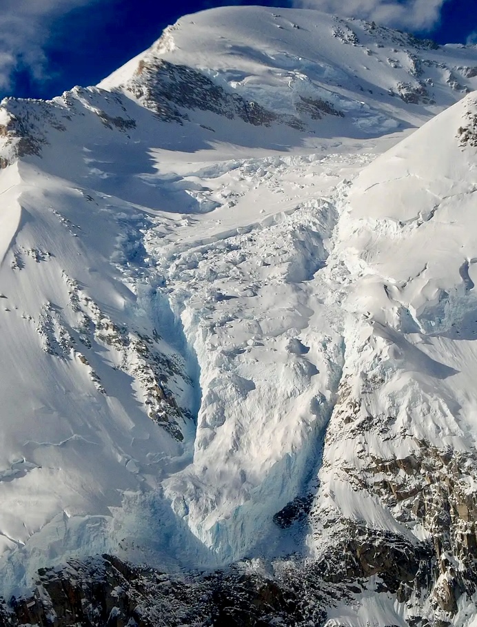
Comparing the 1967 winter and summer expeditions
It is interesting to compare this summer expedition with McKinley's first winter ascent from February of the same year. Gregg Blomberg’s winter party had much more experience and enough collective knowledge to handle extreme conditions.
The winter team's decision to construct an ice cave below the summit was pivotal. The small cave was an important shelter that protected them from the worst of the wind. However, the July hurricane was much stronger than the February storm.
Mental strength is another important factor in a week-long hurricane at high altitude, in subzero temperatures, with frostbite setting in. Only strong mountaineers are capable of thinking clearly in these circumstances. Most people without experience on high mountains simply can’t react as assertively.
Luck
Luck also plays a major part. It was pure chance that the storm arrived during the July team's most exposed moment. Weather forecasting in 1967 could not predict its exact onset, and the rangers’ warning didn’t pinpoint the critical hours. The five who summited earlier, on July 15, were lucky to have made it to the top. By making it down in time to a lower camp, they missed the worst days.
However, it’s important to listen to the mountain and retreat when there are signs of changing weather. The key day was when all 12 members were at high camp, trapped by the weather, with the July 15 summiters unable to descend and the rest of the team unable to ascend.
Aftermath
The 1967 tragedy led Denali National Park to modify climbing protocols, including requiring parties to register in advance, document their mountaineering experience and readiness, carry two-way radios, and contact park officials when the climb is over.
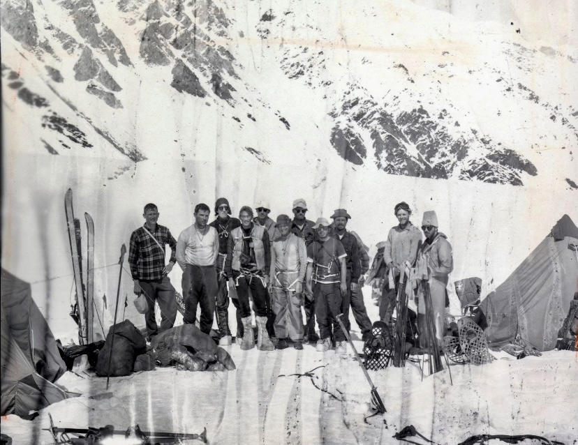
In 1967, Mount McKinley (Denali) witnessed two pivotal moments in mountaineering history.
In February, a group of climbers embarked on a grueling quest for the first-ever winter summit. Five months later, a sudden, violent storm tested another team, resulting in one of the worst tragedies ever on a North American peak.
In this two-part series, we revisit these two 1967 expeditions. This is Part I, the story of McKinley's first winter ascent.
(Writer’s note: Following the Associated Press style guide, I will use the name McKinley in these pieces.)
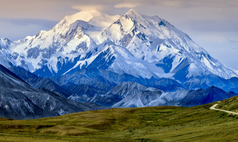
McKinley's first ascent
North America’s highest peak, McKinley (6,190m) is located within the Alaska Range in Denali National Park.
It was first summited on June 7, 1913, by a team led by Hudson Stuck and Harry Karstens. Walter Harper and Robert Tatum were key team members. Harper, a young Athabascan climber, first stepped onto the summit. Harper insisted on calling the mountain Denali.
The first summiters followed the Muldrow Glacier route, approaching from the northeast and continuing along Karstens Ridge and the Harper Glacier (both named later).
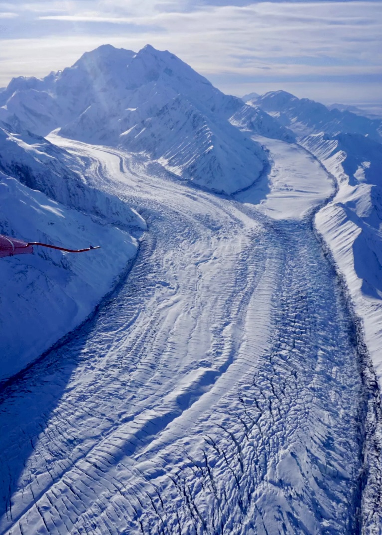
First ascent of the West Buttress
A team led by Bradford Washburn made the first ascent of the West Buttress route on June 17, 1951. This expedition marked a significant milestone, as the West Buttress became the most popular and accessible route to the summit.
Washburn had explored and photographed the route in the 1940s, identifying the West Buttress as a less technical alternative to the Muldrow Glacier. It required mostly snow and ice climbing but was still challenging because of crevasses and weather risks.
The West Buttress route approaches the mountain from the southeast, starting by landing on the Kahiltna Glacier in a small bush plane. The key features are the West Buttress ridge, Windy Corner, and the upper slopes near Denali Pass.
By the end of 1966, McKinley was still unclimbed in winter.
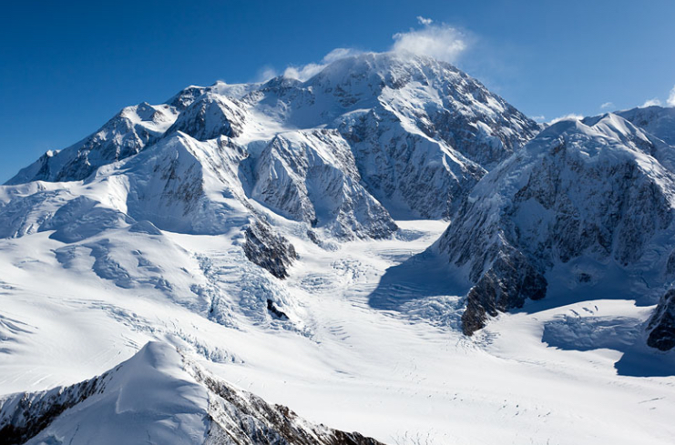
The 1967 team
In 1965, Art Davidson and Shiro Nishimae from the Osaka Alpine Club began to explore the idea of a McKinley winter attempt.
The Winter 1967 Mount McKinley Expedition consisted of eight climbers: U.S. climbers Gregg Blomberg (leader), Art Davidson, Dave Johnston, John Edwards, and George Wichman, Shiro Nishimae of Japan, Ray Genet of Switzerland, and Jacques Batkin of France.
Many climbers of the era believed a winter climb of McKinley was impossible. But these eight mountaineers relished the idea of facing the cold, lack of light, storms, and bad weather.
Pilot Don Sheldon dropped them on the southeast fork of the Kahiltna Glacier on Jan. 29, 1967.
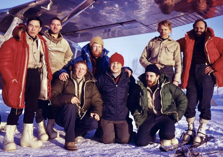
Starting in good spirits
The climbers would face the West Buttress route. "[We felt] that the lack of technical difficulty would be compensated for by the weather," Blomberg recalled in his report for the American Alpine Journal.
It’s important to note that the route certainly isn’t easy. The elevation gain from base camp to the summit is more than on most 8,000m peaks.
Blomberg’s party started the climb unroped on the flat open expanse of the Kahiltna Glacier. They would resort to roping up when conditions warranted it.
The team atmosphere was great from the beginning.
"The darkness of our first night was no match for the intense happiness and comradeship inside the tent," Blomberg wrote. "Our laughter spilled out onto the snow with the light of the Coleman lanterns. The jabber of the group in their many accents was music to my ears."
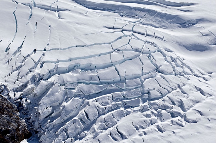
Tragedy strikes
Progressing toward one of their first camps, each climber kept his own pace. In a moment, Davidson fell into a crevasse. Fortunately, he was unhurt.
"The small hole my body had punched in the surface of the glacier was the only indication that a crevasse, probably a whole system of crevasses, sprawled before me," Davidson wrote.
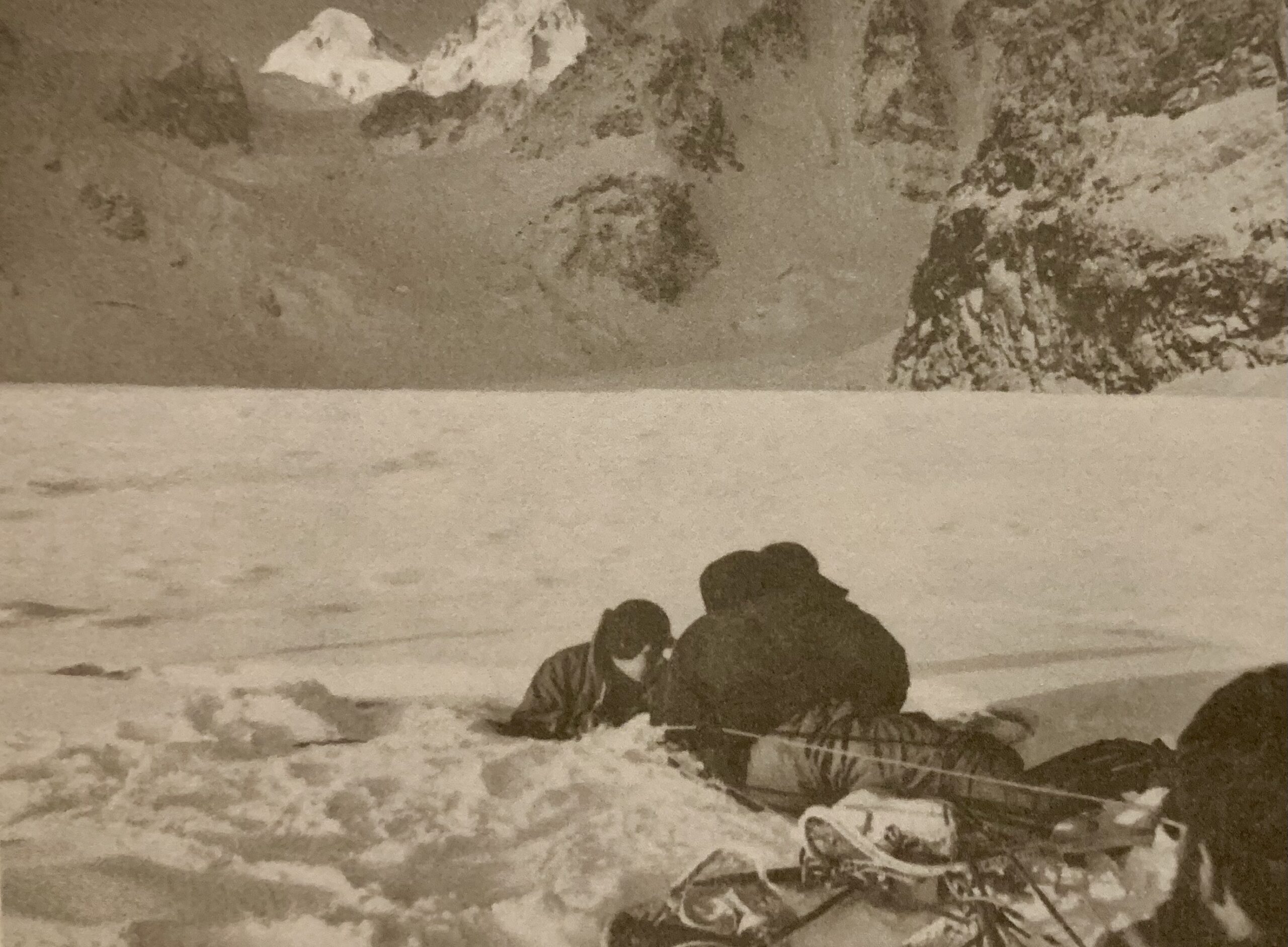
On January 31, tragedy struck. While part of the team reached their new campsite and started to set up, they realized that Batkin had disappeared. Batkin had been carrying a load to camp when he fell into the same crevasse that Davidson had narrowly escaped earlier.
The team tried to help Batkin, but he had died in the fall, and several resuscitation attempts failed.
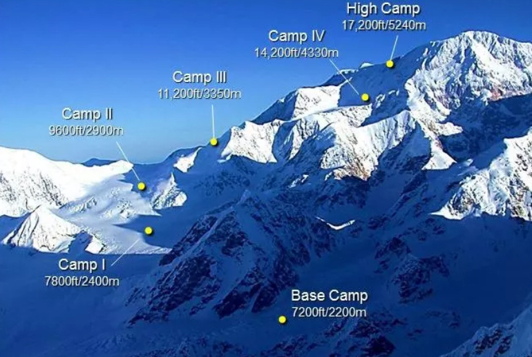
"That evening, there were seven of us in the two tents, yet how very alone each of us felt," Blomberg wrote.
The team was about to quit the expedition. However, after meditating, they wrote a press release as follows: "Jacques Batkin died in the pursuit of a winter ascent in which he truly believed. We will continue the attempt with his spirit and presence very much in mind."
Progressing on the route
Later, Edwards also had a close call when he fell into a crevasse in an area they considered safe. Fortunately, he was tied to one of his partners, and the rope caught him.
After a few stormy days, they had more than a week of good weather and established Camp 3: a three-unit igloo-plex below the Kahiltna Pass at about 3,000m. Kahiltna Pass marks a key milestone; it is often where teams establish an early camp and is a transitional point on the West Buttress route between the lower glacier and upper basin.
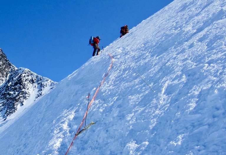
By the end of the eight days of good weather, the party had set up Camp 5 at about 4,300m. At this camp below the West Buttress, the climbers built two igloos almost entirely above the snow, with entrances below floor level. Because Camp 5 lies in a south-facing basin, it receives the brief but beautiful winter sun.
Over the next two days, they had to wait out the poor weather before continuing. The climbers progressed gradually and reached 5,240m. There, they established their highest camp. First, they used a tent, and later, they dug a snow cave into almost rock-hard snow. This camp would be key when returning from the summit.
Denali Pass
On February 26, the climbers left Camp 5. From the ridge, they ascended to Denali Pass at around 5,547m. It is a high, exposed col, situated between McKinley’s main summit and the slightly lower South Summit.
Above Denali Pass, they saw that McKinley’s summit had clouded over, and 300m below, they stopped to discuss their options. The climbers decided to descend. But the weather tricked them. As soon as they reached their high camp, the peak cleared.
The next day, the five climbers set off again. After reaching Denali Pass, Nishimae and Blomberg prepared a bivy site for the others and returned to high camp.
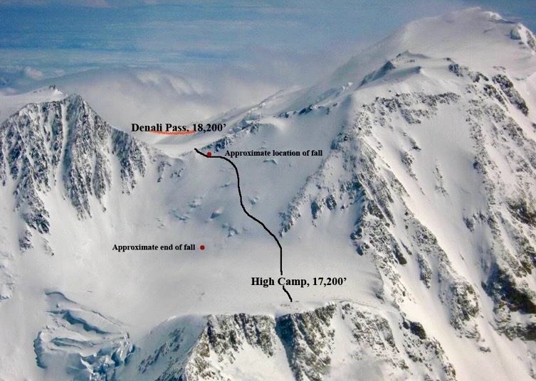
Summit
Davidson, Genet, and Johnston topped out on February 28 at about 7 pm. The three climbers grabbed each other in a three-way hug and shouted: "We made it!"
"We have looked forward to the view from the summit, but there was only darkness in every direction," Davidson said.
Before descending, they hollowed out a hole in the snow and buried Batkin’s hat in tribute.
More trouble
By midnight, Davidson, Genet, and Johnston reached Denali Pass. There, they carved a small cave into the mountainside for shelter as the weather deteriorated. It was the beginning of a seven-day ordeal as they waited out a violent storm.
By now, the expedition was split. Blomberg, Nishimae, Edwards, and Wichman were at 5,240m and had no way to communicate with the three summit climbers.
On March 1, Blomberg and Nishimae tried to reach Davidson, Genet, and Johnston but could not progress far in the hurricane-strength winds.
"The fury of the storm made it suicide to go further," Blomberg recalled.
There was no option but to keep faith that the storm would eventually weaken. For now, both groups were trapped.
Recipe for survival
There is no concrete recipe for how to survive a storm at altitude. Davidson, Genet, and Johnston's only sustenance was courage and determination.
"We were exultant, not from any sense of conquering the wind, but rather from the simple companionship of huddling together in our little cave while outside in the darkness, the storm raged through Denali Pass and on across the Alaska Range," Davidson said.
For the three trapped climbers, the low air temperature outside their cave combined with the intense wind to create a windchill equivalent of -100ºC. Fatigue and frostbite took hold, and they were about to run out of food.
Descent
On the fourth day, Blomberg and Edwards began their descent from high camp. They hoped to get a helicopter back to the Pass at the first opportunity. The two climbers reached Camp 5 on March 5 and later arrived at Base Camp and radioed out. Meanwhile, a whole series of rescue operations began.
After a week, the storm had finally stopped, and on March 7, an army plane sighted three climbers descending Denali Pass. Davidson, Genet, and Johnston were alive.
The three spent the night at Camp 5. The next day, military helicopters plucked them from the peak, along with Edwards and Blomberg, and flew them to Talkeetna. Rescuers also picked up Nishimae and Wichman from Camp 3 on March 9.
Aftermath
Genet became an important figure in the development of commercial expeditions to McKinley. But he died on Everest on Oct. 3, 1979, while descending from the summit with a client. Both died of exposure, exhaustion, and frostbite.
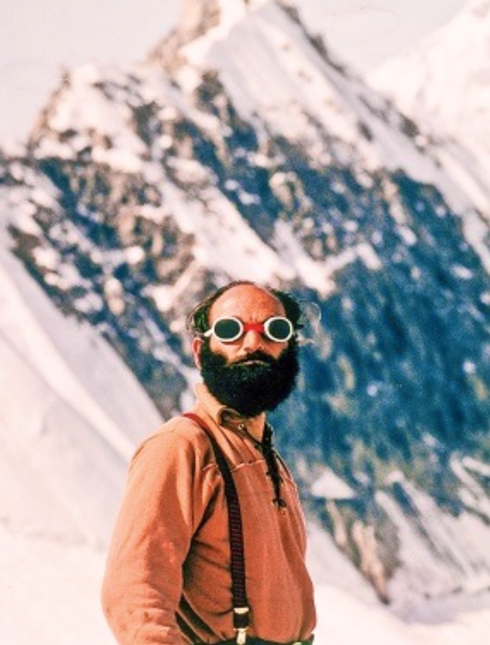
On June 21, 1991, Genet's son, 12-year-old Taras Genet, became the youngest person to summit McKinley.
Ten years later, on June 17, 2001, Galen Johnston, son of Dave Johnston, summited McKinley at age 11 with his parents. He still holds the record for the youngest person to summit McKinley.
Art Davidson has written an account of this expedition called Minus 148 - The First Winter Ascent of Mount McKinley, which is well worth reading.
We will publish Part II tomorrow.
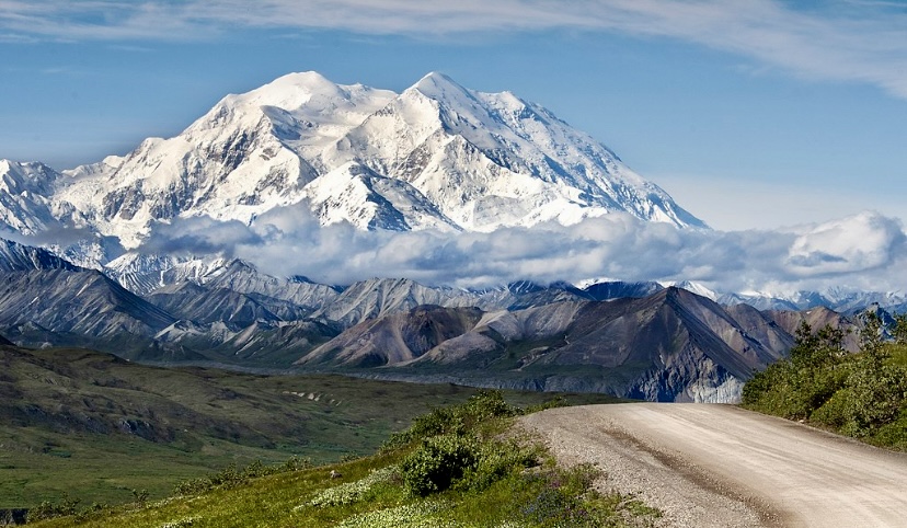
Many people associate Noel Odell’s name with George Mallory and Andrew Irvine on Everest in 1924 because he was the last person to see them alive. That expedition became the most famous mystery in mountaineering history, with Odell’s testimony a key feature.
Odell’s other expeditions are less well-known, but he was a tireless explorer and climber who did his last ascent at the age of 93.
Geology and first climbs
Odell was born on Dec. 25, 1890, on the Isle of Wight, off the southern coast of Britain. Odell became interested in geology as a teen, attended Brighton College, and then studied geology at the Royal School of Mines.
In the early 1910s, before the war, Odell started to develop his climbing skills in North Wales. In 1916, at 25, Odell joined the Alpine Club and started to test himself in the Alps.
In 1919, Odell carried out the first ascent of the Tennis Shoe route (HS 4b) on the Idwal Slabs in Snowdonia, Wales. Odell boldly soloed this now-classic multi-pitch trad route, which stretches 141m up the south-facing slabs in the Ogwen Valley, with minimal gear. This milestone demonstrated excellent climbing skills.
Over time, as other climbers repeated Odell’s line, they started to call it the Tennis Shoe. This is because the route relied on friction and the grippy nature of the Idwal Slabs’ rock. Climbers at the time often wore canvas shoes with rubber soles, similar to old-school tennis shoes.
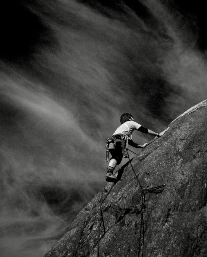
Spitsbergen, 1921
In the summer of 1921, Odell joined the Oxford University Spitsbergen Expedition, led by noted ornithologist Francis Charles Robert Jourdain. Its members included Tom Longstaff and Julian Huxley (brother of the famous writer Aldous Huxley). They aimed to complete a biological survey, with particular emphasis on the bird life of Svalbard.
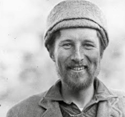
As a secondary goal, they attempted to sled across the central ice cap but only reached halfway because of delays and illness.
Odell contributed both as a geologist and as a key member of the sledding party. He was tasked with studying geological features, collecting rock samples, and analyzing the region’s tectonic and glacial history. During their ice cap crossing, Odell showed his endurance.
The 30-year-old also had a growing reputation as a climber.
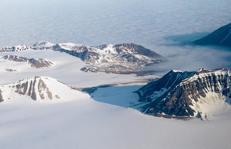
Irvine and Odell’s first encounter
Odell first met Andrew Irvine in 1919 on Foel Grach, a 975m Welsh peak. That day, Odell and his wife Mona were ascending the mountain when they spotted a teenager riding his motorcycle to the summit. It was Irvine. Irvine’s bold and unconventional spirit impressed Odell.
Their paths crossed again two years later. In the summer of 1923, Odell and Irvine joined another Spitsbergen adventure: the Merton College Arctic Expedition led by Arctic explorer Frederick George Binney.
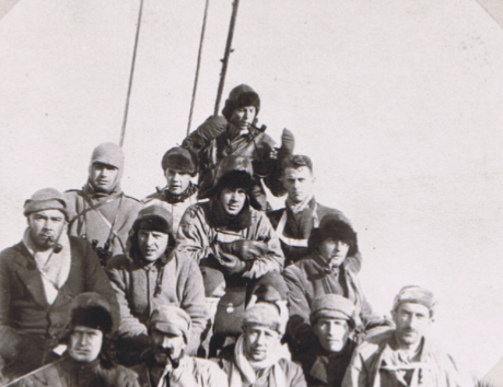
Odell realizes Irvine’s strength
During the 1923 Spitsbergen expedition, Odell was struck by Irvine’s remarkable strength and endurance and how well he handled challenging tasks. Odell later recommended Irvine for the 1924 Everest expedition despite Irvine’s lack of high-altitude experience.
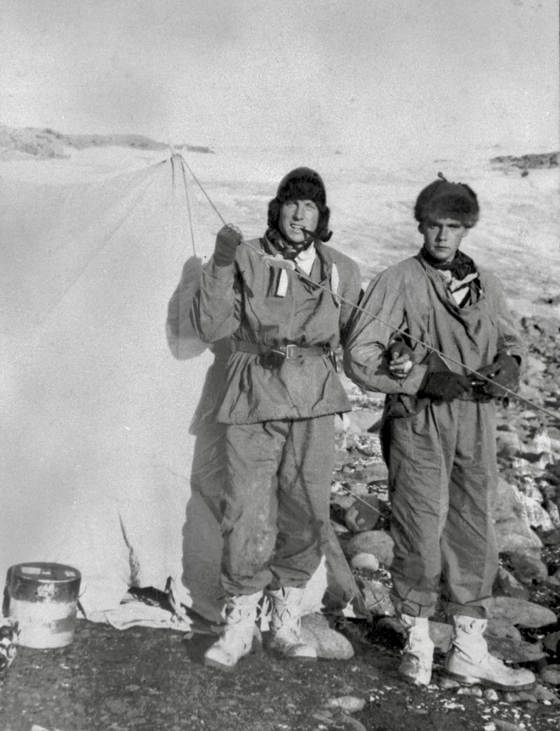
Everest 1924
Odell was the oxygen officer for the 1924 British Everest expedition.
On June 8, Odell was ascending the mountain in support of teammates Irvine and Mallory. At around 7,925m, near Camp VI, he caught sight of two tiny figures on the ridge near the summit. The figures were moving up.
This was the last confirmed sighting of Mallory and Irvine, who vanished soon afterward.
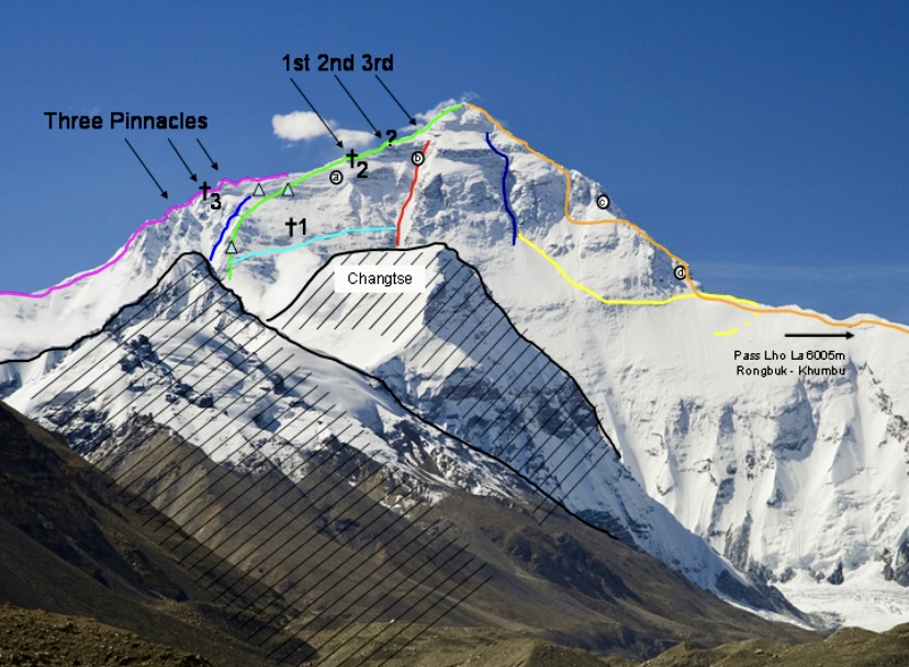
Odell spent 11 nights above 7,000m without supplemental oxygen. Twice, he climbed above 8,200m trying to find his partners.
Odell also found limestone containing fossils from the upper part of Everest, at around 7,770m. These were the first fossils identified on Everest. He later wrote about his findings, noting that Everest’s summit region was once part of an ancient ocean floor, uplifted over millions of years by tectonic forces.
First ascents
From 1928 to 1930, Odell taught geology at Harvard University. He proved a great inspiration to the recently formed Harvard Mountaineering Club.
During his time at Harvard, Odell climbed the ice gully in Huntington Ravine on Mount Washington in winter. The gully was named Odell Gully.
In the summer of 1930, Odell went to Canada. He climbed in the Selkirk Mountains and later, with C.G. Crawford and Terris Moore, made the first ascent of Mount Robson's difficult and technical south-southwest ridge.
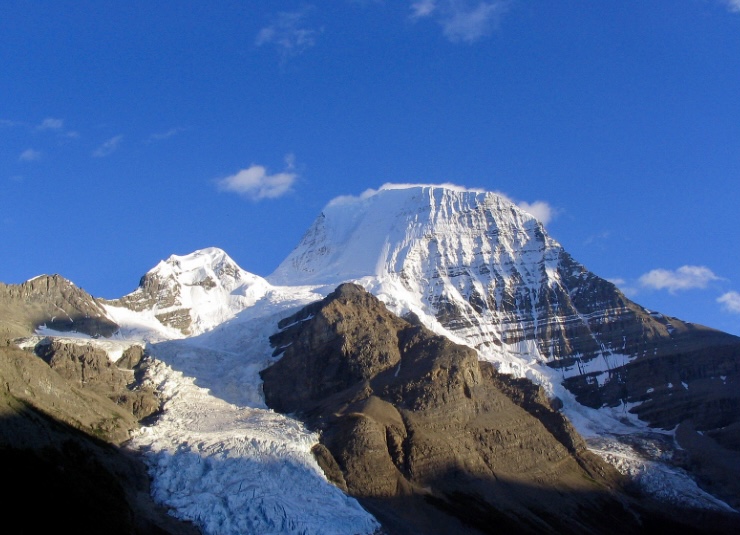
Labrador and Greenland
In 1931, he joined Alexander Forbes' American expedition to northern Labrador. They aimed mainly to map the area by air, but Odell also made several first ascents in the Torngat Mountains, including Mount Tetragona and Mount Razorback. Rising up to 1,652m, the rugged Torngats have the highest peaks in mainland Canada and the U.S. east of the Rockies.
In 1933, Odell was a member of an American scientific expedition to Northeast Greenland. There, with Walter A. Wood, he made 10 first ascents near Franz Josef Fiord and also the second ascent of Berenberg on Jan Mayen Island.
Nanda Devi
Odell's most important Himalayan expedition was to India's 7,816m Nanda Devi, the ”Blessed Goddess.” This peak is considered one of the most beautiful mountains in the world.
In 1905, Tom Longstaff and the Brocherel brothers attempted Nanda Devi from the east, but they did not succeed. There were a few more attempts, but by the beginning of 1936, the mountain was still unclimbed.
In the summer of 1936, Odell joined Charles Houston's British-American Himalaya Expedition to Nanda Devi.
"God! It’s good to be back," Odell exclaimed during the approach trek.
"Odell was accompanied by a great number of scientific instruments whose name I do not know and whose purpose I could not guess," Houston wrote.
On August 29, Bill Tilman and Odell made the first ascent of the main peak of Nanda Devi via the southwest ridge.
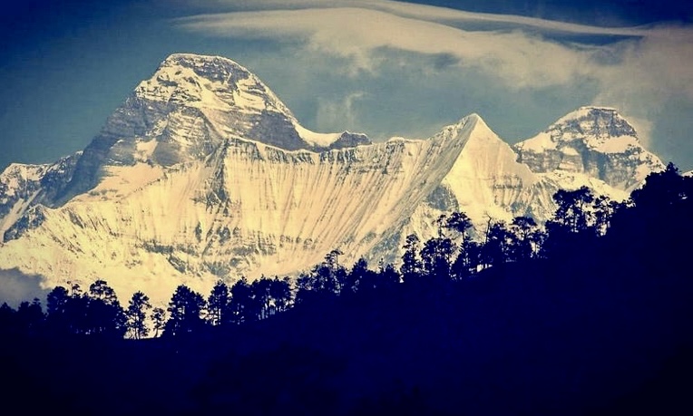
According to mountaineer Eric Shipton, this was one of the most important climbs of the era. Odell and Tilman reached the top in good style and without bottled oxygen. Until Annapurna I’s first ascent in 1950, Nanda Devi was the highest mountain ever summited.
Two years after his ascent of Nanda Devi, Odell returned to Everest. Odell reached 7,000m without bottled oxygen.
The first ascent of Mount Vancouver
During the late 1940s and early to mid-1950s, Odell’s mountaineering shifted to North America. He climbed in the Rockies, the Yukon, and Alaska.
In 1947, Odell climbed in the Canadian Rockies. In 1949, Odell went to the Saint Elias Mountains on the Alaska-Canadian border as part of a geological expedition called Project Snow Cornice.
Odell (then 58 years old) and American climbers William Hainsworth, Robert McCarter, and Alan Bruce-Robertson made the first ascent of 4,810m Mount Vancouver. At the time, Mount Vancouver was the highest unclimbed peak in North America.
Between 1950 and 1956, Odell was a professor of Geology at the University of Otago in New Zealand. During this time, he made several climbs in the Southern Alps.
Mountaineering clubs
Odell was a member of the Alpine Club and was elected vice president in 1945. He was also with the Himalayan Club and was an honorary member of the American Alpine Club, the Canadian Alpine Club, the New Zealand Alpine Club, and the Norsk Tinder Klub.
He served in the Royal Engineers and later worked for various oil and mining companies. But he continued to climb for his whole life. His last excursion was on the 125th anniversary of the founding of the Swiss Alpine Club when Odell was 93 years old.
Just a few days before his death on Feb. 21, 1987, he attended a memorial organized for Don Whillans at the Royal Geographic Society.
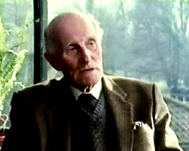
A modest but important mountaineer
As the American Alpine Journal points out, Odell never sought fame. He was more interested in others’ activities than talking about his own.
"He was a gentleman. Generous, mild, modest, and seldom ruffled or angry. He was a lovely companion, never bloody-minded or out of sorts, even when his companions were impatient with his deliberate pace. Although he had a grand store of reminiscences and anecdotes, he was never boring. He was a joy to be with and a loss to generations who may never know someone like him," Charles Houston wrote of Odell.
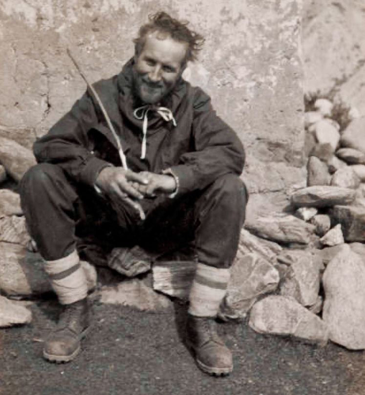
Today, British mountaineer Alison Hargreaves would have turned 63. Hargreaves dedicated her life to climbing but died too early, in the 1995 K2 tragedy.
Hargreaves was born in Derbyshire, England, on Feb. 17, 1962. Her parents were avid hikers, and the Hargreaves family often spent time walking in England and Scotland. At nine, Alison climbed Ben Nevis. At 13, she started rock climbing.
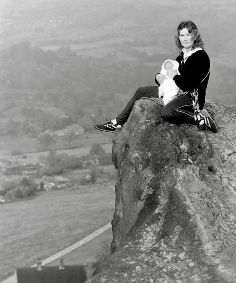
Hargreaves left home at 18 and moved in with her boyfriend, Jim Ballard, whom she later married. Ballard also loved climbing and took a job selling mountaineering equipment. The couple had two kids: Tom (born in 1988) and Kate (born in 1991).
In 1984, when Hargreaves sent in her application to the Alpine Club, she already had extensive experience in the Alps.
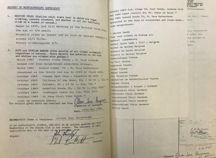
New route on Kangtega
In the spring of 1986, Hargreaves took part in the Kangtega-Nuptse Expedition, a joint U.S.-UK party led by Jeff Lowe.
Kangtega (6,783m) is located in the Khumbu Himal, southwest of Ama Dablam. David Dornan, Tom Frost, Michael Gill, and Jim Wilson -- members of an international team led by Edmund Hillary -- made the first ascent on June 5, 1963 via the southeast face.
By the end of 1985, 15 climbers from four different teams had topped out on Kangtega. A Japanese team had summited in 1979 via the north face, a Catalan team had topped out in 1984 via the southeast face, and a South Korean team climbed the southwest face-south ridge route in 1985.
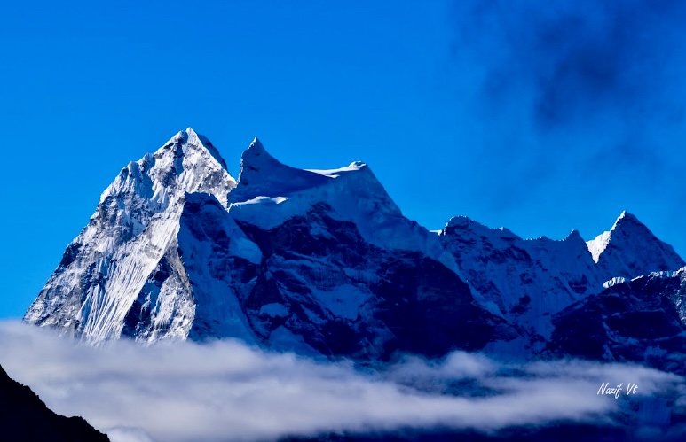
Lowe’s 1986 team chose a new route on the right side of Kangtega’s northwest face. The expedition consisted of six members: Jeff Lowe, Alison Hargreaves, Tom Frost, Henry Kendall, Bruce Roghaar, and Mark Twight.
On May 1, Hargreaves and Twight reached the summit after successfully ascending the steep, icy northwest face. They descended by the northeast couloir. Hargreaves was the first Brit to summit Kangtega.
In the autumn of 1987, Hargreaves attempted Ama Dablam, reaching 5,700m.
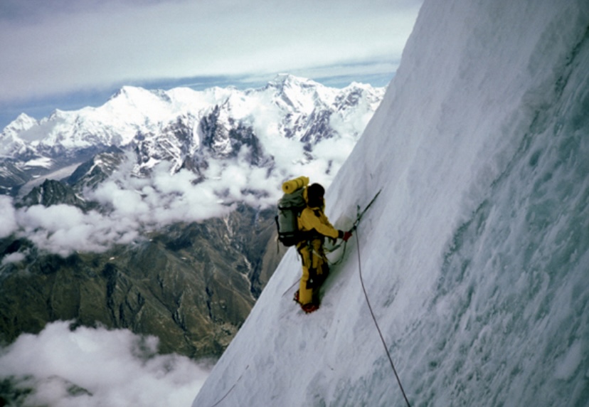
Eiger: pregnant, not sick
Hargreaves made several great climbs in the European Alps. After Kangtega, she went back to the Alps in 1988 and climbed the North Face of the Eiger while six months pregnant with her first child. After the climb, she received criticism.
"I was pregnant, not sick," Hargreaves responded
Ballard realized his wife possessed extraordinary skills and determination, and the couple sold their house to move to Switzerland.
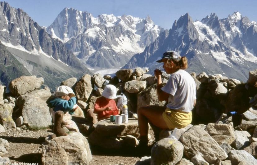
Soloing the six classic North Faces of the Alps
In 1993, Hargreaves became the first climber to solo the six classic North Faces of the Alps in one season: the Eiger, Matterhorn, Petit Dru, Piz Badile, Grandes Jorasses, and Cima Grande di Lavaredo.
She was the first woman to solo the Croz Spur on the Grandes Jorasses (1993, in a day). She also made several other first female solo ascents, including Aiguille du Petit Dru, the Cassin Route on the Cima Grande in the Dolomites, and the Matterhorn.
She was the first British woman to climb the Eiger North Face, the North Face of Les Droites, and the super couloir on Mont Blanc du Tacul.
In 1994, she published a book about her climbs: A Hard Day’s Summer.
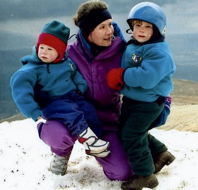
Everest
In the autumn of 1994, Hargreaves took part in the British Everest Medical Expedition led by Simon Currin. The expedition climbed the South Col-Southeast Ridge route. Charlie Hornsby, Roddy Kirkwood, Dawa Temba Sherpa, and Dorje Sherpa summited.
Hargreaves climbed from Camp 4 to 8,400m in five hours but had to turn around when her feet began to feel numb.
Hargreaves’ next project was ambitious. She wanted to climb Everest, K2, and Kangchenjunga in one year without bottled oxygen.
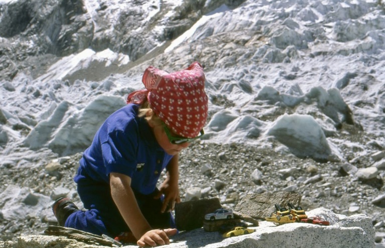
In the spring of 1995, Hargreaves went to Everest alone. She aimed to climb the North Col-Northeast Ridge route without bottled oxygen or Sherpa support.
Above Advanced Base Camp, she moved independently of other teams, did not use the fixed ropes, and climbed without supplemental oxygen or support. Hargreaves only used the ladder on the Second Step, high on the mountain.
She topped out on May 13, becoming the first woman to climb Everest unsupported without supplemental oxygen.
"To Tom and Kate, my two children, I am on the highest point in the world, and I love them dearly, over," Hargreaves said over the radio.
"[She is] a new star of the Himalaya, for women, but also men," a climber told The Himalayan Database afterward.
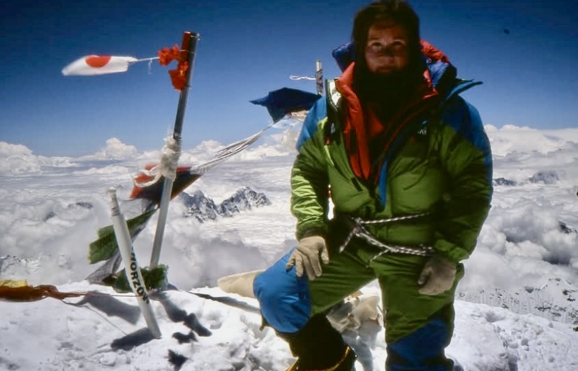
Death on K2
Only a few months later, in the summer of 1995, Hargreaves headed to Pakistan to fulfill her second big goal: to climb K2 without support or supplemental oxygen.
According to Lorenzo Ortas Pont, a member of a Spanish team on K2 that year, Hargreaves told them before the summit push that she would not go to Kangchenjunga after K2 but instead return to Scotland (where she and the family moved in 1995) to spend time with her children on the beach.
Hargreaves summited on August 13, along with other climbers from various teams. They topped out very late that afternoon, and a huge windstorm caught them just below the summit during their descent.
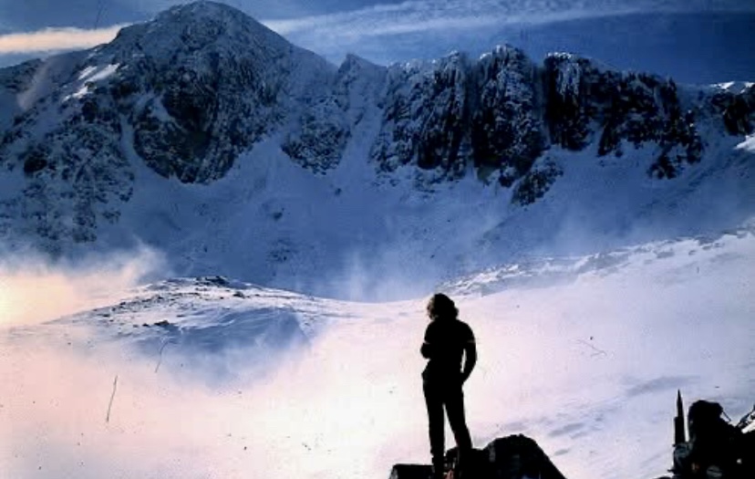
The 1995 tragedy is one of the most tragic events of K2's climbing history. Hargreaves was likely blown off the mountain. She was 33 years old. Six other climbers also died. In a separate article, we will examine the 1995 disaster.
Tom Ballard
Hargreaves’ son, Tom Ballard, became an outstanding climber. Between December 2014 and March 2015, he followed in his mother's footsteps, climbing the six great North Faces of the Alps solo. He was the first person to complete this feat in a single winter season without a support team.
Ballard died on Feb. 24, 2019, on Nanga Parbat.
After we published a story about an unusual expedition to the Sierra Nevada de Santa Marta in Colombia, several readers asked whether this highly restricted area, located between the rainforest and the Caribbean coast, was open to climbers again.
The short answer is yes, but not to anyone.
A group led by Ricardo Rubio climbed a new route on Simon Bolivar Peak on December 18, 2024. They also summited neighboring Cristobal Colon Peak. Both mountains are similar in altitude (just over 5,700m), and an ongoing debate has centered around which was higher and was therefore the highest peak in Colombia.
The first survey, in 1939, judged Colon three meters higher than Bolivar. However, later expeditions, including Rubio's, insisted that Bolivar's summit was slightly higher. However, in the last few years, no one has climbed the peaks to make sure.
(Almost) inaccessible
Both mountains lie in the Sierra Nevada de Santa Marta, a peculiar spot. Rising right from the shores of the Caribbean, it is the highest coastal range in the world. Access is highly restricted to preserve the Arhuaco tribal community, which regards the range as El Corazon del Mundo ("The Heart of the World"). Armed groups in the region are a further reason for the restrictions.
But after years of isolation, climbers are back, thanks to a cooperative agreement between a few local companies and the Arhuaco community. The companies also negotiated a safe passage for the climbing groups with the armed paramilitary groups in the area.
The tribe's members earn money as porters and support staff. Expeditions have to trek three to four days right from the Caribbean beaches at sea level, through the jungle, then along alpine meadows, and finally on rock and glaciers to well over 5,000m.
Ricardo Rubio of Ascenso Andino Colombia told ExplorersWeb that in January, they had managed three international groups, including climbers from Poland, Austria, the U.S., and Mexico. All summited Colon Peak, and four individuals also climbed the more technical Simon Bolivar Peak.
"We have permission of passage from the Arhuaco people, from the villagers in San Pedro de la Sierra, as well as from the armed groups," Rubio said.
He insists it is safe since both local communities and the armed groups recognize the benefits of this sustainable, cooperative tourism.
The expedition takes a total of 12 days, and the season goes from December to March.
Altitude confirmed
Shortly after we published the story about the new route on Bolivar, U.S. peak bagger Eric Gilbertson also contacted ExplorersWeb to confirm he, Ginge Fullen, and Jonathan Suarez also climbed Bolivar a few days later via another variation that he deemed slightly harder. He wrote that Rubio's Dec 18 route was 5.4 M1, while his variation was 5.6 M2.
Gilberton's team also brought professional survey equipment on their climb and measured both summits. Bolivar, he said, was 5,720.42m +/-0.08m, and Colon was 5,712.79m +/-0.87m (orthometric height).
"The debate is settled," he concludes.
Gilbertson explained that Colon used to be Colombia's high point when the peaks were surveyed in 1939. At that time, Colon was 5,775m and Bolivar 5,773m, but the snow on their summits has melted considerably since then.
"The highest visible rock on each peak is two to three meters below the summits, so if the melt rate continues, it appears Bolivar will remain the country's high point," Gilbertson said.
Eric Gilbertson and his twin brother Matthew, from Seattle, have spent the last 30 years trying to summit the highest peak in every country in the world.
On January 29, 1873, Prince Luigi Amadeo Giuseppe Maria Ferdinando Francisco di Savoia-Aosta, better known as the Duke of Abruzzi, was born. The Italian Duke's interests were extensive. He was an arctic explorer, sailor, oceanographer, big-game hunter, topographer, geologist, botanist, zoologist, financier, and mountaineer.
Today, we examine the Duke's mountaineering activities.
Early start
The Duke of Abruzzi was a member of the Italian Royal House of Savoy. He was born in Madrid during the short period when his father, Amadeo I, Duke of Aosta, ruled Spain (1870-1873). Shortly after his birth, his father abdicated, and the family returned to Italy. His uncle became King Umberto I of Italy in 1878, and his cousin Vittorio Emanuelle III became king in 1900.
The family lived in Turin, Italy, only 106km from Mont Blanc. His mother, Princess Marie del Pozzo della Cisterna, died when the Duke was only three years old, and the young Duke received a strict, disciplined education.
At six, he became a cabin boy and then attended a naval college. Five years later, he received his first experience on a warship. By 20, he commanded his own ship, the Volturno, to Somalia.
One year later, the Duke cruised around the world on a ship called the Christopher Columbus. The trip took two years. Much later, at 31, he captained another vessel on a three-year, round-the-world voyage.
Love for mountaineering
As a child, the Duke spent most of his summer holidays at his family's hunting lodge in the Alps. Hiking was a popular family activity, and his aunt Margherita was an avid mountaineer. During those summers, the Duke and his siblings spent a lot of time with Friar Francesco Denza, founder of the Moncalieri Meterologic Observatory. Denza taught them science, meteorology, and geology.
Accompanied by mountain guides and friends, including Emile Rey, one of the best climbers of that era, the Duke also began to climb in the Alps. In 1892, with Francesco Gonella, the past president of the Italian Alpine Club, he climbed Peak Levanna in Val dell’Orco. The following month, they summited several peaks in Gran Paradiso and the Mont Blanc massif.
Abruzzi also ascended 4,014m Dent du Geant, a challenging climb at the time.
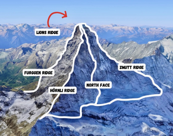
Meeting Mummery
In 1879, Albert Frederick Mummery and guides Alexander Burgener, Augustin Gentinetta, and Johann Petrus made the first ascent of the difficult Zmutt Ridge on the Matterhorn. Mummery’s success sparked the Duke’s interest.
In the early 1890s, the Duke’s team ascended 4,357m Dent Blanche, and then 4,221m Zinalrothorn. By chance, they met Mummery, who had just opened a new route. Returning to the valley together, the Duke told Mummery he wanted to climb the Zmutt Ridge. They agreed to climb it together.
After this meeting, the Duke hurried to Monte Rosa to ascend Dufourspitze and Gnifetti. Afterward, the Duke received a telegram from Mummery asking him to head immediately to Zermatt because conditions were good for the Zmutt Ridge.
On Aug. 28, 1894, Mummery, the Duke, Norman Collie, and Joseph Pollinger summited the Matterhorn via the Zmutt Ridge.
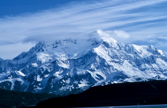
The first ascent of Mount St. Elias
In 1897, when the Duke was only 24, he organized and led an expedition to unclimbed 5,489m Mount St. Elias on the border of Alaska and the Yukon.
Storms from the nearby Gulf of Alaska pound Mount St. Elias almost incessantly. Nevertheless, on July 31, the Duke and his partners (including the renowned Italian photographer and alpinist Vittorio Sella) made the first ascent. The second ascent came 48 years later!
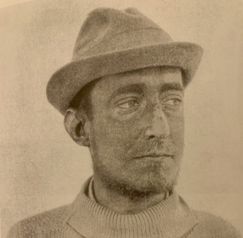
Ruwenzori
In 1904, the Duke was in Honolulu when the news arrived that Henry Morton Stanley had died. The newspaper reporting Stanley's death included a quote from a speech Stanley gave in 1901 at the Royal Geographic Society: "I hope that a man dedicated to his work, a passionate mountaineer, will take Ruwenzori into consideration and study it, explore it from top to bottom, crossing its enormous ridges and deep corridors."
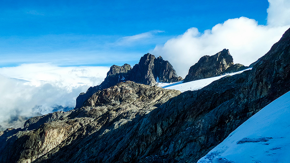
The Duke's next goal was clear: to climb the Ruwenzori Mountains in eastern equatorial Africa. The highest peak in the glaciated Ruwenzori is 5,109m. Ruwenzori means King of the Clouds, and this range was believed to be the mysterious Mountains of the Moon mentioned by the ancient Greeks.
In 1906, the Duke organized an expedition that climbed 16 mountains in the range, including the highest peak. Ten Ruwenzori peaks surpass 4,800m. The highest are Mt. Margherita (5,109m) and Mt. Alexandra (5,105m), both named by the Duke. Afterward, the energetic Duke made a map of the Ruwenzori range.
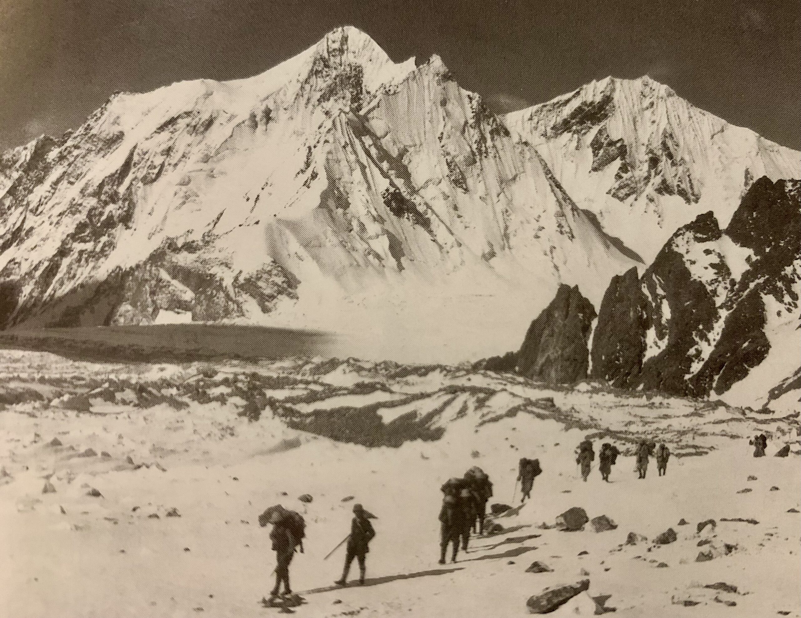
Attempt on K2
In 1909, the Duke organized an expedition to then-unclimbed K2. At 8,611m, it was the second-highest mountain in the world.
The first party to attempt K2 was a British-Austrian expedition led by Oskar Eckenstein in 1902. That group tried to ascend the northeast ridge but only made it to 6,000m.
The Duke’s team marked the second attempt.
After making an exhaustive plan and a long approach trek, they finally reached the mountain and tried twice. First, they attempted the Southeast Spur and made it to 6,200m. Today, this route is called the Abruzzi Spur and has become K2’s normal route.
They also attempted the Northwest Ridge, reaching 6,644m.
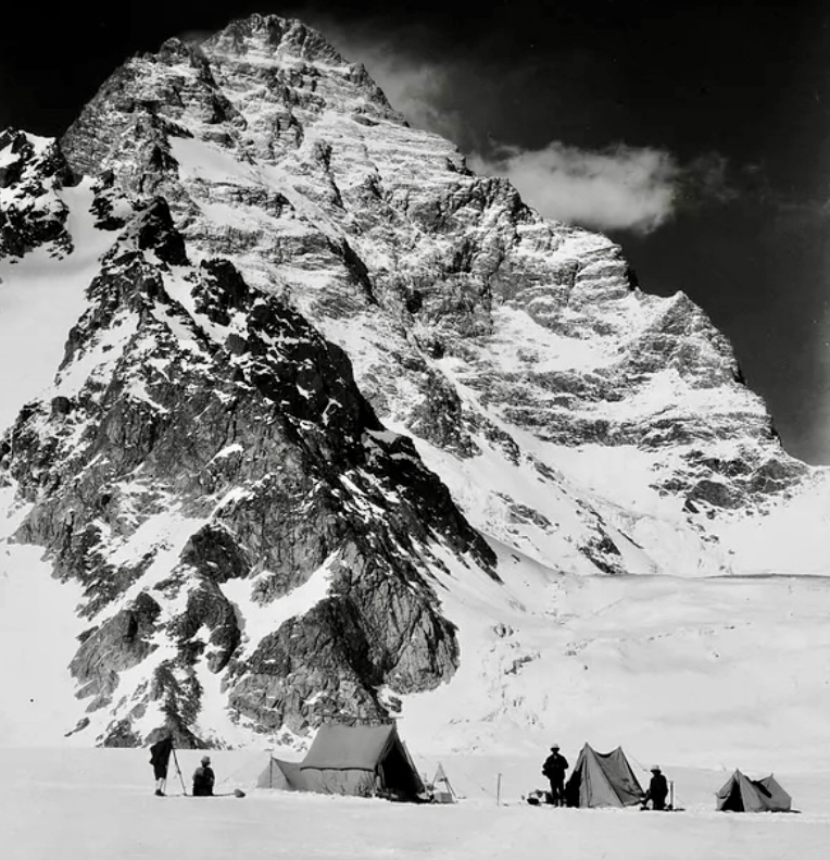
Chogolisa
After K2, the Duke headed to unclimbed 7,665m Chogolisa, one of the most beautiful mountains in the Karakoram. On Chogolisa, the Duke and two partners reached 7,498m, a record height at the time. Bad weather, poor visibility, and deep snow prevented them from summiting.
Vittorio Sella’s book, Mountain Photographs (1879-1909), has a beautiful collection of images from these expeditions.
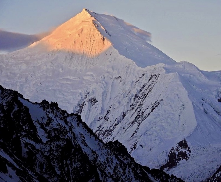
Somalia
The Duke did not have an easy life. His forbidden love with Katherine Elkins (he was not allowed to marry her because she came from a lower class) and many other complicated circumstances weren’t easy to manage.
After losing several climbing partners and some of his family over the years, he retired to Italian Somaliland. Nobody could convince the Duke to stay in Italy.
"I prefer that the fantasies of Somali women intertwine around my grave rather than the hypocrisy of civilized men," the Duke said.
The Duke died at age 60 on March 18, 1933, in Jowhar, Somalia.
For more on his expeditions and life, we recommend The Duke of the Abruzzi: An Explorer’s Life by Mirella Tenderini and Michael Shandrick.
The 100th anniversary
In 2009, a group of climbers attempted K2 to celebrate the 100th anniversary of the Duke's expedition. A fantastic film was made about their attempt.
The documentary K2: Siren of the Himalayas by Dave Olson can be viewed for free on YouTube. It stars Gerlinde Kaltenbrunner, Jake Meyer, Chris Szymiec, Ralf Dujmovits, and David Goettler, among others. The 1909 expedition is well presented, with original photos and fragments of the Duke's expedition report.
You can view the film below.
On January 2, 1909, the versatile mountaineer Riccardo Cassin was born in Friuli, Italy.
Cassin's father died in a mining accident in Canada in 1913. To help his family, Cassin left school at the age of 12 to work in a blacksmith shop.
In 1926, Cassin moved to Lecco and worked at a steel plant. He started boxing and also went to the surrounding mountains every spare moment. Eventually, he had to choose between boxing and climbing, and he chose climbing. He started honing his skills in the Grigna massif around Lecco. Eventually, he excelled in all disciplines, including rock, big-wall, and alpine climbing.
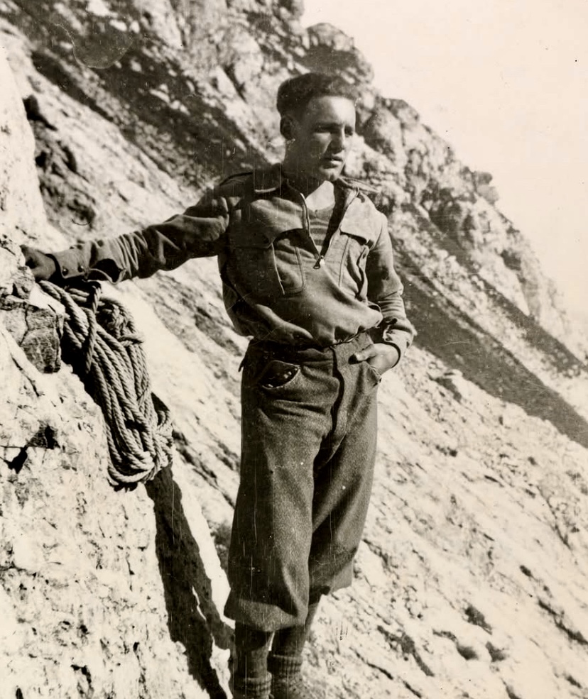
Cassin made several pioneering climbs in the 1930s. Among them:
- 1934: First ascent of Cima Picolissima of the Tre Cime di Lavaredo with two partners. The following year, he climbed the Torre Trieste via the southeast ridge and established a new route on the north face of the Cima Ovest di Lavaredo in the Dolomites with Vittorio Ratti.
- 1937: First ascent of the northeast face of Piz Badile along with partners Ratti and Gino Esposito. They also teamed up with two others, M. Molteni and G. Valsecchi, who died of exhaustion during the descent.
- 1938: Climbed the Walker Spur on the North Face of Grandes Jorasses with Esposito and Ugo Tizzoni. One year later, Cassin and Tizzoni ascended a new route on the north face of the Aiguille de Leschaux.
100 first ascents
These are only a few of his 2,500 ascents, of which 100 were first ascents.
The Second World War stopped his climbing. During the war, Cassin fought against the Nazis as a partisan.
The Ragni di Lecco (Spiders of Lecco) chapter of the Italian Alpine Club was founded in 1946. Their goal was to surpass Lecco's so-called "old climbers," including Cassin, who also became part of the group.
Thwarted from joining K2 expedition
In 1954, the leader of the Italian K2 expedition, Ardito Desio, left Cassin off the team -- according to Cassin, because of their rivalry. Instead, Cassin went on to lead several major expeditions himself, including a successful 1958 climb of 7,932m Gasherbrum IV. On that expedition, Walter Bonatti and Carlo Mauri made the first ascent of GIV via the northeast ridge.
Then in 1961, Cassin led a strong party to the still-unclimbed south face of 6,190m Denali. On July 19, all five members topped out on a difficult route that became known as the Cassin Ridge.
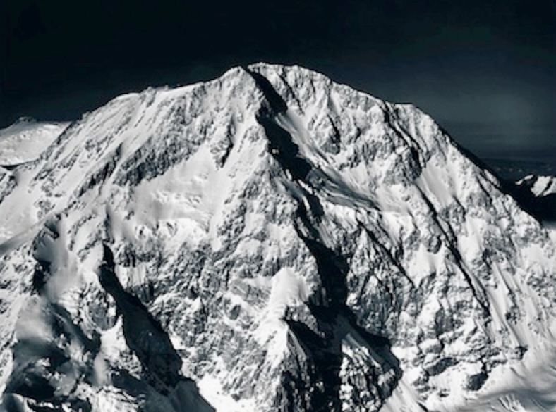
Cassin returned to the Himalaya in 1975 to lead an expedition to 8,516m Lhotse. They wanted to try a new route along the west part of the south face. Two years earlier, a Japanese party had tried that line unsuccessfully. Two members of Cassin's team reached roughly 7,500m, when bad weather forced them to turn around.
Piz Badile at 78
In 1987, on the 50th anniversary of his first ascent of the northeast face of Piz Badile, Cassin climbed it again at the age of 78. His filmmaker friend, Fulvio Mariani, would have liked to film it, but Cassin had not told him about the ascent, so Cassin volunteered to do it again.
When journalists reported that Cassin had repeated his own route twice, Cassin pointed out that the second repetition was not valid because a helicopter had picked him up at the summit.
Cassin continued climbing until he was 80. He died in Lecco on August 6, 2009, at the age of 100.
Alex Lowe, one of the best alpinists of the 1990s, would have turned 66 today.
An incredibly versatile climber, Lowe was good on big walls, alpine routes, rock climbing, skiing, and speed climbing. He also made several first ski descents. Today, we'll take a short look at some of his great climbs.
In the pre-monsoon period of 1989, Lowe and Steve Swenson climbed a new grade VI route on 6,011m Kwangde Nup via the north buttress. The most difficult part of the three-day ascent was on the last day when the two climbers had to do several difficult mixed pitches to surmount the steep upper headwall.
Lowe established new routes in Grand Teton and in Kyrgyzstan’s Ak-Su region. His experience on Denali included a rescue in which the powerful Lowe carried one of the stricken climbers down on his back.
In 1999, he climbed a new route on the northwest face of 6,286m Great Trango Tower in Pakistan with Jared Ogden and Mark Synnott.
Khan Tengri
In 1993, Lowe climbed 7,010m Khan Tengri solo in a record time of 10 hours and 8 minutes. Three years later, Lowe and his friend Conrad Anker went to 7,555m Annapurna III. They acclimatized up to 7,200m on the west ridge of Annapurna IV. Their plan was to climb Annapurna III’s southeast pillar, but due to deep and dangerous snow, they couldn’t get onto the mountain.
Lowe attempted K2 (back in 1986) and Gasherbrum IV (1992). Sometimes known as the Lungs With Legs, Lowe was always preternaturally good at altitude. In 1996, Lowe made the first free ascent of the route Troubled Dreams on Mount Rundle in the Canadian Rockies.
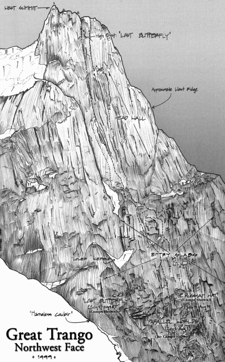
In 1997, Lowe and Conrad Anker made the first ascent of Rakekniven, a Cerro Torre-like granite needle in the Filchner Mountains of Queen Maud Land, Antarctica. The following year, Alex Lowe, Mark Synott, Greg Child, Jared Ogden, Gordon Wiltsie, and Jon Catto made the first ascent of Great Sail Peak on Canada’s Baffin Island. You can read more about this ascent in Mark Synnott's report.
Lowe ascended Everest twice, in 1990 and 1993 (with oxygen). In 1994, he took part in the U.S.-Canadian expedition led by David Breashears to climb the difficult Kangshung Face of Everest without bottled oxygen. The party reached 7,375m but had to turn around due to dangerous snow conditions.
Death on Shisha Pangma
In September 1999, Lowe, along with Anker and David Bridges were attempting the Southwest Face of 8,027m Shisha Pangma. Lowe and Anker wanted to ski from its summit. Unfortunately, on October 5, a serac broke above the climbers, triggering a huge avalanche. Lowe and Bridges perished. Anker survived with some injuries.
On April 27, 2016, Ueli Steck and David Goettler found the remains of Lowe and Bridges emerging from the glacier.
The best way to conclude this short remembrance is to quote Alex Lowe himself. It appeared in a beautiful article that Gordon Wiltsie wrote about him in the American Alpine Journal.
"The best climber in the world is the one having the most fun.”
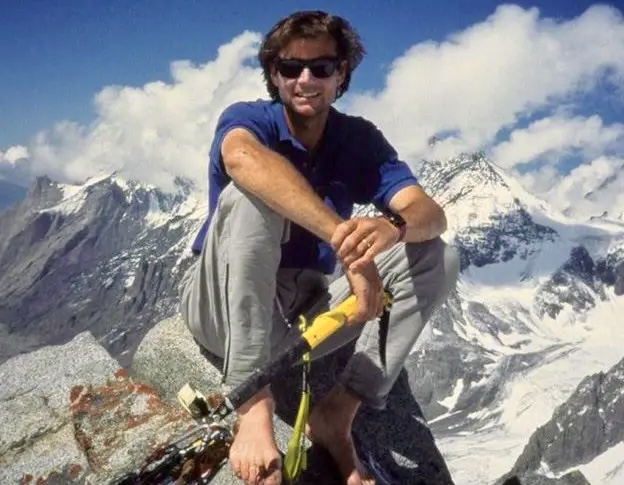
The Italian mountain site montagna.tv has listed ExplorersWeb's Angela Benavides as one of the 50 most influential mountain people of 2024.
Regular ExplorersWeb readers will be familiar with her almost daily coverage of mountain happenings around the world, especially in the Himalaya and Karakoram. Angela doesn't only report the news; she gives context and depth to the alpine stories of the day. Whether it is up-to-the-minute news about an ongoing summit push, an in-depth investigation about the controversial death of a Pakistani porter on K2, or clarifying the byzantine rules around obtaining a climbing permit in Tibet, Angela's tireless work puts her at the core of contemporary mountain journalism.
Others on the yearly list include Kilian Jornet, Jimmy Chin, Francois Cazzanelli, Kilian Jornet, Nives Meroi, and Nima Rinji Sherpa.
Congratulations to Angela!
Today, ExplorersWeb would like to remember the mountaineers and adventurers we lost in 2024. It was a particularly tragic year, and the full list of climbers and explorers who died is much longer than we can include here, but all have our utmost respect.
There are few treasures of more lasting worth than the experiences of a way of life that is in itself wholly satisfying. Such, after all, are the only possessions of which no fate, no cosmic catastrophe can deprive us; nothing can alter the fact if for one moment in eternity, we have really lived. -- Eric Shipton
Jean Malaurie
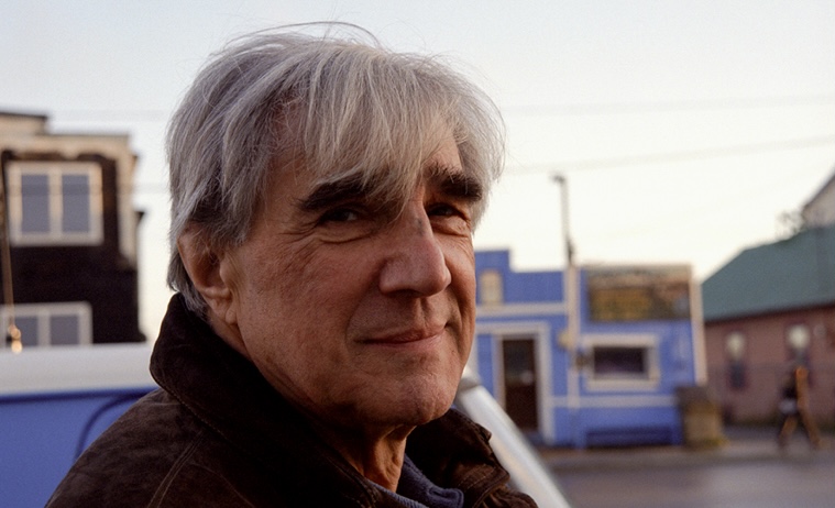
On February 5, the pioneering French adventurer Jean Malaurie died at 101.
Malaurie is best known for his classic work, The Last Kings of Thule, about the people of North West Greenland. In the 1950s, when Malaurie traveled, and for decades beyond, the people there continued to live traditionally, traveling by dogteam for weeks at a time, hunting seals to feed themselves and their dogs. The book has been translated into 23 languages and remains the most widely distributed work on the Inuit.
Malaurie defended the rights of arctic minorities and became a UNESCO Goodwill Ambassador for northern issues.
Evgeniy Glazunov
On February 16, Russian alpinist Evgeniy Glazunov died on 5,355m Ak-Su in Kyrgyzstan’s Pamir-Alai range. He died while climbing solo, shortly after he became the first person to ascend the 1,400m north wall via the Chaplinsky route in winter. He perished during the descent.
Glazunov was one of Russia's best contemporary climbers. Mainly climbing in Central Asia, he had soloed many long routes, including several first ascents. He was the brother of Sergey Glazunov, who died on Latok I in July 2018.
Robin Campbell
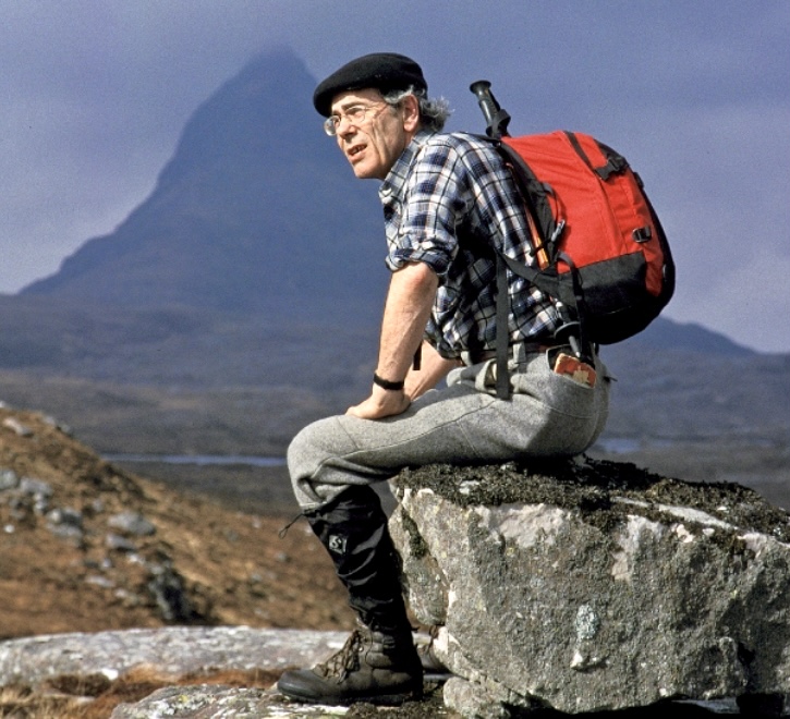
Scottish mountaineer and academic Robin Campbell died on March 4. Campbell received the Scottish Award for Excellence in Mountain Culture and was a respected authority on climbing history, with a particularly keen focus on Scottish mountaineering.
With partners Robins Smith, Dougal Haston, and Neil Macniven, Campbell established many high-quality routes.
David Breashears
On March 14, mountaineer David Breashears died at age 69. He was the first U.S. climber to summit Everest twice, in 1983 and 1985. Breashears took part in 16 expeditions to the Himalaya. He summited Everest five times, Ama Dablam once in 1979, and Kwangde in 1982.
As director and film producer, Breashears co-created the IMAX documentary Everest. He made several other excellent documentaries that captured the essence of adventure, including Kilimanjaro: To The Roof of Africa.
In his productions, Breashears combined visual beauty with captivating narratives.
Lou Whittaker
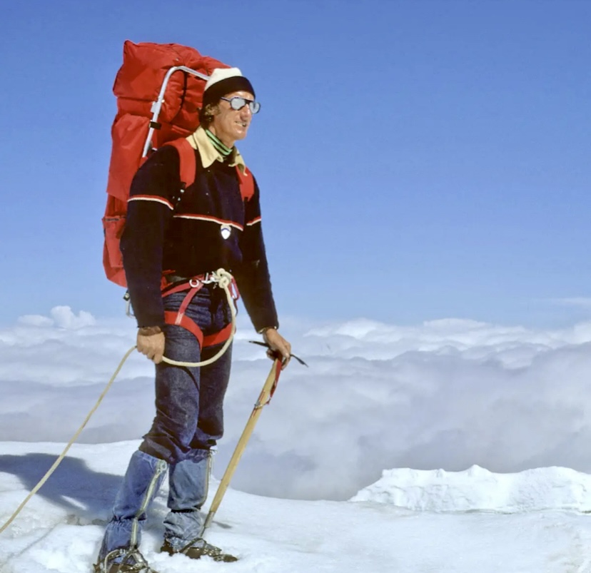
On March 24, U.S. mountain guide Lou Whittaker died at age 95. With his twin brother Jim, Whittaker began climbing at 12. The Whittakers summited Mount Rainier at 16 and had climbed all of the major peaks in Washington by 18.
As an experienced glacier travel guide, Whittaker summited Mount Rainier over 250 times. He rescued dozens of climbers over his long career. He also led the first American ascent of the North Col of Everest in 1984.
Masatatsu Abe
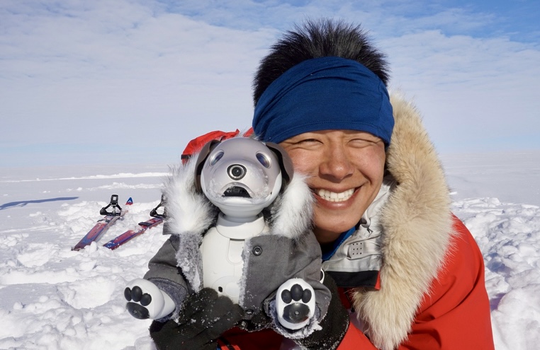
On March 27, Japanese adventurer Masatatsu Abe died at the age of 41. Abe developed his love for the outdoors young. Among his many journeys around the world, Abe bicycled 11,000km through South America, traversed the Continental Divide Trail from Canada to Mexico, and hiked the 1,200km Great Divide Trail in Canada. Abe then traveled 2,000km down the Amazon River on a homemade raft.
In 2018-19, the ever-smiling Abe reached the South Pole after 55 days and 918km via the Messner Start. In 2021-22, he tried to retrace a 1911 Japanese expedition led by Nobu Shirase, but ran out of time.
Abe was scheduled to go to Antarctica again in November 2023, but after completing his preparations, he was diagnosed with brain tumor that eventually killed him.
Denis Trento
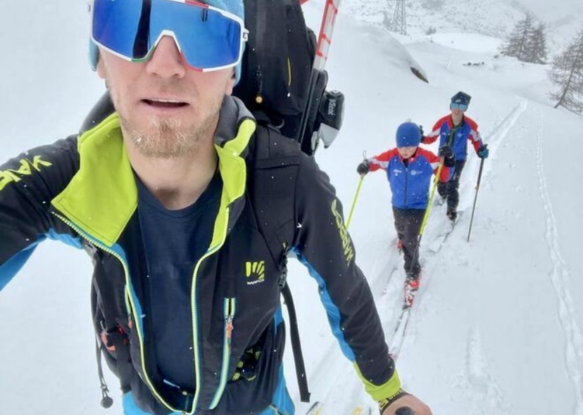
On May 3, Italian mountaineer Denis Trento perished at the age of 41. A ski mountaineering champion and mountain guide, Trento died on the north face of Testa del Paramont in Italy's Aosta Valley in a fall.
In 2016, Trento traversed the Rochefort Ridge of the Grandes Jorasses. Two years later, he linked the Bonatti and Aigle on Petit Mont Blanc, and a few months afterward, he climbed the Innominata ridge and the Monte Rosa Express with Robert Antonioli. In 2020, he climbed the Central Pillar of Freney with Filip Babitz, making the round-trip in less than 24 hours.
Martin Feistl
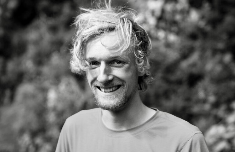
On May 18, German climber Martin Feistl fell to his death while free soloing the south face of the Scharnitzspitze in the Austrian Tirol. He was 27 years old and an experienced free soloist.
Feistl made a name for himself as a first-rate ice and mixed climber, although he was equally at home on rock. In 2020, he was a candidate for a Piolet d’Or for the first ascent (with David Bruder) of Stalingrad, a 1,000m ice route in Austria’s Karwendel Massif.
At 20, Feistl climbed Shivling in the Garhwal Himalaya. He was a purist looking for first ascents on ice routes. In the summer of 2023, he opened new routes in East Greenland.
Tomas Franchini
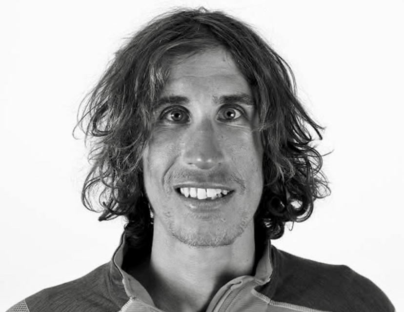
On June 2, Italian climber Tomas Franchini perished after falling from the northeast face of 5,716m Cashan in the Andes. Franchini was 35 years old.
Franchini had been nominated twice for a Piolet d’Or. In 2017, Franchini opened a new route on the west face of 6,618m Mount Edgar in China's Sichuan mountains with Francois Cazzanelli and Matteo Faletti. In the spring of 2022, Franchini, Philipp Brugger, and Lukas Waldner made the first ascent of 6,653m Shaue Sar via its north face.
John Middendorf
On June 21, U.S. big-wall climber and gear designer John Middendorf died suddenly from a stroke. Middendorf’s outstanding climbs in Yosemite and on the Great Trango Tower were followed by more pioneering big-wall routes in Zion National Park. Many climbers use his famous portaledges.
Keita Kurakami
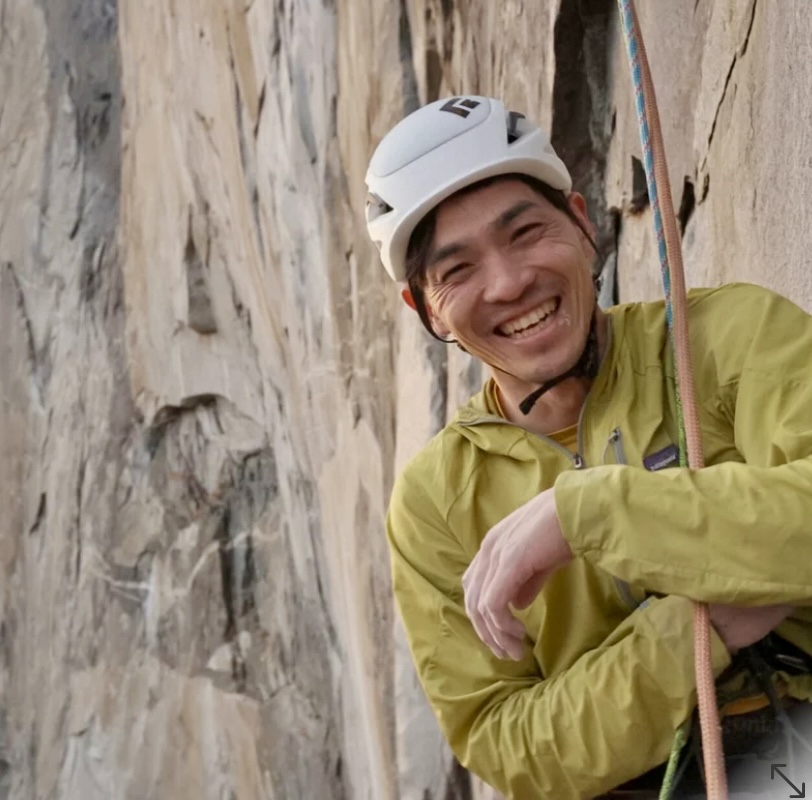
On June 26, Japanese rock climber Keita Kurakami passed away at the age of 38 after a heart attack on Mount Fuji.
Kurakami pioneered important trad routes, including challenging rope-solo free ascents. In 2017, Kurakami and a partner climbed the Nose on El Capitan. When it was reported that they free-climbed the route, Kurakami corrected the reports, stating that it was not a totally free ascent. So, in 2018, he went back. This time, he not only freed the route ground up but did it rope-solo, self-belaying. He became the fifth person to rope-solo free the Nose.
Kurakami knew he had a heart condition, but he did not want to stop climbing, choosing to pursue his passion till the end.
Kazuya Hiraide and Kenro Nakajima
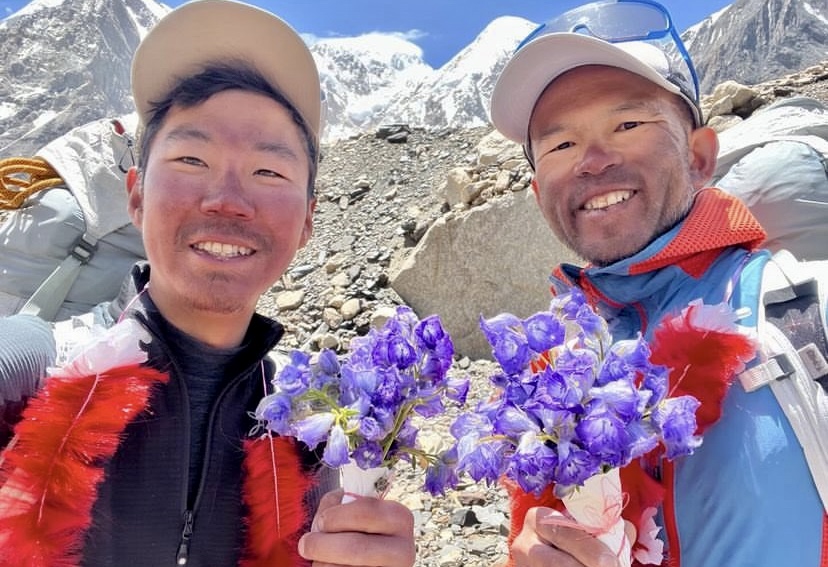
On July 27, two of the world's top alpinists, Kazuya Hiraide and Kenro Nakajima of Japan, perished on the West Face of K2 in a fall from 7,500m.
Their outstanding legacy includes multiple Piolets d’Or for both of them. This month, they received another Golden Ice Axe for their first ascent of the north face of Tirich Mir in 2023.
Family members of both climbers attended the Piolet d’Or ceremony in Italy, and Nakajima’s wife posted an emotional letter on her husband’s social media, saying: "Although he was called a professional mountain climber, he always gently grinned and said, 'I am just a mountain lover'...Our children and I embrace his spirit strongly and will move forward slowly, little by little. May he live in your heart forever."
Archil Badriashvili
On August 10, Georgian alpinist Archil Badriashvili died in the Caucasus after an incredibly unlucky accident. A lightning strike hit nearby while he was on 4,388m Shkhelda, prompting a fall. Badriashvili was 34 years old.
A physician but also a professional mountain guide, Badriashvili climbed extensively in the Caucasus and wrote many exciting reports for the American Alpine Journal. His first ascent of the isolated Saraghrar Northwest in 2021 earned him and his team a Piolet d’Or.
Sergey Nilov
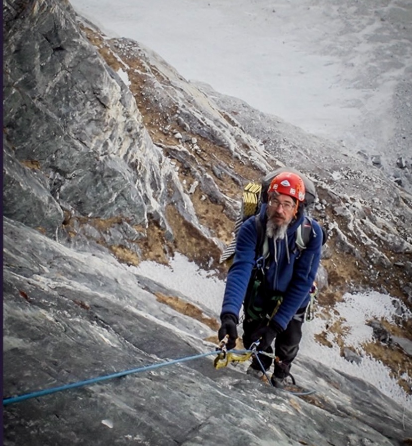
On August 17, Russian Sergey Nilov perished on 7,932m Gasherbrum IV in an avalanche. It occurred while Nilov and his climbing partners were trying to find Dmitry Golovchenko's body. Golovchenko had died last year when he and Nilov were attempting a first ascent of the southeast ridge of Gasherbrum IV.
Over a 20-year partnership, the Golovchenko-Nilov duo won the Piolet d’Or for their ascents of Thalay Sagar and Muztagh Tower. They carried out other highly committed, first-class expeditions on Jannu and Trango Tower. Many of their climbs were first ascents of new routes. The essence of mountaineering was key to all their undertakings, and they were inseparable friends.
Mike Gardner
On October 7, American climber Mike Gardner fell to his death on the north face of 7,468m Jannu East while attempting to make the first ascent of the mountain. Gardner was a second-generation mountain guide from Idaho. He described himself as a climber, skier, but most of all, a skateboarder.
In 2022, Gardner was part of a team that broke the speed record on the Slovak Direct route on Denali. That same summer, they opened a new route on the east face of Mount Hunter.
Ondrej Huserka
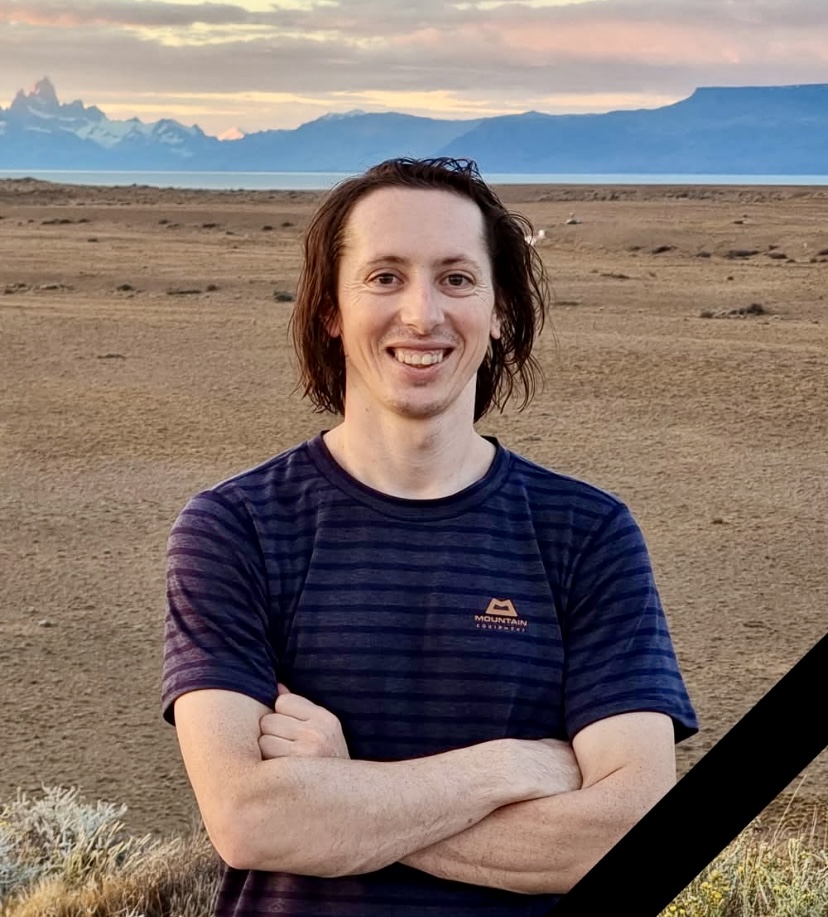
On October 31, 34-year-old Slovakian climber Ondrej Huserka perished while descending the east face of 7,227m Langtang Lirung. He and Marek Holecek had just made the first-ever ascent by the difficult east face.
In 2017, Huserka made the first ascent of the 1,000m high west face of Alexander Block Peak in Kyrgyzstan. In 2019, Huserka successfully climbed Cerro Torre.
Other great mountaineers who died this year
Sadly, this year’s list is very large. We would like to pay homage to other climbers who died in 2024, though we cannot mention everyone:
Alexander Dusheyko, Oleg Kruglov, Vladimir Chistikov, Mikhail Nosenko, and Dmitry Shpilevoy perished on Dhaulagiri I; Murad Sadpara from Pakistan died on Broad Peak. Others included British-American climber Chris Jones; Italian climbers Francesco Favilli and Filippo Zanin; Rocky Shorey; Irish climber Richard O’Neill-Dean; Dave Tan; T. Hagiwara; Gioachino Gobbi; Japanese climbers Ryuseki Hiraoka, Atsushi Taguchi, and Hiroshi Onishi, who died on Spantik; Carlos Romero, Kurt Blair, and a Canadian partner on Mount Cook; Italian World Cup speed skier Jean Daniel Pession and Elisa Arlian; skiers Sylvain Saudan and Matilde Lorenzi.
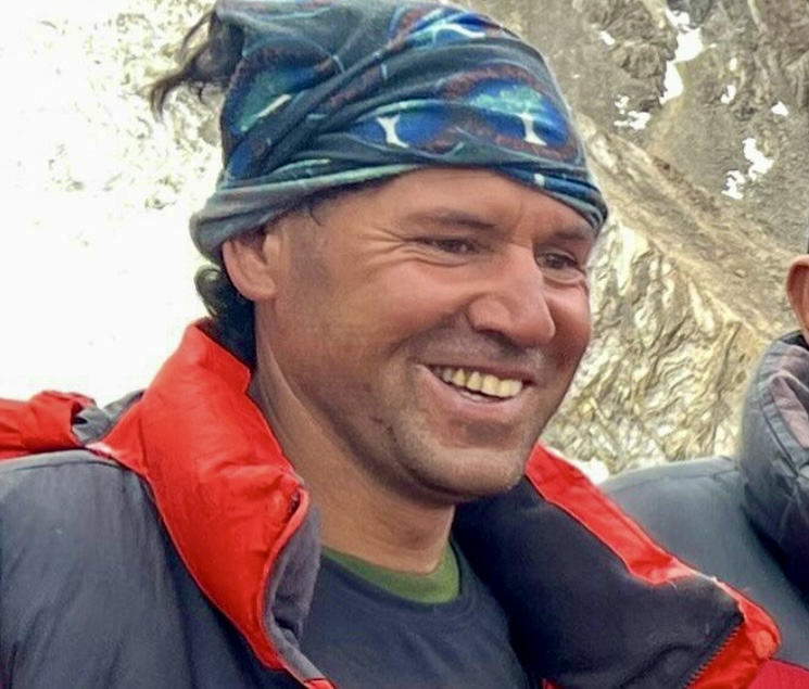
We should not pretend to judge those who seek danger in the highest places, or demand that they tell us the meaning of what they do. Simply put, when they pay the ultimate price for their passion, we must recognize them. -- Wanda Rutkiewicz
French alpinist Liliane Barrard would have turned 76 today.
Born Liliane Bontemps on Dec. 9, 1948, her love for mountaineering started at the age of 13 in Chamonix.
In 1973, Maurice Barrard led a successful French Alpine Club expedition to the Cordillera Blanca in Peru. There, they made the first ascent of the northeast face of Huascaran North, and he also met Liliane. Four years later, the couple married and moved to the Loire Valley. They became the best-known climbing couple of their time.
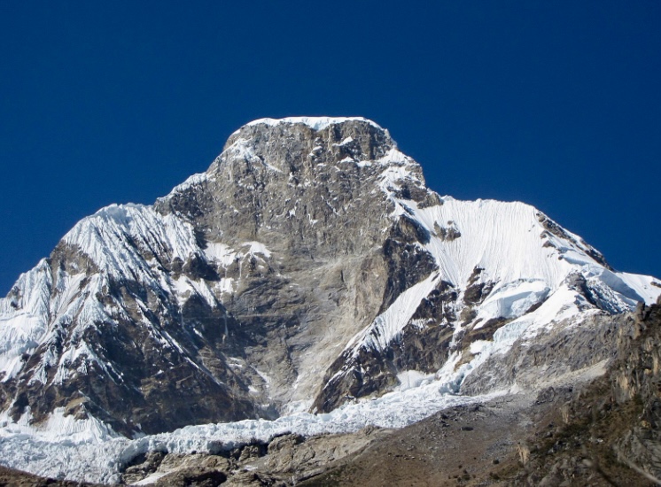
In 1977, Barrard returned to the Andes to solo the south face of Artesonraju in the Cordillera Blanca. He also climbed a new route on the south face of Pisco Peak.
Liliane, newly married to Maurice, also took part in this expedition. A few days later, she, her brother Alain Bontemps, and Christian Bougnaod repeated the Pisco route. The French party also made other first ascents in the area.
In the summer of 1980, Maurice Barrard and his regular partner Georges Narbaud summited Gasherbrum I. Their ultralight expedition, without supplemental oxygen, also featured no logistical support or high-altitude porters.
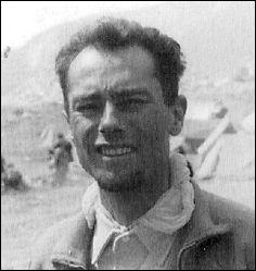
The 'world’s highest couple'
Soon after, Maurice began to climb with his wife as his partner, always lightweight and without sherpa assistants or bottled oxygen. The Barrards had decided to become the ”world's highest couple.” On June 12, 1982, they, along with Alain Bontemps, summited Gasherbrum II in the Karakoram four days after leaving Base Camp.
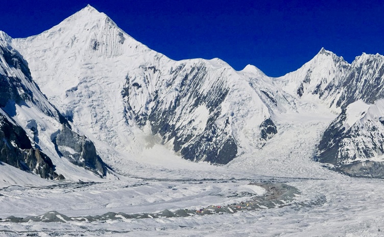
In the summer of 1983, Liliane and Maurice attempted Nanga Parbat via a variation of the Diamir route. They did not succeed, and on that long, hungry expedition, both dropped more than ten kilos. Liliane also lost a toe from frostbite.
But one year later, the Barrards returned to Nanga Parbat and climbed it without bottled oxygen. Liliane thus became the first woman to summit Nanga Parbat.
In the spring of 1985, the couple attempted 8,485m Makalu, again without bottled oxygen, with partners Erich Beaud and Georges Narbaud. They were the only party on the mountain that spring. They used neither camps nor fixed ropes and went via the Makalu La–Northwest Ridge-North Face route. At a high point of 8,430m, they had to turn back because of high winds and frostbitten toes. They also wanted to ski down the peak, but there was no snow on the mountain, only rock and ice.
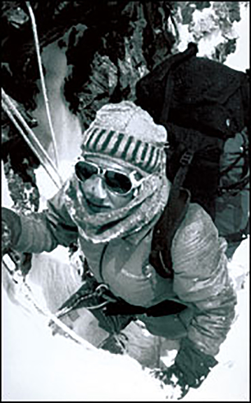
Broad Peak
The couple then attempted Broad Peak in August 1985. Despite four summit pushes, they again fell short because of bad weather, reaching a high of 7,800m. On that expedition, the Barrards helped Wanda Rutkiewicz search for her friend, Barbara Kozlowska, who drowned crossing a glacial river. They then helped to bury her.
Back in 1979, Maurice Barrard and a French expedition attempted the difficult Magic Line on K2. In 1986, Maurice and Liliane attempted 8,611m K2, this time together. Poland's Wanda Rutkiewicz and Michel Parmentier of France joined them. The four wanted to ascend the normal Abruzzi Spur route without outside help or bottled oxygen.
Bad luck plagued their 1986 expedition from the beginning. According to Jim Curran in his book K2: Triumph and Tragedy, the Barrards lost their entire expedition budget, thousands of dollars, plus airline tickets and passports, in a taxi. Despite this, they continued to the mountain.
In the summer of 1986, nine expeditions obtained permits to climb K2 by various routes. The Barrards, Parmentier, and Rutkiewicz started their summit push before the fixed ropes were laid. Before 1986, no woman had summited K2.
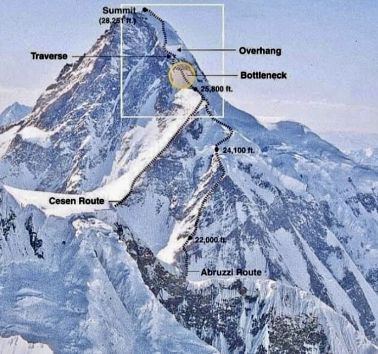
Tragedy soon struck. On June 21, American climbers John Smolich and Allan Pennington, attempting the south-southwest ridge, died in an avalanche at 6,000m.
Barrard’s team, comprising Rutkiewicz, Parmentiere, Liliane, and Maurice, was the first to top out on K2 that summer.
The Barrards and Parmentier climbed the final section of K2 slower than Rutkiewicz, who topped out at 10:30 am on June 23. Rutkiewicz thus became the first woman to summit K2. Liliane and Maurice Barrard joined her half an hour later at 11 am. None used bottled oxygen. All four stayed on the summit until midday.
Two Spanish climbers, Mari Abrego and Josema Casimiro, also summited that day, at about 2 pm, also by the Abruzzi Spur.
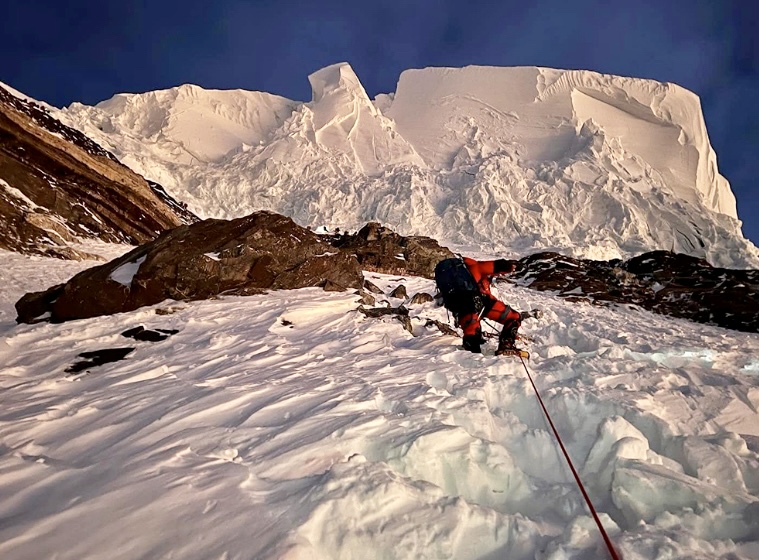
Fatal descent
While Abrego and Casimiro descended without incident to their high camp at 8,000m, Barrard's team struggled. They made it down only to their last bivouac site at 8,300m near the Bottleneck, but they had no sleeping bags in the tent.
On June 24, after a difficult night at altitude and very tired, the Barrard party continued down. They had run out of fuel for the stoves. Parmentier, who set out first, wanted to borrow some fuel from Abrego and Casimiro, who were a little below them. Rutkiewicz followed Parmentier, while the Barrards brought up the rear.
Unfortunately, Casimiro and Abrego had run out of fuel too, so they, Parmentier, and Rutkiewicz hurried down to Camp 3 at 7,800m as quickly as possible. From there, Abrego, Casimiro, and Rutkiewicz continued descending while Parmentier stayed at Camp 3 to wait for the Barrards. Benoit Chamoux, also at Camp 3, tried to convince Parmentier to continue down, but he insisted on waiting for Liliane and Maurice.
But the Barrards never arrived. In high winds and suffering from the cold, Parmentier eventually descended in a whiteout, guided by radio from Base Camp. All four finally made it to Base Camp, but the Barrards had disappeared.
It is possible that they wandered off the route in poor visibility, somewhere below 8,300m. They may have fallen off the mountain or collapsed from hypoxia and exhaustion.
A South Korean team discovered Lilian Barrard’s body a month later at about 5,300m. Maurice Barrard’s body was found 12 years later, on the glacier above Base Camp. Both are buried at the Gilkey Memorial at K2.
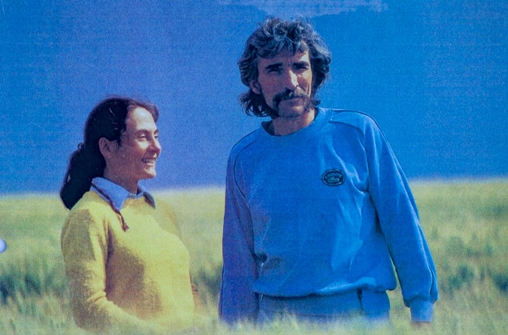
K2's terrible year
During the summer of 1986, 27 climbers summited K2 via different routes.
It was one of the most tragic seasons ever on an 8,000m peak. That summer, K2 claimed the lives of 13 climbers. Apart from John Smolich, Alan Pennington, and the Barrards, Tadeusz Piotrowski, Renato Casarotto, Wojciech Wroz, Mohammed Ali, Julie Tullis, Alan Rouse, Alfred Imitzer, Hannes Wieser, and Dobroslawa Wolf also lost their lives.
For more on this story, we recommend the books of Jim Curran (K2, Triumph and Tragedy), and Kurt Diemberger (The Endless Knot: K2, Mountain of Dreams and Destiny).
The police searching for the three climbers missing on 3,724m Aoraki/Mt. Cook since last week has given up hope of finding them alive. A drone search yesterday showed pieces of gear and footprints on the mountain but no trace of the climbers. Their families have been informed of the tragic news.
The drones confirmed the suspicions that Kurt Blair, 56, of Colorado and Carlos Romero, 50, of California, plus a third unnamed Canadian, likely took a fall while attempting the Linda Glacier/Zubriggen Ridge route on Aoraki/Mt. Cook, the highest peak in New Zealand. The team flew to the Plateau hut on Saturday and expected to reach the summit the following day. A search-and-rescue operation began after they failed to meet their prearranged transportation on Monday.
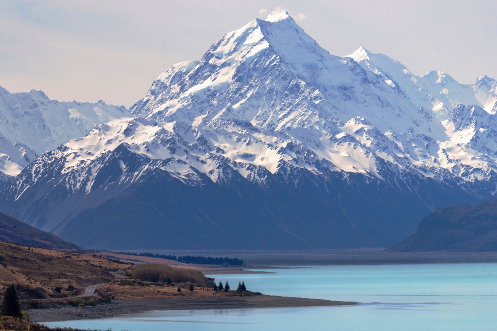
Search abandoned
The police have told New Zealand media that they aren't continuing to search at this stage.
"However, we remain poised to reactivate our search if we receive fresh information or credible reports of sightings, especially from the climbing community," they told 1 News.
Asked about launching an operation to recover the bodies, the police said that option would be "carefully considered."
Both Blair, from Colorado, and Romero, from California, were professional mountain guides with IFMGA/AMGA accreditation and wide experience in mountains around the world.
Mount Cook is an impressive peak on the west coast of New Zealand's Southern Island. There is no easy route to its summit, and the climb is exposed to several objective dangers, including rockfall, avalanches, steep sections on hard ice, and abruptly changeable weather.
Three climbers -- two Americans and one Canadian -- are missing on 3,724m Aoraki/Mt. Cook, the highest peak in New Zealand.
The climbers flew to Plateau Hut on Saturday and planned to climb the peak on Sunday. When the climbers failed to meet their pre-arranged transport yesterday, a search began. Patrols found clothes and climbing gear but no trace of the missing team.
Fall suspected
The search was suspended today due to bad weather. It is not expected to resume until conditions improve, likely not till Thursday.
The missing Americans are Kurt Blair, 56, from Colorado; and Carlos Romero, 50, of California, AP reported. Both are certified mountain guides. The name of the Canadian has not been shared yet.
Two hours ago, New Zealand's 1 News quoted a relative of one of the missing climbers, who said that authorities believe they may have suffered a fatal fall.
For experts only
Aoraki/Mt. Cook, on New Zealand's Southern Island, is a serious climb suitable only for experts. The heavily glaciated peak features huge crevasses, steep sections, avalanche-prone slopes, and highly variable weather.
The missing team was probably climbing the peak via the standard route up the Linda Glacier and Zubriggen Ridge. They skipped the lower section across the Tasman Glacier and Haast Ridge by flying directly to Plateau Hut, the usual point from which summit pushes are launched.
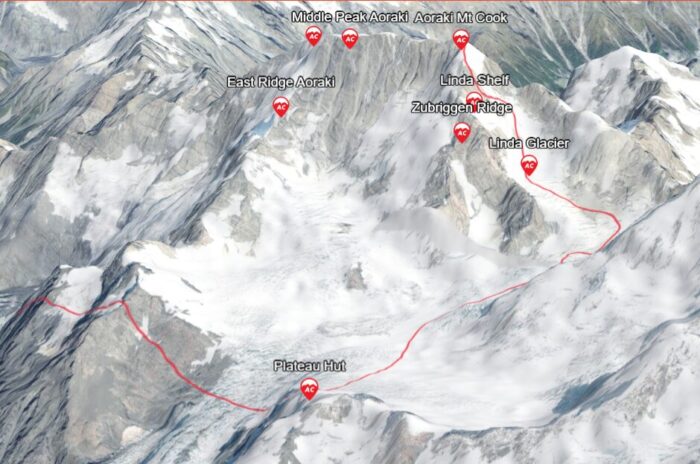
The long summit day involves an early start to minimize avalanche risk. Climbers navigate the heavily crevassed Linda Glacier, then follow the Zurbriggen Ridge to the summit, which includes 50º sections on ice, according to SummitPost. The round trip back to Plateau Hut usually takes 15-20 hours.
According to SummitPost, the Linda Glacier route is the most popular because it is the least technical but it is also the most dangerous route up the mountain.
"The route is exposed in numerous places to avalanches, rockfall, and ice-fall danger from above," New Zealand-based Adventure Consultants confirms. "From December onward, the route can become heavily crevassed before eventually becoming impassable. Crevasses may slow travel through areas threatened by ice avalanches and can be unacceptable from a safe guiding perspective."
More than 240 people have died on Aoraki/Mount Cook and in the surrounding park in the last 120 years.
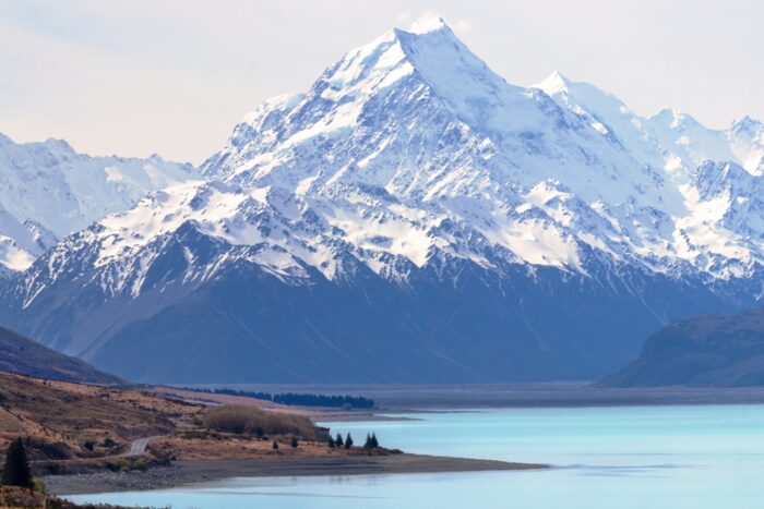
Potential Mt. Cook clients must have their skills and level of fitness assessed by the local outfitter. Climbers also stop some meters away from the peak's highest point out of respect for the Ngāi Tahu community of the Maori people, for whom Aoraki is a sacred ancestor.
Sixty-nine years ago today, the pioneering French alpinist and ski instructor Louis Lachenal died in a crevasse in the Alps. Lachenal was one of the first two mountaineers in the world to summit an 8,000m peak. That was Annapurna I in 1950.
Lachenal was born on July 17, 1921, in Annecy, in the Auvergne-Rhone-Alpes region of southeastern France. His love of mountaineering started early. In his early 20s, he became a mountaineering and ski instructor and a guide in Chamonix.
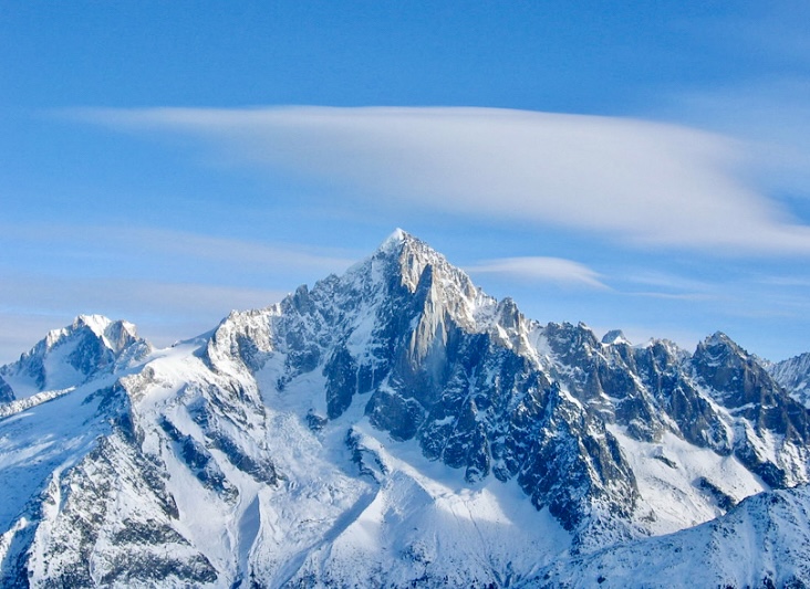
Lachenal started climbing with Lionel Terray in the summer of 1945. They had met that spring when Terray passed through Annecy. As he strolled through town, he was approached by a poorly dressed young man who asked him, ”Aren’t you Lionel Terray?”
Terray said yes, and Lachenal introduced himself. Terray then remembered that he had heard of Lachenal's exceptional climbing skills from some friends. The two men went for beer together, and thus, an exceptional climbing duo began. That July, Lachenal and Terray climbed the 4,122m Aiguille Verte.
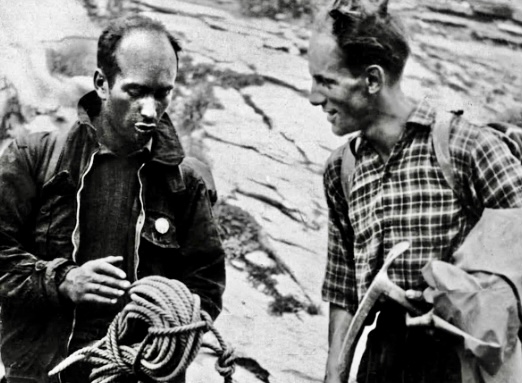
The following year, they made the fourth ascent of the Walker Spur of the Grandes Jorasses. During the ascent, the two climbers became lost in bad weather and traversed too far to the right of the ridgeline. According to the American Alpine Journal, Lachenal and Terray were then forced into the difficult and dangerous couloir high on the face. It became known as the Terray Escape. Because of the treacherous unstable rock, it was a very narrow escape.
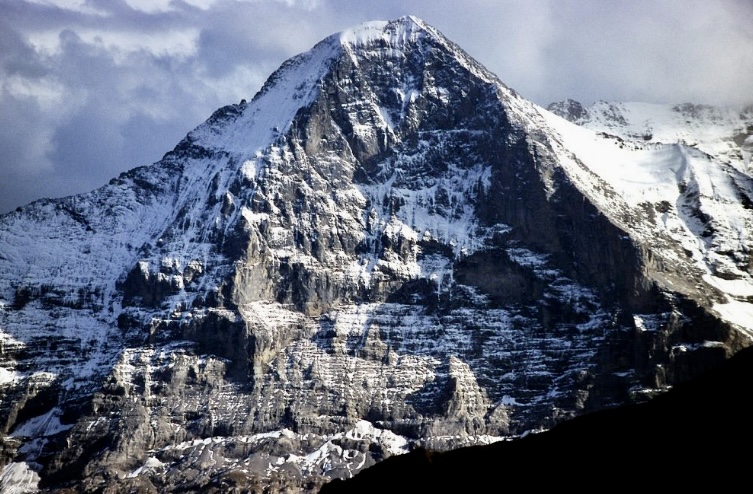
In 1947, Lachenal made the second ascent of the North Face of the Eiger, again with Terray, who was now his regular climbing partner.
Annapurna I
Maurice Herzog invited Lachenal on his 1950 Himalayan expedition. The original objective of the French expedition was an unspecified 8,000'er. According to Adam Carter in the American Alpine Journal, this greatly limited their choice of mountain. At the time, nearly all 8,000m peaks were out of bounds because of the India-Pakistan war in Kashmir and the Chinese Communist presence in Tibet.
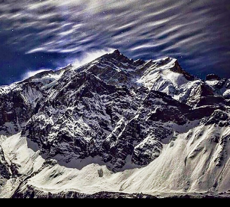
Eventually, the French received permission to enter Nepal and attempt either 7,134m Gaurishankar or to follow the Krishna Gandaki Valley and try 8,167m Dhaulagiri I or 8,091m Annapurna I. The French stuck with their 8,000m plan and had the two peaks to choose from.
Herzog's team included Jean Couzy, photographer Marcel Ichac, Louis Lachenal, Jacques Oudot (team doctor), Gaston Rebuffat, Marcel Schatz, Lionel Terray, and eight sherpas -- Ajiba Sherpa, Ang Dawa Sherpa, Ang Tshering Sherpa, Ang Tharkay Sherpa, Dawa Thondup, Ila, Phu Tharkey, and Sarki Sherpa.
Dhaulagiri I discarded
By 1950, only one party had apparently attempted Dhaulagiri I, an American group the year before. However, The Himalayan Database noted that this had just been a rumored attempt.
Herzog’s team eventually discarded Dhaulagiri I because they could not find a feasible route. They only reconnoitered the Southeast Ridge and the North Side. So in the end, they headed to Annapurna I. No one had attempted it before.
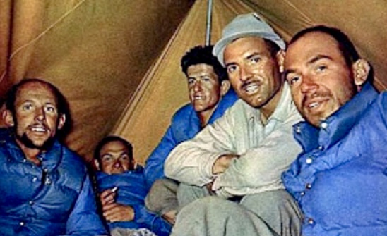
They arrived at Annapurna’s Base Camp on May 18. Despite the initial shock of how imposing the giant peak looked, they gamely started climbing its northern slopes. They did not have much time before the monsoon. After making it up to 6,000m on the Northwest Spur, the French finally opted for the North Face.
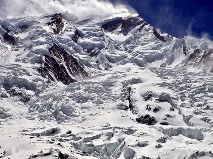
On June 3, Herzog and Lachenal summited Annapurna I without supplemental oxygen and became the first alpinists in history to climb an 8,000’er. Lachenal was about to give up during the push but finally decided to accompany the determined Herzog to the top.
On the summit, Herzog lost his gloves when he took them off to take photos. They spent one hour on the summit. A storm was approaching, and a nervous Lachenal urged Herzog to descend. Herzog refused to hurry down, so Lachenal started to go down alone. Eventually, Herzog followed.
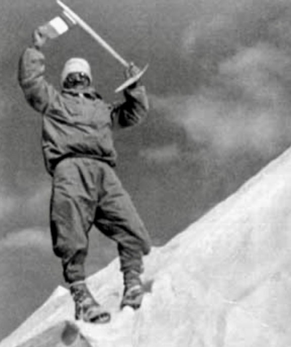
Descent and frostbite
Both suffered severe frostbite during their dramatic descent. Terray and Rebuffat were waiting for them at Camp 5 at 7,500m. In the bad weather, they had no visibility and had to bivouac in a crevasse, all four in one sleeping bag.
Finally, they made it back to Base Camp. Herzog later lost both his fingers and toes; Lachenal’s toes were amputated as well.
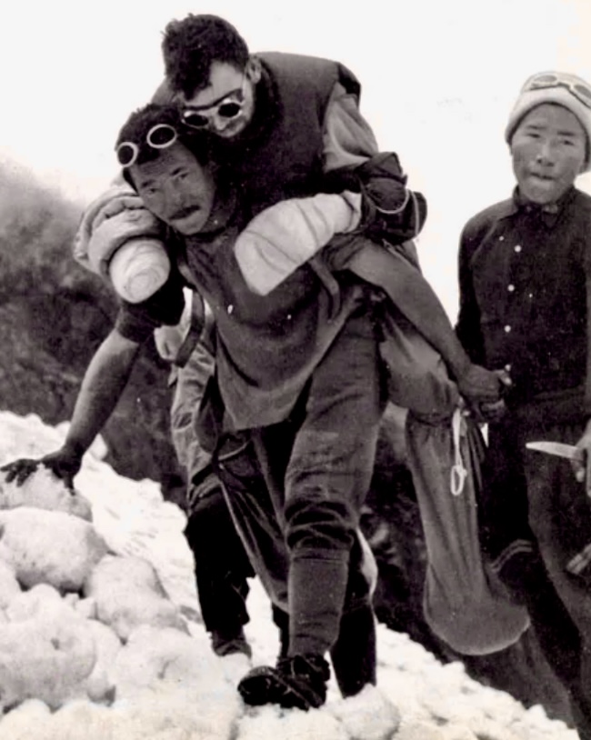
The Annapurna expedition had its controversies, both among the mountaineers who were there and in the climbing community at large. Some doubted that the French had summited at all.
Accident
Lachenal died at the age of 34, five years after Annapurna. On November 25, 1955, Lachenal was skiing in the Vallee Blanche in Chamonix with Jean-Pierre Payot when Lachenal fell into a crevasse and died immediately. The next day, Lachenal’s friends and some guides retrieved his body from the deep crevasse.
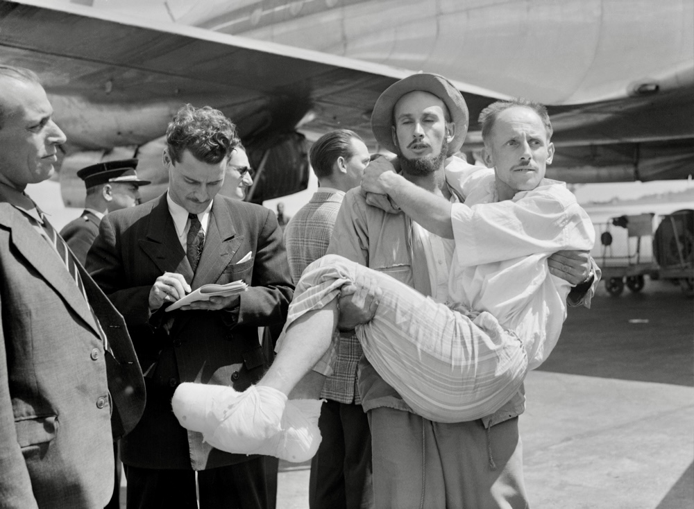
Later, 3,613m Point Lachenal in the Mont Blanc Massif was named after him. ”The mountains were not my weekend hobby, they were my entire life,” he said once.
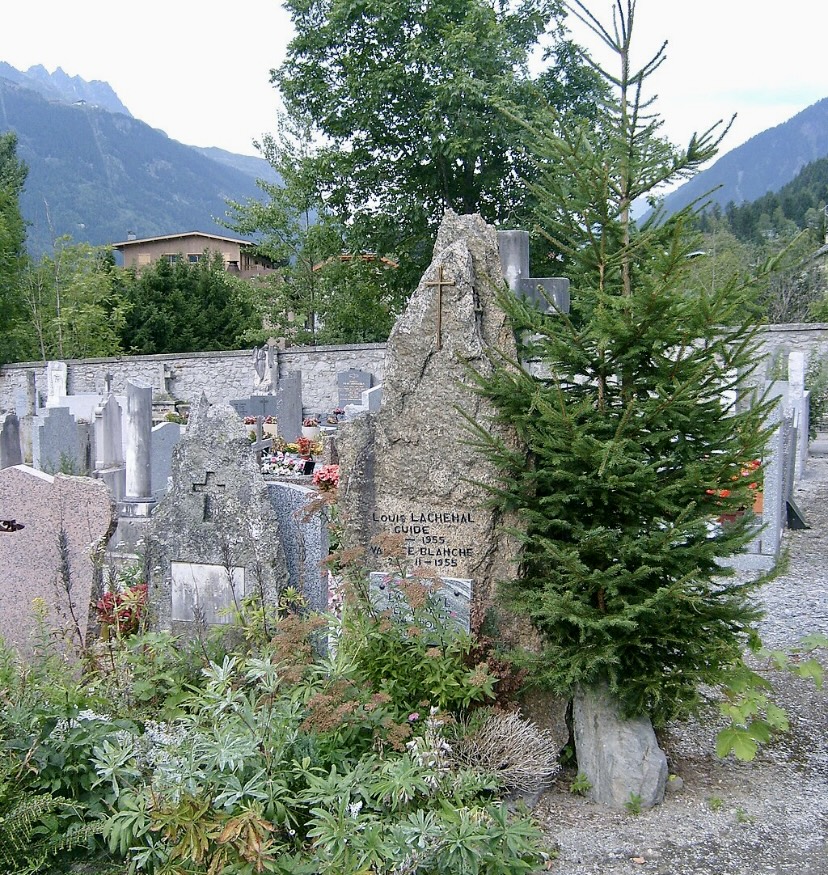
Maciej Kimel, Michal Krol, and Mariusz Madej of Poland have set a new route up Kiajo Ri, a popular 6,187m peak in Nepal's Khumbu Valley.
The trio called their 1,300m line Butterfly Effect and estimated its difficulty as M6, 6b. The climbers needed three days for the 34 pitches, plus another day for the descent.
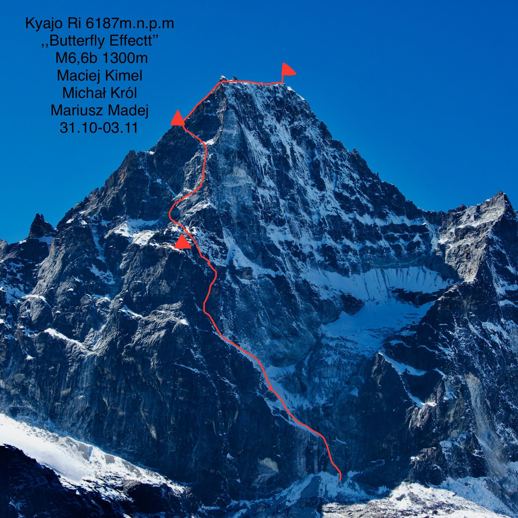
No rest
One of the main challenges was exhaustion. The climbers acclimatized for five days but had no time to rest. The continued good weather threatened to disappear in a few days, so they had to start immediately.
The three set off on October 31 at 5:30 am. Climbing in pure alpine style, they covered 500 vertical meters on mixed and rocky terrain on the first day, Polski Himalaizm Sportowy reported.
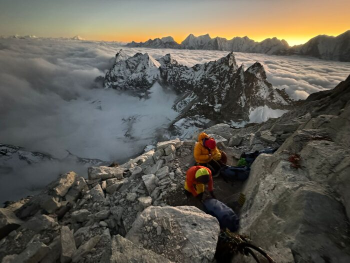
The climbers said the wall was almost vertical from the beginning. "We knew that the –- relatively comfortable -- bivouac spot was at around 5,600m," they explained. This motivated them to climb 15 pitches to the bivy ledge, which they reached at 5:45 pm.
The following morning, they continued under a light snowfall, compensated by the excellent rock on the otherwise vertical central wall.
"Despite the considerable difficulties, the climbing went smoothly," they reported. "After 14 pitches, we found ourselves on a comfortable shelf at 5,900m, [where] we slept in sleeping bags without a tent."
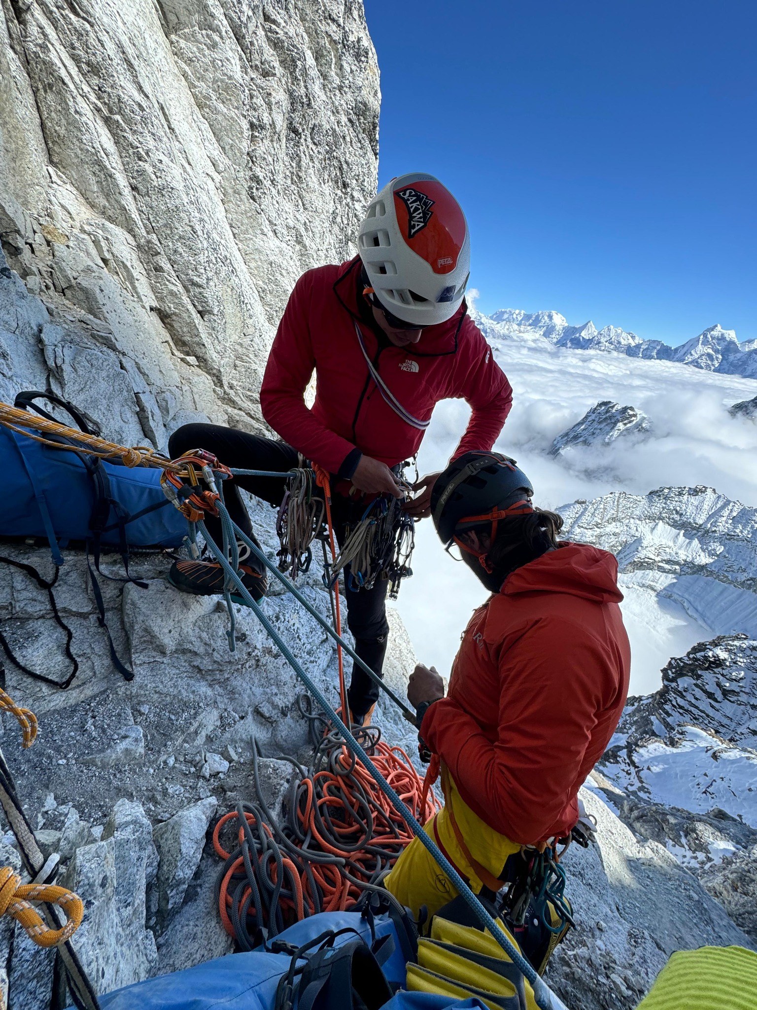
To the summit
In the morning, they gained the remaining 300 vertical meters to the summit.
"At first, we climbed the eastern peak, thinking that getting to the main peak would be a mere formality," they recalled. "Nothing could have been further from the truth! The ridge between the eastern and main peaks is very jagged and requires climbing."
They reached the summit at 10:30 am. The descent was tricky due to the fragile terrain on the upper parts of the mountain and some overhanging rappels. Night fell before they finished descending, so they set up a bivouac at 5,700m. The following morning, they used the last few hours of good weather to reach Advanced Base Camp around noon.
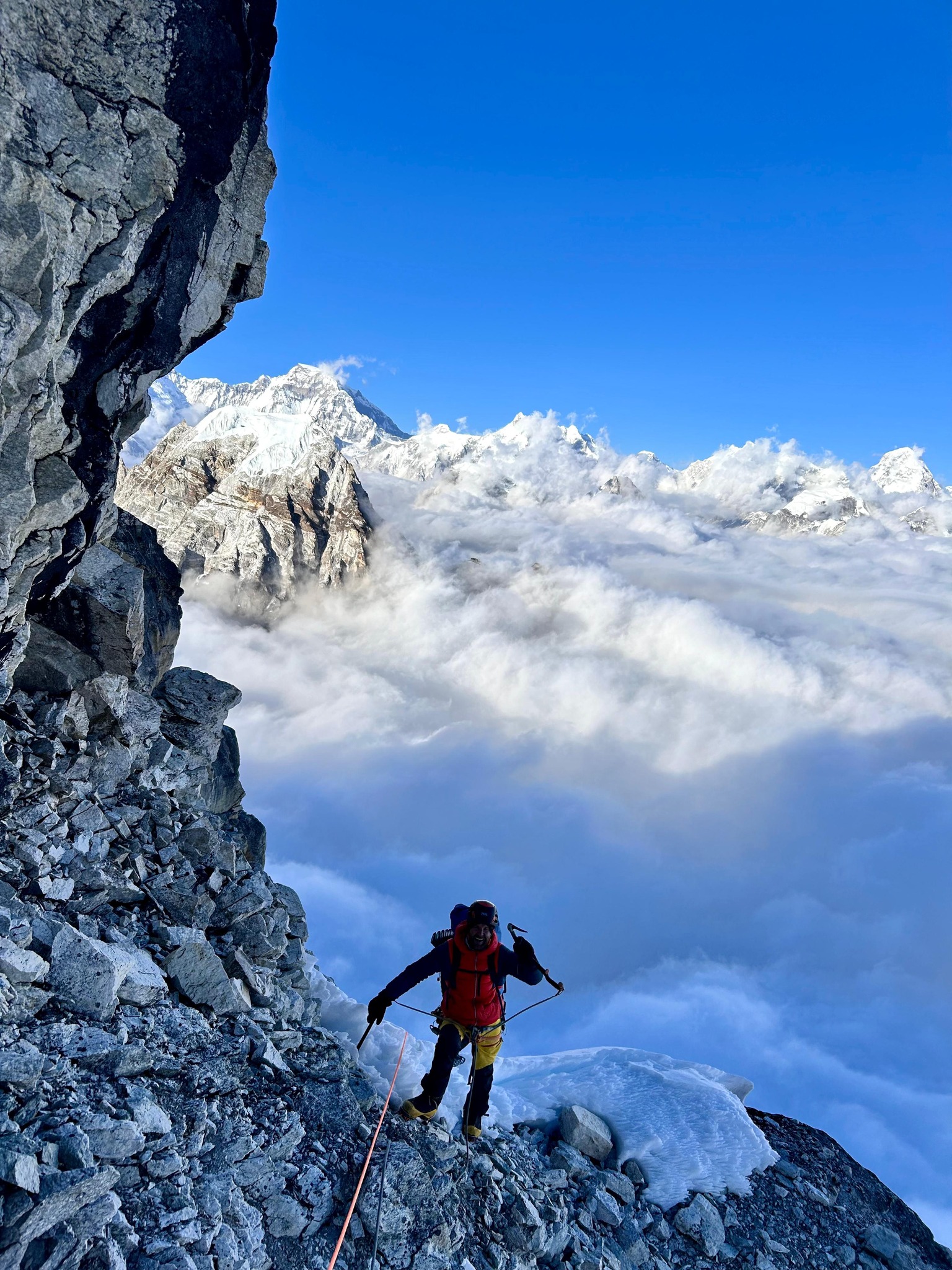
Check the video summarizing the expedition on Maciej Kimel's social media:
The route follows the northeast ridge of the peak, close to the previous Russian-Ukrainian route opened in 2013, called Stealing Beauty. The current team has noted that they were careful to open a completely new route. The two routes only intersected once, at 5,700m, said the climbers.
Bitter news
The team returned to the village of Marchamo exhausted and dehydrated but happy. But then they heard the tragic news from Langtang Lirung, that their good friend Ondrej Huserka had died in a crevasse fall.
"Joy turns into sadness, excitement into depression and anger," they said. "Unfortunately, mountains sometimes take our loved ones away from us without any warning signs."
Last year, Maciej Kimel opened a new route on Chobutse with Wadim Jablonski. Jablonski had tried to coordinate a rescue for Huserka right after he heard news of the accident. He had hoped that Huserka might have survived the fall.
Shortly afterward, Huserka's partner Marek Holecek wrote on social media that the climber had died in his arms. Still, a long-line rescue was scheduled for Monday and then suspended because of bad weather.
Flying conditions have not improved in the last 24 hours, and it is not clear whether the retrieval operation will resume. Outfitter Subin Thakuri of 14 Summits Expeditions said that he was concerned about the risks to the rescuers.
Renowned South Korean mountaineer Park Young-Seok would have turned 61 today. Park is the only person to have completed the true Explorers Grand Slam: He climbed all 14x8,000'ers, completed the Seven Summits, and did full-length manhauling treks to both the North and South Poles.
Close call on Everest
In 1991, Park had a close call on Everest. He was attempting the Southwest Face on the 1975 British route, leading at 7,000m, when he fell 150m but somehow survived.
Though he didn't summit that year, Park ascended Everest three times: in 1993, 2006, and 2009. On the 2009 climb, he opened a new route on the left side of the Southwest Face.
Young-seok also ascended both Cho Oyu and Shisha Pangma Central twice. He finished both the Carstensz and Kosciuszko versions of the Seven Summits in 2002.
Disappearance on Annapurna I
In the autumn of 2011, Park was on the South Face of Annapurna I with Shin Dong-min and Kang Ki-seok. Their final communication with Base Camp was on October 18. The climbers were not heard from again. A search-and-rescue operation was unsuccessful.
Park was 47 at the time of his death. Before the climb, he wrote, "I’m getting more and more likely to die. I live each day with a grateful heart, but a mountaineer who settles down is not a mountaineer. If a tiger loses its wildness, is it still a tiger? I was born with the luck of an explorer, so I think I will explore and climb mountains until the day I die."
No one else has completed the true Explorers Grand Slam. Since Park, the term itself has become watered down. It is simply too hard for those eager to claim such a flashy label, so they tweaked this unofficial term to fit what they accomplished. In particular, that is because of the full-length North Pole requirement. It was always the hardest of all, but for logistics and climate-change reasons, it is even harder today. A full-length North Pole expedition hasn't been done in 10 years.
Below, you can watch a video homage to Park Young-seok.
The Piolets d'Or committee has revealed the winners of the coveted mountaineering awards for 2023. Sadly, one of the prizes will be posthumous.
Kazuya Hiraide and Kenro Nakajima won recognition for their new route Secret Line on Tirich Mir. Tragically, the two Japanese perished this past summer while attempting the West Face of K2. This is the fourth Piolet d'Or for Hiraide and the third for Nakajima.
Three teams awarded
As usual in recent years, the jury singled out not one but three climbs. Americans Jackson Marvell, Matt Cornell, and Alan Rousseau also won for their alpine-style climb of the formidable 2,700m north face of Jannu in Nepal's Kangchenjunga region.
Finally, three young Swiss climbers were awarded for a little-publicized but impressive new route up 6,100m Flat Top in India's Kishtwar Himalaya. Hugo Beguin, Matthias Gribi, and Nathan Monard made the second ascent of the mountain via a new 1,400m route graded as ED, 5c A2 WI4 M6, which they called Tomorrow is Another Day. The team descended via the previously unclimbed west face of the mountain.
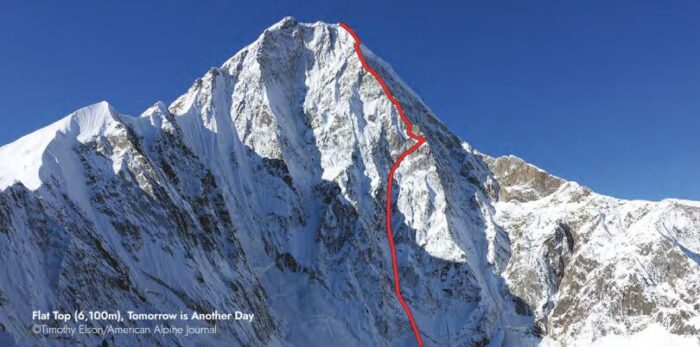
The jury of Lise Billon (France), Ales Cesen (Slovenia), Toni Gutsch (Germany), Genki Narumi (Japan), Enrico Rosso (Italy), Jack Tackle (U.S.), and Mikel Zabalza (Spain) selected these three outstanding climbs among a not-so-short list of nearly 60 finalists.
Nives Meroi wins at home
This year, the organizers promoted female alpinism with an award to Nives Meroi of Italy in the Special Mention category. Meroi was part of a team with her husband, Romano Benet, and Peter Hamor of Slovakia. The threesome opened a new route up Kabru South in Nepal's Kangchenjunga region.
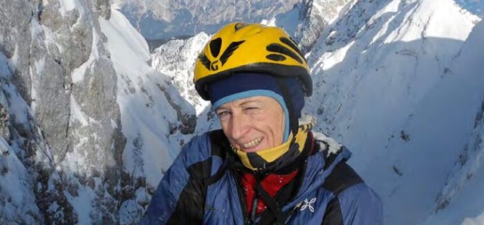
Meroi has always done her climbs with partner Romano Benet. She was working on her 14x8,000m challenge when Benet fell seriously ill while climbing Kangchenjunga. Meroi stopped her climb and waited until Benet recovered from a long illness. The couple returned to high-altitude climbing in 2014, summited Kangchenjunga, and then completed all the 8,000'ers together on the summit of Annapurna in 2017. They didn't use bottled oxygen or sherpa support on any of the peaks.
The Piolets d'Or ceremony will take place in San Martino di Castrozza in the Italian Dolomites from December 8-10. In addition to the awarded climbs, there will be a tribute to the climbers who perished this year, including many past award winners. Jordi Corominas of Spain will also receive a Lifetime Achievement Award.
Read more on the climbs and the ceremony here.
Thirty-five years ago today, one of the all-time giants of mountaineering perished.
On Oct. 24, 1989, Poland's Jerzy Kukuczka was attempting the South Face of 8,516m Lhotse, when his rope broke. Kukuczka fell to his death from an altitude of 8,350m.
Born in Katowice, the great Polish climber had already completed all 14 8,000m peaks. At this time, this was one of the pinnacles of alpinism, compared to today, when it is fast becoming an Instagram listicle for guided clients. Kukuczka established several new routes on these 8,000m peaks and completed four successful winter ascents of them.
Beyond his incredible physical strength and technical skills, Kukuczka was a loving family man. An electrician by trade, he found joy in the Himalaya and the Karakoram. Sometimes, he painted factory chimneys as a temporary high-altitude worker to raise money for his expeditions.
”At the top, there is no explosion of happiness," Kukuczka said once. "Happiness is when everything remains in front of you, when you know that you have a few hundred, a few dozen meters ahead to complete your goal. That is happiness.”
Although this is the day he died, it's best to celebrate his life and legacy by sharing the documentary below about this legendary climber.
Instead of announcing a short group of nominees, the organizers of the Piolet d'Or Award have released what they call the "big list of significant ascents."
While the favorite is likely the American team which opened a direct new route on the North Face of Jannu (Nepal, Kangchenjunga region) last fall, the list highlights a rich assortment of adventures. ExplorersWeb reported on nearly all of them and a few were already selected for our Best of 2023 list.
The Piolet d'Or list was compiled by Lindsay Griffin and Dougald MacDonald of the American Alpine Journal, and Rodolphe Popier, formerly of 8,000ers.com.
Sixty remarkable ascents
The list includes seven ascents in Pakistan, six in India, ten in Nepal, one in Tibet, three in China, one in Georgia, two in Russia, two in Kyrgyzstan, three in Greenland (Denmark), six in Alaska (U.S.), two in the rest of the U.S., two in Canada, three in Peru, one in Bolivia, four in Patagonia (Argentina-Chile), one in New Zealand, four in Norway, and eight in the European Alps (France/Italy/Switzerland).
That makes for a grand total of 66 ascents and a tough job for the technical jury, comprising Lise Billon of France, Jack Tackle of the U.S., Mikel Zabalza of Spain, Genki Narumi of Japan, Toni Gutsch of Germany, Ales Cesen of Slovenia, and Enrico Rosso of Italy. However, if recent Piolet d'Or trends hold, the jurors will pick more than one ascent.
The organization committee also noted that they will include a Special Mention Award "to promote female alpinism."
Women promoted but not nominated
Interestingly, there is not an all-female team among the eligible climbs. The only female representation comes from team members in seven of the 60 climbs:
14x8,000'ers summiter Nives Meroi of Italy, who climbed Kabru South (Kangchenjunga region, Nepal) with her husband Romano Benet and Slovak Peter Hamor.
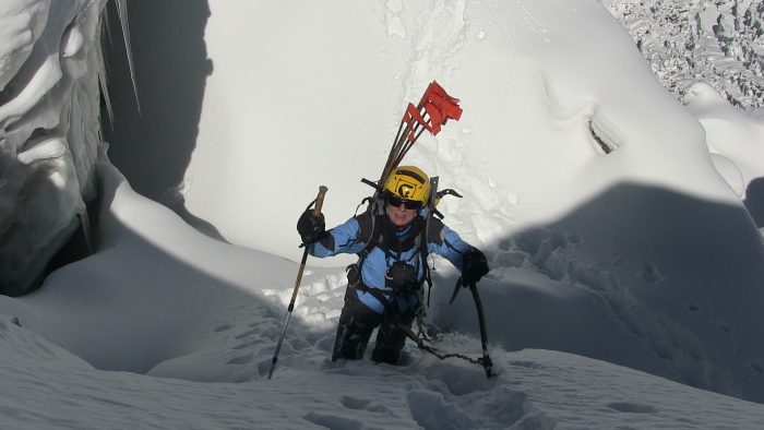
Olga Lukashenko of Russia, who climbed Pik Ulun in Kyrgyzstan with Evgeny Murin and Ilya Penyaev.
Russian Marina Popova, who climbed Pik Breeze in the Pamir Alai with Denis Prokofiev.
American Michelle Dvorak and Brit Fay Manners, who climbed Greenland's Ataatup Tower with the late Martin Feistl.
Silvia Loreggian of Italy, after her climb of Cemetery Spire (2,316m) in Alaska's Kichatna Mountains, via Gold Rush (600m, 5.12a A1+), with Stefano Ragazzo.
Maria Teresa Llampa Vasquez of Bolivia, for a new route on the southwest face of Huallomen (5,463m), Bolivia's Cordillera Real, with fellow Bolivian Ronaldo Choque and Italian Daniele Assolari.
Tribute to the fallen
On Dec. 6, the Golden Iceaxes will be awarded during a ceremony held in San Martino di Castrozza, in the Italian Dolomites.
There will be time to greet the winners and discuss the climbs of the year, but also to pay tribute to five climbers, all of them Piolet d'Or awardees, who lost their lives in 2024. Dmitry Golovchenko and Serguey Nilov of Russia perished in subsequent expeditions on Gasherbrum IV. A lightning strike killed Archil Adriashvili of Georgia while climbing Shkhelda. And Kazuya Hiraide and Kenro Nakajima of Japan lost their lives while trying to open a route on the West Face of K2.
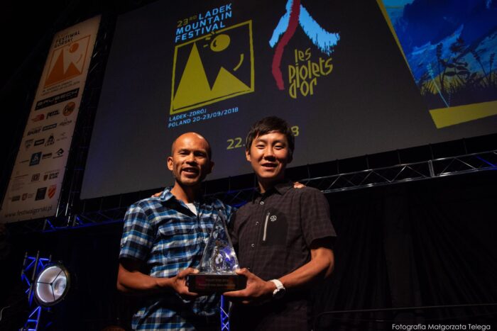
In a sad twist, Hiraide and Nakajima are among the eligible candidates for the Piolet d'Or this year. The pair are nominated for their first ascent of The Secret Line (2,200m) on the north face (and subsequent traverse) of Tirich Mir (7,708m) in the Hindu Kush. We chose their ascent as our top expedition of 2023.
The shortlist for this year's Boardman Tasker Award for Mountain Literature has been announced. It features six books, including several by familiar authors.
Bernadette McDonald's Alpine Rising: Sherpas, Baltis, and the Triumph of Local Climbers in the Greater Ranges focuses on the underappreciated roles played by Nepali and Pakistani climbers, especially on the future of high-altitude endeavors.
Behind Everest: Ruth Mallory's Story, by Kate Nicholson, weaves Ruth Mallory’s personal struggles and contributions into the often-murky history of women in early 20th-century mountaineering.
Clive Oppenheimer's Mountains of Fire: The Secret Lives of Volcanoes explores the intricate relationship between volcanoes and humanity.
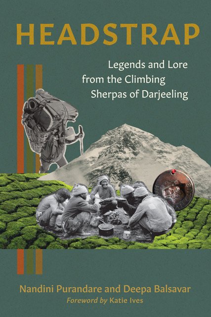
Headstrap: Legends and Lore from the Climbing Sherpas of Darjeeling, by Nandini Purandari and Deepa Balsavar, offers a captivating glimpse into the lives of the legendary mountaineers who populate the "Kathmandu of India."
David Smart's latest book, Royal Robbins: The American Climber details Robbins’ journey from a troubled upbringing to a legendary climber.
A Fine Line: Searching for Balance Among Mountains, by Graham Zimmerman, is an introspective account of the challenges faced by modern alpinists.
The summer season ends soon, but there are still some good days ahead to climb Mont Blanc. If conditions are right, it is a relatively straightforward climb. At the same time, its 4,809m are not to be underestimated. Due to the peak's popularity, it's best to plan months in advance.
"People doing guided ascents in 2025 on the normal route should book their climb this autumn," says Chamonix-based guide Stuart Macdonald. Otherwise, booking beds at Gouter Hut may prove impossible. "The demand for beds is off the scale," Macdonald says.
Stuart Macdonald, an IFMGA guide, has climbed in the Alps since the 1990s and moved to Chamonix in 2007. He guides Mont Blanc a maximum of 3-4 times every year. In his career, he has summited the peak over 40 times. "I actually stopped counting years ago," he admits.
Cradle of alpinism
Mont Blanc, or Monte Bianco in Italian, lies on the border between France (Haute Savoie) and Italy (Aosta Valley). It is the highest peak in both countries, as well as the Alps and Western Europe. Its allure comes from its status as the highest, but there is much more to it. Surrounded by glaciers and jagged peaks in the heart of the Alps, it is near some of the most scenic mountain towns -- Chamonix and Saint Gervais in France and Courmayeur in Italy -- and is the cradle of mountaineering history. Basically, alpinism was born there.
Moreover, its first ascent by Jacques Balmat and Dr. Michel Gabriel Paccard, and three years later, by Balmat again and Horace Benedict de Saussure, ushered in a new era. It was previously supposed to be a "doomed place" inhabited by malignant supernatural beings, to be avoided.
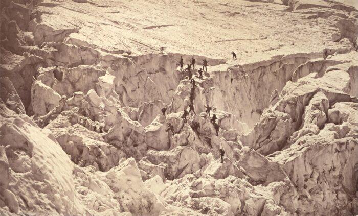
The first accident on the mountain took place during the 10th ascent, in 1820. Three local guides died in an avalanche, unable to veto their clients, who had insisted on continuing up despite bad conditions. (Sound familiar?) This had a strong impact on public opinion at the time and changed the way future generations approached climbing in the Alps.
The guides united, and on May 9, 1823, they founded the Compagnie des Guides de Chamonix (Company of Chamonix Guides). Similar guiding companies began in Courmayeur and Saint Gervais. Professional guides became essential figures in the evolution of mountaineering in the Alps, which soon became known as alpinism.
Can everyone climb Mont Blanc?
For independent climbers, Mont Blanc is considered a serious challenge. It requires a previous background on lesser peaks and knowledge of how to move safely in glacial and high mountain terrain. Even when assisted by a guide, a strong climbing background is a valuable asset.
Yet many clients often attempt the Roof of the Alps without any background in mountaineering. This is a suitable option if done with an accredited guide who assesses the fitness and experience of potential summiters. So, can Mont Blanc be climbed without previous experience? According to Stuart Macdonald, it can.
"It’s pretty normal for someone arriving for a guided ascent to have no experience, and that’s fine by me," Macdonald says. "Personally, I have found that the only way to know that people are ready is for them to spend three days training and acclimatizing (sleeping in mountain refuges) before the summit attempt. A novice can arrive, and then be ready a few days later."
Macdonald insists on leading the acclimatization trips as well. "While some companies are happy for people to do their own acclimatization and training, I’ve found this seldom works and no longer offer it," he explains.
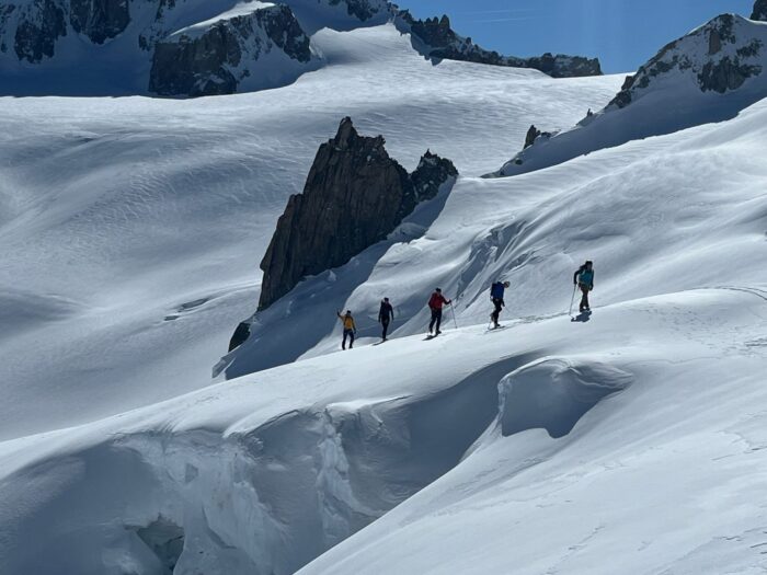
Preparation is key
"Mont Blanc involves a long summit day, and I find that people who are used to big hiking days, or long-distance runners, usually do best," Macdonald said.
For novices, Macdonald suggests, "If you can jog your way around a half marathon in two hours or so, then you should be fine. The worst performers are generally gym freaks with a lot of muscle mass but low levels of cardiovascular fitness."
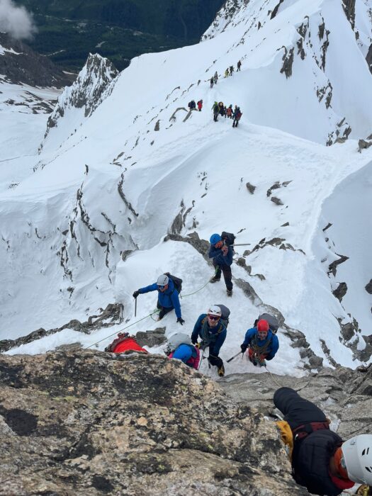
Fitness may be a requirement, but it is not enough. "Preparation is everything," Macdonald says. "I like my groups to sleep at around 3,000m for two nights while training. We will focus on crampon work because slips and trips cause most accidents. We always practice on some steep and challenging terrain, such as the Aiguille Marbree. That way, I can see if anyone will struggle between the Tete Rousse and the Gouter refuges or freak out on the summit ridge."
After the would-be client puts in adequate preparation time, Macdonald says there's really only one thing to worry about on Mont Blanc: the weather.
The normal route, step by step
The route along the Dome du Gouter and the Bosses Ridge is by far the most popular route on Mont Blanc for one simple reason. It offers the best chance of success. Interestingly, the route of the first ascent, up the Bossons Glacier, is currently not an option in summer due to glacial retreat. Rather, it is done on skis in winter and spring.
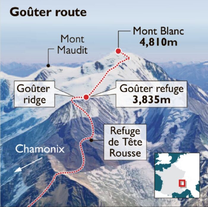
Here is how Macdonald does the Gouter Route with his clients, stage by stage and in his own words:
Tete Rousse Hut to Gouter Hut
It starts with a 2.5-hour walk from the train station at Nid’aigle to the Refuge Tete Rousse. From there, you can go to the summit the next day, sleeping in the Gouter Hut on the way down. The most technical section is between the two refuges. Shortly after leaving the Refuge Tete Rousse, you have to cross the Grand Couloir du Gouter.
While technically straightforward, this short section (which takes just a minute or two to cross) is prone to rockfall. Hence, it’s best done when the couloir is snow-filled and frozen. If not frozen, it should be dry (when there is no thawing, and not after a rainfall).
Sometimes, the rockfall gets so bad that the route closes. I’ll only guide the route in June or September, which tend to give the safest conditions. After the traverse of the Couloir, you have to scramble for around two hours up to the Gouter Hut.
The terrain varies from easy paths to low-grade rock climbing. It’s not very difficult, but it is steep, exposed, and you'll need to be confident. Guided clients are roped up from the moment they leave the hut. There are also cable-protected sections along the way.
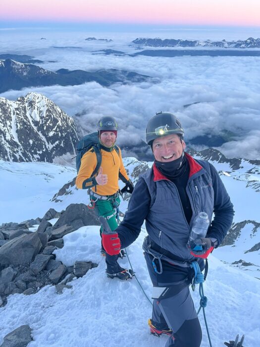
Gouter Hut to the Vallot Shelter
When we reach the Gouter Hut, we normally take a break and drop off a few things that we will not need for the summit push. After setting off again, the terrain is quite easy. We go up snowfields until the Vallot Shelter, a small cabin used for emergencies, located at 4,365m. There, we take another break before the final push.
Vallot Shelter to the summit
Shortly after the Vallot Shelter, we follow the Bosses Ridge to the summit. The ridge is narrow in places and requires good crampon technique and a head for heights. The total time from Tete Rousse to the summit is around seven hours.
Descent
The descent back to the Gouter Hut takes between two and two-and-a-half hours, and we spend the night there. Using both refuges increases flexibility and safety. Mainly, you don’t have to cross the Grand Couloir in the afternoon (when it’s warmer). If the weather isn’t good enough to summit on the planned day, there is a chance to wait at Gouter and have an early start the next day before heading all the way down.
Alternative: The Trois Monts Route
The alternative Trois Monts (Three Peaks) Route goes from the Aiguille du Midi over the shoulders of Mont Blanc du Tacul and Mont Maudit to the summit of Mont Blanc, Macdonald explained. You can either stay in the Cosmiques Hut the night before, or take the first lift from Chamonix, climb the route, and overnight at Cosmiques after the climb.
"That latter approach means that you will be climbing in daylight when it’s quiet and usually warmer," Macdonald said. "This route is generally much more quiet than the Gouter Route, but it has some issues to be aware of."
The slopes of Mont Blanc du Tacul and Mont Maudit are prone to serac fall and perfect for avalanches, he says. "After fresh snowfall, the route needs several days to stabilize. Even though it might be a bluebird day, the route could be completely out of condition."
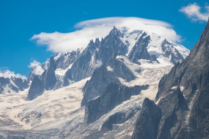
Many fatal accidents have occurred on the slopes of Mont Blanc, including recently. Last week, two climbers died in an unfortunately timed rappel accident. At the beginning of August, another died and four were injured in a serac fall.
The seracs looming over the route may fall any time of day or night and can be difficult to predict. The final issue with this route is that melting glaciers have made it steeper. The route used to be guided at 1:2, but nowadays, the ratio is more commonly 1:1. The Maudit shoulder is definitely more serious than it used to be. To summarize, it’s a great route when the conditions are right.
Pope Route
There is a third option to consider: the so-called Pope Route from Italy. It leaves from Val Veny and proceeds via the Gonella Hut. The name comes after Achille Ratti, who first used that route coming down from the summit. Years later, Ratti became Pope Pius XI.
"It’s a wonderful climb with an incredible feeling of remoteness and solitude, but like the Trois Monts, it has a few problems," Macdonald noted.
He noted that the approach to the refuge is a solid five-hour slog with no lifts or trains to shorten the way. It requires a perfect weather forecast and top physical shape.
"The refuge is small and nice but suffers from water supply problems," Macdonald said. "Once the water dries up, it closes for the season, often in late June. At the time of writing this story (late August), Gonella is closed.
"The glacier is steep and complex," warms Macdonald. "Sometimes it gets too icy, or snow bridges collapse. Either can render the route impassable."
The ridge above the glacier is also steep. Once on the summit, the options are to return via the same route, which involves an extremely long descent, or to traverse into France. In that case, logistics must be arranged to return to Italy.
Climate change
"Climatic change has affected Mont Blanc enormously," Macdonald says. "Snow melts out of the Grand Couloir du Gouter faster than before."
The guide notes that in recent years, the route has been closed most seasons for three to six weeks, something that hasn't happened before. The Gouter Route has been open all through the season this year but suffered lengthy closures in 2022. Macdonald also mentioned that the glaciers on the Trois Monts route have gotten steeper and more serious.
"Mont Blanc was always a serious mountain, but it’s even more serious now," he concluded.
Russian climbers Ratmir Mukhametzyanov, Alexander Parfenov, and Alexey Sukarev have postponed their attempt on the unclimbed North Face of Baintha Brakk I (7,285m), commonly known as The Ogre.
On July 24, Mukhametzyanov fell 10m on a route he was climbing in the Tsey-Loam range of peaks in the Caucasus.
The Tsey-Loam range, which reaches about 3,000m, lies in Russia's Republic of Ingushetia. The ancient Ingush population, a northeastern Caucasian ethnic group in the central Caucasus, considered the range sacred.
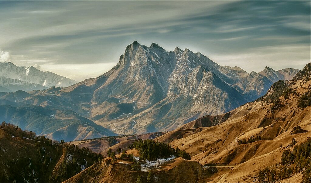
Makhumetzyanov fractured his ribs and pelvis in the fall and was evacuated from the mountain. He is undergoing surgery this week, and then he will need a couple of months for recovery.
Rather than replace Mukhametzyanov on the upcoming expedition to Baintha Brakk I, his partners chose to postpone the attempt.
Last year, the trio won the Russian version of the Piolet d'Or for their new route on Military Topographers Peak in the central Tien Shan.
"Why [Latok I] again?" Thomas Huber asked in a recent post. "My climbing career started on the Latoks...What I saw there blew me away. Or in [American climber] Jim Donini’s words, 'This is it! There are no better peaks and walls in the climbing world. This is the Mountain Cathedral.' That is why."
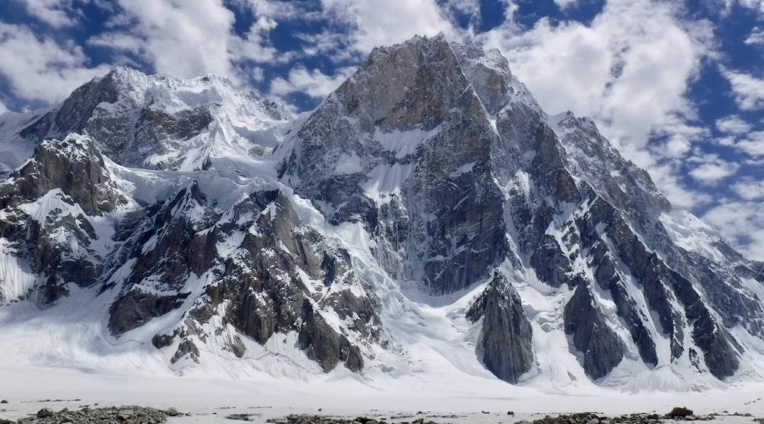
The Latok group of peaks lies in the Panmah Muztagh, part of the central Karakoram range in Pakistan. To the south is the Baintha Lukpar Glacier, a small tributary of the Biafo Glacier. On the north side is the Choktoi Glacier.
The Latok peaks include 7,145m Latok I, 7,108m Latok II, 6,949m Latok III, and 6,456m Latok IV. Latok II was climbed first, in 1977, then Latok I and Latok III in 1979, and finally Latok IV in 1980.
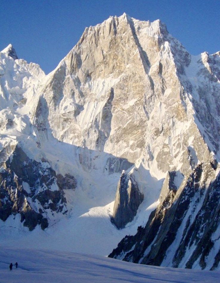
Early attempts on Latok I
Between July and September 1975, the Tokai section of the Japanese Alpine Club attempted Latok I. However, huge avalanches and rockfall persuaded them to give up and explore the nearby glaciers.
Led by Makoto Hara, the party went up the Biafo and Simgang. Crossing the Sim La, they had to descend a 458m ice wall to the Choktoi Glacier, before continuing along the Panmah to the Baltoro and finally back to Askole.
In the summer of 1976, another Japanese team attempted to climb the couloir between Latok I and III. Led by Yoshifumi Itatani, they reached 5,700m before turning around because of a serac fall.
An Italian team attempted Latok I in the summer of 1977, led by Arturo Bergamaschi. First, they scoped out the 1976 Japanese route, but the Italians considered it too dangerous because of continuous ice fall. Bergamaschi’s team instead turned to Latok II and topped out there.
All three attempts went to the southern side of Latok I, and all three turned back because of avalanche danger.
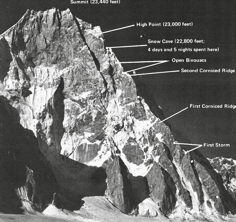
The most important attempt
In 1978, an American party attempted Latok I via the steep, 2,400m north ridge. The team included Michael Kennedy, Jim Donini, George Lowe, and Jeff Lowe, accompanied to base camp by doctors George Lowe Sr. and Ralph Richards. The party climbed in lightweight alpine style.
"There is no easy way up the precipitous, ice-encrusted walls of this imposing mountain," Kennedy wrote in the American Alpine Journal. "The easiest route would present the technical challenge of the hardest peaks in North America."
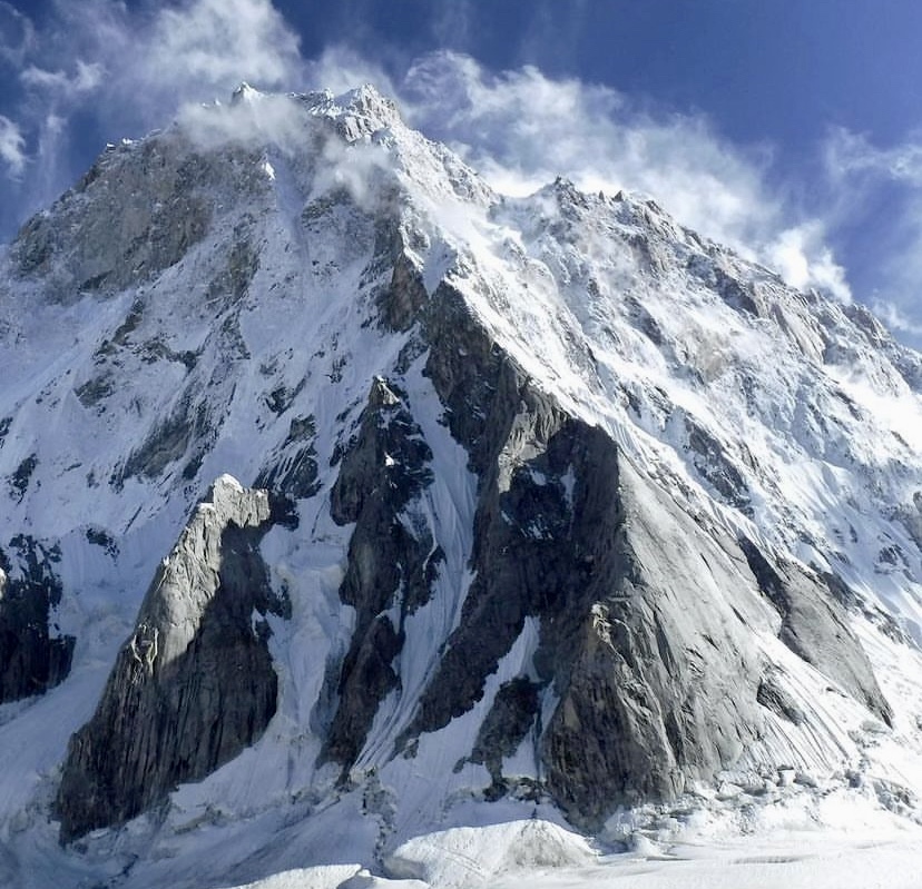
For the American party, the north ridge appeared to be perhaps the only route free of objective danger. However, they knew there was only a 50% chance of success. Starting in July, they spent 26 days on the north ridge and descended after reaching approximately 6,995m. Although they didn’t reach the top, their climb was widely admired. You can read their detailed report here.
The first ascent
In the summer of 1979, a Japanese team led by Naoki Takada finally made the first ascent of Latok I, via the south face. The route ascended the buttress left of the couloir that divides Latok I and Latok III.
Takada’s party established Base Camp on the Baintha Lukpar Glacier on June 10. They set up Camp I in the couloir at 5,500m on June 20, but the next day, an avalanche wiped it out. Two days later, they established a new Camp I high on the glacier at 5,052m.
At 5,792m, at the point they left the couloir for the steep rock buttress, they set up Camp 2. It took them eight days to fix the route from Camp 2 to Camp 3. This last Camp was established at 6,500m after a bivy.
On July 17, their first summit attempt failed. But two days later, on July 19, Tsuneo Shigehiro, Sin’e Matsumi, and Yu Watanabe struggled through bad snow for 13 hours to the summit. On July 22, Hideo Muto, Jun’ichi Oku, and Kota Endo also topped out.
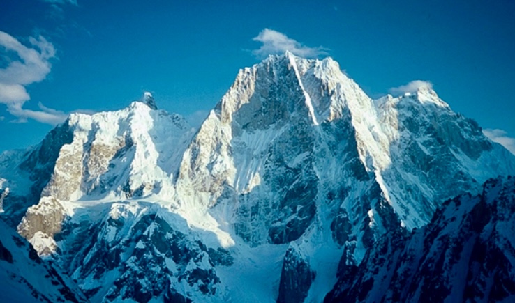
Death on the north ridge
From 1982, there were a lot of attempts on Latok I, several of them via the north ridge. Yet no one succeeded again until 2018.
On July 31, 2018, a Russian duo attempted the north ridge, but their expedition ended in tragedy. Sergey Glazunov died and his partner Alexander Gukov was rescued by helicopter at 6,100m. A beautiful short film was made in homage to Glazunov.
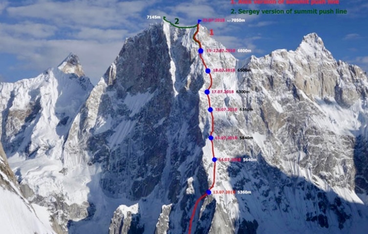
In the same summer, on August 9, an international party that included Ales Cesen, Luka Strazar, and Tom Livingstone made the second ascent of Latok I. The trio climbed three-quarters of the north ridge before traversing to the west face. Although they didn’t climb the entire north ridge, they were the first to climb the peak from the north, after more than 40 years of attempts.
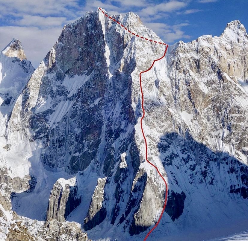
Thomas Huber made his last attempt on the north ridge in 2019 with Simon Gietl and Yannick Boissenot. After a hiatus of some years, he returns this summer to Latok I.
Every spring for over a century, the American Alpine Club announces the American expeditions they will support with a Cutting Edge Grant. The grant only supports pure alpine-style projects to difficult, remote mountains.
This year, we will see action on five peaks: Shivling, Yashkuk Sar, Jannu East, Ultar Sar, and Chiling II. In a new series, we’ll take a short look at the climbing history of each peak. We begin with 6,543m Shivling.
Shivling and the Gangotri group
Shivling is located in the Gangotri Valley in India's western Garhwal Himalaya. The Gangotri group features several challenging mountains, including 7,138m Chaukhamba I, 6,940m Kedarnath, 6,904m Thalay Sagar, 6,660m Meru, 6,856m Bhagirathi I, and 6,543m Shivling.
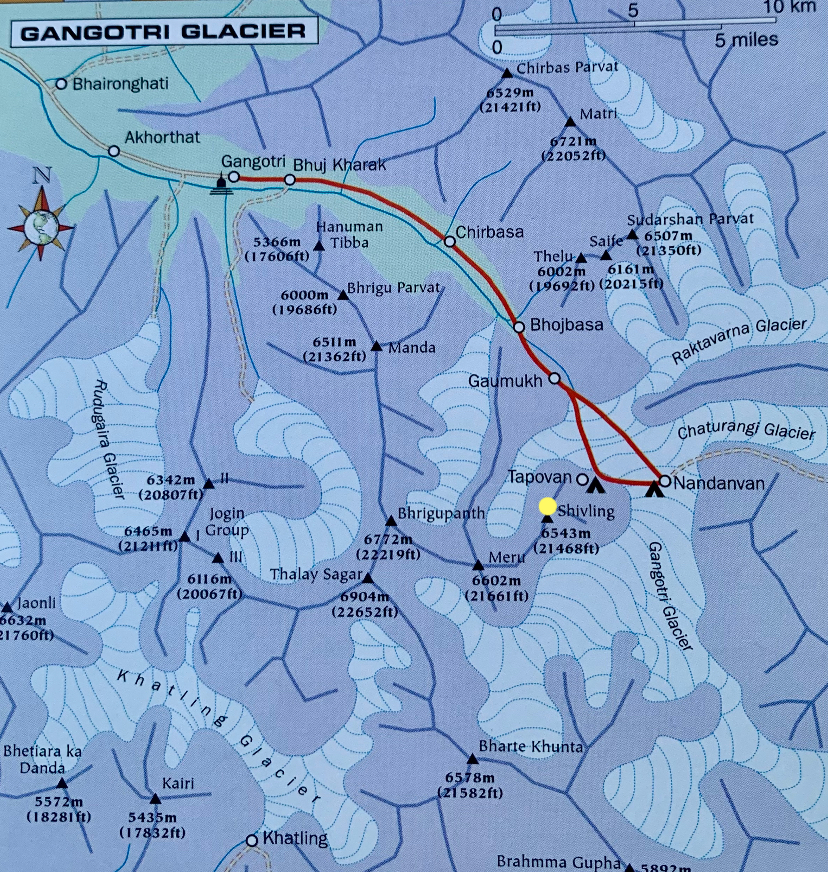
Despite its prominence of just 850m, Shivling is a striking peak. It lies near the snout of the Gangotri Glacier, six kilometers south of the holy site of Gaumukh. Gaumukh is the source of the Bhagirathi River, one of the primary headwaters of the Ganges River.
Gaumukh means "mouth of a cow" and is mentioned in Hindu texts such as the Puranas. According to legend, a boy searching for a lost sheep found the glacier in Gangotri and likened the snout to a cow's face.
Between Gaumukh and Shivling lies the Tapovan meadow, a popular pilgrimage site and the usual base camp for mountaineers attempting Shivling.
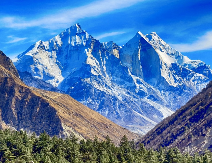
Shivling is a symbol of the god Shiva and the most revered peak in the Gangotri group. From afar, Shivling seems like a perfect pyramid, but it has twin summits. The northeastern summit is 6,543m and the southwestern measures 6,501m. There are no easy climbing routes on either peak.
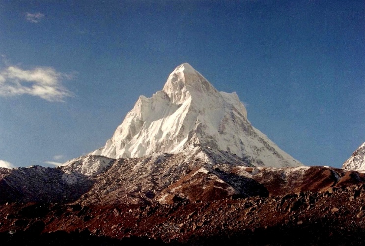
A Himalayan Matterhorn
Two Scottish army officers, Alexander Gerard and brother James Gilbert Gerard discovered the snout of the Gangotri Glacier in 1818. After they publicized their find, the site became a popular pilgrimage destination.
In 1933, Greek-British author and mountaineer Marco Alexander Pallis led a small expedition to the nearby Kinnaur area and possibly climbed 6,816m Reo Purgyil. He considered trying Shivling too. Pallis described the peak as "a horrid-looking mountain with a striking resemblance to the Matterhorn...beautifully alluring, hideously inaccessible."
No feasible route
In 1938, a German expedition led by Rudolf Schwarzgruber headed to the Garhwal Himalaya to explore the Gangotri Glacier. The team included Edi Ellmauthaler, Walter Frauenberger, Toi Meszner, Leo Spannraft, and Dr. Rudolf Jonas.
The party scouted Shivling. Schwarzgruber later wrote for the Himalayan Club that "disappointment was caused by a reconnaissance to the north of Shivling, that mountain which our British predecessors had called the Matterhorn peak...No feasible route up this mountain could be discovered. The only possible but extremely dangerous way leads across the northwest face, which is overhung by threatening ice-towers."
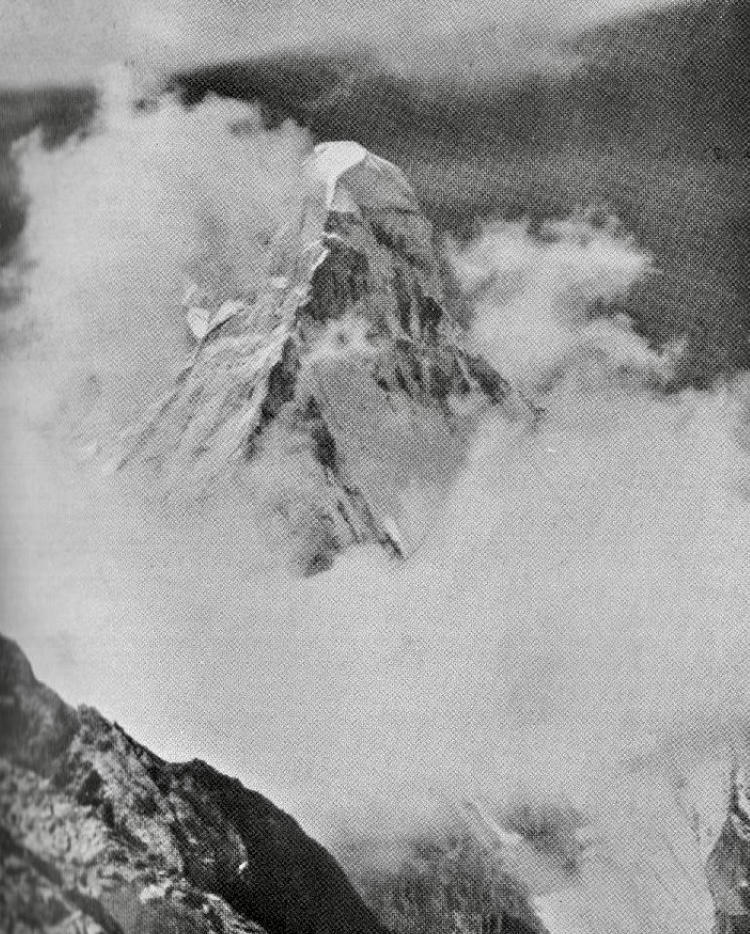
The first ascent of Shivling
Shivling was first ascended on June 3, 1974, by Laxman Singh, Dorje, Ang Tharkey, Pemba Tharkey, and Pasang Tsering Sherpa. Led by Hukam Singh, they were members of the Indo-Tibetan Border Police. The party went up the west ridge, which later became the normal route.
They established three camps. It was tough going, according to Kamal K. Guha's report for the American Alpine Journal. From Camp 1 at 5,486m to the summit, the route was sheer rock, overhanging in places. During the final pitches, a steep ice wall and a hanging glacier required expert rock and ice technique. The team fixed over 2,130m of rope along the route.
On May 26 and 30, the party made two aborted summit bids. Bad weather beat them back. Finally, on the third try, they summited.
Other small teams from the Indo-Tibetan Border Police also climbed 6,940m Kedarnath and 6,596m Nilkantha in May and June of 1974.
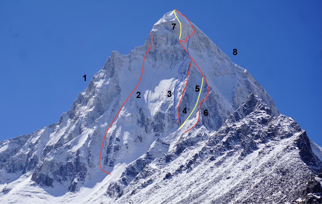
Still a challenging objective for elite climbers
Since its first ascent, about 10 routes have been established on Shivling. Fifty-five teams have targeted the mountain. Climbers have ascended almost all its ridges and major faces, but every route represents a serious challenge.
In 2012, Valery Rozov made an impressive wingsuit flight from the mountain.
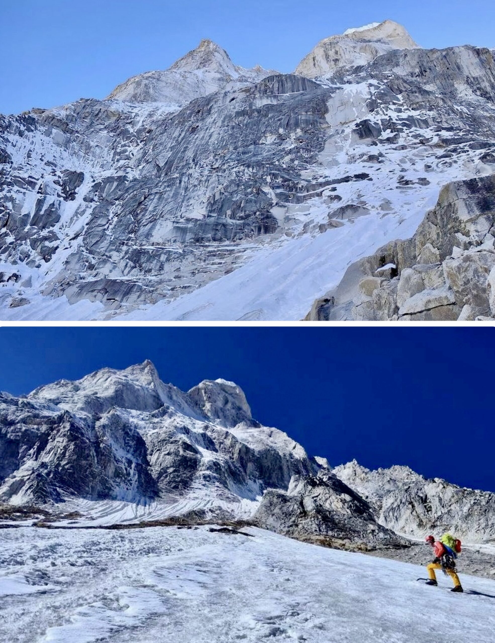
A new route in 2024?
Shivling saw most action in the 1980s and 1990s, but there have been some recent expeditions. Chantel Astorga and Fanny Schmutz made the last attempt in 2023. Astorga and Schmutz opted for an objective that involved mixed and big-wall climbing.
"As is often the case with ambitious alpine climbing expeditions in the Himalaya, it’s difficult to open a new route on the first try," Astorga wrote after their return.
The pair faced the heat and quite a bit of rain to 6,000m. "After spending five weeks at our base camp [at Tapovan], we learned a lot about the line, and it was a great experience being with Fanny [Schmutz]," Astorga wrote.
Astorga received a 2024 Cutting Edge Grant to return to Shivling. With Schmutz, she will make a second attempt at a direct route on the east face this year.
The climbing community is reacting to the article published last week by The New York Times, in which Lotta Hintsa of Finland and U.S. physician April Leonardo accused Nirmal Purja of sexual assault.
Influential figures such as Adrian Ballinger and Kilian Jornet, as well as expedition outfitters, women climbers, and some sponsors have spoken up for the women who went public in The Times about their experiences. Meanwhile, Purja has limited comments and blocked the option to be tagged on social media.
American guide Adrian Ballinger was in Chengdu celebrating his Alpenglow group's success on the North Side of Everest when the news broke. He immediately linked to it.
"I’m choosing to share this article because I believe we need to empower victims to speak out through our support," he posted on Instagram. "I’m deep enough in this world to have a pretty good sense of where the truth lies."
Influential climbers' support
His post immediately drew a large number of comments from other well-known climbers, including Kilian Jornet, who also posted about it:
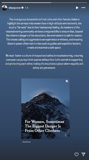
Jornet's 1.5 million Instagram followers, and another influential post by professional skier Cody Townsend, quickly amplified the news.
Other Western outfitters, including Australia-based Climbing the 7 Summits, Austria's Furtenbach Adventures, and NZ's Adventure Consultants followed Ballinger within the next 12 hours. All posts suggested that the allegations against Purja are "credible" and supported the "brave" women who spoke out. They also gave their commitment to avoid such events occurring on their watch.
"We can and must create a safe and respectful environment for everyone who entrusts us with their mountain adventures," Furtenbach's company wrote.
"We talk about community and taking care of one another but never before have we let part of our family suffer in silence like this," wrote Garrett Madison. "There are always a lot of firsts on the mountains. This is not one we welcome or can tolerate."
Not a new problem
But the issue is far from new. Outfitters acknowledge that gender-based harassment or abuse is a real problem in the outdoors.
"It’s time to talk about women in the big mountains," Caroline Pemberton and Mike Hamill, owners of Climbing the 7 Summits, wrote. "Few women I know haven’t experienced some level of micro-aggressions, harassment, and/or abuse."
Melissa Arnot, the first American woman to summit Everest without supplementary oxygen and a professional high-altitude mountain guide, has been speaking about this issue for years. It includes her own bitter experience, as she recounted on Instagram today.
I was often expected to tell the joke or be the joke. Flirt back or be excluded. Go along with it and don’t cause problems. I was called the “total package” by a supervisor as he explained to clients why it was ok to rope up with a young, small girl. And I smiled and played my part.
I regret so much of it now, but at the time it felt like the only way to survive a place I really wanted to be.
AWExpeditions, an outdoor travel operator "for women, by women," shared their shock at the allegations.
"Unfortunately, we can state with confidence, based on many informal conversations, that this high-profile case is but the tip of the iceberg of a systemic issue in mountaineering," the company wrote.
Lotta Hintsa, one of the women who spoke out against Purja in the NYT article, has remarks that many women have contacted her to share similar experiences. "It seems like a lot of people have been waiting for this news to break any minute for a really long time," Hintsa said. "It's obvious that many know. Now it's time to speak."
Sponsors
Swedish climber and photographer Emma Svensson asked in a WhatsApp group for around 100 Grivel ambassadors, of which she was one of them, what actions they should take. Grivel is also a sponsor of Nirmal Purja; his name is embossed on their ice axes. She received the following reply from Grivel's CEO:

As it happened, Svensson was with Lotta Hintsa when the events happened. "I don't understand why you think these women would make something like this up?" Svensson replied.
She noted that it is common for women to be accused of lying when confronted with someone else's word. "I won't want to be in a team that works with someone as their main profile who sexually assaults women," she wrote. Then she quit the Grivel ambassador team and published the conversation on her social media.
Backpack manufacturer Osprey took a different stand from Grivel. Today, the U.S.-based company posted the following press release on X:
Banned from Nepal?
Nepal's climbing community members, who traditionally try to avoid public conflict, have not yet made official statements. Local outfitters consulted by ExplorersWeb declined to comment.
However, Rajendra Bajgain, a member of Nepal's parliament, has demanded that Purja, who was born in Nepal but is now a UK citizen, be barred from entering the country.
"The MP accused him of defaming Nepal by sexually harassing climbers, misusing Nepali citizenship card to climb mountains, and defaming the Sherpa community," journalist Badra Sharma posted on X.
What's next?
Some blogs defended Purja after the NYT released its story, based on the presumption of innocence and Purja's frequent argument that those jealous of his success are trying to bring him down. That argument applied particularly to past controversies about mountaineering tactics and logistics. It is harder to apply to alleged sexual abuse.
Led by Lakpa Dendi Sherpa and 14x8,000m climber Um Hong-gil, the Nepalese-Korean expedition has summited its first planned goal: Jugal I (6,591m), on the Nepal-Tibetan border.
On May 3, Lakpa Dendi led the trail-breaking and fixed the route to the summit of Jugal I. He reached it at 12:30 pm, the liaison officer told The Himalayan Times. Um Hong-gil followed with Babu Lama at 3:30 pm. Korean climbers Joung Je Gyun, Kim Dong Jin, Koo Eun Soo, and Baek Jong Min topped out the following day.
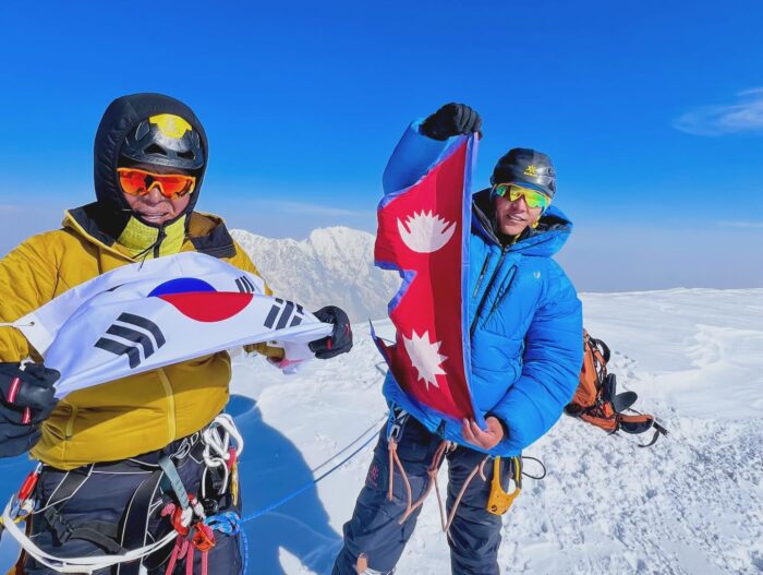
The team has shared no details about the climb. However, a topo posted by Lakpa Dendi shows a nice line up a couloir.

Next, the team will climb neighboring Jugal II (6,518m). They originally planned to climb both in one push but have decided to do them separately. The Jugal massif, which opened to climbing just last year and is quite close to Kathmandu, has attracted much attention from foreign climbers. Currently, three teams hold permits for peaks on the massif.
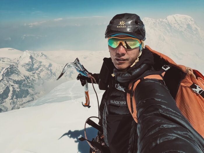
"You've got to be joking."
That's what Doug Scott scrawled across a piece of paper given to him by the organizers of an event in 1975.
The paper? A liability waiver for the Derby Mercury Road Club's annual Dovedale Dash — essentially a 7.6km fun run. Scott himself? A legendary English mountaineer who was part of a team that had just made the first ascent of Everest's Southwest Face. Time between Everest ascent and fun run?
About two months.
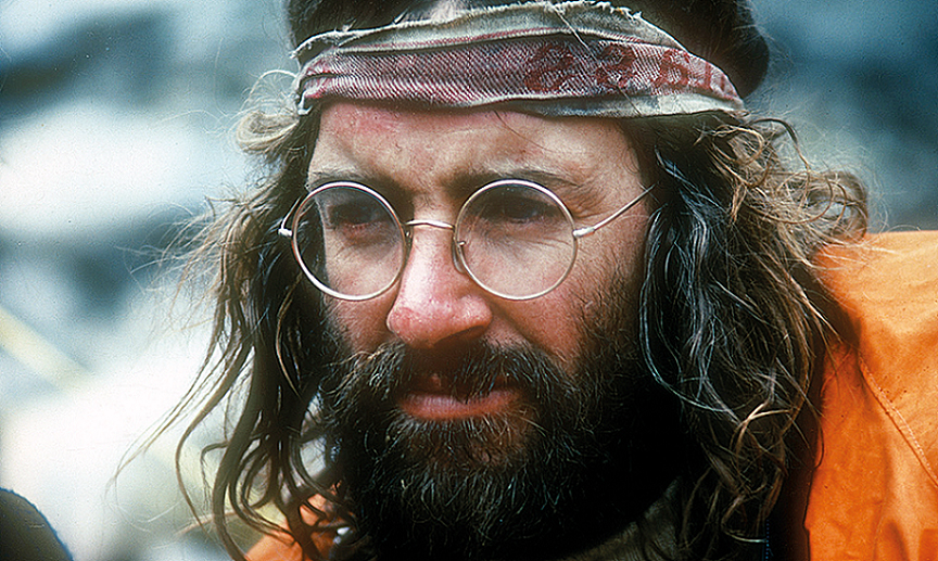
So we can understand Scott's cognitive dissonance. Imagine spending months pioneering a new route up the world's highest peak, only to return home and be asked to sign a liability waiver promising not to sue in the event of a rolled ankle or scraped knee.
In Scott's defense, the response came across as lighthearted to all involved, according to a post by the Mountain Heritage Trust.
View this post on Instagram
The post also features a newspaper clipping from the November 3 edition of the Derby Evening Telegraph — a clipping that doesn't hesitate to take a sly and good-natured potshot at the hometown hero.
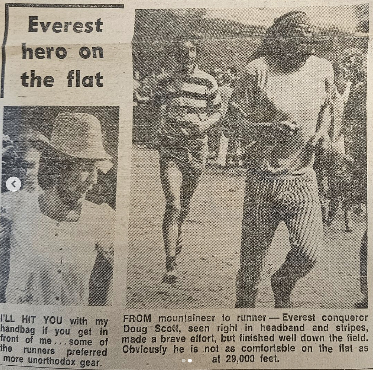
"Doug Scott...made a brave effort, but finished well down the field. Obviously, he is not as comfortable on the flat as at 29,000 feet," reads the caption underneath a decidedly hippie-looking Scott jogging along and presumably avoiding injury.
Doug Scott — an English Legend
Scott spent ten years as a teacher in his early days but quickly became one of the world's most noteworthy high-altitude mountaineers. In 1975, he became the first Englishman to summit Everest as part of an expedition led by Chris Bonington. The summit push ran into difficulties with oxygen equipment and deep snow but was ultimately successful at 6:00 pm on Sept. 24.
The summit led to an overnight bivouac with Scottish partner Dougal Haston. Neither climber had a functioning headlamp, nor did Scott have his down suit. Nevertheless, both made it down safely the next day.
In his later years, a shorter-haired Scott studied Buddhism, became a mentor to younger climbers, and founded the non-profit Community Action Nepal. He died on Dec. 7, 2020, of cancer.
"Steep skiing is a very, very unique discipline. Basically, it's skiing faces you would normally climb. It's places where you aren't supposed to be there with skis."
If that sentence doesn't give you the heebie-jeebies, you aren't human. Luckily, the man saying those words in the opening seconds of this week's film barely qualifies as such.
"Superhuman" is a word tossed around a lot with respect to Killian Jornet — a mountain-running legend with so many FKTs and ultra-race wins to his name that it almost defies belief. This journalist will never forget the sense of hopelessness he felt when he was thinking about attempting an FKT on the Tahoe Rim Trail only to give up immediately after discovering Jornet held the title at the time.
In any case, in this video, the multi-disciplined Jornet lets gravity take the wheel by hurling himself down slopes probably best descended with ropes. And heart-pounding doesn't even begin to describe it.
For Jornet, extreme skiing came later
In between stunning POV shots of Jornet descending steepies that — again, this can't be emphasized enough — a mountain goat might prudently decide against, viewers discover a little more about this unrecognized side of the champ. Jornet grew up skiing both alpine and cross-country, two pursuits he eventually merged into competitive ski-mountaineering.
Already well into a successful mountain-running career, Jornet picked up his new adrenaline-inducing pastime of steep skiing after moving to the Alps in 2012.
"For the last ten years, it's been one of my biggest passions," the legend shares with the casual tones of a middle-aged man describing a sedate hobby like woodworking.
"One of the fun things about steep skiing is that you are really in the zone. Nothing else exists outside your bubble, because you need to be concentrated," he continues. "Because you need to be thinking about what's going on in the next second. You are not thinking about what's going on in the next minute, or what's been happening in the last ten minutes. You are just thinking about the next second."
Careful preparation
Jornet is known for his fluid, graceful style as he bounds over rocks and obstacles in his mountain races. He's no different on skis as gravity propels him through chutes and down exposed faces. But like any good mountain traveler, Jornet puts in the work on the front end, meticulously planning each ascent and descent to minimize risk (in as much as that's possible!).
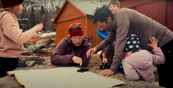
Surviving such endeavors requires a synthesis of conditions, both external and internal. This is where Jornet's long experience as a fast-and-light mountain traveler comes in handy.
"Some days, the mountain was in good condition, but maybe that day we weren't feeling ready," he shares. "Other days, we were feeling super-excited and good for going, but then there was something in the mountains that was not good. When you do a project like this...you have to analyze what can be all the possible outcomes."
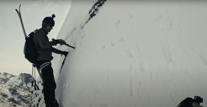
"What makes you feel alive? For me, to do these projects in the mountains, that's what makes me feel alive. Even if I'm taking some risks. Sometimes, I can feel stupid to be there. I'm on the edge of my comfort zone, and I know that a mistake here could mean I would die. But I believe we need to get out, we need to do these things, we need to expose ourselves [to danger] to feel alive. And that's how I believe life is," Jornet concludes.
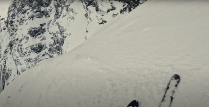
Wise words. Just remember — there's only one Killian Jornet.
New Zealand alpinist Daniel Joll leads off Changabang with a voiceover. He’s describing the sensation of a certain objective that dominates one’s consciousness. His words aren’t calculated, but they’re still bullseye-precise. He emphasizes “knowing,” “sits,” and “eats.”
“Knowing that mountain is there. It sits in the back of your head. It eats away at your consciousness.”

For him, it’s Changabang.
Maybe it’s not the most prominent peak, but Changabang (6,864m) commands respect. It’s a hard-won feather in the crown of any climber in India who perches on its lonely summit. Joll and two teammates couldn’t shake the visionary effort of Pete Boardman and Joe Tasker on Changabang’s West Wall in 1976. So they leaned into it — and came out with a second ascent the mountaineering community had anticipated for 46 years.
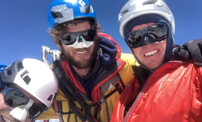
Success after 46 years
Twenty teams had failed on the 1,600m Boardman-Tasker Route before Joll, Matthew Scholes, and Kim Ladiges. But the three changed the calculus in 2022 and cracked the top five in ExplorersWeb’s expeditions of the year.
The effort didn’t seem plausible until the final hour.
“The only way to cope was to focus on one day at a time…We reminded each other not to think too far ahead. None of us thought we would summit. We never imagined it could be possible until the final one hundred meters,” Joll told ExplorersWeb’s Angela Benavides.
The team’s vigor for improvisation sharpens into focus in Changabang: Return to the Shining Mountain.
Ladiges describes that even the routine task of acclimatization was practically impossible.
“Just because of the time involved with getting to the mountain, all those things, we just knew it wasn’t going to work,” he said of the team’s early May ascent. “So we just kind of knew we had to strap onto the mountain and start.”
To say the least, the climbing merited attention. Watch for shattered blonde granite, neve-blanketed vertical ice, and dizzy exposure.
A Mount Rainier icon has lapsed into the alpenglow.
The Associated Press today reported the mountaineer’s death. According to Rainier Mountaineering Inc., the Pacific Northwest guide company he founded in 1969, it occurred peacefully at home on Sunday. Whittaker was 95.
Whittaker began climbing in the 1940s with his twin brother Jim, who earned fame as the first American to summit Mt. Everest in 1963. Lou Whittaker himself claimed an American superlative on the world’s highest peak, leading the first American ascent of the Everest North Col in 1984.
Born and raised in Seattle, Whittaker gained most of his renown as a Mt. Rainier climbing guide. He led an estimated 250 trips to Washington’s highest peak, inspiring countless climbers and professionals along the way — most famously Ed Viesturs.
Saved dozens of lives
His career as a mountain rescuer may merit even more prestige. Whittaker saved dozens of lives during numerous rescue efforts over his career, RMI told the AP, including operations during his work supporting military mountain units. Jim and Lou Whittaker helped train the Army’s famed 10th Mountain Division during attachment to the Mountain and Cold Weather command at Camp Hale, Colorado in the 1950s.
When the two returned from service, Jim began managing REI’s first location; Lou leaned into his guiding career on Rainier, Denali, and beyond.
“Mountains were the source of his health, the wellspring of his confidence, and the stage for his triumphs, and he was one of the first to make mountaineering and its benefits accessible to the broader public,” the company said in statement posted to its website Wednesday. “His leadership made mountain guiding a true profession, with many of the world’s premier mountaineers benefiting from Lou’s tutelage.”
Lou is survived by his son, Peter, who acts as primary decision-maker for Whittaker Mountaineering, and his brother, Jim, who still works as a writer and speaker.
As the climbing season starts in the Himalaya, we typically highlight those who attempt some of the 8,000m peaks without supplementary oxygen.
Nowadays, of course, sherpas fix ropes on the normal routes and set up the tents in each camp. Most climbers also enjoy one-on-one sherpa assistance during their climb. All this support counts almost as much as bottled oxygen. However, it’s still enlightening to see a short statistical summary of no-O2 ascents over the years.
On Everest, only a very low percentage of climbers forego bottled oxygen. But there are other, lower 8,000’ers in Nepal. Not too many years ago, the presence of bottled oxygen was a rarity.
Let's examine some data from The Himalayan Database over three time periods: up to 1999, from 2000 to 2023, and then specifically 2018 to 2023. We'll consider three of the 8,000’ers: Dhaulagiri I, Annapurna I, and Makalu. But the trends on those peaks apply to the others too.
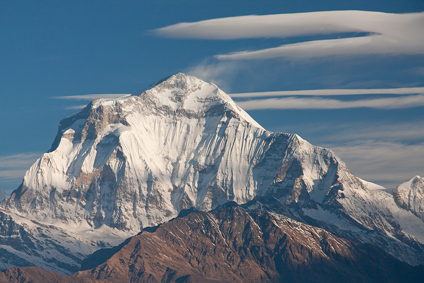
Dhaulagiri I
At 8,167m, Dhaulagiri I is the seventh-highest mountain in the world. Until the end of 2023, a total of 669 people ascended Dhaulagiri I, including 392 without supplementary oxygen. Until 1999, a total of 299 climbers summited, 231 of them without O2.
Between 2000 and 2023, 370 people summited, 161 without bottled oxygen. Between 2018 and 2023, of the 123 people who summited Dhaulagiri I, only 22 did so without bottled oxygen. You can see where the trend is going.
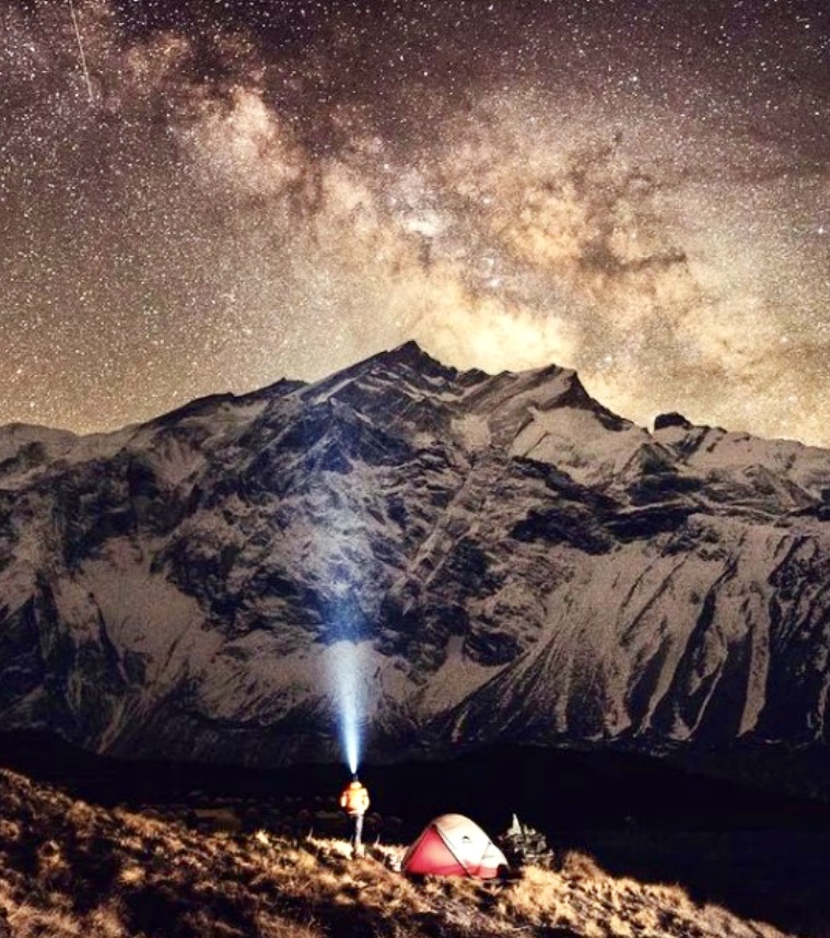
Annapurna I
Another 8,000m mountain where the use of bottled oxygen was rare in the past, 8,091m Annapurna I is the tenth highest peak in the world. The Himalayan Database has registered 476 successful ascents, 228 without bottled oxygen.
Until 1999, of the 107 total summits, 96 were done without O2. Between 2000 and 2023, there were 367 summiters, and 130 of them did not use bottled oxygen. But from 2018 to 2023, of the 215 successful climbers, only 19 did not use O2.
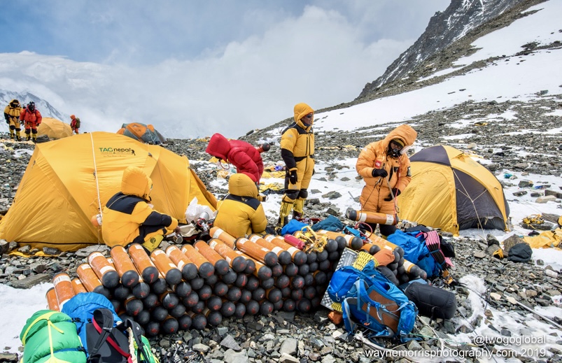
Makalu
Makalu (8,485m), the fifth highest peak in the world, has been climbed by 718 people, including 254 no-O2. Until 1999, of the 156 summiters, 96 did not use oxygen.
Between 2000 and 2023, of 562 summiters, 158 went without O2. Between 2018 and 2023, 254 climbers topped out on Makalu, but only 19 made it without supplementary oxygen.
Note that these statistics may include a few small errors, because some climbers who did not ascend without oxygen may be credited with having done so. Their outfitter could have made a mistake in submitting the report or doubts may exist regarding the veracity of someone’s no-O2 climb.
Reinhold Messner has finally received the second boot of his younger brother Gunther, who controversially died in 1970 on Nanga Parbat. For most, it is a reminder of one life lost on the so-called Killer Mountain. For Reinhold, it is a message Gunther sent from beyond the grave to confirm his innocence.
The boot was found and retrieved from the glacier on the Diamir side of the mountain in June 2022, 52 years after Gunther Messner's death. Last week, Pakistani climber Liver Khan traveled to the South Tyrol and gave the boot to Messner, Barrabes reported.
The boot is important because it corroborates Reinhold Messner's side of the story about the tragedy on Nanga Parbat.
The 1970 tragedy
In 1970, the Messner brothers, part of a big expedition led by Karl Herrligkoffer, launched a summit push on the still-unclimbed Rupal side of Nanga Parbat. (Check the last videos of the two brothers on Messner's Instagram below.) Only the elder brother returned, days later, badly frostbitten and almost dead from exhaustion, on the Diamir side of the mountain.
Reinhold explained that after the two of them had summited at 5 pm, Gunther was too exhausted to retrace his steps down the difficult sections of the Rupal face without a rope. They then decided to go down the milder Diamir side. Reinhold went first. At one point, on the lower part of the mountain, he lost sight of his brother. He looked for him but only found the signs of a recent avalanche.
Decades of accusations
However, some of the expedition members didn't believe him. Hans Saler and Max von Kienlin deemed Reinhold an overambitious climber who didn't want the weaker, less experienced Gunther along.
According to Herligkoffer's orders, Gunther was not supposed to go with Reinhold on the summit push. But when Reinhold set off from the high camp, Gunther followed him nevertheless. Saler and Kienlin openly accused Messner of abandoning his brother to his death during the ascent, before reaching the summit.
The controversy has pursued Messner for 34 years. In 2004, the first boot and some bones surfaced on the Diamir Glacier. A climber who was looking for minerals for his children stumbled upon the remains. Hearing word of the find, Messner traveled to Nanga Parbat's Base Camp and burned the remains at a small ceremony on the spot. However, he took a few samples for genetic identification. The remains were indeed Gunther's. The controversy was settled, and the boot was exhibited in one of Messner's museums.
The second boot was not necessary proof, but for Reinhold Messner, it was a kind of confirmation that "disprove[d] the conspiracy theories about Gunther and the Nanga Parbat tragedy," he wrote. "Gunther, thank you and I am thinking of you."
Bad weather stranded a group of 12 climbers last Saturday on Orizaba (5,636m), Mexico’s highest peak. Six managed to descend on their own, and three were rescued. A fourth, identified only as Jessica N., died at some 5,200m.
Searchers swept the mountain for several days, looking for the group's guide, Luis Flores. They found his lifeless body last night. Another climber remains missing.
The group, members of a club called Barracracks, had left from Atzitzintla on the southern side of the mountain. They got into some kind of trouble around 5,100m. Reports suggest that they lost their way in bad weather and became separated. It remains unclear if Jessica N. suffered any kind of accident.

Bad timing
Rescuers from the Mexican Red Cross told N+ news that the volcano was not in a good condition for climbers. A forecast cold front hit the mountain, and hard snow and ice encased the slopes from 5,000m. Authorities also noted that the team had not registered at the park entrance, so the group's climbing plans were unknown. Survivors later said they intended to cross to the northern side of the mountain and finish at the town of Tlachichuca, Infobae reported.
In fact, six climbers managed to make their way down on Sunday. Five retraced their steps to Atzinzintla, while one managed to reach Tlachichuca after traversing to the far side of the mountain. Rescuers found three other survivors and Jessica N.'s body that day.

Helicopters and ground rescuers searched both the south and north sides of the volcano for three days since guide Luis Flores was reported missing. Patrols didn't know whether Flores might have retraced his steps or gone down the other side of the mountain. A spokesperson for the Civil Protection Corps in Puebla state said that they were even considering checking the mountain's northeast face.
The speculation ended last night when they found Flores' lifeless body at 4,600m. It was already nightfall, and rescuers were unable to move his remains right away. They expected to carry it down the mountain today, local authorities said.
Civil Protection officials also confirmed that one member of the group, Jose Luis Diaz, is still missing.
As for the survivors, some were later admitted to the hospital with bruises, hypothermia, and frostbite. Andrea Hernandez, 41, was transferred to Guadalajara Hospital yesterday with frostbitten fingers.
Mexico's roof
Orizaba (Citlalteptl in the local Nahuatl language), is an active volcano between the Veracruz and Puebla regions. It is the third-highest peak in North America after Denali and Mount Logan and is the seventh-most prominent peak on Earth.
Its climb is a straightforward uphill hike in good conditions, but that can quickly change in case of bad weather. Four people died on the mountain just last August. The upper sections above 5,000m feature steep slopes up to 35º on snow and ice. It's most typically tackled between November and March, but there are climbs year-round.

Hiking up Mount Fuji is more of a traveling experience than a mountain climb. That may be part of the appeal of the iconic Japanese volcano for the hundreds of thousands that line its slopes every summer. However, this human pressure has proven too much for the mountain, forcing authorities to establish limits this year. But those limits might not be enough.
Seventy days, 300,000 visitors
Mount Fuji is the highest peak in Japan. A sacred mountain with a snow-capped summit like icing cake on its perfectly conical shape, it is perhaps the most popular landmark in the country. The climbing season lasts from July 1 and spans 70 days, until mid-September. Authorities close the peak to tourists for the rest of the year.
This window bunches visitors together, including mountaineers and tourists aiming for summit views, but also locals and Shintoist pilgrims. Around 300,000 people climb Fuji each year and 30% of them are foreigners, according to Japonpedia.
Unsurprisingly, the trip is far from lonely. The Yoshida Trail is especially busy. It's the easiest and most crowded of Fuji's four official routes. While the ascent is divided into 10 stations (mountain refuges with facilities and food), most people start walking from the fifth station, located at 2,305m. This is the last station reachable by public transport. From that point, expect to walk in line at all times along the black rock trail to the top.
On the summit, in addition to the crater rim, you'll find a ramen service and a post office.
Those looking for open space and a full mountain experience will probably be disappointed. Several travel guides quote a Japanese saying: "It is stupid not to climb Mount Fuji once in a lifetime, but it is even more stupid to climb it twice."

Limited, to 4,000 a day
Yamanashi prefecture authorities will now impose a toll (they will decide the amount later this month) and will limit the number of climbers per day up the Yoshida Trail to 4,000, Times of India reported.
Climbers will no longer be allowed to start the walk between 4 pm and 2 am, a strategy employed to see the sunrise from the summit. Now, sunrise enthusiasts will need to try and find a free place in one of the crowded mountain huts along the way or to make sure they're fast enough to reach the summit in time when starting at 2 am.
Yet, authorities are aware that these limitations will not be enough to improve the situation on the overcrowded mountain. Facilities such as paid toilets and mountain huts are insufficient for the daily flow of visitors. The number of sick and injured visitors grows every season and the waste disposal systems are overwhelmed. Further measures will be needed.
On Jan. 11, Matthew Pavitt set a new FKT (Fastest Known Time) for a winter traverse of the Cuillin Ridge, located in Scotland's Isle of Skye.
He made it in 4 hours 35 minutes, and 17 seconds. That's 20 minutes less than the earlier FKT set on Feb. 26, 2018 by Uisdean Hawthorn, who completed it in 4 hours and 57 minutes.
The Cuillin Ridge traverse is a climb that follows a continuous 12km ridge crest from start to end. The route traverses the main summits of the Black Cuillin Mountains on the Isle of Skye.
The traverse is considered one of Britain’s finest mountaineering challenges. It requires crossing more than 30 summits and usually takes about two days. The terrain includes around 3,000m of ascent and descent, with some difficult climbing pitches on the TD Gap, King’s Chimney, and the Inaccessible Pinnacle.

Local climbers Leslie Shabolt and Alastair McLaren first did the traverse on June 10, 1911. They went from south to north in a little over 12 hours.
Pavitt started his north-south traverse at 10:29 am from Sgurr nan Gillean and finished at Gars-bheinn at 3:04 pm.

Too nice a day?
Pavitt wore crampons from start to end, did all the climbs, and included all the summits. Nevertheless, he felt obliged to apologize that the weather that day might not have been wintry enough.
”Were things rimed up to typical Scottish perfect expectations?" he wrote on social media. "No is the short answer. But equally, it didn’t really feel like summer or rock climbing at all.”
Finlay Wild holds the FKT of this traverse in a non-winter season. On Oct. 12, 2013, he did it in 2 hours, 59 minutes, and 22 seconds.
Five days ago, there was a difficult, 15-hour rescue of three people on 3,800m Grossglockner in the Austrian Alps.

On Jan. 5, according to Alpin.de, two 40-year-old brothers and their 57-year-old guide arrived at Grossglockner after a long drive from the Czech Republic. Despite snow, low temperatures, strong wind, and a bad weather forecast, they decided to climb the south side of the peak. They began around 6 am, carrying ski touring and climbing equipment.
At 3,500m, the three men could not go any higher, nor could they descend in the bad weather. Around 11 pm that evening, they phoned for rescue. The helicopter couldn’t fly, so 13 rescuers and a local police mountain guide climbed through the night toward the stranded mountaineers.
The next morning, at about 5 am, the rescuers reached a mountain hut. From here, they set off toward the south face of Grossglocckner and eventually reached the trio.
The complicated rescue cost around 20,000 euros, and the public prosecutor’s office is investigating whether the three men will have to pay the cost.
Tourists stuck in flooded Slovenian cave
In southwestern Slovenia, there was another rescue earlier this week, this time in the famous Krizna Jama cave. Five tourists became trapped after sudden flooding, according to Sloveniatimes.com.
On Jan. 6, a Slovenian family of three with two guides entered the cave on a tour. Then water levels suddenly rose because of strong rains in the area, trapping the group. When they didn't reappear several hours later, a rescue that included cave divers began.

The group was trapped more than two kilometers into the eight-kilometer-long cave system. They sheltered on a small ledge, ten meters above the water level. On the first day, rescuers reached but could not evacuate them. They gave them food and blankets to survive until the waters receded.
After two days, everyone made it safely out. This was the first incident of its kind in the popular cave.
The Krizna Jama cave lies in Slovenia's Loz Valley. The karst cave has more than 20 underground lakes, which can be navigated by boat. The cave also features more than 60 different animal species.
A cave bear’s skeleton can be seen there too. Aleksander Skofiz first discovered the bones in 1847, and Ferdinand von Hochstetter started the excavation in 1878. The remains are the richest of its kind in Europe.
Archaeological remains up to five thousand years old add further to the interest. People didn’t live there but used the cave. There are daily guided visits into this popular tourist attraction.
On Jan. 5, Adam Kaniak and Riso Nemec of Slovakia climbed one of the most emblematic walls in the Julian Alps, the 900m north wall of 2,472m Spik.
Climbing simultaneously, the duo went up the Direktna smer route. After the seven-hour ascent, Kaniak and Nemec rated the difficulty of the line as AI5+. Nemec said they had fantastic conditions in the mountain.

The Direktna was first climbed on Sept. 5-6, 1926 by Mira Marko Debelak and her climbing partner, Stanko Tominsek. It was one of the most important climbs of the time in Europe. Debelak was one of the most successful alpinists between the two World Wars and became the first female member of the Austrian Academic Club.
The route was first repeated in 1927 by Edo Derzaj and Stane Hudnik, and later by other well-known climbers, including Francek Knez (1978), Nejc Zaplotnik (1979), and Igor Mezgec (1981), among others.

Spik is a pyramidal peak located in Slovenia's eastern Julian Alps. Its name, "spike,” derives from its pointed shape. The normal route follows the southern slope, while the north side of the peak is very difficult. There are at least 15 routes on the mountain, and Direktna is the most challenging. Although Spik is not the tallest peak in its group, its formidable north wall has long attracted admiration.

1952 disaster
The greatest tragedy in the history of Slovenian mountaineering happened on that same north face in 1952. That spring, to celebrate May 1, a group of young mountaineers wanted to hike on Spik. They first targeted another route, but later they changed their objective and headed up the north face.
In the meantime, it started to rain. The young mountaineers, divided into two groups, decided to turn around. However, on their way down, one of them slipped, pulling his partner off the wall with him. They fell 200m and died. When the other three saw the accident, they secured themselves to the wall and waited for rescue.
The next afternoon, other members of the divided team, who were in a mountain hut, called rescue services. However, due to bad weather, the rescue could not start until the next day, more than two days after the accident.
Since then, one of the mountaineers on the wall had died due to exposure, while two were still alive. Then the weather worsened again. One more young climber died before rescuers could reach them. A fifth died during the rescue. All five victims were between 21 and 25 years old, including three brothers.

When we’re not outdoors, we get our adventure fix by exploring social media and the web. Here are some of the best adventure links we’ve discovered this week.
The Worst National Park Reviews of the Year: Every year, thousands of people flock to national parks across America. TripAdvisor and Google are littered with visitors' views and opinions, and some are not at all impressed.
Apparently, Yosemite "looks like any place with mountains and trees," Glacier Bay National Park is "like some ice cubes got scattered on a hill," and Hawaii Volcanoes National Park is a "horrible disappointment" because there is not "a single pickleboard court in sight."
The Rise of Female Mountain Professionals: Anna Fleming writes about the growing number of female guides and instructors. This year, at the Alpine Club Aspirants Meet in Switzerland, all three instructors for the alpinism course were women. This is the same club that didn’t even let women join until 1974.

Good news from Lebanon
Building a Climbing Utopia in War-torn Lebanon: Many climbers moan about the commercialization of their sport and overcrowding at their favorite walls. One place still holds the feeling of the good old times. Lebanon has a relatively small number of climbers, but this has created a close-knit community.
This passionate group has developed new bouldering areas and new climbing routes around their troubled country. They want to show that even in difficult times, some good things are happening too.
Bad-tempered moose
Hiker Stumbles Across Cranky Moose: Some "notoriously cranky" moose caught a hiker off guard in Anchorage, Alaska last week. He was walking with his dog when he stumbled across a group of the giant ungulates, known locally for their bad temper. Two of the moose charged at the poor man. They knocked him over and kicked him, and only ran away after his dog started barking at them.
The man limped back to the trailhead and made it to the hospital. Luckily, he only suffered some bruises.

Women Make Their Mark in the Sydney Hobart Yacht Race: Women have competed in the Sydney Hobart Race since 1946, and the first all-female team was in 1975. This year, 10 crews are skippered by women, the highest number ever.
The increase is due to two reasons: a growing women’s sailing network in Sydney that encourages more girls to try sailing, and the introduction of two-person ("two-handed") races rather than the usual six-man crew or more.
As more women enter, the end goal is clear -- a female-skippered team winning the overall race trophy, the Tattersall Cup.
Tough for women in Antarctica
My Sexual Harasser Was Never Caught: Every year, thousands of researchers and support personnel head to Antarctic research stations. The vast majority are not scientists, but the people who keep the stations running. Two-thirds of them are men.
Every season, sexual harassment and assault has been hushed up and overlooked. A survey of female employees showed that 72% think sexual harassment and assault are a problem, 59% have faced this themselves, and 95% know a victim. Elizabeth Endicott worked at McMurdo Station for three years and talks about her experiences as a janitor.

Lighthouse Keeper Hangs Up Her Bonnet: Sally Snowman has been the keeper of the Boston Lighthouse for 20 years. She is the only woman keeper in its 307-year history and is now the only lighthouse keeper left in the U.S. Now, at the age of 72, she is finally retiring.
Massachusetts’s Little Brewster Island has been integral to her life. She first visited when she was 10. Her father was in the Coast Guard. She got married there, volunteered there, and finally became its keeper.
The Line: This monthly round-up of the American Alpine Club details different projects recently undertaken by climbers, including some first ascents in Indonesia's Mt. Arjuna massif.
Today, ExplorersWeb would like to remember the mountaineers we lost in 2023.
"The deep pain that is felt at the death of every friendly soul arises from the feeling that there is in every individual something inexpressible, peculiar to him alone, and is, therefore, absolutely and irretrievably lost," wrote philosopher Arthur Schopenhauer.
The full list of climbers and explorers who died this year is much longer than we can include here, but all have our utmost respect.
Zach Milligan

On Feb. 12, Parks Canada found 42-year-old U.S. climber Zach Milligan dead at the bottom of a high ice cliff. The body was near the Polar Circus ice climb in Jasper National Park in the Canadian Rockies. He likely suffered a fatal fall.
Milligan was an experienced free soloist on both rock and ice. He had made hundreds of climbs in North America. In 2021, Milligan and Jason Torlando were the first to ski Yosemite’s Half Dome from the summit to the valley.
The Calgary Herald quoted Milligan’s close friend, climber Chris Van Leuven, who said, "[He was] my favorite dude and I loved his honesty. I loved his personality, his black-and-white way of viewing the world, his dedication to his craft, and his high ethics."
Ammon McNeely

Yosemite climber Ammon McNeely always followed his own path. The American climber specialized in big wall and aid climbing. He set several speed records and made the first one-day ascent of many climbing routes on El Capitan.
McNeely had a non-climbing accident on Feb. 18 in Moab, Utah.
"Ammon’s motorcycle was parked. He walked out onto a precipice with his girlfriend and another friend to enjoy the sunset. As Ammon was moving to sit down, he lost the footing under his prosthetic leg and fell backward off the cliff. There’s no need for further speculation," his sister Amanda Haywood explained.
McNeely survived two serious BASE-jumping accidents around Moab in 2013 and 2017. After the second accident, part of one leg had to be amputated.
McNeely was a much-loved figure within the climbing and BASE jumping community.
"I would rather live 40 years of excitement and fun and exhilaration than 80 years of la-de-da-de-da boring," he said once.
Noel Hanna

Northern Irish mountaineer Noel Hanna lost his life on April 18 at the age of 56. He died after summiting Annapurna I in the Himalaya without supplementary oxygen.
The night before his death, many climbers got stuck in Annapurna's high camps in very bad weather, eventually running out of food, fuel, and supplementary oxygen (for those using it). Other climbers found Hanna dead in his tent in Camp 4. Acute mountain sickness was the cause of death.
Hanna had climbed Everest 10 times with supplementary oxygen and also attempted Winter K2 during the tragic 2021 season. He loved Nepal, climbing there often. Hanna successfully summited Ama Dablam, Burke Kang, and the foresummit of Manaslu. He also attempted Kangchenjunga. In Nepal alone, he took part in 20 expeditions.
Tom Hornbein

In May, Everest legend Tom Hornbein died at the age of 92. The renowned American mountaineer was fascinated with geology and mountains. An anesthesiologist by profession, he was an early climber in Boulder, Colorado.
In May 1963, together with Willi Unsoeld, he made the first ascent of Everest via the West Ridge. The difficult upper couloir was named after him: the Hornbein Couloir. Their Everest adventure was the subject of the documentary High and Hallowed: Everest 1963.
In 2018, Hornbein was awarded a Lifetime Achievement Award by the Seattle-based Mountaineers Club. Hornbein's enormous legacy cannot be summed up in a couple of paragraphs, but the mountaineering world has lost a giant.
Line Van Den Berg

Line Van Den Berg, 30, and her two climbing partners, Mats Wentholt and Jeroen van Ommen, were descending from 3,754m Grosshorn in the Bernese Alps when an avalanche swept them away. Emergency services found the bodies two days later.
Van den Berg was an outstanding climber. In January 2022, she ascended the Phantom Direct on the north side of Grandes Jorasses with Fay Manners. In Kyrgyzstan, she summited 5,290m Pik Alexandra and 5,025m Pik Currahee, both via a challenging north face route.
The 2022 documentary My Phantom is an intimate, honest look at Van Den Berg, questioning what it means to be a woman in the climbing community.
"Be honest and real, even, or especially, when that means being vulnerable," she wrote early this year.
Luis Stitzinger

German mountain guide and skier Luis Stitzinger, 56, summited Kangchenjunga on May 25, but disappeared during the descent. His body was found sometime later.
Stitzinger ascended without supplementary oxygen, topping out quite late, at 5 pm. His initial intention was to ski down but eventually decided against it. At 7 pm, he was still on the mountain's upper section.
The last contact with Stitzinger was at 9:30 pm when he was still a couple of hours from Camp 4. According to The Himalayan Database, no rescue team arrived that day. On May 27 and 28, helicopter flights were impossible because of the weather. On May 30, a three-sherpa search team found his body at about 8,400m.
Kangchenjunga was Stitzinger’s tenth 8,000m summit. He skied down six of these. Stitzinger did not use supplementary oxygen except on Everest while he was guiding. He ascended six of his ten 8,000'ers with his wife Alix von Melle.
Stitzinger skied several challenging mountains in the Karakoram, including Gasherbrum II, Broad Peak, Nanga Parbat from 7,850m, K2 from 8,050m, Shishapangma, and Gasherbrum I. He also skied the north face of Peak Lenin in the Pamirs.
Szilard Suhajda

On Kangchenjunga this spring, "only" one climber died, Luis Stitzinger. On Everest, it was the most tragic season ever. In total, 18 people lost their lives, among them professional mountaineers, clients, and sherpas. One of them was Hungarian climber Szilard Suhajda, who attempted to climb Everest without bottled oxygen or sherpa support.
Less than 300 vertical meters below the summit, Suhajda disappeared. One of the last images of Suhajda showed him sitting at the Balcony, at 8,450m. He was last seen on May 25, at the bottom of the Hillary Step. Suhajda had previously climbed Lhotse, K2, and Broad Peak.
Dimitry Pavlenko

Russian alpinist Dimitry Pavlenko, his wife Svetlana, and two clients disappeared on 7,439m Pobeda Peak in the Tien Shan. The team was climbing Pobeda via the Abalakov route on July 19, on a long summit push from 6,100m. They did not summit, turning back at 7,300m.
Their tracker showed that they descended to 7,200m before one of the climbers’ trackers suddenly dropped to 6,580m. An avalanche may have swept the climbers away.
Pavlenko had completed several first ascents on difficult routes in the Tien Shan and he was a member of notable expeditions in the Himalaya, including the West Face of Makalu and the North Face of Jannu by a new route.
Shinji Tamura

In August, Japanese mountain guide Shinji Tamura died attempting an unnamed 6,800m peak in the Karakoram. He was climbing alpine style with Takayasu Semba in Pakistan's Kande Valley. On Aug. 11, the climbers suffered an accident. Tamura died and Semba was injured. The search team could not find his body.
Tamura and Semba often targeted alpine-style first ascents. Tamura moved to Zermatt, Switzerland in 1989. Since 2003, he worked as a high-altitude mountain guide.
Tamura was an experienced climber, with expeditions on Everest (which he summited four times), Manaslu (four times), and Cho Oyu (three times). He piled up expeditions elsewhere in the Himalaya and Karakoram too, as well as on Aconcagua, Denali, Mount Logan, and Vinson in Antarctica.
Ermanno Salvaterra

On Aug. 18, Italian mountain guide Ermanno Salvaterra, 68, died on Campanile Alto’s west ridge in the Brenta Dolomites. Salvaterra fell on the last section of the Hartman-Krauss route while leading a pitch. He fell around 20m from 2,750m.
Salvaterra established several routes in the Dolomites over 50 years. He spent time climbing the huge towers of Patagonia, his second home. In particular, Salvaterra mastered Cerro Torre, where he opened five new routes. In 1985, he was part of the team that made the first winter ascent of Cerro Torre.
Dmitry Golovchenko

One of the best contemporary climbers, Russian Dmitry Golovchenko died on Aug. 31 while attempting 7,925m Gasherbrum IV with his friend Sergey Nilov. The pair were climbing a new route, via the unexplored southeast ridge.
The climbing community was following their expedition when, at the end of August, contact from the climbers suddenly stopped. There was no further public information on them for five days.
After weeks of slow progress and bad weather, the two climbers reached 7,684m on Aug. 31. A mere 250 vertical meters below the summit, the accident happened. Golovchenko slipped and fell, carrying their tent into the void. Nilov was outside the tent at the time, trying to secure it.
Nilov had to descend the dangerous route alone, rappeling 15 difficult pitches to where Golovchenko had fallen. Sadly, Golovchenko was dead.
Forty-year-old Golovchenko had completed several world-class climbs. He was awarded the Piolet d’Or twice, for Thalay Sagar and Muztagh Tower.
Juan Senoret and Christophe Henry

Two extreme skiers, Chilean Juan Senoret and Christophe Henry of Chamonix died on the upper slopes of 2,493m Volcano Puntiagudo in Chile. They fell to their deaths while skiing down.
Henry was known for his super-fast descents of Chamonix’s classic lines. The Piolet d’Or committee listed Senoret’s first ascent of the north face of 2,168m Cerro Catedral in Torres del Paine with his brother Cristobal Senoret as one of the most significant climbs of 2022.
Nadya Oleneva

In October, Russian climber Nadya Oleneva lost her life on 8,167m Dhaulagiri in Nepal. Oleneva, Roman Abildaev, and Rasim Kashapov were climbing without supplementary oxygen or sherpa support.
Oleneva fell from about 6,600m, shortly before reaching Camp 2. The 38-year-old was a mountaineering instructor and a highly experienced alpinist.
Tenjen Lama Sherpa

Tenjen Lama Sherpa died on Shishapangma while accompanying client Gina Marie Rzucidlo in October. The avalanches cost the lives of four people (two clients and two Nepalese sherpas), in one of the worst accidents in the Himalaya this year.
Tenjen Lama was with Alex Txikon on winter Manaslu and led Kristin Harila on every stage of her 14X8,000'er speed record, sharing the achievement.
Last week, Italians Paolo Marazzi and Luca Schiera made the first ascent of Cerro Nora West, via its north face.
This peak erupts from the northern Patagonian Icefield in Chile. Cerro Nora West's north face is two kilometers wide and features more than 800m of vertical granite.
One of the most difficult things about this area is the approach. Mountain guide and photographer Giovanni Ongaro, Patagonian resident Andrea Carretta, and a gaucho accompanied the two Italians to the mountain. It took almost a week for the party to reach the base camp of Cerro Nora West.
The pair are currently on their way home and we have no details of the climb itself. Even Cerro Nora West's elevation is unknown. But adjacent 2,460m Cerro Nora was first ascended two years ago by Isidora Larena and Nadine Lehner via the southeast face. You can watch a short documentary about their climb here.

The Northern Patagonian Icefield is the second largest in the world outside the polar regions. This large expanse of rock and ice extends 120km from north to south in Chilean Patagonia and has an area of 4,200 sq km. The region still contains a lot of unexplored mountains.
Marazzi and Schiera have been climbing partners for the last decade and had visited Patagonia several times before. They also shared climbs in the Karakoram, the Garhwal Himalaya, the Pamirs, and Greenland.
On Nov. 24, an avalanche hit nine members of a climbing party on 4,150m San Boran Peak. It is the highest mountain of the Oshtorankuh range in western Iran.
According to the IRNA news agency, the climbers started up a day earlier, despite warnings from local authorities about dangerous conditions. In the last few weeks, there has been heavy rain, and it snowed higher up.
After the avalanche hit, rescuers took four injured climbers to the hospital, but another five remained missing. Later that day, two bodies were found, and on Saturday, with the help of the Red Crescent, the other three bodies were located.
The Oshtorankuh range is part of the Zagros Mountains of Iran, northern Iraq, and southeastern Turkey. Oshtorankuh in Persian means "mountain of camels." Its eight peaks over 4,000m look like a caravan of camels. San Boran is about 300km southwest of Tehran.
This is not Iran's first major avalanche calamity. In 2020, a series of slides killed 12 people in the mountains. Mountaineering is not recommended here in late autumn and winter because of the dangerous terrain.

In the summer of 1992, an Indian-British expedition headed for the Kumaon region of the Indian Himalaya. It's a place suitable for mountaineers looking for real adventure on highly technical peaks.

Kumaon
Kumaon lies west of Nepal and consists of three valleys, according to Indian mountaineer Harish Kapadia in his detailed book, Trekking and Climbing in The Indian Himalaya.

The first valley, Darma Ganga, is in the east and features several peaks above 6,000m. The second, western valley is called Pindari and is flanked by beautiful yet difficult 6,000’ers, such as 6,663m Panwali Dwar and 6,611m Nanda Khat. A subsidiary valley called Sunderhunga branches off from Pindari and leads to the southern foot of Nanda Devi Sanctuary.
The third valley, the Milam Glacier Valley, is the central valley of Kumaon and contains the Kalabaland Glacier. Southeast of the Milam Glacier stand the five peaks of the Panch Chuli group.

The Panch Chuli massif
The Panch Chuli massif is between Nanda Devi in Garhwal and Api in Nepal. You can approach from the east via the Sona and Meola Glaciers.
The five peaks are numbered from northwest to southeast: Panch Chuli I (6,355m), Panch Chuli II (at 6,904m, the highest in the group), Panch Chuli III (6,312m), Panch Chuli IV (6,334m), and Panch Chuli V (6,437m).
As British mountaineer Victor Saunders points out in his book No Place To Fall, the massif has other striking peaks too. These include 6,537m Rajrambha, 6,410m Nagalaphu, 5,782m Shadev, 6,102m Telkot, 6,071m Bainti, and 6,041m Nagling.

Local people have long worshipped Panch Chuli. The massif is named after the five Pandava brothers: Yudhishthira, Bhima, Arjuna, Nakula, and Sahadeva. They are the central characters of the Hindu epic Mahabharata. They were the sons of Pandu, the king of Kuru.
The Panch Chuli peaks represent the hearths on the five peaks where they cooked their last meal before ascending to heaven. At sunrise, the peaks reflect the sun’s rays into the sky. The hearth-like glow repeats shortly after sunset. This magical view indicates the way to Nirvana.

Attempts from the east
Before his two Mount Everest expeditions in 1933 and 1936, English mountaineer Hugh Ruttledge had made a reconnaissance of the Panch Chuli peaks in 1929.
Approaching from the east and examining possible climbing routes, Ruttledge concluded that the sharp ridge of the north arete might be climbable. However, it would be decades before anyone climbed any of the Panch Chuli peaks.
In 1950, a Scottish expedition led by W. H. Murray attempted a climb from the east. They tried to reach the north col and follow the northeast ridge. Because of the tricky terrain, they did not progress far.
Twenty days later that same season, British climber Kenneth Snelson and South African J. de V. Graaff targeted the northeast summit ridge of the massif, but huge cliffs blocked their route. Snelson and Graaff then considered the south ridge but finally abandoned their attempt on the southeast face after just 122m.
In 1970 and 1988, there were two other unsuccessful attempts from the east of the massif.

Attempts from the west
One year after Murray, in 1951, Austrians Heinrich Harrer and Frank Thomas approached the massif with two sherpas and a botanist. They approached through the Uttari Balati Glacier, bypassing three icefalls. For the time, it was a pioneering adventure.
Reaching the Balati Plateau and examining the north and west ridges, Harrer decided to attempt the west ridge. But the team gave up after one of the sherpas fell and injured himself. Nevertheless, their 16-day expedition showed subsequent parties the best way to approach.

One year later, more attempts came from the west when two parties reached the Balati Plateau. In 1953, Indian mountaineer P. N. Nikore claimed a solo ascent but could not provide any evidence of his climb.
Another Indian attempt came more than 10 years later. A party led by Captain AK Chowdhury attempted Panch Chuli II, the highest peak in the massif. They then claimed to have ascended Panch Chuli III, IV, and V within two days.
But their claim is not logical, as these peaks are unapproachable from the Balati Plateau. Instead, they mistakenly climbed three humps near Panch Chuli II.

The first ascents
The first ascent of a Panch Chuli peak was 6,355m Panch Chuli I. In 1972, an Indian party led by Hukam Singh ascended through the Balati Plateau via the Harrer route and successfully topped out.
Repeating the same route, an Indian team led by Mahendra Singh managed to summit the highest peak of the group, 6,904m Panch Chuli II, in 1973. The 18 members of this team topped out on May 26 after fixing almost 3,000m of rope on the southwest ridge.
Panch Chuli III remains unclimbed, despite a few attempts. Four members of a New Zealand team led by John Nankervis first climbed Panch Chuli IV in 1995.

The Indo-British Panch Chuli Expedition of 1992
In May 1992, some of the best mountaineers in the world headed from Great Britain to India. There, they joined the elite Indian mountaineer and explorer Harish Kapadia and his team on a joint Indian-British expedition to the Panch Chulis. The third expedition of Kapadia’s Indo-British ventures, it took place between May 10 and June 29.
The party consisted of: Harish Kapadia (co-leader), Monesh Devjani, Bhupesh Ashar, Vijay Kothari, Muslim Contractor (his name, not religion and profession!), Anil Srivastava (liaison officer), Chris Bonington (co-leader), Graham Little, Richard Renshaw, Victor Saunders, Stephen Venables, and Stephen Sustad (an American living in Britain). Their porters were Pasang Bodh, Yograj, Kubram, Prakash Chand, Suratram, Sundersingh, Revatram (cook), Harsinh Senior, and Harsinh Junior.

The team was stacked with experience and natural talent: Bonington with his high-level first ascents and new routes; Kapadia with more than 20 first ascents; Saunders, the hesitant architect who made some amazing climbs and first ascents (and who wrote about them with such humor in his books); and Venables, who, after ascending Everest without supplementary oxygen via a new route, decided not to take part in 8,000m peak collecting.

The party left Bombay on May 10, 1992, with 84 porters handling the expedition's baggage. They followed the route along the Uttari Balati Glacier to the Balati Plateau. On May 18, they reached their base camp at 3,270m, below the snout of the Uttari Balati Glacier. It is one of the lowest base camps in the Himalaya.
"The height difference from base camp to Panch Chuli II was 3,700m, more than on most high mountains, including Everest," Kapadia told The Himalayan Club.

From Victor’s Terror to Harish’s Horror
Four days later, the group established a glacier camp above the first icefall at 3,900m. The problems started just after, as the terrain became more and more complicated. There were still two very dangerous icefalls to get through.
Victor Saunders was opening the left side of the glacier. The party named this section "Victor’s Terror."
As Saunders worked, there was suddenly a loud sound, and Bonington was hanging by a jumar on the fixed rope. Everything beneath him had collapsed.
Fortunately, Harish Kapadia found another route through the icefalls, via the right side. That way wasn’t easy either, and they named it "Harish’s Horror." This right bank route was probably chosen by Harrer previously and avoided the second icefall.
Finally, on May 26, after passing the third icefall, they established an advanced base camp below a small rock buttress at 4,840m.

Not content with one new route
From here, the team divided into groups to try several new routes.
On May 28, Bonington and Little made the first ascent of 5,750m Sahadev East by the northwest snow rib.
Then on June 4, while descending the steep gully known as Harish’s Horror, Indian Vijay Kothari slipped. He gathered speed as he fell towards a giant bergschrund at the bottom. Sundersinh ran after Kothari and managed to catch him at the last moment. Kothari’s ankle was broken, but two Indian climbers carried him to the glacier camp. Here, a helicopter flew him to the hospital.
On June 5, Renshaw, Saunders, Sustad, and Venables climbed 6,537m Rajrambha via a new route, traversing the east ridge over 6,000m Menaka Peak (It was Menaka’s first ascent.) They descended by the west ridge and the south face.
Two days later, on June 7, Contractor, Devjani, and Pasang Bodh made the fourth ascent of Panch Chuli II.
On June 8, Bonington and Little opened a new route on Panch Chuli II by the west spur.
On June 20, Kapadia, Contractor, Devjani, Kubram, and Prakash Chand made the first ascents of 5,220m Panchali Chuli and 5,250m Draupadi via the Panchali Glacier.
After all the difficulties, Kothari’s accident, and several great ascents, the expedition could have finished. However, some members of the group were still busy with another goal.

The first ascent of Panch Chuli V
Venables, Saunders, Renshaw, and Sustad decided to go for unclimbed 6,437m Panch Chuli V. Accompanied by Bonington, they set off up the Panch Chuli Glacier on June 17, carrying food for four days.
"We had chosen Panch Chuli V because it was the highest and most remote of the unclimbed peaks, a beautiful pyramid rising behind a barrier of icefalls," recalled Venables in his report for the Alpine Journal.
The four men wanted to ascend the difficult south ridge. According to Bonington, the approach to the ridge was complex and dangerous. After bypassing the third icefall via a different gully, the small group stopped at 5,400m on a col at the foot of the final ridge because of snowfall. The col was precariously situated on a corniced crest.

The buttress above camp was 200m of steep rock broken by snow and ice slopes. Their map showed that it was a kilometer from the top of the buttress to the top of the peak. Bonington, who eventually decided not to push for the summit, promised to wait for the others at this precarious camp.
But every day, the weather worsened while the team waited for a short weather window.

Sustad described the upper part of the buttress as some of the best and hardest mixed climbing he had ever experienced in the Himalaya. On June 20, Venables, Saunders, Sustad, and Renshaw reached the summit.

The accident
After topping out, the four-man team immediately started to descend. Bonington realized that the group's descent was desperately slow over the technically difficult terrain. The onset of thunder and lightning made the descent even more dangerous.
At 3:30 am, Sustad, Saunders, and Renshaw had rappelled down and Venables removed the backup anchors, which might be needed later on. At that moment, he was relying on a piton driven into a horizontal crack of rock. The piton pulled out, and Venables hurtled down almost 100m.

"I think I had gone about 20ft [6m] when the noise started. It was loud, metallic, and brutal, but I only realized gradually that it was happening to me. It took me a while to understand that it was my body that was being subjected to this vicious battering, punched and pummeled as I swooped, bounced, and somersaulted down the mountain," Venables said.
His partners were convinced that this was the end for Venables. After the fall, there was a terrible silence, but a few minutes later, they heard Venables' voice from 80m below.

A difficult rescue
Venables was lucky to be alive. He severely damaged his right knee, broke his left ankle, and injured his chest. The team started to assist him down the mountain to a tent, but from there they needed a helicopter.
Kapadia and his colleagues were finalizing the expedition account on the afternoon of June 23. Suddenly, they heard someone running toward them to say that Bonington was on the phone from Madkot, with news of Venables' accident. The Indians drove to Madkot, met up with Bonington, and started to organize a rescue. All knew that if a helicopter could not reach the small party on the mountain, they would all perish.
"Why did this have to happen on the last day? Why always on my expeditions? They are all happily married," Bonington said.
The team waited for two days in the open, scanning the sky with binoculars. The helicopter went in twice but came out again because of clouds. The pilots could not locate Venables' tent.
Kapadia and the others formed a Plan B. If the chopper could not pick Venables up on the third day, they would go up with a 20-person party, including a doctor and all the support required to get him down safely.

Rescue at last
Finally, four days after the fall, the helicopter managed to pick him up. The pilots, P. Jaiswal and P.K. Sharma, did a magnificent job. On June 27, Renshaw, Saunders, and Sustad also returned.
"It had been a close thing. Not just Stephen Venables, but all five of us were lucky to come back alive," Bonington wrote. "Yet this is the very nature of climbing. Without that element of boldness, very few Himalayan climbs, certainly ones tackled alpine-style, would be completed...In spite of everything, it was one of the best trips I have ever had in the mountains."


One final note. We highly recommend the exciting books written by the team about their experience on Pancha Chuli during that impressive summer of 1992.
- A Slender Thread: Escaping Disaster in the Himalaya by Stephen Venables
- No Place to Fall: Superalpinism in the High Himalaya by Victor Saunders
- Trekking and Climbing in The Indian Himalaya by Harish Kapadia
Andrey Stepanov, the head of the Extreme Time travel agency in Novosibirsk, Russia, has been sentenced to four years in prison. A Russian court found him guilty of providing services that did not meet safety requirements, according to mountain.ru.
The group was ascending the 4,754m Kluchevskaya volcano in Kamchatka, in the Russian Far East, when the tragedy occurred in September 2022. Nine people out of 12 died.
During the summit push, three climbers fell to their deaths. Six others (five clients and one of the two guides) became stranded at more than 4,000m.
The second guide, Ivan Alabugin, had earlier accompanied two clients who were not feeling well back to a lower camp. Alabugin then hurried up to the site of the accident. He tried to help the stranded clients and his colleague, who had broken his leg and could not move.
They were stuck there for three days and died one by one, except for Alabugin and the two clients who had earlier turned around.
The court in Petropavlovsk-Kamchatsky, the capital of Kamchatka where the volcano lies, found Stepanov guilty of poor safety standards that resulted in the death of more than two persons through negligence, according to Russia's criminal code.
After the 10 clients had arrived in Kamchatka, Stepanov's two guides, Ivan Alabugin and Andrey Mishchenko, gave them instructions. But neither they nor anyone else present had the proper qualifications to organize such a trip.
The Kluchevskaya volcano was in the news again last week, this time for a fresh eruption.
As a dedicated technophobe, I’ve always felt a certain kinship with the English explorer H.W. Tilman (1898-1977), who would have thrown a GPS into the trash, assuming he ever had one. On his mountaineering expeditions, he engaged in alpine-style climbing and refused to bring any oxygen equipment with him, while in his seafaring trips, his boats carried no technical devices other than a compass, a sextant, and a short-wave radio. Nor did those boats have engines, since he preferred to be under sail. “Radar is a superstition,” he once wrote.
In 1986, I was in the village of Angmagssalik (now Tasiilaq), East Greenland, and I happened to ask a local Danish shipbuilder if he’d ever met Tilman, who’d visited these parts several times in his pilot cutter Mischief.
“Funny you should ask me that,” the fellow said. “I repaired the Mischief in 1973 when it was struck by ice floes. While I was doing my repairs, Tilman climbed that mountain over there every day” — here he pointed to a steep icy mountain — “to examine the ice conditions in the fiord. Or that’s what he told me. I actually think he climbed the mountain just for the hell of it. Because he was that sort of guy. By the way, he must have been 75 years old at the time.”

Just walk out the door
Tilman was indeed “that sort of guy.” A would-be explorer once asked him how he could get on an expedition, and “Bill” (as his acquaintances called him) replied, “Put on a good pair of boots and walk out the door.” He himself lit out for the territory whenever possible. For him, that territory included the battlefields of war (he served valiantly in World War I), the wilds of Africa (he bicycled east to west cross the continent — a first), the Himalaya (he made the first ascent of Nanda Devi in 1936), Patagonia (he sailed through the notoriously difficult Strait of Magellan), or some remote part of the Arctic.
So how did he travel? By foot, by boat, or by bicycle. “Only a man in the devil of a hurry would fly to his mountain, foregoing the lingering pleasure and mounting excitement of a slow, arduous approach,” he once wrote. He seemed never to be in the devil of a hurry himself, which makes him quite different from a number of better-known explorers.
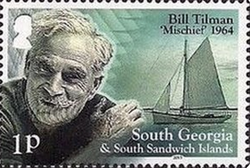
Tabasco sauce essential
Like many an English explorer, Tilman was something of an eccentric. Or maybe he was just a man who marched to the beat of his own drummer. You can experience his idiosyncratic march by reading any of his 15 travel books, particularly the Mischief ones.
In doing so, you’ll learn that he thought Tabasco sauce was an essential item to be brought on an expedition, since anything, even lifeboat biscuits (i.e., hardtack), could be made edible with a few drops of it. You’ll also learn that he advertised his Mischief expeditions with these words: “Hand wanted for long voyage in small boat. No pay, no prospects, not much pleasure.” Believe it or not, he got plenty of enthusiastic replies.
Since I’m an arctic hand myself, I have a particular interest in Tilman’s arctic expeditions, all of which took place in his later years and featured the Mischief as well as another pilot cutter called the Sea Breeze. Among the reasons he liked the Arctic was that he didn’t have to submit to any authority other than himself.
“No bother, no police, no customs, no immigration or health officials to harry us,” he wrote about it.
He could have added something like “only a wondrous natural world” to end this description. At 3,000 feet on a mountain in Greenland, he found a yellow poppy and was utterly enchanted!
A hard trek at age 65
Bylot Island is rugged island off the northwest coast of Baffin Island in the Canadian Arctic. Taking a boat from the Inuit village of Pond Inlet, I once tried to hike across it, but I didn’t get very far before my energy gave out. Not so Tilman! At age 65, he was considerably older than I was, but he made a first crossing of the island in 15 days. That crossing included negotiating his way over an ice col that was 5,000 feet above sea level. “The hardest 50 miles I have ever done,” he said with a grin.

Even more remote than Bylot is Jan Mayen, a Norway-owned island to the east of Greenland. Rising up from it is Beerenberg, a 7,470 foot mountain that’s the northernmost active volcano in the world. I climbed it in three days and ended up being blanketed by volcano ash. One of my companions who didn’t make the climb claimed not to recognize me when I returned to our base camp.
Tilman himself was eager to climb Beerenberg, but before he could do so, the Mischief got stuck on an offshore rock. A goodly percentage of the boat’s supplies were lost, but the item he most lamented the loss of was his pipe. The Norwegians who manned the island’s weather station tried to save the Mischief, but to no avail. Tilman felt like he’d witnessed the death of a dear friend. Even so, he found another friend in the Sea Breeze, and the following year he stopped at Jan Mayen en route to Scoresbysund in East Greenland. “Mr. Tilman, I presume?” one of the Norwegians said to him.
Hunger for adventure grew stronger
As he aged, his desire for adventure seemed to grow stronger. He wanted to spend his 80th birthday in the Arctic, but since that birthday was in February, Antarctica seemed like a more appropriate destination. Thus he sailed south in a gaff-rigged cutter called En Avant with a young explorer named Simon Richardson. In Rio de Janeiro, he sent letters to several of his friends in England. Then — silence. The En Avant vanished without a trace somewhere in the South Atlantic. Tilman was doubtless pleased to have breathed his last in this fashion rather than in a hospital or an old folks home.
My thanks to librarian Mary Sears for providing me with some obscure facts about Tilman’s life.

After climbing all the 14x8,000'ers in three months and one day, Kristin Harila has no further climbing plans at all. She told Norway's media that she is done with high-altitude mountaineering.
"Actually, I'm likely done with climbing," Harila, 37, told the Kronstadposten. "I feel that I have done my part, and I no longer have the motivation needed for such trips."
Yet she is far from done with speaking about her past climbs. Harila's calendar is full of lectures and motivational speaking gigs. She is also writing a book about her experiences in the Himalaya. In Norway, she has become a national celebrity, on the same level as the great polar explorer Borge Ousland.
In addition, Harila had all her record-setting climbs this year filmed. Her goal, seemingly like many climbers, athletes, and adventurers these days, is to sell a documentary to one of the big TV platforms. Everyone, it seems, is hungry to hit the media jackpot, as Nirmal Purja did with Netflix.
She also recently mentioned that she wants to focus on her personal life and to start a family. Below, an Instagram post featuring Harila and her boyfriend.
In addition to her own film, Harila may also appear in other documentaries, including an upcoming Austrian one about the events surrounding her last climb on K2. On that occasion, Pakistani porter Muhammad Hassan died while dozens of climbers stepped over him on their way to the summit.
As for Harila's guide Tenjen Sherpa Lama, he is back guiding clients on the 8,000'ers. Last week, he summited Manaslu, leading a Seven Summit Treks group.
Still relatively wild and lonely, Ladakh offers a long summer climbing season and plenty of potential for exploration both for international teams and for young local climbers.
Recently, we posted about a new route up Jamyang Ri in the Rangtik Topko Valley. And an Italian team led by Francesco Ratti is currently climbing a new route in the Miyar Valley. Between them, in August, four friends from different parts of India undertook a climbing trip to Zanskar.
They originally aimed to climb Ubarak Kangri, near Padum village, but ended up on the summit of two unnamed and (likely) unclimbed peaks. Theirs is not a story of highly difficult climbs or conquering the highest summits. It was just a vacation in their home mountains, pushing their limits, honing their skills, and making their own decisions.
They provided a complete report, including an expedition diary, pictures, GPS tracks, and coordinates of the peaks and points reached. Equal thoroughness would be welcome from many professional expedition teams.

Four friends, one peak
Thirty-four-year-old Tashi Phunchok was born and raised in Zanskar and led the group. He is the oldest and most experienced of the group, an accredited mountain guide with a resumé that includes several first ascents in the area. The other three climbers were in their twenties: Harsh and Kanishk (their full names) are from Manali, in the Himachal Pradesh. Vikas Anantha Kaushik comes from Bangalore. Harsh has trained as a ski and mountain instructor, while Kanishk and Vikas Kaushik (who recounted the expedition for us) were relative newbies.

This was neither a guided expedition nor a sponsored project. They approached Base Camp carrying all their gear along a 100km route that combined some sections in 4x4s and quite a lot of trekking.
"Harsh, Kanishk, and I entered Zanskar by crossing the Kang La (a 5,450m col) on foot. We were told it was the first time in several years that the rarely attempted Kang La has been crossed successfully," Kaushik said. They also noted that the Kang La is on the route to the Neverseen Tower, a potential goal for the Italian team currently in the area.

The three climbers met up with Tashi Phunchok at Padum village, rested at Sani (the last village in the valley), and started on August 14, the first day of their climbing permit.
Unfortunately, conditions on the northeast ridge of Ubarak Kangri were too exposed to serac and rockfall. The ridge included "at least 1,500m of exposed, poorly protected, technical mixed climbing. An endeavor for the future," they decided.
An alternative route
"Then we noticed two unnamed, unclimbed peaks. The first one was covered in ice and snow, and the second was bare rock," Kaushik said.
They believed that the second peak, to the northwest of Ubarak Kangri, could provide an alternative (although longer) route to the peak. "We were wrong," he said. They only found this out after they were well into the climb.
"The crux of the icy peak is a steep, sustained ice wall (60°-80°) that offered safe conditions only when it was not in the sunlight," Kaushik said. "The ice wall was layered, and the fragile upper layers had to be cleaned to unveil the hard, blue ice at the bottom. Also, the approach to the ice wall was challenging because of the extreme danger of rockfall around it."

The climbers observed the conditions for two days and then started on a colder-than-usual morning, hoping the clouds would cover the sun. They moved fast on the steep moraine and then stepped onto the ice wall.
"Tashi opened the route while placing protection," Kaushik wrote. "Harsh followed, fixing the rope. I followed Harsh by climbing the wall with my safety anchor following the rope, and in turn, was followed by Kanishk on jumar."
Close call
There was a scary moment for Kaushik when he was hit by a chunk of ice.
I deftly dodged a fist-sized ice block which went whizzing past my left cheek, but got knocked out by a second large ice block. I blacked out on the wall for a second or two before regaining my composure.Fortunately, my stance was stable and my focus sharp when the lights turned on again. I let my team know I was fine and continued climbing to the top of the ice wall with no further incident. I later found out my carbon fiber helmet had a clean crack and signs of abrasion at the point of impact. I live to climb another ice wall another day.

But the top of the ice wall, at 5,402m, was as far as the young climbers got.
"We saw that our planned approach included several other points separated by cracks and cliffs which would have required long rappels and to climb again along fractured jagged ridgelines," they explained. "It would have taken another 10 to 15 days and more equipment than we had."
Instead, they decided to target two peaks that rose in front of them from ABC (on top of the ice wall). They went for them both in a single push, planning to rest for a few hours near the summit so they could descend in the early hours of the morning when conditions were safest.
Plan B
"We began our summit push from ABC (at 5,070m) at 1 am, topped out on a snowy peak (which we named Shakti Kangri, 5,700m+) at 5:40 am, and summited a second rocky peak (Mukti Kangri, 5,800-5,900m+) at 6:30 am. The summit wall of Shakti Kangri is a 100m, 45°-55° snow slope, separated from the second peak by a 125m-long corniced ridgeline. The summit wall of Mukti Kangri is 70-80m of large, sharp rock slate embedded in firm snow," the team wrote.
After the second summit, they descended a few meters and set up a bivy camp at 5,500m to rest until 1 am, when they returned to ABC.

"Please note my team did not step on the absolute pinnacle of Mukti Kangri out of respect," Kaushik said.
Cosmic energy
The team then descended to Ubarak Phu, clearing Base Camp along the way.
"We were each loaded with 25-40kg on our way down, including equipment, cooking gas, rations, and garbage," Vikas said. "We left no garbage, not even a square of plastic, on our mountain."
Kaushik explained how they came up with names for the peaks.
"Shakti embodies feminine cosmic energy and is said to drive the potential that resides in each of us. Mukti refers to liberation or enlightenment in a Buddhist sense. Kang means several things: icy, snowy, provider of water, purest, supreme. Ri means mountain."
Naming peaks involves a long process, since first of all the local villagers must accept the proposed names. Then the Indian Mountaineering Foundation will decide whether to register the names, once they have sufficient proof of a successful ascent.
"The process takes six to eight months," said Kaushik.
In their case, however, the locals are happy with the name, the climbers said, because the concept of Shakti and Mukti is somewhat related to Buddhism.
The next time, the four will attempt higher peaks in the area. "Something like Menthosa (6,400m), Papsura (6,500m), or Parvati Peak(6,600m)," they said.
At the end of August, Eneko Pou, Iker Pou, and Micher Quito did the first ascent of the northwest face of 6,162m Ranrapalca in the Peruvian Andes. The trio climbed this Cordillera Blanca peak free and in alpine style.
After opening several routes in the Karakoram, among them Waa Shakir 6b M5 70˚, 2,200m on Trango II (with Fay Manners), the Spanish brothers headed to the Andes.

They first saw Ranrapalca last year, when they and Quito opened Hanan Pacha and Emmoa on 5,495m Urus. On the other side of the valley, they spotted Ranrapalca and a possible route up it. At the time, however, they weren't sure if they would be able to climb something so long, vertical, and complex at more than 6,000m.
"In fact, we tried it then but were already very worn out after a two-month expedition," said Eneko Pou. "With the route in bad condition because of a lack of snow, we decided to turn around."
This year, they decided to try again. It took them two days of climbing to open the first route on Ranrapalca's northwest face to the top. They named the route Ya Pe' Cholo 6b/80 degrees/1,200m.

Long, hard, and exposed
"It was a hard, exposed, and very long climb," recalled Eneko Pou. "Climbing such a big wall with about 20kg on your back multiplies the difficulty. It was exposed because at the end of the season, and with the heat, rocks and ice were falling constantly around us."
The Pou brothers say that they had a perfect synchronization with Quito. Eneko Pou led nine pitches on the first day, while Iker Pou and Quito carried much of the weight during the more than 13 hours of climbing.
Eventually, they reached a ledge more than 500m from the ground that seemed good for a bivouac. However, rocks fell around them constantly throughout the night. In the morning, it was difficult to climb some grade-six pitches with heavy backpacks and the temperature well below zero.
That second day, Iker Pou led the climb up to a plateau. From there, Quito took the lead. "We needed relief because we were both very worn out," said Eneko Pou.
They had to jump over several large crevasses on the plateau before summiting that afternoon. Fifteen minutes after topping out, the trio started to descend.
"We knew we had to move quickly because we had several vertical rappels coming up and then we had to cross a glacier full of terrifying crevasses," they recalled.

On the last rappel, they had a close call when a huge rock glanced off Eneko Pou's head, briefly knocking him unconscious. But he eventually recovered and was able to continue the rappel. They finally reached the Giordano Longoni shelter in the middle of the night, after crossing a labyrinth of crevasses.
"Being able to imagine, devise, and create new avant-garde projects allows us to further the evolution of mountaineering and to try to leave a good legacy behind us," said Eneko Pou.

In this series, we look at the world's five highest unclimbed mountains, based on Eberhard Jurgalski's list from 8,000ers.com. We will cover each peak's modest climbing history and consider why no one has summited them yet.
Note that this series covers independent mountains, those that are not just secondary bumps on higher main peaks. The debate about subsidiary peaks versus independent mountains is a recurrent headache when climbers search for the "highest unclimbed peak." Here, we are covering those unclimbed peaks for which there is no debate.
In our first three articles, we wrote about Kangkar Punzum, Lapche Kang II, and Apsarasas Kangri I. Our next peak is 7,221m Karjiang I, the fourth-highest unclimbed mountain in the world.

Karjiang
Karjiang is in Tibet, on the border with Bhutan. It is three kilometers northeast of 7,538m Kula Kangri (first ascended on April 21, 1986, by a Japanese party led by Hirai Kazumasa) and 30km northeast of Kangkar Punzum.
Just 30km north of Karjiang lies a beautiful Tibetan lake called Puma Yumco. Located 5,030m above sea level on the southern Tibetan plateau, Puma Yumco receives snow melt from the surrounding mountains. The name means "the blue jewel floating in the sky."

The main peak of Karjiang is the southern one, 7,221m Karjiang I, with a prominence of 895m. There are three subpeaks, the 7,216m Northwest Peak (with a prominence of 66m), 7,045m Karjiang II (with a prominence of 195m), and 6,824m Karjiang III (with a prominence of 174m).
1986 Japanese attempt
In the autumn of 1986, six climbers from the Himalayan Association of Japan, under the leadership of Nobuhiro Shingo, traveled from Lhasa to Monda. After approaching the nearby glacier on Sept. 9, the team attempted the main peak, Karjiang I.
But because of the difficulty of the terrain, they eventually changed their plan and targeted the 7,216m Northwest Peak. On Oct. 13, they set up Camp 3 at 7,000m. The following day, in a strong wind, Nobuhiro Shingo, Kenji Tomoda, and Hiroshi Iwasaki reached the Northwest summit via the northwest ridge. On Oct. 16, Tsutomu Miyazaki and Akinori Hosaka also topped out.

Fifteen years later
In the autumn of 2001, again during the post-monsoon season, a seven-man party from the Netherlands wanted to ascend Karjiang I. The team included Haroen Schijf, Rudolf van Aken, Pepijn Bink, Court Haegens, Willem Horstmann, and Rein-Jan Koolwijk.
On Sept. 20, they established a base camp at approximately 4,950m on the north of Karjiang. They only had photos of Karjiang's west side, but some excellent satellite images showed Schijf that it might be possible to ascend from the northeast. So the Dutch party decided to head around to the east side of the mountain.

On Sept. 24, the party established an advanced base camp. The next day, Schijf and Horstmann reached a col at about 5,800m. From there, they could contemplate the 800m northeast face of Karjiang I.
Both men agreed that this face was steeper, more difficult, and more dangerous than anything they had seen previously. They decided to abort their attempt.

Before retreating, Haegens made what was probably the first ascent of a nearby 5,881m peak, closely followed by the rest of the Dutch party. Haegens named that peak 5,881m peak Rognon of Good Hope.
On the last day of September, Schijf, Van Aken, Haegens, and Horstmann attempted to reach a 6,412m sub-summit via its west face. On the 60° ice slope, the three men only made it to 6,150m before retreating.

The opposite side
Next, the Dutch team went to the opposite side of the mountain to try Karjiang I's west face. On Oct. 4, they established an advanced base camp at 5,700m. The next day, Haegens fixed 100m of rope to protect them in a dangerous part of the icefall. That was the only length of rope used by the Dutch party during the whole expedition.
In their report for the American Alpine Journal, the team wrote that they found a lot of trash in the area. According to Schijf, the Japanese expedition had probably left it.
Two days after fixing the rope, they started up. But at 6,500m, they caused a 25m wide slab avalanche that fell 200m to the bottom of the face. No one was hurt, but the close call prompted them to reevaluate the climb. Eventually, they decided to rappel down rather than continue.

Still not defeated, the party went to the Kula Kangri group to attempt one of the subpeaks. On Oct. 13, they made a summit push on the 7,381m peak from a high camp at 6,700m. But because of low temperatures and strong wind, they retreated from 7,100m.
Instead, on Oct. 19, Bink, Horstmann, Koolwijk, and Schijf made the first ascent of a 6,824m subpeak via its north face. According to Schijf, it was a beautiful pyramid. They named the peak Taptol Kangri (also sometimes called Karjiang III).

Meanwhile, Van Aken and Haegens put up a camp at 6,100m on the northeast glacier of Karjiang, just below the narrow south-southwest ridge of the 6,412m subpeak. When they topped out, they named this subpeak Kangmi Kangri, which means "Yeti Snow Mountain."
Plans foiled in 2010
In 2010, American climbers Joseph Nicholi Puryear and David Gottlieb received a Shipton-Tilman Grant for an attempt on Karjiang. However, they didn't receive a climbing permit from local authorities. They changed their target and went to Lapche Kang, located 420km west of Karjiang. There, Puryear died in a fatal fall.

Name confusion
Like Lapche Kang and Apsarasas Kangri, there is some confusion regarding the names of the various Karjiang peaks. Both the Japanese climbers who summited Karjiang's northwest summit and the Dutch party used the wrong names for the subpeaks.
For clarity, the Japanese party in 1986 made the first ascent of 7,216m Karjiang Northwest Peak and the 2001 Dutch team made the first ascent of 6,824m Karjiang III.
Meanwhile, 7,045m Karjiang II and 7,221m Karjiang I -- the only independent mountain of the Karjiang group -- remain unclimbed.
“I think the Karjiang will be climbed soon, when it is possible to get a permit again,” Haroen Schijf told ExplorersWeb.
Given the inherent subjectivity of peakbagging, it's not surprising that Eric Gilbertson's latest achievement is a bit difficult to describe.
The 34-year-old American has summited nearly 2,000 mountains worldwide, according to his own count on PeakBagger.com. But on Sept. 1, Gilbertson and his partner Andreas Frydensberg claimed a possible new first in mountaineering: climbing in all seven of "the 'Stans."
Put simply, the pair have climbed the highest mountain in seven countries in Central Asia: Afghanistan, Pakistan, Kyrgyzstan, Kazakhstan, Tajikistan, Uzbekistan, and Turkmenistan.
While that means Gilbertson and Frydensberg climbed the infamously dangerous K2 — Pakistan's highest point — most of the other mountains aren't well-known, even among mountaineers. Completing these seven high points is likely more difficult than summiting all 14 of the world's peaks over 8,000m, said Gilbertson, who has summited three of them, in addition to an Everest attempt.
"This subset just kinda collects most of the hardest peaks in the world," he told ExplorerWeb on Monday. "It’s a unique list because it’s so difficult. I’m not aware of other people who are collecting all these peaks."
As for claiming the first ascent of all seven — Gilbertson has the evidence to back it up. Since 2018, he has been measuring mountains around the world to find the true high points. His research has resulted in new "highest mountains" for seven countries, including Uzbekistan, which he and Frydensberg summited in August.
According to his measurements, it's Alpomish — not Khazret Sultan — that's actually Uzbekistan's high point.
"A lot of the time, just getting to base camp is one of the most difficult parts," Gilbertson said of his far-flung ascents. "Sometimes, that feels like the crux."

A different kind of crux
Earlier this summer, Hungarian journalist Laszlo Pinter wrote a comprehensive essay summarizing what many of the world's best alpinists have noticed: Just Collecting 8,000m Peaks No Longer Has Any Real Climbing Value.
"Guided summit collectors who seek fame do nothing more than exploit the myth that real climbing greats have created," Pinter wrote.
If "real mountaineering" must include the uncertainty and danger that fixed lines mostly prevent, then Gilbertson's focus on lesser-known peaks certainly counts as something outside the ordinary.
In 2019, for example, he climbed Afghanistan's highest mountain, a 7,000m peak called Noshaq. Hiring local guides is necessary here. For one, the approach requires avoiding land mines, tragically common throughout Afghanistan due to its troubled history. The area was also controlled by the Taliban, meaning that climbers risk a million-dollar ransom if captured.
So it's easy to understand why the mountain's crux (several pitches of 5.7 M4 climbing, according to Gilbertson) might not happen on the rock.
"We saw a cow that had stepped on a land mine on the way out," Gilbertson said. "It wasn’t very pretty. They just kind of left it there...Luckily, the locals know a safe way."
Given that Afghanistan is even more unstable now than in 2019, aspiring climbers might reconsider following in Gilbertson's footsteps any time soon.

More than a peakbagger
But what makes Gilbertson's exploits even more interesting is the research he conducts along the way.
When he arrived in Uzbekistan this summer, officials considered Khazret Sultan the highest peak in the country, based on a 1981 survey by the Soviet Union that measured the mountain at 4,643m.
When Gilbertson and Frydensberg climbed a neighboring peak, Alpomish, Gilbertson took six measurements with his sight level from different points. He found that Alpomish has an elevation of 4,668m, with a margin of error of 8 meters.
That means it's actually the highest point in Uzbekistan. To date, Gilbertson's research has also revealed new country high points for Saudi Arabia, Togo, Guinea Bissau, Guinea, Ivory Coast, and Gambia.
"It’s kind of surprising that there’s all this uncertainty still in country high points," Gilbertson said.

While mountain measurements can easily be found on Google Earth, those have a margin of error of up to 10 meters. It's possible to pay private companies for more specific measurements of a given mountain, but that's expensive and still comes with a margin of error of up to 3 meters.
A ground survey at the actual mountain remains the "gold standard," Gilbertson said, and many of the world's mountains are sufficiently out of reach to make that difficult.
For Gilbertson, it's just one more example of a truth that's hard for many modern humans to accept: There are still lots of places to explore.
"I couldn't find much documentation about the mountains in Uzbekistan. I didn’t know until I went in there," he said. "There are still plenty of places like that left — you just don’t hear about them."
Keep up with Gilbertson's busy climbing schedule on his website CountryHighPoints.com. Also, here are the full details of all seven high points of the Stans, as completed by Gilbertson and Frydensberg:
- Pakistan (K2, 8,611m)
- Tajikistan (Ismoil Somoni, 7,495m)
- Afghanistan (Noshaq, 7,493m)
- Kyrgyzstan (Pobeda, 7,439m)
- Kazakhstan (Khan Tengri, 7,000m)
- Uzbekistan (Alpomish, 4,668m)
- Turkmenistan (Ayrybaba, 3,139m)