A powerful new player has entered the debate about commercialization and the environment in Nepal. The country's Supreme Court has ordered the government to limit the number of climbers on Everest. It also bans helicopters above base camp on all its mountains and orders new regulations to limit garbage on its peaks.
The tribunal's order comes after a public interest petition filed by advocate Deepak Bikram Mishra, My Republica reported. The decision tasks the government with implementing the court order.
According to the justices, the government can only issue climbing permits after specifying how many climbers will be allowed, according to available capacity. Helicopter flights above base camp will also be banned, except for rescues.
Finally, climbing teams must submit a list of the gear and supplies they are carrying up the mountain and must leave a deposit. They receive back the deposit only after proving that they brought everything down.
Endless debate
Every season, local and national authorities try to minimize the impact of the growing high-altitude tourism industry on the fragile mountain environment. And every year, stories of overcrowding, abandoned garbage, and deaths on the world's highest peaks taint Nepal's reputation on the world stage.
On the other hand, the richest outfitters -- some of which are partners in a helicopter business -- make a case for airlifts and ever-larger teams. They argue that the helicopters increase safety, especially when they spare clients and staff from going through risky sections like the Khumbu Icefall. But mainly, helicopters allow faster and easier expeditions, which encourages clients to climb more than one peak in a season. More business. In recent years, helicopters have significantly increased profit by providing optional airlifts to or from higher camps.
The Supreme Court resolution highlights the potentially disastrous consequences of climate change, including melting glaciers melting and burst glacial lakes flooding downstream rural areas.
"In this context, it appears imperative for the state to undertake special care and protective measures in response to the impacts of climate change on the mountains and glaciers," the order reads, as quoted in My Republica. "This also aligns with the constitutional responsibility of the state toward the environment and its citizens."
The document blames over-tourism for negatively impacting conservation and sustainability. The court thus mandates pollution management and cleanup in mountain areas.
Measures already - but how effective?
Government officials may respond to the court order by arguing that such measures are already in place, especially on Everest and nearby mountains, through the Sagarmatha Pollution Control Committee. Every year also sees public and private cleaning campaigns, and Liaison Officers are theoretically in charge of controlling expeditions and raising visitors' awareness. But the problem remains, how to increase the efficiency of such measures and find common ground among the different stakeholders.
Banning helicopters above base camp would clearly affect expedition logistics, especially on mountains such as Annapurna, where gear airdrops are common. Whether the Supreme Court ruling will have real teeth over powerful private interests remains to be seen.
Every week, Nepal's Department of Tourism (DoT) updates its list of climbing permits for mountains above 6,000m. Although it's hard to estimate final figures based on this dribbled information, Everest continues its popularity. Every year, the number of visitors hoping to Everest increases. According to the preliminary stats, this year may not be an exception.
More than last year
Last year, the first list of Everest permits came out on April 10. At that time, 20 teams had signed in, totaling 197 foreign climbers (166 male and 31 female).
This year, the permit lists started appearing earlier. On April 2, there were 86 permitted Everest climbers (70 male, 16 female). By April 10, exactly a year after last year's figure of 197, a new update noted a running count of 209 permits (170 male, 39 female). That is, 12 permits more.
The figure does not reflect the Nepalese supporting climbers and guides. Typically, they more than double the final numbers.
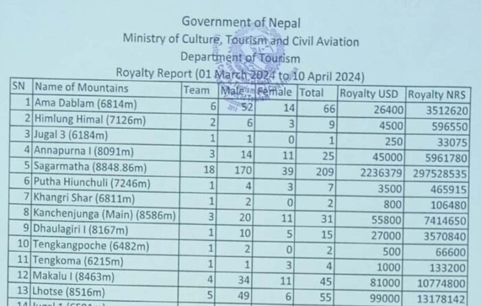
Understandably, Nepal only counts those climbing Everest from the south -- the Nepalese side. This year, a number of teams received permission to climb the Northeast Ridge in Tibet.
Adrian Ballinger of Alpenglow Expeditions told ExplorersWeb that about 200 people will be on the Chinese side of the mountain this spring. This includes Tibetans, Chinese, Nepalese, and foreigners.
Last year, the final DoT figures gave a total of 478 foreign Everest permits for the Nepal side. At the end of the season, the final summit number -- compiled by The Himalayan Database, based on the data gathered by Nepal's authorities -- was 655 summits, including local climbers. Fifteen of those locals summited Everest twice while Lakpa Sona Sherpa did so three times.
At the beginning of this season, The Himalayan Times newspaper estimated 400 permits. But if the trend continues, the final figure will likely be higher, making 2024 another record year for the Everest business industry.
It is 1916. Two motorcycles roar down 8,850km of road from New York to Los Angeles. Two riders clad in helmets, leather riding breeches, and military-styled outfits capture the American imagination while courting controversy. Augusta and Adeline Van Buren did not wish to live the conventional life. Instead, they lived to evoke change.
The Van Buren sisters -- Augusta (born 1884) and Adeline (born 1889) -- were supposed to be "society girls." They were descendants of Martin Van Buren, the eighth president of the United States. Such a legacy must have been quite a weight.
Rather than learning the art of conversation, wearing fine clothes, and going to parties, they loved the outdoors. Both learned how to ride, to box -- yes! -- and were politically active, which was controversial at the time. Their era was one of immense change and volatility. The women's suffrage movement was at its height, and the First World War raged in Europe. Women were entering the workforce. America had not yet joined the conflict overseas, despite international pressure to intervene.
Augusta and Adeline, forward-thinking and patriotic, sought to get a head start in bolstering the war effort. They believed that women should not sit idly by while their husbands and fathers laid down their lives on the battlefield. They found women capable of doing more active tasks, specifically driving to deliver messages for the military. Alas, although it was a good idea, the military did not care less.

'Tough' was an understatement
Often, the sisters' ideas encountered scrutiny and ridicule. Strong-willed as they were, the pair set out to prove their point. They decided to show the world that they could withstand a tough motorcycle journey throughout the continental United States.
Their expedition began on 4 July 1916 from Sheepshead, New York. They spent the next 60 days on the road. Their 1000cc Indian motorcycles weighed over 400 pounds, had Firestone non-skid tires, a gearbox, a 2.5 gallon fuel tank, and cost almost $300 overall -- about $8,600 today.
The term "tough" is an understatement. They encountered many problems on their journey, not only because dealing with their motorcycles required a lot of physical strength at times but also simply because of their gender. The police arrested them several times for wearing men's clothes, which incredibly, was illegal back then.
At this time, America's roads were underdeveloped and dangerous. Most were dirt and prone to damage by rain and erosion. Some went high into the Rocky Mountains and were almost inaccessible. The trip was so arduous that some nights, the girls fell asleep on their bikes and fell over while riding.
Once, they got lost in the deserts of Utah and Nevada without much water. Luckily, a passerby came to their aid. Despite the challenges, they claimed small victories. They became the first women to summit Colorado's Pikes Peak by motorcycle.

Did they receive the recognition they earned? Yes and no. While many marveled and took photos with the intrepid sisters for local newspapers throughout America, many sought to tear down their success. Newspapers called their journey a "vacation" or an affront to "femininity." At the end of their successful expedition, they applied for dispatch positions in the army, but they were still rejected.
Soon, the sisters went back to their lives. They did not attempt another expedition like this but lived their ordinary lives extraordinarily. Adeline became a lawyer and Augusta became a pilot. They both married.
Today, their names are inscribed in two Halls of Fame: the AMA Motorcycle Hall of Fame and the Sturgis Motorcycle Hall of Fame. Every decade, their modern descendants honor their legacy by retracing their ride from New York to Los Angeles.
Last month, Guinness World Records (GWR) kicked up a media storm when it decided to alter the record books and relegate Reinhold Messner's achievement of being the first person to climb all the 8,000m peaks to that of a "legacy" record. Based on extensive research on summit topography by the expert team at 8000ers.com, Guinness now states that the first person to summit all of them was American Ed Viesturs.
Guinness has never held much sway in the mountaineering world, and Viesturs himself dismissed the record change as "ridiculous." So did much of the wider climbing community. But for the general public, achievements from Messner and many others climbing luminaries have now been thrown into doubt.
Historically, Guinness has done a reasonable job at cataloguing major exploration records, such as the first to climb notable mountains, cross deserts, or ski to the Poles. But in recent years, as guided adventure tourism has allowed relative beginners to take on more extreme challenges, the record chronicling organization has begun rubber stamping an endless number of adventure records, many of which are tenuous and contrived.
See, for example, the fastest ascent of the top three highest mountains with supplementary oxygen (female) or fastest time to climb the Seven Summits and ski the polar last degrees (male).
When did the contrived records begin?
Before changing its name to Guinness World Records, the organization began as the Guinness Book of Records from 1955-1999, with a primary focus on its famous reference book. Over the years, GWR has become an international franchise that is considered the global authority for chronicling and verifying world records of the human and natural world, as well as creating museums and even television series.
In 2008, the franchise was bought out by the Jim Pattison Group, which also owns the Ripley's Believe It or Not! museums. Some media sources have suggested that since 2008, GWR has moved its business model toward helping individuals and companies create records to garner attention, while the company generates income via a consulting fee for would-be record breakers.

Seven Summits
It's hard to pinpoint exactly when the rash of contrived adventure records linked to Guinness started, but it may have its roots in the wider commodification of adventure. In the 1980s, American businessman Dick Bass dreamed up and completed the Seven Summits. Bass's quest helped kick-start commercial guiding of rich amateurs on major peaks such as Everest and Mt. Vinson in Antarctica.
A decade later, British businessman David Hempleman-Adams ushered in the era of the Explorers Grand Slam in 1998. These listicle records were at the time considered second best to a true polar first or an unclimbed line on a Himalayan wall, but they were still thought of as significant challenges.
In hindsight, however, they were a means for adventurers to create a record and a claim of originality that may have paved the way for feats that included increasing numbers of qualifiers. This became common in the early noughts e.g. Fastest time to climb the Seven Summits (both lists) by a married couple.
Looking back at early versions of the Guinness Book of Records, you can find references to adventure and exploration. For example, in the 1984 edition, Ranulph Fiennes was rather grandiosely proclaimed as "the greatest living explorer." And the 1985 edition (see below) details key mountaineering records on major peaks such as Everest.

Not a mountaineering authority
Historically though, Guinness was never a reference for serious mountaineers. Instead, preference was placed on The Himalayan Database or nowadays, 8000ers.com. Yet in the last five to ten years, mountaineering -- particularly on the 8,000m peaks -- has become infested with contrived records by commercial climbers. It could be argued that climbers such as Nirmal Purja and his 14x8,000m speed record, and the associated glut of GWR certificates, started this trend. See for example his record for the "fastest triple header of 3x8000m peaks."
Himalayan outfitters have latched onto this, and both Sherpas and guided clients have ticked off everything from the youngest female to climb Everest and K2 to the most ascents of Makalu in a season.
It's not just mountaineering and polar travel that are affected. In 2010, British TV presenter Helen Skelton broke the Guinness World Record for the longest distance kayaked by a woman in 24 hours (75 miles). Seasoned kayakers dismissed this claim as a "long training run," and Katie Pfefferkorn-Mansker promptly more than doubled the distance in the same year.
Get famous-quick-adventurers
Many adventurers now clamor for their own framed GWR certificate, in the hope it will lead to greater publicity. These are ready-baked for the Instagram generation of heavily guided climbers or polar skiers to wave aloft. If you can dream up a record, Guinness will likely endorse it, as long as you can prove you did it. This is a problem for several reasons. First, it creates the perfect conditions for get-famous-quick adventurers.
That is someone who is a relative beginner in his or her discipline and who targets a record -- usually low-hanging fruit that has not been previously attempted often, if at all. Typically, they get a lot of guided help. The more canny marketers are able to leverage significant publicity for commercial gain. Rarely do the guides get much credit. Often, this diminishes the credit of those adventurers who are truly on the cutting edge. This happened with Borge Ousland after Colin O'Brady's partial crossing of Antarctica.
Unfortunately, the growing focus on creating shallow records for those preoccupied with marketing their originality, no matter how diluted with qualifiers, overshadows the real value of adventurous experiences. These include personal growth, scientific or geographic learning, rarely-seen imagery, cultural accounts, and the simple joy of traveling through sublime natural landscapes.

Outfitters' business model
This model of record-generating is unlikely to vanish any time soon. Outfitters and logistics operators have begun using it as part of their business model. They often tantalize potential clients by pointing out which records they have a chance to break. While they are not all Guinness records, the influence of Guinness has arguably promoted the wider practice of creating records with increasing numbers of qualifiers (youngest, of certain ethnicity, gender, or nationality).
For example, when independent traveler Anja Blacha (who is not a get-famous-quick type) completed a solo unsupported ski expedition from Berkner Island to the South Pole in Antarctica in 2020, her certification letter from Antarctic Logistics and Expeditions (ALE) listed no more than seven potential records, including “the first woman under 30 to ski solo, unsupported, & unassisted to the South Pole.”
Records beget business for adventure outfitters, and the attention the record-setters get inspires others to get out their magnifying glasses to hunt for even more obscure records.
A good example of this symbiotic relationship between outfitter and record pursuer is controversial adventurer Colin O'Brady, who was drawn in by ALE with the prospect of a world first in Antarctica in 2018. In subsequent years (and this coming season), further adventurers have targeted similar partial crossings of Antarctica. This includes Preet Chandi: Despite a solid effort, she fell just short of a partial crossing last season but bagged a number of largely irrelevant Guinness World Records in the process.

Shishapangma from near Base Camp. Photo: Sasko Kedev
Ethical issues
Some more ethically focused issues are also worth considering. The pursuit of a world record can lead to unhealthy competition. In recent weeks, we have seen the argument that competition to become the first American woman to climb the 8000'ers may have contributed to the deaths of four climbers on Shishapangma, the world's fourteenth-highest mountain. Likewise, there are many other examples of climbers risking "hair-raising conditions" to keep pace for a speed record -- see Kristin Harila's 2022 Manaslu climb, for example.
The pursuit of these speed records in the high mountains also comes at an environmental cost. Both Nirmal Purja and Kristin Harila used helicopters to speed between base camps, as well as ferry equipment higher up the mountain. This practice runs in stark contrast to environmental principles for many in the adventure community.
Slipping past fact-checkers
In 2018, Polish adventurer Marcin Gienieczko claimed to have completed a 5,986km solo canoe descent of the Amazon. Gienieczko said he completed it alone in an open canoe. Guinness quickly certified Gienieczko's expedition as the “Longest Journey by Canoe (Kayak) Solo.”
A subsequent investigation by Canoe & Kayak revealed that it was not the longest, nor was it solo. Gienieczko caught a ride on a motorized boat and forced his Peruvian fixer to paddle hundreds of kilometers with him, according to the magazine. In addition, several adventurers have paddled a great deal farther solo.
It's clearly hard for Guinness to keep up with the minutia of all the sub-disciplines of adventure, and some false or dubious records are bound to slip through the net. Recently, Guinness has partnered with experts for more robust record adjudication. For polar records, they work with the Polar Expeditions Classification Scheme (PECS), and for mountaineering, they consult mountain chronicler Eberhard Jurgalski of 8000ers.com.
Even these consultations are not infallible, though. Guinness used Jurgalski's excellent work to tarnish Reinhold Messner while handing out tenuous climbing records like confetti to commercial climbers. And while PECS started precisely to ensure consistency on polar record claims, it still allows some hair-splitting "records." It could also face conflict-of-interest accusations since at least one of its members also works for Antarctic Logistics and Expeditions.
Enduring prestige
For the general public, Guinness records still carry prestige. Flash one of their certificates in a corporate meeting and you may score funding for your next adventure, even if you can't put on your own crampons without help. Flash one of their certificates to the press and you might make it into your country's national newspaper.
But if the adventure community continues to encourage Guinness to legitimize contrived records, public skepticism will grow and interest will diminish. That may have consequences for those who seek to make a living from their passion, through guiding, speaking, photography and film, or journalism. Like the boy who cried wolf, who will be left to listen?
Stick to gimmicks

Many of us seek adventure for deeply personal reasons. Concepts like style, difficulty, and the connection with nature matter most. They certainly trump the external validation of a dubious first. The adventure community should consider if they want the very same organization that hands out absurd records to wacky dictators such as Gurbanguly Berdimuhamedov (skip to 12:30), to preside in any way over the annals of adventure. Perhaps Guinness is better left sticking to what first made it so charming, overseeing gimmick records by, for example, those who paddle a giant pumpkin boat.
Full disclosure
In 2015, I took part in a GWR attempt for the most people bouncing on trampolines at the same time. It was fun and we may have held the record for a short time.
This year's Piolets d'Or awards have gone to new routes on Pakistan's Pumari Chhish East, Nepal's Jugal Spire, and Peru's Jirishanca, climbed by French, British and Canadian teams respectively. There is also a special mention of a new route on Greenland's Sun Spire by an international female team on an expedition with a low carbon footprint.
Pumari Chhish East and Jugal Spire, both first ascents, were also selected among the best expeditions of 2022 by ExplorersWeb. Berg and Roberts' route on Jirishanca in Peru came as a pleasant surprise.
Jirishanca (ca. 6,094m), south-southeast spur
Canadians Alik Berg and Quentin Roberts completed the first ascent of the SSE spur of Jirishanca, one of the highest peaks of the Huayuash range in Peru. They named their 1,000m, M7 AI5+ 90° route Reino Hongo (Mushroom Kingdom).
The line has all the typical features of high-level Andean climbing: unknown terrain, snow and ice mushrooms, and ice-plastered, vertical walls. The pair climbed the SSE spur in excellent style: on-sight, in a single push, and carrying everything with them.

[The pair] climbed five or so pitches up the lower spur and then wrapped around the steeper section above onto the south flank. Here, they climbed steep mixed terrain to regain the spur below the convoluted snow/ice ridge shaped like a dragon’s back. They completed this section on day one, the ridge itself on day two, and the crux headwall on day three. The latter provided unprotected pitches that were sometimes as difficult and potentially as dangerous for the second as the leader.
Although Jirishanca is rarely climbed, Berg and Roberts met another team (from the U.S.) on the summit. They used their route (via the east buttress and lower southeast face) to descend, which took one more bivy night.
Jury members felt this was "an inspiring line, direct to the summit, and climbed in exactly the style and with the spirit of adventure that the Piolets d’Or wishes to promote."
Pumari Chhish East (ca. 6,850m)
Christophe Ogier, Victor Saucede, and Jerome Sullivan of France succeeded on their (sixth overall) attempt on the eastern and most technical point of the Pumari Chhish group, north of the Hispar Glacier. Their route, which they dubbed The Crystal Ship, is 1,600m long and goes up the south face and upper west ridge. The team graded it as 6b A2 M7.
The team started by enduring 26 straight days of bad weather. The moment an optimistic weather report came, they hurried across the snowfield at the base of the peak during the night and started up.

On the 700m pillar, they employed big-wall techniques, with the leader hauling while the two seconds jumared. Aid was often used to surmount overhangs or to remove large snow formations plastered onto the cracks. Generally, they climbed as free as possible under the conditions. The first three bivouacs were poor, exposed, and uncomfortable, but the fourth day took them through the remaining difficulties, which included two vertical 6b rock pitches at 6,600m (led in rock shoes), to a relatively spacious shoulder. The next day, they climbed through the summit mushroom and were on top at 10 am.
The climbers then waited in their bivy spot for the sun to disappear from the face before rappelling down in the afternoon. They made it back to Base Camp by midnight.
"[It is] an elegant line...full of uncertainty, on one of Pakistan’s big unsolved problems," the jury declared. "It is not the easiest option on the mountain, but the steepness and sustained high level of difficulty made it one of the safest, rising almost directly to the summit. The ascent was very much a collective effort, displaying great team spirit."
Jugal Spire (aka Dorje Lhakpa II, 6,563m)
The UK's Paul Ramsden had spent the COVID lockdown looking for a peak to climb in the future. When the opportunity came, he traveled to Nepal with young Tim Miller to attempt the rocky north face of unclimbed Jugal Spire. Almost rocky, to be accurate. A thin line of ice crossed at least part of the face. A big section was hidden, and there was no way to know if the ice line had a continuation. They went for it, anyway.

After the initial day, which involved sections of unprotected and delicate mixed climbing leading to a comfortable bivouac, they reached the steep rock wall. Surprised, they found a series of chimneys hidden behind a line of flakes that gave intense Scottish-style climbing. The following night, spindrift avalanches ripped the tent. Part of their time was spent standing in the dark until spindrift eventually subsided. The third night was more pleasant, though by now the tent was no longer usable, and the two just hid inside the fabric. The fourth bivouac, close to the top of the bullet-proof ice of the summit slopes, lay inside a natural rock cave. The next day, after 37 pitches from the bottom of the face, they crossed the summit, rappelled from Abalakovs to the south, then dropped west down a broad gully to make their last bivouac where it met the glacier.
No wonder they called their route, ephemeral and hidden from sight, The Phantom Line. They graded the 1,300m route as ED. Ramsden said it was one of the best lines he had ever climbed. This is his fifth (!) golden ice axe.
"This was a perfect example of ambitious exploratory mountaineering, carried out in simple but effective alpine style: two sacks, two ropes, one tent, and no ascenders, bolts, or weather forecasts," the jury said.
Special mention: Northern Sun Spire (1,527m)
This all-female team comprised not only climbers but also sailors. Together, they carried out an ingenious, multi-faceted adventure. Skipper Marta Guemes (Spain) and crew Caroline Dehais and Alix Jaekkel (both France) sailed from La Rochelle with climbers Capucine Cotteaux (France), Caro North (Switzerland), and Nadia Royo (Spain), plus photographer Ramona Waldner (Austria). It took them six weeks of sailing on rough seas and dealing with sections of packed ice. They finally anchored in East Greenland. They had only 10 days left, but it was enough to open this 780m-long rock route (6b-,7b+).

Cotteaux, North, and Royo spent two days climbing steep difficult terrain and fixing 300m of rope, the leader sometimes resorting to aid while the followers mostly free climbed. With one-and-a-half days now left before a predicted snowstorm, the three set off up the ropes, added four more difficult pitches, and spent the night in portaledges. The following morning, after a further six pitches of more reasonable 6a-6b, they reached the upper south ridge. They used natural gear throughout. Incoming weather persuaded them not to make the easy scramble to the summit (the top section of the 2019 first ascent route). By the time they regained the base of the wall, it was raining.
The team then spent four more weeks and 7,400km at sea sailing back to France.
The jury noted the "fine adventure by a self-contained, international group of women" and the minimal carbon footprint as the main assets of the expedition.
No short list
Some weeks ago, as usual, the Piolet d'Or organizers posted a list of 53 "significant ascents" around the world, chosen by American Alpine Journal editors and Rodolphe Popier of 8.000ers.com. They specifically noted that these were not part of a short list, but a selection of alpine-style or capsule-style climbs in which little or no drilling had been used.
Last week, the Piolet d'Or for Lifetime Achievement went to American climber George Lowe.
They will all gather for the ceremony in Briançon, France on Nov. 14-16.
Climbers on commercial expeditions will no longer have to "prove" their summits through an interview with The Himalayan Database.
For 60 years, the non-profit has recorded nearly every summit from 160 Nepal peaks, but will now stop interviewing team members and leaders from expeditions climbing the normal routes. Instead, they will "concentrate on new and interesting routes on the 8,000'ers and other commercial peaks, as well as new and technically challenging mountains that are climbed in Alpine style in the Nepal Himalaya," they stated in a press release yesterday.
Too many to track
The decision is not surprising. As they note, things have changed a great deal since the Himalayan Database founder Elizabeth Hawley started her famous interviews with the 1963 American Everest expedition led by Norman Dyhrenfurth. At the time, there was only one permit issued for each mountain per season; this spring, Nepal's Department of Tourism issued 1,176 permits to foreigners climbing Nepal peaks, 478 of them for Everest.
"There are so many individual climbers with different outfitters nowadays, it is no longer possible [for the seven-member team] to chase them the way we chased them during Miss Hawley’s time," Billi Bierling told ExplorersWeb.

"Back in those days, we used to ring the trekking agents to find out who was arriving when, and where they were staying," Bierling explained. "We would then ring the hotel as soon as we thought the climbers would have arrived from the airport and arrange a meeting for the next day. We would speak to the climbers before and after their expeditions."
"I feel sad that we had to do this [stop interviewing every climber]. However, if we tried to continue our work in the 'Liz Hawley style', we would have to employ a team of 100 people and would still not be able to keep up," Bierling said.
Looking for the alpinists
"What we will focus on in the future are interesting or new routes on commercial mountains, such as Kilian Jornet's attempt on the Hornbein Couloirs in Alpine style on Everest this season. We will look at noteworthy climbs on mountains aside from the 8,000'ers, preferably in Alpine style, and anything else that does not take place in a hugely commercialized way. Cutting the interviews with everyone who attempts a commercial route on a commercial mountain also means that we will have more time to do in-depth interviews with alpinists who make mountaineering history in Nepal," Bierling explained.

Still willing to talk
The team will still record summits from commercial 8,000'er expeditions, but these will be based on the lists provided by Nepal's Ministry of Tourism. The ministry's staff rarely require summit proof and don't note the use of helicopters.
The team will happily talk with teams who ask for an interview. "If someone, who has just climbed Everest wants to tell us their tale, we spare no effort to meet them and listen, or give them a ring if we are not in Kathmandu. We even have a form they can fill in," Bierling told us. "We will also continue to do sporadic interviews and meet expedition leaders with larger teams as this will give us a good overview of the season."

"We also welcome any hints and corrections to our data. The truth deserves to be told, just like Elizabeth Hawley emphasized in her career," the team noted in their press release.
How about the use of O2?
An interesting question is what will happen to those climbing without O2, especially on Everest.
"As far as no-O2 ascents on Everest are concerned, we will definitely try and speak with them. Most people will post about this amazing achievement on social media," Bierling said. "To me, climbing Mount Everest without supplemental oxygen is still an amazing feat which only the best can do."

On lower 8,000m peaks, no-O2 climbs were not supposed to be anything extraordinary, but rather the norm.
"It is interesting to note that peaks like Cho Oyu (the sixth highest mountain in the world at 8,201m) were traditionally almost exclusively climbed without supplemental oxygen," Bierling said. "The number of no-O2 ascents of Cho Oyu is still higher than the number of ascents with oxygen (2,414 without O2 vs. 1,519 with O2), and the same applies to Dhaulagiri 1, for example (395 without O2 vs. 257 with O2)."
"This was also the case with Manaslu but, as commercial expeditions have used Manaslu as a training peak for Everest, the number of O2 ascents overtook the number of no-O2 ascents a few years ago," Bierling said. "Though it has become an exception to climb even the lower 8,000'ers without O2, looking back at history, this style of climbing used to be the norm."
Simon-Pierre Goneau and Samuel Lalande-Markon have completed their winter journey from Quebec's southernmost point along the Chateauguay River to its northernmost point at Cape Anaulirvik near the Inuit community of Ivujivik. The journey — conducted by bicycle and skis — was 2,960km long. It took the pair 68 days of traveling to complete the route.
As previously reported on ExplorersWeb, Goneau completed the cycling portion on a prior expedition. So Lalande-Markon set out on that leg solo, finishing the 1,583km journey along the Billy-Diamond (formerly James Bay) road in 15 days.
In an interview with ExplorersWeb, Lalande-Markon shared that he struggled with isolation and the presence of vehicles during this section, saying that he'd initially "underestimated it a bit."

Goneau joined Lalande-Markon in the Cree community of Chisasibi. There, they strapped on skis and towed their 68kg sleds northward. Lalande-Markon noted that Goneau "found the first ski segment difficult, especially because he was embarking on an expedition that was already in motion."
Other challenges during this portion included deep inland snow and temperatures that never topped -30˚C. The pair identified the section between Chisasibi and Hudson Bay as one of the most difficult slogs of the entire expedition.

Matters improved when the two skiers reached Hudson Bay and could ski on windblown ice.
"It was kind of a relief," Lalande-Markon said of reaching the Bay. "After that, it wasn't exactly a vacation, with ice conditions that were sometimes very fractured, but we were now very confident."

Goneau and Lalande-Markon skied in segments of six to 11 days, stopping at Indigenous communities along the way to resupply, rest, and visit with local schoolchildren.
The pair reached Cape Anaulirvik on April 28, 2023, in good spirits. They'd made such good time in the expedition's final quarter that they were forced to slow their pace to allow a documentary crew to catch up with them.
"It allowed us to really enjoy the end of the expedition," Lalande-Markon told ExplorersWeb.

According to the expedition, the route marks the first time on record that anyone has connected these two points in Quebec while traveling under human power. But the team is always quick to point out that over the thousands of years of Indigenous habitation of the area, someone likely beat them to it. And in any case, they say, the boundaries of Quebec are arbitrary "colonialist structures."
Expedition of the year and a forthcoming documentary
The thoughtfulness behind the expedition, in addition to the physical and logistical challenges, prompted the Royal Canadian Geographical Society to honor it with its Expedition of the Year award.
On top of that, a three-person documentary crew met up with the expedition on four separate occasions, including at their finish at Cape Anaulirvik. The film, funded by a Canada Council for the Arts grant, is expected to release in the winter of 2024.
Although we live in an age with unrivaled access to information, climbing statistics don't typically include the number of injured climbers each season. It is hard to know, for example, how many return each year with one more summit but one or more fewer toes. How common is frostbite, and what are the consequences?
Dr. Monica Piris has seen a lot of frostbite over her 20 Himalayan trips as an expedition doctor. Fourteen of those trips were to 8,000'ers, 10 of them to Everest Base Camp.
"In my personal opinion, losing a digit to frostbite is a sign that something went horribly wrong on a climb," she told ExplorersWeb. "I would never call a climb a success if the climber sustained frostbite."
We spoke to Dr. Piris about symptoms, treatment, and how much supplemental O2 reduces the risk of frostbite.

Unrecognized risk
Do high-altitude climbers underestimate the risk of frostbite?
There is a huge lack of knowledge about cold injury among people attempting 8,000m peaks. [Frostbite] is actually more of an unrecognized risk than an underestimated risk.
There is a lack of knowledge about how to prevent it, what to do if it happens, and how truly life-changing losing a digit can be. This lack of understanding leads to an inability to calculate the risk involved, as well as an inability to judge the severity. It’s basically the worst of all worlds.
On 8,000m peaks, supplementary oxygen is widely available and used for longer periods at lower altitudes at higher flow rates than ever before. How has this helped limit frostbite?
I don’t have access to exact numbers, but my impression is that although you might think an increase in the use of high-flow oxygen helps prevent frostbite, that is not necessarily the case. The huge increase in the total number of people going up (and the relative lack of experience of those people) has meant that the total number of cases per year has remained the same or even increased.
However, I would guess that the number of cases per 1,000 climbers may have decreased and that would likely be a result of high-flow oxygen use.
Less oxygen, more risk
A number of clients on commercial expeditions have announced that they plan to climb without bottled O2. What should they be aware of?
For climbers used to supplementary oxygen, it is important to realize that the weather windows appropriate for climbing with oxygen may not be suitable for a no-O2 attempt. The first important decision in preventing frostbite is to know when the conditions are too severe for a safe attempt without O2.
Climbers going above 8,000m without supplementary oxygen face many challenges. One of these is the inability to generate enough heat to keep their core temperature up and to stop their extremities from freezing. Not only is heat generation a problem, but heat loss is much more significant because of the increased rate and depth of breathing.

No margin for error
Those attempting a no-O2 climb need to understand how much more at risk they are of sustaining a cold injury. They should be constantly thinking about their fingers, toes, cheeks, and nose. To me, that means a regular mental check: Can I feel all my toes? Can I feel my fingers? Almost like an hourly mantra. If the answer is ever no, they need to stop, check, rewarm, or turn around.
The margin for error when climbing without oxygen is so close to zero that missing the moment at which you should turn around almost always has significant consequences. Knowing when it’s OK to keep pushing versus when it’s a potentially fatal error is something that comes from experience. Ill-placed, inflexible motivation is a dangerous thing.
One common mistake is removing a glove to fiddle with a camera or a carabiner. Skin contact with a cold metal object can cause a direct freezing injury to that patch of skin. Even that momentary removal of protection might make it very difficult to get that hand warm again.
Frostbite can happen almost anywhere
We are used to seeing frostbitten climbers on their return from a summit, but what about trekkers? Are they safe from frostbite at lower altitudes?
Cold-related injuries, including frostbite, can occur at sea level if the temperature is low enough. The low partial pressure of oxygen in the air at altitude makes it much more likely because our ability to generate heat is so impaired by the lack of oxygen. The small amount of blood that does reach the extremities carries very little oxygen, so metabolic processes that generate heat are almost at a standstill.
Yet freezing temperatures alone cause cold injury and can happen anywhere. There are many cases of urban frostbite, often affecting vulnerable people in cities where the winters are severe. So yes, trekkers can also sustain frostbite.
Note that the actual air temperature must be below freezing for frostbite to occur. Wind chill equivalents do not count. Near the summits of 8,000m peaks, however, it's always below freezing.
@fahadbadar2 #duet with @fahadbadar 6 months apart
بعد ٦ شهور من العملية
♬ Say It Right - Sped Up Remix - Nelly Furtado & Speed Radio
Symptoms
So, which symptoms do we need to pay attention to, and what should we do if they appear?
If you’ve felt cold for a while, then ask these questions:
Can I feel all my toes?
Can I feel all my fingers?
Can I feel the tip of my nose and ears?
If they are numb or feel wooden, this is a sign that you need to act. That might be doing windmills with your arms, wiggling toes, or gently rubbing your ears/nose. If this doesn’t work and the feeling doesn't return, then the climber should turn around and descend to a place of relative safety to focus on rewarming their numb extremity.
If the climber has access to bottled oxygen, then putting it on will immediately improve the blood flow and will warm their extremities.
Finally, if an extremity remains numb for too long, it is likely frozen. Freezing of the intracellular and intercellular fluid causes irreversible structural damage to the cells which results in tissue death and the need for amputation. This is what frostbite is.

Frostbite means something has gone very wrong
Some climbers are motivated to endure hardships. That might push them to keep climbing and ignore symptoms. To reach the summit, some may believe the possibility of losing a toe or a fingertip is a risk worth taking. What is your advice for such diehards?
In my opinion, losing a digit to frostbite is a sign that something went horribly wrong on a climb. I would never call a climb a success if the climber sustained frostbite.
I think a lot of people hugely underestimate the impact of losing a piece of a finger or toe. The way we walk depends on having five full toes. To lose even just a piece of one toe entails months of pain followed by having to learn how to walk again.
Frostbite risk higher for no-O2 climbers

Minimizing heat loss

Treatment in the field and afterward
How is frostbite treated?
The treatment of frostbite can be usefully divided into what you can do in the field and what needs to happen in a hospital.
In the field, administer oxygen as soon as possible, if it is available. Hot sugary drinks will help elevate the core temperature and blood glucose. Once in a place of safety, and once you have confirmed that there are no other injuries, concomitant hypothermia, or other life-threatening altitude illnesses, then remove all layers and inspect the affected body part. If it is frozen, it will be white, cold, and hard, like a piece of frozen chicken.
The next step is vital. You need to think about getting to an evacuation point. If you have a frozen foot, but you need to wear your boots to descend for evacuation, then you should not start rewarming. Rehydrate, rest, then continue your descent as soon as it is safe to do so.
The reason for this is twofold: First, if the affected body part refreezes after being warmed, the damage will be much more severe. Second, if it is a foot or toes, the swelling that will occur after rewarming will make it impossible to put a boot back on, and walking will be impossible. It is better for the extremity to remain frozen until the climber arrives at a place where evacuation assistance is possible.

Rewarming: care needed
When rewarming in the field, use warm water at no more than 37ºC in a basin that is large enough to submerge the affected body part without touching the sides. Add a capful of iodine to the water. Once the frozen body part is in the water, the water cools very quickly, like when you put an ice cube in a drink. It is necessary to regularly add more 37ºC water. Take great care when adding hot water as the frozen part is unable to feel anything and can easily be burned.
Once rewarming is complete, the foot or hand will feel warm and soft. There will be redness and swelling will become apparent. Blisters may appear. There is likely to be an awful lot of pain which will need aggressive treatment with painkillers.
There is evidence to support the use of low-dose ibuprofen (200mg per day). If the patient is still at high altitude, research shows that supplementary oxygen and the use of a portable hyperbaric chamber can minimize damage. Aloe vera gel, soft, bulky, protective dressings, and elevation of the whole limb are about all that is possible in the field.
Long-term care
Within 72 hours of rewarming, the victim should be evacuated to a hospital where doctors can administer Iloprost intravenously. Iloprost is a medication that several small studies have shown can reduce the need for amputation in digits affected by frostbite.
However, its use with acute frostbite is not permitted in all countries (in the U.S., for example, it is not allowed). Usually, intravenous infusions of iloprost are given for five consecutive days before the patient can make their way back to their home country for ongoing care over subsequent weeks.
It is important that a surgeon (usually a vascular surgeon) with experience and knowledge in the treatment of frostbite provides ongoing care. The affected digits need to be left for several weeks, with great precautions to avoid infection. During this process, all the dead tissue eventually turns black and shriveled.
It is truly devastating, and patients who have suffered these injuries usually agree that these weeks of waiting are the hardest. They must watch their fingers or toes turn black, shrink, and sometimes fall off.

There are two reasons why it is recommended that this process happen naturally rather than immediately having surgery. First, the body will make it very clear where the line of surviving tissue is. If we jump in with surgery too soon, it is almost always at the expense of some viable tissue.
Second, some surgery to tidy things up is almost always necessary. The longer we allow the tissue at the edge of a frostbitten digit to repair itself, the better it will withstand this final surgery.

Final thoughts
There is another medication, Tissue Plasminogen Activator (TPA), which doctors can also use in the acute treatment of frostbite. However, the window for administering this is just 24 hours, so it is almost impossible in the context of most climbing or remote adventure injuries.
Finally, there is also some recent anecdotal evidence that hyperbaric chambers may be helpful in reducing subsequent tissue loss. But as yet, there is no quality scientific evidence to support this.
Dr. Monica Piris (MBChB, Dip. Mountain Medicine) has worked as a doctor on high-altitude expeditions since 2007. She has been on more than 20 expeditions to the Himalaya, including 14 to 8,000m peaks. She now works as the expedition doctor for Alpenglow Expeditions and offers medical coverage for private expeditions. When not on an expedition, she divides her time between her home life in northern Spain, Chamonix, and the UK, where she works part-time in emergency medicine. She is the partner of mountaineer David Goettler, whom she first met at Everest Base Camp.

Peter Hamor has arrived in Kathmandu for his planned first ascent of the 7,318m west face of Kabru South. His wife Maria will hike with him in the Kangchenjunga area for the next three weeks.
"It will be a good acclimatization for me," he told ExplorersWeb about his hike. He will also scope out the current conditions on Kabru South. Then in mid-April, his wife flies home, and climbing partners Nives Meroi and Romano Benet join him. They set off for Kabru on April 14.
A huge unclimbed face
"Rathong and all the Kabru peaks form a magnificent ridge," Hamor explained. "The huge unclimbed west face first caught my attention in 2012. Last year, I sat under it again, trying to find a logical and at least somewhat safe line to the top."
Hamor didn't say whether he now has any particular line in mind.

"We'll bring along snow spikes, ice screws, pitons, Friends, nuts, and slings with us for the ascent...It will definitely be great alpinism, similar to the Northwest Ridge of Dhaulagiri," said Hamor. "The first 700-800 meters will be crucial. Then it will only be dangerous :-)"
The team is not aiming for a pure alpine-style climb but will try to go as light and as fast as possible. They expect to fix ropes in certain passages, but exactly where and how much rope will depend on conditions.
"At least, that is our original plan," Hamor said. "Every day spent on this wall with good friends will be exactly what Himalayan climbing [is about]."
Bitter Kangchenjunga
Hamor has summited all the 8,000'ers except for Manaslu without supplementary oxygen and also made a second ascent of Annapurna. Now, in the company of kindred spirits on a slightly lower mountain, the Slovak climber hopes to put behind him his disappointing experience on Kangchenjunga last year.
Hamor had already summited Kangchenjunga in 2012, but he returned to the mountain last spring with two goals in mind. First, he wanted to support climbing partners Horia Colibasanu and Marius Gane until at least Camp 4.
"At that point, I planned to split and try to climb Yalung Kang, where I would decide whether to traverse to the main peak or descend to C4," Hamor said.
But plans often change in the mountains. This time, the unexpected hurdle was administrative and economic.
"I was very surprised to learn that the Nepalese authorities consider each peak of Kangchenjunga as a separate 8,000'er," he said. "This needed additional fees for the permits, and even an additional liaison officer, which was far beyond my budget."

At least, he was able to climb with Colibasanu, who finally reached the summit without supplementary O2 on May 7. Hamor and Gane went more slowly and eventually waited in the last camp for him to return.
"I was so happy!" said Hamor about his friend's success. "Horia climbed the same route I had followed in 2012, and we closed a chapter that had begun 10 years before."
In 2012, while attempting Kangchenjunga with no previously fixed route, Peter Hamor took a different line on the upper sections than the one followed by Colibasanu, Nives Meroi, and Romano Benet. Hamor's route was the correct one, and he reached the true summit alone.
The other three eventually realized that they had picked the wrong couloir and eventually had to turn down. Peter Hamor's was the only Kangchenjunga summit that year.
8,000'ers are now different mountains and draw different people
Asked how Kangchenjunga has changed over the last 10 years, Hamor said bluntly, "It's unrecognizable."
In 2012, we climbed the peak as a foursome with Horio, Nives and Roman, and we had the mountain to ourselves. In 2022, it looked exactly like any other 8,000'er in Nepal: I didn't even know how many people were in the base camp and how many ended up standing at the top. Helicopters, hundreds of oxygen bottles, lots of people, kilometers of fixed ropes, maximum comfort and service until the last camp, and experienced guides going with their clients to the top. This new trend, in my opinion, is a step, or rather a leap back, and has nothing to do with real climbing.
But, alas, what can be done? Times change and so do people. I am just glad that I was lucky enough to experience a different Nepal.

On Feb. 1, Simon-Pierre Goneau and Samuel Lalande-Markon will embark on a 2,785km south-to-north traverse of Quebec.
The journey — dubbed the Expedition Transboréale 2023 — will begin on bicycle at Quebec's southern border. It ends on skis at Wolstenholme Cape, the northern tip of Canada's largest province.

"As a Quebecer, there is something fascinating about the Quebec territory," Lalande-Markon told ExplorersWeb. "It is vast and largely unknown to the general public. It is not a territory [with] high mountain ranges, for example, but it has its own character, very northern and very rugged."
The route
The wheeled portion of the trip passes through Montreal and turns northwest to Val-d'Or before heading directly north to Chisasibi. Lalande-Markon will be solo for this portion, as Goneau already cycled this route in 2020.
That journey was part of Goneau's failed attempt to traverse Quebec from north to south entirely by bicycle. It ended when difficult conditions and pandemic-related worries combined to force an early bailout. For the record, Goneau "remains convinced that the portion north of Chisasibi could be ridden [in] good conditions."

Lalande-Markon, an experienced adventure cyclist, is applying the lessons learned from Goneau's previous expedition to this year's effort. For instance, his steel-framed fatbike has an internal, belt-driven Pinion gearbox. The belt is a rubber-and-carbon-composite material that should stand up to the corrosive conditions that plagued Goneau in 2020.
The bike route makes heavy use of the James Bay Road and a network of roads built and maintained by Hydro-Québec. Goneau will join Lalande-Markon in Chisasibi. Here, the two will strap on skis and follow a coastal route north along Hudson Bay. The pair will resupply four times at Inuit villages along the way.
"The [interactions] in the communities are part of our experience and we do not want to deprive ourselves of their conveniences," Lalande-Markon noted.
The duo expects the journey to take about 100 days.
Lessons from the past
Simon-Pierre Goneau and Samuel Lalande-Markon are not the first to undertake a human-powered, south-to-north traverse of Quebec, though their route might be the longest such attempt.
The four-man 1980 expedition led by Andre Laperriere and Louis Craig took a more remote, shorter, inland route from Montreal to Ungava Bay. They skied and pulled sleds the entire way. A 2014 team later honored their expedition with a similar route.
"Although the destination was less northerly, the management of supplies was more complex. [The Laperriere/Craig] expedition has a legendary aura," Lalande-Markon said. "Our conditions [on the coastal route] will be different. Probably faster for [skiing], but more exposed to the wind and also inhabited by polar bears."

"We anticipate a more difficult progression because...there are rocky ridges to cross," the adventurer continued. "We expect to take more time to avoid damaging [our skis] on the rock."
Between the two of them, Goneau and Lalande-Markon have a diverse resume of adventures in Quebec and elsewhere, including climbing, mountaineering, and multi-sport, long-distance journeys on bicycles, skis, and canoes. But extreme northern Quebec, known as Nunavik, will be the ultimate challenge.
"We did everything we could to be ready," Lalande-Markon told ExplorersWeb.
Follow along with Simon-Pierre Goneau and Samuel Lalande-Markon here.
Two years in the logistics phase, 45 days on the ice: That's what it took an elite French military mountaineering team to pull off a stunning expedition.
Late last year, five alpinists attached to Le Groupe Militaire de Haute Montagne (GMHM) traversed over 600km to link two famous Patagonian ice fields: Campo de Hielo Norte and Campo de Hielo Sur.
Multiple outlets including Rolando Garibotti’s PATAclimb have characterized the expedition as “unprecedented.” Even at cursory inspection, it’s clear that it took a massive amount of work.
To execute it, the team negotiated vast tracts of featureless ice, deep gorges filled with meltwater, and segments of jagged crevasses. They used techniques from kite skiing to (inflatable) kayaking to long-term snow cave survival. And along the way, an untimely injury threatened to dismantle the mission entirely.
PATAclimb credited Didier Jourdain with conceiving of the adventure when he scoped out the terrain during a flight home from an Antarctic expedition several years ago. He, Thomas Auvaro, Leo Billon, Jordi Noguere, and Christophe Malange made up the crew. A sixth member, Commander Jacques-Olivier Chevallier, was also locked into the roster but a reported appendicitis attack sidelined him at home in France. (However, his resulting position at the rear of the expedition would come into play later, Montagnes Magazine reported.)
The journey got underway in Lago Leones, the team’s access point for the plateau of the Campo de Hielo Norte.
The men proceeded to trudge the 120km of the Hielo Norte, pulling 100-kilogram loads behind them on pulks. Within two weeks, they found themselves at an inlet where they began kayaking.
Six days of paddling later, they packed up the inflatable boats and broke out the kite skiing gear on the Campo de Hielo Sur.
According to Montagnes Magazine, everything proceeded according to plan — until the team encountered its first two major obstacles.
The kites let them travel swiftly on the wings of the wind, at a reported clip of about 150km a day. That led them to Reicher Falls, a pinched glacier traverse. They cleared it and headed for a formation Montagnes called “le Bastion,” a 500m wall guarded by snow mushrooms and seracs.
Then the notorious Patagonia weather took root. The punishing wind howled in at 130kph, trapping the team in a snow cave for five days, Montagnes said.
When it “calmed down” to 80 kph, they emerged and pushed on toward the Bastion.
Then — as the team roped up and picked their way through a field full of jagged ice blades and deep crevasses — disaster occurred.
“I was thrown off balance by the rope, I slipped down the slope and fell vertically, directly on my hip, 5 meters below,” Malange told Montagnes. “No blood, no open fracture... the inventory is rather reassuring but the diagnosis carried out by satellite telephone with a doctor from the EMHM is clear: there is a fracture somewhere. Emergency services must be called.”
Montagnes reported that’s when Chevallier sprang into action. From his position in France, he proved “extremely valuable in the rear base to manage the rescue,” Malange said. Ultimately, the four uninjured team members shuttled him down to a tent in a safer area. Then, thanks to a tiny weather window, a helicopter evacuated him without further strife.
“It was the only flyable day for the helicopter,” Malange recalled to Montagnes. “A day later, it would have taken 7 to 10 days and a big fight to get me back down to the fjord where a boat would have picked me up. It would have been much more complicated and would probably have compromised the rest of the expedition... Finally, I was lucky!”
Malange eventually underwent emergency surgery for a fractured femoral head in nearby Punta Arenas, Chile — also thanks to reported logistical help from Chevallier.
Meanwhile, the delay resulted in consequences for the remaining team members. Hamstrung by yet another episode of bad weather, they dipped into their emergency rations while they awaited their chance to clear the Bastion, Montagnes said.
Ultimately, they carried on to a slightly less southern terminus than they originally planned. PATAclimb’s in-depth report offers direct insights into the specific stresses of the mission.
Colin Haley’s September expedition to Patagonia to solo the “Supercanaleta” had all the makings of a classic: close-lived experience on the route, overtones of death, and drama leading to grave concerns.
The route stats: 1,600m, 5.9, WI4, M5-6. It splits the west face of Fitz Roy, taking a steep, deep gully more or less directly to the tower summit. Complicated tracts of shattered granite are the typical medium. Several hundred metres of gendarmes (a series of pillars that block progress) guard the summit.

No one had ever tried to climb the behemoth alone in winter before Haley. Very few had attempted to solo it at all.
Haley pulled off the feat on Sept. 19. The veteran alpinist later wrote that he "felt very, very far away from everything" when standing alone on the Fitz Roy summit in the blood-red sunset.
Haley's long affair with Supercanaleta
Though this time was different, Haley had been in the same position several times before. He first climbed it 15 years ago, with Canadian alpinist Maxime Turgeon. That outing resonated in Haley’s memory due to a “miserable” forced bivy. But it didn’t stop him from making the second-ever solo ascent of the route two years later in 2009.
Finally, he speed-climbed it with Alan Wyatt in 2016, capturing the first one-day ascent of Fitz Roy in the process.
So Haley arrived in El Chaltén this September prepared for what lay ahead — in a way. Because it had been so long since he’d touched the route, he said that he couldn’t remember it well enough to make a difference.
And he’d also seen the results of the worst possible outcome on the dangerous route first hand. Twice on the Supercanaleta, he wrote, he happened to pass by the remains of solo climbers who died in falls.
From Haley’s exhaustive first-hand account of his winter solo attempt, the possibility existed that he could have joined them.
First-round beatdown
Haley arrived for the climb in El Chaltén on Aug. 29. Then he started running loads up to Piedra Negra, where he would leave a gear cache for his ascent. He would speed solo the route, attempting to climb and descend all 3,000m+ in a push.

His first reasonable weather window opened on Sept. 12. Bitter temperatures gripped Haley while he kitted out, but he started up the Supercanaleta that morning anyway.
About 300m of “easy” snow led to thin cover, then a smear of gray ice that frustrated progress.
“Despite being technically easy, all the hard ice made the couloir drastically more tiring and time-consuming than in typical summer conditions, when it is filled with snow and névé,” Haley wrote. “[Although] I wasn’t surprised by the difficult conditions, it wasn’t until four hours after crossing the bergschrund, and a humongous amount of front-pointing and axe-swinging, that I arrived to the Bloque Empotrado, and the start of the more technical climbing.”
Haley arrived at a key rappel location around 2:30 pm. The Patagonian night would set in soon. He considered his options, but the promise of frigid overnight temperatures forced a retreat.
“With the winter temperatures, I knew that I couldn’t risk being high on Fitz Roy in bad weather. It was pretty clear that the only reasonable choice was to bail,” he wrote.
That’s when things started to turn ugly.
Because the evening sun was drenching the gully below, keeping it warm, Haley didn’t feel rushed. So he stayed there for a few minutes — and entertained enough existential dread to make him doubt whether he’d come back to try again.
“I spent 30 minutes pondering life, climbing, the people I love, soloing, ambition, risk, and the desire to stay alive. I felt as I have many times before, that what I was doing was ridiculous, and too stressful and scary to be enjoyable. Already before setting up the first rappel, I thought it was very unlikely that I would make another attempt.
“In fact, I concluded, once again, that it was time to put hard, solo alpinism behind me.”
A long, nerve-wracking rappel ensued and frequent rockfall impeded his progress. So did blowing snow back at his gear cache, which was stiff enough to break Haley’s tent poles and fill his jacket pockets.
Finally, torrential rain soaked him to the bone on the hike out.
Down, but not out, in El Chaltén
Haley was demoralized.
“It was particularly heinous because I hiked out with all my equipment and therefore a very heavy pack, confident not only that I wouldn’t make another attempt on the Supercanaleta, but that I wouldn’t do more solo climbing on the trip at all,” he wrote.
Resolving to engage in some fair-weather sport climbing with his partner, Alisa Owens, he dumped his saturated gear in El Chaltén and tried to forget about the Supercanaleta.

But soon, the weather improved and the objective captured his focus again. A game familiar to many climbers began: rationalization and compromise.
“Just the day after returning to town, I started to think about the Supercanaleta again. I thought about how I could improve my strategy and rationalized that it wasn’t so bad up there. It soon became clear that another spell of good weather -- in fact, a much better spell of good weather -- was on its way. Within a couple of days after returning to town, I began to pack and plan for another attempt,” he wrote.
On the morning of Sept. 17, Haley hiked back out to Fitz Roy.
A 'focused frenzy'
Haley started at the same time as before and found roughly equivalent conditions on the first 1,000m of the route. So he made it to his previous high point just 15 minutes faster than on his Sept. 12 attempt.
That meant that again, he’d lose his light soon. (And with it, a lot of his warmth.)
But nonetheless, the forecast still looked like it would give him a marginally better shot in the gendarmes. So he went for it.
“I was in a sort of focused frenzy for this whole section of the climb, moving as fast as I felt I safely could, but having to take a lot of care in many places, and a lot of time in several places. On some sections, there was a bunch of rime plastered to the rock, which made progress slow, but in other places, the rock was nearly bare, which was very advantageous.
“As the sun was dipping to the west it was filtered through low clouds above the South Patagonia Icecap and made for utterly gorgeous scenery. I finished the last difficult pitch at 20:05, just as it was getting dark,” he wrote.
Some of the hard, tenuous gray ice still lurked above. Haley charged up it, though the thought of downclimbing it made him reluctant. He persevered to reach the Fitz Roy summit at 9:23 pm.
“[I] could see the lights of El Chaltén 3,000m below. I wondered if anyone down in town was outside taking in some fresh air, and might see my headlamp,” Haley wrote.
He didn’t linger at the “very, very far away” outpost for long.
“I felt extremely anxious about the descent, and started down just a couple minutes after arriving on the summit,” he wrote.
An arduous descent in the dark led to the safety of Haley’s tent at the base of the formation around 5 am.
Haley concluded his long blog just three days later. In it, he thanked his longtime friend Rolo Garibotti for his support — and one key element he needed most of all.
“[He] helped me in many ways, from sending weather updates, to loaning me a bicycle, to offering advice in countless ways,” Haley wrote, “and most importantly, for encouraging me to buy the ticket and take the chance.”
March is Women's History Month, and Grape-Nuts is taking a unique approach to honoring the occasion. The 125-year-old brand looks to donate a total of $125,000 to 10 adventurous women in need of expedition support.
No application required
Between March 15 and March 30, 2022, Grape-Nuts' donor panel will review the GoFundMe campaigns of women seeking to head for Everest or the South Pole in 2022 or 2023. No applications are required. The selection of awardees will be made at Grape-Nuts reviewers' discretion, subject to each explorer's campaign appeal and "overall need for support".
Selected women will receive funding from Grape-Nuts sometime between March 31 and April 8, 2022.
Extra credit: Grape-Nuts history
Did you know that Grape-Nuts dates back to 1897? Lightweight, compact, and non-perishable, the granular cereal became a nutritional staple for fast-and-light explorers and expedition teams in the early twentieth century.
In 1933, the brand sponsored Admiral Byrd's Antarctic expedition. In World War II, Grape-Nuts landed in the backpacks of Allied forces. Hillary and Norgay reportedly carried some with them on Everest.
Learn more here, and for updates on Grape-Nuts's Women's History Month initiative, follow @GrapeNutsCereal.
Most long-distance hikers are familiar with the thru-hiking Triple Crown of the United States’ Appalachian Trail (AT), Continental Divide Trail (CDT), and Pacific Crest Trail (PCT). But while thru-hiking continues to gain traction in the U.S. and Canada, the countries’ North American neighbor has lagged behind.
Both the Continental Divide and Pacific Crest trails have a terminus at the Mexican border. Mexico itself, however, has no thru-hiking scene to speak of.
One woman is looking to change that.
Mexican thru-hiker Zelzin Aketzalli completed the Triple Crown in 2019 on the CDT. In April of that year, she started it at a unique place, with a unique idea in mind — to see if she could extend it into Mexico.

Route research: Continuing the CDT in Mexico?
Aketzalli’s CDT thru-hike started 136km south of the U.S. border, in the Mexican state of Chihuahua.
“I started there because I wanted to see if it was possible to continue the route along the Continental Divide through Mexico and then connect to the Continental Divide Trail in the United States,” she told christiancentury.org. “I got a taste of what a Mexican portion of the CDT would be like.”

Quickly, though, she realized that northern Chihuahua was too dangerous for thru-hikers, so she shifted her focus to Baja California.
The long, narrow peninsula is already home to the world-famous Baja 1000 off-road race. Aketzalli saw hiking potential in it, though, based on an ancient missionary route.
The Camino Real: Aketzalli seeks to build a path along this ancient conduit
Catholic Jesuits oversaw the construction of the Camino Real from 1697-1768. The trail connects Loreto at the southern end of the peninsula with El Descanso in the north. Road construction and erosion have significantly blurred the original route, but much of it is still visible.
Aketzalli said research for a thru-hike based on the Camino Real is “almost finished”, but that significant obstacles still lie ahead. Routefinding challenges like avoiding roads while stringing water sources together stand in the way, as do bureaucratic roadblocks.
The project would be the first of its kind in Mexico, where Aketzalli says that thru-hiking is all but nonexistent.
“No one even knows what it is; it doesn’t really exist in Mexico as a sport or as a concept. That’s why education and promotion are my first challenges and objectives in Mexico,” she said. “I think the biggest obstacle will be introducing the people of Mexico to this type of sport. Another is getting support from the government for these kinds of trails.”

She also hopes the possible 1,100km route will focus attention toward the environment and empower Indigenous communities by economic proxy. For her, thru-hiking is a spiritual undertaking. She hopes that her work can help other Mexicans feel the same way.
“I have had many spiritual experiences on my hikes. For the Nahua people of Mexico, Mother Earth is called Tonantzin. She takes care of you because you take care of her,” Aketzalli explained. “Walking the Camino Real offers us a chance to explore and better understand our relationship to our land and history.”
You can follow Zelzin Aketzalli on Instagram.
Two weeks ago, Irina Galay was planning to climb Annapurna in the spring. Now she has swapped her outdoor clothing for the military fatigues. Today, she is coordinating a corps of volunteers who are taking up arms to defend their country against the Russian army.
"We are good and highly motivated," her partner tells ExplorersWeb. He sounds as confident as when he announced Galay's success on K2 last summer. It's hard to notice that he is talking a war, not a summit push.
They appreciate the many messages of support they've received from mountain friends and colleagues around the world. But they are also disappointed about some influential climbers who speak neutrally about a "conflict" between two parties rather than an invasion.

Walking the line
The attack of Ukraine startled the world when it started on February 24. Five days later, Kyiv still resists the bombing. Almost the whole world has spoken against the conflict. It has been an awkward line to walk for some with ties to both Ukraine and Russia.
"I always spoke Russian, I had many acquaintances in Russia, clients, friends(!), relatives, but three days ago everything changed," Valentyn Sypavin said this week. The Ukrainian guide climbed with Russian clients last summer. He was the first to provide a factual, balanced report about the finding of Ali Sadpara, JP Mohr, and John Snorri's bodies on K2 last summer.
But Sypavin couldn't keep his temper when he spoke of how on the morning of February 25, his mother and son joined a 10km-long queue to flee Kharkiv. Ukraine's second-largest city suffered heavy bombardment against civilian targets yesterday, according to international agencies. Sypavin gave sleeping bags and rugs to a neighboring family whose home had been destroyed by a missile.
"Rockets fly to peaceful neighborhoods in Ukrainian cities. It's not a fake, it's fucking Russian rockets!" Sypavin vented. "This is insanity! Everyone knows me as very tolerant. But the Russians attacked Ukraine! This is WAR! And now I rejoice when I [hear about] a killed Russian soldier or a burned Russian tank or column."
The life they knew is over
Many Ukrainian climbers have shared similar messages. Mainly, they remark how one day they are working, climbing, meeting friends, going about their lives. Suddenly, the life they knew is over. Everything else has faded to irrelevance in the face of this tragedy.
Oleg Ivanchenko, the owner of a company called Extreme Guide, has turned the basement of his alpine club in Odessa into a shelter for those fleeing the bombing. On his Facebook page, he links to fundraising organizations that outsiders can contribute to. And he tries to reason with his readers in Russia and Belarus: "This is not your war. Stopping mad Putin and his supporters is within your power."
International climbers and Institutions
At first, some opted for the non-committal "I'm against war" message. But as the Russian attack continued, more and more showed sided with Ukraine. We have seen no accounts that openly support Putin's invasion, although some have tried to pin the blame on NATO to some extent. They also cite previous problems in the Donbas region. And predictably, they say it's hypocritical to criticize the attack on Ukraine while remaining silent about other armed conflicts around the world.

Meanwhile, Russia is becoming increasingly isolated, even in mountaineering. The International Federation of Sport Climbing has suspended the Boulder and Speed World Cup scheduled for this April in Moscow. They will find another host country. Likewise, the UIAA Ice Climbing World Tour has canceled the remaining two events, both in Russia, "in the interest of the safety of all participants and to maintain the integrity of the UIAA Ice Climbing World Tour."
Elsewhere, climbers have stopped promoting their projects on social media because it's inappropriate to post happy shots of snowy summits at such a time. Antonios Sykaris of Greece is no longer in the mood to talk about the 14x8,000m project that would normally be consuming him. "Instead of war being a bad memory, we see people being displaced from their homes within Europe itself [and] a new Cold War rising," he wrote yesterday.
How about the Russians?
"As I see it, the climbing community splits into two big camps: one supports Putin's decision, others are against it," journalist Elena Laletina of RussianClimb.com told ExplorersWeb. "Some climbers are against war but support Putin's politics."
Laletina estimates that the opposition to Putin may be greater among climbers. In Russia overall, she says, it's about 50-50. Although Russians can usually access international sources of information, "state propaganda is highly efficient," she points out.
Laletina has covered mountain news for over 20 years; recently, mainly via social media. But now that Russia has blocked Facebook and Twitter, she has lost her platforms.
Remarkably, many Russians are openly expressing on social media their opinions for or against Putin's war. Bravely, when they speak up against.
"So far, it has been no problem, but of course, we don't know what will happen in the future," Laletina said.

"Honestly, I really hoped the war would open many eyes but I hoped in vain," wrote Russian climber Vladimir Stetsenko. "'War is peace, freedom is slavery, ignorance is strength,'" he adds, quoting George Orwell's 1984.
"I support Russia's defeat, as bloody as possible, because Russia is the aggressor," posted Dmitry Pavlenko, another Russian mountaineer. "That's it. You're with me or against me. Everything else is bullshit."
Open letter
Anna Piunova and her staff at Mountain.ru addressed fellow Russians and the international community via an open letter penned by Nobel Prize winner Dmitry Muratov. Nearly a hundred people signed the letter, including the entire Mountain.ru team.
"Compatriots! The outbreak of Russia's war against Ukraine is a SHAME," it reads. "This is OUR shame, but, unfortunately, our children, a generation of very young and unborn Russians, will also have to bear responsibility for it."

Mikhail Fomin, one of the three Ukrainian climbers to forge the new route on Annapurna III last year, applauds the letter from besieged Kyiv. He told ExplorersWeb that he and his family are safe, so far.
The three Annapurna III climbers, worthwhile contenders for the next Piolet d'Or, have moved many in the community. "Incredibly, three of the most badass alpinists currently on Earth run a very real risk of being killed in the near future by the Russian military," American Colin Haley wrote on social media. "These aren’t guys who grew up dreaming of going to war. They are super friendly, normal people who love to climb mountains, love their families, and just want to live a peaceful life."

Open wounds
Mountaineering is supposed to be a place where people from all walks of life share a common goal, and often work together. The war has broken friendships and turned former Base Camp partners into irreconcilable enemies. It has also shown some brave souls and caring friends.
Two days ago, Irina Galay received a satellite phone call. It was her climbing partner on K2, Mingma Dorchi Sherpa, the CEO at Pioneer Adventure. He was at 7,000m on the South Face of Cho Oyu. "I want to reach the summit: I will do it for Nepal and for Ukraine," he said.
Among the sirens and the blasts, it sort of made her day.
Teams on all 8,000'ers have safely abandoned the mountains on the last day of the winter season. No one has reached a summit.
In a remarkable effort, Gelje Sherpa climbed all the way down to Base Camp after a valiant last push which ended near the East Ridge of Cho Oyu. Conditions were tough, and he reached Base Camp by midnight.
Other than this, there are no details from any climber in either team on the mountain.
Nor do we know much about the last summit push on K2. But Dolma Outdoor in Kathmandu has at least confirmed that everyone is safe (and apparently, on their way back to Skardu).
Jost Kobusch is also back in the Khumbu and off Everest. He had waited for two days in Camp 3 at 6,460m for a last-minute chance to beat his own altitude record on the West Ridge today. But conditions didn't allow him to move any higher.

"At the last minute, the weather forecast predicted higher [wind] speeds, which would have made climbing too much of an unnecessary risk," he wrote. "After all, the route remains technical. And believe me, it was definitely exciting enough to climb down the hard ice backward and in the dark at high wind speeds. I did what was possible."
Kobusch admitted that he had expected rough weather but it was even "a touch worse than I had hoped," he said.
Summing up, the 2021-22 winter season ends with zero 8,000m summits out of six attempts -- or five, if we assume that Kobusch was not really intending to summit Everest this year.
Amid one of the most active Patagonian summer seasons in recent memory, you may have missed a snippet of news or two. Over the last few months, climbers and trekkers were busy establishing new routes, retreading old ones, and linking some together for big enchainments.
Multiple windows of unusually stable weather prevailed for most of the season. Now, the austral summer draws to a close in Patagonia. From the tragic to the triumphant, here’s a rundown of the 2021-22 season highlights.
At first, COVID threatens climbing season
Initially, it looked like nobody might climb in Patagonia at all in 2021-22. As of October, Chile’s staunch COVID restrictions demanded stringent protocols and prohibited climbing.
Chile started allowing foreign tourists on October 1, but with tight caveats. Proof of vaccination and recent PCR testing, various credential applications, and purchasing health insurance covering COVID to $30,000 all stood in the way.
Ultimately, authorities opened Patagonia to climbing for foreigners by late October, but kept many of the protocols in place.
Korra Pesce’s final climb: Cerro Torre and 'Brothers in Arms'
The final active day of Corrado “Korra” Pesce’s life was January 28, 2022.

No Patagonia story commanded more attention this season than the prolific Italian climber’s death on Cerro Torre. Intensive rescue efforts saved his climbing partner, Tomas Aguilo, but Pesce never made it back down the tower.
On Tuesday, January 25, Italians Matteo Della Bordella, Matteo De Zaiacomo, and David Bacci started up a first ascent bid on the East Face. At the end of their climbing day, they watched Aguilo and Pesce start fixing ropes on their own prospective new route below.
Two days later, the five climbers’ routes coincided on the North Face. There, they resolved to join forces to the summit.
Pesce and Aguilo reached the summit first around 5 pm, with the three other Italians close behind. The group shared a celebratory moment, then Pesce and Aguilo decided to descend.
In the dark, the two made it back down to where they’d left their gear for their summit push and decided to rest before continuing. While they sat with their gear in the early morning of January 28, an avalanche hammered them. Aguilo sustained serious injuries, and Pesce suffered “complete paralysis”.
Della Bordella, De Zaiacomo, and Bacci took an alternate descent and didn’t find out what happened until they reached the ground that night. As soon as they touched down, Della Bordella joined a rescue operation led by Thomas Huber. They found Aguilo about 300m up the tower and brought him down to safety.
Sadly, Pesce was beyond reach, in a location too steep for a helicopter pickoff and bad weather incoming.
Della Bordella, De Zaiacomo, and Bacci called their route Brothers In Arms (7a A2, 90°, 1,200m).

Female team crushes notorious ice field traverse FKT
The 90km traverse around the Hielo Continental (or Southern Patagonia Ice Field), the second-largest icefield in the world outside the polar regions, can take six to eight days. Most teams don’t check in to the finish line in El Chaltén, Argentina until at least a day after starting at the Rio Eléctrico bridge to the north.

Fernanda Maciela and Kaytlyn Gerbin did it on a February day in just 13 hours and 15 minutes. At the time, the mark was the “fastest known time” (or FKT) by nearly seven hours.
Maciela had attempted the route once before, more than a decade ago. This summer, she traveled back to Patagonia to complete it with North Face teammate Kaytlyn Gerbin.

“The traverse is brutal and challenging, and it will take a perfect window to be able to complete it with weather and logistics aligned,” Maciela said.
Tyrolean traverses, crevasse-riddled ice fields, and low-grade mountaineering characterize the route. The backdrop for the long, namesake Hielo Continental ice field hike is none other than the Fitz Roy Massif.
"The terrain here is wild. Running together on a rope while jumping over thousands of crevasses was an unbelievable experience,” Gerbin said. “We were fortunate to have good conditions and a beautiful day after so many bad weather days here in Patagonia."

Shortly after Maciela and Gerbin finished, Jenny Abegg, an editor on ExWeb's sister publication Switchback Travel, established a female FKT of the closed-loop route (El Chalten to El Chalten), traveling solo, with a time of about 15:30.
Pelletti, Jurado, Marcotti grab first ascent opportunities
Sebastian Pelletti and Pepo Jurado enjoyed twofold success in January, with the first ascent of the Torres del Paines’ last unclimbed peak and a new route elsewhere in the Torres.
Vacaciones Metamórficas (600m, 5.11- or 6b+/c) tops out the previously unclimbed Cuerno Este at over 2,000m. Climbed with Romano Marcotti, the route touches the final peak in a region that saw summit climbs as early as the 1930s.

Apparently unquenched, Pelletti and Jurado started up a nearby formation right after they got back to the ground. Cuarzo Menguante (5.11+ A2, 700m) takes a long crack system up La Hoja (“The Blade” in English).

The line, following distinct features, was straightforward; the climbing was not. The team shivered through an unplanned bivy on the way up, then watched an “eternal sunrise” in the morning before summiting.
They performed a little stewardship on their way down, rebolting the anchors on the neighboring Anduril.
‘Dos Hermanos': Dream first ascent in the Torres del Paine
Climbing in Patagonia can be either nightmarish in its complexity or beautiful in its simplicity. Dos Hermanos (5.11+ A0, 20 pitches) fits the latter bill and looks destined to become a classic.

The route, by Cristobal and Juan Senoret, has a total of three bolts in 20 pitches on what looks like stellar trad climbing. To climb it, bring a standard double rack of cams, a full set of stoppers, and two bigger cams. To get back down, rappel the route.
Dos Hermanos sways back and forth up a huge sunny shield on La Catedral, and a possible bivy on an “obvious ledge” sits conveniently two-thirds of the way up.
The summit facilitates a panoramic view of the Valle del Francés below.
What more could a climber ask for?

‘El Zorro y La Rosa’: Moderate new route could go free on Aguja Saint-Exupéry
Horacio Gratton, Esteban Degregori, and 18-year-old Pedro Odell tacked 500m of new climbing into Aguja Saint-Exupéry over two days of climbing.
El Zorro y La Rosa (6c+ C1, 650m) shares a summit push with a neighboring route.
For a Patagonia route that summits a formation, it’s notably approachable: moderate free climbing and clean aid characterize it.

The 500 previously unclimbed metres take the ramp feature at climber’s left. It shares its last pitches with a 1987 route climbed by Austrians Hans Barnthaler and Ewald Lidl.
El Zorro y La Rosa tops out at Saint-Exupéry’s south summit, Punta Cristina. To tag the summit proper, future climbers would need to do a 50m descent and a few more pitches.
The team also said, enticingly, that the route could easily go free.

Priti and Jeff Wright enchain Torre Egger, Aguja Standhardt, Punta Heron
Priti and Jeff Wright nabbed three peaks over four days in Patagonia without touching the ground.
The team’s Torre Group enchainment linked up Aguja Standhardt to Punta Heron to Torre Egger.

To do it, the pair ticked Festerville (400m, 90 degrees snow/ice, 6c, 15 pitches) on Standhardt; Spigolo di Bimbi (350m, 90 degrees snow/ice, 6c, 8 pitches) on Punta Heron; and Espejo del Viento (200m, 80 degrees snow/ice, 6a+, 6 pitches) on Torre Egger.
“Climbing in Patagonia means shenanigans,” Priti Wright wrote. “The cracks full of ice and loose blocks must be climbed, wet slab traversed, boots and crampons come on and off, packs must be worn or hauled, rappels made, gear left, weather analyzed, snow melted, bivy ledges flattened, and the way must be found.”
Unofficially, Wright is just the third woman to summit Torre Egger.

'Living Maps' seek to chart Patagonian history and geography
Last September, Natalia Martinez and Camilo Rada announced a unique and ongoing Patagonia mapping project. Seeking the interpretive history of the region through topography, the two decided to take the road less traveled through Patagonia to create what they call “living maps”.
The documents aim to consolidate “the collective imaginings, histories, and geographies of the mountains of Patagonia into maps.”
“To us, discovery is not a single event documented in history books,” they wrote in an article for Alpinist. “It's a process, a living adventure that we can all be a part of.”

As such, the team’s research can produce maps that defy conventions like official place names. Following a historical approach, they say, leads to restoring the history of indigenous people and explorers.
Despite the possible logistical difficulty inherent in bypassing official place names, the maps promise utility for explorers. Martinez and Rada note that they’ve discovered vast unexplored tracts including valleys, summits, potentially world-class granite walls, and glaciers.

Mapped areas include the Cordillera Darwin, Cordillera de Sarmiento, Peninsula Munoz Gamero and the Northern Patagonian Icefield. “Easily” a third of the summits in the areas, they say, are untouched.
A rare solo ascent of Torre Egger
Canadian Quentin Roberts notched a solo on Torre Egger solo in early January. Because the 2,685m tower sits next to Cerro Torre, Roberts shared a moment of camaraderie with Pesce’s Italian team at their respective summits. The climbers reported they could shout back and forth to each other across the expanse.

Roberts took advantage of a very good weather window to tick the first Torre Egger solo in years. Colin Haley first soloed it in January 2016. Later, Marc-Andre Leclerc soloed it in winter. The film The Alpinist follows Leclerc’s ascent.
Aguja Guillaumet avalanche kills promising young climber
Robert “Bertl” Grasegger died in early January when an avalanche swept him off Aguja Guillaumet. The experienced German climbing guide was 29.
Details on the incident are sparse, but Patagonia Vertical wrote a thorough tribute to the young climber on Instagram.

An aptly-named first ascent: ‘Pain and Gain’
In a season of outstanding weather windows, especially by Patagonian standards, two Slovakians hit hard luck. Mother nature threw a fusillade at Ondrej Huserka and Jozef Kristoffy on Aguja Desmochada for two days in January. But the pair held on for a gritty first ascent.

Pain and Gain goes at 7a+ C1. If you’ve ever climbed those grades, you know that climbing them in “extreme heat, terrible cold, wind, ice, [and] snow” would be desperate at best.
Chileans tag remote summit and ski descent
In one outing, Chileans Raimundo De Andraca, Javier Galleani, and Nicolas Valderrama became the first people to summit 2,300m Cerro Pinuer in winter, and the first to ski down.

Pinuer squats in the remote Valle Exploradores. First summited just three years ago by Javier Galleani Calderon and Luis Torres, it’s little-explored.
De Andraca, Galleani, and Valderrama took a clean line down the mountain’s eastern slope. They succeeded in the late Patagonian winter, on September 2.
You can find galleries of the mountaineers’ adventure on their social media accounts: @raideandraca, @javiergalleani, and @andes.che.
Schaeli, Heller, Pontoriero paraglide off Cerro Torre
Roger Schaeli, Mario Heller, and Pablo Pontoriero snagged some of this season’s best Patagonia footage when they flew off Cerro Torre in mid-January.

The team climbed the tower via the popular Ragni route. Schaeli reported that unexpectedly harsh weather slowed them down on the ascent and forced a bivy below the summit mushroom.
But it all came out in the wash of an ensuing bluebird day and ideal flying conditions. Check out some of the most unique Patagonia imagery we’ve seen on Schaeli, Heller, or Pontoriero’s Instagram accounts.
Gelje Sherpa's team is battling the elements on Cho Oyu but it might have been in vain. Early this morning, the Nepali team proceeded with a last-minute summit push. It was one final push to try and reach Cho Oyu's summit on the last day of the winter season.

At 1 pm Nepal time today, Gelje Sherpa's tracker placed him close to the East Ridge. Despite the usual glitches (common when the device is in remote areas and carried beneath several layers of clothing), the tracker clearly showed that one hour later, he had turned around and lost altitude. It appears that he reached one of the high camps at around 7,500m.
Unfortunately, the team is not sharing information on their progress. We are therefore left to wait for reports from the support team in Kathmandu.
On Everest, Jost Kobusch has also retreated. At noon Nepal time, he was back in Camp 1 at the base of the Lho La col.

Near the village of Northwest River, Labrador, I once rented a cabin from a woman named Katharine whom men of a certain age called “Gasoline”. They would say, “Good morning, Gasoline” to her, or “Want some caribou haunch, Gasoline?” I later found out that she’d acquired this nickname because she fueled the sexual urges of local men in her younger days.
One morning, I decided to go canoeing on the long, narrow body of water, known as Grand Lake, adjacent to my cabin. I put my canoe in the lake just north of a cascade called The Rapids, and although I paddled it in a more or less easterly direction, it moved in a northerly direction. Since I knew there was a short stretch of fast water at the lake’s entrance, I wasn’t too concerned, but once I’d gone beyond that stretch, a strong tail wind began pushing the canoe yet more swiftly north.
After an hour or so of having crests of froth splatter my face, I figured it was time for me to paddle ashore. The wind seemed irked by this decision, for now it began blowing from what seemed like all points of the compass with renewed energy, as if it was saying, “I’m the boss around here.”
The canoe responded to the wind’s arrogance by zigzagging maniacally in one direction, then another, while completely ignoring my paddle strokes. This is getting serious, I thought, and my paddle strokes felt like they were being made by person stronger than I am. When I was 10 or 15 feet from the shore, I grabbed the canoe’s rope and hopped into the water.
All at once I saw a mink skittering along the shore. Contemplating this sleek critter, I forgot to contemplate the rope in my hand, and a gust of wind easily jerked it loose. I watched the canoe move toward the middle of the lake…without me in it. I had no choice but to splash my way out of the water…without the canoe.
I felt like I was marooned in the middle of nowhere. There were no roads or even trails in the vicinity, and the nearest dwelling was on the other side of the lake. On the lake itself, there was no boat other than the dwindling speck of my canoe.
What to do now? I thought about hiking back to my cabin, but this would have been impossible because the cliffs along the shore would bar my way, so then I considered taking an inland route. Easier said than done, for shortly after I walked away from the shore, I encountered a dense jungle of alders. I engaged in hand-to-hand combat with these apostates of the birch family, and the apostates won.
All of a sudden I heard my stomach growling. No, it was a bear growling. No, it was actually my stomach growling. As I seemed unable to distinguish between these two different types of growls, I wondered if I might be losing my mind, but concluded that, no, I was just feeling very hungry. After all, the caribou jerky, the tins of sardines, the apple, and the peanut butter sandwiches I’d brought along for the trip currently resided in the canoe.
I tried to look on the positive side — at least the wind was keeping Labrador’s voracious hordes of black flies and mosquitoes from sucking my blood. Tried and failed. Better to be sucked dry by these damned insects than to meet my so-called Maker here, I thought.
I’d been stuck on the shore for five or six hours when I saw a motorboat skimming across the lake. Or rather the wake of a motorboat. I hollered and waved my hands frantically. Did the boatman see me? He seemed to be heading away from me…
…but he was actually tacking and swerving to avoid the lake’s waves. At last he opened the boat’s throttle so that he was roaring toward me. Soon the fellow in the boat — a local man perhaps in his mid-fifties — came close enough for us to shout at each other.
“Hey, aren’t you the guy who’s stayin’ in Miss Gasoline’s cabin?” he
said, raising his voice above the wind. “Grand Lake’s been kickin’ up a fuss with you, eh?”
“I was canoeing and got whacked by the wind,” I shouted back. “My canoe is probably on the other side of the lake now.”
He shook his head in amazement. “You didn’t hear the forecast of 30 knot winds?” he said. “That’s not a problem for me ‘cause I have a motorboat, but a canoe…”
I decided not to tell him that I regard weather forecasts as fictional and seldom listen to them.
The fellow gestured for me to climb into his shallow draft aluminum boat, and once I did, we motored three miles across the lake to where my canoe was bouncing in the water along the shore. My benefactor tied the canoe’s rope to his boat, and we soon made it to my cabin because we were now going with the wind rather than against it.
“Nice to have the right sort of boat, eh?” the man grinned.
I thanked him profusely for his help, then I pulled the canoe ashore, this time grasping the rope firmly, indeed emphatically.
In the cabin, I made myself some coffee, and in my haste to drink it, I raised the cup too quickly to my mouth and spilled most of the coffee on the floor. Another blunder, but one that was somewhat less serious than the one I’d recently made when I gazed at a mink.
The 8,000m climbers in Nepal are trying till the last moment of the winter season to get as high up as possible, but the wind is not giving them a break.
After some days without internet connection, Gelje Sherpa checked in from Camp 2 yesterday, before heading up on a last-minute summit push. Conditions were reportedly tough, with high wind and snow falling.
"This will be hard but we don’t want to miss out an opportunity to try," Gelje wrote. However, he has not moved since yesterday, according to his tracker.
Meanwhile, there is no news from the second team on Cho Oyu.

On Everest, Jost Kobusch has not moved for the last two days. His latest climbing plan was to stay put in Camp 3 until February 28, when the wind is expected to diminish. Then he will try to get as far up as possible, or down, if conditions don't improve.

Strange silence on K2
Strangely, there is no news from K2. Grace Tseng's social media team continues to add photos but gives no information about her current whereabouts. The latest news, which came yesterday, stated that the team had aborted its summit push and were going down from Camp 3. (It is unknown if they tried to get any farther before turning around.) By now, Tseng and her Sherpa guides should be back in Base Camp. They are supposed to leave the mountain tomorrow or Tuesday.
When we’re not outdoors, we get our adventure fix by exploring social media and the web. Sometimes we’re a little too plugged in and browsing adventure reads can turn from minutes to hours. To nourish your own adventure fix, here are some of the best adventure links we’ve discovered this week.
The 30 Best National Parks in the World: The parks on this list span six continents and tens of millions of hectares, offering excellent fodder for any nature-addicted international traveler looking to indulge their wanderlust. Sadly, I've only been to one of them, and I'm unlikely to ever visit 99% of the rest.
The Retirees Who Hiked Out of Suburbia and into the Long-Trail Record Books: In their fifties, Marcia and Ken Powers began long-distance hiking. They eventually became two of the most prolific hikers in the United States. Among many treks, they completed the Triple Crown of American Hiking, knocking off some 12,800km of the Appalachian, Continental Divide, and Pacific Crest Trails.

Very Hungry Bear ‘Hank the Tank’ Is In Fact Three Bears, DNA Shows: DNA evidence has shown that the 500-pound black bear the public had nicknamed Hank the Tank is, in fact, at least three not-so-little bears. The trio have damaged more than 30 properties around Lake Tahoe in recent months.
Dawson City Is in the Middle of Nowhere and That's Precisely Why You Should Go There: Strange things done in the midnight sun, reads the first line of William Service’s famous Yukon poem. It’s an apt slogan for Dawson City, Canada. A place unlike any other, the endless summer daylight shines upon wide, dusty streets and the constant churn of the Yukon River.
Yosemite Legend Royal Robbins on the First Ascent of El Cap’s North America Wall: Royal Robbins, Tom Frost, Yvon Chouinard, and Chuck Pratt teamed up to take down the first ascent this groundbreaking route on El Capitan.
Lost At Sea

How Sea Kayaker Andrew McAuley Came Heartbreakingly Close to Making History: Soon after Andrew McAuley disappeared just 50km from the end of a 1,600km kayak crossing from Tasmania to New Zealand a dozen years ago, pundits began second-guessing him. Nothing could be worth such risk, they scolded, especially to a man blessed with a loving wife and young son.
An Unbroken Journey to Every Country on Earth: Last week, Thor Pedersen boarded the good ship Kota Ratna, a 144m-long Pacific ocean liner. After waiting two years of waiting in Hong Kong for COVID restrictions to lift, Pedersen was finally off again. He passed Taiwan, Guam, Saipan, and Yap on the 4,600km journey to Palau. He now has just seven countries left: Tonga, Samoa, Tuvalu, New Zealand, Australia, Sri Lanka and the Maldives.

Australia's X-Rated Underwater Show: Each year, the small South Australian town of Whyalla becomes home to one of the most spectacular underwater events: the spawning of the giant Australian cuttlefish.
Redpoint (v): To climb a route on lead without falling, but only after trying and falling at least once.
Note the qualifier “at least once.” Want to know what hard redpointing’s really like? You asked for it.
Robbie Phillips first rappelled down the schist wall that would produce What We Do in the Shadows (E10 7a or 5.14b) in August 2020. The short film of the same name zooms in and out a lot, but it maintains the same focal point that Phillips did for two years: a section of rock about the size of a parking space.
The film opens on Phillips’ care-free attitude. He cranks out dirtbag clichés like hotcakes, but somehow makes each one stick.
“I can commit to a scary runout, but not to a stable job.”
“Life is for livin’. Climb now, work later. I’ll deal with the real-life shit when it happens.”
Phillips’ candor strikes an unusual balance between massively psyched and totally mellow. Early on, he imitates a primordial Chris Sharma scream in what his mom would probably call his inside voice.
The video follows suit; gentle music often accompanies footage of steep climbing on gnarly, tiny holds.
Functionally, the film constitutes a deep dive into the redpointing process. Strange things start to happen as it inexorably sucks the viewer into Phillips’ consciousness.
What do we do in the shadows? Phillips gets weird.
Like any route at a climber’s physical limit, he finds What We Do impossible at first. By October, he has pulled “barely one move” on the several-metre-long crux.
Soon, Scottish climbing legend Dave MacLeod makes an appearance. His thoughts on the route lend credence to Phillips’ evaluation: can confirm, “it’s hard.”
But steady progress takes over. MacLeod and Phillips soon begin to find subtle nuances that generate small victories. Gradually, sequences emerge and the climbers begin to link them together.
Winter comes as a bizarre interruption — a tragedy provokes a stirring tribute, and leads to a spectral interlude.

After a substantial self-reflective period, Phillips rappels back down What We Do in the Shadows and makes an odd discovery. “Funny what a year does,” he says. “I’d say the holds look smaller!”
Of course, they’re the same holds. Phillips is just a different Phillips. He’s changed. It’s clear he’s not the same careless vagabond that he was at the start of the film. At least, he’s unwilling to play that character anymore.
Ultimately, that’s how it goes on long climbing projects, and it’s what makes What We Do in the Shadows (the film) work. We change, but climbing doesn’t.
It’s more than a little absurd to crystallize one’s entire life experience into a section of a cliff the size of your garage floor. As someone who’s done it, I can say that it shows you things about yourself that you don’t want to see. It’s hard to admit that your sense of self-worth has become inextricable from your ability to hold on to a tiny piece of rock.
And if you’re really in the throes of it, it may seem like all you’ve got.
Does redpointing imitate life, or does life imitate redpointing?
Robbie Phillips flirts with that dark energy, and invites us to see everything that informs it and comes from it — stoke, heartbreak, self-deprecation, and obsession all influence the action.
Most publicized climbing looks triumphal — successful climbers pump their fists at the tops of routes and proceed to tell the world their stories. If you want to acquaint yourself with the underbelly of hard redpointing without physically dragging yourself through it, watch What We Do in the Shadows.
Oddly, I’m not sure I’d want to watch it if I was in the process of a prolonged redpoint. As the film wore on, Phillips’ inner-monologue voice-overs started to hit uncomfortably close to home.
But I could just be feeling insecure. Maybe I should just go climbing. "Life is for livin," right?
Elks are too smart for their own good: Elk in Utah are moving off public land into protected areas during hunting season, then returning when it ends. "It's almost like they're thinking, 'Oh, all these trucks are coming, it's opening day, better move,’” said Brock McMillan, lead author of the new study. He found that the number of elk on public land dropped by a staggering 30% at that time.
This clever behavior has caused issues for landowners, because these large elk populations are wrecking habitat, disrupting farming, and eating food meant for livestock. Meanwhile, hunters are complaining about the lack of elk.
Seasonal hunting keeps the elk population at a manageable size, but this new survival strategy has significantly increased elk numbers. This is not sustainable long-term. Hunters can now apply for further permits to hunt on private land, as long as the landowners agree.
Early humans
The largest human family tree ever created: Scientists have created the largest-ever family tree. It attempts to show how humans today link to each other and to our ancestors. Geneticists studied genome sequences from modern and ancient humans across 215 populations. Computers then showed distinct patterns of genetic variation.
The final map contains almost 27 million ancestors. "We definitely see overwhelming evidence of the out-of-Africa event," said researcher Anthony Wilder Wohns.
The ancient genomes also revealed when different mutations first appeared and how they spread.
Ancient African DNA revels surprises about early humans: Researchers have found the earliest known human DNA from Africa. They studied the remains of six individuals buried in Malawi, Tanzania, and Zambia between 18,000 and 5,000 years ago. They also reanalyzed published data on 28 other individuals in the ancient sites. The research showed major demographic shifts that took place 20,000 to 80,000 years ago. As far back as 50,000 years ago, people migrated within Africa to trade, share information, and find partners.
Drones in science

NASA is flying drones in the Arctic: Scientists have struggled to use drones in the Arctic. The extreme environment -- cold weather, wind, vast open spaces -- has meant that they can’t fly for very long. But NASA has now developed a fixed-winged drone named Vanilla that can remain airborne over the Arctic for several days at a time.
Among other things, it uses radar to measure snow depth on top of the sea ice. Eventually, the drone may also assess how freshwater melt from Greenland and Antarctica is contributing to sea-level rise.
In 2021, Vanilla earned the world record for the longest continuous flight for a remotely piloted aircraft without refueling -- eight days. Though this was in a temperate climate, its builders hope that Vanilla will fly for five days over the Arctic.

Drones reveal whether dolphins are pregnant: Scientists can now use drones to detect pregnant dolphins by measuring the body width of females. A particular pod of dolphins in northern Scotland has been studied for 30 years. Until now, researchers could only tell a successful pregnancy when a calf appeared. “Using aerial photos will allow us to routinely monitor changes in reproductive success," said Barbara Cheney of the University of Aberdeen.
History's largest flyers
New species of Pterosaur uncovered in Scotland: A Ph.D. student in Scotland has discovered a new species of Jurassic pterosaur. Pterosaurs were the first vertebrates to fly and were among the largest flying animals in the earth’s history.
The remains are the largest ever found. It is also the best-preserved pterosaur ever unearthed in Scotland. “Its sharp, fish-snatching teeth still retain a shiny enamel cover, as if it were alive mere weeks ago,” said paleontologist Steve Brusatte. The 170-million-year-old species belongs to a group of early pterosaurs known as Rhamphorhynchidae. The reptile's skull reveals large optic lobes, suggesting that pterosaurs had excellent eyesight.
We are awaiting further details but can confirm that there was no summit push on K2 last night. Grace Tseng and the Dolma Outdoor team are descending.
On Everest, Jost Kobusch has also delayed his last push up the West Ridge. The German climber reached Camp 3, at 6,450m on the West Shoulder, two days ago. He had planned to climb higher last night. At the last minute, he changed his plans.
Photographer Daniel Hug, who is waiting for Kobusch at the base of the mountain, explained that Kobusch has "strategically moved the ascent to February 28." It is not clear whether he intends to remain in Camp 3 in the meantime.
In the far northwest of Nepal lies a little-known area full of sensational peaks. The history of climbing in the Gurans Himal features peculiar characters and some fantastic stories.

Gurans Himal
The Gurans Himal is a small subrange of the Himalaya, made of two subsections. One, the Saipal area east of the Seti River, whose highest peak is Saipal (7,030m). Two, the Yoka Pahar area west of the Seti. It contains Api Main (7,132m), Api West (7,076m), Rokapi (6,468m), Jethi Bahurani (6,850m), Nampa (6,729 or 6,755m), and Bobaye (6,808m).

First western explorers
Several British expeditions ventured into the region in the late 19th century. English doctor, mountaineer, and explorer Tom George Longstaff investigated the Nampa Glacier in 1899. Longstaff went on to explore Tibet in 1905, traveling across the Tinkar Valley and entering Tibet via the Lipu Pass. Two years later, in India, Longstaff and three partners summited the highest peak ever climbed at that time, 7,120m Trisul.

Arnold Henry Savage Landor, an English writer, painter, anthropologist, and explorer also explored the area. In 1896, so he said, he was captured and tortured in Tibet -- a claim now considered spurious.
At any rate, Landor survived and wrote two books about northwestern Nepal, In the Forbidden Land and Tibet and Nepal. These were some of the earliest works about the Himalaya.
For much of his life, he maintained a breakneck travel schedule. In 1901, the eccentric Landor traveled from Russia to India, riding on horseback through Persia with his two cats.
The Swiss expedition
In 1936, the Swiss Scientific Society promoted a three-man Swiss Himalayan Expedition. It included geologist Arnold Heim, his student Augusto Gansser, and noted mountaineer Werner Weckert. They aimed to study the Himalaya for eight months. But just three days into the expedition, Weckert came down with appendicitis and had to be evacuated.
Heim and Gansser continued to explore. They crossed the "forbidden border" into Tibet and onto the Api Glacier. They were probably the first people to ski in the region.
On June 28, 1936, Gansser decided to head to Mount Kailash with two Tibetans and a Sherpa porter. Heim stayed in Nepal.

A fake pilgrim and mysterious pills
Gansser and his three companions crossed the border into Tibet at Mangshang La. Gansser disguised himself as a Buddhist pilgrim. At the time, it was forbidden to collect samples from the area, which is considered sacred land.
"I was able to hide a lot of things under my red sheepskin caftan cloak, such as a geologist's hammer, camera, sketchbooks, and a compass," Gansser wrote.

Although Gansser claimed to be a "pilgrim from the most distant regions", the lamas realized that he was not a real monk. Nevertheless, he was able to enter. He was even welcomed by the Dalai Lama, who "[gave] me a bag of small pills to rid me of all possible bad luck," Gansser later recounted.
Api Main and Nampa
In the spring of 1953, mountaineer William Hutchison Murray arrived in the Api and Nampa area with two companions, Bentley Beetham and John Baird Tyson. Murray had been deputy leader to Eric Shipton on the Everest Reconnaissance Expedition in 1951. But he didn't acclimatize well and he was not included on the 1953 Everest team.
Beetham was an ornithologist and photographer as well as a mountaineer. A good climber, he had been a member of the 1924 British Mount Everest Expedition, during which Irvine and Mallory perished. Beetham did not summit because he suffered from dysentery and sciatica.
The third member, Tyson, was a mountaineer and school teacher who mapped out previously unexplored areas of the Himalaya. In 1952, he led the first Oxford University Scientific Expedition there, and he maintained a link with Nepal throughout his life.

The trio climbed a virgin peak in Yoka Pahar and scouted Api Main but ultimately didn't attempt to climb it. Murray approached Nampa too but likewise did not try the peak.
An attempt on Api Main and fatalities in 1954
Api Main (7,132m) stands out for its enormous prominence: It rises more than 3,300m above its base. After the exploratory expedition by the British, an Italian team made an attempt in the spring of 1954.
Under the leadership of Piero Ghiglione, the team of five (four Italians and one Nepali) tried to climb the south face. They did not get higher than 5,850m. Then they changed routes and tried the northwest face and ridge, reaching 7,100m, barely 30m from the top.
But the trip proved a disaster. One climber died from acute mountain sickness, another went missing, and a third had a fatal fall from a bridge.

First ascent of Api Main
In mountaineering, it's said that if you find a strange or little-known peak and look for information about its first ascent, you will likely discover that a Japanese party first did it.
The first ascent of Api Main proceeded via the 1954 Italian route. On May 10, 1960, Gyaltsen Norbu Sherpa and Katsutoshi Hirabayashi of Japan reached the summit. The next day, Motoh Terasaka and Yasusuke Tsuda also managed to top out. From its summit, there are spectacular views over India's Nanda Devi (7,817m).
Api Main has seen only 19 expeditions and 23 successful ascents. The last was in October 2015, by Kazuya Hiraide, Takuya Mitoro, and Kenro Nakajima of Japan. A Czech team planned to try it in 2019, but they couldn't even reach base camp because of landslides on the trail.

Saipal (7,030m)
In autumn 1953, Austrian Herbert Tichy and Pasang Dawa Sherpa reached the Saipal area on the other side of the Seti River. There, they climbed five different virgin peaks between 5,000 and 6,000m. Several of those have either not been attempted since or have seen very little climbing. Eventually, Tichy's party ran out of time and supplies and was unable to attempt Saipal.
A few months later, in the spring of 1954, another Austrian group wanted to climb Saipal. Rudolf Jonas wanted to climb a mountain west of Saipal, called Firnkopf (6,730m). From the top of Firnkopf, they planned to reach Saipal's west ridge.
Everything was going well until they reached 6,300m on May 29, 1954. One of the climbers, 29-year-old Karl Reiss, began to feel unwell. Two days later, Reiss passed away from pneumonia, and the group canceled the climb.
The first ascent of Saipal
On September 27, 1963, the Doshisha Himalayan Expedition team arrived at Saipal Base Camp. Led by Kanji Kojima, the group consisted of six Japanese climbers and Pasang Phutar, a Sherpa with extensive experience.
They chose to try the south ridge. Between Camp 1 and Camp 2, there was a very steep ice wall followed by a difficult rock ridge.

On October 21, 1963, Katsutoshi Hirabayashi and Pasang Phutar reached the top of Saipal. Hirabayashi later summited Api Main as well.
After the successful first ascent of Saipal, the team built a bonfire at Base Camp and spent the night singing and celebrating. "We got drunk not only with brandy but also on our success," Kojima recalled.
Today, only 18 people have summited the main peak of Saipal. The last was in 1998, by two Japanese climbers.

Nampa
Although Nampa (6,729m) had already caught the eye of W.H. Murray in 1953, the first real attempt was only in the autumn of 1970. A British team from Manchester attempted to climb it via the south face and west ridge, under the leadership of John Allen. They finally stopped at 6,250m because a member of the group was suffering from AMS, and the weather had deteriorated.
A Japanese team chose that same route in the spring of 1972. Team leader Seigo Matsushima consulted with Allen and decided to climb the British route because the 3,000m south face was very steep and the east ridge had difficult icefalls. But the west ridge was not easy, either.
Fukutoshi Kimura and Susumu Takahashi made the only summit push. On May 4, 1972, the pair bivouacked at 6,500m in very dangerous, icy conditions. Finally, they managed to reach the summit on May 5 at 12:30 pm. After spending an hour at the top, Kimura and Takahashi began to descend.
The fatal fall
Kimura led the descent. The two climbers were on blue ice, just below the summit, 200m from where they had bivouacked the night before.
Then Takahashi's ice pick came off the hard ice. He slipped and fell 2,000m into an inaccessible abyss. Someone said that his fall was as if he “had been thrown out of an airplane”. Kimura managed to make it down alive.
Since 1972, only two other expeditions have gone to Nampa, the most recent in 1996.

Jethi Bahurani
Even less frequented is Jethi Bahurani (6,850m). It has seen just three expeditions in all. The first attempt was in the autumn of 1972 by a Japanese team via the north ridge. At 6,150m, after the death of a Sherpa and a fierce storm, they aborted.
British climbers tried the south ridge in the spring of 1974 but also left without a summit. Their expedition retreated from 6,250m in deep snow and bad weather.
Finally, Japanese climbers Kazuo Mitsui, Hideki Yoshida, and Nobuhito Morota managed to climb Jethi Bahurani on April 27, 1978, via the very steep east ridge. The group had permission for Nampa South, but Nepal's authorities said that they did not have a permit for Jethi Bahurani. Although this first ascent was accepted, Nepal banned the leader of the expedition, Kazuhiko Yamada, from climbing in the country for five years.

The Three Peaks Expedition
In autumn 1996, the Slovenian Alpine Association organized the Three Peaks Expedition to Api Main, Nampa, and the unclimbed Bobaye. Led by Roman Robas, the group included Dr. Frenk Srakar, Dusan Debelak, Jernej Grudnik, Tomaz Humar, Matic Jost, Peter Meznar, Janko Meglic, Marko Prezelj, Bostjan Slatensek, Tomaz Zerovnik, and Andrej Stremfelj. In addition, Mingma Tensing Sherpa (sirdar), Pasang Kaji Sherpa (cook), Ang Kami Sherpa, Sandem Sherpa, Tashi Tubdu Sherpa, liaison officer Dwarika Prasad Bhattarai, and more than 80 porters accompanied the Slovenian group.
The team established a common base camp at 3,650m, below the three mountains on a strawberry field. Then the Slovenians divided into small groups for the climbs. They climbed in pure alpine style.
Three new routes
The Slovenians climbed three new routes. On November 3, 1996, Matija Jost and Peter Meznar completed the second ascent of Nampa, via a new line on its south face.
On November 4, 1996, Dusan Debelak and Janko Meglic summited Api Main, also via a new route, this time on the southeast face.
And then there was Tomaz Humar. When we talk about Humar, we remember his incredible climbs, mostly solitary, with a high level of commitment. There was also his unpredictable character, together with his technical skills, that pushed him to achieve great feats, including Ganesh V, Annapurna, Ama Dablam, Dhaulagiri, and many, many more. We remember his last ascent where he lost his life, on the south face of Langtang Lirung. During his career, he made more than 1,500 climbs, more than 70 of them on new routes.
However, the media has said little about his first solo climb, on Bobaye in the fall of 1996.

While his companions were on the other two peaks, Humar climbed Bobaye.
"I had never before felt as alone as I did on October 30, while I packed my 30-kilo backpack. I needed someone who would say something I could take with me," Humar later said about the start of his climb.

The first ascent of Bobaye
Humar began on November 1, 1996, at 2 am. First, he had to cross a dangerous glacier in deep snow, full of hidden crevasses. Then he started up the west face, into a diagonal couloir of 80 degrees, bombarded by the ice of a frozen waterfall.
Next, he traversed toward the northwest ridge. The terrain was unknown, and Humar made slow progress. He had to bivouac on the face at 5,500m, in an ice cave under threatening seracs. After the bivouac, he reached the northwest ridge and crossed over onto the northwest face. Through a rock band covered by thin ice at 6,500m and over a saddle, he reached the summit of Bobaye on November 2, 1996, at 1 pm. Much of his route was on terrain between 60 and 90 degrees.
He descended via a new route too, a much more direct way via the west pillar and the west face. He dedicated the up-route to his wife and called it "Golden Heart". The down-route he named for a lost climbing partner and friend, Vanja Furlan.
There have been no further expeditions or climbs on Bobaye since Humar's first ascent.

Jost Kobusch is progressing on Everest despite the winds. On Tuesday, he finally reached his high-altitude camp at 6,450m on the West Shoulder. He rested there all day today, as the wind shook his tiny tent.
Conditions are not expected to improve. On the contrary, winds may increase in upcoming days, so Kobusch has no time to wait. At half-past midnight local time, Kobusch will leave on his final push, reported photographer Daniel Hug. He is waiting for Kobusch at the base of the mountain and keeps in touch with him.
Two days ago, Hug photographed Kobusch climbing some highly difficult pitches on vertical ice/mixed terrain at around 6,000m.

There is little news from Cho Oyu, although Ngaa Tenji Sherpa of Pioneer Adventure continues to wax optimistic. "Hopefully, the weather gets better soon and team can climb further," he wrote earlier today, suggesting that they are not quite ready to pack it in yet.

On K2, the climbers in Camp 3 have revealed nothing about their immediate plans. But on this key day, the team must either move up toward the summit or descend to Base Camp. We will update as we hear.
Even after the early lockdowns lifted, severe travel restrictions aborted many adventures over the last two years. High-altitude climbing continued -- sometimes disastrously -- but arctic expeditions, in particular, all but stopped until this year. As an earlier story pointed out, non-essential outsiders couldn't even visit Canada's Nunavut territory for much of that time. The one notable expedition that did run managed to get an exemption by doing some science en route.
But as the sun returns to the Far North -- it first peeked above the horizon in Grise Fiord, Canada's northernmost community, on February 11 -- the vibe suggests a slow return to normalcy. Arctic expeditions are happening. Others are waiting to see whether Russian entrepreneurs will build the floating ice station Barneo, near the North Pole, again this year. No one knows yet.
Barneo has not run since 2018. In 2019, a now-prescient dispute between Russia and Ukraine cause a last-minute cancellation. Then the pandemic in 2020-21. If the ice station does resurrect this year, expect not only Last-Degree tourist trips, North Pole marathons, etc. but possibly longer efforts that rely on Barneo for pickup.

In the meantime, here is a partial inventory of arctic journeys ongoing or upcoming. We'll update the list as we get further news.

Lena River
Charlie Walker of the UK is currently in Yakutsk, in the coldest part of Siberia, about to trek 1,600km north along the frozen Lena River. We were wondering if Russia's war on Ukraine would cause problems for a Western visitor, but he's there now.

He took his first steps on the Lena's frozen surface two days ago. In a few days, he will begin his long trek to Tiksi, population 5,000, on the Laptev Sea. He insists that it's more than a physical feat: He wants to document the indigenous reindeer herders along the way.


Qitdlarssuaq Returning Home
Pascale Marceau, the partner of veteran arctic traveler Lonnie Dupre, is anxiously watching satellite imagery these days. She hopes that the 1,200km manhauling journey she plans to do with partners Scott Cocks and Jayme Dittmar will come off. They want to ski from Greenland, down the east coast of Ellesmere Island, then across to Devon Island and Baffin Island. Their journey will end at the arctic town of Pond Inlet.
They want to enact the return route of the great Inuit shaman Qitdlarssuaq. He and his party reached Greenland from Baffin Island, stayed many years, and eventually decided to return. Qitdlarssuaq died early in the return trek, shortly after the crossing to Ellesmere Island. Marceau and party want to trace that theoretical return.

But whether they will even begin depends on whether the ice bridge forms between Canada and Greenland. As of February 23, it remained wide open. For hundreds of years, Greenland Inuit used this ice bridge every spring to cross to Canada to hunt muskoxen. But with climate change, its formation in recent years has been hit or miss. They also have a lot of open water to contend with further south as well.
Dupre will join them by dogteam on the Greenland side just as far as Rensselaer Bay, where they will wait for the right conditions to cross.
"If it doesn't form at all... then, well we [will] have a very expensive holiday in Greenland," Marceau said.

Lake Baikal
Usually Lake Baikal hums at this time of year with trekkers hauling their sleds the 650km length of the world's largest lake by volume. It's become a good introduction to arctic sledding because of its moderate length, relative accessibility, and good hauling surface. But whether because of COVID's long tail or Russia's war on Ukraine, we know of only one independent party on Baikal so far: Lukasz Rybicki of Poland, whose drives a bus in London as his day job.
In 2020, Rybicki hoped to set a new speed record but he abandoned his crossing after 300km and six days on the ice. He had suffered a few injuries and fell into the water. Now in 2022, he is giving it another go. The record is about 10 days. Rybicki set off in mid-February dragging a 60kg sled.

"With the gusts of more than 40kph and concerns over time and safety, the team has decided to stay at Camp 3 today," Nima Gyalzen wrote. "Depending on the weather tomorrow and the day after, [we] will decide whether to go for the summit or descend."

It's now or never
As we reported yesterday, Jost Kobusch is back on Everest, despite less-than-ideal weather.
Now Kobusch confirms that the jet stream is receding but has not yet left Everest's upper sections. His current plan, he reiterates, is not to reach the summit -- "practically nonexistent" as an option. Rather, he wants to climb "higher than last time, to see more and gain experience". His original goal this year was to reach the base of the Hornbein Couloir at 8,000m.

In 2020, Kobusch reached 7,300m. Before setting off yesterday, he was cautious about his options. "If the risk is too high, there's no shame in descending," he admitted.
However, his tracker shows that he is going up at a good pace. He is now well past the Lho La and is mounting Everest's huge West Ridge. Today at around 4 pm local time, the German climber apparently stopped for the night at 6,328m, barely 100m below his high point for this year. He reached that on January 6.
This season, Kobusch has not set a proper Base Camp on the Khumbu Glacier. Instead, he has pitched a single tent at the beginning of the icefall leading to the Lho La. He identifies this as Camp 1. A second tent sits at 6,000m on top of the col, close to the face of the mountain. On his previous attempt in 2020, Camp 1 was on the col and Camp 2 (the grey tent symbol on the upper part of the map) was at 6,800m.
Kobusch will retrieve all his equipment from the mountain on the way down. This will be his last foray up Everest this year.
On October 11, 2017, tragedy befell an accomplished young big wall climber in Yosemite Valley. That was the day that Quinn Brett fell more than 30 metres from a fabled multipitch line on El Capitan's Boot Flake.
The injuries she sustained were harrowing. The impact shattered her T12 vertebra and split open her scalp. Most heartbreaking of all, it robbed her of the ability to use her legs.

Quinn Brett & the accident that changed her life
It was no small miracle that she survived the incident. Flight For Life lifted Quinn from the Valley and carried her to a new chapter. It would prove far more challenging than any big wall route ever could.
She underwent a litany of operations, began physical therapy, and slowly started to learn how to live in a body so transformed from the one that had carried her to the world-renowned summits of Longs Peak, Half Dome, and Cerro Torre, to name a few.
An Accidental Life, a mountain festival film, documents Quinn after her fall. Through it, director Henna Taylor bears witness to Quinn's tenacious spirit as she fights to reclaim her strength, peace, and stoke.
In a 2018 essay, Quinn Brett on Her Life-Changing Accident and Her Passion for Wilderness, the young woman wrote:
My accident rerouted my life, but I’m still alive. I can still act. The therapists have a machine that supports my legs so I can stand, and although I can’t feel my legs, standing tall feels good in ways that I cannot describe. When my friends help wheel me onto gravel and gentle dirt trails, my heart sings. I still love wild places so much.
An Accidental Life premiered this week at the 2022 Big Sky Documentary Film Festival. Viewers can take in the feature-length film here from February 23-26, 2022.
"This is definitely going to be interesting," said Jost Kobusch before heading back toward Everest base Camp on a very windy morning. With the end of the season imminent, the German climber has time for just one more attempt to reach the Hornbein Couloir. But if the wind keeps howling, he may be grateful just to retrieve the gear he left on the mountain.

Kobusch's tracker shows that by the end of today, he climbed past Base Camp at the Khumbu Icefall to his Camp 1, halfway up the Lho La.
Last-ditch push on Cho Oyu?
On Cho Oyu, no one seems to be willing to give up quite yet. Ngaa Tenji Sherpa, director of Pioneer Adventure in Kathmandu, flew to Base Camp today with fresh supplies for the team. "They all seem positive about the summit," he commented on social media.

Neither group is saying anything about when they might launch a new push up their different routes, but forecasts, below, show a possible window on Monday. Note that mountaineers preparing for a summit push on a big peak use more accurate and tailor-made forecasts. The one below only indicates possible trends.

Finally, on K2, a group of Sherpa left Camp 3 this morning and fixed the route to Camp 4. Traveling in the dark, they are now back in Camp 3. The entire team will leave Camp 3 tomorrow evening for the summit, which they hope to reach on Friday morning.
Climbers on K2 have spent the day hunkered down in Camp 3 because of rising winds. The wind came as no surprise. Leader Nima Gyalzen says that it shouldn't affect Thursday's summit push.
Tomorrow, some will proceed to Camp 4, fixing as they go. Then they return for the night to Camp 3, from which the final summit push begins.
ExplorersWeb spoke with Sakahwat Hussain Sakhi, managing director of local outfitter Summit Karakoram. He is in constant contact with Base Camp and with Gyalzen on the mountain. Sakhi explained the team's next moves.
Only six going up
Only six climbers will take part in the summit push. Joining Nima Gyalzen and sole client Grace Tseng are Chhiring Sherpa, Dawa Sherpa, Furi Sherpa, and Ningma Dorje Tamang. The other two members of the expedition will remain in Base Camp.

As for Tseng, she has counted on Gyalzen and his Nepal-based Dolma Outdoor to climb five 8,000'ers in the last two years. As she did on Kangchenjunga, she hired the entire expedition. All the Sherpas traveled from Nepal to Pakistan on her behalf.
Despite her lack of experience and strong dependence on O2 and her guides, the young Taiwanese has endured weeks of privation in the harsh Karakoram winter. Her project seemed way too ambitious when the expedition reached the Baltoro Glacier, after weeks of delay because of various visa problems. But now she's within one decent weather window of the summit of K2 in winter.
Camp 3 is at its usual summer location on the Shoulder, at around 7,300m, above the Black Pyramid. This is a significant improvement compared to the C3 of some of the commercial clients who attempted K2 last winter. Back then, many of them were in a "lower" Camp 3. This meant an extremely long and arguably unrealistic summit push.

Camp 4: a key
If all goes according to plan, part of the team will fix the route as high as possible tomorrow. They will then return to Camp 3 for the night. Tseng will likely remain in C3 for one more day. The use of oxygen spares the climbers further rotations up and down the steep Abruzzi Spur.
Crucially, the fixing team will also establish a Camp 4, even though the climbers don't usually sleep there. Typically, it's at 8,000m, at the base of the Bottleneck.
"It will be useful both for the ascent and the descent," Sakhi explained. "It gives a place to rest, melt snow for water, have some food, etc."
A refuge at 8,000m stocked with supplies could have meant the difference between life and death last year for the three climbers who ventured beyond Camp 3 on the second summit push. John Snorri, Ali Sadpara, and Juan Pablo Mohr never made it back. Their bodies were found during summer expeditions to K2, not far above the location of Camp 4. Valentyn Sypavin, who found Mohr's remains, believes that a tent at Camp 4 might have saved at least Mohr's life.

Timeline
For the final push, the team plans to start climbing on the evening of February 24. They'll continue through the night and all the next morning. The exact departure time depends on the weather.
Although everyone will be on O2, it will be a long, hard journey, especially those in front, breaking trail and fixing ropes.
"They want to fix their own ropes, they do not want to use the old ropes still in place," Sakhi told ExplorersWeb. Ropes fixed last summer or even last winter aren't as reliable, especially on ice and snow, which describes K2's Abruzzi Route above Camp 3.

Janusz Golab, Maciej Kimel, and Michal Krol have arrived in Pakistan to repeat the British route on the Nameless Tower (6,286m). This would mark the first (astronomical) winter ascent on that line in the Trango Towers.

The route, opened in 1976 by Martin Boysen, Joe Brown, Malcolm Howells, and Mo Anthoine, follows a 1,100m line up the South Face. It was graded as VI 5.10 A2 in summer, but the upcoming expedition will have to tackle an ice-covered face. They may have to climb the entire route with ice axes and crampons.
Tail end of winter
Polish teams have chosen targets in the Trango area at both the beginning and the end of the winter season. Marcin Tomaszeski and Damian Bielecki pioneered a new route on Uli Biaho Gallery in November-December. While they missed doing the entire clib during astronomical winter, the 800m-high face was definitely in a wintry state.
Tomaszewski and Bielecki had first aimed for Shipton Spire. They changed their minds after Pawel Haldas, the third member in the team, couldn't board the plane because he lacked some COVID documentation.
The current expedition, led by Golab, will surely be the last winter project in the Karakoram this season. While not within the limits of "meteorological" winter, they hope to complete the climb before calendar winter ends on March 21.
Both teams on Cho Oyu's south side have safely reached their base camps. The Pioneer Adventure team will rest there for a few days. For now, they are not looking ahead. "Only once the weather clears can they decide their further actions," a spokesman told ExplorersWeb.
Meanwhile, Gelje Sherpa is keen to try again as soon as weather improves. "This is not over yet," he insists.

On the last summit push, Gelje and his men set off at 10:30 pm and climbed through the frigid night in -30ºC. Despite the early departure, they did not have enough time to reach the summit, or even the col, before the winds returned.
"It took us longer [than expected] to fix ropes on the vertical wall," he reported.
Eventually, as the winds rose again during the morning, they had to turn around. Today, he shared some images of the upper sections ahead of them.
"We needed a few more hours to reach the summit," Gelje said.


The treacherous East Ridge
In fact, they might have needed even more time than that -- possibly a lot more. First, they would have had to reach the col separating Cho Oyu from Tenzing Peak. The exact route is not clear, but according to their trackers, the col didn't lie straight ahead of them: The Nepalis reported reaching slightly above 7,500m, which is higher than the col itself.
Sergey Bogomolov, a member of the only team that has ever climbed that ridge, recalls that this saddle lay at 7,400m.
"We set a tent there, a provisional Camp 4 that we actually didn't use to sleep, but just for storing gear," Bogomolov told Elena Laletina of RussianClimb.
Then Gelje and his team would have had to climb the East Ridge.
An epic climb
Laletina has translated the 1991 Russian expedition diaries into English and shared them on her FaceBook page. Their account is epic.
The Russian expedition, led by Sergey Efimov, was the first to complete the climb along Cho Oyu's East Ridge. Previous attempts had failed. The ridge itself took them two days and cost the life of one of the members when a rock hit him during their descent.
The team was climbing without O2, so their pace was slow. But besides the thin air, the main difficulty was the extreme exposure and the difficulty of that ridge, with its rotten rock. Worst of all, they twice had to negotiate a 70m-deep crack in the middle of the ridge. It was particularly bad on the way back, as they descended, exhausted, with a sick climber.
It took so long that the Russians had to set up their fifth and last camp between the crack and the final (easier) part of the ridge leading to the wide summit plateau of Cho Oyu.
Whatever the outcome of Gelje's climb, it sounds like an unrealistic route for future clients.
Unlike on Cho Oyu, pounded by snowfall and strong winds, the benign weather on K2 has allowed Grace Tseng and Nima Gyalzen Sherpa's team to reach Camp 3 safely.
They hope to reach and set up Camp 4 tomorrow. But if the wind is too strong, the team will stay in Camp 3 until conditions improve. They have set Thursday, February 24 as their potential summit day, according to outfitter Summit Karakoram.

Meanwhile on Cho Oyu, Gelje's tracker shows that he is back in Base Camp. The climbers in Pioneer Adventure's team were reportedly all okay but still on their way down to Base Camp. We will update further as we hear more.
The two Nepali teams on Cho Oyu's south side are retreating in tough conditions.
Gelje Sherpa's team set off toward the summit at midnight. According to Seven Summit Treks (one of the expedition sponsors), they reached 7,400m by dawn. Soon after, the wind stopped them in their tracks.
"They are struggling to get onto the col between Tenzing Peak and Cho Oyu Ridge, and weather [forecasts] predict the jet stream at noon. So they will descend back to a safe spot and plan further," Seven Summit Treks' CEO Chhang Dawa Sherpa wrote on social media.
Gelje Sherpa's tracker shows he reached a high point close to 7,500m. Since then, he has been descending fast.
At 12:30 pm Nepal time he was back at 6,800m. Lakpa Dendi's tracker is unavailable.
Pioneer Adventure's team put their summit push on hold due to heavy snowfall yesterday. A spokesperson from Pioneer Adventure told ExplorersWeb that forecasts predict bad weather for the next few days.
Jet stream winds are hitting hard from the Chinese (north) side of the mountain. Therefore, the climbers decided to head back to safety. They are currently on their way back to Base Camp.
When we’re not outdoors, we get our adventure fix by exploring social media and the web. Sometimes we’re a little too plugged in and browsing adventure reads can turn from minutes to hours. To nourish your own adventure fix, here are some of the best adventure links we’ve discovered this week.
I Survived an Avalanche in 1984. It Took Me Decades to Pick Up the Pieces: Mountaineering and avalanches, unfortunately, go hand in hand. In recent years, avalanches have killed some of the world's top climbers, from David Lama to Marc-Andre Leclerc. This essay focuses on one climber's brush with death on Alaska’s Eagle Peak. His account won Outside's inaugural survival stories essay contest.
What It Takes to Row Across an Ocean: It's not uncommon for ExWeb to cover ocean rowers who suffer capsizes, unwelcome weather, injuries, and a good dose of pain. To gain further insight into what ocean rows involve, a British research group recently interviewed 71 trans-ocean rowers who (mostly) made it to the other side. You won't be surprised to read that the most common ailment reported was “salt sores/chafing/rashes.”

We Can't Leave Them -- Climbing and Humanity: It could be argued that the greatest act of humanity is to put your life on the line for another. In the climbing world, many have faced this choice. Veteran climber Mick Ward argues that everyone can learn from some of their stories.
So why didn’t the Nepalis do it before? "Because I wasn’t there! "
Meeting Nirmal Purja, Universal Mountaineer: A few weeks before Denis Urubko gave a brutally honest account of Purja's mountain exploits for ExWeb, the French outlet Alpine Mag caught up with the record-breaking Nepali mountaineer. Purja is characteristically boastful and, among various things, reveals plans to tidy up some of the 8,000'ers.

Lionel Terray, Mountaineering’s Conqueror of the Impossible: In this Historical Badass piece, Adventure Journal covers the life and times of the great French climber Lionel Terray. Among stunning first ascents of mountains like Makalu and Jannu, he is perhaps best known for the book, The Conquistadors of the Useless, an all-time classic mountaineering tome that takes the reader on climbs in Chamonix, the Andes, the Himalaya, and Patagonia.
“You feel hunted in the alpine”
An Interview With Jim Bridwell, Climbing Legend: First published in 1994, this interview with the late American climbing legend Jim Bridwell runs the gamut: aid routes, alpinism, fast free climbs, vivid dreams, Patagonia, sport climbing, and more.
Hiking Hipsters: How Outdoor Clothing (Somehow) Became Cool: In recent years, technical outdoor clothing has made an unlikely leap into the mainstream. It has become the style of choice for TikTok teens, high fashion brands, and rappers. The Great Outdoors Magazine looks into how this happened and asks what it means for the outdoor industry.

Necessity Bears: Bears are fierce; bears are cautious. Bears are solitary; bears, the females at least, are dedicated to family. Bears are omnipotent; bears are vulnerable. They are everything we want to be and everything we cannot abide. Those are a lot of human characteristics to project onto another species, especially when we are so ill-equipped to handle them ourselves.
Gelje Sherpa's support team in Kathmandu confirms that the team has set off toward the summit of Cho Oyu around midnight, Nepal time. At last word, at 6 am Nepal time, Lakpa Dendi's tracking device located him at almost 7,400m.
We will update as we receive further news.
Earlier today, Lakpa Dendi's tracking device placed him at 7,100m. Gelje Sherpa's tracker was once again not updating properly, although its highest point registered shows 23,200 feet (7,075m), similar to Lakpa Dendi's.
They remain 500m below the col between Cho Oyu's East Ridge -- supposedly, their route to the summit -- and Tenzing Peak. They have a long way to go in a strong wind to reach the summit.


With this latest news of a summit push, Gelje's team seems to be following their original plan. They need to summit tomorrow, during a short pause in the wind: One forecast from Kathmandu suggests that the winds will drop to 15kph to 25kph until midday on February 21. However, multimedia models show extremely high summit winds every day, with no lessening.

Pioneer Adventure's partner, Ngaa Tenji Sherpa, said that the Pioneer team proceeded toward Camp 2 yesterday. They were to try for Camp 3 today. He also shared a new route map, which reinforces the idea that they are following the mountain's long SSW Ridge, which has never been climbed before.

Jost Kobusch: It's really windy
Very strong winds are also buffeting Everest, just 20km east of Cho Oyu. "The clear sky is misleading," Jost Kobusch warned. "It remains brutally windy." The German soloist continues to wait for a chance to climb again.

"The weather forecast promises that the jet stream will hit the mountains more irregularly over the next few days, so there might be a small window to climb, after all. This is something I have to keep an eye on...[But] in the end, the goal is not to reach the summit, but to survive."
K2 team to the end of the ropes
On K2, the team climbed all the way from Base Camp to Camp 2 yesterday. Today's goal was Camp 3, although that will require hard work since the route is not fully fixed.

"The weather reports are not fully favorable until [February] 22..so either February 23 or 24 could be summit day," outfitter Summit Karakoram reported.

“Many of my stories are not polite...but I am following my truth and I am trying to be honest,” Denis Urubko said. “My past is not a fantasy...There is not a moral in the stories I share.”
Urubko was speaking about the books he has written, but what he says also applies to our interview. We discussed good and bad climbing partners, sweet and bitter experiences, and the difficult truth that no one defeats Father Time.
Current goals
ExplorersWeb: You are about to start a new stage in your mountaineering career. What are your goals?
I have done virtually no mountaineering in the last two years. Instead, I have focused on spending time with my family, my job, and on rock climbing.
It was a pleasant break, but my goals for this new stage were clear even before I stopped: To beat the record of Juanito Oiarzabal, with 26 ascents over 8,000m, to open a new route up an 8,000'er in alpine style with one woman as a partner (which would be a first), and to complete a winter climb on an 8,000'er.
These are the personal achievements I want to devote my next two to three years to.

I am not getting any younger, so I am not pushing myself for miracles. Just climbing classic routes on 8,000'ers, done four or five times, should be enough.
Pakistan vs Nepal
This year, you started winter mountaineering again, in Pakistan. Why?
Pakistan is a good place for ambitious mountain projects. The main reason is that there is not an aggressive attitude against mountaineers. I am aware that terrorism has sometimes occurred in mountain areas, but the government does its best to protect alpinists.
The army helicopter pilots are highly skilled and very familiar with mountaineering expeditions, as they have proven during many rescue operations. I remember the long-line evacuation of Tomaz Humar by Brigadier Rashid Ullah, and the help I received from General Khalil. The liaison officers are really efficient, too.
The paperwork of organizing an expedition in Pakistan is also cheaper and easier than in Nepal. Plus, you will not have as many discussions and quarrels with the locals as with Sherpas. I have never had any issues with people in Pakistan, but many negative experiences in Nepal.

[Problems] are also apparent when Nepalis travel to Pakistan. Have a look at the camps on the mountain after the expeditions. You can tell where the Nepalis were from the piles of garbage they leave. Pakistani liaison officers are dutiful, but their Nepali equivalents will not even show up at Base Camp.
It sounds like you are not planning to visit Nepal any time soon.
I will try to visit Nepal too. To see the magic mountains and try to improve on my past experiences. But I have seen some people do things there that verge on criminal. I've come away with a horrible feeling.
I hope they will be able to change their mentality for the better. For the time being, I prefer to visit Pakistan.
Are you happy with your climb on Koshar Gang?
It was an experiment. The most difficult part was to put together the expedition from Europe, because of the COVID restrictions.

Onto the Gasherbrums
What’s next?
I feel ready to go to Gasherbrum I and Gasherbrum II this summer, to launch a winter attempt on Cho Oyu from China, and maybe Everest, why not?
Real challenges are waiting everywhere, as long as we use our creativity. For instance, I have climbed Gasherbrum II four times and it was always different. Once a speed record [7.5 hours], once in winter, once on the easy classic route in summer, and once via a new route, solo in 24 hours.
And then there’s Nanga Parbat, a magical arena for adventure, sport, and art.
Partners good and bad
Are you climbing with friends?
On the classic 8,000m routes this summer, I am ready to climb without partners. I will just need to buy a place on a commercial expedition and share Base Camp services with strangers.
But why? You must know virtually everyone in the Himalayan climbing scene!
Honestly, I am tired of some other climbers’ irresponsibility. It takes time and effort to plan a joint project. To get the funds and share the costs, to find the best way to climb together, and then to see my partners making mistakes, not focusing on the climb as they should, not being self-disciplined enough...
But I might change my mind and climb with someone else. Let us see what the future brings.

I had partners who were like brothers to me. Sergey Samoilov [lost on Lhotse in 2009], Boris Dedeshko [with whom he opened Reincarnation on Cho Oyu's South Face], Gennady Durov [new route on Pobeda peak]. But right now, I have no partner like them.
But you climbed with friends on Koshar Gang last month?
I didn’t intend to invite anyone. I had planned to go to Pakistan alone, but then Anton Kravchenko, Maksim Berngard, and Andrey Shliapnikov asked me to join them. They were well trained after several ascents in Russia’s frozen mountains. In fact, they had got me quite jealous with their recent climbing stories!
During acclimatization near Skardu, we were joined by our friend Ali from Hushe village. He had spent the summer working on the slopes of the Gondogoro La pass. But he joined us not as a worker, but as a climbing partner.
Blade of attack
How do you choose your partners?
I am proud to act as the blade of attack [this is a frequent Urubko expression that means to carry out cutting-edge activities] with people of similar mentality. To create an idea, to have a challenge, and to overcome all difficulties to achieve it.
Some great climbing mates were former pupils of mine. I worked as a coach, guide, and mountaineering instructor for over 15 years at the Central Sports Club of the Kazakhstan Army. Also, for several expeditions in the Himalayas and Tien Shan, I had my Urubko-CAMP program. And many of my students eventually became my climbing partners on difficult ascents, such as Dedeshko, Durov, Otepbayev, Sharipova, Shutov, Komarov, Trofimov, Cardell, Ryazantsev, etc.
I have worked as a private guide but I am an expensive guide, and not many people are willing to pay. I make no money from teaching. This is something I do because I believe I must support people who dream of climbing. If it’s about sharing passion, emotions, challenges, and effort, it is a pleasure for me to join in.

Rescues
You have participated in many rescues, both of climbing partners and people you had not met before, sometimes alone, sometimes without even interrupting your own climbs. When you return to the Gasherbrums, there will be other several expeditions and someone may get in trouble again. Will you be willing to help?
Doctors, hospitals, firemen, and police are there to protect us in normal life, and some of us expect their help in emergencies even in the mountains. But I don’t. I've already passed my limit for rescues. I too created problems for my partners and many strangers in 1994-1995. But I also learned some good lessons.
What happened then?
I was young and strong. Had many good achievements in 1991-1993, and they made me much too reckless. In 1994-1995, I had four very bad accidents in the mountains and even in town. It was a miracle I survived. I was in hospitals, spent a lot of time in rehab.
Now I prefer not to count on any external assistance, but I am ready to help others. Many years ago, my instructors taught me how to organize rescues. It’s not that I like to help in accidents, but I do feel a duty to lend a hand when needed, even if I lose my own chance for a summit push. I am really grateful to people like Sergi Mingote, Don Bowie, Jaroslaw Zdanowicz, Adam Bielecki, and others who have joined me on the difficult, unpredictable searches on Nanga Parbat, Annapurna, and Gasherbrum VII.

The bright mosaic
Talk about how you feel at high altitude, especially without supplementary O2.
Ah! Over 8,000m, you feel a bright mosaic of strong sensations. The problem is, without O2, your mind is bogged down in a kind of liquid gel. Once, I died. It happened on Cho Oyu's South Face in 2009. Deep in the middle of the night, Boris Dedeshko and I had reached our limit. We were at rock bottom, without even the strength to feel anything. We felt certain that we had no chance to return. Bad weather, avalanches, no fuel, no food, fatigue, darkness had crushed us. I died then and there.
In the end, we survived by following the rules and being lucky. We followed the trail down from the summit and discovered the turn from the ridge to the South Face. We rappeled through avalanches and had enough screws, pitons, nuts, and Friends to descend many pitches on overhanging rocks. All this, without food or water, and I had a head injury. It was unbelievable when we finally got down. We didn't feel happy or sad, just reborn.
Another experience that conveys the miracle of 8,000m life occurred on Broad Peak in 2003. After helping rescue [Jean-Christophe] Lafaille, I did a very fast ascent. Despite feelings of loneliness, I was full of power. A huge wave of positive energy took me step by step from 4,800m to the top. The emotions were so powerful, I was screaming in happiness!
I've had other experiences like that too. Every successful expedition gives me the satisfaction that a master chess player must feel. You construct one game from beginning to end, you win, and have also won the right to relax, to look ahead to a bright future. High-altitude mountaineering is that unique world that mixes risk, luck, personal ability, and brotherhood into a cocktail of happiness.
Unfinished business
Is there a climb that you would like to do but know that you will never do?
Yes! The North Face of K2. I tried in 2007 [with Sergey Samoilov] in alpine style. But it got too late during our summit push and we had to turn back or we would not have returned from the mountain.
Oh! And Kangchenjunga's North Face! There is this magic line that could be possible. That would be a dream route to open, too.
But you can go there any time!
No, I am too weak because of my age. I am not young anymore, and I am tired after so many years of mountaineering.
Fifteen to twenty years ago, I was so strong. I could break a wall with my head! But now I am a different person. Okay, maybe I could [complete those climbs] if everything went perfectly. Perhaps someone could give me a million euros, so I could focus completely on a great mountaineering target. But miracles just don’t happen in life. Not in my life.
Reality is reality. I may consider opening a less demanding route on a lower 8,000’er, like Shishapangma, but not something as high as Kangchenjunga.

Back to the coliseum
You have nothing left to prove and chain-climbing 8,000’ers is not new. So what really drags you back, and what are your expectations?
For me, the high-altitude world is the music of the void, the deepness of self-exploration, something that elevates me above everyday life. I feel young when I am touching the stars with my fingertips over the Karakoram and Himalaya. Then later at home, I appreciate more keenly the treasures of civilization. I rediscover the happiness of a warm bed and the smiles of my kids. Or enjoy feeling my tendons tighten in perfectly safe conditions when I practice sport climbing.
I admit that I get some satisfaction from sporting goals, like opening new routes or summiting a record number of 8,000'ers. But that is not the real aim. It is just a motivation, maybe an excuse, to see the huge mountains again, the open horizons. To feel my blood pulsing and the limits of breath at 8,000m.
I want to be back in my coliseum again.
Gelje Sherpa's team on Cho Oyu and Grace Tseng's on K2 and have set off toward the summit in far-from-ideal conditions. They still have a lot of rope to fix, but both parties realize that as far as this winter is concerned, it's now or never.
Gelje Sherpa reported yesterday from Camp 1 about the new variation that his team is opening.
"The wind is blowing at 90kph here," he wrote. "In spite of it, we plan to move higher, [with] the whole team of 10 climbers."
The climbers have managed to reach 6,340m (Camp 2?) today. In a remarkably bold move, they plan to go for the summit on Monday, February 21.

The team's route will take them over the highly difficult East Ridge on their way to the summit, and conditions are not going to make that any easier.
"The weather seems tricky, [but] on February 21, there may be some hours of less wind above 7,500m," Gelje reported. "We are [waiting] for those few hours in the morning to make the final summit push."

About the tracker controversy
Both Gelje Sherpa and Lakpa Dendi are carrying InReach devices, but until recently, the tracker information was not public. On the team's latest rotation, Gelje posted some screenshots on social media with confusing altitude data. From Kathmandu, Alex Txikon told ExplorersWeb that he had access to both trackers.
"No one manipulated the pictures or the data," Txikon said. "Rather, there was an error in the measurements from Gelje's device."
It seems that one waypoint showed 7,400m in error, while others nearby registered 7,200m -- the maximum altitude reported by Lakpa Dendi. Gelje's team in Kathmandu feeding his Instagram may have accidentally used the wrong reading.
The crew at Racetracker told Explorersweb that InReach devices are very accurate when properly positioned, but they may give inaccurate readings if carried under several layers of clothing, or especially if the device sits upside down in a pocket or backpack.
To Camp 3 and beyond on K2
Meanwhile, in Pakistan, outfitter Summit Karakoram has confirmed that the K2 team left for Camp 1 this morning, on a last-ditch summit attempt.
"Camp 3 is already fixed and probably our team will progress further," the outfitter wrote. "We can say it is the summit push."

On February 14, Alina Kosovska completed the first winter crossing of Ukraine's Transcarpathian Route. And she did it solo.
Kosovska began on January 8 and finished 37 days later. During her snowshoe trek, she also delivered first aid kits to huts along the routes, so that tourists on the trail can use them. Along the way, she either stayed in huts or camped.
The Transcarpathian Route is the country's longest hiking trail. It stretches 398km through Ukraine's Carpathian Mountains, from the village of Velyky Berezny, on the Slovakian border, to Dilove, near the Romanian border.

Hardest section
One of the most challenging sections was through the Chornohora range to Marmarosy. It included a passage over Hoverla, at 2,061m Ukraine's highest peak.
On social media, Kosovka said, "It is the most difficult because you have to walk almost 100km independently, carrying all food, fuel, supplies, etc.” Although it was hard physically, that was mentally one of the easiest sections, because she knew she was nearing the end of the journey.
Her average pace was 1.5km per hour and her longest day was 12 hours when she covered 22km in the Chornohora.

Kosovska is no stranger to the Carpathian Mountains. She guides tourists on many of the trails in summer. She also spent a lot of time preparing for her winter crossing. Over the summer, she walked all parts of her route in her free time. She feels this helped her significantly because she could recognize landmarks and navigate through areas that are technically difficult in winter.

Marathon training
In preparation for the physical demands, she ran regular marathons and half-marathons. She also tested every piece of kit, “from socks and mittens to tent and sleeping bag, in conditions as close as possible to the conditions on the route.”
She took pleasure in sharing the trail with all the small forest animals along the way, such as mice and bullfinches. "When I'm alone in the mountains, I'm not alone," she said.

In a wide-ranging conversation last weekend, Denis Urubko gave his take on the current and future state of high-altitude mountaineering -- including his doubts that Nirmal Purja summited winter K2 without oxygen.
At 49, Urubko bears the confident air of a veteran warrior. At the same time, he recognizes the increasing gulf between his values and those of a changing world. However, Urubko is still willing to pick a fight in his coliseum of choice, the world of vertical rock and ice.
Urubko is not particularly interested in social media or correctness. Over cups of Pakistani green tea, the blunt but thoughtful Urubko discussed the changing world of mountaineering.

ExplorersWeb: In winter 2021-22 there were a record six expeditions to 8,000m peaks but only one alpine-style attempt. Three expeditions relied heavily on O2 and two included clients with little experience. Finally, climbers spent a lot of time lower down the valley. Is this the logical evolution of high-altitude winter climbing or are these approaches killing its spirit?
This is quite a philosophical question. It’s difficult to answer, but I will try my best.
First, evolution may mean either progress or regression. If an activity provides good results, it will survive. If the results are bad, the activity will disappear. But positive results may not be immediately obvious.
Some people invest a lot in projects just for their own benefit, which results in weak achievements. The problem is that the media are part of the business too. The press often buys shit because it looks like chocolate.
Can you elaborate?
For instance, alpine style. What is it really? Alpine style is a pure ascent on unknown terrain, from the bottom to the top of the route. However, most alpine-style climbers actually attempt the same route several times, some even fix ropes…then they promote their expeditions as incredible achievements. And indeed, they may be excellent, but they must be assessed properly.

Choose your style but be honest about it
For all mountaineering achievements, it is essential to declare the truth. It makes me sad to see climbers pretending in public. How can you claim alpine style after several years of scouting and partly climbing a route, step by step?
What can we learn from the story of Nims [Nirmal Purja] and his 14x8,000'er project? Nothing. But the media, the market, and social media followers press for the confirmation of success. Something smells rotten in how sports mountaineering is developing.
All we get are increasing options for high-altitude tourists. In the end, this is not bad or good, just different.
Luckily, we also have some examples in mountaineering history of real strength. George Mallory and Herman Buhl were inspired. Wielicki and Cichy made winter history 40 years ago. The first no-O2 Everest by Messner and Habeler and their alpine-style ascent of Hidden Peak. Kukuczka’s creativity, Messner on Nanga Parbat's Diamir face, the route Samoilov and I opened on Broad Peak, Steck's incredible push on Annapurna. These are ascents far beyond the current combination of money and weakness.

Old climbers, young climbers
And yes, old climbers like Juan Oiarzabal and I are now turning back to the normal routes. We are not going to add anything to exploration. Our time is over. It will just be a personal adventure. But the younger climbers? I respect that they may want to climb the normal routes up 8,000'ers for training. But then they can show their true colors on the vertical by going for pure, real records.
Rather than aim to become the first person sticking his finger up his left nostril on top of the world, they can open routes like Bonington’s.

Photo: María J. Cardell
High-altitude doping
So, best we don’t speak about the use of oxygen…
Supplementary oxygen is doping at high altitude. I may forgive its past use during first ascents at 8,000m, but not now. I find it shocking that sports authorities are fighting against doping in all other sports, while the mountaineering community applauds O2-doped athletes.
As I see it, this is unethical. Supplementary O2 is now used by people who are too weak for the goals they have set. They use gas to simulate achievements.
Do you think it would still be worth trying to climb winter K2 completely without O2?
Yes, of course! It is a very good project for younger climbers. Winter K2 has been climbed with O2. Without it, it is a completely different target. It is the next step, as with Everest. Hillary and Tenzing summited with O2, then Messner and Habeler did it without.

Nirmal Purja claims that he has already summited Winter K2 without O2.
Well, that’s what he said. But I saw his pictures and the summit video. It is impossible to be like that on K2's summit without O2. Least of all to keep pace with a crew of climbers on O2. Check the footage of people who reached the summit of K2 in summer without O2.
[Here is an example: Adrian Ballinger, Topo Mena, and Carla Perez, in summer 2019]
Not sport or art but PR stunt or business
So nothing worthwhile has been done in the Himalaya recently?
Everything was worth it for those who climbed! Look, every climb is valid as long as one gets back home safely. Sometimes you are happy and satisfied, sometimes frustrated and feeling you wanted more. Each climber has criteria, and so do I. Under my personal criteria, I understand mountaineering as a mix of adventure, sport, and art.
For me, it makes no sense to set a specific winter deadline when you can just fly by helicopter from Kathmandu whenever you want. What is the point of climbing in winter but using chemical heat packs throughout the ascent? Or worse, relying on supplementary O2 in the 21st century? That is not a true sport and not art. That is a simulation, show, a PR stunt, business...

The same goes for winter climbers who leave Base Camp for lower altitudes. They may climb as they please, but that is not for me. My rules should be pure, should embrace winter conditions, cold included. One must concentrate and be completely involved in the adventure from beginning to end.
But if others prefer different criteria and choose to be airlifted to civilization, why not? You could even argue for it during acclimatization. For example, before going to winter Gasherbrum II, Simone Moro, Cory Richards, and I acclimatized on Koshar Gang at 6,000m. Then we retreated for some rest in Skardu before heading to Base Camp at the Gasherbrums. I admit that resting after acclimatization was a great help, both physiologically and psychologically. A purist could criticize me for that. As I have said, it is a question of each person setting his own rules.
Part II of Denis Urubko's conversation with ExplorersWeb will appear tomorrow.
As borders reopen, long-distance cycling has become more popular than ever. It's low cost, eco-friendly, and allows you to go almost anywhere -- even Antarctica.
ExplorersWeb has rounded up six exciting long-distance bike tours happening right now. Some of the cyclists are athletes. Others are relatively new to life on two wheels. Their expeditions range from round-the-world marathons to extreme Arctic adventures.

Arctic World Tour
Italian cyclist Omar Di Felice started his journey on February 2. He is cycling 4,000km through eight arctic regions. Di Felice began with the first winter bike crossing of Kamchatka, the wild peninsula in the Russian Far East. He covered that 740km in five days.
Next, he is cycling 1,200km from Murmansk, Russia through Finland and Sweden to Tromsø in northern Norway. That section is already underway. On February 14, he crossed into Finland.
From Tromsø, he will cycle short sections in Iceland and Greenland before shifting to Western Canada. From there, he will cycle to Alaska.
Siberia 105°
Stefano Gregoretti and Dino Lanzaretti began a 2,000km expedition through Siberia on January 13. First up, an ambitious 1,200km ride from Oymyakon to Verkhoyansk. These two villages are the two coldest settlements in the world.
But after just 620km, they aborted on February 4. The duo had struggled from the start. In the first few days, they had problems with the gearboxes on the bikes. Then strong winds forced them to push their bikes, even downhill. It's unclear whether that was because of the strength of the wind or the ungodly wind chill.
Their only options were to abort or to wait out the weather, but their one-month Russian visas would expire before they could complete a postponed expedition. They chose to abort.

Chains and Chords
Louisa Hamelbeck of Germany and her American boyfriend Tobi Nickel are making their way “around the world with bikes and a guitar”.
They left Salzberg, Austria last June and plan to cycle for the next two to three years. Since setting off, they have pedaled through Austria, Slovenia, Croatia, Montenegro, Albania, Greece, and Turkey. From Turkey, they flew to Florida and have now reached New Mexico.

It took them 82 days to travel the 3,250km to their first big milestone: Artemida, near Athens, where Tobi’s father lives. Here, they spent six weeks seeing friends, researching the next few sections of their route, and servicing their bikes.
They wanted to go to the U.S. by boat but they are traveling on the cheap. They found it impossible to find an affordable ship that would take their bikes. In the end, they cycled to Turkey and flew to Miami on December 9.
Explore for Huntington
Dimitri Poffé is biking 15,000km across Central and South America. As the title of his project suggests, he is doing this to raise awareness of Huntington’s disease, for which he tested positive three years ago. Unfortunately, the disease runs in Poffé's family: His sister has had it for eight years, and he lost his father to it 15 years ago.
Currently, he is asymptomatic but he knows that he will develop symptoms between 35 and 40. The diagnosis “was a trigger to realize a dream: to go around the world.” He has chosen Central and South America because the disease most affects that region of the world.

Poffé set off on October 3 from Mexico City. He plans to pass through Guatemala, El Salvador, Nicaragua, Costa Rica, and Panama before cycling through South America.
He reached Guatemala on January 20 and has spent a month exploring the country on two wheels. His next stop is El Salvador.
Migratory Bikes
Camille Pages and Antoine Jouvenel are cycling from the south of France to Nepal. Carrying 40kg each, the French duo will cross 19 countries and cover 20,000km.
Both were relatively new to cycling when they started planning their expedition. They quickly realized that they had a lot to learn.

After a COVID delay, they began their “cyclo-nomadic adventure” in July 2021. Nine days later, they reached Italy. Here the inexperienced pair faced some of their most challenging routes, including Izoard Pass (made famous by the Tour de France) and the Dolomites.
So far they have cycled through France, Italy, Slovenia, Croatia, Bosnia and Herzegovina, Montenegro, and Albania.
Voies Recyclables
Brewenn Helary and Lea Schiettecatte want to complete a zero waste, zero carbon, trip around Europe. Voies recyclables translates to ‘recyclable paths’.
Their circumnavigation of Europe will cover 15,000km. They set off on February 12 from their hometown of Iffendic, in France. Their round-Europe trip will take them through 20 countries.

The two Nepali teams currently attempting to open a new commercial route on the south side of Cho Oyu have progressed surprisingly quickly. This, despite the harsh winter weather and technical difficulty on the Nepali side of the mountain.
Both teams say that they're ready for a summit push once conditions permit. It is not unlikely that they will end up trying to reach the 8,201m summit at the same time, via their different routes.
The question is -- exactly where are they climbing?

Few details
Gelje originally told Stefan Nestler that he wanted to approach the peak “not from the Gokyo side, but from the Nangpa La side (the pass between Nepal and Tibet).”
That is, "over the flank of the 7,000'er Nangpa Gosum, which is connected by a ridge to the highest point of Cho Oyu," Nestler added.
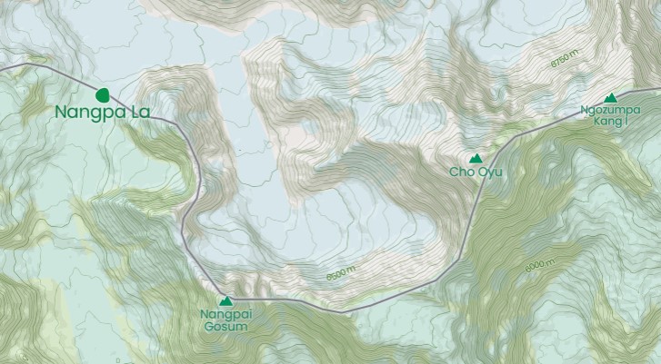
Gelje Sherpa is a respected climber who is trying to become the youngest 14x8,000m summiter. He was also, impressively, one of the 10 who summited K2 in winter a year ago.
As with any other Himalayan climber, we take him at his word, but there has been some recent confusion or obfuscation about the route. Two days ago, he published three screenshots from his tracking device. They showed that their route actually followed a much more direct line up Cho Oyu from Ngozumpa Glacier, toward the col separating Cho Oyu (to the west) and Ngozumpa Kang I (7,916m), also known as Tenzing Peak (after Tenzing Norgay).

We asked the geolocation and GPS tracking experts at RaceTracker to check the route that Gelje and his team are following. Based on Gelje's tracker screenshots, the topography, and Google Earth, this is their conclusion:


Mixed messages
There also seems to be some confusion about the highest point that the climbers reached before retreating to Base Camp. Gelje posted a screenshot of a zoomed-in track. There was no overview, but the data at the bottom of the screenshot read 7,409.72m.

Fellow ExWeb writer @KrisAnnapurna noted that this altitude was remarkably higher than the altitude cited on other screenshots. We did some research, again with the help of RaceTracker. They located the exact point of the last screenshot and concluded that it corresponds to 6,900m, not 7,400m.
We have reproduced their results below. Interested readers can check it for themselves: Go to coordinates 28.090664870631976, 86.69104276103228 on Google Maps, compare the features (select the satellite layer) with the tracker, then change to terrain layer and check the altitude.


This does not imply that Gelje and his team are being misleading about the highest point that they reached. There are many reasons why the climbers could have gone higher than their tracker registered. They could have shut it off to conserve battery power, for example. But it does mean that Gelje's initial screenshot above has been combined with data from a higher altitude. Hopefully, the climbing team will be able to explain these irregularities when they return.

Earlier today, Gelje's teammate Lakpa Dendi wrote that they had to retreat in rapidly worsening weather from 7,200m.
The route ahead
Gelje Sherpa's team is heading for the col between Cho Oyu and Tenzing Peak. (See the last image above.) Once at the col, they will have to follow the long East Ridge toward the main summit. That is, unless they find a shortcut up the face, but this is unlikely, considering the almost vertical terrain.

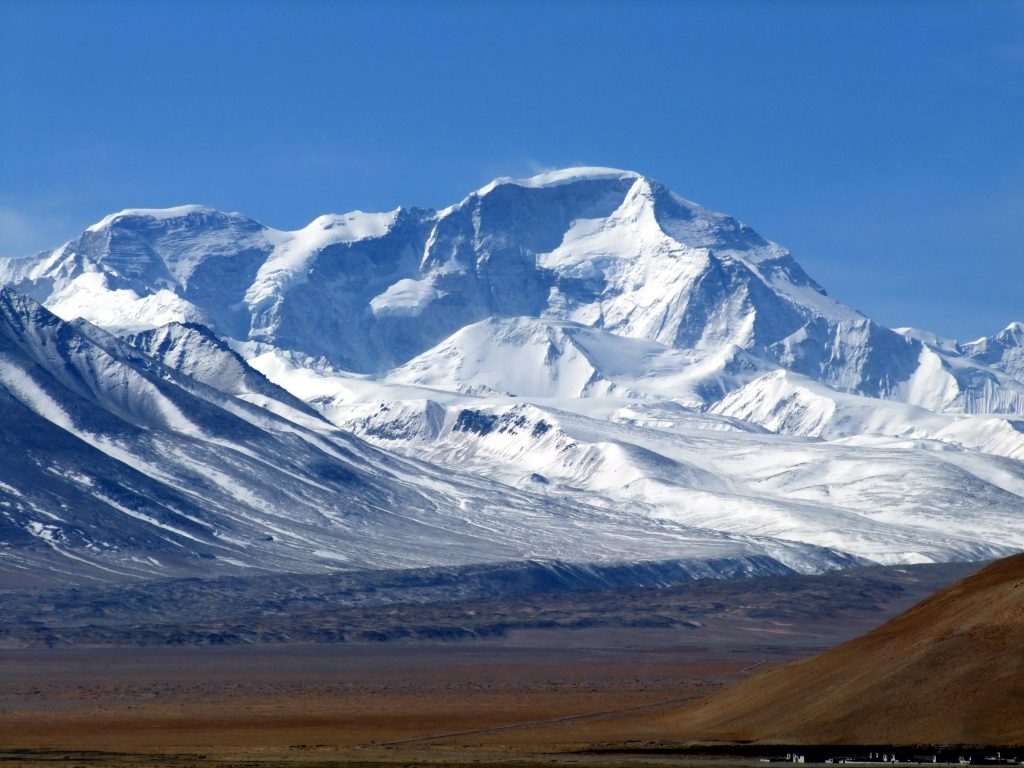
Following Mingma G's proposed route
Gelje Sherpa's team is actually following one of the two routes that Mingma G presented to the government of Nepal when they promised to fund a local expedition seeking to open business on Cho Oyu's Nepali side.
Mingma G shared these details with ExplorersWeb back in late November. He proposed two possible routes up the SE Face. Both aim for the difficult East Ridge. Gelje is leading his team up the aqua-colored line identified as Route 2 in the legend.

Mingma G. also detailed the crux of the climb, which lies further than the highest point that the current expedition reached: the East Ridge. That ridge has been already climbed but never repeated.
The Southeast Face+East Ridge of Cho Oyu had thwarted several expeditions before an elite Russian team finally succeeded in October 1991. In her report, Elizabeth Hawley deemed the East Ridge "formidable" and mentioned a "70-metre-deep gap with 80° rock on its sides at a very high altitude."
On their no-O2 summit push, the five Russians set high camp at 6,900m and a bivouac on the ridge at 7,900m. Sadly, falling rock killed one climber during the descent after the successful climb.
Gelje mentioned that they intend to set Camp 3 at 7,800m, which places it above the col. Later, we hope to clear up whether this is a new route, a variation, or a repetition.
Pioneer Adventure's route
The second team on Cho Oyu, launched by Pioneer Adventure, has shared their climbing route with ExplorersWeb. It follows a totally different route, from the south.

We compared the map provided by Pioneer Adventure with a topographic map of Cho Oyu routes compiled by Animal de Ruta's mountaineering blog. We found two options that might be similar to Pioneer Adventure's route.
At first glance, it seems to match the route opened up the southeast buttress by the Polish Ice Warriors in winter 1985. That team, led by Andrzej Zawada, set up five camps and succeeded despite relentless bad weather. Maciej Berbeka and Maciej Pawlikowski summited on February 12, followed by Zygmunt A. Heinrich and Jerzy Kukuczka three days later. It was Kukuczka's second winter first ascent of an 8,000'er that season, he had summited Dhaulagiri on January 21.

However, it is also possible that the map provided by the Pioneer Adventure team shows a line much further west, up the SSW ridge.

According to Animal de Ruta's blog, the SSW ridge, on the border with Tibet, has never been climbed. This isn't surprising: It is difficult and extremely long. The ridge stretches 6.5km and gains 2,900 vertical metres. There is more than one possible access point for the SSW ridge.
We are waiting for Pioneer Adventure's climbing team to confirm the exact line they are climbing.
Today's update:
Gelje's team is in Base Camp, resting and preparing for the summit push. Elite Exped ground manager Ashok Wenja Rai, who is working with Gelje, reports that they have tentatively scheduled their summit push for February 24 to 27.

A spokesperson at Pioneer Adventure told ExplorersWeb that their team might go up at the same time. We may therefore see two Nepali teams racing for the summit of Cho Oyu from different angles. However, Pioneer's team is currently facing an unexpected problem.
"It seems we miscalculated the distance," the spokesperson told ExplorersWeb. "The ropes we sent at the beginning [ran out], so we delivered new ropes today. The team's original plan was to set up Camp 2 yesterday and fix to Camp 3 today. [Instead] they hope to fix Camp 2 tomorrow."
At least, the weather has been clear all day.
Denis Urubko weighs in
The Nepali lines apparently lie to either side of Denis Urubko and Boris Dedeshko's 2009 direct route up the peak's SE Face. The highly difficult line, climbed in pure alpine style without oxygen, was the last opened on Cho Oyu's Nepal side.

Urubko returned to Cho Oyu's south side in 2013 to acclimatize before attempting Everest with Alexey Bolotov. Urubko's educated opinion:
"That face is very steep and rather humid because of its [southerly] orientation. It also features many rocky pinnacles, and avalanches pose a serious threat. All these factors minimize the chance of success. Yet I respect the desire of Nepali teams to find a safe line, which down the road could help the Khumbu economy. Is it possible? In my humble opinion, yes, it is."
As for the routes themselves, Urubko suggests that according to the map provided, the Pioneer team may be climbing a variation of the Polish route, but from the right side of the plateau. "As for the Russian route up the East Ridge," he says, "the crack on the ridge is technically difficult and risky -- definitely not for clients."
Urubko adds that winter conditions are radically different than the more dangerous situation in spring or fall when the clients would come.
"[In warmer conditions], that face is unpredictable," he warned. "Is it worth putting clients through such risks? It would be more effective and safer to build a tunnel to the top, as on the Eiger! Or to concentrate on the business of the rest of 8,000ers...This climb may show the Nepalis' strength to the world, but [doing it] once should be enough."
The first time I realized that your circulation is highly sensitive at polar temperatures was on my first expedition, in Canada's northern Labrador. It was too cold to stop for lunch, so I held my sandwich in my hand as I skied along, taking occasional bites. By the time I finished eating, I'd frostbitten my index finger, which had lightly held the sandwich.
It was the first and only case of frostbite I've ever had. It wasn't a bad case: a big, purple, water-filled blister that hurt like hell, but which healed over the weeks as I continued.
It taught me a valuable lesson: Polar temperatures are not just colder than ordinary winter temperatures. They're on a different spectrum: Gear, bodies react differently. It's like being an astronaut on another planet.
I'm not talking about -20˚C. That's cold enough, but things behave the same as you're used to. At -40˚, -50˚, they don't always.

Numbness
The second lesson about hypersensitive circulation came years later, when one foot went numb. It did not feel like a dangerous numbness, a frostbite numbness. It felt, as sometimes happens on very cold expeditions, that the peripheral nerves had died. That occurs, usually on the feet, when the skin temperature is around 10˚C for long periods. The nerves near the surface die, and it takes a few weeks or months for them to grow back.
The numbness is a little concerning when it first happens, but it's no big deal. Back home, feeling gradually returns. Numbness becomes tingling, and soon enough, the feet are fine again.
But that wasn't the problem this time. I wondered why the other foot wasn't numb too, so after a couple of days, I checked the problem foot in the tent. It looked fine, although my sock had come down a little and had bunched around the ankle. That little bunching had restricted circulation enough to cause numbness. How do I know? Because a day after I had pulled the sock back up, the feeling returned.

Diabetic socks
Such experiences have made me obsessive about avoiding even normally benign tightness, anywhere. On very cold expeditions, I wear midweight diabetic socks, because those medical socks stay up but do not constrict at all. Some ordinary socks are fine too, but others are too tight at the top.
Most very warm gloves are designed for downhill skiing. Downhill skiers do not ski at -40˚. And here in the Rockies, skiers love to crash through powder. So powder cuffs are useful for them. Not so for those pulling a sled in the polar regions. Sledders do not crash through powder. And those elastic cuffs pinch the wrist slightly and could affect your hands in those weird, wonderful polar temperatures.
So the first thing I do with a new pair of gloves for polar use is to remove the elastic powder cuff with a seam ripper. Sometimes I have to cut open the inside of the glove because the elastic is on the inside. It's a bit finicky, but not hard.
Wristlets

You might think that cold air might leak in through the now-wider mouth of the gloves. Not so, because you should always wear a pair of homemade wool or fleece wristlets if one of your undergarments does not already incorporate them.
The wristlets are thin enough that they do not constrict, and they add about half a layer of warmth. They let you make repairs in the tent barehanded or with just thin gloves on if it's not too cold.
For the next phase of his global circumnavigation, Karlis Bardelis has paired up with fellow circumnavigator Dimitri Kieffer. Together, the pair is rowing from Sri Lanka to Tanzania.
Bardelis started his journey in Namibia in 2016. He rowed to Brazil, cycled to Peru, then rowed 26,000km across the Pacific. In 2020, when he landed in Malaysia, he became the first person to row from South America to Asia. At this point, the pandemic put his round-the-world trip on hold.
In January 2022, he restarted at last. He rowed from Malaysia and reached Sri Lanka on February 2. In Sri Lanka, he crossed an antipodal point -- vital for official recognition of his circumnavigation.

Tick list for circumnavigators
Bardelis has listed three criteria that are part of every circumnavigation of the globe:
1. Travel at least 40,000km. "I'm close to that, he says.
2. Cross all meridians (a bit more than 1/6 left)
3. Be sure to cross antipodal points.
Antipodal points are places that are directly opposite to each other if you drew a line through the centre of the earth. The North and South Poles are two obvious such points. A point near Putalama, Sri Lanka is the antipode to a spot he rowed over in the South Pacific. Since Putalama is on land, he landed his boat and cycled to it. Over four days, he cycled 500km.
An unusual duo
Bardelis's second reason for stopping in Sri Lanka was to pick up Dimitri Kieffer. Kieffer is completing a circumnavigation of his own. His journey began back in 2005, in Alaska. Over 15 years, he has covered 35,000km. He has trekked, cycled, swum, skied, and kayaked his way to Malawi.
Now he has paused his own expedition and went to Sri Lanka to row the 4,800km to Tanzania with Bardelis. He is using the row as a training opportunity and to “get proper sea legs” before re-starting his own endeavor. The two kindred spirits have been in contact for four years, but this is the first time they have met in person.

The row to Sri Lanka was challenging, Bardalis told ExplorersWeb. Steady north winds pushed him south when he needed to go west. As he slept, the boat drifted and he had to spend the next day making up the lost distance.
Still, he remains pleased with his progress. In a single month, he covered 2,400km. “For me, this is quite fast," he said. "The best [Pacific passage] I have done.”

On February 12, the pair left for the Southern Maldives, the first stopover on their row. Here, they will wait out the cyclone season before continuing on to Tanzania.
Jonatan Garcia of Spain and Topo Mena of Ecuador are preparing for an alpine-style ascent of Gangapurna (7,455m). They have the permit, the plane tickets, and the longing to be alone on a wild face. What they haven't yet nailed down is the route or even the side of the mountain they'll climb.
The two young climbers first met on Dhaulagiri last spring and instantly became friends. They shared a common language and a desire to summit Dhaulagiri without oxygen. At the time, Garcia had partnered with Andorra's Stefi Troguet, while Mena was with Carla Perez.

In the end, no one summited that spring. First, constant snowfall made the avalanche-prone normal route even more hazardous than usual. Then COVID spread through Base Camp. First, it hit local staff. Then it worked its way through many clients who had previously summited Annapurna and celebrated in Pokhara. Troguet was one of those who reached Camp 2, then tested positive and was airlifted to the hospital.
Seeking solitude
Garcia returned home disappointed with the Base Camp atmosphere. He declared that he was done with crowded 8,000'ers. So he was delighted when Mena suggested a quick climb to the rarely visited Gangapurna, in the Annapurna massif.
"Gangapurna has two normal routes, which follow the mountain's East and West Ridges," Garcia told ExplorersWeb. "We want to climb either the North or the South Face, but we haven't made our minds about which one yet."

Garcia went on: "The North Face looks just amazing: a sheer wall of ice and snow, all to ourselves, with no previous direct routes yet opened."
In the past, two Yugoslavian teams had managed to climb the lower part of the face, then proceeded up the NE Ridge. But bad conditions or the high technical difficulty of the route thwarted the few attempts on the North Face itself.
"We have been unable to spot a safe place for Base Camp from the few available images," said Garcia. "The base of the mountain seems to be in a basin surrounded by big, threatening seracs."
North Face: where to acclimatize?
An extra problem, at least for Garcia, is that few nearby peaks exist on which to acclimatize. "Topo [Mena] will be just fine because he guides in the Andes all the time, but the highest peak I can train on here in the Pyrenees is Aneto, at only 3,440m."

South Face better known
Meanwhile, the South Face is easy to reach via the famous Annapurna trail from Pokhara.
"It will be drier, with mixed terrain, and the most obvious line up the face was opened by a Canadian team, led by John Lauchlan, in 1981," said Garcia.
A South Korean team under the leadership of Kim Chang-Ho climbed a second line in 2016. That was the latest ascent on Gangapurna.
"If we choose that [South] Face, we will just look up and decide which route we'll climb -- either a repetition or if possible, a new line," Garcia said. "We will also decide at that time where to acclimatize."
The climbers meet in Kathmandu on March 2. "Once there, we need to decide right away which face we want to climb, because we will fly into Base Camp," Garcia said. "Otherwise, we plan to travel light, with no Base Camp staff or Sherpa support. The idea is to acclimatize well, then launch a single summit push."

Since our last update, rowers set six course records in the Talisker Whisky Atlantic Challenge, and multiple new ocean row expeditions have taken to the waves.
Talisker Whisky Atlantic Challenge (TWAC)
In the TWAC, soloists, pairs, trios, and quads race to complete the 5,000km crossing from Tenerife to Antigua. This year's entrants set off on December 12. After 63 days, only three crews remain at sea: two soloists and a pair.
This year’s winners crossed the finish line after 34 days, 23 hours, and 42 minutes. The four-man Swiss Raw team of Roman Mockli, Jan Hurni, Samuel Widmer, and Ingvar Groza are the first team from an inland country to win the race.

This year, teams set multiple course records. We Are ExtraOARdinary cut a staggering seven days off the record for an all-female trio. Wild Waves smashed the previous record for a women’s pair by five days. Force Atlantic became the fastest mixed four to complete the race, beating the previous record by 33 hours. Atlantic Nomads became the fastest-ever mixed trio, finishing in 40 days and 37 minutes.
In addition to the course records, solo winner Lasse Wulff Hansen is now the first Dane to solo cross any ocean. And The Entrepreneur Ship, a pair of Guy Rigby and David Murray, set the record for oldest pair to row any ocean. Their combined age was 124 years and 301 days.
The winners from each race class are as follows:
Overall winners: Swiss Raw (34 days, 23 hours, 42 minutes)
Winning five: Five in a Row (36 days, 4 hours, 42 minutes)
Winning four: Swiss Raw
Winning trio: East Rows West (37 days, 17 hours, 59 minutes)
Winning pair: Two Rowing Finns (41 days, 11 hours, 14 minutes)
Winning soloist: Ocean Rower (55 days, 1 hour, 9 minutes)

Mission Atlantic
Mission Atlantic is another event taking place in the Atlantic Ocean. The event is much smaller and only open to serving members or veterans of the military.
The organizers stress that it isn’t a race but that they just provide support for teams wanting to row the Atlantic independently. The 4,815km route runs from Gran Canaria to Barbados. Two crews set off on December 22.
Atlantic Dagger: This four-man crew completed their row on February 8, after 48 days, 4 hours, and 17 minutes at sea.
In the last few weeks of their row, the temperature was so hot that resting in the cabins became unbearable. They tried leaving the hatches open while they rested to let in a breeze, only to get soaked by unexpected waves. They kept high spirits by having, for example, friendly competitions to see which pair recorded the highest pace. But near the end, they admitted that it felt a bit like the Groundhog Day movie, the same thing over and over.

Cockleshell Endeavour 2021: This four has covered 4,300km of the journey. They decided to take a more direct route than Atlantic Dagger, but the gamble did not pay off. Though they led initially, strong trade winds soon slowed them down.
Though they have struggled at times, hitting bad weather that the other team managed to avoid, they are now in the home stretch.
And just in time: Yesterday, they ran out of basic food. Now they only have protein shakes and emergency rations left. They hope to arrive on Friday, but with only 700 calories a day to keep them going, it will be a hungry last few days.
Independent Atlantic Rowers
United We Conquer: Jack Jarvis (UK) is rowing alone from Portugal to Miami. On February 1, after 60 days at sea, he passed the halfway point of his journey. He recently wrote, “From flying fish...to different weather...it has certainly been a whirlwind of a trip.”
To date, he has rowed 4,200km and has faced some pretty unfavorable conditions. Jarvis has gained a celebrity following too. He has received messages of support from famous footballers David Beckham and Gary Neville, and rowing legend Steve Redgrave.

One pair give up
Rö over Atlanten: Swedish pair Soren Kjellvist and Mans Kampe wanted to row from Portugal to Antigua. After 1,690km and 23 days at sea, they have aborted.
From the beginning, they suffered from seasickness, and their autopilot broke just hours after setting off. After a few weeks of good weather, things began to change. Just one day from Tenerife, the winds shifted and started pushing them northwest into the North Atlantic.
They managed to reach Madeira but had to be towed for the last section. By this point, they were a month behind schedule. With their budget, resources, and available time running out, they decided to make Madeira the endpoint of their row. “We are relieved, frustrated, happy, disappointed, and exhausted all at the same time,” they said.
Shecando 2021: Karen Weekes (IRE) is rowing solo from Gran Canaria to Barbados. She hopes to become the first Irish woman to row the Atlantic alone from east to west. She began on December 6 and has covered 4,000km, 81% of her route.
After some early storms and a few days stuck in her cabin, she has had no further problems and is speeding toward the finish line.

Round and round they go
Forget Me Knot: This trio started their 5,900km Atlantic crossing on January 25 from Portugal. They hope to make it to French Guiana while beating the crossing record of 50 days.
In their first week, they suffered from extreme seasickness and had to make repairs to their autohelm. Strong winds have pushed them off course and around in circles.
The wind continues to play with them. Every few days, it eases up and they try to make the most of it. Then it pushes them around again. They use their para-anchor when necessary.

Rame Océan: Patrick Favre (FR) and Matt Dawson (US) are rowing from Restinga El Hierro, the southernmost tip of the Canary Islands, to Guadeloupe. They started on January 31. Two weeks in, they remain in good spirits.
In their first few days, the sea was calm. If they had any complaint, it is that the beginning was too placid. There was almost no wind at all. So far, they have had some mild seasickness and a broken water pump. After tinkering for a day, Favre managed to fix it.
Atlantic Roar: Emma Wolstenholme (UK) began a solo row from Tenerife to Barbados on February 3. She hopes to break the current record of 49 days, 7 hours, and 15 minutes. Ten days into the crossing, she has covered 600km.
The scariest moment so far occurred on her fourth night, when her automatic transponder went off. She was on a collision course with a 157m oil tanker. Happily, the Liberian-flagged ship maneuvered to a safe distance.

Sea Change Sport: The newest boat to take to the sea. Victoria Evans (UK) began a solo row from Tenerife to Barbados on February 11. Evans is very clear about her goal: She wants to become the fastest female to solo row the Atlantic. This makes her the second woman this season to attempt this particular record. In her first full day, she has rowed over 100km and is feeling positive about her chances.
Pacific Ocean
Erden Eruç: Eruç started his row on October 6 in California. He is aiming for Hong Kong. At 11,000km, it is the longest ocean row currently underway. He has already covered 6,000km and has now paused for the second time on his journey.
In January, he decided that he would stop in the North Marianas to resupply. A nonstop crossing to Hong Kong would have meant resupplying at sea.
He eventually settled on Guam. But although the weather was good, the U.S. Navy had planned a live-fire exercise just north of Guam at exactly the time and place when he was approaching.
Luckily, after some frantic calls, they shifted the exercises to the opposite side of the island. He landed in Guam on February 12.
Eruç is the first recorded person to row from Hawaii to the Marianas. After months on his boat, he has lost 14kg. His wife is now flying to Guam, and he is looking forward to spending Valentine's Day with her.
While on dry land, he has to fix his water pump and replace two oars he lost in a storm. He also must decide whether to continue his journey or re-launch it next season because of pending bad weather.

Rowing and cycling
Zerow-Emission: Julen Sanchez is attempting to row from Portugal to Miami. His row is part of a larger challenge. He wants to complete a zero-emission journey that connects Europe and America. He began by cycling 2,800km from Paris to Portugal and is now rowing the 7,500km from Portugal to Miami. Once he reaches Miami, he will cycle the final 2,500km to Pittsburgh.
At the end of January, Sanchez passed the 4,000km mark of his row, but it is now difficult to track his location. His third (and last) phone has broken, so he cannot communicate directly with his family or send GPS positions. Despite this, he has decided to continue. He will send updates through the other vessels he encounters.
There will be no more rotations on Cho Oyu. Next time Gelje Sherpa's team starts up the South Face, they will head for the summit. Meanwhile, Gelje is in Base Camp, preparing for the final assault.
"We have fixed lines up to 7,409m," he said. "Hence, we have 779m to go to the summit."
Gelje had hoped to set up their third and last camp at 7,800m, but the expedition meteorologist in Kathmandu warned of worsening weather. The team on the mountain confirmed the change, so Gelye called for a retreat.
Easier than expected?
It is remarkable how fast the team has progressed on Cho Oyu's difficult and dangerous South Face. Gelje has not revealed the route they are following, although at the beginning of the expedition he mentioned that they would first reach Nangpa La. This col separates Nepal from Tibet and lies close to Camp 1 on Cho Oyu's normal route. He specified that they would not cross the border into China at any point.
There are also no details about where the climbers started using supplementary oxygen.
"So far, we are sticking to plans and we believe we will make it," said Gelje.
The second team on the mountain, organized by Pioneer Adventure on a slightly different route, has set up Camp 1. They plan to fix the route to Camp 2 today, according to a post shared this afternoon, Nepal time. It is unclear whether they reached their goal or whether the worsening weather that Gelje Sherpa reported turned them back.

While his team works on the route, Pioneer Adventure's expedition leader, Dorchi Sherpa, flew to Base Camp yesterday. So far, each team is working on its route independently. Although a winter ascent is not the primary goal -- mainly, they want to establish a commercial route up Cho Oyu from the Nepal side -- a winter success would be a bonus. For this, they must move fast, in order to summit before the end of meteorological winter, two weeks from now.
Meanwhile, K2 summit push on pause

On K2, winds in Camp 2 forced the lone team to delay their planned summit push. Instead, everyone retreated to Base Camp. At least, Camp 3 is all set up. Outfitter Summit Karakoram confirms that their next push will aim for the summit.
When we’re not outdoors, we get our adventure fix by exploring social media and the web. Sometimes we’re a little too plugged in and browsing adventure reads can turn from minutes to hours. To nourish your own adventure fix, here are some of the best adventure links we’ve discovered this week.
Why Does No One Stay To Explore The World’s Southernmost City? It’s the world’s southernmost city and the gateway to Antarctica — but why does nobody stick around in Ushuaia? Travel journalist Matthew Teller went exploring and discovered a town that had forgotten its own story.
The Middle East May Be The Next Great Hiking Destination: Several long-distance trails have opened in the Middle East in recent years, such as the Red Sea Mountain Trail. They have shaken up misconceptions about the region and recalled its long history of foot travel.
The Pearl Fishers of Arabia: When you think of Arabia today, you think of oil and unimaginable wealth. But less than a century ago, oil had yet to be discovered. The region was poor and one of its main sources of income -- pearl fishing -- was about to succumb to cheap competition and the intransigence of colonial administrators.
Making Mountains

Making Mountains out of Marine Drifters: How Plankton Shaped Peaks: Many of the mountain ranges we climb would be far less vertiginous if not for the lubricating effects of plankton, a new study has revealed. Two billion years ago, a boom in the microscopic marine organisms led to prime conditions for orogeny, or mountain building.
How To Photograph the Northern Lights: Want to learn how to take photos of the aurora borealis? Then grab your camera with your favorite wide-angle lens and follow along, as outdoor journalist and gear nerd Hendrik Morkel helps you capture the swirling lights.

What It Feels Like to Die from Heatstroke: Your head starts pounding, your muscles cramp, and your heart races. Then you get dizzy and the vomiting starts. Heatstroke kills thousands of people every year. This is what it feels like — and how to know when you’re in danger.
Retracing the Voyage of America's Greatest Traitor: A glorious and ill-considered expedition to retrace the nearly 500km sufferfest endured by colonial rebel Benedict Arnold and his 1,100 brave, starving men. Their aim: to take Quebec City from the British. A group of modern-day re-enactors attempts to simply survive the journey.

The Quest For A Collision Zone: An Arctic Expedition: Geologists on a mission to vindicate their theory of a lost mountain range discover something even more significant buried beneath the ice. You'll need to settle in with this one: At 4,848 words, it's a long read in an era of shortening attention spans.
A passion for the natural world drives many of our adventures. And when we’re not actually outside, we love delving into the discoveries about the places where we live and travel. Here are some of the best natural history links we’ve found this week.
Lost range of ‘supermountains’ discovered: Scientists have found a new range of ancient supermountains. Previous studies had hinted at the existence of the Transgondwanan Supermountains that spanned the supercontinent of Godwana. They confirmed this and also found evidence for the even earlier Nuna Supermountains. They were as tall as the Himalaya but stretched three times as far.
Mountains form when tectonic plates force landmasses together, pushing surface rock to great heights. But mountains don't last forever: As soon as they form, erosion starts grinding them down. The first supermountain range lasted from 2 billion to 1.8 billion years ago. The second began 650 billion years ago and survived until 500 million years ago.
These dates are very important because they coincide with two of the biggest evolutionary events on earth: the first appearance of eukaryotic cells (cells with a nucleus, the building blocks of all plants and animals) and the Cambrian explosion of marine life. It is likely that as the mountains eroded, huge amounts of nutrients entered the oceans and sped up evolution.
Balm for chimpanzees
Chimpanzees use insects to treat wounds: Chimpanzees have their own healthcare system. They apply insects to open wounds. Though other animals are known to self-medicate, this is the first time we have seen any animal using other animals as medication. The chimps also used the smashed-up insects to treat their friends' wounds.
The chimps would catch winged insects and apply them directly to open wounds. Over 15 months, researchers witnessed this 76 times. They suspect that the insects may have anti-inflammatory or antiseptic properties.

Mosquito color likes and dislikes
Mosquitos fly to specific colors: The smell of carbon dioxide triggers mosquitoes to scan for signs of an attractive nearby host to bite. New experiments have shown that mosquito behavior changes with different colors. Scientists sprayed carbon dioxide into containers of female mosquitoes. The mosquitoes flew toward red, orange, cyan, and black dots, but ignored green, blue, and purple ones.
Unfortunately, human skin gives off long wavelengths in the red-orange range. But it seems that we can still lessen our attractiveness. When the researchers wore green gloves, the mosquitos once again ignored them.
Sea sponges feast on fossils: Food is hard to find on the seafloor of the central Arctic Ocean, far from any coastline. But in 2016, researchers found an extinct submarine volcano covered in sea sponges, which were usually rare in this area. What they were eating? It turns out that the sponges feasted on the fossilized remains of tubeworms that once thrived on the active volcano. This marked the first time that scientists found an animal that survives by eating fossils. “[This] is very cool,” enthused marine ecologist Jasper de Goeij.

A close call for iguanas
Galapagos volcano produces river of fire: On January 6, the Wolf Volcano in the Galapagos Islands erupted, and a river of fire snaked through the landscape. It glowed so brightly that it was visible from space. Lava spurted 60m into the air, and researchers worried about the pink iguanas that lived on the volcano. Only 200 breeding adults remain. Luckily, the eruption occurred on the opposite side of the volcano from where the iguanas live.
Earth has 9,200 more trees species than we thought: A new study estimates that Earth has 73,300 species of trees, including 9,200 still-undiscovered varieties. Most of these are likely rare or vulnerable and found in the world’s biodiversity hotspots, especially tropical South America.

Male elephant seals get huge or die trying: Male northern elephant seals strive to grow as big as they possibly can. An impressive size is the only way they can find a mate, and they will take great personal risks to find food. While females can weigh hundreds of kilograms, males are up to seven times larger.
Their eating habits explain the colossal size difference. Females head to the open ocean and dive deep for their food. Males stay in shallower waters near the coast. There is more food here, but it is also more dangerous. Males are six times more likely to die while foraging. Among other perils, the nearshore waters are hunting grounds for orcas and great white sharks.
Sherpas on K2 have managed to set up a lower Camp 3, about 200m below the usual summer location. Forecasts suggest worsening weather for the next two days, but the team will try to summit during the current rotation. This means that either they will keep climbing despite increased wind or they will hunker down in Camp 2 for a couple of days before resuming.
"February 17 could be summit day, but it’s...not yet fixed," says outfitter Summit Karakoram.
Gelje Sherpa and his team on Cho Oyu have also advanced despite hard conditions. In their case, wind made the climbers in Camp 1 hesitate. But after a discussion with the expedition's meteorologist in Kathmandu, they proceeded to Camp 2.

After fixing more than 2,000m of rope, the climbers deposited O2, ropes, and tents at Camp 2. Then they retreated to Camp 1 in preparation for briefly worsening weather tomorrow. Still, Gelje remains optimistic.
"Hoping for the weather to hold a few days," he wrote. "Next, we will fix the ropes up to the third and final camp before the summit."
Late last month, an avalanche of ice and stones struck Corrado Pesce of Italy and his partner, Tomas Aguilo of Argentina, on the North Face of Cerro Torre. As we reported earlier, Aguilo was injured but survived; Pesce did not.
According to the Italian media, during a short weather window in early February, a helicopter tried to retrieve Pesce's remains. When it flew over the area where a drone had previously spotted him, the body had disappeared. After many passes, they could only find his equipment, the ropes, food, and backpack.

The bad weather has now returned, which will hinder any new attempts. Pesce's body will remain on Cerro Torre. His sister, Lidia Pesce, told the media: "It's too dangerous. Korra will not come home. It is agony.”

A quartet of geophysicists and hydrobiologists has obtained a permit to dive beyond the 30-metre mark of Lake Cheko in Siberia. Their research, slated to begin in late February, will focus on the cataclysmic Tunguska event. It will be the deepest expedition ever conducted at the site.
Using lakebed samples, the team aims to answer a century-old question posed by the leader of the first Tunguska research expedition, mineralogist Leonid Kulik. His question was this: If a meteorite caused the explosion, where is the epicenter of its crater and the extraterrestrial matter from it?

The Tunguska event and conflicting research
In July 1908, a meteoroid measuring 50-60 metres in diameter plunged through the atmosphere above the Siberian taiga, catalyzing the 12-megaton Tunguska explosion. Experts estimate that the blast decimated some 80 million trees and dispatched at least three human beings. It is Earth's largest impact event on record, but scientists have yet to locate its crater.
Some believe the blast was caused by a mid-air explosion. Others think it was caused by hard impact. In 2012, an Italian research team found evidence that pointed to a small 500m crater in Lake Cheko as the point of impact. The study was hotly contested because that crater is located some eight kilometres from the Tunguska event's supposed epicenter.
The Italian group collected seismic measurements of the crater's bottom, which showed about 100 years' worth of accumulated sediment. And Lake Cheko's bed — which is shaped like a crater — was deeper than is typical for the region. Dense stony substrate beneath the sediment was likely the remains of the exploded meteoroid, they concluded.
In 2017, a Russian team contested those findings. Core samples drawn by the Russians seemed to indicate that the lake bed was nearly 200 years older than the Tunguska event. Geologically young, but not young enough to be the epicenter.

Tunguska research expedition, 2022
Lake Cheko bottoms out at 54m and resides in the Tungussky Nature Reserve, a rural stretch in central Siberia's Krasnoyarsk region. This winter expedition will start a cycle of long-term research there.
"The team of researchers aim to study how thick the lake bottom’s sediments are, and take primary samples," reserve inspector Evgenia Karnoukhova told The Siberian Times. "The data they’ll gather will be analyzed and passed on to geologists. We are not speaking about the search for any celestial body at this stage."

The wire from Patagonia is crackling with climbing news this season, during one of the region’s most active stretches in recent memory. Climbers have rallied throughout the Chalten and Fitz Roy, despite a tragic outcome for Korra Pesce’s team on Cerro Torre back in January.
All season long, teams have seized solid weather windows to notch notable ascents. This week in Patagonia, we learned about big new adventure routes on La Hoja and La Catedral; a new line on Aguja Saint-Exupéry; and a productive trip that produced an audacious enchainment.
Here’s the roundup.
'Cuarzo Menguante' (5.11+ A2, 700m), East Face of La Hoja , Torres del Paine, Patagonia
Fresh off their first ascent of the Torres del Paines' last unclimbed peak, Pepo Jurado and Sebastian Pelletti punched out another bold line nearby. On January 19, they and partner Romano Marcotti became the first humans to stand atop Cuerno Este. By January 28, Jurado and Pelletti topped out Cuarzo Menguante on La Hoja.
Of the two new routes, Cuarzo looks like the more attractive prize. An obvious crack system thrusts 700m from the talus to the top of the jagged formation (“The Blade” in English). The line stands out clearly; but the climbing was neither straightforward nor technically easy.
In the end, it forced a seemingly unplanned bivy, which resulted in an experience the climbers called “eternal”.
"The ascent was incredible, nails climbing and a lot of route finding was necessary to put the line together,” Pelletti wrote to Planet Mountain. “At one point I aided up a small seam as the crack system sealed up."
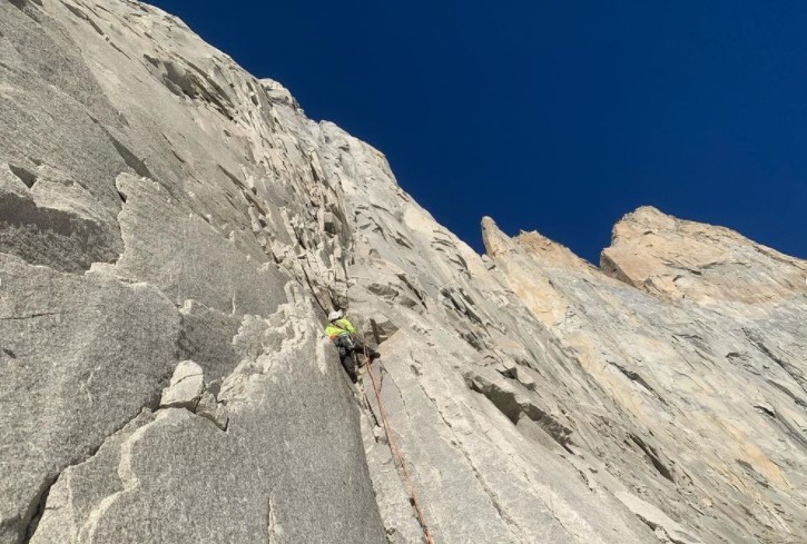
From there, the two punched out a few more pitches before dark. Then they coiled their ropes on a small ledge and shivered through a cold night. The two began the next morning, Pelletti reported, by “watching an eternal sunrise” before climbing to the ridgeline by the afternoon.
Cuarzo Menguante is the third route on the east face of La Hoja. The two descended by rappelling the nearby Anduril, replacing the anchors as they went.
'Dos Hermanos' (5.11+ A0, 20 pitches), North Face of La Catedral, Torres del Paine, Patagonia
If you ever want to know why climbers think the climbing in Patagonia is so good, look at routes like Dos Hermanos by Cristobal and Juan Señoret.

Typically, negotiating a 20-pitch first ascent on an unclimbed face requires exhaustive effort, relatively heavy bolting or other permanent hardware, and generally prohibitive logistics.
Dos Hermanos, on the other hand, has a total of three bolts. All you need to climb it is a standard double rack of cams, a full set of stoppers, and two bigger cams. To descend, rappel the route.

The route looks like a certified stunner. The line sways back and forth up the massive, sun-soaked shield, and a promising bivy on an “obvious ledge” awaits two-thirds of the way up. And the broken blocks on the summit facilitate a panoramic view of the Valle del Francés.
What more can you ask for? Dos Hermanos has the makings of an instant Patagonia classic.
'El Zorro y La Rosa' (6c+ C1, 650m), Southeast Slope of Aguja Saint-Exupéry, Fitz Roy Massif, Patagonia
Horacio Gratton, Esteban Degregori, and 18-year-old Pedro Odell engineered 500m of new climbing (sharing 150m with another route) over two days on Saint-Exupéry.
El Zorro y La Rosa checks in at an approachable difficulty, with moderate free climbing and clean aid. Based on the route’s technical threshold, topping out the picturesque tower looks like a tidy reward for the climbers.
The route takes 500m through previously unclimbed terrain on the ramp feature at climber’s left. In the final pitches, it joins a 1987 route climbed by Austrians Hans Barnthaler and Ewald Lidl.
El Zorro y La Rosa gains Saint-Exupéry’s south summit, called Punta Cristina. To continue to the summit proper, subsequent teams would have to negotiate a 50m descent and climb about three more pitches.
The route, they said, could easily go free.
Enchainment: Torre Egger, Aguja Standhardt, Punta Heron
For four days recently, Priti and Jeff Wright bagged three peaks in Patagonia and never touched the ground.

The Torre Group enchainment toured from Aguja Standhardt to Punta Heron to Torre Egger.
The pair’s routes included Festerville (400m, 90 degrees snow/ice, 6c, 15 pitches) on Standhardt; Spigolo di Bimbi (350m, 90 degrees snow/ice, 6c, 8 pitches) on Punta Heron; and Espejo del Viento (200m, 80 degrees snow/ice, 6a+, 6 pitches) on Torre Egger.

Via Instagram, Priti described the outing with intangibles that reverberate to climbing’s adventurous core.
The grade, the heights, the hours, don’t really paint an understandable portrait of this kind of adventure, just like the lines of the topo didn’t really explain where to go.
Climbing in Patagonia means shenanigans. The cracks full of ice and loose blocks must be climbed, wet slab traversed, boots and crampons come on and off, packs must be worn or hauled, rappels made, gear left, weather analyzed, snow melted, bivy ledges flattened, and the way must be found.
It was a great deal of fun, and highly stressful.
Unofficially, Priti Wright is the third woman to stand on the Torre Egger summit — one that some claim is Patagonia’s hardest to reach.
On K2, Grace Tseng is expected to reach Camp 1 today while her team fixes the way to Camp 2. Meanwhile, the two Nepali teams trying to open a commercial route on the demanding South Face of Cho Oyu have also made progress.
Camp 1 on Cho Oyu
Gelje Sherpa's group has split into two teams, under Gelje and Lakpa Dendi. Both reached 300m below Camp 1 on Tuesday.
"After carrying more than 45kg of fixing ropes, ice screws, snow bars, bamboo, personal climbing gear, and personal cooking gear and tents, the climbers were too exhausted to proceed further," Gelje reported. "I decided that we should head back to Base Camp."
After a rest day, the climbers are back at work today, setting up Camp 1.

The competing Pioneer Adventure team rested in their separate Base Camp yesterday but will move up shortly. "Our target is to complete the expedition by the end of February," said a Pioneer spokesperson from Kathmandu. So the team has 18 days to find, fix, and climb a route up the highly difficult face.
Jost Kobusch update
ExplorersWeb caught up with Jost Kobusch yesterday, as he moved from Lobuche toward Everest, on a fresh attempt to get higher up the West Ridge. Unfortunately, the climb ended before it began.
"I'm turning around right now, it's too windy," Kobusch told ExplorersWeb.
"Seems unfair," I said sympathetically.
"It's not unfair, it's just the weather," he replied.

Back in Lobuche, Kobusch keeps checking the forecast and trying to stay optimistic.
"I intend to remain here until February 28, when the winter ends, so let's see if the jet stream turns south," he said. "If weather permits, I should have a chance."
Since the pandemic, four long-distance hiking trails have opened around the world. They all differ in distance and difficulty but are ideal for working off your shutdown restlessness.
The Red Sea Mountain Trail: Egypt
The Red Sea Mountain Trail (RSMT) opened in 2019. At 170km, it is mainland Egypt's first long-distance hiking trail. For the gateway beach resort town of Hurghada, the trail is also a community tourism initiative that aims to preserve the endangered Bedouin culture.
The RSMT is a network of ancient routes that the Bedouin have used for centuries. The Khushmaan clan of the Maaza, Egypt’s largest Bedouin tribe, manages it.
“We want the Red Sea Mountain Trail to diversify Hurghada’s tourism and create a space for slow, immersive travel in which the Bedouin can communicate their rich knowledge of their homeland to outsiders,” Ben Hoffler, one of the founders of the trail, told Afar magazine.

Completing the full 170km would take most hikers 10 days. The trail is so new that currently, no hiker has completed the full distance. Though many would see 15-20km a day as a manageable distance, the walk is not easy. There is not a well-trodden path to follow, there is considerable elevation gain, and some sections require exposed scrambling.
Everyone who wishes to tackle the trail must do so with Bedouin guides. For centuries, these nomadic desert tribes have been the only people to walk through these mountains. The guides aim to show visitors the “wisdom and beauty of Bedouin heritage”.

This month sees the first-ever group trying to complete the full thru-hike. So far people have only completed smaller sections. For those who don’t have 10 days to spare, or who want a less demanding trail, you can choose shorter, flatter guidedcircuits.
The founders of the trail have also created supplementary ‘hiking hubs’. Each hub consists of a web of secondary routes that fork off of the main trail, and centers around a specific mountain massif.
The six hubs can add a further 600km to the journey. The Red Sea Mountain Trail Association is already exploring the idea of expanding the main path into a 1,000km route that follows the Red Sea and provides economic support for other clans and tribes.
The Michinoku Coastal Trail: Japan
In March 2011, a 9.0 magnitude earthquake and tsunami ravaged the northeast coast of Japan. It is the fourth largest earthquake since records began in 1900 and it claimed over 18,000 lives.
In the decade since, Japan has been rebuilding its communities, but one initiative in the Tohoku region has gone relatively unnoticed. Among all the reconstruction, they have also built a new hiking trail.

The Michinoku Coastal Trail (MCT) stretches for 1,000km along Tohoku’s eastern coastline. Michinoku is the ancient name of the Tohoku area. Officials hope that the trail will increase tourism in the little-known area and help with the region's long-term recovery.

The MCT officially opened in June 2019 but it remains relatively untouched because of COVID travel restrictions. The route connects Hachinohe in Aomori Prefecture with Soma in the Fukushima Prefecture.
This off-the-beaten-track route “follows the Pacific Ocean coast over grassy promenades, through forests, along remote beaches and soaring clifftops and to fishing ports, some tiny with a few one-man boats and others with fleets of ocean-going trawlers," Paul Christie from Walk Japan told the BBC.

Completing the full trail takes anywhere from 6 to 12 weeks. Those daunted by the prospect of a three-month trek can do smaller sections. The route runs through four prefectures of Japan: Amori, Iwate, Miyagi, and Fukushima.
The Michinoku Coastal Trail website breaks these down even further into 28 smaller hikes. It explains which ones are best for newbies, and which are more challenging.
Grampians Peak Trail: Australia
The Grampians Peak Trail runs 160km through Grampians National Park in Victoria, Australia, from Mount Zero in the north to Dunkfield in the south. The Victoria government bills it as a “challenging" 13-day hike.
The trail traverses several mountains and bypasses waterfalls, sandstone rock formations, grasslands, ravines, and eucalyptus forests. Some of the highlights include the Grand Canyon, the Major Mitchell Plateau, and the summits of Mt. Difficult, Mt. Abrupt, and Mt. Sturgeon.

Even though you summit several mountains, the trail was not built as a sporting route or place to see who can complete it the fastest.
Known as Gariwerd to the Djab Wurrung and Jardwadjali, who have lived here for over 22,000 years, the Grampians feature aboriginal rock art, as well as abundant wildlife -- 40 different mammals, 28 reptiles, and countless birds. There are also over 1,000 plant species, including 130 types of orchids.

Navigation is tricky. The route crosses large rocky expanses without a worn trail to show the way, only sporadic yellow markers.
After a decade of work and a cost of $33.2 million, the GPT finally opened in November 2021. Eleven new campsites, deep within the park, offer simple amenities. Water is available either at these campsites or at designated nodes, identified on the trail website.
The Walk of Peace: Slovenia and Italy
The Walk of Peace trail stretches 270km from the Alps to the Adriatic Sea, along the World War I front line between Slovenia and Italy.

The Walk of Peace opened in April 2020 and follows the Isonzo Front, which saw 12 battles between Italy and the Austro-Hungarian Empire from 1915 to 1917. Over 350,000 soldiers died here. The trail aims to restore the historical sites in the region.
In part, the trail is a history lesson for active students. Mountains and rivers compete with museums and memorials that give trekkers insight into what the region endured during World War I.

The Walk of Peace begins in Triglav National Park. From here, hikers follow the Soča River through Solvenia’s wine country. Leaving Brda, the trail meanders through the Karst region before descending toward the Adriatic. The endpoint is Trieste, Italy.
The main trail splits into 15 one-day sections and is accessible for hikers of varying abilities. Two further trails and a myriad of smaller paths branch off from the main route. One subtrail leads to Kranjska Gora, a winter sports hotspot. The second ends at the town of Bohinjska Bistrica. Smaller paths loop to historical sites.

Throughout the walk, peace and natural beauty contrast with the setting for wars fomented by kings, politicians, and their generals.
The Island Walk: Canada
Prince Edward Island is Canada's smallest province, but that doesn't mean it's short on attractions. Cradled in the Gulf of St. Lawrence by New Brunswick and Nova Scotia, it's famous for its red soil, beaches, and seafood.

It's also the fictional home of Anne of Green Gables and produces outstanding potato crops.
Now, it features the country's newest hiking trail. The 700km Island Walk spans the picturesque island's entire perimeter in 32 sections. Hikers can finish it in a month of longish day hikes.

Along the way, inland and coastal passages reveal beaches, farmland, intermingled hardwood and softwood forests, and cozy towns. The scenic highlights look like they're ripped right out of a coffee table book.

Partnering inns and hotels along the way help travelers with various logistics like luggage transfer services and kitchen access.

Hiking the trail requires notably minimal equipment -- basically, a day pack and a comfortable pair of shoes. Bicycle rental services are also available.
The Island Walk season generally starts in May and ends in October. July and August are heavy tourist months on Prince Edward Island, so note that accommodations might be in peak demand at that time.
The trail officially opened in November 2021. For more information, including FAQs and a section-by-section breakdown, go to theislandwalk.ca.

"The guides will fix Camp 3 and above," reported outfitter Summit Karakoram. While no one is uttering the words "summit push", guide Nyma Gyalzen Sherpa recently implied that given the time constraints, their next move might be all the way to the top.
They had wanted to set up Camp 3 on their previous rotation three days ago, but strong winds pushed them back down from Camp 2.

Decision time at Camp 3
The guides should be able to reach Camp 2 tomorrow and start fixing up the Black Pyramid toward Camp 3. Once (and if) they get there, they will pitch the tents and supply the camp with gear, fuel, and oxygen. Then they will have to make some important decisions. Should they try to get higher? If so, should they set up a fourth camp?
The Nepali team that summited K2 last winter didn't use one, but they were a large, strong team climbing in astonishingly good weather. On the other hand, we will never know if the tragic end to the second summit push on February 5, 2021 would have ended differently with a Camp 4 in place.
It is over for the climbers attempting winter Manaslu. Forecasts predict more snow and strong winds. Time has run out.
"It was undoable; this was a bad winter, alternating two sunny days, then two bad ones, and so on. It has stolen the team's energy," Alex Txikon said in a video.
"Of course, we could continue our efforts and climb to Camp 2 or Camp 3, but that’s not the goal," Oswald Pereira said. "We don't want to risk our lives or the lives of those working and climbing with us."
"The problem is that you can't really go beyond Camp 1. Camp 1 is protected, but afterward, when the real climbing begins, the danger of avalanches is high and the wind is a real problem," Simone Moro added.
Ironically, the last three days on the mountain have been gorgeous. Unfortunately, the team can only use the sunny weather to pack up. The expedition lasted 58 days, but the climbers have spent long periods hunkered down, taking shelter from heavy snowfall either in Samagaon village or in Kathmandu.
In the summer of 1965, Tété-Michel Kpomassie became the first African to explore Greenland. He was 24 on the day that he stepped onto the dock at Qaqortoq, on Greenland's southern coast. But his arctic journey had actually begun some seven years prior, in the West African town of Lomé, Togo.
Now approaching 81 years of age, Kpomassie is packing up his Parisian apartment and heading back to northern Greenland, where he intends to live out his gloaming.

The story of an African and Greenland
Kpomassie's fabled life story starts with a bit of chance and a book. The young Togolese was 16 when he bought anthropologist Robert Gessain's Les Esquimaux du Groenland à l’Alaska (The Eskimos from Greenland to Alaska) from a small bookshop in Lome. Immediately, the subject captivated him, and within a year he'd run away from home in pursuit of the Arctic.

His trajectory to Greenland was anything but direct. He traveled along the West Coast of Africa, from Côte d’Ivoire in the south to the northern crest of Algeria, eventually crossing into Europe. Ther,e he stayed for some time before disembarking for Greenland via Copenhagen.
"I took my time to step out," he recalled in an interview with The Guardian. "I suspected none would have met a black man before. When I did, everyone stopped talking, all were staring. They didn’t know if I was a real person or wearing a mask. Children hid behind their mothers. Some cried, presuming I was a spirit from the mountains."

Kpomassie found his true home in Greenland's northern reaches, where the Inuit culture that he'd pored over in a book as a boy was very much alive. Over the next 18 months, Greenland's first African transplant learned to ski, mush, ice fish, hunt, and flourish in the tundra.
He returned to Togo in late 1966, reluctant but determined. He adapted the journal he'd kept into a tome, and taught himself several languages through correspondence with friends he'd made on his pilgrimage.

Kpomassie then went on to give numerous lectures about his experience in halls and classrooms throughout Africa and Europe. And he settled down in Paris and raised a family, returning to Greenland on three occasions in that time. "[A]ll the while I knew where I ultimately needed to end up," he said.
His seminal book, "An African in Greenland," was published in France in 1977 and reproduced in English in 1981. It earned him France's Prix Littéraire Francophone International award, also in 1981, and has since been translated into eight languages.

Kpomassie intends to close his story much as it began — with a book and a bit of chance. "I'll have a dog sled and huskies," the explorer remarked. "I’ll find myself a small fishing boat. And here I’ll happily spend my remaining days, and finally find time to write my second book, about my childhood in Africa."

Climate scientists have published a groundbreaking study on the degradation of glaciers in the Hindu Kush and the Himalaya, including Everest (8,849m). It revealed a rapid and accelerating melt-off at the top of the world.
Few studies exist about how rising global temperatures affect the world's highest ranges. To bridge this gap, scientists went to the Nepalese side of Everest in spring 2019. They did in-depth studies of biology, geology, glaciology, and meteorology. They reported their findings this week in Nature Portfolio Journal Climate and Atmospheric Science.

Everest South Col glacier dwindling rapidly
The team installed Earth's two highest weather stations on the South Col Glacier and pulled an ice core sample. They found that this glacier is losing ice 80 times faster than it took to build up. That amounts to a loss of 2,000 years' worth of ice in just 25 years. The rate of degradation continues to increase. Currently, the glacier is shedding several decades of ice annually.
Among other things, the study concludes that the glaciers aren't safe anywhere on the mountain. Strong winds at high, dry altitudes lead to more sublimation, though less melt-off. Increased humidity at lower altitudes lessens sublimation, but then melt increases in the warmer air.
"[This study] answers one of the big questions...whether the highest glaciers on the planet are impacted by human-sourced climate change," said glaciologist Paul Mayewski. "The answer is a resounding yes, and very significantly since the late 1990s."
Only four expeditions, 15 people in all, have climbed Masherbrum. Its West Face remains unclimbed. Its even bigger Northeast Face ranks as one of the most difficult big walls in the world and among the greatest unsolved problems in modern high-altitude climbing. The latest successes happened almost 40 years ago. Could this be the year that someone tries again?
Masherbrum = K1
Masherbrum is so impressive that 19th-century British geographers, viewing the Karakoram from distant Harmukh, thought it was the tallest in the whole range. They called it K1.

In fact, its 7,821m summit comprises an entire massif that includes such coveted peaks as Chogolisa and K6. American aces George Bell and Willi Unsoeld (and Nick Clinch and Pakistani Jawed Akhter Khan shortly after) reached the summit for the first time in 1960 via the SE Face.
Since then, few others have followed. Even fewer have succeeded. The most recent summits took place on two consecutive days in the summer of 1985. A Japanese team topped out via a new route while an Austrian group followed the 1960 American-Pakistani line.
Possibly the hardest face on Earth
Yet there's Masherbrum, and then there's the Northeast Face. It is highly technical, vertical, exposed to constant avalanches, and well into thin air. Even Base Camp is at 4,800m.
The first who dared that monster face was a Russian team led by Alexander Odintsov and Alexander Ruchkin. After tackling Jannu North Face, they were ready for anything. They planned an expedition-style ascent. But bad weather and unacceptable danger forced them to call off their attempt at Camp 1 (5,800m). Oditsov said that it was "impossible" to climb.

The Eiger and Cerro Torre combined
In 2014, David Lama, Hansjorg Auer, and Peter Ortner tried an alpine-style approach. Later, Lama graphically described it as "the North Face of the Eiger with a Cerro Torre on top of it."
Lama estimated a strong team might need five or six days to climb the face alpine style. And they would need to be fast. The lower third of the face is so exposed to avalanches, seracs, and rockfall that the less time one spends in that shooting gallery, the better.
The middle section proceeds mainly on vertical ice, Lama explained. "Then the headwall (mixed climbing) starts at 7,000m, and it must be one of the highest and hardest headwalls in the world."
Check Red Bull's expedition promo video here. The team launched a single push. Slowed down by soft snow and surrounded by avalanches, they retreated after just 400m.
Is anyone willing to try?
"Masherbrum is really extremely dangerous, you can not try it every year," Auer once told Stefan Nestler. "If you do, you won’t come home someday."
They had first tried a direct line up the face, but Auer admitted that that route was unclimbable. Thinking about a future attempt, he admitted that whichever route they chose involved serious commitment. Sadly, Lama and Hauer both perished in an avalanche in the Canadian Rockies before they could try again.
Since then, only one climber we know of has designs on Masherbrum: Marek Holecek. The Czech Piolet d'Or winner has spotted a potential new line up the unclimbed West Face. He had hoped to try last summer, but he postponed the attempt because he needed to recover from his epic climb on Baruntse that spring.
With just three weeks to go before the end of meteorological winter, bad weather continues to stymie the progress of all climbing teams.
Jost Kobusch on Everest and the Grace Tseng/Dolma team on K2 have barely reached Camp 2. Those on Cho Oyu and Manaslu, not even that far. In this final stage of the season, we will see either last-minute rushes, if the weather improves, or frustrated climbers watching the wind blow away their last chances.
K2: summit next?
The Taiwan-Nepal team successfully established Camp 2 at 6,760m on K2. "The initial plan was to complete C3 (7,350m) but the strong winds stopped their progress," local outfitter Summit Karakoram reported today. "Four members safely reached Base Camp last night and rest are joining them down there today."

Camp 2 is modest but it will have to suffice. The team is running out of time. Climbing leader Nima Gyalzen plans to push for the summit right away during the next weather window. "It will take at least five to six days of completely favorable weather," Gyazen said.
It will also take a huge effort for the Sherpas to carry gear, ropes, and a lot of oxygen. With so little opportunity for acclimatization, they will need O2 from a relatively low altitude, possibly between Camps 2 and 3. They will have to set Camps 3 and 4 as they go.
Cho Oyu: BC in the storm

On Cho Oyu, both Nepali teams have reached Base Camp, despite severe conditions. Lakpa Dendi got there yesterday in a heavy snowstorm that stranded part of the team in Gokyo. Last night, the wind hit 70-80kph, but it has decreased today.
"There are times where you feel like giving up, but you must push through to get to the other side of your dreams," Lakpa Dendi wrote.

Pioneer Adventure has also reportedly set up their Base Camp after approaching from Thame. Chhewang Sherpa shared some pictures and videos, as well as a topo of the route, based on research that Pemba Sherpa did four years ago.
Chhewang explained that opening a new route had been in their minds for a while, but the pandemic forced them to delay it. Here is the planned route, with BC and higher camps marked.

Manaslu: snow, snow, and more snow
Little has changed on Manaslu. The latest snowfall has covered the mountain again. Although the climbers enjoyed a sunny Sunday, they hesitate to move to Camp 1 amid such unstable snow. Forecasts announce still more snow beginning tomorrow evening.
The end of winter approaches
One wonders how far anyone will get. "Nothing is impossible," Alex Txikon rightly said. Still, it is increasingly unlikely that anyone will summit an 8,000m peak this season.
As we pointed out recently, while calendar winter lasts until March 21, the winter climbing season, and the permits for it, end on February 28 -- the official end of winter for most alpinists. It would be possible but expensive to extend an expedition beyond that. It would also be controversial as a winter ascent since many consider March not real winter.
As locals, the Nepalis on Cho Oyu might be able to remain longer without paying added fees. However, most of them are professional guides with a full slate of spring commitments.