We’ve all heard of El Dorado. The fabled lost city in South America, built of solid gold and ruled by a king so rich that he was covered head to toe in gold dust, has burrowed itself into the mind of many explorers since the 16th century. Ship captains, conquistadors, soldiers, and mapmakers dared the treacherous jungles in search of it, but to no avail. In the late 1500s, treasure hunters turned their attention to a mythical body of water, supposedly near El Dorado or even the lake upon which it was built, Lake Parime became their next fixation.
Deconstructing the myth
Before we get to Lake Parime, let us deconstruct the El Dorado myth. Where did the story come from? The name El Dorado did not originally refer to a city; the name comes from Spanish explorers and translates into "the golden one." The golden one was supposedly a man completely covered in gold, obscenely rich, or a powerful leader.
Rumours of gold had been circulating amongst explorers since at least 1529. The early expeditions of German conquistadors Ambrosius Dalfinger and Nikolaus Federmann recorded their encounters with tribes in the interiors of Venezuela who possessed plenty of gold and precious jewels. In 1534, Spanish conquistador Sebastián de Belalcázar mentioned an encounter with a mysterious man dressed in gold ornaments or armour. He called him "el indio dorado" or "golden Indian."
However, most historians trace the story of El Dorado to 1541, when a Spanish chronicler and soldier named Gonzalo Fernández de Oviedo y Valdés wrote about a king who conducted a sacred ritual in a lake near Quito, Ecuador. Oviedo said:
They tell me that what they have learned from the Indians is that a great lord or prince goes about continually covered in gold dust as fine as ground salt. He feels that it would be less beautiful to wear any other ornament...he washes away at night what he puts on each morning, so that it is discarded and lost, and he does this every day of the year.
Further information came from the writings of Juan de Castellanos, a conquistador who became a priest. In the 1570s, he wrote Elegías de varones ilustres de Indias, and identified the king as a cacique or zipa (leader) of the Muisca, a culture that resided in the Altiplano Cundiboyacense region of the Colombian Andes. Castellanos said that the lake in which this leader cleansed himself was Lake Guatavitá, 57km northeast of Bogotá.
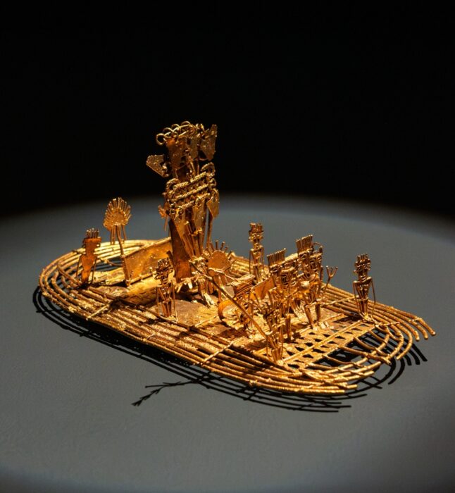
The king cleansed himself in the sacred waters, and the villagefolk would toss in an array of gold pieces, jewels, and other treasures as an additional offering to their gods. Today, a depiction of the ceremony is captured in the Muisca Raft, an intricate golden object that the Muisca cast between 1295 and 1410 AD, which now resides in the Museum of Gold in Bogotá, Colombia.
As the Spanish continued to descend upon the continent, it was not long before they caught wind of this incredible story. Conquistadors searched the lake but only found a handful of gold pieces. In 1541, Gonzalo Pizarro (brother of famed conquistador Francisco Pizarro) set out with a large expeditionary force of 4,000 natives and over 300 conquistadors in search of El Dorado. However, he failed miserably, and they returned empty-handed.
Over time, El Dorado was used interchangeably to describe a city, a king, or the lake.
Sir Walter Raleigh and Lake Parime
Sir Walter Raleigh searched for El Dorado up the Orinoco River in the 1590s. He had heard about El Dorado from the former governor of Trinidad, Antonio de Berrío, whom he captured when he landed on the island. Berrío had searched for El Dorado but failed.
According to Raleigh, during his exploration of Guiana, he heard about the city of Manoa and natives laden with gold:
I have been assured by such of the Spaniards as have seen Manoa, the imperial city of Guiana, which the Spaniards call El Dorado, that for the greatness, for the riches, and for the excellent seat, it far exceeded any of the world, at least of so much of the world as is known to the Spanish nation. It is founded upon a lake of salt water of 200 leagues long, like unto Mare Caspium.
I asked the manner how the Epuremei wrought those plates of gold, and how they could melt it out of the stone; he told me that the most of the gold which they made in plates and images was not seuered from the stone, but that on the lake of Manoa, and in a multitude of other rivers they gathered it in grains of perfect gold and in pieces as big as small stones.
One of Raleigh's colleagues, Lawrence Kemys, was the first to write about Lake Parime:
...afterwards they return for their canoes, and bear them likewise to the side of a lake, which the Iaos call Roponowini, the Charibes, Parime: which is of such bigness, that they know no difference between it and the main sea.
Kemys placed Lake Parime near the Essequibo River. As a result of these writings, some cartographers placed El Dorado and Lake Parime in Guyana. In the 17th century, English cartographer Robert Morden published Geography rectified; or, a description of the world, stating that:
The country about the Lake Parime, in the middle of Guyana, acknowledge, by report, a successor of Guainacapa of the House of Incas of Peru, and compose the true Kingdom of the Golden King.

Theories
Expeditions in subsequent years began to shed light on why explorers couldn’t pin down the lake’s location. An expedition led by Alexander von Humboldt found that no such lake exists, leading him to believe the "lake" was the result of the Rupununi Savannah flooding during the rainy season. The Rupununi floods every year from May to August. English naturalist Charles Waterton supported this explanation after natives told him that Lake Parime did not exist.
Fast forward to the 1970s, and explorer Roland Stevenson hoped to put the matter to rest. His travels took him to Roraima rather than Rupununi. He learned of a sacred road called "Nhamini-u" that featured numerous Inca petroglyphs and artefacts. His exploration of the road led him to the supposed water line of an ancient lake. He believed the lake disappeared and drained into the larger Rio Branco because of tectonic activity in the area. Scientists determined that it was possible that a lake formed there during the Paleozoic era.
It seems likely that early explorers, after witnessing local rituals, overestimated how much gold the native cultures possessed. Additionally, locals may have led the conquistadors on a wild goose chase, mixing fact and fiction.
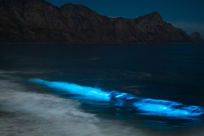
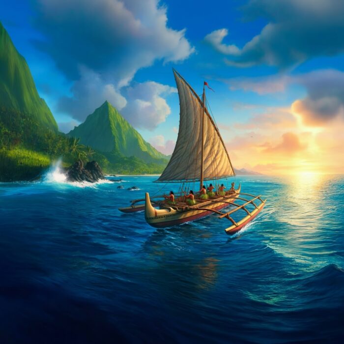
Do you believe that the Pacific Islanders simply drifted until they found land? Over the last hundred years, most scholars believed that the Polynesians let the winds and weather push their boats wherever they may. But recently, the narrative has shifted, and many historians think that the Polynesians navigated the vast Pacific Ocean by reading the world around them. They observed the behaviour of birds, clouds, and ocean swells. But they also relied on an odd phenomenon that they couldn’t explain: a mysterious underwater light source that pointed them toward reefs, and inevitably, land.
A mysterious light
This light is called te lapa, which translates as "flashing light," or "darts." Though we have no photographic evidence, eyewitness testimony and historical sources say it has a consistent white colour, with some modern-day witnesses comparing it to the beam of a flashlight underwater.
Pacific islanders believe it originates from islands and travels through the ocean. According to writer Jeff Evans in his 2011 book Polynesian Navigation and the Discovery of New Zealand, te lapa can appear as far as 130km from shore and occurs 45cm to 1.8m under the ocean's surface. Depending on your distance from an island, te lapa's intensity varies.
The flashes are said to be visible just beneath the surface of the water or skimming the surface at night, appearing as faint but fast-moving beams of light that point in the direction of the nearest island. Unlike atmospheric phenomena, te lapa acts as a pilot signal whose appearance doesn’t depend on whether it’s raining, cloudy, or clear. It is not affected by surface waves.
What is it?
Explanations for the phenomenon are scant. Evans equates it with phosphorescence. However, in his book We, The Navigators (1972), writer and researcher David Lewis disagrees:
Te lapa has nothing in common with ordinary surface or subsurface phosphorescence. It comprises streaks, flashes, and momentarily glowing plaques of light, all well beneath the surface. Exactly like lightning, it flickers and darts and is in constant motion. It occurs a good deal deeper than common luminescence, at anything from a foot or two to more than a fathom.
Te lapa, dynamic, transient, and deep in the water, is in all these respects quite distinct from ordinary phosphorescence…common phosphorescence is most profuse within a mile or so of reefs and coasts, whereas te lapa does not begin until 8 or 9 miles offshore.
Lewis believed that he could trace te lapa's formation to "deep swell movement, perhaps to ground swell or backwash waves reflected from land or reefs."
Other scientists have chalked it up to bioluminescent marine organisms responding to subtle energy disturbances. Some organisms, such as plankton, emit a glowing light when disturbed. This can take on a green, blue, or white colour. Underwater currents or waves hitting underwater structures near islands might cause trails of light to appear. This could create the illusion of a directional flash moving through the water. However, critics of this theory argue that bioluminescence is generally scattered and does not form in straight lines.
Another theory involves electrical or tectonic forces. Some scientists speculate that underwater volcanic islands might generate natural electrical discharges because of tectonic or geothermal activity. Latent activity can cause materials like quartz to generate electricity or light under stress. In theory, these discharges could be visible as quick, flashing lines. However, this remains speculative, with no hard evidence.
Some researchers propose that te lapa could be light refracting or reflecting underwater. Possibly influenced by the interaction of moonlight, ocean swells, and sea floor topography, this theory suggests that the flashes are nothing more than an optical illusion, where light is channelled or bent through temperature layers in the water.
Richard Feinberg, a professor at Kent State University, searched for te lapa between 2007 and 2008. However, he did not witness it.
"[My] attempt to document te lapa ended in frustration. I even noted in my journal feeling as if I had been searching for the abominable snowman," Feinberg wrote.
What does a Polynesian navigator say?
Marianne George has been studying te lapa for several decades, and does not believe it is bioluminescence. She ruled out several natural phenomena, claiming:
I was already very familiar with a lot of lights one sees at sea: bioluminescence and luminescence that appear in the glowing wake of a vessel in both inland seas and offshore, St Elmo’s fire in the rigging, shooting stars, satellites, comets, the green flash, and strange lights and colors that occur at sunset.
George states that te lapa does not resemble any of these phenomena, and behaves very differently.
In the 1990s, she visited Taumako in the Solomon Islands and befriended a local legend, an experienced Polynesian navigator named Te Aliki Koloso Kahia Kaveia. The two of them frequently went out on the water and claimed to have experienced te lapa. George saw that the lights were sometimes skirting on the water’s surface and sometimes below. Kaveia insisted te lapa was above the surface.
George and Kaveia believe te lapa may be the result of ocean swells bouncing off the islands, the resulting waves meeting each other at certain points, and reflecting light caused by tectonic activity on the ocean floor.
"Te lapa may be the result of magnetic or electrical fields that are caused by the same tectonic energy emissions manifesting atmospheric light and color effects in the atmosphere as well as piezoelectric emissions prior to earthquakes," George says.
Conclusion
Polynesian navigators believe te lapa is a guardian force that looks out for seafarers, appearing when a person is most in need of its assistance. They say that experiencing te lapa is a sacred gift and has played a key role in the story of the voyagers who made the Pacific islands their home. Te lapa and other unconventional navigation tools might encourage sailors to develop a crucial skill: intuition.
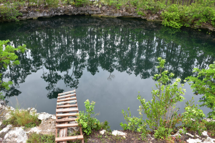
My tour guide and I were in the middle of a lava field, with nothing but hills and heaps of solidified black lava flanking both sides of the highway. He pointed to an inconspicuous hole in the ground and said, "I have a cool tunnel to show you."
Half-afraid I was about to be murdered, I gathered my courage and climbed into the blackness. Stumbling along with nothing to help me except my phone flashlight, I began my exploration of one of the many lava tubes hidden beneath the rolling lava fields of Lanzarote, half an hour outside Arrecife. The air inside was close, which did not help the claustrophobic feeling. Nevertheless, we emerged safely back into the light a few minutes later through another hole.
A fortunate isle
Lanzarote is one of the oldest and the first to be settled of the Canary Islands. The Guanches made their home here around 1000 BCE, most likely from North Africa. The islands, though small, were interesting enough for Romans, Carthaginians, Numidians, and Phoenicians to visit. If you enjoy reading about mythical or lost islands, the Canaries are a possible location for the Fortunate Isles or Isles of the Blessed.
Classical writers like Pliny the Elder and Plutarch described the Fortunate Isles as “winterless” and a paradise. Even today, the Canaries are known as the islands of eternal spring because of their year-round mild weather and sun.

Volcanic chaos
The volcanic history of the Canary Islands is messy, complicated, and still highly debatable. Geologists and volcanologists believe that a hotspot formed this archipelago off the coast of northwestern Africa. A hotspot is a location in the Earth's mantle where a plume of magma rises toward the surface.
What makes hotspots unique is that they do not need to form on the boundaries of tectonic plates. Rather, they can emerge within a plate, thus creating volcanic chains. Here, the Canary Hotspot lies on the African Plate, which created the archipelago around 60 to 70 million years ago.
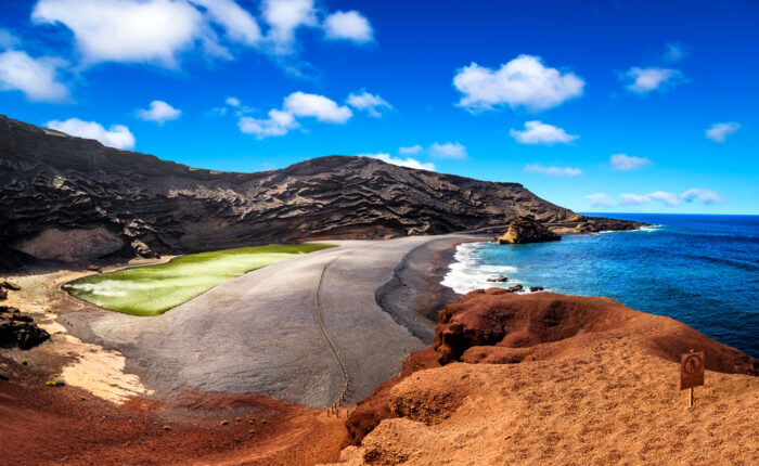
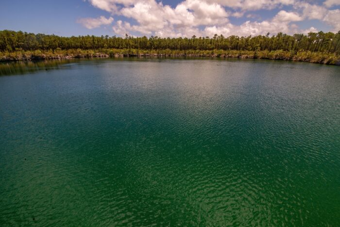
I started off my journey with an early-morning wakeup and a half-hour drive from the capital of Arrecife to a small fishing village called El Golfo. As I got out of the car, my eyes were trying hard to adjust to the many contrasting colors. I was standing on red lava rocks and soil, the bright blue waves of the ocean were on my immediate right, and a striking green lake was on my left.
“El Lago Verde,” my guide told me. The Green Lake.
The lake formed during a series of eruptions in the 18th century. Its green color comes from algae mixed with its sulfuric surroundings. This was quite the start to my journey through this otherworldly island.
Desert island
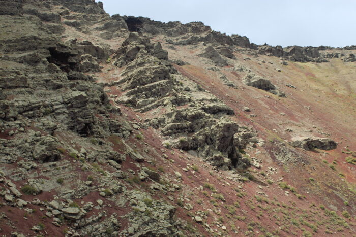
Lanzarote is the easternmost of the Canary Islands. Unlike its siblings, it is an outlier with a much wilder landscape. Its raw volcanic aspect and otherworldly color suggest the surface of Mars. While Tenerife boasts lush laurel forests and quaint historic towns, Lanzarote is a classical “desert” island — arid, rocky, and replete with volcanic cones, fissures, and bowls of black, red, brown, and ochre volcanic rock and soil.
Though Lanzarote is called The Island of 1,000 Volcanoes, there is only one active volcano on the entire island. It's called Timanfaya, also the name of the national park in which it sits. Despite the volcanoes, Lanzarote is not as mountainous as some other islands in the Canaries, with a high point of only 670m.
Though things seem quiet on Lanzarote, don’t take it for granted. Since the eruption of Cumbre Vieja in 2021 forced the evacuation of 7,000 residents elsewhere in the Canaries, it is important to be vigilant. From 1730 to 1736, Lanzarote experienced continuous volcanic eruptions, creating 32 volcanoes and burying 11 villages. In 1824, the volcano stirred again. The lava fields and volcanoes popular with hikers all resulted from these eruptions.
Amid the destruction, one miraculous story of a community's survival emerged. When the flowing lava threatened a village called Tinajo, they placed a cross in its path. The flow miraculously halted, so they say. They attributed the flow's sudden pause to divine intervention.
Volcanoes restricted in park
As for the other dormant or extinct volcanoes on the island (only 25 lie within Timanfaya National Park), you are free to climb and hike them. Within Timanfaya, the volcanoes are restricted as you are not free to roam without supervision…and you must pay for guided tours. However, the volcanoes in nearby Los Volcanes Natural Park usually have very accessible paths. The trails wind around on a gentle incline, so the hikes are not particularly strenuous.
Popular hikes include Volcán de la Corona, Montaña Blanca, and Montaña Colorado. Guided tours to the Montañas del Fuego in Timanfaya are available. Here, you will get demonstrations of setting off geysers and eat some unusual restaurant food that uses volcanic heat for cooking.
Taming the land
Lanzarote has great hikes and scenery and extensive lava tunnels and tubes below the surface. The island features the world’s largest underwater volcanic tunnel, appropriately crowned the Tunnel of Atlantis, which is over 1.5 km long. This tunnel is part of a wider network called the Cueva de los Verdes, which is six kilometers long. Occasionally, it also acts as a concert hall for live entertainment.
Like most deserts, Lanzarote is by no means barren. Its soil is some of the most fertile out there. La Geria is a protected area where farmers create unique vineyards in small craters in the black soil. They line half of the crater’s rim with stones to protect crops, usually grapes or figs, from the wind. The landscape is pockmarked as far as the eye can see.
The European Space Agency found Lanzarote to be the perfect laboratory for training and simulating missions to the Moon and Mars. They call the program PANGAEA -- Planetary ANalogue Geological and Astrobiological Exercise for Astronauts.
The takeaway
So, if you wish to see an alien world but you’re not an eccentric billionaire with a spaceship, Lanzarote awaits.
“Listen! Listen! Talk to me! I am hot!…oxygen…oxygen…am I going to crash?” For several decades, these chilling words, which screeched through a makeshift radio in the 1960s, have refused to fade. A choppy, distorted, and panicked voice of a woman in trouble was one of the many recordings which gave rise to one of the most persistent urban legends of the Space Age: the lost cosmonauts.
Believers in the lost cosmonauts reject Yuri Gagarin’s title as the first man in space. Their theory insists that the Soviets were secretly launching humans into space before Gagarin made his pioneering flight aboard Vostok I in 1961. The cosmonauts on these supposed earlier flights had all died.

The bond of brothers
It is four years after World War II. Italian brothers Achille and Giovanni Battista Judica-Cordiglia had a vested interest in radio technology. They spent their adolescence saving up to buy parts to make radio antennas. Along with other pieces of radio equipment that they bought from American soldiers, they built an enormous antenna, which they mounted on the roof of their apartment.
For fun, they enjoyed tuning into frequencies from around the world. However, one moment changed everything for them. When Russia successfully sent Sputnik I into orbit in 1957, it also launched the space race. In 1958, the United States followed with Explorer I. The brothers managed to capture the frequencies of both missions.
Achille and Giovanni wanted in on this space race in their own way, by eavesdropping. In a repurposed World War II German bunker just outside of Turin, where their parents had moved the family, they continued their radio work. Eagerly, they set up an experimental listening station, with their homemade radios tuned into happenings in the night sky.

A deadly discovery
For months, the brothers worked tirelessly to perfect their system to track all Soviet missions. One night, they held their breath as faint beeping started to come through their headphones. Morse code. More accurately, an SOS. They believed it must have been a manned launch that went wrong. However, at this time, only dogs were used on space flights.
The next odd occurrence was the sound of a human heartbeat accompanied by heavy breathing, most likely coming from a male in distress. After that, panicked transmissions from a team of three people (two men and one woman) said, “Conditions growing worse. Why don’t you answer?...Remember us to the Motherland! We are lost! We are lost!”
Over the years, such dire transmissions continued and further fueled the rumors that the Soviets were regularly losing their cosmonauts.
News outlets caught wind of the story, but it wasn’t the first of its kind. In 1959, an article from the Continentale in Italy claimed that a Czechoslovakian official gave a list of the names of cosmonauts who died during their missions: Alexei Ledovsky, Andrei Mitkov, Sergei Shiborin, and Maria Gromova.
Test pilots?
In a Soviet periodical called Ogoniok, Pyotr Dolgov and Ivan Kachur were declared dead, not during a clandestine mission to space, but after conducting a parachute test at high altitude. No one was able to confirm and clarify these details. This begs the question: Were these "cosmonauts" actually high-altitude test pilots or parachutists?
Achille and Giovanni’s discoveries did not escape notice. Soon enough, there was an ominous knock at their door from none other than the KGB. Writer Micah Hanks at The Debrief wrote that years later, a journalist named Kris Hollington tracked down a KGB visitor in 2008, who admitted:
“Of course, we were interested in the Judica-Cordiglia brothers; they were hacking into our communications. Imagine that today, a pair of amateur kids taking apart the Russian space program like it was a toy…”
To their surprise, the man let them off with a warning. Nonetheless, the visit itself was ominous and made them question whether or not the Soviets were trying to cover up or silence any interested parties.
The brothers' work earned them a well-received visit to NASA headquarters, where scientists and communications specialists praised them for their inventions and self-taught knowledge. They also recorded John Glenn's communications during his mission in 1962. Seeing their value, NASA and the brothers exchanged information, with NASA trading American mission frequencies for Russian frequencies. Achille and Giovanni established the Zeus Network, which allowed radio enthusiasts around the world to tap into spaceflights. This lasted until at least the 1969 moon landing.
Theories
Did the brothers actually overhear dying cosmonauts crying out to the ether for help? The many cryptic and terrifying jumbled cacophonies suggested a failing Soviet space program that could leave America the victor of this highly politicized race.
Some believe the brothers lied or exaggerated to gain notoriety. According to writer and science scholar Maria Rosa Menzio, the brothers received two kinds of translations from the mostly indiscernible recordings they intercepted. When they sent them to native Russian speakers, the translations made little sense. However, when they took the recordings to a German teacher who spoke Russian, the teacher only gave them what she thought she heard or was able to make out. Therefore, skeptics find the brothers to be an unreliable source.

Space historian James E. Oberg provided his own take on the lost cosmonauts. Digging into some of the names, he claims to have clarified the story of one of the victims mentioned in Ogoniok. He said:
Dolgov, an experienced test pilot and stratospheric parachutist, really did disappear under mysterious circumstances about that time. More than two years later the Russians announced that he had just died in a high-altitude jump in November 1962.
He also quoted Dr. Charles Sheldon, a Washington expert on the Soviet space program, who said:
Those who would believe in these purported Soviet orbital deaths must think there is a second and independent Soviet manned program. In contrast to the open program which always brought the man back until 1967, the secret program always failed. Why the Russians would want to run a secret failure program parallel to their open success program is not clear.
Many real accidents
It is no secret that the Soviet space program had its share of bad luck. There were many accidents, probably more than we know, which were never made public. But most importantly, one of the main reasons why many people believe in the lost cosmonauts is the highly secretive and authoritarian character of the Soviet Union. Media, higher education, culture, and even thought were under heavy state control and censorship. No one truly knew what was going on. From assassinations and undercover operations to mysterious disappearances, it was always tempting to lean toward the theory of a big cover-up.
The behavior of Soviet leaders fomented further suspicion. Sometimes, Nikita Khrushchev teased at upcoming launches that they were ready to send men into space. Then nothing would happen, which made people believe the launches occurred but failed.
This brings us to another strange story. In the newspaper The Daily Worker, journalist Dennis Ogden wrote about a cosmonaut named Vladimir Ilyushin who was supposedly the first man in space. He launched two days before Yuri Gagarin’s flight, but his flight crashed in China, and he suffered severe brain damage. Officials claim Ilyushin was the victim of a car accident, while others say this was an excuse to explain away Ilyushin's injuries.
The takeaway
The Cold War was a battle between the West and the East, but also a fight between what was real and what wasn’t. Truth and propaganda came head to head. It's hard to get to the bottom of propaganda.
Oberg says:
The only safe answer still is that no one outside a small coterie in the USSR can know. We can say, however, that there is no hard evidence available to indicate that any such fatal secret missions ever took place…
As we examine the evidence, it is possible that the "lost cosmonauts" could have been a group of ill-fated high-altitude test pilots or parachutists who might have been destined to go into space one day. Unfortunately for them, they didn't make it. In the craze of one of the world’s most intense periods, truth was sometimes mixed with fiction.
Imagine you are a child in the 1980s and 1990s. You are driving home from school one day, and you and your family get stuck in afternoon traffic. This is a normal routine…until it’s not. What is usually an hour or so turns into several. Urgent car horns start piercing the air, and drivers get impatient. On investigation, they find the culprit: a black sticky substance emerging from the road with a mind of its own.
Background
La Mancha Negra's place in Venezuelan collective memory is debatable. While some remember it as the source of a nationwide panic alongside the growing political and social ills, others can't recall such an event taking place at all. Whatever the origin, La Mancha Negra began to dominate local and foreign newspapers.
The Spanish words, La Mancha Negra, translate to “the black stain." It began appearing in 1986 on the Autopista Caracas-La Guaira, a major highway linking the capital to the coast in northern Venezuela, and continued to show up throughout the 1990s and early 2000s.
The goo’s texture is described as thick, greasy, and gummy, which turns "slick as ice" in certain conditions. When the temperature was very hot, the goo turned very slippery. When it cooled down, the goo became harder and manageable. Regardless, it was enough to do serious damage.

1,800 deaths??
What seemed like an isolated case of oil spillage 50m long quickly grew into something much more troubling. The substance spread rapidly, covering over 12 kilometers of highway. La Mancha was oozing from underground, moving and growing like it was alive, the more people drove on the roads. Reports claimed 1,800 people died as a result of the mysterious goo. Over time, La Mancha Negra expanded into other highways around Caracas, with reports of accidents increasing wherever the stain appeared.
The government, hearing its citizens cry for an explanation and solution, boasted to have spent millions of dollars on scientific studies and cleaning efforts. Supposedly, European, American, and Canadian governments provided equipment and expertise, attempting to remove it. Detergents, high-pressure hoses, and even resurfacing the roads proved largely ineffective. The goo just kept seeping through the ground. One strategy that seemed to work temporarily was covering the goo with pulverized limestone. The substance dried up...until the limestone dust made the city's breathing quality unbearable. To make matters worse, the patches reappeared and got bigger. Answers were nowhere near being solved.
Composition
According to the "studies," the substance consisted of dust, oil from cars, and other organic material. This theory proposed that poor-quality asphalt, combined with tropical humidity and heat, caused the road to deteriorate and leach out oily byproducts.
Author Ana Elena Azpurua, who compiled reports and chronicles about the highway, stated that the Ministry of Transport hypothesized:
It is a black stain caused by the interaction of spilled oil with "fresh" asphalt, which, because it was recently laid, is highly susceptible to temperature and has not aged or oxidized. This asphalt was laid in 1990, when the section from Pariata and Viaduct No. 3 to Catia was repaved.
A Wall Street Journal article from 1996 reported:
...due to the cheap gasoline prices in the country, Venezuelans would drive dated gas guzzlers, stating 'Locals call the highway "la mancha negra," or the black stain, because it literally shines with the oil drippings of thousands of big cars that labor up an incline into the city each day.
Explanations
Let us consider Venezuela's geography for a second. Venezuela lies on a fault line between the South American Plate and the Caribbean Plate. This fault line results in earthquakes and makes Venezuela a hotspot for hydrocarbon reserves of oil, gas, petroleum, and natural asphalt.
Like its neighbor, Trinidad, Venezuela has an asphalt lake called Lake Bermudez. Though Lake Bermudez is quite far from the capital, it shows that Venezuela as a whole sits on a bed of hydrocarbons. Petroleum and oil seeps are quite common in these areas.
In the case of La Mancha Negra, it probably began to penetrate the asphalt. Why? Because the roads were poorly paved from the very start. Some suspected underground water seepage was mixing with road materials and automotive waste to create the greasy sludge. The fact that the goo reappeared showed that the underlying problem, particularly underground, was not dealt with.

Geologist K.H. James in his study, The Venezuelan Hydrocarbon Habitat, wrote:
Venezuela forms part of an important hydrocarbon province, defined by the presence of prolific Cretaceous source rocks, which extends across northern South America. By early 1997, the country had produced 53 billion barrels of oil. Reserves are estimated to total 73 billion barrels of oil and 146 TCF of gas with 250 billion barrels recoverable in the Heavy Oil Belt.
Conspiracy theories
Even before La Mancha, it was public knowledge that the roads were neglected, poorly constructed, and posed a public safety issue. The asphalt cracked and broke away in several areas, leading to rushed and rudimentary patches along the highway. It is very possible that oil seeped through the cracks. Unfortunately, government corruption mismanaged basic infrastructure.
That should have put the matter to rest, right? Sadly, it is not as simple. Due to the unstable political situation, news about La Mancha Negra was heavily influenced by media bias and conspiracy theories.
Why were the "studies" not made public? Did they even happen? Why is most information so scarce? If they knew what the substance was, why was the incident left so open-ended?
La Mancha Negra as a political tool
La Mancha appeared at a rather precarious time in the country’s political history. More conspiratorial ideas have included sabotage by political enemies or criminal organizations attempting to destabilize Caracas traffic or even reduce voter turnout during election seasons by making travel more dangerous.
The two presidents of Venezuela at the time of La Mancha Negra were Jaime Lusinchi and Carlos Andres Perez. Both were accused of corruption. Perez himself made allegations that La Mancha was a ploy by his political opponents to discredit him and blame him for mismanagement.
In 1992, Hugo Chavez, who eventually became president, attempted a coup to overthrow him. Supposedly, the opposition hired homeless people to spread the goo all over the roads under the cover of darkness. This was most likely a lie. The La Mancha Negra story died eventually, even to the point where people forgot it existed or believed it was an urban legend.
Conclusion
La Mancha Negra became more than just a public safety issue — it was a symbol of infrastructural and political decay in Venezuela. As the country faced mounting unrest, inflation, and corruption scandals from its leaders, La Mancha Negra stood as a visible and dangerous reminder of neglect.
“Now from the North Of Norumbega, and the Samoed shoar, Bursting thir brazen Dungeon, armd with ice And snow and haile and stormie gust and flaw…”
When I read this in college, I was lost, as you probably are. After all, these lines came from John Milton’s Paradise Lost, one of the most complicated literary works out there. For starters, the name Norumbega went straight over my head until much later.
Norumbega was supposedly a lost land somewhere on the east coast of the United States. According to maps and the fevered writings of explorers and sailors during the Age of Discovery, it was a city whose buildings were made of quartz crystals and precious jewels, and whose inhabitants wanted for nothing. Sounds pretty sweet. Also sounds pretty unrealistic.
Maps, maps, and more maps
This lost land first appeared on the 1529 map of Italian cartographer Giovanni da Verrazano. Verrazano's patron, King Francois I of France, wanted him to find a western passage to Cathay (China), but after a storm almost obliterated his expedition, he was unable to stick to the original plan. Instead, he opted for an impromptu two-year jaunt (1522-1524) from New Brunswick to Florida.
He visited Arcadia (north of Virginia) and New York Harbor. Most notably, he discovered a "Refugio" of friendly, beautiful natives, fertile land, and pure bliss. This Refugio supposedly lay in what is now Rhode Island. But when he drew his map, he added a curious little land called Norumbega just above the Refugio.
It did not have the name “Norumbega” right away. Rather, it was called Oranbega. Academic sources suggest that the name may have roots in the Algonquian language, where it means “quiet stretch of water.” Some sources suggest that it was a play on the Spanish word oro, meaning gold, because of its subsequent reputation as a gold-laden, indigenous utopia. Years later, the exact location of Norumbega remains a subject of great speculation.
A year after Verrazano’s expedition, Portuguese explorer Estevao Gomes explored Nova Scotia down to Maine and encountered a unique native community in what is now Penobscot Bay. He wrote that the people were:
...great archers, and wear skins of wild beasts and others. The country contains excellent martens of the sable kind, and other fine fur-bearing animals . . .They have silver and copper, as they gave to understand by signs. They worship the Sun and Moon, and share the other idolatries and errors of the natives on the continent.
A German connection?
Based on Gomes's reports, cartographer Diogo Ribeiro drew his world map. Scholars linked Gomes's encounter to Verrazano's. This is rather strange, as Verrazano never highlighted Norumbega as a particularly special place. In his letters to the French monarch, he doesn't mention it at all. Rather, he was preoccupied with the Refugio. How did Norumbega evolve into such a mythical place?
Giacomo Gastaldi included Norumbega in his 1548 New World map but spelled it "Nurumberg." Why this Germanic name? Nuremberg was a shining example of a wealthy European civilization of the time. Perhaps he wanted to pay homage to this great city.
From the 1570s to the 1590s, several world maps came out, all mentioning Norumbega. One even located it roughly in Virginia. Apparently, the famed John Smith believed Norumbega stretched from Virginia to New England. However, the maps depicted it as different things: a small town, a metropolis, a country. No one could make up their mind. Yet, they zeroed in on the New England area.
The rumor mill
The myth of Norumbega’s riches comes from an English sailor, David Ingram, who claimed to have walked from Mexico to Nova Scotia in 1568. During his trek, he supposedly visited Norumbega and wrote about the inhabitants' immense wealth but vicious nature.
“There were precious stones," he enthused. "Turquoise and onyx and garnet…pillars of quartz crystal and columns of wood wrapped with thin sheets of silver and even of gold…”
He added that the natives were cannibalistic. Unsurprisingly, historians have questioned Ingram’s exaggerated account.
A couple of decades earlier, a man named Jean Allefonsce presented a more realistic view. Writes historian Joe McAlhany: “[Allefonsce] identified a Riviere de Norenbegue that was clearly the same river called Norombegue, which was populated by a noble tribe clearly modeled on the inhabitants of Verrazano’s Refugio…"
During a colonizing mission to Canada in 1542, Allefonsce wrote of the "clever inhabitants" of this Riviere de Norenbegue, who:
...trade in furs of all sorts; the town folk are dressed in furs, wearing sable…the people use many words which sound like Latin. They worship the sun. They are tall and handsome in form…
In this case, he proposes that it’s a trading hub, which fits the narrative of a wealthy community.
Baking powder and Vikings
One man claimed to have all the answers about Norumbega. An eccentric professor of agricultural chemistry, Eben Horsford was a man of many interests. Best known for inventing baking powder, he had a secret obsession: Vikings. We're not sure when or why he became interested in such a niche topic, but he staunchly believed that Norumbega was the fabled Vinland of Leif Erikson. (This was well before the discovery of L'Anse Aux Meadows in Newfoundland in the 1960s, which was not Vinland, either.)
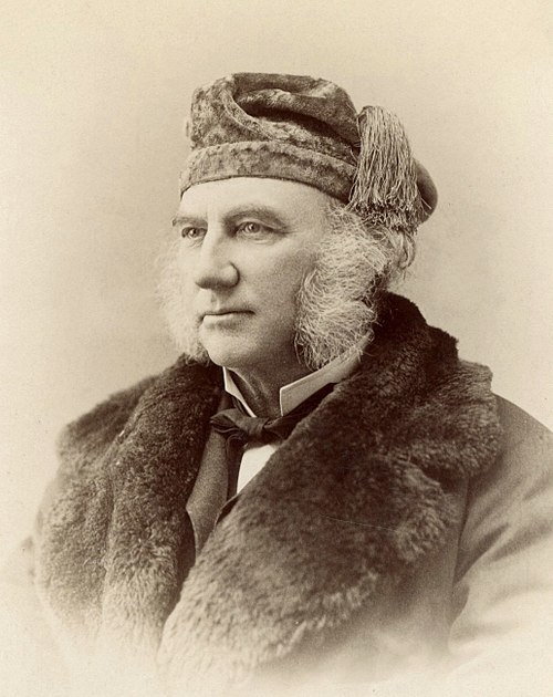
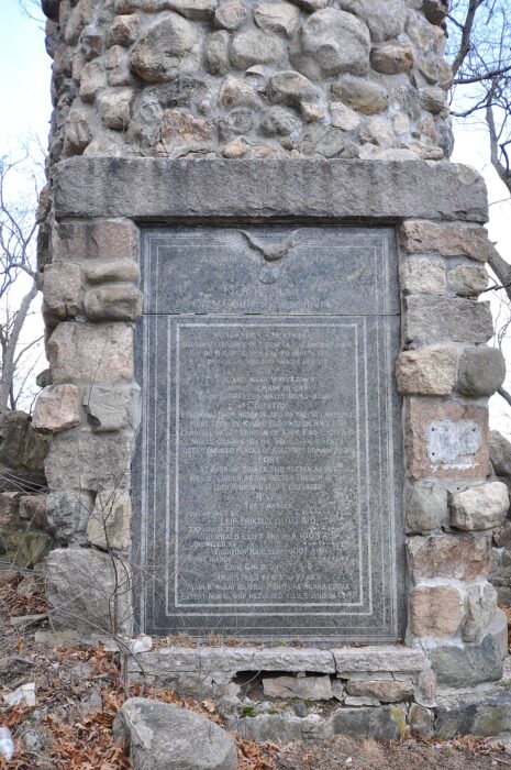
In 1890, Horsford announced the discovery of Leif Erikson's dwelling place, conveniently close to his own Cambridge, Massachusetts home. He supposedly dug nearby and discovered...something. He wrote to a local judge, stating:
It is now nearly five years since I discovered on the banks of the Charles River the site of Fort Norumbega, occupied for a time by the Bretons some four hundred years ago, and as many years earlier still built and occupied as the seat of extensive fisheries and a settlement by the Northmen.
The judge seemed to take it well and wrote back to congratulate him. Horsford commemorated his contribution by installing a plaque and Norumbega Tower, a 12m tall stone pillar. Thereafter, the surrounding areas started to name their local landmarks after Norumbega, imprinting it on the regional culture. In the 19th century, Bangor, Maine, embraced the myth by naming its municipal building Norumbega Hall. Newton has Norumbega Park, and Cambridge carries Norumbega Street. Though there is no physical evidence whatsoever of Norumbega's existence, New England just rolled with it and celebrated an interesting piece of history...or non-history.
Wacky linguistics
Horsford cited linguistic evidence to those who doubted. He said:
Many hundred years ago, the country we call Norway was called Norbegia and Norbega which are the same philologically -– as we have just seen -– as Noruega or Norvega, or Norwegs; the b is the equivalent of u, or v, or w.”
Hosford then went further to point out that Native American names were actually Norse in origin.
Writer Katie C. Berry with the Harvard Crimson brings up an interesting point. She proposed that these crazy ideas came from a rivalry between Protestants and Catholics. Catholics laid claim to the land's Catholic heritage with Columbus's discovery. On the other hand, Protestants wanted something else to emulate, in this case, the Vikings.
Conclusion
By the time John Milton came out with those cryptic lines in Paradise Lost in 1667, the myth of Norumbega was well-established. The place may well have existed, although not in the way we think. Lost cities rarely meet our expectations of advanced and spectacularly rich metropolises. Norumbega might have just been a regular indigenous trading hub, whose name and character got misconstrued in the chaos of discovery and hype of New World riches.
As for how Norumbega became associated with a mythical utopia, the world maps produced around the same time as each other might have just copied each other's place names. Or there may have been several indigenous communities along the coast that later became one singular Norumbega. Certainly, early maps were not the sober, reliable documents, produced from air photos, that we're familiar with today. Imagination and rumor figured largely in these early charts. If it wasn't dragons, it was mythical places like Norumbega.
It is the place “between the spaces” — a purgatory. At least, the locals on the island of Pohnpei in Micronesia seem to think so. For centuries, restless spirits of dead Pohnpeians have lingered here and vowed to harm any disrespectful visitors. The lost city of Nan Madol is half-submerged and half-taken over by the twisting spines of mangroves.
But first impressions can be deceiving. It is one of the very few places in the world which continues to perplex archaeologists. How and why it was built, and by whom?
Sophisticated construction
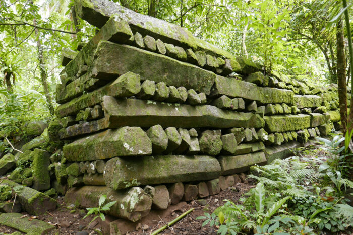
Nan Madol is an ancient city in a lagoon dotted with small artificial islands linked by canals. Basalt columns form the base of these constructions; some may be simply fallen pillars.
The origins of Nan Madol have one foot in fiction and the other in history. The locals of Pohnpei Island simply accept the stories of their ancestors as fact. Their culture dates to the 1200s, but human activity goes back even further, to at least 500 CE.
The islanders most likely came from a New Caledonian group called the Lapita. Originally from the Philippines, the Lapita traveled to Micronesia and mixed with local populations. Among the evidence, patterns on pottery shards here match those of the Lapita. Near Nan Madol is a rock art gallery with carvings that are almost identical to those in New Caledonia, 3,000km away. Yet the Lapita were not known for their advanced technology or sophisticated building techniques.
Venice of the Pacific
Nan Madol is often referred to as the Venice of the Pacific because of its canals. The site is 1.5 kilometers by .5 kilometers and encompasses a sea wall, 92 islets, canals, an irrigation system, ceremonial and residential sections, tombs, and even a prison. The entire city complex sits upon a coral reef, and the islets upon which the basalt structures lie are man-made. The boulders and logs are naturally hexagonal and made of volcanic basalt. In total, the complex weighs over 750,000 tons. The walls are 7.5 meters high, and the logs are 5.5 meters long. According to UNESCO, its construction involved
...small island populations in the mining, moving, and maneuvering of an estimated 2,000 tons of volcanic rock every year for at least three to four centuries without the benefit of pulleys, levels, metal tools, or wheels.
Archaeologists and historians find this site hard to believe. How could these simple islanders build such a city, let alone stack megaton logs of basalt on top of each other 7.5 meters high? Micronesian societies were not this advanced. This suggests that its builders were not from around here...
An impressed visitor
In 1836, a British vessel called the Lambton sailed to Micronesia. On board was a curious surgeon named Dr. Campbell, who had been thoroughly impressed by the region’s incredible beauty. As they sailed, they came across a unique structure not seen on the other islands. From a place he had come to know as simple, with modest boats, crafts and tools, the presence of a stone complex that took over an entire reef astounded him. When he asked the native population about it, the language barrier left him incredibly frustrated. He concluded that it was
...the work of a race of men far surpassing the present generation, over whose memory many ages have rolled, and whose history oblivion has shaded forever, whose greatness and whose power can only now be traced from the scattered remains of the structures they have reared, which now wave with evergreens over the ashes of their departed glory, leaving to posterity the pleasure of speculation and conjecture.
As word spread of Nan Madol, other travelers came to see it for themselves. In 1873, Polish naturalist John Stanislaw Kubary visited Nan Madol while traveling through the Marshall and Caroline Islands. He acquired 23 crates worth of materials for museums before losing them in a shipwreck.
In the 1970s and 1980s, archaeologists conducted underwater surveys and found basalt pillars on the seafloor, which meant the complex went deeper than originally thought.
But who built it? It turns out Nan Madol has an odd past, which started with an unexpected arrival on this idyllic island. Let us take a look at Pohnpeian oral tradition.
Unexpected invaders
Locals tell a story of foreigners who came to Pohnpei. It goes like this.
Once upon a time, two charismatic brothers from a distant land came to the native Pohnpeian people and claimed to be sorcerers. Olisihpa and Olosohpa were described as strong giants who were divine intermediaries, controlling both the earthly and spiritual realms. They were said to harness supernatural powers. Some claimed they could control the weather or even communicate with the gods.
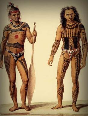
Though the locals did not know where they came from, they welcomed these wise men with open arms. A group of foreign men and women in large canoes accompanied Olisihpa and Olosohpa, wanting to establish a settlement. Oral tradition states they had the power to make the basalt columns float and stack on top of each other.
However, the goodwill did not last long. The brothers quickly secured an iron grip on the humble society, forcing the citizens to pay tribute, do hard labor, and bring them food and water. No one moved without them knowing. No one breathed without them allowing it. They even promoted cannibalism. This carried on for centuries. The brothers founded the island's Saudeleur dynasty, which reigned until 1628.
Eventual rebellion
From 1200 to 1700, Nan Madol was a cultural and spiritual hub, thanks to the Saudeleurs. At the same time, their grip on power grew tyrannical, and the disillusioned people of Pohnpei eventually rebelled against their rulers’ heavy-handedness. Many Pohnpeians died and were buried within the walls.
The story gets more complicated. Oral tradition says that the Saudeleurs worshipped the god of thunder, Nahnsapwe. They made the locals sacrifice their most sacred animal, the turtle, to a moray eel, which represented him. Nahnsapwe saw all this chaos and decided to intervene. He and a female relative had a demigod son named Isokelekel, who defeated the tyrants in the 1500s. By now, this was not an ancient story but rather a semi-modern one.
Isokelekel brought peace to Pohnpei and established a system of chiefdoms instead of absolute rule. This system is used today on the island.
Eventually, Isokelekel died, and he was buried on a nearby island called Pehi en Kitel. Supposedly, to disturb his remains is to risk dying suddenly and terribly. Nan Madol was slowly abandoned and left to the infringing waves.
While this provides some background, and oral tradition is a valuable tool for historians, it does not paint a complete picture.
What's real?
First, the Sadeleurs and the subsequent kings might have been real. In 1907, the bones of Isokelekel were supposedly discovered by the island's German governor, Victor Berg. The bones were much larger than the average human's. In 1928, the Japanese excavated his tomb and found more giant remains. The bones supposedly are still there, guarded and venerated by the local people. Victor Berg died soon after discovering the tomb.
As for the construction of Nan Madol, scientists have a hypothesis other than magic and floating rocks. On the island, there is a near-vertical hill of basalt. According to writer William S. Aryes of Archaeology magazine,
Initially, local inhabitants transported massive basalt boulders to the reef, forming foundations upon which wood and thatch structures were erected. They then stacked finely fitted basalt columns horizontally around the crude boulder foundations to buttress coral rubble used to level the islet surfaces. Islanders tell us that the columns were quarried by heating large clusters of naturally formed basalt columns with fire and then breaking them apart along natural fissure lines with cold water...
...probably transported by raft at high tide; maneuvering even a small craft at low tide would have been impossible.
There is no evidence that the islanders possessed the technology to carry such great weights. It is most likely that the kings forced the conquered to build it. But how? Some have suggested ropes, but stacking the boulders on top of each other is hard to believe. As of now, archaeologists have no idea how this could have been done.
Connection to the lost continent of Mu
As mentioned in a previous article on the lost continent of Lemuria and Mu, another explanation for Nan Madol’s construction has long focused on an ancient race that was advanced in technology and engineering, and which supposedly originated in Mu. Two men were responsible for pushing the Mu theory. First was Augustus Le Plongeon. In his studies of the Yucatan Peninsula and the Maya, he argued that they came from a lost continent, based on his translations of the Popol Vuh and Madrid Codex. In his book, Queen Moo & The Egyptian Sphinx, he said:
In our journey westward across the Atlantic, we shall pass in sight of that spot where once existed the pride and life of the ocean, the Land of Mu, which, at the epoch that we have been considering, had not yet been visited by the wrath of Human, that lord of volcanic fires to whose fury it afterward fell a victim. The description of that land given to Solon by Sonchis, priest at Sais; its destruction by earthquakes, and submergence, recorded by Plato in his Timaeus, have been told and retold so many times that it is useless to encumber these pages with a repetition of it...
Disaster strikes
The people of Mu were purportedly advanced in engineering, writing, and city planning. However, a series of natural disasters, such as earthquakes and volcanic eruptions, caused it to sink beneath the Pacific like Atlantis.
British explorer and mystic James Churchward also supported this theory. Churchward believed that Mu was a vast continent situated in the middle of the Pacific Ocean and stretched from Hawaii to the enigmatic Easter Island. He suggested that Nan Madol was a remnant of Mu, and the people residing there were the survivors.
Needless to say, such explanations have been dismissed as pseudoscience.
Visiting today
Getting there is a challenge even today, but not because of the rugged landscape and thick jungle. It requires extraordinary permission from Pohnpei's current king in a special ceremony with the local elders and a semi-psychedelic drink that will make you unsteady on your feet for a bit. You have to ask for their approval, promise to be respectful, and receive spiritual protection. More visitors have come as popular National Geographic documentaries and the infamous Ancient Aliens TV series have led curious minds to this far corner of the world.
Conclusion
Strangely, archaeology has largely neglected Nan Madol. Few studies have been done, and many questions remain. We are not sure if it's due to cultural sensitivity and the heritage of the Pohnpeian people, who believe these stories to be real, or the dismissal of anything pseudoscientific.
Long before Spanish colonization, the indigenous people of Peru kept track of important dates and numbers, and perhaps even stories, using a mysterious coding system of strings and knots called a quipu.
When the Spanish invaded, they decided these bundles of strings and knots were idolatrous and pagan, in opposition to the Catholic Church. They burned them, hoping to quell any thought of resistance.
How does it work?
Quipu means knot in Quechua, the dominant indigenous language in the region.
You might mistake a quipu for a brightly colored necklace or headdress, but it is a communication device. Unlike their Mayan and Aztec counterparts, the Incas had no written language. They used quipu instead.

Quipus consist of a series of colored, knotted cords made from cotton, wool, or other animal fibers. The knots and their placement on the cords represented numerical values. In some cases, it carried other information, such as dates or records of events. The use of the quipu dates back to 2500 BCE, long before the Inca Empire emerged. We still don't know how it originated.
Deciphering quipus is tough. Its purpose and meaning can change depending on the length of the cord, the number of knots, the color, the way the cords are twisted and woven, the material, and the arrangement. While some historians think they were used almost exclusively to communicate numbers, others believe they were capable of storytelling and poetry.
Certainly, the main purpose of the quipu was to track and manage the data of populations, goods, resources, and taxes. It was the administrative tool of the empire. Each knot on the cord had a specific value depending on its position, with different knot types (such as single knots, long knots, or figure-eight knots) representing different values. The Incas used the decimal system and knots to record 1s, 10s, 100s, 1000s, and so on.
The colors of the cords could indicate categories like resources, people, or geographical locations. For example, red represented warriors or war, white represented silver, and yellow symbolized gold.
Record keepers
The quipus were managed by quipucamayocs, which means "quipu authority." These administrators were the record keepers, accountants, bookkeepers, mathematicians, census takers, and historians of the empire. The smooth running of the empire rested almost entirely on their shoulders.
The Incas had a complex road network called the Qhapaq Ñan. All these roads led to the capital of Cusco. Endurance runners called chasquis transported quipus along these roads, resting or passing them to other runners in supply stations called tambos posted every few kilometers. Messengers could quickly carry news of an Incan victory, the death of an emperor, or details of an enemy attack from province to province.
Quipu as a weapon
After smallpox had killed the ruler Huayna Capac, his sons, Atahualpa and Huascar, battled for the throne. Atahualpa triumphed and killed his brother. To further legitimize his ascension, Atahualpa had all records destroyed. This meant burning quipus that recorded anything to do with his brother.
Atahualpa even killed the quipucamayocs. "[It was] a total renewal, what the Incas called a pachakuti or a turning over of time and space," historian Mark Cartwright wrote.
Later, a Spanish governor of Peru, Vaca de Castro, tried to find quipucamayocs to teach him about the land. Eventually, he came across two who had survived the purge. "They found them wandering in the mountains, terrorized by the tyrants of the past," according to historian John A. Yeakel.
Spanish response
Though the Spanish destroyed many quipus, some chose to study them. Inca Garcilaso de la Vega was the son of a conquistador and an Incan prince, and acted as an intermediary between the two peoples. He learned about the quipu as part of his upbringing and wrote extensively about them:
When my father's Indians came to town on Midsummer's Day to pay their tribute, they brought me the quipus; and the curacas [local leaders] asked my mother to take note of their stories, for they mistrusted the Spaniards, and feared that they would not understand them. I was able to reassure them by re-reading what I had noted down under their dictation.
Likewise, a rogue Jesuit priest named Blas Valera advocated for learning from the quipus. Also half Spanish and half Inca, Valera proclaimed that the Incas were the real rulers of Peru. He died under house arrest in 1597.

Threads of a story
In 2015, anthropologist Sabine Hyland got a call from the remote Andean village of San Juan de Collata. This little village held some of the last remaining quipus.
Villagers granted Hyland access to two quipus from the 18th century. They told her that for years, guarding the quipus was a coming-of-age ritual for local adolescent boys. After seeing one of Hyland's documentaries, the village elders had reached out, hoping she would visit.
"Over the next couple days, we would learn that these multicolored quipus, each of which is just over two feet long, were narrative epistles created by local chiefs during a time of war in the 18th century," Hyland wrote.
The elders recounted the story of a failed rebellion against the Spanish. A leader, betrayed by his associates, was imprisoned and eventually executed. He had used the quipu to tell his countrymen that he was the ruling Inca Emperor.

Not far from the village of San Juan de Collata, Hyland was invited by a local schoolteacher to examine a hybrid quipu. The hybrid was set on a wooden board containing a ledger of names and multicolored quipu threads.
"The board bears the names of villagers, while the quipu cord associated with each name indicates the contribution of labor and/or goods that the individual was expected to provide in a community ceremony," Hyland wrote.
Much to Hyland's astonishment, quipus were used in the village until the 1940s for communal, administrative, and record-keeping purposes.
Tenerife, an island off the coast of Morocco, was not on my radar before 2023, when I found myself teaching English there for seven months. After three flights, four airports, and 23 hours of flight time, I made it to the largest of the Canary Islands in one piece. As I settled in, I began to research the island's history and soon discovered the fascinating history of the Guanches.
Who were they?
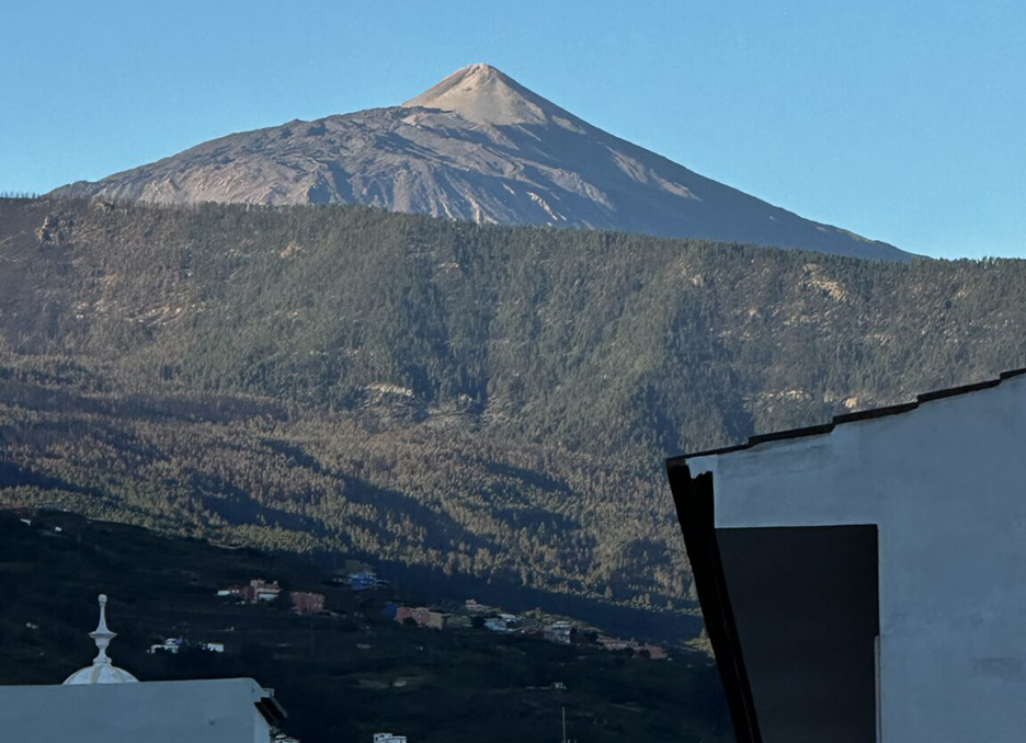
My home base on Tenerife was La Orotava, a village on the slopes of Spain’s highest peak, El Teide. The volcano’s summit greeted me every time I stepped outside my door, and its presence was a quintessential part of day-to-day life on the island. Using my somewhat okay Spanish, I asked the locals about the volcano and its history. One word kept popping up: Guanches.
The Guanches were the island's original inhabitants. They were described as blonde, tall, strong, light-skinned, and speaking an unknown language. Anthropologists are unsure how they arrived on the island and how their civilization developed in isolation. Evidence suggests that the Guanches were not a seafaring people. Excavations have found no evidence of boats, rafts, or sails. When the Spanish invaded, it seemed that these mysterious people were always just…there.
The lack of information has prompted a few theories, including that they were former Roman prisoners or a Berber sub-group. DNA analysis has confirmed a North African origin.
Though we know little about them, the legacy of the Guanches can be found in every nook and cranny on the island, from the top of El Teide to the sweeping coastline. Let’s start at the top.
El Teide
Originally, the Guanches called the volcano Echeyde, but over time, it evolved into Teide. Linguists think it might mean "mountain of evil" or "hell," and the locals feared it. In their mythology, the volcano was home to a demon called Guayota, the great adversary of the sky god Achamán.
To prevent this malevolent being -- who usually appeared in the form of a vicious black dog -- from causing havoc, the Guanches climbed El Teide during eruptions to light bonfires and scare him away. Achamán eventually defeated Guayota and imprisoned him inside the volcano. Since this battle, the Guanches used El Teide as a place of worship, leaving offerings scattered throughout El Teide National Park.
The transition from the coast to the top of the peak is not as obvious as you’d think. I was surprised that I had not noticed how the city had fallen away before the scorched pines and snow began. But I was driving. If you’re looking for the easiest way to a great view, the drive along winding roads is fantastic. Alternatively, do it the traditional way and hike.
The 040 route
Tour guides usually take hikers from Santa Cruz, the capital, to the hike’s starting point on the edge of the national park. However, if you want the authentic Guanche experience, you need to do the coast-to-summit trek, known as the 040 route. This trail is over 27km long and takes you to an altitude of 3,600m. It's a tough trek, and you should not take the rapid altitude change lightly.
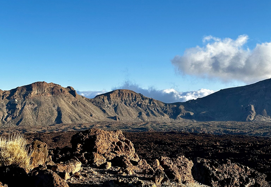
The starting point is Playa Del Socorro in Los Realojos in northern Tenerife. You’ll go through rural areas, farmland, and along remote roads. Eventually, you will stumble upon Las Cañadas del Teide, an area the Guanches used to store water, herd their livestock, and make tools out of volcanic glass.
As you approach the summit -- depending on the time of day you arrive -- you’re going to need a permit. Nighttime or early morning does not usually require a permit, but past eight or nine in the morning, you will need to purchase one. You can apply online, and it’s only a few euros.
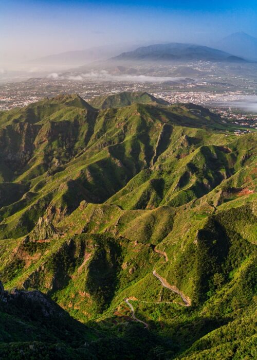
Anaga
Anaga was one of nine Guanche kingdoms (menceyatos) in Tenerife. Guanches were cave dwellers, and Anaga’s dense, ancient laurel forests and jagged mountains provided the perfect place to hide from the Spanish. Beneharo, one of the sons of Tinerfe (after whom the island is named), was a king of Anaga who tried to make peace with the Spanish.
In Anaga, I found a labyrinth of twisting, moss-covered tree branches and dense foliage. The thick canopy blocked most of the sunlight, casting the forest in an eerie dark green hue. The Guanches hid in these parts for good reason.
An ancient forest
Calling this laurel forest old is an understatement. It is approximately nine million years old and contains the most endemic plant species in Europe. Anaga's rugged terrain, shaped by volcanic activity, consists of ravines, sharp ridges, and coastal cliffs that have helped isolate and preserve a high level of biodiversity.
Among the most popular treks is the Sendero de los Sentidos (Path of the Senses). This part of the forest encourages hikers to engage their senses. The humidity casts the forest in a constant mist, the trees are so close together, and you can’t help but hear yourself think. Another favorite is the Chamorga to Roque Bermejo trail, with its panoramic views and ancient hamlets. Hikers can also take the Cruz del Carmen to Punta del Hidalgo trail, a descent from the heart of the forest to the coast.
The Anaga region encompasses 26 local villages and parts of the Santa Cruz de Tenerife, La Laguna, and Tegueste areas. In a small village called Afur, locals found a volcanic stele containing Guanche engravings, which are now in a local museum. The Guanches used the stone for mummification and funerary rituals, and it may have links to a Carthaginian deity, linking the Guanches to North Africa.
Cueva de Achbinico
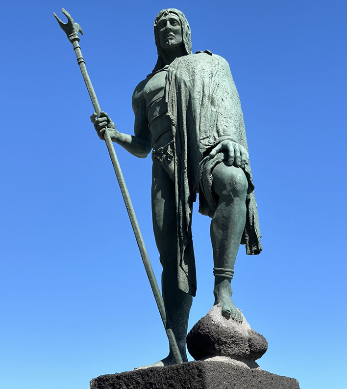
I almost did not make it to Candelaria, but after several wrong turns, I drove down to the Plaza de la Patrona de Canarias. There, nine bronze statues stand on volcanic rocks as if guarding the town against the roaring Atlantic waves. Each sentinel is the likeness of a Guanche king and faces the Basilica of Candelaria.
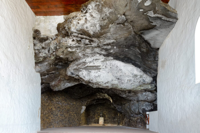
According to legend, before the Spanish conquest, two Guanche shepherds found a statue of the Virgin Mary floating in the water off a beach called Chimisay. They brought it to their king, who placed it in a cave to be worshipped as their goddess.
When the Spanish came, they found the statue, and eventually the town was named after its patron saint, the Virgin of Candelaria. A replica of the statue is located in the cave adjacent to the Basilica.
Pyramids of Güímar
Here’s where the Guanche story gets a little strange. The Pyramids of Güímar are six structures built from lava stone without mortar. They're not particularly high or even that impressive. However, this pyramid complex has sown division in the archaeological community.
Initially dismissed as simple agricultural terraces or piles of rocks cleared by 19th-century farmers, further investigation revealed their deliberate construction and possible ceremonial or calendrical functions. For believers, the pyramids are aligned with astronomical events such as the summer and winter solstices.
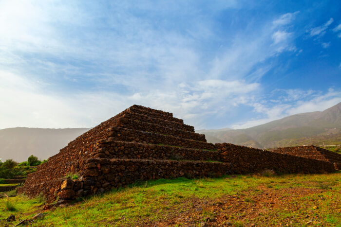
The debate about the pyramid's history started when an already controversial figure read about them in a newspaper article in the 1990s. Norwegian explorer Thor Heyerdahl made a name for himself thanks to unconventional ideas that he promoted through interesting nautical journeys in primitive boats. His Kon-Tiki expedition was not just revolutionary in demonstrating that ancient cultures and civilizations may have interacted, but also brought Tenerife into the international spotlight by noting potential links between the Canary Islands, Egypt, and pre-Columbian America. Heyerdahl thought the Guanches built the pyramids after interacting with people from Mesoamerica or Egypt.
Other archaeologists do not support this theory and attribute the structures to relatively recent agricultural activity in the 18th or 19th century. Despite this, Heyerdahl’s work led to the creation of the ethnographic Parque Etnográfico Pirámides de Güímar, a museum and cultural center that presents his theories alongside other information about pyramid-building cultures worldwide.
Cueva del Viento
If you get claustrophobic or easily spooked by the dark, the Cave of the Winds is not for you. The Cueva del Viento is one of the largest volcanic tube systems in the world and is located in Icod de los Vinos, below El Teide.
Formed by lava flows from the Pico Viejo volcano, the second-highest peak on the island next to El Teide, the cave extends over 17km. It features a complex labyrinth of passages and is known for its unique geological formations, including lava stalactites, terraces, and lava lakes.
The Guanches used these tunnels, and excavations uncovered artifacts and remains.
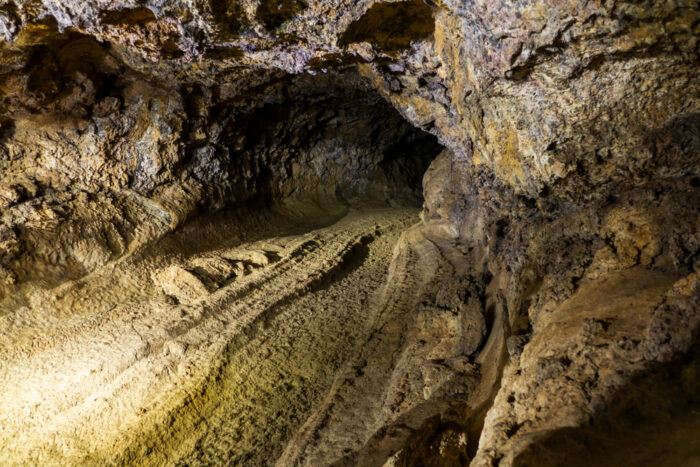
Archaeologists and paleontologists have found fossils of extinct animals, such as the giant lizard (Gallotia goliath) and giant rat (Canariomys bravoi) in the Cave of the Winds, providing insight into the island's prehistoric ecosystem.
Beyond the beaches and resorts of the Bahamas, Andros Island is the country’s best-kept secret. A hidden world of blue and black holes pockmarks the coastline and interior.
Andros has 200 blue holes, the highest concentration in the world. Blue holes typically occur around limestone. In the Caribbean, about 2.6 million to 11,700 years ago, sea levels were up to 120m lower than today. This exposed large areas of limestone bedrock to weathering and erosion. Slightly acidic rainwater seeped into the ground and slowly ate away the limestone, forming underground cave systems.
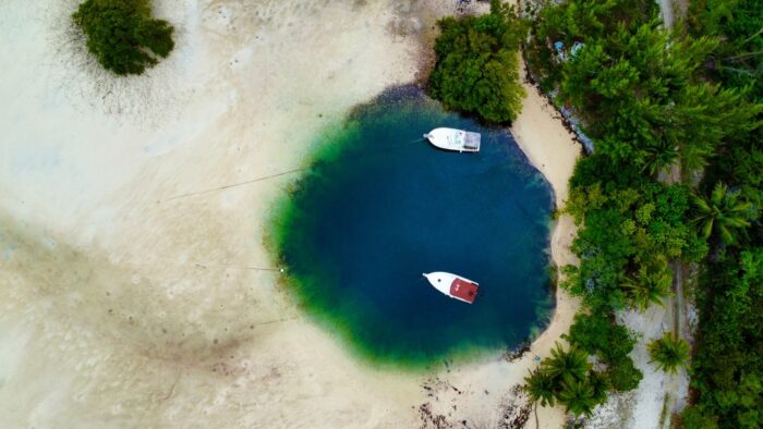
Some of these caves collapsed and formed vertical sinkholes. When the last ice age ended and glaciers melted, sea levels rose and flooded the sinkholes, creating deep, water-filled vertical shafts with a distinctive dark blue color. Some holes are even black; the color varies with the type of bacteria in the water, the amount of oxygen, levels of light absorption, and other factors.
Weathering and erosion created complex limestone formations and carved out underground tunnels that stretch for many kilometers. Divers flock to Andros to explore these labyrinths, with their stalactites and stalagmites, and dark, vertical shafts penetrating hundreds of meters.
Though it's the largest island in the Bahamas, Andros is the least developed. Sometimes, the holes hide in plain sight, off dirt roads and among mangroves. Access is not heavily regulated and is managed by the Bahamas National Trust. No fees or bookings needed. All you need is bravery and scuba equipment.
Some of the more famous blue holes include: Cousteau’s Blue Hole (named after Jacques Cousteau), Stargate Hole, Captain Bill’s Blue Hole, Uncle Charlie’s Blue Hole, Benjamin’s Blue Hole, and Rat Cay Blue Hole. They vary in depth but range from 30m to 60m.
Cultural connections
Historically, Andros was home to the Lucayan Indians, who lived there for centuries before Christopher Columbus arrived in the Bahamas in 1492. The Lucayans left traces of their civilization, including ceremonial sites and artifacts. These ancient remnants are part of the island’s spiritual connection with the earth and sea.
In the 1970s and '80s, legendary British diver Rob Palmer and his wife Stephanie conducted scientific dives in Andros's blue holes, stumbling upon Lucayan remains and a Lucayan canoe at the bottom of Stargate Blue Hole. Sadly, the canoe later disappeared from the site.
Centuries after Columbus, the transatlantic slave trade brought Africans to the Caribbean. They developed new legends about the blue holes, combining them with traditional African beliefs.
Writer Noelle Nicolls with Caribbean Beat explains that according to Yoruba elders, blue holes represent an ancient African water spirit known as Oshun Ololodi. While locals mostly associate Oshun with rivers and freshwater ponds, she is also the spirit of dams and reservoirs -- and thus indirectly, the blue holes in the Bahamas.
What's at the bottom of a blue hole?
Some locals believe that the Lusca, the Caribbean’s answer to the kraken, lies in wait for unassuming divers. The Lusca is a half-shark, half-octopus creature, though some accounts depict it as a giant cuttlefish, octopus, or squid. This cryptid is supposedly 20 meters long and can drag humans and even ships into the depths.
The first sighting of the Andros Island blue hole's monster was in 1836. An American captain told journalist Benedict-Henry Revoil that a kraken violently dragged two of his sailors into the ocean. One of the men chopped off an arm of the creature, which they presented to Barnum’s American Museum. Curators doubted its authenticity.
In 2011, a body with tentacles and a portion of a head reportedly washed ashore on Grand Bahama Island. However, this might have been just a rumor or tale; there was no evidence of this occurrence.
Explorer Josh Gates interviewed a local fisherman who saw the Lusca.
"We were fishing for dorado, and we happened to come across this strange animal," the fisherman told him. "I thought it was a whale shark, but getting within fifty feet of it, I found out it was a strange animal with tentacles and the head of a shark. The head was kind of similar to a mako shark, with a pointed nose. The tentacles were the last thing we saw."
It seems likely this folktale developed from sailors trying to explain deaths around the blue holes. The Lusca remains a popular tale in Caribbean culture and even inspired the cheesy sci-fi film Sharktopus.
In 1980, 19-year-old Peter Lambert was working aboard the MV Derbyshire, one of Britain's largest ships, transporting several thousand tons of iron ore from Japan. It was supposed to be his final trip on the high seas. He was already thinking about his life after this voyage, preparing for another job and planning to marry his childhood sweetheart.
Instead, the ship disappeared in a treacherous body of water called the Devil's Sea.
Local fishermen and the Japanese government call it ma no umi, meaning "the sea of troubles." For centuries, those who don’t respect it have risked catastrophe.
Off the Pacific coast of Japan, roughly 1,000km south of Tokyo, the Devil's Sea is close to the island of Miyake in the Philippine Sea.
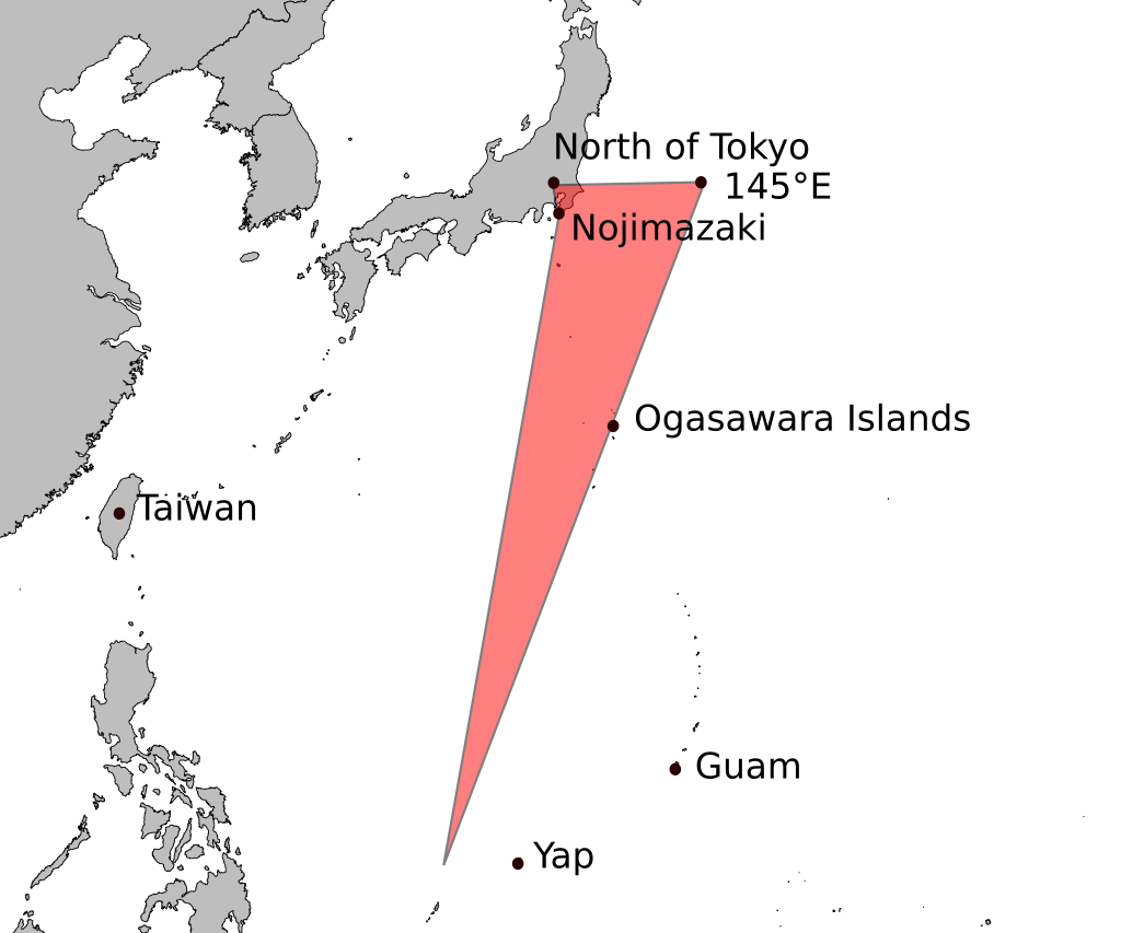
When you try researching this area, there is scant information. The Devil’s Sea is significantly less well-known than its counterparts, such as the Bermuda Triangle, the Alaska Triangle, and the Bennington Triangle.
The sea that saved Japan
The Devil’s Sea was key to one of Japan’s most significant battles. Between 1274 and 1281, Kublai Khan (grandson of Genghis Khan) sought to expand the Mongolian Empire and conquer Japan. Japan was rich in gold and had great trading power in East Asia. Kublai Khan was also a prideful man who felt slighted when Japan rejected Mongolian ambassadors. After conquering much of China and Korea, he wanted to add Japan to his collection.

But a sudden burst of devastating weather, which the Japanese call "divine winds," destroyed Kublai Khan's invasion force.
The defeat went down in Japanese history as a work of divine intervention. The typhoon appeared suddenly and was powerful enough to sink over half of Kublai Khan's fleet. The failed invasion force had been sailing along the western edge of the Devil's Sea.
The Japanese were not the only ones who believed that something dangerous and supernatural lurked in the water here. Chinese mythology speaks of dragons at the bottom of the Devil's Sea. Supposedly, these dragons stirred up unusual storms, waterspouts, violent currents, whirlpools, and rogue waves.
Over the centuries, fishermen reported glowing lights and water bubbling and spewing wildly. They claimed to see serpent-like creatures the size of boats. In the 1800s, sailors claimed to see a woman sailing a ghost ship.
More disappearances
In 1944, pilot Toshiaki Lang saw odd shapes over the water during a battle. Lang claimed to see a serpent with a long, winged body that poked from the water.
Between 1952 and 1954, five vessels went missing in the Devil's Sea. The Japanese government designated the area a danger zone.
One of the most famous incidents occurred in 1952. Japanese research ship Kaiyo Maru No. 5, carrying 31 crew, was completing oceanographic studies in the area when it disappeared without a trace. An extensive search turned up no wreckage, and the ship did not send any distress signals. As a result, Japanese authorities further limited ship traffic in this area.
An unofficial (and unconfirmed) statistic from paranormal writer Charles Berlitz claims that the Devil's Sea killed 700 people between 1952 and 1954.
On March 22, 1957, a U.S. flight left Micronesia for Tokyo with 67 military personnel on board. The nine-hour flight was routine, with clear weather and extra fuel onboard. For the first eight hours, everything proceeded as planned, but the aircraft never arrived.
In 1980, the MV Derbyshire met its end in the Devil's Sea while sailing from Canada to Japan. A powerful typhoon had developed off the coast of Japan, and although the ship was well-equipped to handle severe weather, the Derbyshire sent a final distress signal and then vanished.
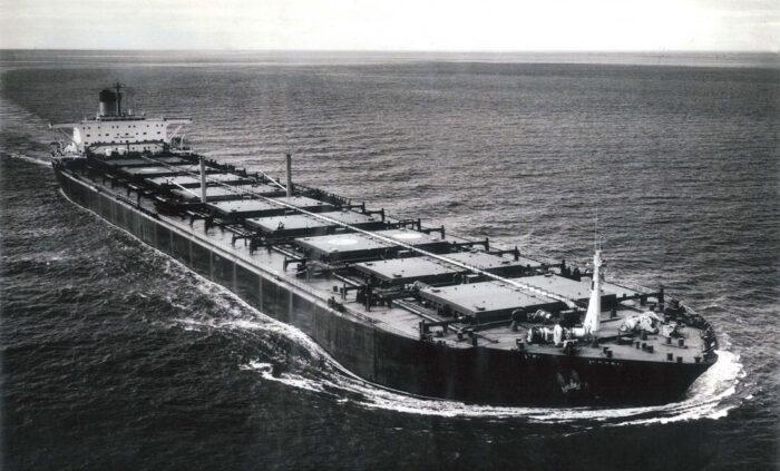
Authorities searched unsuccessfully for six days. Eventually, the 44 crew members were given up for dead.
In 1994, the wreckage was located at the bottom of the Pacific by shipwreck hunter David Mearns and his team. Their inspection revealed that the ship had likely sunk after a catastrophic structural failure caused by the violent storm. The tragedy led to significant changes in maritime safety regulations, particularly concerning ship design.
Explanations
A Nov. 11, 1952 newspaper report from The Canberra Times reported on one of the 1950s incidents:
United States Navy hydrophones on the California coast recorded the eruption of a Japanese volcano so clearly that scientists believe they know when it destroyed the Japanese hydrographic vessel, the Kaiyo Maru. The Kaiyo Maru was dispatched to study the Myojin Island eruption. It vanished with 31 people on board on September 24. The hydrophone graphs of sound waves carried through the ocean showed that at 12:20 pm, there was a tremendous explosion.
The Kaiyo Maru was investigating a newly formed volcanic island. By the time it arrived, the island had disappeared. The area was still tectonically active, and an underwater eruption likely destroyed the vessel.
The Devil's Sea lies within the Pacific Ring of Fire, a hotbed for volcanic activity, and a volcanic eruption can create powerful shock waves that can damage or destabilize a ship. Underwater eruptions, especially those involving the collapse of volcanic material or large explosions, generate massive waves or tsunamis. These waves can be large enough to overwhelm ships, capsize them, or cause severe damage.
Methane hydrates may have also played a role. Methane hydrates are crystalline compounds in which methane gas is trapped inside a lattice of water ice. These hydrates typically occur on the ocean floor, especially in areas of high pressure and low temperature, such as deep-sea environments. Methane hydrates are stable only under certain pressures and temperatures. If seismic activity changes these conditions rapidly, released methane can lead to rapid changes in water density and buoyancy. It can also cause turbulent currents that ships can't escape.
Vile vortices
"Vile vortices" is a pseudoscientific term referring to areas where strange or unexplained phenomena are said to occur. The term was coined by biologist Ivan T. Sanderson. He speculated that these areas were mysterious/paranormal places where unusual weather patterns or magnetic anomalies occur. Sanderson believed there are 12 vile vortices on Earth. These included the Bermuda Triangle, the Devil's Sea, and the Great Pyramid of Giza.
Magnetic anomalies could explain navigational difficulties reported by sailors.
Conclusion
Writer Larry Kushe, who wrote extensively about the Bermuda Triangle, had this to say about the Devil's Sea:
The story is based on nothing more than the loss of a few fishing boats 20 years ago in a 750-mile [1,200km] stretch of ocean over a period of five years. The tale has been reported so many times that it has come to be accepted as fact.
The most simple explanations are usually the correct ones. A combination of bad luck and volatile geography is most likely to blame for the fearsome reputation of the Devil's Sea.
On April 1, amateur metal detectorists Katarzyna Herdzik and Jacek Ukowski made a stunning discovery on a Polish beach. Their scanners led them to an ornate 24cm dagger covered in stars and crescent moons, approximately 2,800 years old. A few months earlier, outside Warsaw, a father and son came across a trove of rare 17th-century coins. These are just two of the many, many metal detector success stories out there.
Metal detecting is now a serious pastime for a growing number of people. Some great archaeological finds and treasures were turned up by those curious enough to poke around beaches, fields, and even waste lots. If you're one of these, this is your ultimate guide.
History
Metal detecting began in the 1840s, when Henrich Wilhelm Dove invented the differential inductor. Its four coils, glass tubes, and copper wiring generated an electric shock when near metal.
Years later, in 1881, Alexander Graham Bell used a more developed version of the inductor to try to locate a bullet lodged in President James Garfield's chest after he was shot by the deluded lawyer Charles J. Guiteau. Sadly, Bell was unable to find the bullet because of the metal bedsprings in Garfield's bed. Garfield died of infection before Bell could figure out why his device did not work.
It wasn’t until the 1920s that Gerhard Fischer and Shirl Herr, working independently, created their versions of the hand-held electronic metal detector around the same time. Fischer, who received the patent first, initially created an aircraft radio direction finder. But when metal objects started to affect a pilot's bearings, his focus shifted to finding the metals themselves. Fischer's version used radio frequencies to determine the direction in which certain metals were. Meanwhile, Herr sought to find objects through the "production of sound waves effected by the distortion of a magnetic field."
Herr’s version eventually made its way into the hands of the military, assisting Mussolini in recovering ancient artifacts. Richard Byrd also used it during his 1933 Antarctic expedition.
Fischer established a research lab bearing his name where he and his colleagues created the metallascope, a metal detector that became quite commonplace at archaeological sites, on the battlefield, and in construction to detect buried pipes.
How does it work?
In simple terms, a metal detector's coil generates an electromagnetic field. When a metal object is nearby, it reacts to the field and gives off a current. When this current distorts the field, the receiver coil (another coil in the detector) alerts the user with either a sound or a visual cue.
Some metal detectors today often have a discrimination setting, allowing the user to distinguish between metals, as well as a setting for the type of soil nearby. The most advanced models include GPS, Wi-Fi, and Bluetooth.
There are several types of detectors. If you're starting out, try a VLF (Very Low-Frequency) detector, which is the most common. These have a simple setup with two coils: one for sending signals and one for receiving them. With them, you can easily discriminate between metals, and you’ll have decent luck finding coins and jewelry. However, be prepared for an onslaught of bottle caps and unreliable results in highly mineralized or saline environments. You will need to adjust your settings accordingly.
More experienced searchers prefer a PI (Pulse Induction) detector. This uses pulse signals to penetrate the ground for deeper searches, even in mineralized and saline environments. If you're searching for old relics, this is the detector for you. Keep in mind that PI detectors may be more powerful than VLF detectors but do not discriminate between metals.
If you're looking for something specific, like searching for gold, a high-quality gold detector is your best option. Gold detectors can go deeper and withstand mineralization, but the cost can be challenging. In general, the price for metal detectors ranges from $250 to $2,000.
According to Metaldetector.com, some of the best on the market today are the Garrett ACE 400 ($339) for beginners, the Fisher F22 ($229) for all-weather conditions, and the Minelab GOLD Monster 1000 ($849) for gold. The XP Deus II ($1,449) ranks as the best all-around metal detector.
How to play by the rules
As with any hobby, there's a certain etiquette involved. Most countries have instituted rules for metal detectorists now that real treasure is commonly discovered. By law, you can't just waltz off with a hoard of priceless metals and historical artifacts. Please read the local or national laws before proceeding.
For example, the National Council For Metal Detecting in the UK states:
You must have the landowner's permission to detect on any land. This includes parks, public spaces, woods, common land and public footpaths! Permission must be from the landowner (and the tenant if the land is leased)....
...Never, ever detect on protected sites. Important historical sites are scheduled, giving them legal protection. It’s a criminal offense to detect on them and you will be prosecuted if caught. Sites of Special Scientific Interest (SSSI) are also protected because of nesting birds, protected wildlife or rare fauna and flora...
...In England, Wales and NI, the landowner owns any non-treasure item found on their land unless they agree otherwise...
The UK has the Treasure Act of 1996, which states specific criteria for what treasure is and the protocol for when it is discovered. The finder must report the treasure to the local coroner. Once it is analyzed and declared treasure by the Treasure Valuation Committee, the finder and/or landowner receives a reward that depends on the value of the treasure.

In Ireland, metal detecting is under strict control. According to the National Museum of Ireland:
The unregulated and inappropriate use of detection devices causes serious damage to Ireland’s archaeological heritage and is subject to severe penalties under the National Monuments Acts 1930 to 2014...
... It is illegal:
- to be in possession of a detection device at monuments and sites protected under the National Monuments Acts.
- to use a detection device to search for archaeological objects anywhere within the State or its territorial seas; without the prior written consent of the Minister for Culture, Heritage and the Gaeltacht.
In the United States, metal detecting is allowed, depending on state and local laws. For example, some state parks allow it, while others don't. All activities fall under the Archaeological Resources Protection Act, which states:
No person may excavate, remove, damage, or otherwise alter or deface or attempt to excavate, remove, damage or otherwise alter or deface any archaeological resources located on public lands or Indian lands unless such activity is pursuant to a permit...
In general, depending on the country, metal detectorists get a finder’s fee, which is either the total value of the treasure or a percentage of it. To preserve the artifacts for public viewing or archaeological study, they don't get to keep the treasure itself.

Success stories
Many of the greatest historical finds today have come thanks to metal detectors. The so-called "world’s greatest treasure hunter,” Mel Fisher, grew up obsessed with finding treasure. He and his family spent the greatest part of their lives searching for the shipwrecks of the famed 1622 Treasure Fleet, in which all 11 ships sank during a hurricane off the southeastern coast of Florida. Fisher and a friend developed a metal detector that was retrofitted from a World War II submarine detection device. He also created a "mailbox" contraption that was able to poke holes in the seafloor and scoop up anything that may be hiding beneath the sand.
He found over a thousand gold coins during one haul after almost a year. Though he acquired quite a bit of money from finding the gold, the money dried up fast as his obsession with treasure-hunting took him and his family beyond their financial means. However, the hard work eventually paid off.
In the early 2000s, he and a company called Aquasurvey created a large-scale metal detector/sled that scoured the ocean floor. It was around 540kg and managed to find silver bars, anchors, cannons, and other submerged relics. Fisher also found the treasure ships Nuestra Señora de Atocha and Santa Margarita. When Fisher and his team found the Atocha, they received 75% of $450 million after a lengthy court battle with the state. The remaining 25% went to the State of Florida.
The Staffordshire Hoard
In the UK, a metal detectorist named Terry Herbert found the famed Staffordshire Hoard, which contains 4,600 gold and silver objects and precious stones, while combing a field in Hammerwich. After reporting his find to the coroner, authorities excavated. The excavations took over three years to find all these pieces, which were worth $4.3 million.
The largest gold nugget ever found in the Western Hemisphere is the Boot of Cortez. An amateur metal detectorist found it in Mexico's Sonoran Desert. Resembling a boot and measuring more than 25cm high, the Boot of Cortez initially sold for a mere $30,000 because its discoverer did not recognize its true worth. It later sold at auction for $1.5 million.
At the height of the Great Depression, a crazy story had the city of Los Angeles abuzz. Three men with a digging permit, an odd invention, an old map, and an insane hypothesis effectively destroyed a historic hillside. They believed that beneath Los Angeles’s streets, there was a vast network of tunnels built by an advanced civilization of lizard people who’d been dwelling there in the depths for 5,000 years.
Background
Our story begins not in the City of Angels but rather in Middletown, Ohio. George Warren Shufelt grew up in a hard-working family of manual laborers. Choosing not to follow the same path, he chose a corporate job as a salesman in Indianapolis. But, though his career was stable, he yearned for more. He was passionate about inventions and had a keen interest in gold.
During the Great Depression, Los Angeles became a hotspot for those seeking fame and riches. Shufelt left for LA in 1933.
A radio X-ray and a failed hunt
Shufelt's obsession with gold prompted him to build a device that could supposedly detect gold and other minerals deep in the ground. He called it his "radio X-ray." This machine was a metal radio attached to a long glass cylinder containing a copper wire. Shufelt claimed he could tune into the frequency of the mineral, and the wire acted like a dowsing rod that pointed the way.
Treasure hunters Ray Martinez and Rex Irving believed in his invention and invited Shufelt to join them. Shufelt accepted, and the trio set out to acquire funding and a digging permit.
Martinez and Irving possessed an old map of dubious origin that supposedly showed the location of a treasure hoard from the Mexican-American War that was buried somewhere on Fort Moore Hill. The trio offered the board of county supervisors a cut of the treasure if they found it. After obtaining their permit, they began to bore holes into the hill.
They created a 15-meter shaft, but the radio X-ray was a bust. Eventually, excavations stopped indefinitely. But Shufelt refused to give up.
A rebrand
In 1934, he approached the county supervisors, attempting to rebrand his project. He claimed to have met a mysterious Native American chief named Little Chief Greenleaf (or L. Macklin) in Arizona. Supposedly, this chief told Shufelt the story of an advanced Native American civilization of lizard people who fled a devastating meteor strike and retreated underground. They built a subterranean city below modern-day Los Angeles. Shufelt claimed the lizard people used a chemical to carve out the tunnels and that their city held a thousand families, with hundreds of rooms laden with gold and precious stones.
Miraculously, this story convinced the board to give Shufelt another chance.
Journalist Jean Bosquet picked up the story, publishing an article titled Lizard People’s Catacomb City Hunted: Engineer Sinks Shaft Under Fort Moore Hill to Find Maze of Tunnels and Priceless Treasures of Legendary Inhabitants.
"Busy Los Angeles, although little realizing it in the hustle and bustle of modern existence, stands above a lost city of catacombs filled with incalculable treasure and imperishable records of a race of humans further advanced intellectually and scientifically than even the highest type of present-day peoples," Bosquet wrote.
Dead end
Shufelt returned to work and drilled to 75 meters. Soon, he claimed to have mapped the entire city, which looked like a big lizard, sprawling from Dodger Stadium to the Central Library. He also claimed to have detected massive golden tablets.
"All records were kept on gold tablets four feet long and fourteen inches wide," Bosquet wrote. "On these tablets of gold...will be found the recorded history of the Mayans, and on one particular tablet, the southwest corner of which will be missing, is to be found the record of the origin of the human race."
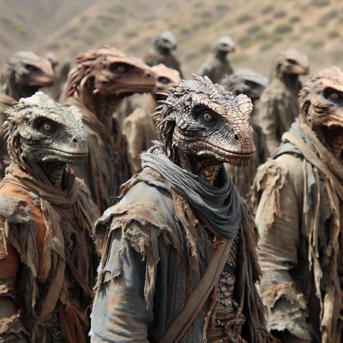
"[I have picked up] tunnels and rooms, which are subsurface voids, and of gold pictures with perfect corners...scientific proof of their existence," Shufelt said.
Shufelt and his team kept digging until they encountered mud and boulders that prevented them from continuing. With their funds drying up, Shufelt gave up in disgrace and abandoned the project.
He died in 1957.
No such legend
There is no record of a Native American legend about lizard people or of a Little Chief Greenleaf or L. Macklin. But the idea of an underground city in Los Angeles isn’t completely crazy. Los Angeles is home to hundreds of tunnels. During prohibition in the 1920s, these were used to smuggle alcohol.
Lizards were important symbols in some Native American cultures, so the story could have referred to an ancient people who followed a religious cult whose symbol was the lizard. However, it is far more likely that the story was fabricated entirely as an excuse to continue digging for gold.
As for advanced civilizations in California, Mount Shasta has a similar story. According to local legends, Mount Shasta is home to the survivors of Atlantis or Mu (another legend of a lost continent). Some people believed that Mount Shasta was also home to lizard people. Could Shufelt have taken inspiration from this story?
Lizard people run the world?
This story led to a larger conspiracy theory: that lizard people secretly run the world. According to David Icke, a British conspiracy theorist, the world's elite are shapeshifting reptilian-human creatures who control governments and economies. He believes figures like the British Royal Family, the Bushes, and the Rothschilds are reptiles. Many of Icke’s followers point to Shufelt’s story as evidence.
Conclusion
The legend of the LA Lizard City stems from Shufelt's desire for fame and fortune. Caught up in the Great Depression, people went to extremes to survive. For Shufelt, this meant inventions and tall tales. We have to hand it to him: It's quite the story.
By 1979, the Cold War had dragged on for 32 years. The nuclear ambitions of major world powers were held at bay by a treaty that banned atomic weapon tests in the atmosphere and underwater. Yet, in the wee hours on September 22, satellites picked up an exceedingly bright double flash in the South Atlantic.
Background
The bombings of Hiroshima and Nagasaki introduced a new weapon that could decimate life on Earth. For years after, the Cold War and the threat of annihilation hung in the air as countries scrambled for military supremacy.
Displays of power through nuclear tests like those of Castle Bravo or Tsar Bomba were both impressive and terrifying.
The Cold War featured secrecy, espionage, close calls, and intense fear. Thankfully, world leaders pulled back from the brink and placed restrictions on nuclear testing in the hope of curbing nuclear proliferation. In 1963, the United States, the United Kingdom, the USSR, and 100 others signed the Limited Test Ban Treaty.
The U.S. launched the Vela Hotel satellites to ensure that everyone complied with the rules. Their job was to detect nuclear detonations by scanning for x-rays, gamma rays, neutrons, and light. Together with satellites developed by the Defense Support Program (DSP), they scanned for nuclear activity.
The incident
Just before 1 am on Sept. 22, 1979, Vela 6911 detected a double flash, characteristic of a nuclear blast. The initial flash peaked in luminosity before declining with the shock wave. Then, it peaked a second time before declining again, all within a matter of milliseconds. The data determined the explosion was around three kilotons.
The point of origin was within a 5,000-kilometer radius between the Prince Edward and Marion Islands off the coast of South Africa, and the Crozet Islands in the sub-Antarctic, some of the most remote islands in the world. No one lives on these islands, but they sometimes host researchers.
There were no recorded eyewitnesses, and no one claimed responsibility.

The situation was puzzling. Vela 6911 was the only satellite to pick up the blast, and though the flash had most of the characteristics of a nuclear blast, it did not possess one crucial marker. There was no nuclear fallout or radioactive debris.
"The DSP satellites recorded no flash, and no radioactive debris was found. [However] a researcher at Arecibo recorded an ionospheric wave traveling in an anomalous direction that could have resulted from a nuclear test," Leonard Weiss, a researcher in International Security at Stanford University, explained.
The U.S. investigated, but aerial reconnaissance found no sign of fallout. The Naval Research Laboratory analyzed ocean data using hydroacoustic sensors designed to detect sound waves traveling underwater. Though the sensors are particularly important for detecting underwater detonations, they can also capture the acoustic effects of atmospheric nuclear tests if the explosion is powerful enough.
"The most probable test location was above shallow waters close to the remote South African Prince Edward Islands, some 2,200km southeast of Cape Town," Weiss wrote. "The satellite detection information remained secret for about one month before ABC reported it on Oct. 25, 1979."
Theories
U.S. President Jimmy Carter's administration was unpopular. Many Americans thought him weak both domestically and in foreign policy. Carter faced Soviet aggression overseas, tension in the Middle East, an ongoing energy crisis at home, and stagflation of the American economy. His 1980 reelection bid was looking bleak.
Evidence of a nuclear blast panicked Carter and the State Department. They hoped to deal with the issue secretly, but someone leaked it to the press soon after.
"There was indication of a nuclear test explosion in the region of South Africa, either South Africa [or] Israel using a ship at sea...At the foreign affairs breakfast, we went over the nuclear explosion. We still don’t know who did it," Carter wrote in his diary.
Then in February 1980, he wrote: "We have a growing belief among our scientists that the Israelis did indeed conduct a nuclear test explosion."
An Israeli test?
Was Israel responsible? The CIA believed that, by 1974, Israel possessed around 20 nuclear weapons.
The most widely accepted theory about the Vela Incident is that Israel and South Africa were co-responsible for the nuclear explosion. During the Cold War, both countries were isolated for different reasons. Israel was concerned about regional security and the Arab-Israel Conflict. South Africa, under apartheid rule, considered nuclear weapons a means of securing its political position on the world stage.
South Africa had been developing its nuclear program in secret since the 1960s. There are eight major uranium deposits in South Africa, and the country made a deal with Israel: they would provide uranium while Israel assisted with research and construction.
Commodore Dieter Gerdhart, a high-ranking official in the South African navy (who was also moonlighting as a Soviet spy), claimed to have witnessed multiple clandestine military exercises between South Africa and Israel. In 1994, he told the Johannesburg City Press that the Vela incident was part of a secret operation between the two countries called Operation Phoenix.
However, experts deemed Gerdhart an unreliable source because he was both a spy and unable to back up his claims with evidence.
Ultimately, no country was blamed for the Vela incident. Carter and other leaders simply turned the other way, hoping the problem would disappear.
Alternative theories
Some classify the Vela Incident as a "zoo event." A zoo event is a false signal or mimic of a nuclear explosion. Natural phenomena like micrometeoroid impacts or even something as trivial as sunlight reflecting off the satellite can cause zoo events. Micrometeroids are not uncommon, but the probability of them hitting one of the satellites is one in a billion. If it was sunlight, why wasn't the phenomenon replicated afterward?
In May 1980, Jack Ruina of MIT brought together a team of eight scientists to try and explain the incident.
"We consider the alternative explanation of the September 22 signal as light reflected from debris ejected from the spacecraft as reasonable, but we do not maintain that this particular explanation is necessarily correct," Runia said.
There is also the possibility that the satellite malfunctioned. Vela satellites had a short shelf life of approximately seven years, and the U.S. launched the DSP satellites to replace them.
In 1967, the Vela satellites documented the world's first evidence of gamma-ray bursts. Gamma radiation is part of the nuclear explosion process, so perhaps events occurring in deep space were mistaken for a nuclear explosion on Earth.
Vela incident proved by sheep?
There was a breakthrough in the case in 2017. Professor Lester Van Middlesworth found that sheep in southeastern Australia carried the nuclear fallout marker iodine-131, dated just days after the Vela incident.
Van Middlesworth found Iodine-131 in the sheeps' thyroids. The blast may have been a low-level detonation that did not create enough fallout for a satellite to detect from orbit, but just enough to show up in these sheep.

By 2003, the U.S. National Security Council was confident enough to state with "high confidence" that the Vela incident was a nuclear explosion.
All these years later, no country has claimed responsibility.
I'm a severe claustrophobe. After getting trapped in a slide in my local McDonald's at five years old, I swore off all tight and dark spaces forever. So it's not entirely surprising that I couldn't get the images of rushing, rising water and tunnels almost impossible to squeeze out of my mind when reading about an expedition to Veryovkina Cave in National Geographic.
This dramatic escape from death took place in September 2018. A Russian expedition, accompanied by two British cave photographers, descended into the depths of one of the world's deepest caves in the remote Gagra Mountains of Abkhazia in the Caucasus. What was meant to be an exciting venture to further map and determine the cave's depth and to evaluate life in extreme conditions turned almost fatal when a dangerous flood threatened to drown the explorers. Because of this, many believe it is one of the most dangerous caves in the world.
Background
Veryovkina Cave is located in the Arabika Massif, which is part of the Greater Caucasus Mountain Range and extends across several countries, including Russia, Georgia, and Azerbaijan. The Caucasus Mountains were formed primarily due to the collision between two tectonic plates, the Eurasian Plate and the Arabian Plate.
The Arabika Massif itself formed during the Miocene Epoch when the Eurasian Plate moved south and pushed against the Arabian and African Plates. The rock that was being folded, uplighted, and faulted was predominantly limestone.
Over millions of years, rainwater, slightly acidic due to dissolved carbon dioxide, has slowly eroded the limestone of the Arabika Massif, forming an extensive karst landscape containing some incredibly complex and deep cave systems, sinkholes, and long underground rivers. The Arabika Massif has four of the world's deepest caves: Krubera-Voronja, Veryovkina, Sarma, and Snezhnaja.
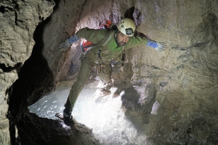
It wasn't until 2018 that the cave really started to make waves in the spelunking community. Why was this?
Though Veryovkina Cave is the second deepest at a whopping 2,212m, its discovery was a complete accident. Let's begin at its entrance: a rather small and unassuming hole in the ground.
The slow descent
The exploration of Veryovkina Cave proceeded slowly. It took over 50 years and 30 expeditions to fully determine its depth. In 1968, cavers from Krasnoyarsk, Russia, found the cave's entrance, a tiny cross-section measuring three by four meters. Though they managed to descend to 115m, they had absolutely no idea how far this subterranean monster went. Almost two decades later, from 1982 to 1986, members of Moscow's Perovo Speleoclub made several expeditions and slowly but surely pushed to a depth of 440m. Then came the fall of the Soviet Union and all the turmoil as people tried to survive hyperinflation and their new reality. It wasn't until 2000 that expeditions started back up again.
From 2000 to 2016, the Perovo teams continued to do small expeditions, finding new shafts and new passages and eventually pushed to a depth of 1,350m. In 2017, they got to 2,151m and happened upon 17km of horizontal tunnels and passages.
Because of the extreme depth and to make exploration easier and safer, a permanent multi-camp system has been set up, much like how it is on Everest each spring. Camp One is on the surface, Camp Two is at 600m, Camp Three at 1,000m, Camp Four at 1,350m, Camp Five at 1,900m, and Camp Six at 2,100m. There is also a cable system for communication. At the bottom, there is a turquoise lake 28m deep. To reach it takes roughly four days and eight hours between each camp.
Exploring Veryovkina Cave is a perilous undertaking due to its extreme depth, narrow passages, and unpredictable conditions. Temperatures drop below freezing, and humidity is 100%.
2018 to 2021
The cave gained international notoriety from 2018 to 2021, when two major incidents occurred. In September 2018, the Russian Perovo Speleo cavers returned there. Its members were Pavel Demidov, Petr Lyubimov, Konstantin Zverev, Andrey Shuvalov, Evgeniy Rybka, Andrey Zyznikov, Roman Zverev and Natalia Sizikova. Also tagging along were well-known cave photographers Robbie Shone and Jeff Wade. Though the photographers were not as experienced with a cave of this magnitude, they knew how to hold their own.
The expedition went according to plan. On day seven, they were making breakfast. Two members, Roman and Natalia, had to leave early to get to the airport for a flight. However, everything took a dark turn. The team noticed water starting to pour into the cave because of a storm on the surface.
This wasn't just a trickle, it was a flood pulse. A flood pulse refers to a temporary increase in the flow of water within a cave system, typically caused by heavy rainfall, snowmelt, or upstream flooding in a connected underground river or stream. This pulse of water can lead to the temporary flooding of passages, chambers, and subterranean water features within the cave. Alarmed, they sent a message to the team below via their cable system. The flood pulse would take 30 minutes to reach the bottom.
At first, the Russians seemed unbothered by the waterfall starting to form, although the sound of its approach shook the cave and was like thunder. However, they'd experienced similar flood pulses many times, and they do not usually last long or turn deadly. Their camp was a decent distance from the water, anyway. However, this calm demeanor changed to terror within a couple of minutes.
'His white face said it all'
In Robbie Shone's article for BASE Magazine, he described what happened next:
The water rose so fast it was impossible to tell how quickly it was rising. Petr checked the hole once again, and as he turned around his white face said it all. The three-meter-deep hole was now full of surging, rising water...
...the most enormous torrent of white water appeared out of this hole, and I just stood opened-mouthed at the sight of this huge white wall of water entering out little home.
The water table was rising so fast that they had little time to pack their gear and hurry to the vertical ropes.
“One must have an extremely high level of physical endurance to ensure a sufficient margin of safety. When something goes wrong in a very deep cave like Veryovkina, you need to act fast. It’s crucial that you haven’t used all your reserves up just getting to the bottom of the cave. In mountaineering, the most dangerous part of the climb can be the descent, and in a big cave the most challenging part can be getting out again.”
They took only essential equipment and had no choice but to leave expensive, heavy equipment behind. The passages, chambers, and bridges they crossed previously were now underwater. Robbie Shone and Jeff Wade climbed up the vertical shaft first. The whitewater poured over their heads and they were barely able to breathe. They ascended agonizingly slowly but managed to get to an outcrop beside the flow of water. Thankfully, the Russian team met up with them, and the expedition made it out alive.
A 2020 victim
Veryovkina did not claim anyone's life that day but eventually did in 2020. In November, hikers found a rope and personal effects at the cave's entrance. Entering the cave without permission is not allowed. Suspecting someone was down there, a group of cavers contacted the authorities, then descended to investigate. They found a decomposed body hanging from the rope at around 915m.
In August 2021, they recovered and identified the body as Sergei Kozeev, an adventurer from Russia. An avid outdoorsman, Kozeev had said goodbye to his family to go on an expedition. As usual, he did not tell them where he was going. Then one day, he didn't come home. A missing person's report was filed, and even after the body was found, it took months for authorities to make out what had happened. They determined that he ran into difficulties, could not move, and eventually died of hypothermia.
Note that Veryovkina is not the deepest cave in this challenging system. Its sister cave, the Krubera-Voronja, is deeper still, at 2,256m.
I've long been a big fan of Greek mythology and all the wondrous beasts that tested, and sometimes bested, mythical heroes. One such creature was the chimera, a grotesque hybrid of a lion, goat, and snake. But chimeras are not only fairy tales or figments of an overactive ancient Greek imagination.
A chimera is an organism with two different genetic materials or DNA, often resulting in unusual physical characteristics and genetic mutations. Scientists can create chimeras, or they can occur naturally.
Chimerism in humans
Though rare, chimerism in humans can emerge as early as conception. While pregnant, a mother and baby exchange DNA, making them "microchimeras."

Chimerism also occurs when two embryos fuse. This is called twin chimerism or the "vanishing twin phenomenon." The resulting individual takes on cells from both embryos, resulting in a mixed genetic makeup. The baby that's born usually displays one or more of the following: different-colored eyes, mixed skin tones or birthmarks, patches of hair with different textures, or both male and female genitalia.
Sometimes, twin chimerism can make DNA testing difficult, particularly paternity and maternity tests. If a father or mother is a chimera, there is a chance that the DNA of his or her vanished twin could pass to a child.
Chimerism can also save lives. If someone has a blood transfusion or an organ transplant, they take on some of the DNA of the donor. The same goes for bone marrow transplants. If the transplant is successful, the donor's stem cells migrate to the recipient's bone marrow, where they produce blood cells. As a result, their cells and blood type will change.
Chimerism is not always obvious, and many people pass through life not knowing that they are an anomaly.
Human-ape hybrids?
In the 1920s, Soviet biologist Ilya Ivanov created a stronger and more resilient horse using artificial insemination. He aimed to increase agricultural production. He also created animal hybrids, like the zeedonk (zebra-donkey) and zubron (bison-cow).
After these successes, Ivanov turned his attention to creating a race of human-ape hybrids. Ivanov appealed to the Soviet government and received a grant of $10,000 to prove Darwin's theory of evolution. He took his venture to French Guinea, where he inseminated local women with chimpanzee sperm without their knowledge. He led the women to believe it was a medical exam.
His horrific experiments did not work, and he was disgraced. Eventually, the Soviets exiled him to Kazakhstan, where he died in the early 1930s.

Allegedly, another set of chimera experiments occurred in China in the 1960s. Unconfirmed reports from the Wenhui Bao newspaper stated that Chinese scientists succeeded in impregnating a female chimp with human sperm. According to a scientist quoted in the paper, the authorities arrested the scientists during the Cultural Revolution, and the chimp died of neglect.
Other human-animal hybrids
In the 1980s, Stanford University scientists injected mice with human stem cells to try to develop a human immune system in them.
In 2020, scientists at the State University of New York at Buffalo and Roswell Park Comprehensive Cancer Center successfully implanted human stem cells into a mouse embryo. The mouse had 4% human cells, the highest percentage ever achieved. Over two weeks, the embryo developed human eye cells and red blood cells. Scientists hope to treat diseases with the cells.
In 2003, scientists in China created a hybrid embryo using human and rabbit cells. The purpose of the experiment was for the rabbit to grow human organs, cells, or tissue to harvest for transplants. They also inserted human cells into pig embryos, hoping that the pigs' kidneys would have human cells.
Most recently, experiments by Juan Carlos Izpisua Belmonte and his team at the Salk Institute created a human-monkey chimera embryo. It took four years, and the embryo successfully grew for a few days before the team destroyed it. His team also produced a rat-mouse hybrid by injecting stem cells from rats into mouse embryos.
Ethical concerns
Researchers believe that hybrids can provide us with organs for transplants. Others think they could hold the key to curing diseases like AIDS, Parkinson's Disease, Hepatitis, or neurodegenerative diseases.
By introducing human stem cells into developing ape embryos, scientists hope to investigate the similarities and differences between species. This could help unlock breakthroughs in regenerative medicine, organ transplantation, and the evolution of certain traits.
Rats and mice are often used in genetic research because they have surprising similarities to humans in immune system structure, genetic makeup, and physiology.
Transplant waiting lists can be extremely long. It can take many years before a prospective patient reaches the top of the list. So, for many, the natural reaction to chimera experimentation is favorable.
However, bioengineering also raises ethical concerns. If scientists created a successful human-animal hybrid, would it be entitled to human rights? Does "playing God" with chimera experiments carry unforeseen consequences? The topic is controversial, and most governments place restrictions on chimera experimentation.
Conclusion
Most governments don't allow scientists to inject animal cells into a human or human embryo to respect the dignity of human life. However, scientists are permitted to inject human cells into animal embryos. These embryos are not carried to term and are usually destroyed after the experiment is finished. Because these experiments are controversial, researchers usually do not have access to public funding.
I first encountered the word “Thule” in college while pouring over beyond-old world maps in class. I thought nothing of it for the next few years until I stumbled across the word again, this time in an obscure mythology page on Facebook. Whether it was a happy accident, coincidence or divine intervention, it is a story wanting to be told.
As a mythical place, Thule is less known than its other Greco-Roman counterparts like Atlantis, Hyperborea, or Lemuria. However, that has not stopped it from forever cementing its place in the minds of classical navigators and today's arctic aficionados.
An accidental discovery
Our voyage begins around 330 BC with a tale of a man who ventured beyond the known world and into a land of frigid cold, strange seas and even stranger people. His name was Pytheas, and he decided to explore beyond his native Massalia (modern-day Marseilles in France).
Pytheas was a scientist, astronomer, and navigator with a unique mission: to search for amber, tin, and gold. Amber was an extremely valuable substance used in medicines, religious practices, jewelry, and most importantly, trade. Tin and gold served many purposes, including weapons. As a Greek colony and trading hub, Massalia served the western Mediterranean, so finding priceless items like these was a priority.
After leaving Massalia, Pytheas sailed through the Pillars of Hercules (Gibraltar) and into the perilous Atlantic to the north, hugging the Atlantic coast of Europe. Then, he discovered a new, cold land with a very rugged coastline measuring over 40,000 stadia (over 7,200km).
This was Britain, and he was the first Greek to set foot on its shores. He was the first Greek to sail to Northern Europe at all. Pytheas took the opportunity to traverse the land itself on foot, witnessing the tin mining activities of the natives on the Cornish coast and traveled as far as the Orkney Islands. After Britain, he continued north for six days, looking for more of these lands. Little did he know that things would take a strange turn. He says:
Neither earth, water, nor air exist separately, but are a sort of concretion of all these, resembling a sea-lung in which the earth, the sea, and all things were suspended...
...there are no nights during the solstice when the sun is passing through the sign of Cancer and also no days during the winter solstice...
'Congealed' sea
For someone from the Mediterranean, this was a never-before-seen, alien phenomenon. Not only was the sea "congealed", but it was immensely cold and full of mist. However, when he came out of the fogbank, he saw it was a land of "endless splendor" as he further observed that the sun hung in the sky perpetually.
The people who lived there were very tall, strong, pale, blond-haired, and wise. They survived on fish, possibly seals, herbs, fruits, and millet and even had a popular drink made of grain and honey. They had technologies like tools and boats.
After this groundbreaking discovery and subsequent expeditions by Greeks and Romans alike, the land became known on maps as "Thule," meaning beyond the borders of the known world. The Romans took it a step further by calling it Ultima Thule, which further exaggerated its remoteness.
There is a lot to unpack here and lots of substantial clues as to where this mysterious island could be. Pytheas originally documented his voyage in a work called On the Ocean. However, it is long gone. It fell victim to the fires that engulfed the Library of Alexandria. His writings are forever lost, so we would have to settle with the bits and pieces found scattered in the works of his contemporaries and writers thereafter. This became a problem.
A 'falsifier'?
Not everyone in the classical world believed Pytheas found an idyllic northernmost land. Some contemporaries who relayed Pytheas's story just didn't buy it. In fact, they conveyed outright hostility and defamed Pytheas as a "falsifier" and opportunist. His main critics, Strabo and Polybius, did not believe that Pytheas even went to Britain. In a commentary from Strabo, he says:
Pytheas, by whom many have been misled; for after asserting that he traveled over the whole of Britain that was accessible, Pytheas reported that the coastline of the island was more than forty thousand stadia, and added his story about Thule...
...For not only has the man who tells about Thule, Pytheas, been found, upon scrutiny, to be an arch-falsifier, but the men who have been to Britain and lerne [Ireland] do not mention Thule. . . . However, any man who has told such great falsehoods about the known regions would hardly, I imagine, be able to tell the truth about places that are not known to anybody...
'Impossible,' said critics
Strabo refused to acknowledge that such a sea existed, let alone a people who could grow food in such a climate. Polybius believed Pytheas made geographical errors and that sailing along the northern European coastline was virtually impossible. This is most likely because no one ever thought a Greek could reach so far.
But despite the controversy, Thule was a reality. In the 2nd century AD, Dionysus visited Thule and experienced the same perpetual sunlight that Pytheas had described. Roman figures seemed to be more forgiving than the Greeks, further bolstering Pytheas's claims.
The Roman historian Tacitus (56–120 AD) mentioned Thule in his work Germania, where he describes it as a land of great cold and darkness beyond the reach of Roman authority. He said the crew sighted it somewhere beyond the Orkney Islands.
In Pliny the Elder's Natural History, he catalogs Thule as lying six days north of Britain and a land of "no nights at all." In the 3rd century AD, historian Gaius Julius Solinus stated that Thule was "fruitful and abundant in the lasting yield of its crops." After him came Servius in the fourth century, who said Thule was just after the Orkney Islands. Roman poets Claudius and Celius Cetalicus spoke about its strange inhabitants being painted blue. The poet Virgil famously stated:
There will come an epoch late in time when Ocean will loosen the bonds of the world and the earth lie open in its vastness, when Tethys will disclose new worlds and Thule not be the farthest of lands.
The list goes on, and Thule had its place in the world. It even became interchangeable with the very similar myth of Hyperborea. The question that remained was, where exactly is it?
Theories
In later centuries, especially during the Middle Ages, Thule became only a symbol of the unknown north. Some scholars believe Pytheas may have been referring to Iceland, given the description of a land north of Britain that experiences long summer days. Others suggest that Thule could refer to Scandinavia in general. Our biggest clue is that the land has no nights, which narrows us down to Norway, Sweden, and Iceland.
The "congealed sea" resembling a "sea-lung" also gives us an idea. A sea-lung was an ancient term for jellyfish. A type of substance that looks like a jellyfish would be either new sea ice or pumice. Both exist in the Arctic Circle near Iceland, with its many volcanoes.
Classicist H.J.W. Wijsman at the University of Amsterdam suggested that Thule was the Shetland Islands, which lie halfway between Orkney and Norway. They experience long days of sunlight and pancake ice. However, the Shetlands are too close to Britain to be six days north. Six days suggests either Norway or Iceland.
That should solve it, right? Wrong. There's another piece to the puzzle: the inhabitants.
Slain Scots
In his writings, the poet Claudius said:
Thule was warm with the blood of Picts; ice-bound Hibernia [Ireland] wept for the heaps of slain Scots.
This detail has made many believe that Thule was actually Scotland since the Picts were its native inhabitants. Celius Cetalicus claimed the natives were painted blue, which the Picts infamously did. We do not know much about what eventually happened to the Picts. They seemed to have vanished completely except for a few archaeological remnants here and there.
Historians do not even know their origin story. Did the Picts originate from Thule and migrate to the British Isles? A clue from Eustathius of Thessalonica could help. He wrote that the inhabitants of Thule were at war with dwarves living in the inner earth. Therefore, they had to flee to nearby lands in the region. This oral tradition continued in the writings of another scholar, Geoffrey of Monmouth, who suggested that dwarves invaded the British Isles in the distant past.
Some offer a more straightforward hypothesis than a dwarf invasion from the center of the Earth. Because Thule seems likely to have been either Scandinavia or Iceland, the blond-haired, tall inhabitants might be Vikings. A Byzantine Greek princess and historian named Anna Komnene explicitly wrote that the Vikings came from Thule. They seem to fit the descriptions, and the Vikings were seafarers, after all. This brings us to our next chapter in the story: the island of Smøla.
Smøla
At first glance, there isn't much here. The Norwegian island of Smøla has a population of just over 2,000 people and a handful of modest wooden houses surrounded by frigid waters. But tourism is bustling since it is being marketed as the lost island of Thule.
In a study done by the Technical University of Berlin, researchers used ancient Greek and Roman maps to determine Thule's location. Taking into account the ancient world's tendency to over or under-estimate distances, they somehow managed to zero in on this small island. One of the researchers told a local Smøla journalist:
About this old information, there cannot be an doubt anymore…You live on the mystic island of Thule.
Local politicians and leaders in the community agreed.
A dubious symbol
Thule became an important symbol for explorers and even some evil characters. Thule played a central role in Nazi Germany’s occultist beliefs. During the early 20th century, a group of German occultists and nationalists formed the Thule Society. It believed that Thule was a lost homeland of the Aryan race. The society was influential in the early stages of the Nazi Party. Although it did not find any physical evidence of Thule, its name became associated with esoteric ideas and racial myths.
Modern scientific expeditions, such as those focusing on Greenland and the Arctic Ocean, continue to push the boundaries of our understanding of the Earth’s polar regions. The Thule Air Base in Greenland (now officially called the Pituffik Space Base), operated by the United States Air Force, is a symbol of the real-world presence of human activity in the remote Arctic, once thought to be beyond civilization’s reach.
Its name carried on to places like Thule Island in the South Sandwich Islands and the Thule people (ancestors of the modern Inuit). However, they have nothing to do with the actual myth.
One thing is certain: more attention must be paid to the inhabitants, particularly the Picts. There is a clear gap in their story and the very random mention of them by Roman scholars. If the Picts originated from Thule, this would unlock a vital part of Scottish history that we did not know existed.
It is a cheesy B-movie, an iconic X-Files episode, and possibly the best-known World War II legend alongside the Nazi Gold Train. From coded letters and strange deaths to teleportation, the Philadelphia Experiment bursts with mystery and intrigue.
Mysterious letters
Our story begins in 1955. Morris K. Jessup was a jack of all trades -- an astrophysicist, mathematician, professor, car parts salesman, photographer, archaeologist, and ufologist. Despite some wild ideas, he was highly respected. His magnum opus, The Case for the UFO, proved popular and drew the attention of readers from all walks of life, including the U.S. government.
In January of 1955, Jessup received some odd letters from a mysterious man named Carl Allen. The unsolicited letters detailed a peculiar incident in the Philadelphia Naval Shipyard involving a ship called the USS Eldridge.
The letters were exceedingly strange. They included multiple errors, randomly underlined text, haphazardly capitalized words, and variations of Carl Allen's name (sometimes referring to himself as Carlos Miguel Allende). Additionally, the letters included a random grouping of letters and numbers with no context. There was a return address:
Road No.1
Box 223
New Kensington
Pennsylvania
Allen closed his letters, rather rudely, "Disrespectfully yours…"
The details
Supposedly, in October 1943, Allen was working on a ship called the SS Andrew Furuseth when he and several others witnessed a strange green glowing fog. The fog enveloped the USS Eldridge and the ship disappeared and reappeared within a span of a few minutes.
Allen wrote that the vessel was rendered invisible and teleported to Norfolk, Virginia (some 480km away) by the U.S. Navy. According to Allen, when the Eldridge disappeared, it looked like something was still floating on the surface of the water. The green glowing fog around the vessel was supposedly a force field that caused it to disappear.
Allen believed that the U.S. government had solved the "unified field theory" and put it into practice. Albert Einstein worked unsuccessfully on the unified field theory for much of his career after the relativity breakthrough. The unified field theory sought to reconcile the four fundamental forces of nature (gravitational force, electromagnetic force, strong nuclear force, and weak nuclear force) into one theoretical framework.
Einstein theorized that if you could reconcile these forces, humanity would be able to achieve things we consider science fiction. We'd be able to control matter, control gravity, create wormholes, and manipulate time and space. According to Allen, the U.S. government had achieved this and successfully teleported the ship.
But Allen also heard screams. When he boarded the ship, he discovered many of the crew members had suffered horrific deaths. Others were violently ill, had limbs fused with the ship, or had gone crazy.
Allen claimed this was part of a top-secret experiment called Project Rainbow. However, when Jessup tried to contact Allen for further details, there was no reply.
Another surprise
Later, the Office of Naval Research (ONR) also received a mysterious package from Allen with a note attached saying "Happy Easter." The package included Jessup’s book The Case for the UFO, cryptic notes, and scribbled math and physics equations.
Unable to track Allen down, the ONR decided to enlist Jessup's help to solve the mystery since his book was at the center of the case. Jessup and the ONR confirmed that the handwriting from Allen's letters to Jessup and the package note were a match. But the return address found on Jessup's letters was a dead end. All the ONR found was an abandoned house.
Yet, for conspiracy theorists, this is evidence that something strange happened in Philadelphia. If the ONR were pursuing this, it had to suggest there was some truth to the story. If it wasn’t true, wouldn’t the Navy have ignored the package?
The U.S. government denies the entire story.
Jessup's death
Jessup died suddenly in 1959. He was found in his car, having died from inhaling toxic fumes from a hose connected to the car’s exhaust pipe. He was in financial trouble, with his books failing commercially, and his wife had left him. Though relatives and friends deemed him suicidal in his last days, others thought differently.
Some sources state that he was not yet dead when police found him. He was not taken to a hospital, and no official autopsy was performed. His death was ruled a suicide. However, there was no suicide note, prompting conspiracy theorists to suggest he was killed.

A cover-up?
The Philadelphia Experiment story refused to go away. Conspiracy theorists insisted for decades that the U.S. military covered it up. There was enough interest that the ONR published an official report/information sheet in 1996 on the scientific impossibility of what some claimed this unified field theory enabled them to do.
The ONR also stated that the Eldridge was never in Philadelphia and that "the archives has a letter from Lieutenant Junior Grade William S. Dodge, the Master of the Andrew Furuseth in 1943, denying that he or his crew observed any unusual event while in Norfolk."
The ONR did admit to investigating the package but explained that the investigation was led by two officers who found the case fascinating.
The Eldridge's logs say it remained in the New York harbor until November 1, and it was part of a larger convoy. On November 2, it entered the Naval Operating Base in Norfolk. It sailed between Norfolk and New York Harbor until December 31. While it was briefly in Norfolk, it did not teleport there and did not arrive there in October. As for the Andrew Furuseth, it traveled from Norfolk to various locations in October.
If there was any experimentation going on, it might have been the Navy testing a new technology that could cloak or render a vessel invisible to radar. This is called degaussing, which refers to the process used to reduce or eliminate unwanted magnetic fields. With a ship or submarine, degaussing helps mask its presence.
As for the green glowing fog, this could be a case of St Elmo’s Fire (a common occurrence on ships) or green lightning.
The real Carl Allen
Carl Allen was a real person. An article in Fate Magazine by Robert A. Goermen, an investigative writer on the weird and unexplained, revealed that he lived in New Kensington, Pennsylvania (Allen's return address).
Goermen tracked Allen's latest address to New Mexico and interviewed relatives who described him as a "master leg-puller." Allen was a known prankster with a flair for the theatrical. A relative stated that Allen was "a drifter, he reads continually but the information gets all twisted somehow."
Allen might have had mental problems that could have stemmed from his service in the U.S. Navy during WWII. He was in the Marines but was dismissed in less than a year. In his letters, the random sequence of numbers and letters next to his name turned out to be his ID. He did work for the Navy as a merchant mariner.
Eventually, Allen did make himself known to authors and interviewers. He had a bizarre habit of showing up and relaying the story with conviction before retracting it and declaring it a hoax. He did this several times. According to author Konstantinos Delimpasis with e-telescope.gr, he provided information about the experiment to paranormal authors Ivan Sanderson and Brad Steiger for their books Uninvited Visitors and The Allende Letters, respectively.
However, he later approached the Aerial Phenomena Research Office in Tuscon, Arizona and admitted he had made the story up. He also allowed authors William Moore and Charles Berlitz to interview him in 1979 for their book The Philadelphia Experiment and retracted his confession.
It seems likely that he was wasting everyone's time. Either Allen wanted attention or had legitimate mental problems.

Robert Eggers' film Nosferatu has renewed interest in vampires. Folklore about them abounds, and their presence -- or preventing their presence -- used to be a real concern. Some archaeologists refer to mysterious graves around Europe and North America as "anti-vampire" burials. These feature iron stakes through hearts, decapitations, sickles placed on necks, and bricks in mouths.
A common practice
Many graves show human remains that people have desecrated, rearranged, and interred with "preventive measures" to ensure the dead didn’t return as vampires.
Sometimes, people buried the deceased on their side or with the skull face down. They stuffed stones or bricks in the skull's jaw to prevent the corpse from chewing through wrappings. Other times, they chained or nailed the body down or even decapitated the corpse.
The Mercy Brown case
Vampires didn't just occur in Transylvania. In 1892, in Exeter, Rhode Island, several members of the Brown family were suffering from tuberculosis. As they wasted away, they looked like living corpses, with sunken eyes and extremely pale skin. Mary Brown and one of her daughters, Mary Olive, died of the affliction. This left George Brown, his son Edwin, and his daughter Mercy Lena.
Then Edwin fell ill. After taking advice from local doctors, he escaped to another state with better weather. There, his health improved a little.
Mercy was also ill, but her case was unusual. She was almost asymptomatic, and minor symptoms that did arise came and went for years. Yet she died at 19 in 1892.
The deaths prompted rumor and speculation.
A local newspaper article from 1892 stated:
During the few weeks past, Mr. Brown has been besieged on all sides by several people who expressed implicit faith in the old theory that -- by some unexplained and unreasonable way -- in some part of the deceased relative’s body, live flesh and blood might be found, which is supposed to feed upon the living who are in feeble health.
People believed the deaths were supernatural, and the panicked townsfolk pleaded with George Brown to exhume the bodies of his family. A neighbor suggested that Mercy might have caused Edwin’s condition and the deaths of her family. He thought Mercy’s corpse could rise from the grave as a vampire.
In response to this local paranoia, the Brown family consulted a local doctor. The doctor believed that exhuming the bodies might provide some answers.
Mercy’s body, unlike those of her mother and sister, appeared remarkably well-preserved. Despite nearly two months in the ground, she had a ruddy, reddish complexion, and her mouth was slightly open. Locals took this as a sign that she was feeding on the blood of the living.
They removed her heart and liver, reportedly still in a "bloody" state. This was considered another telltale sign she was responsible for the deaths in her family. They cremated her heart and liver, mixed her ashes into tea, and fed it to her sickly brother Edwin. Whatever they hoped this would accomplish, it didn't work. He died some months later.
New England's Vampire Panic
A similar story occurred decades earlier. The Ray family from Jewett City, Connecticut, also suffered from a disease now suspected to be tuberculosis. The father and his two sons died, and another son fell ill soon after.
The bodies of the deceased sons were exhumed and burned. They became widely known as the Jewett City Vampires.
Jewett City became a hotspot for grave desecration. Smithsonian Magazine writer Abigail Tucker recounts another eerie discovery from the 1990s.
A group of children found human remains near a mine. Experts dated the bones to the 1840s, and subsequent archaeological excavations found 29 more skeletons. One stood out.
J.B. (as shown on his tombstone) was decapitated, and his ribs shattered. His coffin was also smashed. Either someone hated him, or he was a "vampire."
The discovery led to hysteria and paranoia. Historians called this madness the New England Vampire Panic. Just as witch hysteria in the 1600s made people fear the living, so this prompted widespread fear of the dead.
Michael E. Bell, a prominent figure in the New England folklore community, spent his life collecting stories of the region's vampires. His blog, Vampires Grasp, delves into oral and family histories. His most famous work, Food of the Dead, contains interviews with the descendants of these so-called vampires. He spoke with Mercy Brown's descendant, Everett, who told him that the vampire panic did not stop with Mercy's death and exhumation:
Everett was angry and sad as he described some of the negative attention that Mercy's grave attracts. People were taking chips from the stone as mementos, and some were even placing tape recorders in her grave.
In 1996, someone stole her gravestone. Our morbid fascination with the unexplained remains unchanged.
Were vampires simply outcasts?
Europe also experienced vampire panic.
On the Greek island of Lesbos, archaeologist Hector Williams uncovered a male skeleton whose corpse was nailed down by iron spikes. The spikes went through his ankles, pelvis, and neck.
We’re used to tales of Count Dracula and Vlad the Impaler from the wilds of Romania, but Poland is perhaps where the vampire myth is strongest. Apotropaic Practices and the Undead: A Biogeochemical Assessment of Deviant Burials in Post-Medieval Poland by a research team led by Lesley A. Gregoricka investigated anti-vampire or "deviant" burials in Poland. They looked for links to immigrant communities or other marginalized groups.
The study examined local cultural practices during the medieval period:
Individuals ostracized during life for their strange physical features, those born out of wedlock or who remained unbaptized, and anyone whose death was unusual in some way -- untimely, violent, the result of suicide, or even as the first to die in an infectious disease outbreak -- all were considered vulnerable to reanimation after death.
[...] Of these six individuals, five were interred with a sickle placed across the throat or abdomen, intended to remove the head or open the gut should they attempt to rise from the grave.
Two individuals also had large stones positioned beneath their chins, likely as a preventative measure to keep the individual from biting others or to block the throat so that the individual was unable to feed on the living.
The study also provides evidence that these individuals were from other parts of Europe. Could this suggest a link between vampires and migrants? Perhaps deeming someone a vampire was a form of prejudice.
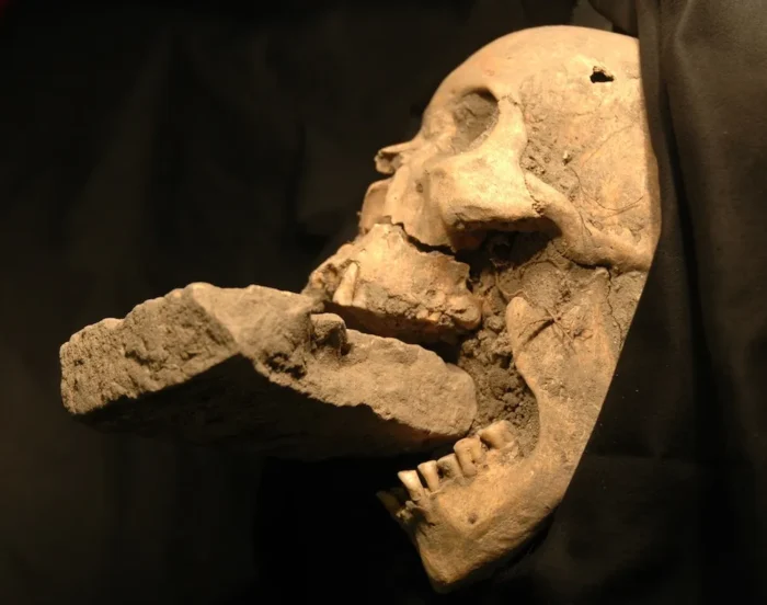
A scapegoat for the unexplained
Vampire stories feature common themes, such as fear of disease. At the time, people did not understand germs and bacteria, and tuberculosis and infection could easily acquire supernatural portents. People also believed diseases were God's punishment, not a natural part of life. Unexplained deaths easily led to supernatural rumors and, occasionally, to vampire panics.
Picture a land free of politics and persecution. The working man, no longer under the heavy thumb of diabolical kings, oppressive governments, and unjust nobility, can live in peace and plenty.
Cultures across the globe all have their version of a mythical utopia: the Garden of Eden, Elysium, Shambhala. In the heart of Eurasia, people believed in Belovodye, a paradise on Earth sought by the Russian peasantry, religious figures, and esoteric thinkers since the 1000s.
In Russian folklore, it goes by several names: Belovodye, Oponskoye, Oponia, the Land of Chud. Belovodye means “Land of White Water.” But where did this myth begin?
Oral tradition
In the late 900s, a monk named Sergius traveled from Greece to Kyiv. He met with Prince Vladimir the Great and spoke of a mythical land in the East where there was no war, crime, or injustice. Rivers flowed with milk, their banks made of honey and jelly. There was vast wealth, and peasants were happy and unburdened with work. The Prince, either a man of great faith or extreme gullibility, sent the monk off in search of this utopia. But the monk’s expedition disappeared.
Over 50 years later, a man came to Kyiv claiming to be Sergius. He explained that wild animals, disease, and starvation killed his men but that he survived deep in the mountains of Asia. There, he obtained secret knowledge and did not grow old. Supposedly, the main commandment of this secret place is that every century, six -- and only six -- people may visit. One of the six must stay behind while the others return home. The man claiming to be Sergius called the place Shambhala.
This story became the basis of a centuries-old struggle by a group of Russian Orthodox Christians fighting to keep their culture and faith alive.

Russian Orthodox legend
In the 17th century, the Russian Orthodox Church underwent a controversial reform. Patriarch Nikon of Moscow made major changes in rituals and texts to align Russian Orthodoxy with Greek Orthodoxy. He also had close ties with the Russian government, whose power and influence he used to suppress practitioners of the previous rites. The people who adhered to the original rites were called Old Believers.
Old Believers passed down the improbable story of an earthly paradise from generation to generation, replacing the name Shambhala with Belovodye. They said that Belovodye was a refuge for Orthodox Christians to live in peace away from persecution and where they were safe from the spirit of the Antichrist. Belovodye was said to be ruled by a White Tsar at the edge of the flat Earth.
The myth continued into the 18th and 19th centuries. According to writer Georgy Manaev with Russia Beyond, a 19th-century monk from the Topozersky monastery in the city of Arkhangelsk claimed to have visited Belovodye. He said it was founded not by Old Believers but by Assyrian Christians. The monk said that one must be baptized twice to return home and that the city contained over 170 Assyrian churches.
He wrote in his account about "a route by the Chinese realm, requiring 44 days across the Guban, then to the Kingdom of Oponia. There, the inhabitants have a home in the confines of the ocean called Byelovodiye."
Slavicist and translator Clarence Augustus Manning believed "Guban" might have meant the Gobi desert.
Theosophist perspective
In the 1920s, theosophist Nicholas Roerich and his wife Helena embarked on a five-year expedition through Asia. He searched for Shambhala and also mentions Belovodye in his writings.
"If, despite all the dangers, your spirit is ready…the people of Belovodye will greet you. Should they find that you are worthy, they may even permit you to remain with them," Roerich wrote.
He claimed that Shambhala and Belovodye are two separate places.
Roerich met with some Old Believers in the Altai Mountains who told him that Belovodye was somewhere among those peaks. However, they said that only those spiritually in tune and full of belief could enter its borders. These stories inspired Roerich to paint his 1933 work, Pilgrim of the Radiant City, our Featured Image above.
Expeditions
The search for Belovodye has been chaotic and full of scams.
Georgy Manaev from Russia Beyond wrote about a peasant who scammed police in 1807, running off with a handsome reward after promising to lead an expedition to Belovodye. A man claiming to be an archbishop from Belovodye also hoodwinked some Old Believers.
In 2015, German travel journalist Jens Muhling journeyed through Russia and heard the Belovodye legend while spending time with a woman named Agafya living in the Taiga. Agafya came from a family of Old Believers who had been oppressed by the Bolsheviks. With their livelihoods taken by the state (their produce was seized and redistributed), her family fled to the Altai Mountains. She told Muhling how her ancestors went searching for Belovodye.
"They knew that true Christians lived in Belovodye. And that there were churches and priests. Even bishops. They wanted to live in Belovodye," she said.
Her family got into contact with a "bishop" claiming to be from Belovodye, but this was also a scam. The family continued to search along the Arctic Coast, the Chinese border, and the Altai before giving up.
Geographical location?
Perhaps Belovodye was not a specific geographic location. Old Believers were oppressed under the Tsar, the Bolsheviks, and the reformed Orthodox Church. Persecutions, including torture and murder, forced Old Believers to flee to extremely remote areas.
Believers ventured deep into Siberia and the Altai Mountains. Some lived simply but happily. The state caught up to others, annexed their land, and enforced brutal double taxation and other restrictions. So, it could be said that these remote areas represented Belovodye, a temporary utopia, at least for a time.
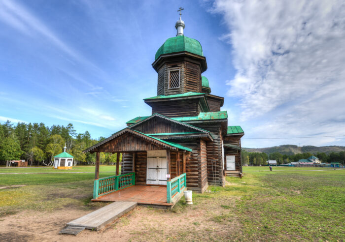
Today, people often refer to Mount Belukha, the Bukhtarma, or the Uimon Valley in the Altai as Belovodye. The Uimon Valley certainly featured Old Believer villages. Additionally, the Altai Mountains lie at the intersection of Russia, China, Mongolia, and Kazakhstan, an intersection of cultures and myths.
Legacy
There are only a few hundred thousand Old Believers left. Since the schism, Old Believers have scattered to several countries, including the U.S., Canada, Georgia, Kazakhstan, Estonia, and Australia.
Recently, the Russian government has used Belovodye to try and persuade Old Believers to repopulate Siberia. Siberia's population is declining. In 2011, the Russian government established special programs for new settlers. Old Believers, used to living in remote areas, began to return to Siberia to revitalize communities.
Conclusion
Going back to the original myth from the 900s, the monk said he visited Shambhala. It is possible that he visited areas in Asia where this myth was alive and popular. Bringing back the myth to Kyiv, it could then have spread to Russia. There, Old Believers could have integrated the myth into their beliefs. Shambhala and Belovodvye share many similarities: They are both mythical utopias of peace, justice, and divinity.
Interestingly, Belovodye is not the only mythical city Old Believers swore existed. They also had their version of Atlantis. Kitzeh was a town that saved itself from a Mongol onslaught by sinking into the sea.
I am prepared to risk it all by admitting that I enjoyed Indiana Jones and the Kingdom of the Crystal Skull. There it is. The 2008 film didn’t get the best reception because of its overdone CGI and unlikeable characters. But the storyline -- centered on a mysterious, elongated skull from Peru -- grabbed me.
Crystal skulls are some of the most fascinating, strange mysteries out there. They arrived on the archaeological scene in the 19th century, most without stories or context attached. For many years, no one knew who made them or why. But in the early 2000s, they were proven to be fakes, so why do museums still bother to display them?
Where it all began
Our story begins in January 1924. The sound of cutting, cracking and enthusiastic voices interrupted the stillness of the jungle in British Honduras (now Belize). A group of local Mayan descendants, a teenage girl and her dear Papa were searching for something. The father, Frederick Mitchell-Hedges, was on a mission to fulfill his dream of becoming a world-renowned archaeologist after leaving his Wall Street job. And Anna, his protege and adopted daughter, wanted to make a name for herself in the field as well.
Somewhere in the bush was a lost city called Lubaantun, or “the place of fallen stones” in ancient Yucatek Maya. The site was occupied from 730 to 890 AD. At first, it did not look like much, with stones scattered everywhere and the ruins of pyramids. But it would become the epicenter of a phenomenon that took the world by storm.
On finding the ruins, young Anna took this chance to explore for herself without the supervision of her father. While peering through a crack in a sunken temple, she saw a small shiny object glistening in the sliver of sunlight. Risking the unstable ruins, she ventured into the dark and uncovered a skull. Not just any skull. Rather, it was a life-size skull of pure, clear quartz (13cm high, 18cm long, and 13cm wide.) This was her ticket to fame, and the skull soon became known as the Mitchell-Hedges skull.
A supernatural object?
The discovery overjoyed their Mayan guides. Supposedly, it had been missing for centuries and was a big part of their heritage. According to local legends, the skull was a crystallized likeness of a beloved and powerful high priest. To preserve his powers, they crafted the skull after him, believing that his essence could be transferred into the skull. Those in possession of the skull could will death on his enemies.
The most important rule was, don’t look into its eyes. It will drive you mad or even kill you. Curiously, the locals gifted Frederick and Anna the skull as a thank-you. Since then, the skull has been credited by New Agers, shamans, and UFO enthusiasts as the key to hidden knowledge and unlocked psychic abilities. They nicknamed it the Skull of Doom.
Skulls were not uncommon in Mesoamerican cultures. They played a big role in the religious, social, and artistic lives of the Maya and Aztecs. It symbolized both life and death and was mostly associated with human sacrifice, rebirth, and appeasing the gods. Skulls continue to be a major symbol of Mexican cultural practices.
An art restorer named Frank Dorland studied the skull to estimate its value. He determined it was thousands of years old, even older than the site itself. He believed it was carved out of a chunk of quartz, rubbed together, shaped, sanded down, and polished with diamonds for 150-300 years, the time it would take to make it so clear.
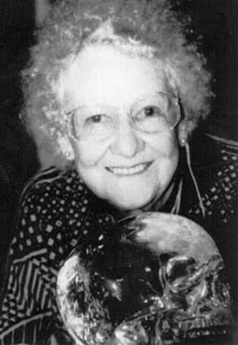
Where it gets weird
You would think that such a discovery would have made Anna and Frederick famous as soon as they got back to civilization. Wrong. It wasn't until the 1940s that the skull went public. So why wait? Unless the pair was hiding something.
After her father died in 1959, Anna went into full-on marketing mode. She began to promote events in which patrons could -- for $5 admission -- view the skull, feel its power, and hear about that life-changing find in the jungles of Belize. First red flag! The 1960s and 1970s were the perfect time to start such a venture, as spirituality and New Age exploration were at their peak.
If you check out Frederick's autobiography titled Danger My Ally, you'll see that it does not mention Anna's discovery at all. You’d think that Frederick would have raved about the skull or at least made its discovery public. Rather, there is only mention of acquiring a skull, saying:
It is at least 3,600 years old and according to legend was used by the High Priest of the Maya when performing esoteric rights. When the High Priest willed death, with the help of the skull, death inevitably followed. It has been described as the embodiment of evil. I do not wish to try and explain this phenomenon....
No mention
Why is there no mention of Anna and her find?
Let's look at Frederick Mitchell-Hedges. He was a restless man working in the finance sector, trying to build wealth for himself in London and Wall Street in New York City. Deep down, however, he yearned to be an archaeologist, particularly one who was well respected in the academic community.
Mitchell-Hedges left his well-paying job after saving up £4000 and became a full-time explorer. He had somewhat of a reputation, getting into relationships with wealthy women so he had access to funding for his expeditions. He even claimed that he found artifacts from Atlantis. Surely, such a person would have spoken about this crystal skull.
However, records from the Sotheby's, published in the British journal Man, show a skull -- reputedly an artifact from Mexico -- went up for auction in 1936. The buyer was none other than Mitchell-Hodges. It seemed that he bought the skull, and the whole story of its serendipitous discovery was apocryphal.
The truth comes out
When Anna was confronted with this information, she stated that her father ran into financial trouble and received a loan from an art dealer named Sydney Burney after Mitchell-Hedges gave him the skull as collateral. However, Burney double-crossed him and put it up for auction.
Yet in a letter to his brother in 1943, Mitchell-Hedges suggests that the crystal skull was, in fact, a purchase:
The "Collection" grows and grows and grows. You possibly saw in the papers that I acquired that amazing Crystal Skull that was formerly in the "Sydney Burney Collection." It is fashioned from a single block of transparent rock crystal, exactly life-size; scientists put the date at pre-1800 BC, and they estimate it took five generations passing from father to son, to complete. It is anthropologically perfect in every detail, a superb piece of craftsmanship. There is only one other in the world known like it, which is in the British Museum and it is acknowledged to be not so fine as this.
The matter was eventually put to rest in the 1970s when curious researchers from Hewlett-Packard's laboratories took up Dorland's suggestion to analyze it. Though the lab's technology could not determine its age, it did find signs of metal drills used on its teeth. Anna did not hesitate to take the skull back and refuse any more scrutiny.
Anna's later years
Anna married a man named Bill Homman and they toured with the skull until she died in 2007. Homman became its owner and he took the skull to the Smithsonian in Washington, D.C. for analysis. However, it did not have the answers he was looking for.
Jane Walsh, the main researcher behind the tests, found some interesting details. X-ray and electron microscope scans revealed polishing and tool marks consistent with 19th and 20th-century techniques, particularly those associated with rotary tools and abrasives, most likely with a diamond head. Therefore, this was most likely made in the 1930s.

Ancient civilizations, including the Maya and Aztecs, lacked the technology to carve such precise and smooth shapes from hard quartz. The fact that some skulls displayed features like perfectly symmetrical teeth suggested they were produced much more recently than claimed. Yet...this skull is on display for its expert craftsmanship rather than its historical accuracy.
It's now apparent that the elaborate tale of Anne finding the skull deep in a cave in a jungle in Belize was made up from start to finish. The inconsistencies in her story, conveniently bending the details of her father’s purchase of the skull from an art dealer in London in the 1940s and the lack of records of having been in Belize in 1924 in the first place all point to an elaborate con job.
Other skulls turn up
The Mitchell-Hedges Skull is not the first such quasi-treasure. They've been around since the 1800s. The British Museum’s crystal skull, often referred to as the Mittler Skull, was acquired in 1897 from a collector named Eugene Boban.
A French antiquities dealer, Boban claimed that it had been discovered in Mexico. Most likely, he lied about its age to get more sales. He said it was found in an ancient Aztec or Mayan tomb. Others linked it to the broader lore surrounding pre-Columbian Mesoamerican cultures. However, the lack of solid provenance and the skull's highly polished surface has led many researchers to question its authenticity as a genuine artifact.

When Dr Jane Walsh received another skull in an anonymous package, she couldn't help but analyze it. This one was not life-size but very large, around 31 pounds. It was not an accurate human skull but had more decorative embellishments. She enlisted the help of British Museum scientist Margaret Sax to help her compare the two skulls.
After rigorous tests, she said:
British Museum scientist Margaret Sax and I examined the British Museum and Smithsonian skulls under light and scanning electron microscope and conclusively determined that they were carved with relatively modern lapidary equipment which were unavailable to pre-Columbian Mesoamerican carvers...
The British Museum skull was worked with hard abrasives such as corundum or diamond, whereas X-ray diffraction revealed traces of carborundum (SiC), a hard modern synthetic abrasive, on the Smithsonian skull. Investigation of fluid and solid inclusions in the quartz of the British Museum skull, using microscopy and Raman spectroscopy, shows that the material formed in a mesothermal metamorphic environment equivalent to greenschist facies. This suggests that the quartz was obtained from Brazil or Madagascar, areas far outside pre-Columbian trade networks.
Conclusion
So, where does this leave us? They're fake, yes. But you can't help but admire the craftsmanship and beauty of the pieces. In a way, its creators got what they wanted: fame of a sort.
My grandfather and I had a daily ritual when I came home from school. I breezed through my homework so we could watch National Geographic, the History Channel, or the Discovery Channel. I called it the Educational Trinity. Those afternoons shaped my fascination with all the strange things in our world.
Glued to the TV one day, I came across a program about UFOs. One particular story stuck with me. In 1998, a photograph was taken from the International Space Station. It was of a black, oddly shaped object hovering in the eerie, pale glow of Earth’s orbit. What was this object? Was it watching us? Where did it come from? Years later, I may finally have answers.
What happened in 1998?
In December 1998, the Space Shuttle Endeavour flew to the International Space Station. The STS-88 mission was critical for the expansion of the ISS, and the astronauts were supposed to connect the first American module (Node 1) to the station.
While some astronauts worked outside, those inside took photos of Earth. To their surprise, a mysterious object was floating a short distance away. When NASA released the images, the object became a topic of debate on Earth.

Some people assumed it was a UFO monitoring our planet. The dark, angular object was unlike any human-made satellite. It lacked the usual circular or cylindrical shape with panels at the sides. Rather, this one had odd edges, curves, and no identifiers like flags or model numbers. In certain images, the object appeared to change shape.
The object became known as the Black Knight Satellite. Some conspiracy theorists believe it dates back to Nikola Tesla's experiments with electricity and radio signals.
Nikola Tesla
Black Knight conspiracy theorists link the object to 1899 when Nikola Tesla conducted experiments in Colorado Springs. Tesla built the Tesla Experimental Station, where he aimed to study electricity, wireless telegraphy, and the role of air pressure. While conducting these tests, his receiver picked up on some peculiar signals. In 1899, he reported:
We’re getting messages from the clouds one hundred miles away, possibly many times that distance…
Later on, in 1935, he stated:
In 1899, while experimenting with a wireless receiver of extraordinary sensitivity, I detected faint signals from Mars, our brother planet. I could not interpret the signals, but they seemed to suggest a numerical code, one–two–three–four.
As interesting as these signals sounded, Tesla ran into financial trouble and did not pursue the matter further.

Decades later, in 1927, Norwegian amateur radio operator Jorgen Hals was playing around with his radio equipment. Upon turning the radio to a certain frequency, the signals bounced back slower than usual (15 seconds as opposed to one-seventh of a second). Why the delay? Had Hals picked up on something lurking above the Earth? This odd phenomenon is cited as early evidence of the satellite's existence.
The UFO craze
In the 1950s and 1960s, reports of a satellite of unknown origin circulated. In a 1954 newspaper report titled Artificial Satellites Circling Earth Now, says Ex-Marine, ufologist and former Marine Donald Keyhoe said there were:
At least one, and possibly two, artificial satellites circling the earth.
Another report stated that unusual radio signals had been detected in Earth's ionosphere. Supposedly, the signals didn’t match patterns from human-made transmissions.
The U.S. military initially attributed the signals to the Soviet Union or natural space phenomena. However, the Soviets only launched Sputnik 1, their first satellite, in 1957. This led some researchers to suggest an alien satellite was responsible.
In 1958, amateur astronomer Steven Slayton spotted an anomaly close to the Moon. Through his telescope, Slayton saw a fast-moving dark object that he estimated was 10m long and 1,000km from Earth. He saw this object more than once during his night sky observations.
In the 1960s, when the Space Race heated up, reports of strange objects increased. Astronaut John Glenn's account of three spacecraft following his ship during his first orbital flight is well documented.
In March 1960, several newspapers reported strange activity in Earth's polar orbit; again, an object of unknown origin. Years later, this was revealed to be a U.S. satellite designed to spy on the Russians.
Observing Earth for 13,000 years
It wasn't until the 1970s that the object finally got its name. 'Black Knight' comes from a novel by Russian author Alexander Kazantsev. In his book, The Destruction of Faena, an alien civilization sent a satellite to observe the human race. The satellite had the code name, Black Prince.
One of the most prominent figures associated with the Black Knight theory is Duncan Lunan, a Scottish researcher and writer. In 1973, Lunan published an article in the Fortean Times, a magazine dedicated to anomalous phenomena. In this article, Lunan analyzed radio signals recorded in 1928 and 1950.
Lunan theorized that the signals were not random. Rather, they were a coded message sent from a satellite orbiting Earth. He suggested that the signals could be of extraterrestrial origin, although he was careful to point out that they might not necessarily be linked to the Black Knight. In fact, Lunan distanced himself from the Black Knight conspiracy, saying it had "nothing to do with me."
Lunan studied Long Delayed Echoes (LDEs) and believed they created "star charts and diagrams," according to an article published by Armagh Observatory and Planetarium. On his website, Lunan states:
When I tried graphing the signals to see if that would work, to my astonishment I found what appeared to be a readable message, giving Epsilon Boötis (Izar) as the origin star of the spacecraft, and its arrival date as 11,000 BC.
Let's debunk
Circling back to Tesla and Hals, there could be a natural explanation for their mysterious findings. They could have picked up signals coming from deep-space pulsars. Pulsars are a type of neutron star, remnants of massive stars that have exploded as supernovas. A pulsar rotates rapidly, often several times per second, and its strong magnetic field generates beams of electromagnetic radiation (radio waves, X-rays, or gamma rays) which we can pick up from Earth. Astronomers did not discover pulsars until the late 1960s.
As for the STS-88 mission, as anticlimactic as it sounds, NASA’s official classification of the mystery object is a runaway thermal blanket or piece of space debris. Space debris in low orbit is common, and objects can appear irregular or even resemble artificial structures, especially from a distance.
Respected space journalist James Oberg provided substantial evidence that the object was debris. He points out that the crew on the STS-88 mission were installing a Node, which required a blanket to protect it from the sun.
In their communications with each other on the spacewalk and from inside the space station, the astronauts even state that they lost a thermal blanket. Here is an official transcript between Commander Robert Cabana and Mission Specialist Jerry Ross:
Cabana: Jerry, one of the thermal covers got away from you.
Ross: How did it do that?
Cabana: Jim saw a tether, I’ll guarantee you. Where did it go?
Ross thought the Black Knight theory preposterous and later said:
If we see something up there, we will be the first ones to ask questions and to tell people we saw something we didn’t understand. Conspiracy theories are fun for those working on them, but a waste of valuable brain power.
So, with all this evidence, why hasn't the story died?
Reemergence in 2017
The conspiracy theory reemerged fairly recently because of an article by writer Daisy Dunne for the MailOnline. The website shared video footage that supposedly showed someone shooting down the Black Knight satellite.
The footage shows a bright white ball of debris falling from the sky. It took the internet by storm.
Who shot it down? "A secret Illuminati warplane," according to online conspiracy theorists.
And so, though thoroughly debunked, the Black Knight Satellite continues to fuel wild theories. We must admit, it makes for a great story.

Petroglyphs are hard puzzles to decipher. Despite a wealth of knowledge, historians and archaeologists can’t always put the whole picture together. The mysterious Dighton Rock is a classic example.
Weird inscriptions
Reverend John Danforth discovered Dighton Rock in 1680. For roughly 20 hours each day, the rock was hidden by the tides of the Taunton River in Massachusetts. The rock weighs 40 tons, is 10 to 11 feet long, and is five feet high. Its greyish-brown sandstone is carved with weird inscriptions, whose origins and meanings continue to elude explanation. Some are intelligible: triangles, infinity symbols, human figures, and animals. The rest look like random scribbles.
To preserve the rock, it was moved in 1963. It now resides in a small museum called the Dighton Rock Museum.
Danforth believed the rock had Native American origins. He speculated that the Wampanoag, Narragansett, or Algonquian peoples might have carved the petroglyphs -- most likely, the Wampanoag, he concluded. He thought that the etchings depicted a great battle and a shipwreck.
Danforth sketched the rock, and his drawings are on display in the British Museum.
Ten years after Danforth's discovery, a famous Puritan reverend named Cotton Mather came across it.
"Among the other curiosities of New England, one is...a mighty rock...there are very deeply engraved [drawings], no man alive knows how or when,” Mather wrote in his book The Wonderful Works of God Commemorated. He believed the symbols were Satanic.
Native Americans?
Native American petroglyphs turn up all over New England. Common motifs include geometric patterns, human figures, animals, astronomical features like the sun and moon, and abstract symbols that likely held symbolic significance for hunting rituals, cosmology, tribal histories, and spiritual beliefs. Petroglyphs are also a form of communication, storytelling, and ceremonial expression. They convey important messages about the natural world, ancestral connections, and the spiritual realm. Some people interpret the Dighton Rock petroglyphs as a hunting scene.
Dighton Rock drew enough attention that even George Washington took an interest. He had experience with Native American petroglyphs and agreed with Danforth.
Phoenicians?
Theologian Ezra Stiles, one of the founders of Brown University, extensively researched Native American history and culture in the 1760s. In particular, he focused on the New England area. He visited the petroglyphs and landed on a rather controversial theory. Stiles believed the Phoenicians were responsible.
"I take [the petroglyphs] to be in Phoenician letters and 3,000 years old," Stiles wrote. "Or Punic or Carthaginian characters."
He mentioned his hypothesis in lectures and sermons. For example: "...not to mention the visit of still greater antiquity by the Phoenicians, who charged the Dighton Rock and other rocks in Narragansett Bay with Punic inscriptions."
Historian Cora E. Lutz states that many academics considered Stiles "the American authority on Dighton Rock."
Despite his expertise in Native American petroglyphs, Stiles's Phoenician theory is way out there. It touches on the cross-cultural contact theory, whose supporters argue that the Phoenicians influenced American civilizations. But there is no hard evidence for this, merely conjecture. Just because some drawings resemble Phoenician characters does not make them Phoenician without further evidence.
Norse?
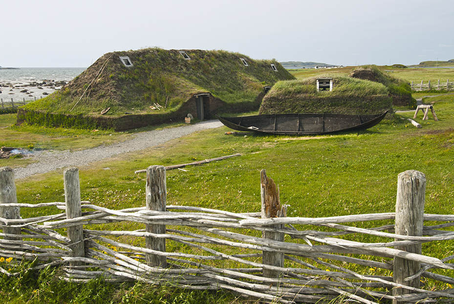
Some people believe that the etchings resemble Viking runes.
In the 1830s, Danish historian Carl Christian Rafn thought he could link the petroglyphs with Viking sagas. Today, historians agree that the Vikings settled briefly in Canada, specifically at L’Anse aux Meadows in Newfoundland. Could Dighton Rock show Viking settlement much further south?
Rafn’s Viking theory was never substantiated.
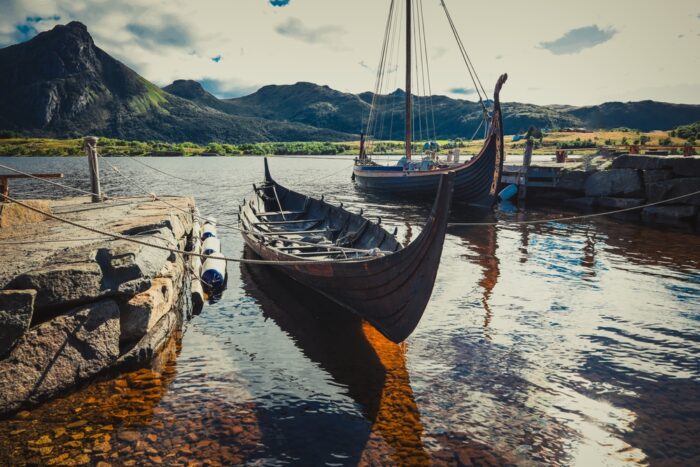
Portuguese?
In the 1920s, Edmund Delabarre of Brown University suggested that the seafaring Portuguese might have carved the rock.
In the early 1500s, Portuguese explorer Miguel Corte-Real explored the Newfoundland coast and vanished without a trace. Delabarre thought that Corte-Real got as far as Massachusetts. Delabarre argues that the glyphs spell out a message: "I, Miguel Cortereal, 1511. In this place, by the will of God, I became a chief of the Indians."
He also claims to see Corte-Real’s coat of arms on the rock. He dates the glyphs to the 1500s.
Chinese?
Some other wild theories include Chinese or Japanese script. A former submarine lieutenant commander named Gavin Menzies has championed the China theory. He wrote books investigating Chinese exploration of the Americas and proposed that explorer Zheng He discovered America before Columbus.
There is no evidence to support Menzies's theory, and academics regard his work as pseudohistory.
Verification problems
Why can’t we determine when the Dighton Rock inscriptions were made? Unfortunately, weathering of the rock's surface has affected the quality of samples. Additionally, because petroglyphs are carved into the rock, they collect mineral crusts. This prevents scientists from extracting accurate samples.
Radiocarbon dating is also impossible. It requires organic material like charcoal, plant material, bone, or fossils to determine age. Petroglyphs carved into rock don't usually contain organic material.
It is also possible that the carvings are a hoax or the work of bored locals sometime before Danforth discovered the rock in 1680.
Conclusion
Most scholars lean toward Native American origins. If Norse explorers or another foreign group created the petroglyphs, it would challenge the conventional narrative of European discovery and settlement in the Americas, already a controversial debate in academia. For now, without a means of verifying the date of the petroglyphs, we are still only able to guess their origins.
In the early 1800s, a Russian naval officer pored over his maps. A pesky question plagued him: Why was Russia no longer a leading exploratory power?
Adam Johann von Krusenstern set out to change things. Because of his persistence and determination, he expanded Russia’s reach in the Pacific and earned the respect of its naval rivals in the West.
Background
Of course, Russian exploration did not begin with Krusenstern. In 1787, Catherine the Great was keen on launching an expedition to the Pacific via the Cape of Good Hope to claim territory. She chose Captain Grigory Ivanovich Mulovsky to lead the expedition. However, the expedition was abruptly canceled when the Russo-Turkish War broke out.
Years later, Krusenstern decided to see the plan through.
After James Cook's world-changing expeditions between 1768 and 1779, European powers vied to explore the uncharted Pacific Ocean. Explorers searched for resources, trade routes, and potential colony locations. But compared with other major maritime powers, such as Britain and France, Russia lagged behind.
Enter Krusenstern
Born in 1770 in what is now Estonia but was then part of the Russian Empire, Krusenstern came from a noble family with a military background. He received a good education, particularly in the sciences. This would serve him well.
Inspired by James Cook, Krusenstern entered the Russian Imperial Navy at 15 and quickly rose through the ranks.
Krusenstern's early experiences serving on the Mediterranean and Baltic fleets exposed him to naval tactics, international trade, and politics. With the navy, he visited America, China, and India, setting the stage for his career as an explorer.
His role also brought important connections. Count Nikolay Petrovich Rumyantsev of the Russian-American Company later became his main patron. He even met Tsar Alexander I.
Krusenstern presented his plans for an expedition to the Pacific to Alexander I. Charismatic, well-spoken, and knowledgeable, Krusenstern convinced the Tsar, who approved the ambitious journey.

Krusenstern believed that the discoveries of the Kamchatka Peninsula in 1696 and the Aleutian Islands (Alaska) in 1741 were two of the greatest achievements in Russian history. Those expeditions opened the door to the Pacific, and Krusenstern hoped to build on their work.
The expedition was organized hurriedly, as the Russian aristocracy was eager for him to begin.
"However flattering the enthusiasm with which the nation looked forward to this expedition, I was still not a little surprised to find that I was expected to set sail that same year,” Krusenstern wrote in a book about his voyages. Eventually, his departure was delayed by a year.
Krusenstern had a multidisciplinary mission in mind. Though establishing Russian relations with Japan and China was a top priority, he wanted to further scientific research in Alaska, the Aleutian Islands, and Oceania. He planned to take an anthropological approach, documenting the lives and cultures of native people along the way.
Preparations begin
He scurried to find the perfect ships for the mission, settling on two British merchant vessels. He named them Nadezhda (Hope) and Neva. Neva was originally called Thames, after the river. In keeping with the tradition, he renamed it Neva, after a river in northwestern Russia.
To pilot the Neva, Krusenstern chose Captain Yuri Lisyansky, a veteran of the Russo-Swedish War who had sailed around the world with the British.
Anchors aweigh
The expedition set off from St. Petersburg on Aug. 7, 1803. They sailed to Copenhagen and then Falmouth, England. From Europe, Krusenstern recruited scientists, navigators, and diplomats for the journey.
They stopped in Tenerife before crossing the Atlantic to Brazil. The two ships sailed around Cape Horn to enter the Pacific. This is where the expedition split up to tackle different objectives. Krusenstern and the Nadezhda sailed to the Marquesas Islands and Nukahiva Island, while the Neva sailed for Easter Island.
They rendezvoused in the Hawaiian (formerly Sandwich) Islands before separating again, with the Nadezhda heading to Kamchatka and Japan to establish diplomatic relations while the Neva went to southern Alaska.
While in Alaska, the Neva was pressed into military duty. It fought at the Battle of Sitka for the Russians against native Alaskans.
After, the ships met up again to sail to Macao and Canton, hoping to establish trade relations. However, this proved unfruitful despite offerings of bear skins and walrus bones. They returned to St Petersburg via the Cape of Good Hope, arriving in August 1806, almost exactly three years after they left.
Legacy
Though the expedition went down in Russian history as a great success, it failed in its objective: Neither Japan nor China were interested in pursuing a relationship with Russia.
Nevertheless, Krusenstern returned with a trove of information regarding resources, ethnic groups, marine life, oceanography, and botany. Krusenstern drew maps that aided later explorers, including his Atlas of the South Sea.
Krusenstern was also responsible for naming the Cook Islands. When James Cook visited in the 1770s, he called them the Hervey Islands. But in his atlas, Krusenstern called them the Cook Islands in the British explorer's honor. The name stuck.
Krusenstern is commemorated in various ways. He lent his name to the Krusenstern Strait (which lies between the Russian mainland and Kamchatka), the Krusenstern Glacier in Antarctica, Mount Kruzenshstern in the Novaya Zemlya archipelago, and Cape Krusenstern in Alaska. The Moon even has a Krusenstern Crater.
Later, his son Paul Theodor and his nephew Otto von Krusenstern continued exploring, venturing further into Oceania and Western North America.
Imagine kayaking on a river with your friends. It’s warm, the sun is out, and the Siberian scenery is stunning. Then suddenly, a blood-curdling scream comes from the shoreline. A hysterical teenage girl covered in blood, mumbling incoherently, runs toward you for help.
This is exactly what happened in August 1993. A few kayakers had their idyllic trip completely shaken up as they rescued the sole survivor of a gruesome tragedy known as the Khamar Daban Incident.
Background
The story begins on August 2, 1993, in the Khamar Daban mountains of southern Siberia. A group of students visiting from Petropavl in Kazakhstan planned to hike from the shores of Lake Baikal and summit Kang-Ula.
The seven hikers were Aleksander Kyrsin, 23; Tatyana Filipenko, 24; Denis Shvachkin, 19; Valentina Utochenko, 17; Viktoriya Zalesova, 16; Timur Bapanov, 15; and leader Lyudmila Korovina, 41. They were reportedly a tight-knit bunch of good friends.
The group had done difficult hikes before, and all were physically fit. They also had a hiking legend in their midst. Lyudmila Korovina was a well-known survivalist with a strong will and excellent problem-solving skills. She even had the nickname of Master among those she led on expeditions.
The party set off with ample food, equipment, and clothing. Korovina called the local weather station, and the forecast was for sunny, pleasant weather. They were also not alone. Korovina’s daughter Natalia was leading a second group nearby. They planned to rendezvous at a certain point a few days later. Lyudmila Korovina’s group planned to cover 220km and climb up to 2,371m.
They set off on August 4 from Murino, near Lake Baikal. The trek started well, but the forecast proved wrong. Rain pelted down, and high winds raked the slopes. The group started to slow down and complained of cold, since temperatures had dropped below freezing. They camped and were not able to start a fire until morning. Then they successfully summited the peak. Their descent would be the last thing they’d ever do.
Trip gone awry
Seventeen-year-old Valentina Utochenko, the sole survivor, described hearing Aleksander screaming. He was frothing from the mouth and blood was pouring out from his eyes, ears, and nose. Korovina ran to assist him but soon suffered from the same symptoms.
When Tatyana Filipenko went to help her, she started to claw at her neck as if choking and proceeded to bash her head onto a nearby rock. The others ran for their lives, but they too collapsed and died on the spot.
Alone by now, Utochenko ran down the mountain to treeline, where she stayed put and waited for her fate. But nothing happened. Eventually, she returned to the scene to see if any of her friends survived. They had not. She then collected leftover supplies and followed the power lines for four days until the kayakers rescued her. They took her to the police station, and she told them what happened.

The autopsy
The bodies were recovered two weeks later, and autopsies were performed. Korovina, apparently, had died of cardiac arrest. The others showed signs of protein deficiencies in muscles that suggested starvation -- dubious on a short trip. Meanwhile, fluid buildup in the lungs indicated hypothermia. Nevertheless, doctors ruled these two conditions as the likely causes of death. However, this does not explain why they died within minutes after presenting no prior signs.
A case of whodunit
Valentina Utochenko, the sole survivor, then vanished from the spotlight until a curious reporter tracked her down in 2018. Even 25 years later, Utochenko’s initial behavior toward the reporter was rather hostile. She asked the reporter why she was bringing up this nightmare again. She could have suffered from PTSD, as she had kept the incident a secret even from her husband. But eventually, Utochenko calmed down and allowed the reporter to interview her.
There are notable spots in Utochenko’s story that could have been mistranslation from Russian sources or trauma, making her forget important details. It is well-known that people can lose pieces of their memory about a stressful event.
For example, she said there was no blood when, in her initial report, there was. She also changed her story, saying there were no screams. Some have speculated whether her reaction suggests she might have been responsible for her friends' deaths, but that is highly unlikely. She had no motive. The group often went on hikes together, and exactly how does a 17-year-old girl murder six colleagues?
Investigations briefly suspected Korovina. She was apparently quite driven when it came to trekking and sometimes pushed her troops too hard. Could she have driven them into exhaustion and hypothermia?
Korovina may have had an intense personality, but she was not unprofessional, power-hungry, or negligent. Valentina Utochenko even stated that Korovina cared for the group, even to the end.
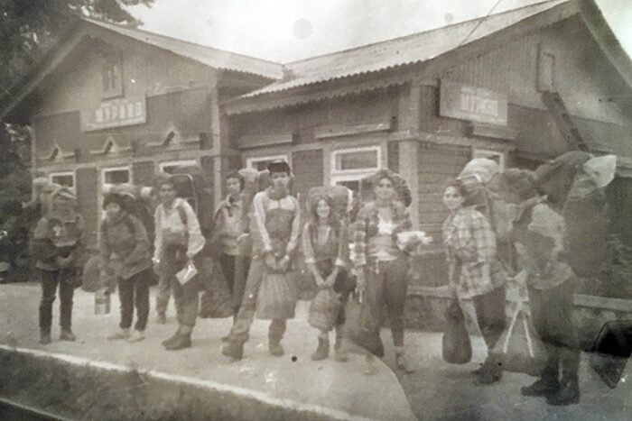
Russian versus English sources
In dissecting this story, the popular YouTube channel The Lore Lodge pointed out that there’s a Russian version and an English version. They differ in significant ways, including even the mountain on which they died. Some sources say it was Kang-Ula, while Utochenko and Russian sources call it Retranslyator Peak. The two peaks lie some distance apart.
Some sources quote different dates for Utochenko’s rescue. Some say she emerged from the trees covered in blood and screaming, while others have her staring into space and unresponsive. It does not help that her initial 1993 police report and her 2018 interview likewise differ in key details.
Nerve agent?
How did the hikers die so quickly and violently? The most common theory remains that they fell victim to a nerve agent. It’s not an outlandish proposition. Frothing at the mouth and bleeding from the eyes, ears, and nose supposedly preceded their deaths. Siberia was the Soviet Union’s playground when it came to weapons testing. The ultimate favorite of the KGB, Novichok, was supposedly tested around here. A nerve agent can linger in an environment for months or make its way into the groundwater.
If this was the case, the nerve agent tests must have occurred months or weeks earlier. It would have stayed there until the rain and wind pushed it toward the group. Since Utochenko was apparently the farthest away from them, she might have escaped the effects.
Resemblance to Dyatlov Pass mystery
For some, this bizarre tale bears a striking resemblance to the infamous Dyatlov Pass Incident of 1959. Nine student hikers from the Ural Polytechnic Institute were found dead in Russia’s Ural Mountains. Their bodies were scattered about in various states of dress or undress. Some were barefoot and had inexplicable injuries.
One of the hikers had no eyes and tongue, another bit his knuckle off, one’s neck was twisted, and another had a fractured skull. One hiker, who left the expedition early on due to illness, survived. The placement of their belongings did not match up with their deaths. Everything was well organized except for a tent that was cut from the inside. Though this cold case remains unsolved, conspiracy theories out there point to nerve agents and government testing as well. Research published in 2019 suggests a more prosaic explanation -- avalanches and katabatic winds.
Katabatic winds can start suddenly as cold air flows down a mountain and can bring on hypothermia quickly. In the Khamar Daban incident, Utochenko verified that they battled high winds for a couple of days. Another possibility is infrasound, a silent killer. These are sound waves at frequencies undetectable to the human ear. Some natural sources of infrasound include volcanic eruptions and earthquakes. High winds are also a common cause of infrasound. Although inaudible, infrasound can do a lot of physiological damage, leading to disorientation, panic, hysteria, hallucinations, cardiac arrest, organ rupture, and even death.
This could explain Korovina's heart attack and Filipenko's violent, self-inflicted head injuries. A study by Ryan Chaban et al. from the University Hospital of Johannes Gutenberg University Mainz, Germany, states that even one hour of infrasound may do serious damage.
Conclusion
It's likely the group either suffered a nerve agent attack or an extreme weather event, perhaps involving infrasound. Due to the chaos and disorientation from the cold and from seeing her friends die, Valentina Utochenko probably confused many details to the point where we can’t know what really happened.
Belgian adventurer Jelle Veyt has been attempting to tackle the Seven Summits under his own power since 2013, by rowing, skiing, cycling, walking, and climbing. It hasn't always worked out. In 2021, he aborted his row from Portugal to Miami because of chronic seasickness. It has prompted him to sail rather than row the oceans for the rest of the project.
After three years of setbacks, he successfully cycled from the Lower 48 to Alaska and climbed Denali this past May. AFter spending a few months with family, he is now heading to 6,961m Aconcagua. This would be his sixth summit, leaving only Antarctica's Vinson to go.
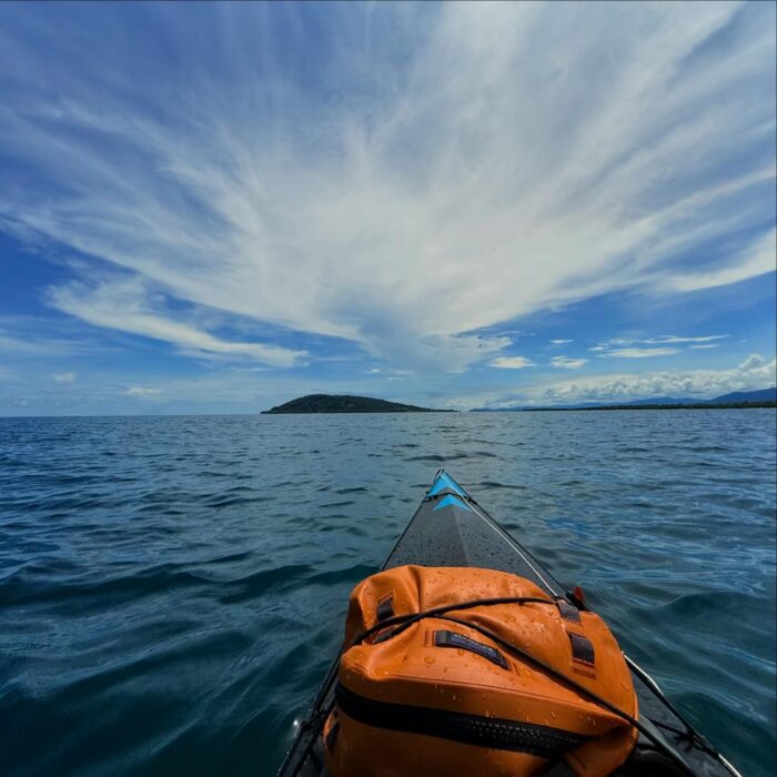
Aconcagua
The highest mountain in South America lies in Argentina's Mendoza province. In September, Veyt announced the expedition's route:
I'll be kayaking from Panama to Colombia, since there are no roads through the Darien Gap. It's much safer to take this coastal kayaking route than to cross the jungle. This part of the journey will take me about two to three weeks. Afterwards, I'll be cycling all the way from Colombia to Argentina. The plan? To climb Aconcagua by December 2025...
He arrived in Panama in mid-October and started kayaking. He dealt with thunderstorms, the intense tropical sun, and stretches of coastline with few places to land. But the scariest part, he told ExplorersWeb, was a run-in with a group of narcos just 40km before his kayaking leg ended. They questioned him for three hours before letting him go.
As the expedition has stretched into 11 years and counting, Veyt has become a little looser about only using his own power. For example, he recently took a bus to drop off his kayak and pick up his bike. Still, he has put in a lot of distance on his own.
Currently, he is in Colombia and about to begin cycling 8,000km to Aconcagua.

Fifteenth-century China was a maritime powerhouse that explored new lands and opened trade routes. It was also the best-connected political entity in the world, with a presence in Asia, Africa, and Arabia. A man named Zheng He led the charge.
A complex, multi-talented character, Zheng He rose from slave to top naval commander, diplomat, and world explorer.
Background
Born into a Chinese Muslim family in Yunnan, Zheng He's birth name was Ma He.
His father was descended from Persians and worked for the Mongol Empire. This became a problem, as Chinese animosity toward the Mongolians was growing. The two nations were at war by the time Ma He was a toddler.
The rise to power
By the time Ma He was 10, his parents had died, and he was a prisoner of the Ming Dynasty's army. As was common practice, Ma He was castrated and sent for military training.
Now a eunuch, he worked at court and became an impressive warrior. Eunuchs were valued members of Chinese society, given key positions in foreign relations, national security, the military, and in court. Chinese leaders did not view eunuchs as potential rivals and did not fear disloyalty.
As horrible as Ma He's early life sounds, he experienced social mobility and became increasingly important in the Emperor's court. He became a trusted confidant of Zhu Di, the Prince of Yan and future Yongle Emperor. He gained new titles and responsibilities, eventually running the Emperor's household. Ma He became Zheng He and also the commander of Nanjing.
"Zheng He’s eclectic religious attitude and broadened cultural horizons made him a good candidate for the armada’s commander," writes Yang Wei of the Association for Asian Studies.
Expeditions
China was already the dominant trading power in the region, but the Emperor wished to extend its influence. But China's goal was not to conquer and colonize. Writer Geoff Wade argues that their aim was globalization.
"Zheng He did not occupy a single piece of land, establish any fortress, or seize wealth from other countries," Wade wrote in his article, The Zheng He Voyages: A Reassessment.

Zheng He undertook seven epic voyages from 1405 to 1433. He sailed with monstrous vessels called "treasure ships." These boats were supposedly the size of football fields, with multiple decks and hundreds of sailors. Writers Marco Polo and Ibn Battuta both mention these treasure ships, but they likely exaggerated their size for dramatic effect.
The ships carried wealth and weaponry and could transport ambassadors and dignitaries back to China. Gold, silver, porcelain, and fine silks facilitated trade and foreign relations.
Force only when necessary
Sometimes, Zheng He needed to exercise force. On one expedition, the king of Sri Lanka thought he could steal from the fleet. Zheng He sent 2,000 troops to take the Sri Lankan capital and capture the royal family. The Chinese Emperor eventually pardoned the Sri Lankan king.
Each of Zheng He's voyages had different needs and goals. The first expedition involved 120 ships and over 27,000 men. They traveled west and met with rulers from India, Sri Lanka, Java, and Champa. His second voyage involved 249 ships as they expected conflict. War had broken out between parts of Java and Ming China.
Zheng He was a charismatic diplomat and a skilled navigator who set foot in what is now India, Vietnam, Indonesia, the Maldives, Somalia, Yemen, Zanzibar, Kenya, and Oman. He brought back exotic animals and foreign dignitaries.
On his last voyage, Zheng He died. We don't know how and where he died, only that his remains are at the bottom of the ocean. During this final expedition, we know that he sailed to Java and India before breaking off from the main fleet to journey to Mecca.
Conclusion
Some people believe that Zheng He's voyages were a form of "proto-colonialism." That may be so, but facilitating this early form of globalization proved highly beneficial to China. It also benefitted Zheng He, who overcame a traumatic childhood to become one of the most influential characters in Chinese history.
Interestingly, there are still echoes of these ancient voyages in places like Kenya. On Lamu Island and Pate Island, a handful of individuals claim descent from Zheng He's sailors. According to local stories, one of Zheng He's ships wrecked on Lamu Island.
A few hundred Chinese sailors assimilated into the local population, converting to Islam and having children with Kenyan women. DNA analysis and archaeological excavations, which revealed fragments of Chinese porcelain from Zheng He's treasure ships, confirm these stories.
During the violence and instability of 17th-century Europe, monarchies and religions struggled for dominance. Constant conflict drove thousands of refugees to distant lands. Jean Baptiste Tavernier emerged from this instability to pioneer trade in the Far East.
Background
Tavernier hailed from a Protestant family of engravers and geographers based in Paris. He grew up during a time of great upheaval in Europe. Catholicism and Protestantism struggled for dominance, and Tavernier’s family traveled back and forth between France and Belgium, depending on the situation for Protestants in each.
Despite the instability in his youth, Tavernier busied himself learning engraving and cartography. His father's travel tales enraptured him. Once he was old enough, he worked in royal courts and with the military.
Through his work, he visited England, Italy, Switzerland, Hungary, Germany, and the Netherlands. He also snagged an important position as controller of the household of the Duke of Orleans. But despite his stable occupation, Europe was not enough for him. He longed to explore the East.
Tavernier heard that a few men were going to travel to the Levant, and he decided to tag along. On his first trip, he traveled through Constantinople, Anatolia, Armenia, Persia, Iraq, Syria, and Malta.
The King of France requested that Tavernier write about his travels to inspire people to trade in the East and discover new routes. Tavernier went on five further voyages and wrote about them (with the help of a biographer) in The Six Voyages of Jean-Baptiste Tavernier.
In this travelogue, he illuminates court politics, royal family dramas, and common people's feelings toward their sovereigns. The first volume details the route from Isfahan, Iran to Agra, India.
Tavernier also wrote about customs laws and the transport of precious metals and jewels. For example, in Surat, he says: "As soon as the merchandise is landed at Surat, it has to be taken to the customs house, which adjoins the fort. The officers are very strict and search persons with great care. Private individuals pay as much as four and five percent duty on all their goods."
Gem dealing
Tavernier's greatest journey was in 1638. He went to India and spent five years making the right connections with emperors and court officials. At the time, the Kingdom of Golconda was the center of India's diamond trade. Here, he discovered his vocation as a gem merchant.
He arrived in Golconda in 1642. Golconda's diamonds came from the Kollur Mine and became world famous. They included the Daria-i-Noor (one of the Iranian Crown Jewels), the Nizam Diamond (which belonged to the Nizam of Hyderabad), the Dresden Green Diamond (which belonged to King Augustus III of Poland), and the Great Mogul Diamond (which belonged to the fifth Mughal Emperor Shah Jahan). However, one particular Golconda gem stood above all others.
In 1666, Tavernier came upon a raw, uncut diamond of 115 carats. It was unlike any gem he had ever seen. The diamond was described as violet-colored. After cutting and other aesthetic touches, it was called the French Blue, and then eventually the Hope Diamond.
The Hope Diamond underwent three phases. In its rawest form, it was called the Tavernier Diamond and was 115 carats when extracted from the mine. Then, it was cut to 69 carats and renamed the French Blue Diamond after it was sold to the King of France, Louis XIV. In 1792, someone stole it during the French Revolution. It was cut again, becoming the Hope Diamond. It was now approximately 45 carats.
After vanishing during the French Revolution, it re-emerged in London in 1812. After several private owners, the Smithsonian Museum bought the diamond. Though cut three times, it is still the largest diamond in the world and is worth approximately 350 million dollars.
As a gem merchant, Tavernier formed close relationships with his customers, particularly royalty. He made acquaintances in India, Persia, and Java. Over decades of travel, he earned a reputation as the top gem merchant in Asia.
A cursed diamond?
The Hope Diamond is said to be cursed. The details surrounding Tavernier's procurement of the diamond are not just fantastical and defamatory but what started the legend. After he obtained the diamond, rumors began circulating in jewel trade circles. One popular tale involved Tavernier murdering someone and stealing the diamond from the head of a sacred statue of Sita, a Hindu goddess who is the consort of the god Rama.
Those who believe in the curse claim that wild animals killed Tavernier. However, historical records don't support this. We know that he died in Moscow, most likely from natural causes.
But some owners of the Hope Diamond indeed suffered financial ruin, illness, or death. One early example is Louis XVI and Marie Antoinette, who were executed during the French Revolution. In 1910, a Greek jewel merchant named Simon Maocharides owned the diamond for a time. He died after driving his car off a cliff.
In the late 1950s, mailman James Todd carried the diamond to the Smithsonian Museum. Todd then suffered an onslaught of bad luck. First, he suffered a car accident that crushed his leg. Then, his wife died. Next, his dog. Finally, his house burned down. It is hard not to see a trend.
Some researchers believe that the diamond was cut several times to disguise its identity and prevent the French government from repossessing it after it was stolen during the French Revolution. So, other pieces of the diamond could be out there. If so, they could be in European crown jewel collections. The Russians claim to have a piece of the diamond among the Russian Crown Jewels. However, experts have not confirmed this.
Other possible "sister" diamonds (cut from the same stone) include the Brunswick Blue. The Brunswick Blue supposedly belonged to Charles II, Duke of Brunswick. According to Lang Antiques, the Brunswick Blue disappeared from public view after the Duke's estate was auctioned off in 1873.
Legacy
Tavernier was so influential that a diamond's worth is calculated using Tavernier’s Law. The worth is determined by the carat weight squared, multiplied by the basic price of the stone.
Tavernier has been the subject of films, including The Diamond Queen (1953) and a series of documentaries.
Author Richard Wise published The French Blue, which dealt with the events leading up to the diamond's final incarnation as the Hope Diamond. The beauty of the Hope Diamond also inspired the Heart of the Ocean necklace from the film Titanic. However, the Hope Diamond isn't a brilliant blue sapphire but rather a greyish blue.
“July 11th. At 4 am, the Flying Dutchman crossed our bows. A strange red light as of a phantom ship all aglow…”
While sailing off the coast of Australia, Prince George, son of King Edward VII and future king of England, spotted the legendary vessel in 1881. Thirteen other crew members backed up his claim. Curiously, one man even fell off the fore-topmast and died. After this, the fear of ghost ships seized mariners everywhere. In their minds, seeing a ghost ship meant that you too would soon become a ghost.
Ghost ships are abandoned vessels without crew or passengers, drifting aimlessly on the world's oceans. Sometimes, there is little or no explanation about what happened to the souls on board. Some pegged their presence to supernatural causes.
These ships are often damaged, keeling over to one side, and simply drifting with the currents and winds. Cargo, possessions, and instruments are often intact. Sometimes, lifeboats are missing.
In other ExplorersWeb articles, we have covered maritime mysteries such as the Mary Celeste, MV Joyita, and SS Baychimo -- ghost ships all. Their crews were missing, lifeboats gone, and the whereabouts of survivors, if any, were unknown. Passengers could abandon ships for many reasons: mutinies, technical problems, life-threatening situations, etc.
Phantom vessels
However, some ghost ships are based on folklore and crazy stories. These ships might not have existed at all, yet their myth has lodged permanently in the minds of believers. These are the so-called "phantom vessels."
So there are two types of ghost ships: real vessels whose crews have disappeared or died, and fictional ones. Here, we'll consider both types.
Because of their eerie and terrifying nature, ghost ships somehow got sucked into the realm of folklore. The unsolved mystery of what happened to their passengers is part of the allure. Sometimes, stories muddle together into chilling nautical tales.
Runaways
Take the story of the SS Baychimo. It sailed during the First World War and into the 1930s. At that time, it became trapped in Arctic ice near Barrow, Alaska. Perhaps prematurely, its crew abandoned ship. When a blizzard hit, they tried to return to Baychimo, only to find it gone. It disappeared and reappeared throughout the 1930s, drifting with the ice. It was last seen as late as 1969. After that, it most likely succumbed to the elements and sank somewhere in the Arctic.
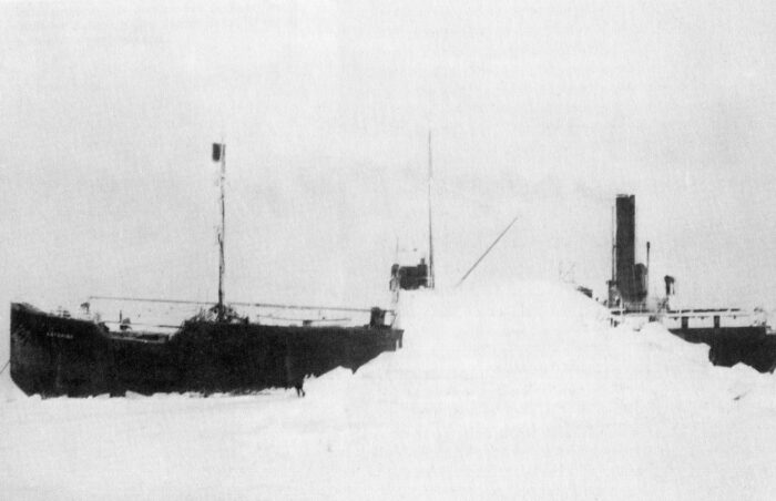
In 2010, a Russian-owned cruise ship called the Lyubov Orlova was seized in St. John's, Newfoundland because it no longer met maritime standards. It was being towed back to Europe for scrap metal in 2013 when the chain connecting it to the towing vessel snapped in rough seas. It was abandoned to its fate and drifted for a few years in the North Atlantic -- occupied, so the tabloid story went, only by "cannibal rats" -- until it emitted an automated signal indicating that it had sunk. This ship had less creepy circumstances but proves that not all ghost ships have suspicious origins.

The Flying Dutchman
Now, we get to the good part. One cannot speak of ghost ships without mentioning the Flying Dutchman. The Pirates of the Caribbean franchise won't let us forget it. Stories of the Dutchman date back to the 1700s. Many sailors swore they’d seen it. Those who did suffered misfortune and death. Supposedly, the Flying Dutchman is doomed to sail the seas forever, unable to make port.
During the heyday of the Dutch East India Company, the Flying Dutchman was sailing treacherous waters when its captain, so the tale goes, unknowingly made a deal with the Devil. if he survived the storm, he agreed to sail it until Judgement Day. Other sources state the captain was working with the Devil and defying God from the very beginning. Nevertheless, the ship and its crew were doomed to roam the seas forever.
As we mentioned earlier, the future King of England supposedly saw it when he served with the Royal Navy in the 1800s. There was also a famous account from a Captain George Barrington in 1795. While sailing around the Cape of Good Hope in the company of a second ship, he spotted the Dutchman nearby during a storm. The second vessel sank, leading the sailors to believe the Dutchman was responsible. Sightings continued until the 1940s.
One incident noted big crowds of people witnessing the Dutchman approaching the shore. Before it made port, it vanished. Even a Nazi submarine supposedly spotted it in Egypt's Suez Canal.
'I die'
Another legendary ship is the SS Ourang Medan, a ghost ship that supposedly wandered the Strait of Malacca. According to reports, in the 1940s, the Dutch freighter sent out a distress message, claiming all crew members were dead and their bodies scattered around the ship.
“All officers including captain are dead, lying in chartroom and bridge. Possibly whole crew dead,” it went, ending with a final, creepy, “I die.”
This story was published in a Dutch-Indonesian newspaper between February and March 1948. The article reads that the ship was boarded by a rescue party to find the deceased crew members with faces distorted into a rictus of horror. Besides the article, records and sightings of SS Ourang Medan are nowhere to be found. Nowadays, most impartial sources believe that the ship never existed.
Likewise, the Jenny supposedly became trapped in ice near Antarctica's Drake Passage during the 1820s. A whaling ship came across it a decade or two later. When the crew boarded, they found a grotesque scene in which its crew members were frozen and almost alive-looking.
The Palantine Light concerns another Flying Dutchman-esque ghost ship. This time, however, it is at least based on a real event. A ship called the Princess Augusta was carrying a couple hundred German Palatine passengers from the Netherlands to Philadelphia in 1738. Sadly, disease, horrendous weather, and starvation took its toll on those aboard. After the captain died, the first mate took command, but the ship ran aground on an island. Despite records of the shipwreck, no physical remains were ever found.
Theories
One of the distinct characteristics of these stories is a ship’s ability to appear and disappear in the blink of an eye. Fabled ghost ships like the Flying Dutchman could be a result of a Fata Morgana, a type of mirage common at sea and in cold regions. Warm air above and cold air near the water refract light and uplift and sometimes invert distant objects. This phenomenon has been responsible for some vanishing islands. So why not ships?
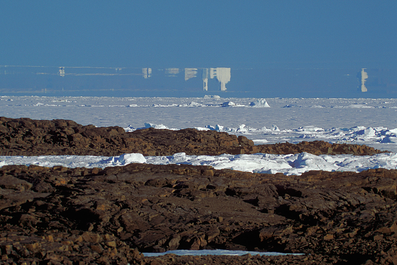
Many Fata Morganas have been reported in the polar regions and other areas with cold seas. Additionally, scholars have suggested that tricks of the light during storms might have caused sailors to seemingly witness a nearby ship, menacing and aglow.
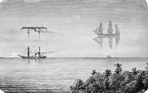
The more outlandish tales could involve someone trying to make money or get their 15 minutes of fame. For example, British tabloids circulated stories of the Lyubov Orlova's cannibal rats and claimed the vessel was off California when it was another ship. Unsubstantiated and anonymously published stories, if well-told, trigger lasting rumors. The high seas have always offered room for the imagination to run wild.
Several legends emerged during times of maritime rivalry. It is possible that stories served as propaganda to deter sailors from rival countries or ships from venturing into certain areas. Sailors have always been a superstitious lot, after all.
Modern ghost ships
Some recent examples of ghost ships have more to do with criminal activities like piracy, illegal fishing, and espionage. Every year, North Korean and Chinese ghost ships appear off the shores of Japan and sometimes Russia. Derelict and sometimes with decomposing human bodies, the ships are very outdated and lack basic technologies. Authorities presume the passengers were fleeing their oppressive home countries and died from disease or starvation.
In the last couple of years, after Russia's invasion of Ukraine, Russia has used ships to transport supplies to its military. They try to avoid detection by turning off their AIS (Automatic Identification System). Bellingcat and other citizen sleuths have exposed some of these suspicious vessels.
While turning off the AIS can turn a vessel into a ghost ship, sometimes the AIS malfunction is genuine. It shows the ship thousands of kilometers from its real location or even going in circles. This could even be due to deliberate interference. This occurred with some ships off the California coast in 2020, leading to suspicions of a new kind of cyber attack.
Conclusion
Most ghost ships have rational explanations. The ocean can be a dangerous place, and some ships simply came to grief. Others are mirages or complete fabrications. But rational or not, these mysterious entities have terrified generations of seafarers.
In 1919, Peter Tessem could not bear his chronic headache and insomnia any longer. The Maud expedition was stuck in thick ice, with little hope of continuing for quite some time. Tessem, accompanied by Paul Knutsen, made the bold decision to venture out into the white nothing. They were never seen again.
Background
The pair’s disappearance had nothing to do with incompetence. They possessed key skills for an arctic expedition. Tessem was a carpenter and Knutsen was an engineer and an adept seaman. The former was part of the 1903-1905 Ziegler Polar Expedition and his companion participated in expeditions to the Kara Sea with Norwegian explorer Otto Sverdrup.
In 1918, the two men embarked on the Maud expedition with legendary Norwegian explorer Roald Amundsen.

But the expedition took a rough turn when thick ice trapped the ship. It might take months before they could move on. Tessem refused to stay on the boat and decided to take his leave of the company. Amundsen did not want him to go alone and initially asked expedition cook Emanuel Tonnesen to accompany him. Later, he instead chose Knutsen because of his expertise and knowledge of the area from previous expeditions.
On Oct. 15, 1919, the pair set out for a telegraph station on Russia's Dikson Island with the following supplies: a tent, a sledge, five dogs, food, fuel, weapons, scientific records, mail, and navigation instruments. Their 800km journey was meant to take a month.
The disappearance
When the two men did not show up at their destination in March 1920, preparations for a search-and-rescue mission began.
Otto Sverdrup attempted a search but encountered too much ice. Ship captain Lars Jakobsen also failed to find the men. Two years later, a Soviet search team managed to find a few clues.

They came across a letter written in mid-November 1919, which confirmed the two were doing well and traveling past Mys Vil’da, about halfway to Dikson. This gave the rescue team some hope that they might find Tessem and Knutsen alive. However, those hopes were dashed when they found the pair’s sledge. The search later turned up a burned skull, bones, and personal effects. But we are not sure if this was Knutsen or Tessem.
Other expeditions in 1922 found skis, a corpse buried with a makeshift cross, a watch bearing Tessem’s name, a wedding ring with Tessem’s wife’s name, and other small artifacts. The mail, records, and other equipment were discovered near Dikson Island and by the Uboynaya River. Only one body turned up. The other is still missing.
Theories
According to Canadian historian William Barr, who produced a thorough analysis of the pair’s last days, Knutsen died first, followed by Tessem. He believes they first found difficulty after leaving Mys Vil’da when they somehow lost their dogs.
Weather conditions could have worsened, forcing them to abandon their sledges and continue on foot. Barr thinks this could explain their scattered belongings.
The first charred body is unlikely to be either of the men. He carried French paraphernalia, which were unlikely items for two Norwegian men. This body could be from the ill-fated 1912 Rusanov Expedition.

The second body, found close to Dikson Island, was almost certainly Tessem because of the watch and wedding ring. This suggests Knutsen buried him. The location of Knutsen’s body remains unknown.
But how did the pair perish so close to their goal? Perhaps there was a freak accident. Some have suggested a struggle between the two men, resulting in the death of one and the other dying from natural causes later. However, considering the personalities of the men, who were both considered honorable team players, this seems farfetched.
You don’t need to be an astronaut or a billionaire to visit other planets. Why? Because they're right here on Earth. Deep in the Libyan Desert is an obscure valley called Wan Tikofi -- the Valley of the Planets. It houses hundreds of planetary-looking rock formations that still confuse scientists today.
Varying in size and shape, these unusual rocks do not just resemble celestial bodies. In some ways, they seem to be alive…
Background
There is very little information on the Valley of the Planets, apart from a few photos circulating on Facebook groups and Reddit threads. These photos capture gigantic spherical and disk-like structures that desert wanderers stroll past on a hot day. The valley stretches for 30km, and the mysterious rocks are scattered throughout.
Those inhabiting this area are nomadic herders called the Tuareg or "blue men." The Tuareg have been around since the 4th century AD, roaming the deserts of Libya, Algeria, Mali, Niger, Nigeria, and Burkina Faso. While known for their remarkable adaptation to the harsh desert, the Tuareg have a special relationship with the stars and planets above. They used the constellations and planets to navigate because they traveled mostly by night to avoid the heat.
Anthropologists believe that the stars and planets were a significant part of their religious mythology in the pre-Islamic era. However, the information is lost to us with the introduction of Islam and the lack of written documentation of their practices. In their oral tradition, the Tuareg simply refer to the rocks as Kawakeb, which means "planets."
Trovants
These rocks may look like planets, but they are actually a result of some complex geological processes. This only takes place in a handful of locations around the world. The rocks, called "trovants," are compacted mixtures of sand, clay, and calcium carbonate. They take on various shapes and sizes, from huge spheres to flattish disks with a sphere in the center. Some rocks sit atop towering pillars and are 10m in diameter.
One of the quirks of these rocks is their ability to grow four to five centimeters every 1,000 years.
These "living stones" not only increase in size. They move and even "give birth" to pebbles. When you break one open, the rock has a series of rings, much like a tree does.
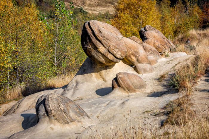
Previously, scientists thought the rocks were concretions. These refer to a hard, compact mass of sedimentary rock that forms by accumulating mineral matter around a nucleus through a process called cementation.
Concretions can take on various shapes, especially spheres and ellipses. They form from the precipitation of minerals from groundwater. They often appear in sedimentary rock, such as sandstone and shale, and can contain organic matter like fossils. But though similar in appearance to concretions, trovants are different.
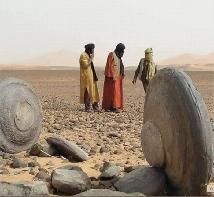
Mechanics
These trovants date to the Middle Miocene (16 million to 11 million years ago), a chaotic period that featured frequent earthquakes. Scientists believe that this may have contributed to their origins.
But how do they grow? The answer is moisture. According to writer Jennifer Walker-Journey of HowStuffWorks, when rainwater contacts the rock, a reaction takes place between the chemicals and minerals, which causes the rock to gradually expand in size. The reaction creates a type of calcium carbonate "cement." The more rain penetrates the rock, the more pressure builds up, and the rock "grows."
Erosion shapes the trovants into spheres. For millions of years, rain, heat, and wind shaped the rocks, creating smooth surfaces of spheres, disks, or imperfect bulbous formations.

Romanian counterparts
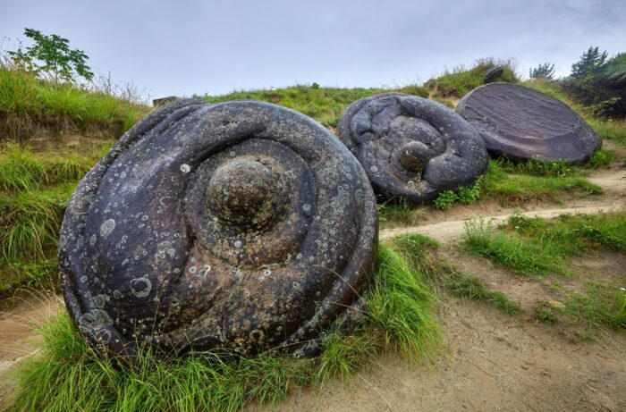
The Valley of the Planets has counterparts in Romania. Near the village of Costesti and in the Buzau Mountains, trovants have become a part of the local folklore. Villagers believe they possess magical powers and sometimes keep them as good luck charms in their homes.
Since they grow, the villagers believe the rocks will also help crops prosper. Other variants of the story say giants created them when they once roamed the earth. The rocks' iconic status has earned them special government protection.
In a village called Ulmet, locals refer to the stones as Babele de la Ulmet, which translates as "Old Women of Ulmet."
In 1934, an archaeologist was digging in the Timna Valley in the sweltering heat of southern Israel. He was trying to prove that King Solomon's Mines was no mere 19th-century fantasy adventure. He believed it was real.
Background
The fascination with biblical archaeology traces back to the Victorian era. With the Industrial Revolution came excavations and the discovery of long-buried sites like Troy, Mycenae, and Nineveh. Some of these discoveries even confirmed tales of Greek mythology and the Bible. The excitement permeated Victorian culture and led to the emergence of adventure fiction.
Enter H. Rider Haggard
The story of King Solomon’s Mines originated in H. Rider Haggard's novel of the same name. This son of a barrister could not figure out what he wanted to do in life. After failed attempts to get into both the army and the British Foreign Office, his father shipped him off to South Africa to work as a personal assistant to a celebrated diplomat. Thus, his love affair with adventure began. Africa and its ancient legends fascinated him. He published King Solomon’s Mines in 1885, and it was an instant hit.
In the novel, he introduced Allan Quatermain, an Indiana Jones-like character who also featured in subsequent novels. Here, a man named Sir Henry Curtis enlists Quatermain for his hunting skills and knowledge of a dangerous region to help find his lost brother.
Curtis’s brother disappeared while trying to find the fabled diamond mines of King Solomon. After narrowly escaping death from hostile tribes, they discover the mines, take some diamonds home, and recover Curtis’s brother. It is worth noting that Haggard placed these mines in South Africa.

Though this is a work of fiction, there might be some truth to the story. The Bible does not explicitly say that Solomon owned mines but does speak about his wealth and his access to raw materials, which he used to create riches for the First Temple. Was Haggard onto something?
Biblical analysis
King Solomon is perhaps the most iconic king in all the Abrahamic religions. He reigned sometime between 975-926 BC. The son of King David and Bathsheba, he was famous for the wisdom given to him by God, for his military prowess and diplomatic skills, for his hundreds of wives, and for his wealth. Supposedly, it “surpassed all the kings of the earth in riches.”
He built this fortune by receiving regular tributes from local and foreign figures as well as through heavy taxation. He used this money to build the First Temple.
The Bible speaks of his wealth extensively in 2 Chronicles 9:13-29:
The weight of the gold that Solomon received each year amounted to six hundred and sixty-six talents of gold, in addition to the tolls levied on merchants and what was collected from foreign trade. All the kings of Arabia and the governors of the provinces also brought gold and silver to Solomon…
King Solomon also made a large ivory throne, which he overlaid with pure gold. The throne had six steps, and a footstool of gold was fastened to it. There were armrests on each side of the seat, with two lions standing beside the arms, while twelve lions stood on either side of the six steps. Nothing like it had ever been made in any other kingdom.
Silver not good enough
He also had around 4,000 stalls for 12,000 horses and chariots and drank only from gold cups -- rejecting silver as not good enough. Much of the wealth went into Solomon’s Temple, also known as the First Temple.
But when Solomon’s reign ended, what happened to his treasure?
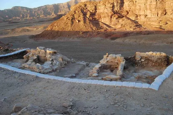
Because of Solomon’s excesses and sins, God punished him. New enemies appeared, and the tribes of Israel rejected Solomon and his successors. His kingdom split into two entities: the Kingdom of Israel to the north and the Kingdom of Judah to the south. Israel was ruled by Jeroboam, one of Solomon's former servants, while Solomon’s notoriously ineffectual son Rehoboam presided over Judah.
Both kingdoms suffered a devastating blow when an Egyptian pharaoh named Shoshenq removed all of Solomon’s wealth from his palace and the First Temple.
1 Kings 14:25–26 says:
In the fifth year of Rehoboam, Shishak, king of Egypt, attacked Jerusalem. He carried off the treasures of the Temple of the Lord and the treasures of the royal palace. He took everything, including all the gold shields Solomon had made.
Egyptians took it all
A temple pillar at Tell Basta, just north of Cairo, confirms the conquest. It states that Solomon's treasures were used as offerings to the Egyptian gods.
Throughout all these passages, there is no mention of Solomon's mines. But 1 Kings 7 explores the construction of the Temple and the materials he sourced. He cast two bronze pillars, 10 bronze carts, and four bronze wheels and axles. Solomon supposedly cast these objects "...in the plain of the Jordan, in the clay ground that lie between Succoth and Zarethan.”
This led historians and archaeologists to believe that Solomon might have used mining to sustain his wealth and maintain the Temple. So, perhaps the idea is not that far-fetched.
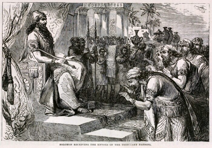
Archaeological evidence
James D. Muhly, a professor of Ancient Near East History at the University of Pennsylvania, states that there is “biblical silence” on the mines. However, numerous books on biblical archaeology do mention them, particularly Solomon’s focus on copper smelting. Solomon even bore the nickname, the Copper King.
The archaeological search for the mines began with the theories of Rabbi Nelson Glueck in 1934. He found large copper smelting slags in the Timna Valley, in the southern part of the Negev in modern-day Israel. Glueck also cited evidence of miners’ quarters.
A few years later, he excavated a mysterious mound in Tell-el Kheleifeh, between Israel’s southernmost city of Eilat and Aqaba in Jordan. This mound hid a large building complex which had a series of peculiar holes throughout the walls. Glueck believed that the building was a refinery and smelter, and the holes allowed wind to keep flames going.
He concluded that Tell-el Kheleifeh was the ancient port city of Ezion-Geber from the Bible. Here, Solomon sent ships to fetch treasures and metals.
The theory falls short
It did not take Glueck’s opponents long to poke holes in the theory. His main critic was a photographer and archaeologist named Beno Rothenberg. Rothenberg claimed that the holes in the walls were simply remnants of where beams were. Plus, mud plaster ringed the holes -- not the type of material that would survive smelting.
Rothenberg did his own investigations in the Timna Valley over the years. Though he found copper mines in the area, they dated before Solomon’s reign by a century and a half. They were also under Egyptian control, as confirmed by hieroglyphs in a temple at Hathor.
In 2013, archaeologists from Tel Aviv University excavated an area in the valley called Slave’s Hill. They found smelting camps containing pieces of clothing, food, broken pottery, and furnaces dating to Solomon’s time. However, they believe the camps belonged to the Edomites -- enemies of Solomon and Israel who lived in the Timna Valley at the same time.
Conclusion
Though the pieces seemed to go together well, the evidence suggests that King Solomon did not have copper mines, from which he cast his treasures, but likely sourced the materials elsewhere. If he did have mines, the Bible would have said so since it details all his other activities and sources of wealth. The legend of King Solomon’s Mines will likely remain a great work of adventure fiction. But this does not mean that other biblical treasures do not exist out there.
Can a continent disappear? Many cultures have stories of vanishing islands or cities swept away by tidal waves. But is there truth to any of these legends?
Our continents have undergone tumultuous periods of shifting, converging, diverging, and subducting. With these geological processes, continents broke apart. Occasionally, we find remnants of ancient continents. Scientists have been searching for one of these, called Argoland, for decades. They might have finally found it.
Paleocontinents
When we talk about submerged continents or lands, we refer to continental crust in our oceans. These landmasses could be the source of "lost land" stories in numerous cultures, such as Atlantis, Lemuria, and Thule.
Landmasses from Earth’s distant past are split into cratons, supercratons, microcontinents, continents, and supercontinents. Gondwana, Laurentia, Pangea, and Rodinia were supercontinents. Broken apart by plate tectonics, they became continents, which sometimes broke into smaller microcontinents.
We have found microcontinents and cratons around the globe. Scientists identified Madagascar and Seychelles as microcontinents of the Gondwana supercontinent. Other islands, like the Azores and Socotra in Yemen, are pieces of Pangea.

Some of Earth's early landmasses were gradually submerged, others subducted -- slipped below -- into the Earth's mantle. Others pushed up to form islands and mountains.
What is Argoland?
Argoland was a continent that purportedly split from northwestern Australia before drifting northwest toward Southeast Asia. Its disappearance left a void in the ocean off the northwestern coast of Australia. No one definitely knew where it went. In theory, it could have settled under Indonesia and Myanmar. Argoland existed during the reign of the dinosaurs and was supposedly 4,800km long and the width of the United States.
Normally, when a landmass moves, it leaves behind a sort of signature. This signature is usually underwater mountain ranges, fossilized wildlife, and other large areas of land underwater. But Argoland did not leave obvious clues.
The search for Argoland
Eldert Advokaat and Douwe van Hinsbergen from the University of Utrecht are key figures in the search for Argoland. They believe that the continent split, creating an oceanic basin called the North Australian Basin or Argo Abyssal Plain. It is 5,730m deep and possesses some magnetic anomalies. For Advokaat and van Hinsbergen, this indicated that something once occupied this space. They launched their search in 2017.
Van Hinsbergen discovered Greater Adria in 2019. This continent broke off from North Africa, splintered into multiple pieces, and settled in the Mediterranean. Pieces can be found all over Europe, including the Balkans, Alps, Anatolia, and Iberia.
Meanwhile, Advokaat had been documenting rocks on the Indonesian island of Sulawesi, believing it held the key to unlocking a missing part of our geological history.
They believe Argoland began to break away some 300 million years ago when Gondwana was still a supercontinent. It finally broke away from northwestern Australia 155 million years ago during the Late Jurassic Period.

Far-flung fragments
Remnants of Argoland lie in Southwest Borneo, Greater Paternoster, East Java, West Burma, and Mount Victoria Land. Advokaat and his team excavated these areas.
Advokaat and van Hinsbergen realized that bits and pieces of Argoland were hiding in layers of rock that differed in age, making it hard to distinguish. They had expected to find a single buried landmass. Instead, rock from different ages was muddled together.
In their study, Advokaat and van Hinsbergen argue that Southeast Asia includes relics of a major continent. As plate tectonics shifted, upheaved, and subducted pieces of the Earth's crust, the process created a deformed, long-lived belt of the Earth's crust called an orogen. This orogen formed during a long, chaotic period of 100 million years.
By evaluating the western and northwestern Australian margins and formations throughout Myanmar, Indonesia and Malaysia, the team managed reconstruct the tectonic movements of Argoland. This reconstruction showed Argoland's trajectory for Southeast Asia as the Northwest Australia Margin was subjected to an eons-long period of ocean spreading, continental extension, and then subduction. As a result, pieces of land were uplifted and lie within those Southeast Asian islands.
Chaotic and messy
Not all continents which separate make such a clean break from South America and Africa, says science writer Cassidy Ward. In the case of Argoland, things got chaotic and messy. Therefore, Argoland was not a large, solid landmass but a chain of islands, an archipelago. The pair have affectionately named it "Argopelago." This archipelago formed as the bigger landmass was breaking off of Australia.
The continent of Great Adria suffered a similar fate. It fragmented so much that you can find pieces all the way from the Iberian Peninsula and the Mediterranean to Western Asia! The painstaking search for remnants lasted more than a decade. Greater Adria supposedly spun and collided into other landmasses, sending a thick chunk of the Earth's crust into the mantle. The rest you can find in strips in the Pyrenees, Occitania, the Alps, Anatolia, and the Caucasus. It was supposedly the size of Greenland at one point.
More continents await
The search for ancient continents never stops. In 2017, scientists discovered a lost continent called Mauritia beneath the surface of Mauritius. It lay between India and Madagascar on Gondwana before the supercontinent split up. After the separation, Mauritia broke into even smaller pieces which can be found in Mauritius, Réunion and the Saya de Malha Bank. Researchers detected it by analyzing the zircon crystal deposits in Mauritius, indicating that they originated from continental crust. There was also a gravitational anomaly which usually signals a much larger, hidden landmass.
As of 2023, geologists completed mapping Zealandia, a land that broke off of Gondwana over 80 million years ago. Most of it is underwater. New Zealand is part of this massive landmass.
Conclusion
After the discoveries of Argoland, Greater Adria, Zealandia, Mauritia and other ancient continents, it is most likely that others remain hidden. These studies have given us leads for a more thorough search. We have better indicators now, like the zircon crystals and magnetic and gravitational anomalies. We also have a firmer understanding of the land's movements.
Many submerged lands turned out to be more fragmented and ribbon-like than predicted. Therefore, scientists need to put aside their preconceived notions of what the Earth used to look like in order to find more of our geological past.
Frozen in time, abandoned for 4,500 years, and under threat from an eroding coastline, Scotland’s "Pompeii" is the best-preserved Neolithic settlement in Western Europe. But despite Skara Brae's immaculate preservation, researchers still don't know why it was abandoned.
Storm reveals a forgotten village
Before its discovery, Skara Brae was nothing more than a sandy, grassy mound in the Orkney Islands off the coast of Scotland. In 1850, a powerful storm stripped the sand away, revealing bits of a small village.
One of the locals who stumbled upon the ruins was an amateur archaeologist named William Watt. Watt and his colleague, George Petrie, excavated the site and uncovered four houses. After Watt died in 1866, Petrie did not continue their work but did present his findings to the academic community.
The site was largely left alone until 1913 when, over a single weekend, someone plundered the site for artifacts. Soon after, another storm revealed more of the village.
In 1925, officials constructed a seawall to protect the ruins from the ocean. Then in 1927, researchers finally decided to investigate the site properly when the government granted access to archaeologist V. Gordon Childe from the University of Edinburgh.
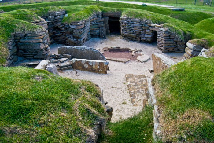
Because of waterlogging and protection from the sand, the site was impressively well-preserved. The researchers found ten flagstone houses built deep into the ground. Each house has Stone Age furniture, including beds, a fireplace, and a Neolithic drainage system. Artifacts included animal bones, tools, jewelry, and pots, as well as a series of carved stone balls with rune-like symbols. Linguists have yet to crack what the runes mean.
Radiocarbon dating suggests most of the discoveries are from around 3180 BC. Around 2500 BC, village life died out. The village shows no sign of advancing further into the Bronze Age, and personal belongings were left behind.
What happened that caused the residents to abandon their homes?
Who lived there?
Archaeologists determined that less than 50 people lived in Skara Brae. The residents were most likely farmers and hunters. Researchers call them the "Grooved Ware People," after some of the distinctive objects they used. They left traces of their existence at other Neolithic sites in Orkney, including the Ring of Brodgar and the Standing Stones of Stenness.
So why did the small community leave? Some historians believe Skara Brae suffered a catastrophe akin to Pompeii. The area is prone to bad weather, and a particularly dreadful storm could have forced the residents to flee. The site was surrounded by dunes, so powerful winds could have blown sand into the village and buried the site.
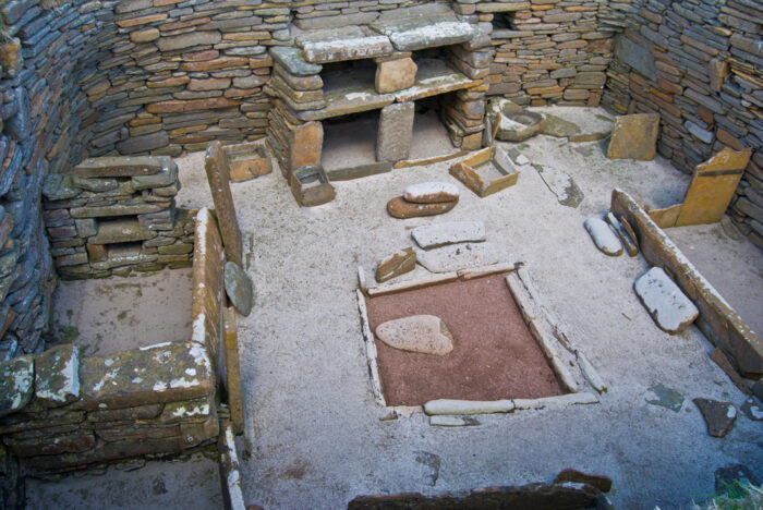
Another theory is that natural erosion of the coastline threatened the village crops.
However, the site was most likely abandoned for several reasons. The transition from the Stone Age to the Bronze Age saw drastic social changes. The Bronze Age brought more sophisticated weaponry, more complex architecture, and the emergence of chiefdoms and hierarchies. Villages grew in size, and migration and trade increased. Perhaps the older residents of Skara Brae died off while the youngest moved on, looking for easier lives.
Skara Brae's abandonment was probably gradual. Straddling two time periods, it succumbed to the tides of change.
Still springing surprises
Recently, Dan Hicks of the University of Oxford tweeted several black-and-white photos from the 1929 Skara Brae excavation, setting off a group of "internet sleuths." The photos contained four women who people had long believed to be tourists. They were actually archaeologists. The internet sleuths embarked on a mission to uncover their identities.
Eventually, they found their names: Margaret Simpson, Margaret Mitchell, Dame Margaret Cole, and Mary Kennedy. All were students of Professor Childe’s. All but one became professional archaeologists. (Cole pursued a writing career.) The women were trailblazers, with female archaeologists exceedingly rare at the time.
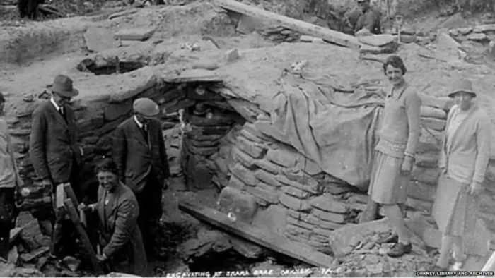
As the Chinese proverb goes, "When the winds of change blow, some build walls, others build windmills." In the case of several remote villages in Iran and Afghanistan, this could not be more true. For centuries, these villages have suffered harsh wind storms that sweep down the plains.
Their answer? Odd-looking structures made from clay and wood. They may not look like much, but they house ingenious mechanical designs. These are the world’s oldest windmills, called "asbads."
Though asbads have slowly been replaced by more advanced designs, some locals strive to maintain them. They are one of the world's first renewable energy prototypes.
The creator of the first windmill
Abu Lu’lu’a Firuz was a Persian slave who lived in the mid-seventh century AD. He was a non-Muslim and may have originally been a Zoroastrian priest.
Non-Muslims were banned from entering and living in the region's Rashidun Caliphate, the empire that immediately succeeded the prophet Muhammad. But because of his exceptional engineering skills, Firuz was allowed access to the capital in Medina alongside his master.
Firuz specialized in machines that could harness the wind and attract the caliph's attention. According to the History of al-Tabari, a chronicle written in 915AD, the caliph Umar ibn al-Khattab said, "I heard you make windmills. Make one for me as well."
"By God, I will build this windmill of which the world will talk," Firuz replied.
This seemed like a good set-up for political favor but it did not turn out that way. Umar established a harsh tax which Firuz refused to pay. Firuz then assassinated Umar while the caliph was leading prayers in a mosque. We are not sure what happened to Firuz after.
However, we know that his invention stood the test of time and still functions today. He created a type of windmill referred to as a panemone. This is a windmill with a vertical axis. Only a handful of them still stand.
Harnessing the wind
After taking the Muslim world by storm, windmills made their way to other parts of Asia and Europe in the 12th century. After invading Iran, the Mongols found them so impressive that they sought to kidnap windmill engineers.
Windmills started popping up in China, Africa, and Europe. Inventors modified them into different shapes, sizes, and designs. But it was only centuries later in Northern and Western Europe that windmills started to take on a horizontal axis. Eventually, horizontal-axis windmills became the most widely used design (as they are today).
A panemone windmill possesses a rotating axis positioned at 90° in the direction of the wind, while the wind-catching blades move parallel to the wind. It is a drag-type turbine. Drag refers to an aerodynamic force that acts opposite to an object's motion through the air. Drag results in less energy and poor efficiency. In Iran and Afghanistan, the panemone windmill is encased in something called an 'asbad'.

An asbad is a two-story adobe, mud, or clay structure. They are typically 20m tall and situated on a hill overlooking a village. The ground floor held millstones to grind grain or machinery to pump water. The top story had a long wall with chambers, each chamber contained six or eight wooden sails dressed with cloth or straw on a vertical axle.
The asbad takes the brunt of strong winds, converting them into useful kinetic energy. As the wind blows through the chambers, it rotates the wheels and vanes to kickstart the grinding or pumping processes below. Harnessing the wind could process a bag of over 100kg of wheat.

The ancient Persians utilized these windmills for two main reasons: to grind wheat and pump water. For the time, asbads were revolutionary and made life much easier. According to historian Robert Forbes, asbads could also chop sugarcane and other crops.
Fighting 120-day winds
The best place to find well-preserved asbads is in the village of Nashtifan in northeastern Iran. Of the 30 windmills there, five are in working order. There are also a few standing in Sistan to the south.
Since the days of the caliphate, the asbads have helped combat the region’s infamous 120-day 'Sistan Winds'. These wind storms occur from May to September and make life difficult for the villagers. They cause intense droughts and can blow at up to 100kmph. In 1991 these winds carried so much dust along the Iran-Afghanistan border that it dried up Lake Hamun. As a result, nearby villages were abandoned and people had to migrate elsewhere.

The Sistan Winds result from the interaction between seasonal winds and the landscape. Their intensity gave rise to the village's name, which translates as "storm's sting."
Heritage
While they seem obsolete compared to modern technology, the asbads play a vital role in the lives of Nashtifan villagers. They draw tourists and are a key part of the villagers' cultural heritage.
In 2002, the Iranian Government recognized the windmills as part of the country's heritage. Unfortunately, maintenance is quite difficult. In Nashtifan, Mohammed Etebari is on a mission to preserve these ancient prototypes. He meticulously cares and cleans them every day. Let's hope that someone steps up to look after these historical treasures when he is gone.
While horizontal-axis windmills are still the norm, some see the benefits of vertical-axis turbines. William Walker of Stress Engineering Services believes that vertical windmills are easier to maintain, would work better for farms, can withstand very high winds, and can reduce production costs. They cause less harm to the environment, less noise pollution, and can generate enough electricity for small-scale operations.
So, could these ancient windmills compete with modern wind turbines? According to National Geographic, an asbad could not even power a lightbulb. Whether useful for generating energy or not, it would be a great shame to let these historic windmills disappear forever.
Today we have advanced submersibles and ocean mapping technologies, yet the ocean remains a dark, mysterious place. For explorers in the 20th century, exploration of the deep sea was limited to rudimentary armored suits and submarines that could not go below 160m. It was exciting, dangerous work.
William Beebe and Otis Barton were early pioneers. The pair were responsible for giving the world its first glimpses of incredible deep sea creatures in a revolutionary craft they designed.
The Azoic Hypothesis
In 1843, Scottish naturalist Edward Forbes stated that life was not viable below 1,800ft (549m). This was called the Azoic Hypothesis and doubtless put off some early adventurers.
However, there were soon signs that deep-sea life existed. In 1860, a telegraph cable 520m below the surface running between Sicily and Algeria snapped. When engineers pulled the cable to the surface they found deep-sea organisms attached.
In the 1870s, the British ship HMS Challenger found deep-sea organisms while dredging and trawling.
The area between 1,000m and 4,000m is called the Bathypelagic or Midnight Zone. This refers to its blue-black color. Sunlight is almost non-existent at this depth, making photosynthesis impossible. A lack of movement from the currents above results in little oxygen, and pressures of over 5,850 pounds per square inch.
With no safe way to descend that far, scientists had no idea what was down there.
Enter William Beebe
William Beebe was a dreamer. His life's pursuit was the depths of the ocean.
Growing up, he enjoyed taxidermy and collecting wildlife samples. He worked in the Bronx Zoo and later in the Galapagos in the 1920s. Eventually, he established a research station on Nonsuch Island in Bermuda. From there he began publishing his deep sea plans in magazines, which eventually caught the eye of Otis Barton.
Barton, an engineering graduate from Columbia University, saw Beebe’s designs and reached out with his ideas for a submarine craft.
Beebe was a brilliant man but was private and skeptical of others. Initially, Beebe turned Barton down, fearing it was a scam. Fortunately, a mutual friend stepped in to set up a meeting where Barton showcased his spherical designs. The meeting was a success and the two men agreed to split the costs of an expedition. Meanwhile, Barton foot the bill for the $11,000 craft.
The Bathysphere
They called their vessel the Bathysphere, a Greek word meaning 'deep sphere.' The craft was made of steel and its three windows were of fused quartz, three inches thick. Inside, there was a small light, a couple of fans, cables, pans of calcium chloride and soda lime, oxygen tanks, and a telephone. The latch alone weighed 400 pounds. In total, the Bathysphere weighed 2.25 tons and was four feet and nine inches in diameter.
The first test dives were rocky. On May 27, 1930, the Bathysphere descended unmanned to 14m. However, the second descent resulted in some concerning tangling of vital electrical cables. This prevented operations from moving forward for some time.
Eventually, the pair felt confident enough to go down themselves. They reached a depth of approximately 244m without incident. Through the quartz-fused windows, they noted unusual species with bioluminescent characteristics.
Their main goal was to reach half a mile below the surface, which they achieved on Aug. 15, 1934. The journey was documented in Beebe’s most popular work Half a Mile Down.

There were always occupational hazards with dives in the Bathysphere. The steel ball had a condensation problem and a window cracked, leading the men to replace the quartz pane with a steel plug. Because of the stuffy conditions and close quarters, the men often suffered from motion sickness.
Sadly, their dives dried up during the 1930s. The Great Depression meant people were more concerned with putting food on the table rather than exploring the deep. But Beebe started writing about his adventures, which managed to keep his program afloat for a little longer.
The research team
Instrumental to Beebe’s and Barton’s success were research assistants Jocelyn Crane and Gloria Hollister. Crane was a carcinologist and researched tropical marine species. In the 1930s, she joined Beebe’s research team in Bermuda straight out of college. She helped to identify, catalog, and determine characteristics of new species.
Hollister was a zoology graduate and worked on transcribing telephone communications between the Bermuda station and the Bathysphere. She provided Beebe and Barton with vital information on weather patterns and their depth, which the Bathysphere was not capable of reading. Hollister even dived to 368m as a birthday wish.
Beebe, Barton, Crane, and Hollister's research played a vital role in opening the door for women in oceanography and biology.
Observations
Some of the species the team discovered include bathysphaera intacta (giant dragonfish), a six-foot-long barracuda-like fish with blue bioluminescence along its body, and the three-starred anglerfish.
"While we hung in mid-ocean at our lowest level…a fish poised just to the left of my window, its elongated outline distinct and its dark sides lighted from sources quite concealed from me," Beebe wrote.
On a dive in 1932, Beebe noted that "although my eyes were perfectly dark-adapted, I could detect not the faintest glimmer of light from 1,700ft (518m) down…from 1,700ft down, animal light is the only external source of illumination."
He described both wildlife and the violet and blue hues of the water. "Blacker than blackest midnight, yet brilliant," he wrote in one journal entry. The dives were brought to life in the illustrations of artist Else Bostelmann for the National Geographic Society.
Legacy
After 1934, the Bathysphere was no longer used for expeditions. But during World War II, it was briefly recommissioned by the U.S. Navy for underwater explosion tests.
By then the Bathysphere had a new and improved successor called the Benthoscope. Barton designed and operated it and was able to go down to 3,000m (10,000ft).

Beebe and Barton’s work laid the groundwork for later explorers, like Jacques Piccard. In 1960, Piccard descended in his vessel, the Bathyscaphe, and reached a depth of 11,000m in the Marianna Trench. His vessel was not a ball but rather a cylindrical self-propelled design. It could go deeper than a submarine.
It is 1820 and Peru is in chaos. Disaffection with the Spanish colonial authorities has reached a breaking point. The citizens of Lima took to the streets armed with weapons and rage, inspired by revolutionaries Simon Bolivar and Jose de San Martin. Amid the commotion, a secret plan was hatched to smuggle some precious cargo out of the city. This cargo? One of South America's greatest treasure hoards.
Chests filled with gold, silver, precious jewels, and relics were loaded onto a ship bound for Mexico. However, the treasure vanished somewhere along the route, never to be seen again. To this day, no one knows where this great South American treasure hoard lies.
Background
The story of the Treasure of Lima starts several decades before its disappearance in 1820.
From 1805 to 1814, Napoleon Bonaparte waged war across Europe. His invasion of the Iberian Peninsular in 1807 proved a crushing blow to the Spanish monarchy.

News of the Spanish defeat, and the subsequent weakening of Spanish authority, soon reached the ears of unsatisfied citizens in South America. Creoles in South America felt ignored. The Spanish limited who they could trade with (Spain alone) and they could not participate politically. Previously, Spanish viceroyalties kept everyone in check. But, eventually, enough was enough.
In 1820, the Argentinian revolutionary Jose de San Martin formed the Liberating Expedition of Peru. He sought to invade and liberate the country from its Spanish oppressors. Upon hearing of San Martin's march to Lima, Lima's Spanish viceroy panicked.
Espionage and betrayal
The viceroy compiled a hoard of treasure from Lima to be sent to Mexico. According to a document in a museum in Caracas, Venezuela, the Treasure of Lima included:
- One chest containing altar trimmings, coated with gemstones of up to 1,244 pieces.
- One chest with two gold relic containers, with 624 topaz/carnelians/emeralds, and 12 diamonds.
- One chest containing three relic containers of cast metal, with 860 rubies and 19 diamonds.
- One chest containing 4,000 doubloons, 124 swords, 5,000 crowns of Mexican Gold, 64 daggers, 120 shoulder belts, and 28 round shields.
- One chest containing eight caskets of cedar wood and silver, with 3,840 cut stones and 4,265 uncut stones.
- Seven chests with 22 candelabra in gold and silver.
- One seven-foot solid gold statue of the Virgin Mary with baby Jesus, adorned with 1,684 jewels.
Today, the treasure would be worth an estimated one billion dollars. The viceroy thought it was a good idea to enlist an English captain to transport the haul, as the English had no ties with the revolutionaries. He chose Captain William Thompson, a well-known English captain of the ship the Mary Dear.
The viceroy sent a military guard and a company of Catholic priests to escort the hoard. Unfortunately, Thompson was less than honorable, despite the viceroy paying him handsomely.

Supposedly, Thompson asked his crew: "We can work as we please the rest of our lives, boys, and not all of us together can ever produce for ourselves as much wealth as there is in one of those big boxes. The fellows who hired us to haul this cargo for them are thieves. They stole all this gold. Let’s take it from them and put it to good use! What is the will of the crew?"
The answer seems to have been decisive. Thompson chucked the military men and priests overboard and they chartered a new course to Cocos Island off the coast of Costa Rica.
Treasure Island
Cocos Island is nicknamed "Treasure Island" for a reason. During the 1800s it was a refuge for pirates and a popular hiding spot for their loot. The waters around the island are rough and it has uneven, rugged terrain.
In later years, the island became so notorious among treasure hunters that the Costa Rican government had to ban treasure-hunting activities entirely in 1994 to protect the ecologically significant environment there. While visitors are permitted, only 1,000 or so are allowed per year.
The hunt
Thompson buried the treasure on Cocos Island for safekeeping, but authorities soon caught up with the mutineers. The Spanish hung the entire crew, except for Thompson and his first mate James Forbes. The authorities let them live so that they could reveal the treasure’s location.
However, inept handling of the case meant that Thompson and Forbes escaped into the jungle. The former eventually got onto a ship bound for Canada and the latter made it to California. Thompson passed away without returning to the island and Forbes built a comfortable life for himself in California, passing on tales of the treasure to his family. Forbes wrote down the details of the location and contents, which he passed on to his son. But, attempts at finding it proved futile.
In the 1840s, Thompson revealed the treasure's location to a man named John Keating, a fellow seaman with whom he became close. Keating visited Cocos Island and found some bits and bobs possibly linked to the Treasure of Lima, such as gold pieces and some jewels. But the vast majority of the hoard was still missing.
German treasure hunter August Gissler became obsessed with finding the Treasure of Lima. Gissler was so committed that he moved to the island from 1889 to 1908. His primary target was the seven-foot golden statue of the Virgin Mary with infant Jesus, laden with precious stones.
The Costa Rican government granted Gissler the position of governor and permission to start a German colony. The colony failed and so did his search. He dug an extensive network of tunnels beneath the island but his excavations led nowhere.
In 1908, he left Cocos for New York, completely heartbroken.

One of Forbes' descendants attempted to find the treasure using information passed down through the family. An article from the Bakersfield Californian newspaper dated Jan. 19, 1949, stated that James Forbes IV went on five expeditions to Cocos Island. At the time of the article, his latest expedition included 50 crewmen and Hollywood movie equipment.
Forbes found some potential clues, such as the "many shreds of canvas believed to have been sails of the ill-fated English merchantman, 'Mary Dear'," but his expeditions were ultimately unsuccessful.
Though the Costa Rican government banned treasure hunting in the 1990s, one man convinced them to give him a chance. After a grueling 18 months of meetings and negotiations, Shaun Whitehead was granted a short permit to explore the island.
Whitehead has an extraordinary resume, from designing Mars landers to exploring the depths of Egyptian tombs. In 2012, he embarked on a 10-day expedition that used radar, 3D mapping, and aerial imaging with helicopters.
But despite all the technology, Whitehead's search came up empty.
Some notable historical figures also took a crack at finding the treasure. Errol Flynn, gangster Bugsy Siegel, and Franklin Roosevelt all looked into the mystery. In total, there have been 300 expeditions to the island. All have failed to find the Treasure of Lima.
What now?
It is possible that stories of treasure on Cocos Island were a ploy to trick naval authorities and throw them off the pirates' trail.
Yet, the presence of coins does suggest some pirate activity. If the Costa Rican government ever permits longer expeditions, hunters might just find something worthwhile.
Before Marco Polo and the great medieval travelers, a humble merchant went on an odyssey to find himself and his people. This unassuming man was not only one of the first medieval travelers but also a pioneer in cultural anthropology and ethnography. Both disciplines barely existed in that era.
Background
Benjamin of Tudela was a 12th-century Jewish merchant from northern Spain. This learned man spoke several languages and had an affinity for foreign cultures. He specialized in coral and gem trading and had a keen eye for investments and business opportunities. We don’t know much about his early life except that his great journey probably started around 1160. He may or may not have been a rabbi, as some Jewish sources claim.
After leaving Tudela, he explored his home country, then France, Italy, Greece, Turkey, Cyprus, the Holy Land, Damascus, and Iraq. In his later travel book, he lays out how long it takes to get from point A to point B. He also provides the reader with the first non-Arab mention of the Druze culture in literature.
Benjamin spent long periods in Christian strongholds like Rome and Constantinople. He was particularly impressed by Constantinople's wealth but felt uneasy by its treatment of its Jewish population.

Marcus N. Adler, a rabbi in the British Empire and one of Benjamin's translators, stated that he was one of the few medieval writers to mention Prester John, the legendary Christian monarch who might or might not have existed.
There is some doubt as to whether or not he traveled beyond Iraq. He reports on Persia, China and even Tibet, but some details of these far-flung lands are sketchy. Elsewhere, everything had been accurate. Persia notoriously oppressed the Jews so it was unsafe for him.
Benjamin also made one of the first mentions of China by name. It is possible that he filled in the gaps with information from other travelers. At the end of his journey, he returned to Spain by boat, passing through Egypt.
His travelogue
Thanks to his travelogue, The Itinerary of Benjamin of Tedula, he is considered one of the best and most accurate sources of medieval life and the relations between religious groups in Europe and the Middle East.
Benjamin seemed to feel more comfortable with Muslims than with Christians and emphasized the decent relations between Jews and Muslims at the time. He was very honest about conflicts in Judaism, pointing out the hostile relations between warring sects of the Rabbanities and the Karasites.
In his unofficial census of the Jewish population in Europe and the Middle East, he noted the numbers, occupations, learned men, synagogues, and practices. For example, he says, "Pisa is a very great city…[with] about twenty Jews." In the city of Lucca, he likewise counted about 40 Jews. In all, he documented around 300 cities.
Through the Itinerary, historians witness first-hand the great shifts occurring in Europe between Jews, Christians, and Muslims. Many transformative events characterized the 12th century: the Crusades, the early Renaissance, the emergence of nation-states, the rise of vernacular literature and translation, diversification in trade, and more.
Why?
Historians are unsure why he traveled, but some believe he had religious or commercial intentions. Throughout the text, he described his faith at play in different countries. The fact that he so thoroughly documented Jewish experiences, sites, and practices could indicate that his journey was a sort of religious quest.
Was he on a pilgrimage to the Holy Land? His tone and content indicate that he was a devout Jew. He tracked populations of his people and visited sites from the Old Testament. Once he commented, "The closer I get to Jerusalem, the more Jews are heretics.” However, if it was mainly about religion, he would likely have written more about the spiritual aspects of his trip.
Lost Tribes
Another possibility is that he was searching for the Lost Tribes of Israel. He and other travelers like him were trying to locate the Lost Tribes -- exiled after an ancient conflict -- as a means of maintaining their heritage. For centuries, the Jews had already scattered across the globe. Writer Alanna Cooper says in the AJS Review that while Benjamin mentions finding the tribes of Dan, Zevulun, Asher, and Naphtali, he does so in passing. His casual tone doesn’t indicate urgency or excitement. Most likely, then, he wasn’t searching for them.
Jewish theologian and Rabbi Michael Signer believes Benjamin’s travelogue was a “consolation for the Jewish people,” a way of uniting them. The Itinerary of Benjamin of Tudela was most likely a passion project for him to tap into his identity or present a map of the Jewish diaspora to potential migrants. In the wake of the Crusades, Jews had been persecuted and driven out of their original dwelling places.
Finally, he may have simply been scouting for trade routes between the Jewish communities. He often mentioned whether those he met were merchants, jewelers, glass workers, silk weavers, or dyers.

Legacy
An urban art project called Street Talk launched in Jerusalem in 2017, dedicated to Benjamin. It reimagined him as a 21st-century backpacker named Benny, exploring Europe and the Middle East.
He makes his way through Jerusalem, encountering historic figures from Jewish history, and receiving advice on where and how to travel. It was partly an educational project highlighting how the Jewish people have been scattered for so long, trying to make their way home.
A medieval geography project called Mapping the Jewish Communities of the Byzantine Empire by Nicholas de Lange at the University of Cambridge used GIS to map Jewish communities in the Byzantine Empire. Benjamin of Tudela was the main data source.
Tudela may not be as famous as Marco Polo or even Ibn Battuta, but his travels are considered on a par with theirs. And his work is crucial in Hebrew medieval literature.
In 1481, a mysterious figure emerged from the desert in Benghazi. The man, exhausted and delirious after having survived a monstrous sandstorm, demanded to speak to the local emir. Intrigued, the emir allowed him to relay the incredible tale of his survival and how he managed to escape the swallowing sands that every desert traveler feared.
The stranger had been driving camels from the Nile to the oases of Dakhla and Kharga. Then he met a series of misfortunes until Providence put him on the path to an unknown oasis in the Sahara, the Oasis of Little Birds, also called Zerzura.
A tall tale?
Hamid Kiela, the man who found Zerzura, was traveling with a caravan west of the Nile when a sandstorm hit. The rest of the company suffocated, but Hamid sought shelter underneath a dead camel and survived.
After the storm had passed, Hamid had more problems to worry about -- mainly food and water. He began to wander the desert in a daze, preparing himself for the inevitable. He passed out, but not long after, a group of strange-looking good Samaritans offered their assistance. They weren’t olive-skinned with dark eyes like everyone else but rather fair-skinned and blue-eyed.
They brought him to a gate with a bird at the top. Inside was an incredible city of white buildings. Significantly for the time, people were not wearing Islamic dress, and there were no mosques. Giants guarded the oasis, and the king and queen were in an enchanted sleep. The guardians of the city were huge birdmen hybrids or jinn.
Zerzura means "bird" or "starling". Thus, it became known as the Oasis of Little Birds.
Asked by the emir why he didn’t stay in this idyllic oasis, Hamid admits that he left of his own accord. Eventually, Hamid showed the emir a regal-looking ruby ring, implying that he had stolen it. The emir punished him but still sent out search parties to find the oasis, to no avail.
Interestingly, local legend says that the stolen ring, supposedly from Zerzura, sat on the finger of King Idris of Libya.
Book of Treasures
Our tale begins with an Arabic manuscript dating to the 15th century, now lost to us. It was called the Kitab al Kanuz, the "Book of Treasures" or "Book of Hidden Pearls". It was a codex of over 400 treasure sites in Egypt, had a general compendium of fables and Arabic myths, and included magic spells for various purposes.
One of the stories in this Book of Treasures involved Zerzura. Fragments of this text emerged in 1904 when pieces showed up in an English newspaper based in Cairo called the Egyptian Gazette:
Account of a city and the road to it, which lies east of the Qala'a es Suri, where you will find palms and vines and flowing wells. Follow the valley till you meet another valley opening to the west between two hills. In it, you will find a road. Follow it. It will lead you to the City of Zerzura.
You will find its gate closed. It is a white city, like a dove. By the gate, you will find a bird sculptured. Stretch up your hand to its beak and take from it a key. Open the gate with it and enter the city. You will find much wealth and the king and queen in their palace, sleeping the sleep of enchantment. Do not go near them. Take the treasure and that is all.
European interest
The first mention of Zerzura by a European was in 1835 by Gardiner Wilkinson, the father of British Egyptology. He met a man who had lost his camel in the desert. The man claimed to have survived after finding a miraculous oasis five days west of the Farafra-Bahariya caravan route. He called it Wadi Zerzura and said it contained shady palms, refreshing springs, and some peculiar ruins.

For several years, the Book of Treasures was allegedly in the possession of a member of the Royal Geographic Society named E.A. Johnson Pasha. When the explorer William Joseph King Harding was trying to pinpoint the origin of the Zerzura story, he met with Johnson Pasha. Pasha told him that he possessed the only copy of a manuscript with the routes to Zerzura and other legendary locations, such as the mines of the great Persian king Cambyses. Harding searched for the city in 1909 and 1911 but found nothing.
The Royal Geographic Society published a series of papers and expedition reports related to Zerzura. They described the lost city as a "problem" that needed solving, not just because they did not know its whereabouts but because they believed it played a key role in an ancient expedition.
Richard A. Bermann, in a paper from 1934, explained their thinking. "The famous expedition of King Cambyses’s army against the oasis of Jupiter Ammon could hardly have been planned if the existence of water somewhere in the middle of the desert had not been known. Throughout the Middle Ages, Arab writers had told about a hidden oasis, the name of Zerzura," he wrote.
Local legends
Harding also heard from locals who claimed to have seen the giant men and animals who hailed from Zerzura or had met residents who emigrated from there. But he heard conflicting reports about the state of the oasis city. Rather than the flourishing, rich city from the Book of Treasures, he often heard of an abandoned oasis. He started to believe that there were dozens of these through the desert.
The Zerzura mystery even inspired the formation of a Zerzura Club. Founded in 1930 by British explorer Ralph Bagnold (famous for crossing the Libyan Desert from east to west), the club had 13 members dedicated to finding the city. It lasted till at least 1935.
A separate group tried to find the city in 1932. Laszlo Almasy, Robert Clayton, pilot H.W.G.J. Penderel, and surveyor Patrick Clayton used planes to scout the desert. They came across lush valleys in southeast Libya containing prehistoric art. Some locals even suggested that the valley belonged to Zerzura.
Theories
There is precious little information about Zerzura, even compared to other mythical places. Take Iram of the Pillars. It was built by a king named Shaddad for the people of Ad. The city was an opulent paradise that grew too greedy, leading to its destruction.
Zerzura does not seem to be an allegory; there is no obvious moral lesson. We have no archaeological evidence to work with either, merely the fanciful words of a story.
The details about the lack of Islam in the city are peculiar. Was it a sort of commune of non-believers? Was that why the location was such a secret?
Or perhaps it was not ancient or Islamic at all. Travelers passing through might have established the oasis. Many non-Muslims traveled through the Sahara, particularly in the medieval period. It could have been a foreign group living in this oasis that did not adhere to Islamic customs. Additionally, they were fair-skinned and blue-eyed, which indicates a European background. The Crusades lasted until 1291. Were these Crusaders that settled in the desert? The mystery endures.
At school, wildlife is pretty straightforward. Kids are told about lions, tigers, and bears (oh my!). But sometimes, the animal kingdom springs a surprise creature on us. Hybrids are unexpected mishmashes of two species. From the majestic liger, born of a lion and tiger union, to the enigmatic wholphin, a product of a dolphin and false killer whale pairing, these creatures challenge our understanding of nature.
Buffalypso
This odd and relatively unknown hybrid species originated in Trinidad and Tobago. It is a crossbreed between a species of swamp buffalo called a carabao and an Indian water buffalo. Locals created the buffalypso out of necessity. Buffalos, imported from India after the Second World War, were highly susceptible to local diseases, particularly tuberculosis, but also hoof and mouth disease and parasite-based illnesses.
After receiving expertise from abroad, veterinary scientist Stephen Bennet returned to Trinidad to develop a solution. He wanted to create an animal hardy enough to withstand the toughest climates and environmental stresses.
"The adaptability of these animals to tropical conditions would indicate that, with selective breeding and improved environmental conditions, these animals may easily find their way in the tropics," Bennet said.
He tested his hybrid with herds belonging to the Caroni Limited Sugar Company. Bennett and his researchers eventually found success. The world's first buffalypsos were physically tougher than your average water buffalo, had much more meat, produced high-quality milk, and were exported to several countries like the U.S., Italy, and Argentina.

However, the buffalypso experiment ended after a few decades. A lack of funding, proper management, research, food supplies, and vaccination protocols led to a sad decline in the animals. Though they were initially disease-resistant, they started to develop brucellosis, which caused a steady decrease in numbers. What was once a healthy herd of a few thousand is now around 1,000. They have also become a nuisance to rural populations; they run around unsupervised, trampling crops and scaring locals.
Wholphin
First identified by the scientific community in Tokyo's SeaWorld in the 1980s, the wholphin was the unexpected result of a union between a male "false killer whale" and a female bottlenose dolphin.
Smithsonian Magazine writer Carlyn Kranking believes that dolphins are more flexible in terms of who (and what species) they breed with than most species. This means there may be more dolphin hybrids in the wild.
The name is a little deceptive. A false killer whale is a type of dolphin, so technically, it is a dolphin hybrid. Researcher John Blanchard at Tokyo SeaWorld described the wholphin as: "darker than the other dolphins, and her nose looked like it was chopped off."
Wholphins typically resemble a dolphin with a thicker, stocky frame and interesting color patterns. They generally fall between the size of a bottlenose dolphin and a false killer whale. They are playful, social, and intelligent.

The wholphin in Tokyo SeaWorld died within 200 days. In Hawaii, a female wholphin survived to adulthood and gave birth to a few calves. All the calves died after a few months, except one, which had trouble nursing. The high mortality rate of the wholphin has prevented further studies.
Liger
The liger is the offspring of a male lion and a female tiger, while a tigon is a cross between a lioness and a male tiger. Ligers are larger and possess a lion's muscular stature and a tiger's large size. They can grow past 3.3 meters long and weigh up to 450kg, while tigons usually grow up to two meters long and weigh 320 to 360kg. Some records show that ligers can emerge in the wild.
Ligers are more susceptible to health problems than either parent species, suffering from obesity and organ issues.

Sightings of ligers date from at least the 17th century in India. One was presented to Queen Victoria when she was a young princess. They possess faint stripes of black, brown, or sandy color.
Though initially thought to be sterile, the Zoological Life Foundation now states that there is a 6% chance that ligers can bear healthy cubs. There are around 100 ligers in captivity today.
Pizzly and grolar bears
The pizzly bear and a grolar bear are hybrids from a polar bear and a grizzly bear. A pizzly comes from a male polar bear and a female grizzly, a grolar is from a female polar bear and a male grizzly. These hybridizations occur where the species ranges overlap, as in the Arctic regions of Canada and Alaska.
A hunter first observed a hybrid in 2006. He was traversing Banks Island in Canada's central High Arctic when he shot a bear. The bear was cream-colored with brown areas on its fur, hunchbacked like a grizzly, and had longer claws than a polar bear.

When the Wildlife Genetics International research team ran a DNA test, they found the bear had a polar bear mother and a grizzly father. More examples popped up in 2010, 2012, and 2014. Some researchers believe climate change is responsible for a surge in hybrids. Grizzly bears are roaming further north for food and polar bears are moving south. As a result, the two species are coming into contact more often.
Narluga
This hybrid is extremely rare. The narluga is a cross between a narwhal and a beluga. The narluga does not have a tusk (it's actually an extended tooth) but inherits the narwhal's grey and white skin. It has the tail of a narwhal and fins of a beluga. Scientists only know this from studying the skull of a narwhal-beluga hybrid found by an Inuit in the 1980s.
Sadly, there is no photographic evidence of this hybrid, only eyewitness testimony and physical remains.
It was a scene out of a horror movie. There was no sound, the air was deadly still, and the putrid smell of rotting eggs wouldn’t go away. Bodies of people and animals lay motionless in several villages near Lake Nyos. In August 1986, hundreds of people died suddenly in one of the rarest geological events of the modern era.
Background
Lake Nyos is a 1.9km long and 200m deep crater lake located in northwestern Cameroon. Between 9 pm and 10 pm on Aug. 21, 1986, villagers in the valley heard a strange rumbling noise. Those closest to the lake itself described a bubbling noise. Then, white smoke started to emerge from the lake and travel northwards. Then, people and animals suddenly dropped dead, killed by a silent assailant. The cloud is called a mazuku, a deadly blanket of carbon dioxide.
Around 1,800 people died, all living in the affected towns of Nyos, Cha, Fang, Mashi, and Subum. Most residents were farmers. About 3,500 livestock also perished. Insects stopped making sounds. It was as if time stood still. The lake water was usually a brilliant blue color, but after the eruption, it turned reddish-brown.
A rescue team did not arrive until 36 hours later. Assisted by the Cameroon military, everyone had to wear protective gear and oxygen tanks. Sadly, the dead could not receive individual funerals, so mass graves were dug.
The aftermath and effects varied. The survivors (four in Nyos and around 5,000 in the general area) were all in comas that ranged from six to 36 hours. They reported falling unconscious and waking up dazed. They escaped death because they lived on higher ground.
Some had respiratory issues, which cleared up soon after. Women suffered miscarriages; others had pneumonia. Some committed suicide after seeing the horror or losing family members. Pictures of the dead bodies also contained big lesions caused by low levels of oxygen.
Limnic eruption
The disaster at Lake Nyos is an example of a limnic eruption, also called a gas eruption. It happens when a lake, typically a volcanic crater lake, instantaneously releases a large amount of dissolved gases.
In this case, Lake Nyos primarily contained carbon dioxide with traces of sulfur dioxide. This gas release can occur when pressure builds up at the lake's bottom from geothermal activity.
When the pressure becomes too great, gas rapidly escapes to the surface and forms a dense, toxic cloud. The cloud can blanket the ground, displacing oxygen and asphyxiating people and animals. It does not seem to affect plant life.
Two other dangerous lakes
Lake Nyos is not the only incident. Just 100km away, Lake Monoun erupted on Aug. 15, 1984, killing 37 people. Lake Nyos erupted almost exactly two years later.
Lake Nyos and Lake Monoun are two of three lakes in Africa that experience these types of eruptions. In the Democratic Republic of the Congo, the third lake, Lake Kivu, expels not just carbon dioxide but also methane and hydrogen sulfide. Though it has not erupted catastrophically like the other two, scientists worry that it has the potential to release over 300 cubic kilometers of carbon dioxide and 60 cubic kilometers of methane, according to journalist Nicola Jones of Nature.
Though companies commercially extract methane from the lake, volcanic activity can trigger a limnic eruption at any time. In 2021, there was a scare when Mount Nyiragongo erupted and triggered small amounts of gas to emerge from the lake. A volcanic crater lake in Italy called Lake Albano also has the potential to have a limnic eruption.
In Russia, the Valley of Geysers is located in the super-active Kamchatka region. Locals refer to an adjacent low-lying area as the Valley of Death because heavier-than-air carbon dioxide can blanket the ground and kill wildlife. While the Valley of the Geysers is a tourist spot (it's the second-largest geyser field on Earth, after Yellowstone), the nearby Valley of Death is understandably off-limits.
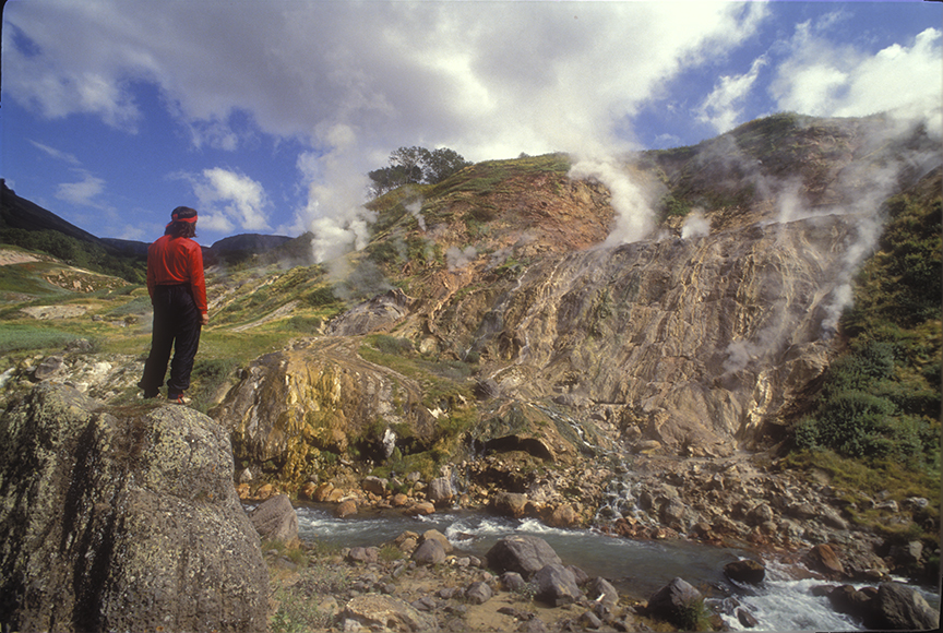
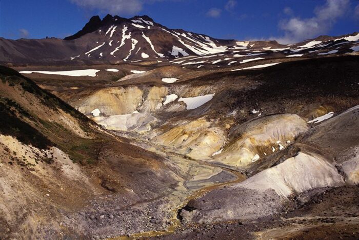
How it happened
“Anaesthetic concentrations of carbon dioxide [was] formed as the gas mixed with air during its flow into the valleys," explained the official study written by Peter J. Baxter et al.
Furthermore, on this calm night, the gas collected in hollows and would stay there until the winds or solar heat dispersed it. Although the initial cloud that erupted from the lake was an estimated 50-100m thick, it is unclear how thick the blanket that settled upon the villages was.
But why are these lakes concentrated in one region? Lake Nyos is not a very old lake, possibly just a few hundred years old. Lake Nyos and Lake Monoun are in the Oku Volcanic Field, part of a 1,600km-long chain of volcanoes that runs from Nigeria and Cameroon in the mainland to the southernmost island of Annobón.
Lake Kivu lies in the East Africa Rift Valley, which is notorious for its highly active and dangerous volcanic formations. The region's volcanism is due to the split between the African and South American plates over 100 million years ago.
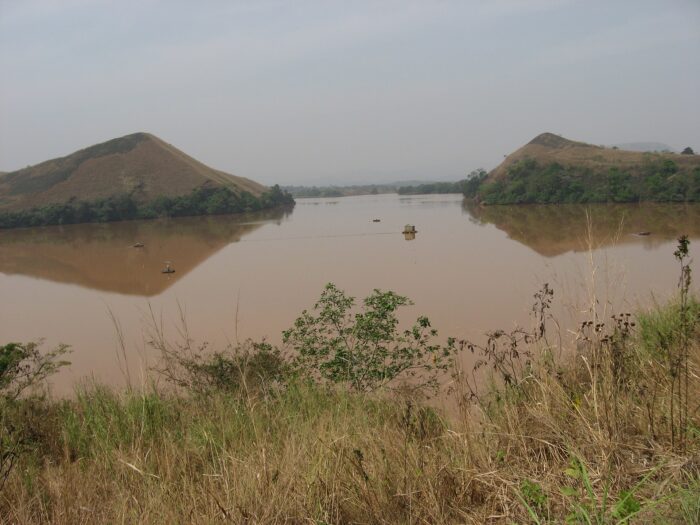
A bubble of CO2
According to NASA, Lake Nyos sits on the edge of an inactive volcano and a pocket of magma. “Carbon dioxide from that magma slowly percolates through Earth’s crust with the groundwater and accumulates in the bottom of the lake," states NASA. "Eventually, the gas becomes too concentrated, and a bubble of CO2 bursts from the lake.”
What triggered the eruption? Most likely a landslide or a small earthquake. This would have released carbon dioxide, which accumulated to over 10%.
So why carbon dioxide? Why wasn’t it mixed with the usual volcanic gases -- sulfur dioxide, hydrogen fluoride, hydrogen sulfide, hydrogen chloride, and carbon monoxide? While water tests showed that the accumulated gas was almost completely carbon dioxide, the rotten egg or gunpowder smell after the eruption suggests that very small amounts of sulfur dioxide might have been present. However, when carbon dioxide is saturated in water, it also gives off this unpleasant smell.
Prevention
To prevent a recurrence, measures were implemented to manage the buildup in Lake Nyos. At first, scientists considered blowing up the lake with a bomb. Instead, they opted for a gradual degassing of the lake.
In 2001, French engineers installed degassing pipes to release the trapped gases in a controlled manner. A plastic tube reached 203m down and conducted the gas safely into the atmosphere. Authorities installed two more pipes in 2011. They did not want to take any chances with Lake Monoun, so they installed three pipes there as well.
They also relocated several communities and have tried to discourage those who wish to return to the lake decades later. Apparently, the lake is still toxic. However, residents claim that this is their ancestral land, and they prefer to bear the risk.
Where did the Aztecs come from? Despite a wealth of archaeological and written records, it remains a pesky question without a concrete answer.
In Aztec writings, from secondhand sources, and passed down via oral tradition, a place called Aztlan is described as the mythical homeland of the Aztecs. But where, or what, is Aztlan?
Origin story
Aztlan has different translations depending on the source. Some believe it derives from the Nahuatl words "aztatl" (heron) and "tlan" (place of). These sources interpret the name as either "Place of Whiteness" or "Place of Reeds." Other sources suggest it simply means "the land of the Aztecs."
According to legend, it was from Aztlan that the forebears of the Aztecs, the Mexica, embarked on a centuries-long migration. This migration eventually led them to the Valley of Mexico, where they founded the capital of the Aztec empire, Tenochtitlan.
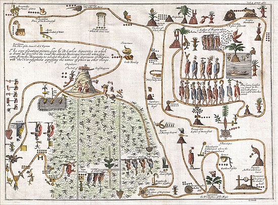
The legend describes Aztlan as fertile and prosperous. Variously described as an island or region, it was north of the Mexica's eventual settlement in the Valley of Mexico.
On their journey, the Mexica were guided by Huitzilopochtli, the god of war and the sun. They moved south from Aztlan, searching for a sign that would indicate where they should establish their capital city. This sign was prophesied to be an eagle perched on a cactus with a snake in its beak. This image later became the symbol of Mexico.
A utopia
To the Aztecs, Aztlan was a utopia. People there were immortal and able to choose how old they would like to appear to others. It had abundant ducks, fish, herons, maize, and beans.
According to legend, seven tribes (the Mexica, Chalca, Acolhua, Tepaneca, Tlahuica, Tlaxcalan, and Xochimilca) lived in seven caves in a place called Chicomoztoc. While Aztlan is the homeland, Chicomoztoc is the origin place.
The tribes left their caves because Huitzilopochtli told them to find a new home. The migrations occurred in waves. First, the Xochimilca left, then the Chalca, the Tepenecas, the Alcolhua, the Tlahuica, the Tlaxacalan, and finally the Mexica. The Mexica eventually arrived at Lake Texcoco, where they founded Tenochtitlan in 1325 AD. This city later became the heart of the Aztec empire.
Aztec manuscripts such as the Codex Boturini and Codex Azcatitlan describe the migration from Aztlan to Tenochtitlan. Historians believe the migration took place in the late 1160s AD.
Later sources
Dominican missionary Diego Duran studied and recorded the ways of the Aztecs. "Moctezuma having become a great lord…determined to learn about the place where his ancestors had lived and about the seven caves to which his histories had given special attention," Duran wrote.
Moctezuma's desire to find their homeland was likely an attempt to legitimize and solidify his rule. He sent out an expeditionary force of 60 sorcerers with precious jewels, gold, feathers, and other valuables, hoping to entice their ancestors.
According to legend, the force arrived at a hill several days after they left Tenochtitlan. Here, a mysterious old man greeted them. The man was a high priest and guardian of Aztlan. He allowed the group to visit and they transformed into birds to journey the rest of the way. In Aztlan, they met the mother of Huitzilopochtli, who was waiting for her son to return.
The story draws a stark contrast between the idyllic Aztlan and Tenochtitlan. The latter cared mostly about conquest, sacrifice, and military might. Aztlan did not. Aztlan and Tenochtitlan ran parallel to each other, one a paradise and the other a hell.
When the tribes left Aztlan, they experienced hardships, illnesses, and dangers. The land was not abundant with food, and their descendants became evildoers. Tenochtitlan was so repulsive to those living in Aztlan that they considered the occupants traitors to the homeland.
Location
The Dillmans, a family of treasure hunters, have been searching for Aztec gold for decades. They believe Aztlan is somewhere in Utah. As a result of the Mexican-American War, Mexico ceded a vast territory to the U.S. in 1848. This included present-day California, Arizona, New Mexico, Texas, and parts of Colorado, Nevada, and Utah.
According to the Dillman family, there is evidence of linguistic similarities between tribes in Utah and the Aztecs. Some linguists agree that there are at least small similarities between indigenous groups in Utah and the Aztecs. Nahuatl was spoken in some parts of the southwestern United States. In Utah, the main language was Numic. Nahuatl and Numic belong to the Uto-Aztecan language family. However, research into a linguistic connection is limited.
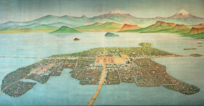
Archaeological evidence suggests that there were trade networks and cultural exchanges between Mesoamerican groups and societies in the American Southwest. This indicates some level of contact between Aztec culture and groups in Utah.
Some Mexican intellectuals suggested that the island of Mexcaltitán de Uribe could be Aztlan. A tiny island city in the Mexican state of Nayarit, it has a vibrant fishing culture but there is no physical evidence to back up this claim.
Political spin
Aztlan was used as the symbol of the U.S. Chicano movement of the 1960s and 1970s. During this period, Chicano activists drew upon Aztlan as a symbolic and ideological framework to assert their Indigenous heritage and claim the lands of the southwestern U.S. Aztlan fit a powerful narrative of reclaiming ancestral lands and asserting cultural identity in the face of social and economic struggles experienced by Mexican-Americans.
Other organizations, like the Brown Berets and the Chicano Student Movement of Aztlan, also adopted Aztlan as a powerful motif.
Conclusion
The physical search for Aztlan had ground to a halt by the 20th century. The homeland became primarily symbolic, representing the longing Mexicans have to regain their heritage and an ideal to strive for.
How exactly do you look for a civilization that never existed? Usually, civilizations leave behind something: art, artifacts, oral traditions. But this civilization only exists in cyberspace and in the minds of some rather eccentric individuals. This is the Tartarian Empire, a civilization supposedly suppressed and erased from history by world governments.
This article will not try to examine whether Tartaria existed. Rather, we will explore how this wild theory emerged.
What is Tartaria?
Tartaria was supposedly an ancient civilization with highly advanced technology. The Tartarians were giants who built mankind’s most impressive architecture: the Great Pyramids, the Taj Mahal, Petra, and the Great Wall of China.
Some believe that the Tartarians even built the Capitol building in Washington D.C. and other classic architecture in the Greco-Roman, Gothic, Baroque, Gilded Age, and Renaissance styles.
Believers argue that many great civilizations, including the Greeks, Romans, Egyptians, Chinese, and Israelites were part of the Tartarian Empire. Another faction of Tartarian theory suggests that history's timeline is completely wrong.
"Deception has been utilized to push history back a thousand years and create an artificial dark age. The time of Jesus was less than 1,000 years ago," believer Minette Christel Kotze writes on LinkedIn.

Supporters of the theory cannot fathom how quickly mankind developed its architecture. They conclude that an advanced race of people must have built everything. The conspiracy theory argues that world governments paper over the last remnants of this great civilization, replacing Tartarian buildings and technologies with inferior modern versions.
The real Tartaria?
There is a real place called Tartary. It is an old name for parts of Eurasia. Europeans and Catholic missionaries used it to emphasize remote areas. The Greek word Tartarus means hell and Europeans wished to convey Asia as a scary, hellish landscape, rampant with pagan peoples and dangers.
Scholars used the name for various areas, including Chinese Tartary (Manchuria and Mongolia), Russian Tartary (Siberia), and Independent Tartary (Turkmenistan, Uzbekistan, and Kazakhstan). Tartary was printed on maps until the 20th century.
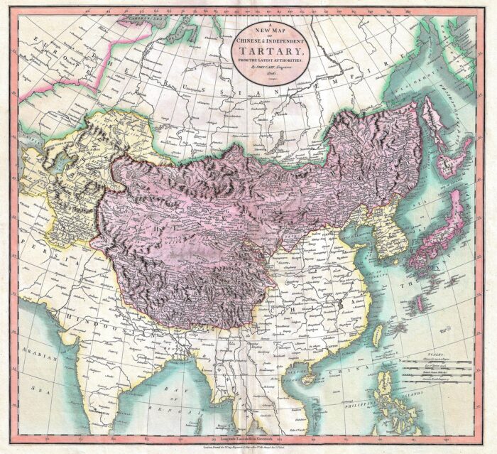
Tatars or sometimes Tartars (not to be confused with the sauce) refer to Turkic groups in Central Asia: the Volga Tartars, Crimean Tatars, Afghan Tatars, Siberian Tatars, and Lipka Tatars. However, these groups were by no means giants. Nor did they surpass the rest of humanity in technology or architecture.
The mud flood
According to Brian Dunning, the host of the Skeptoid podcast, the modern conspiracy theory of Tartaria began circulating online in 2016. YouTubers started posting about a massive "mud flood" that wiped out this great civilization. Their evidence? Buildings with basement windows, underground tunnel systems, and structures built on each other. They argued that the mud flood destroyed Tartarian architecture not thousands of years ago but sometime between the 19th and 20th centuries. The theory states that the destruction reset mankind's history and collective memory.
Photos of the World's Fairs held in Chicago, San Francisco, Paris, and other cities were supposedly really photos of the capitals of the Tartarian Empire, showing the world its technologies.
Further down the rabbit hole, Tartarian believers think that wars and other disasters were used intentionally against the Tartarian Empire. World Wars I and II, the Napoleonic Wars, and the destruction of cities by fires and pandemics were efforts to eradicate this glorious civilization.
We can see just how far removed the myth of the Tartarian Empire is from the geographical definition of Tartary. However, some proponents have tried to link the two, suggesting that Genghis Khan was a Tartarian king who expanded the empire and sought to save it from destruction.
Origin story
Where did this wild pseudohistory originate? All signs point to one man. Russian professor Anatoly Fomenko is one of the world’s very few "recognized" conspiracy theorists. A member of the Russian Academy of Sciences and tenured at Moscow State University, Fomenko published an extensive chronology that completely rewrote history. His New Chronology (published in the 1970s) aimed to discredit the Catholic Church and the Romanov dynasty.
Fomenko's work inspired the emergence of a new-age Russian nationalist movement called Levashovism. This movement called Russia "Great Tartaria" and used the term to legitimize Russian attempts to take control of Central Asia.
A publicly available CIA document titled National Cultural Development Under Communism mentions the Soviet Union's use of Tartaria: "The Communists have interfered in a shameless manner, ordering the party's Tartar Provincial Committee to proceed to a scientific revision of the history of Tartaria, to liquidate serious shortcomings and mistakes of a nationalistic character committed by individual writers and historians in dealing with Tartar history."
Tartarian believers cite this document as evidence that the Tartarian Empire existed.
But how did we go from a tool for Russian nationalism to a civilization that built the modern world? Even the conspiracy theorists don't have a clear answer, though some argue that our governments are keeping us in a matrix-like simulation. Yes, it's all pretty wild.
Online army
YouTube and Reddit are the main platforms on which Tartarian enthusiasts congregate and exchange ideas. The r/Tartaria subreddit has over 45,000 members. Their opening line reads: "Maybe the history we've been told is a lie!"
There's a community on Facebook too. The Mudflood, Tartarian Empire Research Group boasts over 129,000 members, with hundreds of posts a day.
Conclusion
It's not clear how the conspiracy theory started, but its popularity is a good indicator of the state of society. Bloomberg writer Zach Mortice describes Tartarian believers as "picking out apparent inconsistencies and making one-off conjectures instead of weaving together comprehensive timelines."
As harsh as it sounds to believers, the Tartarian Empire theory is a confusing, convoluted mess. There is no consistency and no true starting point. There is no clear narrative about how the empire began, why it declined, why world governments were hell-bent on destroying it, and how events have been magically erased from human memory.
Perhaps believers can’t reconcile how humanity went from the great architecture of old to some of the bland, uninspiring buildings today. Tartaria might be a manifestation of people’s nostalgia for the beauty and accomplishments of the past and distaste for modernism.
In 1885, tightrope walker-turned-explorer William Leonard Hunt was searching the Kalahari Desert for diamonds when he found a different kind of treasure in some rocky terrain: ruins of what he said was an ancient civilization. Did he really stumble on a lost city buried beneath the sands? He thought so.
Hunt's story lives on today and has inspired dozens of expeditions to search for the ruins, including several by Elon Musk's grandfather.
Tightrope walker turned explorer
Today, William Leonard Hunt is mostly known for his colorful resumé. He walked across Niagara Falls on a tightrope, built the machine used for the world’s first human cannonball stunts, and collaborated with circus impresarios like P. T Barnum and William C. Coup.
A restless soul, he bounced from occupation to occupation. In 1885, he briefly left show business to chase fantasies of riches in remote places. He was drawn to the Kalahari Desert in South Africa and became the first white man to traverse it.
He set off from Hopetown with his adopted son and photographer Lulu, two African workmen, and two guides named Kurt and Jan Abrahams. Hunt himself posed as a Canadian explorer named Guillermo Farini. The company experienced many highs and lows during the expedition, including encounters with both dangerous animals and suspicious local people. Once, they almost died of starvation.
The city?
After crossing the Molopo River between present-day Botswana, South Africa, and Namibia, they ended up very lost. Eventually, the team came across some stones that looked expertly cut, as if by a mason. They were square-shaped with sharp right angles. To Farini, they looked like ruins.
In his book, Through the Kalahari Desert, he says the ruins “formed an arc, inside which lay at intervals of about forty feet apart a series of heaps of masonry in the shape of an oval or obtuse ellipse…”
Additionally, he says, “We camped near the foot of it, beside a long line of stones which looked like the Chinese Wall after an earthquake…[and] proved to be the ruins of quite an extensive structure…”
Apart from the rock formations, he found nothing else: no artifacts, no signs of human settlement. Either this supporting evidence remained buried in the sand, or this was not a ruin of a city.
Yet he was adamant that he had found something significant. He managed to publish his discovery through the Royal Geographic Society, along with the expedition’s photographs. Interestingly enough, this flamboyant character did not go to the press to claim this great triumph.
Theories
He had several theories for these structures. He proposed a “city or a place of worship or the burial ground of a great nation, perhaps thousands of years ago.”
However, in 1964, explorer and author A.J. Clement claimed to have debunked Farini’s lost city as a disappointing case of dolerite rock. He found these rocks near the town of Rietfontein, where they were called the Eggshell Hills. This igneous rock forms when magma penetrates other types of rocks deep underground and cools quickly, forming a column of stronger and differently colored rock.
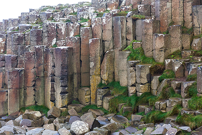
Walls of dolerite build up via columnar jointing and present almost perfectly angled fractures. It looks very similar to the more familiar columnar basalt, which we see in examples all over the world, including Giant’s Causeway in Ireland, Fingal’s Cave in Scotland, and Devil’s Postpile in California. Dolerite also has a crystalline appearance, which people could mistake for building material. This part of South Africa has a high concentration of dolerite.
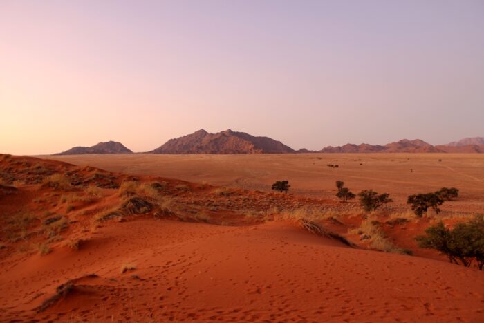
Given that Farini was prone to exaggeration, made up false identities, and had a career in show business, it would not be surprising if he reached an unwarranted conclusion based on a geological curiosity he didn't understand.
Conveniently, he did not provide the exact route or landmarks with which to find this “city.” This does not lend much credence to his story, either.
Counterpoint
The Kalahari may be a difficult climate in which to establish a city or civilization, but it is not impossible. There are various ancient settlements and archaeological sites scattered across the Kalahari, like Kweneng and Ditsobotla in Botswana. The city of Kweneng dates to the 1400s and was buried beneath vegetation in Suikerbosrand National Park in South Africa. It was discovered via Google Earth and LiDAR. This city was a trading hub between the 15th and 19th centuries. Was Hunt's lost city something like this?
Around the world, deserts have managed to host advanced civilizations. Beginning around 1000 BC, the Garamantes lived in the Sahara and became one of the first urban societies to thrive in a desert. Likewise, many Native American tribes lived in the southwestern United States. In the Arab world, the Bedouin adapted to harsh climates for thousands of years. It can be done.
However, to sustain a larger city would be a challenge. Water sources are modest and too far away. A nomadic lifestyle makes more sense. Building permanent structures would not have been a priority.
Other expeditions
Over the years, some 30 expeditions have attempted to find it. In 1933, Professor E.H.L. Swartz, F.R. Praver, Dr. W. Meent Borcherds, and two or three others traversed the region but came back empty-handed. They found limestone formations but doubted that these were the city. In 1936, Lawrence Green tried retracing the 1933 expedition and found limestone as well.
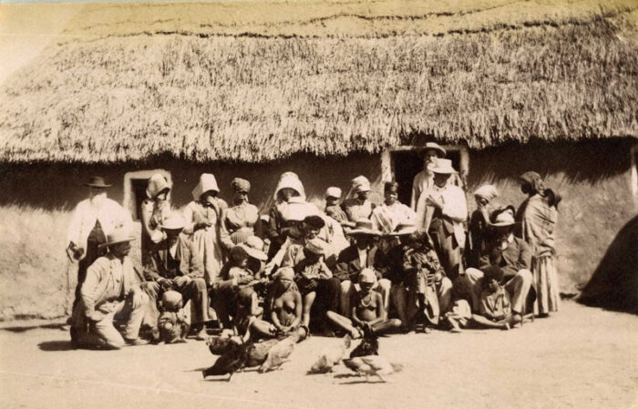
An unlikely individual who combed the desert in search of this lost city was none other than the grandfather of Elon Musk. Yes, the grandfather of the CEO of SpaceX, Telsa and X (formerly Twitter) took part in this quixotic search. His name was Joshua Norman Haldeman, and he was a chiropractor. He took his family, including Musk’s mother, on an expedition every July for three weeks, according to CNBC. This tradition started in 1953, and they went on 12 expeditions over the years. Haldeman even flew over the Kalahari, looking for signs of the ruins.
The Travel Channel’s reality series Expedition Unknown covered Hunt's Kalahari story. Its team traveled along the Oranje River and didn't find the city but turned up art etched onto rocks. Host Josh Gates stated, “Analysis of the early rock art and stone structures we examined confirms that they were made more than a millennia ago…”
Still, as of today, there is no evidence to suggest that the Kalahari hosted a lost civilization. But as LiDAR and other technology help rediscover previously elusive ruins, there is a small chance of finding something beneath the sands.
Conclusion
What can we take away from this? Farini was an entertainer and perhaps an exhibitionist who might have been disposed to jump to conclusions. Yet he also lived in a time of great discoveries in archaeology. Africa, in particular, had many secrets to tell.
As there was no other evidence besides the rock formations, it is safe to conclude that he was describing some natural rock formations. But Farini did leave behind a story that, at least culturally, remains something of a treasure.
Once upon a time in the 12th century, two odd children arrived in a little English village. The boy and girl spoke an unknown language, wore strange clothes, and, most peculiarly, had green skin. The tale of the Children of Woolpit is a pesky medieval mystery that has not been solved.
The strangers arrive
In the 12th century, England was unstable, and life was messy. A century before, in 1066, William the Conqueror took over a volatile kingdom already suffering from a succession crisis. He suppressed Anglo-Saxon revolts, and no peace lasted long. In the years that followed, strife and violence continued.

In this time of upheaval, a young boy and an older girl wandered into the village of Woolpit. Woolpit, nestled in Suffolk's rolling hills, is a play on "wolf pit." Villagers used wolf pits to capture the region's wolves.
The children's appearance startled the locals. With green skin and unusual clothing, they didn't speak English, French, or Latin. The villagers tried to feed them, but the pair refused the food. Strangely, they ate only raw broad beans.
Landing in the care of Sir Richard de Calne, a local knight, the children were gradually weaned off their bean-only diet. As their diet changed, their skin color returned to a normal pink/white. But soon after, the boy fell ill and died. The girl survived and worked in the knight's household. She was baptized and given the name Agnes.
A tall tale
Eventually, Agnes learned English and revealed the mystery of her identity. She claimed they came from St. Martin’s Land, a land of perpetual twilight deep underground. The sun never shone in St. Martin's Land, but a river ran through their subterranean home. The children arrived in Woolpit after following cattle and a series of bells.
Agnes married a nobleman, Richard Barre, the archdeacon of Ely in Cambridgeshire. Barre was a real figure who served Henry II as a judge and ambassador.
Several sources cite the story of the green children: Ralph of Coggeshall (an abbot), William of Newburgh (a member of the Augustinian religious order), William Camden (an English antiquarian), and Bishop Francis Godwin (a historian and fiction writer).
Wrote Camden: "Wulpet is a mercat towne, how two little boies of a green color, and of satyrs kinde, after they had made a long journey by passages under the ground, from out of another world, from the Antipodes and Saint Martin's Land, came up here."
Flemish migrants or fairies?
The green children became a common folktale, with the children typically described as fairies visiting the human world. Historian Jeffrey Jerome Cohen believes the story symbolizes the struggle between different ethnic groups in England during the Middle Ages. However, there might be some truth to the tale. Agnes does show up in historical records, listed as the wife of Richard Barre.
Historians suggest that the children were Flemish. There were several waves of Flemish immigration to England. The first came in 1066 with William the Conqueror's invasion. William’s queen was Matilda of Flanders.
In the 12th century, more Flemish migrants arrived, fleeing environmental disasters and overpopulation. Henry I welcomed them into England, gifting them land in Pembrokeshire. From there, they spread out through England. However, their good fortune did not last. Henry II started persecuting the Flemish in 1154, believing they impeded English trade.
The town of Fornham St Martin is not far from Woolpit. It is the site of the 1173-1174 revolt against Henry II. The battle included thousands of Flemish mercenaries, and many ordinary Flemish villagers were caught up in the conflict. Some historians believe that the children of Woolpit might have been Flemish immigrants who escaped into the forest or local caves.
What caused the green skin?
As for the children's green skin, certain conditions can alter human skin color. In the 1820s, the Fugates family in the U.S. made the news because they had blue skin. They carried a rare blood disorder. A more recent example is Paul Karason, a man from Washington whose skin turned blue because of long-term exposure to silver chloride.
Perhaps the children suffered from a genetic mutation or were exposed to copper. If the children only ate beans, they may have suffered from a vitamin and mineral deficiency that could have turned their skin green. Researchers suggest they had hypochromic anemia, also known as chlorosis, a vitamin B6 deficiency that can create a greenish tint in the skin.
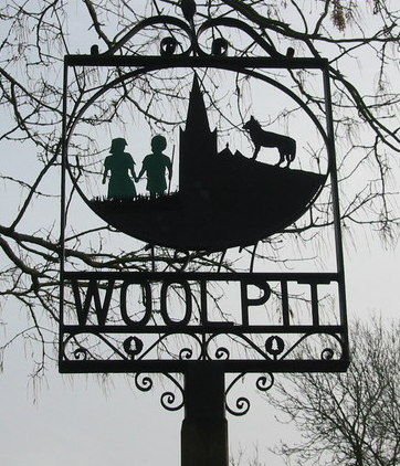
Is it possible that an underground community existed? If a Flemish community sheltered underground from Henry II’s forces, they may have lacked access to sunlight and nutritious food. The children's descriptions of a river and perpetual twilight could be a cave system used by refugees.
Folklorists believe the story has something to do with St. Martin of Tours (a former Roman soldier who converted to Christianity) and the Celtic underworld. St. Martin of Tours supposedly had a dream where he divided his robe and gave one of the pieces to Christ.
He is the patron saint of weavers and tailors. St. Martin’s Day is his feast day, also called Old Halloween in the Middle Ages. The day celebrated the transition from autumn to winter. Some cultures, including the Celts, associated broad beans with death and the underworld. While intriguing, these two elements do not work well enough within the narrative to form a solid link.
Conclusion
It seems plausible that the tale of the green children of Woolpit is based on real stories of sickly Flemish refugees. St. Martin’s Land could be a play on the nearby town of Fornham St Martin. The area also features chalk caves and tin mines.
Religion, mythology, and truth seem to have all meshed into a wondrous fairytale.
Sometimes, extraordinary circumstances cause children to become isolated in the wilderness for years without a human caregiver. This is a common subject of legend —Romulus and Remus, Mowgli, Tarzan.
Some real children have also joined packs of animals. Unlike fictional children, who often acquired some of the bush savvy of their adopted kin, the experience stunts the mental, emotional, and linguistic faculties of these castaways. Some early psychologists mistook their damaged state for what they called idiocy or madness.
Victor of Aveyron
Victor of Aveyron was a nine-year-old feral child who came to the attention of French authorities in the late 1790s. Hunters tried to capture him, but he evaded them. Eventually, the authorities caught him in 1800. He was covered in scars, made animal-like sounds, was completely naked, walked on all fours, and relieved himself in public. The public called him the enfant sauvage de l’Aveyron -- the wild child of Aveyron.
His origins are a mystery. No relatives or friends came forward to claim him, and he remained in the state's care. Some theorized that he was an illegitimate child abandoned by his parents; others, that he was a survivor of the chaos of the French Revolution.
Doctors observed that Victor disliked clothes and was very acclimatized to the cold. He could not speak and learned only a few French words. He also tried to escape society back to his wild, singleton state.
One of Victor’s more romantic caretakers believed that he was an example of an uncorrupted soul. While Victor could communicate little, he showed empathy for those around him, such as offering comfort to someone crying.
One theory of the time suggested that Victor was autistic. Autism research and special education for mentally disabled children only began in the 1790s, and Victor was a ground-breaking case study. Psychologist Jean-Marc Gaspard Itard developed a special recovery program for Victor that included sensory and physical exercises. These were supposed to increase his cognitive faculties and encourage him to form interpersonal relationships with others. However, Victor showed little progress.
In 1828, Victor died around age 40 from pneumonia. He never learned to speak, and he had not integrated into society.
Dina Sanichar
In some ways, Dina Sanichar was the Indian version of Victor. In 1867, hunters exploring the jungle around Bulandshahr, India, discovered a large cave. Inside, they found a six-year-old boy who walked on all fours and barked and howled like a dog. They found him with a wolf pack. They killed the she-wolf and took the child to an orphanage.
Here, he received a name, clothes, and food. Some tried to educate him.
The transition proved very difficult for Sanichar. He could not speak except to growl, howl, and bark. Christian missionaries attempted to teach him how to speak and walk upright. It took a very long time, but he learned to walk and wear clothes. His speech, however, remained completely impaired. He only communicated with gestures.
Sanichar did make a friend in the orphanage, another feral boy. Feral children were quite common at the time, leading to several folk tales and stories. Perhaps the most famous was Rudyard Kipling's The Jungle Book, in which wolves raised the boy Mowgli.
As an adult, Sanichar did not speak but developed an affinity for cigarettes. He died at just 34 from tuberculosis.
Oxana Malaya
More recently, Oxana Malaya is a feral Ukrainian girl raised by dogs in the 1980s. At the age of three, Oxana suffered abuse from her alcoholic parents. They neglected her basic needs and often shut her out of their home. Their excuse was that they had too many children.
As a result, the toddler found a surrogate home with a pack of stray dogs. Instead of speaking, Oxana growled, barked, and walked on all fours. The dogs protected her from harm. With the pack, she learned to clean herself, sleep on the floor, eat, and rummage for food.

Malaya survived like this for over four years until a neighbor reported her to the authorities, and the state placed her in foster care. Incredibly, her rehabilitation proved relatively successful. She regained her ability to speak and write.
Today, Malaya lives at a home for disabled people. She works at a farm and has even built human relationships. She is in touch with her siblings, who also suffered neglect. About 10 years ago, she gave an interview on Ukrainian television in which she seemed quite articulate and comfortable in her own skin. She even smiled several times. However, psychologists believe she may never lead a normal life because of the early abuse.
Marina Chapman
In the 1950s, during one of the most devastating periods in Colombian history, a little girl was kidnapped from her village and left alone in the jungle. Marina Chapman believes she was approached by two people who chloroformed her near her home at the age of five.

Left alone in the jungle, a band of capuchin monkeys adopted Chapman. She lived with them for five years, feeding mainly on fruits. She grew adept at climbing trees, finding food, and communicating like the capuchins. She explained how the monkeys cared for her when she got sick with food poisoning. Eventually, hunters found her. But they did not have good intentions.
Instead of reporting Chapman to the authorities, the hunters sold her to a brothel. She lived on the streets for a time and then as a slave to a mafia family. While some view the story as farfetched, Chapman swears it is true. Critics believe her trauma created false memories.
Later Chapman's former neighbor's daughter adopted her, taking her to the UK where she could start over. Chapman married and now lives a normal life.
Wild Girl of Champagne
Marie-Angelique Memmie Le Blanc gained notoriety in the 18th century, a few decades before the French Revolution. At age 19, she was caught by hunters while stealing apples from an orchard in the village of Songy in Champagne, France. She had been roaming the wild since she was 10.
She was not animalistic but rather acted as a hunter and a gatherer. She was very skilled at obtaining food, usually stealing and foraging. She was on constant alert. She wore rags and animal skins for warmth. Her diet consisted of fruits, vegetables, and raw meat. She did not speak.
While animals may have adopted other feral children, Le Blanc spent much of her time fighting them off. She carried a wooden club for protection.
Word of the feral girl spread, even reaching the King and Queen of France. They ordered her capture, wishing her to be reassimilated into society. The case became a media sensation, and many Enlightenment thinkers wanted to study her.
Le Blanc became literate and joined a convent in her adulthood. Her fame also led to substantial wealth.
Many years later, researchers believe they pieced together who Le Blanc was and where she came from. Supposedly, she was a Native American from America or Canada. Someone abducted her but died of the plague while returning with her to France. She then wandered the wilderness, left to her own devices.
Notable hoaxes
While these stories are real, many other tales of feral children were not. There were a few hoaxes concerning wolf children in India, perhaps encouraged by the tale of Dina Sanichar. In the 1920s, two girls from Bengal named Kamala and Amala (eight years old and 18 months old respectively) gained notoriety in this way. Allegedly, a clergyman found them. He claimed their parents abandoned them, and a she-wolf subsequently raised them. However, the clergyman falsified the story for monetary gain.
The story of the Syrian Gazelle Boy was not a deliberate hoax but a misunderstanding. In 1946, the Iraqi Army found a 10-year-old boy wandering around with a herd of gazelles. They claimed to see him running at impressively fast speeds of up to 50km per hour and assumed the gazelles had raised him. Unsurprisingly, the story turned out to be untrue.
Explorers and mapmakers called uncharted lands Terra Incognita. Though Columbus’s expeditions revealed parts of the New World, some regions remained isolated and mysterious. One such blank spot was Patagonia. It remained an unknown frontier for centuries after Columbus, with only crumbs of information filtering back to Europe.
Idealistic Portuguese explorer Ferdinand Magellan made his name circumnavigating the world in the 1500s. In the far reaches of South America, he claimed to have met a mysterious race of giants. Word of these Patagonian giants spread, and the legend has persisted. But was there any truth to Magellan's claims?
Background
Magellan and Columbus had the same vision. They believed the Earth was round and that they could reach the east by sailing west.
Magellan initially petitioned the Portuguese king Manuel I for funding to sail to the Moluccas (in modern-day Indonesia) but was rejected. Instead, Magellan did what Columbus did: He turned to Spain. King Charles V agreed to sponsor the project, and Magellan acquired a fleet of five ships carrying 270 men. He departed Spain in September 1519.
However, the expedition experienced continuous bad luck. The crew suffered malnutrition, starvation, disease, and bad weather. There were mutinies and plenty of bad behavior.
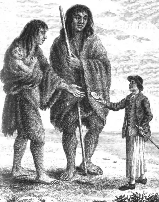
Their ships crawled along the coast of South America and eventually made landfall in a mysterious region that Magellan later named Patagonia.
Magellan finds giants
A scholar named Antonio Pigafetta accompanied Magellan to document the voyage. He described the expedition's first encounter with giants.
According to Pigafetta, Magellan and his men saw a very large naked man dancing on the beach. Magellan ordered one of his crew to mimic the dance to show they meant no harm. The dance worked, and the crew approached. Up close, the sailors were astounded to find that the naked man was over nine feet tall.
They named the giant Paul. "Paul" allowed the foreigners to meet his people, a tribe that wore animal skins.
"His face was large and painted red all over except that around the eyes were yellow circles," Pigafetta wrote of Paul. Pigfetta claimed that their reflections in mirrors scared the giants.
Magellan wanted to exhibit this extraordinary race of people and decided to take two men back to Spain. He lured them onto his ship with shiny metallic objects. But both men died on the journey back to Europe.
"Patagonia” translates as "land of the bigfoot" in Portuguese, and the people were called "patagao."
More reports
More reports of giants in Patagonia began to pop up, including by Dutch sailors in the late 1500s.
In 1764, naval captain John Byron (the grandfather of the poet Lord Byron) claimed to have met the giants during his global circumnavigation on the HMS Dolphin.
"If I may judge of his height by the proportion of his stature to my own, it could not be much less than seven feet," Byron wrote. Some of his sailors described the giants as nine feet tall.
In 1853, Captain Benjamin Franklin Bourne published an obscure account of the giants. His book, Giants of Patagonia: Captivity Amongst the Extraordinary Savages of Patagonia, claims giants kidnapped him when he sailed to Terra del Fuego looking for gold. In Bourne's account, the giants spoke broken Spanish, were very large and muscular, hydrophobic, and morally lacking.
"They are taller than any other race I have ever seen. Their average height is nearly six and a half feet," Bourne wrote. He described the race as having superhuman strength, brown or black eyes, and coarse hair. Their tribe numbered 1,000.
But not everyone was convinced. Sir Francis Drake thought the Spanish were lying about the giants. "The Spaniards did not think that any Englishman would come hither to reprove them, and therefore might presume the more boldly to lie," he said.
Yet a chaplain acquainted with Drake swore to have seen bodies measuring 12 feet long while on a voyage in the region with the English privateer Sir Thomas Cavendish.
Hoax?
In the late 1600s, an unusual body arrived in Britain. Allegedly, Spanish sailors traveling through Patagonia killed a giant after it attacked and killed four sailors. They brought the body back to Europe, where it was exhibited in freak shows.
The corpse was 12 feet long and had two heads, almost like a conjoined twin. People called it Kap Dwa, meaning "two heads." The mummy was bought and sold several times before it landed in an obscure little exhibition in Baltimore, U.S. In Bob’s Sideshow, it is displayed alongside two-headed ducks and the bones of "Dracula’s son."
However, no academic takes the mummy seriously.
What are the facts?
It was not uncommon for explorers to stretch the truth or even make things up. Perhaps Magellan exaggerated many of the details to compensate for the Patagonian people’s strangeness. Magellan's "giants" could have been the Tehuelche. This Indigenous group populated Patagonia, Argentina, and southern Chile (from the Strait of Magellan to the Rio Negro). They wore the skins of guanacos, a relative of the llama. However, studies show they were of average height, ranging from five to six feet.
Reports varied wildly on the giant's heights. Some sources describe them as six feet, others up to 12 feet. Could it be that these people were simply taller than your average sailor? Historians note that Europeans during the Age of Discovery rarely exceeded 5′5″.
Another possibility is the Selk’nam people. This group was also reportedly tall, often six feet or more. The Selk’nam inhabited the islands of Tierra del Fuego, but colonists wiped them out in the 19th and 20th centuries.
Black-flagged ships sailed up the Nile, bringing mysterious seafarers who wrought havoc wherever they went. They pillaged, plundered, and burned cities to the ground during the Late Bronze Age Collapse. Who were these so-called Sea Peoples, and were they responsible for social collapse in the Mediterranean?
The Bronze Age and its collapse
The Bronze Age lasted from 3300 BC to 1200 BC. This precarious period between the Stone Age and the Iron Age featured great civilizations in the Mediterranean and the Middle East, including the Assyrians, Hittites, Mycenaeans, Minoans, Canaanites, and Egyptians.
People had shifted from a nomadic existence and started to settle permanently. Groups expanded their territories, and hereditary monarchies replaced communal/clan living from the Stone Age. Class differentiation became commonplace, and societies began to use slaves.
When humans figured out how to create bronze by smelting tin and mixing it with copper, it changed society. It made agriculture easier, opened up new trade opportunities, altered warfare, and became a symbol of wealth and power. The era also saw the development of writing, such as cuneiform, Egyptian, a proto-Caananite script, and Chinese.
However, archaeological evidence shows that several civilizations from this era then suffered a mysterious and sudden decline. Most written records ceased with the destruction of these civilizations, particularly in the eastern Mediterranean. Cultures disappeared, or other powers assimilated them. Historical evidence points to various possible causes: earthquakes, disease, drought, mass migrations, war, and a mysterious force from the sea.
Who were they?
No one knows for sure, but there are a few theories. French Egyptologist Olivier Charles Emmanuel used the phrase "peuples de la mer" (peoples of the sea) after he read about maritime invaders in the Great Karnak Inscription near Luxor.
Based on ancient Egyptian temple inscriptions and steles, the Sea People consisted of nine groups: the Lukka, Sherden, Shekelesh, Peleset, Denyen, Teresh, Tjekker, Weshesh, and Eqwesh. Historians have been unable to verify the origins of these unfamiliar groups. They've settled for some educated guesses based on the linguistic similarities of place names.
For example, they speculate the Lukka came from the Lycia region, the Sherden from Sardinia, and the Shekelesh from Sicily. The Peleset could be the biblical Philistines. Some ancient Jewish texts and the Bible also mention "peoples of the sea."
Sources say the various groups wore very different clothing and armor from each other. As they weren't a single army, historians speculate that nations hired them as mercenaries or that the Sea Peoples had several objectives.
An inscription from the reign of Ramesses III paints the Sea Peoples as bloodthirsty, anarchical, and evil: "The foreign countries made a conspiracy in their islands. All at once the lands were removed and scattered in the fray. No land could stand before their arms."
Physical evidence
In 1928, locals stumbled upon an ancient tomb in northern Syria. French archaeologist Claude Schaeffer investigated and excavated Ugarit, a Bronze Age city of great wealth.
A tablet unearthed from the site revealed a letter between the King of Ugarit and the King of Cyprus. They both wrote with urgency about an impending invasion of the Sea Peoples. The King of Ugarit begged the King of Cyprus for help. The Sea Peoples plundered the countryside, leaving a trail of destruction. He was surrounded, and judging by the archaeological digs, it did not end well.
Further excavations revealed signs of this destruction, including ash, crumbled building material, arrowheads, and buried treasure in Ugarit.
Theories
After the Bronze Age Collapse, the ancient world descended into a dark age. With no surviving written records, further evidence of the Sea Peoples vanished too. We do not know where else they conquered, if they settled, or whether they assimilated into other cultures.
Historians believe the Sea Peoples could have been mixed ethnic groups who banded together after their own cities declined because of environmental or political problems. The decline of the Mycenaeans in Greece, the Minoans in Crete, and the Hittites and Philistines may have prompted people to explore the seas in search of a new home. In this scenario, the Sea Peoples were migrants. If so, perhaps they fought out of necessity rather than to conquer.
Established in 2014 to "unpack cultures from 2000 BC...and uncover the mysteries of the Collapse," a Swiss group called Luwian Studies concluded that the Luwians, from Anatolia and parts of the Hittite Empire, were the Sea Peoples.
Other academics have argued that the Sea Peoples may have originated from Central Europe or the Black Sea, but limited evidence supports this.
Villains or victims?
The Egyptian reliefs show not only warriors and battle scenes but also women and children, supporting the theory that the invaders were at least partly migrants.
As societies broke down, survivors from collapsed civilizations in the Aegean may have banded together to form a loose confederation. They then moved along the eastern Mediterranean, looking for somewhere to rebuild. Perhaps Egypt, one of the last strongholds of the age, looked like the most inviting spot.
Modern historians have regarded the Sea Peoples sympathetically, citing desperation as their primary driver. The Bronze Age Collapse was hard for everyone. Perhaps the Sea Peoples were a victim of the time rather than the cause of the collapse.
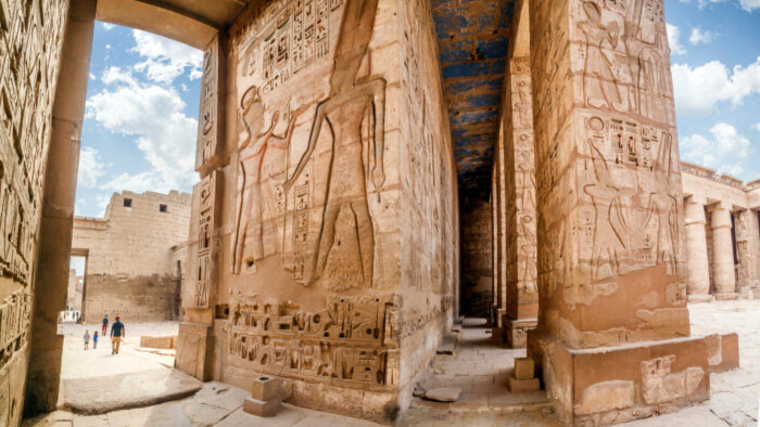
Legacy
New theories regularly pop up to explain the cause of the Bronze Age Collapse. Recent publications have pushed the Sea Peoples aside, focusing instead on environmental factors (earthquakes and volcanic eruptions), disease, famine, and political crises. However, the collapse was probably the result of all these factors.
Skilled explorer or overreaching dilettante? Crusading abolitionist or violent murderer? General with the soul of a country on his mind? Or self-centered opportunist only interested in tapping the zeitgeist to make a buck?
All of these charges, both positive and negative, have been laid at the feet of John C. Fremont in the last 150 years. Over the course of a turbulent and adventurous life, Fremont managed to embody all of the above and more. In the process, he became one of America's biggest celebrities before that word had even been coined.
Historians' opinions on John C. Fremont have ebbed and flowed over the years, but what is certain is that the man who'd be known to the American public as "Pathfinder" was well-traveled, deeply complex, and seriously flawed.
Fremont's beginnings
Born in 1813, Fremont was an unpredictable character who greatly disliked authority, even at an early age. That streak continued through his adult life and put him in trouble with his superiors more than once.
He was highly intelligent, though. “In the space of a year," said U.S. Senator George S. Boutwell of Massachusetts, "Fremont read four books of Caesar...six books of Virgil…Horace…two books of Livy...and four books of Homer’s Iliad.”
Finding himself in the military but possessed of an allergy to bureaucracy and academia, Fremont declined a naval position as a math teacher. Instead, he took a more exciting post as a surveyor and railroad engineer. Through this avenue, he joined the Topographical Corps and began to lead expeditions for President Martin Van Buren.

Manifest Destiny
Fremont led a total of five expeditions through the western frontier from 1842 to 1853. They first explored the Oregon Trail and the South Pass, which cut through the Continental Divide. Oregon was at the forefront of politicians’ minds, often called a “pioneer’s paradise” thanks to its fertile land, navigable rivers, and opportunities for trade. This early expedition counted among its ranks the legendary Kit Carson, himself an iconic figure in the opening of the American West to settlers of European descent.
Along the way, Fremont climbed a 4,189m mountain in Wyoming's Wind River Range. In the style of the day, he named it after himself. Fremont’s Peak became the official marker of the United States’ acquisition of the Rockies and, by extension, the West.
He noted down all that he saw, drawing maps as he went, which assisted explorers after him. Fremont returned a conquering hero after five months on the trail. He received the nickname Pathfinder, though it must be said that many of his plaudits were generated by his own knack for publicity — and a fortuitous marriage.
Marry up
Fremont's wife, Jessie, was the daughter of Missouri Senator Thomas Hart Benton, who chaired the Senate Committee on Military Affairs. Through this fortunate connection, Fremont received both wider exposure to America's upper crust and the funding to pursue his expeditions. And when he returned from the first of them, it was Jessie who helped him write an account of the trip.
“The horseback life, the sleep in the open air,” she said later, “had unfitted Mr. Fremont for the indoor work of writing."
Taking up the pen herself, Jessie filtered her husband's notes and dictations, producing a work called Exploring Expedition to the Rocky Mountains, 1843. The account's publication in newspapers across the country was the start of Fremont's fame and helped secure funding for future expeditions. And why not? Under Jessie's dutiful authorial skills, Fremont's wanderings in service of his young country became something more romantic.
“Railroads followed the lines of his journeyings...and cities have risen on the ashes of his lonely campfires,” she declared in one report. These lush tales of the West encouraged people to pack up their lives and risk the unknown.

Second and third expeditions
In his second expedition, Fremont (again with Kit Carson at his side) explored and mapped the Great Salt Lake, Mount St. Helens, the Sierra Nevada, the Great Basin, and Lake Tahoe. He confirmed that a rumored Buenaventura River did not exist, despite the assurances of previous explorers such as Atanasio Dominguez and Alexander von Humboldt. And that's just his second expedition!
Unfortunately, violent encounters with Native Americans stained Fremont's standing with future historians. His third expedition occurred on the eve of the Mexican-American war, and the explorer was under orders to bend his will toward military matters should the need arise. Fremont embraced the new direction.
Traveling back and forth from California to Oregon, Fremont and a band of men comprising 60 white explorers and a handful of Native Americans participated in a series of three encounters known to history as the Sacramento River Massacre, Klamath Lake Massacre, and South Butte Massacre.
Native American massacres
Contemporary accounts by members of the expedition and other witnesses put the numbers of dead Native Americans at anywhere between 100 and 900 in the Sacramento River Massacre alone. Men, women, and children were shot, trampled, and tomahawked to death indiscriminately. Many more drowned in the Sacramento River while trying to escape. In his memoirs, Kit Carson later described the event as "perfect butchery."
In another set of memoirs, expedition member Thomas E. Breckenridge wrote:
"I think that I hate an Indian as badly as anybody and have a good reason to hate them, but I don't think that I could have assisted in that slaughter. It takes two to fight or quarrel but in that case, there was but one side fighting and the other side trying to escape."
Three days later, Fremont's party killed 14 members of the Klamath people in the Klamath Lake Massacre, then attacked a group of Patwin people after hearing rumors they were planning on attacking Whites in the area. In his own memoirs, the explorer admitted to attacking the native band before they had done any violence of their own. History knows this event as the South Butte Massacre.
Neither Fremont nor any member of his party was ever held to legal account for these happenings.
California politics
As the Mexican-American war broke out, Fremont found himself engaged in a kind of guerilla warfare on behalf of the United States in the California region. He was so successful that in 1847, he was appointed the military governor of California.
However, shortly thereafter, a contradictory set of orders placed U.S. Brigadier General Stephen W. Kearny in the same position, and the two men clashed over who was really in charge. The resulting tangle of egos, orders, communications, and troop movements — confusing even at the time and even more so now when viewed through the fog of history — resulted in Fremont's court-martial.
Thanks to his powerful father-in-law, successful campaigns in the Mexican-American War, and popularity with the American public (thanks, Jessie), President James K. Polk commuted Fremont's sentence and re-instated him to the Army. But the always prickly Fremont resigned and settled in California.
But not for long. More adventures (and controversy) beckoned.
Railroads and Republicans
Fremont's fourth and fifth expeditions were private affairs on behalf of railroad companies. Hired to find possible routes linking the crowded East to the growing West, the explorer-turned-campaigner-turned-explorer spent time, energy, and, eventually, lives looking for a perfect railroad route across the West. His fourth expedition ended in chaos and cannibalism after becoming stranded in the snowy San Juan Mountains. Ten men succumbed to the elements and Ute attacks.
After a brief sideline as one of California's Senators, his fifth and final expedition was more successful. He discovered a plausible winter railroad route over the Rockies at Cochetopa Pass.
But it was all for naught. The eventual Transcontinental railroad ended up running along a more northerly route through a pass in Wyoming.
Unfazed and still as popular as ever, Fremont was tapped as the young Republican party's first national candidate in the 1856 presidential elections. An abolitionist in the vein of the party's more radical members, the adventurer ran under the slogan "Free Soil, Free Men, and Fremont," which is pretty catchy even by modern standards.
Failed candidate
However, national politics weren't ready for such a radical stance. Despite widespread popularity as the Pathfinder, Fremont lost to Democratic candidate James Buchanan. It would take a more centrist candidate by the name of Abraham Lincoln to win the burgeoning Republican party its first presidency in 1860.
At the outbreak of the Civil War, Lincoln tapped Fremont for a Major General position in the Union Army. Fremont was a middling general whose most noteworthy wartime accomplishment wasn't a major victory or brilliant troop movements but a bucking of authority that once again landed him in hot water.
On Aug. 30, 1861, Fremont (without notifying the President) placed Missouri under martial law and unilaterally decreed that all slaves in the state were emancipated. Students of history will remember that Lincoln didn't issue his own emancipation proclamation until almost a year later. Lincoln was weighing the policy heavily and carefully and slow-walking it so as to avoid losing more border states to succession. He swiftly ordered Fremont to walk back the order, which the stubborn Fremont predictably refused to do.
Lincoln sacks Fremont
Lincoln then removed Fremont from command. However, given the pressing need for capable leaders, it wasn't long before Fremont was once again charging into battle in Virginia, Tennessee, and Kentucky. Organizational changes in 1864 prompted his final resignation from military life.
Fremont spent the rest of his days battling financial difficulties caused, at least in part, by his resistance to authority. For example, a brief stint as the Governor of the Arizona Territory ended when the cantankerous explorer refused to actually govern from the territory itself. Ultimately, the family relied upon publishing income generated by the always-resourceful Jessie. Fremont died in 1890 at the age of 77.
A complex legacy
Fremont is both a revered and controversial figure. There is no doubt that Fremont was crucial to westward expansion. He pioneered the way for settlers through hard work and an idealized vision of American progress.
Today, the city of Fremont near Sacramento, California and the famous Fremont Street in Las Vegas are named after him. Los Angeles has a John C. Fremont High School. His name features on many places across the U.S. There's no escaping his legacy.
At the same time, he exposed the flaws of such idealization while crippling his own career through a stubborn adherence to his complicated morality.
“Davy, Davy Crockett, king of the wild frontier…Davy, Davy Crockett, the man who don’t know fear…”
The Ballad of Davy Crockett was the anthem of baby boomers all over the world. Kids -- well, boys anyway -- ran around with their coonskin hats and toy guns, emulating the frontier folk hero who briefly dominated 1950s pop culture. But who was the man behind this early craze?
Background
Many details of Crockett's life have been exaggerated or are just downright false. Despite the ballad, he wasn't born on a mountaintop but in a valley. As an adult, he looked rather portly. He certainly didn't kill a bear at the age of three. And although this remains controversial, it's likely he didn't fall heroically at the Alamo but surrendered and was executed.
However, the frontier was in his blood even before he was born. Davy Crockett's father John was one of the Overmountain Men, pioneers who fought during the American Revolution.
Despite John Crockett's heroics, the family fell on hard times. Davy had a brief stint in school but ran away due to difficult teachers and bullies. Soon, he had to work as an indentured servant to support the family.
Though he was illiterate and did not have many other prospects, the early toughness he developed helped him find his calling. He became a hunter, frontiersman, and cowboy, traveling all over the West.
For a time, he earned a decent income hunting bears. One year, he killed 105 of them.
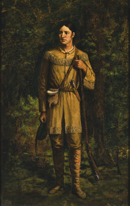
Crockett also joined the military, which was working hard to quell tensions between settlers and native groups. Like many others, he joined in response to the Fort Mins Massacre in Alabama. Future president Andrew Jackson was the militia's general. Crockett worked as a scout and took the lead in hunting for food.
Crockett preferred to stay away from major combat and was not in favor of dehumanizing native people. He recalled disapprovingly how "we now shot them like dogs; and then set the houses on fire..."
He fought in the War of 1812 and Creek War.
Politics
Not enjoying the life of a soldier, he eventually chose to go into politics. He became quite popular -- a common, simple hunter turned politician was a novelty at the time. He became a public commissioner, then a judge, and served as the Representative of Tennessee. His proposals sought to help the poor but never really came to fruition.
What really frazzled him was Andrew Jackson's 1830 Indian Removal Act. Crockett was one of the Act's strongest opponents. He refused to participate in the killing of indigenous warriors. His stance cost him the next term as a representative. This began an unstable pattern in his political career. He lost and won several times.

Crockett went to Texas to revamp his political career. As he wrote in an 1836 newspaper: "I told the people of my district that I would serve them as faithfully as I had done; but if not, they might go to hell, and I would go to Texas..."
Little did he know that it was in Texas that his fate would be decided. The story of Crockett gets a little murky from here. After he died at the Battle of the Alamo, sources said he either surrendered and was executed or went down fighting in a blaze of glory. Television executives preferred the second ending.
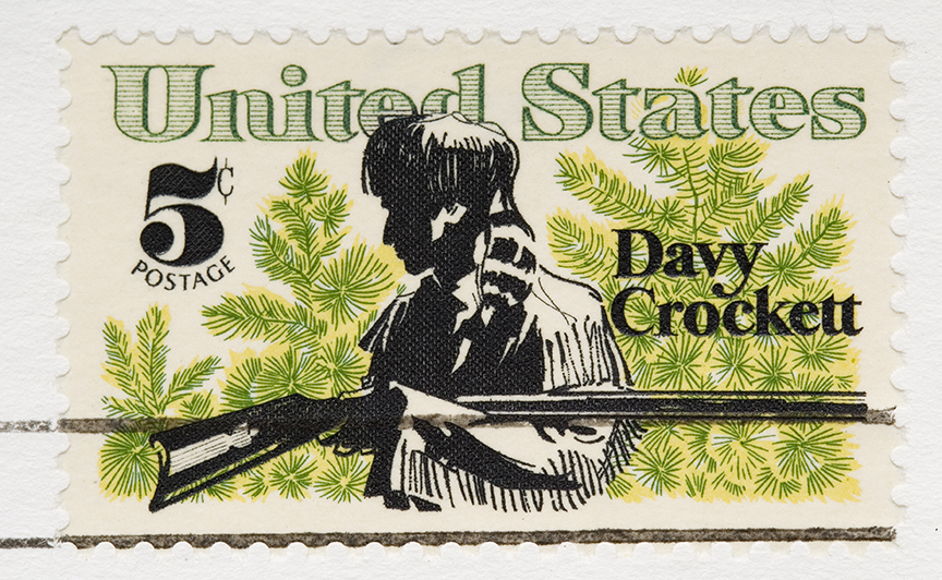
Legacy
What turned this long-dead, almost obscure figure into an overnight sensation in the 1950s? A play called The Lion of the West, written in 1831, originally made him a bit of a folk hero. But he hit the big time in 1954.
Walt Disney Studios was still recovering from the Second World War. Pop culture had stagnated. The creatives over at Disney planned to turn things around. Thus began the development of Disneyland.
However, the vision went beyond amusement parks. Disney began an invasion of TV screens, and the hour-long Sunday Disney program became an institution. As part of their Frontierland series, they highlighted historical American figures. Crockett was one of their first and most popular.
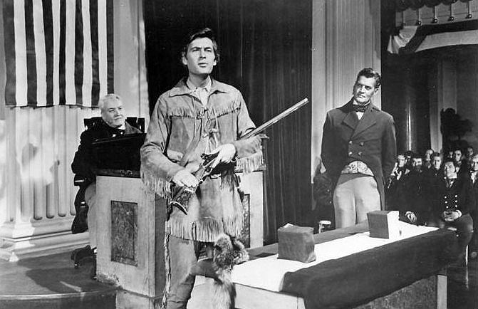
The Davy Crockett miniseries starring Fess Parker became an overnight hit. Young boys were thrilled by gunfights with Indians, river pirates, bears, and heroics at the Alamo. They wore imitative fringed leather jackets and coonskin hats.
Crockett became the quintessential American hero, sympathetic to the Indians yet firm when confronting trouble. He was kind yet fearless and opinionated, always ready to help others. Davy Crockett represented hope and post-war optimism.
He even made his mark on the nuclear arms race between America and the Soviet Union. The U.S. Army chose the heroic name "Davy Crockett" for a launcher that fired nuclear missiles.
Conclusion
Davy Crockett was dead for over a century before he experienced his overnight rise to fame. He took America and the United Kingdom by storm and formed an integral part of baby boomers' childhoods. Though his background featured embellishments and artistic license, the man was humble and tried to do right. And his humanistic attitude toward America's native people in an era rife with conflict was decades ahead of its time.
We know the Earth is not hollow. While we enjoy the occasional escapism from Jules Verne and Warner Bros., there is nothing beneath our feet but kilometers upon kilometers of lava, rock, gas, high pressures, and the all-powerful forces of our planet.
However, this has not stopped a rather stubborn theory from persisting even today. That is Agartha and the Hollow Earth.
Background
Agartha is a mythical kingdom supposedly located in the center of the Earth. Its entrance lies somewhere deep in the Himalaya. Nepalese outfitters would make a fortune guiding tours there, but so far, none have attempted to open up this market. Yet the subterranean kingdom links all the continents on Earth through an incredible network of tunnels, created by a race of powerful beings called the Old Ones. They far surpass humans physically and spiritually, as well as in intelligence and technology.
Accounts describe this mysterious race as almost omniscient, aware of all happenings on the surface. Supposedly, all world governments know of this city already. Agartha holds millions of people and is ruled by its king, the Master.
The kingdom preserves its knowledge in vast libraries and has advanced transportation capabilities such as flying vehicles.
Agartha once thrived on the surface. However, as the world became more violent and unstable, the kingdom went underground. According to legend, it will rise again when the world restores balance and peace.
Hollow Earth theory
Because of the similarities, Agartha and the Hollow Earth theory are very closely linked. Hollow Earth, of course, refers to Earth having a hollow center rather than a molten core.
Hollow Earth legends have existed since ancient times and somehow survive even today. It sees the world in layers, with an underworld realm for souls or deities. Dante portrayed the planet this way in his Inferno in the 14th century. Scholars from the 16th century onward thought the Earth had a hollow shell with layers containing different atmospheres, densities, and even a miniature sun at its center.
Accounts of Agartha
All of this sounds familiar, doesn’t it? We’ve all heard it before; Shambhala, Xibalba, Eden, Asgard, etc. Multiple cultures from Hindus, Buddhists, Native American tribes, Celts, and others all convey a similar story of human origins, mythical races, or even gods living in deep caves away from the world.
Perhaps Agartha's closest relative is Shambhala, with which it is often confused. Shambhala features prominently in sacred Hindu texts. However, the two are not the same. Agartha does not have such ancient backing. The name started to creep onto the scene when French occultist and linguistics enthusiast Alexandre Saint-Yves d’Alveydre took an interest in learning Sanskrit in the 19th century.
He came into contact with a mysterious bloke named Prince Hardjii Scharipf, whose backstory is murky. Nevertheless, he was a very educated man with knowledge of the unknown. This enigmatic tutor came from a supposed “Great Agarthian School.” He learned not only Sanskrit but also an unknown language called Vittanian, apparently spoken by Agarthians. He also learned that Agarthians had two tongues and could speak more than one language at the same time.
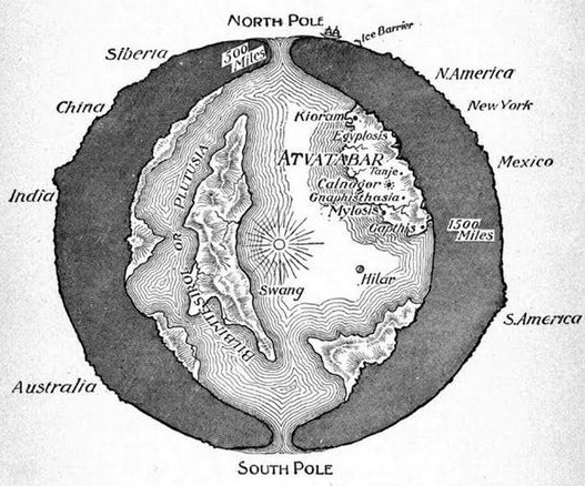
Atlantis connection
Some 19th-century writers believe that subsurface kingdoms might have been a refuge for survivors from Atlantis.
One unexpected development in this story is the internet’s belief that explorer Admiral Richard Byrd came into contact with the Agarthians during a mission in Antarctica. PDFs of his “secret diary” (origins unknown) have been circulating for the last few years, which allegedly recorded his encounters in early 1947. Byrd was in Antarctica at this time for Operation Highjump, the establishment of an American research base.
While flying over the frigid landscape, Byrd’s instruments went haywire and he saw a green forest among the snowy mountain ranges. His radio was then highjacked by the Agarthian superbeings. They invited him to land and visit the subterranean city. He described it as "a vast metropolis, glittering with rainbow colors...too beautiful and wondrous to describe…[and] formed of a crystal-like substance.”
Admiral Byrd
In exploration history, Byrd is known for two things: faking a flight to the North Pole -- which, like Robert Peary's 1909 North Pole expedition, the public believed was successful until recent decades -- and overwintering alone in Antarctica, where he almost died from carbon monoxide poisoning from a leaky stove. However, Byrd said nothing about Agarthians, nor did he spot some nonexistent Antarctic oasis. That's all online disinformation.
These Agarthians supposedly expressed their concern to him over the World Wars as well as the current development of nuclear weapons. After their meeting, they sent Byrd back to the surface and he was sworn to secrecy by the U.S. government after reporting what he saw to the Pentagon. It is quite a story, one which Raymond Bernard (a pseudonym), the main driver of the Hollow Earth theory, wrote about in the 1960s.
In addition, it was no secret that the Nazis had a morbid fascination with the occult. According to conspiracy theories, after losing World War II, Hitler and his goons fled to the South Pole and hid in the center of the Earth. Some even believe that the Chinese invaded Tibet in the 1950s to gain access to this mythical kingdom.
Expeditions
There have been a couple of expeditions to find Hollow Earth. President John Quincy Adams approved of one such expedition, according to writer Rachel Baxter of Iflscience. A particularly staunch supporter of the Hollow Earth theory was a man named John Cleves Symmes Jr. He believed the North and South Poles had two large holes into which you could dive.
The North Pole Inner Earth Expedition in the 2000s attempted to find these mysterious holes. A planned 2022 follow-up expedition has been indefinitely delayed.
Why?
Was Agartha a Western invention? Occultism has contributed to some quite outlandish beliefs about the planet. Take theosophy, for example. Helena Blavatsky’s movement believed in Agartha as one of the subterranean realms inhabited by the “masters of wisdom.” They reputedly came from an island which is “no more, but the country where it once bloomed remains there still…”
Hollow Earth societies run parallel to those of Flat Earth. No one takes them seriously, but the stories are interesting as psychological case studies. Conspiracy theorists and fans of Ancient Aliens get behind these notions as if they were gospel. Online forums, whole societies, and clickbaity YouTube videos dedicated to furthering the theory all agree that Byrd found something he wasn't supposed to.
Alas, if the Earth were hollow, we would know. Our planet’s mass, density, and gravity would be vastly different. We know this due to surveys, tests with seismic waves, data from boreholes, and other methods. Agartha is one of those many cases where ugly facts stand in the way of a beautiful story.
Google Earth has done a lot more than show us obscure mountain faces to climb. Zooming in on a Google Earth image has become a tool for archaeologists, historians, and amateur sleuths.
They occasionally find treasure -- an old military installation, a long-lost plane crash, mysterious crop circles, and even pop culture accidents, like giant KFC logos in a cornfield.
The Middle East has some particularly puzzling oddities, visible only from above. These man-made structures resembling wheels and kites date back much farther than the Nazca Lines. They were built by an ancient people known as the Old Men.
Background
Although crypto-archaeology isn't his area of expertise, archaeologist David Kennedy happened to be reading about the Works of the Old Men from the reports of early pilots from the 1920s. He then spent hours on Google Earth assembling over 2,000 images of these structures across the Middle East. But who built them?
The Bedouins themselves refer to mysterious “old men” who built the structures. They say that these have existed long before Islam.
“The old men are what the local Bedouin call the ancient inhabitants of the area," says Kennedy.
Research confirms that the structures are mostly prehistoric. Some stretch back to the 7th millennium BC. Back then, the Middle East was not the barren landscape we know today. It rained regularly and had lots of grass. This meant humans could settle and graze their animals for long periods.
The Works of the Old Men are a series of formations stretching across the Arabian Desert from Syria to Saudi Arabia. They aren't giant scratches in the ground but are akin to geoglyphs made from stone, in different forms and patterns.
If not for aerial photography, we would never have noticed them. From the ground, they look like a bunch of random rocks. But from the air, they become large, elaborate structures in the shapes of wheels, kites, and gates. In the 1920s, RAF pilots spotted these oddities while flying over the lava-filled desert of the Transjordan Panhandle. It was an accidental discovery: The pilots had simply been scouting a Cairo-Baghdad airmail route.
Most of the works are in this Transjordan Panhandle, in the Harrat ash-Sham -- black basaltic lava fields that stretch from Syria to Saudi Arabia.
British archaeologist O.G.S. Crawford wrote in The Geographical Journal in 1929 that, “The walls consist of loose boulders...Their relative weathering proves them to be ancient structures, and they can always be distinguished from modern [Bedouin] work. They know nought of them..."
Characteristics
Usually, they are one to two meters high and up to several kilometers long.
The wheel formation is self-explanatory. It consists of around six spokes radiating from a central point and encompassed by a circular rim. Some have dots inside the wheel; others outside.
Some wheels are not perfect circles. They may be completely irregular, for example, in the shape of a paint splat. The wheels often occur in clusters.
The next common shape is a kite. They are the largest of the works and look like those you flew as a child, with a large, wide head and long tail. Usually, the tails form a funnel that goes into the head.
Others are shaped like keyholes, trumpets, pendants, bullseyes, and even circles and rectangles divided into quarters. Some of the structures overlay each other, either to reinforce or repurpose them.
Analysis
Due to the limitations on aerial reconnaissance in the Middle East, there isn’t as much information on the works of old men as we would like.
Sadly, due to political or security concerns, archaeologists and surveyors have to jump through hoops to access these regions or conduct aerial studies. However, Google Earth works outside of the realm of politics. As Australian archaeologist David Thomas said, “Google Earth has a policy of no censorship, so you can get access everywhere.” Luckily, we caught these before they faded into obscurity.
Jordan and recently Saudi Arabia have been very cooperative in allowing researchers to study the shapes with aerial photography and from the ground.
Theories
Some archaeologists have suggested that they are ancient cemeteries or ritual sites. Another popular theory is that the Works of the Old Men had astronomical meaning. Many Neolithic societies put in stone what they knew about the heavens. The placements of the wheels or their spokes could suggest an alignment with the planets or something to do with the solstices. Yet most of these formations do not look like others around the world. They are inconsistent and seemingly too random.
In 2019, archaeologists from the University of Western Australia received permission to study the works in the Harrat Uwayrid in Saudi Arabia. Beneath the structures, they discovered remains of a Neolithic settlement: house remnants, cattle bones, and personal items. This points to the theory that the works were once houses or Neolithic villages.
Other archaeologists think the works, especially the kite-shaped ones, are “mega-traps” for animals. Large herds of gazelle or oryx would roam into the area and go through the narrowing funnel into the head area. Here, hidden hunters would spear or capture the animals for domestication or food.
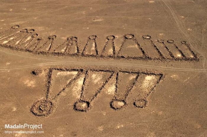
Legacy
Finding oddities via Google Earth has become a popular pastime on social media in recent years. Facebook has several hundred Google Earth groups, with Google Earth, Structures and Anomalies banking 1.8 million members. Many members post images of pareidolia, the phenomenon of seeing faces in landscapes. Others also try to find secret locations to prove conspiracy theories.
Some individuals attempt to use Google Earth more actively, like the controversial YouTuber GeoWizard. He walks across countries in straight lines, ignoring the consequences of trespass.
Aerial archaeology has developed as a direct result of Google Earth. It has given us not only a bird’s-eye view but an astronaut’s. It has unlocked a new world, showing us things previously unseen or misinterpreted.
Conclusion
It is safe to say that the Works of the Old Men are remnants of a long-lost Neolithic Arabian past. It was a time when humans built structures for shelter and to trap animals. The variety in the shapes of the works suggests that they weren't for just one purpose.
Thanks to Google Earth, we will likely uncover many more such mysteries.
The forty days and nights of rain during the Biblical flood does not compare to what happened in the late Triassic, over 234 million years ago. Earth was hot and humid, and the rain lasted two million years. An umbrella -- and not just one ark but a fleet of them -- would have been recommended.
The Triassic Period featured several major upheavals in the climate, landscape, and life on Earth. One of the least known is the Carnian Pluvial Event (CPE). Not surprisingly, the two million years of rain changed the planet forever.
Before the Great Rain
What was Earth like before this endlessly steady rain? At the time, the main landmass was Pangea. Essentially, it was a gargantuan, barren desert stretching from the North to the South Poles. Plant life was unimpressive, characterized by small desert plants dotted across the sands.
Rainy seasons were short and infrequent. Mountain ranges around the interior prevented rain from penetrating regularly. Only the coastlines had their share of water. Earth was 10°C warmer than today and seas were 47°C -- much hotter than bath water.
Animal life consisted of very ancient forms of insects, reptiles, mammals, and the earliest dinosaurs. Reptiles ruled while small dinosaurs were the awkward new kids on the block. Conditions weren't optimal for them. The Earth also had one main ocean called Panthalassa, in which there lived ammonoids, gastropods, sponges, corals, and other species.
This all changed when what started as a few dark clouds and drops of rain soon turned into a two-million-year monsoon.
Strangely enough, this event has rarely been talked about until now, although evidence about it has circulated since the 1970s. When it comes to mass extinction events, scientists have always focused on the "big five": Ordovician-Silurian, Devonian, Permian-Triassic, Triassic-Jurassic and End-Cretaceous. However, this one seems to have escaped their notice for quite some time.
Some researchers blame the event's odd chronological position for its neglect. It did not happen at the beginning or end of a major geological era, like they often do. It seemed to have occurred at a very random time. Was it random, though?
Volcanism at work?
The main theory for this long period of rainfall is that a series of powerful volcanic eruptions around Alaska and British Columbia sent massive amounts of carbon dioxide into the atmosphere. This caused a long period of global warming and acidification of the oceans. It created great humidity, which inevitably led to extreme rainfall.
These volcanoes would have been powerful enough to change the water and carbon cycles, altering the climate forever. Many species died out as a result, including one-third of all marine animals. It's important to note that the rains were in intervals, not in one continuous, neverending deluge.
“It’s like charging a massive battery," explained geoscientist Jacopo Dal Corso, who has led research into the topic. "A ton of cooling high in the atmosphere and a ton of evaporation and heating near the surface…[is] going to cause an enormous storm.”
Some palaeontologists suggest that a new mountain range caused all this trouble due to pressure changes between land and the ocean. However, most scholars believe that the volcanism theory is more plausible.
Evidence
The Carnian Pluvial Event was only discovered in the 1970s. Geologists Schlager & Schollnberger were studying rocks in Austria's Northern Limestone Alps when they noticed a peculiar and sudden layer of dark grey siliciclastic rock within the previously consistent carbonate rock record.
They dated it to 234 million years ago. This rock was not consistent with Pangea's hot, dry climate. Rather, this type of rock typically showed up in very wet areas or those with an abundance of water.
Other deposits from this time started popping up all over the globe. In southwest England, geologists found it embedded in layers of red sandstone. It also turned up in Israel, Italy, and Utah, in the U.S.

Other indicators of a deluge included the presence of amber, coal, ancient rivers and lakes with fossilized plant debris, and a white powdery clay called kaolinite. Additionally, fossilized pollen and spores found in rocks from the Carnian period also indicated a humid climate and hot temperatures.
Because of its recent discovery and the difficulty in finding data over the years, some geologists refer to the CPE as the "hidden extinction."
After the rains...
Though climate change from human activity is considered undesirable nowadays, this ancient period of climate change did the world a lot of good. The planet saw a drastic acceleration of the major cycles, including the carbon and hydrological cycles.
Dinosaurs thrived, and the weather regulated itself more. Reptiles began to decrease as towering conifers and other large plants replaced their food supply (ground vegetation). Dinosaurs fared well with the larger plants. The ancestors of modern animals such as turtles and crocodiles emerged alongside them. The newly acidic seas led to the growth of plankton and coral reefs.
Did the rains stop? Yes, this period of rain and its subsequent flooding dissipated and global temperatures settled down into a less intense, cooler climate. Pangea became a desert again, but it was a different-looking landscape. The accelerated hydrological cycle caused rampant erosion and weathering. The soil from which plants grew changed radically from a carbonate base to much darker and more fertile sediment. The air shifted from its hot, dry state to a more humid one.
When the Late Triassic closed and the Jurassic period began, Pangea started breaking up and new oceans began to form. This created even more humidity, turning the climate subtropical. Deserts became tropical forests.
After the CPE, rain also regulated itself. It instead fell regularly at an average of 1-3 metres annually in more steady, seasonal intervals that did not last that long, especially not as long as two million years.
Essentially, this event was the beginning of our modern world, in the geological sense. The environment we have today, the climate, and our flora and fauna took hold after the CPE.
Conclusion
The climate continued to change after the CPE. More extinctions and reshaping of the environment occurred. The timing of the emergence of the dinosaurs and the CPE is no coincidence. This event was crucial for their domination in the Late Triassic. Scientists are happy to include yet another mass extinction in their line-up of Earth's history. While this event is not as substantial and violent as the "big five," it still played a pivotal role in birthing our modern world.
Mysterious writing. No author. Enigmatic etchings that don't make sense. I'm not referring to some artifact from Egypt or Easter Island. I'm describing an intriguing, ancient, and rather odd site in Aberdeenshire, Scotland.
Two stone pillars with a muddled backstory stand in someone's garden. We do not know when, where, and how these came to be, only that their discovery was complete happenstance.
Background
In 1804, the Earl of Aberdeen found two odd vertical stones around where he was trying to build a road. They were uprooted and placed in the garden of a local antiquarian, Alexander Gordon, who lived on an estate called Newton House. The stones themselves most likely date to the 6th and 7th centuries.
In a letter dated Sept. 10, 1885, Lord Aberdeen wrote to a correspondent: "The stone, at the time to which I refer, might have been passed by thousands without characters being at all observed. The rugged surface and the rude manner in which the letters are inscribed, rendered them little likely to attract notice..."
The Newton Stone is one of two pillars. The first pillar stands approximately two meters tall, while the second is slightly taller. According to Scottish heritage organizations, the symbols etched into the first are distinctly Pictish. They show a serpent and a Z-rod alongside a double disc.
This particular symbol has appeared on other Pictish sites throughout Scotland. Little is known of the Picts, who lived in the region throughout the early Middle Ages. A few carved stones are almost all we have to go on.

The mysterious second stone
The second stone is not so straightforward, which is the mystery we focus on. The writing on the left side of the pillar is possibly Ogham, an ancient Irish or Brittonic language long extinct. It resembles runes, as its letters contain long lines with slashes and dashes along them. The Ogham script possibly spells out a name, Ethernan, whose context is also unknown.
However, most intriguing is the right half of the stone. This features carvings of an unknown script and odd symbols including a swastika. We have no key to decipher the meaning. Perhaps, as some have suggested, it's simply gibberish.
Writers have published the script in books since 1814, in the hope of catching a linguist's attention. And that it did.
Linguistic puzzles
Solving the "unknown script," as it's officially called, is the key to understanding these stones. Five ancient languages have been proposed: debased Latin, Greek, Gaelic, Phoenician, and Gnostic symbolism. Other proposals include mixtures of Hebrew, Canaanite, Hittite, and Bactrian.
George Moore, author of Ancient Stone Pillars of Scotland, wrote, "I was struck with the general resemblance of the characters to those I had seen on certain coins known as Bactrian...Arian and Pali rock records of Northwestern India, and recognized as Buddhistic..."
An English antiquarian, Thomas Wright, suggested that the unknown script was debased in Latin. His translation read, “hie facet Constantinus” or “here lies Constantinus, the son of,” which would make the stone a headstone.

A popular proposal suggested a Phoenician origin and translated the text as: “To Eshmun, God of Health, by this monumental stone, may the wandering Exile of me, thy servant, go up in never-ceasing memorial, even the record of Han Thanet Zenaniah, Magistrate, who is saturated with sorrow.”
"Eshmun" refers to the Phoenician god of healing, whose corresponding symbol is a serpent. It sounds promising. Could this have been a healing stone of sorts?
Theories
With regard to the debased Latin proposal, even though the Roman armies left Britain in the 5th century, some stayed and built a life there. Perhaps this was the work of one of those individuals.
Could it be some variant of Pictish that linguistic historians have not yet discovered? There are very few examples of Pictish "writing" out there, which does not give us much to go on.
The Phoenician hypothesis gained traction in some circles, and the serpent symbol was one of the driving pieces of evidence. However, the Picts also used the serpent symbol often. There is another Pictish stone with this same serpent carving in Aberdeenshire called the Brandsbutt Stone. Because of the close proximity to the Newton Stone, did the Picts mean to create a pilgrimage route that connected the various stones?

A hoax?
The Phoenician theory is intriguing but farfetched. How did Phoenician script end up on a stone in Aberdeenshire, Scotland? Some proponents have suggested that the Celts descended from Phoenicians.
The other ancient languages -- Greek, Hittite, Canaanite, etc. -- are likewise improbable. This brings us to the next theory. Archaeologist C.A. Gordon claims it is a hoax inspired by the Rosetta Stone, found only five years before the Newton Stone.
Due to the inconsistency of the unknown script, academics agree that some carvings were added later on, as late as the 18th and 19th centuries. "The incomprehensibility of the inscription was due to it being a forgery perpetrated in the early years of the 19th century,” wrote Gordon.
Finally, the stones could have started out as Pictish in origin before someone carved their own symbols into them, thus the confusion. It could have been a practical joke or a perverse attempt to puzzle.
Conclusion
If you want to solve this mystery and have some coin to spare, the Newton House and its property are currently on sale for £1,650,000. You can then own the stones themselves. This is a chance to unlock this mystery once and for all.
However, from what we know so far, this could either be a hoax or the vandalization of a rare Pictish archaeological find. Whatever the case, it does not diminish its intrigue. Until we get a firm grasp of the language, that one Newton Stone continues to puzzle us all.
In the early 1800s, Zheng Yi Sao was the terror of the South China Sea. This female warrior raided countless villages and defeated elite naval forces from Asia to Europe. Through unshakeable determination and brilliant strategy, she created the world's greatest and largest pirate confederation.
Beginnings
Zheng Yi Sao's beginnings are a bit murky. Most likely, she hailed from rough beginnings in a poor family. Her name was originally Shi Xianggu. Some sources claim she was one of the Tanka, an ethnic group occupying Shanghai, Macau, Hong Kong and other areas. They were known for living on Chinese junks parked on a river or in a bay. It is possible that she was a prostitute or madame of a brothel in one of the junks.
Marriage
During this time, she met her first husband Zheng Yi, who turned out to be a pirate from a long line of seafaring criminals terrorizing South China. After marrying him, she changed her name to Zheng Yi Sao, which means “Zheng Yi’s wife.” The couple had two sons.
His family members had large fleets of ships that raided towns and vessels and fought against government naval forces. Zheng Yi was originally a privateer for the Vietnamese dynasty Tây Sơn before he had other ambitions in mind. His cousin, another pirate leader, died, allowing him to take leadership of his large fleet. This gave them an idea. After he and Zheng Yi Sao got married, they began building one of the world’s greatest pirate empires.
A pirate confederation
In this period, piracy was a lucrative business and very successful in evading and defeating naval forces. Many became pirates to escape poverty. Some simply wanted power. However, some individuals were pirates by coercion and all these walks of life were part of Zheng Yi Sao’s operation. Other than raiding, the confederation provided paid protection and offered mercenary services.
They absorbed other fleets, not by force but by another method. In order to foster cooperation and a lack of rivalry, Zheng Yi Sao and her husband convinced the fleets’ leaders to form a confederation, and they agreed to give up some of their autonomy for the good of all. Each fleet would have relatively the same amount of money and resources, they would have each other’s backs in conflicts, and live by important codes.
These conditions made them an incredible and united fighting force. Six fleets signed the agreement. They were named after the color of their flags -– red, black, purple, white, and yellow. Red was the largest of them all. By the time this was done, Zheng Yi Sao and Zheng Yi managed over 60,000 or 70,000 pirates.
Zheng Yi Sao was quite adept at negotiation and organization. Sociologist Joseph MacKay stated that Zheng Yi Sao “substantially reformed and formalized the gang’s administrative structure, imposing complex systems for dispute resolution and division of acquired wealth.”
Essentially, she was the brains behind the operation while her husband was the leader and brute force.
The confederation took on major powers including the East India Company, the Chinese government, and the Portuguese. Even the British got involved. These forces often underestimated the pirates. Their organization was extremely efficient. The confederacy ran parallel to the system structure of the Qing Dynasty.
Rise to power
Zheng Yi Sao ended up taking over the entire fleet when her husband fell overboard to his death. Despite her widowhood, she carried on with pirate affairs…and other personal affairs. She entered a relationship with her husband’s adopted son, Zhang Bao. This led to speculation that they were fraternizing behind Zheng Yi’s back when he was still alive. Her relationship with Zhang Bao and the support of other pirate leaders were instrumental in her rise to power.
Conventions for Chinese women were the total opposite in the realm of piracy. When you would think that men would have rejected her after Zheng Yi died, they greatly respected and followed her rule. In fact, because of their loyalty and Zheng Yi Sao’s strategic mind, the confederacy went further than ever. Her leadership brought South China to its knees.
Members of the confederation had to follow several rules or they would be executed by decapitation. A pirate could not go onshore without permission, steal from another pirate, or rape or harass of women. All these transgressions were punishable by death. Zheng Yi Sao was particularly strict about protecting women, probably because of her past as a prostitute.
Zheng Yi Sao did not create these rules, but after her husband died, she wrote several more commandments to build on his. She decreed that no one else but her and a few other superiors would give commands. There was no stealing from villagers who helped them, no withholding loot, and plunder was redistributed fairly among the fleet. Finally, only she could approve raids. During their raids of Shunde, Donguan, Xinhui, and Guangdong, over 12,000 people died.
Battling the Portuguese and Chinese
Eventually, the Chinese allied with the Portuguese in an attempt to cripple the pirate fleet. They set up blockades, engaged in skirmishes, and sent fireships to burn them in the water. The Portuguese wanted payback after the pirates defeated them in some early battles. The attempted blockade did not last long, though. Zheng Yi Sao was also a brilliant tactician and managed to break blockades and turn their enemies' fireships back on themselves.
Surrender and retirement
Brilliantly, Zheng Yi Sao saw a perfect opportunity to get off scot-free. She officially surrendered in 1810 and in exchange, she was allowed to retire without consequences. As far as the citizens of South China were concerned, they simply wanted to stop the piracy. Her negotiation skills helped her and her fellow pirates in their amnesty deals.
Usually, pirates do not see a happy ending. But Zheng Yi Sao did. This did not mean that she gave up the pirate life for good. She opened up a gambling house and earned a fortune. She passed away at 69.
Legacy
Feminist groups claim Zheng Yi Sao as a hero and a woman who beat all odds. She made it quite far in her time, especially after her husband died. She is even hailed as the greatest pirate in all history. Take that, Blackbeard!
Her legacy lives on extensively in graphic novels, books, TV shows, musicals, and movies. Do you remember Mistress Ching from Pirates of the Caribbean: At World's End? Yes, that was inspired by Zheng Yi Sao.
In 2020, an Australian climber named Angela Eiter was the first woman to ascend a route she named Madame Ching in Imst, Austria in honor of the famed pirate. She said "...the most dangerous female pirate in history and a perfect name for my possible hardest first ascent to date!"

Law and order runs a bit differently in Benin, Togo, and parts of Nigeria. Instead of cop cars patrolling neighborhoods, villages of the Ogu people have their own way of keeping streets safe. They have Zangbeto, vodoun spirits which act as judge, jury, and executioner.
What are they?
Videos of Zangbeto have surfacing online in recent years. Western forums all ask the same question: Is Zangbeto real or fake? When you look at the videos, you don't really know what to make of it.

Zangbeto is a Gun word (language of the Ogu people) meaning "men of the night." Essentially, they are supernatural guardians who protect communities from natural and supernatural forces. These spirits know if someone has stolen, cast evil spells, murdered or otherwise harmed the innocent. Because of their formidable nature, believers do not dare mess around.
Once summoned by individuals in a cult dedicated to it, Zangbeto patrol villages mainly at night to find the perpetrators. If caught and unrepetent, the Zangbeto will curse this individual and make their lives hell by way of justice.
Cult
Bringing a Zangbeto into the mix is managed only by this special cult that summons it, pays tribute, and makes sure no one interferes in the ritual. The cult consists of mostly males, with a few women. Those who wish to join need to undergo a vetting process. They need to be of good character and able to keep secrets. The cult leads the Zangbeto around and prevents people from touching them.
The cult organizes the Zangbeto's appearance at events like funerals or for prominent guests.
Appearance
Although they are spirits, Zangbeto manifest themselves in colorful costumes as they move and dance throughout the village. These cone-shaped costumes are made of raffia palm leaves that are dyed in reds, greens, yellows, purples and browns. The cones dance, twirl, and can do acrobatic tricks.
Before you think there's someone inside, think again. The cult members assemble the whole thing in front of everyone, from putting the thin wooden frame together to putting the leaves over it. They do this for onlookers to believe.
After the ritual, the cult members disassemble the structure to show that there is no one inside. Sometimes, people hear a frightening voice coming from the object.

The Zangbeto performs miracles for the crowds and can make objects and animals appear out of nowhere. Skeptics believe that practitioners control it remotely somehow or manage to conceal someone inside.
But traveler Chris Stance, who witnessed the tradition, said questioning is equal to blasphemy so few dare to challenge it.
This tradition dates back centuries. English journalist Stuart Butler, who traveled throughout Benin and witnessed this tradition, states, "Zangbeto evokes a power that is said to have inhabited the earth long before the appearance of man..."
Some locals say that Zangbeto are actually the spirits of ancestors who give back to current generations and protect them.
Annual festival
With the Zangbeto's permission, the Ogu have used it to instil fear in rival tribes. The Zangbeto were vital in psychological warfare. Nowadays, they are mostly around to maintain sacred traditions, for law enforcement, and even entertainment. Recently, the Ogu have used the Zangbeto in environmental efforts to protect local mangroves, fishing spots, and forests.
In an article for Voice of America, a village leader in Benin warned, "If you go into the forest, you will be punished by the laws of our talisman...he is feared."
If you wish to see it for yourself, Zangbeto has its own nine-day festival every July or August in Badagry, Nigeria.
William Drummond Stewart did not conquer lands of the American West for a President, nor did he wish to discover new species. What drew him to the West? While expeditions like those of Lewis and Clark and John C. Fremont had scientific or military goals, Stewart’s was simply…to go on an epic lad's trip.
Background
Stewart was born in Murthly Castle in Scotland, and his father was a Scottish laird. The Stewarts came from a long line of barons and were influential in politics and the military. While records of his childhood seem to be lost, his adolescence and adulthood are very much documented.
When he was 17, his father bought him a position in the army for £700. It is unclear why he did so. Buying one's way into a high position indicates some inadequacy on Stewart's part that his family saw the need to step in and help. £700 was a hefty fee back then.
Stewart enjoyed both action and flamboyance. Initially, he was assigned to the Sixth Dragoon Guards. This bored him, and he requested a transfer to the 15th Kings Hussars, which were in the thick of fighting the Napoleonic Wars. He and his unit fought valiantly at Waterloo. Their illustrious uniforms made other officers jealous, which Stewart enjoyed thanks to his desire for the spotlight.
A double life
Stewart's outward persona as a charismatic, accomplished military officer and nobleman hid his true nature. He was secretly gay. Historians do not know for how long he conducted clandestine same-sex relationships, or if he ever did before the 1830s. He had a heterosexual relationship with a servant named Christian Marie Batterby in Scotland, with whom he had an illegitimate son. He never married her but took care of his son and the mother financially.
Historian William Benemann, author of Stewart's autobiography Men in Eden: William Drummond Stewart and Same-Sex Desire in the Rocky Mountain Fur Trade suggests that this relationship with Batterby was Stewart's way of trying to "cure" himself. However, in later years, he lifted the veil and engaged in a decade-long relationship with a man.
The pleasure trip
Stewart enjoyed travel and was a great admirer of poet Lord Byron and his journeys throughout Greece and Turkey in the 1800s. The East and its exoticism appealed to him, sending him on a pilgrimage inspired by Byron's travels. But his eyes then turned to an entirely different world: the American West.
Westward expansion was now kicking into high gear. Manifest Destiny and the romanticization of unknown lands drew restless souls to explore trade and new frontiers. The indigenous cultures already in the area both scared and fascinated people.
In 1833, Stewart decided to go to North America and see all these new things for himself. In St. Louis, Missouri, he joined a group of mountain men heading to Wyoming for a rendezvous. This was an annual fur traders' event where explorers, cartographers, and men of all stripes met, networked, hunted, and conducted business. It included dancing, singing, cooking together, and sports. Essentially, the rendezvous was a guys' trip of epic proportions.

Stewart stayed in the West for several years, attended many such events until the 1840s, and met many intriguing individuals. They include naturalist Kirk Townsend, missionaries Daniel and Jason Lee, artist Alfred Jacob Miller, Baptiste Charbonneau, the son of Sacagawea, of Lewis and Clark fame. He also met a mountain man named Antoine Clement, with whom he spent a decade in a relationship.
After his father died, his brother inherited it and recklessly incurred great debts. However, his brother died, thereby passing on the title and burden of debt to him. Stewart had to go back to Scotland for a time to officially become a baron. But he disliked the responsibility and eventually returned to the United States.
During these various rendezvous, Stewart and his friends traveled over the Big Horn Mountains, Taos, the Green, Columbia, and New York Rivers, Washington, Fort Vancouver, the Rockies, New Orleans, and many other locations across the country.
First luxury travel
It was no secret that Stewart liked to travel in style. He had hedonistic tendencies and did his wilderness explorations as luxuriously as possible. No doubt this was a consequence of his aristocratic upbringing.
Accounts described his expeditions as “pleasure trips,” a new concept at the time. Leisure travel was very rare, but when word got out about these entertaining fur trade rendezvous, it seemed to start a trend. One explorer wrote how “some professional gentlemen come on the trip for pleasure, some for health…doctors, lawyers, botanists…men of nearly all professions.”
One member of the expedition party described what sounded like first-class treatment at Fort Jackson. "Our baggage was brought and put into a spacious room without consulting us…fine muskmelons and watermelons and apples were set before us…”
Despite their high-end nature, Stewart's pleasure trips included many exciting events: hunting buffalo, and brushes with bears and with Native American tribes. Despite or because of the dangers, Stewart loved the West. To capture his beloved land in a different light, he hired an artist named Alfred Jacob Miller to tag along and give the public a new perspective on the frontier.
Legacy
Stewart is not as well-known as many of his contemporaries. While the Museum of the Mountain Man in Pinedale, Wyoming gives him some attention, only a few books out there cover him. Most sources mention him only in passing as part of Scotland's general involvement in the American fur trade. His legacy lives on mostly through the paintings of Alfred Jacob Miller.
This is most likely because Stewart's homosexual lifestyle was taboo until recently and his travel style was more hedonistic than pioneering. It is unclear if the fur traders respected him or not. Kirk Townsend, the naturalist, described Stewart as “an English gentleman of noble family, who is traveling for amusement and in search of adventure.” The term "for amusement" sounds somewhat disparaging today.
Nevertheless, one individual has set out to uncover Stewart's enigmatic past. Historian William Benemann has meticulously scoured documents and obscure letters in the Bancroft Library at UC Berkeley to piece together the details of his secret lifestyle.
He believes that the American West was both a refuge and an escape for Stewart. Its remoteness allowed him to live the life he always wanted. According to Benemann, this was the case for many with same-sex desires. The mountains gave men a more secretive space to conduct their affairs away from public eyes.
Interest groups on Facebook and other forms of social media do not mention his contributions to travel at all. But LGBTQ blogs and Reddit posts are starting to discover his story and trying to shed light on this lost part of American fur-trading history.
A peculiar satellite image recently made the rounds on social media. NASA captured a shot above a desert, but something was amiss. As well as the dunes you might expect, the landscape featured odd blueish formations.
These were actually numerous lakes of many shapes and sizes. The Badain Jaran Desert in China's Inner Mongolia has both saline and freshwater lakes. Somehow, these have managed to form at the base of mega-dunes in Badain Jaran. But how?
Lack of information
For a phenomenon that is so miraculous, there is little information out there. Mainly, you get a wealth of Chinese websites and a blog or two with a couple of pictures. They don't reveal much. No one truly knows how or why these lakes exist. But with the information we do have, we can put together some kind of sketch.
First of all, this formidable place ranks as China's third-largest desert. It is a great rival of the Sahara for its high concentration of mega-dunes. Because of its harshness and remoteness, the Chinese Communist government used it to house "re-education camps" here. Thousands died and were buried under the sands in mass graves.
The name
The name Badain Jaran seems to be a mixture of Mongolian and Tibetan. Some sources say that Jaran derives from a Tibetan word meaning "hell." Others claim that it refers to the number 60 and represents the number of lakes, albeit inaccurately.
Badain comes from a local oral tradition of a Mongolian shepherd of that name who came to the desert, discovered the lakes, and chose to settle here.

Badain Jaran is far from hell. Rather, it teems with life. This temperate desert contains more moisture than many deserts around the world. Perhaps because of its unusual character, it has long symbolized prosperity, miracles, and the divine. Thanks to its remarkable sources of water, many fruits grow here. In the past, those crossing the desert often mistook the lakes for mirages.
Formation
Of Badain Jaran's 144 lakes, only 12 are freshwater. The rest are saline and home to crustaceans and small fish. Half the lakes are year-round while others dry up for part of each year. They vary in depth from 2m to 28m.
The real mystery is where this water comes from. The water table may lurk just beneath the sands. There are natural springs throughout the desert as well.
According to Chinadiscovery.com, water might be located in the southeast of the desert, overflowing from the earth's crust and creating a hot spring. Underground rocks contain limestone, and therefore calcium carbonate. As the water surfaces, the temperature, pressure changes, and interaction with the calcium carbonate cause it to turn salty.

The saline lakes change color from green to brown to pink, thanks to the interactions between chemicals, minerals, cyanobacteria, and sometimes algae blooms.
The freshwater lakes are all seasonal and form from snow and rain. Since the desert experiences heavy snow in winter, the snowmelt creates a layer of fresh water on the surface. Some suggest that runoff from the surrounding mountains also feeds the freshwater lakes. You can drink safely from them.
Features
One of the most intriguing lakes is Yinderitu Lake, which is both salt and freshwater. On one side, 108 springs churn out drinkable and sweet water, leading to its local reputation as a "divine spring.”
Its miraculous reputation has drawn locals to it. According to Yhangyetravel.com, princes hailing from Alxa League (a district of Inner Mongolia) used this lake as a vital stopover on their travels.
The sacredness of the lakes also led some people to build Buddhist temples along the shores. The Sumin Jaran Temple on Badain Lake, the largest of the lot, sat in the sands since 1755 AD, during the Qing Dynasty. It has barely changed and it escaped the chaos of the Cultural Revolution in the 1960s. It became a place of refuge for Buddhists to practice their faith. Sumin Jaran means "inland lakes with temple" in Mongolian.

There's also Bilutu Peak, the highest sand dune in the world. This Everest of the desert measures 1,611m high. From its summit, you can see seven lakes called Haizis, supposedly created by fairies in ancient times. Another famous dune with a lake at its base, the Baori Taolegai, supposedly "roars" on occasion.
The dunes themselves reportedly sing. Researchers believe the noise comes from the electrostatic charge generated by the friction of the sand particles as the wind peels off layers of the sand. The hums, whistles, burps, or booms only happen in summer and last for at most a minute.
Straight out of a National Treasure movie, the Beale Ciphers have promised hundreds of pounds of gold, silver, and jewels to the one who can crack the code. But is the treasure even real?
Background
The ciphers first appeared in a modest pamphlet in 1885. It told of a man named Thomas J. Beale who buried this extraordinary treasure in Bedford County, Virginia in the 1820s. He obtained these riches, it said, from a mine in Sante Fe, New Mexico. Paranoid about losing it, he created a series of difficult ciphers to hide its location. Then he locked the pamphlet away in an iron box, along with some letters and other documents.
He gave the box to an innkeeper named Robert Morriss. He told Morriss not to open the box until he returned sometime in the next 10 years. Beale never came back. Nor did he give Morriss the key to solving the ciphers.
The Beale ciphers supposedly comprise three parts: the treasure’s location, its precise contents, and the person or persons to whom Beale wanted to bequeath the treasure.

Morriss eventually opened the box in 1845. After failed attempts at solving the peculiar puzzle, Morriss gave them to a friend (identity unknown...conveniently), who ended up cracking one cipher. He used the Declaration of Independence as the key. He figured out that "71" corresponded to the 71st word in the Declaration of Independence; "965" was the 965th word, etc. This is followed by taking the first letter of that word.
Deciphered, that part of the puzzle read:
I have deposited in the county of Bedford, about four miles from Buford’s, in an excavation or vault, six feet below the surface of the ground…the first deposit consisted of ten hundred and fourteen pounds of gold, and thirteen-eight hundred and twelve pounds of silver…the second…consisted of nineteen hundred and seven pounds of gold and twelve hundred and twenty eight of silver; also jewels... value at thirteen thousand dollars.
Different rules seem to apply to the two other ciphers. This key does not work.
The treasure, which is worth over 54 million dollars today, supposedly sits in iron pots in a stone vault somewhere. Alas, the two remaining texts remain unsolved.

Cracking the code
Many have tried to discover its contents using well-known historical texts. Apart from the Declaration of Independence, others have tried the U.S. Constitution, the Bible, the Magna Carta, and other iconic documents. The anonymous friend of Robert Morriss made the cipher available to the public in the hope that someone could break the code.
No one has succeeded. Even cryptographers have hit a brick wall with the other two. Some have even suggested that the numbers seem more random than anything. Nothing they've done has led to any words or phrases that make sense.
Furthermore, some of the supporting letters that were in Beale's locked box, along with the pamphlet, contain discrepancies. Some words in the letters originated in the 1830s instead of the 1820s, (such as "stampeding" or "Improvise"), suggesting that the mystery itself might be a hoax.

Who was Thomas Beale?
Enthusiasts have scoured census records from the 1800s to figure out who the purported author was. One Thomas Beale lived in New Hampshire and another in Connecticut in 1810 and 1820. A Thomas Beall lived in St Louis, the location from which Beale sent letters, as stated in the pamphlet.
Some mystery hounds even insinuated that writer Edgar Allan Poe was the real author because of his love of mysteries, codes, and ciphers. However, they didn't do their homework properly, because the timing did not match. Poe died before the Beale Papers came out.
Another candidate is Thomas Jefferson since he played a major role in the Declaration of Independence. Thomas Beale might have been a pseudonym. However, the shared first name could simply be a coincidence.
There are no other clues as to who Thomas Beale could have been.
Crazed attempts
It seems that the prospect of the treasure sent a few individuals off the rails. People from all walks of life -- contractors, electricians, psychics -- tried to find it. Some bankrupted themselves. Others broke laws including trespassing, using explosives illegally, and unauthorized digging in cemeteries.
According to one source, a man named Stan Czanowski spent over $70,000 to dig up sections of land using explosives and heavy machinery. A high-ranking editor lost his job because of his obsession. Another claimed that he received the location in a dream. More than one tried to use psychic powers to pinpoint the location.
In a 1984 article from The Washington Post titled "Legendary Treasure Quests," author Hank Burchard mentions a woman named Marilyn Parsons who spent two months in Bedford County jail for desecrating a cemetery. Convinced that gravestones were parts of the code, she dug up parts of the cemetery with a backhoe.
In modern times, the Beale Cipher Association was set up to help with the search. Every year, members who pay a $25 annual fee get to attend regular workshops, talks, and seminars about the cipher's details. However, nothing came to fruition.
Various online groups have tried to solve the ciphers. The r/cryptography subreddit has taken a couple of unsuccessful cracks at it. Some very old Facebook groups and outdated websites are the last remnants of the search. It seems that the wider public has lost hope of ever solving them.
Conclusion
Could it be a hoax? Some contemporary skeptics suggest that this was simply a ploy to sell pamphlets of the Beale numbers, which cost 50 cents at the time.
It is also worth noting that the solved cipher was from a modified version of the Declaration of Independence. (There were several variations of the Declaration floating around at that time.) Why not the original version? Even though the result from the modified version looks promising, it could be a case of someone seeing what they want to see.
If someone could uncover the true identity of Thomas Beale, it might yield clues about the key to the other ciphers.
A driven daredevil, Jean Francois Pilatre de Rozier traded a respectable career as a teacher to become the world’s first balloonist -- and the world's first aviation fatality.
Background
He was one of four children, born to an innkeeper and his wife. According to chemist and researcher Clement Duval, de Rozier was “careless, inattentive, fond of pastimes and rebellious toward study.”
However, his father was firm about giving his son a stable future and tried to fit this square-peg son into a round hole. At first, they shipped him off to a military hospital to be a doctor. But he hated surgery. His family then sent him off to study pharmacy, physics, chemistry, and natural history for three years.
While de Rozier eventually secured a position as chemist in an apothecary, he managed to network with the right people and opened a museum in Paris in 1781. He ran the museum on his own terms, preferring to make it interactive.

Making things go boom
While the Frenchman had an interest in the sciences, particularly chemistry and physics, he preferred practical application to boring theory. De Rozier published his scientific research but he never gained any recognition from it. He preferred to experiment, even dangerously. He liked to make things go BOOM!
And that, he did. Some experiments included making hydrogen-based explosions and turning glass into powder. His interest in the reactions of gases led to one of his greatest contributions: a respirator. Yes, all those N95 masks we had to use during the 2020 pandemic came from an early model invented by de Rozier. He wished to create a device that allowed the purification of the air when he was working with harmful fumes.
His study of gases also led to his fascination with the balloon movement, then in its infancy. He believed that "this inexpensive contrivance would be very useful to an army for detecting position of the enemy manoeuvers." This statement definitely shows him to be not just a dreamer, but a forward thinker.
Balloonamania
Balloons and early attempts at aviation became popular in France in the late 1700s. The National Air and Space Museum refers to this period as “balloonamania.” It was a revolutionary mode of travel, inspiring everything from engineering to pop culture and fashion. The nobility and the royal family also had a vested interest in this new technology. Benjamin Franklin supposedly witnessed balloon flights in Paris.
Leading the balloon craze were two innovative bothers, the Montgolfiers. Joseph-Michel and Jacques Etienne started their ballooning career in June 1783. They began small, doing tests here and there, without passengers. In the fall of 1783, they used animals like goats or sheep to test whether or not humans could withstand higher altitudes. All was seemingly well.
De Rozier, who always longed for the spotlight, offered to do the first human balloon flight. He had observed the brothers' work for some time. The king, Louis XVI, initially suggested that convicts should do the first human flight, to eliminate any unnecessary risk to regular civilians. De Rozier passionately disagreed. With approval from the king, he and nobleman Francois Laurent successfully flew untethered at a height of 100m on Nov. 21, 1783.

A lucky escape
The success made de Rozier want to try another flight, this time with some rich passengers on board. However, this next flight, in January 1784, had a mishap. The balloon, made of sheepskin and paper, tore. It crashed, and de Rozier was lucky to escape death. This foreshadowed the fate he suffered just a couple of years later.
De Rozier wanted to try again, and indeed, his third flight turned out much better. No tears, no crashes. He soared up over 2,700m for almost an hour. With each successful ascent, his reputation and fame grew, inspiring other dreamers and innovators to make their own attempts.
The balloon race
The world's first "space race" was actually a balloon race in which the French would compete against the English. When de Rozier heard of this, he acquired a large donation to build his dream hydrogen balloon. He wanted to fly it across the English Channel from France. He and another man named Pierre Romain made their flight in June 1785.
That day was unsuitable for flight because of high winds. However, the intrepid balloonist's impatience got the better of him. After half an hour, the balloon caught fire, and the pair fell to their deaths near the town of Wimereux, just north of Boulogne-sur-mer. They died instantly, and thus became the first-ever aviation deaths. An obelisk stands at the site of the crash, commemorating this unfortunate but historic event.
Conclusion
Some called him foolhardy. Others vain and crazy. To aviators, he was an idealist and was "lost afar in the future." His biographer called him a "victim of honor and zeal."
"The airplane has unveiled for us the true face of the earth.” -- Antoine de Saint Exupery
It was the 1920s. A lost young man decided to join the French military. Antoine de Saint Exupery did not anticipate becoming a pilot or one of the world's most famous authors. Both complicated and adventurous, Saint-Exupery became an airmail pioneer and paved the way for ambitious pilots in a time when the field was in its dangerous infancy.
Background
He was born into an aristocratic family in Lyon, but misfortune befell them after his father died. His father's death deeply affected the young Saint Exupery, though he often affected a stoic exterior while caring for his siblings. However, his younger brother died as well, adding another tragedy to his life.
Circumstances caused the upper-class family to lose its wealth and status. For years, an aimless Saint Exupery had no plan or purpose.
He longed to do something different, but he did not yet know what that was. Science or academics did not entice. He failed a couple of exams and so couldn't join the Navy. Instead, he dropped out of a prestigious architectural school and worked mundane, odd jobs here and there, searching for fulfillment of some kind.
Becoming a pilot
In 1921, he decided to join the French army. There, he took an interest in flying. This seemed to stick with him and he became a pilot not long after. The nascent air force posted him to North Africa, where he spent many years flying to and gaining inspiration for the next steps in his career.
While Saint Exupery loved flying, he was not a flawless pilot. He had seen his fair share of crashes and brushes with death in his compatriots. Unable to deal with another tragedy, he needed to take a hiatus from his adventurous life.
Yet before too long, he found a new purpose: airmail. Airmail was in its infancy in the 1920s. Saint-Exupery took up a position with Aéropostale and flew from France to parts of the Sahara. He also volunteered for rescue missions of soldiers trapped in the deserts.
One would think that he would have been satisfied and fulfilled in this job. But no one saw what was coming next. Unexpectedly, Saint Exupery showed a writing genius. As a student, he did not enjoy humanities nor did he give an inkling of his literary talents. But somehow, aviation inspired him to write novels and memoirs, using characters and experiences as allegories for greater themes in life.
Combining writing and aviation
French journalist and biographer Joseph Kessel stated, “I have met a number of individuals who were both poets and men of action. But in every case, one of these two capacities had developed at the expense of the other. Only the author of Vol de Nuit ["Night Flight"], who also carries airmail over the deserts, the jungles, and the pampas, is at the same time a first-rate pilot and a writer of foremost rank.”
What made Saint Exupery so good was his ability to balance both identities. His first books were L'Aviateur, Courrier Sud, and Vol de Nuit. All had similar themes: pioneering pilots, crashes in the desert, and voyages of self-discovery. The autobiographical motif of his works made him stand out and he rose to fame in the late 1920s and 30s.

One famous incident granted him immense inspiration for Wind, Sand, and Stars as well as The Little Prince, his magnum opus. The Little Prince includes a pilot narrator who crashed in the Sahara. He meets a little boy who comes from a distant planet and learns great wisdom from him.
In 1935, he and his navigator survived a terrible crash in the Libyan desert. They almost died from exhaustion, dehydration, and malnutrition. They also had injuries that never healed. They were saved, almost deus-ex-machina fashion, by a Bedouin who appeared out of nowhere. The close call scarred him for life and prompted him to explore the depths of the human psyche. He detailed this harrowing experience unforgettably in Wind, Sand, and Stars.
The decline
The years of the Second World War were extremely hard on him. He went back into service as a reconnaissance pilot. However, rumors circulated that he was a Nazi sympathizer. The stress from the situation caused him to spiral into depression. After flying out for a mission in July 1944, he disappeared and was never seen again.
Evidence of his death did not turn up until 1998 and 2000 when personal effects and pieces of his plane were found in the ocean off Marseille. German forces likely shot him down.
Legacy
The Little Prince is one of the most celebrated and translated books of all time. From graphic novels and anime to stage plays, the message of the novella never fails to transcend time. Saint Exupery's legacy can be traced from France all the way to Brazil, where numerous schools, foundations, and museums bear his name. June 29 marks Little Prince Day, which is dedicated to him. Many Facebook groups and fan pages post daily about him and share archival photos.
This February has been a big month for him and his estate. On Feb. 1, 2024, author Jean-Pierre Goux, along with help from Antoine's great-nephew Olivier d'Agay, released a sequel to The Little Prince called The Little Princess, fulfilling a promise of a continuation Saint-Exupery made to his wife. Saint Exupery's Courrier Sud and Le Petit Prince even inspired a new fragrance. The marketing campaign retraced his steps in the Sahara.

Reddit threads are not so much occupied with his disappearance but rather love to discuss The Little Prince. Some cite its messages as life-changing, inspiring, even sometimes depressing. After 80 years, Saint Exupery is still being talked about.
Conclusion
One could say that Saint Exupery was great at what he did but always remained somewhat of a lost soul. Ironically, his love of flying was the only thing keeping him grounded. It helped him find purpose and an untapped talent to change the world around him.
“And ever pushed Sir Mordred, league by league, back to the sunset bound of Lyonesse, a land of old upheaven from the abyss…” wrote the poet Lord Tennyson. Off the coast of Cornwall, this great kingdom of Lyonesse was swallowed whole by the Atlantic Ocean in one night. A mythical land that rivaled Camelot in Arthurian legend, Lyonesse has engulfed the minds of archaeologists.
Background
Lyonesse, also called the "City of Lions," was a prosperous kingdom with beautiful architecture and good-looking people. Flanked by fertile hills, the city contained hundreds of churches and a main cathedral that looked more like a castle than a place of worship. Archaeologists determined that Lyonesse was built on top of the Seven Stones Reef and is located between an area called Land’s End and the Isles of Scilly.

Lyonesse was home to an Arthurian knight named Tristan (or Tristram). He was its prince but never had the opportunity to ascend the throne. He was caught up in the business of his uncle, King Mark of Cornwall. Then he found himself in love with King Mark’s wife Isolde, creating one of the most tragic love triangles in Arthurian lore.
Legend says one night, a man named Trevelyan was out on his white horse when he suddenly heard a loud noise. When he and his horse went to higher ground to investigate, he saw a tidal wave consuming Lyonesse and its people.
This one supposed survivor is said to be the originator of famous Cornish lineages, including the Vyvyan and Trevelyan families. They both bear crests with a white horse, paying homage to their ancestor’s lucky escape from Lyonesse’s destruction. This event allegedly occurred on Nov. 1, 1099.

According to local superstition, people today occasionally hear the bells of Lyonesse’s churches or see forests reemerging. The Lyonesse Project began after the discovery of a sunken forest in 2009. Excavations found submerged stone walls, and some local fishermen discovered artifacts like glass and eating utensils.
Origins of the myth
The myth of sunken cities, prosperous yet decadent and struck by a vengeful higher power, is a recurring theme in many cultures, including throughout the British Isles. In this case, the citizens of Lyonesse committed grievous but unspecified sins, and God punished them by sending a tidal wave.
Archaeologists and geographers Trevor Bell, Aidan O’Sullivan, and Rory Quinn wrote in Discovering Ancient Landscapes Under the Sea that medieval legends possess “ideological intentions.” This refers to stories created to teach listeners valuable moral lessons, like an Aesop's fable.
In a further article entitled Lyonesse: The Evolution of a Fable, archaeologist David Bivar posits an origin for the myth. He traces it back to a legend about Charlemagne, who was attempting to crush pagan forces in a town. Charlemagne prayed for God's wrath to descend upon his foes, and a devastating storm indeed wiped out the town and its citizens. According to Bivar, Charlemagne did, in fact, lay siege to a town run by Saracens. He suggests that these fantastical stories could have come to France from other parts of Europe.
What's with the name?
According to some, the name Lyonesse is not just a semi-literal translation of the City of Lions. Rather, the French name may come from Lothian, a Latin place name. Lothian refers to the area outside of Edinburgh, Scotland. This is, however, a bit of a stretch, as it is nowhere near Cornwall. Scotland is not as attached to Arthurian myth as Cornwall and Southern England are.
Records do show that historians in the Elizabethan era spoke of a city in Cornwall called Lethowstow. It had the same characteristics as Lyonesse and was destroyed by a tidal wave.
The search
A proposed location for Lyonesse is St Michael’s Mount in Mount’s Bay, Cornwall. On this tidal island, an 8th-century monastery perches on a conical mount of grey rock. Eons ago, the island was well-forested.

From 2009-2013, the Lyonesse Project investigated what the Isles of Scilly were like during the Holocene Epoch. It aimed to determine how the physical geography of the Isles of Scilly developed. It also sought to find links to the legend or to discard at least some of the stories.
As it happens, almost 10,000 years ago, the Isles of Scilly were not separate islands but one rather large one. Data shows that the rise in sea level caused over two-thirds of the land from Land’s End to the Isles of Scilly to succumb to the sea.
It is mostly accepted that the ocean completely changed after the last ice age. Twenty thousand years ago, during the Holocene Epoch, a steady rise in temperature and therefore sea levels occurred. Scientists also agree that a mega-tsunami event caused by an underwater landslide also occurred at this time (see Exploration Mysteries: Doggerland). This tsunami would have submerged various lands bordering the Atlantic.
Conclusion
The Isles of Scilly have always been vulnerable to the ebb and flow of the Atlantic. They are prone to erosion, contain hundreds of tiny rocky islets barely above sea level, and are perpetually at the mercy of the tides. So the Isles have constantly changed for the last few thousand years.
The Lyonesse Project’s main goal was to highlight the dangers that the Isles of Scilly currently face. If climatic change triggered the original disaster that wiped out the whole city, that is also a caution for contemporary society.
The dramatic shift in northwestern Europe’s geography, along with the harsh climatic changes and natural disasters during the Holocene, left a deep scar on the minds of people who lived through it. Like what happened to Doggerland, which happens to be part of the same area, tales of misfortune lived on for generations. The evidence so far suggests that a prosperous community did disappear due to a rise in sea level. This led to oral traditions passed down through families, while contemporary authors picked up the story for their literary masterpieces.
Did you ever wonder how Britain separated from the rest of Europe? Long before the crazy geopolitical mess called Brexit, an area rich in resources connected the two landmasses.
However, after a period of geological change, long ice ages and other natural disasters, Doggerland vanished beneath the waves of the dreadful North Sea, causing the separation of Britain from the continent. Now, scientists believe they finally know what happened to this Northern European Atlantis.
An ancient plain
In the 1990s, a professor from the University of Exeter named Bryony Coles coined the name Doggerland after Dogger Bank, a large sandbank in the middle of the North Sea. The word "dogger" refers to a type of medieval Dutch fishing boat specific to the area.
This extensive landmass stretched from Britain to the Netherlands, Belgium, Germany, and Scandinavia. Doggerland covered approximately 46,620 sq km and occupied what is now the North Sea and the English Channel. Most importantly, it connected the British Isles to mainland Europe. It included vast wetlands, rivers, lakes, and marshes in which dwelt woolly mammoths, saber-toothed cats, hyenas, and other ancient species.
These animals provided valuable food sources for the Neanderthal population. Because of its abundant resources, flamboyant researcher Sasja van der Vaart-Verschoof (aka the Overdressed Archaeologist) calls Doggerland the "heart of Europe." Droves of hunter-gatherers came here, following the herds.

"Doggerland was one of the most attractive and important areas for human settlement in northwestern Europe in the Last Pleistocene/Early Holocene," states another researcher, James Walker.
Accidental discovery
No one knew of Doggerland's existence until 1931. By chance, a fishing vessel called the Colinda extracted a hunk of stinky peat just off the coast of Norfolk. On closer examination, the peat contained a Mesolithic barbed harpoon made from an antler measuring 21.5cm long. This harpoon dated back to 10,000 BC. While it does not seem like much, this find heavily suggested that more prehistoric secrets lay at the bottom of the North Sea. And they did.
The end of the last ice age changed everything for Doggerland. Around 12,000 BC, as temperatures increased, melting glaciers caused sea levels to rise. Over time, Doggerland started to vanish into the sea. By around 7,000 years ago, it had almost completely submerged, except for a sliver of sandbank known as Dogger Bank.
Britain then became the solitary island it is today. The only question remaining is how Doggerland vanished. Was it a gradual process or did something more sudden and dramatic sweep it below the waves?
The search
More pieces of evidence have turned up over the years. Amateur archaeologists and scientists greatly fueled the Doggerland search, combing the beaches for artifacts and clues. A Facebook group called Doggerlanders invites people to share their knowledge and discoveries. Some have even posted pictures of supposed well-preserved footprints of Neanderthals.
Some searchers have successfully uncovered artifacts that wouldn't have otherwise been found. In 2009, a 40,000-year-old piece of a skull turned up off the coast of Zeeland. In 2016, a nurse named Willy van Wingerden discovered a 50,000-year-old artifact made of flint, minor human remains, and hyena bones along a beach in Rotterdam.
Ironically, much of the Doggerland data came, not from funded expeditions, but rather oil and wind farm companies. They helped map and gather evidence.

As of today, there are over 2,000 objects recovered from Doggerland. These include human remains, animal bones, axes, hammers, and fossils. The public was able to view many of these in a 2021 exhibition in the Netherlands titled Doggerland: Lost World in the North Sea.
Link to Atlantis?
A popular theory attributes Doggerland's fate to a sudden catastrophe. Catastrophism is the hypothesis that Earth's formation comes from a succession of fast, violent natural events. Such events include the Theia Impact theory, the Great Deluge from the Bible and other cultures, and stories in which mega-tsunamis wiped out entire populations.
Eccentric Frenchman and engineer Jean Deruelle spent decades trying to prove that Doggerland was in fact Atlantis. We all know the story, originally cited by Plato, of an idyllic city state swamped overnight. Undoubtedly, the similarities between Doggerland's fate and that of Atlantis made Deruelle try to connect the dots. His magnum opus, L'Atlantide des Mégalithes, explored the links between the two. He believed that Plato's Atlantis was a "great plain" rather than an island.
According to political scientist and catastrophist Alfred de Grazia (1919-2014), Druelle believed that Doggerland matched the classical Atlantis description of a great plain. He stated that Atlantis even contained a dike to keep the North Sea at bay -- a preventive barrier that was ultimately unsuccessful. He also described Atlantis as rectangular in shape.
While his notions are worth considering, several holes in his theory stand out. His date estimate of the catastrophe, for one thing, between 7,000 BC and 2,600 BC, is later than what scientists have come to agree on.
Two theories
Of the two leading theories, the first suggests that a powerful mega-tsunami destroyed Doggerland and cut off Britain from the mainland. Coincidentally, 8,000 years ago, a major underwater landslide off Norway triggered a tsunami in the North Sea. They call this the Storegga Slide. Some archaeologists extracted cores of soil which held bits of broken shells and DNA from ancient trees which point to the tsunami theory. Additionally, analysis of hunter-gatherer remains indicate a decline in the local population around that time.
Yet computer models suggest that the resulting wave was not big or threatening enough for such a permanent change. Even if such a wave came, the waters soon went back to normal levels.
Most favor a gradual rise in sea levels after glaciers and ice sheets began to melt. Ice covered all of Scandinavia and Scotland. National Geographic suggested that due to the slow rise, people had to abandon the once prosperous hunting plains down below in favor of higher ground.
Conclusion
Most likely, Doggerland suffered from a gradual rise in sea levels which submerged the continent in the North Sea. It is very rare for a tsunami to change a landscape by itself. If a giant wave did have something to do with its disappearance, then it could have been a starting event, which then led to a period of higher sea levels as the glaciers continued to melt.