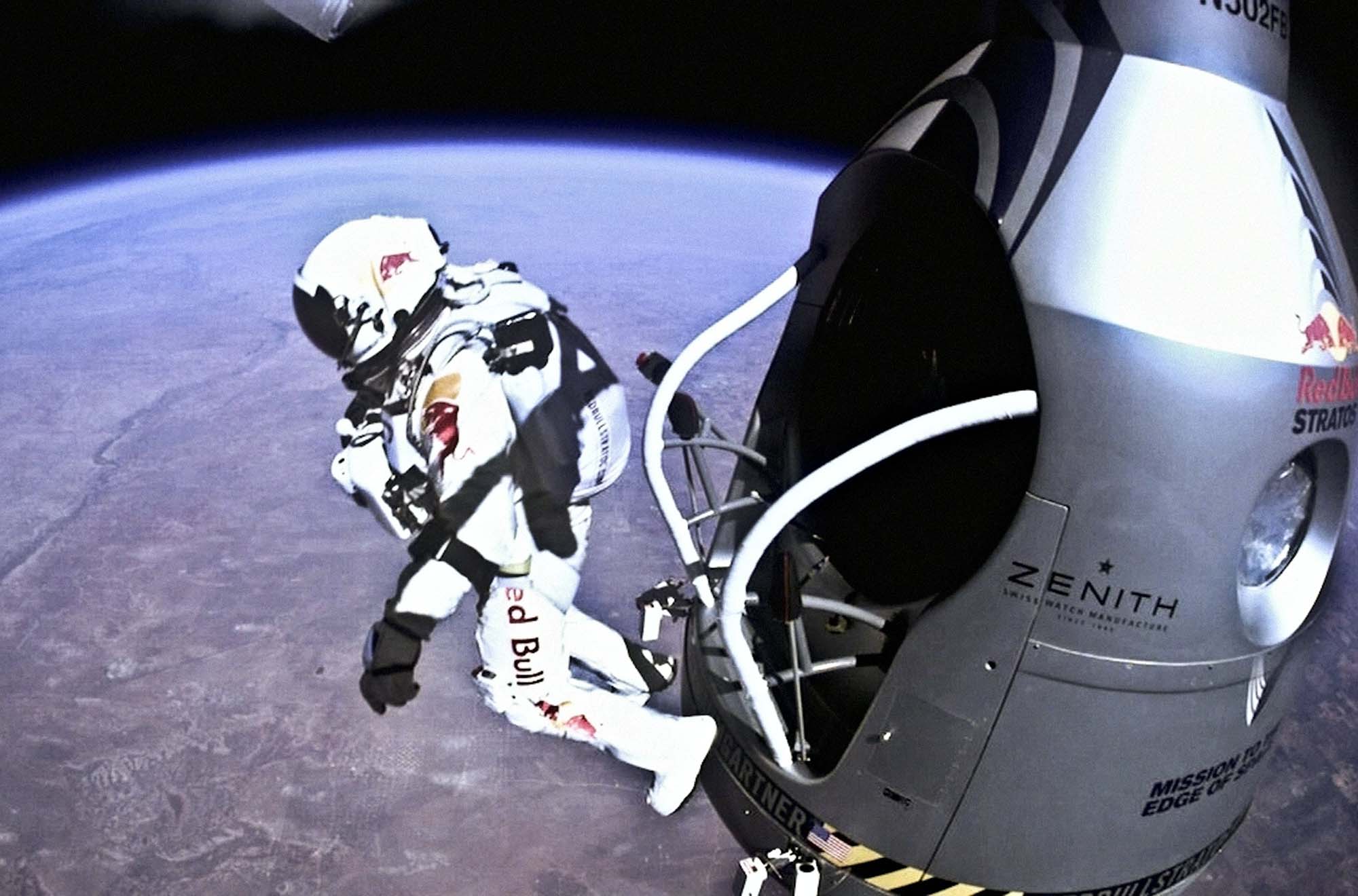
Austrian extreme skydiver Felix Baumgartner, the first person to break the sound barrier during a freefall jump, has died in a paragliding accident.
Baumgartner, 56, was paragliding in Italy’s central Marche region yesterday when he lost control and crashed. He fell to the ground near a hotel in the town of Porto Sant’Elpidio. The town's mayor, Massimiliano Ciarpella, said that reports suggest Baumgartner may have suffered a cardiac arrest while flying.
The man who jumped from the edge of space
Baumgartner is best known for a 2012 jump in which he skydived from a balloon on the edge of space. The project, called Red Bull Stratos, resulted in several firsts. Leaping almost beyond gravity in a custom suit, Baumgartner plunged toward Roswell, New Mexico, faster than the speed of sound.
During a nine-minute descent, he set three world records, including Maximum Vertical Speed (1,357.6kmph, 843.6mph/Mach 1.25), Highest Exit Jump Altitude (38,969.4m, 127.852.4ft), and Vertical Distance of Freefall (36,402.6m, 119,431.1ft).
A former Austrian military parachutist, Baumgartner had a long career spanning thousands of jumps. In 1999, he parachuted from the Petronas Towers in Malaysia, and in 2003, he flew across the English Channel using a carbon fibre wing.
On July 3, in a remarkable bit of quick thinking, a Vietnamese farmer used his drone -- usually used to spread fertilizer -- to save two children from a flooded river.
Tran Van Nghia was working his land in Gia Lai, in Vietnam's central highlands, when he heard a cry for help from the nearby Ba River. Speaking to local news organization Tuoi Tre Online, Tran explained that some children had been herding cows across the river when a sudden surge of water -- likely from monsoon rains upstream -- trapped them off on a fast-submerging island in the middle of the river.
Locals tried to swim to the children, but the current was too strong, and instead, people rushed off to find a canoe. But with the water rising quickly, Tran felt forced to act. He attached a rope to his drone and proceeded to airlift two of the three children from the fast-disappearing island. The third child was then rescued by canoe soon after.
You can see two videos of the rescue below:
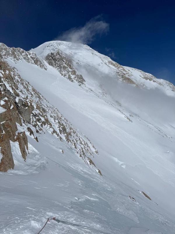
It's the height of the climbing season on Alaska's Mt. McKinley, with 433 climbers on the mountain and 395 climbers already finished. The National Park Service has its hands full with avalanche rescues and frostbite patients, while an American climber announces the first ever solo of the legendary Slovak Direct route.
Another death on the West Buttress route
Just a few days after ski mountaineer Alex Chiu fell to his death on the West Buttress route, there has been another death. On June 10, a soft slab avalanche caught American Nicholas Vizzini, 29, and his partner below the Rescue Gully above Camp 14 on the same route.
"Two mountaineering rangers on an acclimatization climb spotted the partner on the surface of the avalanche debris and were able to respond within minutes," the National Park Service (NPS) said in a statement the next day. "During the search, Vizzini was visually located and found mostly buried in the debris. The rangers immediately began digging to establish an airway. CPR was initiated but discontinued after forty minutes due to traumatic injuries and no pulse."
Four days later, another avalanche swept through Rescue Gully, catching a skier who was lucky to escape without injury.
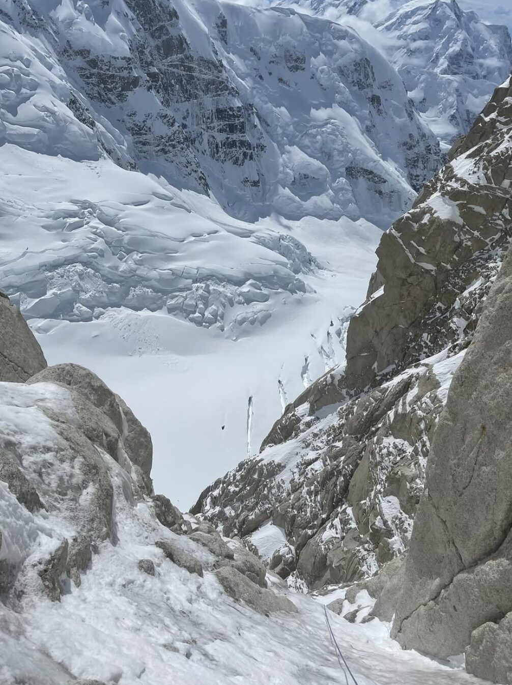
First solo of the Slovak Direct
Established by Slovak climbers Blazej Adam, Tono Krizo, and Frantisek Korl in 1984, the Slovak Direct is a difficult, technical route that rises over 2,700m up McKinley's towering South Face. Graded VI, 5.9X, M6+, WI6, A2, it has had fewer than 20 total ascents.
American Balin Miller claims to have just notched the first recorded solo on the route.
"Fun times with high pressure on the South Face. A more casual ascent at about 56 hours, with 70% of that time spent sleeping," Miller wrote of his climb on Instagram.
Miller is just 23, and his 56-hour solo push is remarkable, clocking in four hours faster than Mark Twight, Steve House, and Scott Backes' groundbreaking 60-hour push in 2000.
According to Climbing Magazine, Miller left Base Camp on June 10 and climbed the route over three days, with a lengthy 19-hour first bivy.
On June 2, ski mountaineer Alex Chiu, 41, of Seattle, Washington, fell to his death on Mt. McKinley.
Chiu was climbing the West Buttress route with two partners when he fell on an exposed 900m face near Squirrel Point. He was unroped at the time. His partners lowered themselves over the edge to look for him, but could not see or hear Chiu. They then descended to the lower camps to seek help.
High winds and snow slowed rescue operations, with helicopters grounded on June 3. On the morning of June 4, the weather cleared, and National Park rangers recovered Chiu's body after an aerial search.
The NPS reports that 500 people are on the mountain, a significant uptick from the end of May, when 230 climbers were active.
The climbing season has begun on Mt. McKinley, though unsettled weather meant a slow start. In the most recent update from the National Park Service (NPS), 936 climbers have registered to climb the peak, with 230 currently on the mountain and 17 climbers already back home after early expeditions.
Expeditions started to fly in during the first week of May, but there's limited information available on teams and goals so far.
Accidents
On May 19, a climber fell 15m and broke his ankle while leading a pitch near Mount Hunter's North Buttress. With the help of a nearby climbing pair, the injured man's team managed to lower him eight pitches down to the base of the route. There, they met up with NPS rangers and moved him to a safe location for helicopter evacuation.
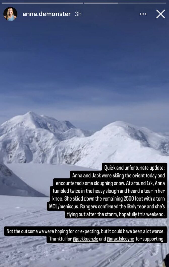
Elsewhere, skier and climber Anna Demonte had been acclimatizing in preparation for a Fastest Known Time (FKT) ski attempt on McKinley. Demonte set the women’s ski FKT on Mont Blanc last year with a time of 7 hours and 29 minutes.
Unfortunately, while skiing with partner Jack Kuenzle at around 5,000m, Demonte fell in sloughing snow and tore her MCL. She managed to ski down to Base Camp, but her season and the FKT attempt are over.
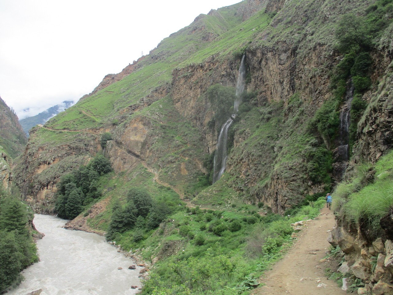
Most travelers don't consider Vietnam a hiking destination, but take it from someone who lives there: The country has plenty of great treks if you know where to look. In the north, the Hoang Lien Mountains are the tapering, tail-end of the Himalaya; in the south, the Da Lat Plateau rises sharply from sea level to over 2,000m, and the underexplored Annamites line Vietnam's spine.
We look at four accessible hikes for those looking to escape Saigon's eight million scooters.
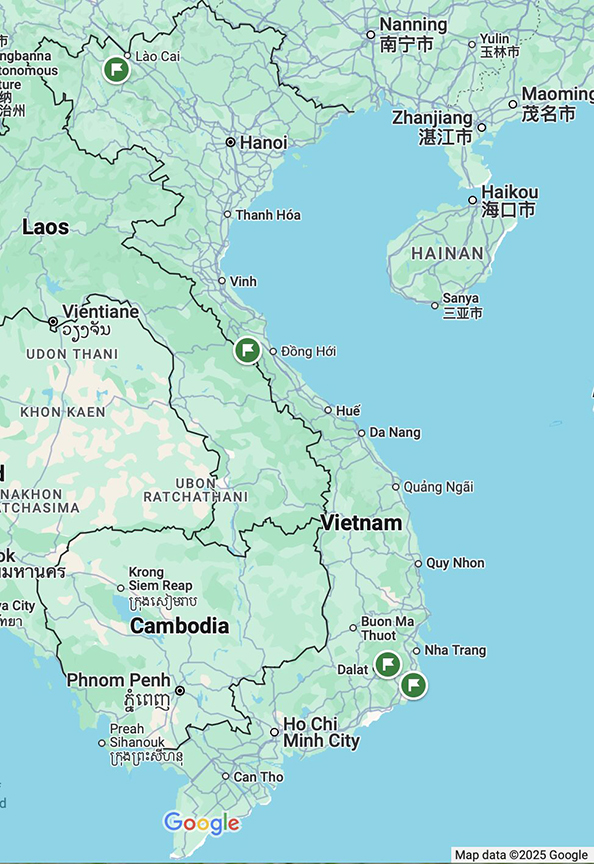
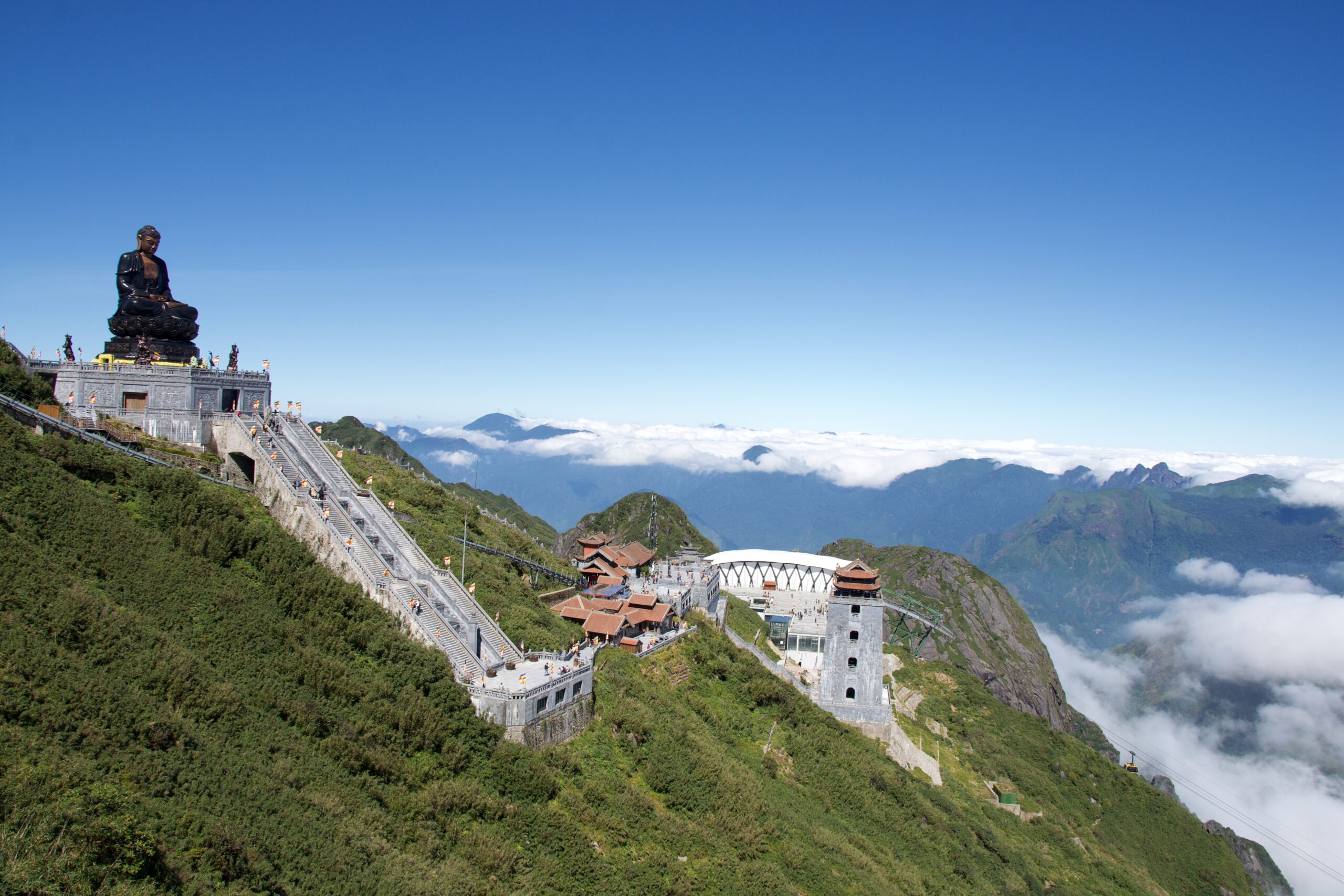
Fansipan Mountain
Let's start with the roof of Vietnam, 3,147m Mount Fansipan, the highest peak in the Hoang Lien Mountains. These run along Vietnam's rugged northern border with China. The summit has been extensively developed, with walkways and two pagodas at the top of an (admittedly beautiful) cable car ride that leaves from near the local town of Sapa. However, for those who'd like to summit on foot, this is a hard, no-frills two or three-day hike through dense jungle.
Different routes
The most direct route begins in the stepped rice paddies just outside Sapa. From the ethnic H'Mong village of Sin Chai at approximately 1,260m, the trail quickly disappears into the forest in Hoang Lien National Park. Though this is the shortest way to the summit (the ascent can be completed in a day), the trail is unclear, and it is easy to get lost. Instead, most independent hikers and guided groups do the Tram Tom Pass Trail.
The summit can be reached in a day on the Tram Ton Pass route too, depending on the weather and your fitness. However, there are two camping areas en route for those who would prefer to take their time. The first is at roughly 2,200m, and the other is fairly near the summit, at 2,800m. The trail starts in dense forest before climbing to exposed, undulating ridgelines. The final section to the summit is very steep.
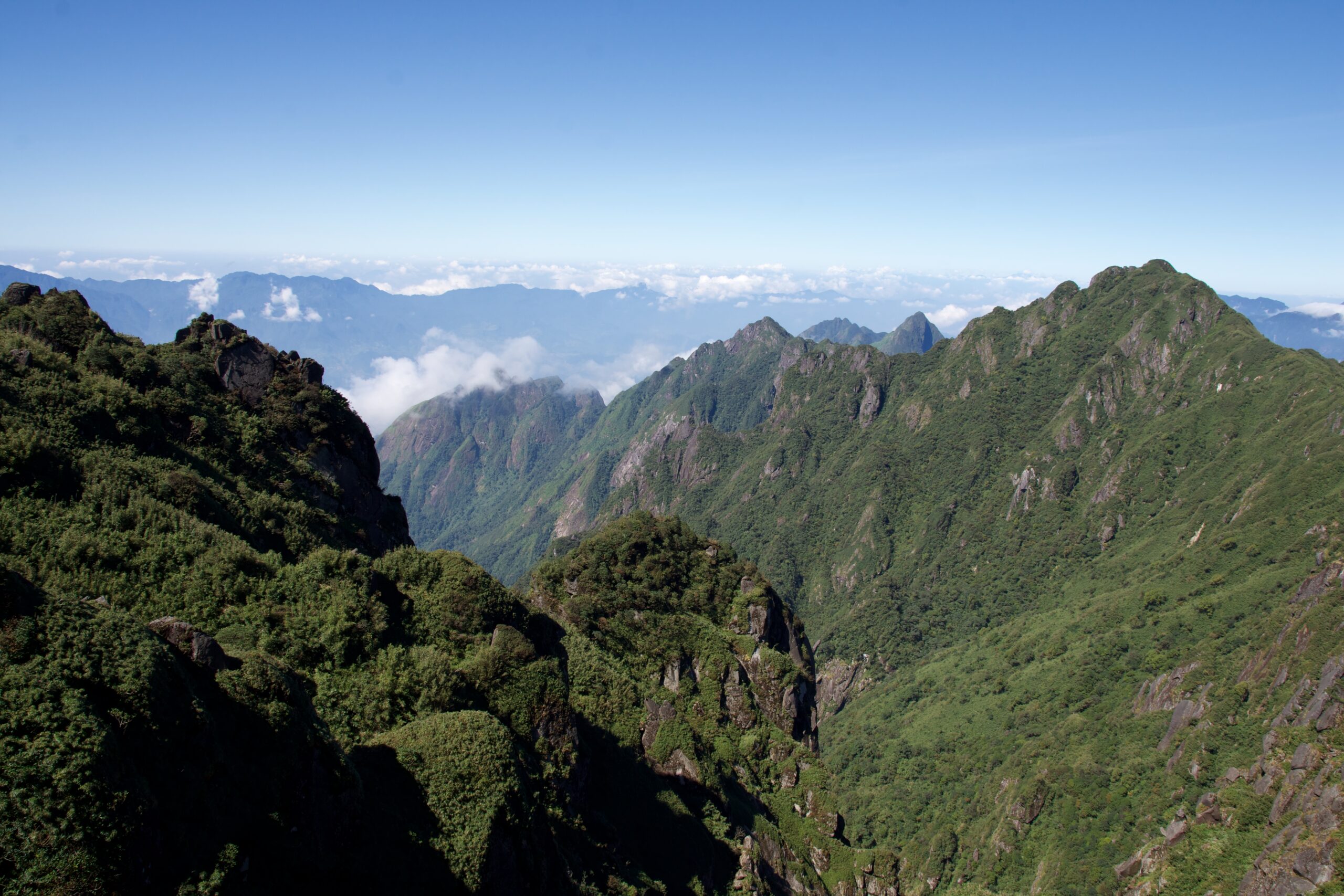
The longest route starts at Cat Cat Village and runs approximately 20km. This trail has the most altitude gain at around 1,900m, and it takes three or four days if you also descend on foot.
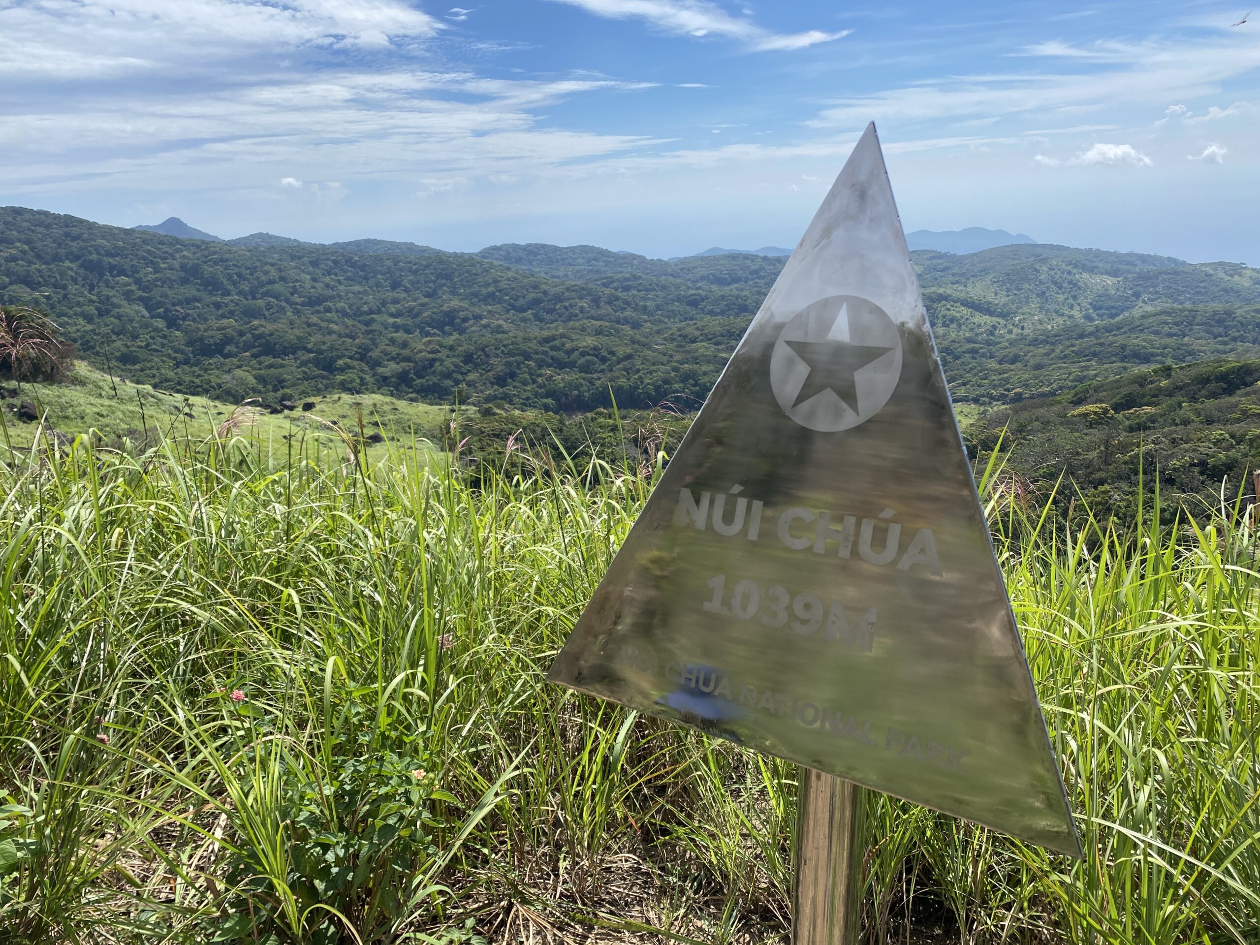
Nui Chua (God Mountain)
Perhaps the least-known hike on this list, Nui Chua Mountain is not very high, only 1,039m. Situated on Vietnam's south-central coast in Ninh Thuan, the hike still requires almost 1,000m of elevation gain. This region is extremely dry, and the heat makes what should be an easy two-day hike more challenging.
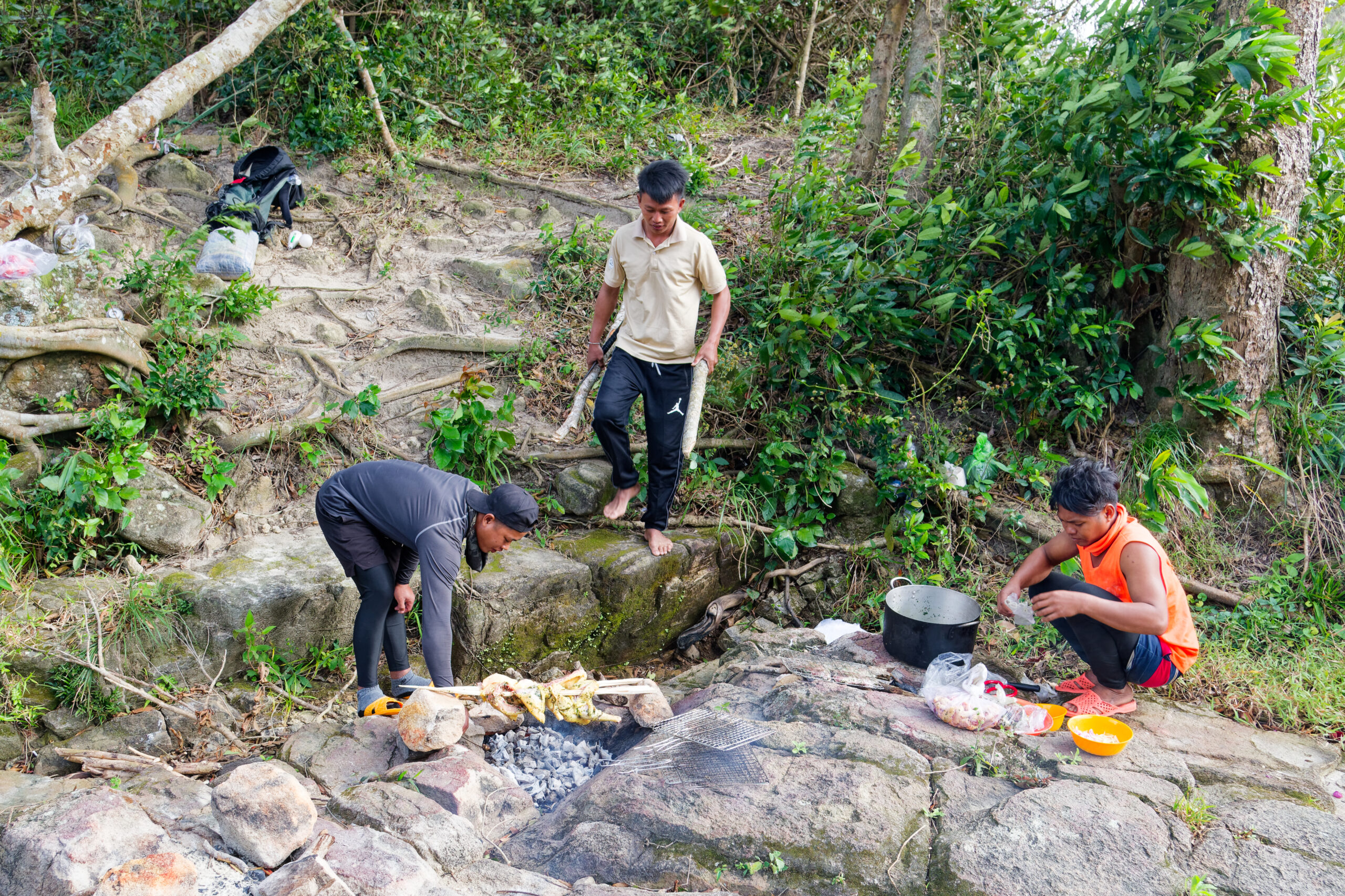
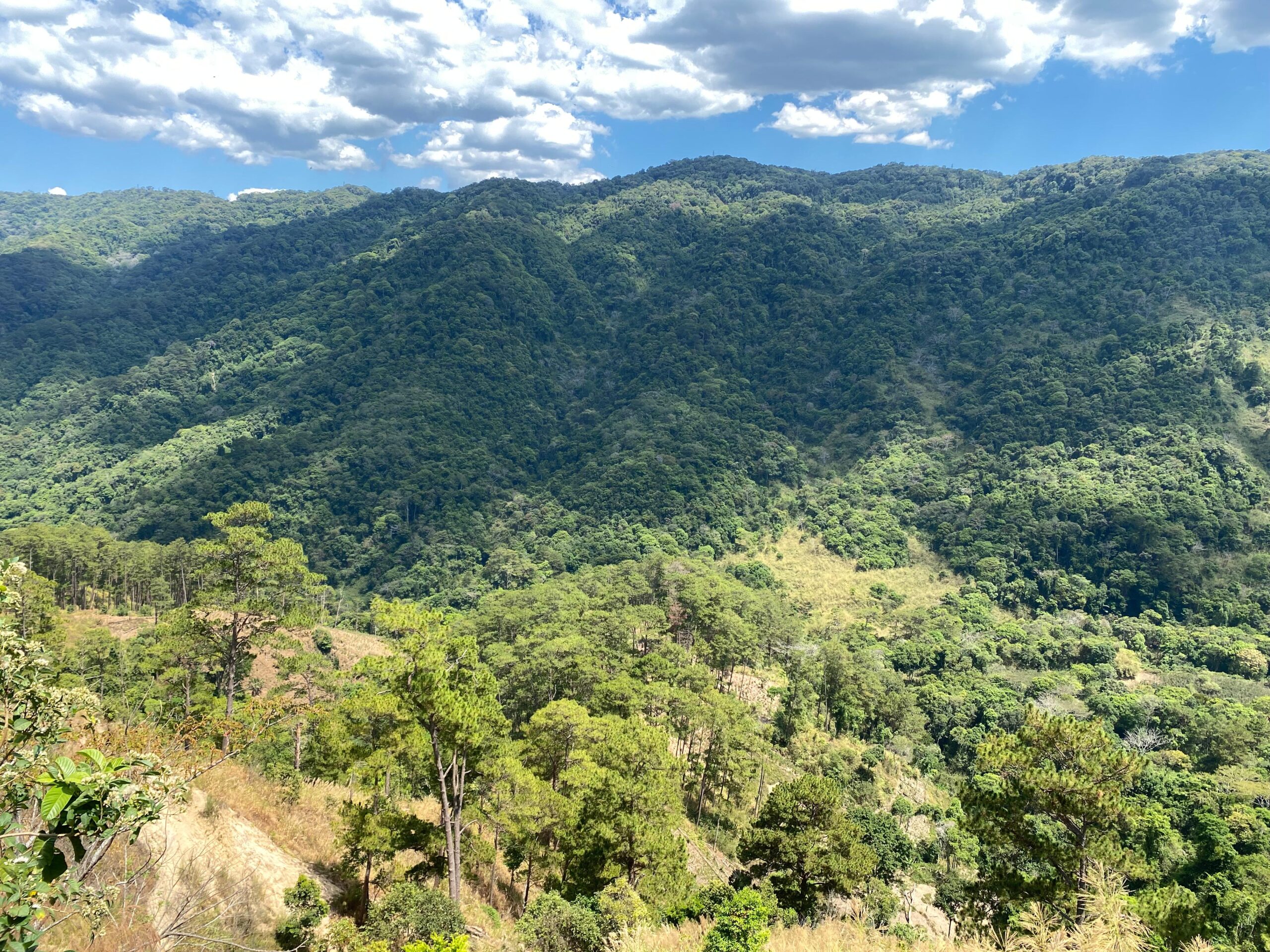
Inside a national park, a guide is required for the hike to Nui Chua's summit. Most of the guides are Raglai -- one of 54 ethnic groups in Vietnam -- and speak a different language from the majority Kinh. Part of this hike's appeal is the guides' knowledge of the forest here. They will stop to pick fruits you've never heard of and collect herbs that grow only at specific elevations to cook with dinner. Both times I've done this hike, the evening meal has been incredible, with chickens roasted over an open fire and the guides producing homemade rice wine. The campsite sits in a grassy clearing created by bombing during the American War. (The Western world tends to call it the Vietnam War, but the Vietnamese, understandably, do not.)
The next morning, you climb to the summit, passing through chunks of primary mixed forest interspersed with swaying grasslands. Then it's a unrelenting descent back down to a Rag Lai village on the edge of the park.
This national park is rarely visited by tourists, so knowing some Vietnamese or traveling with a Viet would make organizing this hike much, much easier.
Bi Doup Mountain
At the southern end of Vietnam's Central Highlands, Bi Doup Nui Ba National Park is an enormous sweep of forest and mountains just north of the city of Da Lat. There are plenty of good hikes possible in Bi Doup Nui Ba, including to 2,287m Bi Doup Mountain, the highest point in southern Vietnam.
The trail starts from a forest ranger station near Da Chais, about 40km from Da Lat. It's a relatively easy two-day hike covering around 26km, first through pine forest and then through mixed broadleaf forest as you get deeper into the park. Getting to Bi Doup's summit requires some scrambling for the steep final ascent. The overnight campsite is at 2,000m.
The area around the mountain is particularly good for several rare bird species endemic to the Da Lat Plateau, such as collared laughingthrushes, white-cheeked laughingthrushes, and Vietnamese cutia.
After the peak, most hikers head out through coffee plantations to emerge back in Da Chais near the village of K'long K'lanh.
Son Doong and Phong Nha-Ke Bang
Discovered in 1990 and first surveyed in 2009, Son Doong is the largest cave in the world by volume (38.5 million cubic meters). It's an expedition to get there, requiring a huge team of porters and guides, and only one company is currently allowed to take tourists: Oxalis Adventure. As a result, it's extremely hard to get a place on an expedition (only 1,000 places are available per year, and they book up far in advance) and expensive for Vietnam ($3,000). But for those with the money -- and who are prepared to wait -- it's one of the world's best adventure treks.
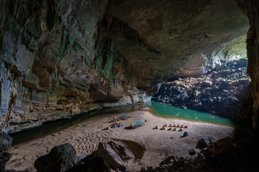
The expedition begins from Phong Nha in central Vietnam and takes four days through the jungle of Phong Nha-Ke Bang National Park. Hikers cover 25km (with 8km inside caves), and the trip requires some basic climbing and rappelling with safety equipment, including climbing a massive rock wall inside Son Doong, nicknamed The Great Wall of Vietnam.
Along with the great wall and an underground river, collapsed ceilings have created unique jungle ecosystems inside the cave, inspiring the first cavers to name the area "Watch out for Dinosaurs."
If your budget doesn't stretch to Son Doong, there are over 400 more caves to explore in Phong Nha-Ke Bang.
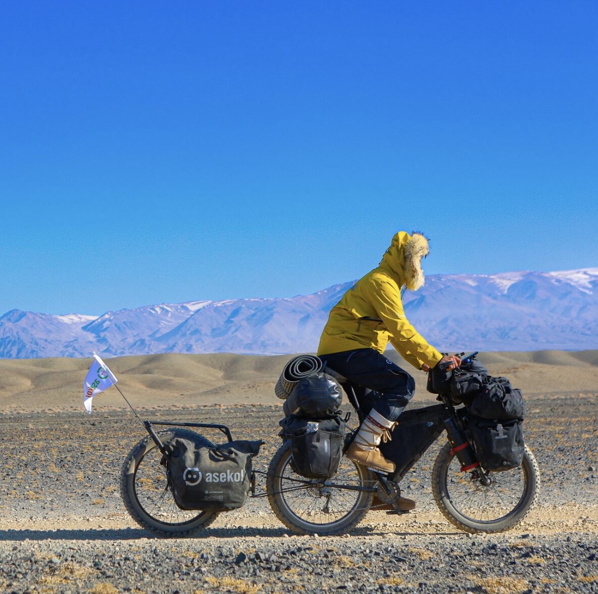
Polish adventurer Mateusz Waligora just can't get enough of the Gobi Desert. Having slogged 1,785km across the Mongolian Gobi pulling a cart in 2018, he returned in February to cycle 1,400km by fat bike.
Waligora started in the western Altai region on February 19. At the outset, his rig was heavily laden. He dragged a trailer loaded with 21 liters of water packed in thermoses, carried 35kg of food, and had two fuel systems because he believed it would be hard to find clean white gas.
A mild winter
Last winter had been very cold in the Gobi, with lots of snow and temperatures as low as -30°C, and Waligora was banking on a milder year. The first stage in the Altai was very cold, but as he moved east, his prediction looked prescient. Temperatures "soared," peaking at 4°C. However, the mild conditions worked against him. With the snow and ice thawing, the ground softened, and he found himself cycling through treacle. Worse, claggy mud collected on his tires. The mud built up until there was no space between the wheels and the frame of his bike, necessitating stops to clean it off by hand.
With the heavy bike, progress was slow, and Waligora had to change his tactics. He found that some of the local gas worked well enough that he'd be able to melt ice and snow for some drinking water, so he ditched some of the thermoses, replacing them with lighter plastic bottles.
"However, I did manage to melt a hole in my tent while melting drinking water," Waligora told ExplorersWeb.
More paved roads
The Gobi had changed a lot in the seven years since his last trip, and Waligora was surprised to find paved roads and 5G in some of the villages he cycled through. It was also Lunar New Year during his journey, and the Gobi was unusually busy with people returning to their home villages to celebrate with family. This would prove fortunate.
On his way to the village of Boulgan -- a tough stretch with no villages during which he had to rely on wells for water, unsure if they'd be frozen -- his crank bearings broke (in the arm that connects the pedals to the bottom bracket of a bicycle). Unable to cycle and still 125km from the village, he considered pressing the SOS button on his Garmin InReach.
"I knew it was over, I couldn't do anything [to fix it]. I considered the SOS button, but I have never used it before, and I believe that if you get into trouble, you still have to be self-sufficient. You need to do your best to get yourself out of the situation. So I calculated my water and worked out that I could walk, pushing my bike, to Boulgan," Waligora explained.
After 5km of pushing, he saw a car. But his hope of rescue evaporated when he saw it was stuffed with 14 people, doubtless returning home for the Lunar New Year. Fortunately, they were more than hospitable, strapping his bike to the roof and cramming him in as far as the village. From there, he traveled to a regional hub and arranged for new bearings to be sent from Ulaanbaatar.
Camel cheese
Getting back to the point he'd left his route proved hard. Nobody wanted to drop him by car back in the middle of nowhere. Instead, he elected to restart his cycle from Boulgan, leaving a gap of 125km in his route.
"On my previous expeditions, it was a point of honor to remain unsupported. In 2018, I tried to refuse gifts of camel cheese. But I don't speak Mongolian and had to take them and then pass them on to other people as gifts. In Antarctica [Waligora skied to the South Pole in 2022], the rubber absorber that protected my back while pulling the sled broke, and I refused a new one [to remain unsupported] and screwed up my back. It was such a stupid decision. This time I didn't give a shit...it's my adventure, and I'm not competing with anyone," Waligora said.
From Boulgan, he made good progress, despite plenty of broken spokes, until very close to the end. Then, 25km from his finish line, the bike's frame finally broke from the weight. Again, it was not possible to repair. He'd have to finish on foot.
Waligora still had the GPS coordinates from his 2018 expedition and chose to retrace his footsteps, camping in the same spot before he finished in the small town of Sainshand.
Waligora had covered 1,285km in 26 days. "I was aiming for 50km each day to ensure I had enough food to finish. I would cycle further if I had enough light, but I didn't cycle after dark because it was very cold for changing punctures, which I'd suffered plenty of in 2018 [on his cart]. At night in winter, it might be -20°C, so sorting an inner tube puncture would be very difficult."
Not as scary
It was a tough trip, with brutal winds and big temperature fluctuations, but he thought it was easier than his foot crossing.
"I maybe had a 10-15% chance to finish the foot crossing. There was no one with the knowledge to help me. It took three years of preparation. I knew that this bicycle expedition would be a little bit harder because of the climate; it would be colder, with winds from the west and north because of Siberia. But I had more experience with the Gobi this time, so it wasn't as scary."
But that doesn't mean he wasn't relieved to finish. "It was a lot of fun, but I can't recommend cycling the Gobi in winter," Waligora said. "I lost a tooth on frozen chocolate in my second week...I had to file it down with my multi-tool to take the sharp surface off. There were hard moments."
And yet, despite the hardships, Waligora doesn't think he is done with the Gobi. It's under his skin now.
"I love this place. I'd love to return, perhaps with my son. Maybe we could walk the central sands with camels."
Will the Barneo Ice Camp finally open this year? It looks like it will, though the website is in Chinese, and getting there will require traveling through Russia. Whether or not we get a proper North Pole season for the first time since 2018, there will be a handful of interesting Arctic expeditions this year in Canada and Greenland.
Ellesmere Island
Polar veterans Borge Ousland and Vincent Colliard will head to Ellesmere Island for the next stage of their Ice Legacy project. They are aiming to ski across the 20 largest icefields on Earth. Last October, they crossed the Juneau Icefield in Alaska, their ninth of the 20.
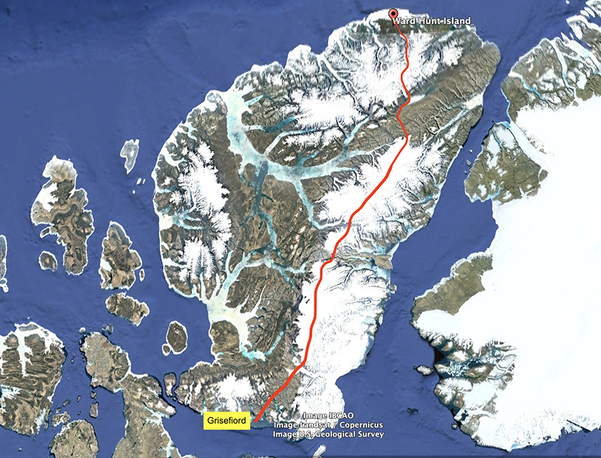
On Ellesmere, they'll leave from Ward Hunt on the northern tip and ski south, almost the entire length of the island, to the small community of Grise Fiord. They plan to cover 1,000km over six weeks and use "ski sails," which presumably means kites, for sections of the route.
They are due to begin in April.
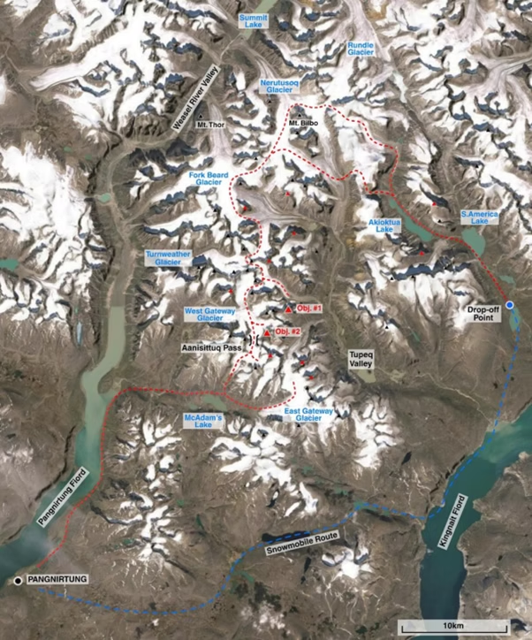
Baffin Island
A British team consisting of Tom Harding, Ben James, Leanne Dyke, and James Hoyes is planning a mixed-discipline trip on Baffin Island. In early April, the team will fly to Pangnirtung before a 60km snowmobile journey to their start point.
"From the Kingnait Fiord, the team will first ski towards the Rundle Glacier before traversing south to the Gateways Glaciers. The distance from our drop-off point back to Pangnirtung is approximately 110km, but we expect to cover more than this exploring the area," they explain on their website.
The team will drag pulks on their ski traverse while also attempting to climb some of the region's peaks.
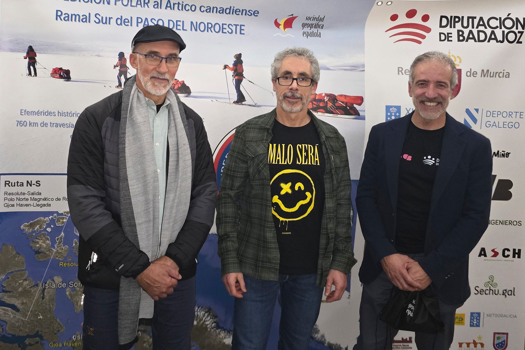
Northwest Passage
Jose Trejo, Sechu Lopez, and Francisco Mira are planning a 760km ski and pulk expedition from Resolute to Gjoa Haven in the Canadian Arctic. They plan to pull 120kg sleds and are budgeting around 40 days for the journey.
"The three of us are normal people who simply do unusual things. We are not young...but we belong to the select group of old people who are well," Lopez wrote of their team.
The Spanish trio will leave Madrid for Canada on March 22.
Meanwhile, as previously covered, Anders Brenna of Oslo will set out in mid-March to manhaul 1,100km solo, from Gjoa Haven to Glenelg Bay on northern Victoria Island.
Ungava

In the Nunavik region of northern Quebec, Dave Greene and his partner are planning a 25-day, 543km ski expedition across the Ungava Peninsula from west to east. Starting in Hudson Bay, they will end in Ungava Bay, Nunavik.
The expedition is scheduled for March.
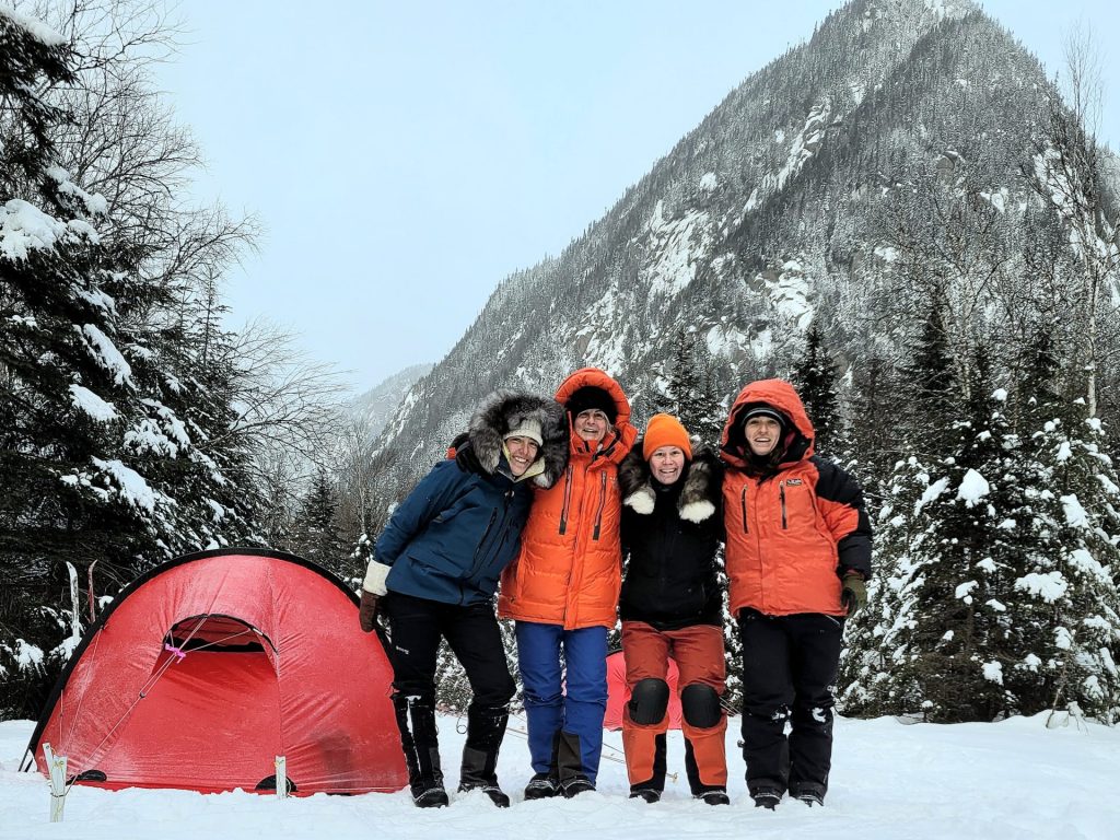
Also in Ungava, four women are already underway skiing 650km from Schefferville to Kangiqsualujjuaq. Kathleen Goulet, Chantal Secours, Julie Gauthier, and Roxanne Chenel are following a well-known wilderness canoe route down the Rivière de Pas and the George River to an Inuit town on Ungava Bay. They set out at the end of January when the rivers are solidly frozen.
Greenland
A team of five, including Finn Jussi Uusitalo, plans to kite-ski from Kangerlussuaq to Qaanaaq, the last sizeable town in North West Greenland. Their trip should take about a month and cover between 1,600 and 2,000km.
Another team plans to go south to northwest. Adeline Gervais and an unnamed expedition partner plan to leave the southern coast with 50 days of food (though they hope the expedition will take around 40 days) and travel over 2,200km. They will snowkite, with Gervais using a snowboard-splitboard and her partner using a more traditional kite-ski setup.
The pair plans to set off in mid-April.
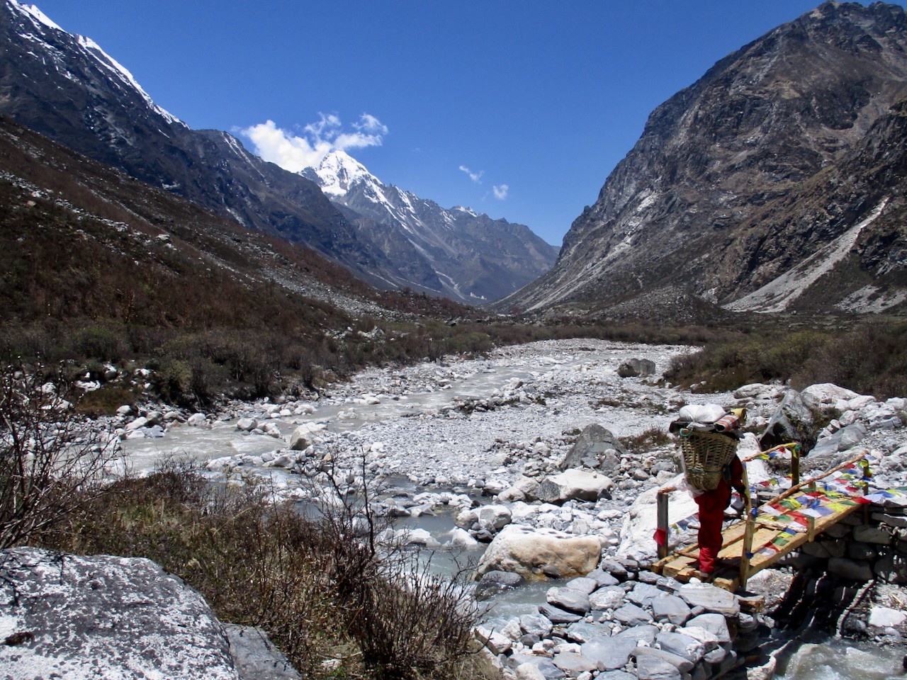
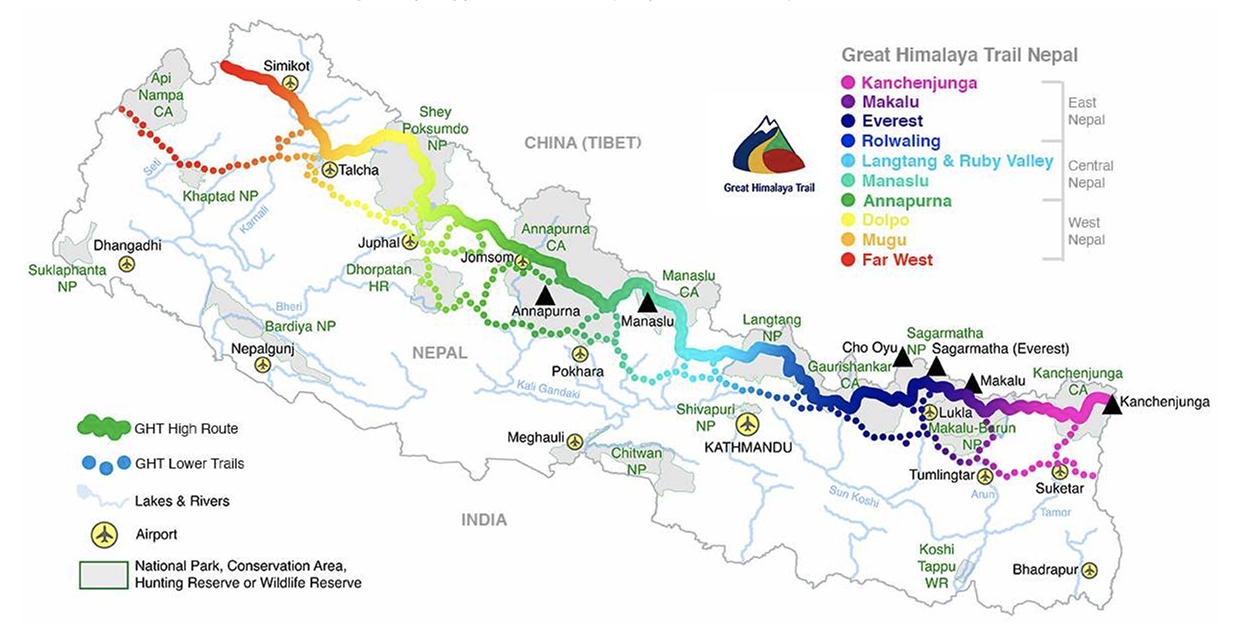
Nepal's Great Himalaya Trail runs 1,750km across the entire country and passes over some of the highest trekking passes in the world. Here in Part II, we examine the route and hear from those who have completed the GHT. You can check out Part I here.

Rolwaling
Tashi Labsta (5,760m) is quite technical and can require fixing ropes. Rockfall can be a problem here. Like Sherpani Col, weather and snow/ice conditions might require a flexible schedule. World Expeditions takes two days on the approach to assess the weather and camp high (5,665m) before the crossing. The pass is close to Thame, roughly 10km away, but 2,500m above the village!
Route finding on both the approach and the pass can be tricky if there’s snow. The “glaciers on the eastern side of the pass are hazardous and crevassed,” Boustead explains on his GHT website. Boustead also notes that food can be hard to come by in Rolwaling, so independent hikers should stock up before the pass.
After the saddle, most trekkers descend to the Trakarding Glacier for a cold night’s camping. Jasmine Star, who hiked half the GHT in 2016 and the other half in 2019, described the descent as the most challenging section.
“It’s hard on the way down," she says. "There are some immense boulder fields after the pass. They go on for like a day, day and a half before you reach a proper trail again.”
The next five to seven days are more relaxed, following rivers and meandering through remote villages in Rolwaling. This section of the GHT finishes at Sano Jynamdan.
Langtang and Ruby Valley
The trail then winds through the villages of Listi, Bagam, Kyangsin, and Dipu. This section is “Nepali flat,” meaning undulating without any big climbs. Then, it’s back to ascending, with a 1,000m+ elevation gain to Kharka and then another 500m to Panch Pokhari at 4,074m.
After a couple more days of gradual ascent, there’s the first high pass in some time. Tilman’s Pass (5,308m) involves some scrambling, and loose rock may cause problems, but it should be doable in a day.
After a night camping just below the pass, the route joins the main Langtang Trail. This means teahouses, relative luxury, and a well-trodden, clearly marked trail. Depending on fitness, speed, and weather conditions so far, hikers can expect to be between 60 and 80 days into the GHT at this point, a little over halfway through.
The next few days are known as the Ganesh link of the GHT, connecting Langtang to the Manaslu and Annapurna regions.
Manaslu and Annapurna
The trail now drops like a stone to 1,503m at the small village of Syabru Besi. The next few days follow a similar pattern. The trail climbs to ridgelines and then descends into valleys and basins (later dipping even lower to 970m), with small villages scattered along the route. This area is the Ruby Valley.
Over several days, you gain altitude again, culminating in a crossing of Larkye La at 5,140m. Along the way, you skirt the edge of the Kutang Himal, a natural barrier that marks the border between Nepal and Tibet. With more elevation, there’s also the return of mountain panoramas, with views of Himalchuli (7,893m), Peak 29 (7,871m), and Manaslu (8,163m). In clear weather, there are good views of Annapurna II (7,937m) from Larkye La.
The trail follows the Marsyangdi River downstream, descending quickly. Leaving Manaslu behind, you enter the Annapurna region. The Annapurna circuit is popular, and the trail is clear, with plenty of places to stay along the route.
You gain altitude again toward Thorong La (5,416m), the highest point in the 300km Annapurna circuit. This pass is a long, arduous day. Tour companies offering Annapurna Circuit treks usually list it as the longest day, with a pre-dawn start to avoid the notorious Thorong winds and 9 to 12 hours of hiking required. It’s not technical, but a long, gradual slog, with several false summits and then a 1,500m descent to Muktinath.
With the Annapurna range now behind you, it’s on to Dolpo.
Dolpo
The Dolpo-pa, a semi-nomadic ethnic group of Tibetan descent, inhabit 24 villages in this region. It’s a remote, rugged bit of the Himalaya with few trees, but the trail is mostly well-marked.
“The GHT provides many variations of ethnicities, religions, and cultures, but the Far West is particularly different,” guide Bir Singh Gurung explained. "Dolpo has its own pre-Buddhist beliefs, such as Animism (Bon) religion and pure Tibetan culture."
Gurung has guided in the Nepalese Himalaya since 1999. He said this was his favorite section of the GHT “because of its remoteness, the wilderness, rich culture, and the landscapes.”
After Muktinath, the trail leads to Kharka, before two sub-5,000m passes bring you to the village of Santa. Another day or two takes you to Lalinawar Khola (river), at the base of 5,550m Jungben La, with great views of Hidden Valley and Dhaulagiri, and 5,120m Niwas La. After quite a few days at lower altitudes, these passes can prove challenging, but both can be completed in around seven hours at a steady pace.
After the passes, the trail descends to another river, Chharka Tulsi Khola. The path flicks between the two sides of the river as you move up the valley. Another high pass rears up ahead, Chan La (5,378m), but it has an easy gradient and is not technical.
Descending to the trading village of Dho Tarap, the trail soon climbs again to Jyanta La (5,100m) en route to Saldang, the administrative center for Upper Dolpo. From there, it’s an easy day to Shey Gompa, an 11th-century Buddhist monastery.
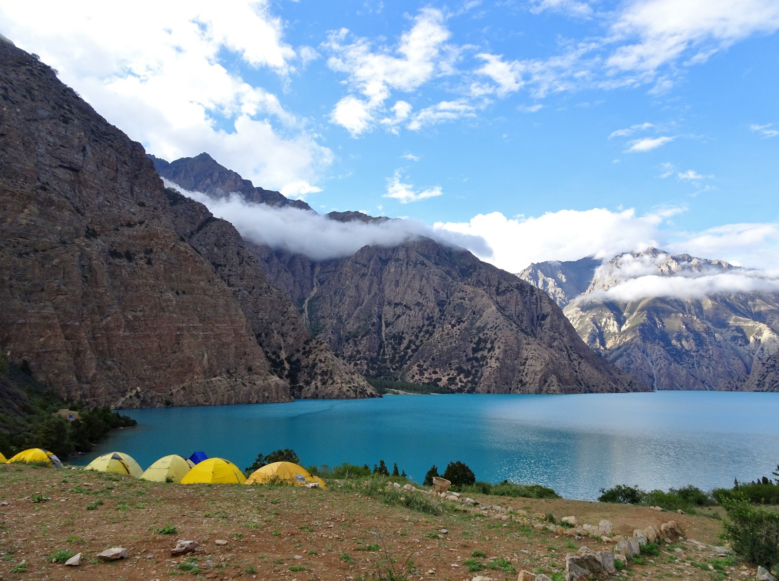
The next two days follow the trail across 5,350m Nagdala Pass to the famously beautiful Phoksundo Lake.
The Far West: Rara Lake & Yari Valley
From Phoksundo Lake, you enter Nepal’s Far West, the least visited region in the country and the final segment of the GHT.
Crossing Kagmara La (5,115m) is a long, two-day effort, but the next five or six days are fairly easy. The trail drops and winds through a few villages on the way to Rara National Park and Rara Lake, the largest lake in Nepal.
Depending on your pace (and your start date), the monsoon rains could begin around this time. If so, expect heavy deluges, muddy boots, and leeches.
From Rara Lake, there are two GHT options: From Gamgadhi to Simikot and the Yari Valley, or cross-country to Kolti and Chainpur and on to the Mahakali Nadi River in India. World Expeditions elects to take clients on the Gamgadhi to Simikot and Yari option because “this route travels closer to the center of the Great Himalaya Range.” But independent trekkers will find either route interesting and little visited.
Assuming you take the “upper” route, you leave Rara Lake for Karnali. Following a familiar pattern for the next week, you climb over ridges and then descend into basins and valleys, never surpassing 4,000m and sometimes dropping below 2,000m. At Shinjungma, the main trail branches away, heading further north toward the border with Tibet. It eventually finishes at the town of Hilsa.
How long does it take?
Finishing times vary considerably. The Great Himalaya Trail website suggests 120-140 days, World Expeditions schedules 150 days (including getting to and from start and end points), and some speedy independent travelers knock it over in around 100 days.
Difficulty, fitness, and training
World Expeditions rates the GHT a 9/10 on their difficulty scale (the highest rating of any of their treks), grading it as an intermediate mountaineering expedition. While they don’t require mountaineering knowledge, they do check fitness levels and previous hiking experience when people wish to sign up.
Heather Hawkins completed the GHT (guided and supported by World Expeditions) with her adult children. Heather is a marathon runner, and she describes the whole family as having a good fitness foundation, with plenty of hiking and bushwalking under their belts. Only her son had climbing experience, but the tour company provided training with jumars, crampons, and using fixed ropes before they hit stage two of the GHT and the high, technical passes.
“We were with climbing sherpas, and I felt very safe and well looked after,” Hawkins said.
Likewise, Jasmine Star (also guided and supported) had great base fitness before taking on the GHT. She had previously finished Bhutan’s famous Snowman Trek and had some mountaineering experience. Star managed a mountaineering lodge on Mount Hood in the 1990s and had previously climbed Mount Rainier.
“The eastern half is very hard because of all the snow,” Star said. "Sleeping, walking in snow, snow on high passes. It’s draining. The West is easier. We had three people start on the full traverse [from east to west], and one asked to be evacuated by helicopter after 27 days, which was very tricky. Different people joined for various sections of the traverse, including six people for stage two. Some suffered altitude sickness and quit to hike out to Lukla after Amphu Labsta.”
Stage two (Makalu & Everest) is the consensus crux of the route. Professional guide Soren Kruse-Ledet trekked most of the route in 1998, but from Mount Kailash in Tibet to Kangchenjunga in Eastern Nepal, and now guides sections of the GHT.
“Stage two is the most challenging as it includes Sherpani Col and West Col,” Kruse-Ledet said. "Both of them are over 6,100m, plus an additional three passes over 5,000m. It’s high altitude, remote, and technical."
He went on: "I have had situations where clients or staff have experienced altitude sickness, which can have quite a sudden onset. We’re trained and prepared to manage these situations, but we are keenly aware of the risks. But, while challenging, it is also exceptionally beautiful. You experience views of Everest and Makalu in a part of the Himalaya that doesn’t see many other travelers."
Kruse-Ledet doesn’t think the GHT is beyond most fit, outdoor people.
“I think it’s challenging because of the length of time that you’re on the route. The difficulty is not necessarily the physical aspect but the psychological challenge of having to walk nearly every day for five months. Overall, I would describe this as a difficult trek for committed and experienced walkers.”
Guide Bir Singh Gurung concurs: “Mental and physical fitness is necessary. Socially [it is different], it is a diet you are not familiar with, and comfort levels are different. You need great willpower and determination. Experienced trekkers with basic mountaineering skills are ideal.”
Vince Gayman completed the GHT guided and supported in 2018.
“I had limited mountaineering experience,” Gayman said. "I had done some glacier travel with crampons and had climbed a couple of our local peaks with ropes and an ice axe, but nothing very extensive. For someone with no experience and traveling without guides, [stage two] would be VERY challenging."
Independent vs. guided
There are several things to consider when choosing between independent and guided GHT hikes. The first may be cost.
Boustead estimates costs for independent trekkers as follows:
Go solo as much as possible: $13,500
Twin-share with minimum guiding: $7,250 per person
Solo “as much as possible” is key. Restricted Area Permits (RAPs) are required for some areas. These are for a minimum of two foreigners (making a true solo journey considerably more expensive) and require a local guide. Those completely adverse to a guide reportedly hire one to pass certain checkpoints and then release them in between. Please note that we are not advising people to do this.
At the time of writing, RAPs are required for 15 areas of Nepal: Upper Mustang, Upper Dolpo, Lower Dolpo, Tsum Valley, Manaslu Areas, Gosaikunda Municipality, Nar and Phu Trek, Khumbu Pasang Lahmu Rural Municipality Ward Five, Humla, Taplejung, Dolakha, Darchula, Sankhuwasabha, Bajhang, and Mugu.
Guided tours are, of course, much more expensive. Tour companies charge $25,000-$30,000 for a fully supported traverse (including guides, porters, accommodation, food, permits, and transport to and from the GHT).
Other things to consider include how much gear you want to/can carry, your tolerance for complex logistical planning (where to stay, how much money to carry, what permits you need, etc.), your desired pace, your fitness/alpine experience, and your route-finding abilities, particularly on the high passes and if the weather is poor.
Pace might seem a minor consideration, but larger groups move much slower, and for the speediest independent hikers, even a single guide can prove a drag.
“Some of the high passes require a fixed rope for safety,” Gayman explained. "This makes for slow going, especially with a large team carrying lots of gear. Needless to say, there is quite a bit of stop-and-go to keep everyone safe. For us, the weather was amazingly good and the views spectacular, so the pace wasn’t a problem.
Thru-hiking is a distinctly American term, but long-distance hiking routes aren’t limited to North America. The Great Himalaya Trail (GHT) might eventually encompass a continuous route through Bhutan, Nepal, and India. But for now, the Nepali GHT already offers an almighty 1,750km journey across the entire country and passes over some of the highest trekking passes in the world. Here, we examine the route and hear from those who have completed or guided the GHT.
History of the GHT
Hiking long-distance across the Nepali Himalaya is not new. Locals have covered vast distances since time immemorial, and foreign hikers have completed traverses starting in at least the 1980s.
Notable early long-distance hikers included Peter Hilary (son of Edmund Hilary) Chhewang Tashi, and Graeme Dingle walking from Sikkim, India, to the K2 Base Camp in the Karakorum in 1981, and Hugh Swift and Arlene Blum's nine-month traverse from Bhutan to Ladakh, India between 1981 and 1982.
More recently, in 1997, Frenchmen Alexandre Poussin and Sylvain Tesson hiked an impressive 5,000km in six months, from Bhutan to Tajikistan.
There have been numerous runners who’ve tackled large distances, too. Richard and Adrian Crane ran from Kanchenjunga to Nanga Parbat in 1983 and in 2023 Rosie Swale-Pope ran 1,700km across Nepal. But both of these trips deviated a long way from what is now the GHT. Swale-Pope ran in Nepal’s mid-hills, and the Crane brothers went far enough south to cross into India.
The modern GHT is a relatively new concept. Between 2008 and 2009, Robin Boustead traced a path over 162 days, linking trekking sections that became the most commonly used route.
The high route
There’s both a high and a low route through Nepal. Hikers can easily switch between them, depending on the weather and their tolerance for high-altitude passes. Often you can adapt the route to suit you. This is a network of trails rather than a singular route. But here, we’ll concentrate on one version of the high route.
Most trekking companies divide the route into three regions, East, Central, and West Nepal, and seven (or more) stages: Kangchenjunga, Makalu & Everest, Rolwaling, Langtang & Ruby Valley Link, Manaslu & Annapurna, Dolpo, and finally Nepal’s far west, Rara Lake and Yari Valley.
Hikers tend to start in the east in early March. This is a couple of weeks earlier than the typical trekking season, and it will still be cold with plenty of snow, making for a tough start.
But there is a good reason to start so early. Hikers need to complete the highest passes before the monsoon rains arrive in mid-June. This is also why most people start in the east rather than the west. The GHT’s highest, most difficult passes are bunched in the east and would potentially be more dangerous later in the year.
East Nepal: Kanchenjunga
It’s quite the slog just to get to the eastern starting point of the GHT, though it won’t tax your legs. From Kathmandu, you fly to Bhadrapur, tucked into the far south-eastern corner of Nepal on the border with West Bengal, India. From there, it’s a long drive as far north as the roads will take you to Chiruwa. The drive usually takes two long days.
After Chiruwa, you’re on foot, continuing north, parallel with the Indian border, toward Kangchenjunga in Nepal’s northeast. You start low, at around 1,600m, acclimatizing gradually as you push north. Three to four days of hiking brings you to Ghunsa (3,430m), the last village in the area that is inhabited year-round.
Over the next three days, hikers ascend quickly, climbing scree and lateral moraine to Kangchenjunga Base Camp at 5,143m. This marks the furthest east you’ll travel. Hikers then retrace their steps back to Ghunsa before the first pass of the GHT: Nango La.
At “only” 4,776m, Nango La is not terribly high, but this early in the season, it can still be tricky, with deep snow. Once over the pass, you drop over 1,000m, heading to the village of Olangchung Gola. It’s possible to do the pass and reach Olangchung Gola in one extremely long day, but most hikers choose to find a camping spot once they’ve descended the pass.
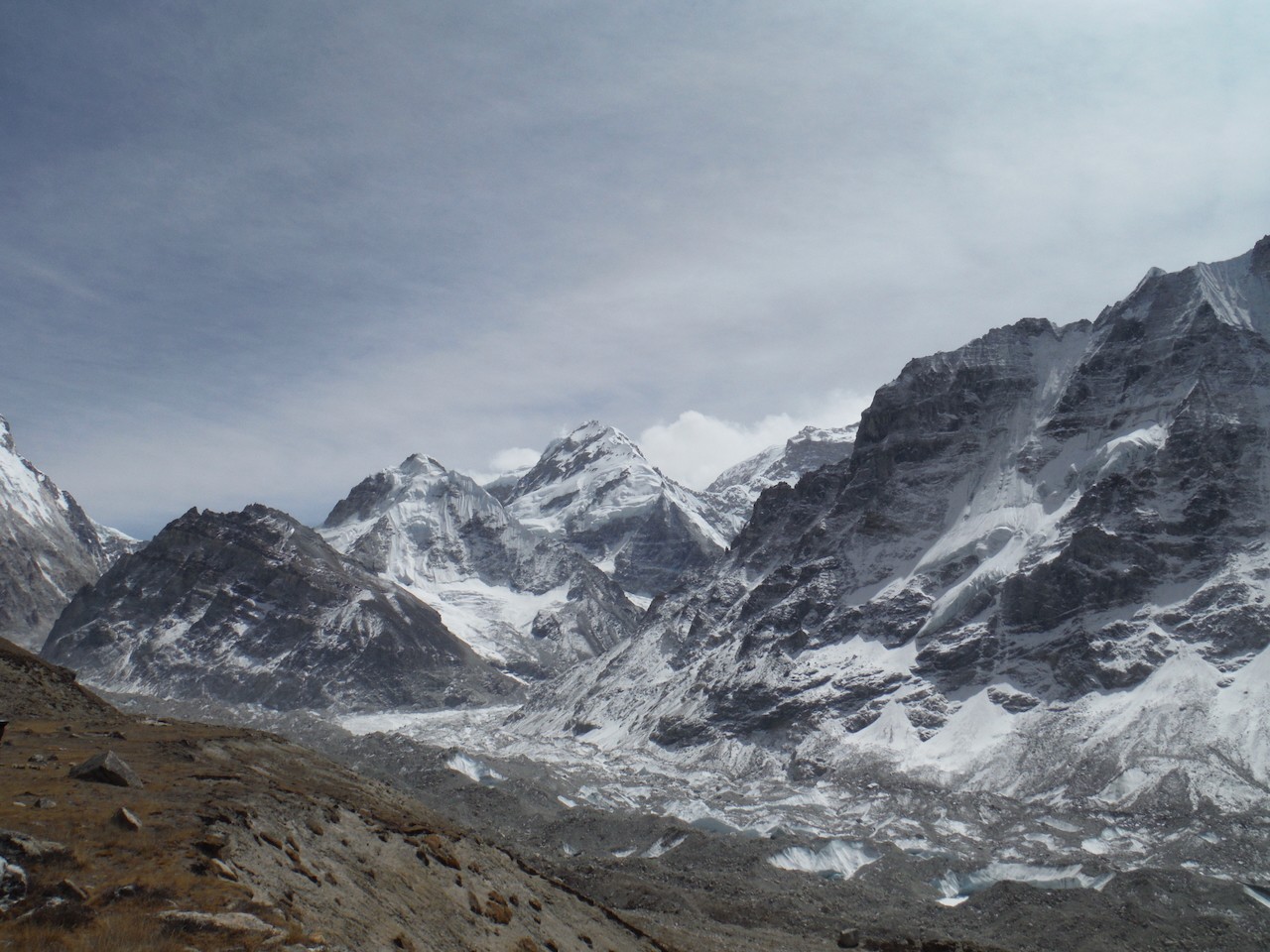
Makalu and Everest, the crux
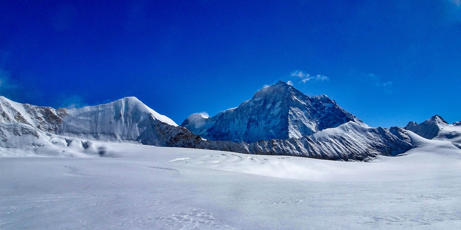
Another reasonably complex pass, Lumbha Sambha, follows Olangchung Gola. Most people camp at a “base camp” and leave before dawn the next morning to cross the saddle of the pass at 5,160m. Expect deep snow and spectacular views of Makalu to the west and Kangchenjunga and Jannu to the east.
Once down from the pass, you’ll hike at a lower altitude for the next few days before gradually climbing toward Makalu Base Camp at 4,870m. From there, it is on to Swiss Base Camp at 5,150m.
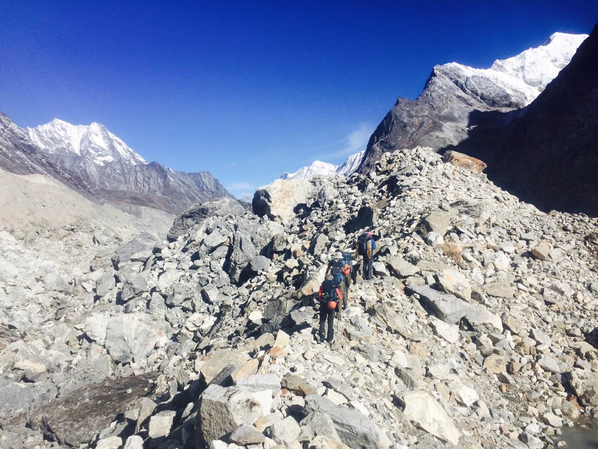
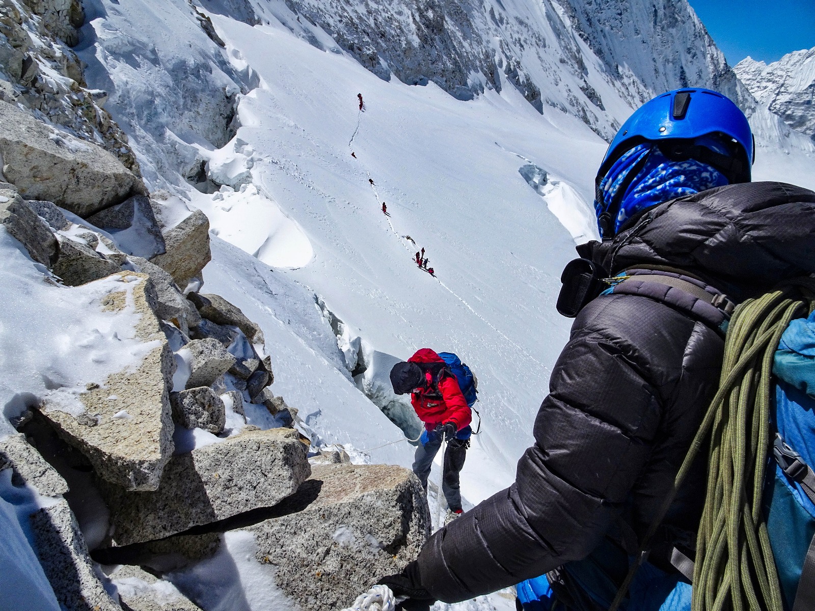
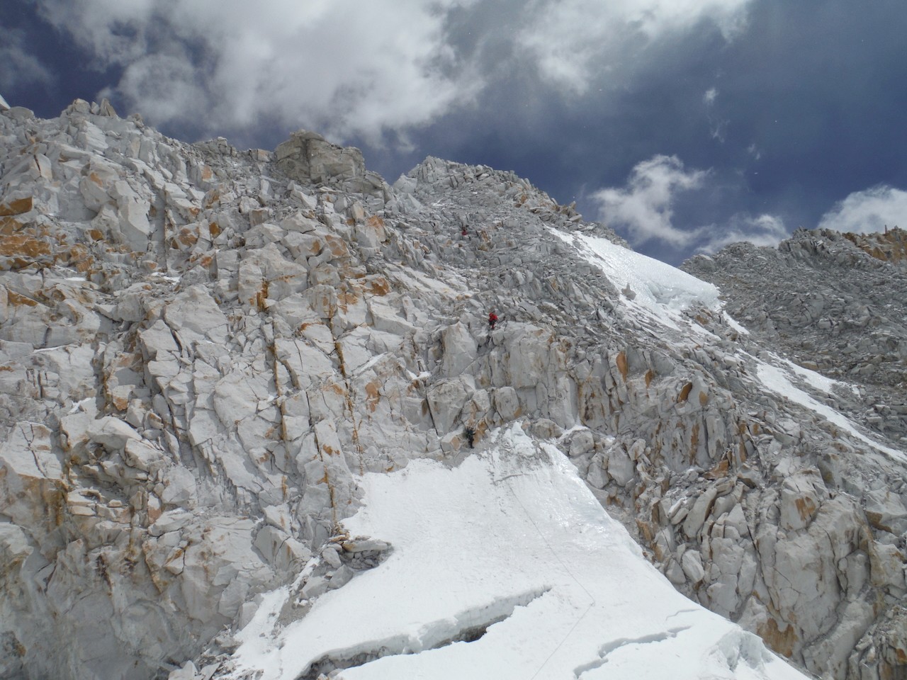
Next comes the crux of the entire traverse: Sherpani Col and West Col.
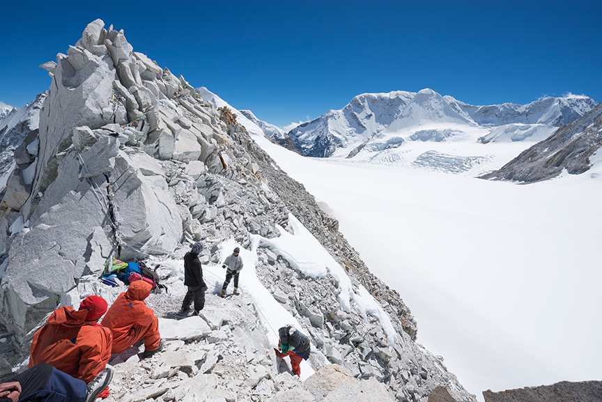
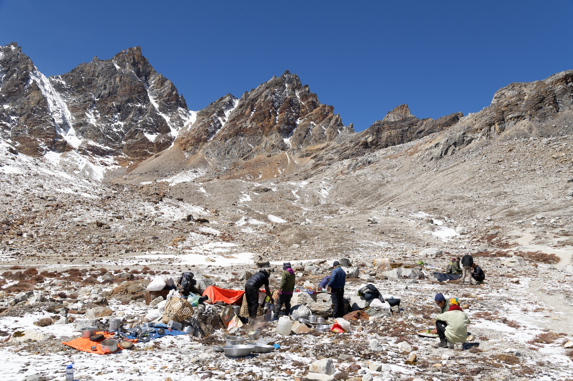
This crossing should not be attempted in poor weather. It’s wise to take a couple of short days on approach to monitor the weather, acclimatize, and prepare your legs. The route requires crampons and ropes. Some sections require rappeling, and basic mountaineering is a plus. Few people cross Sherpani Col unguided.
It’s best to camp close to the pass. Expedition companies typically stay near the glacier's snout at 5,688m, leaving only 500m of altitude gain to Sherpani Col at 6,155m.
Sherpani Col
The ascent to Sherpani begins on a gentle snow slope but soon transitions to steep, loose rock. Once on the col, it’s a steep descent (with dangerous loose rock) requiring ropes to the flat glacier that links Sherpani and West Col (6,143m). It’s only a couple of kilometers between the cols, but in deep snow above 6,000m, it can be an energy-sapping slog.
Getting across in one day, especially for large guided groups, is rare but not impossible. Heather Hawkins, who trekked the GHT in 2016 as part of a tour, described the crossing as the hardest of her 152 days during the traverse.
“I had worried about this pass before the trip, but it was a fantastic, challenging day. It took 13 hours through deep snow and across hidden crevasse fields, but we crossed in one day. It was hard because of the altitude, and the weather deteriorated toward the end of the day, but by then, we were preparing to camp.”
Conditions are everything, and the earlier in the day you start, the firmer the snow is, and the more likely you are to cross both cols in a day.
World Expeditions, a tour company specializing in the GHT, builds in at least a day of flexibility for the crossing:
“If conditions are favorable, and the group is moving at a good pace, we may attempt both cols in a day. But in all likelihood, we’ll be camping at Baruntse Camp 1 on the West Col at 6,100m on the first night. [We then] descend the col to the Honku Valley the next day.”
The descent from West Col to the Hongku Glacier is not as steep as from Sherpani but still requires fixing ropes. From here, you’ll receive spectacular views of the Khumbu, provided the weather plays ball.
Rappelling down high passes
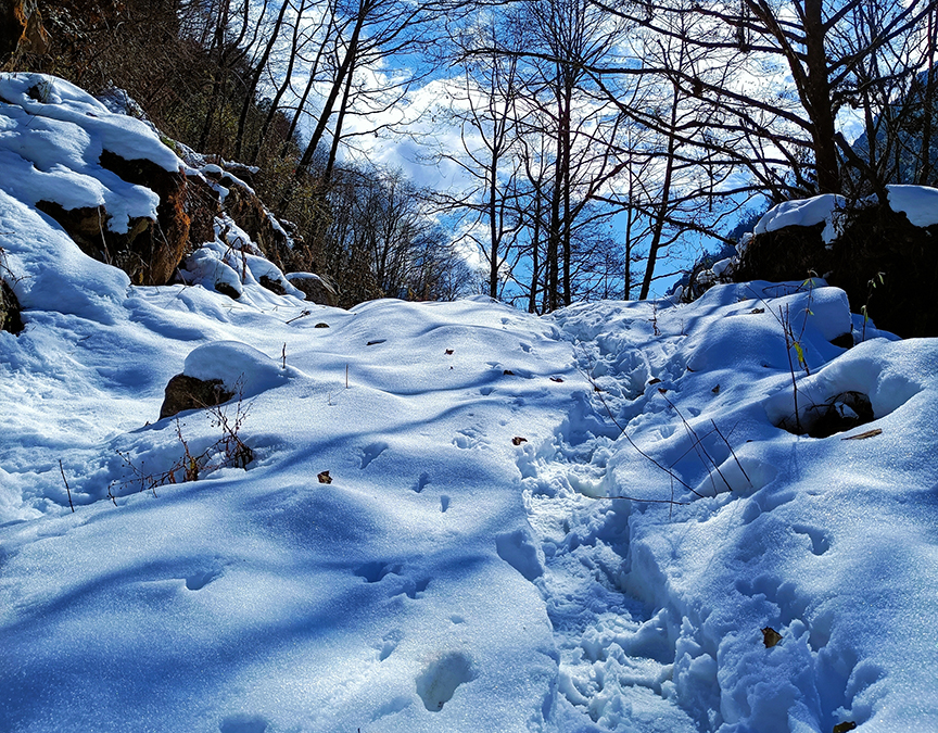
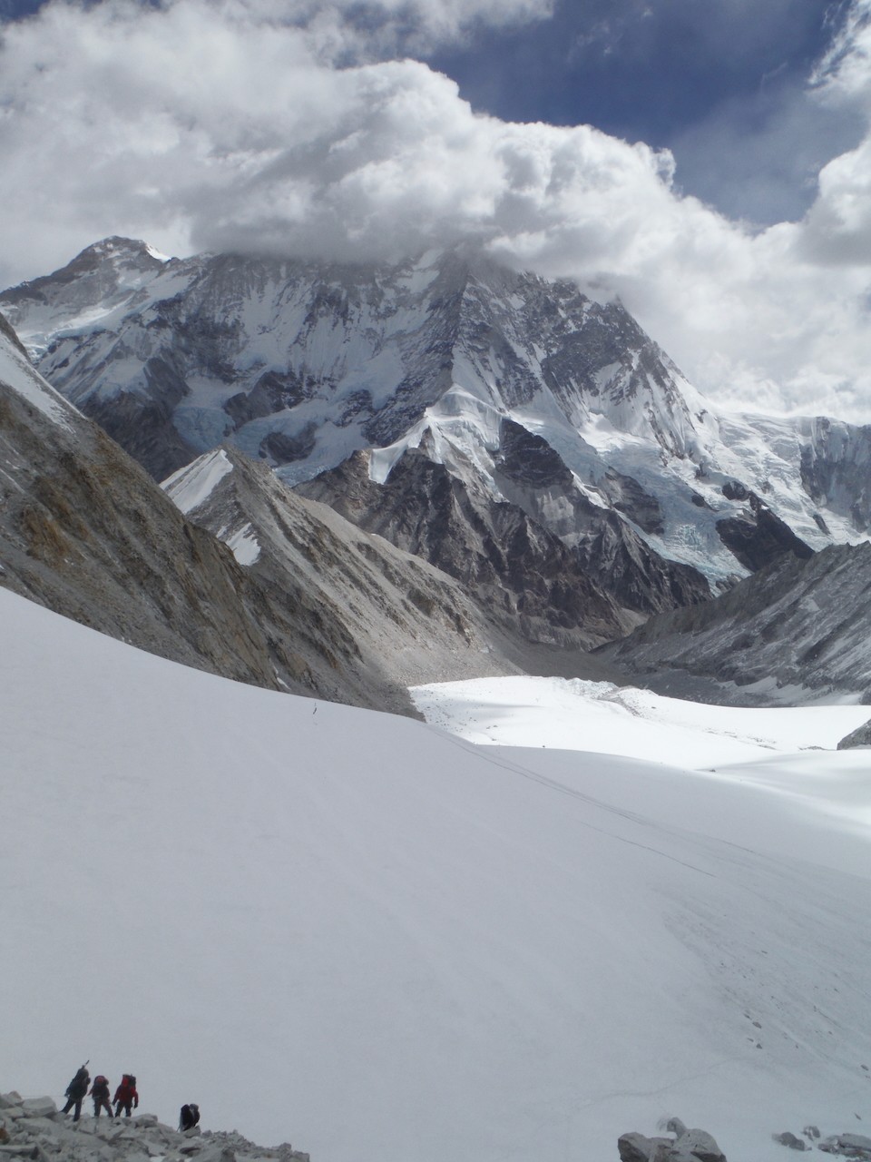
The next day is more relaxed, hiking across the moraines of the Hongku Basin, but it doesn’t last, the 5,000m+ passes come thick and fast till Rolwaling.
Amphu Labsta, 5,845m, is lower than the cols but a difficult glaciated pass with a narrow, exposed ridgeline. The descent requires fixed lines and rappelling. Hawkins regards this as the most technical section of the trek.
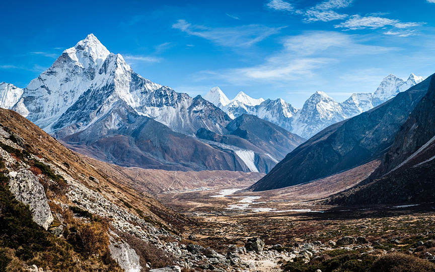
From Amphu Labsta, you descend to Chukung and then Dingboche. After some pretty remote trekking and camping, this is a return to civilization, with tea houses and (likely) many other hikers.
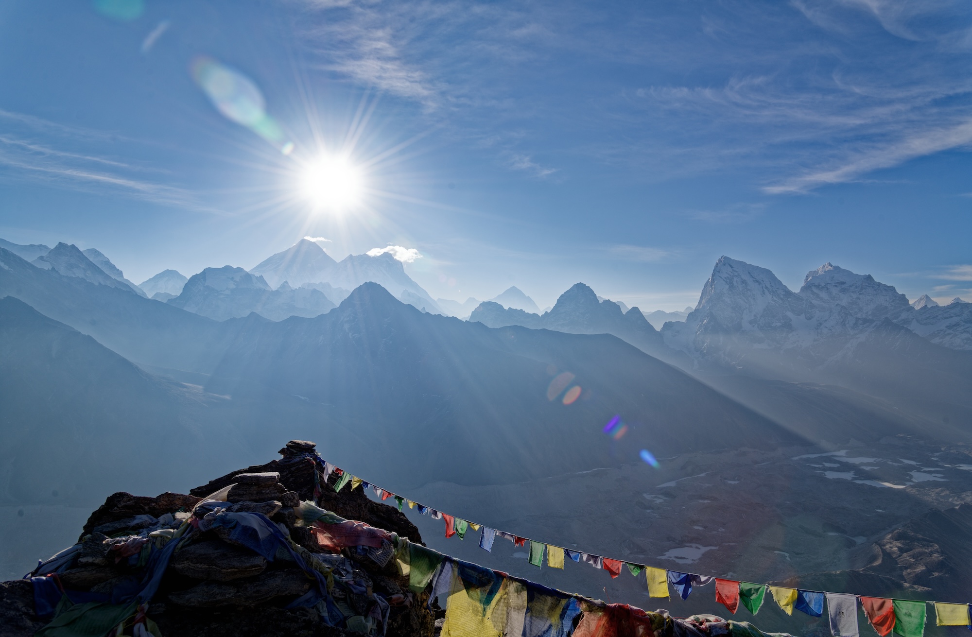
From Dingboche, you scramble up to cross 4,759m Cho La and then descend to the Ngozumba, the longest glacier in Nepal (the Khumbu is the largest). After crossing the glacier, you arrive in picturesque Gokyo. Here, you can take a day hike to Gokyo Ri for perhaps the best view of Everest without climbing a major peak. The trek up is brief but unrelenting, a one to three-hour slog depending on your fitness, ascending from 4,750m to 5,357m.
Whether or not you do Gokyo Ri, you’ll make a steep ascent leaving Gokyo. Renjo La (5,360m) is steep but not difficult in good weather. The descent is via huge stone steps. In good conditions, you can do the pass and descend to the village of Thame (famously, the childhood home of Tenzing Norgay and recently hit by catastrophic floods) in one long day. However, most groups either camp en route or stay in one of the tiny Sherpa villages along the way.
From Thame, there is one final big pass before Rolwaling and an extended period of lower-altitude hiking.
You can read Part II of the Great Himalayan Traverse, covering the route from Rolwaling to the Tibetan border and the differences between guided and unguided hikes, here.
This short documentary follows two young women as they bikepack along the old Arctic Post Road in Scandinavia's far north. Friends Henna Palosaari and Sami Sauri (and an unseen cameraman) set off on their mini-adventure from Yllas in Finland to Alta in Norway, hoping to knock over the roughly 430km in time for Sauri's flight back to Spain a few days later.
Their journey follows the remnants of the old Copenhagen-Alta post route and the cyclists hop between gravel tracks and mountain bike trails.
"When the gravel route goes on a road, we are not going to ride it...we both don't like riding on the road, that's the worst," Palosaari explains. "We'll go then on the mountain bike route and do a bit of a bike hike."
Rough terrain and unique snacks
The Scandinavian Arctic holds some of Europe's last true wilderness and the route to Alta isn't always easy, whether they are on the gravel or the mountain bike trails. At times, the bike-packing is literal: Rocky, uphill sections force the pair to shoulder their bikes and carry them to easier ground. There are streams to ford and muddy trails to struggle through. The crossing from Finland to Norway is particularly rustic and involves creating a hole in a barbed wire fence and squeezing through.
Villages are few and far between, but when they do run into people, they make the most of it, trying some reindeer tongue and getting some piping hot food.
They arrive in Alta with time to spare for a final "dinner" of bread and cheese.
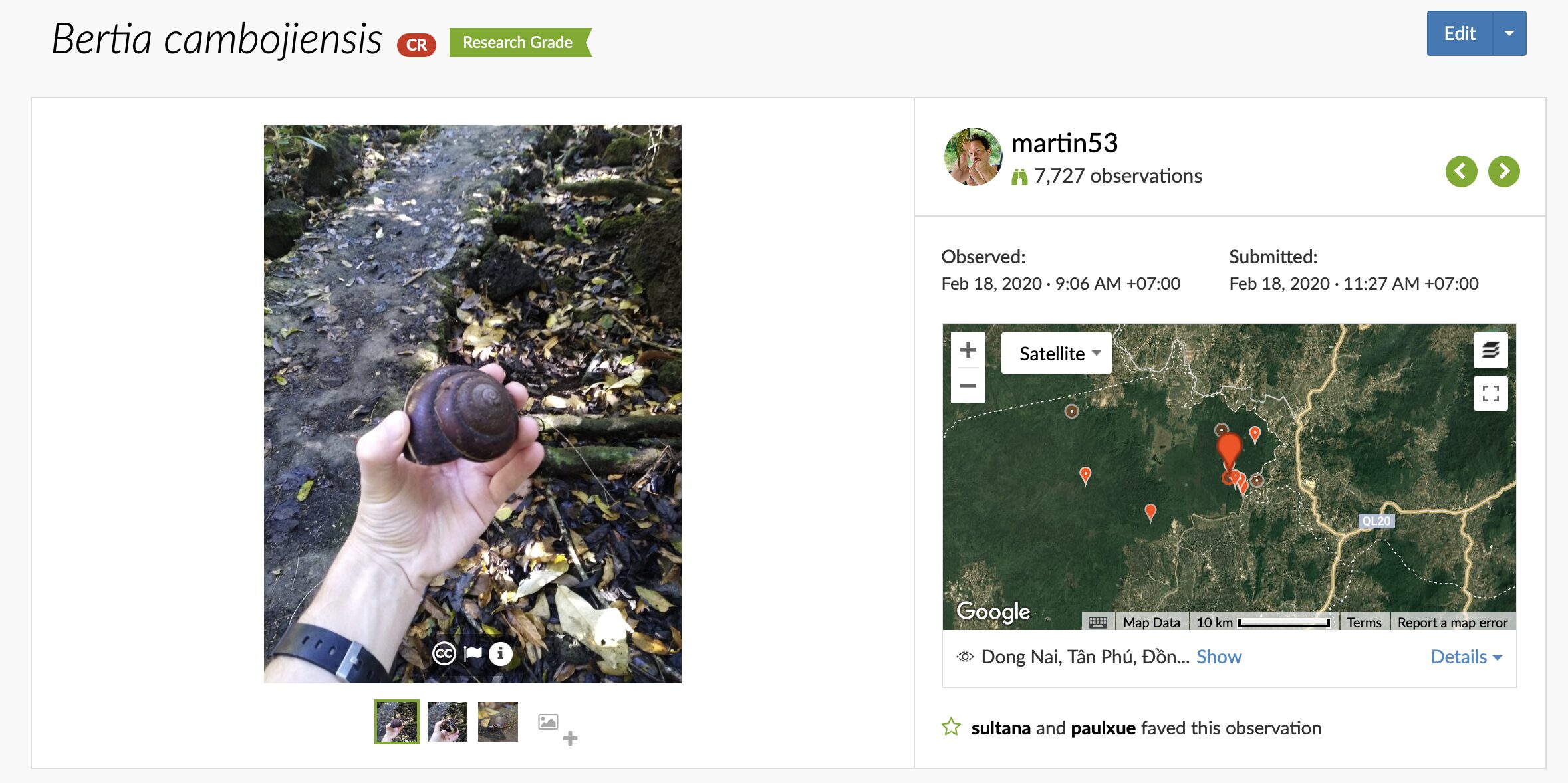
I started using iNaturalist in 2018. I had been using the app, a free citizen science platform that defies easy categorization, to record the wildlife I observed as I traveled. A sort of real-life Pokemon. But it wasn't until 2020 that I was fully hooked.
I was walking through Cat Tien, a sweaty chunk of lowland jungle in Vietnam. I had spent the night at a ranger station set up to protect a critically endangered population of Siamese crocodiles. But it wasn't the crocodiles that triggered my iNat addiction. It was something much smaller, something I might not have noticed pre-iNat, let alone photographed. On the trail, I found a large land snail and decided to take a couple of snaps of it.
Later, I uploaded the sighting to iNaturalist. For some organisms, the AI identification tool immediately provides an ID with reasonable certainty. For others, it has less information to work with. In these cases, you upload with an ID to whatever level you're comfortable with. With no knowledge of Vietnamese snail species, I went with the very generic gastropods.
More than a social network
This is when another of iNat's functions comes in. The app (and website) do much more than serve as a gallery of the things you've seen. It describes itself as "an online social network of people sharing biodiversity information to help each other learn about nature. It's also a crowdsourced species identification system and an organism occurrence recording tool."
Within a couple of days, other users identified my snail as Bertia cambojiensis, the Vietnamese giant magnolia snail. Critically endangered, this species was long thought extinct and only rediscovered in 2012.
From there, it was a slippery slope. Within a year, I'd bought a large camera and some proper binoculars. Soon, I was reading research papers on species splits and primate behavioral studies. Last week, I was chatting to a lepidopterist (someone who studies moths/butterflies) in Colombia who wanted to know if she could use one of my photos for a field guide. I'm 2,400 species deep and still going strong.
And that's the thing: iNaturalist makes you look at the world differently. It encourages you to take in what's around you, to explore, and to learn about what you find. Unlike eBird, which has been around much longer and also collects crowd-sourced data, iNat deals with all life: plants, birds, mammals, reptiles, viruses -- if it is wild, upload it. This breadth encourages learning, and it encourages a more holistic view of the natural world.
Fancy getting addicted, too? Here's a quick explainer on how to use iNaturalist.
Getting started
It might be helpful to think of the three elements of iNaturalist as different levels of interest.
Do you just want a quick AI-driven ID of something in your garden? Try the Seek app, made by the same company. This is the most basic version of what iNaturalist offers. Point your phone at a flower, take a photo, and the image recognition software will try to tell you what it is. You don't have to upload the observation (but you can!).
Want to track what you've seen and contribute to science? Then, the iNaturalist app is better for you. It will track what you've uploaded, allow you to explore other people's observations from around the world, and provides most of the functionality of the website. You can find the Android app here and the iPhone app here.
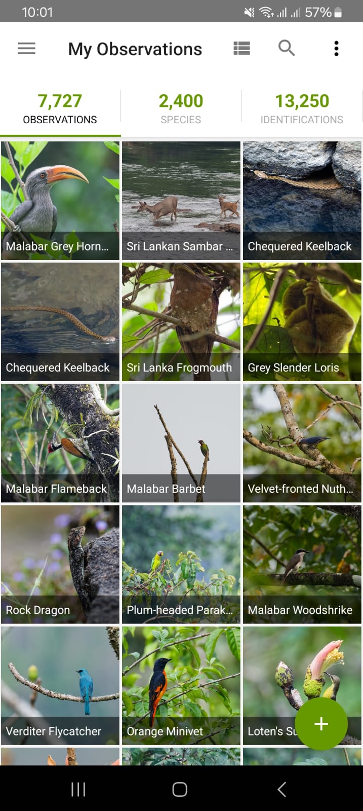
Want the full package? The website is best if you want to do all of the above and also help others to identify their observations. I use it to learn, plan trips, and help out by identifying birds and mammals in Southeast Asia, where fewer users have the requisite knowledge.

Making an observation
To make an observation, you need a few things.
- A photo or a sound recording.
- When (date/time) you saw the organism. This is usually added automatically from a photo's metadata.
- Where you saw the organism. This can be added automatically if you're taking the photo on your phone. Otherwise, you will need to do this manually using the map.
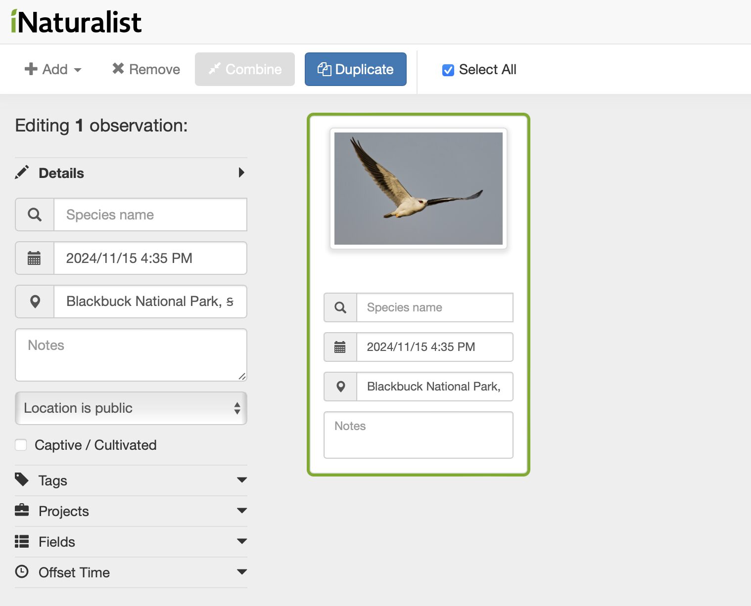
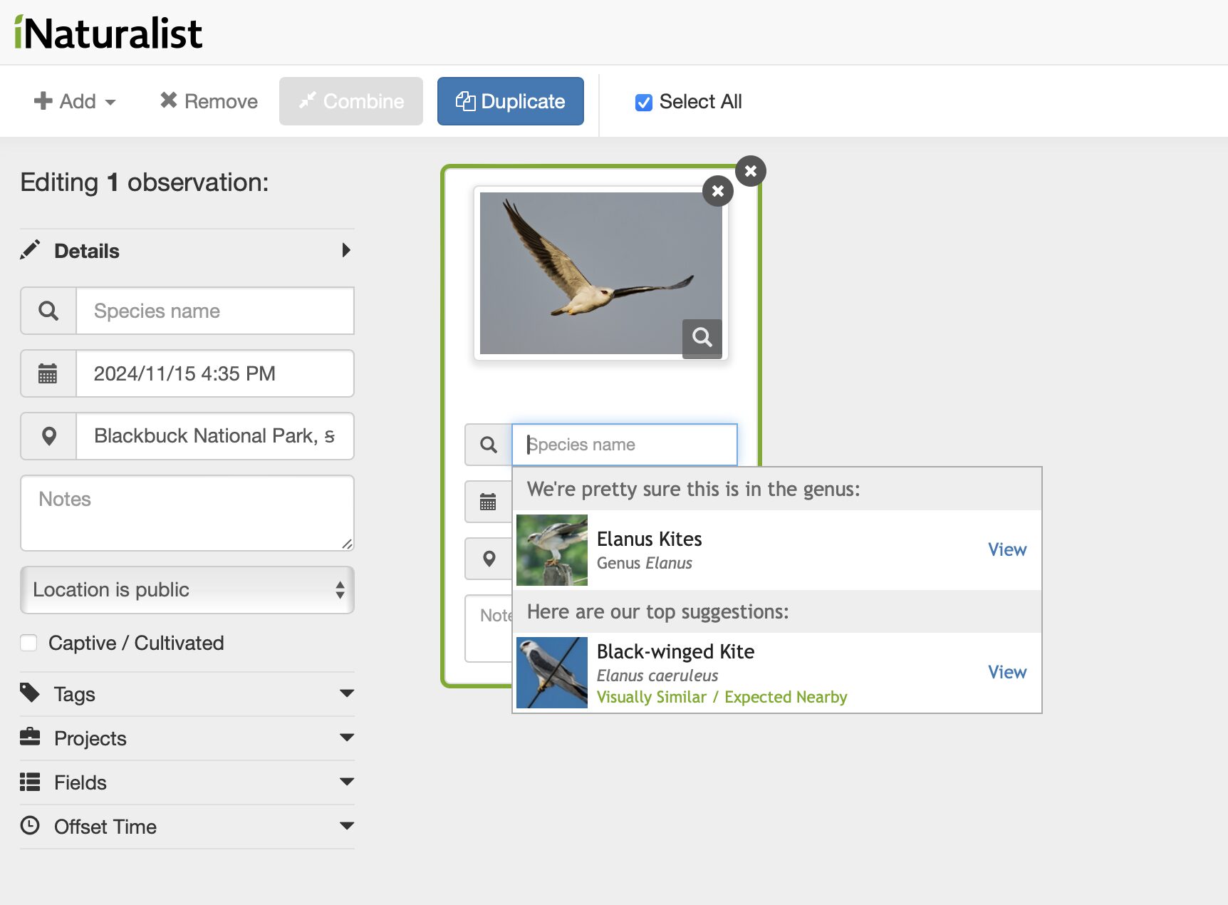
- What did you see? The AI will offer suggestions. Sometimes, it will say: "We're pretty sure this is..." with a single suggestion. If this matches what you observed, select this. Other times, it won't be so sure: "Here are our top suggestions." In this case, it is best to only ID to a level you are sure of -- eg. You've seen a woodpecker but you're not sure of the species? Type in woodpeckers and select the family group. It's always better to go with a coarse ID like "Birds" or "Mammals" rather than guess what something is.
- Was it wild? Is it a pet/zoo animal/cultivated plant? Then tick the captive/cultivated box.
Got old wildlife photos? You can upload historical records, too.
iNaturalist has a detailed step-by-step guide to making observations here.
Citizen science
If an observation reaches "Research Grade" (has all the data listed above and the ID is agreed upon by at least 2/3 of identifiers), then scientists can use it. You might see your observations included in a research paper or upcoming study.
Occasionally, iNaturalist leads to the rediscovery of a species or the discovery of new ones. This month, a London commuter uploaded an invasive insect not seen in the UK for 18 years. Last month, a marine worm was rediscovered after 68 years when researchers spotted it photobombing seahorses, and a user spotted a humpback whale in New York's East River!
During the pandemic, bitcoin millionaire Jon Collins-Black devised a grand treasure hunt. Over the next few years, he amassed two million dollars of valuables, including gold, a Michael Jordan rookie card, lunar rock specimens, and a coin designed and minted by Pablo Picasso. He then hid the loot in five chests across the U.S. and is releasing a book of clues to help treasure hunters find them.
The book, There’s Treasure Inside, features puzzles and maps. Collins-Black released it earlier this month.
"You don’t have to be a genius to solve the clues. There’s no grand cipher. If you have curiosity, imagination, and the willingness to try something new, you can find the treasures that I’ve hidden," Collins-Black announced.

Somewhere in the open
According to Collins-Black, all five chests are within three miles of a public road and are not buried. None are on private land.
This is not a new concept. The genre is known as "armchair treasure hunts" and perhaps started with Kit Williams' 1979 picture book Masquerade. The book featured 15 painted illustrations that concealed an elaborate puzzle. Alongside the book, Williams crafted and then buried a jeweled, golden hare.
Masquerade was solved three years later, but it turned out that the "winner" had used insider knowledge to tip the scales, causing some controversy. It will be interesting to see if Collins-Black's effort lasts as long.
The Banff Mountain Book Competition has released its 2024 award winners, offering readers a curated list of great new adventure and mountain exploration books.
Each year, the competition awards $29,000 in cash prizes across eight categories: Mountain Literature (Non-Fiction), Mountain Fiction and Poetry, Environmental Literature, Adventure Travel, Mountain Image, Guidebook, Mountain Article, and Climbing Literature.
You can see the winners of those categories below, but you’ll have to wait until October 31 to find out the Grand Prize winner, which will be announced at the Banff Centre Mountain Film and Book Festival.
Adventure Travel
Move Like Water: My Story of the Sea
Hannah Stowe, Tin House (USA, 2023)
"The visceral power of the sea and its hold on all who immerse themselves in its world are conjured with wonder in this beautifully written memoir. Exploring it through her own remarkable story as a mariner and marine biologist and sharing with us hardships, dangers, and accidents, but above all, her passion for the sea, Hannah Stowe shows us a seascape we might think we know but don’t. Featuring such emblematic sea creatures as the whale, the albatross, and the humble but extraordinary barnacle, this is a siren song in vivid, exacting prose."
- Tony Whittome, 2024 Book Competition Jury
Mountain Fiction & Poetry
Empty Spaces
Jordan Abel, McClelland & Stewart (Canada, 2023)
"Empty Spaces, by Nisga’aa writer Jordan Abel, is a book of poetry that does not behave like most poetry. It is a flowing river of words that represent the timelessness, power, and movement of the natural world. Reading this book is like entering a deep forest and feeling the wind, hearing birdsong. There is a haunting progression through the ages, followed by the arrival of cities, violence, towers, garbage, and bodies. Until the natural world re-emerges. At once harrowing and consoling, Empty Spaces gives us a profound experience of the land that rewrites our history."
- Marni Jackson, 2024 Book Competition Jury
Mountain Literature (Non-Fiction), The John Whyte Award
Alpine Rising: Sherpas, Baltis, and the Triumph of Local Climbers in the Greater Ranges
Bernadette McDonald, Mountaineers Books (USA, 2024)
"We are privileged as judges to honor not one but two books that help transform our understanding of Himalayan mountaineering. Bernadette McDonald’s Alpine Rising, arguably the most important book in her long and distinguished career, tells the unsung, heroic, and sometimes tragic story of the Sherpas, the Baltis, and other Indigenous peoples without whom no Himalayan peak could have been climbed. As truths emerge from the shadows of empire and they take their rightful place in their world, she reveals the lives and humanity behind their dramatic stories, culminating in the all-Nepali first winter ascent of K2."
- Tony Whittome, 2024 Book Competition Jury
Environmental Literature
Crossings: How Road Ecology Is Shaping the Future of Our Planet
Ben Goldfarb, W.W. Norton & Company (USA, 2023)
"A million animals a year are killed by cars in the U.S. alone, even though environmentalists are building highways for mountain lions and bridges for toads. The Banff underpass also has a cameo in this stunning work of reportage. Ben Goldfarb somehow makes a book about roadkill and asphalt into a reading experience that will forever change how you view the environment. Crossings is full of humor, memorable characters, and lively writing on a topic that could not be more important to the health of the planet."
- Marni Jackson, 2024 Book Competition Jury
Mountain Image
Monica Dalmasso: Sauvage!
Monica Dalmasso and Cédric Sapin-Defour, Glenat (France, 2023)
"It is fascinating to see how each person interprets art differently. Are we meant to take in a book from cover to cover, or do individual images resonate more when absorbed gradually over time? Is simplicity or complexity more important? That's the nature of art; it gets us all talking. Sauvage! was chosen as this year’s Mountain Image winner for its diverse portrayal of mountain life, showcasing everything from the presence of humanity within its landscapes to its absence, as well as the macro details that define these elevated terrains. Although the text was not meant to be weighed as heavily as the imagery, I found the words in Sauvage! perfectly complemented the visuals in a way that enhanced and added depth to the imagery, making me continually want to turn pages. In the end, we all agreed: this book inspired us to want to go out, explore the world, and create a few images of our own. And if that's not the purpose of mountain imagery, then what is?"
- Irene Yee, 2024 Photo Competition Jury
Guidebook
Backpacking on Vancouver Island: The Essential Guide to the Best Multi-Day Trips and Day Hikes
Taryn Eyton, Greystone Books (Canada, 2024)
"Taryn Eaton’s approach to traversing the forested expanses of Vancouver Island is practical, portable, and inspiring. Her helpful and vivid descriptions of some of the region’s best treks leave readers dreaming up their next adventure through the island’s towering cedars and whispering inlets — or reveling in journeys past. With compelling writing and a leave-no-trace ethos, this guide is sure to stand the test of time as the perfect companion on any hike through the island’s rugged mountains or along rain-drenched coasts."
- Gloria Dickie, 2024 Book Competition Jury
Mountain Article
The Terror of Turning a Corner
Astra Lincoln, Climbing Magazine (USA, 2024)
"If you’ve ever suffered a concussion, you may know that recovery can take a surprisingly long time, and it can shake your confidence too. This is what happened to climber Astra Lincoln after a bike accident left her with lingering post-concussion symptoms. In this buoyant and highly entertaining article, Astra Lincoln describes how coming back to climbing on a modest route in Colombia brought her face to face with her post-injury fears and led her to acceptance."
- Marni Jackson, 2024 Book Competition Jury
Climbing Literature
Headstrap: Legends and Lore from the Climbing Sherpas of Darjeeling
Nandini Purandare and Deepa Balsavar, Mountaineers Books (USA, 2024)
"A phenomenal feat of oral history that sheds light on the historically overlooked role of Darjeeling Sherpas in developing the mountain exploration and climbing culture that has come to define the Himalayan region. Recognizing their valor and strength of spirit, body, and mind, Headstrap gives these awe-inspiring figures their due. Purandare and Balsavar have made a pivotal contribution to the realm of climbing literature with this painstakingly researched and passionately curated book."
- Gloria Dickie, 2024 Book Competition Jury
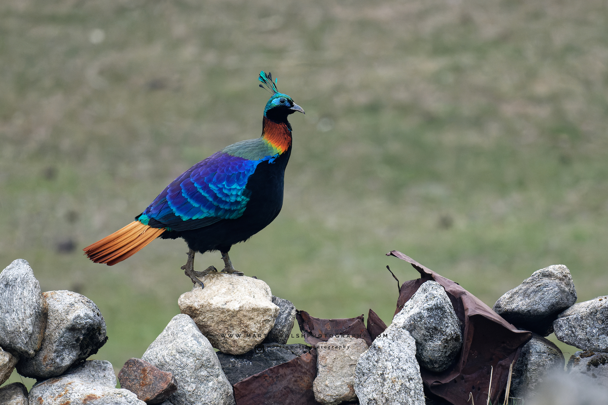
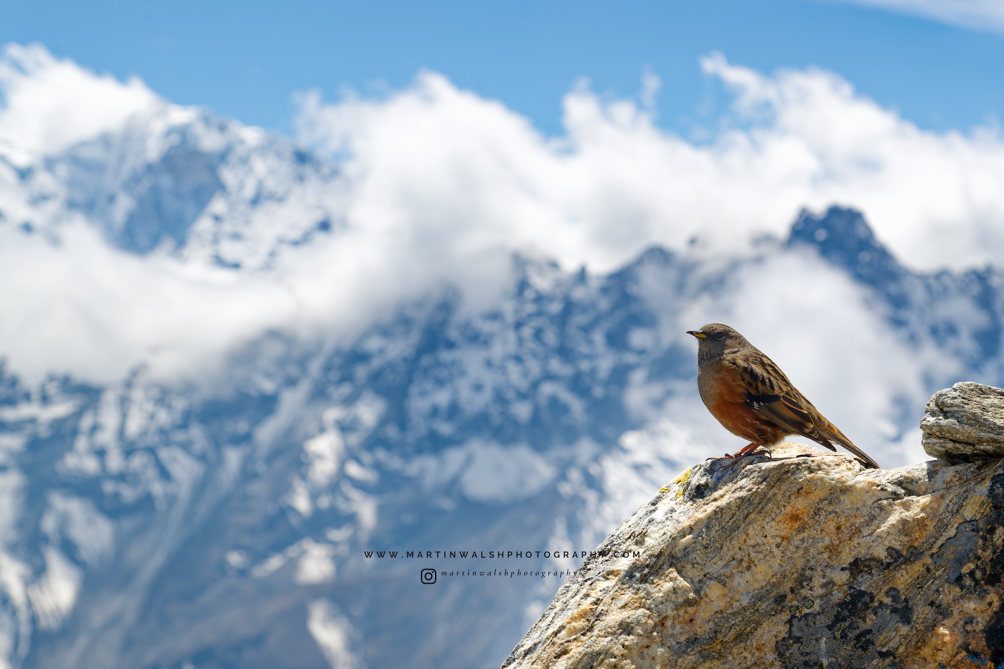
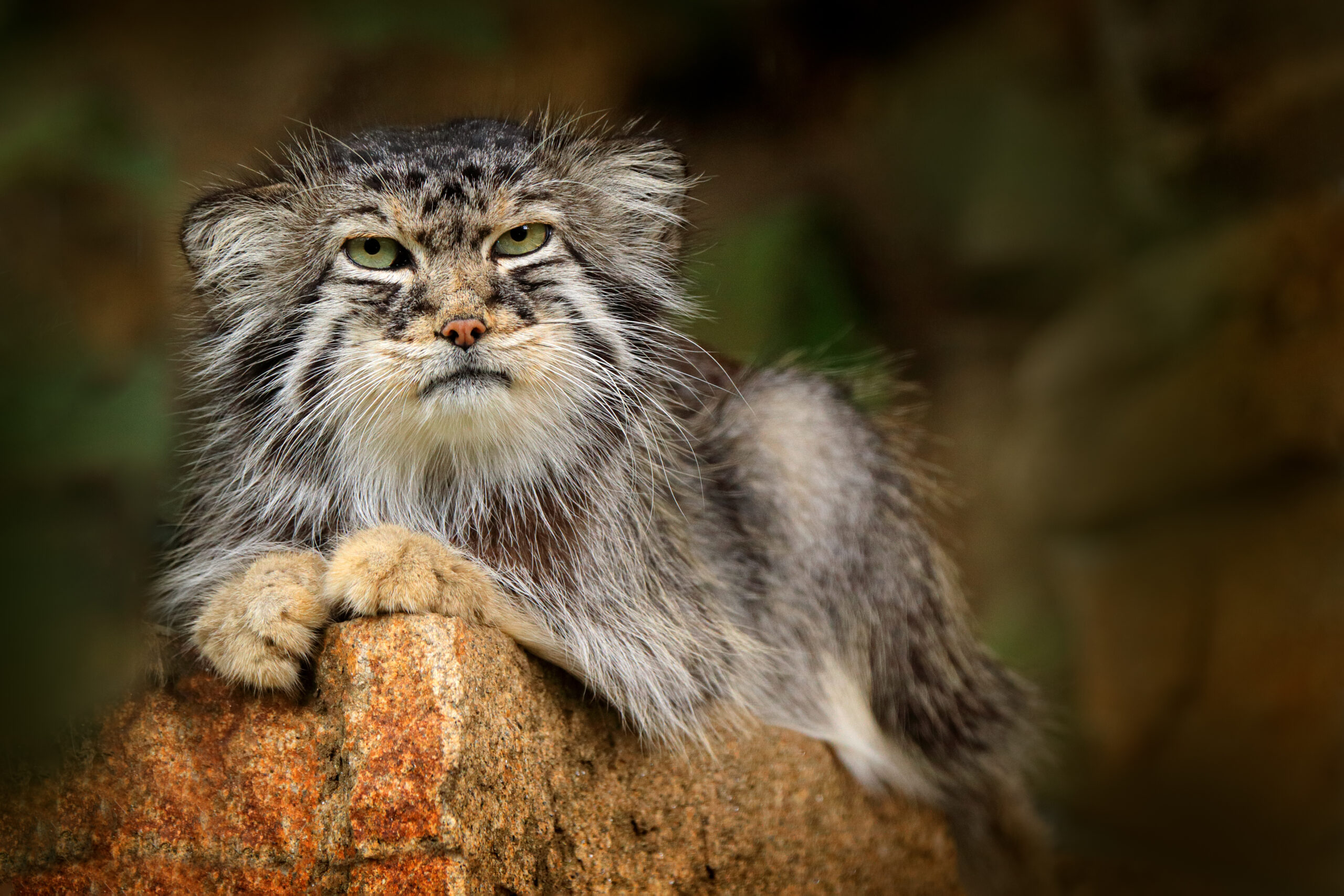
Most visitors don’t consider the Himalaya a wildlife destination, but the world’s highest mountains hold a surprising amount of diversity.
From snow leopards and grumpy Pallas's cats to blood pheasants and red pandas, here are some of the places wildlife watchers head for mountain wildlife.
Hemis National Park, Ladakh, India
Hemis covers 4,400 square kilometers a vast swathe of rugged, high-altitude desert between 3,000 and 6,000m in Ladakh, India.
The park holds a stable population of argali, urial, and bharal (all wild sheep species). These are nice to spot, but for most visitors, they are more important for what they represent: big cat food. An abundance of prey supports an estimated 200 snow leopards in Hemis, which might be the highest density of any protected area in the world.
For a long time, wildlife watchers regarded seeing a wild snow leopard as almost impossible. Evidence of their presence (scat, territorial markings, paw prints) was easy enough to find, but actually spotting the ghost of the Himalaya was a tall task. Sightings required insane luck or months, if not years, of work.
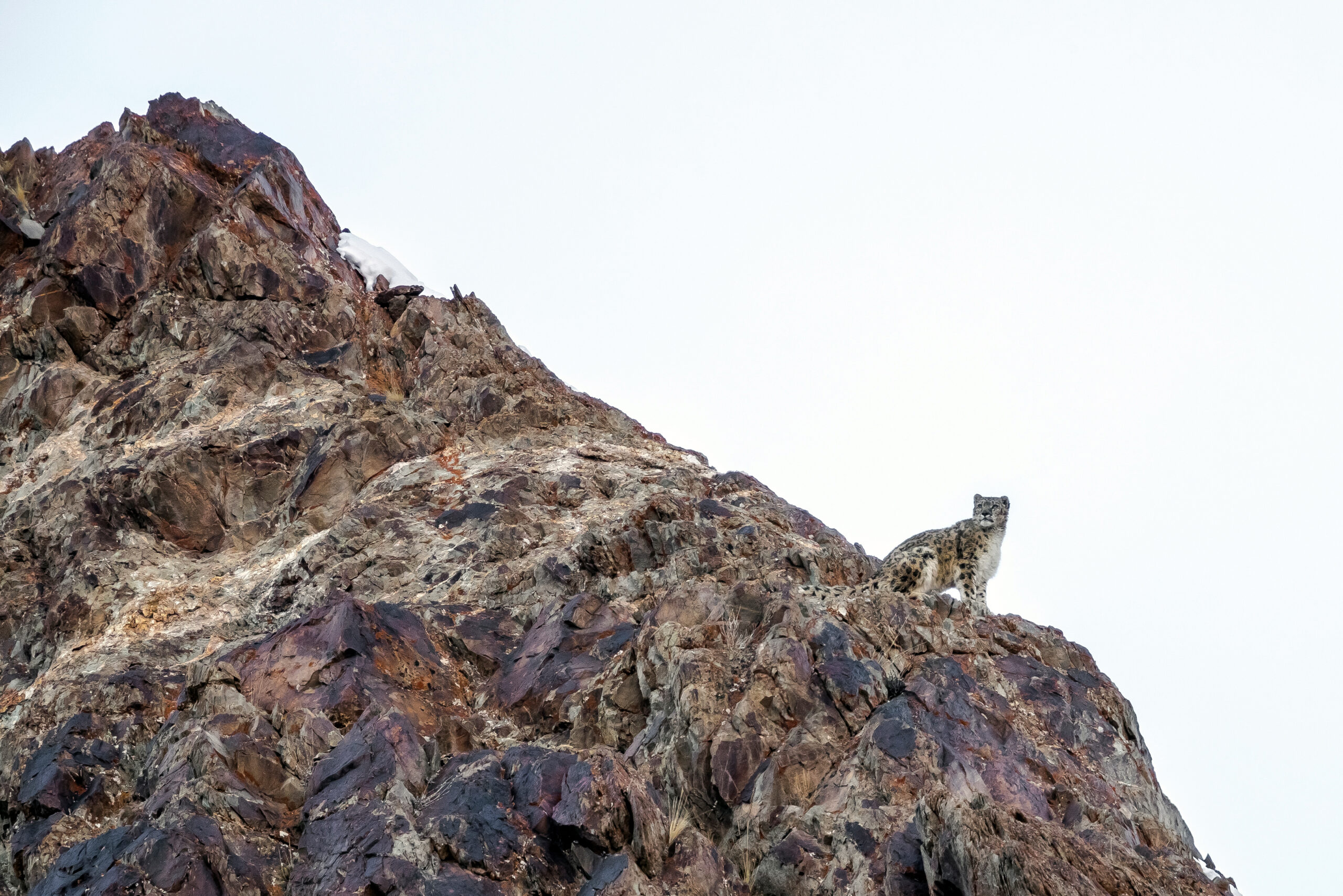
Now, things are much easier. Increased knowledge of territories and habits revealed that snow leopard sightings were not just possible but likely, given enough time. You needed to be in the right place at the right time. And you will need to spend long hours in the cold.
Sightings generally require at least a few days spent scouring ridges and cliff faces at dawn and dusk. It’s cold, uncomfortable work, but the potential payoff for photographers and wildlife enthusiasts is worth the effort.
And sightings aren’t restricted to big national parks like Hemis. In remote Ladakhi villages, residents will tell you that they regularly see the cats. Locals have shown me phone camera videos of snow leopards practically close enough to touch, stalking past houses and leaping dry-stone walls (and occasionally taking domestic livestock -- leading to some human-wildlife conflict). As a result, some of these out-of-the-way hamlets now draw tourists for week-long stays.
Eagle’s Nest, Arunachal Pradesh, India
Foreigners require special permission to visit Eagle’s Nest in Arunachal Pradesh. This means it’s not a cheap trip, despite only basic accommodation at two campsites. However, it continues to attract adventurous wildlife enthusiasts because the area has built a strong reputation for unusual wildlife sightings.
Named after an old military base (formally occupied by the “Eagles” unit), the area is particularly popular with birders. In 2006, researchers described a new species of liocichla from here. Ornithologists named it the Bugun liocichla after a local ethnic group. With evidence of only 10 breeding pairs, it is critically endangered.
Though it has long been a birding destination, it has only recently caught the attention of mammal watchers. The road between the two campsites has proved productive for some hard-to-see nocturnal species, including mega-rarities like clouded leopards and golden cats.
Sagarmatha National Park, Nepal
More than just Everest, Sagarmatha National Park is surprisingly busy with wildlife. Despite the heavy foot traffic during trekking and climbing season, you can see many pheasant and grouse species, including blood pheasants and the national bird of Nepal, the monal. Commonly seen mammals include Himalayan musk deer and Himalayan tahr.
Humans wiped out snow leopards here in the 1970s through overhunting, both of the cats and their prey. A small number have returned over the last half century as the prey species have rebounded. However, sightings remain extremely scarce.
Langtang National Park, Nepal
Established in 1976, Langtang was the first-ever Himalayan National Park. Its proximity to Kathmandu (it starts just 30km from the capital and stretches to the China-Tibet border) makes it easy to visit independently.
It has a reputation as a good spot to find red pandas and is fantastic for birds (373 species recorded) because of lakes such as Gosainkunda. Commonly observed mammals include Himalayan tahr, Himalayan musk deer, Assam macaque, and Nepal sacred langur.
While most wildlife-focused visitors to Nepal head to Chitwan National Park or Bardiya National Park down in the Terai, it’s worth combining a visit with some hiking to look for mountain specialist species.
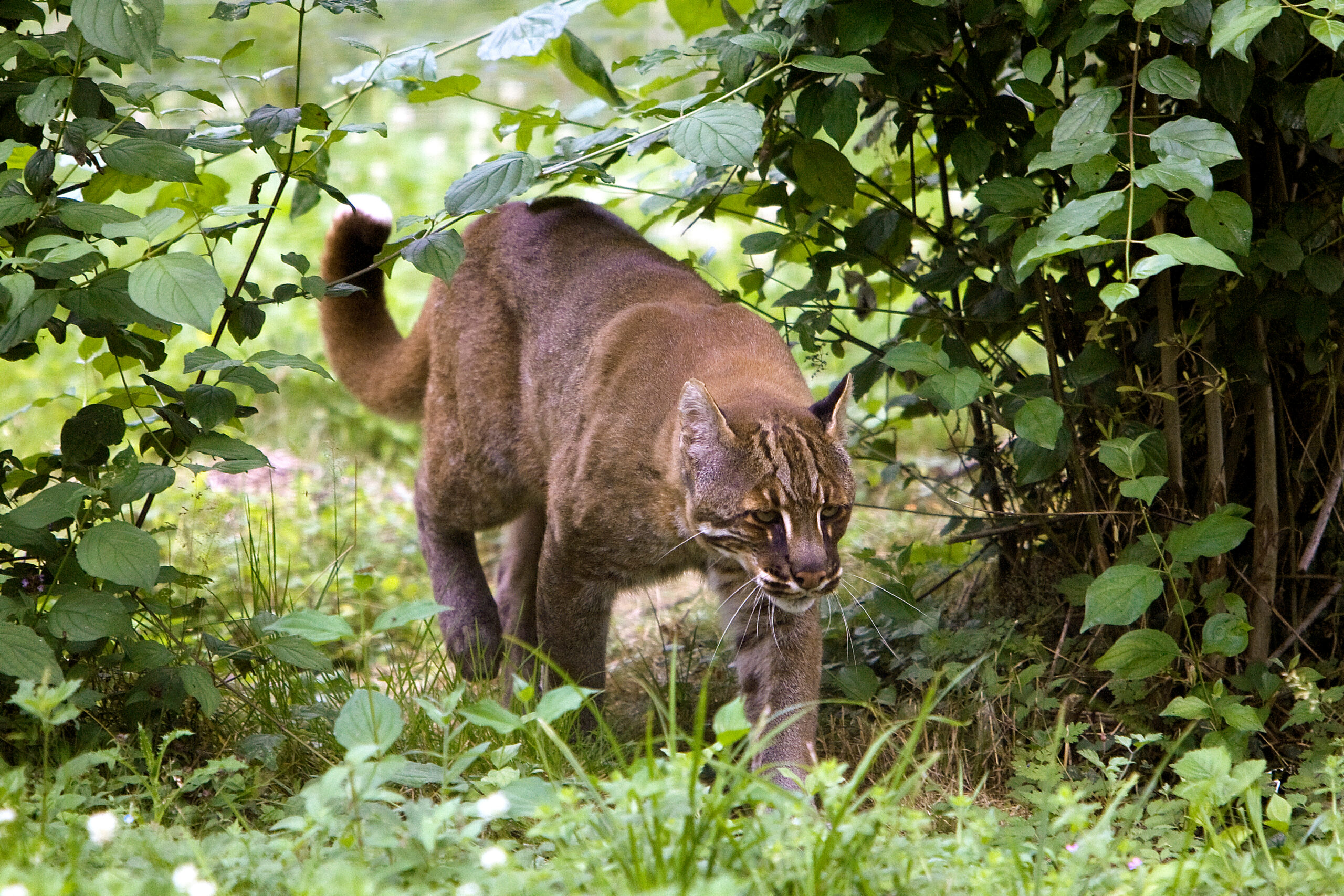
Hengduan Mountains and the Tibetan/Himalayan Plateau, China
Though they are not technically the Himalaya, I’m lumping the Hengduan mountains of Sichuan and neighboring areas of the Tibetan Plateau into this list.
This is one of the best regions in the world to see an array of cat species. Pallas’s cat (the manul), Eurasian lynx, snow leopard, Chinese mountain cat, and leopard are all possible here. Asian brown bears and wolves are not uncommon. Tantalizingly, it is also one of the few places where you might spot a wild panda.
National parks are a new concept in China. The government revealed five initial national parks in 2021. One of these was Giant Panda National Park, an effort to unite a sprawling group of 81 existing nature reserves. Tangjiahe Nature Reserve in the Hengduan Mountains is part of the park's core area. The elevation ranges from 1,150m to 3,837m and features a mix of dense bamboo and subtropical forest. It is an important panda habitat.
Sightings are extremely difficult, and those who do spot a wild panda are reluctant to reveal exactly where sightings took place. Researchers estimate that there are 39 pandas in the reserve.
Other charismatic megafauna present include golden snub-nosed monkeys and Tibetan takin, a species of goat-antelope.
The potentially life-sapping cold of continental Siberia requires a specific lifestyle. In Yakutia, the world's largest administrative and territorial region, people must adapt to long, brutal winters with average temperatures of -50°C. The lowest temperature recorded was -71°C, the coldest on Earth outside Antarctica.
Keep busy, keep warm
This short documentary gives a snapshot of family life in this harsh environment.
Yakutia is not a place to be lazy; everyone pulls their weight. Simple things like drinking water take preparation and effort. There are no water treatment facilities here, since the pipes can't stand the cold. So water is harvested from a local stream in November and then piled up in big blocks of ice outside the house to melt as required.
Families have to heat their houses for nine months a year, so collecting and chopping firewood is another essential daily task. Fishing and hunting are almost equally vital.
Arian is just nine years old, but he might already have more (and better) practical skills than I do. He descales and guts fish with his mother, goes ice fishing with his father, and chops wood for the fire with a not insignificantly-sized axe.
"I believe every single man has to be able to make something by hand," Arian's knife-crafting father says. "At least knives or dishes."
'Snow days' are rare
When it's "warm" enough, Arian gets a break to go to school. The children in Yakutia only go to school when it’s warmer than -54°C. If it is any colder, the government considers it too dangerous to venture outside.
But on this day, it's a balmy -40°C, and Arian gets kitted up for a mini-polar expedition -- the 10-minute walk to his classroom. He seems a chipper kid, unfazed by what most people would consider life-threatening conditions. During this short 20-minute watch, Arian and his family seem happy. Their lifestyle looks almost idyllic if you don't think about it too hard.
"There is no such thing as bad weather, there is just weather and your attitude toward it," the narrator says, borrowing a quote from American self-help author Louise Hay to wrap up the video. It's a nice sentiment. However, I doubt Hay ever had the runs while it was -71°C, and the only toilet was outside and unheated.
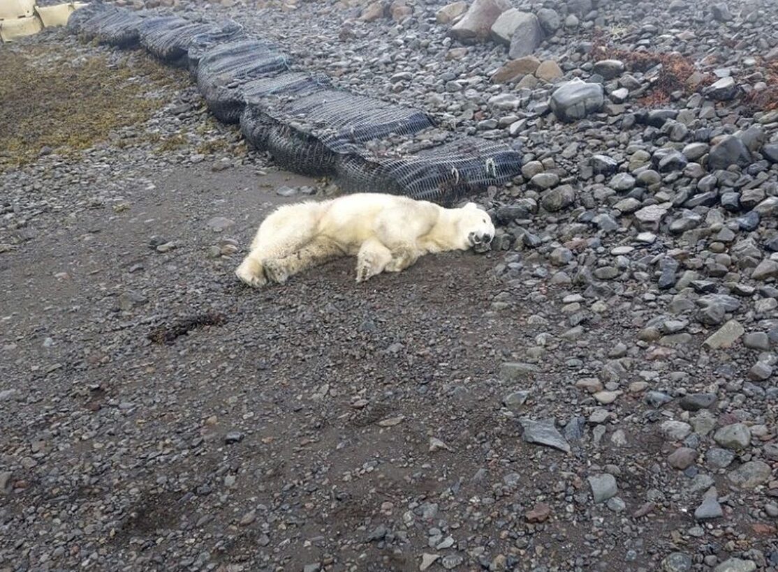
Polar bears aren't native to Iceland, though an occasional vagrant arrives from Greenland. So, it was quite a surprise for an elderly resident of a remote village to find one raiding her bins. Panicked, she locked herself upstairs and called for help.
After consulting with the Icelandic Environment Agency, police arrived and shot the bear. The agency decided not to try and relocate the animal, following recommendations laid out in a 2008 study. That study concluded that moving bears back to Greenland was prohibitively expensive and suggested killing vagrant bears was the best response.
A protected species?
Polar bears are a protected species in Iceland and cannot be killed at sea. However, they can be killed if they threaten humans or livestock.
"It’s not something we like to do," Westfjords Police Chief Helgi Jensson told The Associated Press. "The bear was very close to a summer house. There was an old woman in there."
This is the first polar bear sighting in Iceland since 2016. Only 600 polar bears have been recorded in Iceland since the ninth century. Experts believe this bear may have traveled from eastern Greenland on an iceberg, of which several were spotted near the north coast recently.
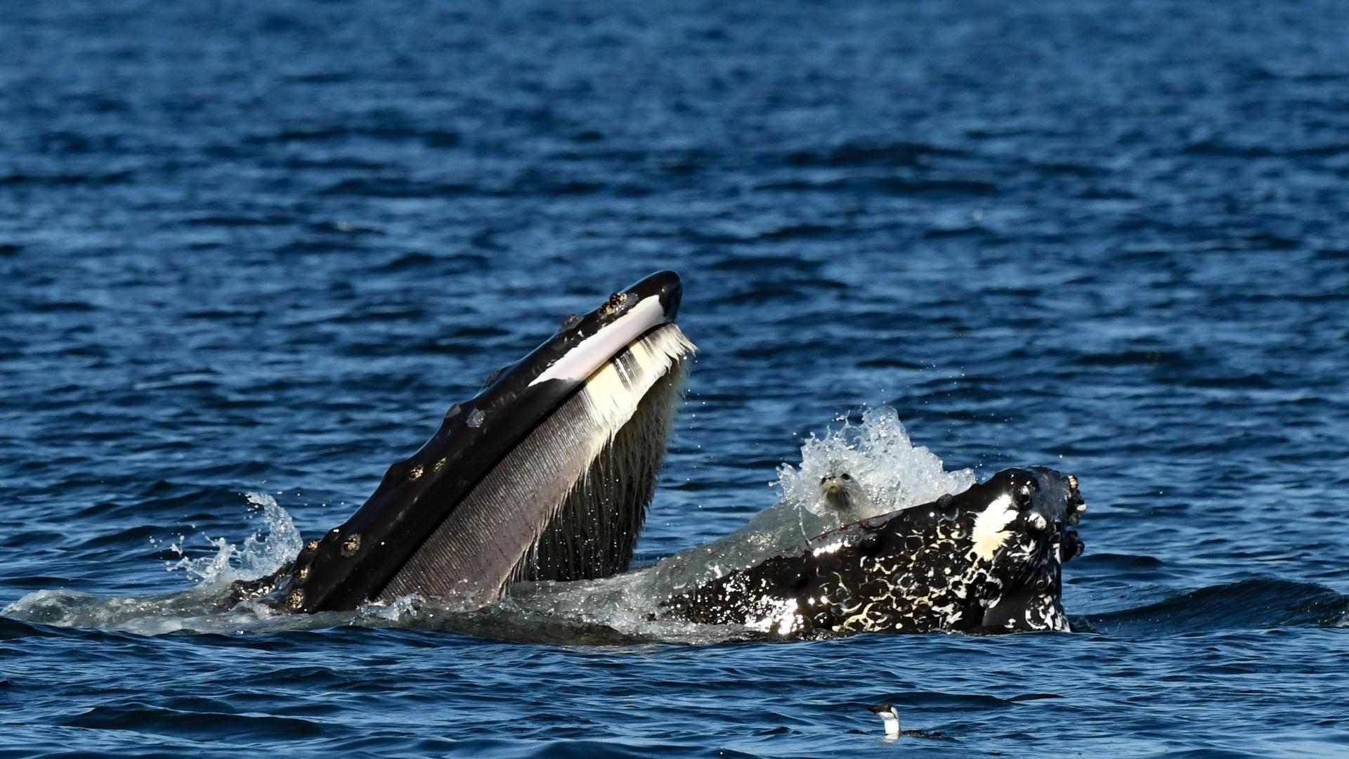
Wildlife photography is as much about luck as skill, but you have to take your opportunities. Photographer Tomis Filipovic certainly made the most of his.
While photographing whales, Filipovic caught a once-in-a-lifetime moment in the Strait of Juan de Fuca near Vancouver Island, Canada. A feeding humpback whale accidentally caught a harbor seal in its mouth, spitting out the undoubtedly confused seal soon after.
"Luckily, a humpback's throat is only about as wide as a grapefruit, so it can't take in anything bigger than that," Filipovic told CTV News in an interview.
Filipovic wasn't the only observer to capture the moment. Brooke Casanova with Blue Kingdom Whale & Wildlife Tours also landed a shot of the rare encounter.
From stuffing pigeons into missiles to discovering that animals can breathe through their anuses, the 2024 Ig Nobel Prize awards have no shortage of headline-grabbing studies.
The ignoble Nobel prize
The Ig Nobel Prize started in 1991 and aims to "honor achievements that first make people laugh, and then make them think." Though it is a riff on the Nobel Prize, the "ignoble" prize does recognize genuine achievements, though without the life-changing million-dollar reward. Instead, winners are given a one-trillion Zimbabwean dollar banknote, worth less than one U.S. dollar.
This year there are 10 studies recognized in 10 categories.
A team of Japanese scientists won the Ig Nobel Prize in physiology for a study that showed that mice, rats, and pigs could absorb oxygen into the bloodstream via the rectum. At first blush, this might not sound like a particularly useful discovery, however, researchers hope that "enteral ventilation" could help treat human patients with respiratory failure. The team is now running a phase one trial with human volunteers.

The Peace Prize went to the late BF Skinner, a U.S. psychologist. His study explored placing live pigeons in missiles to guide them to their targets.
"This is the history of a crackpot idea, born on the wrong side of the tracks intellectually speaking, but eventually vindicated in a sort of middle-class respectability. It is the story of a proposal to use living organisms to guide missiles," Skinner wrote by way of introduction to his article Pigeons in a Pelican.
Can we trust reports of extreme old age?
Saul Newman at the University of Oxford won the Demography Prize for his study looking into claims of extreme old age. Newman demonstrated that many claims of extreme old age in humans come with a host of suspect data points.
"Relative poverty and short lifespan constitute unexpected predictors of centenarian [100 years] and supercentenarian [110 years] status and support a primary role of fraud and error in generating remarkable human age records," the study concludes. "Only 18% of ‘exhaustively’ validated supercentenarians have a birth certificate, falling to zero percent in the USA."
The Medicine Award went to a mixed Swiss/German/Belgian team for their study that involved a (rather terrifying) twist on the placebo effect. Researchers found that medicine that causes side effects can be more effective than medicine that does not.
The Chemistry award went to a Dutch team that separated drunk worms from their sober brethren using chromatography (separating a mixture into its components) and a maze. The study aims to increase our understanding of polymer dynamics by analyzing differences in wriggle activity.
"The sad conclusion is that the drunk worms get home very late," Woutersen said as he accepted the award.
Plant vision and the swimming abilities of dead trout
American Jacob White and German Felipe Yamashita shared the Botany Award for their potential discovery of "plant vision." The duo found that a South American plant can mimic the leaves of plastic plants it is placed next to.
Physics went to James Liao from the University of Florida for an off-the-wall-sounding study that investigated the swimming abilities of a dead trout.
"The musculoskeletal system [of trout] is phenomenally well matched to the environment. We know this because a dead fish exhibits unnervingly similar Karman gait kinematics [an undulatory swimming motion] to a live fish, with the exception that it cannot put on the brakes. In a remarkable example of passive thrust production," the study explained.

Winning coin flips and scaring cows with cats
Fifty researchers shared the Probability Prize for their study on the good old coin flip. After over 350,000 coin flips, their study concluded that coins are marginally more likely to land the same way up as they started.
Finally, Fordyce Ely and William Petersen won the Biology Award posthumously for their investigation into dairy milk production. They decided to scare cows using a cat and exploding paper bags to see what would happen to the cow's milk. Perhaps unsurprisingly, cows harassed by a cat on their back and subject to exploding bags produced less milk.
In an extremely unusual situation, a golden eagle was killed after a string of attacks in Norway. The bird attacked four people, including a toddler.
Golden eagles are a widely distributed species with an average wingspan of around 2m. Though intimidatingly large birds, golden eagles usually hunt small prey, such as rabbits and marmots. Attacks on humans are practically unheard of. Yet, over a few days last week, a young eagle showed behavior that was "radically different from normal."
A brazen attack
The most recent (and final) attack may have been the most terrifying. The eagle grabbed a 20-month-old toddler while she was playing in her garden in Norway's central Trondelag region. Fortunately, her mother and a neighbor were nearby. It took both adults to force the eagle to release the toddler, who needed stitches and was left with scratches on her face.
"But it kept coming back," the child's father told Norwegian public broadcaster NRK. It was undeterred even when "the neighbor chased it away with a stick."
The incident with the toddler appears to have been the fourth attack. Two days previously, 31-year-old Francis Ari Sture was out hiking when he thought a human had tried to shove him from a cliff. Turning to confront his attacker he came face to face with an extremely aggressive golden eagle.
"We are staring at each other for, maybe, a whole minute," Sture told the Associated Press. Then, the eagle launched a barrage of attacks, chasing him down the mountain and scratching at his head and face. Sture managed to escape and a local hospital treated him for deep wounds to his face.
An eagle with a behavioral disorder
A day before that, the eagle attacked Mariann Myrvang. The eagle landed on her shoulders, forcing her to her knees under its weight. Myrvang's husband had to beat it with a tree branch to drive it away. Like Sture, Myrvang required a hospital visit.
Alv Ottar Folkestad from BirdLife Norge believes that the young female eagle must have had a "behavioral disorder," that prompted the highly unusual sequence of attacks.
Whatever the cause, the bizarre reign of terror is now over. Local game warden Per Kare Vinterdal arrived shortly after the attack on the toddler and killed the eagle.
Three tiny glass beads, from a sample of 3,000 taken from the Moon, have revealed evidence of recent volcanic activity. Previous scientific estimates suggested volcanic activity ended more than 2 billion years ago, but a new study suggests far, far more recent eruptions. Volcanoes on our lunar satellite were still spewing lava while dinosaurs walked the Earth.
Valuable cargo
The samples, picked up by the Chinese Chang'e 5 mission in 2020, are the first Moon rocks brought to Earth since the 1970s. Over the next four years, a team from the Institute of Geology and Geophysics at the Chinese Academy of Sciences in Beijing painstakingly analyzed the minute beads, each smaller than a pinhead. On Sept. 5, they published their findings.

They only identified three beads with a volcanic origin "based on their textures, chemical compositions, and sulfur isotopes." The remaining 2,997 were likely the result of meteorite impacts.
Though these aren't the first volcanic beads discovered on the Moon, they are certainly the most interesting. Previous samples date back billions of years, to the formation of lunar maria, enormous basaltic plains formed by lava flowing into craters. Meanwhile, "uranium-lead dating of the three volcanic glass beads [from 2020] shows that they formed 123 million, ±15 million, years ago," the report explains.
What was driving volcanic activity for so long?
However, existing models of the Moon's evolution suggest that its interior should have cooled beyond volcanism long before the formation of these glass beads.
As is often the case, researchers are left with more questions than answers. Perhaps the recently discovered Moon cave will help scientists understand what caused this surprisingly recent volcanic activity...
In a trend that is unlikely to abate any time soon, people engrossed in their mobile phones risked their lives for content. A viral video from China shows tourists caught out by surging waters on the Qiantang River.
The Qiantang River flows through the Chinese province of Zhejiang on the eastern coast, just below Shanghai. The video of tourists on the river's edge, posted on X, is allegedly from a couple of days ago. Though we can't confirm the video's authenticity, it appears to show a huge tidal bore rushing up the river and then engulfing a group of around 20 people filming or photographing the incoming wave. The water sweeps some people away and it isn't immediately apparent if everyone is accounted for as the water recedes.
The video, with a warning that the content could be distressing, can be viewed below.
WARNING - disturbing (And I post this as a warning).
Another video of people taking dangerous selfies. This is Qiantang River in China a couple of days ago....
pic.twitter.com/0P5JhX2FTH
— Volcaholic
(@volcaholic1) September 8, 2024
The surge could be because of typhoon Yagi, a superstorm that has left a trail of destruction in its wake across the Philippines, south-eastern China, and north Vietnam. Asia's largest storm of the year, Yagi has killed at least 141 people in Vietnam.
Unnecessary risks?
This is not the first phone-related death we've covered this summer. In mid-August, Czech gymnast Natalie Stichova fell to her death in Germany while trying to get in position for an Instagram photo with the famous Neuschwanstein Castle.
After 140 days split between cycling, canoeing, sailing, and hiking, the Canada west-to-east team has finished their 6,900km crossing of Canada's north.
Nicolas Roulx and Catherine Chagnon set out from Beaver Creek on the Alaska-Yukon border on April 21. They started on bicycles for a 16-day "warm up" as they pedaled east on the Alaska Highway. After a nasty climbing accident shortly after his 2021 Canada north-to-south expedition, Roulx hoped that the relatively relaxed start would help ease him into a long, physical journey.
The ride went smoothly, with "some knee pain, but nothing serious or abnormal," before the real test began on the wild rivers of the Northwest Territories and Nunavut.
A battle against the clock
Roulx and Chagnon traded their bicycles for canoes near the entrance to the Little Nahanni River. This juncture marked a couple of key milestones. They would be joined by friends Mathieu Beland and Guillaume Moreau, and their carefully laid plans would require some on-the-fly adjustments.
This was the first team change of the expedition, but not the last. Roulx and Chagnon were due to add Dominic Roulx (Nicolas Roulx’s brother) and Laurence Garceau later in their 2,800km canoe section and eventually joined a completely separate sailing team at Baker Lake. This made for strict time constraints because of the logistical complications involved with different team members joining for various sections. Keeping a few days ahead of schedule was vital.
Thus, arriving at the Little Nahanni River to find it was still frozen threw a spanner in the works. With no time to wait for the river to thaw, they took the “rarely frequented” Flat River to join the Nahanni.
“A rather rough start, the river getting rocky and crowded, quickly gave way to smoother days,” they wrote.
The team put in long days, paddling 10-11 hours and covering around 60km daily to stay on track.
"We didn’t do much research on the Flat River. We paddled it for about a week, and fortunately, it was a little shorter than the Little Nahanni. This gave us a natural time advantage of a few days. We also paddled very, very fast," Roulx told ExplorersWeb.
Paddling and portaging
From the Flat River, they moved on to the Nahanni. It was a stressful transition. The river was flooded with plenty of sediment and "muddy, ugly water." Then came the Liard, which empties into the Mackenzie River, where they struggled upstream for roughly 350km. Though a large river, they encountered shallow water and battled headwinds, making for a tough stretch.
Yet despite the route change and some brutal paddling, they managed to stay just ahead of their tight schedule. In fact, their timing was perfect. As they approached Great Slave Lake at the end of the Mackenzie River, there were still big chunks of ice around. “We couldn’t have arrived even a week earlier,” Roulx explained.
Soon after, Dominic Roulx and Laurence Garceau joined them on Great Slave Lake for the final canoe section to Baker Lake. The expanded team of six set off from the small community of Lutselk’e on June 25 and almost immediately faced a series of intense portages through a chain of lakes.
This was a theme for the 41-day journey, during which the team racked up 37 portages, moving from boreal forest to tundra and inching east.
Canoe to sailboat
On August 4, they arrived at Baker Lake with time to spare before the next stage of their journey. Here, they left their friends and their canoes behind and joined a sailboat crew.
The sailboat Anorak had just completed a long journey north from Quebec. After a change of crew, they set off again to ferry Roulx and Chagnon to Baffin Island. In theory, the next 2,600km should have been a relative breeze compared to their slog in Canada's wild interior. But it was not to be.
"The journey from Baker Lake was fierce. From early on, we had to sail in close to 45kmph headwinds right in the middle of Hudson Bay. It was at this moment that Nicolas [Roulx] learned the hard way that he gets seasick," they wrote in late August. "For us, this was 2,600km of waves, strong winds, staying up to sail 24/7, vomiting, turbulent horizons, dark waters, and soda biscuits to calm the stomach."
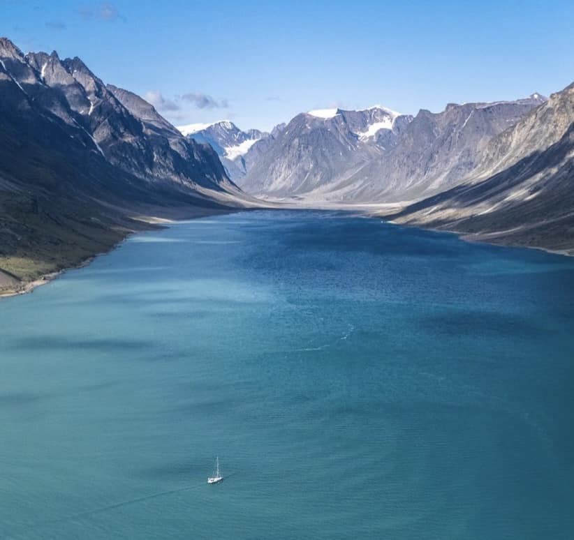
After 16 sometimes unpleasant days, the pair were likely relieved to return to dry land and start their final section: eight days hiking from Pangnirtung across the Cumberland Peninsula to the east coast of Baffin Island.
On the afternoon of September 7, they finished a quite remarkable journey.
"Without a welcoming committee, we arrived at the edge of a dizzy cliff-lined fiord just north of the Arctic Circle," they wrote yesterday. "To go further, we would have to cross the Davis Strait by boat, which would lead us to Greenland. All the lakes, rivers, waters, and mountains we've traversed through the Yukon, Northwest Territories, and Nunavut have been occupied by the First Peoples for millennia. The words that we think are the most relevant to utter right now are those of our gratitude."
Roughly 400 million years ago, scorpions the size of small alligators roamed our oceans. With their powerful claws and thick exoskeletons, these 2.5m-long predators dominated their world.
Until recently, researchers have found most sea scorpion fossils in North America and Europe. But recent finds in China and Australia suggest that these arthropods may have migrated long distances.
Endurance swimmers
In a new study, paleobiologist Russell Bicknell of the American Museum of Natural History and his colleagues studied two fresh sets of fossils from Australia. The incomplete fossils came from two different species, Pterygotus and Jaekelopterus. Each could grow larger than a man.
The researchers believe the scorpions made "a substantial trek" from North America to Australia. "That tells us that these animals were built quite effectively for traveling really far. So they were probably traversing a similar distance [that] some whales do," Bicknell told the CBC.
Fossilized potential prey like fish and trilobites turned up in the vicinity of the scorpions. Could they have migrated seasonally with a food source? Or was it a one-time event? The researchers are not sure.
Sudden extinction
Nor do they know why these frightening predators suddenly disappeared. Once there were over 200 species of them, but all went abruptly extinct about 400 million years ago.
"It may be environmental. It may be ecological, so they're sort of competing with different animals," Bicknell said. "Or they may have just pushed themselves too far [with their mega-migrations]."
Since their demise, no giant arthropods have roamed the seas.
It has been a tough summer season in the Alps. Rockfall is increasing as climate change melts the permafrost holding the rocky faces together, heavy rains flooded alpine towns, and there has been a rash of deaths, including three in a week on the Matterhorn.
The Matterhorn is a hugely popular peak, with roughly 3,000 summits per year. With so many climbers, accidents are inevitable. There are four to six deaths per year, mostly the result of rocks or falls. Many deaths (and all three last week) occur on the descent, a hair-raising, three-and-a-half-hour highwire act along a sharp ridgeline and down through loose rock.
The short film Way to the Matterhorn does a solid job showing off the mountain's most popular route, the Hornli Ridge. Some 70% of climbers choose this route, which gets exceedingly busy in peak season. But presenter Julia Lyubova and local Zermatt guide Andreas Steindl are lucky. Climbing early in the Covid pandemic and with poor weather predicted for later that day, they have the mountain mostly to themselves.
After a very early start from the Hornli Hut, we're treated to a spectacular sunrise from high on the mountain and some vertigo-inducing shots of the windy summit ridge. But the film doesn't shy away from the difficulties of the descent.
Careful footsteps and nervous chatter
On the way down, climbers are typically physically and mentally tired. The descent can require rappeling, and it's easy to wander away from the route without an experienced guide.
Lyubova and Steindl are up and down without incident, yet you can feel Lyubova's nerves through sections of the descent. Quiet moments are punctuated with heavy breathing and nervous chatter.
"The descent feels much harder than the ascent," Lyubova explains. "I am not sure if I have done anything more frightening in my life before this."
A SpaceX mission planned for later this year will send a crew of four, including ExplorersWeb contributor Eric Philips, into orbit. The spaceflight will mark the first-ever crewed mission over the Poles.
Fram2
The Fram2 mission is named after the famous polar ship, the Fram, captained by the great Norwegian explorers Fridtjof Nansen, Otto Sverdrup, and Roald Amundsen between 1892 and 1912.
Nineteenth-century polar expeditions were undoubtedly expensive -- Sverdrup's four-year expedition aboard the Fram cost about $2 million in today's dollars -- but Fram2 certainly raises the bar. Though SpaceX does not publicly list prices, NASA has "previously disclosed it pays about $55 million per seat" to fly astronauts with the company, according to CNBC.
This would put a crewed mission at more than $200 million. Incredibly, cryptocurrency entrepreneur Chun Wang is privately funding Fram2. Born and raised in China, SpaceX describes Wang as an "entrepreneur and adventurer from Malta," after he received Malta citizenship late last year.
Wang has assembled a team of three to join him for the three to five-day mission. Norwegian filmmaker Jannicke Mikkelsen will serve as vehicle commander, Eric Philips of Australia will be the vehicle pilot, and German researcher Rabea Rogge will be the mission specialist. Wang told CNBC that he first met Mikkelsen, Rogge, and Philips while living in Longyearbyen on Svalbard.
A polar first
Flying at an altitude of 430 to 450 kilometers, their polar orbit will require more juice than a typical orbit because the spacecraft can't use the Earth's rotation to boost velocity. This added energy cost means that previous polar orbits were unmanned and primarily used for military surveillance.
The Fram2 crew plans to study "unusual light emissions resembling auroras" above the Poles and to capture the first human X-ray images in space.

The team arrived at the SpaceX training facility in Los Angeles this week. The expedition, using SpaceX’s Falcon 9 rocket and Dragon capsule (aptly named Endurance after Ernest Shackleton’s ship), will launch late this year at the earliest.
It may not sound like what most of us would call a heat wave, but temperatures of -25˚C to -30˚C are alarmingly balmy for midwinter Antarctica. Temperatures since mid-July on the planet's coldest continent are up to 28°C (50°F) higher than normal.
A changing Antarctica?
The heat wave may continue until mid-August and follows another significant temperature spike in March 2022. The 2022 heat wave caused temperatures to rise over 20°C above average. However, it was briefer and not as widespread.
An unusual combination of atmospheric conditions has extended the unseasonal heat. According to Amy Butler, a physicist at NOAA’s Chemical Sciences Laboratory, the southern polar vortex (an area of cold rotating air over Antarctica) has become disrupted. As a result, cold air is flowing away from the continent, leaving room for warmer air to enter.
"The polar vortex disruption began in the second half of July and could continue through the first half of August, perhaps peaking in intensity in about a week," Butler told CNN.
Ominous signs
Climate change and this relatively warm winter will accelerate ice melt in Antarctica.
The Thwaites Glacier, also called the Doomsday Glacier, continues to melt at an unprecedented rate. Since 2020, the Thwaites has lost over a trillion tonnes of ice and accounts for four percent of global sea level rise. If it melted completely, the sea would rise by almost three meters globally.
The Thwaites is in West Antarctica, and most climactic studies have focused on this region, where rapid melting of the ice sheets may now be unavoidable, according to a 2023 study published in Nature. But the current heat wave is in East Antarctica, demonstrating that climate change affects the entire continent.
For perspective, when three of Robert Scott's men hauled sleds for 200km through midwinter Antarctica in 1911, they considered temperatures in the -50s a mild spell.
The Canada West-to-East team has shape-shifted as it has progressed across the country. Over 106 days, Nicolas Roulx and Catherine Chagnon are the only constants, while their means of travel and teammates change. The pair have just arrived in Baker Lake, Nunavut, having cycled and now canoed 4,200km north of the 60th parallel.
Baker Lake marks the end of the most difficult segment of their journey, a mammoth 2,800km canoe section. It included plenty of portaging and a route change when they arrived at the Little Nahanni River to find it was still frozen. By the end of the canoeing, their team had expanded to six, as Mathieu Beland, Guillaume Moreau, Dominic Roulx (Nicolas Roulx’s brother), and Laurence Garceau joined the party.
Plenty of legwork
The 41-day journey from Great Slave Lake to Baker Lake went relatively smoothly but required a meaty 37 portages.
They left the small community of Lutselk'e on June 25. They immediately faced a tough choice: cross a huge open-water bay but avoid a portage or do a series of eight portages through a chain of lakes that would halve the distance they had to travel. Tired of paddling on the lake, they selected the second option.
"It is a choice we would make differently in retrospect. It was hard on the body, with billions of black flies and a dense, steep forest. We had to put the canoes on ropes up slopes...It was very intense," Nicolas Roulx told ExplorersWeb.
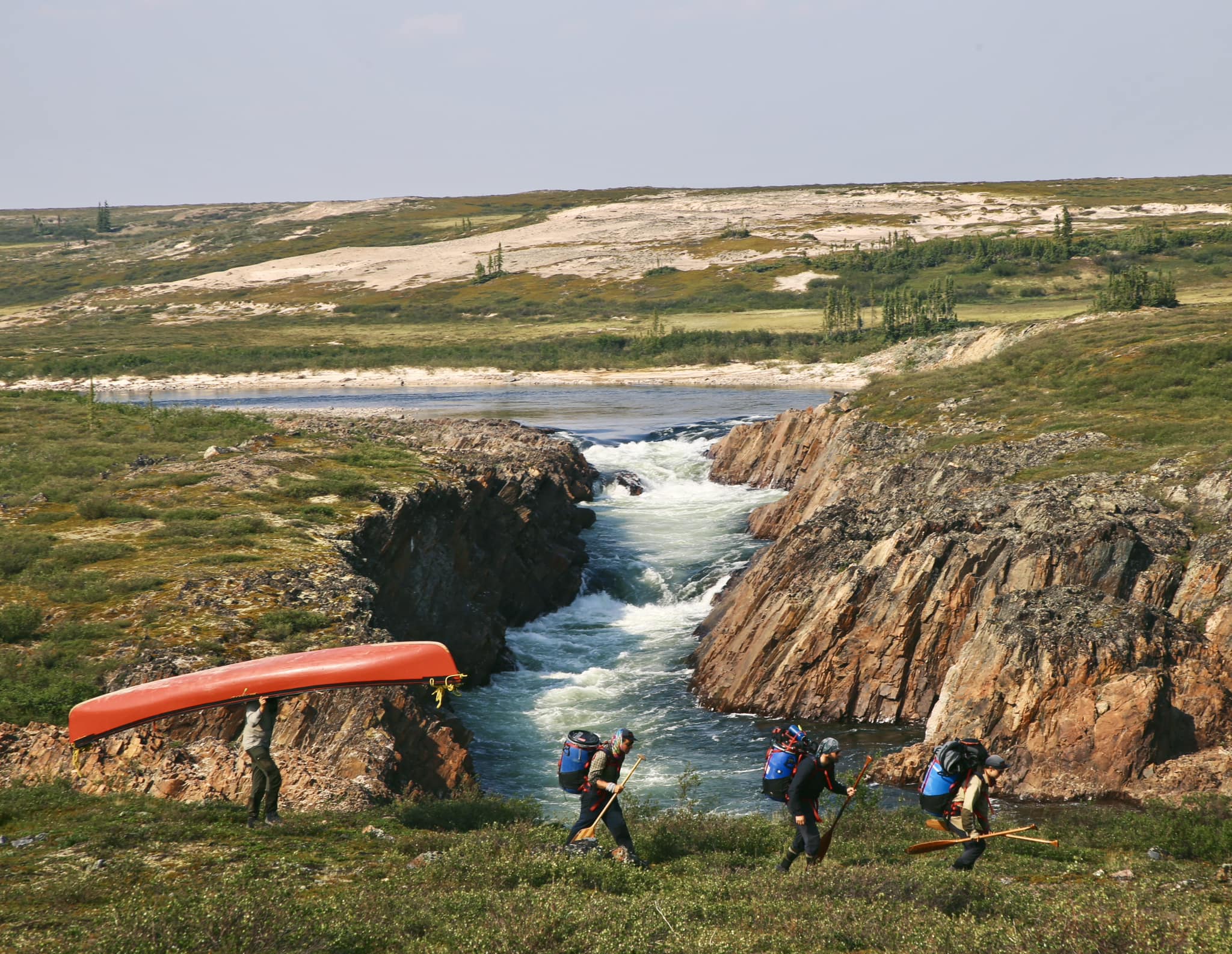
After the grind, there was no let-up. "We took the ancestral route of the illustrious and notorious Pike’s Portage, [which took us] from boreal forest to tundra," Roulx said.
As the name suggests, Pike's Portage required more legwork. It also brought more wildlife of the blood-sucking variety.
They then joined the Hanbury River, a small, narrow river with plenty of rapids that they could not run in their canoes. This required more portages.
"The portages went through the tundra, so no trees, a bit easier, but windier," Roulx explained. "The landscapes were astonishing. So many big rapids and big waterfalls. River life as we like it but with incessant portaging."
They then joined the Thelon River, a fast-moving but smooth-riding river. It eventually gave way to a series of lakes for the 200km run to Baker Lake. After a few frustrating windbound days, they arrived on August 4.
Canoe to sailboat
The next stage of their journey is very different. They'll leave their canoes behind to join a sailboat crew. The sailboat Anorak has just completed a long journey north from Quebec to meet them.
It's highly unusual for a sailboat to come inland to Baker Lake, and Roulx says that the locals are excited about its impending arrival.
"They are eager to see the boat. We've been so happy to meet with people here. It has been a great, warm welcome. People tell us that it might be the first sailboat coming to Baker Lake in 50 years."
Roulx and Chagnon will leave their canoe crew behind to join Louis Poliquin, Laurent Poliquin, Hubert Poliquin, and Jean-Michel Vezina sailing east.
The boat will ferry them across Hudson Bay to Pangnirtung on Baffin Island. This should take around 20 days, with a few stops in Inuit communities along the way. From Pangnirtung, Chagnon and Roulx will continue on foot, hiking for 10 days to Qikiqtarjuaq on the east coast of Baffin to finish off their enormous expedition.
Two paddling teams heading in opposite directions in the Northwest Passage will pass each other soon.
Kayakers Simon Carrier and Maxime Geoffroy have made a strong start after their roundabout road trip to the Northwest Territories. The pair set off on July 7, paddling west to east from near Tuktoyaktuk toward Pond Inlet. Over the first two weeks, they averaged over 40km a day before slowing slightly. They experienced their first windbound day on July 28.
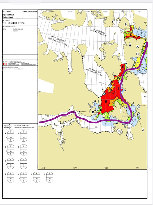
Judging by their GPS updates, they are still on track and have a great shot to complete the passage, if the ice cooperates. They are currently paddling toward Cambridge Bay, the halfway point of their journey. The sea ice is still blocking the passage from the western to the eastern part of the High Arctic, but it has plenty of time to clear before they reach that crucial area.
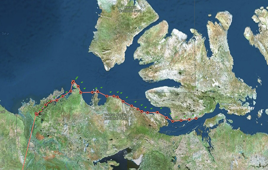
Rowing the other way
Meanwhile, on Aug. 2, an ocean rowing team led by Leven Brown set off from Cambridge Bay heading west. Brown led an attempt to row the passage in 2023, but the team aborted because of unstable fall weather. Mike Harding is the only returning crew member, while Stefan Hacker and Art Huseonica joined the 2024 team. The new team is not rowing the full passage. Instead, they continued where the last group called off their row.
They made a smooth start but anticipate rough weather soon.
"We expect to anchor in Wellington Bay for quite a few more days unless the weather forecasts should change dramatically," Stefan Hacker wrote on his blog today.
After 13 months and 3,900km, Justin Barbour has finished a monstrous journey from Hudson Bay in northeastern Canada to Cape Pine, the southernmost point on the island of Newfoundland.
"What a rip in the wilderness," Barbour wrote on his social media. "It was a journey that just kept on going. Canoe, snowshoe, bike, and hike through one of the planet's last great wild areas."
Better kit, better skills
This was a journey six years in the making. In 2018, Barbour's first attempt to cross Labrador from east to west ended when an early winter bogged him down. He vowed to return better kitted out and with more winter experience.
"I want to experience a full year in the northern wilderness," he told us in May 2023, just before setting off. "To experience the four seasons as the indigenous people of the area have. I felt good physically and mentally in 2018. I had enough summer experience, but my winter skills in the subarctic cold weren’t there yet."
The skills are there now. During the 13-month journey, Barbour canoed 1,150km, snowshoed 700km, backpacked/packrafted 550km, and cycled 1,500km.
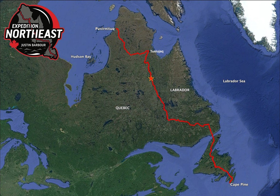
A change of plan
The long-distance cycle ride was not planned. After a break to see out the depths of winter, Barbour spent over a month manhauling through Labrador's rugged interior before opting to turn back to the Trans-Labrador Highway. Spring had arrived, and thawing rivers removed his "river roadway for tobogganing." Meanwhile, the lakes were still frozen, making canoeing impossible.
In the end, Barbour opted to retrace his steps to the highway and bike all the way to Labrador's south coast. "Being too restless to wait a month for lakes to ice out enough for a canoe, I adapted," Barbour wrote at the time. "Pedaling in-between seasons kept the momentum going and the expedition close to on schedule."
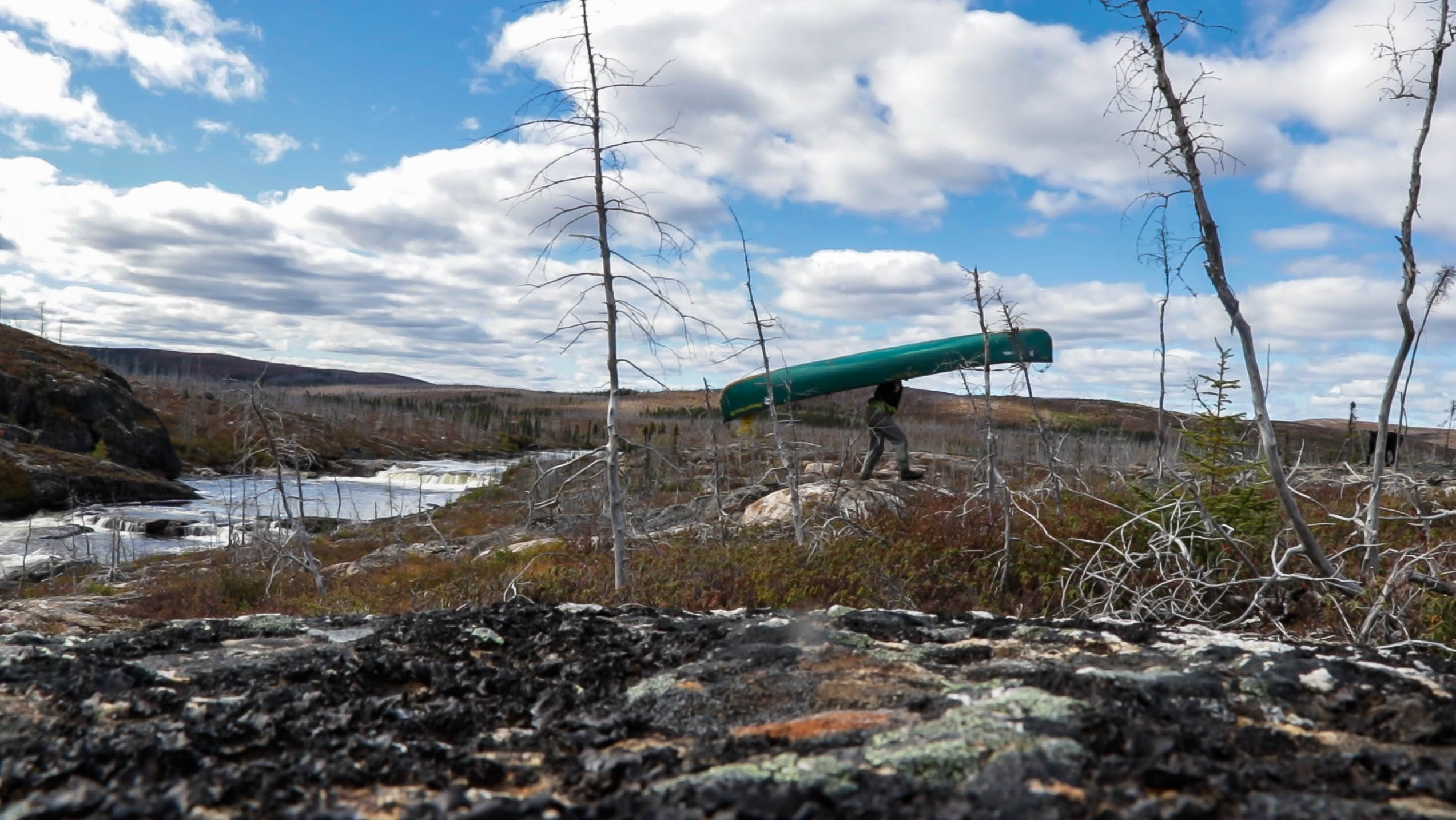
The final leg of his journey involved hiking and packrafting south through Newfoundland with his dog Saku. It also featured a close encounter with a black bear. "Close call for Saku with bear and cubs," Barbour wrote, with roughly 240km to go to Cape Pine.
Barbour arrived at Cape Pine on July 22 after 372 days spent almost entirely in the wilderness.
"With youth-like giddiness, I look forward to sharing the full story. Four seasons of travel living with nature's rhythms, mostly alone," he posted.
It's been a bumpy start, but Canadians Simon Carrier and Maxime Geoffroy have set off to kayak the Northwest Passage.
The pair planned a roughly 3,000km kayak journey from Tuktoyaktuk to Pond Inlet but needed to complete an equally long road trip from Edmonton before starting. The car journey went smoothly until on July 5, with a fair distance remaining, they found the Mackenzie River ferry out of order.
It was unclear when the boat might be repaired. This left them with three options. They could wait indefinitely for the ferry, begin their adventure by kayak from the ferry terminal (adding a disheartening 300km of kayaking to their already formidable distance), or kayak across the river to the ferry drop-off point and hope for another lift from there.
They eventually opted for the latter and were fortunate to find someone waiting to cross the other way by car. With the ferry non-operational, the driver had time to kill and gave them a lift to Eskimo Lake, nearer the mouth of the Mackenzie River and closer to their starting point at Tuktoyaktuk.

Finally on the water
After spending a night on the shores of Eskimo Lake, they finally began paddling on July 7. They are carrying 40 days of food and will pick up more supplies in Cambridge Bay (about halfway through their journey).
Some summers, sea ice still blocks the Northwest Passage. In 2018, for example, no vessel made it through. Even large ships had to turn back. In other years, the Passage has been wide open. Last year, West Hansen, Jeff Wueste, Eileen Visser, and Mark Agnew became the first to paddle the entire Passage in a single season.
Hansen's team paddled the opposite way, heading east to west. It will be interesting to see how Carrier and Geoffroy find conditions in the Passage.
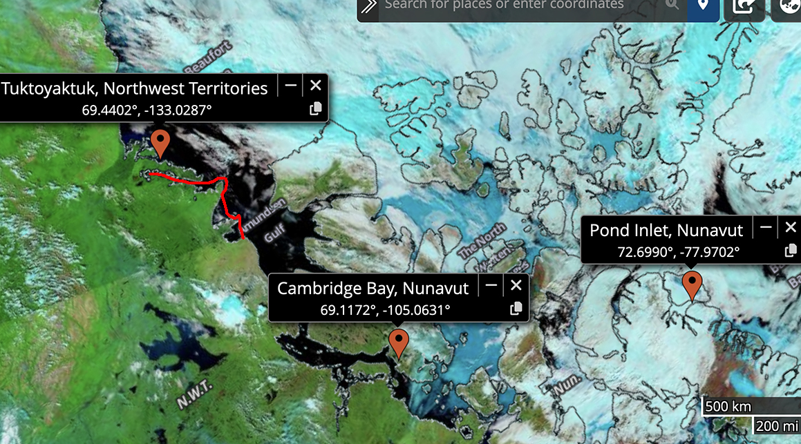
Speaking to Radio Canada, they reported no problems as they set off.
"Currently, the melting of the ice is going well, but sometimes with the winds and everything, [the ice] moves onto the edge of the coasts...but there are many tools that we can use to see how the ice moves, so we are well equipped [to handle that]," they said.
The duo anticipates the full journey will take 80 days. You can follow their GPS updates here.
Last year's Denali season featured extended periods of rough weather and a meager summit success rate of just over 30%. This year, things have been smoother, though not without drama. And one remarkable climb stood out.
More summits but still a tough year
Yesterday, the National Park Service (NPS) announced the end of the Denali climbing season. The season's final 38 climbers flew out on July 9. Many spent an unplanned extra week in the Kahiltna Base Camp because of bad weather that grounded flights.
The season's final stats look much healthier than last year. There were 974 registered climbers for Denali and 511 summits, giving a summit percentage of 52%. That summit percentage is significantly up from 2023 but way off the highs of 2022, when roughly 70% of registered climbers topped out.
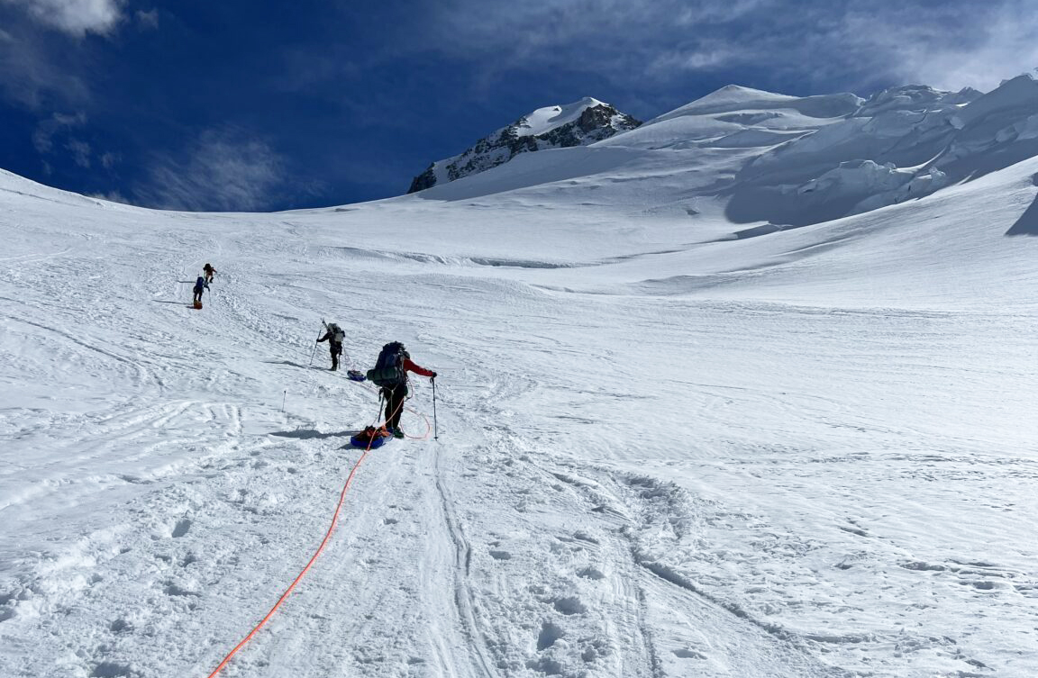
A first ascent of a complex link-up
In a climb not marked in Denali's 2024 statistics, Japanese climbers Subaru Takeda, Genya Takenaka, and Toranosuke Nagayama became the first team to link the West and East Kahiltna peaks with the Cassin Ridge.
Although they didn't top out, their route involved the entire south ridge of Denali and extended the usual Cassin Ridge route by a remarkable 7.5km, according to local media. After ascending West Kahiltna (3,913m) and East Kahiltna (4,098m), they then descended nearly 500m on an exposed knife-edge ridge to the usual Cassin Ridge starting point at Kahiltna Notch. The link-up took them 10 days in one continuous push.
Their remarkable climb almost didn't happen. In a turn of events straight out of a Disney movie, after two years of planning, the three climbers' gear was stolen after they arrived in Anchorage. The next day, Takeda posted a handwritten note asking for information about the theft in a local REI store. Soon after, the team was inundated with kind offers of gear loans from the Alaskan climbing community.
The climb was back on, and the trio certainly made the most of their second chance.
The route has attracted top Japanese mountaineers before. In 2008, Yuto Inoue and Tatsuro Yamada attempted the link-up, only to disappear. A year later the NPS discovered their bodies just above 6,000m.
In 2011, Yasuhiro Hanatani and Kei Taniguchi tried the same route but turned back.
Rescue partly succeeds
Besides this remarkable climb, the season saw several high-altitude medical emergencies, including a prolonged rescue near the summit.
Overwhelmed by strafing winds and clouds on the 6,190m peak, three Malaysian climbers had called for rescue via satellite message on May 28. One climber managed to descend to a lower camp, where he met with rescue services. The other two were stuck in a snow cave just below 6,000m in an area known as the Football Field.
After a period of unflyable weather, a helicopter pilot and climbing ranger extracted one surviving expedition member from the snow shelter on June 1. The operation used a short-haul rescue basket dangling from a rope line.
The surviving climber informed rescuers that his partner had died two days prior. The NPS announced that he died from "exposure and altitude illness."
Other recent medical emergencies include a guided client who came down with HAPE last week. The NPS evacuated the individual from a high camp.
In late June, a guide "suddenly and temporarily lost consciousness at elevation." The guide descended to 4,300m under his own power but was then evacuated to Talkeetna for tests.
Mount Foraker
Mount Foraker is never particularly busy and typically ends with a lower summit percentage than Denali. But this year's summit percentage is particularly grisly: 0%. Not one of the 27 registered climbers managed to summit.
Serial adventurer Frank Wolf has already knocked over two expeditions in 2024. In March, he paddled a sea kayak 500km around the Darien Gap between Panama and Colombia. In early June, he joined an all-Canadian team for a 325km sled trip to Baffin Island’s Clyde River region. Today, Wolf embarks on a significantly longer journey. He is paddling 1,400km from Yellowknife in Canada's Northwest Territories to Kugluktuk in the Northwest Passage.
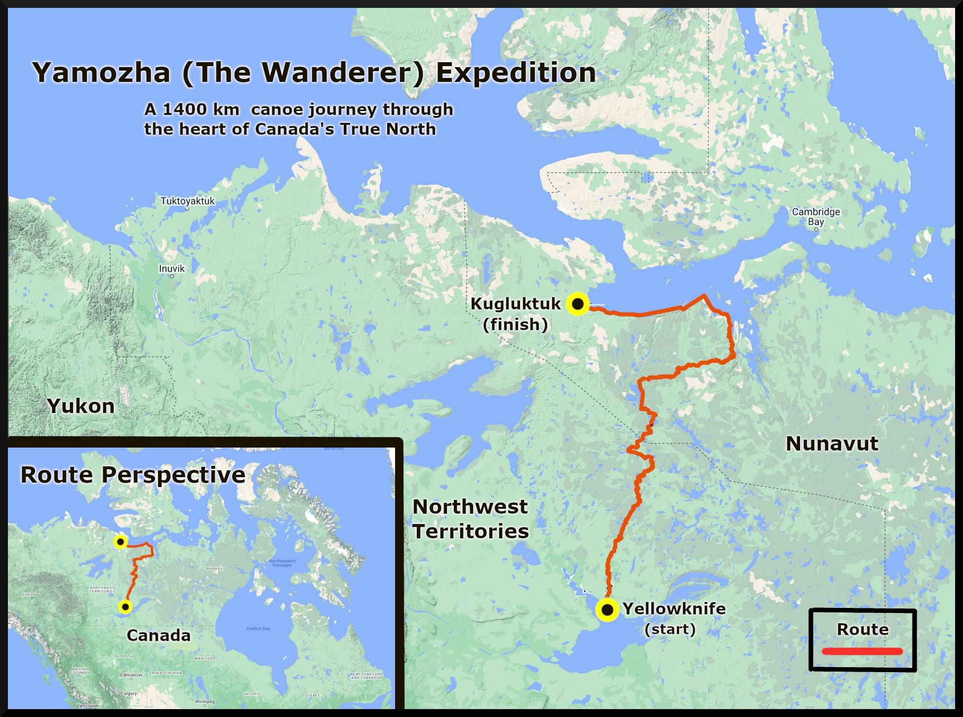
Filling in the wilderness
"Over the years, I've slowly been filling in the wilderness, drawing lines on the map of northern Canada," Wolf told ExplorersWeb, a couple of days before flying to Yellowknife. "This route is a fresh landscape for me. It's a rarely used route...but I realize that these routes have been traveled for thousands of years by the Dene people."
Inspired by those journeys, Wolf has christened the paddle the Yamozha Expedition. Yamozha means "traveler" or "wanderer" in the indigenous Dene language. Wolf won't be wandering alone. He is teaming up with Arturo Simondetti. It will be the pair's first expedition together.
At first glance, they seem an odd couple. Simondetti is just 23, while Wolf is in his mid-50s. But a chance meeting through their part-time work demolishing derelict boats was enough to convince Wolf that an expedition partnership would work.
"Grinding through these boats on 10-hour days showed me that he'd have the mentality to do this kind of journey," Wolf explained. "He's also a talented filmmaker...something of an old soul. We clicked straight away."
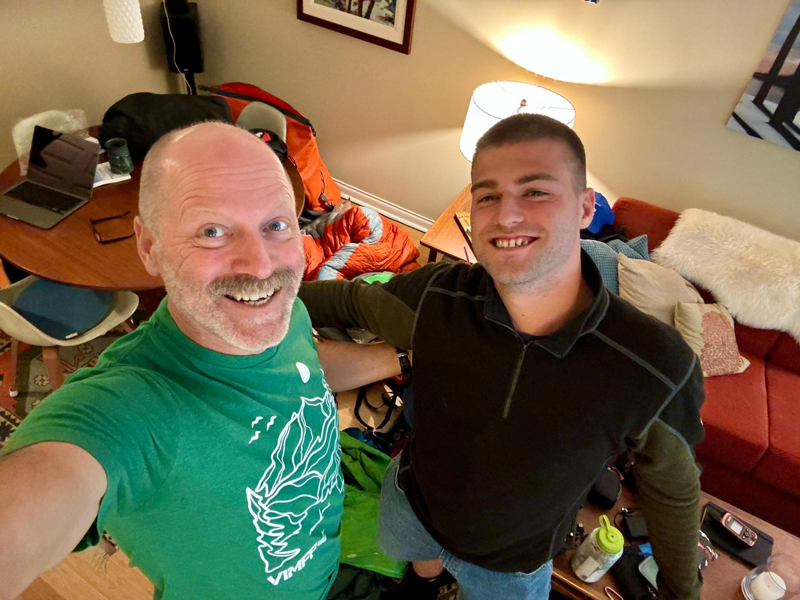
Paddling and portaging
Wolf thinks their route, which includes the Yellowknife River, Winter River, Coppermine River, and Hood River systems and ends with 325km of ocean paddling in the Arctic Ocean, should take around 33 days. They'll take 38 days of food, giving a slim buffer for windbound days.
The plan requires a 40km per day average, but Wolf thinks their daily totals will vary considerably.
"Early on, it'll be a physical challenge working upstream on the Yellowknife River. With all the food, we'll be carrying the most weight, and water levels are a bit lower this year. There will be some challenging portaging, dragging, grinding...Here, we might only average 20km each day," he said. "But once we're on the Hood and the Coppermine, we should move pretty good."
With roughly 10 hours on the move each day, Simondetti will shoot footage for a film as they go. Wolf believes that's for the best.
"Shoot when it's hard or there's no point," he says. "There's no point doing a film if it's just lunchtime in campsites. You've got to get the good stuff in between."
You can follow the Wolf and Simondetti's progress via their Garmin InReach here.
Nicolas Roulx and Catherine Chagnon are now nine weeks into their latest mammoth trip through the Canadian North. After a forced route change and a grueling paddle against the current on the Mackenzie River, they are now making their way across Great Slave Lake.
Their current route is part of a 2,800km canoe journey that comprises the most difficult section of their 6,500km west-to-east epic through Canada.

A tight schedule
In our last update, we reported on a change of route. At the start of their paddling section, they discovered that the Little Nahanni River was still frozen. Because the team has to keep to a tight schedule (with members joining and leaving at specific points on specific dates), they didn't have time to wait for it to thaw. Instead, they took to the Flat River with friends Mathieu Beland and Guillaume Moreau.
"We didn't do much research on the Flat River. We paddled it for about a week, and fortunately, it was a little shorter than the Little Nahanni. This gave us a natural time advantage of a few days. We also paddled very, very fast," Roulx told ExplorersWeb.
From the Flat River, they moved on to the Nahanni, then the Liard, which empties into the Mackenzie River. There, they struggled upstream for roughly 350km. Though a large river, they encountered shallow water and battled headwinds, making for a tough stretch.
"But we knew that the two other legs of our planned canoe route would be very hard too, so we were determined to get ahead of schedule, and it worked," Roulx said.
Their timing turned out to be perfect. As they approached Great Slave Lake at the end of the Mackenzie River, there were still big chunks of ice around. "We couldn't have arrived even a week earlier," Roulx explained.
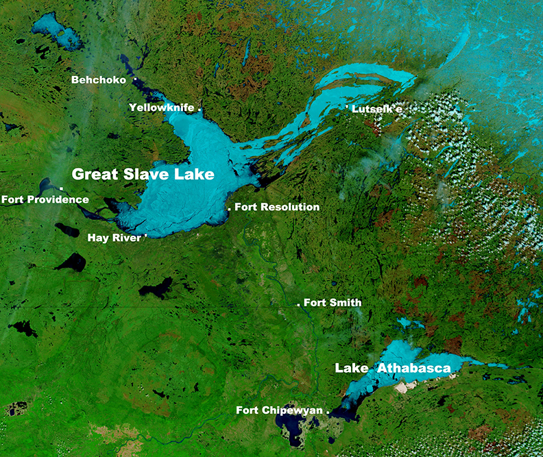
Great Slave Lake
Having successfully dodged the ice, the foursome arrived at the community of Hay River on the southern shore of Great Slave Lake on June 6. There, the team expanded to six with the addition of Dominic Roulx (Nicolas Roulx's brother) and Laurence Garceau (Nicolas Roulx's girlfriend).
In the two weeks since, they've been paddling across Great Slave Lake. After 400km, they arrived in the community of Lutselk’e early this week. They have averaged roughly 40km per day and only suffered four windbound days -- impressive for such a big lake. This allowed them to keep ahead of schedule for the third paddling leg, a 45-day stretch to Baker Lake that they began on June 25.
Big portages to come
Roulx suffered a nasty leg break shortly after the group's 2021 expedition and endured a long road to recovery. But so far, his leg hasn't caused any issues.
"For now, my leg is holding up very well," Roulx said. "Thus far, it has mostly been an upper body challenge, but the real challenge will be in the next six weeks. This section of the canoe trip will be hard on the lower body because we'll have so many portages. Lots of elevation, hilly...it'll be very rough."
Nicolas Roulx and Catherine Chagnon have completed the cycling section of their six-month, 6,500km west-to-east journey through Canada. The section went smoothly until they approached the entrance to the Little Nahanni River. Just under 100km short of their entry point, they found the road blocked by mud and snow. They also discovered the river was still frozen — not ideal for paddling.
Friends Mathieu Beland and Guillaume Moreau have joined them for the upcoming 2,800km canoe section. However, the frozen Little Nahanni necessitated a change of plan. They would take the "rarely frequented" Flat River to join the Nahanni.
"A rather rough start, the river getting rocky and crowded, quickly gave way to smoother days," they wrote in a recent update.
Ahead of schedule
Last week, they joined the Nahanni. It was a stressful transition; the river was flooded, with plenty of sediment and "muddy, ugly water." The team covered 200km on the Nahanni, passing through three massive canyons, before moving to the Liard River.
The team has strict time constraints because of the logistical complications involved with different team members joining for various sections of the trip. Keeping a few days ahead of schedule is vital so the team puts in long days, paddling 10-11 hours and covering around 60km.
Nepal’s Solukhumbu isn't all crowds and helicopters. Away from the Everest Base Camp trail, it still feels suitably wild. There are alpine mammals, alleged Yeti sightings, and perhaps the world's greatest long-distance hiking route, The Great Himalaya Trail (GHT).
You can catch up with Part I of my trip with World Expeditions here.
Gokyo Ri
Above the village of Gokyo, from Gokyo Ri, you get perhaps the best view of Everest without climbing a major peak. The trek up is brief but unrelenting, a one to three-hour slog depending on your fitness, ascending from 4,750m to 5,357m.
Heading up to catch the dawn, I saw a sherpa guide carrying up an exhausted (at a guess) 12-year-old and a mother trying to coax a child onward who could not have been more than five. A handful of trekkers seemed to be struggling with the altitude. Later, a helicopter arrived to airlift out a trekker who had fallen on the descent.
At the top, the sun rose directly over Everest and Lhotse. To the north, Cho Oyu feels close enough to touch.
Renjo La
The next day involved trekking back up to roughly the same altitude, the 5,360m Renjo La. The third pass of the Three Passes route, it’s a spectacular day. We were lucky with the weather. It had snowed the previous night but most of it had melted by the time we were climbing the steepest sections.
Just below the saddle of the pass, we stopped for lunch. Having now merged our small group with the three Australian trekkers hiking the full 150+ day GHT with World Expeditions, our team was substantial and felt like a major expedition. A flat area without snow quickly transformed into a makeshift kitchen, where vegetables were diced and the ubiquitous Nepali black tea brewed.
The food during the tour was surprisingly varied. I expected to survive on a diet of almost exclusively dhal bhat (dhal and rice) but had been treated to chapatis, tuna, salami, spaghetti, and even pizza during our trek. Now, at well over 5,000m, we were served a three-course meal including a starter soup, curry, and fresh fruit for dessert.
After digesting, we packed up and marched off, the two ultra-fit French Canadians leading the way. The three Australians, Roger, Mal, and Allan, brought up the rear with a second guide. Their mammoth trek necessitated a slow and steady approach. A third of the way through their traverse, their endurance was impressive.
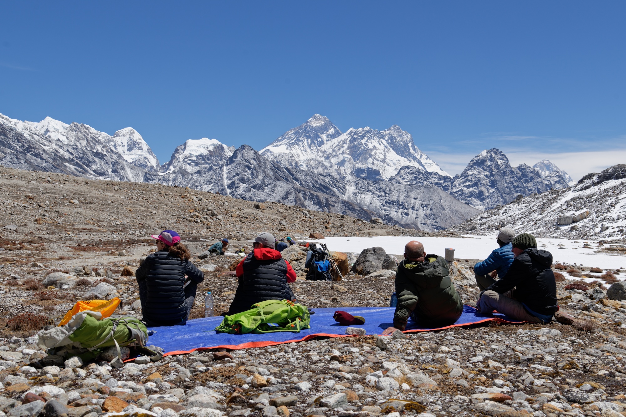
New friends
I had assumed they were friends from home, but they hadn't known each other before meeting in Kathmandu at the start of their trek. Nearly two months later, they had settled into an easy camaraderie. With the youngest 57 and the oldest 68, the trio must be on the far right of the fitness bell curve for their age. Nursing a few bumps and bruises and quite a few kilograms lighter, they'd already completed arguably the hardest sections of the GHT.
"We signed up looking for an adventure, and we certainly found it," Rodger told me in Gokyo, describing some of the 6,000m+ technical passes they'd left in their wake. As they continue further west they hope to encounter less snow and ice as Nepal transitions to the monsoon season and they drop to slightly lower elevations.
The rest of the climb to the top of Renjo La is steep but not difficult, bar the usual shortness of breath at altitude. Though the route is much longer, it feels less relentless than Gokyo Ri. At the top, the pass drops precipitously to another alpine lake in the northern valley. Behind us, we grab our last views of Everest.
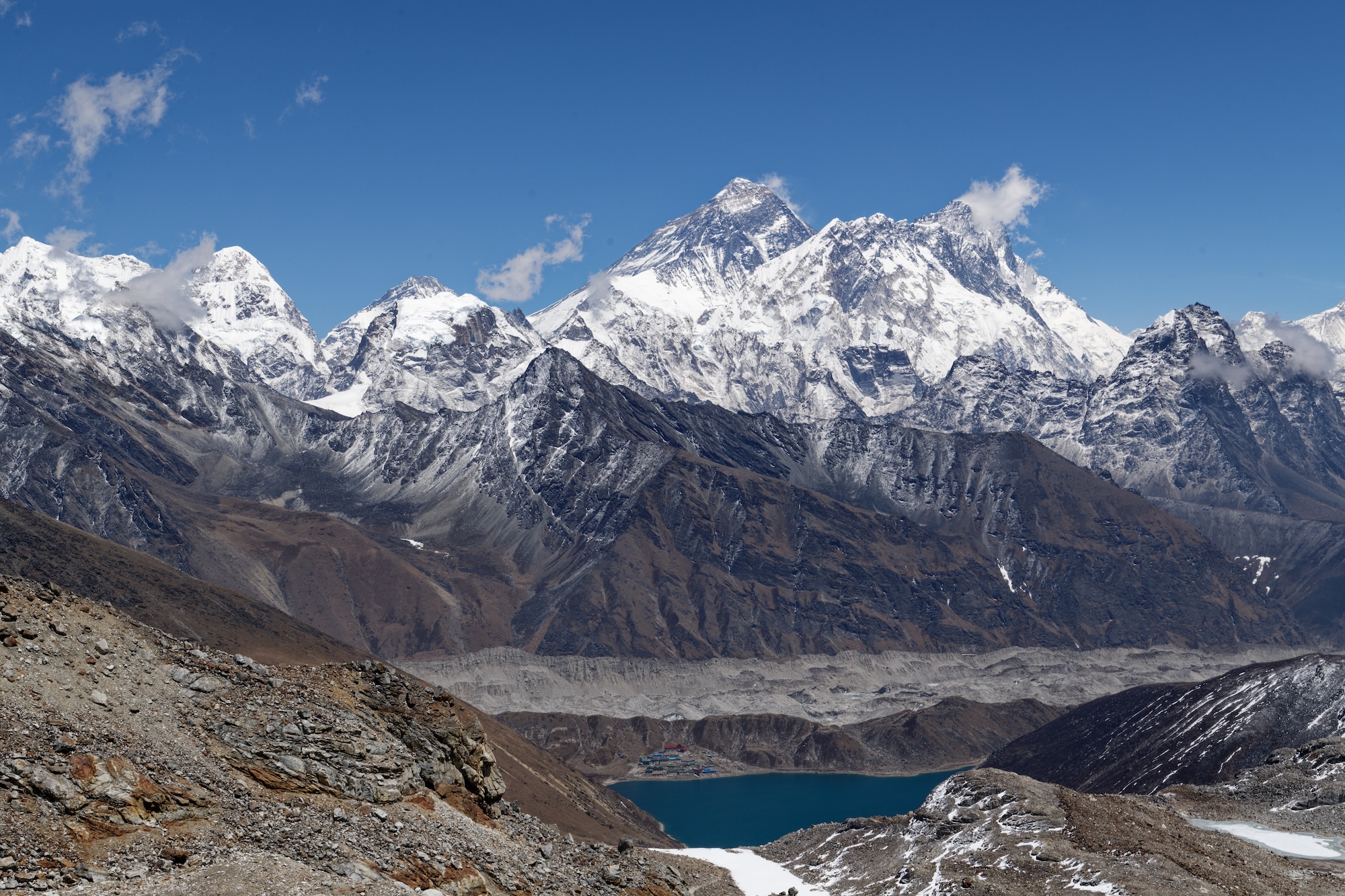
Recently, local communities banded together to construct stone steps into the valley, making ropes unnecessary and speeding our descent to a campsite further down.
The rest of the day served a dramatic change of scenery, resembling Tibet more closely than Nepal. After the steep stone steps, we followed the valley down over jumbled rock, then ice, and finally onto sand. After the lung-busting high-altitude pass, it felt like we'd washed up on some distant shore, the sand an incongruous sight juxtaposed against the snow-capped peaks.
Onto the Great Himalaya Trail
After a cold night camping, it was a long but relaxed walk through tiny Sherpa villages to Thame the next day. Thame is famous for its ancient monastery and as the childhood home of Tenzing Norgay. By the time we arrived in the early afternoon, clouds and mist had already swallowed the village. From here, I continued down the next day, completing a loop back through Namche Bazaar to Lukla to fly out.
The rest of my group continued on. The team hiked off to cross the almost 6,000m Tashi Labsta pass into Rolwaling to make a long, steady 10-day descent back toward the lowlands of the terai. There, the French Canadians planned to head home while the Australians would enjoy a (extremely brief) rest in Kathmandu to resupply before continuing with the GHT. Their six-month odyssey includes a further 100 days of hiking.
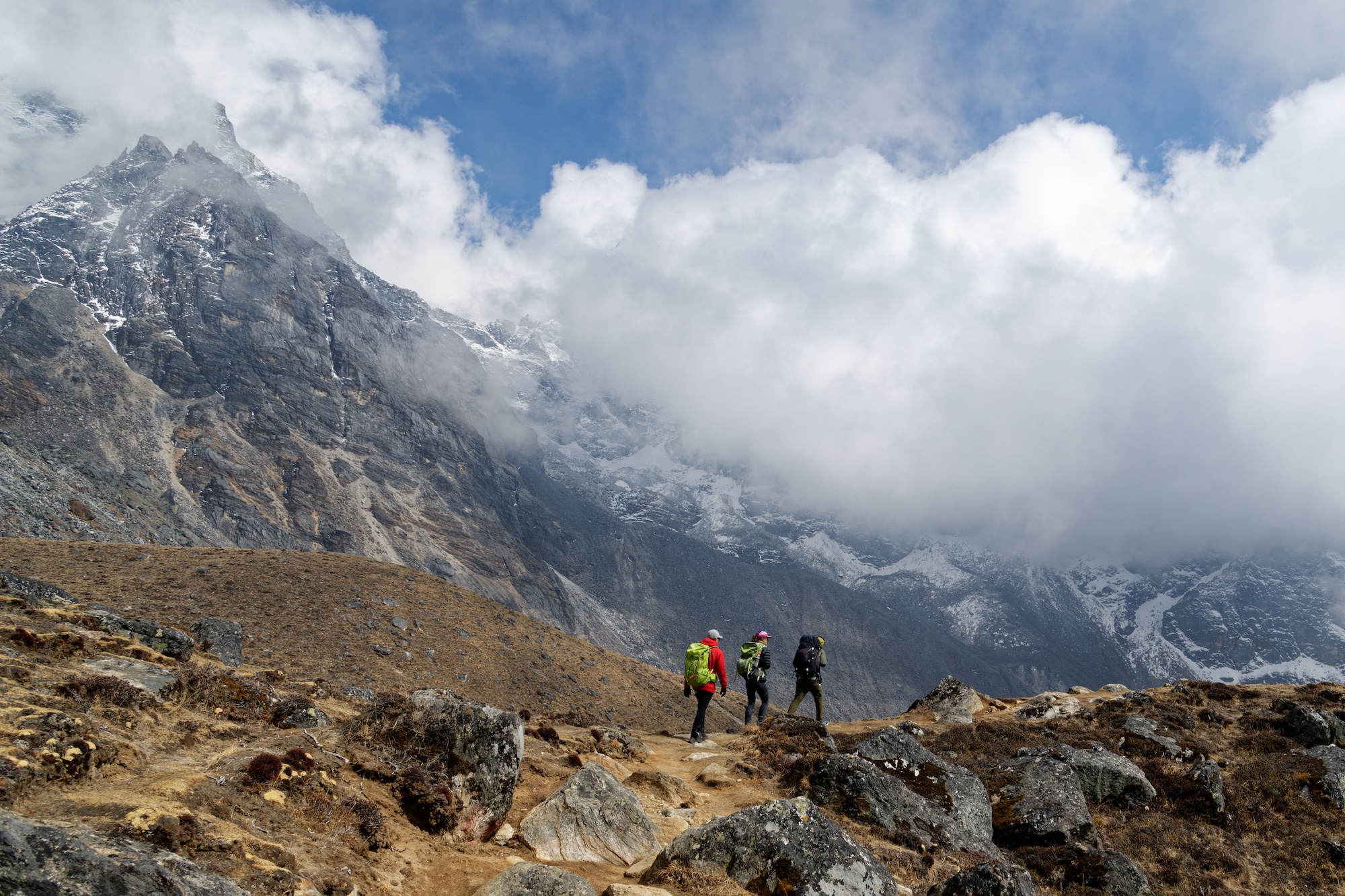
Before entering the Solukhumbu area, the Aussies hadn’t seen another foreigner in three weeks. In Rolwaling, they were unlikely to see one again for another 10 days.
Attractive places will always be busy, and the buzz of helicopters around Lukla and Namche Bazaar can grate after a few days, but there's still solitude to be found in the high Himalaya. Nowhere guarantees an escape from the over eight billion people on our planet and journeys beyond Everest Base Camp might take more time and commitment, but the options are there. Retirement has never looked so tempting.
Almost a year ago, in June 2023, Justin Barbour set out to canoe, snowshoe, and trek 3,800km from Hudson Bay in northeastern Canada down to the southernmost point on the island of Newfoundland. He wanted to finish in a year and has mostly stayed on schedule, despite some setbacks and a recent route change.
We last covered Barbour in early January when he exited the canvas tent in northern Quebec to hit the trail again. He'd stayed in place for a few weeks until winter froze the creeks, lakes, and rivers, making travel possible again.
Strapping on his snowshoes and dragging a traditional toboggan, he set off again on January 4. Heading south, he covered 207km over the next 38 days, eventually arriving at the small community of Schefferville.
Extreme cold and plenty of snow
From Schefferville, he continued across the border into Newfoundland and Labrador. Before he set off, Barbour told us that this manhauling stage might be the toughest section of the entire route.
From his occasional updates, his prediction looks accurate. Barbour reported extreme cold, with temperatures as low as -42°C, and some stormy weather.
"[I've been] blasted with several major snow storms...and nearly lost the tent to a sudden...wind squall," he wrote in mid-February.
A month later, in mid-March, he took a break from Labrador's interior. "After 230km in 22 days from Schefferville, I dragged the ol' sled out to the Trans-Labrador Highway on Friday, just west of Churchill Falls," Barbour wrote.
There, he reunited with his wife for the first time in four months, ending the second half of his expedition's winter leg.
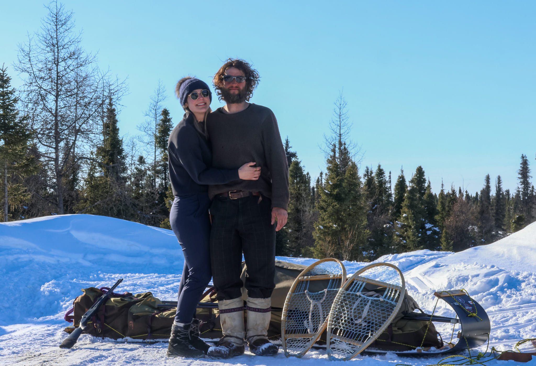
After a few days off Barbour was back in his snowshoes and marching south-east. "Atikonak Lake it is. Big Land skies! 424km to next goal. Tricky route ahead as wilderness tightens," he wrote in a brief GPS update on March 27. His next check-in, on April 10, suggested things might be getting tricky: "Little Mecatina River now. But nature is heating up."
Swapping out the snowshoes
Next came a surprise announcement of a major change of plan. Barbour had doubled back to the highway and traded in his snowshoes and sled for a bicycle.
"Been interesting times folks! Just solo bikepacked 1,150km across Trans-Labrador Highway...there's a longer grind of a story to it. But in brief, spring struck hard, my river roadway for tobogganing burst open, and being too restless to wait a month for lakes to ice out enough for a canoe, I adapted. Pedaling in-between seasons kept momentum going and the expedition close to on schedule," Barbour wrote on Facebook.
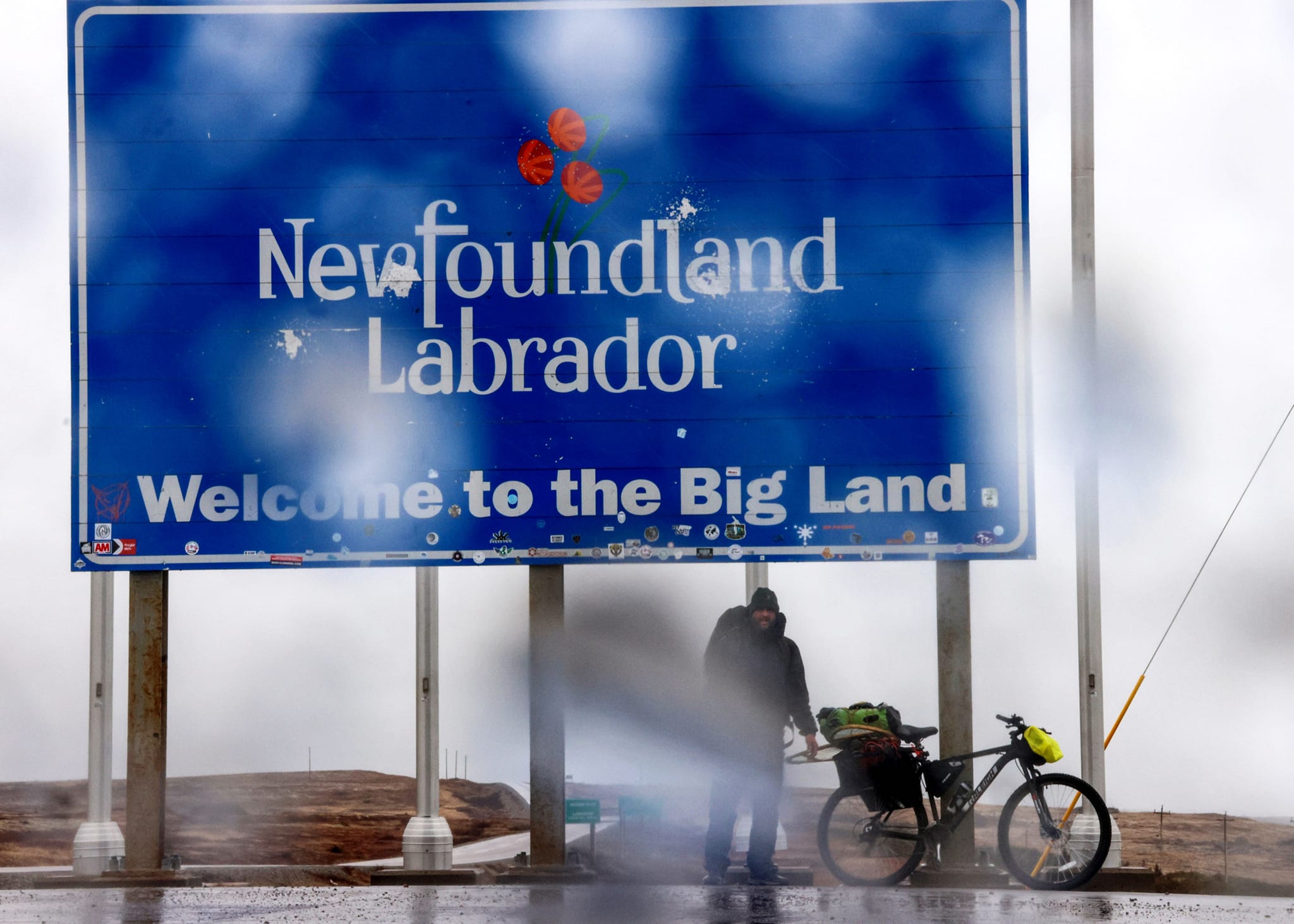
Now reunited with his dog Saku, Barbour's next stretch will involve backpacking through the woods of Newfoundland's Great Northern Peninsula for 300km. He has roughly 1,000km remaining to his endpoint on Newfoundland's southern coast. He hopes to arrive by July 6.
You might be forgiven for thinking that Everest and its surrounds are a circus of helicopters and crowds. But after 16 days hiking a medley of trails, it’s obvious to me that it remains a spectacular place to visit. Although the region gets 80,000 tourists a year and you are never far from another human, you can still find solitude amid the world’s highest peaks.
From the terai to the mountains
It had been eight years since my last trip to Nepal. That was a very different journey, focused on the sweaty lowlands. During that trip, my only experience of the high Himalaya came through a grubby window on flights between Kathmandu and Nepalgunj. I watched the snow-capped peaks appear suddenly from the near-constant Kathmandu haze as we climbed, then disappear again when we approached Nepalgunj, a dusty industrial-feeling terai town.
From there, I muddled my way via rammed local buses blaring Hindi hits to Bardia National Park. I spent a week tracking tigers on foot and occasionally making panicked ascents of nearby trees.
This time, I headed into the mountains with a group from World Expeditions. We were hiking a combination of Everest Base Camp, Gokyo, and Three Passes routes. This is one section of a much larger whole that World Expeditions presents. Our Everest and Rolwaling Traverse is part three of the enormous Great Himalaya Trail.
Arriving in Kathmandu from Saigon, it was obvious that neither the haze nor the traffic had improved. Kathmandu butts up against the Himalaya, and you should be able to view the mountains from the city. But Kathmandu sits in a bowl-like depression. Industrial fumes mingle with smoke from farmers burning their fields. The cocktail collects over the city, blotting out the mountains except for brief glimpses after heavy rain.
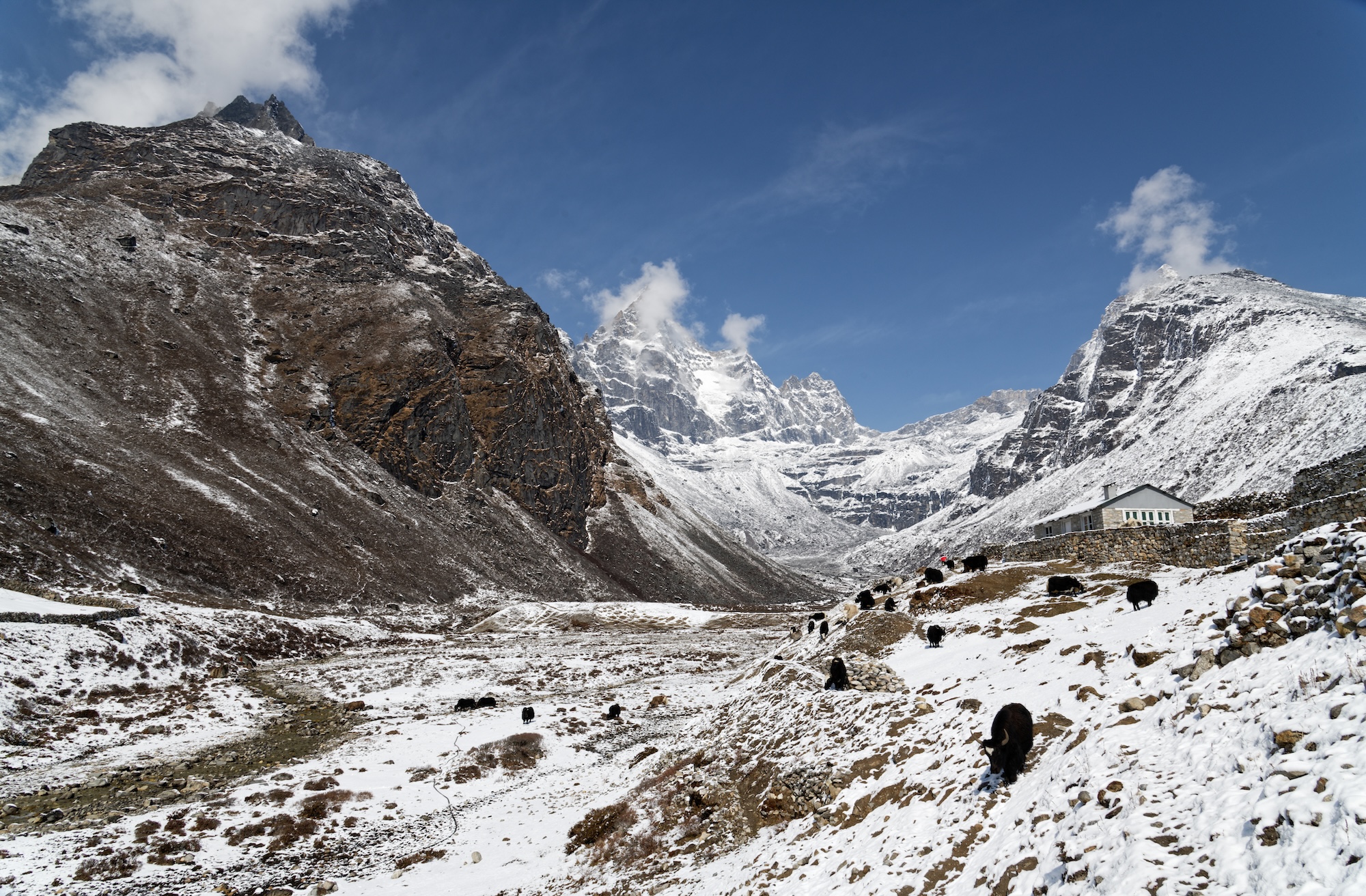
Cheerful chaos
In recent years, flights to Lukla have operated from Ramechap Airport rather than Kathmandu. Five hours outside the city, a night in Ramechap is an anti-climactic start to a Himalayan hike. A huddle of houses on a river, the liveliest place in town is the small airstrip.
At first glance, particularly through bleary, early morning eyes, the airport is utter chaos. Guides rush around collecting tickets and greeting friends, huge expedition duffels litter the ground, and an enormous crowd of trekkers and climbers mill about in similar-looking clothing, trying to work out where to go.
But there is a method to the madness, and eventually, I was bundled into a Twin Otter with other hikers. The strained sound of the small plane’s engine is familiar to many expeditioners, but it always gets off the ground all right, despite sounding like an overtaxed lawnmower.
The short flight to Lukla brought us out of the terai’s smog. We skidded to a halt on Tenzing-Hillary Airport’s iconic runway, which looks like you’re flying straight into the side of a mountain.
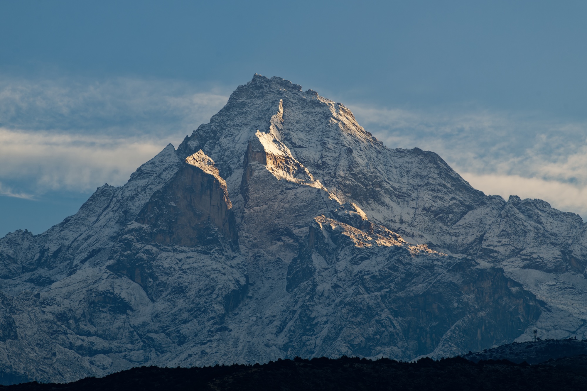
Lukla and the route to Everest
Hiking out of Lukla, the scenery is instantly spectacular. Above the town, Numbur Peak scrapes 7,000m, and ahead, the Dhudh Kosi snakes down the valley. Dhudh Kosi means “milk river” in Hindi and the rapids froth bright white among the meltwater blue.
My group consisted of a French-Canadian couple and our guide Bikash. At the end of each day's hiking, we'd see the other members of our team, our cook Karna, and, depending on our day's pace, perhaps our porters arriving with the cooking and camping equipment. Later, in Gokyo, we met up with three Australians hiking the full Great Himalaya Trail with World Expeditions (for six months!).
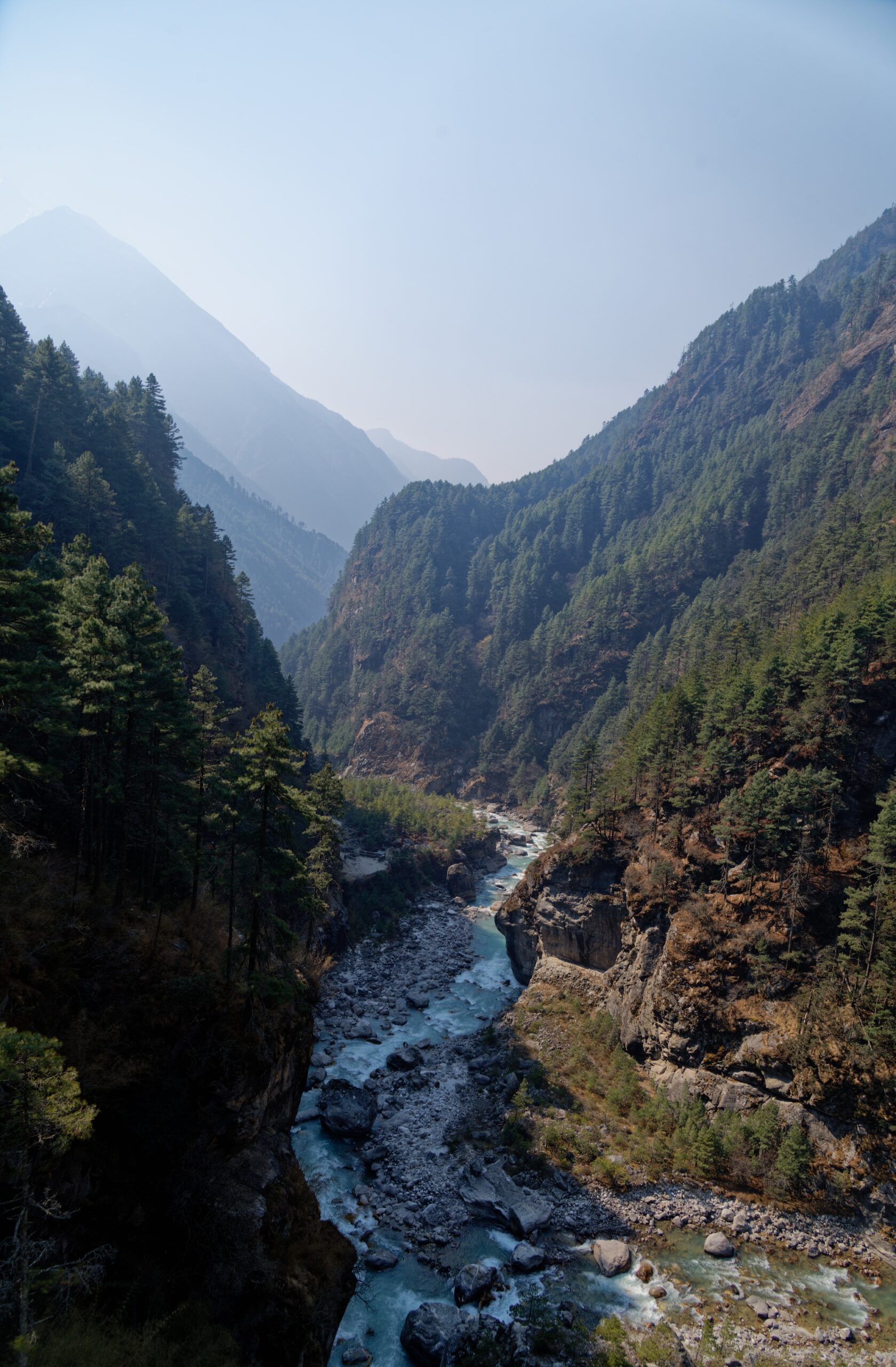
The first few days are necessarily slow to allow for acclimatization. Lukla is already over 2,800m, and you slowly climb higher as you meander through the villages to Namche Bazaar. The route is pretty busy with hiking groups, porters (some ferrying goods between villages, others attached to climbing or trekking expeditions), and beasts of burden: donkeys, horses, and chauri gai -- hybrid yak-cows that fare better than yaks at lower elevations.
The government sets a standard weight allowance of 35kg for porters, and World Expeditions limits their porters to 30kg, but locals often carry substantially heavier loads. They are paid based on the weight they carry, and their loads often look eye-watering.
100kg packs
Of particular note are the porters moving cases of beer. According to our guide, their loads can approach 100kg. Others tote huge piles of timber for building. Whatever the cargo, it is balanced on the back and secured by a tump line around the head (locally called a namlo). Porters with the heaviest loads use a T-shaped stick to support the haul when they rest, wedging it under their consignment like a camping stool.
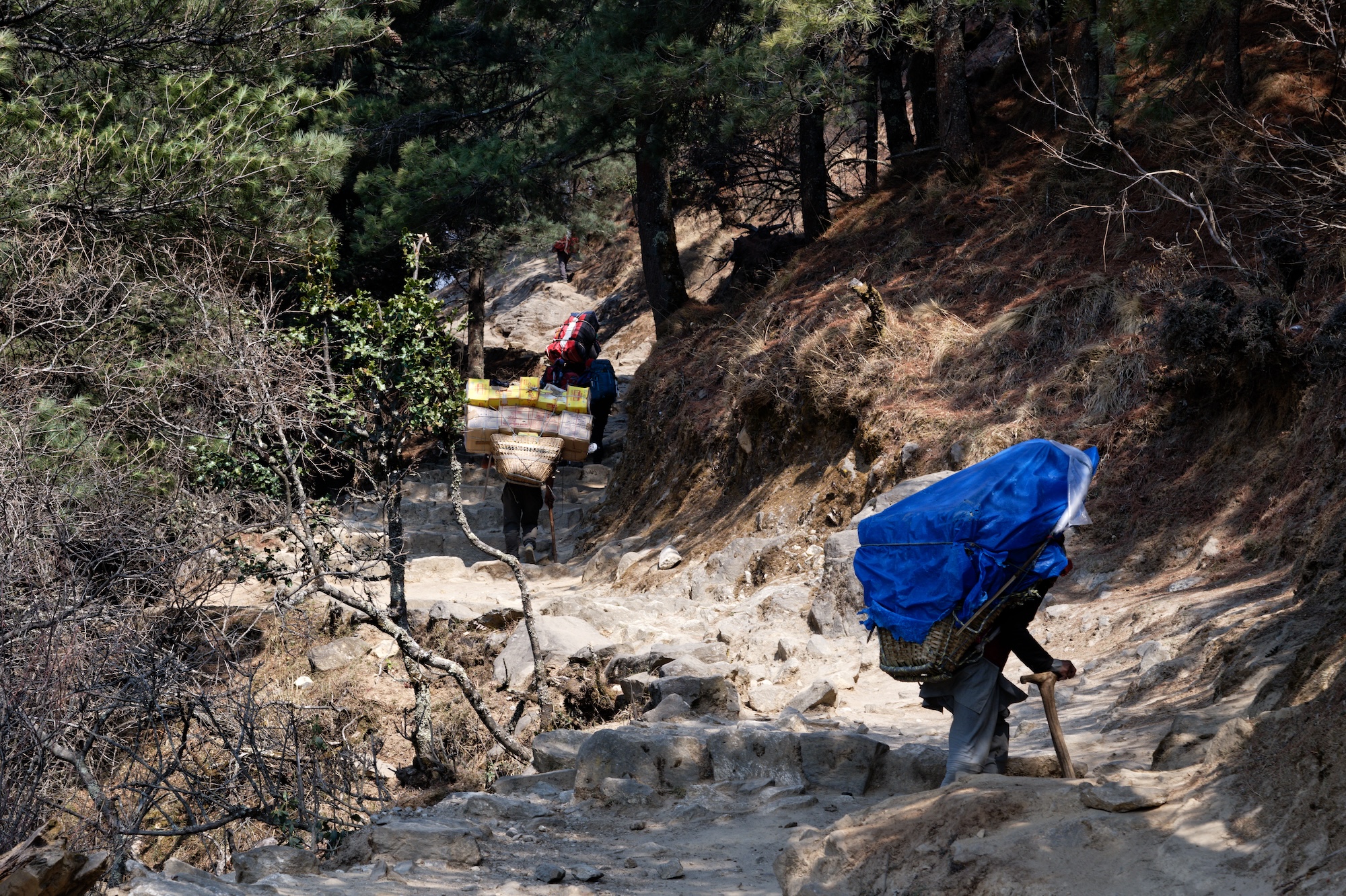
Unsurprisingly, a 2005 study found that Nepalese porters are "the world's most efficient carriers." Their carrying method allows them to exert only half the energy Westerners use with heavy backpacks (when the load is more than half (60%) of their body weight). It's impressive but remains grueling and sometimes dangerous work.
This initial trail is now primarily used by groups heading to Everest Base Camp. It’s a wide, easy track, through villages that are now almost completely dedicated to tourism. There are beer gardens (including an Irish pub), bakeries, and countless teahouses.
Rhododendrons, Nepal’s national flower, dot the valley flanks and Buddhist prayers line the rocks, flags, and prayer wheels around every bend. Brown dippers and water redstarts flit along the river in pleasingly dense numbers and laughing thrushes chortle through the undergrowth right by the path, seemingly emboldened by the Buddhist populations' respect for life and the protection of Sagarmatha National Park.
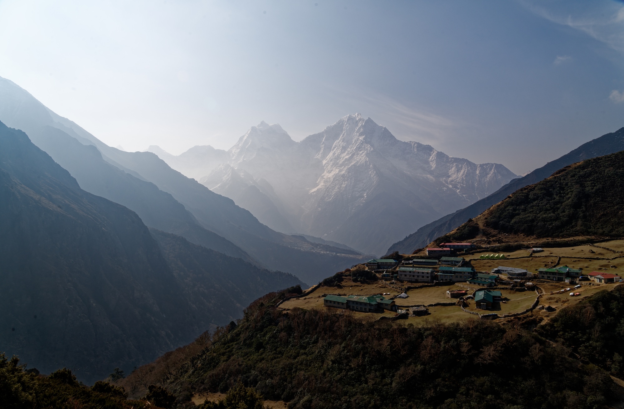
Acclimatizing and inching higher
After the village of Manjo, it is a steeper uphill grind to Namche Bazaar, crossing the Hilary Bridge (which appears to have a bungee jump under construction beneath it…) and then plodding up switchbacks while avoiding descending mule trains.
Namche Bazaar is an important acclimatization stop, and many hikers will spend two or three nights here at 3,440m. We stayed two nights, grabbing our first views of Everest and Lhotse from above town on our day off.
From Namche Bazaar, it is an up-and-down ("Nepali flat" as many guides are fond of joking) day to Phortse at 3,950m. Surrounded by birch forest, this is the only place I spotted mammals during the hike. Alpine musk deer and Himalayan tahr are both common. Allegedly, a fairly recent Yeti "sighting" took place in nearby Dole, but I see no evidence of a cryptid beyond a lone hirsute trekker.
Phortse is where we branch off from the Everest Base Camp route toward Gokyo. From here, foot traffic decreases significantly. There are still sporadic hikers, but the huge tour groups disappear. An occasional passing yak replaces the mule trains.
The next few days, via Dole and Machermo, are easy but bring solid altitude gains. Hiking in the Himalaya is very different from what I’m used to elsewhere. Days are very short, both in terms of distance covered and time walking. The slow speed is designed to minimize the risk of altitude sickness. This proved particularly challenging for one of our group. A semi-professional marathon runner, Melanie was fresh off an eighth-place finish in the LA marathon and was used to a much more intense cardio workout.
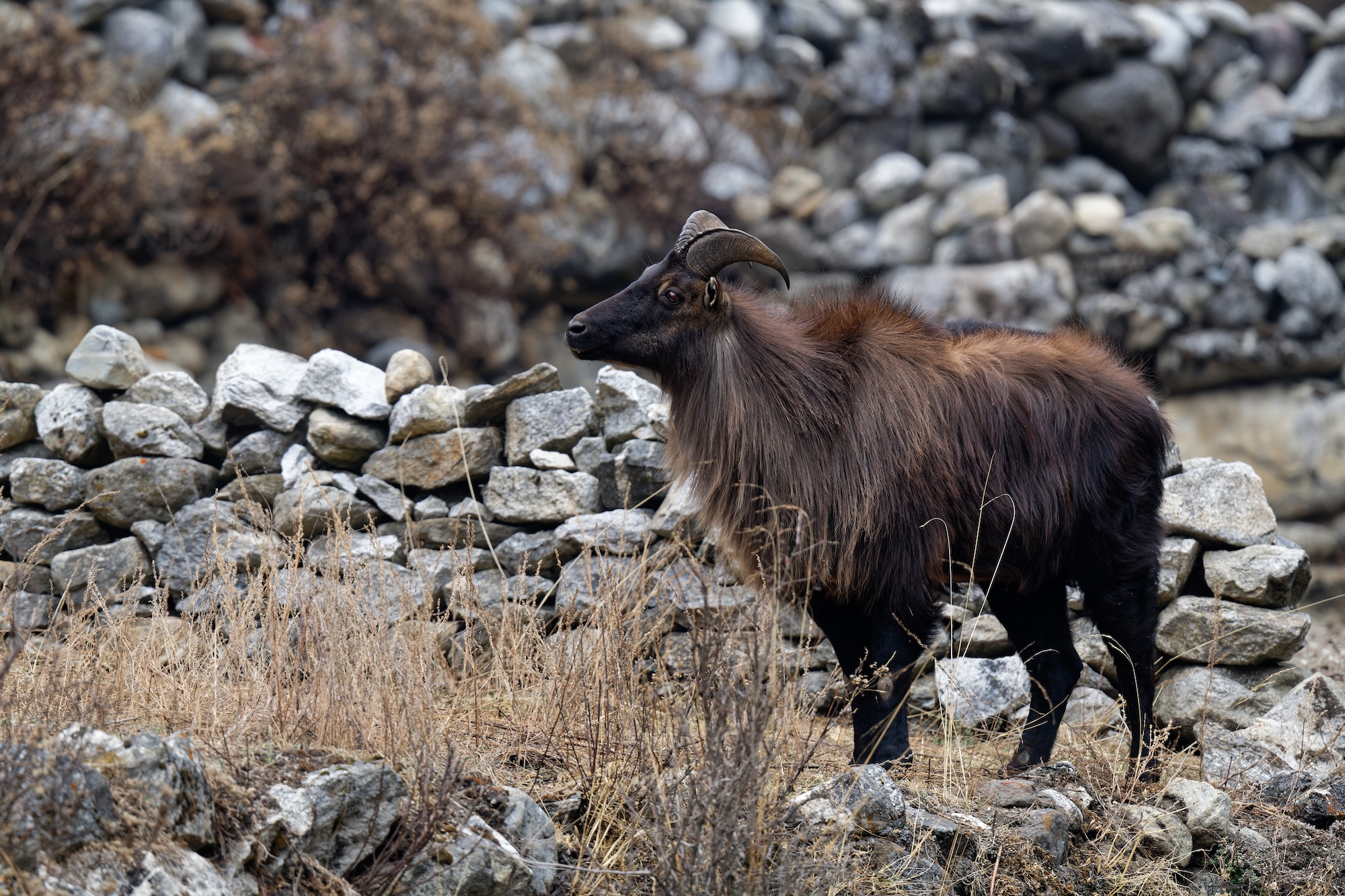
In the shadow of Cho Oyu
Leaving the tree line, we continued up the valley, steadily climbing toward Gokyo. Ahead, the monolithic Cho Oyu dominated the skyline, a huge block of snow and ice against the blue. To my untrained eye, it looked imposing but not incredibly technical. Looks can be deceiving. Four teams have tried Cho Oyu from the south in the last three years, and all four failed to summit.
Now well above 4,000m, most days started clear and sunny but usually clouded over in the early afternoon. We experienced snow flurries some evenings and nighttime temperatures plummeted. Even in teahouses, I now slept in my thermals. When camping, I was often in two or three layers. After eight years in Vietnam, I'm no longer adapted to the cold, and my wool beanie was now practically fused to my head, as much a part of me as my hair.
The trail flattened at around 4,700m and wound past two small alpine lakes, still partially frozen, their shores lined with stone chortens. A third lake, Dudh Pokhari, was much larger and ice-free. From the shore, a small rise hides Gokyo, a picturesque village sandwiched between the lake and the Ngozumba Glacier. At 36km, Ngozumba is the longest glacier in the Himalaya.
Editor's note: Part two of the journey will be published next week.
Nicolas Roulx and Catherine Chagnon have set off on their monster six-month, 6,500km west-to-east journey through Canada. The duo's entire trip will take place north of the 60th parallel.
Chagnon and Roulx had planned to set off by bicycle from near Beaver Creek on the Alaska-Yukon border on April 18 but left a few days later on April 21. By May 1, they had covered 900km along the Alaska Highway. As the pair transition to the dirt Nahanni Range Road, their 120km per day pace may slow. Camping as they go, they've had good weather and encountered some wildlife, but no grizzlies.
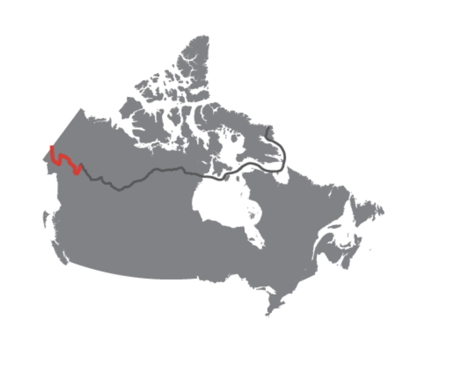
They will ride the dirt road for around a week before reaching the village of Tungsten. Here, they will meet friends Mathieu Beland and Guillaume Moreau. The foursome will then begin the meaty 2,800km canoe section of their expedition on the Nahanni River.
Will it be warm enough to paddle?
It will be interesting to see how much paddling they manage on the lakes and rivers of the Northwest Territories. Much of the route could still be frozen, though Roulx told ExplorersWeb they did not expect it to be a major problem before setting off.
"It’s an El Nino year, so it should be a little warmer," Roulx explained.
These opening few weeks are a vital warm-up for Roulx. He suffered a nasty accident not long after his 2021 Canada north-to-south expedition. He broke his leg while bouldering and has endured a long road to recovery. So far Roulx's knee is holding up well, though he does report "suffering from some knee pain, but nothing serious or abnormal."
Humans left Africa between 70,000 and 60,000 years ago, but our ancestors did not spread out across Eurasia for another 20,000 years. A new study addresses that huge gap in our understanding of early human migration.
It argues that the Persian plateau provided a "home away from home" for Homo sapiens during this time. And when conditions were right, they struck out from launching pad across Europe and Asia.
Colonization of Eurasia a complex scenario
Scientists have previously suggested a "hub" population was vital for later waves of migration. It was a "complex scenario, encompassing multiple expansions and local extinctions," the new study explains.
Previous studies did not address where this Hub population came from.
The authors used genetic, fossil, and archaeological findings to pinpoint it as the Persian (or Iranian) plateau. The region covers roughly 3,700,000 square kilometers across parts of modern-day Iran, Afghanistan, and Pakistan.
The region seems to have been more hospitable to large numbers of people than other potential staging areas. For 20,000 years, it was the cradle of civilization before the restless early humans began to fan out across Eurasia.
Bracketed by two ice ages, the Cambrian period produced some strange creatures. Among them were seafloor-dwelling predatory sandworms. Armed with a nasty collection of teeth and curved spines, they were seemingly straight out of the movie Dune, except they were only an inch or two long.
Now, a team of scientists has discovered a new species of these Selkirkia worms that existed 25 million years later than expected.
A conveyor belt of fangs and teeth
Selkirkia worms were a common predator roughly 500 million years ago during the Cambrian period.
"If you were a small invertebrate coming across them, it would have been your worst nightmare,” study co-author Karma Nanglu told the New York Times. "It’s like being engulfed by a conveyor belt of fangs and teeth."
The worms formed cone-shaped tubes around their bodies from material secreted by the worm. The tubes were likely defensive but may have become a hindrance when free-swimming predators emerged at the end of the Cambrian Explosion. It forced the worms to either evolve or go extinct.
A true survivor
The worms disappeared from the fossil record until Nanglu and his team stumbled on some interesting fossils stored in Harvard’s Museum of Comparative Zoology. While examining samples extracted from Morocco’s Fezouata Formation, they spotted some fossils that looked extremely similar to Selkirkia worms, only 25 million years out of place.
After analyzing the fossils, they determined this was a new species of Selkirkia worm. The team has named the species tsering, from the Tibetan for "long life." The discovery shows that these predatory worms survived the end of the Cambrian Explosion and well into the early Ordovician period. They were finally outcompeted in an increasingly diverse ocean ecosystem.
In early February, 70-year-old Peter Kaestner announced he had broken birdwatching's most mind-boggling record. He had just observed his 10,000th species.
Then shockingly, Kaestner discovered that he had been pipped to the post. Another birder, an almost complete unknown in the community until uploading a life list of some 9,000 species in October 2023, claimed to have spotted his 10,000th species just a few hours before.
Raised eyebrows
Birding is a hobby that people pursue in different ways. Those who track their sightings and search for rare birds, like Kaestner, are sometimes called "listers." Listers typically use websites like eBird or iGotTerra to track their sightings and "life lists." These public websites feature leaderboards that foster competition, but they don't do much to check the veracity of sightings. Largely, birders/listers operate on trust.
So when Jason Mann bulk uploaded his life list of over 9,000 birds and then rapidly accelerated toward the magical 10,000 threshold, it raised some eyebrows. While Kaestner was well known in the lister community, publicizing his findings online over many years, no one seemed to know Mann. When Mann announced he had seen his 10,000th species just a few hours before Kaestner, people understandably found it hard to believe.
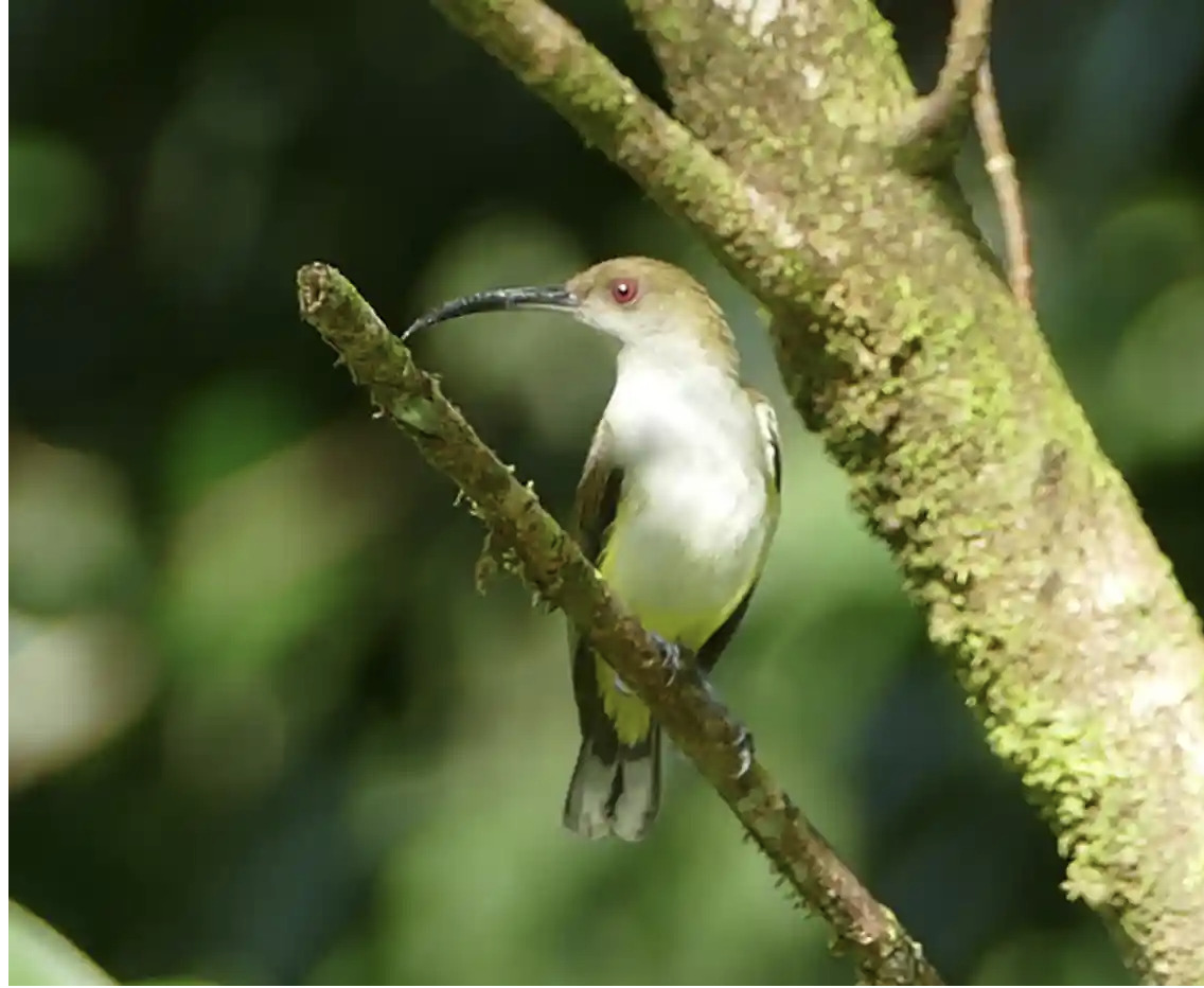
The online community began to examine both men's lists in-depth. A particularly spirited discussion broke out on the Bird Forum website. The thread is at over 430 posts and still going strong.
The luckiest birder in the world, or something fishy?
Perhaps inevitably, there were a few species on both men's lists that provoked skepticism. But Mann's list had by far the most questionable species. He had included some birds that people had not observed in decades, such as the New Caledonian Nightjar, a species seen only once, in 1939. Mann's list also had far less documentation to support each sighting when compared with Katesner's substantial online footprint over many years.
In light of a few inaccuracies spotted in his life list, Kaestner trimmed his list by a couple of species but remained above 10,000 as he continued to travel and bird watch.
The furor must have reached Mann, who eventually posted on Bird Forum and conceded defeat.
"Clearly, I made some errors when inputting my sightings into iGoTerra. New Caledonian Nightjar, for example. I'm not sure how that happened...[I] recognize that in haste there were a few oversights," Mann wrote. "I think it best to put my support behind Peter [Kaestner] as the first birder to 10,000."
However, Mann, an American doctor living in Hong Kong, stands by the majority of his list. At close to 10,000 birds, it would be a remarkable achievement, not least because of his obscurity in a close-knit community of "big listers."
The IOC World Bird List contains a total of 11,194 species, so both Mann and Kaestner's figures represent roughly 90% of the world's species.
Footage of a tiger clearing a stream in one massive bound has gone viral on Instagram and X.
Wildlife photographer Harshal Malvankar captured the short video of a lone tiger in the Sundarbans, the world's largest mangrove forest that straddles the border between India and Bangladesh.
Another photographer, Uday Agashe, captured an amazing photo of the roughly 200kg cat just as it launched. He then uploaded it to the international citizen-science app INaturalist.
Conservationists estimate that there are around 100 Bengal tigers in the Sundarbans. Sightings are fairly rare, partly because tigers avoid people, and partly because visibility within the mangrove forest is extremely restricted. The best bet for those hoping for a tiger sighting is to watch creeks and banks at the edge of the forest during low tide.
"Because of a rise in the count and density, tigers have to keep moving between islands to keep their territory intact. Tigers are very territorial. The increased movement results in more sightings," Justin Jones, the deputy field director of the Sundarban Tiger Reserve, told The Telegraph India.
Two years after (mostly) crossing Canada from north to south with Guillaume Moreau, Nicolas Roulx is ready for another mammoth Canadian crossing.
During their 2021 expedition, only Roulx and Moreau completed the full 7,600km journey, but a variety of friends joined them during sections. The latest expedition follows a similar framework. This time, Roulx and Catherine Chagnon will be the constants during a six-month, 6,500km west-to-east journey entirely north of the 60th parallel.
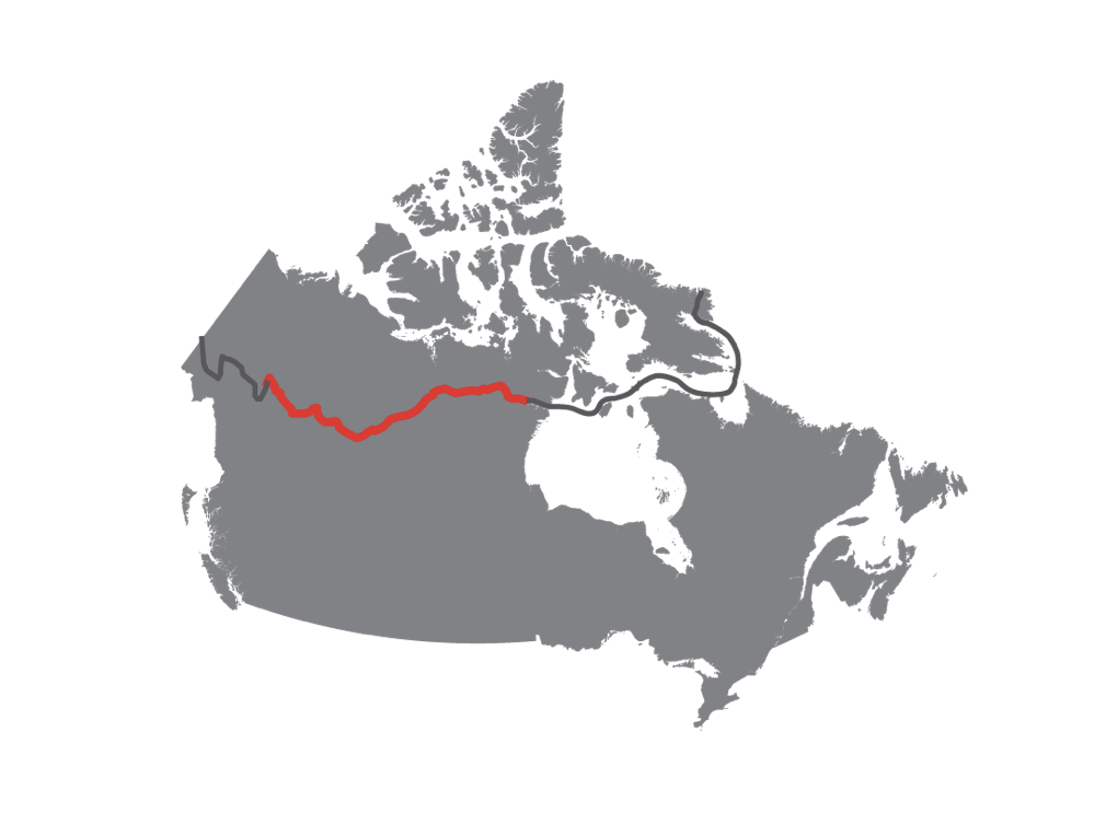
Cycling starts April 18
Chagnon was also involved in the 2021 journey. In fact, she effectively saved the expedition when team member Philippe Voghel-Robert unexpectedly left midway through the canoe section. At incredibly short notice, Chagnon (who is Moreau's girlfriend) flew out to Baker Lake and stepped in as their fourth paddler.
This time, the roles will reverse, with Chagnon aiming to complete the whole journey while Moreau will only join the canoe section. "I think we created a monster," Roulx joked when I spoke to him on the phone.
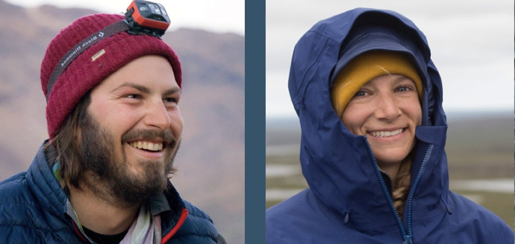
Chagnon and Roulx will set off from the Alaska-Yukon border on April 18 by bicycle. They will mainly cycle gravel roads, en route to the Northwest Territories. They hope to only be in the saddle for a couple of weeks, before switching to their preferred discipline: canoeing.
"I'm looking at the cycling section as a good warm-up," Roulx said. A warm-up is particularly important for Roulx, who suffered a nasty accident not long after the last expedition. He broke his leg while bouldering and has endured a long road to recovery.
A year on crutches
"I spent about a year on crutches and with a cane," said Roulx. "I had to learn to use my leg again. I still have some limitations and there's nerve damage in my left foot. I can't lift my foot up. I need a brace to walk and run. I know I'll probably have to spend the rest of my life with that brace. It's not that bad, it's just disappointing to be 30 years old and stuck with that."
As well as monitoring how Roulx's leg holds up, they'll need to watch out for bears. They are pedaling through grizzly territory just as they emerge from hibernation. Though they have some polar bear experience from 2021, grizzlies behave very differently.
In early May, they will reach the lakes of the Northwest Territories, where Moreau, Dominic Roulx (Nicolas' brother), and Laurence Garceau join them for various lengths of a three-month, 2,800km canoe journey.
The lakes might not have melted yet, which would require some of the "experimental canoeing" from previous expeditions. That suggests lots of portaging, dragging canoes over ice, and frustratingly little paddling.
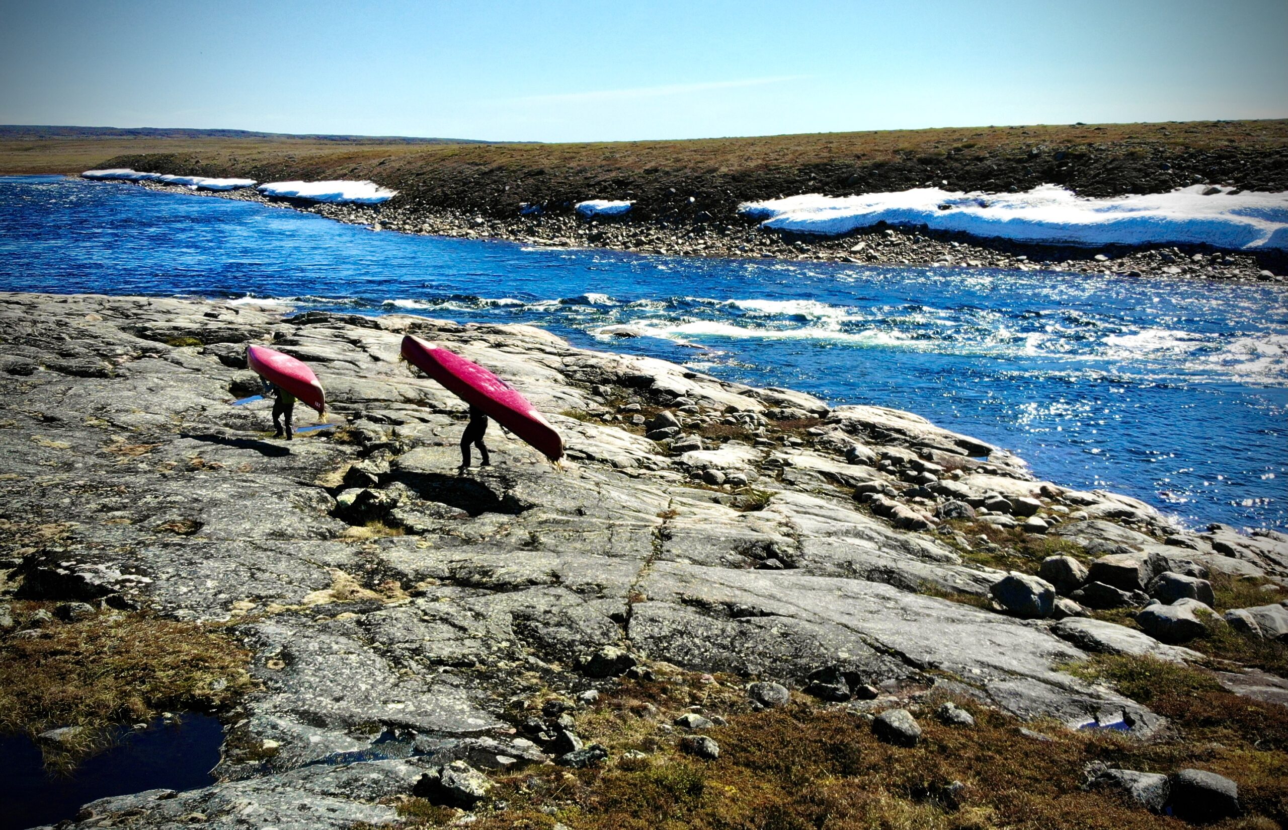
However, they hope the ice won't be too big a problem this time. "It's an El Nino year, so it should be a little warmer," Roulx explained.
It is worth risking an early start to avoid the worst of the spring floods on the Little and South Nahanni rivers. After these, it'll be onto the Mackenzie River and then to Great Slave Lake before they eventually arrive at Baker Lake via the Thelon River in early August.
From cycling and canoeing to sailing
Baker Lake, near the geographic center of Canada, is where a complex journey gets logistically more complex. A month before they arrive at Baker Lake, a sailboat will set off from Quebec, aiming to meet them there. That sailing crew then flies home and another takes over to ferry Roulx and Chagnon across Hudson Bay to Pangnirtung on Baffin Island.
Sailing to Baffin Island should take around three weeks and will represent quite a change of pace for Roulx and Chagnon.
The switch from self-propelled to sailing is driven by the duo's route choice.
"We see a line and then ask: How can we achieve that line in a single push? You look at the seasons and what transportation you need to complete the route," Roulx said. "You can't go across Hudson Bay in a canoe, you'd have to go around the edge and it would take another three months. An eight-month trip is very difficult on the body. [Roulx and Moreau's 2021 north-to-south took eight months - this expedition should take six.] You can't keep doing those trips forever unless you're Borge Ousland or Mike Horn!"
From Pangnirtung, Chagnon and Roulx will continue on foot, hiking for 10 days to Qikiqtarjuaq on the east coast of Baffin. Simultaneously, a third crew arrives to take the sailboat back to Quebec.
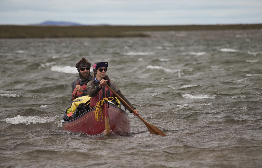
More people, more gear, more money
The combination of multiple disciplines and, in particular, a borrowed boat, makes this expedition as much a logistical challenge as a physical one. Their estimated budget is $220,000. But Roulx sounds at peace with the many moving parts.
"Of course, we have a Plan B and a Plan C, but I don't think we should spend too much time worrying about different scenarios. Maybe we were too prepared on the last trip, and still, nothing happened as it was supposed to. Be prepared, be in good shape, and make sure everything is ready, but you’ll have to improvise anyway."
The University of Florida’s International Shark Attack File's 2023 data has revealed that last year was not a good one for humans versus sharks. Of the 120 attacks investigated, 69 were considered "unprovoked." Ten of these unprovoked attacks proved fatal. This doubles the number of 2022 fatalities. Note that four other fatal interactions were judged as provoked.
Fatalities higher but number of bites similar
The 10 fatalities are not only double last year, they are higher than the five-year annual global average of six unprovoked fatalities per year.
However, the number of unprovoked bites worldwide was in line with the five-year average. So why so many more deaths?
The researchers suggest two possible reasons: random annual variation, or the increasing number of white sharks near popular surf beaches, particularly in Australia.
Indeed, four of the 10 deaths occurred in Australia, and surfers experienced 42% of the 69 unprovoked attacks. The four deaths in Australia stand out because they came from only 15 attacks. The Australian Shark Incident Database, with data going back to 1791, records an average of one fatality per year in Australia, so this is a significant jump. Experts attributed three of the deaths to great white sharks and one to a bull shark.
However, it was the U.S. that led the world in total unprovoked attacks, with 35 of the worldwide total of 69. Fortunately, the 35 attacks led to only two deaths. This is in line with last year, when the U.S. again led the world with 41 attacks.
Attacks still very rare
Researchers say that the majority of attacks were "test bites," with sharks confusing people (particularly surfers) for their prey. Even though sharks will usually leave after a test bite, the force of the attack can still result in death.
But the report is keen to highlight that shark bites are incredibly rare. "The total number of unprovoked shark bites worldwide remains extremely low," the report states.
To put the numbers into context, humans kill approximately 100 million sharks per year, or roughly 6.4% to 7.9% of all shark species globally. An unsustainable figure.
Three student researchers have won three-quarters of a million dollars by using AI to decipher an ancient papyrus scroll from the town of Herculaneum, near Pompeii. The technological breakthrough could be a game changer for researchers attempting to read ancient texts.
Too delicate to read
Archaeologists unearthed over 1,000 papyrus scrolls in a ruined Roman villa in the 18th century. Historians believe Julius Caesar’s father-in-law owned the villa, whose extensive library was destroyed by the eruption of Mount Vesuvius in 79 AD.
The haul of texts, known as the Herculaneum scrolls, were invaluable, but also unopenable. Attempts to unroll the texts resulted in destroyed or badly damaged scrolls as the carbonized papyrus crumbled in researchers' hands.
However, a small student team found an ingenious solution. Youssef Nader from Germany (or Egypt, depending on the source), Luke Farritor from the U.S., and Julian Schilliger from Switzerland trained AI to study scans of intact, rolled-up scrolls. As a result, they've won the Vesuvius Challenge grand prize of $700,000.
Computer scientist Brent Seales of the University of Kentucky and some Silicon Valley backers launched the Vesuvius Challenge in 2023. It offered large cash prizes for extracting text from CT scans of a few scrolls.
Seales set down a solid foundation for teams to work with. He released a machine-learning algorithm that could read the ink on the hidden layers of scrolls. The AI could spot tiny differences in the papyrus structure captured by X-ray images, potentially allowing researchers to read the scrolls without touching them. But only if you could decipher letters from the ink markings.

Seales hoped that international teams would take his research and run with it. "We’re having a competition so we can scale up our ability to extract more and more of the text,” Seales told The Guardian early last year. "The competitors will be standing on our shoulders with all of our work in hand."
Cooperation spurs breakthroughs
The competition moved quickly. Small breakthroughs were shared among researchers and drove a culture of cooperation and good-natured competition. A few months in, an American former physicist named Casey Handmer noticed something he called "crackle" in the scans. Crackle seemed to form the shapes of Greek letters.
Farritor expanded on Handmer's work and won the $40,000 "first letters" prize when he identified the ancient Greek word for "purple." Soon after, he teamed up with Schilliger and Nader to aim for the main prize.
Just before the competition deadline, the students deciphered over 2,000 Greek letters from a scroll. The scroll contains a previously unknown philosophical work about the senses and pleasure from music and food. Historians believe that they can even identify the author: Epicurean philosopher Philodemus.
"It probably is Philodemus. The style is very gnarly, typical of him, and the subject is up his alley," Robert Fowler, chair of the Herculaneum Society, told The Guardian.
Just the beginning
The three student's work can likely be expanded to read the rest of the Herculaneum scrolls. The 2,000 letters submitted by Farritor, Schilliger, and Nader only represent about 5% of a single scroll, so there is plenty of work to do, and plenty of new knowledge now tantalizingly close.
"In 2024, our goal is to read a few passages of text to entire scrolls, and we're announcing a new $100,000 grand prize for the first team that can read at least 90% of all four scrolls that we have scanned," Nat Friedman, a U.S. tech executive and founding sponsor of the Vesuvius Challenge recently wrote on X (formally Twitter).
It's tempting to think of the Moon as unchanging, a place where time stands still. But a new NASA-funded study urges future Moon missions to exercise caution. The Moon is shrinking and could become even less hospitable.
A cooling core
The Moon's core is cooling; as it does, it slowly shrinks our satellite. This contraction is very small (roughly 45m in diameter over the last few hundred million years) but causes moonquakes.
Unlike Earth, the Moon does not have tectonic plates, but rather a single plate. As this contracts, the crust scrunches together, pushing up ridges scientists call thrust faults. Images from NASA’s Lunar Reconnaissance Orbiter show thousands of these small thrust faults on the Moon.
"The fact they remain on the surface, instead of being eroded to nonexistence, means they must be young and probably active," lunar geologist Tom Watters told The Washington Post.
The Moon's contraction won't affect Earth. Its mass isn't changing so its shrinking diameter will not impact our tides. However, moonquakes could cause issues for future manned missions to the Moon's surface.
South Pole moonquakes
The faults appear all over the Moon's surface, but a particularly powerful shallow quake occurred near the South Pole. This is an area of considerable scientific interest. The region features areas that lie in permanent shadow, and scientists speculate that water ice could be present.
Both India's successful soft-landing in August last year and Russia's Luna-25 probe crash targeted the South Pole for this reason. NASA’s Artemis III mission, recently delayed till at least September 2026, plans to land in the same area.
The new study analyzed areas around the Pole and found that some areas, including the Shackleton Crater (a proposed Artemis III landing site), were susceptible to landslides caused by moonquakes.

Moon not benign, static
However, the report team is keen to emphasize that the study is not intended to curtail exploration.
"This is not to alarm anyone and certainly not to discourage exploration of that part of the South Pole of the moon but to raise the caution that the moon is not this benign place where nothing is happening," Watters said.
Predicting how often moonquakes occur in a specific region is difficult, and a manned mission is unlikely to spend an extended period on the Moon, minimizing the risk of humans experiencing a moonquake. Therefore the new study is unlikely to change NASA's plans for Artemis III.
Experts are considering 13 potential landing spots near the South Pole based on "criteria such as the ability to land safely in the region, the potential to meet science objectives, launch window availability and conditions such as terrain, communications, and lighting," study coauthor and NASA planetary scientist Renee Weber explained to CNN.
Though moonquakes might be a minimal risk for Artemis III, space agencies will need to factor the quakes into plans for long-term visits to our solar satellite. It's probably best not to plan a permanent Moon base on a seismically active fault.
Weird, bushy, top-heavy tree fossils found in a Canadian quarry come from an experimental period for Earth's earliest forests.
Archaeologists Olivia King and Matthew Stimson first unearthed the strange trees in New Brunswick in 2017. Some of the fossils were immaculately preserved, thanks to an earthquake that buried lake-margin vegetation in the area. Remarkably, one of the five fossilized trees is completely intact. It is one of only a handful of entire plant fossils ever recorded.
Last week, Current Biology published a full study of the fossils. "The tree architecture consists of an unbranched, 16cm-diameter trunk with compound leaves arranged in spirals of ∼13 and compressed into ∼14cm of vertical trunk length," the authors wrote.
Decoded, the trees look a little like enormous ferns, with thin trunks rising a little higher than a human. A huge toilet-brush of leaves spreads out from the top for five meters.

"What it really does look like is one of those truffula trees from The Lorax," King told CBC, referring to the famous children's book by Dr. Seuss.
The 350-million-year-old trees existed before the dinosaurs and likely grew below the canopy, using their broad mop of leaves to make the most of the limited light. They are the earliest examples of trees growing beneath the canopy.
An experiment that didn't catch on
The trees, named Sanfordiacaulis densifolia (after Laurie Sanford, the owner of the quarry), are so odd that lead author Robert Galstado likens them to an evolutionary experiment. Romer's Gap is a period between 360 million and 345 million years ago where the fossil record for both animals and plants is similarly thin.
"The evolution of the plant kingdom underwent many different experimental forms that were successful for some million or more years of time, but didn't survive the test of time," Galstado told LiveScience.

A few years ago, archaeologists working in Hohle Fels Cave in southwestern Germany unearthed some mysterious ice-age objects. The team found 13 pieces of carved mammoth ivory that fit together to form what they described as a "perforated baton, with four holes containing precisely carved spiral grooves."
A wand, an instrument, or perhaps a totem?
Depending on the viewer, the artifact looks like an instrument, a wand, or perhaps something ritualistic, a decorative symbol for some long-forgotten religion. Scientists discovered other similar artifacts at another site in Germany, but their purpose remained unclear.
Now, archaeologists Nicholas Conard (from the University of Tubingen in Germany) and Veerle Rots (from the University of Liege in Belgium) believe they've solved the mystery.
In a new paper, Conard and Rots argue that the 35,000-year-old ivory baton is a tool for making rope. Researchers were fairly sure that Paleolithic people used rope or twine, but the evidence was limited to depictions in art and a few impressions in clay. While evidence that ice-age people used rope was limited, there was no evidence illuminating how they manufactured it. Therefore the paper's conclusion is a major breakthrough.
The grooved holes were the key.

Grooved holes still lined with fibers
"We suspected that the holes with spiral grooves were made to have something fed through them, which led us to hypothesize that the artifact may have served to align fibers to make rope or twine. While twine can be made by hand without tools, by pulling and twisting plant fibers together, we tested whether or not the perforated baton from Hohle Fels could have been used to align, twist, and combine fibers to make rope," the paper explains.
Microscopic examination revealed fiber remnants around the grooves. Conard and Rots compared these fibers with sediment samples from around the artifact to rule out simple contamination from the environment. They found that the soil contained few plant fibers.
As a final test, Conard and Rots made a perforated baton of their own and tested it. Using the grooved holes they found that they could twist thick cords of up to four strands quickly and efficiently. They tested a few materials believed to be common during the period including deer sinew, flax, hemp, and others. They found cattail and willow fibers produced the best results.
"We are now able to demonstrate one way people of the early Upper Paleolithic manufactured rope. This work contributes to our understanding of the evolution of technology, cooperative work, and Paleolithic social organization," the authors conclude.
Centuries-old shipwrecks don't tend to suddenly appear, if anything they require a great deal of exploratory searching to find. So the mysterious arrival of a wreck near Cape Ray in Newfoundland, Canada, has baffled the tiny town.
The Guardian reports that local resident Gordon Blackmore spotted the wreck while hunting seabirds on Jan. 20. He had seen nothing in the same spot just a few days before.
Freed by a storm?
However, the area around Cape Ray does have a history of wrecks. Nearby island "The Rock" features the remains of at least eight ships. Still, a previously unknown boat turning up in shallow water is extremely strange.
Neil Burgess, president of the Shipwreck Preservation Society of Newfoundland and Labrador, told the outlet that coastal erosion and a recent storm may have freed the ship from its previous resting place.
But those same strong swells and stormy weather now threaten the wreck's integrity. Locals worry that the ship will wash back out to sea before experts can investigate it. A few have taken the initiative and attached ropes to secure the wreck to the beach.
A centuries-old wreck
Though experts have not yet examined the wreck in detail, a few features suggest the ship is from the 1800s. The wreck features trunnels, a sort of wooden nail commonly used in the construction of boats in the era, and copper pegs. It's also a fairly large ship, the wreck measures around 24m and is incomplete.
"It was a fairly substantial sailing ship, bigger than a schooner, I think," Burgess told CBC.
While they await experts, the Cape Ray community is banding together, diving to explore the wreck, and documenting the find in a lively Facebook group for residents.
A company specializing in underwater exploration believes they may have found Amelia Earhart's missing plane.
Earhart, a pioneering aviator, went missing in 1937 while attempting to become the first woman to circumnavigate the Earth by plane. Earhart and navigator Fred Noonan disappeared over the central Pacific. The pair had aimed to land on tiny Howland Island where they needed to refuel. But they never arrived.
A three-month search
Between September and December last year, a company called Deep Sea Vision searched 5,000 square kilometers of the Pacific for Earhart's Lockheed Model 10-E Electra plane. Using an autonomous underwater submersible equipped with sonar sensors, the company captured an image that company founder Tony Romeo seems sure is Earhart's plane.
"You’d be hard-pressed to convince me it’s not the plane,” Romeo told The Washington Post.
The image (at the top of the page) shows something resting about three miles underwater somewhere within a 100-mile radius of Howland Island. The company has not released a precise location.
Squint and the object certainly appears plane-shaped, but confirming the find will require Deep Sea Vision to return and investigate the object, perhaps using a remotely operated vehicle (ROV).

"They need to go back"
Romeo, a pilot and former U.S. Air Force intelligence officer, was in South Carolina real estate before he sold up to fund his search for Earhart’s plane. His fixation on finding this particular wreck could cloud his judgment. Experts certainly don't sound as convinced.
"While it is possible that this could be a plane and maybe even Amelia’s plane, it is too premature to say that definitively. It could also be noise in the sonar data, something geologic, or some other plane," underwater archaeologist Andrew Pietruszka explained to CNN.
"It’s hard to say what it is," Dorothy Cochrane, a curator at the National Air and Space Museum told The Washington Post. "They need to go back."
Romeo hopes the company will return to the site within the next year. If he could find the "NR16020" certification printed on the underside of the missing Lockheed's wing, he'd open a new chapter in the 85-year mystery.
Researchers only discovered the wrecks of HMS Erebus and HMS Terror, the ships from John Franklin's lost expedition, in 2014 and 2016 respectively. They're already in a race against time to salvage what artifacts and information they can.
The Erebus is vulnerable
Climate change will reshape the Arctic and the Erebus is at risk of degrading fast. While the Terror is 24m under the surface, the Erebus lies in shallower water, just 11m down in the Queen Maud Gulf. This shallow depth leaves the Erebus vulnerable in warmer water that is exposed to increasingly fierce storms.
"Parts of the ship’s upper deck collapsed recently and other parts are sloping over dangerously,” Jonathan Moore, manager of the Parks Canada underwater team, told The Guardian.
Ironically, researchers initially believed climate change might make investigating the wrecks easier. Warmer conditions meant less sea ice and more time each year to dive at both sites. Yet even when diving was possible, the water was often close to freezing, making for demanding, unpleasant working conditions.

But new technology has improved things, in particular the introduction of heated diving suits. Back in September, a team made 68 Erebus dives in just 12 days.
And these dives are producing plenty of interest. The latest finds "include an intact thermometer from an officer’s cabin, a leather shoe, and a collection of fossils, all traceable to particular crew members," Euro News reports.
It's not only archeologists who are interested in Franklin's ships. The two wrecks form unique artificial reefs. "Analysing the ecology of these artificial ecosystems will provide important information about what influences Arctic marine life, and how marine organisms have influenced the wrecks," Parks Canada writes.
To ensure that research into Erebus can continue as long as possible, the agency is roping in outside help to model how changing wind and wave patterns will affect the wrecks.
In the meantime, research will continue. "[The Erebus] is our prime concern...we are going to concentrate on it and peel back its story, layer by layer," Moore told The Guardian.
Franklin's lost expedition
John Franklin's expedition left England in 1845 for the Arctic, intending to open a new trade route through the fabled Northwest Passage.
When two years passed with no word from Franklin, the searches began. Finding Franklin was one of the great mysteries of the age. As time went on, it became clear that Franklin and all 129 men had perished. Searchers turned up many tantalizing clues, but Franklin’s fate has never been satisfactorily resolved.
Skiing through a long, covered tunnel without natural light might sound unpleasant to some, but ski tunnels could be the future of skiing in Scandinavia.
In Sweden, climate change means fewer days of snow cover. The Swedish Meteorological and Hydrological Institute writes that the country is 1.9°C warmer because of climate change, with a snow season that is two weeks shorter than before 1991.
Keeping cross-country going for longer
Cross-country skiing is a huge sport in Scandinavia, both professionally and recreationally. Hoping to keep their ski seasons alive, countries like Sweden and Finland have attempted to future-proof the sport.
Sweden's Torsby Ski Tunnel opened in 2006 and Finland opened the world's first cross-country ski tunnel, Vuokatti, in 1998. Since those two mega-projects opened, other, smaller, ski tunnels have opened for business too.

Torsby was the largest ski tunnel in the world when it was built. It is 1.3km long and lined with permafrost-covered concrete pipes to maintain the low temperature. Above the pipes sits a thin layer of artificial snow that protects them during the four months the ski tunnel closes each year.
Despite some resistance to skiing indoors, Torsby Tunnel is very popular. The technology works. Provided you can put up with the strip lighting and monotony of the view, the tunnel offers perfect training conditions from June to February.
A new trend?
So, will similar ski tunnels pop up in North America or the Alps? It seems unlikely. Constructing a center for cross-country skiing is a very different proposition to future-proofing downhill ski resorts. Still, the adaptability and ingenuity displayed in Finland and Sweden could point the way to a warmer future that still has space for winter sports.
British ultrarunner Russ Cook set off early last year from the tip of South Africa in high spirits. Cook planned to run 360 marathons in 240 days, covering 15,000km to the shores of the Mediterranean.
But plans change, especially for a project this ambitious. Cook's 240-day estimate went out the window a while ago, he's now 278 days in and still needs to cross the Sahara. He's also changed his route, avoiding Mali and changing his endpoint from Tunisia to Algeria because of safety issues.
The entire expedition now hinges on Algeria
But these route changes might not be enough to ensure he finishes "Project Africa."
Cook announced in an Instagram video that Algeria has not granted him and his team (a small film crew that accompanies him in a van) visas. They need permission to cross into Algeria from Mauritania, and it's likely this detail that has put a spanner in the works. Northern Mauritania is unstable and the UK Foreign Office advises against all travel to the region.
View this post on Instagram
"I’ve been running for 278 days, covered nearly 12,000km through 13 countries...but right now, all of that is hanging on whether we can get permission from Algeria to let us cross in through this border," Cook wrote. "This is the only option we have left so, Algeria, if you’re listening, please reach out."
Blood, sweat, and the runs
Cook has soldiered on impressively through other issues during the expedition. The team was robbed at gunpoint in Angola, he's had to stop for multiple doctor's checkups because of blood in his urine, and (ironically) he almost constantly seems to have the runs.
Unfortunately, Cook can't grit his teeth and just run through a bureaucratic hurdle, he'll need some help to finish. For now, he'll continue running north through Senegal and keep his fingers crossed that someone in Algeria will come to his rescue.
On Jan. 11, Vincent Colliard broke the Hercules Inlet to South Pole speed record in Antarctica. This was not low-hanging fruit. Christian Eide's 2011 time of 24 days, 1 hour, and 13 minutes, was exceptional.
A handful of hopefuls had tried to best Eide in the last decade-plus, but none came particularly close. Colliard not only trimmed the time, he knocked almost two days off it, finishing in 22 days, 6 hours, and 8 minutes.
Now back in Oslo, Norway, Colliard spoke to us about the record, his time on the ice, and his future plans.
This interview has been edited for brevity and clarity.
First of all, congratulations on the speed record. How are you feeling?
I'm feeling good, still a little bit confused, trying to process everything that has happened. I was still in the tent just over 10 days ago and now I'm here in comfort. A big change but I'm very, very stoked.
I feel fine. Mentally I am very good because I'm pleased that it somehow worked out. But physically I still have the impression that I've been in a race, that my body needs to recover. When I go up and down the stairs it feels strange on the hips, the knees, the feet.
But I do hope to be back skiing as soon as possible. I want to keep an active lifestyle and don't want to miss too many great winter days here [in Oslo]. It might sound weird to go back to skiing, but it is my favorite sport, it's a lifestyle.

Staying slightly cold
How did you structure your days on the ice? Did you sleep most of the "day" and travel at night when it was colder and, in theory, the snow was firmer?
No, I stayed on Chilean time. I stayed on the same time as Antarctic Logistics & Expeditions (ALE).
I was skiing on average 12 hours per day, fluctuating between 11 and 13 hours. From 9 am, I was on skis until 9 or 10 pm. I took as short breaks as possible and tried to stay slightly cold the whole time. I was making sure that my body temperature was always ready to go, ready to keep moving.
Did you keep track of your cadence/strides per minute while skiing? Or were you just tracking the hours you were putting in?
I was just tracking the kilometers. My goal was to make sure that I could go above 50km in less than 12 hours. I knew that Christian's daily average was 47km for the length of the expedition.
I thought I had to go over 50km. I didn't manage to do this at the beginning. I had some powder and some whiteouts. It was only on day nine that I managed to break 50km. I knew I had to respect my sleeping time, so I had to make sure I could do 50km in 12 hours. That was my base for skiing.
Christain Eide averaged 47km but he finished on a pretty massive closing kick, completing 90km or so on his final day. Did you have that in mind?
Yes, absolutely. I wrote Christian's kilometers on the inside of my tent and wrote all my days on the other side so I could compare. I knew that he had such an amazing day at the end. On my side, I was unsure that I could do such a long day so my game plan was to try and build consistency every day. I tried to do just a little bit more than him, to accumulate, to get a buffer.

Did you find knowing exactly what Christian had done, day in and day out, to be an advantage or a hindrance? Did you feel pressure?
In the beginning, it was for sure pressure. I was like, man, the standard is high. That's what I told Christian two days ago when we met in Oslo. I told him it was probably easier for me, it was a big challenge, lots of pain, but in the end probably easier. Because Christian didn't have anyone to beat, no one in front, just himself.
But it's a question mark in my head. Isn't it easier to break a record than to establish it? I think it is easier to break it.
Seven spills in a day
What skins did you use and how did you manage your sled? I recall you were putting them in a catamaran setup for some sections for stability.
In the first half of the journey, I had various days with whiteouts and sastrugi. Even though the sastrugi were not very big, they were big enough to capsize my sled. One day I capsized seven times.
I thought, this is not good, I'm losing time and energy. So I put the sleds together as a catamaran. It's much more friction but I can at least relax and go straight without worrying about them tipping over. I had to do it for three days but it worked.
For skins, most of the way I used 30mm skins. I only had to use wider skins on day one, just for the first climb. I never used long skins, I didn't even bring them with me.

In terms of gear, you were traveling incredibly light. Did this mean you had to worry about damaging or breaking equipment?
Good question. I changed my mindset, whether it was with my tent, my sledbag, or with every zipper on my clothing, I felt that everything was so fragile. I had to modify the way I used my gear, being extra careful.
As soon as the weather was a little bit tougher, I told myself: "If you feel the need to speed up, just try to slow down. Do the opposite of what you usually do."
Every time I felt I was going too quick or too strong on the equipment, I'd stop the process, have a drink, and think. Think about what would happen if I break something. I'd be in trouble or at least lose a lot of time.
I wouldn't do it again with super-light equipment. I'd take a little more weight and relax a bit because it is difficult to be very careful when you're very tired.
Coming close to pulling the plug
With the weather and snow conditions, do you know how your run compares to average years or Christian's run? Were you lucky, unlucky?
First of all, it's my first full-length expedition in Antarctica. I've guided there on the peninsula and on two last-degree trips, but I don't have tons of experience. But if you compare it with the Arctic Ocean, I think the terrain in Antarctica is quite easy. I'm not one to be dramatic, I thought the terrain was OK.
I think the weather this year might have been a little more challenging than Christian's year, but we'd have to fact-check with him. I had more than three degrees with powder.
When I got past the Thiels mountains, when I was close to 86°, I told Lars Ebbesen [polar guide who attempted the speed record in 2018] that if the weather continues like this, with powder and whiteouts, I might pull the plug. Two times I was on the edge of pulling the plug. I was still putting in the kilometers but was close to mentally breaking down. I just thought I couldn't keep doing 50km in those conditions.
But things improved and at Thiels [Corner], I got rid of five days of food and later I got rid of two more days. I didn't want to just reach the Pole, I had to take the risk to be lighter.

If the worst moment was at Thiels Corner, what was the best?
I think the best was at 83°. It was probably better than seeing the Pole. I had my first day of good weather, a hard surface, and no wind. It was the first day I managed to ski 53km and it was the only day of the expedition that felt like I was skiing rather than walking.
You improved Christian’s record by almost two days. I’d be interested to know what time you think could be possible for the route. Were you near your max or do you think you could conceivably go faster than your 50km+ per day average?
No, I don't think it is the limit. I now have the answer that my body did the job, and I think it is possible to do better. With a harder surface and less powder, it should be possible to improve the time.
Other challengers
Do you see anyone else trying it considering you've made a hard record even harder?
Yeah, I know there is a guy here in Norway who might try. People will try. Especially because there are few firsts left in the polar regions. There are still some [firsts left] but they are so expensive. So I think people will go back to Antarctica and try to break the record.

If someone can break it, presumably, it will be an Olympic cross-country skier or similar.
This is exactly what I thought. I hope I stay humble because I know that if a professional cross-country skier takes an interest in pitching a tent and starting a stove, then they're going to do a lot of damage!
Finally, do you have any plans for what is next? A couple of years ago you were planning to go to the North Pole before the Barneo season was cancelled.
Yes, North Pole is still in my head, but not for now. I spent too much money and energy on this project. I might go back to the Arctic Ocean if everything there is stable.
For now, the beautiful thing is Caroline [Cote, Colliard's partner] is pregnant so we'll be spending family time next season. But I think we'll get back to Antarctica, not next season but maybe the season after, even if it's to do a season at ALE. The people at Union Glacier have been so supportive that we'd love to do a season down there.
Barneo, a floating ice camp typically set up 100km from the North Pole, has been closed to tourists for the past five years. Last year, it was initially announced that the camp would reopen, only for Norwegian authorities to put the kibosh on things.
This year, the route through Longyearbyen remains closed, but the Swiss-owned company that operates Barneo hopes to re-route staff and clients through Krasnoyarsk, Russia. This is likely to limit participation. Some clients from the Middle East or Asia might be open to the idea, but Westerners would face criticism for indirectly supporting what has become a blackballed state since the invasion of Ukraine.
Founded in 2002 by Alexander Orlov, Barneo has hosted skiers, divers, runners, scientists, and overnight tourists. According to the Polar Journal, it should return to the ice in April this year. It remains to be seen who'll be willing to travel through Russia to get there.
The Antarctic expedition season has mostly wrapped up after Vincent Colliard's remarkable sprint to the Pole. Most expeditions have now finished or are close.
Hercules Inlet to the South Pole
On Jan. 12, Baxter had seven days of food remaining and 162km to go, putting him on track for a Jan. 19 finish. He's cutting it a little fine but thought the distance doable. Fortunately, he found better snow entering 88°, and after a couple of decent days, he crossed into the last degree on Jan. 15.
Georgina Gilbert and Rebecca Openshaw-Rowe made the Pole after 52 days, 10 hours, and 30 mins. The pair finished on Jan. 12 with a 36km push, showing they still had something left in the tank after a long expedition.

Vincent Colliard
On Jan. 11, Vincent Colliard reached the South Pole, breaking the speed record from Hercules Inlet.
His 50km+ daily average is quite remarkable, and it'll be interesting to see if anyone attempts to best his time next season.
Berkner Island to the South Pole
Bernier made good time from the longer Berkner Island start point, putting in very consistent 25km+ days right from the start of his trip.
Guided trips
Fifty-six days into their expedition, Kustaa Piha, Anders Brotherus, and guide Poppis Suomela are still enjoying themselves.
"Before, you could see height differences on the horizon and shapes in the landscape, but now it's like standing on top of one pancake. There is a smooth snowfield, 360° around. It seems endless no matter which way you look," they wrote today.
On the polar plateau, they should reach the Pole tomorrow.

In June 2023, Justin Barbour set out on a 3,800km odyssey from Hudson Bay in northeastern Canada down to the southernmost point on the island of Newfoundland. The ambitious journey would take 12 months and involve canoeing, snowshoeing, backpacking, and packrafting. Now, he's ready to set off on the snowshoeing leg of his journey.
The journey so far
Stage one of four on what Barbour calls Expedition Northeast, took Barbour and his dog Saku 44 days. They covered 692km from Hudson Bay to Tusiujaq.
"Travel up and down rapids, endless lakes and northern lights that danced like green ghosts in the night sky as we laid down our weary and contented heads to sleep," was the general texture of the first leg, he said.
After a break in Tusiujaq, the pair put in another 440km of mostly upriver travel over 61 days. For 60 days of the journey, they did not see another soul. Barbour had originally planned to cover 700km to reach Labrador before the winter freeze set in but ended up stopping earlier and arranging an air taxi back to civilization. But rather than go home for the six weeks, he lived in a bush tent outside a small northern town.

"Last camp in northern Quebec, 200km from the nearest community, before pausing as freeze-up grips the land tight. Continuing the fight, which got riskier by the day, was unnecessary. As part of the original plan, I'll be going right back there properly outfitted for the subarctic winter when ice conditions are safe," he wrote.
Back to camp
Barbour headed back to his camp without Saku. The dog headed home with Barbour's partner, Heather. Though Saku had held up exceptionally well on the journey, he would not be cut out for the extreme cold of winter.
Meanwhile, Barbour waited for the creeks and rivers to freeze and the snow to harden up as the cold set in. Early winter is traditionally the time when trappers and native Innu in Labrador and northern Quebec traveled minimally.
"For the last six weeks...I have been living in a canvas tent in the northern Quebec bush," Barbour wrote on Jan. 2. "Getting acquainted with winter. In short, there were hurdles getting back to my last camp. It is 200km from the closest village. But patience pays off, and today is the day I return. Here we go! 1,140km behind us. Some 2,600km remain."

Back on the trail
On Jan. 4, he was back on the trail and covering good ground. "Eight kilometers yesterday by snowshoe [with a] 250lb sled. Crossed glorious Lac Otelnuk," he posted in his most recent InReach message.
Before he set off, Barbour told us that this stage might be the toughest section of the entire route: "Upriver from Tasiujaq will be hard, but anything in a canoe is easier than pulling a toboggan in snowshoes. For roughly 1,100km from the Trans-Labrador Highway down, I’ll be manhauling, with the potential for storms and deep snow."
It will be an extremely cold next couple of months for Barbour on Labrador's high plateau. It is open and windswept, with temperatures sometimes dropping to around -50°C in early February.
But the cold and wind do come with some advantages, the snow should be fairly hard, making for good conditions to pull a sled.
This week in Antarctica, Omar Di Felice aborts his cycle ride at Thiels Corner and Vincent Colliard only needs one big kick to break the Hercules Inlet to South Pole speed record.
Hercules Inlet to the South Pole
The next waypoint was about 40 km to the south...However, to the east of this was a crevassed area...[so] we should stay west from it. I also had information from the most experienced Norwegian expedition organizer that it was far better to go much further west. That way, the climbs were not so steep, the sastrugi were smaller, and you were well away from any potential crevasses. So I decided to veer west...and then come back east again and join the ALE route some 30-40km to the south.
Climbing to the polar plateau, Baxter says the wind has been a "constant menace." The weather forecast for the next few days is not ideal, so he'll continue to battle the wind and poor visibility.
Georgina Gilbert and Rebecca Openshaw-Rowe are now several days ahead of Baxter. The pair are well into degree 89 and should finish in two or three days. They've sped up on the polar plateau and are putting in close to 30km per day.
After not seeing anyone else since 85°, they are bumping into last-degree skiers.
"It's a really strange feeling, but it's nice to see other people enjoying Antarctica," they said in their most recent audio update.
Pierre Hedan needed to hurry to the Pole because of a fuel leak, with dodgy ski bindings adding further stress. He coped admirably, rationing his fuel and nursing the binding through the sastrugi.
On Jan. 8, his home team announced that he had arrived at the South Pole. He finished in 49 days and managed to avoid a resupply, despite his tribulations.
Vincent Colliard
Colliard has just broken 1,000km in 21 days and remains on track to break Christian Eide’s time of 24 days, 1 hour, and 13 minutes, set in 2011.
Colliard's daily average is the same as Eide's, at 47km per day, but that doesn't tell the whole story. Eide finished his run with roughly 190km in three days, raising his average considerably. Colliard is ahead of Eide at the same point in their journeys, with three days to go and less than 150km to cover. (Colliard's home team reports that he is now within 100km of the Pole.) He should beat the record if he can come close to matching the Norwegian's closing kick.

Berkner Island to the South Pole
Fat biking to the Pole
As expected, Omar Di Felice ran out of time to reach the Pole, let alone to push on to the Leverett Glacier as he had planned.
Di Felice covered 680km, just over half the distance required to the South Pole, never picking up much momentum and likely spending much more time pushing the bike than riding it.
After discussions with ALE, he returned to Thiels Corner for pick up and flew back to Union Glacier.
Guided trips

Vincent Colliard needs only nine (very) big days to break Christian Eide's impressive Hercules Inlet to South Pole speed record. Meanwhile, Pierre Hedan is soldiering on with limited fuel and a finicky ski binding.
Hercules Inlet to the South Pole
James Baxter found the soft snow around 86° tough going. There was a slow drizzle of snow on Dec. 29-30, and "these small snow particles, like caster sugar, grip the runners of the pulk and don’t let it pass easily," he wrote. "I felt like a large plow horse pulling a three-bladed plow through an everlasting field of sorbet."
Over these two days, Baxter dropped his daily distance totals by design. He focused on four five-kilometer sessions in the deep snow rather than his usual six sessions.
Fortunately, the snow firmed up in the New Year and he is back to 20km+ days. You can read his excellent, in-depth daily summaries on his website.
Georgina Gilbert and Rebecca Openshaw-Rowe are a little over a degree ahead of Baxter and will cross into 88˚S tomorrow. They also found soft snow around 86˚ (and battled through a few whiteout days), but increased their daily ski time to stay on schedule. They are hoping to arrive at the Pole in eight days.
Pierre Hedan needed to hurry to the Pole because of a fuel leak, but his dodgy ski binding adds an extra complication. The binding is extremely difficult to open and close, and he's nursing it through some big days.

Hedan has passed 1,000km and is on the plateau. "It is flat, not a single sastrugi, but it is cold, snowing, and windy. I've now got my biggest gloves on...and the sweat from my socks freezes while walking," he wrote in his most recent update.
He is managing his fuel well, and his rationing means that he should reach the Pole without a resupply. He has just 90km to go as of this morning.
Speed record hopefuls
Of our three hopefuls, only Vincent Colliard is still on the ice. Colin O'Brady aborted after a scary crevasse fall, leaving Colliard as the lone skier attempting to best Christian Eide's overall speed record from Hercules Inlet to the South Pole.
Preet Chandi has already finished her secret run to the Pole, handily breaking Caroline Cote's record from last season. Chandi finished the 1,130km route in 31 days, 13 hours, and 19 minutes. She bested Cote’s time by 1 day, 14 hours, and 34 minutes. She maintained an average of 36km per day.
Colliard is flying along, wrapping up 2023 with an astonishing four straight 50km+ days. The New Year has seen more of the same. He covered 102km over the previous two days, despite lots of powder, and is now on his seventh 50km+ day in a row. He's on track to break Eide's record, roughly 37km ahead of where Eide was after 15 days. But he has now crossed 86˚, where the other skiers reported soft snow.
Colliard has set up his sleds in a catamaran style to deal with the combination of whiteouts and sastrugi over the last few days. This setup helps stop the sled from overturning.
"I'm really pushing my body to the edge. I think it is a fine line between failure and success. I have nine days to reach the South Pole," Colliard said in an audio update yesterday.
Colliard is right. Eide put in an almighty kick to finish his 2011 run, including around 90km on the last day. It'll be touch and go till the end.
Berkner Island to the South Pole
Fat-biking to the Pole

Omar Di Felice's daily average has hovered around 14km per day for most of his expedition. Now, just under 618km into his 1,130km journey, conditions are perhaps harder than ever. Fresh, soft snow has slowed him to a crawl. In yesterday's update, he spent an hour and a half dragging his gear 800m before electing to stop for the day.
"[This is] the most difficult place to cross that I have ever faced. Physical and mental effort do not help, so stopping for a few more hours, eating and trying to relax, is the only thing I can do right now," he wrote.
Barring a miracle, ALE will cut his expedition short before he reaches the Pole. ALE imposes a Jan. 18 deadline for expeditions to finish.
Guided trips

Nature's had enough of humans and their boats. First, orcas learned to sink ships, and now crocodiles are leaping into boats in Australia. On New Year's Eve, Queensland local Richard Brookman was fishing in Jane Creek when an enormous four-meter saltwater crocodile launched itself into his boat, jaws gaping.
Shocked but unharmed
Brookman was fishing from a small aluminum boat. He'd been on the water for a few hours when he had "that eerie feeling that something was watching me," he told ABC News. He turned on his headlight and spotted a pair of eyes approaching.
At first, he was unconcerned. Crocodiles are common in Queensland's waterways. But as it neared the boat he realized that the croc was massive, roughly a meter longer than his boat.
Brookman decided it was time to skedaddle and stood up to retrieve his anchor, only for the croc to leap out of the water and into the boat, inadvertently blocking his way. He had to leap over the reptile to the bow. Fortunately for Brookman, the croc then lost its balance and fell back into the creek. The crocodile was so heavy that it bent the rails of Brookman's boat.

Very unusual behavior
Most Australians are well aware of the threat posed by crocodiles in the water, but one that launches itself into a boat is "not what we would call typical behavior," said wildlife officer Jane Burns of the Queensland Department of Environment, Science and Innovation. "It is concerning behavior, so it is definitely getting investigated."
In a statement, a spokesperson reassured the public that the crocodile's behavior was likely accidental, rather than an attack. However, a team will perform both daytime and nighttime assessments of Jane Creek.
"Wildlife officers investigate every report we receive, and estuarine crocodiles that pose a threat to human safety are targeted for removal under the Queensland Crocodile Management Plan," Burns said.
It has been a dramatic week in Antarctica. Colin O'Brady survived a crevasse fall, the lone crossing attempt ended with an evacuation, and Vincent Colliard is striving to keep pace with Christian Eide's blistering Hercules Inlet to South Pole pace.
Crossings
ALE's doctors suspect Cox has kidney stones. "[Cox had] started to experience some discomfort. As the pain worsened and other symptoms began to show, Sam sought medical advice. Despite Sam wanting to push on, the medical team intervened because of the risk to his physical well-being and the potential implications to his long-term health if left untreated," Cox's home team wrote on social media.
"It’s too early to say about another attempt," Cox said. "However, the first 600km felt good, and there was plenty more in the tank."

Hercules Inlet to the South Pole
James Baxter is enjoying himself. "I cannot believe this weather," he wrote just before Christmas, as he arrived at the Thiels Corner fuel cache. "It is yet again a beautiful cold, crisp clear day with little wind. I have nothing to compare it to so don’t know if I am being fortunate or whether this is the norm."
Baxter noted the "multitude of tracks" from both skiers and vehicles heading from Thiels Corner toward the Pole. Though not equivalent to the South Pole Overland Traverse (SPOT) road linking the Pole to McMurdo Station, it's interesting to consider whether this route could constitute a level of support too. At the very least, no navigation is necessary.
After the run of great weather, Dec. 25 was a whiteout, but Baxter still made 21km before setting up his tent. He is now 485km from the Pole.
A little over a day ahead of Baxter, Georgina Gilbert and Rebecca Openshaw-Rowe are doing well. They've been averaging over 25km per day, though the Christmas whiteout resulted in a truncated 20km day. The Brits have completed 813km. At their current pace, they should reach the Pole in a little over two weeks.
After a fuel leak, Pierre Hedan needed to hurry to the Pole to avoid losing his unsupported status. His pace hasn't increased noticeably, but there's no word of a resupply yet. He has 258km remaining.

Speed record hopefuls
Well, it was a dramatic start for Colin O'Brady! Just 6km into his Hercules Inlet to the South Pole speed record attempt, O'Brady fell into a crevasse.
In an emotional Instagram post, O’Brady recounted how he broke through a snow bridge into a meter-wide hole. The traces on his sled kept him from falling in too deeply -- luckily, the sled didn't follow him in -- and he managed to clamber out. A team from ALE arrived to retrieve his lost ski from 25 to 30m down in the crevasse and drive him back to his start point.
He has now set off again, resetting his timer to reach the Pole. He is not sharing his tracker but reports that he covered 48km on his second day, matching Christian Eide’s pace in the early going.
Vincent Colliard, who is sharing his tracker, has started behind Eide's pace. He is covering over 40km per day, but regularly falling short of the 47km needed to match Eide. "I'm trying to keep up with the incredible pace of my friend...some days it takes me 11 or 11 and a half hours," he said.

"It has been very, very tough, incredibly hard battle these past two and half days because I was in a very thick whiteout," he said in a recent audio update. "One day I fell four times and my sled capsized seven times."
There's still no word about the woman aiming to best Caroline Cote's female speed record from last season, but unconfirmed reports identify the skier as Preet Chandi.
Berkner Island to the South Pole
Fat-biking to the Pole

The Christmas period may have spurred some food cravings: "After 37 days, eating the same rations, my head decided to undermine my food balance by increasing the sense of hunger and unleashing unrealizable desires that I struggled to control," he said in a recent update.
Guided trips

The weather in Antarctica is good, but injuries and gear issues are mounting. Despite an excellent start, Pierre Hedan is going to have to pick up the pace, while Georgina Gilbert and Rebecca Openshaw-Rowe battle injuries and illness.
Back at Hercules Inlet, Vincent Colliard and Colin O'Brady start their race to the Pole.
Crossings
Sam Cox's 2,000km crossing from Berkner Island to the base of the Reedy Glacier via the South Pole is this season's longest expedition. He is making good progress despite his heavier pulk. Over the last week, he has tacked on another 145km, bringing his total to 650km.
Recently, a steep incline forced him to shuttle his heavy load uphill in stages, in a grueling 14-hour day.
Cox reports excellent conditions. However, it has been a hot couple of days, sunny with little to no wind, which has made some of the uphills a slog.

Hercules Inlet to the South Pole
Baxter has 30 days of food left and is just over halfway after 30 days on the ice. He remains on track to finish unsupported.
Roughly a day ahead of Baxter, Georgina Gilbert and Rebecca Openshaw-Rowe are also on schedule. Like Baxter, their daily totals are increasing as their pulks lighten. On Dec. 19, they completed their longest day yet (28km) and passed the halfway mark.
Gilbert is suffering from polar thigh. She's managing the injury by keeping it as warm as possible and applying steroid cream. "Everything's OK," she said in a recent audio update. Meanwhile, Openshaw-Rowe had a chest infection and then diarrhea caused by the antibiotics. Fortunately, she seems to be over it.

In a measure of Antarctica's increasing commercialization, Gilbert and Openshaw-Rowe also spotted an electric car this week. Scots Chris and Julie Ramsey were driving the vehicle on a "Pole to Pole" journey, from the 19th-century location of the Magnetic North Pole (much further south than today) to the South Pole.
Pierre Hedan was well ahead of the pack in our last update, but he might still need to pick up the pace. Hedan is running out of fuel. On Dec. 15, he discovered that 2.5L of fuel had leaked into his pulk from an open jerrycan. Heavily rationed fuel, coupled with a dodgy ski binding, means Hedan might struggle to finish his journey unsupported.
For now, he's going for it. He'll need to cover roughly 30km per day over the final 500km to avoid a resupply.
Speed record hopefuls
There are at least three Hercules Inlet to the South Pole speed record hopefuls. An anonymous woman set off earlier in the season, Vincent Colliard set off yesterday, and Colin O'Brady is due to start soon. O'Brady made a predictably dramatic last-minute announcement last week. So far, it doesn't appear that he will be sharing his tracker publicly.
Colliard's tracker is here.
The two men are aiming to best Norwegian Christian Eide's time of 24 days, 1 hour, and 13 minutes, set in 2011.
The women's record is held by Colliard's partner, Caroline Cote. Cote finished her solo, unsupported run from Hercules Inlet in 33 days, 2 hours, and 55 minutes last season.
Berkner Island to the South Pole
Fat-biking to the Pole
"[I'm] allergic to numbers and averages. Every day, the situation can change and you quickly go from being stuck in the tent to cycling more than 20-25km, which is a very good distance. For this reason, you don’t need any calculators until the end of the adventure...The only thing that matters is to keep pushing to the end," he wrote in a recent update.

While positive thinking might help Di Felice push on, it's not useful for covering his journey, so I'm afraid I'll have to ignore his advice to bin my calculator. Di Felice is 376km into his journey after 30 days, averaging 12.53km per day. With 766km to the Pole, he'll need a very impressive kick to finish.
Yet his social media suggests unwavering belief. A recent update even suggests he might have time to continue past the Pole! "If there will be time and chance, we will go towards the Leverett Glacier. Every extra kilometer beyond the Pole will be the distance record cycled in Antarctica," he wrote.
Preet Chandi exploited that idea last year: Rather than stop at the South Pole, go a little further even if it leads nowhere, because then you can claim a record distance.